Merian
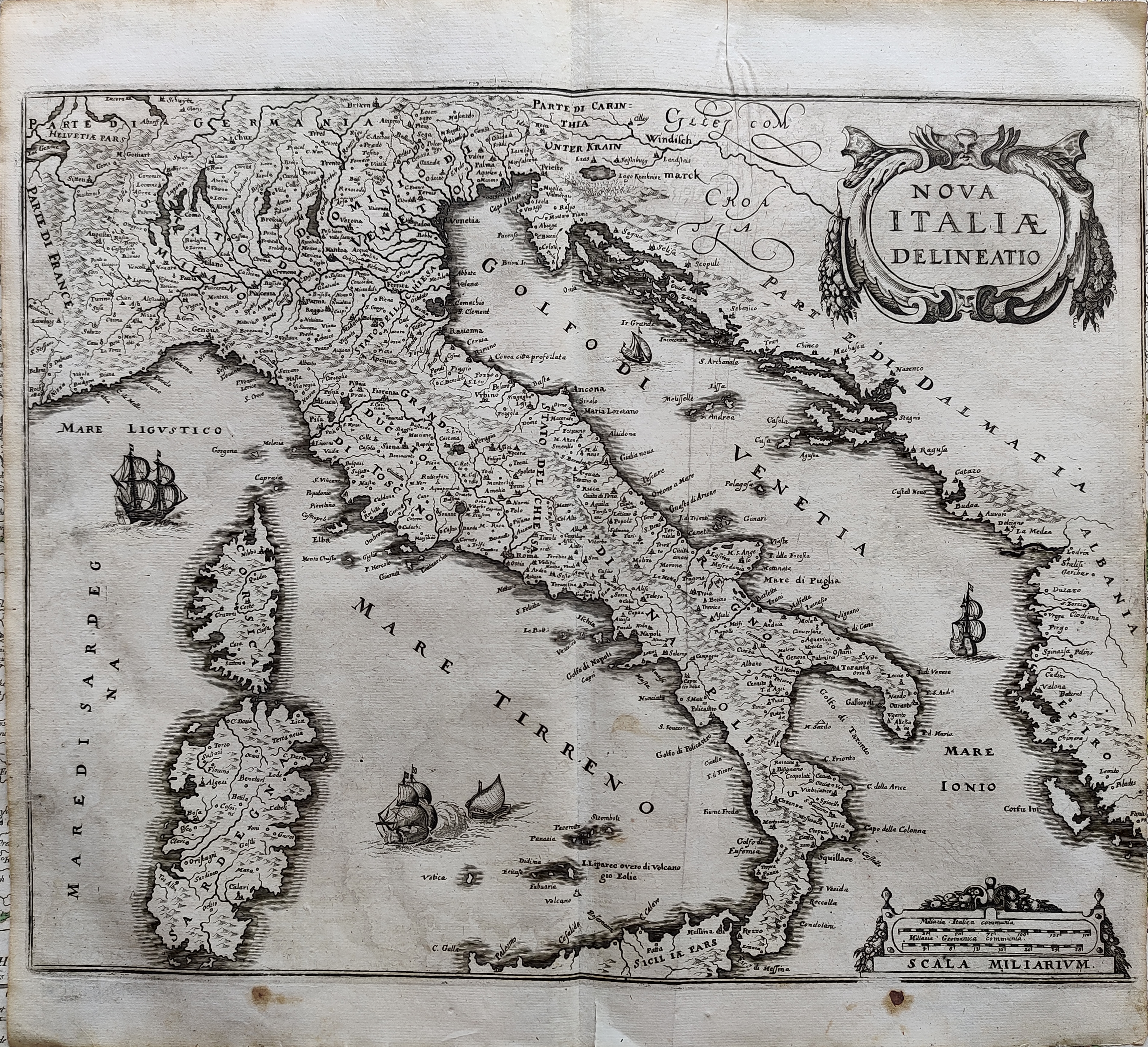
Map title
Nova Italiae delineatio
Author
Merian
Location shown in map
Italy
Edition date
Circa 1640
Edition place
Frankfurt
Editor
Atlas
Price
300 Euro
State
[mint/EXCELLENT/very good/good/fair/mediocre/poor]
Color
Black/white
Verso
Blank
Size
Plate: cm (36 x 28) inches (14.17 x 11.02) Paper: cm (37 x 34) inches (14.57 x 13.39)
Technique
Copper engraving
Note
Reference
R.Borri L'Italia nelle antiche carte pag.133
Wiki
Here for more info
In stock
Available
Info
info@thetreasuremaps.com
Code
#1068
×
![Nova Italiae delineatio by Merian, Italy, Circa 1640]()
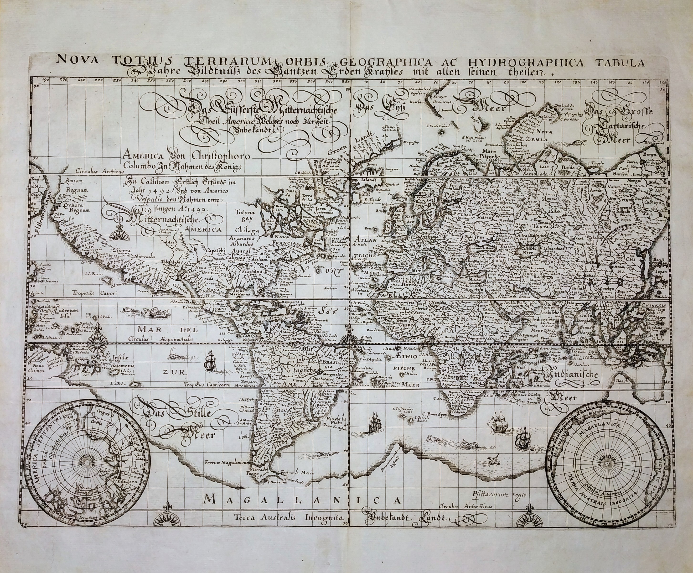
Map title
Nova Totius Terrarum Orbis Geographica ac Hydrographica Tabula
Author
Merian
Location shown in map
World
Edition date
Circa 1646
Edition place
Frankfurt
Editor
--
Atlas
Neuwe Archontologia Cosmica
Price
1000 Euro
State
[MINT/excellent/very good/good/fair/mediocre/poor]
Color
Black/white
Verso
Blank
Size
Plate: cm (35 x 26) inches (13.78 x 10.24) Paper: cm (39 x 33) inches (15.35 x 12.99)
Technique
Copper engraving
Note
No particular notes for this maps.
Reference
--
Wiki
Here for more info
In stock
Available
Info
info@thetreasuremaps.com
Code
#0705
×
![Nova Totius Terrarum Orbis Geographica ac Hydrographica Tabula by Merian, World, Circa 1646]()
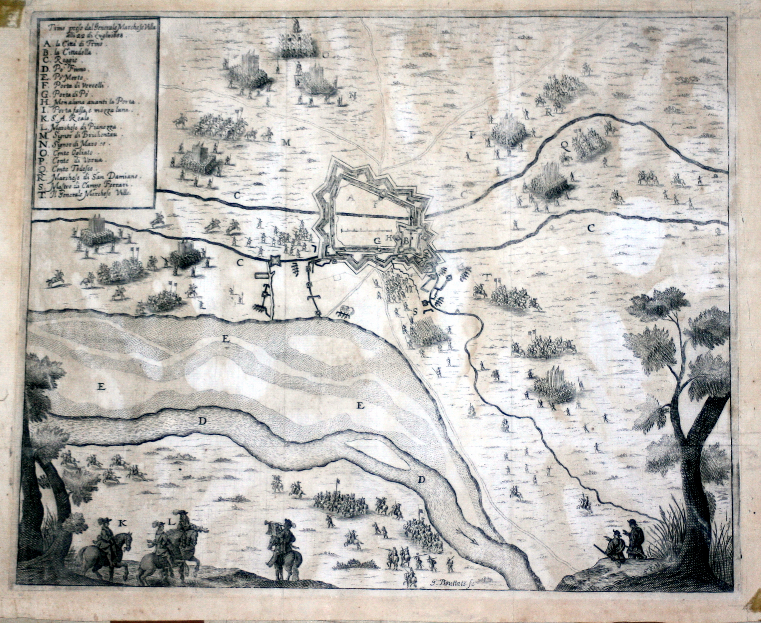
Map title
Trino preso dal generale marchese Villa
Author
Merian
Location shown in map
Trino
Edition date
1659
Edition place
Editor
--
Atlas
Historia di Leopoldo Cesari
Price
Please ask: info@thetreasuremaps.com
State
[mint/EXCELLENT/very good/good/fair/mediocre/poor]
Color
Black/white
Verso
White
Size
Plate: cm (39.4 x 31.8) inches (15.51 x 12.52) Paper: cm (41.9 x 34.3) inches (16.5 x 13.5)
Technique
Copper engraving
Note
No particular notes for this maps.
Reference
--
Wiki
Here for more info
In stock
Available
Info
info@thetreasuremaps.com
Code
#0542
×
![Trino preso dal generale marchese Villa by Merian, Trino, 1659]()

Map title
Utriusque Burgundiae, tum Ducatus tum Comitatus
Author
Merian
Location shown in map
Burgundia, France
Edition date
1695
Edition place
Frankfurt
Editor
--
Atlas
--
Price
Please ask: info@thetreasuremaps.com
State
[mint/excellent/very good/GOOD/fair/mediocre/poor]
Color
Black/white
Verso
Blank
Size
Plate: cm (35.6 x 26.7) inches (14.02 x 10.51) Paper: cm (36.8 x 33) inches (14.49 x 12.99)
Technique
Copper engraving
Note
--
Reference
--
Wiki
Here for more info
In stock
Available
Info
info@thetreasuremaps.com
Code
#0143
×
![Utriusque Burgundiae, tum Ducatus tum Comitatus by Merian, Burgundia, France, 1695]()
Map title
Lotharingia Ducatus Vulgo Lorraine
Author
Merian
Location shown in map
Loraine, France
Edition date
1695
Edition place
Frankfurt
Editor
--
Atlas
--
Price
Please ask: info@thetreasuremaps.com
State
[mint/excellent/very good/GOOD/fair/mediocre/poor]
Color
Black/white
Verso
Blank
Size
Plate: cm (35.6 x 26.7) inches (14.02 x 10.51) Paper: cm (36.8 x 33) inches (14.49 x 12.99)
Technique
Copper engraving
Note
--
Reference
--
Wiki
Here for more info
In stock
Available
Info
info@thetreasuremaps.com
Code
#0144
×
![Lotharingia Ducatus Vulgo Lorraine by Merian, Loraine, France, 1695]()