Tirion
Map title
Nuova Carta Del Polo Artico secondo l'ultime osservazioni a Amsterdam da Isac Tirion
Author
Tirion
Location shown in map
Polar Arctic Regions
Edition date
1736
Edition place
Amsterdam
Editor
--
Atlas
--
Price
300 Euro
State
mint/excellent/VERY GOOD/good/fair/mediocre/poor]
Color
Black/white
Verso
Blank
Size
Plate: cm (35.6 x 30.5) inches (14.02 x 12.01) Paper: cm (45.7 x 38.1) inches (17.99 x 15)
Technique
Copper engraving
Note
California as an island
Reference
--
Wiki
Here for more info
In stock
Available
Info
info@thetreasuremaps.com
Code
#0329
×
![Nuova Carta Del Polo Artico secondo l'ultime osservazioni a Amsterdam da Isac Tirion by Tirion, Polar Arctic Regions, 1736]()
Map title
Nuova carta della Tartaria
Author
Tirion
Location shown in map
East Asia
Edition date
1740
Edition place
Amsterdam
Editor
--
Atlas
Atlante Novissimo. Giambattista Albrizzi
Price
150 Euro
State
[mint/excellent/VERY GOOD/good/fair/mediocre/poor]
Color
Black/white
Verso
Blank
Size
Plate: cm (33 x 27.9) inches (12.99 x 10.98) Paper: cm (48.3 x 38.1) inches (19.02 x 15)
Technique
Copper engraving
Note
No particular notes for this maps
Reference
--
Wiki
Here for more info
In stock
Available
Info
info@thetreasuremaps.com
Code
#0222
×
![Nuova carta della Tartaria by Tirion, East Asia, 1740]()
Map title
Carta accurata dell'impero del Giappone
Author
Tirion
Location shown in map
Japan
Edition date
Circa 1740
Edition place
Venice
Editor
--
Atlas
--
Price
300 Euro
State
MINT/excellent/very good/good/fair/mediocre/poor]
Color
Black/white
Verso
Blank
Size
Plate: cm (32 x 26) inches (12.6 x 10.24) Paper: cm (33 x 27) inches (12.99 x 10.63)
Technique
Copper engraving
Note
Framed
Reference
--
Wiki
Here for more info
In stock
Available
Info
info@thetreasuremaps.com
Code
#1126
×
![Carta accurata dell'impero del Giappone by Tirion, Japan, Circa 1740]()
Map title
Nuova carta dell'Asia
Author
Tirion
Location shown in map
Asia
Edition date
Circa 1740
Edition place
Venice
Editor
Albizzi
Atlas
Atlante novissimo
Price
250 Euro
State
[mint/excellent/VERY GOOD/good/fair/mediocre/poor]
Color
Black/white
Verso
Blank
Size
Plate: cm (43.2 x 33) inches (17.01 x 12.99) Paper: cm (48.3 x 36.8) inches (19.02 x 14.49)
Technique
Copper engraving
Note
Reference
--
Wiki
Here for more info
In stock
Available
Info
info@thetreasuremaps.com
Code
#1148
×
![Nuova carta dell'Asia by Tirion, Asia, Circa 1740]()
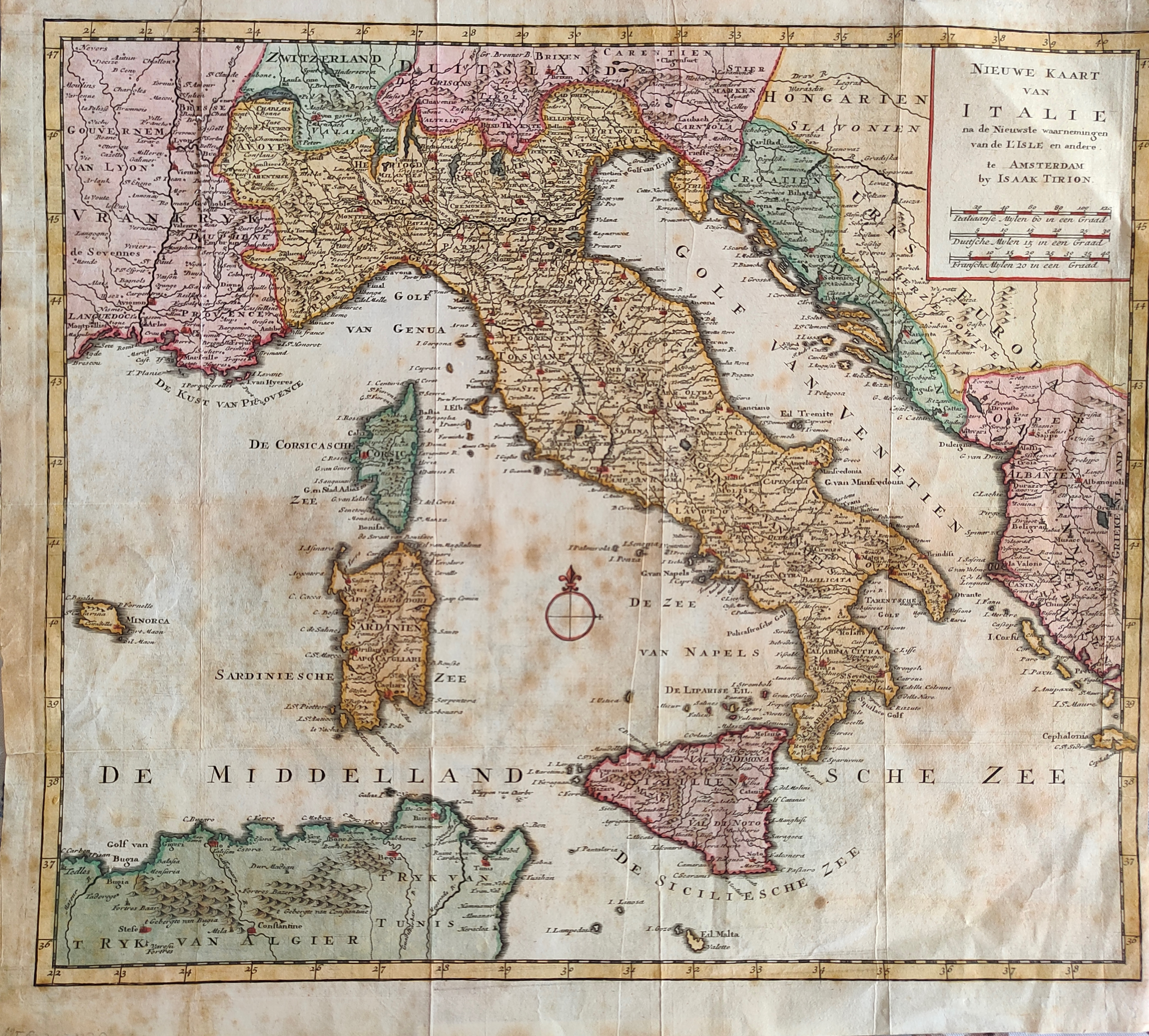
Map title
Nieuwe kaart van Italie
Author
Tirion
Location shown in map
Italy
Edition date
1744
Edition place
Amsterdam
Editor
Atlas
Hand-Atlas
Price
175 Euro
State
[mint/EXCELLENT/very good/good/fair/mediocre/poor]
Color
Old colors
Verso
Blank
Size
Plate: cm (39 x 33) inches (15.35 x 12.99) Paper: cm (40 x 37) inches (15.75 x 14.57)
Technique
Copper engraving
Note
Reference
Wiki
Here for more info
In stock
Available
Info
info@thetreasuremaps.com
Code
#1307
×
![Nieuwe kaart van Italie by Tirion, Italy, 1744]()

Map title
Carta geografica del regno di Corsica
Author
Tirion
Location shown in map
Corsica
Edition date
1762
Edition place
Venice
Editor
--
Atlas
Modern History printed by Thomas Salmon.
Price
250 Euro
State
[mint/excellent/VERY GOOD/good/fair/mediocre/poor]
Color
Black/white
Verso
Blank
Size
Plate: cm (43.2 x 33) inches (17.01 x 12.99) Paper: cm (48.3 x 36.8) inches (19.02 x 14.49)
Technique
Copper engraving
Note
Detailed map of the Corsica island.
Reference
--
Wiki
Here for more info
In stock
Sold
Info
info@thetreasuremaps.com
Code
#0402
×
![Carta geografica del regno di Corsica by Tirion, Corsica, 1762]()