1700-1799
Map title
Carte generale du theatre de la guerre
Author
Nolin
Location shown in map
North Italy
Edition date
1701
Edition place
Paris
Editor
Atlas
Price
150 Euro
State
[mint/EXCELLENT/very good/good/fair/mediocre/poor]
Color
Old colors
Verso
Blank
Size
Plate: cm (34 x 25) inches (13.39 x 9.84) Paper: cm (49 x 33) inches (19.29 x 12.99)
Technique
Copper engraving
Note
Reference
Wiki
Here for more info
In stock
Available
Info
info@thetreasuremaps.com
Code
#1083
×
![Carte generale du theatre de la guerre by Nolin, North Italy, 1701]()
Map title
Genua
Author
Thomas Fritschen
Location shown in map
Genoa
Edition date
1702
Edition place
Leipzig
Editor
Thomas Fritschen
Atlas
Schauplatz Krieges in Italien
Price
Please ask: info@thetreasuremaps.com
State
[mint/EXCELLENT/very good/good/fair/mediocre/poor]
Color
Black/white
Verso
White
Size
Plate: cm (14 x 12.7) inches (5.51 x 5) Paper: cm (17.8 x 17.8) inches (7.01 x 7.01)
Technique
Copper engraving
Note
No particular notes for this maps.
Reference
--
Wiki
Here for more info
In stock
Sold
Info
info@thetreasuremaps.com
Code
#0543
×
![Genua by Thomas Fritschen, Genoa, 1702]()
Map title
Savona
Author
Fritschen
Location shown in map
Savona
Edition date
1702
Edition place
Lipsia
Editor
Thomas Fritschen
Atlas
Schauplatz des Krieges In Italien, Oder Accurate Beschreibung der Lombardey
Price
200 Euro
State
[mint/EXCELLENT/very good/good/fair/mediocre/poor]
Color
Black/white
Verso
Blank
Size
Plate: cm (14 x 8) inches (5.51 x 3.15) Paper: cm (17 x 10) inches (6.69 x 3.94)
Technique
Copper engraving
Note
Reference
Wiki
Here for more info
In stock
Available
Info
info@thetreasuremaps.com
Code
#0810
Savona
Author
Fritschen
Location shown in map
Savona
Edition date
1702
Edition place
Lipsia
Editor
Thomas Fritschen
Atlas
Schauplatz des Krieges In Italien, Oder Accurate Beschreibung der Lombardey
Price
200 Euro
State
[mint/EXCELLENT/very good/good/fair/mediocre/poor]
Color
Black/white
Verso
Blank
Size
Plate: cm (14 x 8) inches (5.51 x 3.15) Paper: cm (17 x 10) inches (6.69 x 3.94)
Technique
Copper engraving
Note
Reference
Wiki
Here for more info
In stock
Available
Info
info@thetreasuremaps.com
Code
#0810
×
![Savona by Fritschen, Savona, 1702]()
Map title
Belli typus in Italia in statu Mediolanesi
Author
Homann
Location shown in map
Lombardy
Edition date
1702
Edition place
?
Editor
--
Atlas
--
Price
350 Euro
State
[mint/excellent/VERY GOOD/good/fair/mediocre/poor]
Color
Old colors
Verso
Blank
Size
Plate: cm (55.9 x 48.3) inches (22.01 x 19.02) Paper: cm (61 x 50.8) inches (24.02 x 20)
Technique
Copper engraving
Note
--
Reference
--
Wiki
Here for more info
In stock
Available
Info
info@thetreasuremaps.com
Code
#0511
×
![Belli typus in Italia in statu Mediolanesi by Homann, Lombardy, 1702]()
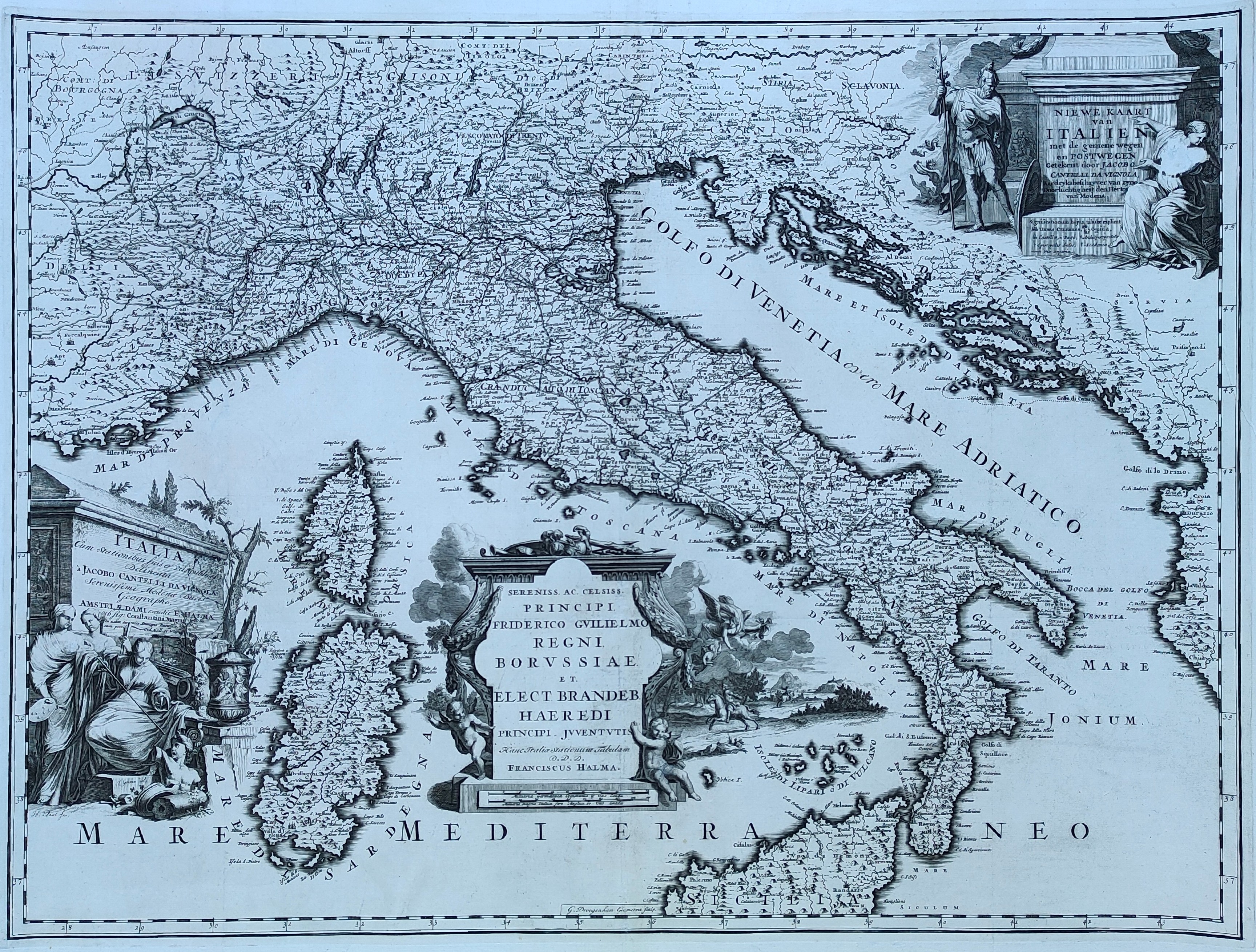
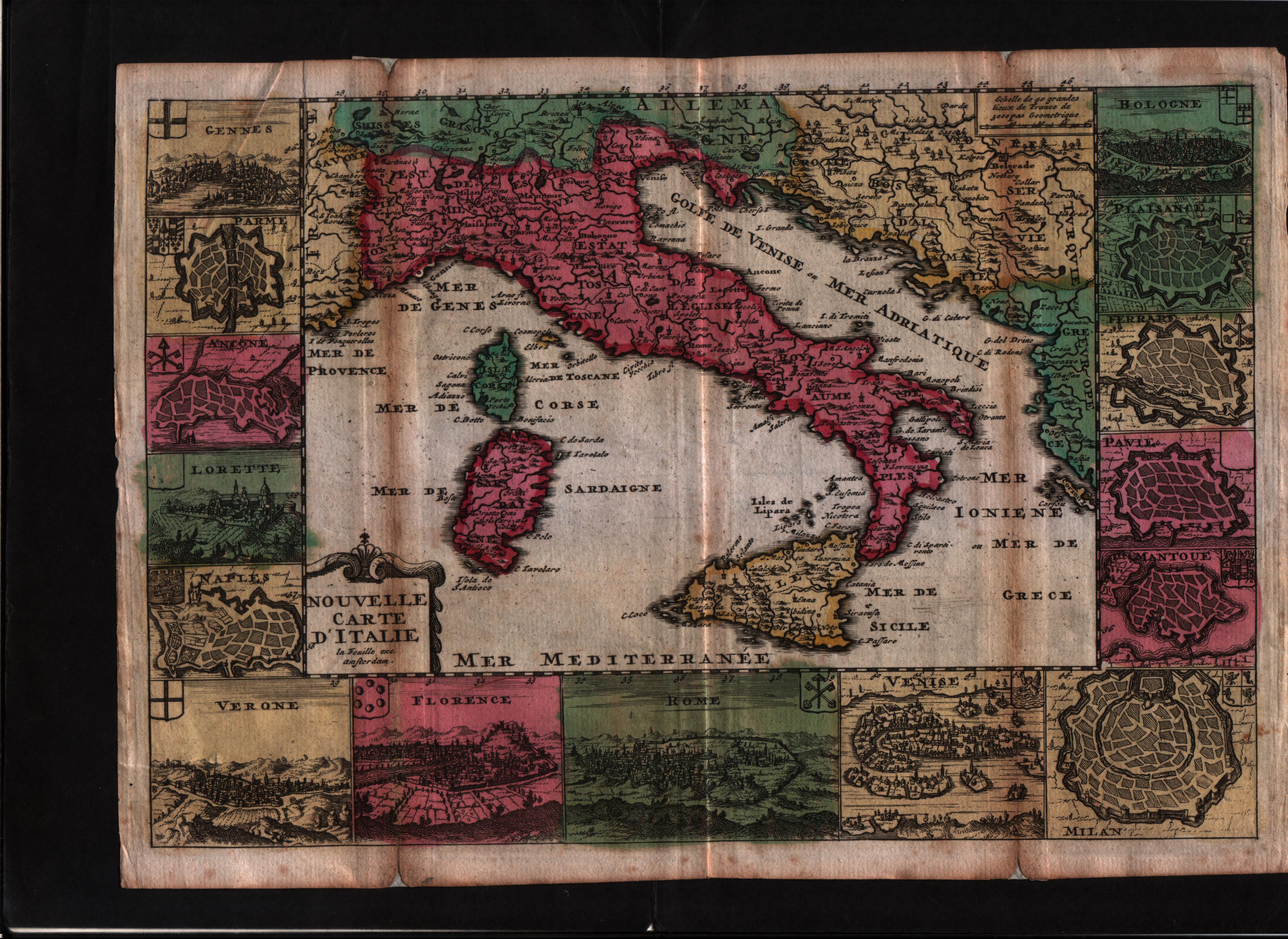
Map title
Niewe kaart van Italien
Author
Cantelli da Vignola
Location shown in map
Italy
Edition date
1704
Edition place
Amsterdam
Editor
Halma
Atlas
Beschryvinge van Oud en Niew Rome
Price
800 Euro
State
[mint/EXCELLENT/very good/good/fair/mediocre/poor]
Color
Black/white
Verso
Blank
Size
Plate: cm (66 x 51) inches (25.98 x 20.08) Paper: cm (70 x 56) inches (27.56 x 22.05)
Technique
Copper engraving
Note
Reference
R.Borri L'Italia nelle antiche carte pag.168
Wiki
Here for more info
In stock
Available
Info
info@thetreasuremaps.com
Code
#0850
×
![Niewe kaart van Italien by Cantelli da Vignola, Italy, 1704]()
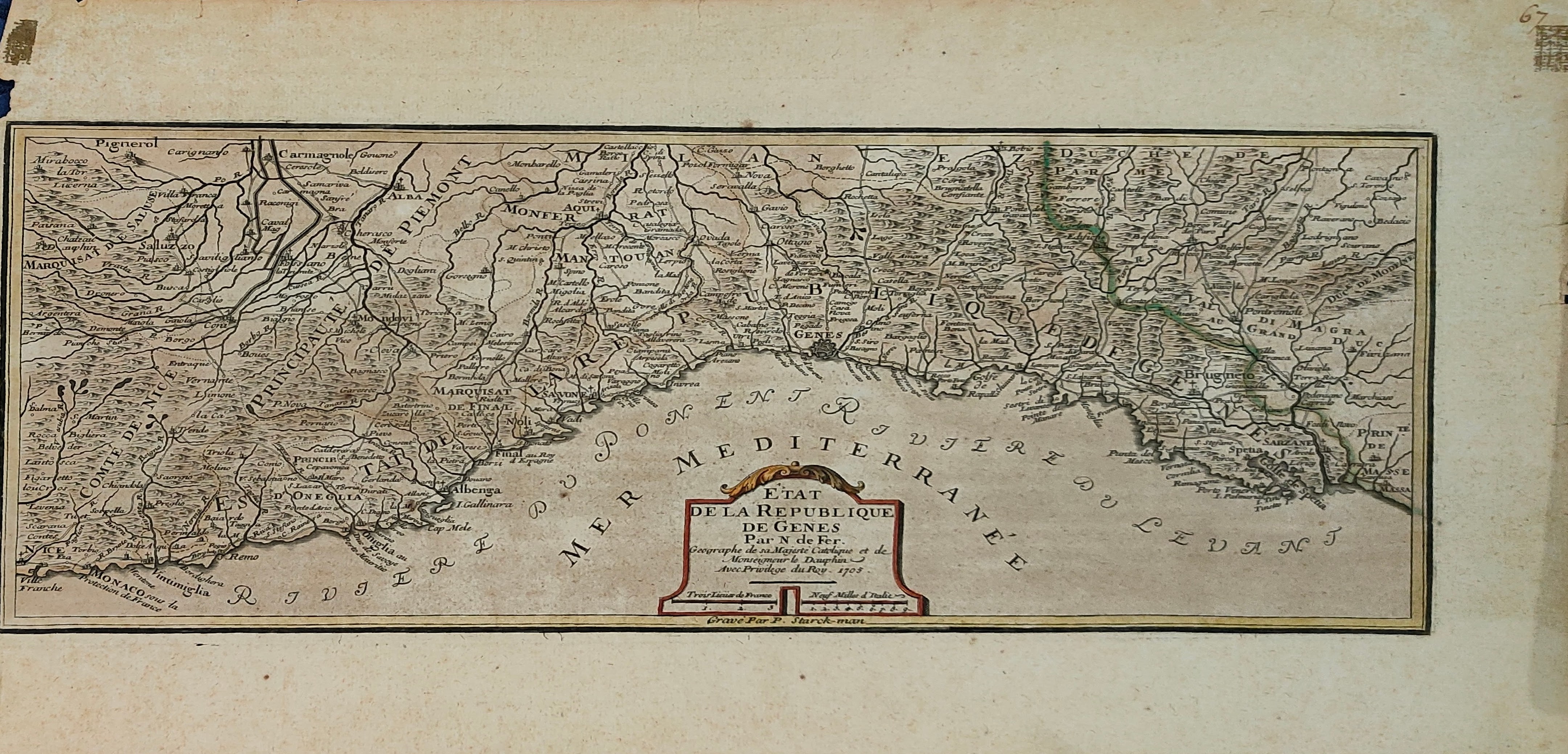
Map title
Etat de la Republique de Genes
Author
De Fer
Location shown in map
Liguria
Edition date
1705
Edition place
Paris
Editor
Chez l'Auteur
Atlas
L'Atlas Curieux ou le Monde Represente ans des Cartes Generales et Particulieres du Ciel et de la Terre ...
Price
350 Euro
State
[mint/EXCELLENT/very good/good/fair/mediocre/poor]
Color
Old colors
Verso
Blank
Size
Plate: cm (37 x 16) inches (14.57 x 6.3) Paper: cm (41 x 24) inches (16.14 x 9.45)
Technique
Copper engraving
Note
Reference
L.Tricerri, Catalog of Maps of Liguria R_068
Wiki
Here for more info
In stock
Available
Info
info@thetreasuremaps.com
Code
#1334
×
![Etat de la Republique de Genes by De Fer, Liguria, 1705]()
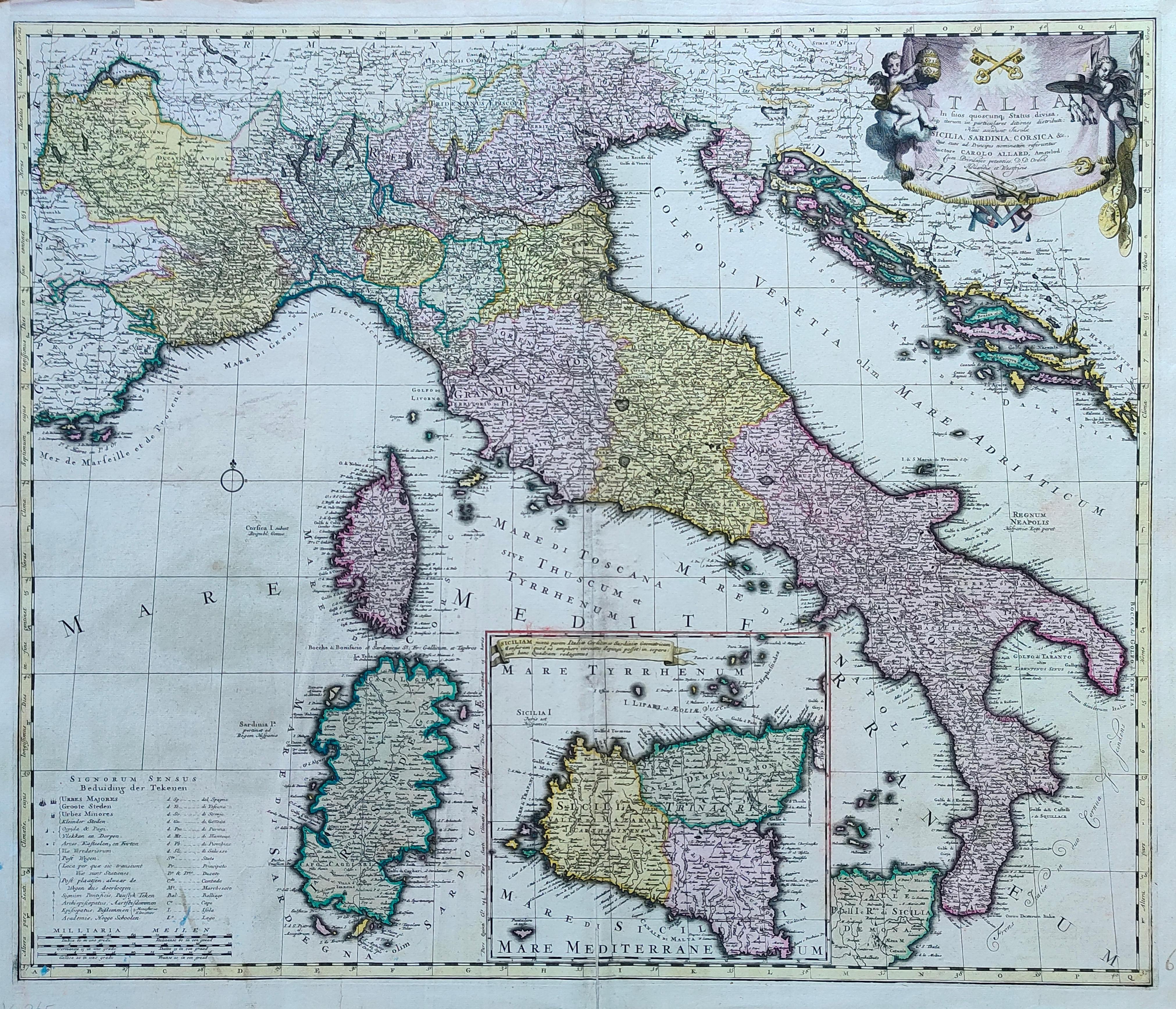
Map title
Italia in suos ...
Author
Allard
Location shown in map
Italy
Edition date
1705
Edition place
Amsterdam
Editor
--
Atlas
Atlas Major
Price
800 Euro
State
[mint/EXCELLENT/very good/good/fair/mediocre/poor]
Color
Old colors
Verso
Blank
Size
Plate: cm (59 x 50) inches (23.23 x 19.69) Paper: cm (65 x 55) inches (25.59 x 21.65)
Technique
Copper engraving
Note
Reference
R.Borri L'Italia nelle antiche carte pag.178
Wiki
Here for more info
In stock
Available
Info
info@thetreasuremaps.com
Code
#1279
×
![Italia in suos ... by Allard, Italy, 1705]()
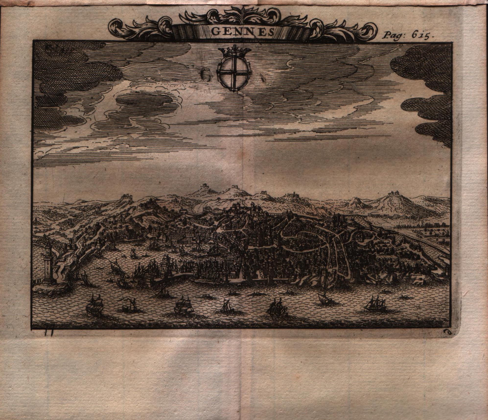
Map title
Gennes
Author
Alexandre de Rogissart
Location shown in map
Genoa
Edition date
1706
Edition place
Leiden
Editor
Pierre Vander
Atlas
Les delices de l'Italie
Price
Please ask: info@thetreasuremaps.com
State
[MINT/excellent/VERY GOOD/good/fair/mediocre/poor]
Color
Black/white
Verso
Blank
Size
Plate: cm (15.2 x 12.7) inches (5.98 x 5) Paper: cm (17.8 x 17.8) inches (7.01 x 7.01)
Technique
Copper engraving
Note
No particular notes for this maps.
Reference
--
Wiki
Here for more info
In stock
Sold
Info
info@thetreasuremaps.com
Code
#0564
×
![Gennes by Alexandre de Rogissart, Genoa, 1706]()

Map title
Africa Propria
Author
Unknown
Location shown in map
Notrh Africa
Edition date
1706
Edition place
???
Editor
--
Atlas
???
Price
Please ask: info@thetreasuremaps.com
State
[mint/excellent/VERY GOOD/good/fair/mediocre/poor]
Color
Black/white
Verso
Blank
Size
Plate: cm (30.5 x 20.3) inches (12.01 x 7.99) Paper: cm (33.7 x 23.5) inches (13.27 x 9.25)
Technique
Copper engraving
Note
No particular notes for this maps
Reference
--
Wiki
Here for more info
In stock
Sold
Info
info@thetreasuremaps.com
Code
#0446
×
![Africa Propria by Unknown, Notrh Africa, 1706]()
Map title
Novelle carte d'Italie
Author
Daniel de La Feuille
Location shown in map
Italy
Edition date
1706
Edition place
Amsterdam
Editor
--
Atlas
Les tablettes guerrieres, ou cartes choisies piur la commodite des officiers
Price
Please ask: info@thetreasuremaps.com
State
[mint/excellent/VERY GOOD/good/fair/mediocre/poor]
Color
Old colors
Verso
Blank
Size
Plate: cm (25.4 x 17.8) inches (10 x 7.01) Paper: cm (26.7 x 19) inches (10.51 x 7.48)
Technique
Copper engraving
Note
--
Reference
Wiki
Here for more info
In stock
Sold
Info
info@thetreasuremaps.com
Code
#0584
×
![Novelle carte d'Italie by Daniel de La Feuille, Italy, 1706]()
Map title
Gennes
Author
Alexandre de Rogissart
Location shown in map
Genoa
Edition date
1707
Edition place
Leiden
Editor
Pierre Vander
Atlas
Les delices de l'Italie
Price
Please ask: info@thetreasuremaps.com
State
[MINT/excellent/VERY GOOD/good/fair/mediocre/poor]
Color
Black/white
Verso
Blank
Size
Plate: cm (15.2 x 12.7) inches (5.98 x 5) Paper: cm (17.8 x 17.8) inches (7.01 x 7.01)
Technique
Copper engraving
Note
No particular notes for this maps.
Reference
--
Wiki
Here for more info
In stock
Sold
Info
info@thetreasuremaps.com
Code
#0565
×
![Gennes by Alexandre de Rogissart, Genoa, 1707]()
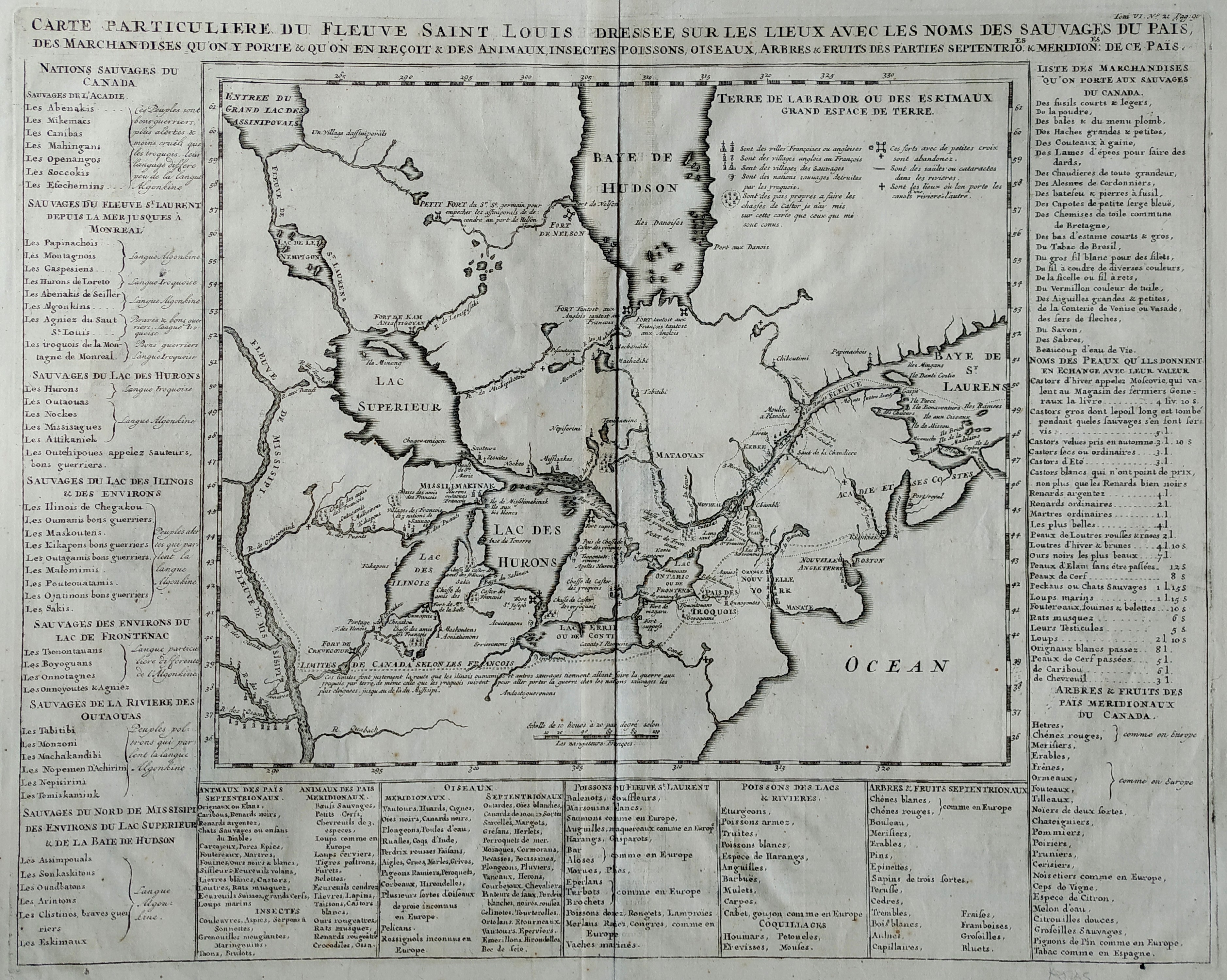
Map title
Carte Particuliere Du Fleuve Saint Louis Dressee Sure Les Lieux Avec Les Noms Des Sauvages Du Pais
Author
Henri Chatelain
Location shown in map
Canada & North America
Edition date
1708
Edition place
Amsterdam
Editor
--
Atlas
Atlas Historique
Price
Please ask: info@thetreasuremaps.com
State
[mint/EXCELLENT/very good/good/fair/mediocre/poor]
Color
Black/white
Verso
Blank
Size
Plate: cm (35.6 x 45.7) inches (14.02 x 17.99) Paper: cm (35.6 x 45.7) inches (14.02 x 17.99)
Technique
Copper engraving
Note
Key giving historical & geographical information
Reference
--
Wiki
Here for more info
In stock
Sold
Info
info@thetreasuremaps.com
Code
#0057
×
![Carte Particuliere Du Fleuve Saint Louis Dressee Sure Les Lieux Avec Les Noms Des Sauvages Du Pais by Henri Chatelain, Canada & North America, 1708]()
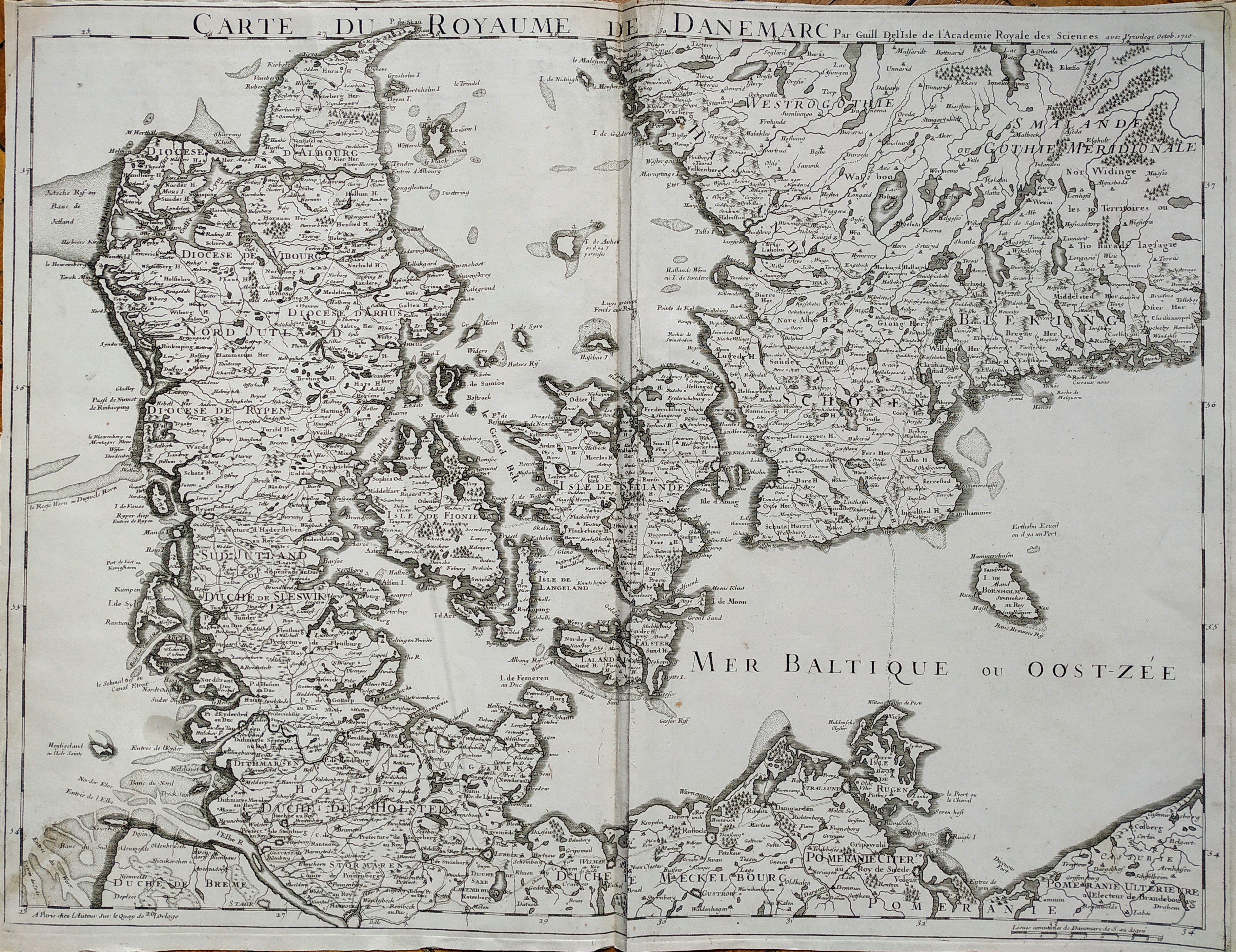
Map title
Carte du roroyaume de Danemarc
Author
De L'Isle
Location shown in map
Denmark
Edition date
1710
Edition place
Paris
Editor
Guillaume Delisle
Atlas
Price
250 Euro
State
[mint/EXCELLENT/very good/good/fair/mediocre/poor]
Color
Black/white
Verso
Blank
Size
Plate: cm (63 x 49) inches (24.8 x 19.29) Paper: cm (65 x 50) inches (25.59 x 19.69)
Technique
Copper engraving
Note
No particular notes for this maps
Reference
Wiki
Here for more info
In stock
Available
Info
info@thetreasuremaps.com
Code
#0727
×
![Carte du roroyaume de Danemarc by De L'Isle, Denmark, 1710]()
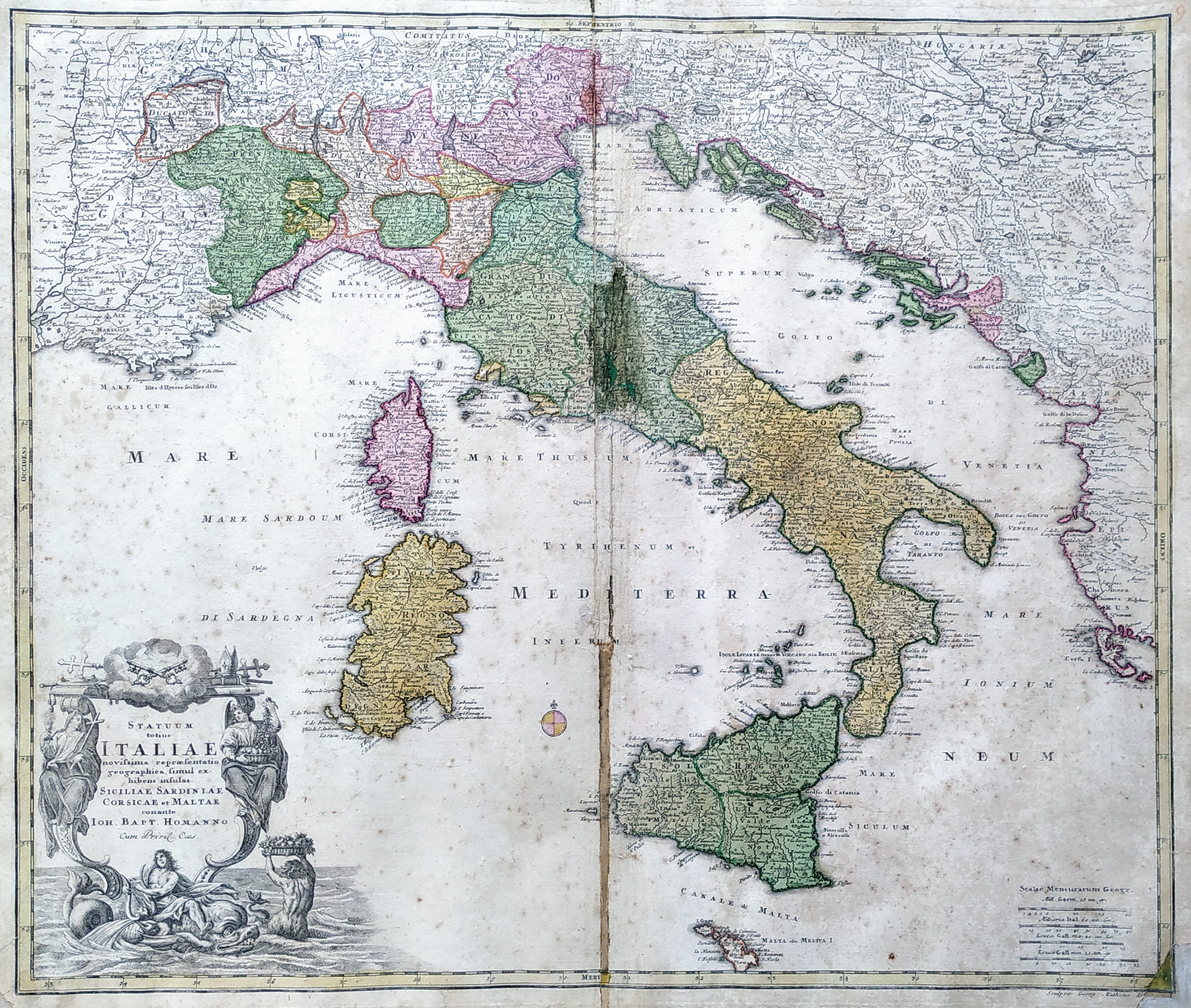
Map title
Statuum Totius Italiae Novissima Repraesentatio Geographica
Author
Homann
Location shown in map
Italy
Edition date
Circa 1712
Edition place
Nuremberg
Editor
Atlas
Price
350 Euro
State
[mint/excellent/very good/good/fair/mediocre/POOR]
Color
Old colors
Verso
Blank
Size
Plate: cm (58 x 50) inches (22.83 x 19.69) Paper: cm (62 x 53) inches (24.41 x 20.87)
Technique
Copper engraving
Note
Reference
R.Borri L'Italia nelle antiche carte pag.185
Wiki
Here for more info
In stock
Available
Info
info@thetreasuremaps.com
Code
#0812
×
![Statuum Totius Italiae Novissima Repraesentatio Geographica by Homann, Italy, Circa 1712]()

Map title
Hispania
Author
Giovanni Battista de Cassine
Location shown in map
Spain
Edition date
1712
Edition place
Milan
Editor
Ambrosii Ramellati
Atlas
Chorographica descriptio Provinciarum, et Conventuum FF. Min. S. Francisci Capucinorum
Price
Please ask: info@thetreasuremaps.com
State
[mint/EXCELLENT/very good/good/fair/mediocre/poor]
Color
Black/white
Verso
Blank
Size
Plate: cm (32 x 22) inches (12.6 x 8.66) Paper: cm (34 x 24) inches (13.39 x 9.45)
Technique
Copper engraving
Note
No particular notes for this maps.
Reference
--
Wiki
Here for more info
In stock
Sold
Info
info@thetreasuremaps.com
Code
#0657
×
![Hispania by Giovanni Battista de Cassine, Spain, 1712]()
Map title
Germania
Author
Giovanni Battista de Cassine
Location shown in map
Germany
Edition date
1712
Edition place
Milan
Editor
Ambrosii Ramellati
Atlas
Chorographica descriptio Provinciarum, et Conventuum FF. Min. S. Francisci Capucinorum
Price
Please ask: info@thetreasuremaps.com
State
[mint/EXCELLENT/very good/good/fair/mediocre/poor]
Color
Black/white
Verso
Blank
Size
Plate: cm (32 x 22) inches (12.6 x 8.66) Paper: cm (38 x 27) inches (14.96 x 10.63)
Technique
Copper engraving
Note
No particular notes for this maps.
Reference
--
Wiki
Here for more info
In stock
Available
Info
info@thetreasuremaps.com
Code
#0721
×
![Germania by Giovanni Battista de Cassine, Germany, 1712]()
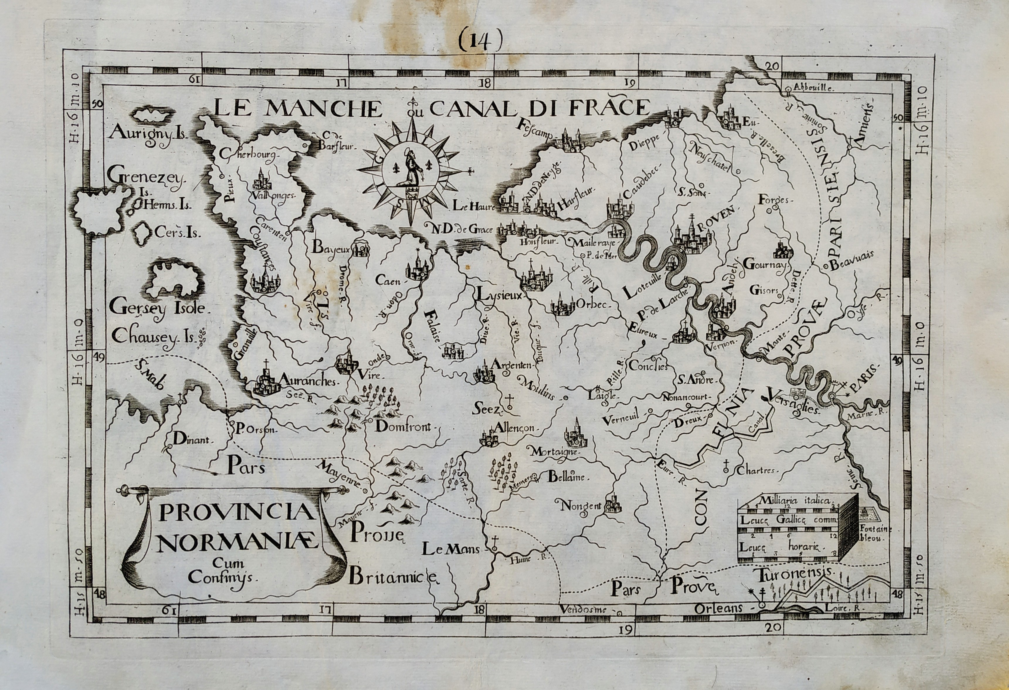
Map title
Provincia Normaniae
Author
Giovanni Battista de Cassine
Location shown in map
Normandie
Edition date
1712
Edition place
Milan
Editor
Ambrosii Ramellati
Atlas
Chorographica descriptio Provinciarum, et Conventuum FF. Min. S. Francisci Capucinorum
Price
Please ask: info@thetreasuremaps.com
State
[mint/EXCELLENT/very good/good/fair/mediocre/poor]
Color
Black/white
Verso
Blank
Size
Plate: cm (32 x 22) inches (12.6 x 8.66) Paper: cm (38 x 27) inches (14.96 x 10.63)
Technique
Copper engraving
Note
No particular notes for this maps.
Reference
--
Wiki
Here for more info
In stock
Available
Info
info@thetreasuremaps.com
Code
#0720
×
![Provincia Normaniae by Giovanni Battista de Cassine, Normandie, 1712]()
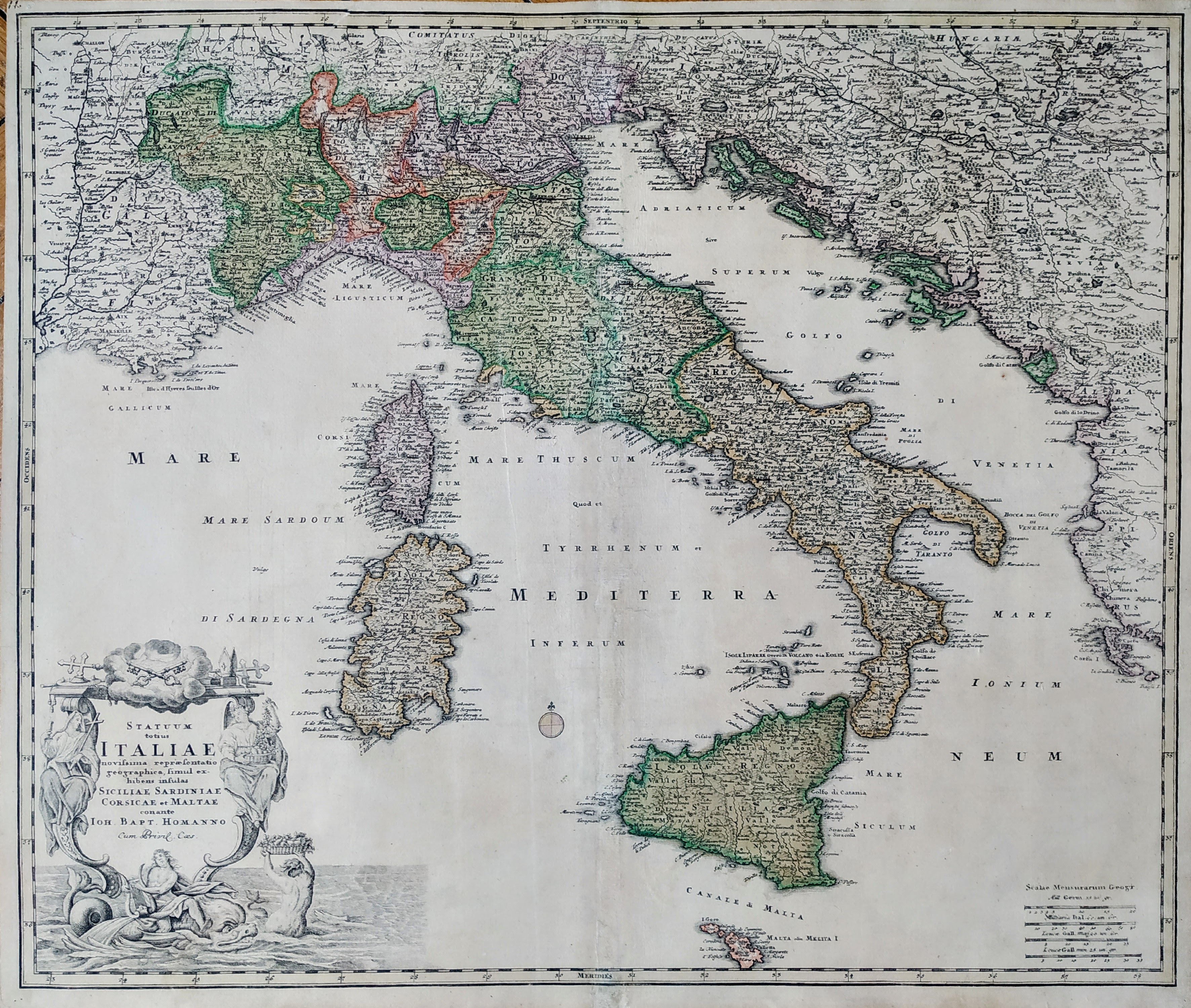
Map title
Statuum Totius Italiae Novissima Repraesentatio Geographica
Author
Homann
Location shown in map
Italy
Edition date
Circa 1712
Edition place
Nuremberg
Editor
Atlas
Price
400 Euro
State
[mint/EXCELLENT/very good/good/fair/mediocre/poor]
Color
Old colors
Verso
Blank
Size
Plate: cm (58 x 50) inches (22.83 x 19.69) Paper: cm (62 x 53) inches (24.41 x 20.87)
Technique
Copper engraving
Note
Reference
R.Borri L'Italia nelle antiche carte pag.185
Wiki
Here for more info
In stock
Available
Info
info@thetreasuremaps.com
Code
#0866
×
![Statuum Totius Italiae Novissima Repraesentatio Geographica by Homann, Italy, Circa 1712]()
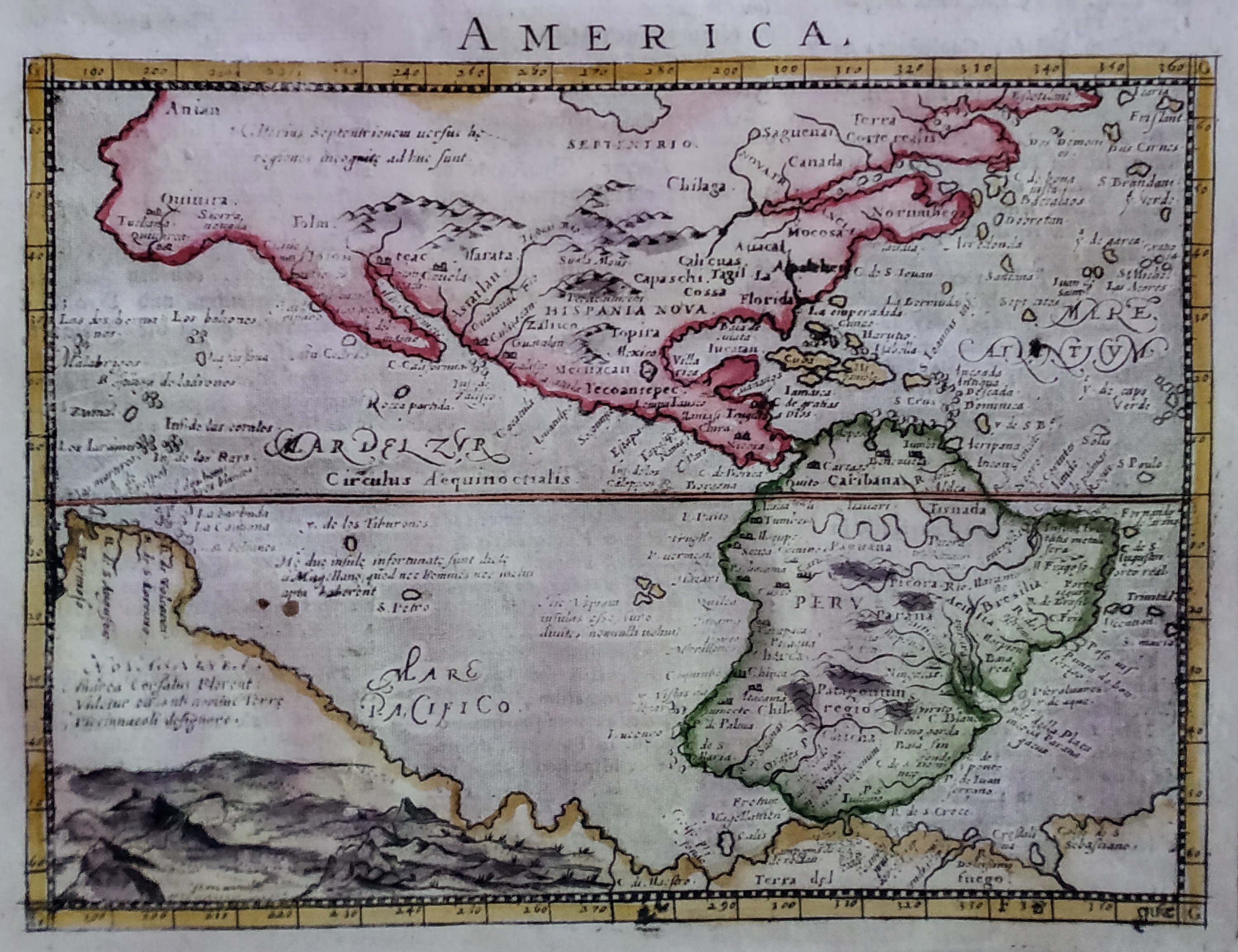
Map title
America
Author
Magini
Location shown in map
Americas
Edition date
1713
Edition place
Padua
Editor
Cadorin
Atlas
Universus terrarum orbis scriptorum calamo delineatus
Price
400 Euro
State
[MINT/excellent/very good/good/fair/mediocre/poor]
Color
Modern color
Verso
Latin text pag.22
Size
Plate: cm (17.8 x 12.7) inches (7.01 x 5) Paper: cm (23 x 34) inches (9.06 x 13.39)
Technique
Copper engraving
Note
Alphonse Lasor a Varea
Reference
--
Wiki
Here for more info
In stock
Available
Info
info@thetreasuremaps.com
Code
#0835
×
![America by Magini, Americas, 1713]()
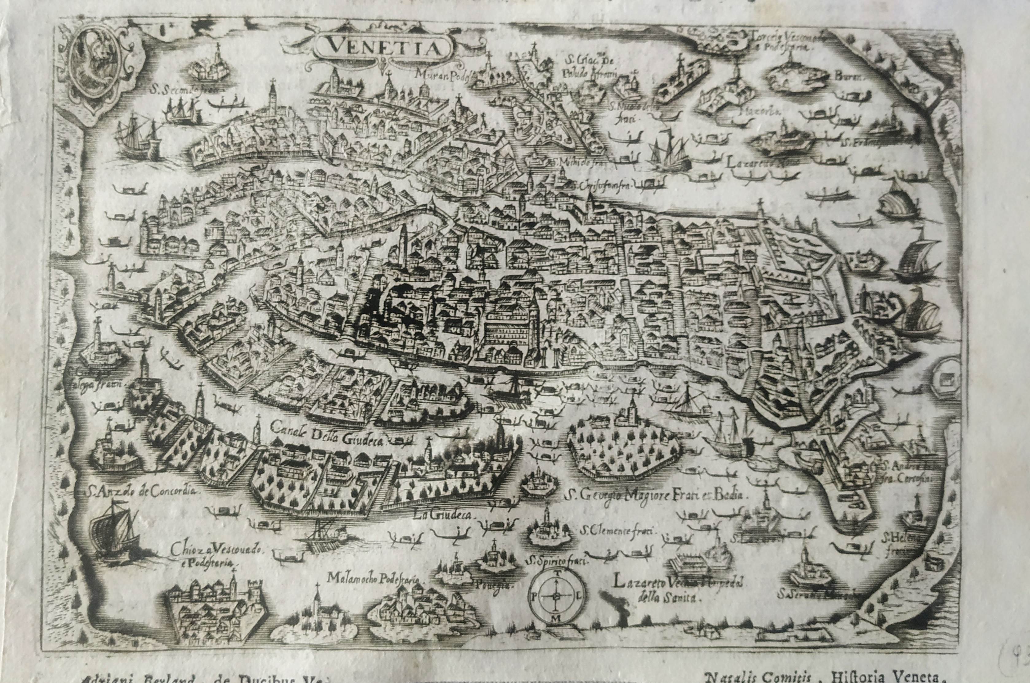
Map title
Venetia
Author
Magini
Location shown in map
Venice
Edition date
1713
Edition place
Padua
Editor
Cadorin
Atlas
Universus terrarum orbis scriptorum calamo delineatus
Price
250 Euro
State
[mint/EXCELLENT/very good/good/fair/mediocre/poor]
Color
Black/white
Verso
Latin text pag.642
Size
Plate: cm (18 x 12) inches (7.09 x 4.72) Paper: cm (22 x 14) inches (8.66 x 5.51)
Technique
Copper engraving
Note
Alphonse Lasor a Varea
Reference
Wiki
Here for more info
In stock
Available
Info
info@thetreasuremaps.com
Code
#0816
×
![Venetia by Magini, Venice, 1713]()