1500-1599
Map title
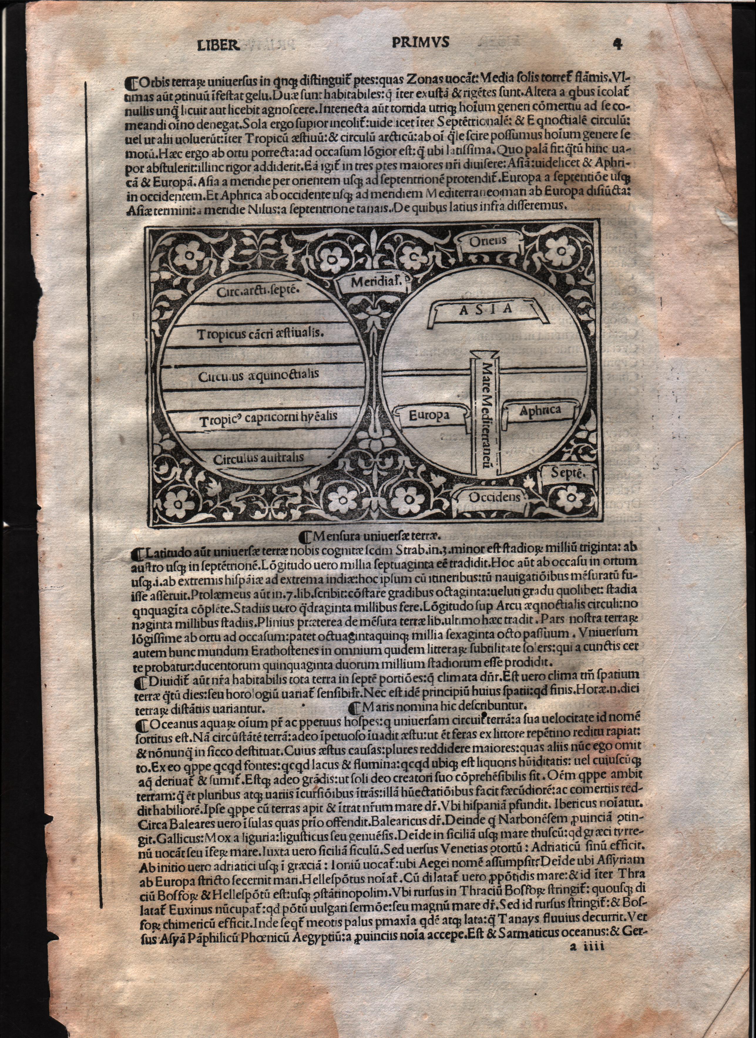
Mensura universae terrae
Author
Foresti
Location shown in map
World
Edition date
Circa 1503
Edition place
Venice
Editor
Georgii de Rusconibus
Atlas
Supplementum supplementi cronicarum
Price
3000 Euro
State
[MINT/excellent/very good/good/fair/mediocre/poor]
Color
Black/white
Verso
Latin text
Size
Plate: cm (14 x 8.9) inches (5.51 x 3.5) Paper: cm (21.6 x 30.5) inches (8.5 x 12.01)
Technique
Woodcut
Note
T-O map
Reference
--
Wiki
Here for more info
In stock
Available
Info
info@thetreasuremaps.com
Code
#0568
×
![]()
Map title
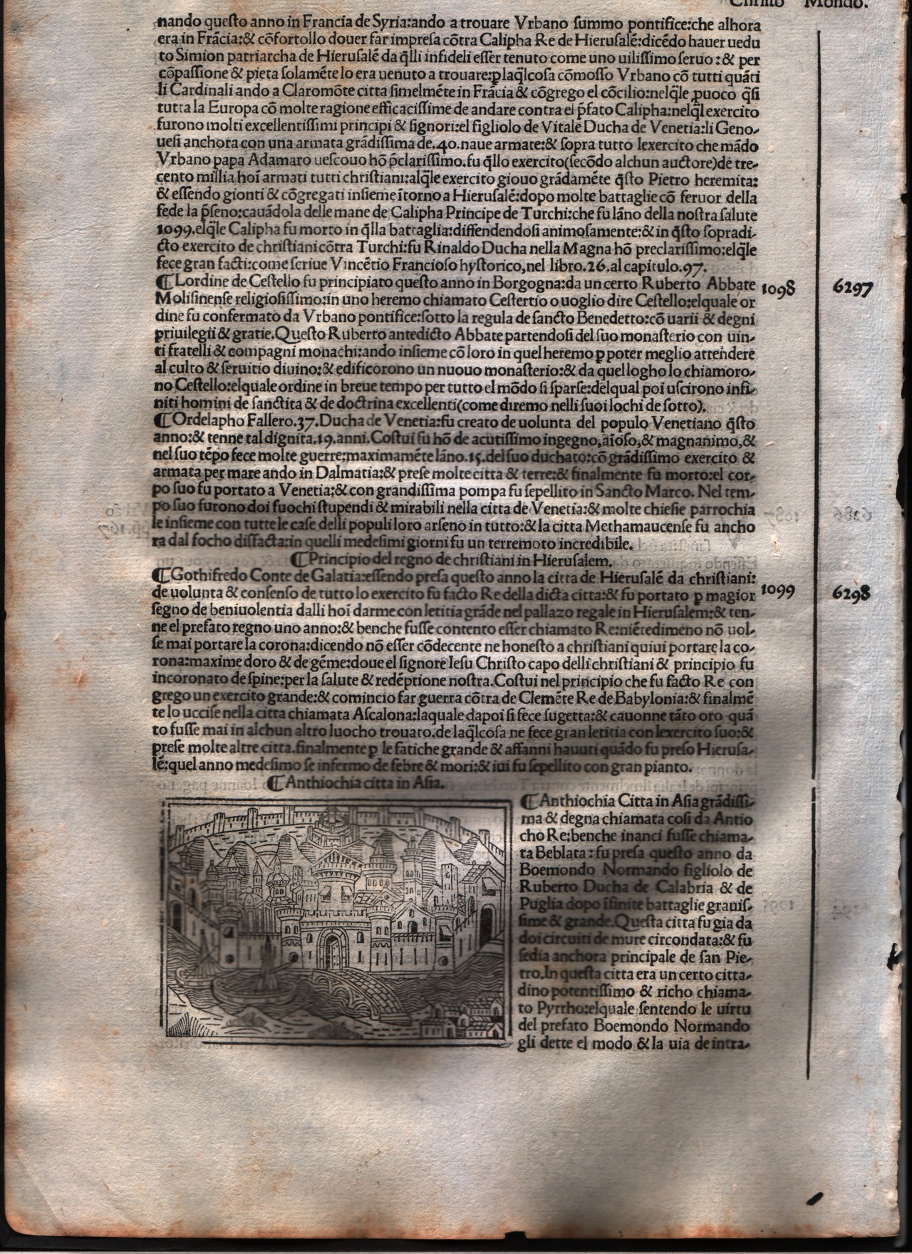
Antiochia
Author
Foresti
Location shown in map
City of Antakya - Turkey
Edition date
1508
Edition place
Venice
Editor
Georgii de Rusconibus
Atlas
Supplementum supplementi cronicarum
Price
Please ask: info@thetreasuremaps.com
State
[MINT/excellent/very good/good/fair/mediocre/poor]
Color
Black/white
Verso
Italian text
Size
Plate: cm (8.9 x 6.4) inches (3.5 x 2.52) Paper: cm (21.6 x 30.5) inches (8.5 x 12.01)
Technique
Woodcut
Note
No particular notes for this maps.
Reference
--
Wiki
Here for more info
In stock
Available
Info
info@thetreasuremaps.com
Code
#0001
×
![]()
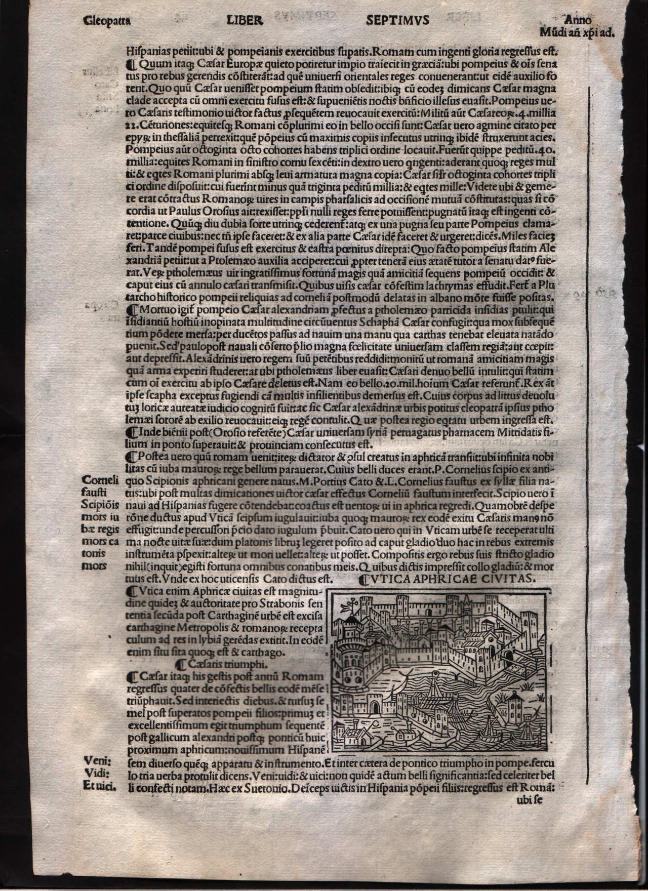
Map title
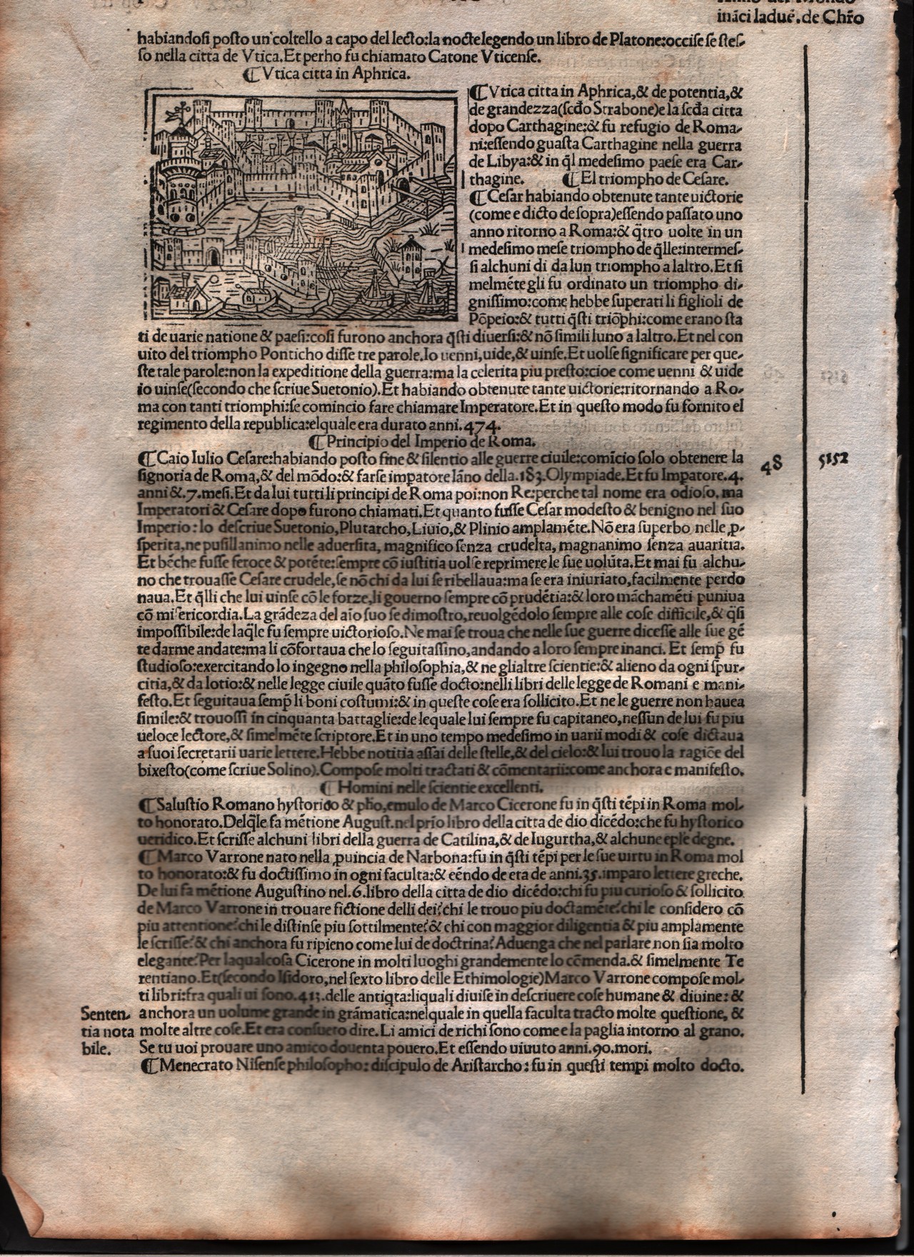
Utica
Author
Foresti
Location shown in map
City of Utica - Tunisia
Edition date
1508
Edition place
Venice
Editor
Georgii de Rusconibus
Atlas
Supplementum supplementi cronicarum
Price
Please ask: info@thetreasuremaps.com
State
[MINT/excellent/very good/good/fair/mediocre/poor]
Color
Black/white
Verso
Italian text
Size
Plate: cm (7.6 x 6.4) inches (2.99 x 2.52) Paper: cm (21.6 x 30.5) inches (8.5 x 12.01)
Technique
Woodcut
Note
No particular notes for this maps.
Reference
--
Wiki
Here for more info
In stock
Available
Info
info@thetreasuremaps.com
Code
#0002
×
![]()
Map title
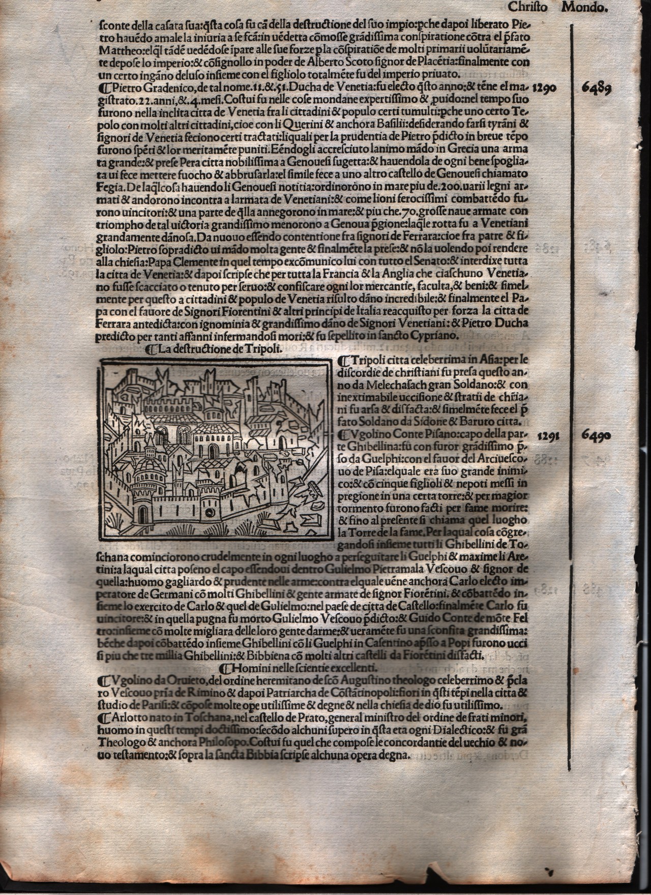
Tripoli
Author
Foresti
Location shown in map
City of Tripoli - Libya
Edition date
1508
Edition place
Venice
Editor
Georgii de Rusconibus
Atlas
Supplementum supplementi cronicarum
Price
Please ask: info@thetreasuremaps.com
State
[MINT/excellent/very good/good/fair/mediocre/poor]
Color
Black/white
Verso
Italian text
Size
Plate: cm (7.6 x 6.4) inches (2.99 x 2.52) Paper: cm (21.6 x 30.5) inches (8.5 x 12.01)
Technique
Woodcut
Note
No particular notes for this maps.
Reference
--
Wiki
Here for more info
In stock
Available
Info
info@thetreasuremaps.com
Code
#0003
×
![]()
Map title
Tyre
Author
Foresti
Location shown in map
City of Tirone - Lebanon
Edition date
1508
Edition place
Venice
Editor
Georgii de Rusconibus
Atlas
Supplementum supplementi cronicarum
Price
Please ask: info@thetreasuremaps.com
State
[MINT/excellent/very good/good/fair/mediocre/poor]
Color
Black/white
Verso
Italian text
Size
Plate: cm (7.6 x 6.4) inches (2.99 x 2.52) Paper: cm (21.6 x 30.5) inches (8.5 x 12.01)
Technique
Woodcut
Note
No particular notes for this maps.
Reference
--
Wiki
Here for more info
In stock
Available
Info
info@thetreasuremaps.com
Code
#0004
×
![]()
Map title
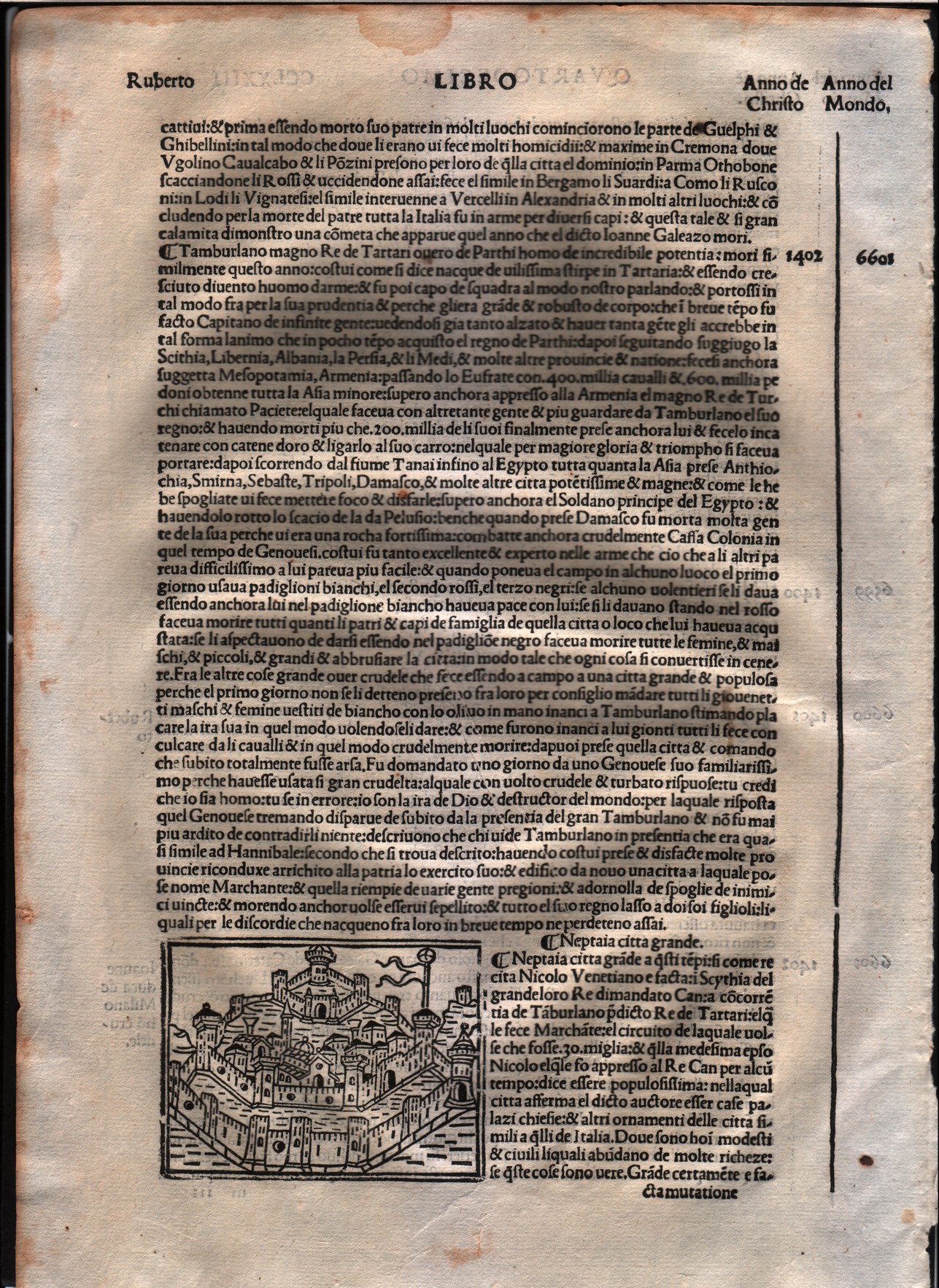
Neptaia
Author
Foresti
Location shown in map
City of Neptaia - Asia
Edition date
1508
Edition place
Venice
Editor
Georgii de Rusconibus
Atlas
Supplementum supplementi cronicarum
Price
Please ask: info@thetreasuremaps.com
State
[MINT/excellent/very good/good/fair/mediocre/poor]
Color
Black/white
Verso
Italian text
Size
Plate: cm (7.6 x 6.4) inches (2.99 x 2.52) Paper: cm (21.6 x 30.5) inches (8.5 x 12.01)
Technique
Woodcut
Note
No particular notes for this maps.
Reference
--
Wiki
Here for more info
In stock
Available
Info
info@thetreasuremaps.com
Code
#0005
×
![]()
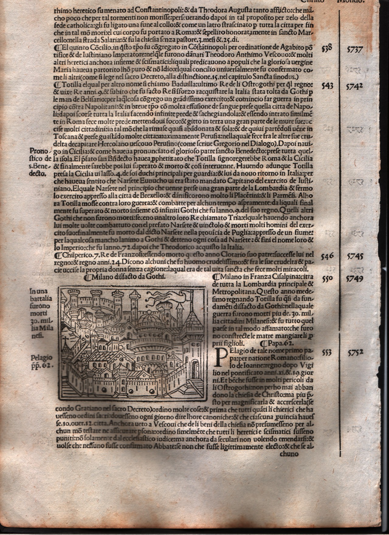
Map title
Milan
Author
Foresti
Location shown in map
Milan
Edition date
1508
Edition place
Venice
Editor
Georgii de Rusconibus
Atlas
Supplementum supplementi cronicarum
Price
400 Euro
State
[MINT/excellent/very good/good/fair/mediocre/poor]
Color
Black/white
Verso
Italian text
Size
Plate: cm (8.9 x 6.4) inches (3.5 x 2.52) Paper: cm (21.6 x 30.5) inches (8.5 x 12.01)
Technique
Woodcut
Note
No particular notes for this maps.
Reference
--
Wiki
Here for more info
In stock
Available
Info
info@thetreasuremaps.com
Code
#0006
Milan
Author
Foresti
Location shown in map
Milan
Edition date
1508
Edition place
Venice
Editor
Georgii de Rusconibus
Atlas
Supplementum supplementi cronicarum
Price
400 Euro
State
[MINT/excellent/very good/good/fair/mediocre/poor]
Color
Black/white
Verso
Italian text
Size
Plate: cm (8.9 x 6.4) inches (3.5 x 2.52) Paper: cm (21.6 x 30.5) inches (8.5 x 12.01)
Technique
Woodcut
Note
No particular notes for this maps.
Reference
--
Wiki
Here for more info
In stock
Available
Info
info@thetreasuremaps.com
Code
#0006
×
![]()
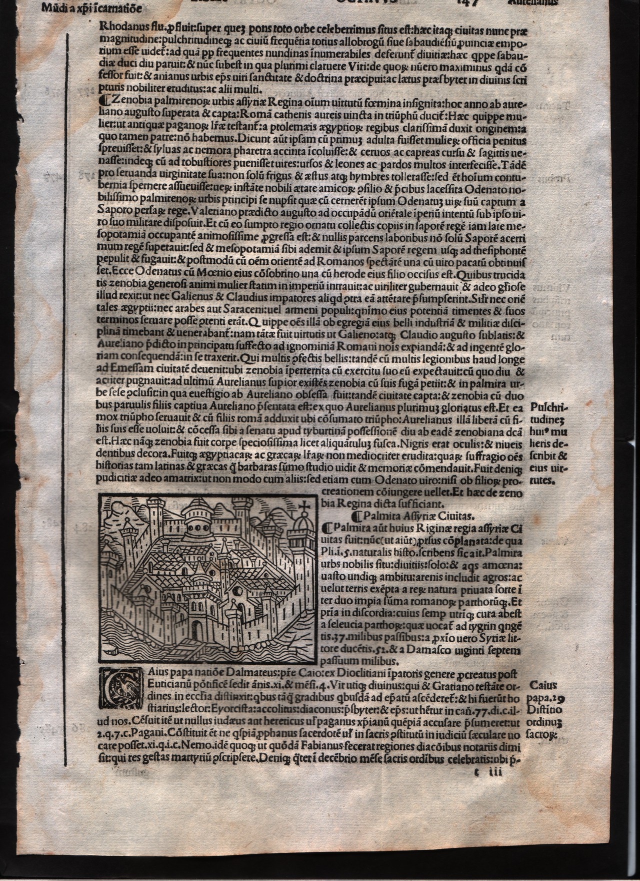
Map title
Palmiria
Author
Foresti
Location shown in map
City of Tadmor - Syria
Edition date
1508
Edition place
Venice
Editor
Georgii de Rusconibus
Atlas
Supplementum supplementi cronicarum
Price
Please ask: info@thetreasuremaps.com
State
[MINT/excellent/very good/good/fair/mediocre/poor]
Color
Black/white
Verso
Latin text
Size
Plate: cm (7.6 x 6.4) inches (2.99 x 2.52) Paper: cm (20.3 x 29.2) inches (7.99 x 11.5)
Technique
Woodcut
Note
No particular notes for this maps.
Reference
--
Wiki
Here for more info
In stock
Available
Info
info@thetreasuremaps.com
Code
#0008
×
![]()
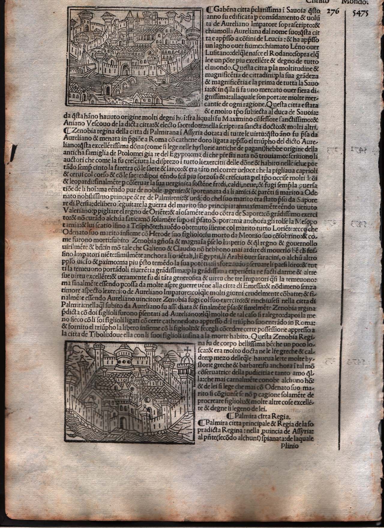
Map title
Palmiria & Gabena
Author
Foresti
Location shown in map
City of Palmiria - Syria
Edition date
1508
Edition place
Venice
Editor
Georgii de Rusconibus
Atlas
Supplementum supplementi cronicarum
Price
Please ask: info@thetreasuremaps.com
State
[MINT/excellent/very good/good/fair/mediocre/poor]
Color
Black/white
Verso
Italian text
Size
Plate: cm (7.6 x 6.4) inches (2.99 x 2.52) Paper: cm (20.3 x 30.5) inches (7.99 x 12.01)
Technique
Woodcut
Note
No particular notes for this maps.
Reference
--
Wiki
Here for more info
In stock
Available
Info
info@thetreasuremaps.com
Code
#0009
×
![]()
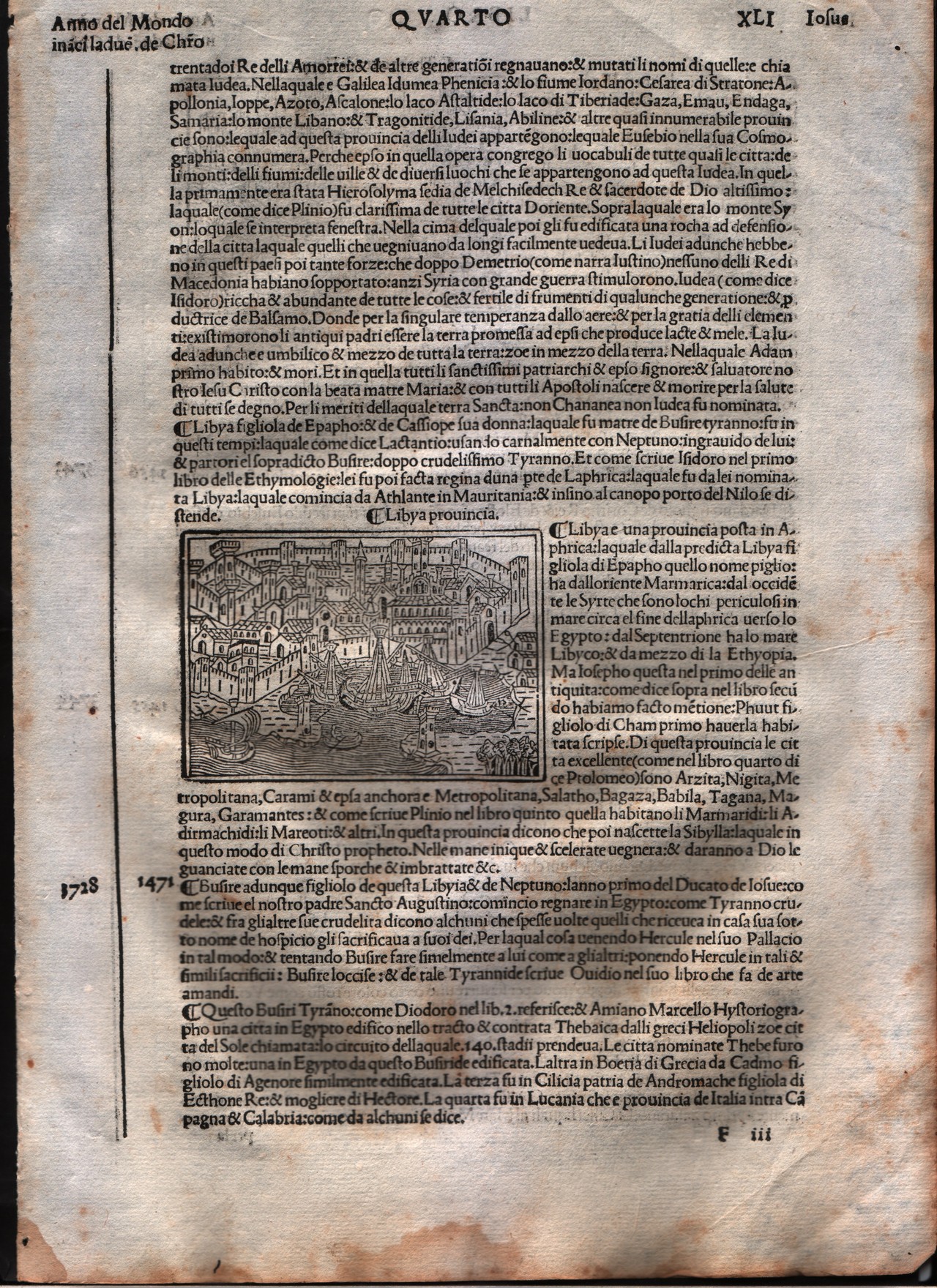
Map title
Lybia
Author
Foresti
Location shown in map
Lybia
Edition date
1508
Edition place
Venice
Editor
Georgii de Rusconibus
Atlas
Supplementum supplementi cronicarum
Price
Please ask: info@thetreasuremaps.com
State
[MINT/excellent/very good/good/fair/mediocre/poor]
Color
Black/white
Verso
Italian text
Size
Plate: cm (8.9 x 6.4) inches (3.5 x 2.52) Paper: cm (21.6 x 30.5) inches (8.5 x 12.01)
Technique
Woodcut
Note
No particular notes for this maps.
Reference
--
Wiki
Here for more info
In stock
Available
Info
info@thetreasuremaps.com
Code
#0010
Lybia
Author
Foresti
Location shown in map
Lybia
Edition date
1508
Edition place
Venice
Editor
Georgii de Rusconibus
Atlas
Supplementum supplementi cronicarum
Price
Please ask: info@thetreasuremaps.com
State
[MINT/excellent/very good/good/fair/mediocre/poor]
Color
Black/white
Verso
Italian text
Size
Plate: cm (8.9 x 6.4) inches (3.5 x 2.52) Paper: cm (21.6 x 30.5) inches (8.5 x 12.01)
Technique
Woodcut
Note
No particular notes for this maps.
Reference
--
Wiki
Here for more info
In stock
Available
Info
info@thetreasuremaps.com
Code
#0010
×
![]()
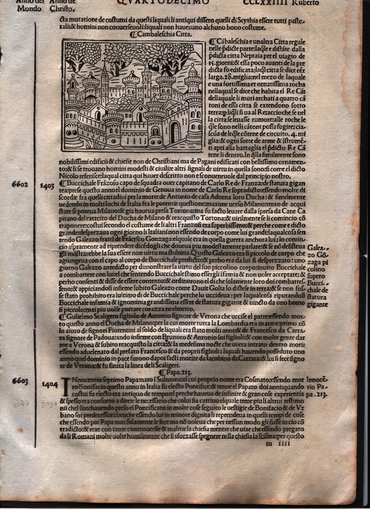
Map title
Cambaleschia
Author
Foresti
Location shown in map
City of Beijing
Edition date
1508
Edition place
Venice
Editor
Georgii de Rusconibus
Atlas
Supplementum supplementi cronicarum
Price
Please ask: info@thetreasuremaps.com
State
[MINT/excellent/very good/good/fair/mediocre/poor]
Color
Black/white
Verso
Italian text
Size
Plate: cm (8.9 x 6.4) inches (3.5 x 2.52) Paper: cm (21.6 x 30.5) inches (8.5 x 12.01)
Technique
Woodcut
Note
No particular notes for this maps.
Reference
--
Wiki
Here for more info
In stock
Available
Info
info@thetreasuremaps.com
Code
#0011
×
![]()
Map title
Utica
Author
Foresti
Location shown in map
City of Utica
Edition date
1508
Edition place
Venice
Editor
Georgii de Rusconibus
Atlas
Supplementum supplementi cronicarum
Price
Please ask: info@thetreasuremaps.com
State
[MINT/excellent/very good/good/fair/mediocre/poor]
Color
Black/white
Verso
Latin text
Size
Plate: cm (7.6 x 6.4) inches (2.99 x 2.52) Paper: cm (20.3 x 30.5) inches (7.99 x 12.01)
Technique
Woodcut
Note
No particular notes for this maps.
Reference
--
Wiki
Here for more info
In stock
Available
Info
info@thetreasuremaps.com
Code
#0012
×
![]()
Map title
Tyre
Author
Foresti
Location shown in map
City of Tyre - Lebanon
Edition date
1508
Edition place
Venice
Editor
Georgii de Rusconibus
Atlas
Supplementum supplementi cronicarum
Price
Please ask: info@thetreasuremaps.com
State
[MINT/excellent/very good/good/fair/mediocre/poor]
Color
Black/white
Verso
Latin text
Size
Plate: cm (7.6 x 6.4) inches (2.99 x 2.52) Paper: cm (20.3 x 30.5) inches (7.99 x 12.01)
Technique
Woodcut
Note
No particular notes for this maps.
Reference
--
Wiki
Here for more info
In stock
Available
Info
info@thetreasuremaps.com
Code
#0013
×
![]()
Map title
Lacedemonia
Author
Foresti
Location shown in map
City of Sparta
Edition date
1508
Edition place
Venice
Editor
Georgii de Rusconibus
Atlas
Supplementum supplementi cronicarum
Price
Please ask: info@thetreasuremaps.com
State
[MINT/excellent/very good/good/fair/mediocre/poor]
Color
Black/white
Verso
Latin text
Size
Plate: cm (7.6 x 6.4) inches (2.99 x 2.52) Paper: cm (20.3 x 30.5) inches (7.99 x 12.01)
Technique
Woodcut
Note
No particular notes for this maps.
Reference
--
Wiki
Here for more info
In stock
Available
Info
info@thetreasuremaps.com
Code
#0014
×
![]()

Map title
Roma
Author
Foresti
Location shown in map
Rome
Edition date
1508
Edition place
Venice
Editor
Georgii de Rusconibus
Atlas
Supplementum supplementi cronicarum
Price
Please ask: info@thetreasuremaps.com
State
[MINT/excellent/very good/good/fair/mediocre/poor]
Color
Black/white
Verso
Italian text
Size
Plate: cm (14 x 11.4) inches (5.51 x 4.49) Paper: cm (21.6 x 30.5) inches (8.5 x 12.01)
Technique
Woodcut
Note
No particular notes for this maps.
Reference
--
Wiki
Here for more info
In stock
Sold
Info
info@thetreasuremaps.com
Code
#0015
×
![]()
Map title
Thebe
Author
Foresti
Location shown in map
Thebes Egypt
Edition date
1508
Edition place
Venice
Editor
Georgii de Rusconibus
Atlas
Supplementum supplementi cronicarum
Price
Please ask: info@thetreasuremaps.com
State
[MINT/excellent/very good/good/fair/mediocre/poor]
Color
Black/white
Verso
Italian text
Size
Plate: cm (8.9 x 6.4) inches (3.5 x 2.52) Paper: cm (21.6 x 30.5) inches (8.5 x 12.01)
Technique
Woodcut
Note
No particular notes for this maps.
Reference
--
Wiki
Here for more info
In stock
Available
Info
info@thetreasuremaps.com
Code
#0516
×
![]()

Map title
Italia XIIII Nova Tabula
Author
Fries
Location shown in map
Italy
Edition date
1522
Edition place
Strasbourg
Editor
Atlas
Claudii Ptolemaei Alexandrini
Price
900 Euro
State
[mint/EXCELLENT/very good/good/fair/mediocre/poor]
Color
Black/white
Verso
Latin text pag.36
Size
Plate: cm (34 x 27) inches (13.39 x 10.63) Paper: cm (50 x 38) inches (19.69 x 14.96)
Technique
Woodcut
Note
No particular notes for this maps
Reference
R.Borri L'Italia nelle antiche carte pag.47
Wiki
Here for more info
In stock
Available
Info
info@thetreasuremaps.com
Code
#0932
×
![]()
Map title
Tabula VI Euro
Author
Fries
Location shown in map
Italy
Edition date
1522
Edition place
Strasbourg
Editor
Atlas
Claudii Ptolemaei Alexandrini
Price
900 Euro
State
[mint/EXCELLENT/very good/good/fair/mediocre/poor]
Color
Black/white
Verso
Latin text
Size
Plate: cm (39 x 24) inches (15.35 x 9.45) Paper: cm (53 x 40) inches (20.87 x 15.75)
Technique
Woodcut
Note
Reference
R.Borri L'Italia nelle antiche carte pag.31
Wiki
Here for more info
In stock
Available
Info
info@thetreasuremaps.com
Code
#1197
×
![]()
Map title
Porto Santo
Author
Bordone
Location shown in map
Madeira island
Edition date
1528
Edition place
Venice
Editor
Nicolò di Aristotile
Atlas
Isolario
Price
400 Euro
State
[mint/EXCELLENT/very good/good/fair/mediocre/poor]
Color
Black/white
Verso
Italian text pag.15
Size
Plate: cm (14 x 8.9) inches (5.51 x 3.5) Paper: cm (20.3 x 30.5) inches (7.99 x 12.01)
Technique
Woodcut
Note
--
Reference
--
Wiki
Here for more info
In stock
Available
Info
info@thetreasuremaps.com
Code
#0171
×
![]()
Map title
--
Author
Bordone
Location shown in map
Ischia
Edition date
1528
Edition place
Venice
Editor
Nicolo di Aristotile
Atlas
Isolario
Price
400 Euro
State
[mint/EXCELLENT/very good/good/fair/mediocre/poor]
Color
Old colors
Verso
Italian text pag.27
Size
Plate: cm (14 x 8.9) inches (5.51 x 3.5) Paper: cm (19 x 29) inches (7.48 x 11.42)
Technique
Woodcut
Note
--
Reference
--
Wiki
Here for more info
In stock
Available
Info
info@thetreasuremaps.com
Code
#0607
--
Author
Bordone
Location shown in map
Ischia
Edition date
1528
Edition place
Venice
Editor
Nicolo di Aristotile
Atlas
Isolario
Price
400 Euro
State
[mint/EXCELLENT/very good/good/fair/mediocre/poor]
Color
Old colors
Verso
Italian text pag.27
Size
Plate: cm (14 x 8.9) inches (5.51 x 3.5) Paper: cm (19 x 29) inches (7.48 x 11.42)
Technique
Woodcut
Note
--
Reference
--
Wiki
Here for more info
In stock
Available
Info
info@thetreasuremaps.com
Code
#0607
×
![]()
Map title
Episkopi
Author
Bordone
Location shown in map
Episcopia
Edition date
1534
Edition place
Venice
Editor
Federico Torresano
Atlas
Isolario
Price
Please ask: info@thetreasuremaps.com
State
[mint/EXCELLENT/very good/good/fair/mediocre/poor]
Color
Old colors
Verso
Italian text pag.53
Size
Plate: cm (14 x 8.9) inches (5.51 x 3.5) Paper: cm (20.3 x 27.9) inches (7.99 x 10.98)
Technique
Woodcut
Note
--
Reference
--
Wiki
Here for more info
In stock
Available
Info
info@thetreasuremaps.com
Code
#0172
×
![]()
Map title
Limonia Carchi
Author
Bordone
Location shown in map
Khalki Limonia
Edition date
1534
Edition place
Venice
Editor
Federico Torresano
Atlas
Isolario
Price
250 Euro
State
[mint/EXCELLENT/very good/good/fair/mediocre/poor]
Color
Old colors
Verso
Italian text
Size
Plate: cm (14 x 8.9) inches (5.51 x 3.5) Paper: cm (20.3 x 27.9) inches (7.99 x 10.98)
Technique
Woodcut
Note
--
Reference
--
Wiki
Here for more info
In stock
Available
Info
info@thetreasuremaps.com
Code
#0517
×
![]()
Map title
--
Author
Bordone
Location shown in map
Delos
Edition date
1534
Edition place
Venice
Editor
Federico Torresano
Atlas
Isolario
Price
300 Euro
State
[mint/EXCELLENT/very good/good/fair/mediocre/poor]
Color
Black/white
Verso
Italian text pag.40
Size
Plate: cm (14 x 8) inches (5.51 x 3.15) Paper: cm (20 x 30) inches (7.87 x 11.81)
Technique
Woodcut
Note
--
Reference
--
Wiki
Here for more info
In stock
Available
Info
info@thetreasuremaps.com
Code
#0624
--
Author
Bordone
Location shown in map
Delos
Edition date
1534
Edition place
Venice
Editor
Federico Torresano
Atlas
Isolario
Price
300 Euro
State
[mint/EXCELLENT/very good/good/fair/mediocre/poor]
Color
Black/white
Verso
Italian text pag.40
Size
Plate: cm (14 x 8) inches (5.51 x 3.15) Paper: cm (20 x 30) inches (7.87 x 11.81)
Technique
Woodcut
Note
--
Reference
--
Wiki
Here for more info
In stock
Available
Info
info@thetreasuremaps.com
Code
#0624
×
![]()
Map title
Limonia Carchi
Author
Bordone
Location shown in map
Khalki Limonia
Edition date
1534
Edition place
Venice
Editor
Federico Torresano
Atlas
Isolario
Price
250 Euro
State
[mint/EXCELLENT/very good/good/fair/mediocre/poor]
Color
Black/white
Verso
Italian text
Size
Plate: cm (14 x 8.9) inches (5.51 x 3.5) Paper: cm (20.3 x 27.9) inches (7.99 x 10.98)
Technique
Woodcut
Note
--
Reference
--
Wiki
Here for more info
In stock
Available
Info
info@thetreasuremaps.com
Code
#0625
×
![]()
Map title
Episkopi
Author
Bordone
Location shown in map
Episcopia
Edition date
1534
Edition place
Venice
Editor
Federico Torresano
Atlas
Isolario
Price
250 Euro
State
[mint/EXCELLENT/very good/good/fair/mediocre/poor]
Color
Black/white
Verso
Italian text pag.53
Size
Plate: cm (14 x 8.9) inches (5.51 x 3.5) Paper: cm (20.3 x 27.9) inches (7.99 x 10.98)
Technique
Woodcut
Note
--
Reference
--
Wiki
Here for more info
In stock
Available
Info
info@thetreasuremaps.com
Code
#0626
×
![]()

Map title
--
Author
Bordone
Location shown in map
Java
Edition date
1534
Edition place
Venice
Editor
Federico Torresano
Atlas
Isolario
Price
Please ask: info@thetreasuremaps.com
State
[mint/EXCELLENT/very good/good/fair/mediocre/poor]
Color
Black/white
Verso
Italian text pag.69
Size
Plate: cm (14 x 8.9) inches (5.51 x 3.5) Paper: cm (20.3 x 27.9) inches (7.99 x 10.98)
Technique
Woodcut
Note
No particular notes for this maps.
Reference
--
Wiki
Here for more info
In stock
Sold
Info
info@thetreasuremaps.com
Code
#0667
--
Author
Bordone
Location shown in map
Java
Edition date
1534
Edition place
Venice
Editor
Federico Torresano
Atlas
Isolario
Price
Please ask: info@thetreasuremaps.com
State
[mint/EXCELLENT/very good/good/fair/mediocre/poor]
Color
Black/white
Verso
Italian text pag.69
Size
Plate: cm (14 x 8.9) inches (5.51 x 3.5) Paper: cm (20.3 x 27.9) inches (7.99 x 10.98)
Technique
Woodcut
Note
No particular notes for this maps.
Reference
--
Wiki
Here for more info
In stock
Sold
Info
info@thetreasuremaps.com
Code
#0667
×
![]()

Map title
--
Author
Bordone
Location shown in map
Necumera Locaz Patera Botegon Mangama
Edition date
1534
Edition place
Venice
Editor
Federico Torresano
Atlas
Isolario
Price
Please ask: info@thetreasuremaps.com
State
[mint/EXCELLENT/very good/good/fair/mediocre/poor]
Color
Black/white
Verso
Italian text pag.69
Size
Plate: cm (14 x 8) inches (5.51 x 3.15) Paper: cm (20.3 x 29) inches (7.99 x 11.42)
Technique
Woodcut
Note
Locaz or Lochac could be Thailand rendered as an island.
Reference
--
Wiki
Here for more info
In stock
Sold
Info
info@thetreasuremaps.com
Code
#0668
--
Author
Bordone
Location shown in map
Necumera Locaz Patera Botegon Mangama
Edition date
1534
Edition place
Venice
Editor
Federico Torresano
Atlas
Isolario
Price
Please ask: info@thetreasuremaps.com
State
[mint/EXCELLENT/very good/good/fair/mediocre/poor]
Color
Black/white
Verso
Italian text pag.69
Size
Plate: cm (14 x 8) inches (5.51 x 3.15) Paper: cm (20.3 x 29) inches (7.99 x 11.42)
Technique
Woodcut
Note
Locaz or Lochac could be Thailand rendered as an island.
Reference
--
Wiki
Here for more info
In stock
Sold
Info
info@thetreasuremaps.com
Code
#0668
×
![]()
Map title
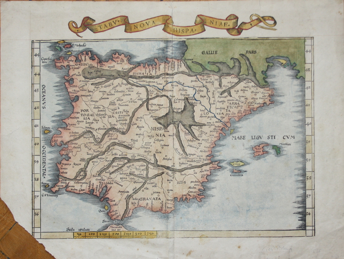
Tabv Nova Hispaniae
Author
Fries
Location shown in map
Spain
Edition date
1535
Edition place
Lyon
Editor
Melchior and Gaspar Trechsel
Atlas
Ptolemy's Geographia
Price
700 Euro
State
[mint/EXCELLENT/very good/good/fair/mediocre/poor] repaired
Color
Recent color
Verso
Blank
Size
Plate: cm (41.9 x 30.5) inches (16.5 x 12.01) Paper: cm (53.3 x 39.4) inches (20.98 x 15.51)
Technique
Woodcut
Note
Missing bottom left corner
Reference
--
Wiki
Here for more info
In stock
Available
Info
info@thetreasuremaps.com
Code
#0091
×
![]()
Map title
India orientalis
Author
Fries
Location shown in map
Southeast Asia
Edition date
1535
Edition place
Lyon
Editor
Melchior and Gaspar Trechsel
Atlas
Ptolemy's Geographia
Price
2000 Euro
State
[mint/EXCELLENT/very good/good/fair/mediocre/poor] repaired
Color
Black/white
Verso
Blank
Size
Plate: cm (41.9 x 30.5) inches (16.5 x 12.01) Paper: cm (55.9 x 40.6) inches (22.01 x 15.98)
Technique
Woodcut
Note
--
Reference
--
Wiki
Here for more info
In stock
Available
Info
info@thetreasuremaps.com
Code
#0173
×
![]()
Map title
Tabv Nova Partis Aphri
Author
Fries
Location shown in map
West Africa
Edition date
1535
Edition place
Lyon
Editor
Melchior and Gaspar Trechsel
Atlas
Ptolemy's Geographia
Price
1200 Euro
State
[mint/EXCELLENT/very good/good/fair/mediocre/poor] repaired
Color
Black/white
Verso
Blank
Size
Plate: cm (39.4 x 30.5) inches (15.51 x 12.01) Paper: cm (50.8 x 39.4) inches (20 x 15.51)
Technique
Woodcut
Note
No particular notes for this maps
Reference
--
Wiki
Here for more info
In stock
Available
Info
info@thetreasuremaps.com
Code
#0278
×
![]()
Map title
Tabu nova orbis
Author
Fries
Location shown in map
World
Edition date
1535
Edition place
Lyon
Editor
Melchior and Gaspar Trechsel
Atlas
Ptolemy's Geographia
Price
4500 Euro
State
[mint/EXCELLENT/very good/good/fair/mediocre/poor] repaired
Color
Black/white
Verso
Blank
Size
Plate: cm (45 x 28) inches (17.72 x 11.02) Paper: cm (55.9 x 43) inches (22.01 x 16.93)
Technique
Woodcut
Note
Professionaly repaired
Reference
--
Wiki
Here for more info
In stock
Available
Info
info@thetreasuremaps.com
Code
#1199
×
![]()
Map title
Genoua cita maritima
Author
Foresti
Location shown in map
Genoa
Edition date
Circa 1535
Edition place
Venice
Editor
Georgii de Rusconibus
Atlas
Supplementum supplementi cronicarum
Price
300 Euro
State
[MINT/excellent/very good/good/fair/mediocre/poor]
Color
Black/white
Verso
Italian text
Size
Plate: cm (12 x 9) inches (4.72 x 3.54) Paper: cm (20 x 29) inches (7.87 x 11.42)
Technique
Woodcut
Note
The woodcut plate dates back to 1492
Reference
--
Wiki
Here for more info
In stock
Available
Info
info@thetreasuremaps.com
Code
#1239
×
![]()
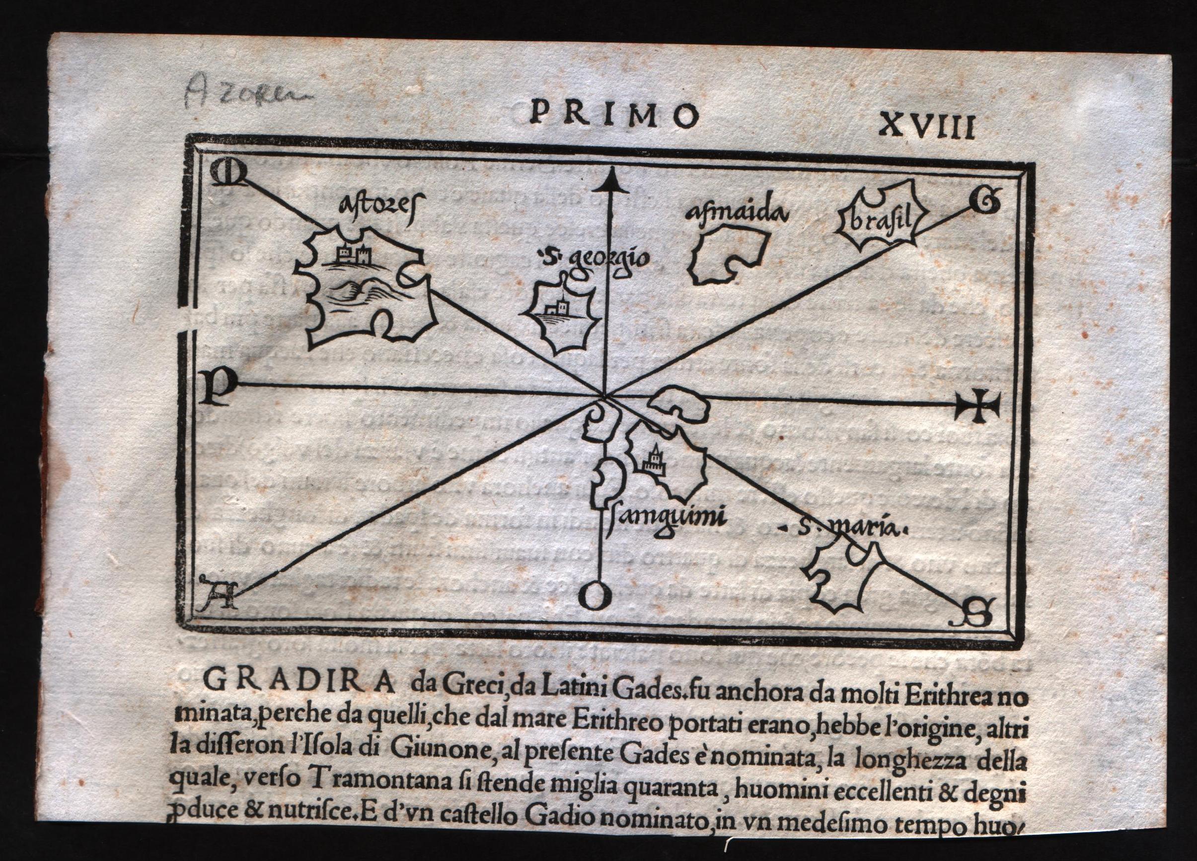
Map title
--
Author
Bordone
Location shown in map
Azores
Edition date
Circa 1537
Edition place
Venice
Editor
Nicolò di Aristotile
Atlas
Isolario
Price
400 Euro
State
[mint/EXCELLENT/very good/good/fair/mediocre/poor]
Color
Black/white
Verso
Italian text pag.18
Size
Plate: cm (14 x 8.9) inches (5.51 x 3.5) Paper: cm (19 x 14) inches (7.48 x 5.51)
Technique
Woodcut
Note
--
Reference
--
Wiki
Here for more info
In stock
Available
Info
info@thetreasuremaps.com
Code
#0579
--
Author
Bordone
Location shown in map
Azores
Edition date
Circa 1537
Edition place
Venice
Editor
Nicolò di Aristotile
Atlas
Isolario
Price
400 Euro
State
[mint/EXCELLENT/very good/good/fair/mediocre/poor]
Color
Black/white
Verso
Italian text pag.18
Size
Plate: cm (14 x 8.9) inches (5.51 x 3.5) Paper: cm (19 x 14) inches (7.48 x 5.51)
Technique
Woodcut
Note
--
Reference
--
Wiki
Here for more info
In stock
Available
Info
info@thetreasuremaps.com
Code
#0579
×
![]()
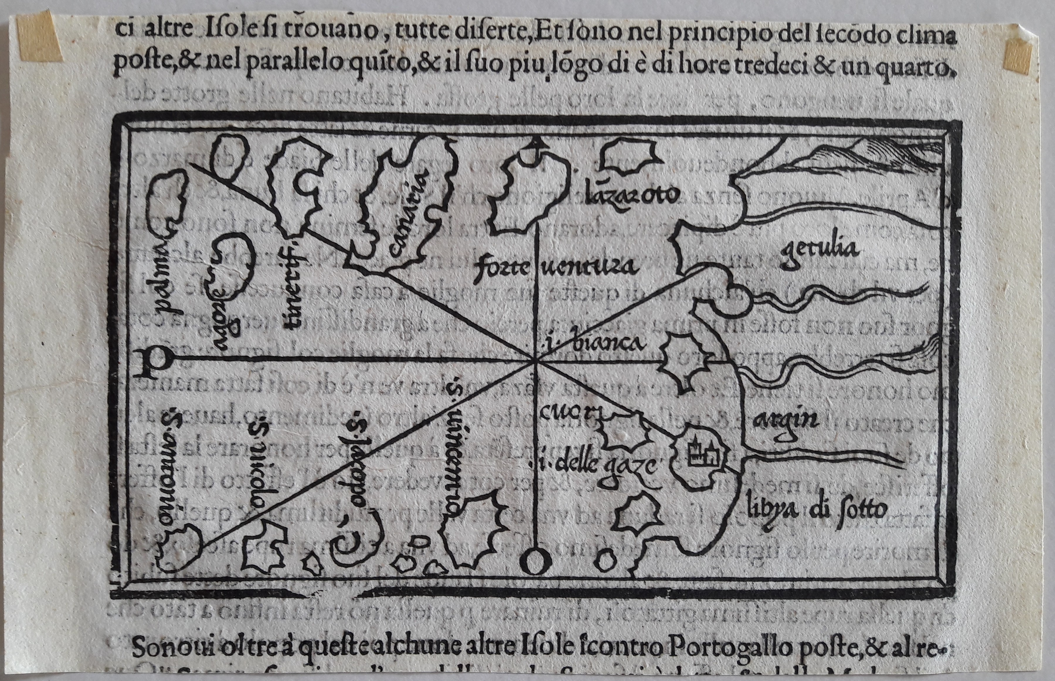
Map title
--
Author
Bordone
Location shown in map
Canary inslands
Edition date
Circa 1537
Edition place
Venice
Editor
Federico Torresano
Atlas
Isolario
Price
400 Euro
State
[mint/EXCELLENT/very good/good/fair/mediocre/poor]
Color
Black/white
Verso
Italian text pag.27
Size
Plate: cm (14 x 8.9) inches (5.51 x 3.5) Paper: cm (19 x 11) inches (7.48 x 4.33)
Technique
Woodcut
Note
--
Reference
--
Wiki
Here for more info
In stock
Available
Info
info@thetreasuremaps.com
Code
#0638
--
Author
Bordone
Location shown in map
Canary inslands
Edition date
Circa 1537
Edition place
Venice
Editor
Federico Torresano
Atlas
Isolario
Price
400 Euro
State
[mint/EXCELLENT/very good/good/fair/mediocre/poor]
Color
Black/white
Verso
Italian text pag.27
Size
Plate: cm (14 x 8.9) inches (5.51 x 3.5) Paper: cm (19 x 11) inches (7.48 x 4.33)
Technique
Woodcut
Note
--
Reference
--
Wiki
Here for more info
In stock
Available
Info
info@thetreasuremaps.com
Code
#0638
×
![]()
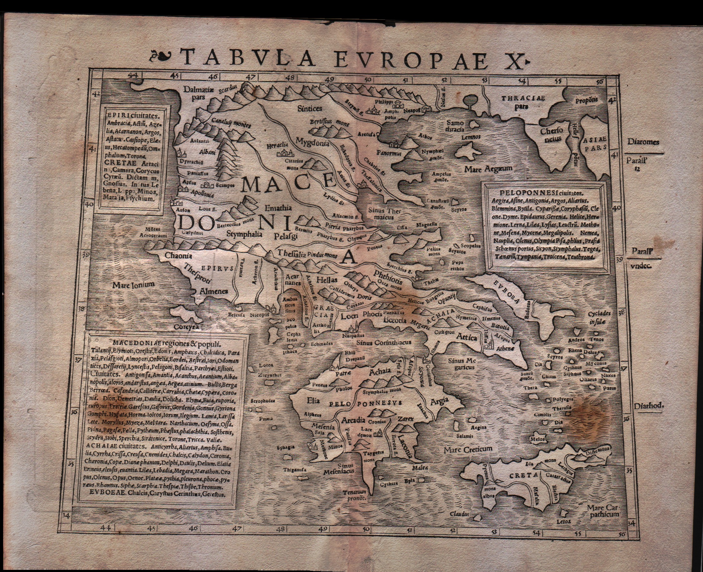
Map title
Tabula Europae X
Author
Munster
Location shown in map
Greece
Edition date
1540
Edition place
Basel
Editor
Henrich Petri
Atlas
Geographia
Price
300 Euro
State
[mint/EXCELLENT/very good/good/fair/mediocre/poor]
Color
Black/white
Verso
Latin text pag.12
Size
Plate: cm (31.8 x 25.4) inches (12.52 x 10) Paper: cm (38.1 x 30.5) inches (15 x 12.01)
Technique
Woodcut
Note
No particular notes for this maps
Reference
--
Wiki
Here for more info
In stock
Available
Info
info@thetreasuremaps.com
Code
#0093
×
![]()
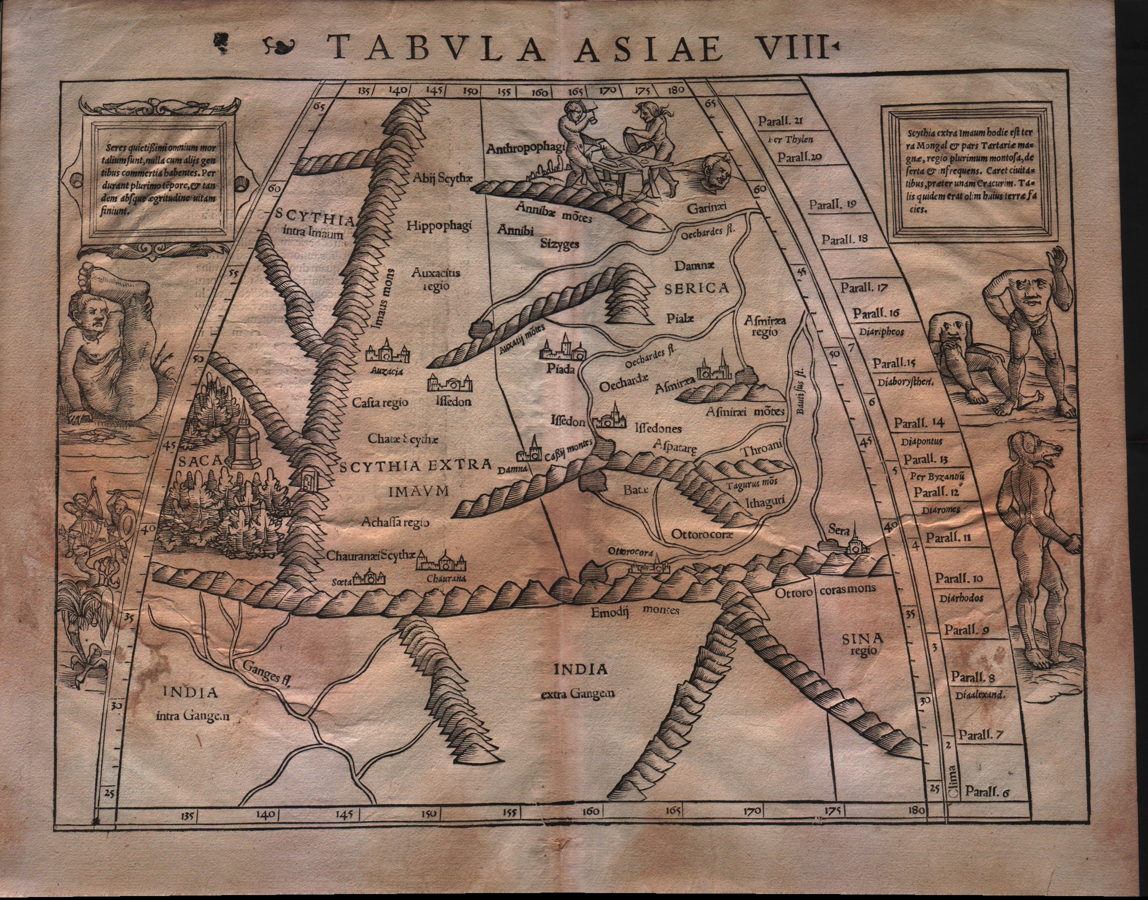
Map title
Tabula Asiae VIII
Author
Munster
Location shown in map
Central Asia
Edition date
1540
Edition place
Basel
Editor
Henrich Petri
Atlas
Geographia
Price
600 Euro
State
[mint/EXCELLENT/very good/good/fair/mediocre/poor]
Color
Black/white
Verso
Latin text pag.24
Size
Plate: cm (34.3 x 25.4) inches (13.5 x 10) Paper: cm (38.1 x 30.5) inches (15 x 12.01)
Technique
Woodcut
Note
Central Asia North of India. Showing in the margin on either side three different imaginary human congenital malformations, as well as a one legged bird.
Reference
--
Wiki
Here for more info
In stock
Available
Info
info@thetreasuremaps.com
Code
#0174
×
![]()
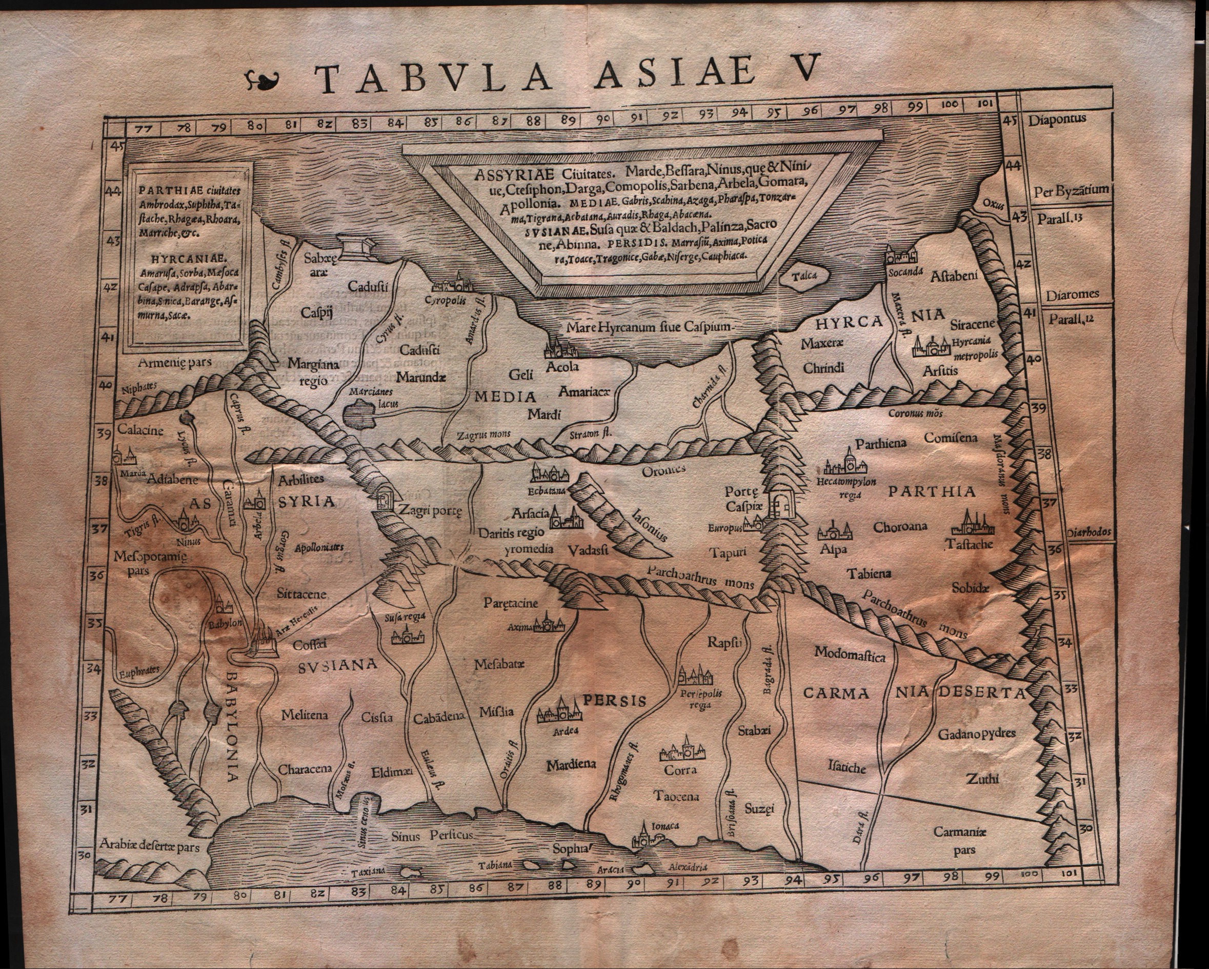
Map title
Tabula Asiae V
Author
Munster
Location shown in map
Iran and Iraq
Edition date
1540
Edition place
Basel
Editor
Henrich Petri
Atlas
Geographia
Price
300 Euro
State
[mint/EXCELLENT/very good/good/fair/mediocre/poor]
Color
Black/white
Verso
Latin text pag.21
Size
Plate: cm (34.3 x 25.4) inches (13.5 x 10) Paper: cm (38.1 x 30.5) inches (15 x 12.01)
Technique
Woodcut
Note
Ptolemaic map of the region between the Caspian Sea and the Persian Gulf. Numerous ancient cities including Babylon.
Reference
--
Wiki
Here for more info
In stock
Available
Info
info@thetreasuremaps.com
Code
#0175
×
![]()
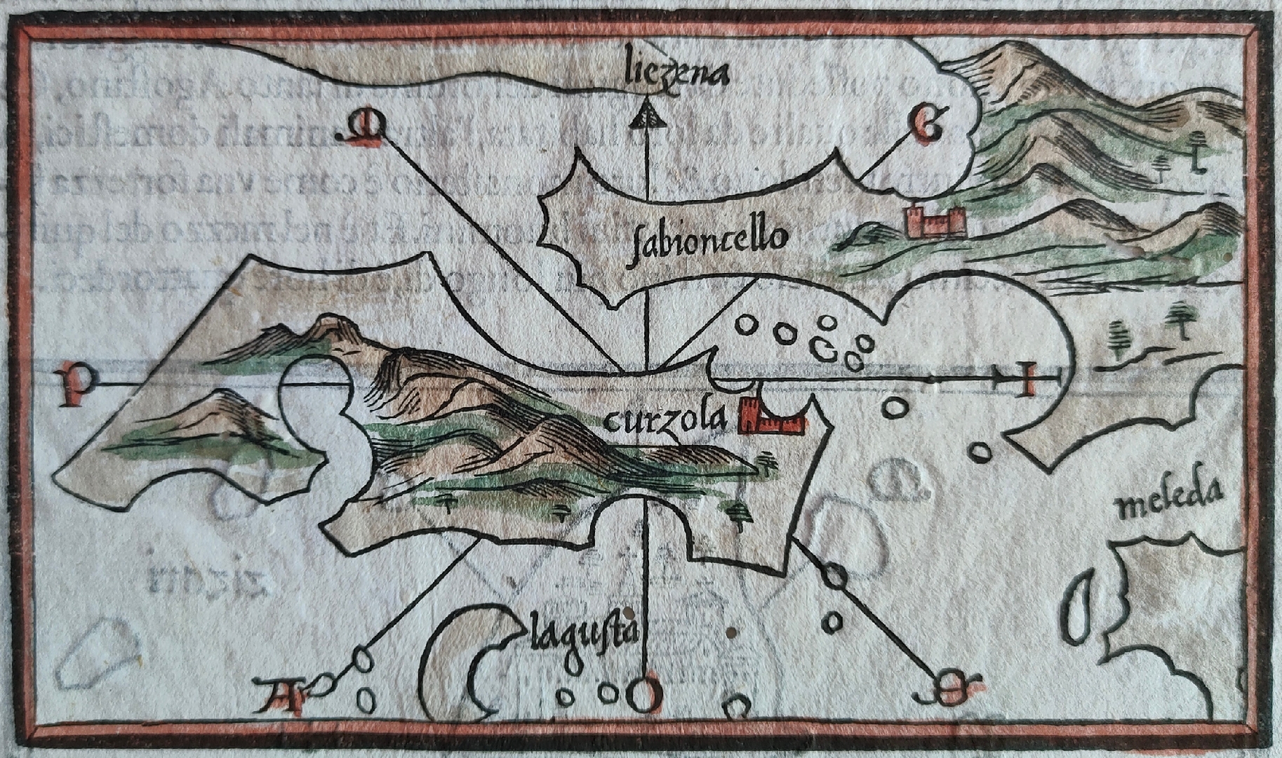
Map title
--
Author
Bordone
Location shown in map
Curzola
Edition date
1540
Edition place
Venice
Editor
Federico Torresano
Atlas
Isolario
Price
350 Euro
State
[mint/EXCELLENT/very good/good/fair/mediocre/poor]
Color
Old colors
Verso
Italian text pag.33
Size
Plate: cm (14 x 8.9) inches (5.51 x 3.5) Paper: cm (19 x 29) inches (7.48 x 11.42)
Technique
Woodcut
Note
--
Reference
--
Wiki
Here for more info
In stock
Available
Info
info@thetreasuremaps.com
Code
#0845
--
Author
Bordone
Location shown in map
Curzola
Edition date
1540
Edition place
Venice
Editor
Federico Torresano
Atlas
Isolario
Price
350 Euro
State
[mint/EXCELLENT/very good/good/fair/mediocre/poor]
Color
Old colors
Verso
Italian text pag.33
Size
Plate: cm (14 x 8.9) inches (5.51 x 3.5) Paper: cm (19 x 29) inches (7.48 x 11.42)
Technique
Woodcut
Note
--
Reference
--
Wiki
Here for more info
In stock
Available
Info
info@thetreasuremaps.com
Code
#0845
×
![]()
Map title
--
Author
Bordone
Location shown in map
Liezena
Edition date
1540
Edition place
Venice
Editor
Federico Torresano
Atlas
Isolario
Price
350 Euro
State
[mint/EXCELLENT/very good/good/fair/mediocre/poor]
Color
Old colors
Verso
Italian text pag.33
Size
Plate: cm (14 x 8.9) inches (5.51 x 3.5) Paper: cm (19 x 29) inches (7.48 x 11.42)
Technique
Woodcut
Note
--
Reference
--
Wiki
Here for more info
In stock
Available
Info
info@thetreasuremaps.com
Code
#0846
--
Author
Bordone
Location shown in map
Liezena
Edition date
1540
Edition place
Venice
Editor
Federico Torresano
Atlas
Isolario
Price
350 Euro
State
[mint/EXCELLENT/very good/good/fair/mediocre/poor]
Color
Old colors
Verso
Italian text pag.33
Size
Plate: cm (14 x 8.9) inches (5.51 x 3.5) Paper: cm (19 x 29) inches (7.48 x 11.42)
Technique
Woodcut
Note
--
Reference
--
Wiki
Here for more info
In stock
Available
Info
info@thetreasuremaps.com
Code
#0846
×
![]()
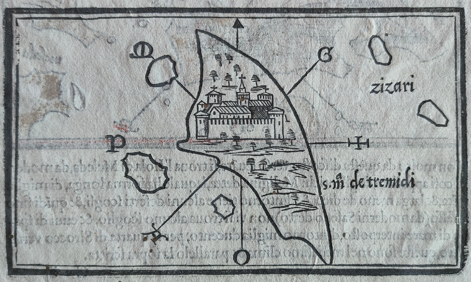
Map title
--
Author
Bordone
Location shown in map
Tremiti
Edition date
1540
Edition place
Venice
Editor
Federico Torresano
Atlas
Isolario
Price
Please ask: info@thetreasuremaps.com
State
[mint/EXCELLENT/very good/good/fair/mediocre/poor]
Color
Old colors
Verso
Italian text pag.33
Size
Plate: cm (14 x 8.9) inches (5.51 x 3.5) Paper: cm (19 x 29) inches (7.48 x 11.42)
Technique
Woodcut
Note
--
Reference
--
Wiki
Here for more info
In stock
Available
Info
info@thetreasuremaps.com
Code
#0847
--
Author
Bordone
Location shown in map
Tremiti
Edition date
1540
Edition place
Venice
Editor
Federico Torresano
Atlas
Isolario
Price
Please ask: info@thetreasuremaps.com
State
[mint/EXCELLENT/very good/good/fair/mediocre/poor]
Color
Old colors
Verso
Italian text pag.33
Size
Plate: cm (14 x 8.9) inches (5.51 x 3.5) Paper: cm (19 x 29) inches (7.48 x 11.42)
Technique
Woodcut
Note
--
Reference
--
Wiki
Here for more info
In stock
Available
Info
info@thetreasuremaps.com
Code
#0847
×
![]()
Map title
--
Author
Bordone
Location shown in map
Kythnos
Edition date
1540
Edition place
Venice
Editor
Federico Torresano
Atlas
Isolario
Price
350 Euro
State
[mint/EXCELLENT/very good/good/fair/mediocre/poor]
Color
Old colors
Verso
Italian text pag.42
Size
Plate: cm (15 x 8) inches (5.91 x 3.15) Paper: cm (21 x 30) inches (8.27 x 11.81)
Technique
Woodcut
Note
--
Reference
--
Wiki
Here for more info
In stock
Available
Info
info@thetreasuremaps.com
Code
#0900
--
Author
Bordone
Location shown in map
Kythnos
Edition date
1540
Edition place
Venice
Editor
Federico Torresano
Atlas
Isolario
Price
350 Euro
State
[mint/EXCELLENT/very good/good/fair/mediocre/poor]
Color
Old colors
Verso
Italian text pag.42
Size
Plate: cm (15 x 8) inches (5.91 x 3.15) Paper: cm (21 x 30) inches (8.27 x 11.81)
Technique
Woodcut
Note
--
Reference
--
Wiki
Here for more info
In stock
Available
Info
info@thetreasuremaps.com
Code
#0900
×
![]()
Map title
--
Author
Munster
Location shown in map
Italy
Edition date
1540
Edition place
Basel
Editor
Henrich Petri
Atlas
Geographia Universalis
Price
1200 Euro
State
[mint/EXCELLENT/very good/good/fair/mediocre/poor]
Color
Black/white
Verso
Latin text pag.43
Size
Plate: cm (33 x 25) inches (12.99 x 9.84) Paper: cm (40 x 31) inches (15.75 x 12.2)
Technique
Woodcut
Note
First edition
Reference
R.Borri L'Italia nelle antiche carte pag.50
Wiki
Here for more info
In stock
Available
Info
info@thetreasuremaps.com
Code
#1293
×
![]()
Map title
Author
Fries
Location shown in map
North Africa
Edition date
1541
Edition place
Vienne
Editor
Trechsel, Gaspar
Atlas
Claudii Ptolemaei Alexandrini Geographicae Enarrationis
Price
400 Euro
State
[mint/EXCELLENT/very good/good/fair/mediocre/poor] repaired
Color
Recent color
Verso
Latin text
Size
Plate: cm (39.4 x 30.5) inches (15.51 x 12.01) Paper: cm (54 x 40) inches (21.26 x 15.75)
Technique
Woodcut
Note
No particular notes for this maps
Reference
--
Wiki
Here for more info
In stock
Available
Info
info@thetreasuremaps.com
Code
#0664
×
![]()
Map title
India orientalis
Author
Fries
Location shown in map
Southeast Asia
Edition date
1541
Edition place
Vienne
Editor
Trechsel, Gaspar
Atlas
Claudii Ptolemaei Alexandrini Geographicae Enarrationis
Price
1200 Euro
State
[mint/excellent/VERY GOOD/good/fair/mediocre/poor]
Color
Black/white
Verso
Blank
Size
Plate: cm (53 x 40) inches (20.87 x 15.75) Paper: cm (53 x 40) inches (20.87 x 15.75)
Technique
Woodcut
Note
Professionaly restored
Reference
--
Wiki
Here for more info
In stock
Available
Info
info@thetreasuremaps.com
Code
#1259
×
![]()
Map title
Hispania Nova Tabula
Author
Munster
Location shown in map
Spain
Edition date
1542
Edition place
Basel
Editor
Henrich Petri
Atlas
Geographia
Price
Please ask: info@thetreasuremaps.com
State
[mint/excellent/VERY GOOD/good/fair/mediocre/poor]
Color
Original colors
Verso
Latin text pag.31
Size
Plate: cm (34.3 x 25.4) inches (13.5 x 10) Paper: cm (38.1 x 30.5) inches (15 x 12.01)
Technique
Woodcut
Note
No particular notes for this maps
Reference
--
Wiki
Here for more info
In stock
Sold
Info
info@thetreasuremaps.com
Code
#0092
×
![]()
Map title
Tabula Asiae IX
Author
Munster
Location shown in map
Pakistan
Edition date
1542
Edition place
Basel
Editor
Henrich Petri
Atlas
Geographia
Price
250 Euro
State
[mint/excellent/VERY GOOD/good/fair/mediocre/poor]
Color
Black/white
Verso
Latin text pag.21
Size
Plate: cm (33 x 25.4) inches (12.99 x 10) Paper: cm (38.1 x 30.5) inches (15 x 12.01)
Technique
Woodcut
Note
Ptolemaic map of the region between the Caspian Sea and the Persian Gulf. Numerous ancient cities including Babylon.
Reference
--
Wiki
Here for more info
In stock
Available
Info
info@thetreasuremaps.com
Code
#0176
×
![]()
Map title
--
Author
Munster
Location shown in map
Italy
Edition date
1542
Edition place
Basel
Editor
Henrich Petri
Atlas
Geographia Universalis
Price
700 Euro
State
[mint/EXCELLENT/very good/good/fair/mediocre/poor]
Color
Black/white
Verso
Latin text pag.43
Size
Plate: cm (33 x 25) inches (12.99 x 9.84) Paper: cm (40 x 32) inches (15.75 x 12.6)
Technique
Woodcut
Note
Reference
R.Borri L'Italia nelle antiche carte pag.50
Wiki
Here for more info
In stock
Available
Info
info@thetreasuremaps.com
Code
#0933
×
![]()
Map title
Tabula Europae VIII
Author
Munster
Location shown in map
Russia
Edition date
1545
Edition place
Basel
Editor
Henrich Petri
Atlas
Cosmographia Universalis
Price
Please ask: info@thetreasuremaps.com
State
[mint/excellent/VERY GOOD/good/fair/mediocre/poor]
Color
Black/white
Verso
Latin text pag.10
Size
Plate: cm (33 x 25.4) inches (12.99 x 10) Paper: cm (40.6 x 30.5) inches (15.98 x 12.01)
Technique
Woodcut
Note
No particular notes for this maps
Reference
--
Wiki
Here for more info
In stock
Sold
Info
info@thetreasuremaps.com
Code
#0094
×
![]()
Map title
Aphricae Tabula III
Author
Munster
Location shown in map
Egypt
Edition date
1545
Edition place
Basel
Editor
Henrich Petri
Atlas
Cosmographia Universalis
Price
200 Euro
State
[mint/EXCELLENT/very good/good/fair/mediocre/poor]
Color
Black/white
Verso
Latin text pag.15
Size
Plate: cm (34.3 x 25.4) inches (13.5 x 10) Paper: cm (38.1 x 30.5) inches (15 x 12.01)
Technique
Woodcut
Note
--
Reference
--
Wiki
Here for more info
In stock
Sold
Info
info@thetreasuremaps.com
Code
#0507
×
![]()
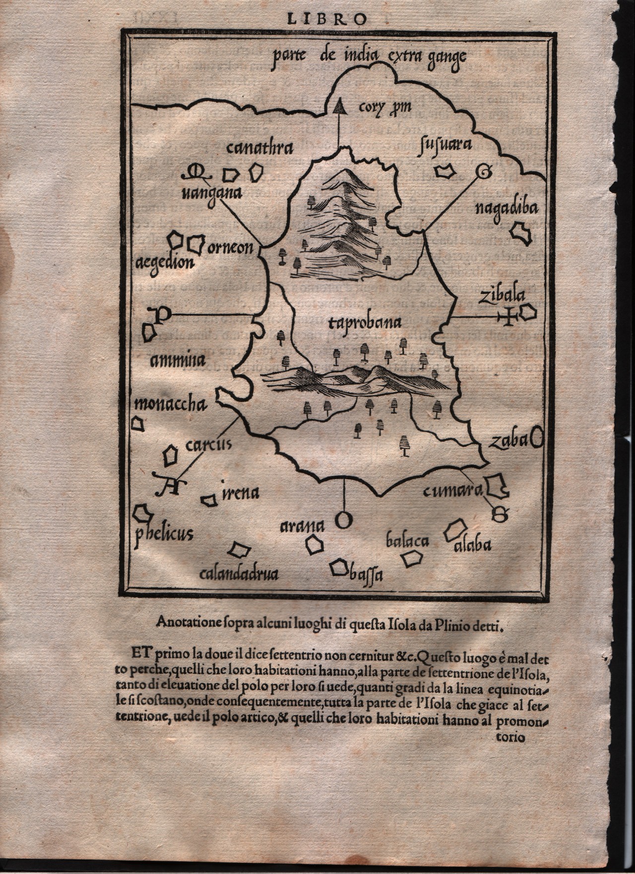
Map title
Taprobana
Author
Bordone
Location shown in map
Ceylon
Edition date
1547
Edition place
Venice
Editor
Federico Torresano
Atlas
Isolario
Price
500 Euro
State
[mint/EXCELLENT/very good/good/fair/mediocre/poor]
Color
Black/white
Verso
Italian text pag.72
Size
Plate: cm (15.2 x 20.3) inches (5.98 x 7.99) Paper: cm (21.6 x 30.5) inches (8.5 x 12.01)
Technique
Woodcut
Note
--
Reference
--
Wiki
Here for more info
In stock
Available
Info
info@thetreasuremaps.com
Code
#0170
×
![]()
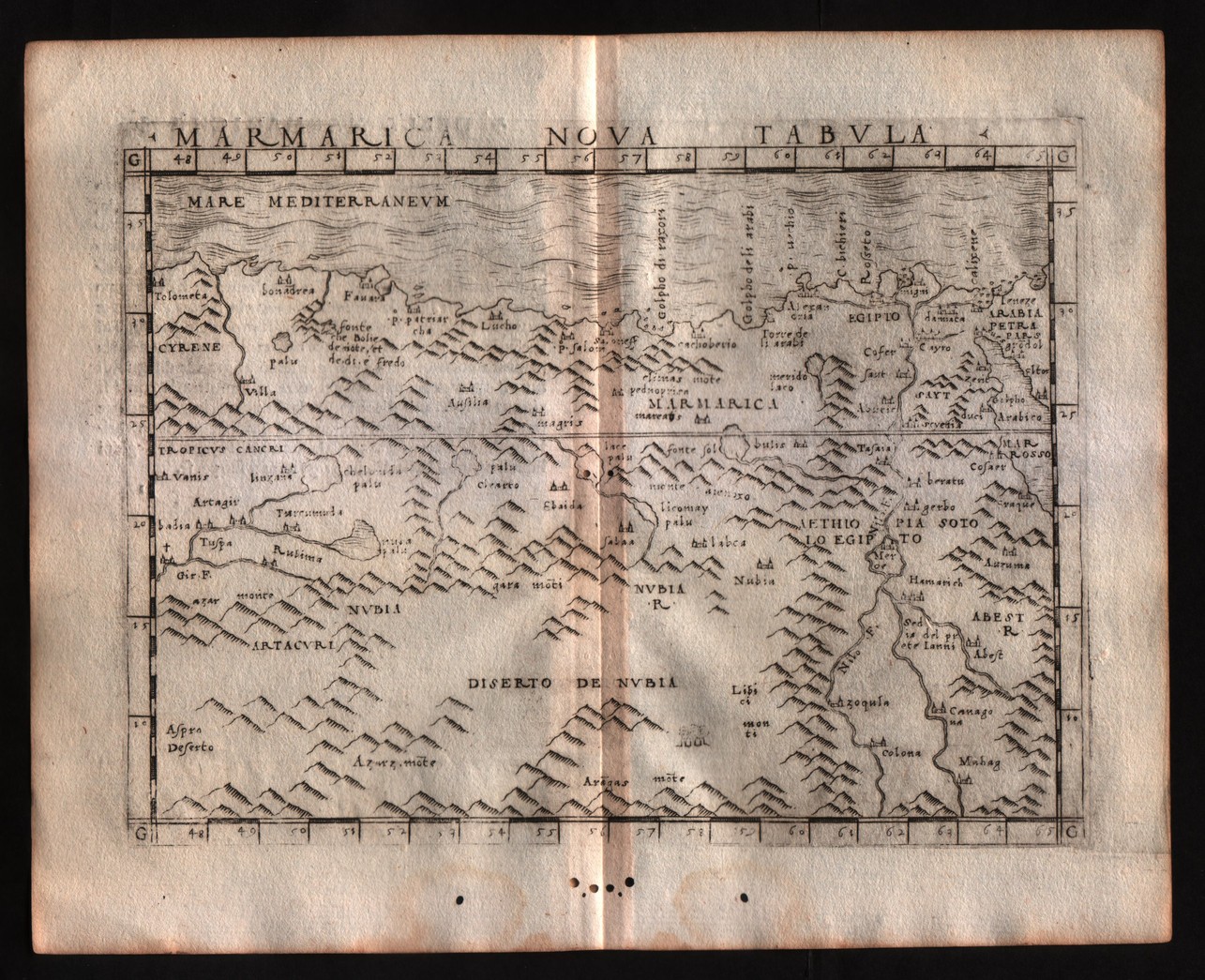
Map title
Marmarica nuova tabula
Author
Gastaldi
Location shown in map
North Africa
Edition date
1548
Edition place
Venice
Editor
Nicolo Bascarini
Atlas
Geographia
Price
200 Euro
State
[mint/excellent/VERY GOOD/good/fair/mediocre/poor] repaired
Color
Black/white
Verso
Italian text pag.31
Size
Plate: cm (17.8 x 12.7) inches (7.01 x 5) Paper: cm (20.3 x 16.5) inches (7.99 x 6.5)
Technique
Copper engraving
Note
No particular notes for this maps
Reference
--
Wiki
Here for more info
In stock
Available
Info
info@thetreasuremaps.com
Code
#0279
×
![]()
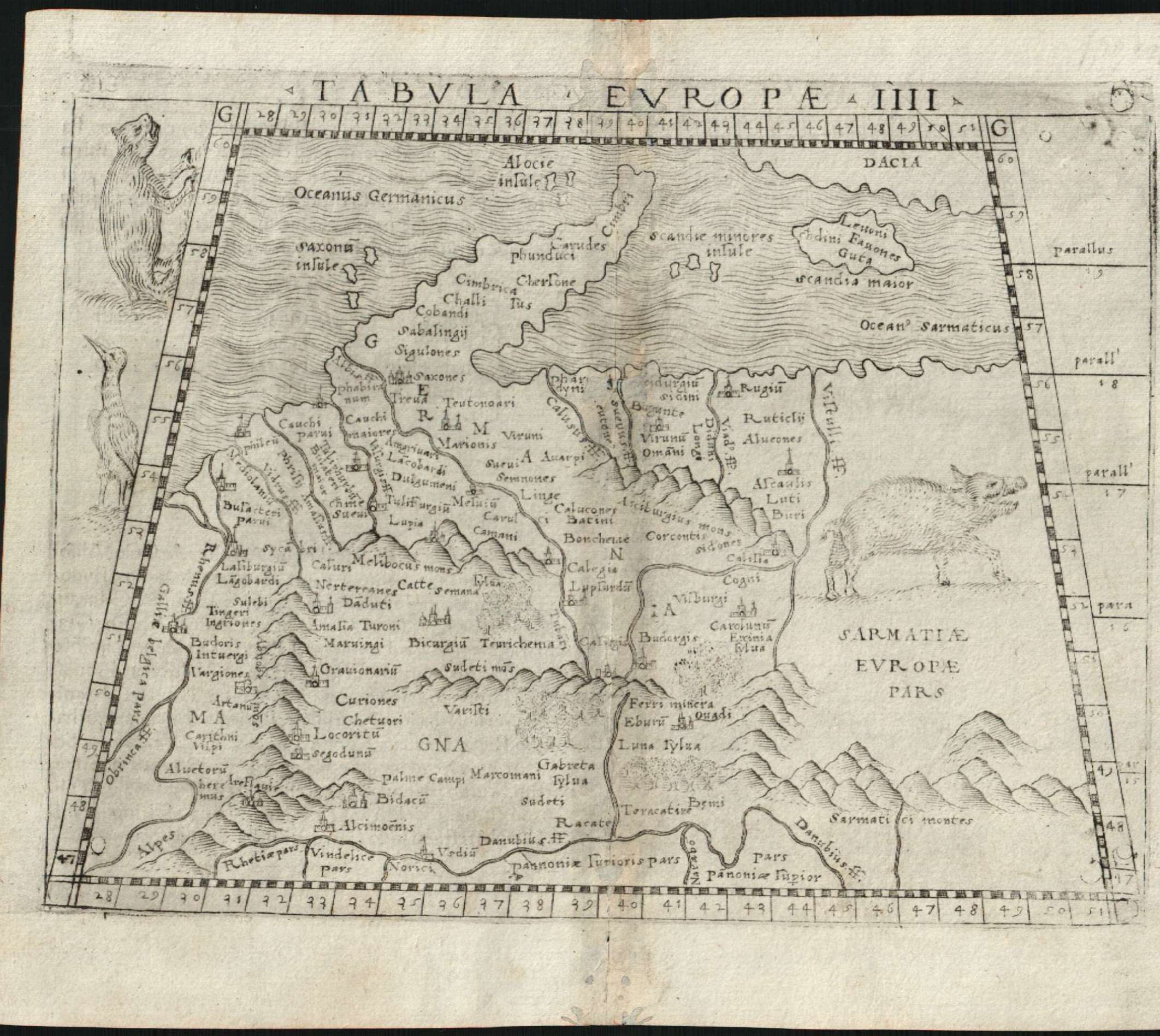
Map title
Tabula europae IIII
Author
Gastaldi
Location shown in map
Germany
Edition date
1548
Edition place
Venice
Editor
Nicolo Bascarini
Atlas
Geographia
Price
400 Euro
State
[mint/excellent/VERY GOOD/good/fair/mediocre/poor] repaired
Color
Black/white
Verso
Italian text pag.8
Size
Plate: cm (17.8 x 12.7) inches (7.01 x 5) Paper: cm (20.3 x 16.5) inches (7.99 x 6.5)
Technique
Copper engraving
Note
No particular notes for this maps
Reference
--
Wiki
Here for more info
In stock
Available
Info
info@thetreasuremaps.com
Code
#0618
×
![]()
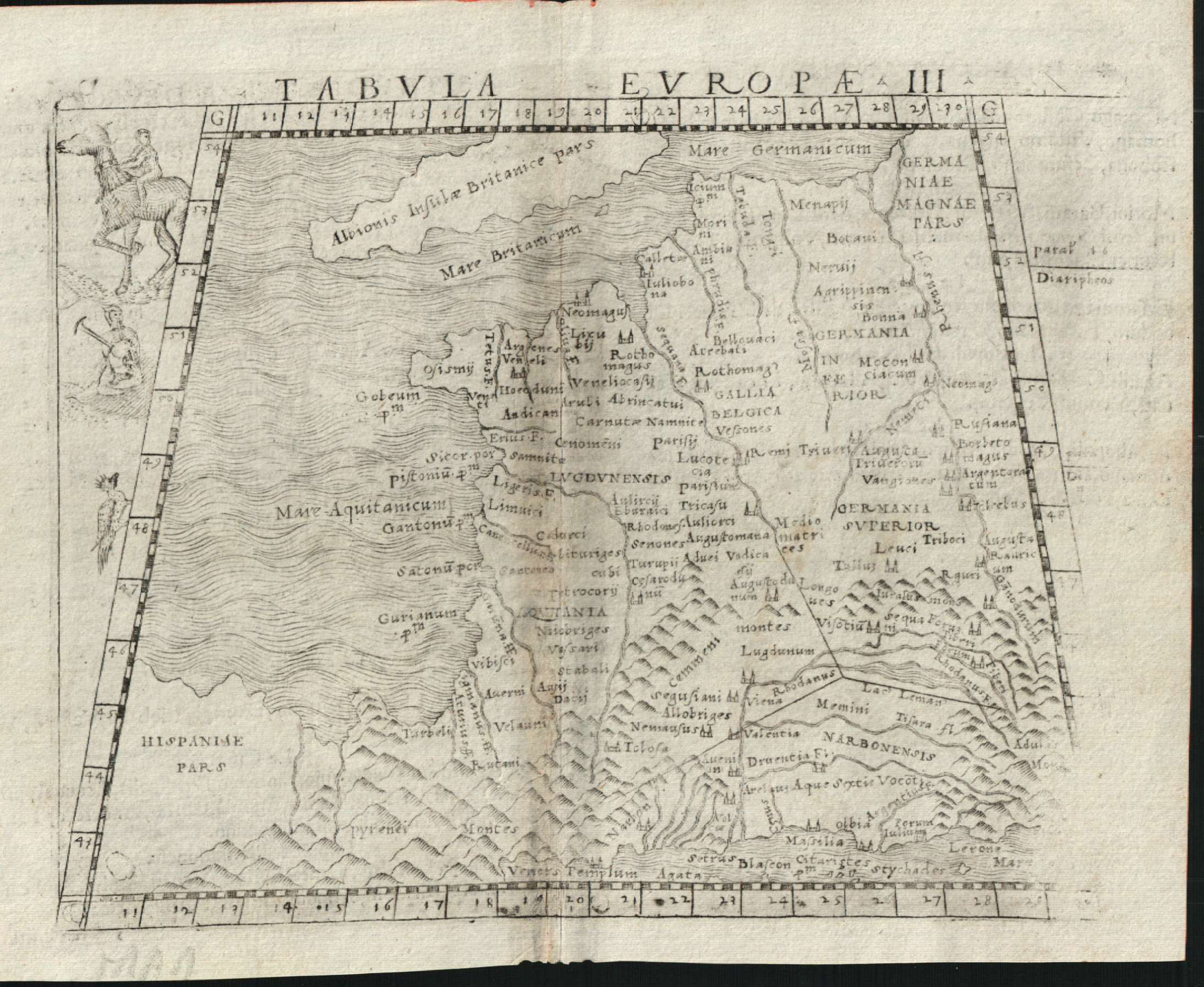
Map title
Tabula europae III
Author
Gastaldi
Location shown in map
France
Edition date
1548
Edition place
Venice
Editor
Nicolo Bascarini
Atlas
Geographia
Price
300 Euro
State
[mint/excellent/VERY GOOD/good/fair/mediocre/poor] repaired
Color
Black/white
Verso
Italian text pag.5
Size
Plate: cm (17.8 x 12.7) inches (7.01 x 5) Paper: cm (20.3 x 16.5) inches (7.99 x 6.5)
Technique
Copper engraving
Note
No particular notes for this maps
Reference
--
Wiki
Here for more info
In stock
Available
Info
info@thetreasuremaps.com
Code
#0619
×
![]()
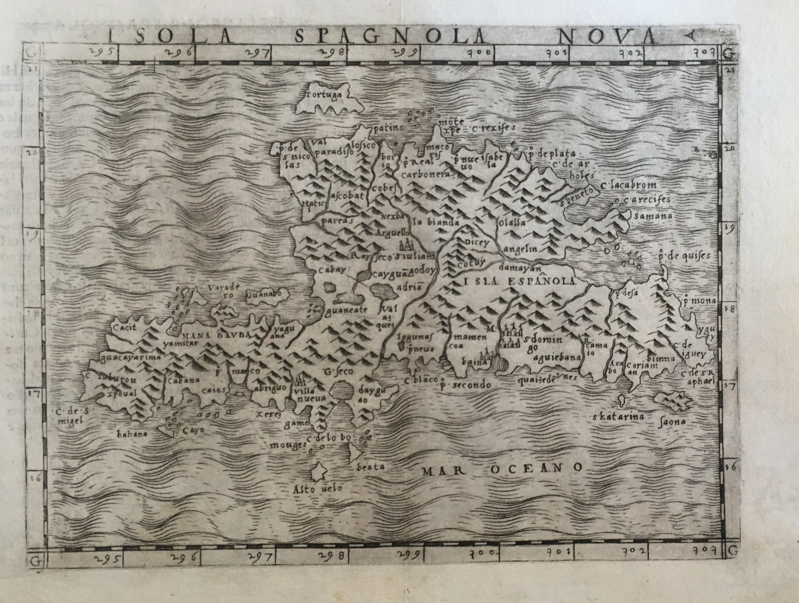
Map title
Isola Spagnola nova
Author
Gastaldi
Location shown in map
Haiti island
Edition date
1548
Edition place
Venice
Editor
Nicolo Bascarini
Atlas
Geographia
Price
300 Euro
State
[mint/EXCELLENT/very good/good/fair/mediocre/poor] professionally restored
Color
Black/white
Verso
Italian text pag.58
Size
Plate: cm (17.8 x 12.7) inches (7.01 x 5) Paper: cm (20.3 x 16.5) inches (7.99 x 6.5)
Technique
Copper engraving
Note
No particular notes for this maps
Reference
--
Wiki
Here for more info
In stock
Available
Info
info@thetreasuremaps.com
Code
#0637
×
![]()
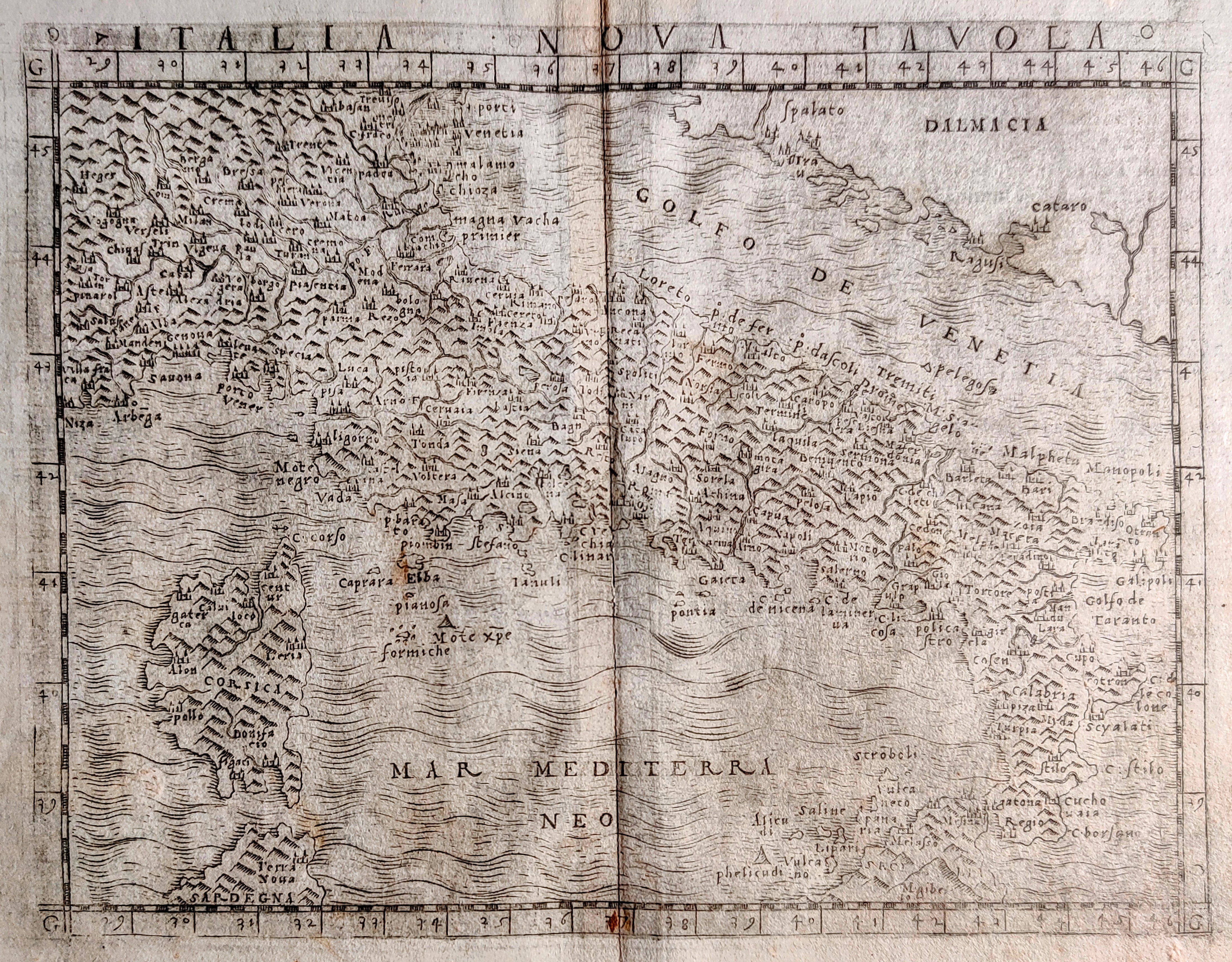
Map title
Italia nova tavola
Author
Gastaldi
Location shown in map
Italy
Edition date
1548
Edition place
Venice
Editor
Nicolo Bascarini
Atlas
Geographia
Price
400 Euro
State
[mint/excellent/VERY GOOD/good/fair/mediocre/poor] repaired
Color
Black/white
Verso
Italian text
Size
Plate: cm (17.8 x 13) inches (7.01 x 5.12) Paper: cm (21 x 17) inches (8.27 x 6.69)
Technique
Copper engraving
Note
Reference
R.Borri L'Italia nelle antiche carte pag.58
Wiki
Here for more info
In stock
Available
Info
info@thetreasuremaps.com
Code
#0814
×
![]()
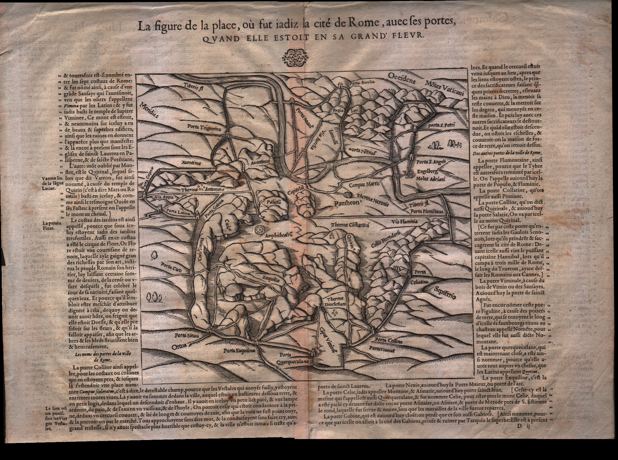
Map title
La figure de la place de Rome...
Author
Munster
Location shown in map
Rome
Edition date
1550
Edition place
Basel
Editor
Henrich Petri
Atlas
Cosmographia Universalis
Price
200 Euro
State
[mint/EXCELLENT/very good/good/fair/mediocre/poor]
Color
Black/white
Verso
French text pag.550
Size
Plate: cm (22.9 x 21.6) inches (9.02 x 8.5) Paper: cm (41.9 x 34.3) inches (16.5 x 13.5)
Technique
Woodcut
Note
No particular notes for this maps
Reference
--
Wiki
Here for more info
In stock
Available
Info
info@thetreasuremaps.com
Code
#0095
×
![]()
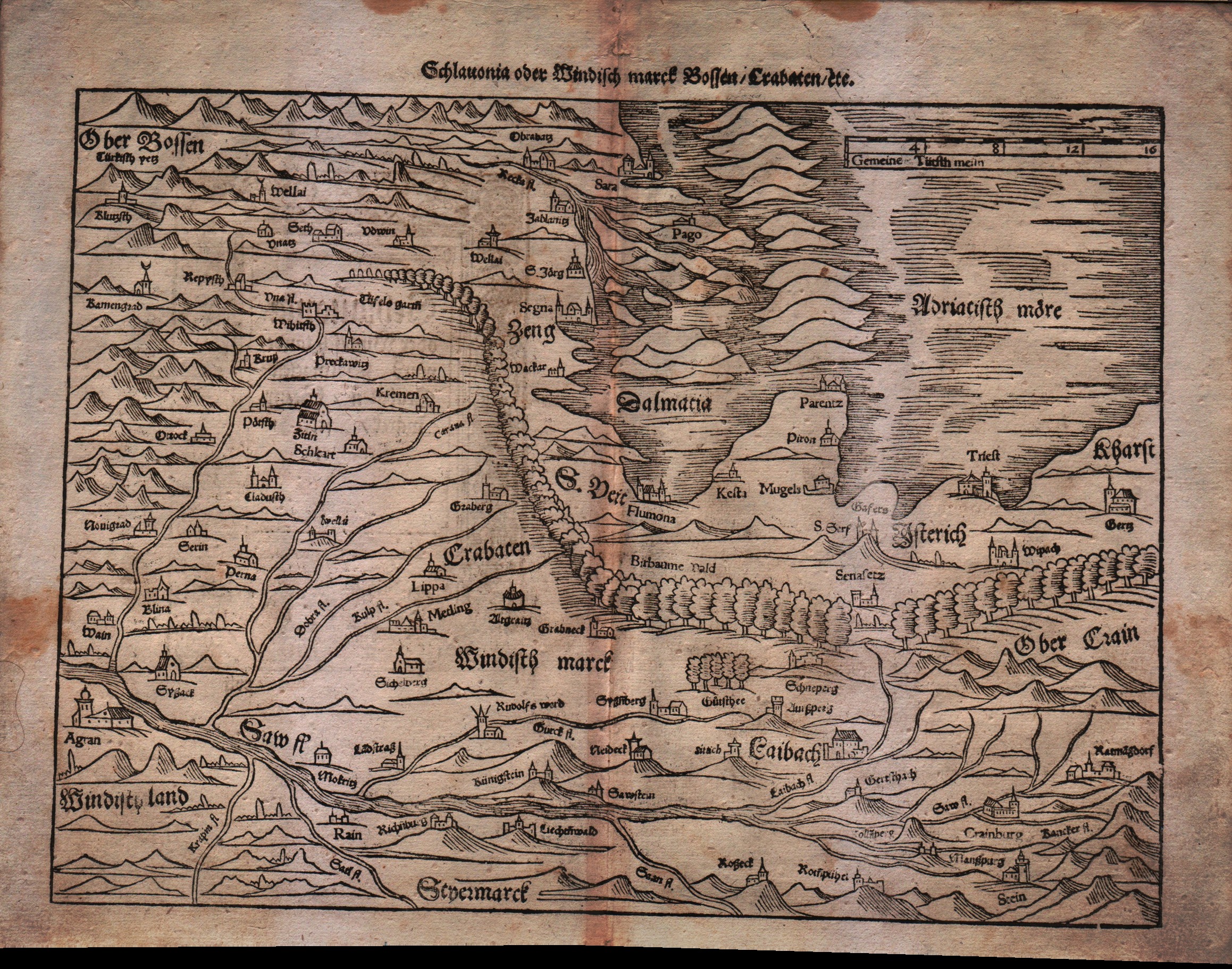
Map title
Sclavonia oder Windisch Marck Bossen Crabaten ...
Author
Munster
Location shown in map
Slovenia,Kroatia,Bosnia,Triest
Edition date
Unknown
Edition place
Basel
Editor
Henrich Petri
Atlas
Cosmographia Universalis
Price
200 Euro
State
[mint/EXCELLENT/very good/good/fair/mediocre/poor]
Color
Black/white
Verso
German text pag.???
Size
Plate: cm (34.3 x 25.4) inches (13.5 x 10) Paper: cm (40.6 x 31.8) inches (15.98 x 12.52)
Technique
Woodcut
Note
--
Reference
--
Wiki
Here for more info
In stock
Available
Info
info@thetreasuremaps.com
Code
#0113
×
![]()
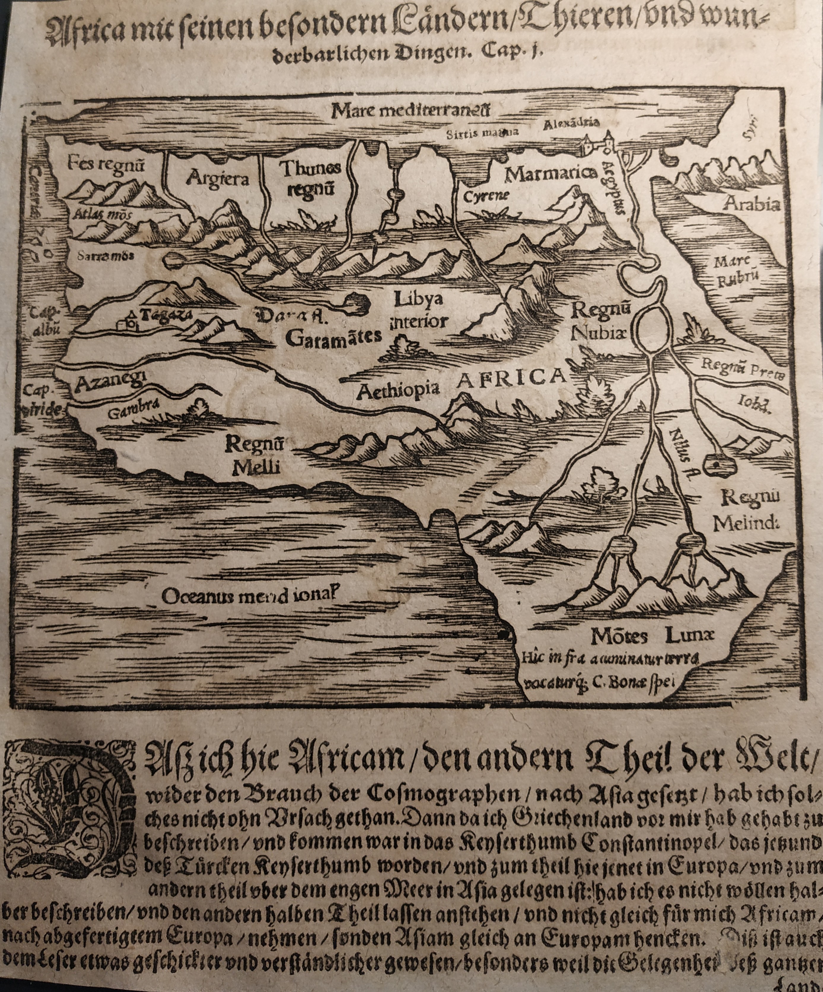
Map title
Africa
Author
Munster
Location shown in map
Africa
Edition date
Circa 1550
Edition place
Basel
Editor
Henrich Petri
Atlas
Cosmographia Universalis
Price
150 Euro
State
[mint/EXCELLENT/very good/good/fair/mediocre/poor]
Color
Black/white
Verso
German text
Size
Plate: cm (16 x 13) inches (6.3 x 5.12) Paper: cm (17 x 21) inches (6.69 x 8.27)
Technique
Woodcut
Note
No particular notes for this maps
Reference
Wiki
Here for more info
In stock
Available
Info
info@thetreasuremaps.com
Code
#0737
Africa
Author
Munster
Location shown in map
Africa
Edition date
Circa 1550
Edition place
Basel
Editor
Henrich Petri
Atlas
Cosmographia Universalis
Price
150 Euro
State
[mint/EXCELLENT/very good/good/fair/mediocre/poor]
Color
Black/white
Verso
German text
Size
Plate: cm (16 x 13) inches (6.3 x 5.12) Paper: cm (17 x 21) inches (6.69 x 8.27)
Technique
Woodcut
Note
No particular notes for this maps
Reference
Wiki
Here for more info
In stock
Available
Info
info@thetreasuremaps.com
Code
#0737
×
![]()
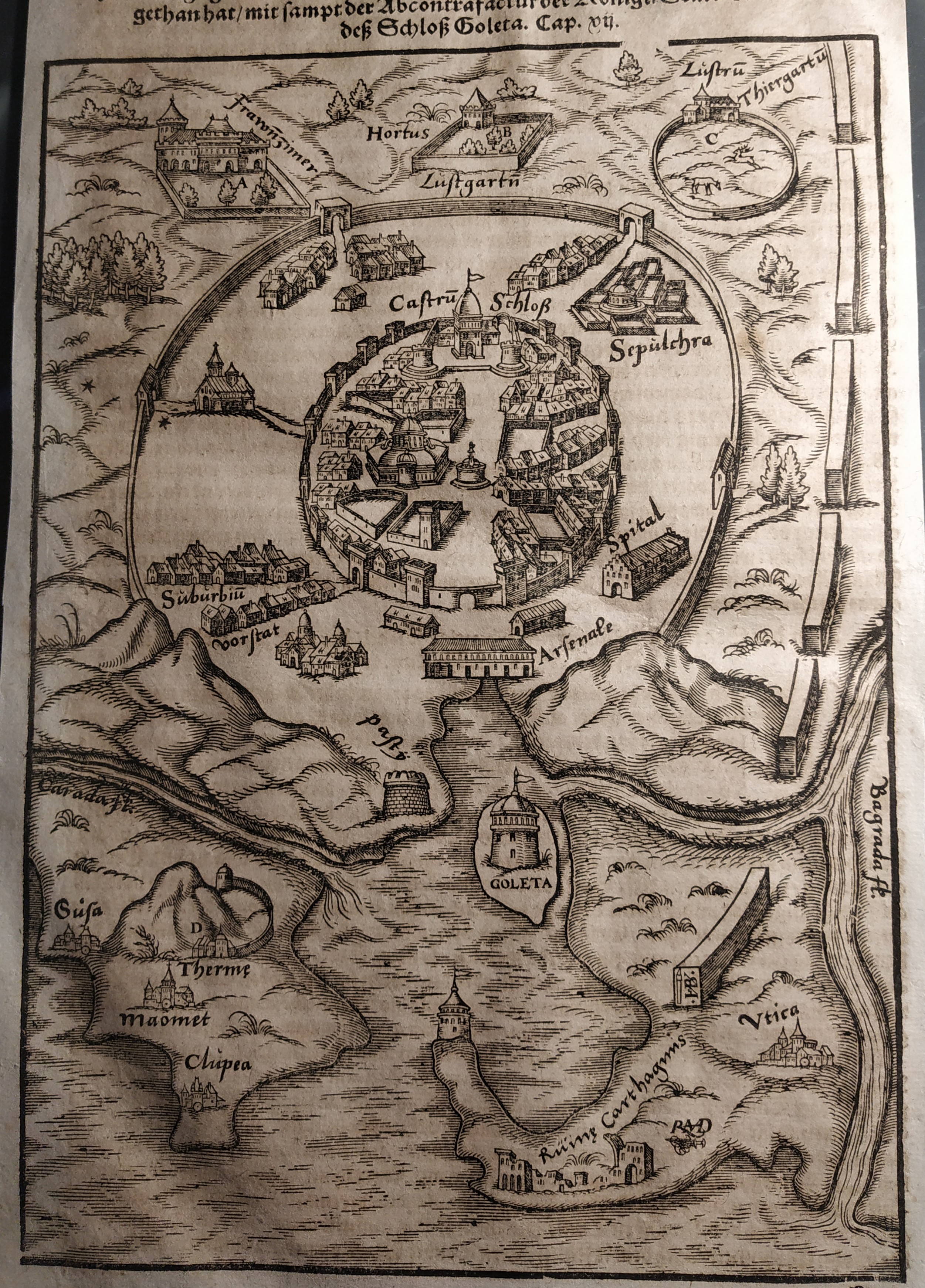
Map title
Goleta
Author
Munster
Location shown in map
Tunis
Edition date
Circa 1550
Edition place
Basel
Editor
Henrich Petri
Atlas
Cosmographia Universalis
Price
Please ask: info@thetreasuremaps.com
State
[mint/EXCELLENT/very good/good/fair/mediocre/poor]
Color
Black/white
Verso
German text
Size
Plate: cm (17 x 24) inches (6.69 x 9.45) Paper: cm (18 x 30) inches (7.09 x 11.81)
Technique
Woodcut
Note
No particular notes for this maps
Reference
Wiki
Here for more info
In stock
Available
Info
info@thetreasuremaps.com
Code
#0738
×
![]()
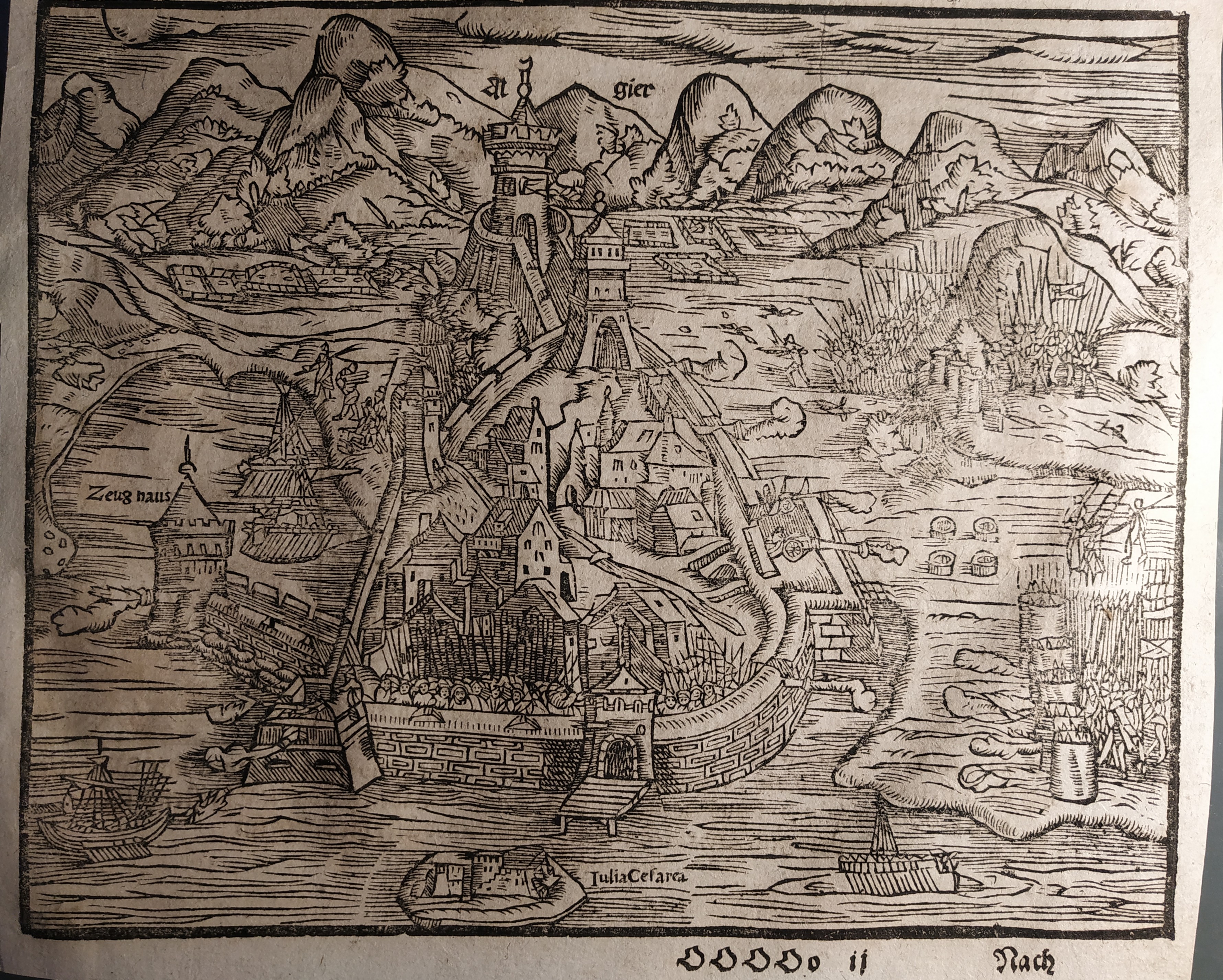
Map title
Algiers
Author
Munster
Location shown in map
Algiers
Edition date
Circa 1550
Edition place
Basel
Editor
Henrich Petri
Atlas
Cosmographia Universalis
Price
Please ask: info@thetreasuremaps.com
State
[mint/EXCELLENT/very good/good/fair/mediocre/poor]
Color
Black/white
Verso
German text
Size
Plate: cm (11 x 15) inches (4.33 x 5.91) Paper: cm (13 x 21) inches (5.12 x 8.27)
Technique
Woodcut
Note
No particular notes for this maps
Reference
Wiki
Here for more info
In stock
Available
Info
info@thetreasuremaps.com
Code
#0739
Algiers
Author
Munster
Location shown in map
Algiers
Edition date
Circa 1550
Edition place
Basel
Editor
Henrich Petri
Atlas
Cosmographia Universalis
Price
Please ask: info@thetreasuremaps.com
State
[mint/EXCELLENT/very good/good/fair/mediocre/poor]
Color
Black/white
Verso
German text
Size
Plate: cm (11 x 15) inches (4.33 x 5.91) Paper: cm (13 x 21) inches (5.12 x 8.27)
Technique
Woodcut
Note
No particular notes for this maps
Reference
Wiki
Here for more info
In stock
Available
Info
info@thetreasuremaps.com
Code
#0739
×
![]()
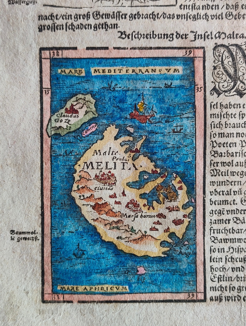
Map title
Malta
Author
Munster
Location shown in map
Malta
Edition date
Circa 1550
Edition place
Basel
Editor
Henrich Petri
Atlas
Cosmographia Universalis
Price
200 Euro
State
[mint/EXCELLENT/very good/good/fair/mediocre/poor]
Color
Old colors
Verso
German text pag.613
Size
Plate: cm (24 x 36) inches (9.45 x 14.17) Paper: cm (8 x 12) inches (3.15 x 4.72)
Technique
Woodcut
Note
Reference
Wiki
Here for more info
In stock
Available
Info
info@thetreasuremaps.com
Code
#0843
Malta
Author
Munster
Location shown in map
Malta
Edition date
Circa 1550
Edition place
Basel
Editor
Henrich Petri
Atlas
Cosmographia Universalis
Price
200 Euro
State
[mint/EXCELLENT/very good/good/fair/mediocre/poor]
Color
Old colors
Verso
German text pag.613
Size
Plate: cm (24 x 36) inches (9.45 x 14.17) Paper: cm (8 x 12) inches (3.15 x 4.72)
Technique
Woodcut
Note
Reference
Wiki
Here for more info
In stock
Available
Info
info@thetreasuremaps.com
Code
#0843
×
![]()
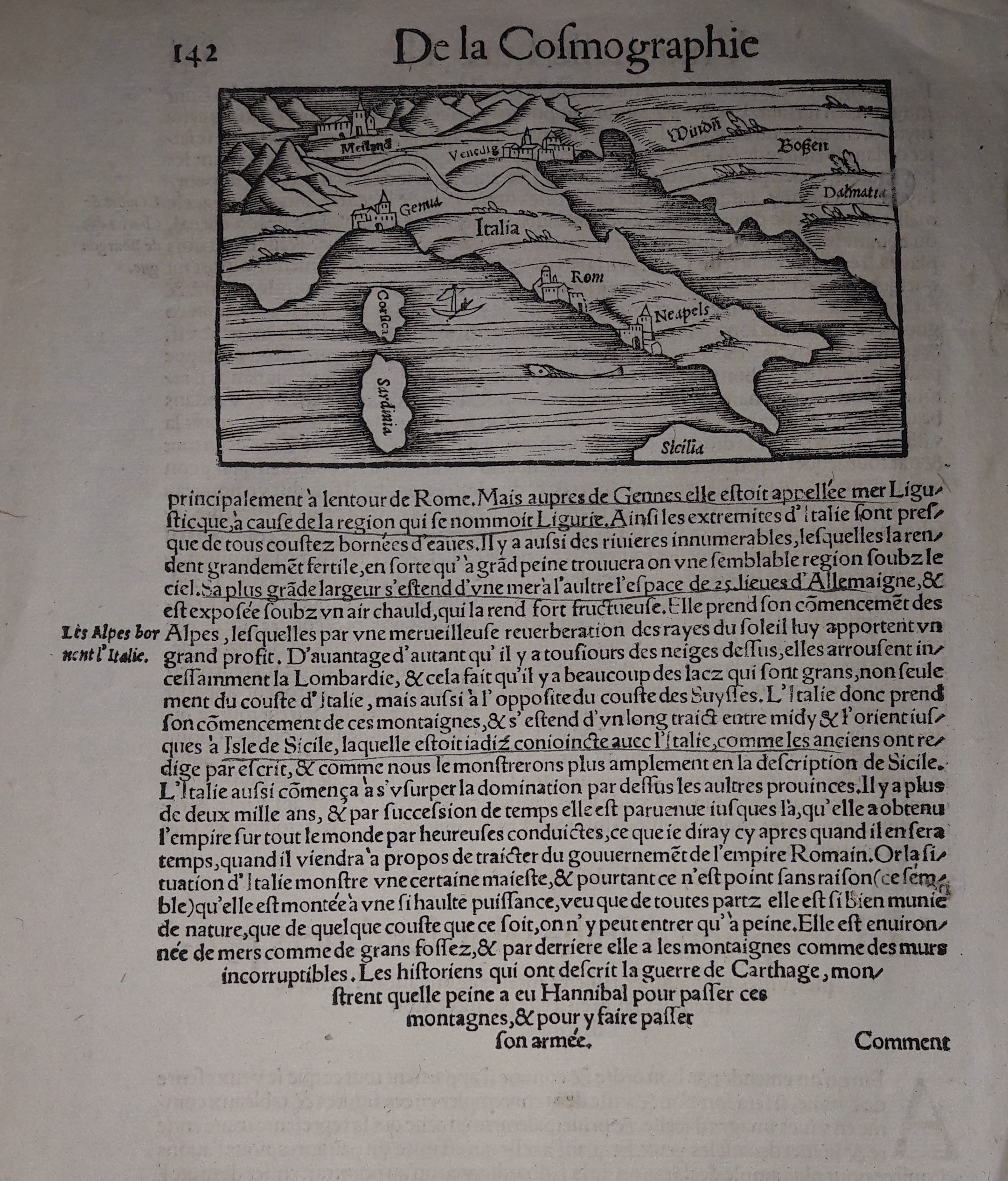
Map title
--
Author
Munster
Location shown in map
Italy
Edition date
Circa 1552
Edition place
Basel
Editor
Henrich Petri
Atlas
Cosmographia Universalis
Price
250 Euro
State
[mint/EXCELLENT/very good/good/fair/mediocre/poor]
Color
Black/white
Verso
French text pag.142
Size
Plate: cm (13 x 8) inches (5.12 x 3.15) Paper: cm (21 x 31) inches (8.27 x 12.2)
Technique
Woodcut
Note
Reference
R.Borri L'Italia nelle antiche carte pag.40
Wiki
Here for more info
In stock
Available
Info
info@thetreasuremaps.com
Code
#0630
×
![]()
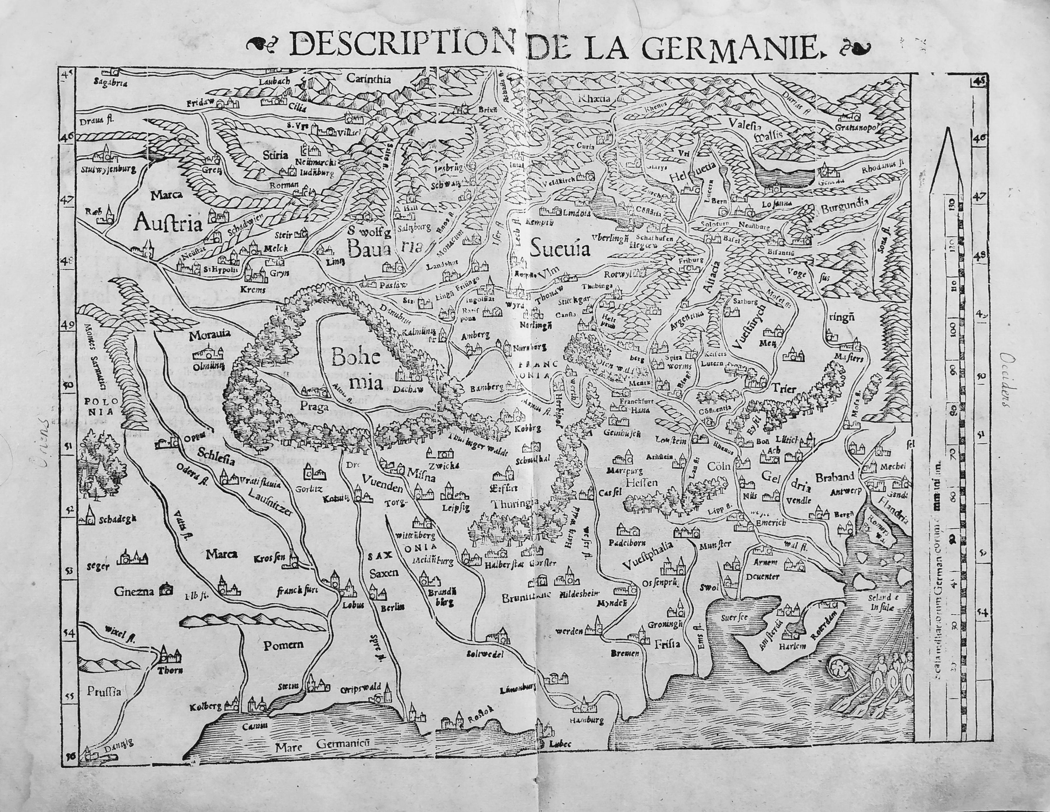
Map title
Description de la Germanie
Author
Munster
Location shown in map
Germany
Edition date
1552
Edition place
Basel
Editor
Henrich Petri
Atlas
Cosmographia Universalis
Price
300 Euro
State
[mint/EXCELLENT/very good/good/fair/mediocre/poor]
Color
Black/white
Verso
Franch text pag.6
Size
Plate: cm (34 x 25) inches (13.39 x 9.84) Paper: cm (39 x 30) inches (15.35 x 11.81)
Technique
Woodcut
Note
No particular notes for this maps.
Reference
--
Wiki
Here for more info
In stock
Available
Info
info@thetreasuremaps.com
Code
#0722
×
![]()
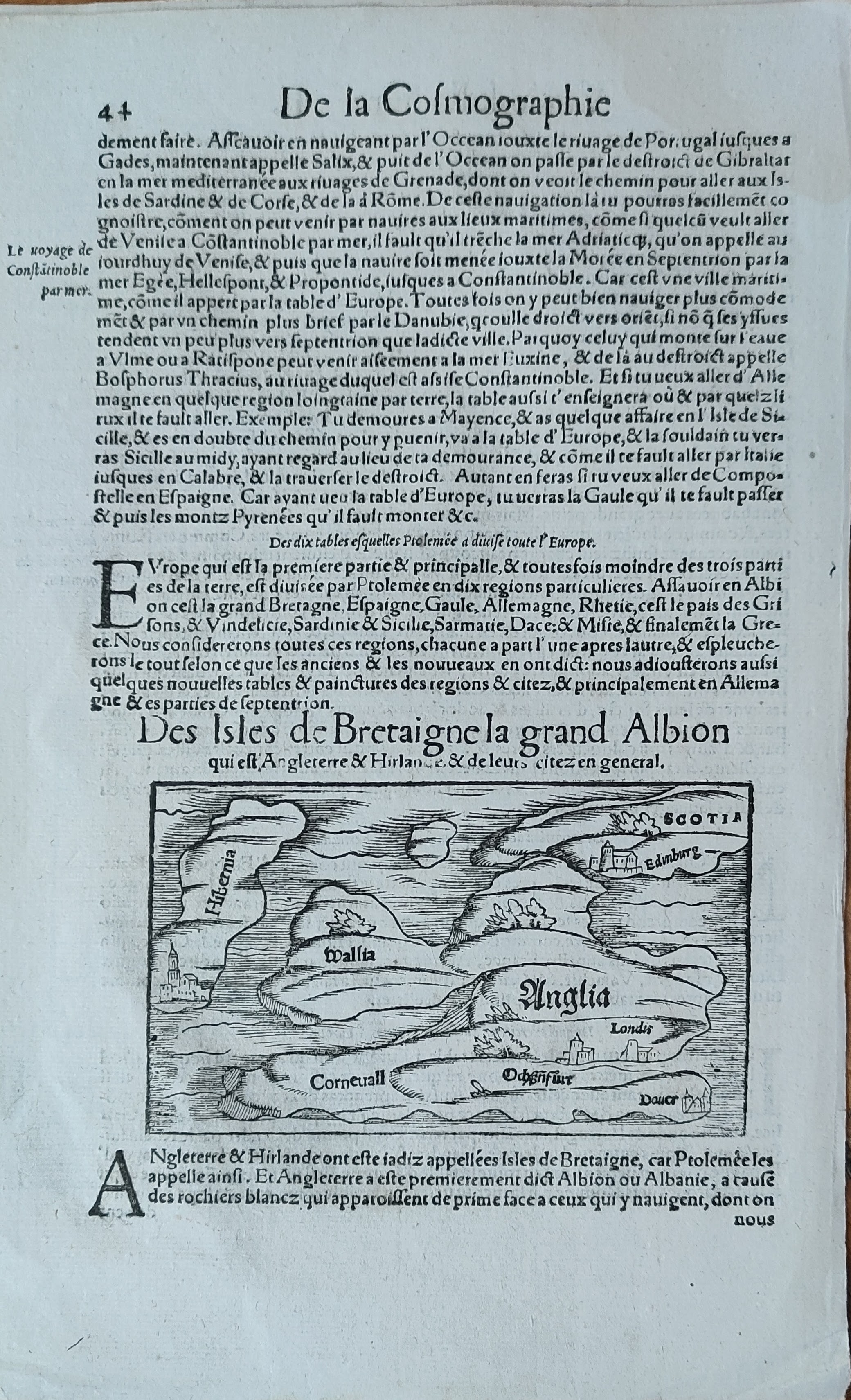
Map title
Des isles de Bretaigne la gran Albion
Author
Munster
Location shown in map
England
Edition date
Circa 1552
Edition place
Basel
Editor
Henrich Petri
Atlas
Cosmographia Universalis
Price
150 Euro
State
[mint/EXCELLENT/very good/good/fair/mediocre/poor]
Color
Black/white
Verso
French text pag.43
Size
Plate: cm (13 x 8) inches (5.12 x 3.15) Paper: cm (20 x 31) inches (7.87 x 12.2)
Technique
Woodcut
Note
Reference
Wiki
Here for more info
In stock
Available
Info
info@thetreasuremaps.com
Code
#0954
×
![]()
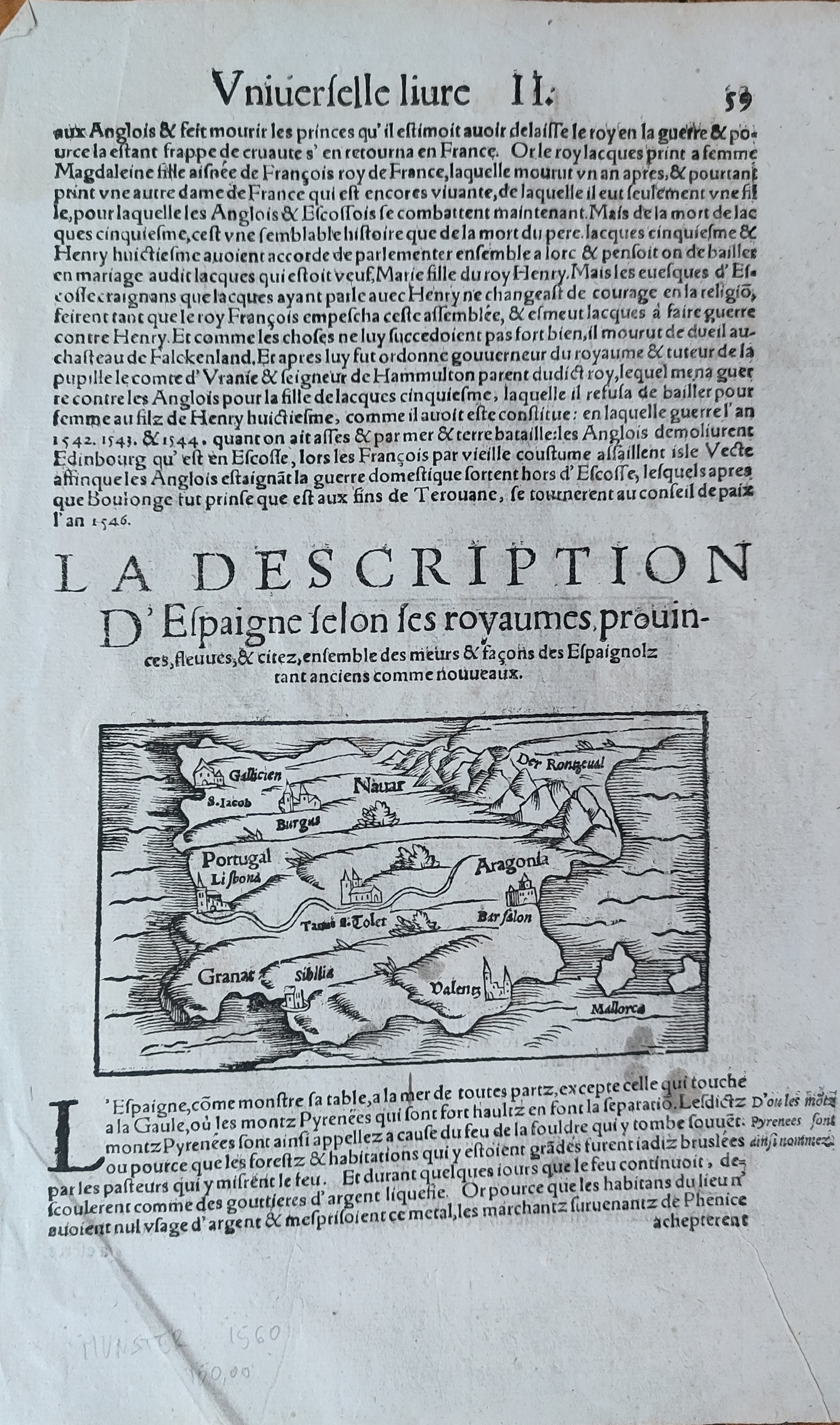
Map title
Espaigne
Author
Munster
Location shown in map
Spain
Edition date
Circa 1552
Edition place
Basel
Editor
Henrich Petri
Atlas
Cosmographia Universalis
Price
125 Euro
State
[mint/EXCELLENT/very good/good/fair/mediocre/poor]
Color
Black/white
Verso
French text pag.60
Size
Plate: cm (13 x 8) inches (5.12 x 3.15) Paper: cm (20 x 31) inches (7.87 x 12.2)
Technique
Woodcut
Note
Reference
Wiki
Here for more info
In stock
Available
Info
info@thetreasuremaps.com
Code
#0955
×
![]()
Map title
--
Author
Munster
Location shown in map
Italy
Edition date
Circa 1552
Edition place
Basel
Editor
Henrich Petri
Atlas
Cosmographia Universalis
Price
250 Euro
State
[mint/EXCELLENT/very good/good/fair/mediocre/poor]
Color
Black/white
Verso
German text pag.105
Size
Plate: cm (13 x 16) inches (5.12 x 6.3) Paper: cm (21 x 31) inches (8.27 x 12.2)
Technique
Woodcut
Note
Reference
Wiki
Here for more info
In stock
Available
Info
info@thetreasuremaps.com
Code
#1101
×
![]()
Map title
Sumatra ein grosse Inseln so von den alten Geographen Taprobana ist genent worden
Author
Munster
Location shown in map
Ceylon
Edition date
1555
Edition place
Basel
Editor
Henrich Petri
Atlas
Cosmographia Universalis
Price
500 Euro
State
[mint/EXCELLENT/very good/good/fair/mediocre/poor]
Color
Black/white
Verso
German text
Size
Plate: cm (33 x 24.1) inches (12.99 x 9.49) Paper: cm (30.5 x 40.6) inches (12.01 x 15.98)
Technique
Woodcut
Note
With large elephant vignette. Tabulae Asiae XII.
Reference
--
Wiki
Here for more info
In stock
Available
Info
info@thetreasuremaps.com
Code
#0177
×
![]()
Map title
Syria Cypern Palestina Mesopotamia Babylonia Chaldea und zwey Arabia mit Bergen Wassern und Statten
Author
Munster
Location shown in map
Holy Land
Edition date
1555
Edition place
Basel
Editor
Henrich Petri
Atlas
Cosmographia Universalis
Price
300 Euro
State
[mint/excellent/very good/GOOD/fair/mediocre/poor]
Color
Black/white
Verso
German text
Size
Plate: cm (34.3 x 25.4) inches (13.5 x 10) Paper: cm (40.6 x 31.8) inches (15.98 x 12.52)
Technique
Woodcut
Note
Middle East from the Nile Delta to the southern coast of Turkey. Tabulae Asiae IV.
Reference
--
Wiki
Here for more info
In stock
Available
Info
info@thetreasuremaps.com
Code
#0178
×
![]()
Map title
German Rhine
Author
Munster
Location shown in map
The Rhine Valley in Germany
Edition date
1560
Edition place
???
Editor
Henrich Petri
Atlas
Cosmographia Universalis
Price
Please ask: info@thetreasuremaps.com
State
[mint/EXCELLENT/very good/good/fair/mediocre/poor]
Color
Black/white
Verso
German text
Size
Plate: cm (16.5 x 25.4) inches (6.5 x 10) Paper: cm (19 x 29.2) inches (7.48 x 11.5)
Technique
Woodcut
Note
No particular notes for this maps
Reference
--
Wiki
Here for more info
In stock
Available
Info
info@thetreasuremaps.com
Code
#0097
×
![]()
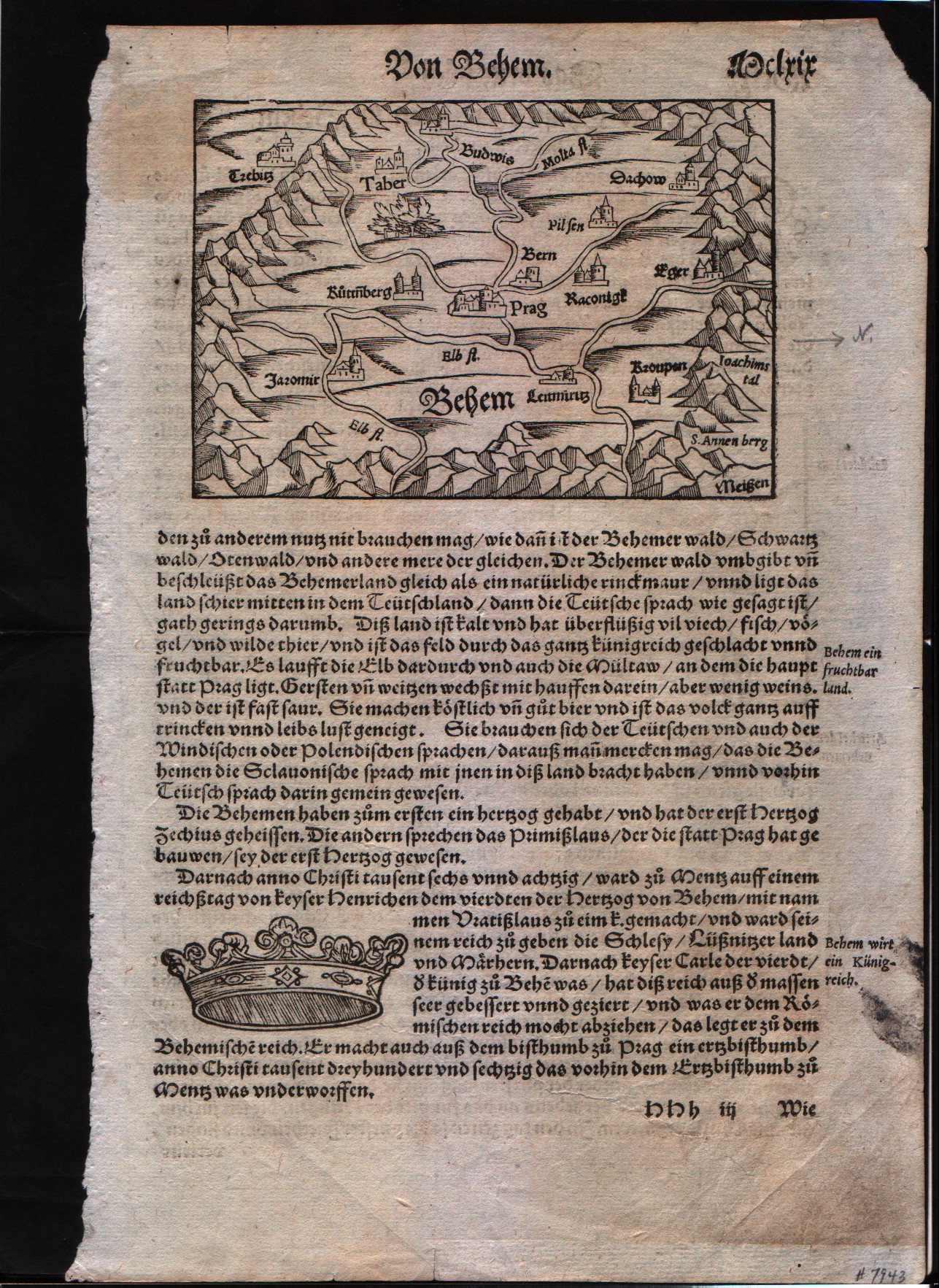
Map title
Prag area
Author
Munster
Location shown in map
Prag area
Edition date
1560
Edition place
???
Editor
Henrich Petri
Atlas
Cosmographia Universalis
Price
Please ask: info@thetreasuremaps.com
State
[mint/EXCELLENT/very good/good/fair/mediocre/poor]
Color
Black/white
Verso
German text
Size
Plate: cm (8.9 x 14) inches (3.5 x 5.51) Paper: cm (44.4 x 29.2) inches (17.48 x 11.5)
Technique
Woodcut
Note
No particular notes for this maps
Reference
--
Wiki
Here for more info
In stock
Available
Info
info@thetreasuremaps.com
Code
#0098
Prag area
Author
Munster
Location shown in map
Prag area
Edition date
1560
Edition place
???
Editor
Henrich Petri
Atlas
Cosmographia Universalis
Price
Please ask: info@thetreasuremaps.com
State
[mint/EXCELLENT/very good/good/fair/mediocre/poor]
Color
Black/white
Verso
German text
Size
Plate: cm (8.9 x 14) inches (3.5 x 5.51) Paper: cm (44.4 x 29.2) inches (17.48 x 11.5)
Technique
Woodcut
Note
No particular notes for this maps
Reference
--
Wiki
Here for more info
In stock
Available
Info
info@thetreasuremaps.com
Code
#0098
×
![]()
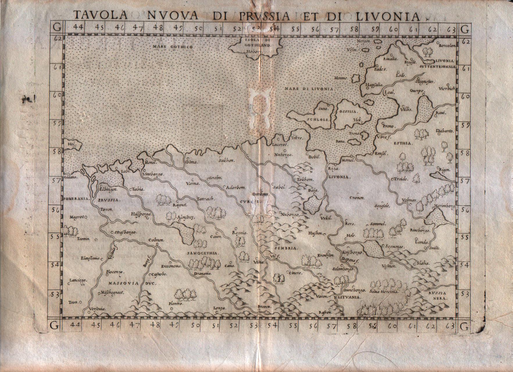
Map title
Tavola nuova di Prussia et di Livonia
Author
Ruscelli
Location shown in map
Poland
Edition date
1561
Edition place
Venice
Editor
Vincenzo Valgrisi
Atlas
La Geographia di Claudio Tolomeo
Price
Please ask: info@thetreasuremaps.com
State
[mint/excellent/very good/good/FAIR/mediocre/poor]
Color
Black/white
Verso
Italian text
Size
Plate: cm (26 x 20.3) inches (10.24 x 7.99) Paper: cm (30.5 x 22.9) inches (12.01 x 9.02)
Technique
Copper engraving
Note
Based on Gastaldi map.
Reference
--
Wiki
Here for more info
In stock
Sold
Info
info@thetreasuremaps.com
Code
#0116
×
![]()
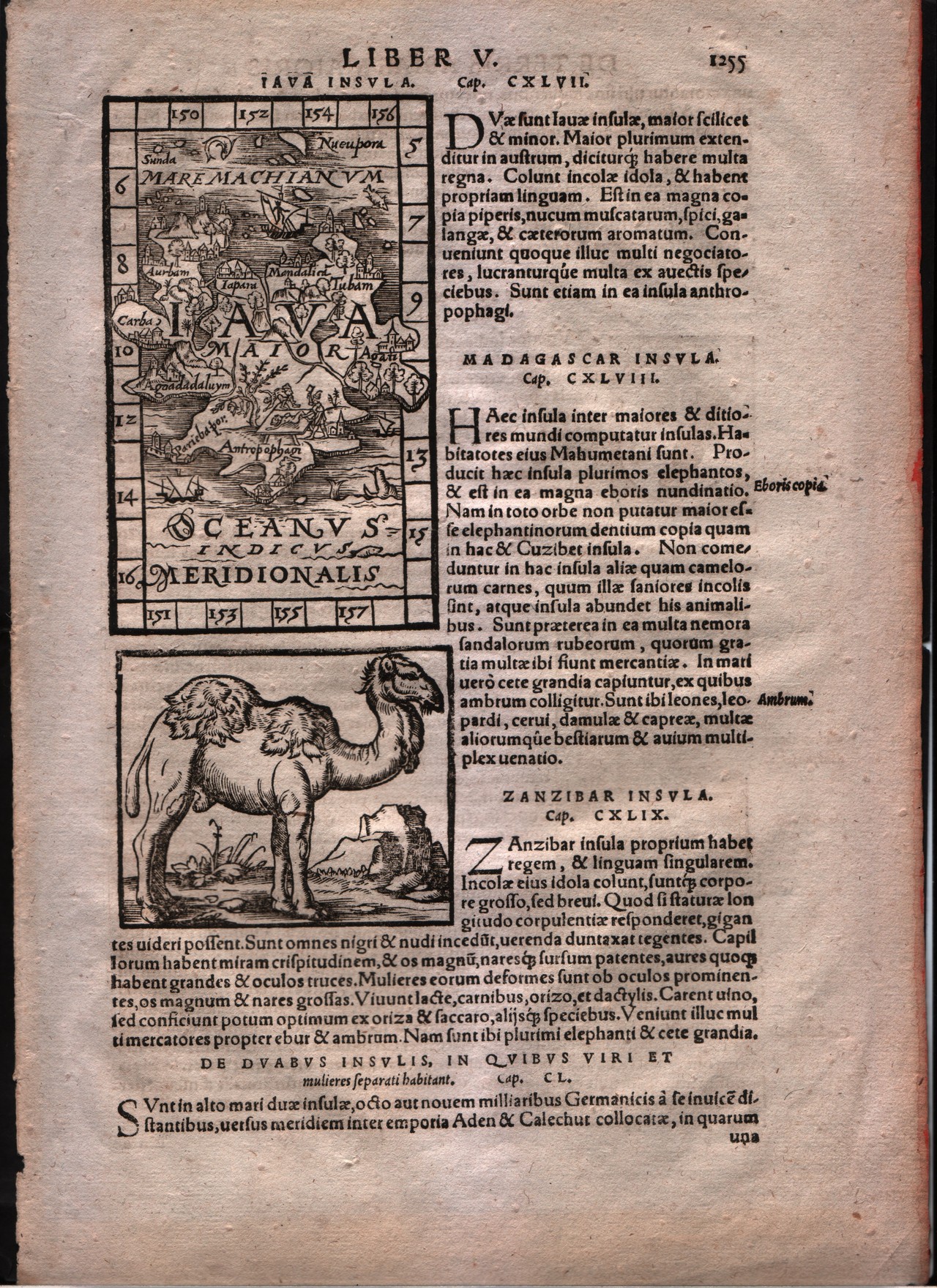
Map title
Iava insula
Author
Honter
Location shown in map
Java
Edition date
1561
Edition place
Basle
Editor
--
Atlas
Cosmographiae Rudimentis -- Johannes Honter
Price
Please ask: info@thetreasuremaps.com
State
[mint/EXCELLENT/very good/good/fair/mediocre/poor]
Color
Black/white
Verso
Latin text pag.1255
Size
Plate: cm (7.6 x 12.7) inches (2.99 x 5) Paper: cm (21.6 x 31.8) inches (8.5 x 12.52)
Technique
Woodcut
Note
--
Reference
--
Wiki
Here for more info
In stock
Sold
Info
info@thetreasuremaps.com
Code
#0180
×
![]()
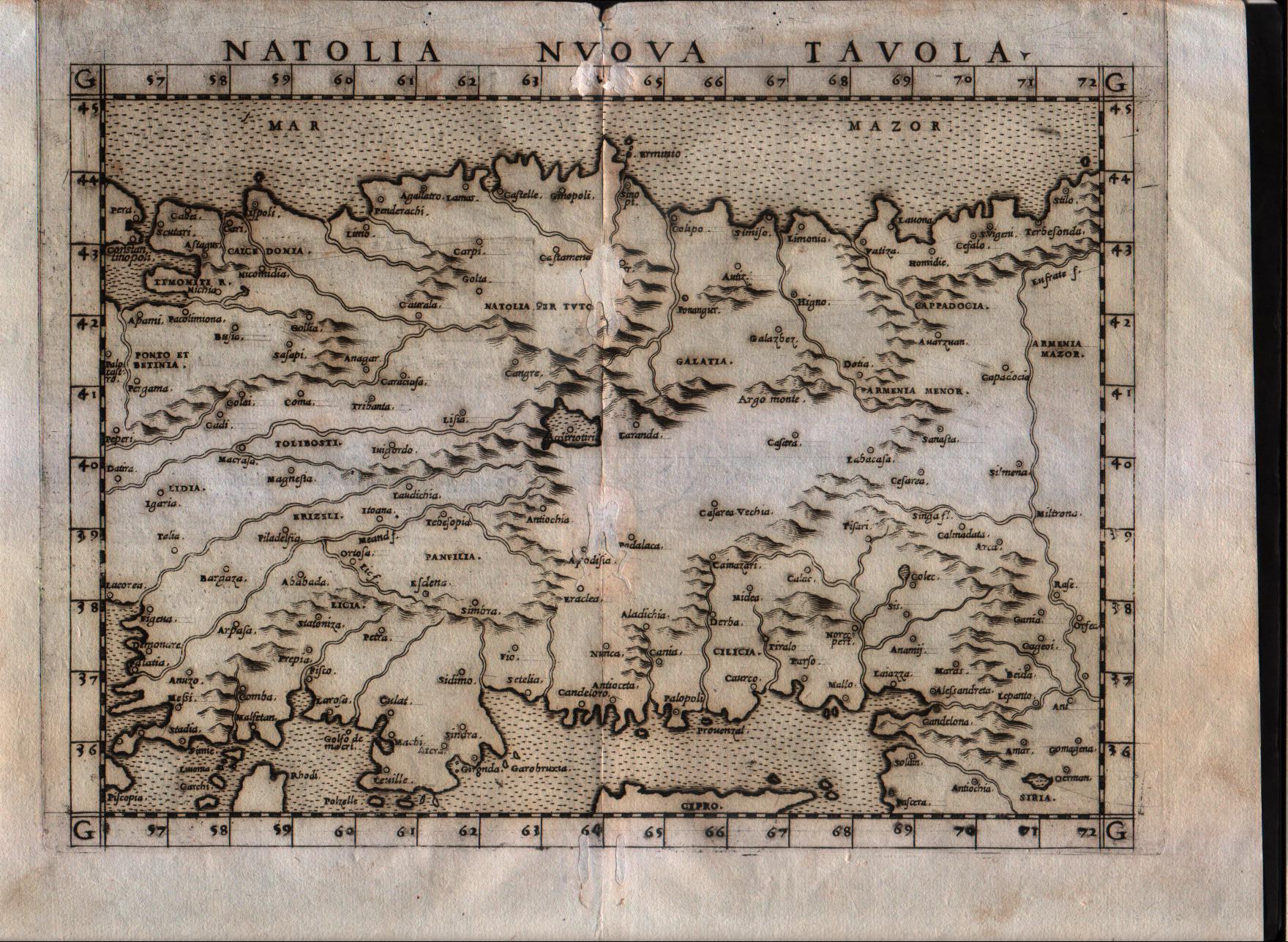
Map title
Natolia nuova tavola
Author
Ruscelli
Location shown in map
Turkey
Edition date
1561
Edition place
Venice
Editor
Vincenzo Valgrisi
Atlas
La Geographia di Claudio Tolomeo
Price
150 Euro
State
[mint/excellent/very good/GOOD/fair/mediocre/poor]
Color
Black/white
Verso
Italian text pag.23
Size
Plate: cm (25.4 x 19) inches (10 x 7.48) Paper: cm (30.5 x 22.9) inches (12.01 x 9.02)
Technique
Copper engraving
Note
Turkey shown.
Reference
Genoa pubblic library "Civica Berio"
Wiki
Here for more info
In stock
Available
Info
info@thetreasuremaps.com
Code
#0193
×
![]()
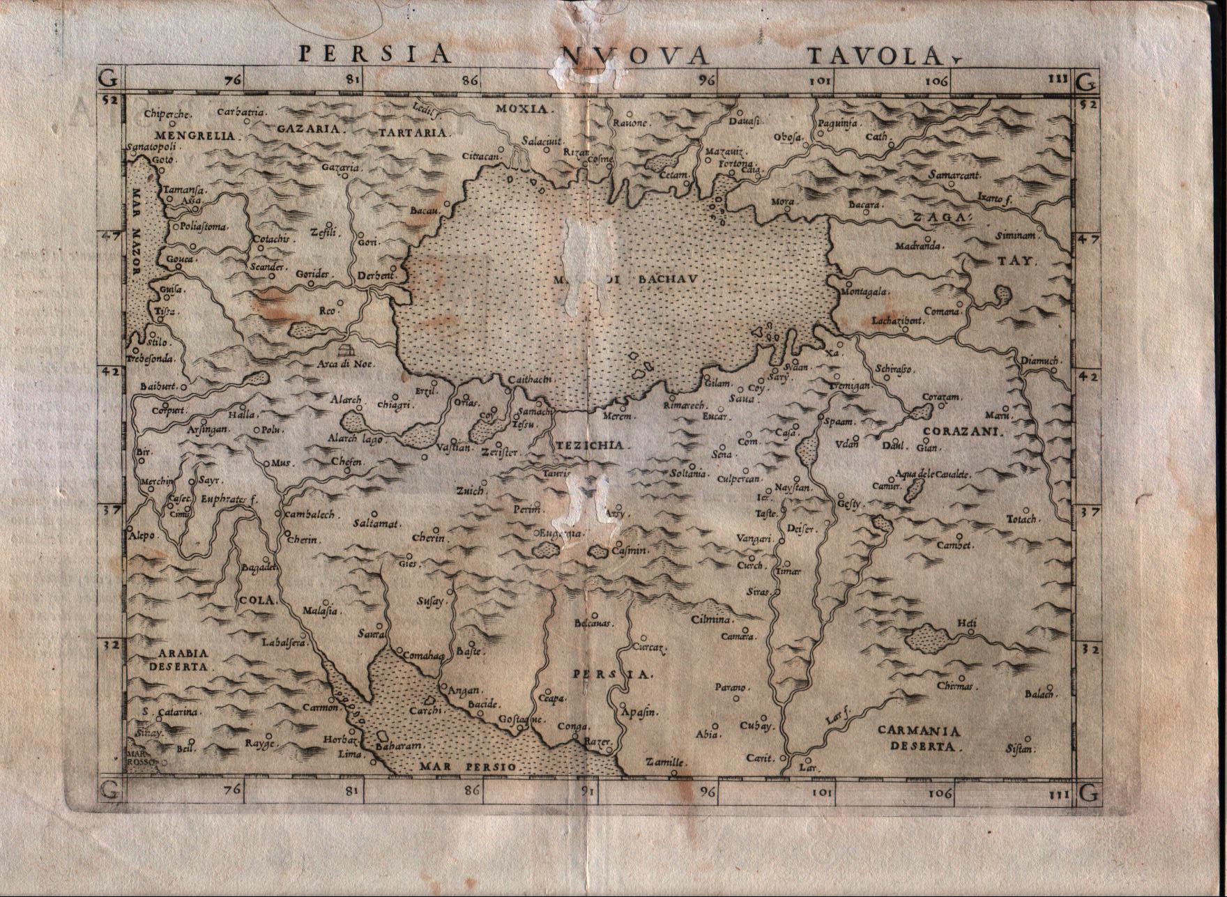
Map title
Persia nuova tavola
Author
Ruscelli
Location shown in map
Persia and west Pakistan
Edition date
1561
Edition place
Venice
Editor
Vincenzo Valgrisi
Atlas
La Geographia di Claudio Tolomeo
Price
200 Euro
State
[mint/excellent/very good/good/fair/MEDIOCRE/poor] repaired
Color
Black/white
Verso
Italian text pag.25
Size
Plate: cm (25.4 x 19) inches (10 x 7.48) Paper: cm (30.5 x 22.9) inches (12.01 x 9.02)
Technique
Copper engraving
Note
Persia and west Pakistan shown.
Reference
Genoa pubblic library "Civica Berio"
Wiki
Here for more info
In stock
Available
Info
info@thetreasuremaps.com
Code
#0194
×
![]()
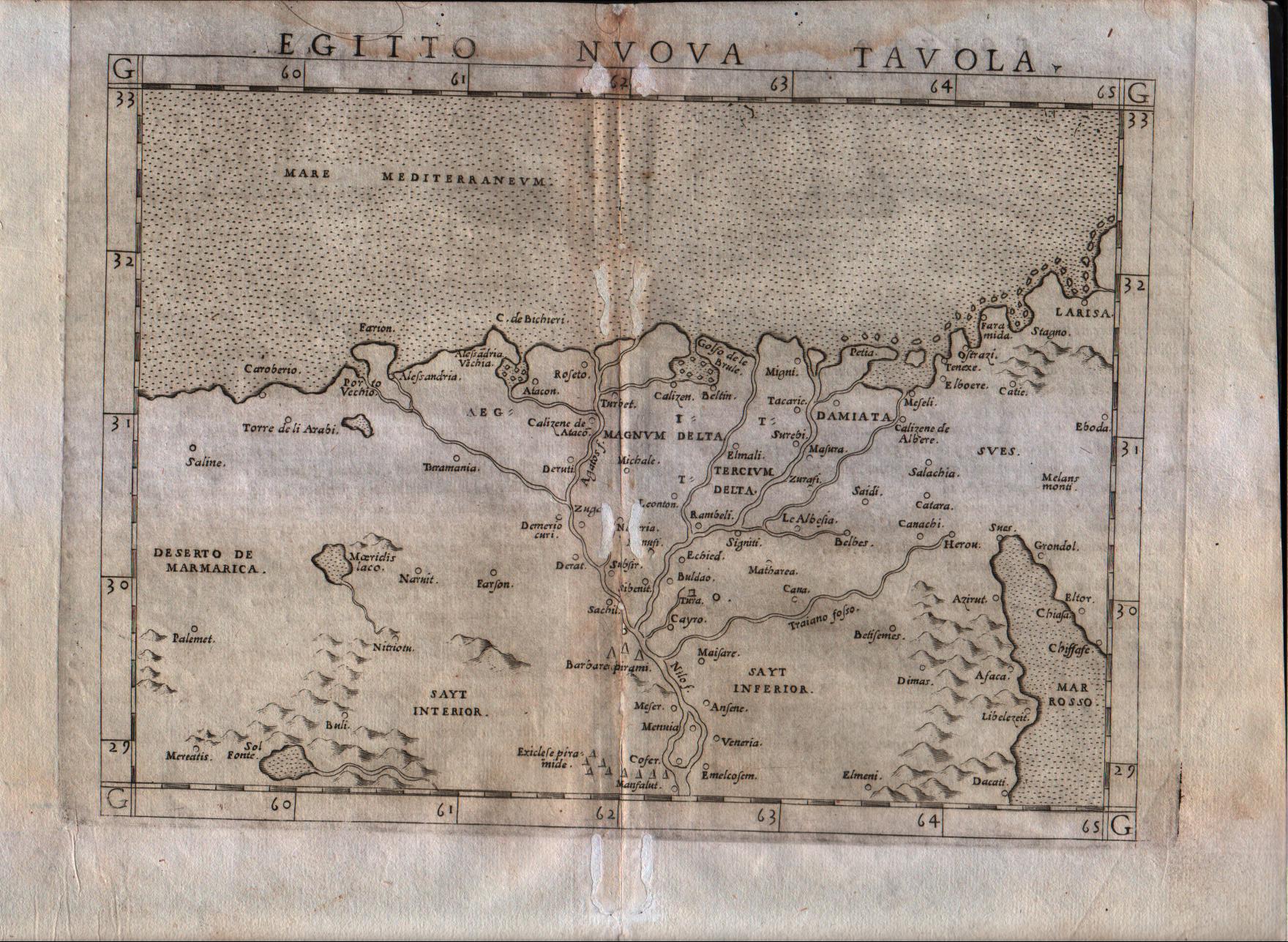
Map title
Egitto nuova tavola
Author
Ruscelli
Location shown in map
Egypt
Edition date
1561
Edition place
Venice
Editor
Vincenzo Valgrisi
Atlas
La Geographia di Claudio Tolomeo
Price
150 Euro
State
[mint/excellent/very good/good/FAIR/mediocre/poor] repaired
Color
Black/white
Verso
Italian text
Size
Plate: cm (26 x 20.3) inches (10.24 x 7.99) Paper: cm (30.5 x 22.9) inches (12.01 x 9.02)
Technique
Copper engraving
Note
Based on Gastaldi map.
Reference
Genoa pubblic library "Civica Berio"
Wiki
Here for more info
In stock
Available
Info
info@thetreasuremaps.com
Code
#0280
×
![]()
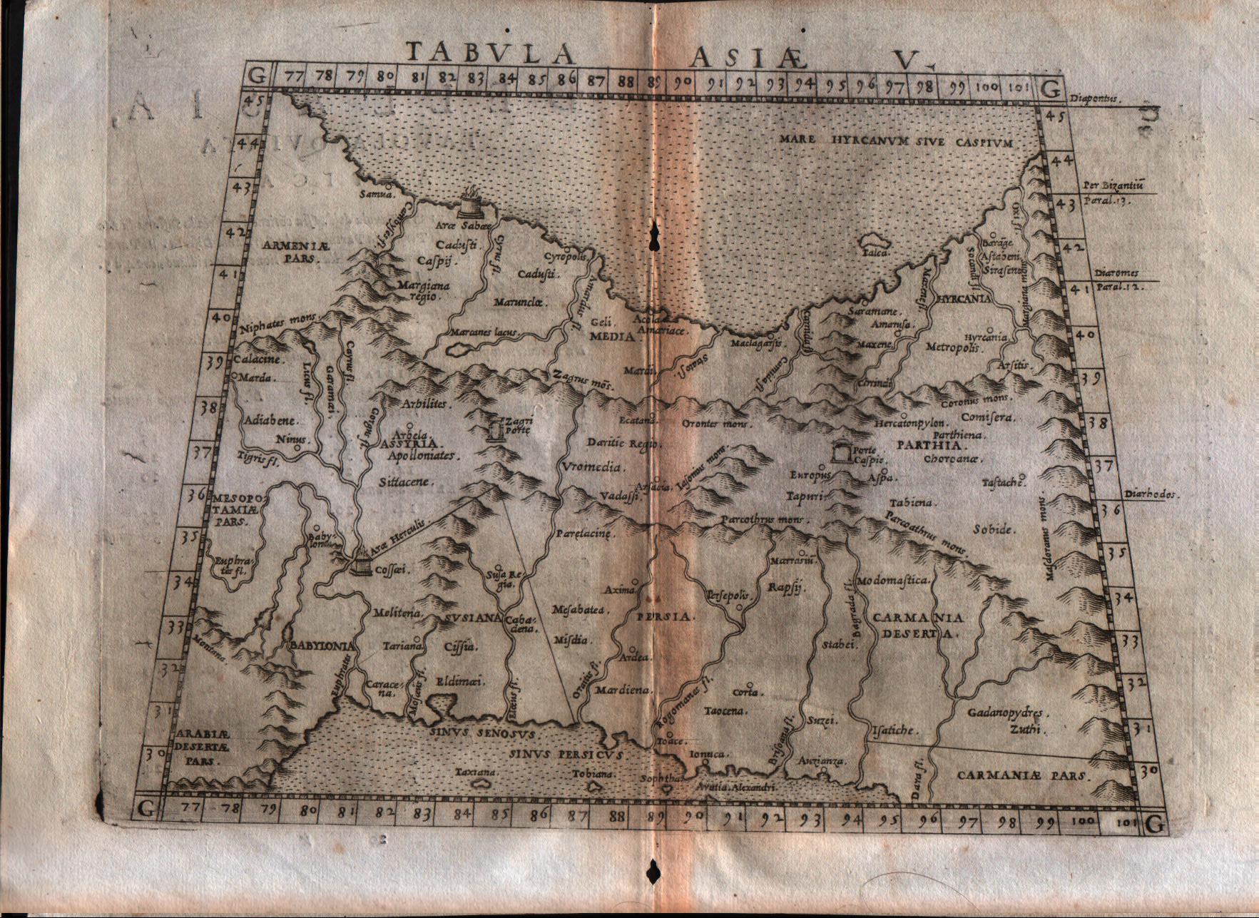
Map title
Tabula Asiae V
Author
Ruscelli
Location shown in map
Persia and west Pakistan
Edition date
1561
Edition place
Venice
Editor
Vincenzo Valgrisi
Atlas
La Geographia di Claudio Tolomeo
Price
150 Euro
State
[mint/excellent/very good/GOOD/fair/mediocre/poor]
Color
Black/white
Verso
Italian text pag.20
Size
Plate: cm (25.4 x 19) inches (10 x 7.48) Paper: cm (30.5 x 22.9) inches (12.01 x 9.02)
Technique
Copper engraving
Note
Persia and west Pakistan shown.
Reference
Genoa pubblic library "Civica Berio"
Wiki
Here for more info
In stock
Available
Info
info@thetreasuremaps.com
Code
#0506
×
![]()
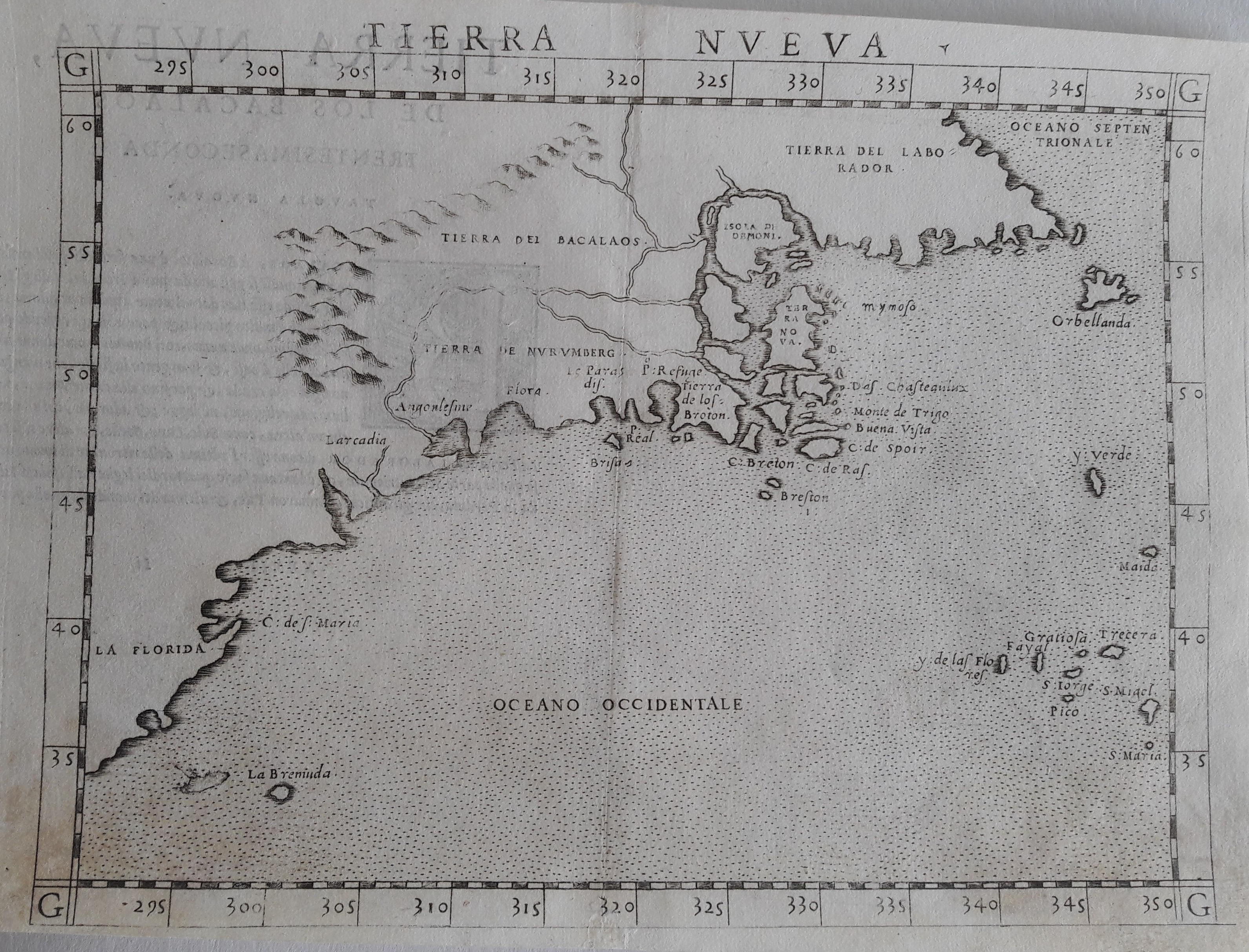
Map title
Tierra Nueva
Author
Ruscelli
Location shown in map
East coast
Edition date
1561
Edition place
Venice
Editor
Vincenzo Valgrisi
Atlas
La Geographia di Claudio Tolomeo
Price
900 Euro
State
[mint/excellent/VERY GOOD/good/fair/mediocre/poor]
Color
Black/white
Verso
Italian text pag.59
Size
Plate: cm (25.4 x 19) inches (10 x 7.48) Paper: cm (27.9 x 20.3) inches (10.98 x 7.99)
Technique
Copper engraving
Note
No particular notes for this maps.
Reference
--
Wiki
Here for more info
In stock
Available
Info
info@thetreasuremaps.com
Code
#0529
×
![]()
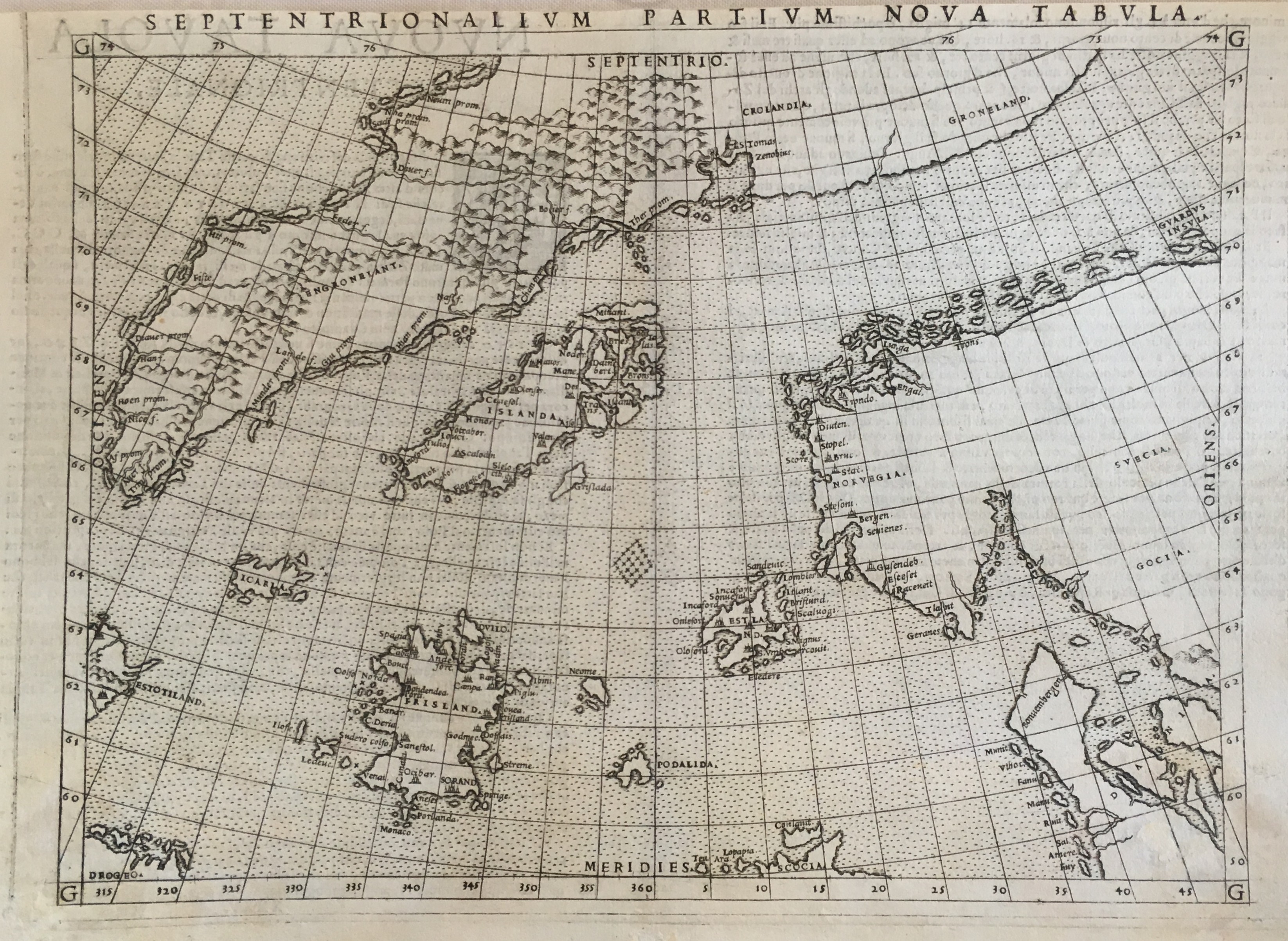
Map title
Septentrionalium partium nova tabula
Author
Ruscelli
Location shown in map
North Atlantic
Edition date
1561
Edition place
Venice
Editor
Vincenzo Valgrisi
Atlas
La Geographia di Claudio Tolomeo
Price
500 Euro
State
[mint/EXCELLENT/very good/good/fair/mediocre/poor]
Color
Black/white
Verso
Italian text pag.35
Size
Plate: cm (25.4 x 19) inches (10 x 7.48) Paper: cm (27.9 x 20.3) inches (10.98 x 7.99)
Technique
Copper engraving
Note
No particular notes for this maps.
Reference
--
Wiki
Here for more info
In stock
Available
Info
info@thetreasuremaps.com
Code
#0530
×
![]()
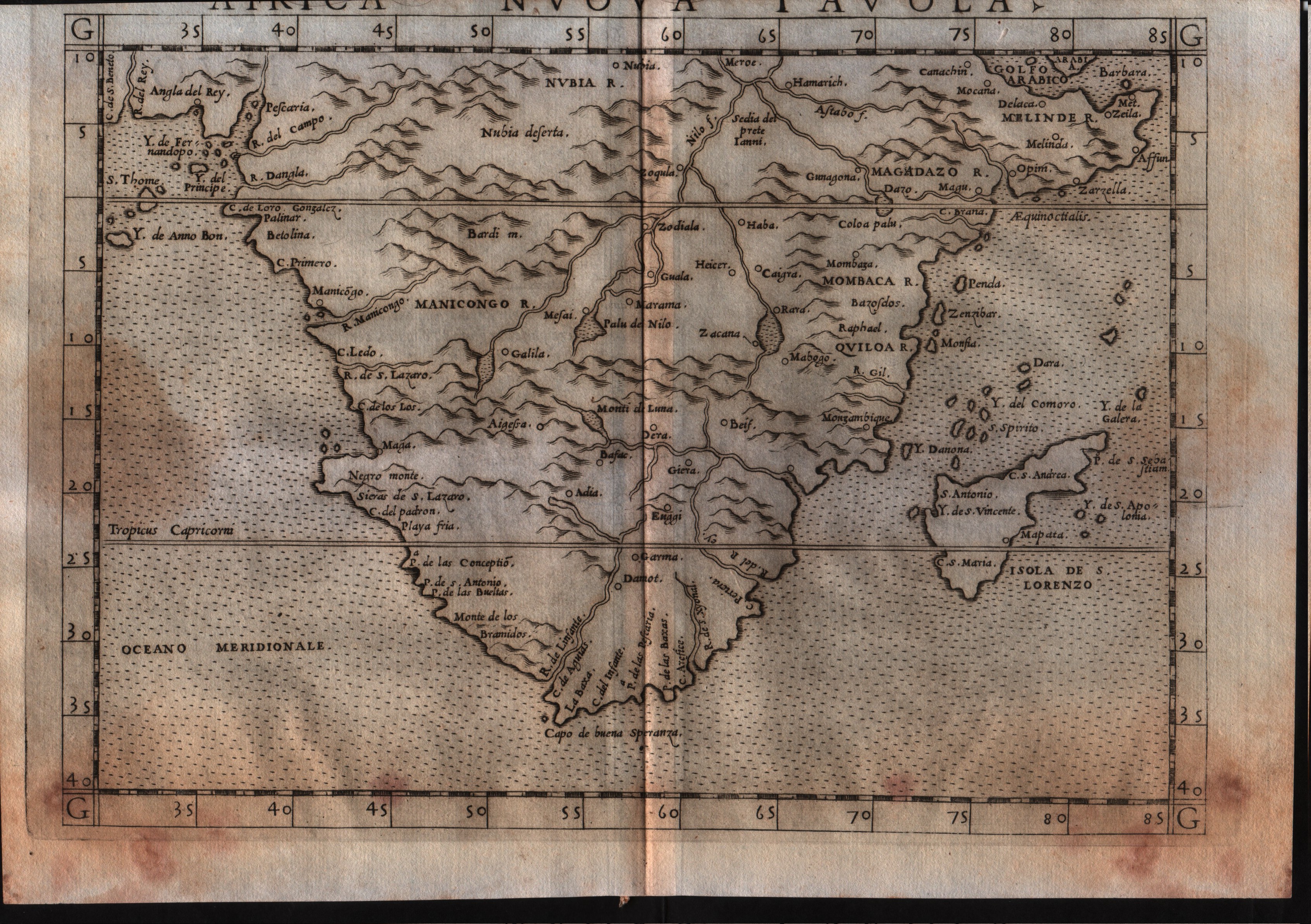
Map title
Africa Nuova Tavola
Author
Ruscelli
Location shown in map
South Africa
Edition date
1561
Edition place
Venice
Editor
Vincenzo Valgrisi
Atlas
La Geographia di Claudio Tolomeo
Price
300 Euro
State
[mint/excellent/very good/GOOD/fair/mediocre/poor]
Color
Black/white
Verso
Italian text pag.22
Size
Plate: cm (26 x 19) inches (10.24 x 7.48) Paper: cm (27.9 x 20.3) inches (10.98 x 7.99)
Technique
Copper engraving
Note
No particular notes for this maps.
Reference
--
Wiki
Here for more info
In stock
Available
Info
info@thetreasuremaps.com
Code
#0531
×
![]()
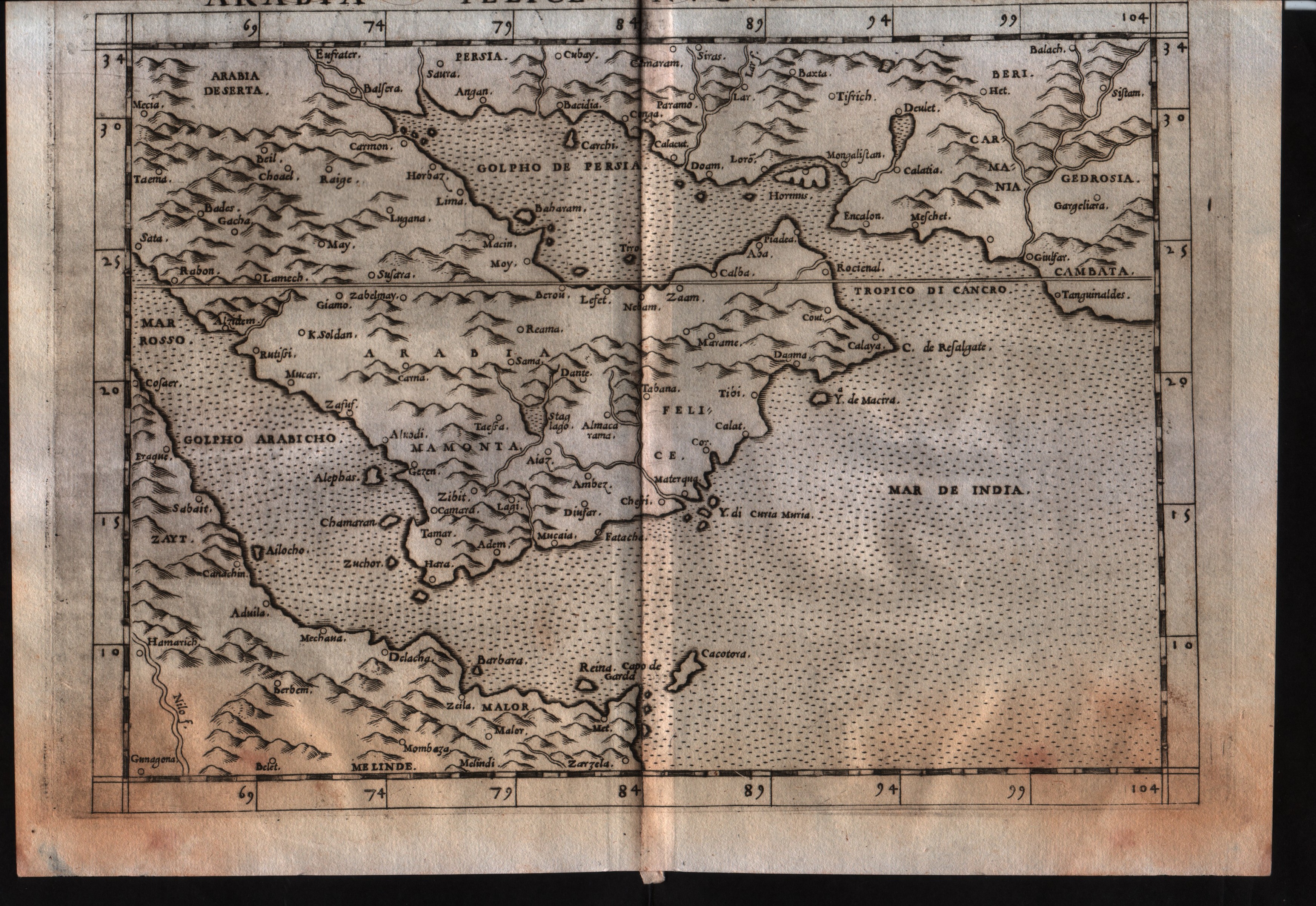
Map title
Arabia Felice Nuova Tavola
Author
Ruscelli
Location shown in map
Arabia
Edition date
1561
Edition place
Venice
Editor
Vincenzo Valgrisi
Atlas
La Geographia di Claudio Tolomeo
Price
300 Euro
State
[mint/excellent/very good/GOOD/fair/mediocre/poor]
Color
Black/white
Verso
Italian text pag.26
Size
Plate: cm (26 x 19) inches (10.24 x 7.48) Paper: cm (27.9 x 20.3) inches (10.98 x 7.99)
Technique
Copper engraving
Note
No particular notes for this maps.
Reference
--
Wiki
Here for more info
In stock
Available
Info
info@thetreasuremaps.com
Code
#0532
×
![]()
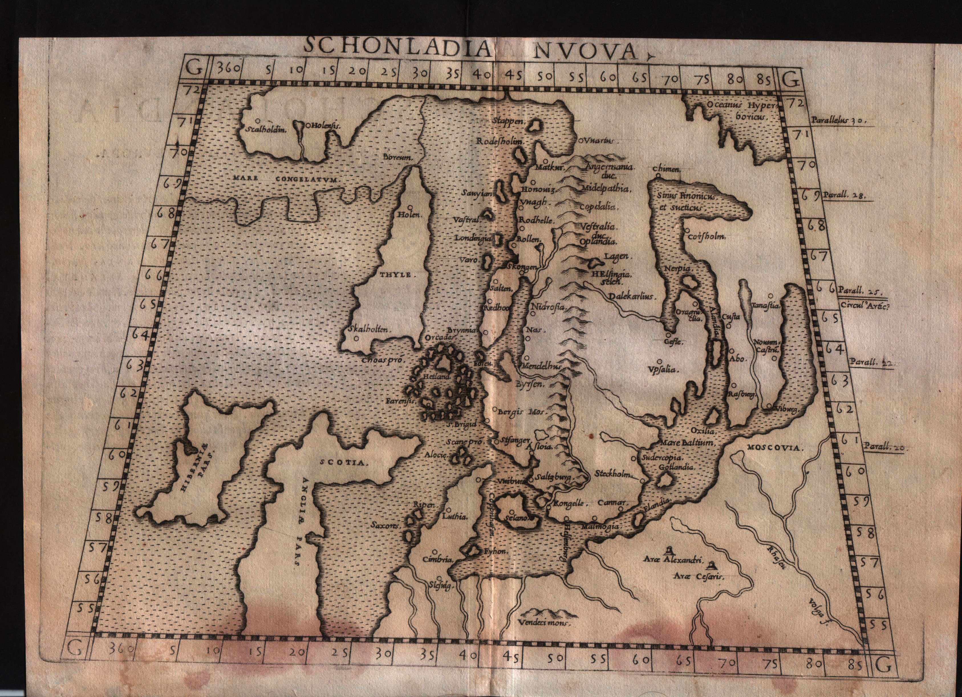
Map title
Schonlandia Nuova
Author
Ruscelli
Location shown in map
Scandinavia
Edition date
1561
Edition place
Venice
Editor
Vincenzo Valgrisi
Atlas
La Geographia di Claudio Tolomeo
Price
600 Euro
State
[mint/excellent/VERY GOOD/good/fair/mediocre/poor]
Color
Black/white
Verso
Italian text pag.6
Size
Plate: cm (26 x 19) inches (10.24 x 7.48) Paper: cm (27.9 x 20.3) inches (10.98 x 7.99)
Technique
Copper engraving
Note
No particular notes for this maps.
Reference
--
Wiki
Here for more info
In stock
Available
Info
info@thetreasuremaps.com
Code
#0533
×
![]()
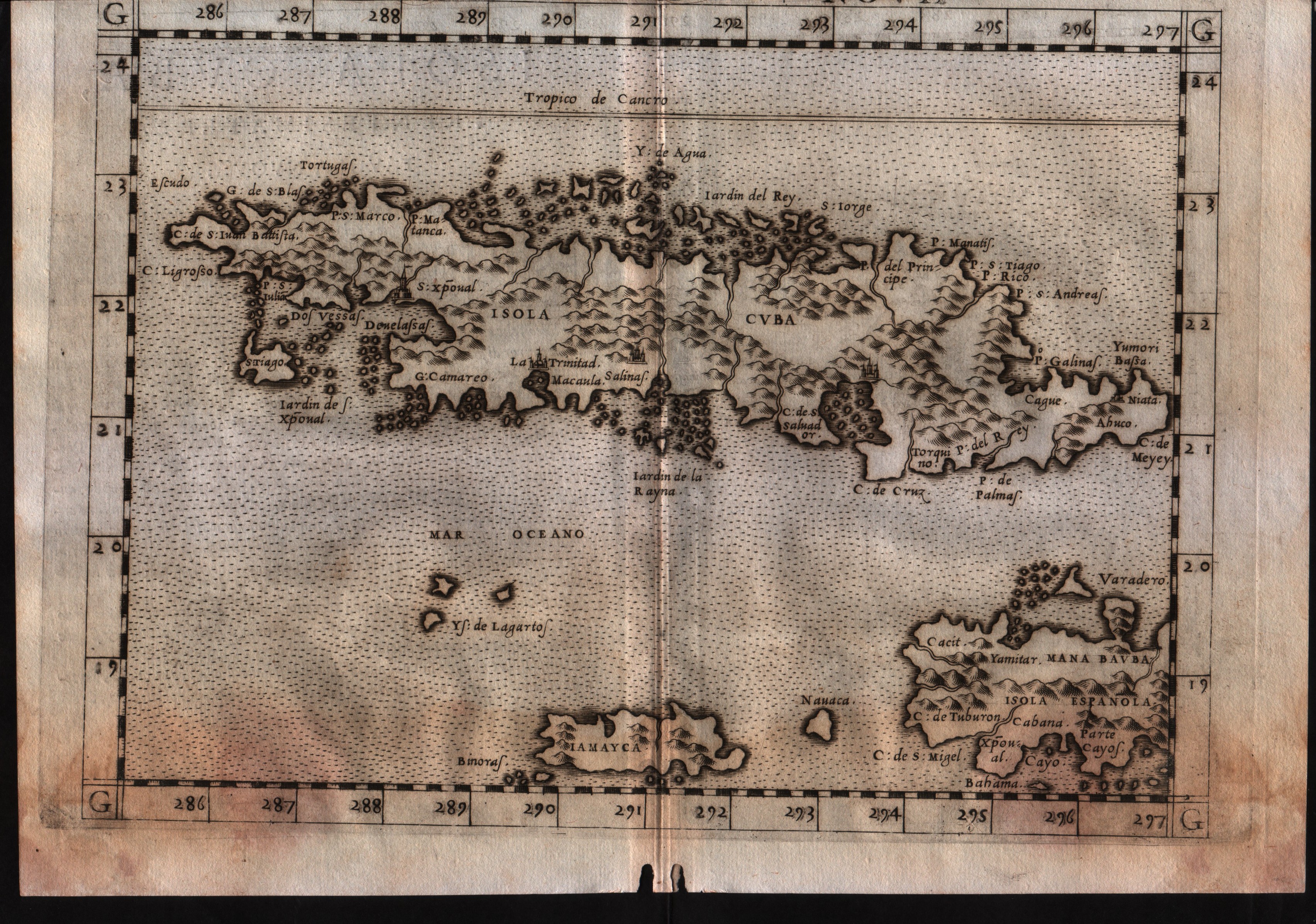
Map title
Isola Cuba Nova
Author
Ruscelli
Location shown in map
Cuba
Edition date
1561
Edition place
Venice
Editor
Vincenzo Valgrisi
Atlas
La Geographia di Claudio Tolomeo
Price
300 Euro
State
[mint/excellent/very good/GOOD/fair/mediocre/poor]
Color
Black/white
Verso
Italian text pag.33
Size
Plate: cm (26 x 19) inches (10.24 x 7.48) Paper: cm (27.9 x 20.3) inches (10.98 x 7.99)
Technique
Copper engraving
Note
--
Reference
--
Wiki
Here for more info
In stock
Available
Info
info@thetreasuremaps.com
Code
#0534
×
![]()
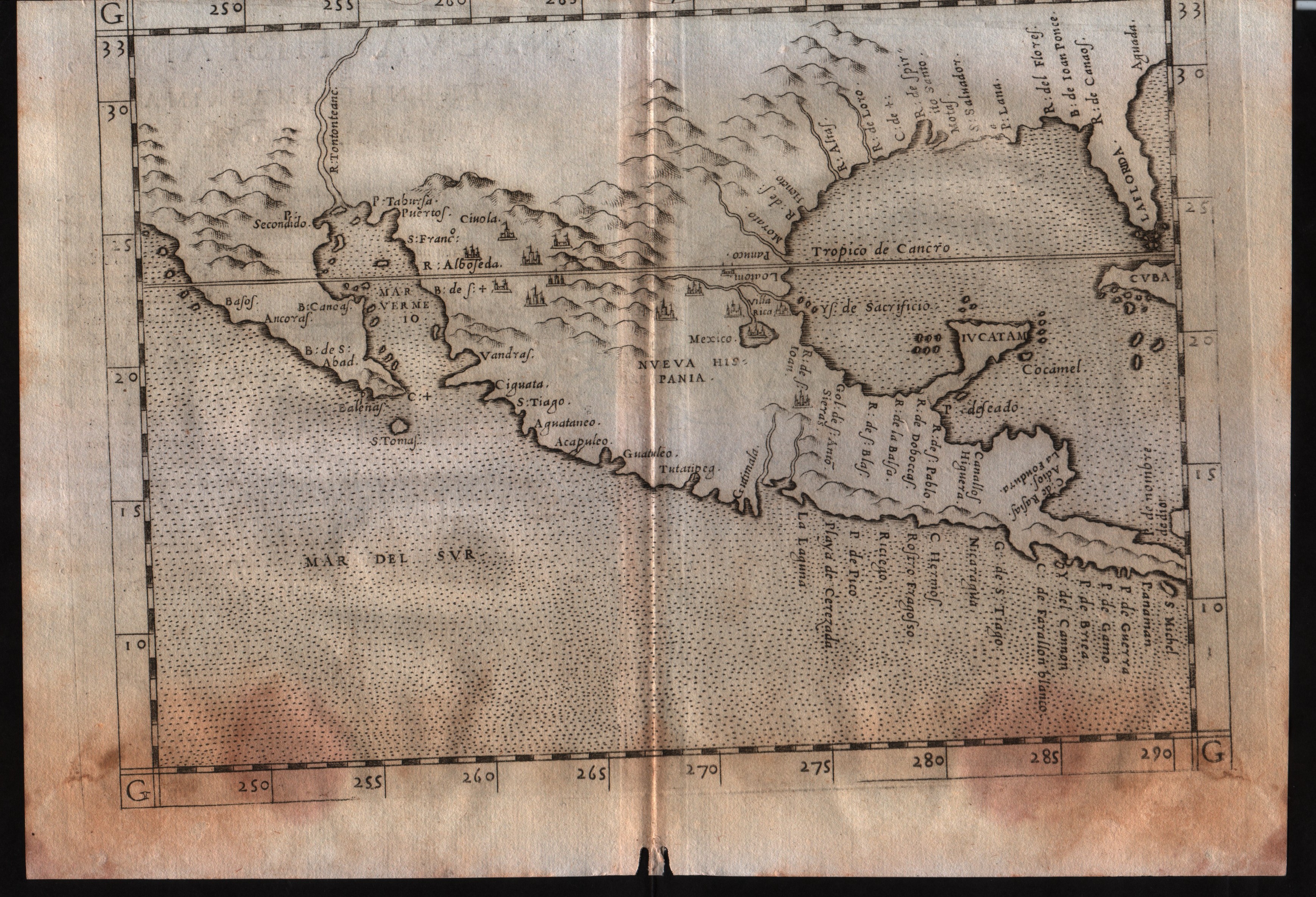
Map title
Nueva Hispania tabula nova
Author
Ruscelli
Location shown in map
Mexico
Edition date
1561
Edition place
Venice
Editor
Vincenzo Valgrisi
Atlas
La Geographia di Claudio Tolomeo
Price
400 Euro
State
[mint/excellent/very good/GOOD/fair/mediocre/poor]
Color
Black/white
Verso
Italian text pag.31
Size
Plate: cm (26 x 19) inches (10.24 x 7.48) Paper: cm (27.9 x 20.3) inches (10.98 x 7.99)
Technique
Copper engraving
Note
--
Reference
--
Wiki
Here for more info
In stock
Available
Info
info@thetreasuremaps.com
Code
#0535
×
![]()
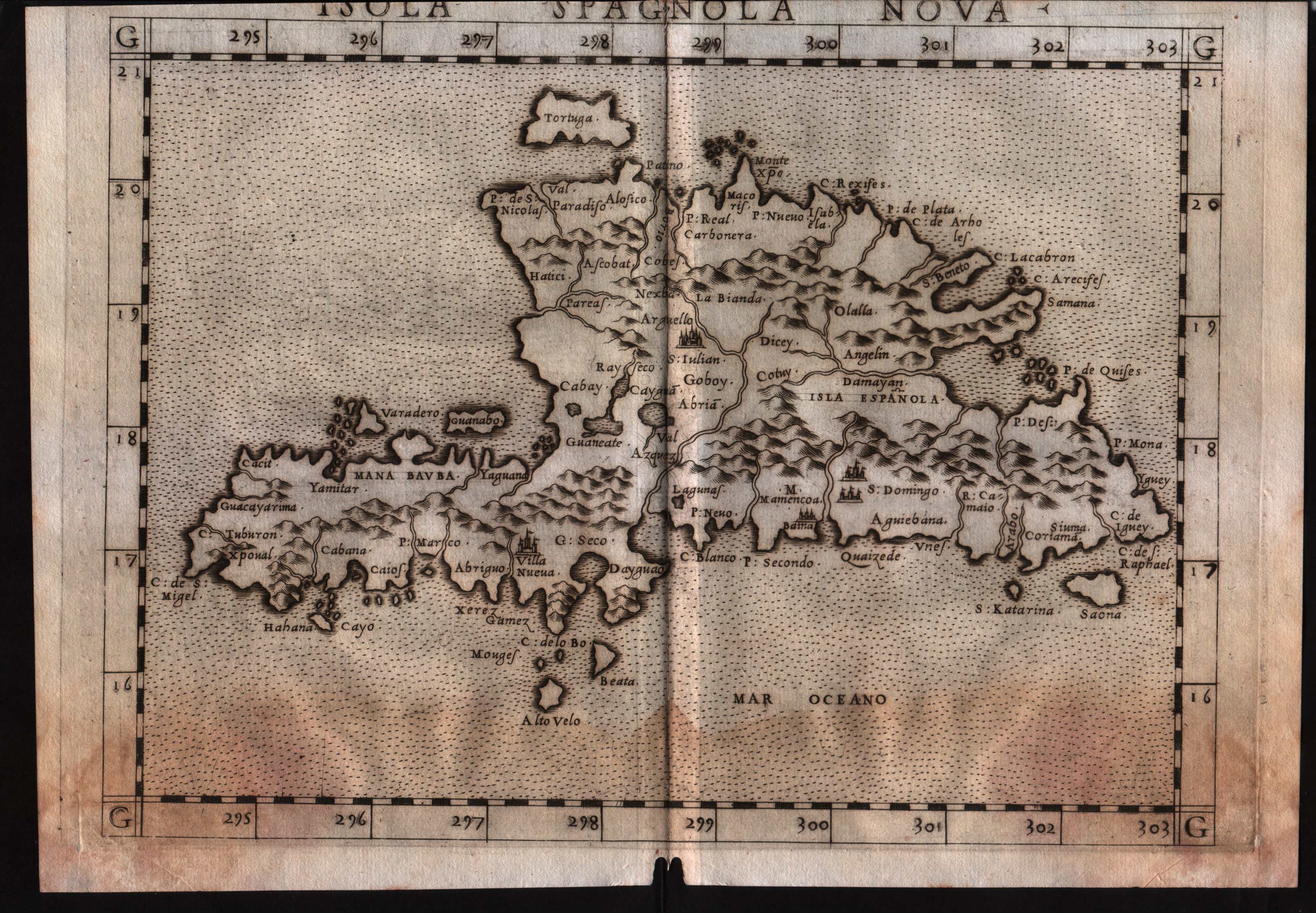
Map title
Isola Spagnola Nova
Author
Ruscelli
Location shown in map
Haiti
Edition date
1561
Edition place
Venice
Editor
Vincenzo Valgrisi
Atlas
La Geographia di Claudio Tolomeo
Price
300 Euro
State
[mint/excellent/VERY GOOD/good/fair/mediocre/poor]
Color
Black/white
Verso
Italian text pag.34
Size
Plate: cm (26 x 19) inches (10.24 x 7.48) Paper: cm (27.9 x 20.3) inches (10.98 x 7.99)
Technique
Copper engraving
Note
No particular notes for this maps.
Reference
--
Wiki
Here for more info
In stock
Available
Info
info@thetreasuremaps.com
Code
#0536
×
![]()
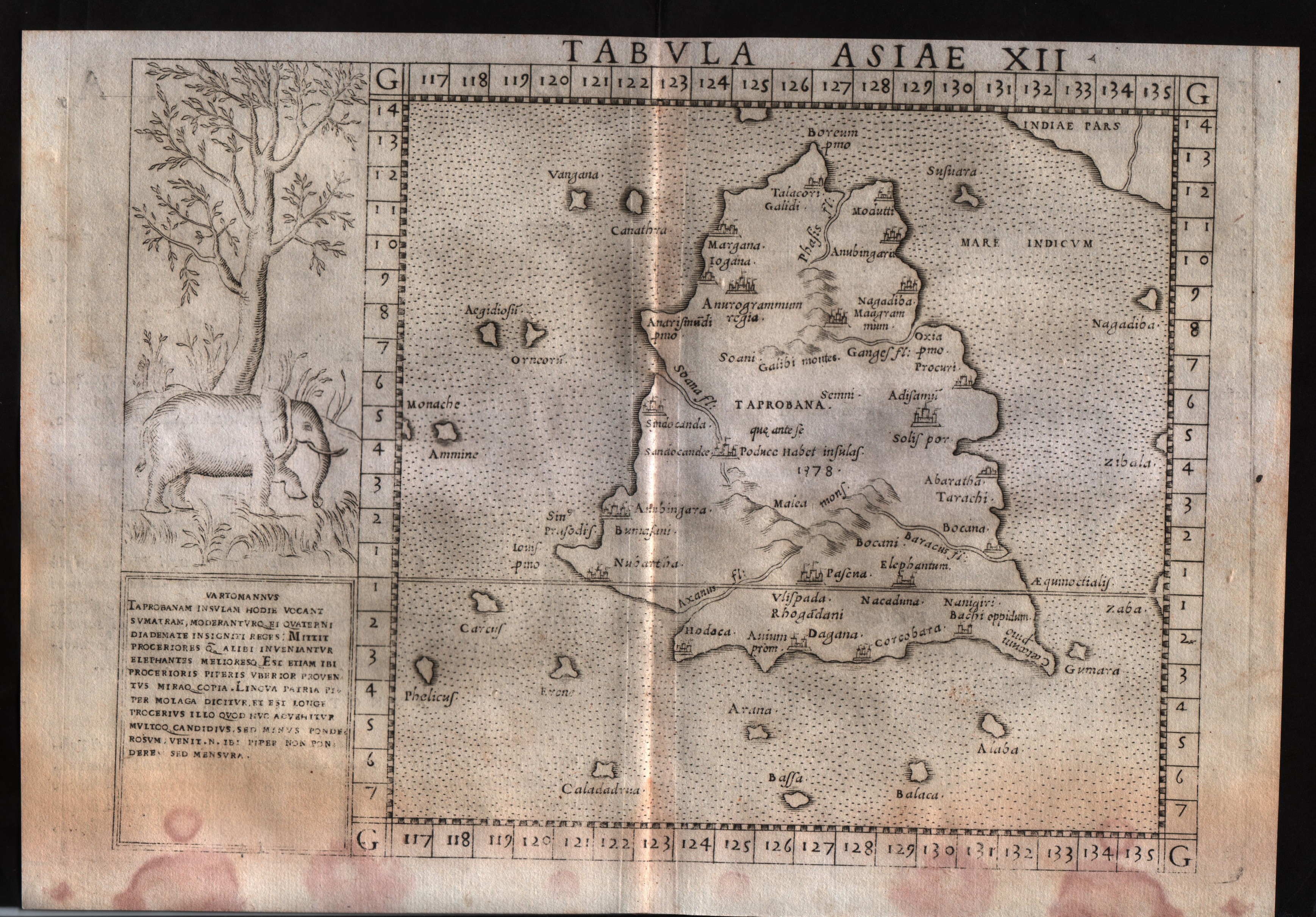
Map title
Tabula Asiae XII
Author
Ruscelli
Location shown in map
Ceylon
Edition date
1561
Edition place
Venice
Editor
Vincenzo Valgrisi
Atlas
La Geographia di Claudio Tolomeo
Price
250 Euro
State
[mint/EXCELLENT/very good/good/fair/mediocre/poor]
Color
Black/white
Verso
Italian text pag.27
Size
Plate: cm (26 x 19) inches (10.24 x 7.48) Paper: cm (27.9 x 20.3) inches (10.98 x 7.99)
Technique
Copper engraving
Note
No particular notes for this maps.
Reference
--
Wiki
Here for more info
In stock
Available
Info
info@thetreasuremaps.com
Code
#0537
×
![]()
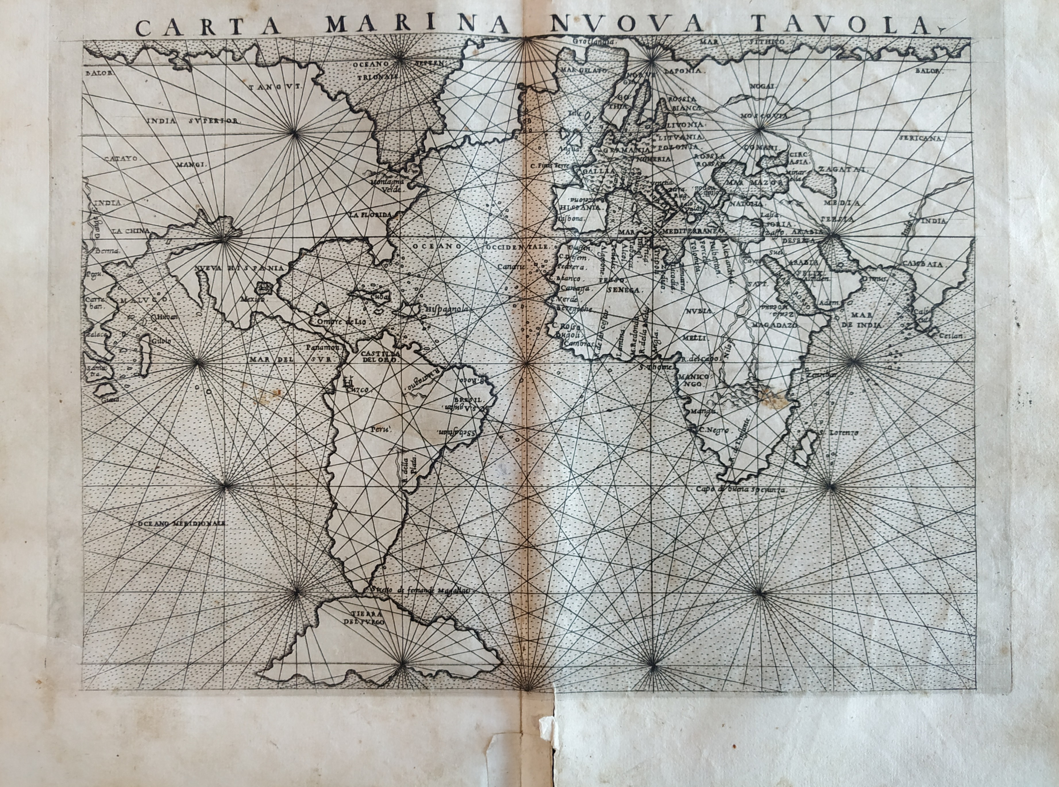
Map title
Carta marina nova tabula
Author
Ruscelli
Location shown in map
World
Edition date
1561
Edition place
Venice
Editor
Vincenzo Valgrisi
Atlas
La Geographia di Claudio Tolomeo
Price
800 Euro
State
[mint/EXCELLENT/very good/good/fair/mediocre/poor]
Color
Black/white
Verso
Size
Plate: cm (26 x 19) inches (10.24 x 7.48) Paper: cm (27.9 x 20.3) inches (10.98 x 7.99)
Technique
Copper engraving
Note
No particular notes for this maps.
Reference
--
Wiki
Here for more info
In stock
Sold
Info
info@thetreasuremaps.com
Code
#0765
×
![]()
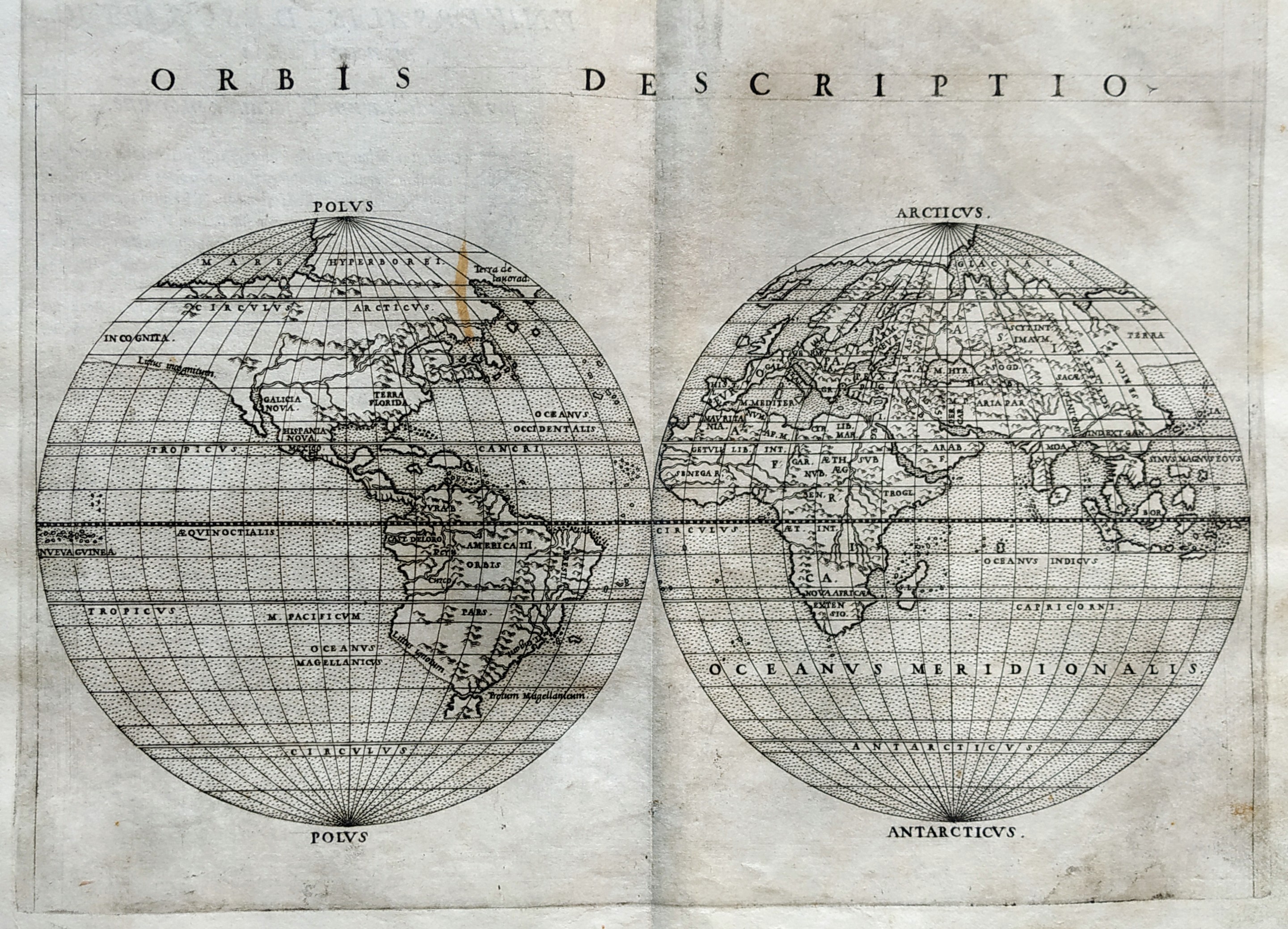
Map title
Orbis descriptio
Author
Ruscelli
Location shown in map
World
Edition date
1561
Edition place
Venice
Editor
Vincenzo Valgrisi
Atlas
La Geographia di Claudio Tolomeo
Price
700 Euro
State
[mint/EXCELLENT/very good/good/fair/mediocre/poor]
Color
Black/white
Verso
Size
Plate: cm (26 x 19) inches (10.24 x 7.48) Paper: cm (27.9 x 20.3) inches (10.98 x 7.99)
Technique
Copper engraving
Note
No particular notes for this maps.
Reference
--
Wiki
Here for more info
In stock
Sold
Info
info@thetreasuremaps.com
Code
#0766
×
![]()
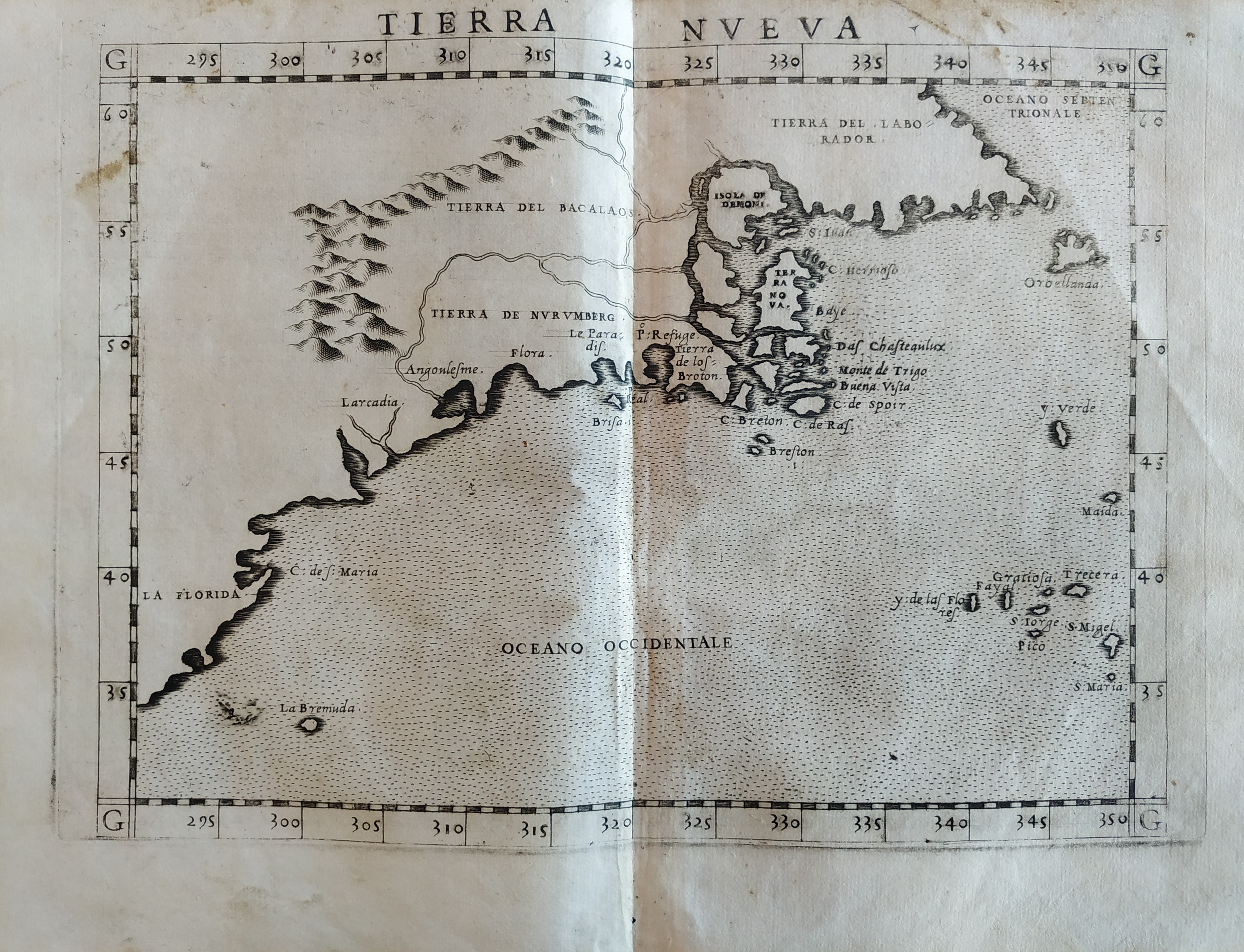
Map title
Tierra Nueva
Author
Ruscelli
Location shown in map
East coast
Edition date
1561
Edition place
Venice
Editor
Vincenzo Valgrisi
Atlas
La Geographia di Claudio Tolomeo
Price
900 Euro
State
[mint/EXCELLENT/very good/good/fair/mediocre/poor]
Color
Black/white
Verso
Italian text pag.32
Size
Plate: cm (26 x 19) inches (10.24 x 7.48) Paper: cm (27.9 x 20.3) inches (10.98 x 7.99)
Technique
Copper engraving
Note
No particular notes for this maps.
Reference
--
Wiki
Here for more info
In stock
Available
Info
info@thetreasuremaps.com
Code
#0767
×
![]()
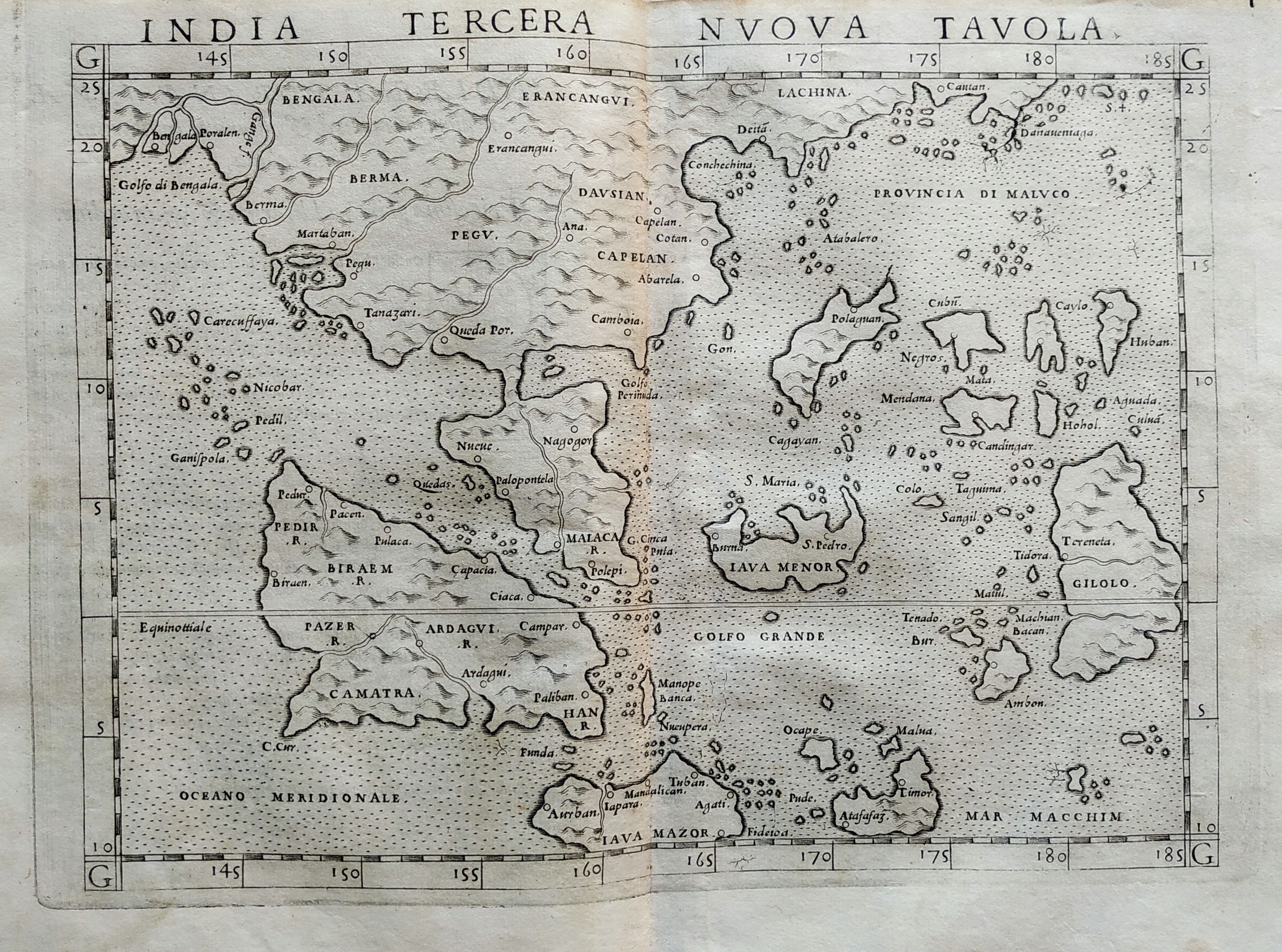
Map title
India tercera nova tabula
Author
Ruscelli
Location shown in map
Southeast Asia
Edition date
1561
Edition place
Venice
Editor
Vincenzo Valgrisi
Atlas
La Geographia di Claudio Tolomeo
Price
500 Euro
State
[mint/EXCELLENT/very good/good/fair/mediocre/poor]
Color
Black/white
Verso
Size
Plate: cm (26 x 19) inches (10.24 x 7.48) Paper: cm (27.9 x 20.3) inches (10.98 x 7.99)
Technique
Copper engraving
Note
No particular notes for this maps.
Reference
--
Wiki
Here for more info
In stock
Available
Info
info@thetreasuremaps.com
Code
#0768
×
![]()
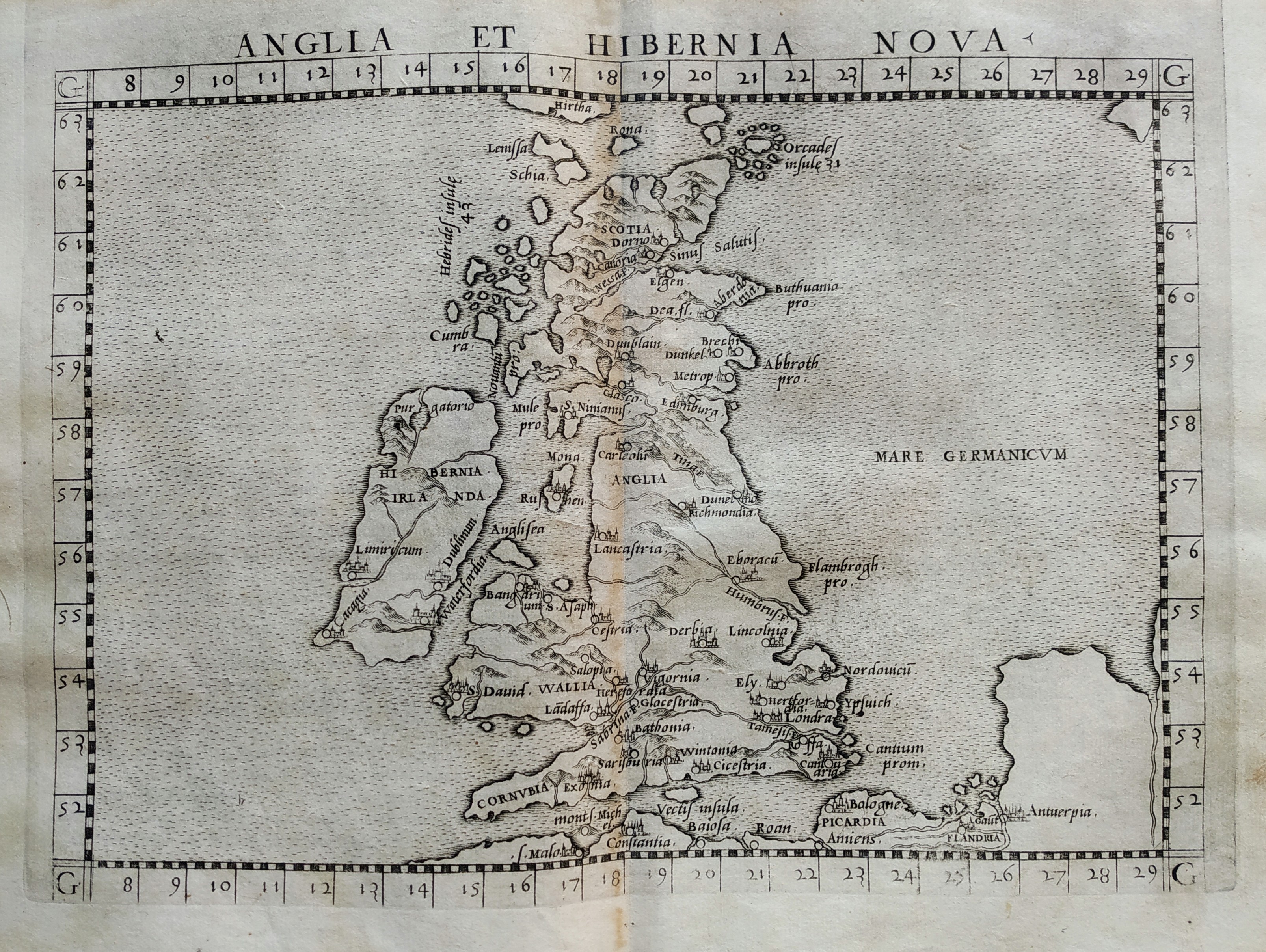
Map title
Anglia et Hibernia nova
Author
Ruscelli
Location shown in map
British Isles
Edition date
1561
Edition place
Venice
Editor
Vincenzo Valgrisi
Atlas
La Geographia di Claudio Tolomeo
Price
300 Euro
State
[mint/EXCELLENT/very good/good/fair/mediocre/poor]
Color
Black/white
Verso
Size
Plate: cm (26 x 19) inches (10.24 x 7.48) Paper: cm (27.9 x 20.3) inches (10.98 x 7.99)
Technique
Copper engraving
Note
No particular notes for this maps.
Reference
--
Wiki
Here for more info
In stock
Available
Info
info@thetreasuremaps.com
Code
#0769
×
![]()
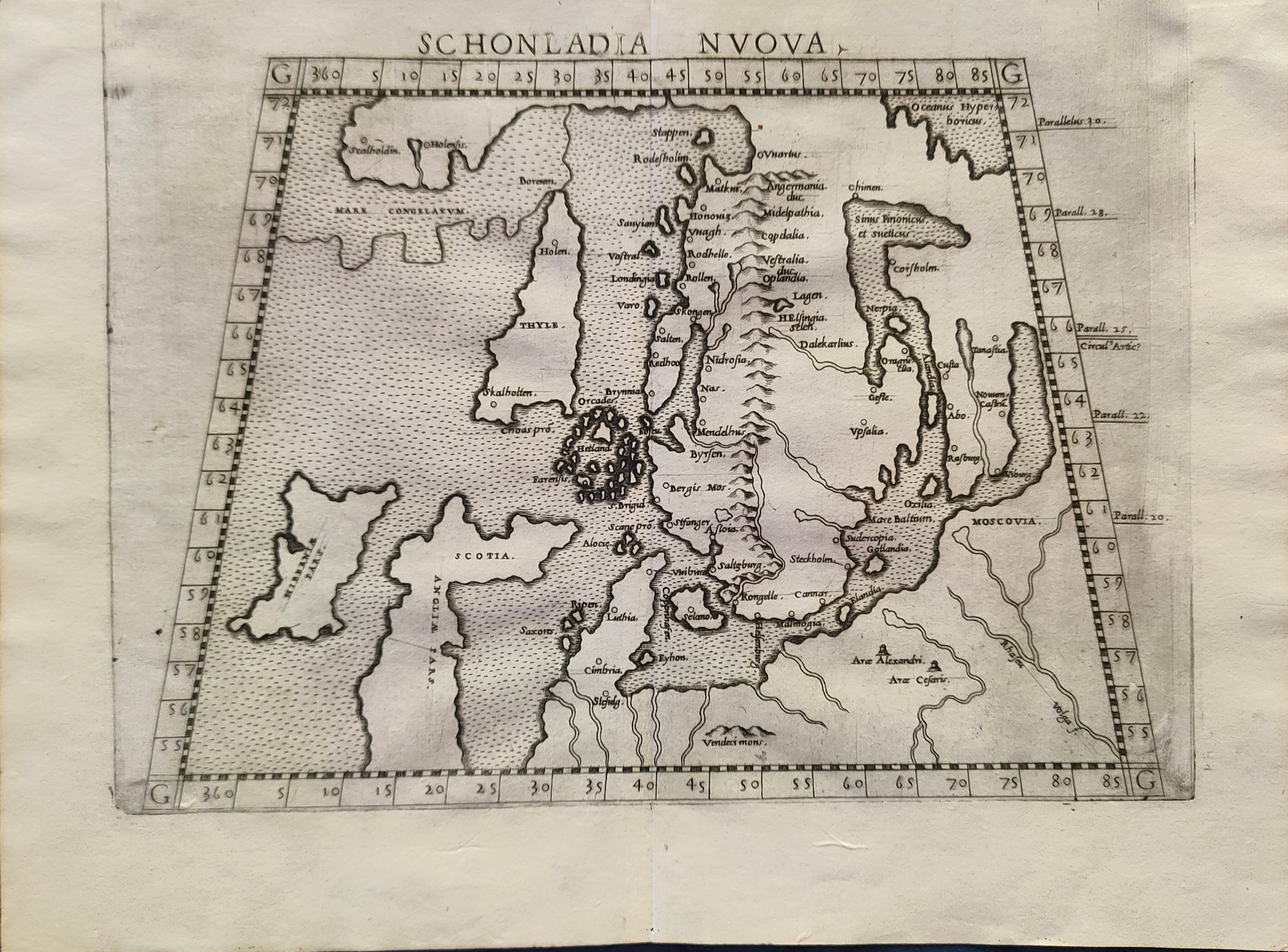
Map title
Schonlandia Nuova
Author
Ruscelli
Location shown in map
Scandinavia
Edition date
1562
Edition place
Venice
Editor
Vincenzo Valgrisi
Atlas
La Geographia di Claudio Tolomeo
Price
600 Euro
State
[mint/EXCELLENT/very good/good/fair/mediocre/poor]
Color
Black/white
Verso
Latin text pag.25
Size
Plate: cm (26 x 20) inches (10.24 x 7.87) Paper: cm (31 x 24) inches (12.2 x 9.45)
Technique
Copper engraving
Note
Reference
--
Wiki
Here for more info
In stock
Available
Info
info@thetreasuremaps.com
Code
#1204
×
![]()
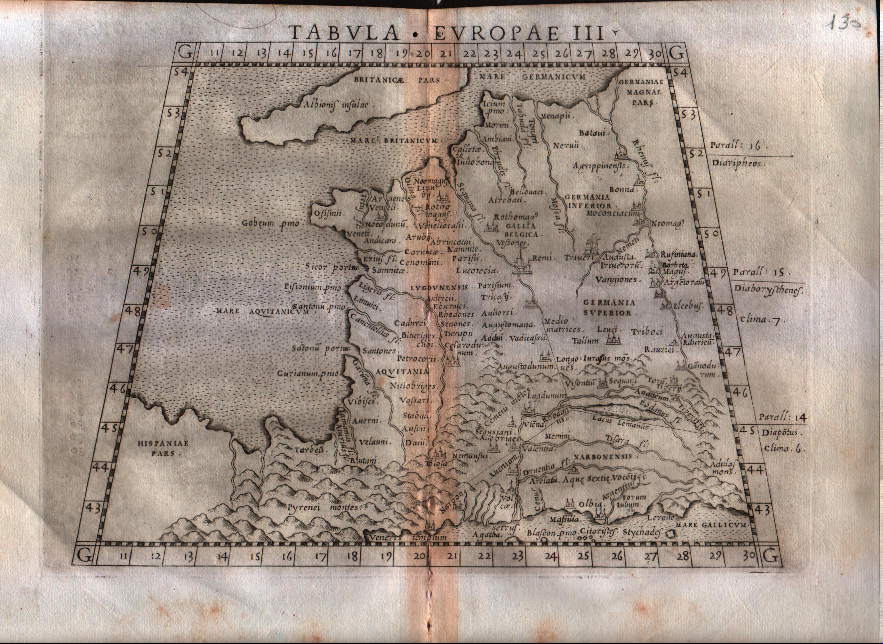
Map title
Tabula Europae III
Author
Ruscelli
Location shown in map
France
Edition date
1564
Edition place
Venice
Editor
Girolamo Ziletti
Atlas
La Geographia di Claudio Tolomeo
Price
150 Euro
State
[mint/excellent/very good/GOOD/fair/mediocre/poor]
Color
Black/white
Verso
Latin text pag.8
Size
Plate: cm (26 x 20.3) inches (10.24 x 7.99) Paper: cm (30.5 x 22.9) inches (12.01 x 9.02)
Technique
Copper engraving
Note
Based on Gastaldi map.
Reference
--
Wiki
Here for more info
In stock
Available
Info
info@thetreasuremaps.com
Code
#0120
×
![]()
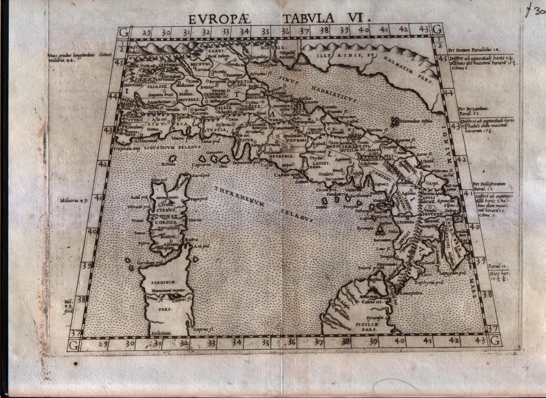
Map title
Europae tabula VI
Author
Ruscelli
Location shown in map
Italy
Edition date
1564
Edition place
Venice
Editor
Giordano Ziletti
Atlas
La Geographia di Claudio Tolomeo
Price
250 Euro
State
[mint/EXCELLENT/very good/good/fair/mediocre/poor]
Color
Black/white
Verso
Latin text pag.15
Size
Plate: cm (26 x 20.3) inches (10.24 x 7.99) Paper: cm (30.5 x 22.9) inches (12.01 x 9.02)
Technique
Copper engraving
Note
Reference
R.Borri L'Italia nelle antiche carte pag.33
Wiki
Here for more info
In stock
Available
Info
info@thetreasuremaps.com
Code
#0121
×
![]()
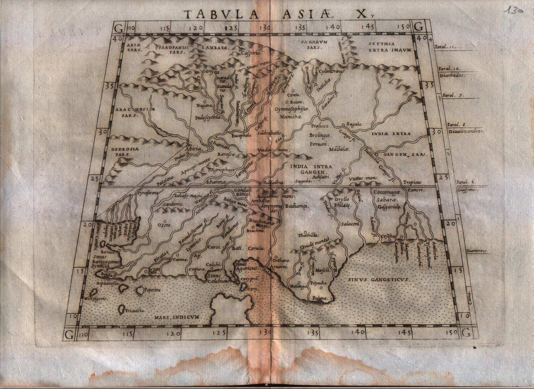
Map title
Tabula Asiae X
Author
Ruscelli
Location shown in map
India
Edition date
1564
Edition place
Venice
Editor
Girolamo Ziletti
Atlas
La Geographia di Claudio Tolomeo
Price
200 Euro
State
[mint/excellent/VERY GOOD/good/fair/mediocre/poor]
Color
Black/white
Verso
Latin text pag.54
Size
Plate: cm (25.4 x 19) inches (10 x 7.48) Paper: cm (30.5 x 22.9) inches (12.01 x 9.02)
Technique
Copper engraving
Note
India shown.
Reference
--
Wiki
Here for more info
In stock
Available
Info
info@thetreasuremaps.com
Code
#0181
×
![]()
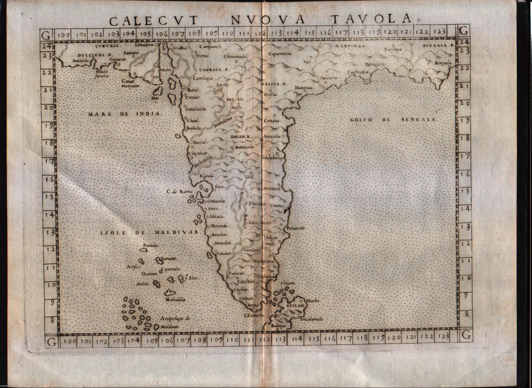
Map title
Calecut Nuova Tavola
Author
Ruscelli
Location shown in map
India
Edition date
1564
Edition place
Venice
Editor
Girolamo Ziletti
Atlas
La Geographia di Claudio Tolomeo
Price
500 Euro
State
[MINT/excellent/very good/good/fair/mediocre/poor]
Color
Black/white
Verso
Latin text pag.55
Size
Plate: cm (25.4 x 19) inches (10 x 7.48) Paper: cm (30.5 x 22.9) inches (12.01 x 9.02)
Technique
Copper engraving
Note
India shown.
Reference
--
Wiki
Here for more info
In stock
Available
Info
info@thetreasuremaps.com
Code
#0186
×
![]()
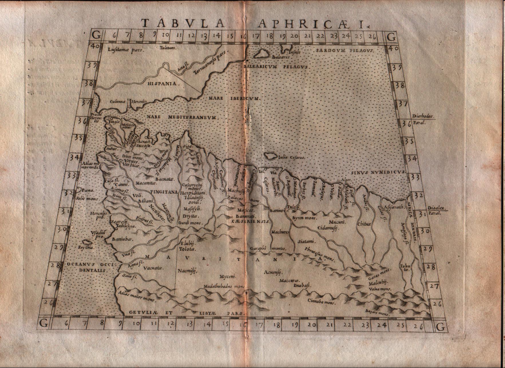
Map title
Tabula Aphricae I
Author
Ruscelli
Location shown in map
North Africa
Edition date
1564
Edition place
Venice
Editor
Girolamo Ziletti
Atlas
La Geographia di Claudio Tolomeo
Price
125 Euro
State
[mint/excellent/very good/GOOD/fair/mediocre/poor]
Color
Black/white
Verso
Latin text pag.31
Size
Plate: cm (25.4 x 20.3) inches (10 x 7.99) Paper: cm (30.5 x 22.9) inches (12.01 x 9.02)
Technique
Copper engraving
Note
No particular notes for this maps
Reference
--
Wiki
Here for more info
In stock
Available
Info
info@thetreasuremaps.com
Code
#0281
×
![]()
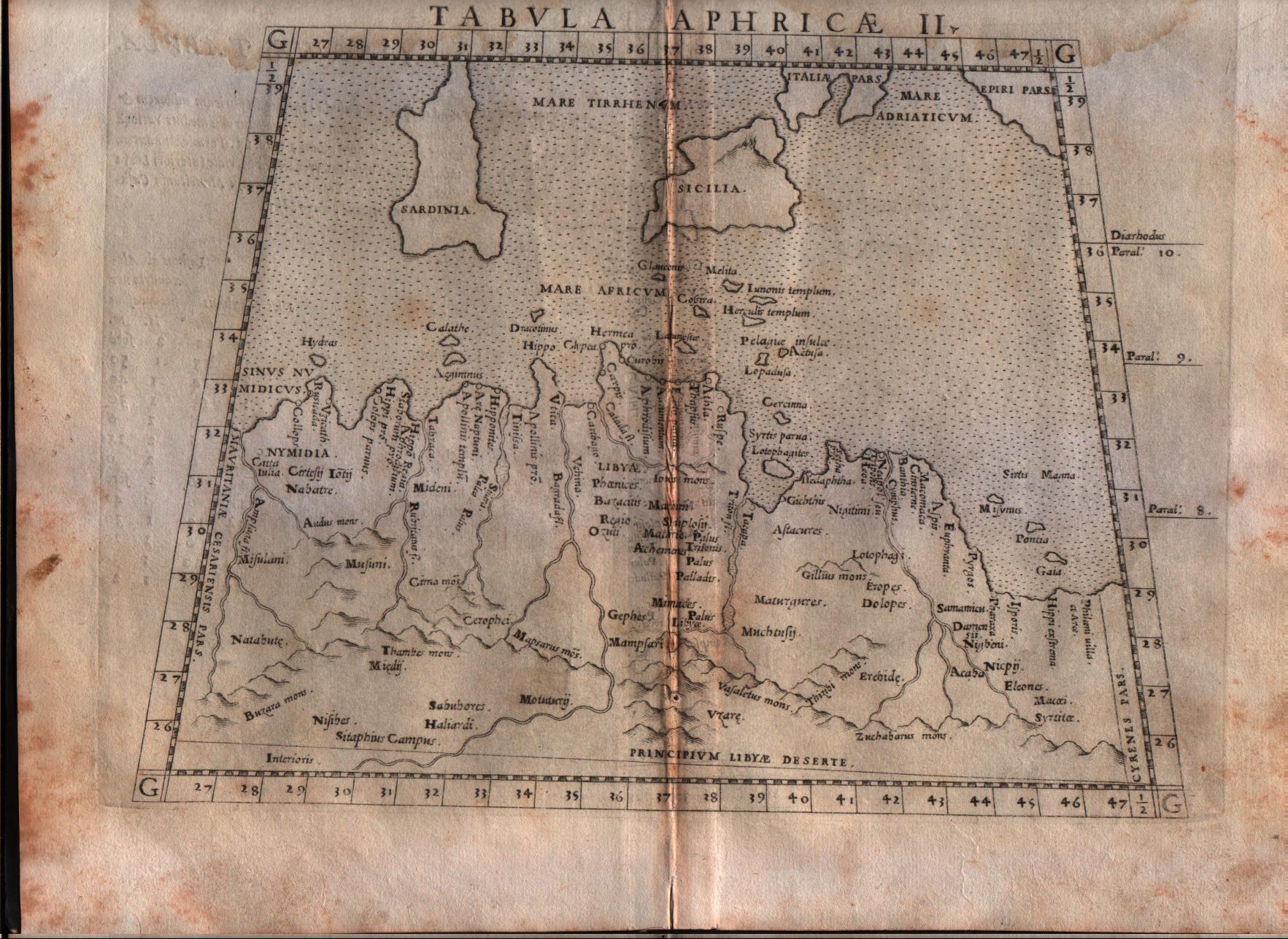
Map title
Tabula Aphricae II
Author
Ruscelli
Location shown in map
North Africa
Edition date
1564
Edition place
Venice
Editor
Girolamo Ziletti
Atlas
La Geographia di Claudio Tolomeo
Price
125 Euro
State
[mint/excellent/very good/GOOD/fair/mediocre/poor]
Color
Black/white
Verso
Latin text pag.33
Size
Plate: cm (25.4 x 20.3) inches (10 x 7.99) Paper: cm (30.5 x 22.9) inches (12.01 x 9.02)
Technique
Copper engraving
Note
No particular notes for this maps
Reference
--
Wiki
Here for more info
In stock
Available
Info
info@thetreasuremaps.com
Code
#0282
×
![]()
Map title
Isola Spagnola Nova
Author
Ruscelli
Location shown in map
Haiti
Edition date
1564
Edition place
Venice
Editor
Girolamo Ziletti
Atlas
La Geographia di Claudio Tolomeo
Price
300 Euro
State
[mint/excellent/VERY GOOD/good/fair/mediocre/poor]
Color
Black/white
Verso
Latin text pag.64
Size
Plate: cm (25.4 x 19) inches (10 x 7.48) Paper: cm (30.5 x 22.9) inches (12.01 x 9.02)
Technique
Copper engraving
Note
--
Reference
--
Wiki
Here for more info
In stock
Available
Info
info@thetreasuremaps.com
Code
#0340
×
![]()
Map title
Genova
Author
Forlani
Location shown in map
Genoa
Edition date
1567
Edition place
Venice
Editor
Zaltieri
Atlas
De’ disegni delle più illustri città et fortezze del mondo
Price
1200 Euro
State
[mint/EXCELLENT/very good/good/fair/mediocre/poor]
Color
Black/white
Verso
Blank
Size
Plate: cm (29 x 19) inches (11.42 x 7.48) Paper: cm (37 x 25) inches (14.57 x 9.84)
Technique
Copper engraving
Note
Reference
Wiki
Here for more info
In stock
Available
Info
info@thetreasuremaps.com
Code
#1291
×
![]()
Map title
Tavola dell'isole nuove, le quali son nominate occidentali, & indiane per diversi rispetti
Author
Munster
Location shown in map
North and south America.
Edition date
1571
Edition place
Vernice
Editor
Henrich Petri
Atlas
Cosmographia Universalis
Price
Please ask: info@thetreasuremaps.com
State
[mint/excellent/VERY GOOD/good/fair/mediocre/poor] need to be restored
Color
Black/white
Verso
Italian text
Size
Plate: cm (33.7 x 26) inches (13.27 x 10.24) Paper: cm (41.9 x 31.8) inches (16.5 x 12.52)
Technique
Woodcut
Note
Superb woodcut map of North/South America, has Magellan's ship in the Pacific along with large Zipangi (Japan). Cathay just makes page upper left. This is the first separate printed map of the Western Hemisphere.
Reference
--
Wiki
Here for more info
In stock
Sold
Info
info@thetreasuremaps.com
Code
#0401
×
![]()
Map title
Schlavonie Croatiae Carniae ...
Author
Ortelius
Location shown in map
Croatia
Edition date
1571
Edition place
Antwerp
Editor
--
Atlas
Theatrum Orbis Terrarum
Price
400 Euro
State
[mint/EXCELLENT/very good/good/fair/mediocre/poor]
Color
Old colors
Verso
Latin text pag.41
Size
Plate: cm (45 x 33) inches (17.72 x 12.99) Paper: cm (50 x 38) inches (19.69 x 14.96)
Technique
Copper engraving
Note
Reference
Van Den Broecke 194
Wiki
Here for more info
In stock
Available
Info
info@thetreasuremaps.com
Code
#1074
×
![]()
Map title
Corsica
Author
Camocio
Location shown in map
Corse
Edition date
Circa 1571
Edition place
Venice
Editor
Atlas
Isole famose porti, fortezze, e terre maritime
Price
1100 Euro
State
[mint/EXCELLENT/very good/good/fair/mediocre/poor]
Color
Black/white
Verso
Size
Plate: cm (21 x 16) inches (8.27 x 6.3) Paper: cm (28 x 21) inches (11.02 x 8.27)
Technique
Copper engraving
Note
Reference
Wiki
Here for more info
In stock
Available
Info
info@thetreasuremaps.com
Code
#1102
×
![]()
Map title
Dulcigno
Author
Camocio
Location shown in map
Dulcigno
Edition date
Circa 1571
Edition place
Venice
Editor
Atlas
Isole famose porti, fortezze, e terre maritime
Price
500 Euro
State
[mint/EXCELLENT/very good/good/fair/mediocre/poor]
Color
Black/white
Verso
Size
Plate: cm (21 x 16) inches (8.27 x 6.3) Paper: cm (28 x 21) inches (11.02 x 8.27)
Technique
Copper engraving
Note
Reference
Wiki
Here for more info
In stock
Available
Info
info@thetreasuremaps.com
Code
#1104
Dulcigno
Author
Camocio
Location shown in map
Dulcigno
Edition date
Circa 1571
Edition place
Venice
Editor
Atlas
Isole famose porti, fortezze, e terre maritime
Price
500 Euro
State
[mint/EXCELLENT/very good/good/fair/mediocre/poor]
Color
Black/white
Verso
Size
Plate: cm (21 x 16) inches (8.27 x 6.3) Paper: cm (28 x 21) inches (11.02 x 8.27)
Technique
Copper engraving
Note
Reference
Wiki
Here for more info
In stock
Available
Info
info@thetreasuremaps.com
Code
#1104
×
![]()
Map title
Sardegna
Author
Camocio
Location shown in map
Sardinia
Edition date
Circa 1571
Edition place
Venice
Editor
Atlas
Isole famose porti, fortezze, e terre maritime
Price
1400 Euro
State
[mint/EXCELLENT/very good/good/fair/mediocre/poor]
Color
Black/white
Verso
Size
Plate: cm (21 x 16) inches (8.27 x 6.3) Paper: cm (28 x 21) inches (11.02 x 8.27)
Technique
Copper engraving
Note
Reference
Wiki
Here for more info
In stock
Available
Info
info@thetreasuremaps.com
Code
#1103
×
![]()
Map title
Forte De Santa Maria
Author
Camocio
Location shown in map
Forte De Santa Maura
Edition date
Circa 1571
Edition place
Venice
Editor
Atlas
Isole famose porti, fortezze, e terre maritime
Price
500 Euro
State
[mint/EXCELLENT/very good/good/fair/mediocre/poor]
Color
Black/white
Verso
Size
Plate: cm (17 x 23) inches (6.69 x 9.06) Paper: cm (21 x 28) inches (8.27 x 11.02)
Technique
Copper engraving
Note
Reference
Wiki
Here for more info
In stock
Available
Info
info@thetreasuremaps.com
Code
#1105
×
![]()
Map title
Descrittione del Mappamondo
Author
Porcacchi
Location shown in map
World
Edition date
1572
Edition place
Venice
Editor
--
Atlas
L'Isole piu famose del mondo -- S. Galignani and G. Porro
Price
600 Euro
State
[mint/EXCELLENT/very good/good/fair/mediocre/poor]
Color
Black/white
Verso
Italian text pag.109
Size
Plate: cm (15.2 x 11.4) inches (5.98 x 4.49) Paper: cm (20.3 x 29.2) inches (7.99 x 11.5)
Technique
Copper engraving
Note
First edition
Reference
--
Wiki
Here for more info
In stock
Available
Info
info@thetreasuremaps.com
Code
#0331
×
![]()
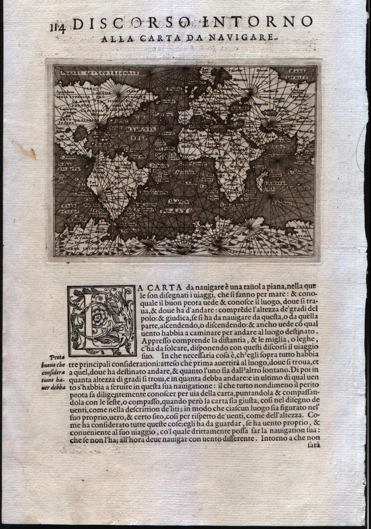
Map title
Discorso intorno alla carta da navigare
Author
Porcacchi
Location shown in map
World
Edition date
1572
Edition place
Venice
Editor
--
Atlas
L'Isole piu famose del mondo -- S. Galignani and G. Porro
Price
600 Euro
State
[mint/EXCELLENT/very good/good/fair/mediocre/poor]
Color
Black/white
Verso
Italian text pag.114
Size
Plate: cm (15.2 x 11.4) inches (5.98 x 4.49) Paper: cm (20.3 x 29.2) inches (7.99 x 11.5)
Technique
Copper engraving
Note
First edition
Reference
--
Wiki
Here for more info
In stock
Available
Info
info@thetreasuremaps.com
Code
#0332
×
![]()
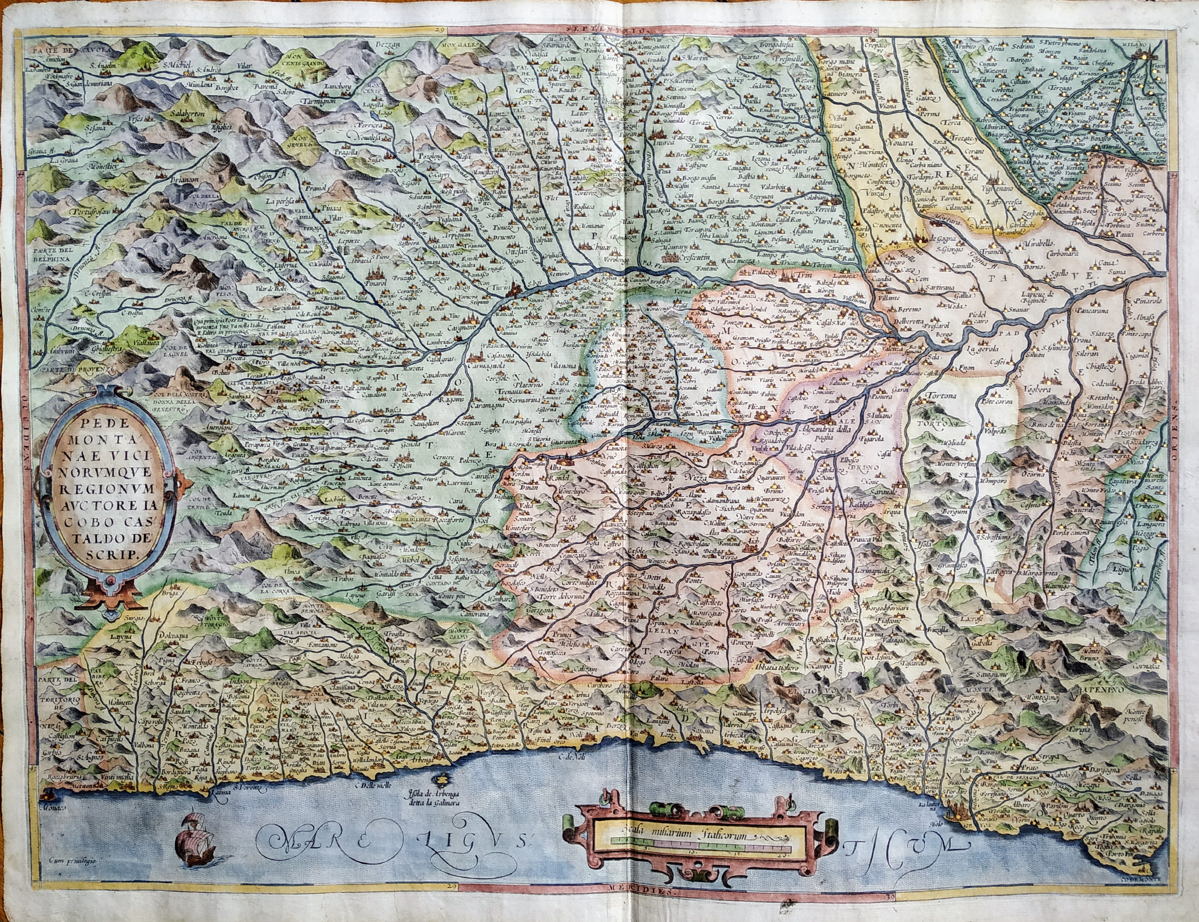
Map title
Pedmontanae Vicinorumque Regionum Auctore Iacobo Castaldo Descrip.
Author
Ortelius
Location shown in map
Piedmont & Liguria, North west Italy
Edition date
1572
Edition place
Antwerp
Editor
--
Atlas
Theatrum Orbis Terrarum
Price
600 Euro
State
[mint/EXCELLENT/very good/good/fair/mediocre/poor]
Color
Modern color
Verso
Franch text pag.34
Size
Plate: cm (49 x 36) inches (19.29 x 14.17) Paper: cm (56 x 44) inches (22.05 x 17.32)
Technique
Copper engraving
Note
No particular notes for this maps.
Reference
Van Den Broecke 128
Wiki
Here for more info
In stock
Available
Info
info@thetreasuremaps.com
Code
#0804
×
![]()
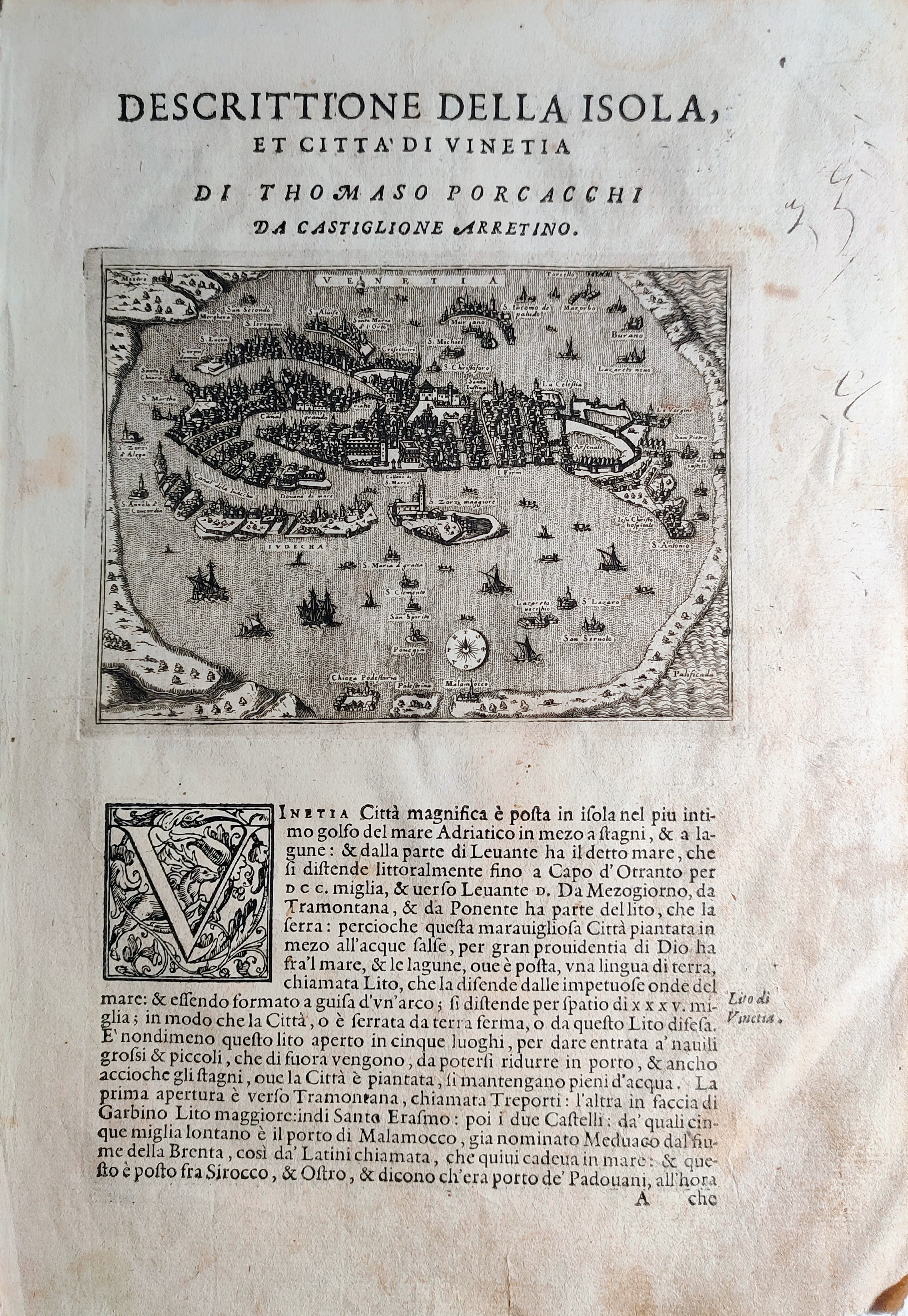
Map title
Descrittione dell'isola et citta di Vinetia
Author
Porcacchi
Location shown in map
Venice
Edition date
1572
Edition place
Venice
Editor
--
Atlas
L'Isole piu famose del mondo -- S. Galignani and G. Porro
Price
250 Euro
State
[mint/EXCELLENT/very good/good/fair/mediocre/poor]
Color
Black/white
Verso
Italian text pag.114
Size
Plate: cm (15.2 x 11.4) inches (5.98 x 4.49) Paper: cm (20.3 x 29.2) inches (7.99 x 11.5)
Technique
Copper engraving
Note
First edition
Reference
--
Wiki
Here for more info
In stock
Available
Info
info@thetreasuremaps.com
Code
#0842
×
![]()
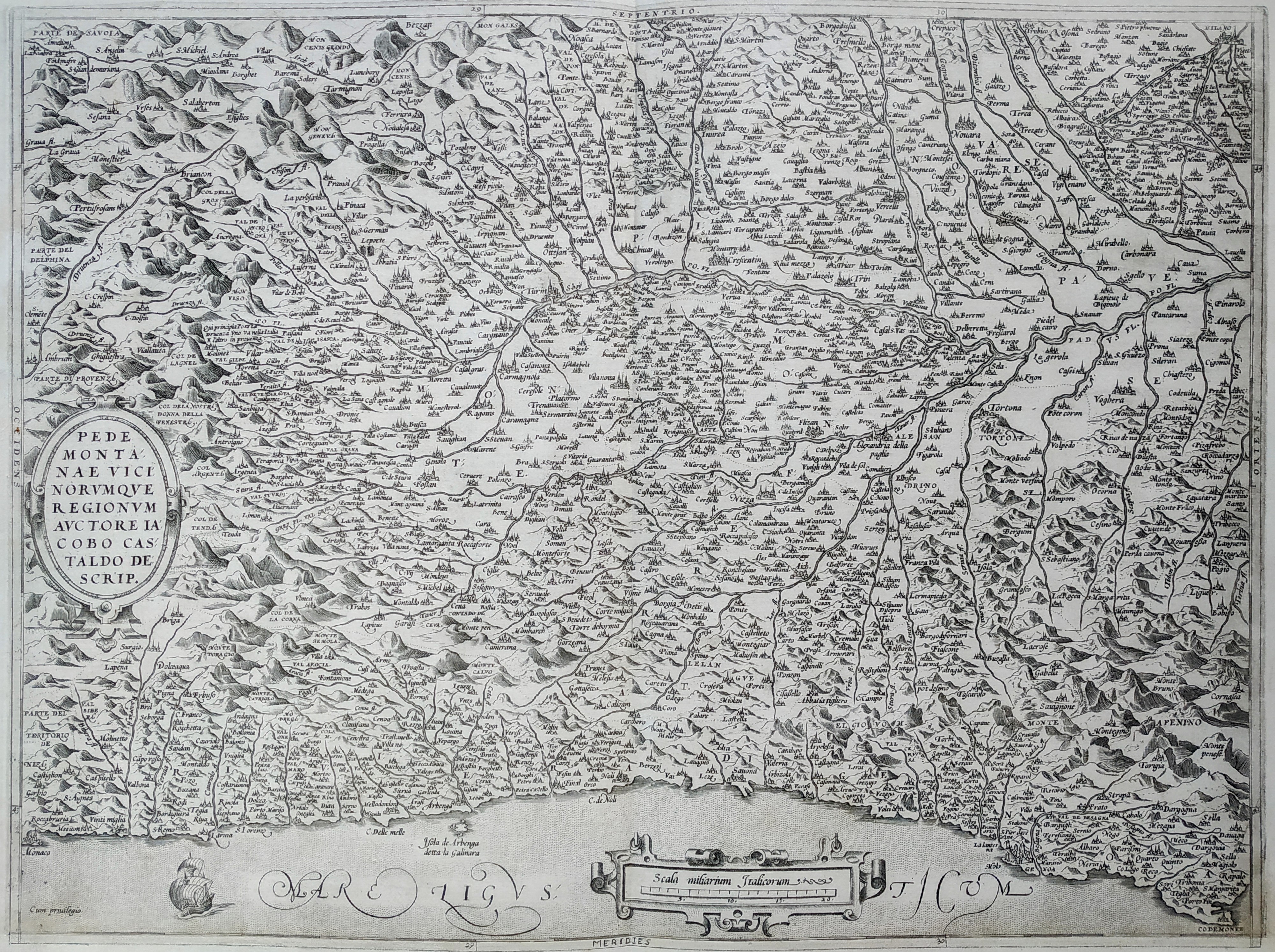
Map title
Pedmontanae Vicinorumque Regionum Auctore Iacobo Castaldo Descrip.
Author
Ortelius
Location shown in map
Piedmont & Liguria, North west Italy
Edition date
1573
Edition place
Antwerp
Editor
--
Atlas
Theatrum Orbis Terrarum
Price
400 Euro
State
[mint/EXCELLENT/very good/good/fair/mediocre/poor]
Color
Black/white
Verso
Latin text pag 34
Size
Plate: cm (47 x 35.6) inches (18.5 x 14.02) Paper: cm (53.3 x 40.6) inches (20.98 x 15.98)
Technique
Copper engraving
Note
Lower margin replaced
Reference
Van Den Broecke 128
Wiki
Here for more info
In stock
Available
Info
info@thetreasuremaps.com
Code
#0841
×
![]()
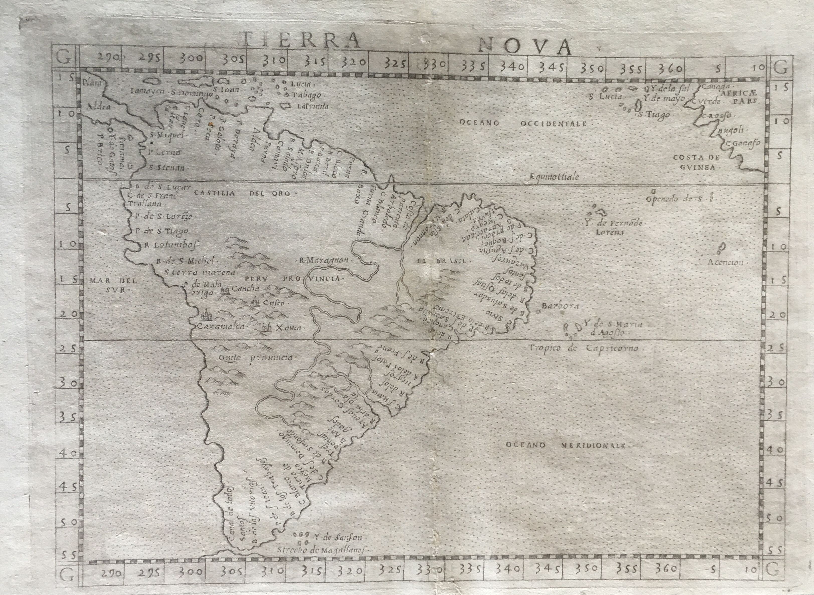
Map title
Tierra Nova
Author
Ruscelli
Location shown in map
South America
Edition date
1574
Edition place
Venice
Editor
Giordano Ziletti
Atlas
La Geographia di Claudio Tolomeo
Price
550 Euro
State
[mint/excellent/very good/GOOD/fair/mediocre/poor] Three small holes in the center.
Color
Black/white
Verso
Italian text pag.33
Size
Plate: cm (24.1 x 19) inches (9.49 x 7.48) Paper: cm (30.5 x 21.6) inches (12.01 x 8.5)
Technique
Copper engraving
Note
A fine early copperplate engraving and one of the first printed maps of the entire continent of South America. Many places named along the coastlines. Little is know of the interior.
Reference
Genoa pubblic library "Civica Berio"
Wiki
Here for more info
In stock
Available
Info
info@thetreasuremaps.com
Code
#0016
×
![]()
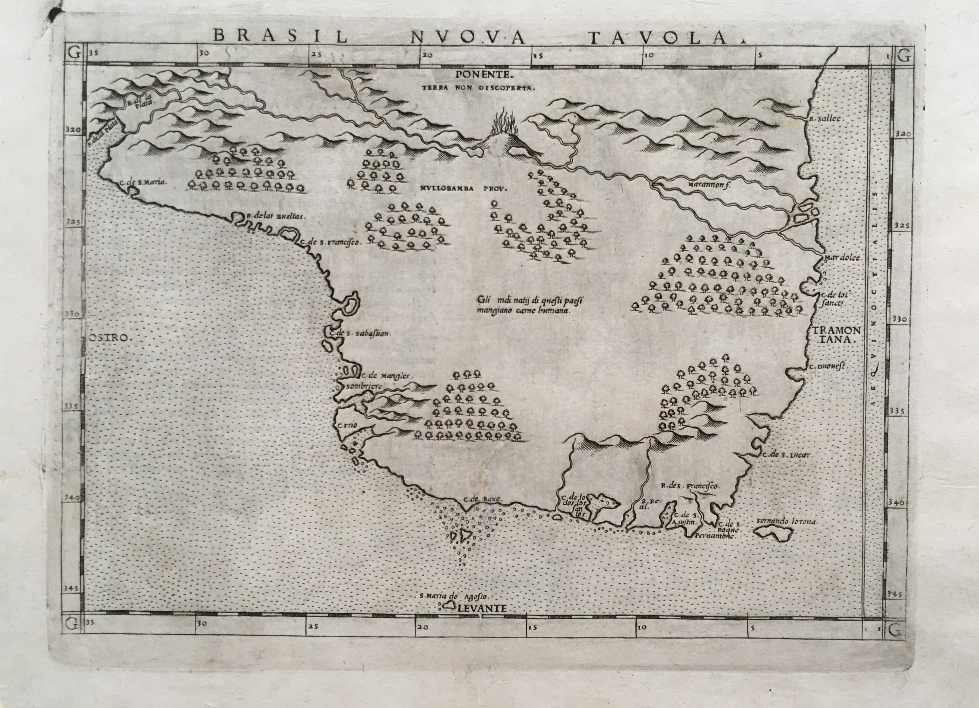
Map title
Brasil Nuova Tavola
Author
Ruscelli
Location shown in map
Bresil
Edition date
1574
Edition place
Venice
Editor
Giordano Ziletti
Atlas
La Geographia di Claudio Tolomeo
Price
400 Euro
State
[mint/excellent/very good/GOOD/fair/mediocre/poor]
Color
Black/white
Verso
Italian text pag.34
Size
Plate: cm (26 x 19) inches (10.24 x 7.48) Paper: cm (30.5 x 22.9) inches (12.01 x 9.02)
Technique
Copper engraving
Note
No particular notes for this maps
Reference
Genoa pubblic library "Civica Berio"
Wiki
Here for more info
In stock
Available
Info
info@thetreasuremaps.com
Code
#0017
×
![]()
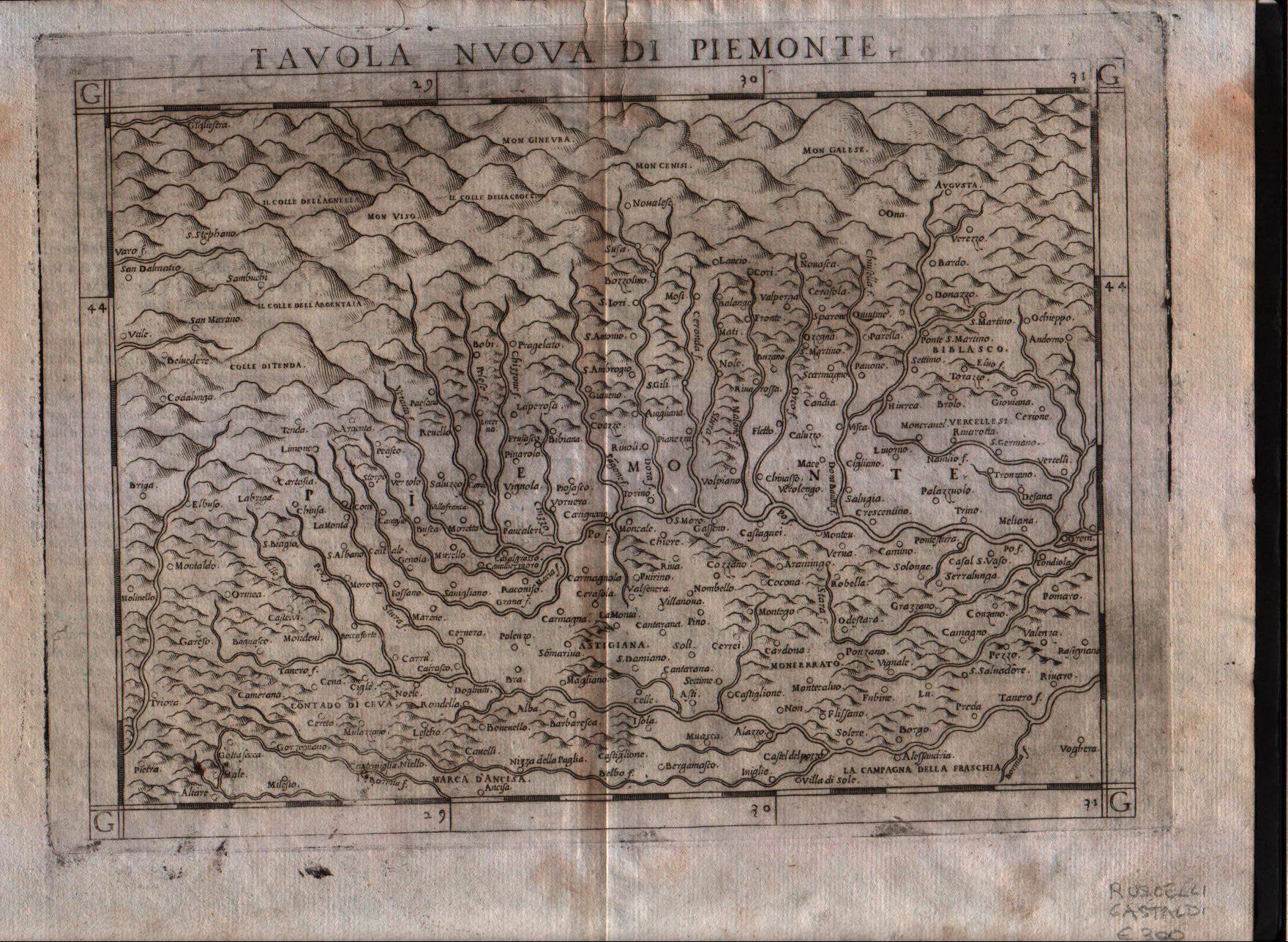
Map title
Tavola nuova di Piemonte
Author
Ruscelli
Location shown in map
Piedmont
Edition date
1574
Edition place
Venice
Editor
Giordano Ziletti
Atlas
La Geographia di Claudio Tolomeo
Price
300 Euro
State
[mint/excellent/VERY GOOD/good/fair/mediocre/poor]
Color
Black/white
Verso
Italian text
Size
Plate: cm (26 x 19) inches (10.24 x 7.48) Paper: cm (30.5 x 22.9) inches (12.01 x 9.02)
Technique
Copper engraving
Note
Based on Gastaldi map.
Reference
Genoa pubblic library "Civica Berio"
Wiki
Here for more info
In stock
Available
Info
info@thetreasuremaps.com
Code
#0117
×
![]()
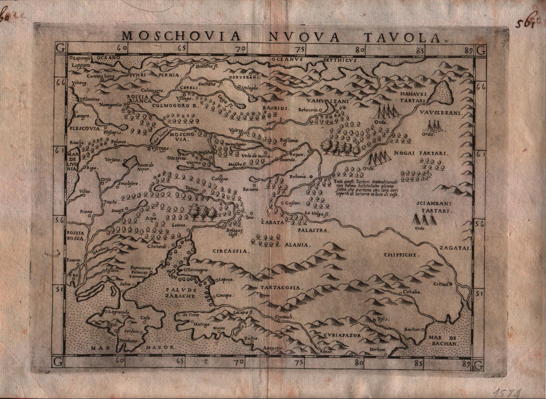
Map title
Moschovia nuova tavola
Author
Ruscelli
Location shown in map
Russia
Edition date
1574
Edition place
Venice
Editor
Giordano Ziletti
Atlas
La Geographia di Claudio Tolomeo
Price
300 Euro
State
[mint/EXCELLENT/very good/good/fair/mediocre/poor]
Color
Black/white
Verso
Italian text pag.25
Size
Plate: cm (26 x 19) inches (10.24 x 7.48) Paper: cm (30.5 x 22.9) inches (12.01 x 9.02)
Technique
Copper engraving
Note
Based on Gastaldi map.
Reference
Genoa pubblic library "Civica Berio"
Wiki
Here for more info
In stock
Available
Info
info@thetreasuremaps.com
Code
#0118
×
![]()
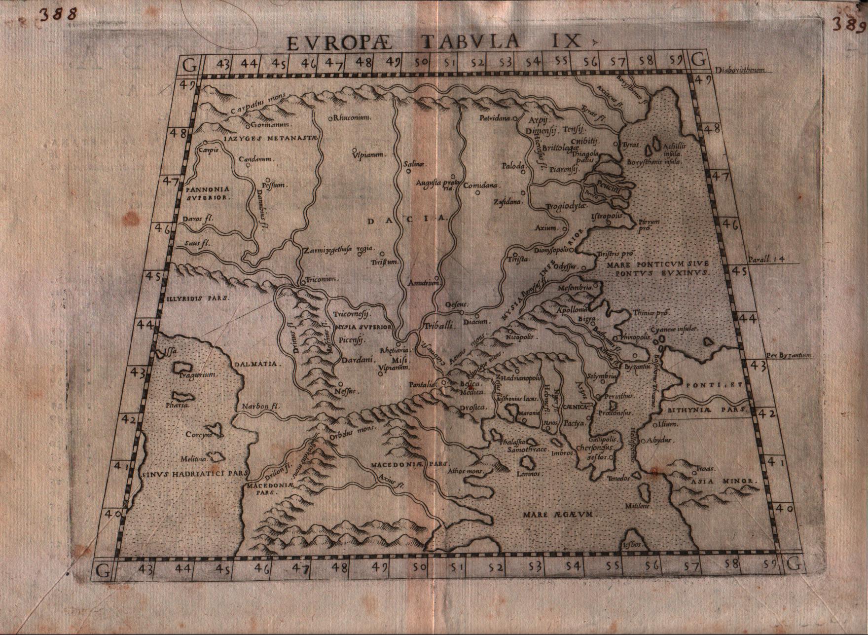
Map title
Europae tabula IX
Author
Ruscelli
Location shown in map
Balkan
Edition date
1574
Edition place
Venice
Editor
Giordano Ziletti
Atlas
La Geographia di Claudio Tolomeo
Price
150 Euro
State
[mint/EXCELLENT/very good/good/fair/mediocre/poor]
Color
Black/white
Verso
Italian text pag.10
Size
Plate: cm (26 x 19) inches (10.24 x 7.48) Paper: cm (30.5 x 22.9) inches (12.01 x 9.02)
Technique
Copper engraving
Note
Based on Gastaldi map.
Reference
Genoa pubblic library "Civica Berio"
Wiki
Here for more info
In stock
Available
Info
info@thetreasuremaps.com
Code
#0119
×
![]()
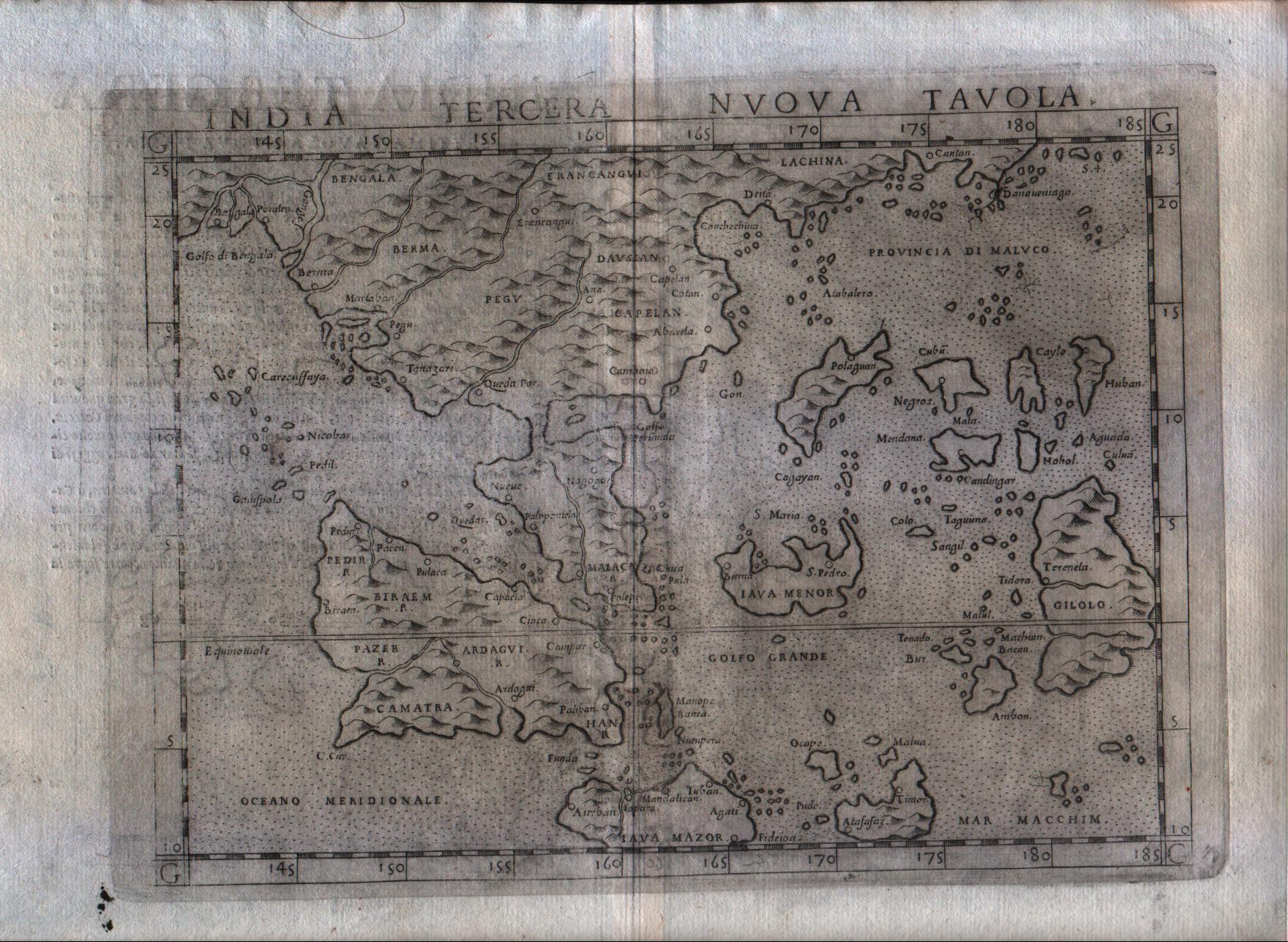
Map title
India tercera nova tabula
Author
Ruscelli
Location shown in map
Southeast Asia
Edition date
1574
Edition place
Venice
Editor
Giordano Ziletti
Atlas
La Geographia di Claudio Tolomeo
Price
500 Euro
State
[mint/excellent/VERY GOOD/good/fair/mediocre/poor]
Color
Black/white
Verso
Italian text pag.30
Size
Plate: cm (25.4 x 19) inches (10 x 7.48) Paper: cm (30.5 x 22.9) inches (12.01 x 9.02)
Technique
Copper engraving
Note
India shown.
Reference
Genoa pubblic library "Civica Berio"
Wiki
Here for more info
In stock
Available
Info
info@thetreasuremaps.com
Code
#0182
×
![]()
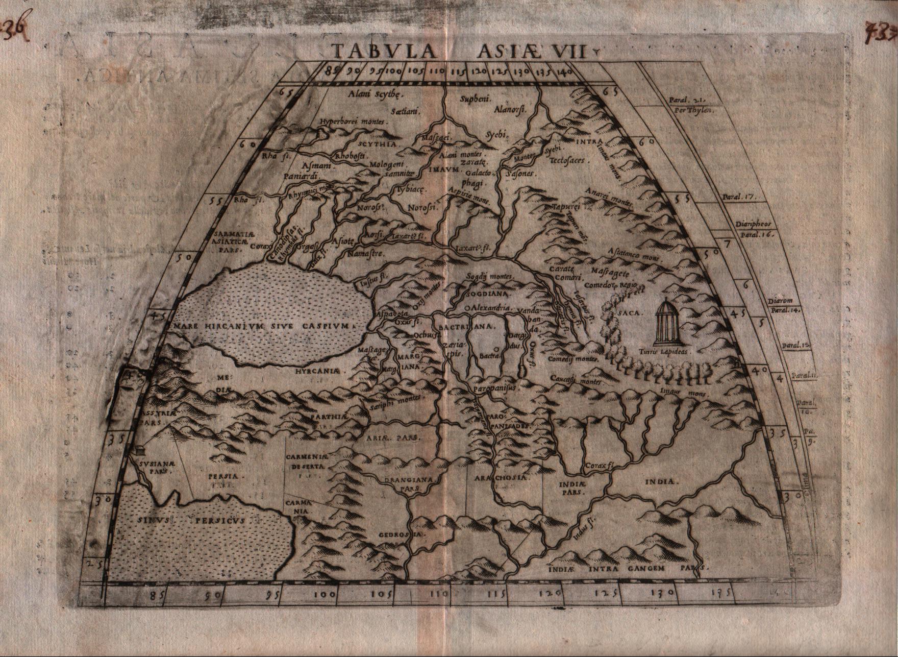
Map title
Tabula Asiae VII
Author
Ruscelli
Location shown in map
Iran
Edition date
1574
Edition place
Venice
Editor
Giordano Ziletti
Atlas
La Geographia di Claudio Tolomeo
Price
125 Euro
State
[mint/EXCELLENT/very good/good/fair/mediocre/poor]
Color
Black/white
Verso
Italian text pag.22
Size
Plate: cm (25.4 x 19) inches (10 x 7.48) Paper: cm (30.5 x 22.9) inches (12.01 x 9.02)
Technique
Copper engraving
Note
--
Reference
Genoa pubblic library "Civica Berio"
Wiki
Here for more info
In stock
Available
Info
info@thetreasuremaps.com
Code
#0183
×
![]()
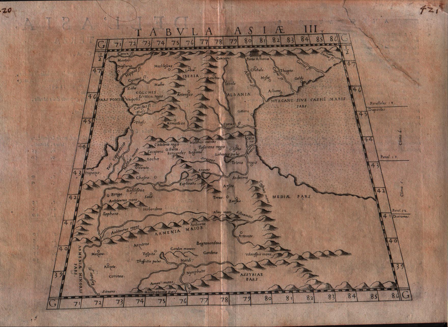
Map title
Tabula Asiae III
Author
Ruscelli
Location shown in map
Armenia
Edition date
1574
Edition place
Venice
Editor
Giordano Ziletti
Atlas
La Geographia di Claudio Tolomeo
Price
125 Euro
State
[mint/EXCELLENT/very good/good/fair/mediocre/poor]
Color
Black/white
Verso
Italian text pag.18
Size
Plate: cm (25.4 x 19) inches (10 x 7.48) Paper: cm (30.5 x 22.9) inches (12.01 x 9.02)
Technique
Copper engraving
Note
--
Reference
Genoa pubblic library "Civica Berio"
Wiki
Here for more info
In stock
Available
Info
info@thetreasuremaps.com
Code
#0184
×
![]()
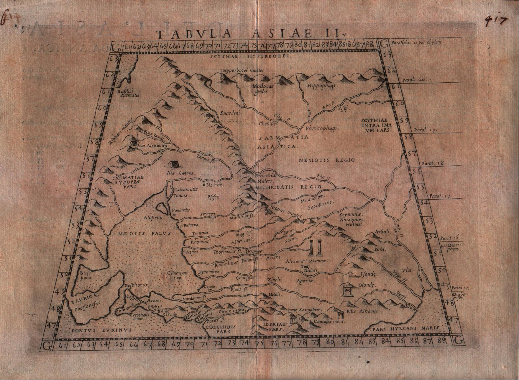
Map title
Tabula Asiae II
Author
Ruscelli
Location shown in map
South Russia
Edition date
1574
Edition place
Venice
Editor
Giordano Ziletti
Atlas
La Geographia di Claudio Tolomeo
Price
125 Euro
State
[mint/EXCELLENT/very good/good/fair/mediocre/poor]
Color
Black/white
Verso
Italian text pag.17
Size
Plate: cm (25.4 x 19) inches (10 x 7.48) Paper: cm (30.5 x 22.9) inches (12.01 x 9.02)
Technique
Copper engraving
Note
--
Reference
Genoa pubblic library "Civica Berio"
Wiki
Here for more info
In stock
Available
Info
info@thetreasuremaps.com
Code
#0185
×
![]()
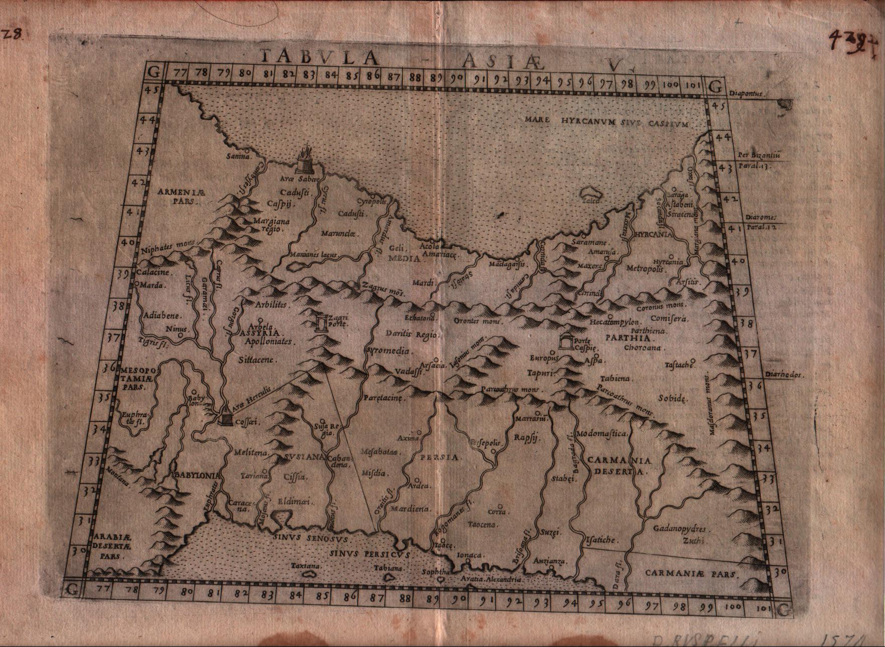
Map title
Tabula Asiae V
Author
Ruscelli
Location shown in map
Persia and west Pakistan
Edition date
1574
Edition place
Venice
Editor
Giordano Ziletti
Atlas
La Geographia di Claudio Tolomeo
Price
150 Euro
State
[mint/excellent/VERY GOOD/good/fair/mediocre/poor]
Color
Black/white
Verso
Italian text pag.20
Size
Plate: cm (25.4 x 19) inches (10 x 7.48) Paper: cm (30.5 x 22.9) inches (12.01 x 9.02)
Technique
Copper engraving
Note
Persia and west Pakistan shown.
Reference
Genoa pubblic library "Civica Berio"
Wiki
Here for more info
In stock
Available
Info
info@thetreasuremaps.com
Code
#0187
×
![]()
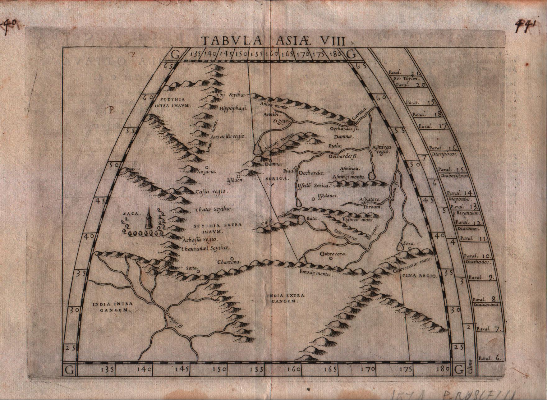
Map title
Tabula Asiae VIII
Author
Ruscelli
Location shown in map
Central Asia
Edition date
1574
Edition place
Venice
Editor
Giordano Ziletti
Atlas
La Geographia di Claudio Tolomeo
Price
125 Euro
State
[mint/EXCELLENT/very good/good/fair/mediocre/poor]
Color
Black/white
Verso
Italian text pag.23
Size
Plate: cm (25.4 x 19) inches (10 x 7.48) Paper: cm (30.5 x 22.9) inches (12.01 x 9.02)
Technique
Copper engraving
Note
--
Reference
Genoa pubblic library "Civica Berio"
Wiki
Here for more info
In stock
Available
Info
info@thetreasuremaps.com
Code
#0188
×
![]()
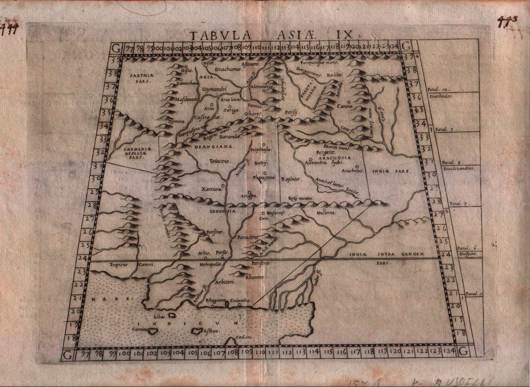
Map title
Tabula Asiae IX
Author
Ruscelli
Location shown in map
Pakistan
Edition date
1574
Edition place
Venice
Editor
Giordano Ziletti
Atlas
La Geographia di Claudio Tolomeo
Price
125 Euro
State
[mint/EXCELLENT/very good/good/fair/mediocre/poor]
Color
Black/white
Verso
Italian text pag.24
Size
Plate: cm (25.4 x 19) inches (10 x 7.48) Paper: cm (30.5 x 22.9) inches (12.01 x 9.02)
Technique
Copper engraving
Note
Pakistan shown.
Reference
Genoa pubblic library "Civica Berio"
Wiki
Here for more info
In stock
Available
Info
info@thetreasuremaps.com
Code
#0189
×
![]()
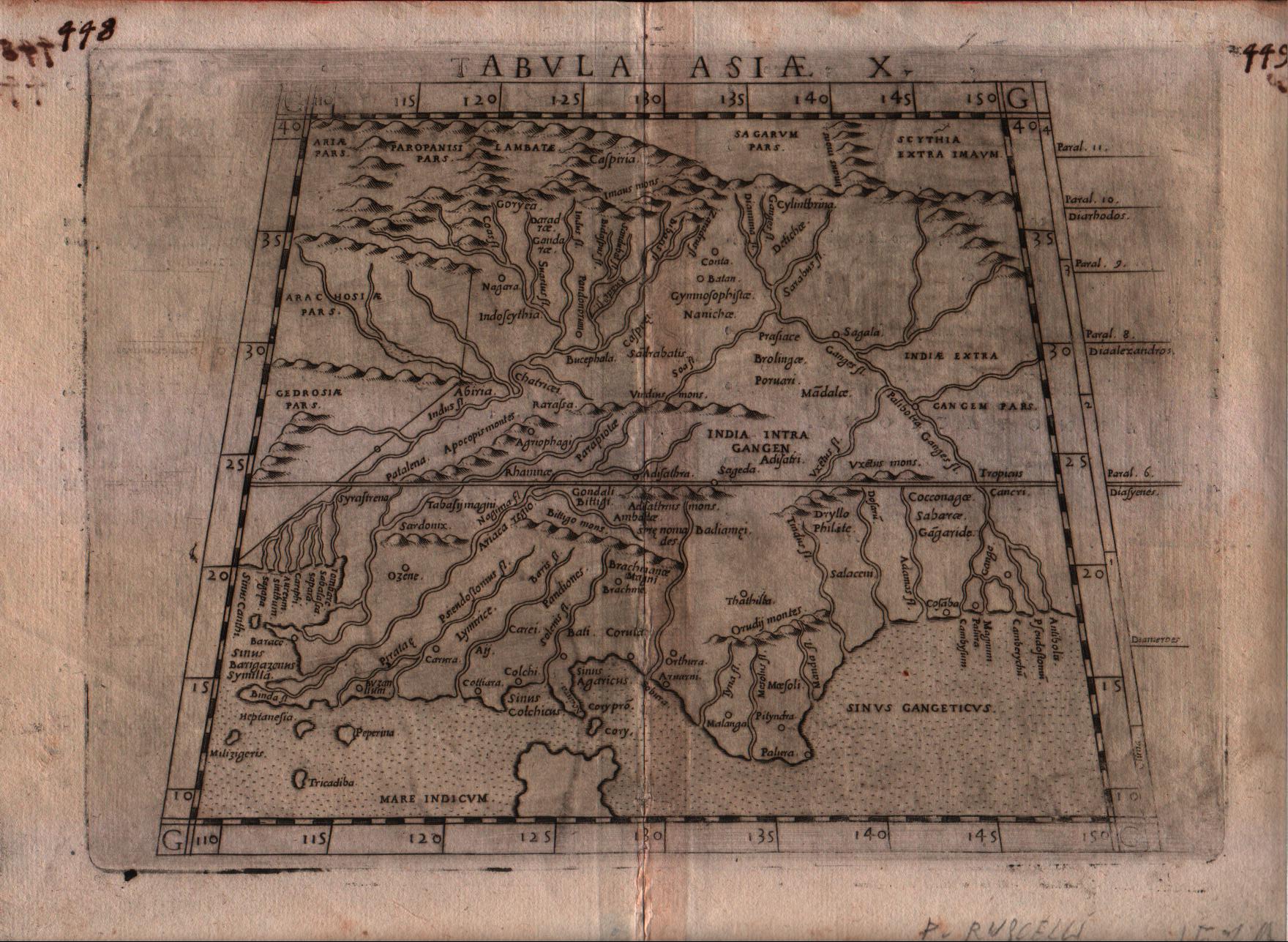
Map title
Tabula Asiae X
Author
Ruscelli
Location shown in map
India
Edition date
1574
Edition place
Venice
Editor
Giordano Ziletti
Atlas
La Geographia di Claudio Tolomeo
Price
200 Euro
State
[mint/EXCELLENT/very good/good/fair/mediocre/poor]
Color
Black/white
Verso
Italian text pag.25
Size
Plate: cm (25.4 x 19) inches (10 x 7.48) Paper: cm (30.5 x 22.9) inches (12.01 x 9.02)
Technique
Copper engraving
Note
India shown.
Reference
Genoa pubblic library "Civica Berio"
Wiki
Here for more info
In stock
Available
Info
info@thetreasuremaps.com
Code
#0190
×
![]()
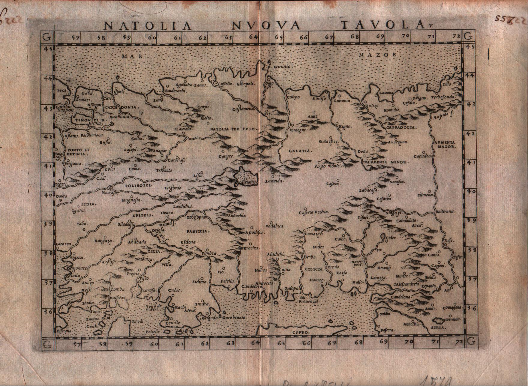
Map title
Natolia nuova tavola
Author
Ruscelli
Location shown in map
Turkey
Edition date
1574
Edition place
Venice
Editor
Giordano Ziletti
Atlas
La Geographia di Claudio Tolomeo
Price
150 Euro
State
[mint/EXCELLENT/very good/good/fair/mediocre/poor]
Color
Black/white
Verso
Italian text pag.24
Size
Plate: cm (25.4 x 19) inches (10 x 7.48) Paper: cm (30.5 x 22.9) inches (12.01 x 9.02)
Technique
Copper engraving
Note
--
Reference
Genoa pubblic library "Civica Berio"
Wiki
Here for more info
In stock
Available
Info
info@thetreasuremaps.com
Code
#0191
×
![]()
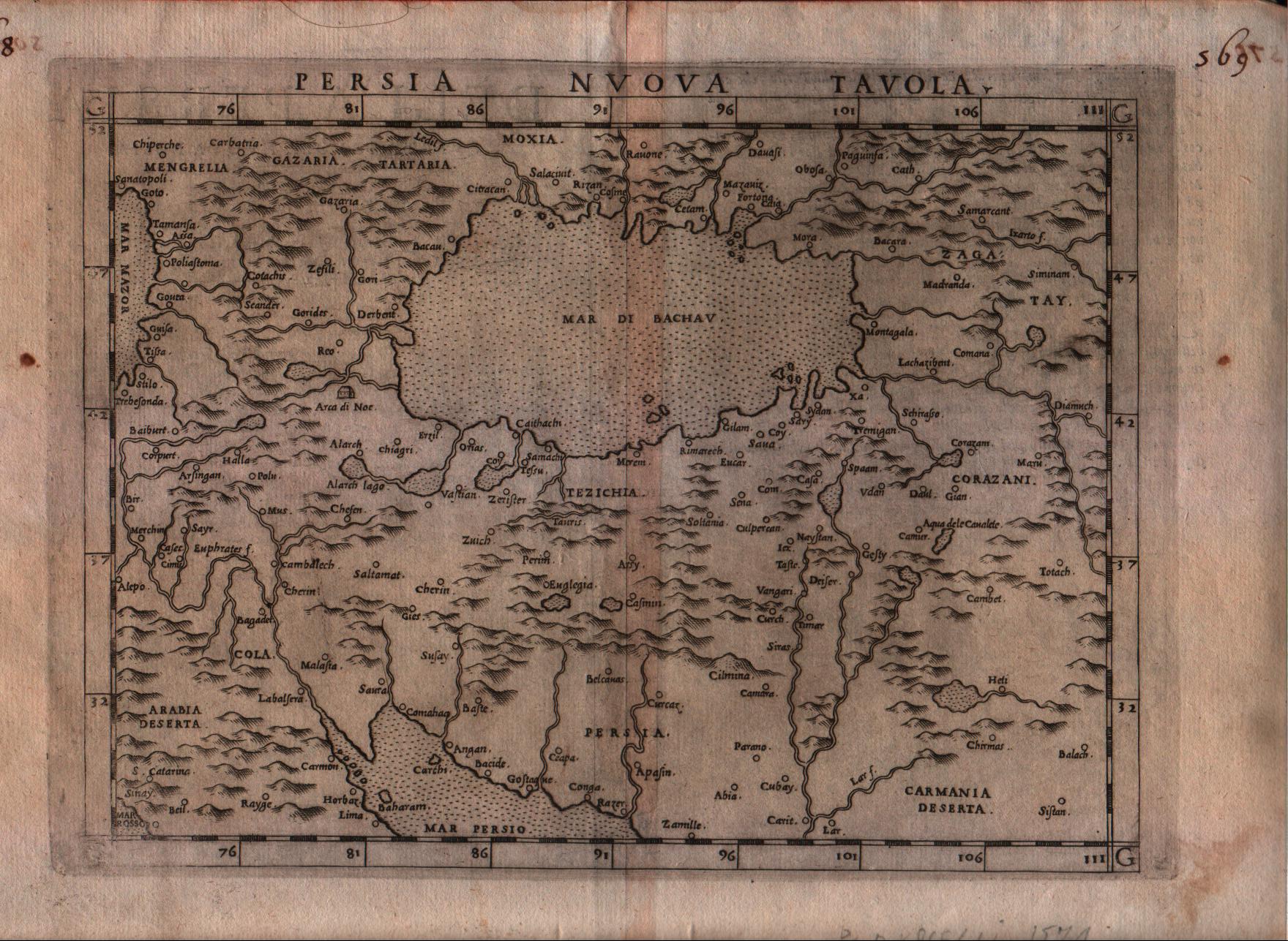
Map title
Persia nuova tavola
Author
Ruscelli
Location shown in map
Persia and west Pakistan
Edition date
1574
Edition place
Venice
Editor
Giordano Ziletti
Atlas
La Geographia di Claudio Tolomeo
Price
200 Euro
State
[mint/EXCELLENT/very good/good/fair/mediocre/poor]
Color
Black/white
Verso
Italian text pag.27
Size
Plate: cm (25.4 x 19) inches (10 x 7.48) Paper: cm (30.5 x 22.9) inches (12.01 x 9.02)
Technique
Copper engraving
Note
--
Reference
Genoa pubblic library "Civica Berio"
Wiki
Here for more info
In stock
Available
Info
info@thetreasuremaps.com
Code
#0192
×
![]()

Map title
Tabula Asiae XII
Author
Ruscelli
Location shown in map
Ceylon
Edition date
1574
Edition place
Venice
Editor
Giordano Ziletti
Atlas
La Geographia di Claudio Tolomeo
Price
250 Euro
State
[mint/excellent/very good/good/FAIR/mediocre/poor]
Color
Black/white
Verso
Italian text pag.27
Size
Plate: cm (25.4 x 19) inches (10 x 7.48) Paper: cm (30.5 x 22.9) inches (12.01 x 9.02)
Technique
Copper engraving
Note
No particular notes for this maps
Reference
Genoa pubblic library "Civica Berio"
Wiki
Here for more info
In stock
Available
Info
info@thetreasuremaps.com
Code
#0195
×
![]()
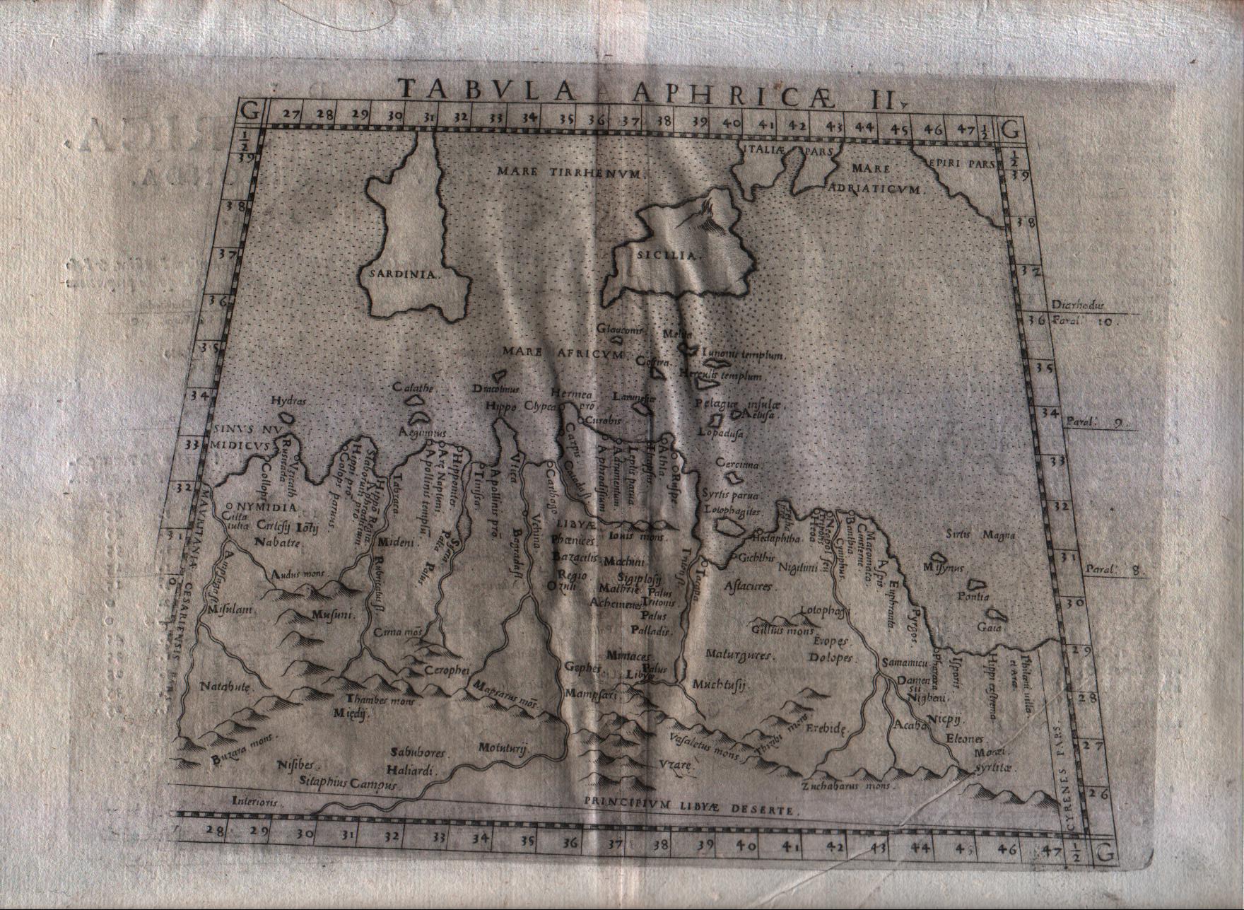
Map title
Tabula Aphricae II
Author
Ruscelli
Location shown in map
North Africa
Edition date
1574
Edition place
Venice
Editor
Giordano Ziletti
Atlas
La Geographia di Claudio Tolomeo
Price
125 Euro
State
[mint/excellent/VERY GOOD/good/fair/mediocre/poor]
Color
Black/white
Verso
Italian text pag.13
Size
Plate: cm (25.4 x 19) inches (10 x 7.48) Paper: cm (33 x 22.9) inches (12.99 x 9.02)
Technique
Copper engraving
Note
No particular notes for this maps
Reference
Genoa pubblic library "Civica Berio"
Wiki
Here for more info
In stock
Available
Info
info@thetreasuremaps.com
Code
#0283
×
![]()
Map title
Tabula Aphricae III
Author
Ruscelli
Location shown in map
Egypt
Edition date
1574
Edition place
Venice
Editor
Giordano Ziletti
Atlas
La Geographia di Claudio Tolomeo
Price
150 Euro
State
[mint/excellent/VERY GOOD/good/fair/mediocre/poor]
Color
Black/white
Verso
Italian text pag.13
Size
Plate: cm (25.4 x 19) inches (10 x 7.48) Paper: cm (33 x 22.9) inches (12.99 x 9.02)
Technique
Copper engraving
Note
No particular notes for this maps
Reference
Genoa pubblic library "Civica Berio"
Wiki
Here for more info
In stock
Available
Info
info@thetreasuremaps.com
Code
#0284
×
![]()
Map title
Tabula Aphricae IIII
Author
Ruscelli
Location shown in map
Africa
Edition date
1574
Edition place
Venice
Editor
Giordano Ziletti
Atlas
La Geographia di Claudio Tolomeo
Price
125 Euro
State
[mint/excellent/VERY GOOD/good/fair/mediocre/poor]
Color
Black/white
Verso
Italian text pag.13
Size
Plate: cm (25.4 x 19) inches (10 x 7.48) Paper: cm (33 x 22.9) inches (12.99 x 9.02)
Technique
Copper engraving
Note
No particular notes for this maps
Reference
Genoa pubblic library "Civica Berio"
Wiki
Here for more info
In stock
Available
Info
info@thetreasuremaps.com
Code
#0285
×
![]()
Map title
Angliae Heptarchia
Author
Location shown in map
England
Edition date
1574
Edition place
--
Editor
--
Atlas
?? -- ??
Price
Please ask: info@thetreasuremaps.com
State
[mint/excellent/very good/GOOD/fair/mediocre/poor]
Color
Black/white
Verso
Size
Plate: cm (27.9 x 17.8) inches (10.98 x 7.01) Paper: cm (27.9 x 17.8) inches (10.98 x 7.01)
Technique
Copper engraving
Note
The map is glued to a '800 century paper
Reference
--
Wiki
Here for more info
In stock
Sold
Info
info@thetreasuremaps.com
Code
#0429
×
![]()
Map title
Tavola nuova di Piemonte
Author
Ruscelli
Location shown in map
Piedmont
Edition date
1574
Edition place
Venice
Editor
Giordano Ziletti
Atlas
La Geographia di Claudio Tolomeo
Price
Please ask: info@thetreasuremaps.com
State
[mint/EXCELLENT/very good/good/fair/mediocre/poor]
Color
Black/white
Verso
Italian text
Size
Plate: cm (26 x 19) inches (10.24 x 7.48) Paper: cm (30.5 x 22.9) inches (12.01 x 9.02)
Technique
Copper engraving
Note
Framed
Reference
Genoa pubblic library "Civica Berio"
Wiki
Here for more info
In stock
Available
Info
info@thetreasuremaps.com
Code
#1100
×
![]()
Map title
Asiae nova descriptio
Author
Ortelius
Location shown in map
Asia
Edition date
1575
Edition place
Antwerp
Editor
--
Atlas
Theatrum Orbis Terrarum
Price
Please ask: info@thetreasuremaps.com
State
[mint/excellent/VERY GOOD/good/fair/mediocre/poor]
Color
Old color
Verso
Latin text pag.3
Size
Plate: cm (36.8 x 48.3) inches (14.49 x 19.02) Paper: cm (43.2 x 52.1) inches (17.01 x 20.51)
Technique
Copper engraving
Note
No particular notes for this maps.
Reference
Van Den Broecke 7
Wiki
Here for more info
In stock
Available
Info
info@thetreasuremaps.com
Code
#0200
×
![]()
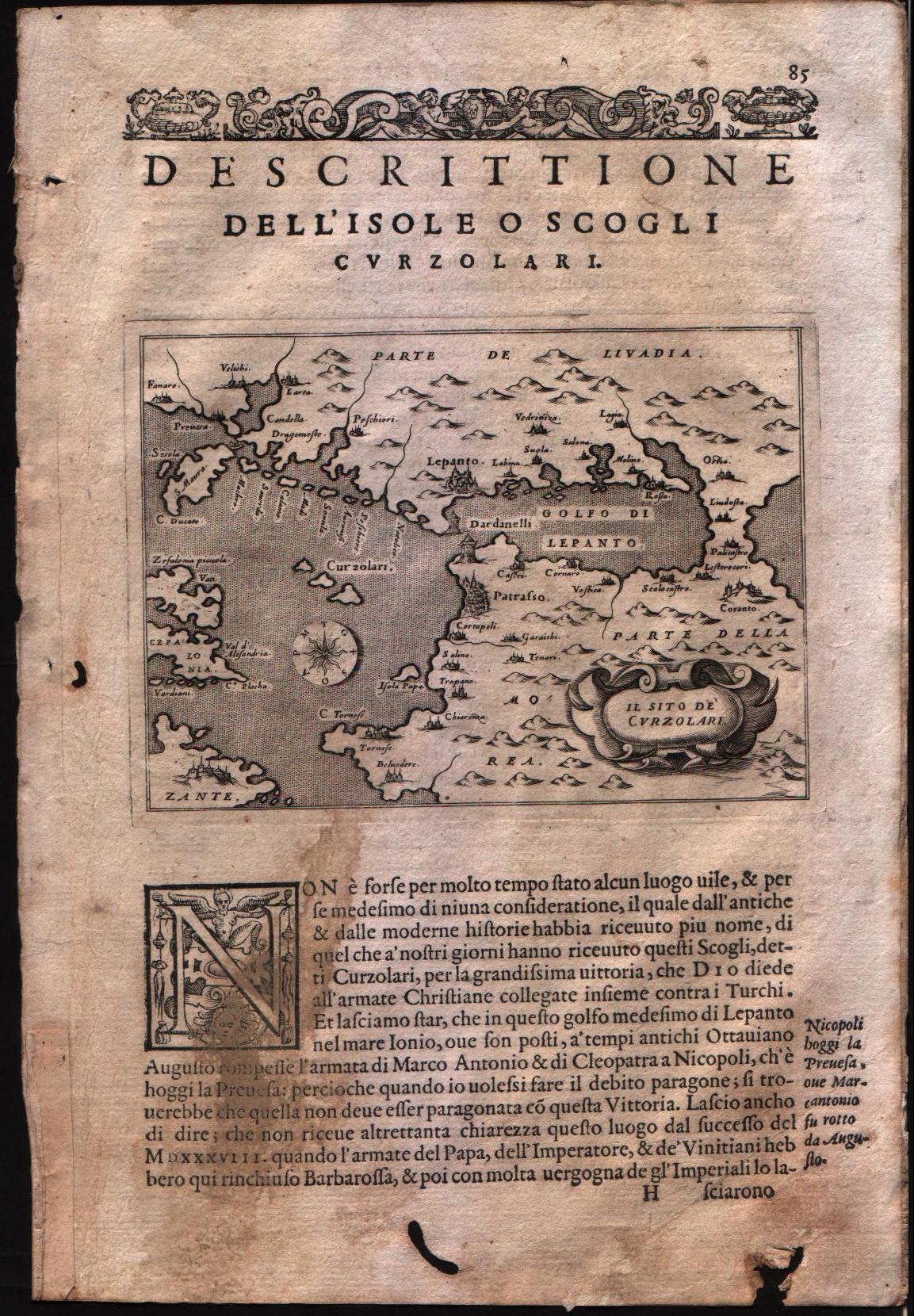
Map title
Descrittione dell'isole o scogli Curzolari
Author
Porcacchi
Location shown in map
Central Greece
Edition date
1576
Edition place
Venice
Editor
--
Atlas
L'Isole piu famose del mondo -- S. Galignani and G. Porro
Price
Please ask: info@thetreasuremaps.com
State
[mint/EXCELLENT/very good/good/fair/mediocre/poor]
Color
Black/white
Verso
Italian text pag.86
Size
Plate: cm (15.2 x 11.4) inches (5.98 x 4.49) Paper: cm (19 x 27.9) inches (7.48 x 10.98)
Technique
Copper engraving
Note
No particular notes for this maps
Reference
Genoa pubblic library "Civica Berio"
Wiki
Here for more info
In stock
Available
Info
info@thetreasuremaps.com
Code
#0099
×
![]()
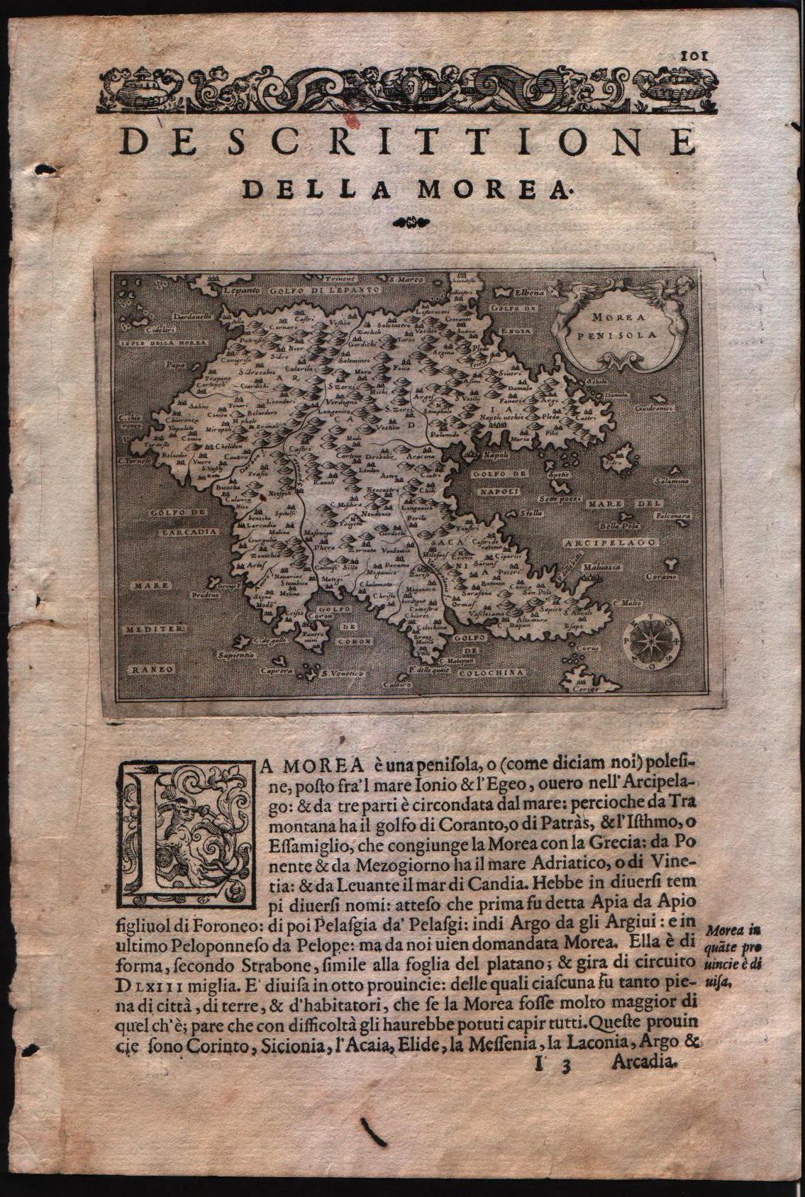
Map title
Descrittione della Morea
Author
Porcacchi
Location shown in map
South Greece
Edition date
1576
Edition place
Venice
Editor
--
Atlas
L'Isole piu famose del mondo -- S. Galignani and G. Porro
Price
Please ask: info@thetreasuremaps.com
State
[MINT/excellent/very good/good/fair/mediocre/poor]
Color
Black/white
Verso
Italian text pag.86
Size
Plate: cm (15.2 x 11.4) inches (5.98 x 4.49) Paper: cm (19 x 27.9) inches (7.48 x 10.98)
Technique
Copper engraving
Note
No particular notes for this maps
Reference
Genoa pubblic library "Civica Berio"
Wiki
Here for more info
In stock
Available
Info
info@thetreasuremaps.com
Code
#0100
×
![]()
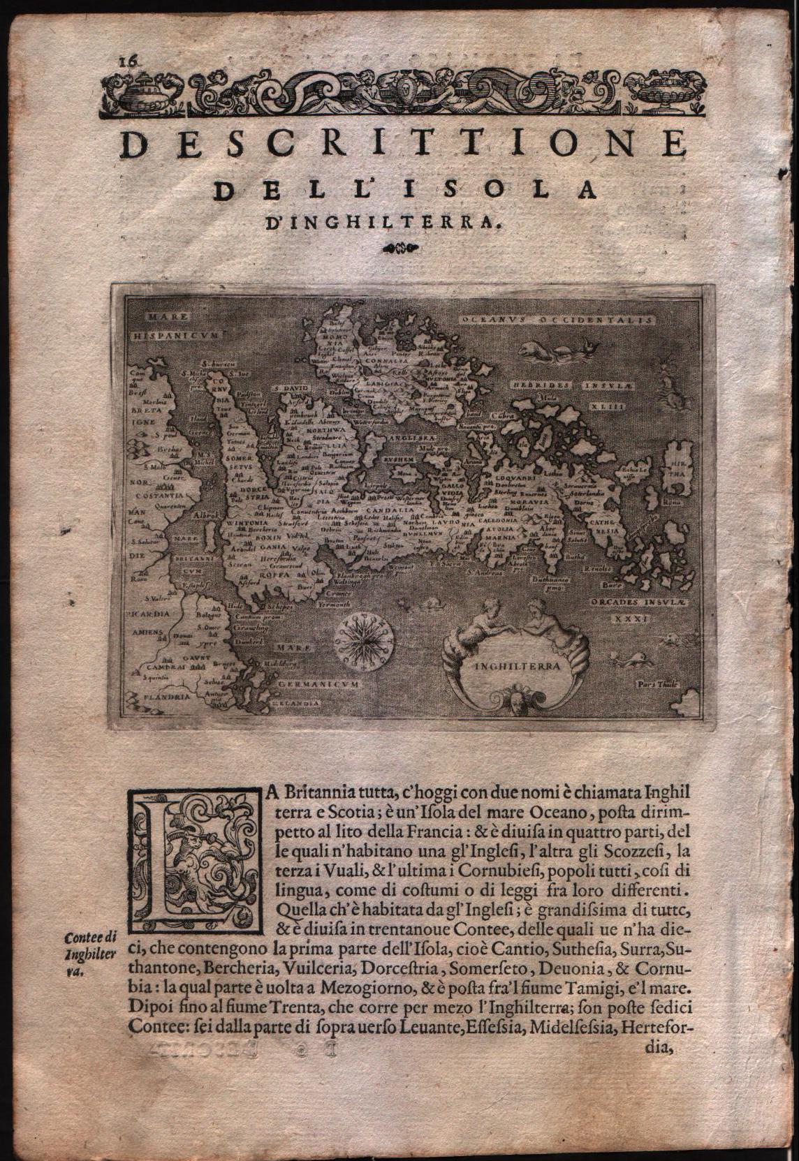
Map title
Descrittione dell'isola d'Inghilterra
Author
Porcacchi
Location shown in map
England
Edition date
1576
Edition place
Venice
Editor
--
Atlas
L'Isole piu famose del mondo -- S. Galignani and G. Porro
Price
Please ask: info@thetreasuremaps.com
State
[MINT/excellent/very good/good/fair/mediocre/poor]
Color
Black/white
Verso
Italian text pag.15
Size
Plate: cm (15.2 x 11.4) inches (5.98 x 4.49) Paper: cm (19 x 27.9) inches (7.48 x 10.98)
Technique
Copper engraving
Note
No particular notes for this maps
Reference
Genoa pubblic library "Civica Berio"
Wiki
Here for more info
In stock
Available
Info
info@thetreasuremaps.com
Code
#0101
×
![]()
Map title
Descrittione dell'isola di Gotlandia
Author
Porcacchi
Location shown in map
Gotland
Edition date
1576
Edition place
Venice
Editor
--
Atlas
L'Isole piu famose del mondo -- S. Galignani and G. Porro
Price
Please ask: info@thetreasuremaps.com
State
[MINT/excellent/very good/good/fair/mediocre/poor]
Color
Black/white
Verso
Italian text pag.9
Size
Plate: cm (15.2 x 11.4) inches (5.98 x 4.49) Paper: cm (19 x 27.9) inches (7.48 x 10.98)
Technique
Copper engraving
Note
No particular notes for this maps
Reference
Genoa pubblic library "Civica Berio"
Wiki
Here for more info
In stock
Sold
Info
info@thetreasuremaps.com
Code
#0102
×
![]()
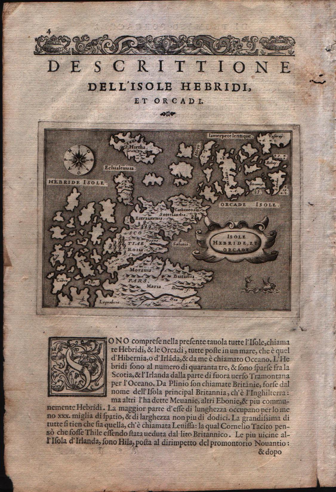
Map title
Descrittione dell'isole Hebridi et Orcadi
Author
Porcacchi
Location shown in map
Scottish islands - The Henrides and Orkneys
Edition date
1576
Edition place
Venice
Editor
--
Atlas
L'Isole piu famose del mondo -- S. Galignani and G. Porro
Price
Please ask: info@thetreasuremaps.com
State
[MINT/excellent/very good/good/fair/mediocre/poor]
Color
Black/white
Verso
Italian text pag.4
Size
Plate: cm (15.2 x 11.4) inches (5.98 x 4.49) Paper: cm (19 x 27.9) inches (7.48 x 10.98)
Technique
Copper engraving
Note
No particular notes for this maps
Reference
Genoa pubblic library "Civica Berio"
Wiki
Here for more info
In stock
Available
Info
info@thetreasuremaps.com
Code
#0103
×
![]()
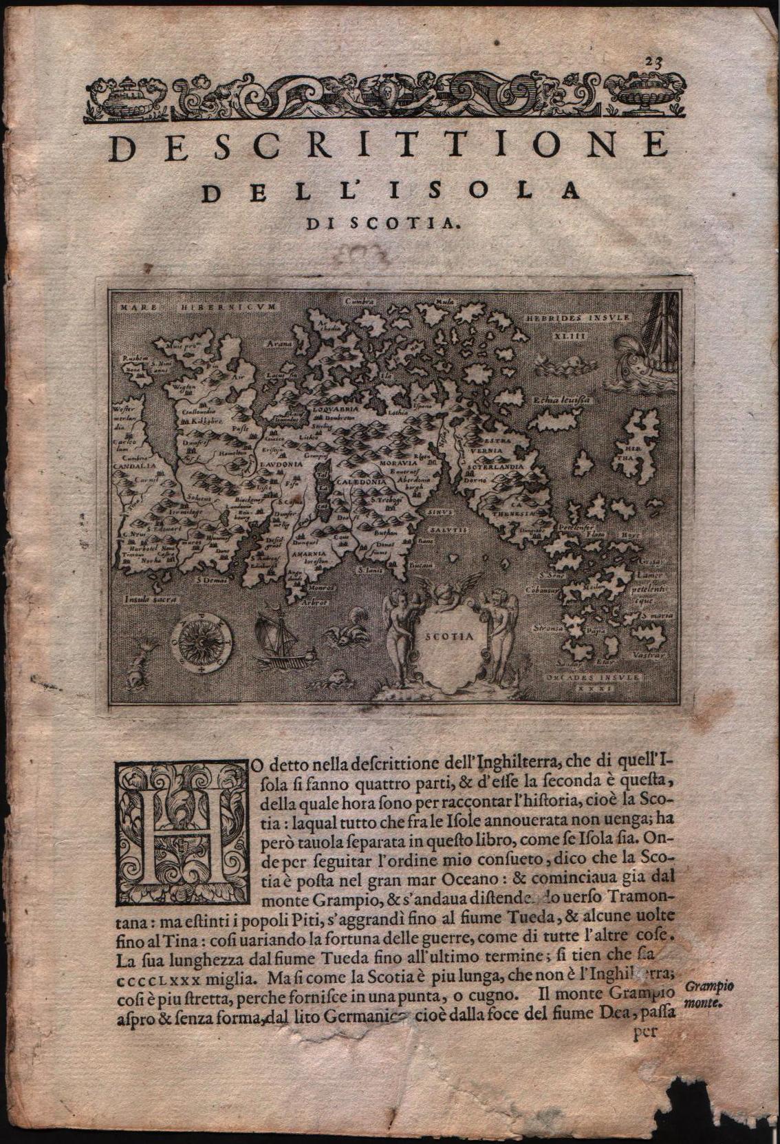
Map title
Descrittione dell'isola di Scotia
Author
Porcacchi
Location shown in map
Scotland
Edition date
1576
Edition place
Venice
Editor
--
Atlas
L'Isole piu famose del mondo -- S. Galignani and G. Porro
Price
Please ask: info@thetreasuremaps.com
State
[MINT/excellent/very good/good/fair/mediocre/poor]
Color
Black/white
Verso
Italian text pag.23
Size
Plate: cm (15.2 x 11.4) inches (5.98 x 4.49) Paper: cm (19 x 27.9) inches (7.48 x 10.98)
Technique
Copper engraving
Note
No particular notes for this maps
Reference
Genoa pubblic library "Civica Berio"
Wiki
Here for more info
In stock
Available
Info
info@thetreasuremaps.com
Code
#0104
×
![]()
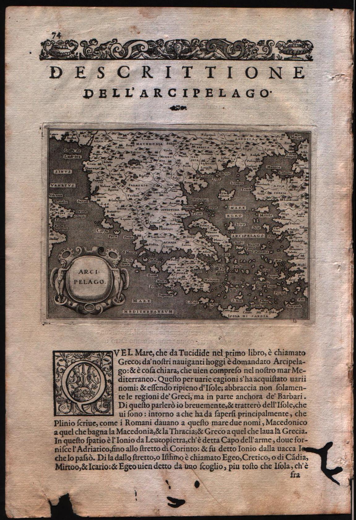
Map title
Descrittione dell'arcipelago
Author
Porcacchi
Location shown in map
Greece
Edition date
1576
Edition place
Venice
Editor
--
Atlas
L'Isole piu famose del mondo -- S. Galignani and G. Porro
Price
Please ask: info@thetreasuremaps.com
State
[MINT/excellent/very good/good/fair/mediocre/poor]
Color
Black/white
Verso
Italian text pag.74
Size
Plate: cm (15.2 x 11.4) inches (5.98 x 4.49) Paper: cm (19 x 29.2) inches (7.48 x 11.5)
Technique
Copper engraving
Note
No particular notes for this maps
Reference
Genoa pubblic library "Civica Berio"
Wiki
Here for more info
In stock
Available
Info
info@thetreasuremaps.com
Code
#0105
×
![]()
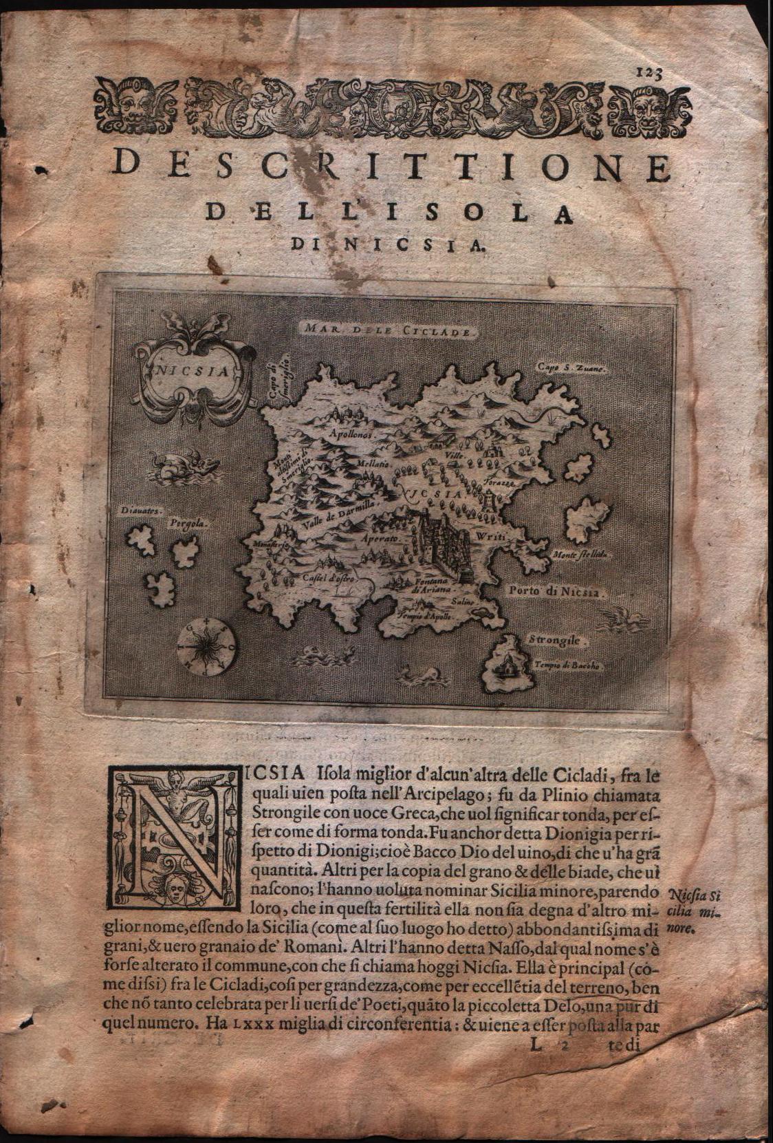
Map title
Descrittione dell'isola di Nicsia
Author
Porcacchi
Location shown in map
Naxos island
Edition date
1576
Edition place
Venice
Editor
--
Atlas
L'Isole piu famose del mondo -- S. Galignani and G. Porro
Price
Please ask: info@thetreasuremaps.com
State
[mint/excellent/VERY GOOD/good/fair/mediocre/poor]
Color
Black/white
Verso
Italian text pag.124
Size
Plate: cm (15.2 x 11.4) inches (5.98 x 4.49) Paper: cm (19 x 29.2) inches (7.48 x 11.5)
Technique
Copper engraving
Note
No particular notes for this maps
Reference
Genoa pubblic library "Civica Berio"
Wiki
Here for more info
In stock
Available
Info
info@thetreasuremaps.com
Code
#0107
×
![]()
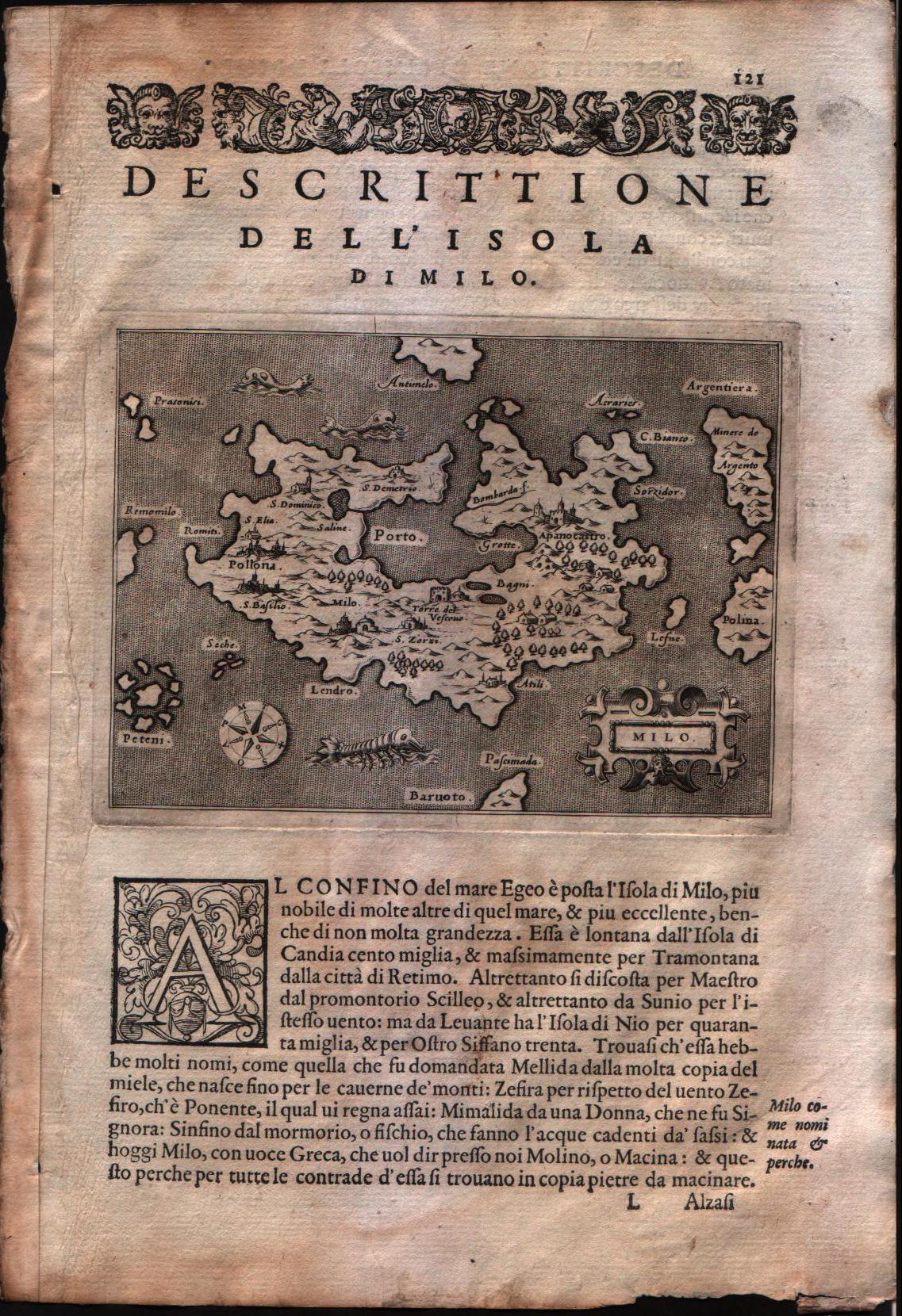
Map title
Descrittione dell'isola di Milo
Author
Porcacchi
Location shown in map
Milo island
Edition date
1576
Edition place
Venice
Editor
--
Atlas
L'Isole piu famose del mondo -- S. Galignani and G. Porro
Price
Please ask: info@thetreasuremaps.com
State
[mint/EXCELLENT/very good/good/fair/mediocre/poor]
Color
Black/white
Verso
Italian text pag.122
Size
Plate: cm (15.2 x 11.4) inches (5.98 x 4.49) Paper: cm (19 x 29.2) inches (7.48 x 11.5)
Technique
Copper engraving
Note
No particular notes for this maps
Reference
Genoa pubblic library "Civica Berio"
Wiki
Here for more info
In stock
Available
Info
info@thetreasuremaps.com
Code
#0108
×
![]()
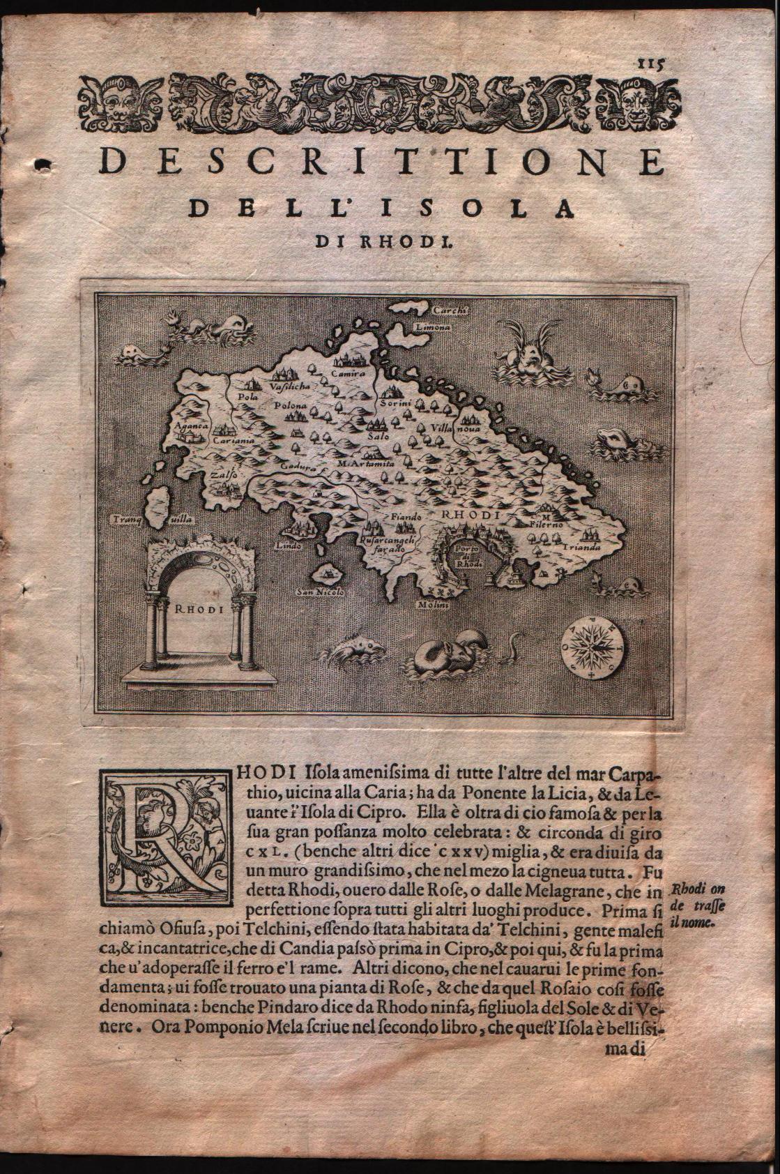
Map title
Descrittione dell'isola di Rhodi
Author
Porcacchi
Location shown in map
Rhodi island
Edition date
1576
Edition place
Venice
Editor
--
Atlas
L'Isole piu famose del mondo -- S. Galignani and G. Porro
Price
Please ask: info@thetreasuremaps.com
State
[mint/EXCELLENT/very good/good/fair/mediocre/poor]
Color
Black/white
Verso
Italian text pag.122
Size
Plate: cm (15.2 x 11.4) inches (5.98 x 4.49) Paper: cm (19 x 29.2) inches (7.48 x 11.5)
Technique
Copper engraving
Note
No particular notes for this maps
Reference
Genoa pubblic library "Civica Berio"
Wiki
Here for more info
In stock
Available
Info
info@thetreasuremaps.com
Code
#0109
×
![]()
Map title
Descrittione dell'isola di Stalimene
Author
Porcacchi
Location shown in map
Lemno island
Edition date
1576
Edition place
Venice
Editor
--
Atlas
L'Isole piu famose del mondo -- S. Galignani and G. Porro
Price
Please ask: info@thetreasuremaps.com
State
[mint/EXCELLENT/Vvery good/good/fair/mediocre/poor]
Color
Black/white
Verso
Italian text pag.140
Size
Plate: cm (15.2 x 11.4) inches (5.98 x 4.49) Paper: cm (19 x 29.2) inches (7.48 x 11.5)
Technique
Copper engraving
Note
No particular notes for this maps
Reference
Genoa pubblic library "Civica Berio"
Wiki
Here for more info
In stock
Sold
Info
info@thetreasuremaps.com
Code
#0110
×
![]()
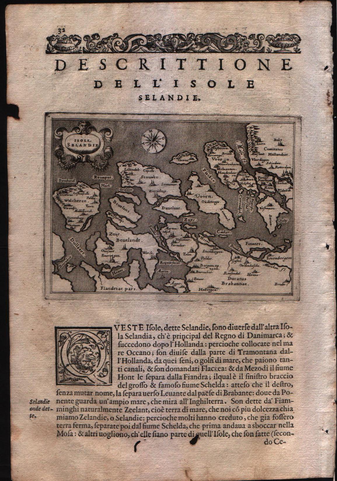
Map title
Descrittione dell'isole Selandie
Author
Porcacchi
Location shown in map
Zeeland islands
Edition date
1576
Edition place
Venice
Editor
--
Atlas
L'Isole piu famose del mondo -- S. Galignani and G. Porro
Price
Please ask: info@thetreasuremaps.com
State
[mint/EXCELLENT/Vvery good/good/fair/mediocre/poor]
Color
Black/white
Verso
Italian text pag.31
Size
Plate: cm (15.2 x 11.4) inches (5.98 x 4.49) Paper: cm (19 x 29.2) inches (7.48 x 11.5)
Technique
Copper engraving
Note
No particular notes for this maps
Reference
Genoa pubblic library "Civica Berio"
Wiki
Here for more info
In stock
Available
Info
info@thetreasuremaps.com
Code
#0111
×
![]()
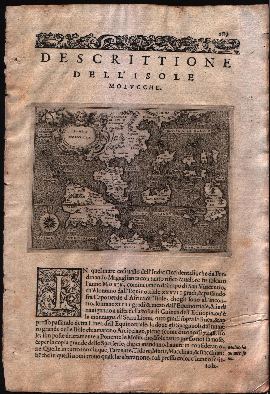
Map title
Descrittione dell'isole Molucche
Author
Porcacchi
Location shown in map
Southest Asia
Edition date
1576
Edition place
Venice
Editor
--
Atlas
L'Isole piu famose del mondo -- S. Galignani and G. Porro
Price
Please ask: info@thetreasuremaps.com
State
[MINT/excellent/very good/good/fair/mediocre/poor]
Color
Black/white
Verso
Italian text pag.190
Size
Plate: cm (15.2 x 11.4) inches (5.98 x 4.49) Paper: cm (19 x 27.9) inches (7.48 x 10.98)
Technique
Copper engraving
Note
No particular notes for this maps
Reference
Genoa pubblic library "Civica Berio"
Wiki
Here for more info
In stock
Available
Info
info@thetreasuremaps.com
Code
#0196
×
![]()
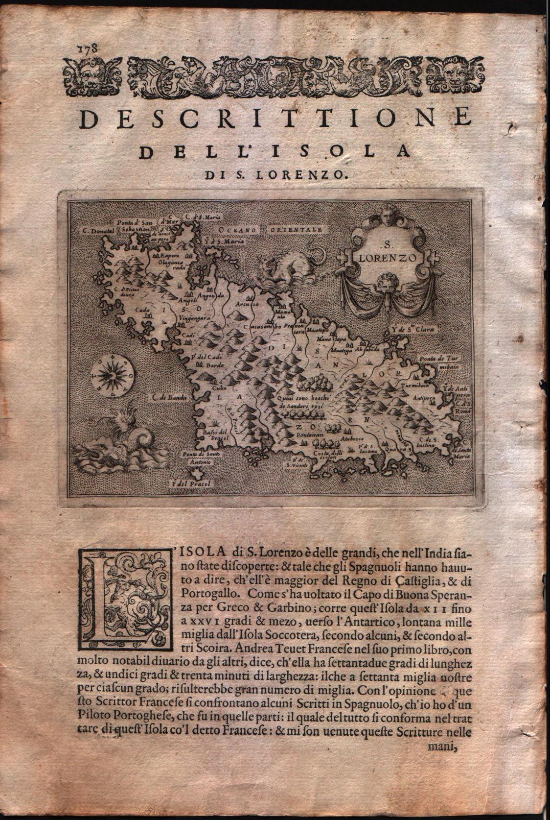
Map title
Descrittione dell'isola di S.Lorenzo
Author
Porcacchi
Location shown in map
Madagascar
Edition date
1576
Edition place
Venice
Editor
--
Atlas
L'Isole piu famose del mondo -- S. Galignani and G. Porro
Price
Please ask: info@thetreasuremaps.com
State
[MINT/excellent/very good/good/fair/mediocre/poor]
Color
Black/white
Verso
Italian text pag.178
Size
Plate: cm (15.2 x 11.4) inches (5.98 x 4.49) Paper: cm (19 x 27.9) inches (7.48 x 10.98)
Technique
Copper engraving
Note
No particular notes for this maps
Reference
Genoa pubblic library "Civica Berio"
Wiki
Here for more info
In stock
Available
Info
info@thetreasuremaps.com
Code
#0286
×
![]()
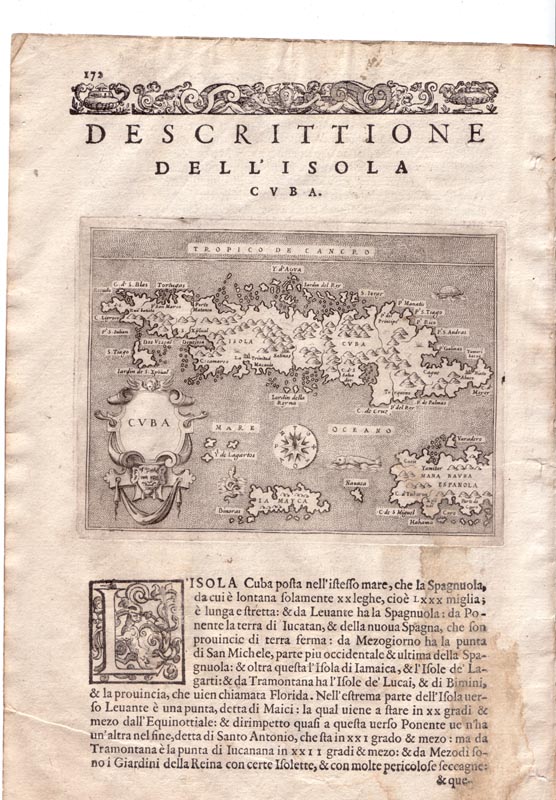
Map title
Descrittione dell'isola Cuba
Author
Porcacchi
Location shown in map
Cuba
Edition date
1576
Edition place
Venice
Editor
--
Atlas
L'Isole piu famose del mondo -- S. Galignani and G. Porro
Price
Please ask: info@thetreasuremaps.com
State
[MINT/excellent/very good/good/fair/mediocre/poor]
Color
Black/white
Verso
Italian text pag.171
Size
Plate: cm (15.2 x 11.4) inches (5.98 x 4.49) Paper: cm (19 x 27.9) inches (7.48 x 10.98)
Technique
Copper engraving
Note
No particular notes for this maps
Reference
Genoa pubblic library "Civica Berio"
Wiki
Here for more info
In stock
Available
Info
info@thetreasuremaps.com
Code
#0341
×
![]()
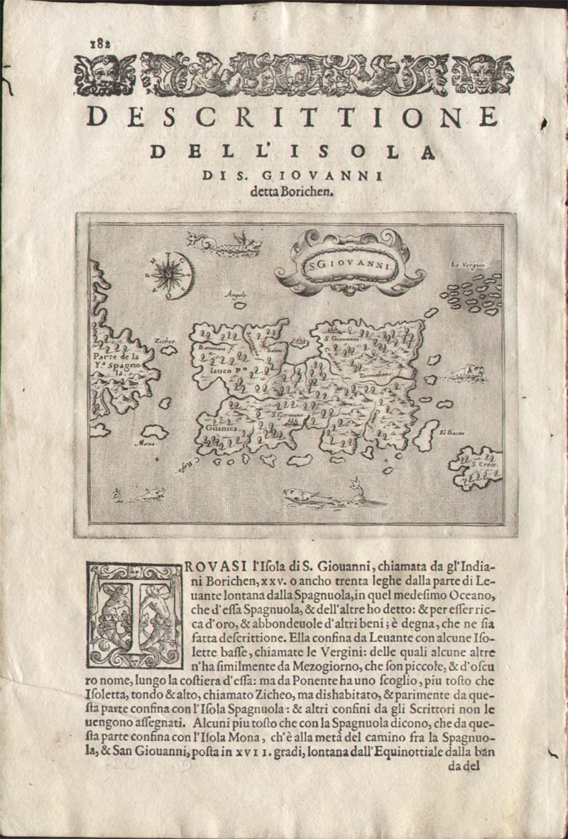
Map title
Descrittione dell'isola di S.Giovanni
Author
Porcacchi
Location shown in map
Puerto Rico
Edition date
1576
Edition place
Venice
Editor
--
Atlas
L'Isole piu famose del mondo -- S. Galignani and G. Porro
Price
Please ask: info@thetreasuremaps.com
State
[MINT/excellent/very good/good/fair/mediocre/poor]
Color
Black/white
Verso
Italian text pag.182
Size
Plate: cm (15.2 x 11.4) inches (5.98 x 4.49) Paper: cm (19 x 27.9) inches (7.48 x 10.98)
Technique
Copper engraving
Note
No particular notes for this maps
Reference
Genoa pubblic library "Civica Berio"
Wiki
Here for more info
In stock
Sold
Info
info@thetreasuremaps.com
Code
#0432
×
![]()
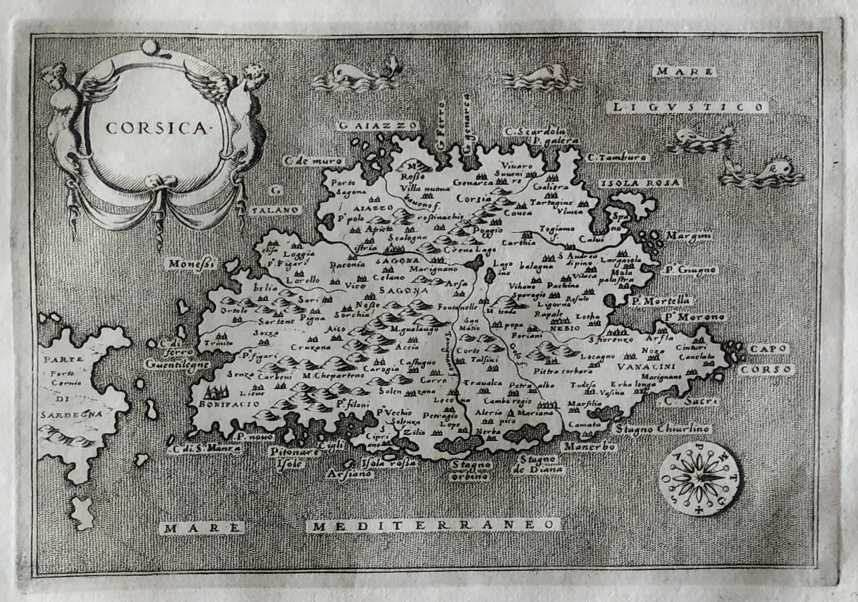
Map title
Descrittione dell'isola di Corsica
Author
Porcacchi
Location shown in map
Corse
Edition date
1576
Edition place
Venice
Editor
--
Atlas
L'Isole piu famose del mondo -- S. Galignani and G. Porro
Price
Please ask: info@thetreasuremaps.com
State
[MINT/excellent/very good/good/fair/mediocre/poor]
Color
Black/white
Verso
Italian text pag.42
Size
Plate: cm (15.2 x 11.4) inches (5.98 x 4.49) Paper: cm (19 x 27.9) inches (7.48 x 10.98)
Technique
Copper engraving
Note
No particular notes for this maps
Reference
Genoa pubblic library "Civica Berio"
Wiki
Here for more info
In stock
Available
Info
info@thetreasuremaps.com
Code
#0794
×
![]()
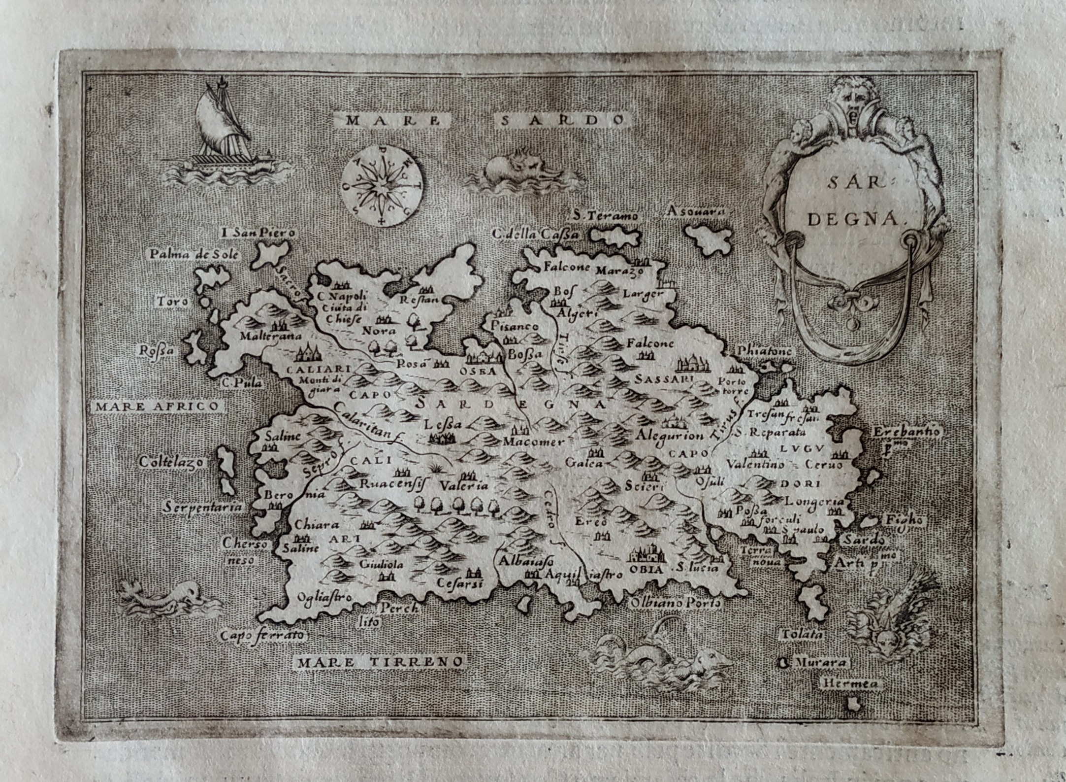
Map title
Descrittione dell'isola di Sardinia
Author
Porcacchi
Location shown in map
Sardinia
Edition date
1576
Edition place
Venice
Editor
--
Atlas
L'Isole piu famose del mondo -- S. Galignani and G. Porro
Price
Please ask: info@thetreasuremaps.com
State
[MINT/excellent/very good/good/fair/mediocre/poor]
Color
Black/white
Verso
Italian text pag.48
Size
Plate: cm (15.2 x 11.4) inches (5.98 x 4.49) Paper: cm (19 x 27.9) inches (7.48 x 10.98)
Technique
Copper engraving
Note
No particular notes for this maps
Reference
Genoa pubblic library "Civica Berio"
Wiki
Here for more info
In stock
Available
Info
info@thetreasuremaps.com
Code
#0795
×
![]()
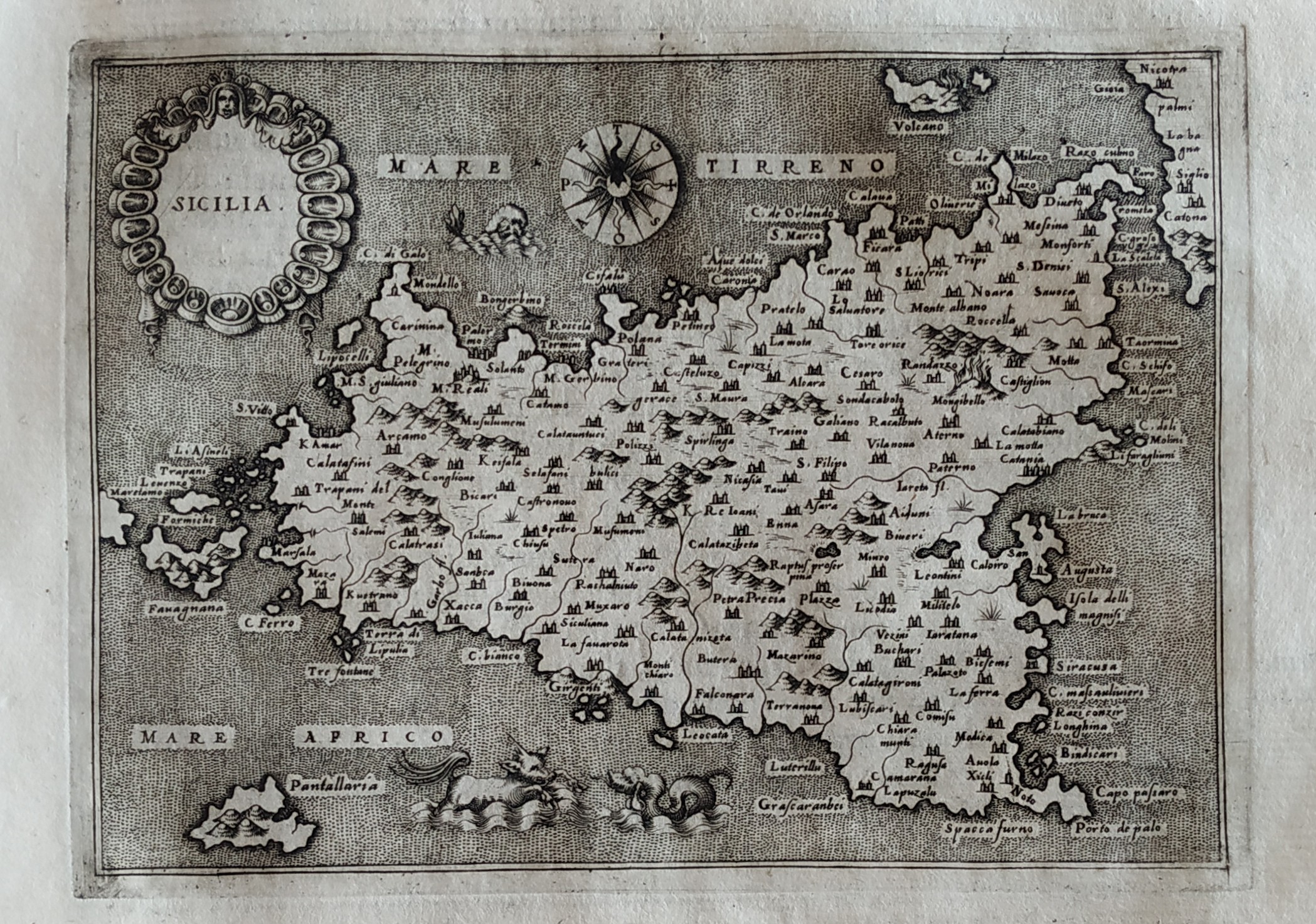
Map title
Descrittione dell'isola di Sicilia
Author
Porcacchi
Location shown in map
Sicily
Edition date
1576
Edition place
Venice
Editor
--
Atlas
L'Isole piu famose del mondo -- S. Galignani and G. Porro
Price
Please ask: info@thetreasuremaps.com
State
[MINT/excellent/very good/good/fair/mediocre/poor]
Color
Black/white
Verso
Italian text pag.52
Size
Plate: cm (15.2 x 11.4) inches (5.98 x 4.49) Paper: cm (19 x 27.9) inches (7.48 x 10.98)
Technique
Copper engraving
Note
No particular notes for this maps
Reference
Genoa pubblic library "Civica Berio"
Wiki
Here for more info
In stock
Available
Info
info@thetreasuremaps.com
Code
#0796
×
![]()
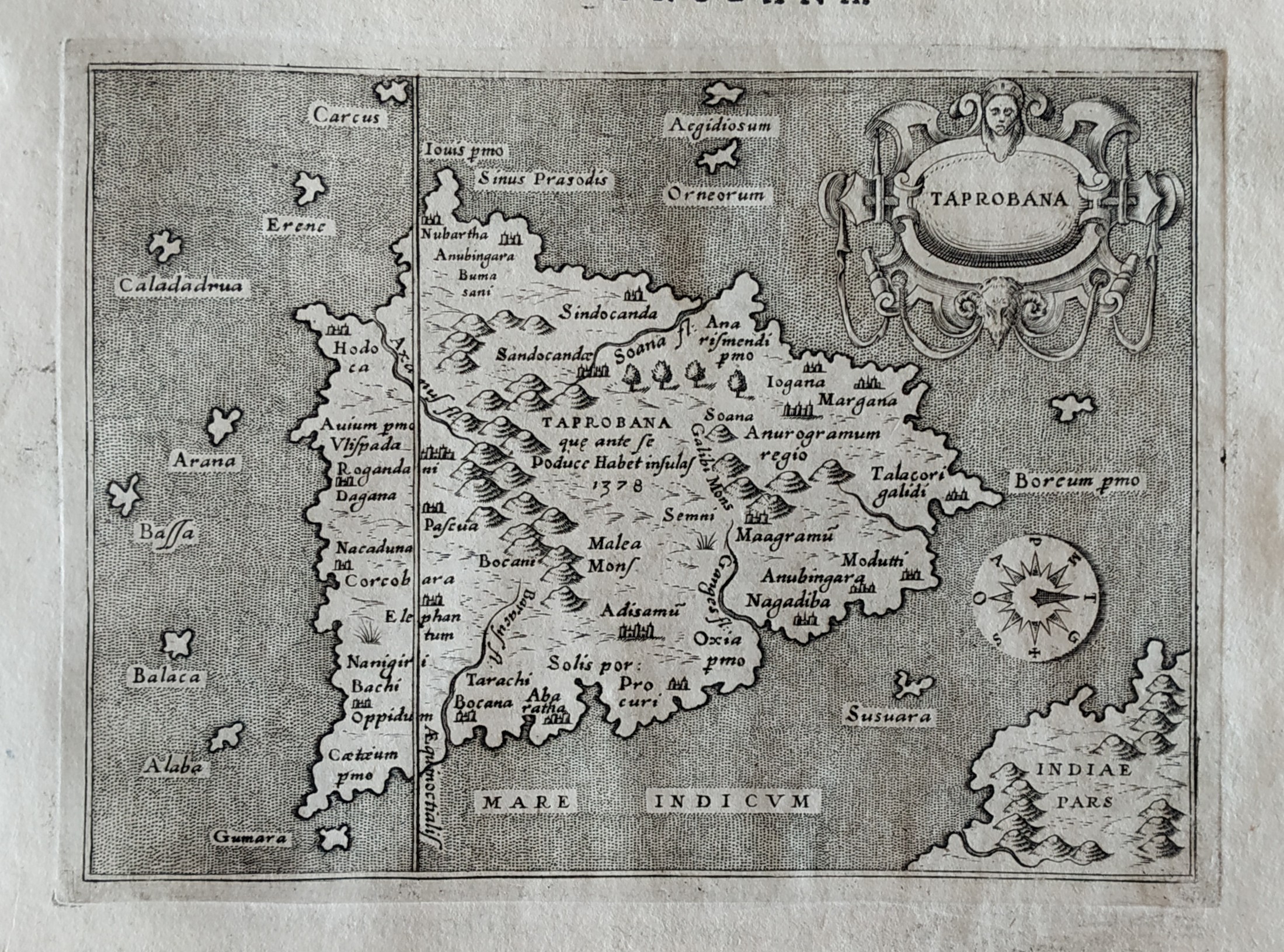
Map title
Descrittione dell'isola di Taprobana
Author
Porcacchi
Location shown in map
Sry Lanka
Edition date
1576
Edition place
Venice
Editor
--
Atlas
L'Isole piu famose del mondo -- S. Galignani and G. Porro
Price
Please ask: info@thetreasuremaps.com
State
[MINT/excellent/very good/good/fair/mediocre/poor]
Color
Black/white
Verso
Italian text pag.186
Size
Plate: cm (15.2 x 11.4) inches (5.98 x 4.49) Paper: cm (19 x 27.9) inches (7.48 x 10.98)
Technique
Copper engraving
Note
No particular notes for this maps
Reference
Genoa pubblic library "Civica Berio"
Wiki
Here for more info
In stock
Available
Info
info@thetreasuremaps.com
Code
#0797
×
![]()
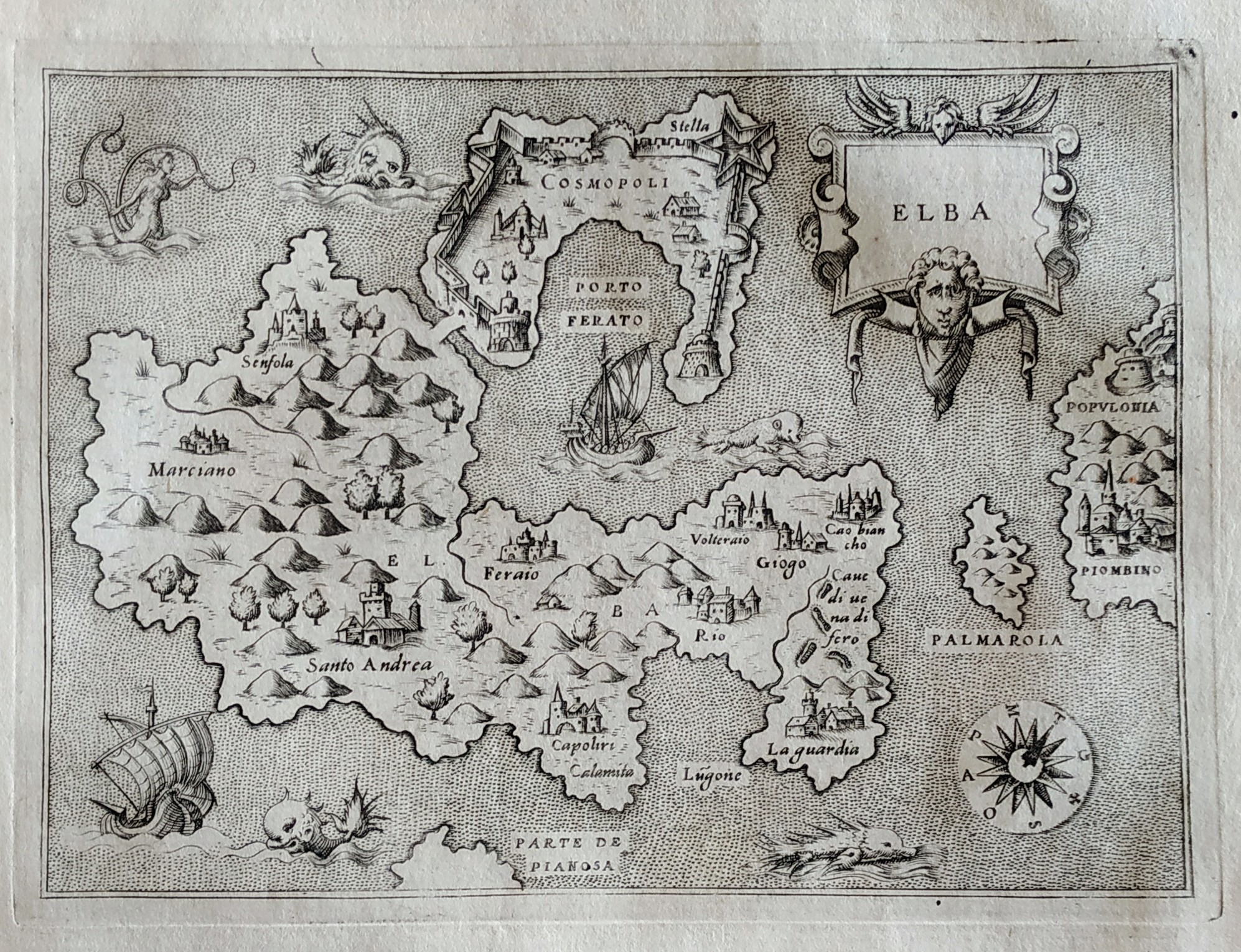
Map title
Descrittione dell'isola dell'Elba
Author
Porcacchi
Location shown in map
Elba
Edition date
1576
Edition place
Venice
Editor
--
Atlas
L'Isole piu famose del mondo -- S. Galignani and G. Porro
Price
Please ask: info@thetreasuremaps.com
State
[MINT/excellent/very good/good/fair/mediocre/poor]
Color
Black/white
Verso
Italian text pag.46
Size
Plate: cm (15.2 x 11.4) inches (5.98 x 4.49) Paper: cm (19 x 27.9) inches (7.48 x 10.98)
Technique
Copper engraving
Note
No particular notes for this maps
Reference
Genoa pubblic library "Civica Berio"
Wiki
Here for more info
In stock
Available
Info
info@thetreasuremaps.com
Code
#0798
×
![]()
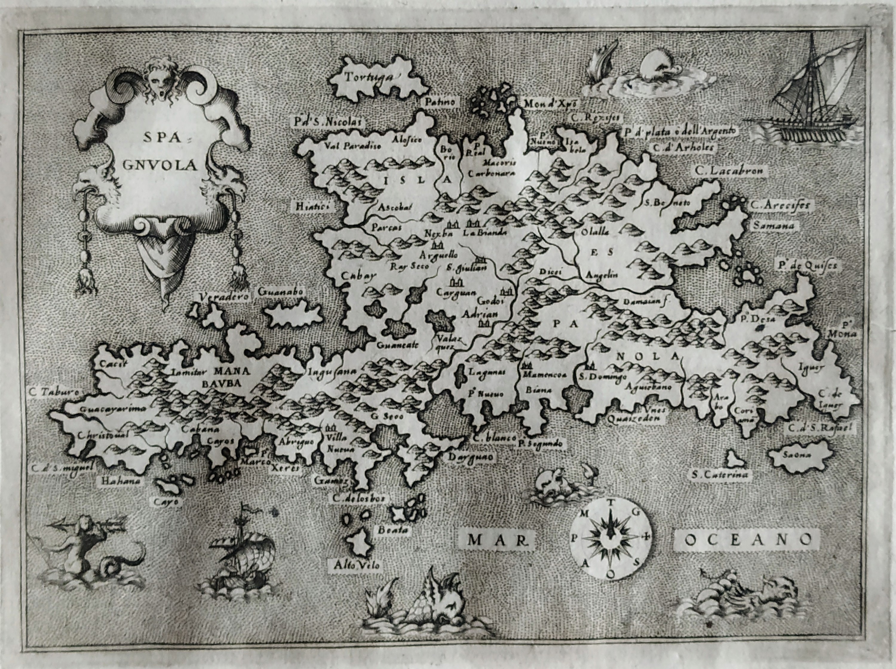
Map title
Descrittione dell'isola Spagnola
Author
Porcacchi
Location shown in map
Haiti
Edition date
1576
Edition place
Venice
Editor
--
Atlas
L'Isole piu famose del mondo -- S. Galignani and G. Porro
Price
Please ask: info@thetreasuremaps.com
State
[MINT/excellent/very good/good/fair/mediocre/poor]
Color
Black/white
Verso
Italian text pag.166
Size
Plate: cm (15.2 x 11.4) inches (5.98 x 4.49) Paper: cm (19 x 27.9) inches (7.48 x 10.98)
Technique
Copper engraving
Note
No particular notes for this maps
Reference
Genoa pubblic library "Civica Berio"
Wiki
Here for more info
In stock
Available
Info
info@thetreasuremaps.com
Code
#0799
×
![]()
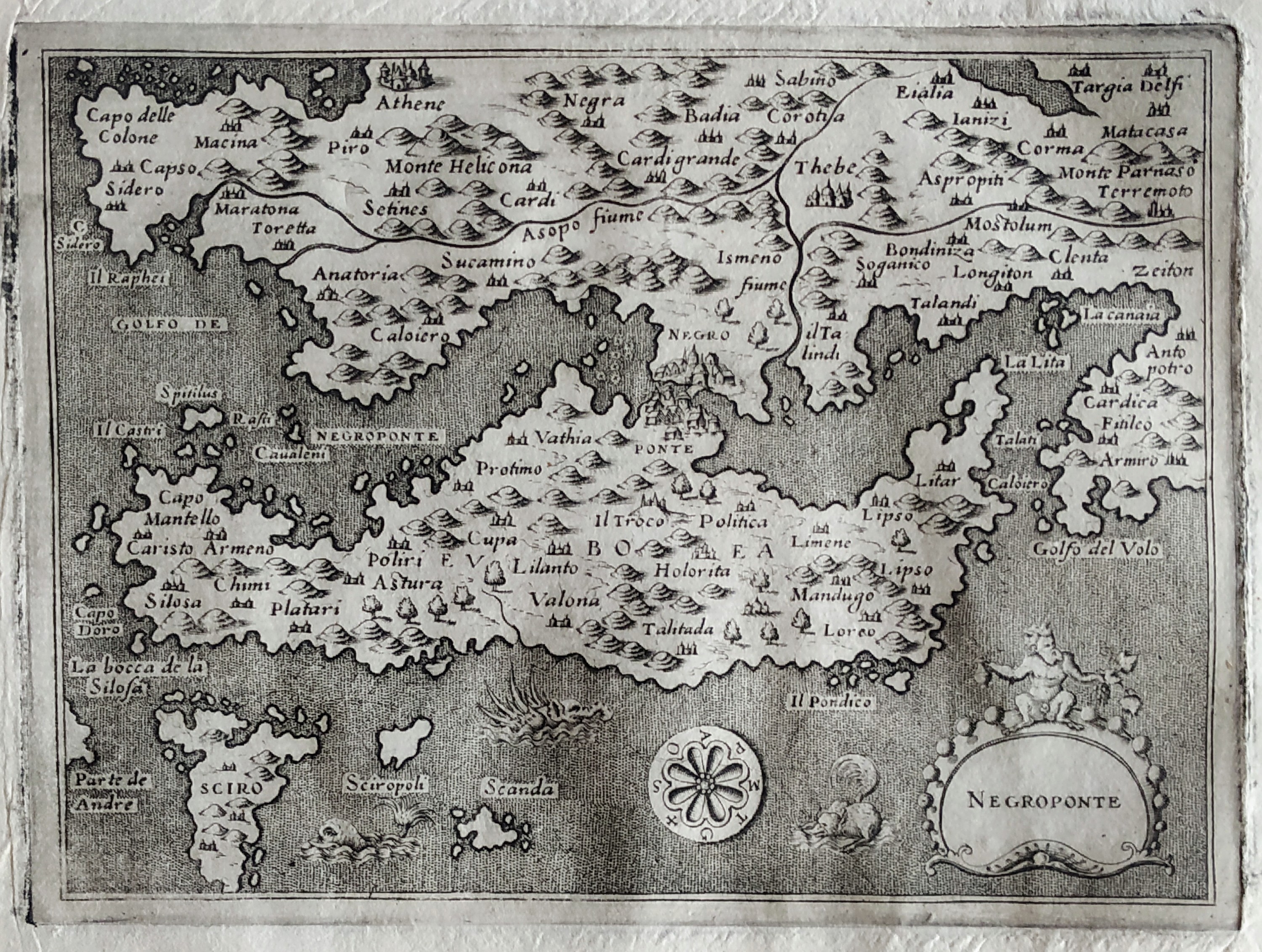
Map title
Descrittione dell'isola Negroponte
Author
Porcacchi
Location shown in map
Euboea
Edition date
1576
Edition place
Venice
Editor
--
Atlas
L'Isole piu famose del mondo -- S. Galignani and G. Porro
Price
Please ask: info@thetreasuremaps.com
State
[MINT/excellent/very good/good/fair/mediocre/poor]
Color
Black/white
Verso
Italian text pag.141
Size
Plate: cm (15.2 x 11.4) inches (5.98 x 4.49) Paper: cm (19 x 27.9) inches (7.48 x 10.98)
Technique
Copper engraving
Note
No particular notes for this maps
Reference
Genoa pubblic library "Civica Berio"
Wiki
Here for more info
In stock
Available
Info
info@thetreasuremaps.com
Code
#0800
×
![]()
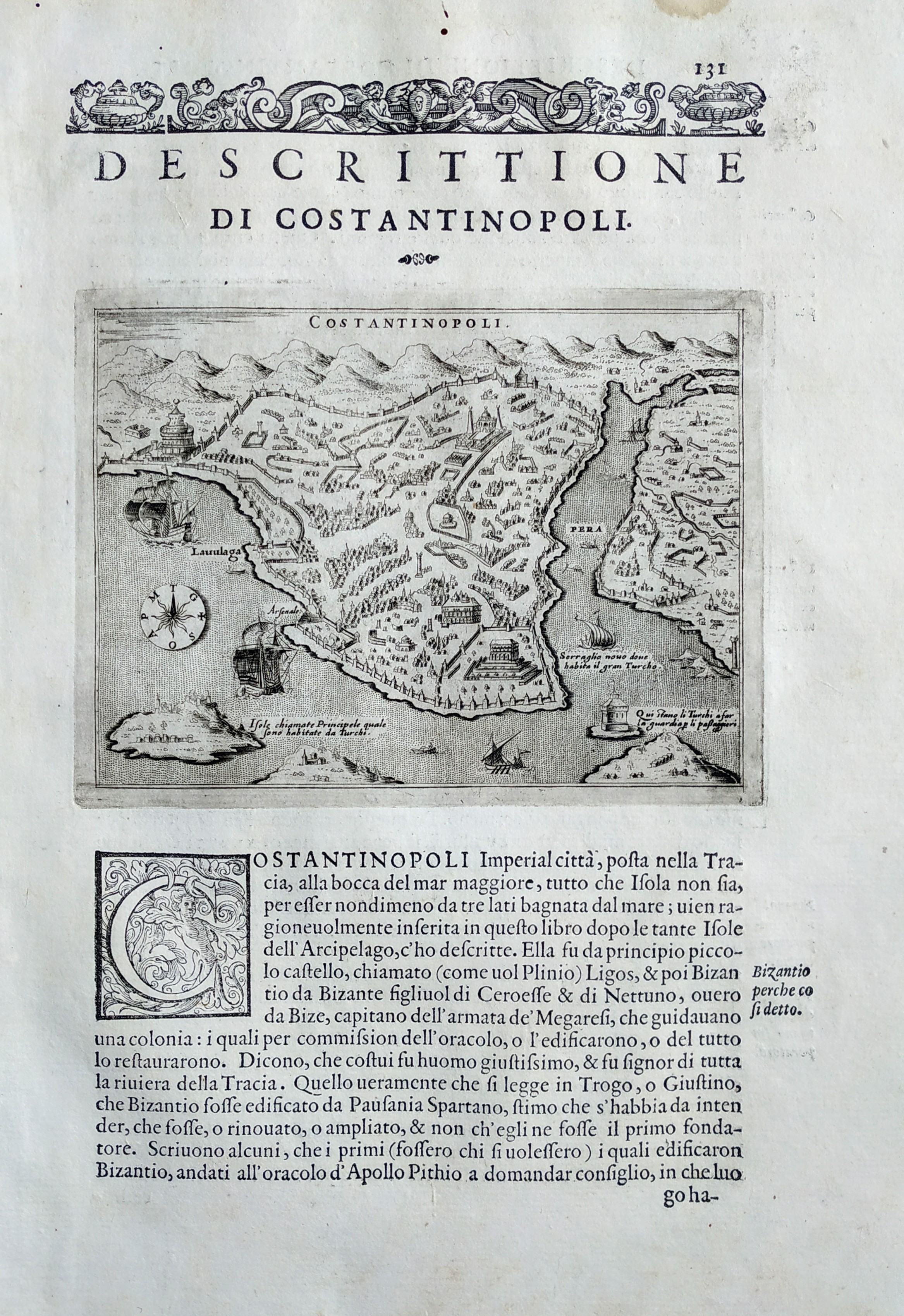
Map title
Descrittione di Costantinopoli
Author
Porcacchi
Location shown in map
Constantinople
Edition date
1576
Edition place
Venice
Editor
--
Atlas
L'Isole piu famose del mondo -- S. Galignani and G. Porro
Price
Please ask: info@thetreasuremaps.com
State
[MINT/excellent/very good/good/fair/mediocre/poor]
Color
Black/white
Verso
Italian text pag.132
Size
Plate: cm (15.2 x 11.4) inches (5.98 x 4.49) Paper: cm (19 x 27.9) inches (7.48 x 10.98)
Technique
Copper engraving
Note
No particular notes for this maps
Reference
Genoa pubblic library "Civica Berio"
Wiki
Here for more info
In stock
Available
Info
info@thetreasuremaps.com
Code
#0801
×
![]()
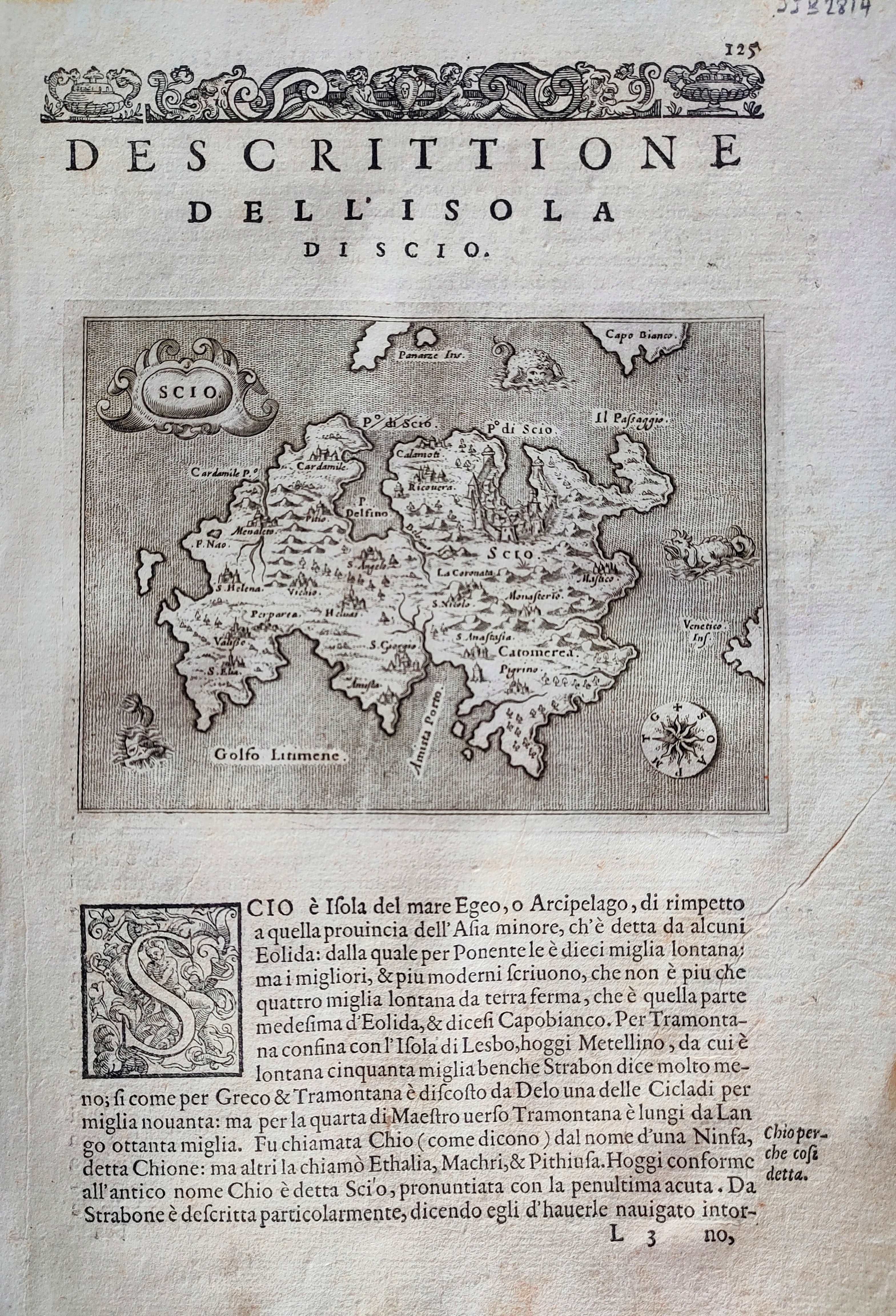
Map title
Descrittione dell'isola di Scio
Author
Porcacchi
Location shown in map
Scio
Edition date
1576
Edition place
Venice
Editor
--
Atlas
L'Isole piu famose del mondo -- S. Galignani and G. Porro
Price
Please ask: info@thetreasuremaps.com
State
[mint/EXCELLENT/very good/good/fair/mediocre/poor]
Color
Black/white
Verso
Italian text pag.126
Size
Plate: cm (15.2 x 11.4) inches (5.98 x 4.49) Paper: cm (20.3 x 29.2) inches (7.99 x 11.5)
Technique
Copper engraving
Note
Reference
--
Wiki
Here for more info
In stock
Available
Info
info@thetreasuremaps.com
Code
#0867
×
![]()
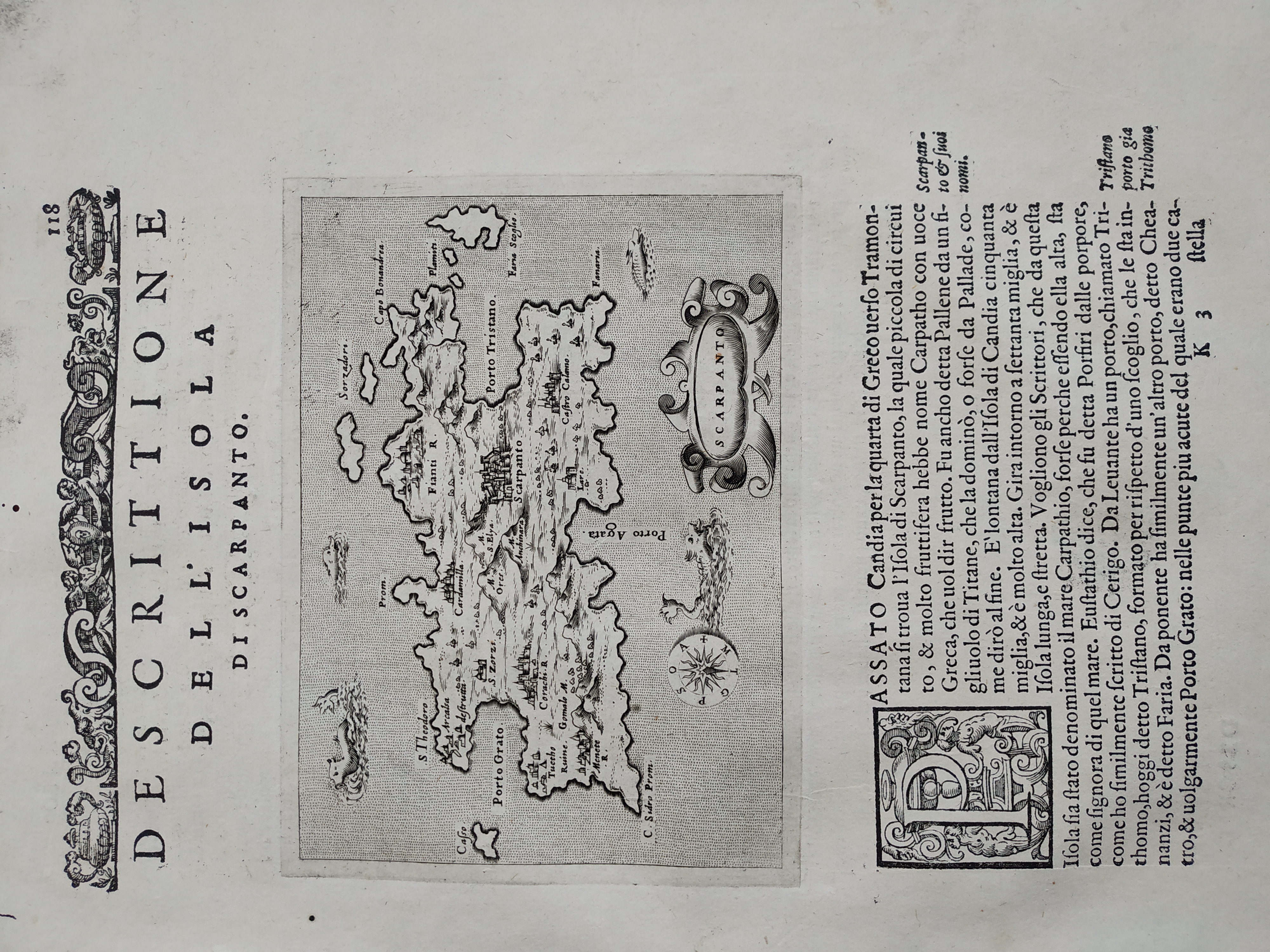
Map title
Descrittione dell'isola di Scarpanto
Author
Porcacchi
Location shown in map
Scarpanto
Edition date
1576
Edition place
Venice
Editor
--
Atlas
L'Isole piu famose del mondo -- S. Galignani and G. Porro
Price
Please ask: info@thetreasuremaps.com
State
[MINT/excellent/very good/good/fair/mediocre/poor]
Color
Black/white
Verso
Italian text pag.114
Size
Plate: cm (15.2 x 11.4) inches (5.98 x 4.49) Paper: cm (19 x 27.9) inches (7.48 x 10.98)
Technique
Copper engraving
Note
No particular notes for this maps
Reference
Genoa pubblic library "Civica Berio"
Wiki
Here for more info
In stock
Available
Info
info@thetreasuremaps.com
Code
#0834
×
![]()
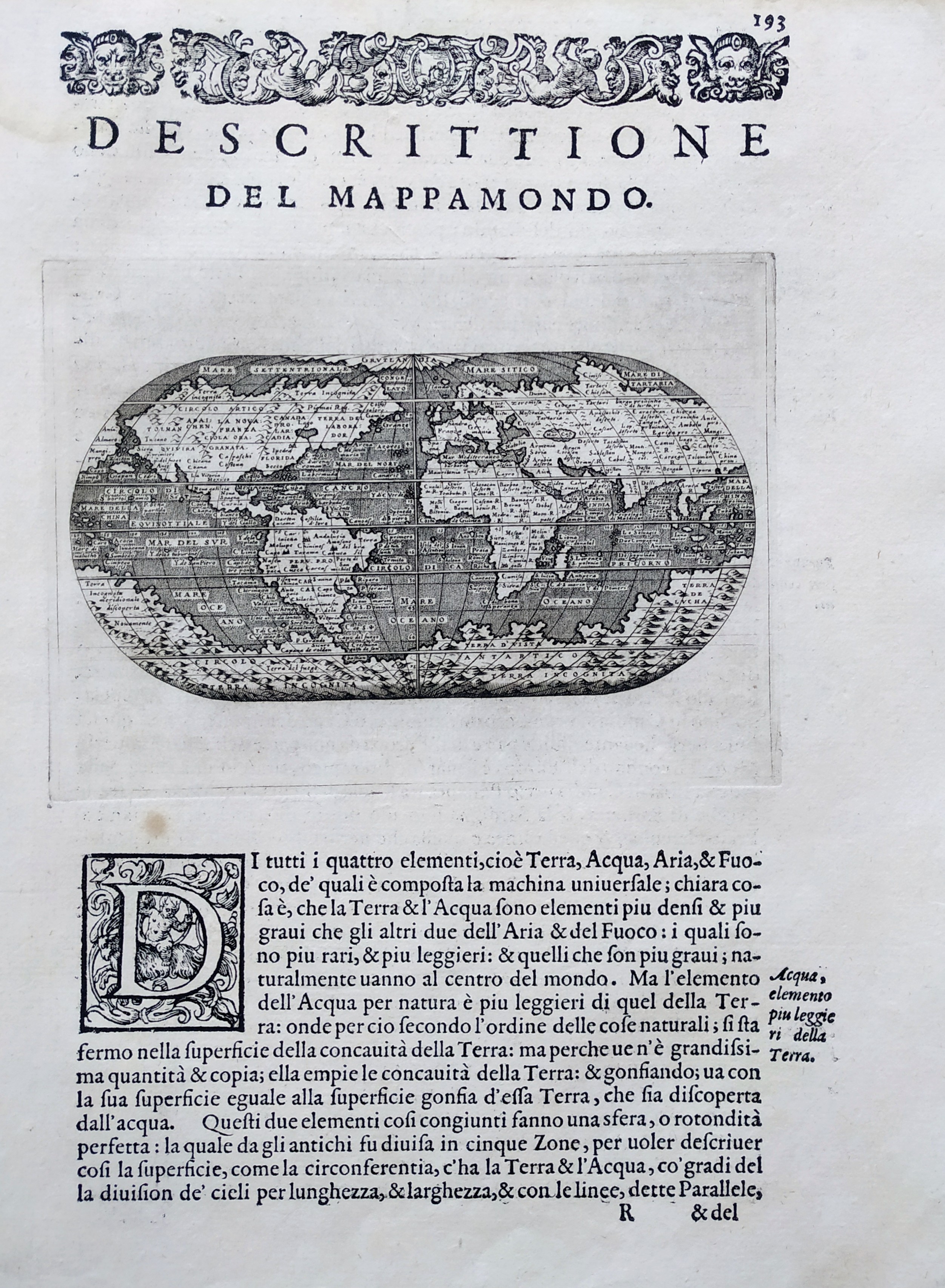
Map title
Descrittione del Mappamondo
Author
Porcacchi
Location shown in map
World
Edition date
1576
Edition place
Venice
Editor
--
Atlas
L'Isole piu famose del mondo -- S. Galignani and G. Porro
Price
Please ask: info@thetreasuremaps.com
State
[mint/EXCELLENT/very good/good/fair/mediocre/poor]
Color
Black/white
Verso
Italian text pag.194
Size
Plate: cm (15.2 x 11.4) inches (5.98 x 4.49) Paper: cm (20.3 x 29.2) inches (7.99 x 11.5)
Technique
Copper engraving
Note
Reference
--
Wiki
Here for more info
In stock
Available
Info
info@thetreasuremaps.com
Code
#0837
×
![]()
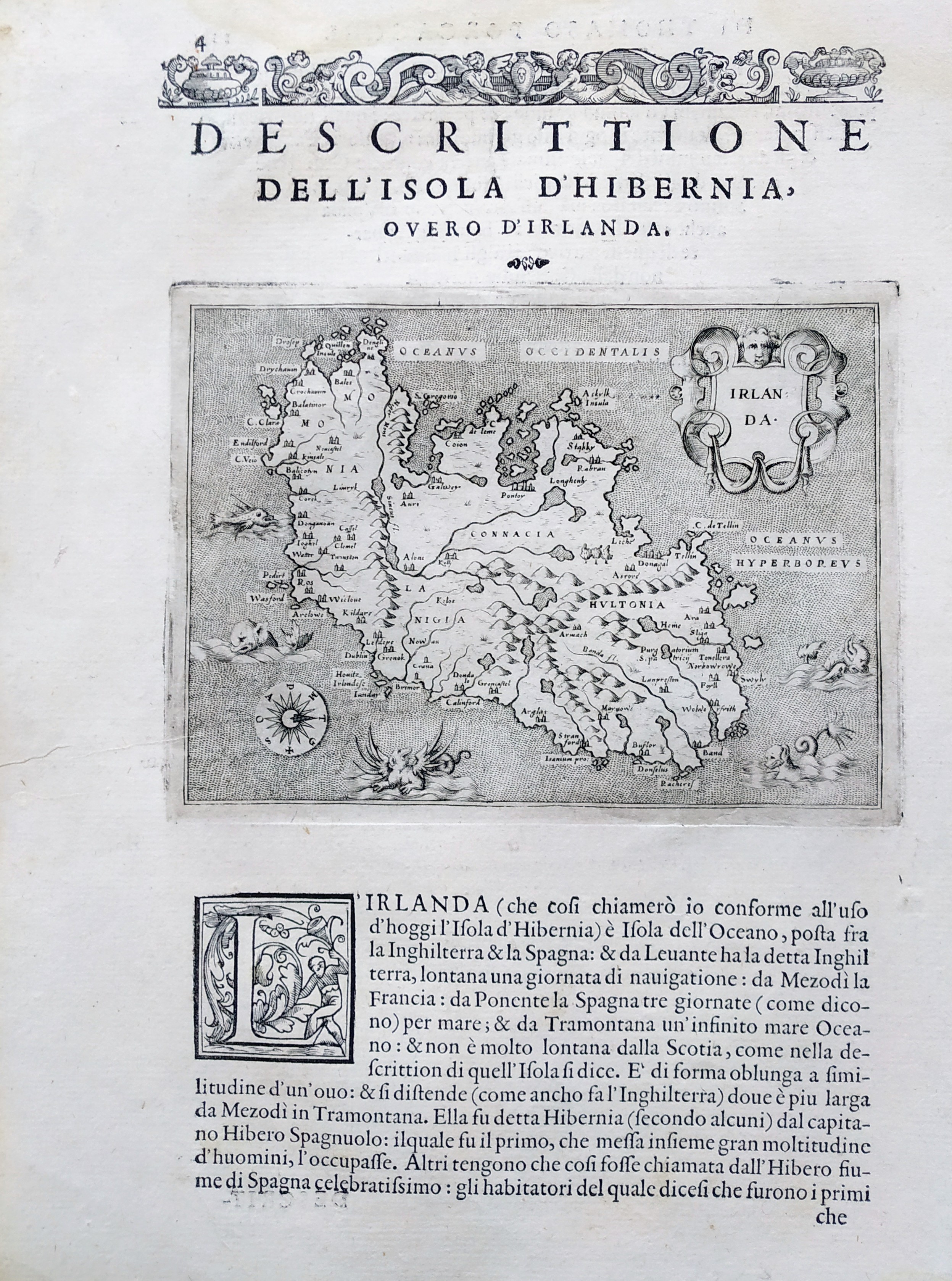
Map title
Descrittione del Mappamondo
Author
Porcacchi
Location shown in map
Ireland
Edition date
1576
Edition place
Venice
Editor
--
Atlas
L'Isole piu famose del mondo -- S. Galignani and G. Porro
Price
Please ask: info@thetreasuremaps.com
State
[mint/EXCELLENT/very good/good/fair/mediocre/poor]
Color
Black/white
Verso
Italian text pag.11
Size
Plate: cm (15.2 x 11.4) inches (5.98 x 4.49) Paper: cm (20.3 x 29.2) inches (7.99 x 11.5)
Technique
Copper engraving
Note
Reference
--
Wiki
Here for more info
In stock
Available
Info
info@thetreasuremaps.com
Code
#0838
×
![]()
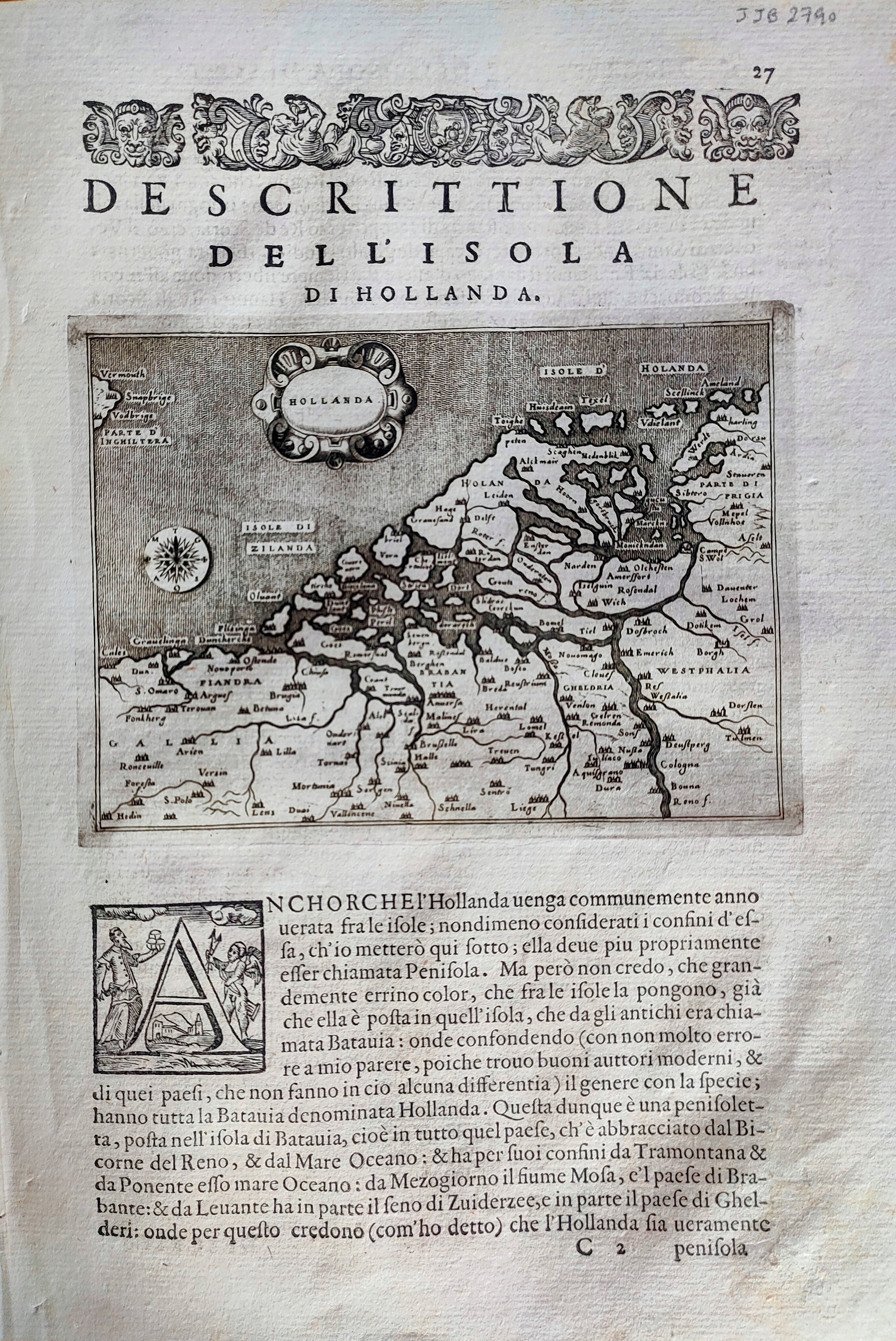
Map title
Descrittione dell'isola di Hollanda
Author
Porcacchi
Location shown in map
Netherlands
Edition date
1576
Edition place
Venice
Editor
--
Atlas
L'Isole piu famose del mondo -- S. Galignani and G. Porro
Price
Please ask: info@thetreasuremaps.com
State
[mint/EXCELLENT/very good/good/fair/mediocre/poor]
Color
Black/white
Verso
Italian text pag.28
Size
Plate: cm (15.2 x 11.4) inches (5.98 x 4.49) Paper: cm (20.3 x 29.2) inches (7.99 x 11.5)
Technique
Copper engraving
Note
Reference
--
Wiki
Here for more info
In stock
Available
Info
info@thetreasuremaps.com
Code
#0868
×
![]()
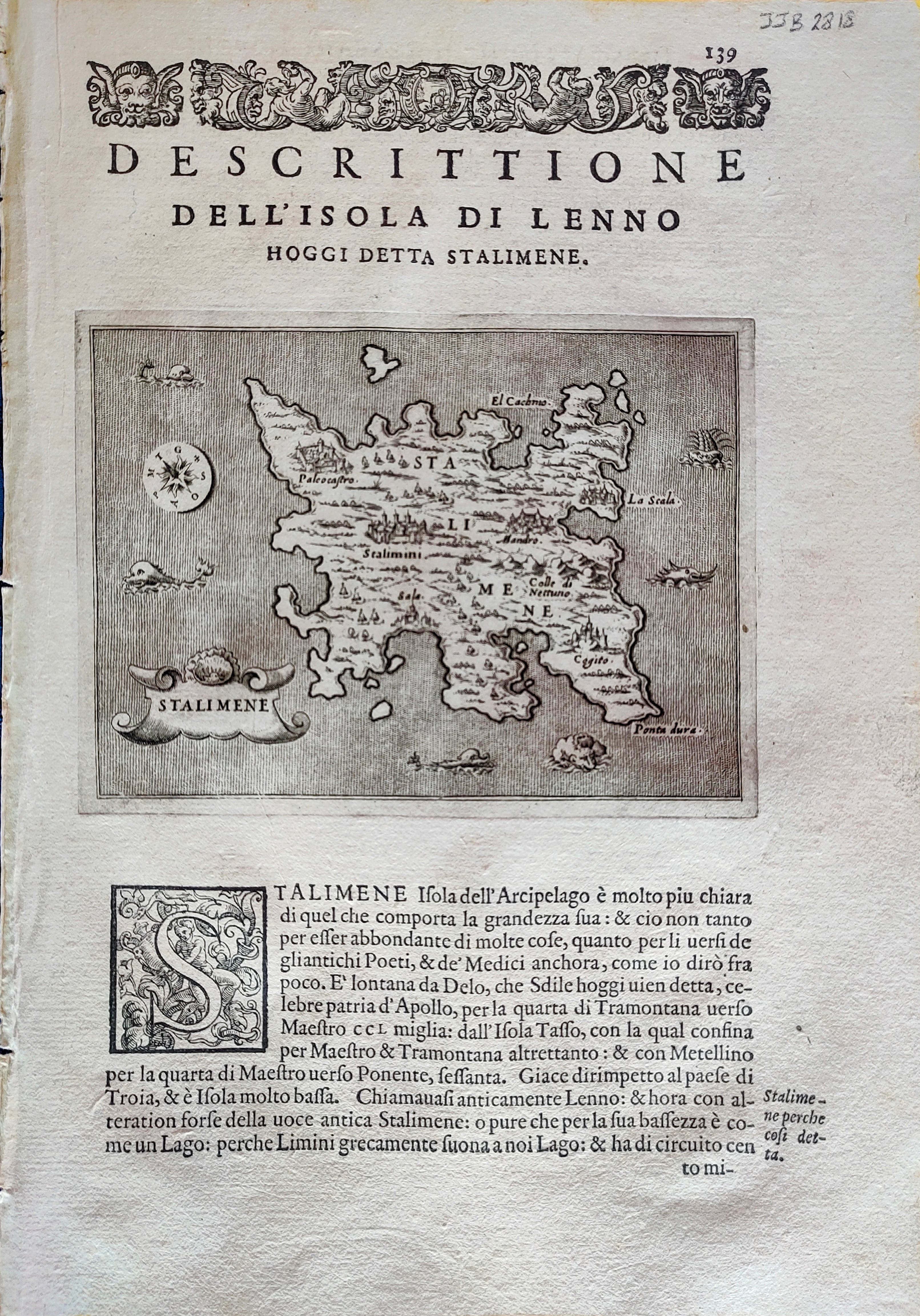
Map title
Descrittione dell'isola di Lenno
Author
Porcacchi
Location shown in map
Lemnos
Edition date
1576
Edition place
Venice
Editor
--
Atlas
L'Isole piu famose del mondo -- S. Galignani and G. Porro
Price
Please ask: info@thetreasuremaps.com
State
[mint/EXCELLENT/very good/good/fair/mediocre/poor]
Color
Black/white
Verso
Italian text pag.140
Size
Plate: cm (15.2 x 11.4) inches (5.98 x 4.49) Paper: cm (20.3 x 28) inches (7.99 x 11.02)
Technique
Copper engraving
Note
Reference
--
Wiki
Here for more info
In stock
Available
Info
info@thetreasuremaps.com
Code
#0899
×
![]()
Map title
Descrittione dell'isola et citta di Vinetia
Author
Porcacchi
Location shown in map
Venice
Edition date
1576
Edition place
Venice
Editor
--
Atlas
L'Isole piu famose del mondo -- S. Galignani and G. Porro
Price
Please ask: info@thetreasuremaps.com
State
[mint/excellent/VERY GOOD/good/fair/mediocre/poor]
Color
Black/white
Verso
Italian text pag.66
Size
Plate: cm (15.2 x 11.4) inches (5.98 x 4.49) Paper: cm (20.3 x 26) inches (7.99 x 10.24)
Technique
Copper engraving
Note
Reference
--
Wiki
Here for more info
In stock
Available
Info
info@thetreasuremaps.com
Code
#0905
×
![]()
Map title
Descrittione dell'isola della Cefalonia
Author
Porcacchi
Location shown in map
Kefalonia
Edition date
1576
Edition place
Venice
Editor
--
Atlas
L'Isole piu famose del mondo -- S. Galignani and G. Porro
Price
Please ask: info@thetreasuremaps.com
State
[MINT/excellent/very good/good/fair/mediocre/poor]
Color
Black/white
Verso
Italian text pag.96
Size
Plate: cm (15.2 x 11.4) inches (5.98 x 4.49) Paper: cm (21 x 30) inches (8.27 x 11.81)
Technique
Copper engraving
Note
Reference
Genoa pubblic library "Civica Berio"
Wiki
Here for more info
In stock
Available
Info
info@thetreasuremaps.com
Code
#0967
×
![]()
Map title
Descrittione dell'isola del Zante
Author
Porcacchi
Location shown in map
Zante
Edition date
1576
Edition place
Venice
Editor
--
Atlas
L'Isole piu famose del mondo -- S. Galignani and G. Porro
Price
Please ask: info@thetreasuremaps.com
State
[MINT/excellent/very good/good/fair/mediocre/poor]
Color
Black/white
Verso
Italian text pag.97
Size
Plate: cm (15.2 x 11.4) inches (5.98 x 4.49) Paper: cm (21 x 30) inches (8.27 x 11.81)
Technique
Copper engraving
Note
Reference
Genoa pubblic library "Civica Berio"
Wiki
Here for more info
In stock
Available
Info
info@thetreasuremaps.com
Code
#0968
×
![]()
Map title
Descrittione dell'isole Molucche
Author
Porcacchi
Location shown in map
Southest Asia
Edition date
1576
Edition place
Venice
Editor
--
Atlas
L'Isole piu famose del mondo -- S. Galignani and G. Porro
Price
400 Euro
State
[MINT/excellent/very good/good/fair/mediocre/poor]
Color
Black/white
Verso
Italian text pag.190
Size
Plate: cm (15.2 x 11.4) inches (5.98 x 4.49) Paper: cm (19 x 27.9) inches (7.48 x 10.98)
Technique
Copper engraving
Note
Reference
Genoa pubblic library "Civica Berio"
Wiki
Here for more info
In stock
Available
Info
info@thetreasuremaps.com
Code
#1077
×
![]()
Map title
Descrittione del conflitto
Author
Porcacchi
Location shown in map
Conflitto
Edition date
1576
Edition place
Venice
Editor
--
Atlas
L'Isole piu famose del mondo -- S. Galignani and G. Porro
Price
400 Euro
State
[mint/EXCELLENT/very good/good/fair/mediocre/poor]
Color
Black/white
Verso
Italian text pag. 87
Size
Plate: cm (15.2 x 11.4) inches (5.98 x 4.49) Paper: cm (18 x 28) inches (7.09 x 11.02)
Technique
Copper engraving
Note
Reference
Genoa pubblic library "Civica Berio"
Wiki
Here for more info
In stock
Available
Info
info@thetreasuremaps.com
Code
#1095
×
![]()
Map title
Descrittione dell'isola di Cipro
Author
Porcacchi
Location shown in map
Cyprus
Edition date
1576
Edition place
Venice
Editor
--
Atlas
L'Isole piu famose del mondo -- S. Galignani and G. Porro
Price
400 Euro
State
[mint/EXCELLENT/very good/good/fair/mediocre/poor]
Color
Black/white
Verso
Italian text pag.144
Size
Plate: cm (15.2 x 11.4) inches (5.98 x 4.49) Paper: cm (21 x 30) inches (8.27 x 11.81)
Technique
Copper engraving
Note
Reference
Genoa pubblic library "Civica Berio"
Wiki
Here for more info
In stock
Available
Info
info@thetreasuremaps.com
Code
#1096
×
![]()
Map title
Descrittione dell'isola di Candia
Author
Porcacchi
Location shown in map
Crete
Edition date
1576
Edition place
Venice
Editor
--
Atlas
L'Isole piu famose del mondo -- S. Galignani and G. Porro
Price
400 Euro
State
[mint/EXCELLENT/very good/good/fair/mediocre/poor]
Color
Old colors
Verso
Italian text pag.108
Size
Plate: cm (15.2 x 11.4) inches (5.98 x 4.49) Paper: cm (20 x 30) inches (7.87 x 11.81)
Technique
Copper engraving
Note
Reference
Genoa pubblic library "Civica Berio"
Wiki
Here for more info
In stock
Available
Info
info@thetreasuremaps.com
Code
#1097
×
![]()
Map title
Europe
Author
Munster
Location shown in map
Europe
Edition date
1578
Edition place
Basel
Editor
Henrich Petri
Atlas
Cosmographia Universalis
Price
400 Euro
State
[mint/excellent/VERY GOOD/good/fair/mediocre/poor]
Color
Black/white
Verso
German text
Size
Plate: cm (35.6 x 30.5) inches (14.02 x 12.01) Paper: cm (43.2 x 36.8) inches (17.01 x 14.49)
Technique
Woodcut
Note
--
Reference
--
Wiki
Here for more info
In stock
Available
Info
info@thetreasuremaps.com
Code
#0214
Europe
Author
Munster
Location shown in map
Europe
Edition date
1578
Edition place
Basel
Editor
Henrich Petri
Atlas
Cosmographia Universalis
Price
400 Euro
State
[mint/excellent/VERY GOOD/good/fair/mediocre/poor]
Color
Black/white
Verso
German text
Size
Plate: cm (35.6 x 30.5) inches (14.02 x 12.01) Paper: cm (43.2 x 36.8) inches (17.01 x 14.49)
Technique
Woodcut
Note
--
Reference
--
Wiki
Here for more info
In stock
Available
Info
info@thetreasuremaps.com
Code
#0214
×
![]()
Map title
Europe
Author
Munster
Location shown in map
Genoa
Edition date
1578
Edition place
Basel
Editor
Henrich Petri
Atlas
Cosmographia Universalis
Price
Please ask: info@thetreasuremaps.com
State
[mint/excellent/VERY GOOD/good/fair/mediocre/poor]
Color
Black/white
Verso
German text
Size
Plate: cm (40.6 x 14) inches (15.98 x 5.51) Paper: cm (41.9 x 33) inches (16.5 x 12.99)
Technique
Woodcut
Note
--
Reference
--
Wiki
Here for more info
In stock
Available
Info
info@thetreasuremaps.com
Code
#0590
×
![]()
Map title
Italie Novissima Descriptio
Author
Ortelius
Location shown in map
Italy
Edition date
1579
Edition place
Antwerp
Editor
--
Atlas
Theatrum Orbis Terrarum
Price
1200 Euro
State
[mint/EXCELLENT/very good/good/fair/mediocre/poor]
Color
Black/white
Verso
Latin text pag.58
Size
Plate: cm (50 x 35) inches (19.69 x 13.78) Paper: cm (54 x 43.2) inches (21.26 x 17.01)
Technique
Copper engraving
Note
Reference
Van Den Broecke 117
Wiki
Here for more info
In stock
Available
Info
info@thetreasuremaps.com
Code
#0741
×
![]()
Map title
Angliae regni
Author
Ortelius
Location shown in map
England
Edition date
1579
Edition place
Antwerp
Editor
--
Atlas
Theatrum Orbis Terrarum
Price
700 Euro
State
[mint/excelent/very good/good/FAIR/mediocre/poor]
Color
Black/white
Verso
Latin text pag.10
Size
Plate: cm (46 x 37) inches (18.11 x 14.57) Paper: cm (52 x 49) inches (20.47 x 19.29)
Technique
Copper engraving
Note
No particular notes for this maps.
Reference
Van Den Broecke 117
Wiki
Here for more info
In stock
Available
Info
info@thetreasuremaps.com
Code
#0748
×
![]()
Map title
Persici Sive Sophorum Regni Typus
Author
Ortelius
Location shown in map
Persia
Edition date
1580
Edition place
--
Editor
--
Atlas
Theatrum Orbis Terrarum
Price
Please ask: info@thetreasuremaps.com
State
[mint/excellent/very good/good/fair/mediocre/POOR]
Color
Old colors
Verso
German text pag.85
Size
Plate: cm (49.5 x 36.8) inches (19.49 x 14.49) Paper: cm (53.3 x 40.6) inches (20.98 x 15.98)
Technique
Copper engraving
Note
No particular notes for this maps.
Reference
Van Den Broecke 167
Wiki
Here for more info
In stock
Available
Info
info@thetreasuremaps.com
Code
#0198
×
![]()
Map title
Persici Sive Sophorum Regni Typus
Author
Ortelius
Location shown in map
Persia
Edition date
Circa 1580
Edition place
Amsterdam
Editor
--
Atlas
Theatrum Orbis Terrarum
Price
400 Euro
State
[mint/EXCELLENT/very good/good/fair/mediocre/poor]
Color
Old colors
Verso
Size
Plate: cm (52 x 40) inches (20.47 x 15.75) Paper: cm (51 x 36) inches (20.08 x 14.17)
Technique
Copper engraving
Note
framed
Reference
Van Den Broecke 167
Wiki
Here for more info
In stock
Available
Info
info@thetreasuremaps.com
Code
#1229
×
![]()
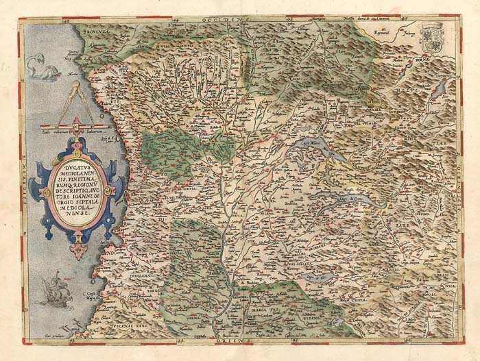
Map title
Ducatus Mediolanensis, Finitimarumq Regionu Descriptio Auctore Iooanne Georgio Septala Mediolanense
Author
Ortelius
Location shown in map
Mediolanum Ducatus, North west Italy
Edition date
1584
Edition place
Antwerp
Editor
--
Atlas
Theatrum Orbis Terrarum
Price
600 Euro
State
[mint/excellent/VERY GOOD/good/fair/mediocre/poor]
Color
Old color
Verso
Latin text pag.67
Size
Plate: cm (47 x 36.8) inches (18.5 x 14.49) Paper: cm (55.9 x 43.2) inches (22.01 x 17.01)
Technique
Copper engraving
Note
No particular notes for this maps.
Reference
Van Den Broecke 125
Wiki
Here for more info
In stock
Available
Info
info@thetreasuremaps.com
Code
#0125
×
![]()
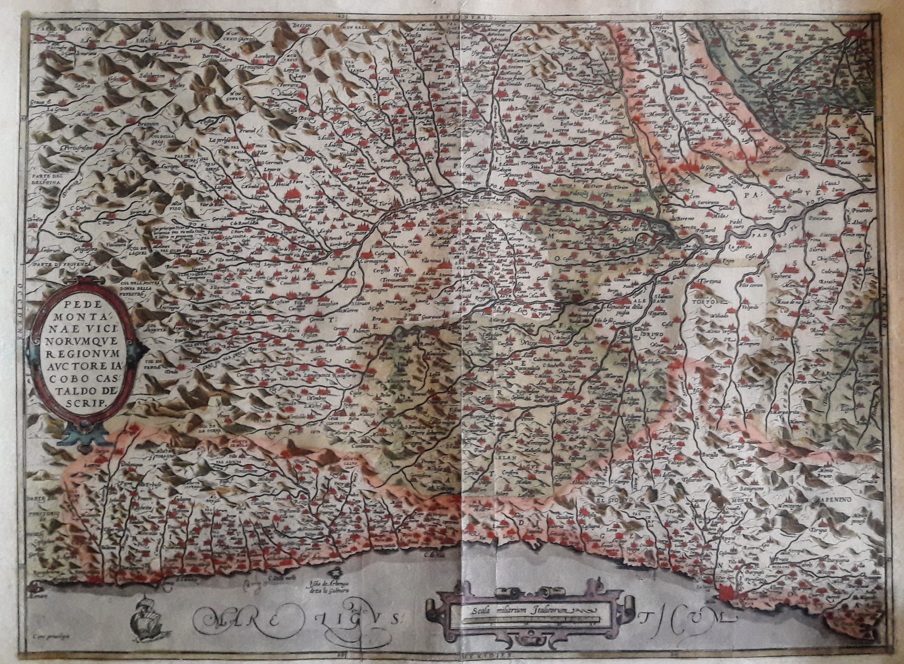
Map title
Pedmontanae Vicinorumque Regionum Auctore Iacobo Castaldo Descrip.
Author
Ortelius
Location shown in map
Piedmont & Liguria, North west Italy
Edition date
1584
Edition place
Antwerp
Editor
--
Atlas
Theatrum Orbis Terrarum
Price
400 Euro
State
[mint/excellent/very good/GOOD/fair/mediocre/poor]
Color
Old color
Verso
Latin text pag.74
Size
Plate: cm (48.3 x 35.6) inches (19.02 x 14.02) Paper: cm (53.3 x 44.4) inches (20.98 x 17.48)
Technique
Copper engraving
Note
Professionally restored
Reference
Van Den Broecke 128
Wiki
Here for more info
In stock
Available
Info
info@thetreasuremaps.com
Code
#0128
×
![]()
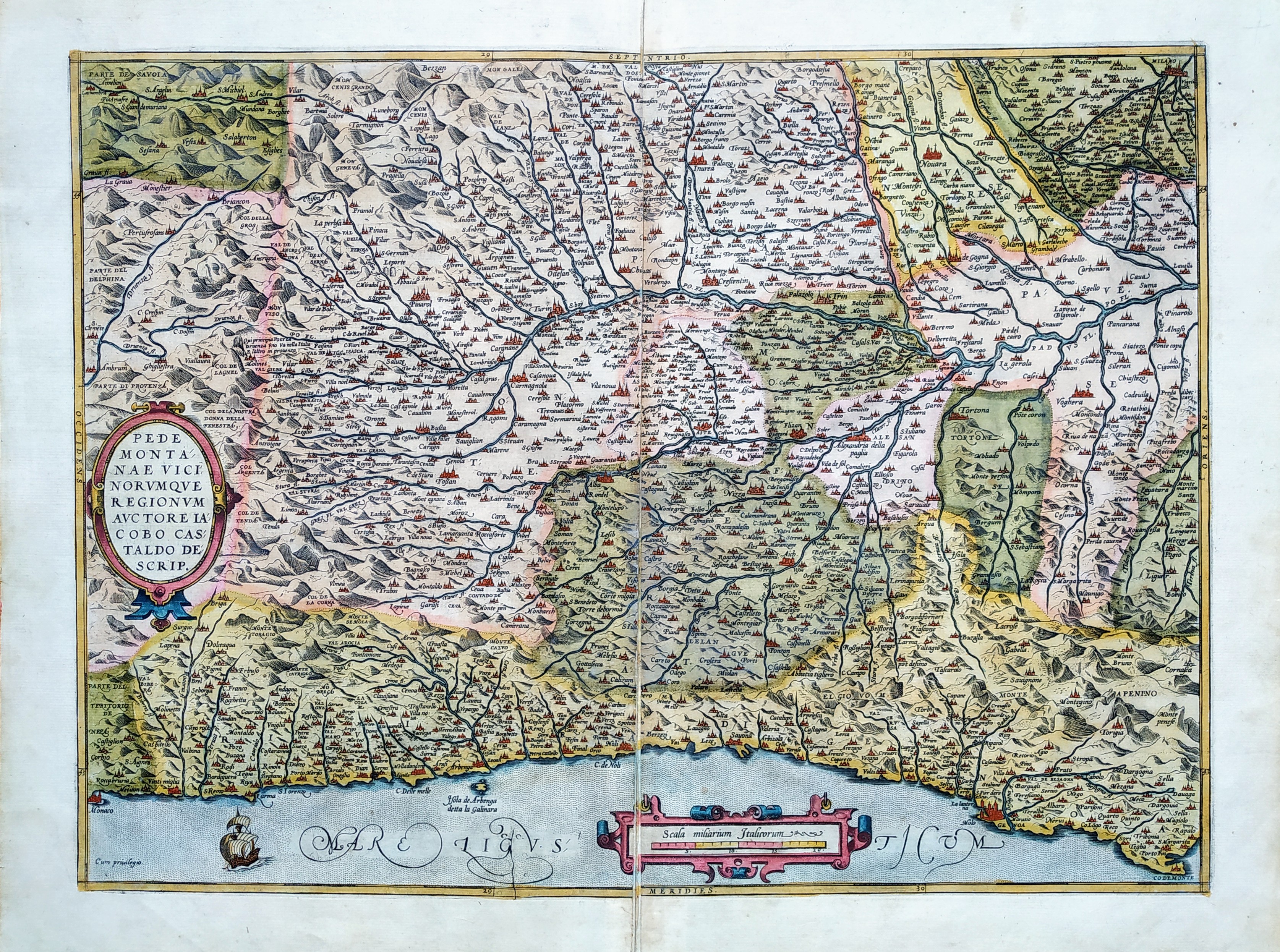
Map title
Pedmontanae Vicinorumque Regionum Auctore Iacobo Castaldo Descrip.
Author
Ortelius
Location shown in map
Piedmont & Liguria, North west Italy
Edition date
1584
Edition place
Antwerp
Editor
--
Atlas
Theatrum Orbis Terrarum
Price
Please ask: info@thetreasuremaps.com
State
[mint/EXCELLENT/very good/good/fair/mediocre/poor]
Color
Old color
Verso
Latin text pag.74
Size
Plate: cm (49 x 36) inches (19.29 x 14.17) Paper: cm (56 x 44) inches (22.05 x 17.32)
Technique
Copper engraving
Note
No particular notes for this maps.
Reference
Van Den Broecke 128
Wiki
Here for more info
In stock
Available
Info
info@thetreasuremaps.com
Code
#0764
×
![]()
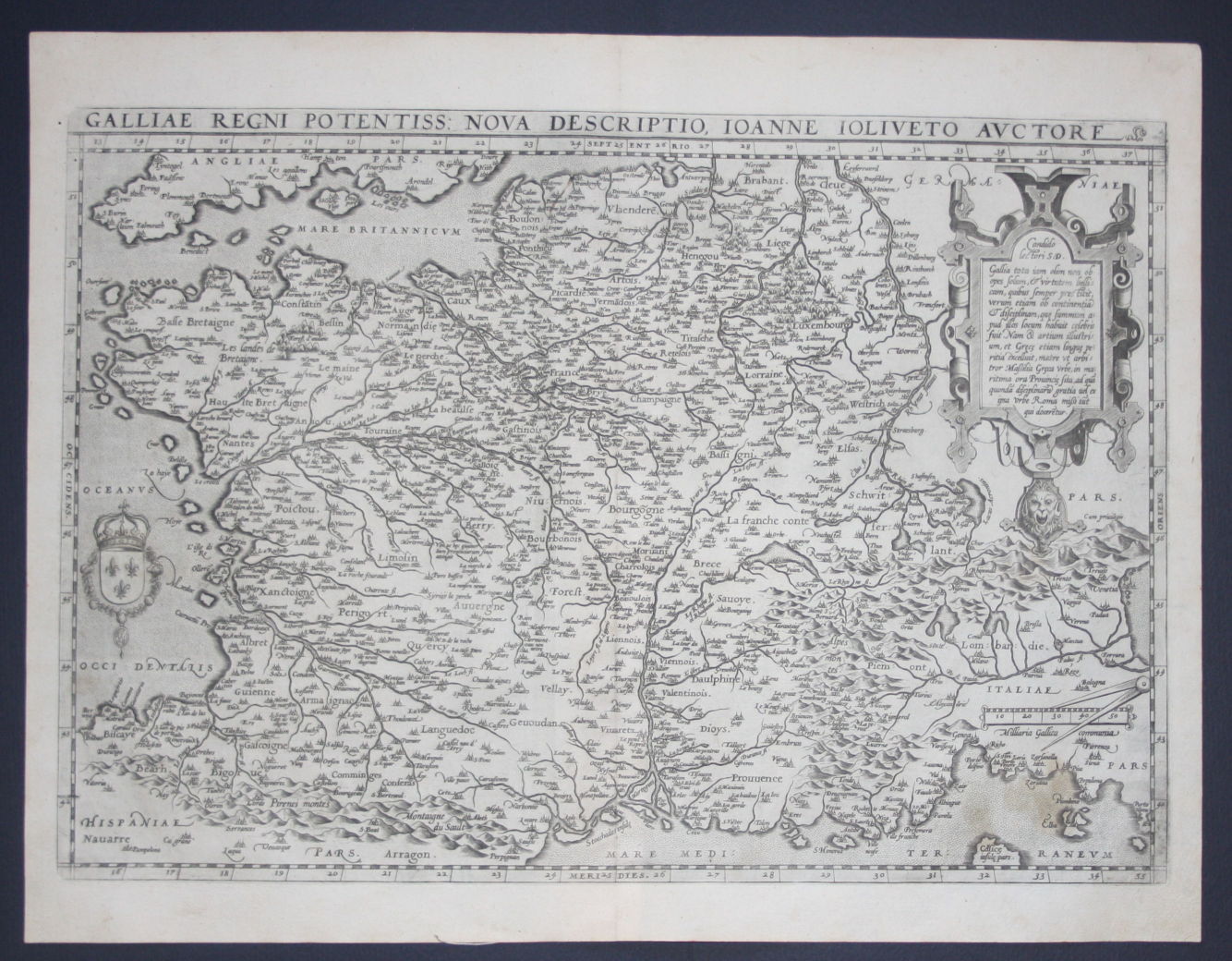
Map title
Galliae regni potentiss: nuova descriptio Ioanne Ioliveto auctore
Author
Ortelius
Location shown in map
France
Edition date
1588
Edition place
Anvers
Editor
--
Atlas
Theatrum Orbis Terrarum
Price
400 Euro
State
[mint/EXCELLENT/very good/good/fair/mediocre/poor]
Color
Black/white
Verso
Spanish text pag.22
Size
Plate: cm (48.3 x 34.3) inches (19.02 x 13.5) Paper: cm (53.3 x 40.6) inches (20.98 x 15.98)
Technique
Copper engraving
Note
No particular notes for this maps
Reference
Van Den Broecke 34
Wiki
Here for more info
In stock
Available
Info
info@thetreasuremaps.com
Code
#0123
×
![]()
Map title
Ducatus Mediolanensis, Finitimarumq Regionu Descriptio Auctore Iooanne Georgio Septala Mediolanense
Author
Ortelius
Location shown in map
Mediolanum Ducatus, North west Italy
Edition date
1588
Edition place
Antwerp
Editor
--
Atlas
Theatrum Orbis Terrarum
Price
500 Euro
State
[mint/EXCELLENT/very good/good/fair/mediocre/poor]
Color
Black/white
Verso
Spanish text pag.67
Size
Plate: cm (47 x 35.6) inches (18.5 x 14.02) Paper: cm (53.3 x 40.6) inches (20.98 x 15.98)
Technique
Copper engraving
Note
No particular notes for this maps.
Reference
Van Den Broecke 125
Wiki
Here for more info
In stock
Available
Info
info@thetreasuremaps.com
Code
#0124
×
![]()
Map title
Pedmontanae Vicinorumque Regionum Auctore Iacobo Castaldo Descrip.
Author
Ortelius
Location shown in map
Piedmont & Liguria, North west Italy
Edition date
1588
Edition place
Antwerp
Editor
--
Atlas
Theatrum Orbis Terrarum
Price
500 Euro
State
[mint/EXCELLENT/very good/good/fair/mediocre/poor]
Color
Black/white
Verso
Spanish text pag.69
Size
Plate: cm (47 x 35.6) inches (18.5 x 14.02) Paper: cm (53.3 x 40.6) inches (20.98 x 15.98)
Technique
Copper engraving
Note
No particular notes for this maps.
Reference
Van Den Broecke 128
Wiki
Here for more info
In stock
Available
Info
info@thetreasuremaps.com
Code
#0127
×
![]()
Map title
Scotiae tabula
Author
Ortelius
Location shown in map
Scotland
Edition date
1588
Edition place
Antwerp
Editor
Atlas
Theatrum Orbis Terrarum
Price
800 Euro
State
[mint/EXCELLENT/very good/good/fair/mediocre/poor]
Color
Old colors
Verso
Spanish text pag 10
Size
Plate: cm (47 x 35) inches (18.5 x 13.78) Paper: cm (53 x 42) inches (20.87 x 16.54)
Technique
Copper engraving
Note
Reference
Van Den Broecke 59
Wiki
Here for more info
In stock
Available
Info
info@thetreasuremaps.com
Code
#1160
×
![]()
Map title
Cambriae Typus
Author
Ortelius
Location shown in map
Wales
Edition date
1588
Edition place
Antwerp
Editor
Atlas
Theatrum Orbis Terrarum
Price
700 Euro
State
[mint/EXCELLENT/very good/good/fair/mediocre/poor]
Color
Old colors
Verso
Spanish text
Size
Plate: cm (47 x 35) inches (18.5 x 13.78) Paper: cm (53 x 42) inches (20.87 x 16.54)
Technique
Copper engraving
Note
Reference
Van Den Broecke 62
Wiki
Here for more info
In stock
Available
Info
info@thetreasuremaps.com
Code
#1165
×
![]()
Map title
Septentrionalium regionum descriptio
Author
Ortelius
Location shown in map
North Atlantic
Edition date
1588
Edition place
Antwerp
Editor
Atlas
Theatrum Orbis Terrarum
Price
1600 Euro
State
[mint/EXCELLENT/very good/good/fair/mediocre/poor]
Color
Old colors
Verso
Spanish text
Size
Plate: cm (47 x 35) inches (18.5 x 13.78) Paper: cm (53 x 42) inches (20.87 x 16.54)
Technique
Copper engraving
Note
Reference
Van Den Broecke 211
Wiki
Here for more info
In stock
Available
Info
info@thetreasuremaps.com
Code
#1166
×
![]()
Map title
Prussiae
Author
Ortelius
Location shown in map
Poland
Edition date
1588
Edition place
Antwerp
Editor
Atlas
Theatrum Orbis Terrarum
Price
350 Euro
State
[mint/excellent/very good/good/FAIR/mediocre/poor]
Color
Old colors
Verso
Spanish text
Size
Plate: cm (51 x 42) inches (20.08 x 16.54) Paper: cm (42 x 36) inches (16.54 x 14.17)
Technique
Copper engraving
Note
Reference
Van Den Broecke 206
Wiki
Here for more info
In stock
Available
Info
info@thetreasuremaps.com
Code
#1187
×
![]()
Map title
Pedmontanae Vicinorumque Regionum Auctore Iacobo Castaldo Descrip.
Author
Ortelius
Location shown in map
Piedmont & Liguria, North west Italy
Edition date
1589
Edition place
Antwerp
Editor
--
Atlas
Theatrum Orbis Terrarum
Price
Please ask: info@thetreasuremaps.com
State
[mint/excellent/very good/GOOD/fair/mediocre/poor]
Color
Old color
Verso
German text pag.63
Size
Plate: cm (48.3 x 35.6) inches (19.02 x 14.02) Paper: cm (53.3 x 44.4) inches (20.98 x 17.48)
Technique
Copper engraving
Note
No particular notes for this maps.
Reference
Van Den Broecke 128
Wiki
Here for more info
In stock
Sold
Info
info@thetreasuremaps.com
Code
#0129
×
![]()
Map title
Italiae Typus
Author
Ortelius
Location shown in map
Italy
Edition date
1589
Edition place
Antwerp
Editor
--
Atlas
Epitome theatri Orteliani
Price
200 Euro
State
[mint/EXCELLENT/very good/good/fair/mediocre/poor]
Color
Black/white
Verso
Latin text
Size
Plate: cm (11 x 8) inches (4.33 x 3.15) Paper: cm (14 x 11) inches (5.51 x 4.33)
Technique
Copper engraving
Note
Reference
Wiki
Here for more info
In stock
Available
Info
info@thetreasuremaps.com
Code
#0935
×
![]()
Map title
Americae sive novi Orbis, nova Descriptio
Author
Munster
Location shown in map
North and south America.
Edition date
1590
Edition place
--
Editor
Henrich Petri
Atlas
Cosmographia Universalis
Price
Please ask: info@thetreasuremaps.com
State
[mint/excellent/very good/good/FAIR/mediocre/poor] need to be restored
Color
Black/white
Verso
German text
Size
Plate: cm (34.3 x 30.5) inches (13.5 x 12.01) Paper: cm (39.4 x 33) inches (15.51 x 12.99)
Technique
Woodcut
Note
Influential wood cut map from Munsters Cosmographia, based on Ortelius 1570 map, with the bulge on the west coast of South America. This map replaced the highly speculative Munster map of 1540
Reference
--
Wiki
Here for more info
In stock
Available
Info
info@thetreasuremaps.com
Code
#0054
×
![]()
Map title
Descrittione dell'isola Spaguola
Author
Porcacchi
Location shown in map
Haiti island
Edition date
1590
Edition place
Venice
Editor
--
Atlas
L'Isole piu famose del mondo -- S. Galignani and G. Porro
Price
200 Euro
State
[MINT/excellent/very good/good/fair/mediocre/poor]
Color
Black/white
Verso
Italian text pag.166
Size
Plate: cm (15.2 x 11.4) inches (5.98 x 4.49) Paper: cm (19 x 29.2) inches (7.48 x 11.5)
Technique
Copper engraving
Note
Decorated with sea monsters and sailing ships.
Reference
--
Wiki
Here for more info
In stock
Available
Info
info@thetreasuremaps.com
Code
#0342
×
![]()
Map title
Descrittione dell'isola Iamaica
Author
Porcacchi
Location shown in map
Jamaica
Edition date
1590
Edition place
Venice
Editor
--
Atlas
L'Isole piu famose del mondo -- Pietr'Antonio Brigonci
Price
200 Euro
State
[MINT/excellent/very good/good/fair/mediocre/poor]
Color
Black/white
Verso
Italian text pag.176
Size
Plate: cm (14 x 11.4) inches (5.51 x 4.49) Paper: cm (20.3 x 29) inches (7.99 x 11.42)
Technique
Copper engraving
Note
No particular notes for this maps
Reference
--
Wiki
Here for more info
In stock
Available
Info
info@thetreasuremaps.com
Code
#0930
×
![]()
Map title
Descrittione dell'isola di S.Giovanni
Author
Porcacchi
Location shown in map
Puerto Rico
Edition date
1590
Edition place
Venice
Editor
--
Atlas
L'Isole piu famose del mondo -- S. Galignani and G. Porro
Price
400 Euro
State
[MINT/excellent/very good/good/fair/mediocre/poor]
Color
Moden colors
Verso
Italian text pag.182
Size
Plate: cm (15.2 x 11.4) inches (5.98 x 4.49) Paper: cm (19 x 27.9) inches (7.48 x 10.98)
Technique
Copper engraving
Note
Reference
Genoa pubblic library "Civica Berio"
Wiki
Here for more info
In stock
Available
Info
info@thetreasuremaps.com
Code
#0965
×
![]()
Map title
Descrittione della citta di Vinetia
Author
Porcacchi
Location shown in map
Venice
Edition date
1590
Edition place
Venice
Editor
Gagliani
Atlas
L'Isole piu famose del mondo -- S. Galignani and G. Porro
Price
Please ask: info@thetreasuremaps.com
State
[MINT/excellent/very good/good/fair/mediocre/poor]
Color
Black/white
Verso
Italian text pag.66
Size
Plate: cm (15.2 x 11.4) inches (5.98 x 4.49) Paper: cm (19 x 27.9) inches (7.48 x 10.98)
Technique
Copper engraving
Note
Reference
Genoa pubblic library "Civica Berio"
Wiki
Here for more info
In stock
Available
Info
info@thetreasuremaps.com
Code
#0973
×
![]()
Map title
Descrittione del conflitto navale successo a Curzolari
Author
Porcacchi
Location shown in map
Curzolari
Edition date
1590
Edition place
Venice
Editor
Gagliani
Atlas
L'Isole piu famose del mondo -- S. Galignani and G. Porro
Price
Please ask: info@thetreasuremaps.com
State
[MINT/excellent/very good/good/fair/mediocre/poor]
Color
Black/white
Verso
Italian text pag.88
Size
Plate: cm (15.2 x 11.4) inches (5.98 x 4.49) Paper: cm (19 x 27.9) inches (7.48 x 10.98)
Technique
Copper engraving
Note
Reference
Genoa pubblic library "Civica Berio"
Wiki
Here for more info
In stock
Available
Info
info@thetreasuremaps.com
Code
#0974
×
![]()
Map title
Descrittione dell'isola di Candia
Author
Porcacchi
Location shown in map
Crete
Edition date
1590
Edition place
Venice
Editor
Gagliani
Atlas
L'Isole piu famose del mondo -- S. Galignani and G. Porro
Price
Please ask: info@thetreasuremaps.com
State
[MINT/excellent/very good/good/fair/mediocre/poor]
Color
Black/white
Verso
Italian text pag.107
Size
Plate: cm (15.2 x 11.4) inches (5.98 x 4.49) Paper: cm (19 x 27.9) inches (7.48 x 10.98)
Technique
Copper engraving
Note
Reference
Genoa pubblic library "Civica Berio"
Wiki
Here for more info
In stock
Available
Info
info@thetreasuremaps.com
Code
#0975
×
![]()
Map title
Descrittione dell'isola di Lenno
Author
Porcacchi
Location shown in map
Lemno island
Edition date
1590
Edition place
Venice
Editor
Gagliani
Atlas
L'Isole piu famose del mondo -- S. Galignani and G. Porro
Price
Please ask: info@thetreasuremaps.com
State
[MINT/excellent/very good/good/fair/mediocre/poor]
Color
Black/white
Verso
Italian text pag.140
Size
Plate: cm (15.2 x 11.4) inches (5.98 x 4.49) Paper: cm (19 x 27.9) inches (7.48 x 10.98)
Technique
Copper engraving
Note
Reference
Genoa pubblic library "Civica Berio"
Wiki
Here for more info
In stock
Available
Info
info@thetreasuremaps.com
Code
#0976
×
![]()
Map title
Descrittione dell'isola di Negroponte
Author
Porcacchi
Location shown in map
Euboea
Edition date
1590
Edition place
Venice
Editor
Gagliani
Atlas
L'Isole piu famose del mondo -- S. Galignani and G. Porro
Price
Please ask: info@thetreasuremaps.com
State
[MINT/excellent/very good/good/fair/mediocre/poor]
Color
Black/white
Verso
Italian text pag.141
Size
Plate: cm (15.2 x 11.4) inches (5.98 x 4.49) Paper: cm (19 x 27.9) inches (7.48 x 10.98)
Technique
Copper engraving
Note
Reference
Genoa pubblic library "Civica Berio"
Wiki
Here for more info
In stock
Available
Info
info@thetreasuremaps.com
Code
#0977
×
![]()
Map title
Descrittione dell'isola di Cipro
Author
Porcacchi
Location shown in map
Cyprus
Edition date
1590
Edition place
Venice
Editor
Gagliani
Atlas
L'Isole piu famose del mondo -- S. Galignani and G. Porro
Price
350 Euro
State
[MINT/excellent/very good/good/fair/mediocre/poor]
Color
Black/white
Verso
Italian text pag.143
Size
Plate: cm (15.2 x 11.4) inches (5.98 x 4.49) Paper: cm (19 x 27.9) inches (7.48 x 10.98)
Technique
Copper engraving
Note
Reference
Genoa pubblic library "Civica Berio"
Wiki
Here for more info
In stock
Available
Info
info@thetreasuremaps.com
Code
#0978
×
![]()
Map title
Pedemontanae vicinorumque
Author
Ortelius
Location shown in map
Liguria
Edition date
Circa 1590
Edition place
Antwerp
Editor
--
Atlas
Epitome Theatri Orteliani
Price
175 Euro
State
[mint/EXCELLENT/very good/good/fair/mediocre/poor]
Color
Old colors
Verso
French text
Size
Plate: cm (11 x 8) inches (4.33 x 3.15) Paper: cm (14 x 10) inches (5.51 x 3.94)
Technique
Copper engraving
Note
Reference
L.Tricerri, Catalog of Maps of Liguria R_013
Wiki
Here for more info
In stock
Available
Info
info@thetreasuremaps.com
Code
#1289
×
![]()

Map title
Ducatus Mediolanensis, Finitimarumq Regionu Descriptio Auctore Iooanne Georgio Septala Mediolanense
Author
Ortelius
Location shown in map
Mediolanum Ducatus, North west Italy
Edition date
1592
Edition place
Antwerp
Editor
--
Atlas
Theatrum Orbis Terrarum
Price
400 Euro
State
[mint/excellent/very good/GOOD/fair/mediocre/poor]
Color
Old color
Verso
Latin text pag.71
Size
Plate: cm (47 x 35.6) inches (18.5 x 14.02) Paper: cm (53.3 x 44.4) inches (20.98 x 17.48)
Technique
Copper engraving
Note
No particular notes for this maps.
Reference
Van Den Broecke 125
Wiki
Here for more info
In stock
Available
Info
info@thetreasuremaps.com
Code
#0126
×
![]()
Map title
Presbiteri Johannis, Sive, Abissinorum Imperii Descriptio
Author
Ortelius
Location shown in map
Central Africa
Edition date
1592
Edition place
Anvers
Editor
--
Atlas
Theatrum Orbis Terrarum
Price
1000 Euro
State
[mint/EXCELLENT/very good/good/fair/mediocre/poor]
Color
Modern/Old color
Verso
Latin text
Size
Plate: cm (44 x 37) inches (17.32 x 14.57) Paper: cm (58 x 46) inches (22.83 x 18.11)
Technique
Copper engraving
Note
No particular notes for this maps
Reference
Van den Broecke 175
Wiki
Here for more info
In stock
Available
Info
info@thetreasuremaps.com
Code
#0287
×
![]()
Map title
None
Author
Location shown in map
Galilaea, Samaria, Judaea
Edition date
1592
Edition place
Prague
Editor
--
Atlas
Itinerarium Sacra Scripturae, or Travels According to the Scriptures -- Heinrich Bunting
Price
Please ask: info@thetreasuremaps.com
State
[mint/excellent/VERY GOOD/good/fair/mediocre/poor] repaired
Color
Black/white
Verso
Italian text pag.24
Size
Plate: cm (17.8 x 25.4) inches (7.01 x 10) Paper: cm (20.3 x 27.9) inches (7.99 x 10.98)
Technique
Woodcut
Note
No particular notes for this maps.
Reference
--
Wiki
Here for more info
In stock
Sold
Info
info@thetreasuremaps.com
Code
#0380
×
![]()
Map title
Ducatus Mediolanensis, Finitimarumq Regionu Descriptio Auctore Iooanne Georgio Septala Mediolanense
Author
Ortelius
Location shown in map
Mediolanum Ducatus, North west Italy
Edition date
1595
Edition place
Antwerp
Editor
--
Atlas
Theatrum Orbis Terrarum
Price
600 Euro
State
[mint/EXCELLENT/very good/good/fair/mediocre/poor]
Color
Modern color
Verso
Latin text pag.74
Size
Plate: cm (47 x 36.8) inches (18.5 x 14.49) Paper: cm (55.9 x 43.2) inches (22.01 x 17.01)
Technique
Copper engraving
Note
No particular notes for this maps.
Reference
Van Den Broecke 125
Wiki
Here for more info
In stock
Available
Info
info@thetreasuremaps.com
Code
#0628
×
![]()
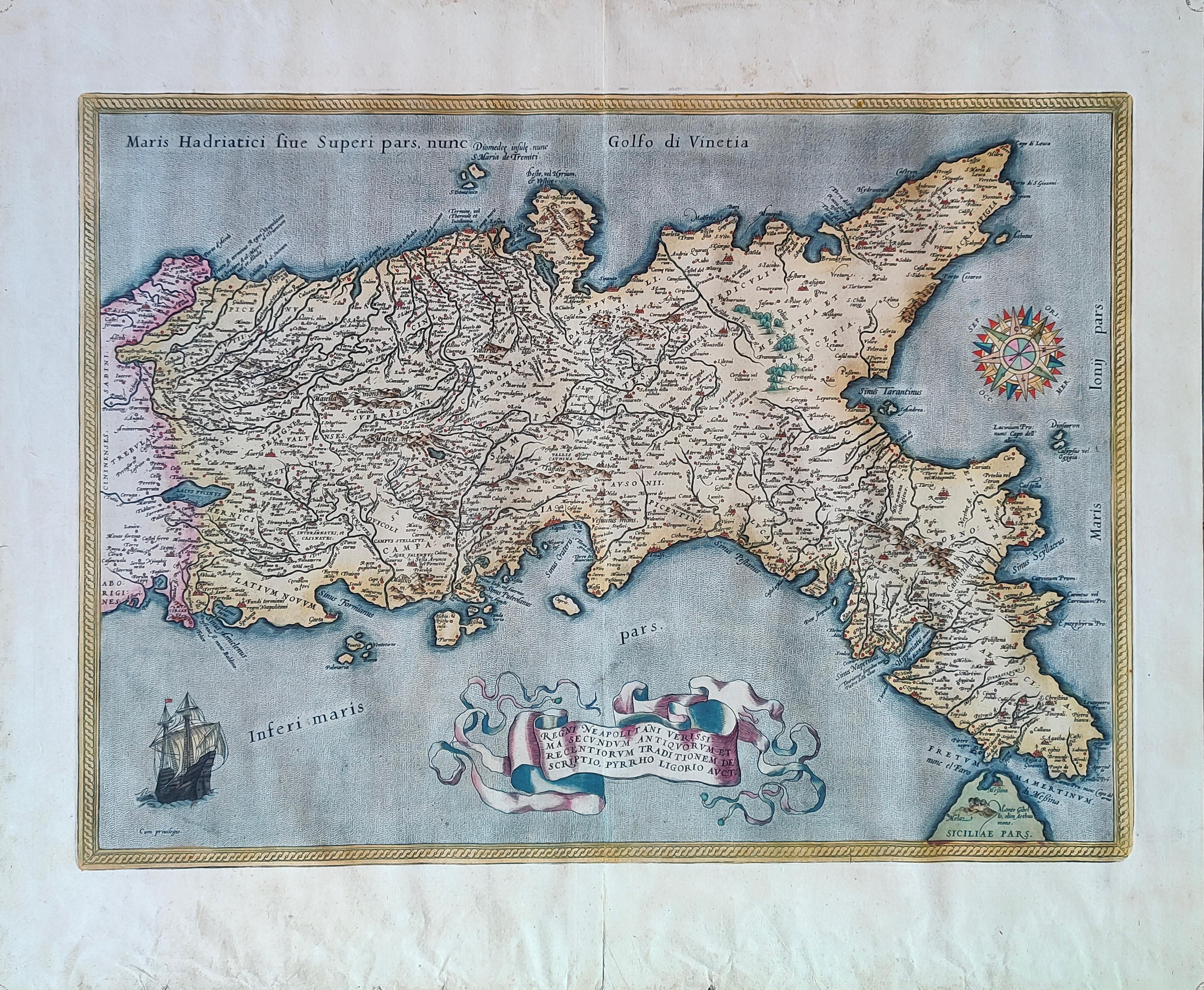
Map title
Regni Neapolitani verissima secundum antiquorum et recentiorum traditionem descriptio.
Author
Ortelius
Location shown in map
South Italy
Edition date
1595
Edition place
Antwerp
Editor
--
Atlas
Price
700 Euro
State
[mint/EXCELLENT/very good/good/fair/mediocre/poor]
Color
Old colors
Verso
Latin Text pag.xx
Size
Plate: cm (50 x 37) inches (19.69 x 14.57) Paper: cm (57 x 47) inches (22.44 x 18.5)
Technique
Copper engraving
Note
Reference
Van Den Broecke 187
Wiki
Here for more info
In stock
Available
Info
info@thetreasuremaps.com
Code
#1273
×
![]()
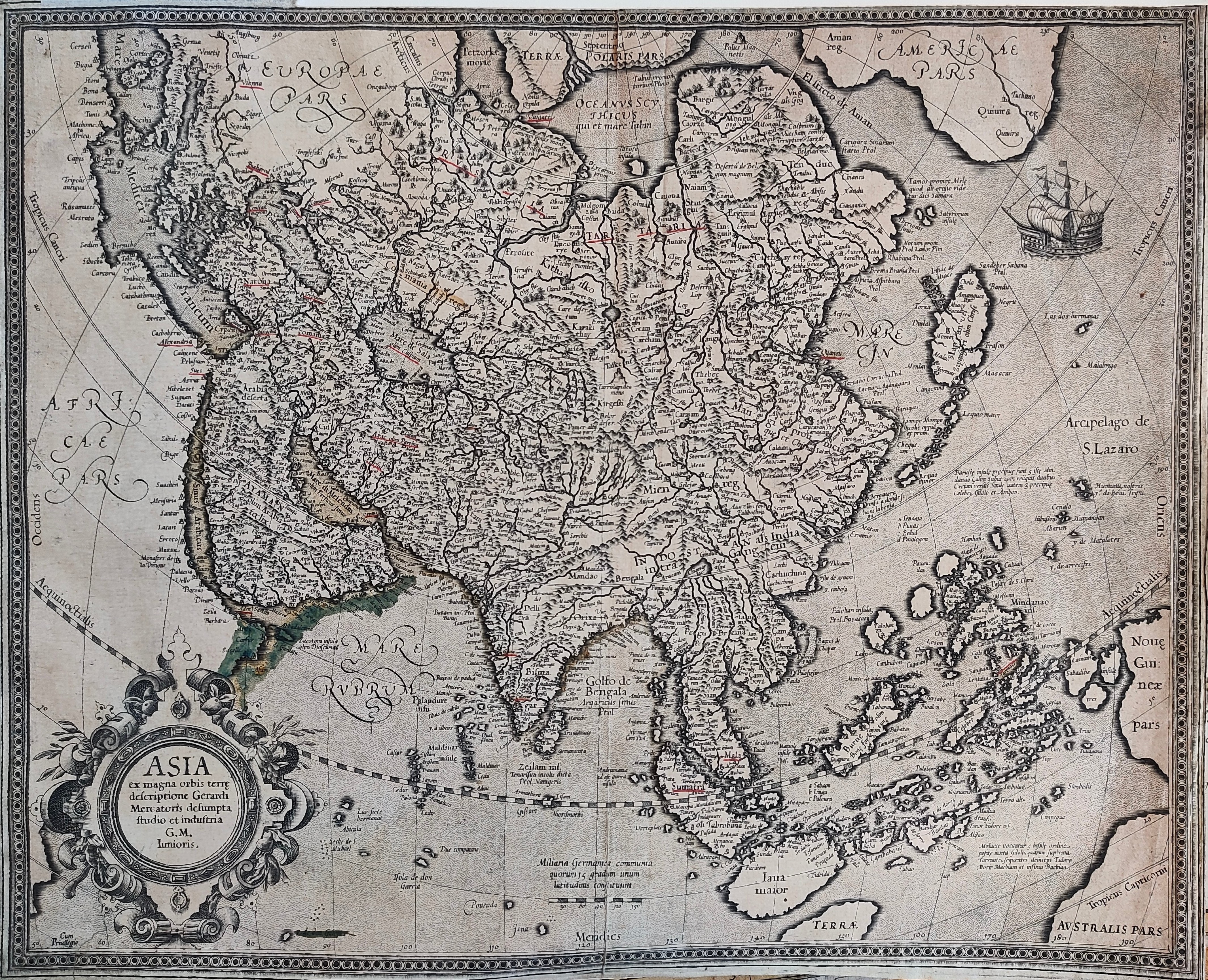
Map title
Asia ex magna orbis terre descriptione Gerardi Mercatoris Desumpta studio et industria G.M. Iumioris
Author
Mercator
Location shown in map
Asia
Edition date
Circa 1595
Edition place
Amsterdam
Editor
Hondius
Atlas
Price
1500 Euro
State
[mint/excellent/VERY GOOD/good/fair/mediocre/poor]
Color
Black/white
Verso
Size
Plate: cm (49 x 39) inches (19.29 x 15.35) Paper: cm (49 x 39) inches (19.29 x 15.35)
Technique
Copper engraving
Note
Reference
Wiki
Here for more info
In stock
Available
Info
info@thetreasuremaps.com
Code
#0906
×
![]()
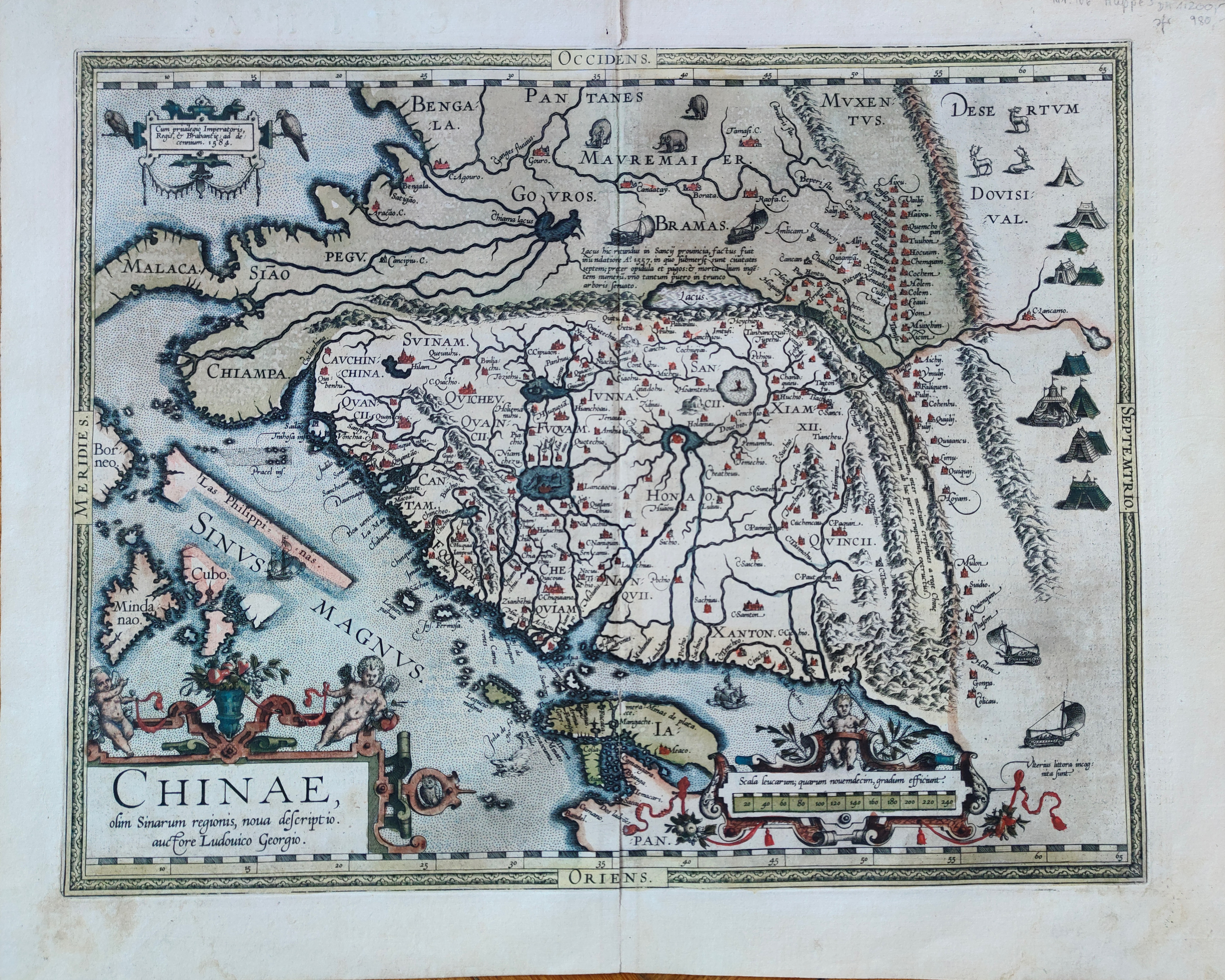
Map title
Chinae
Author
Ortelius
Location shown in map
China
Edition date
1595
Edition place
Antwerp
Editor
--
Atlas
Theatrum Orbis Terrarum
Price
3000 Euro
State
[mint/EXCELLENT/very good/good/fair/mediocre/poor]
Color
Old color
Verso
Latin text pag.106
Size
Plate: cm (47 x 37) inches (18.5 x 14.57) Paper: cm (54 x 43) inches (21.26 x 16.93)
Technique
Copper engraving
Note
Reference
Van Den Broecke 215
Wiki
Here for more info
In stock
Sold
Info
info@thetreasuremaps.com
Code
#1210
×
![]()
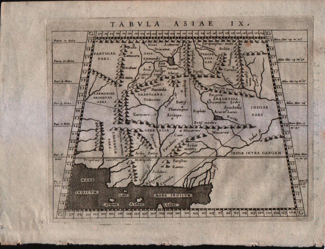
Map title
Tabula Asiae IX
Author
Magini
Location shown in map
Pakistan and Afganistan
Edition date
1596
Edition place
Venice
Editor
Heredes Simoni Galignani
Atlas
Geografia di Claudio Tolomeo -- Giovanni Antonio Magini
Price
Euro
State
[MINT/excellent/very good/good/fair/mediocre/poor]
Color
Black/white
Verso
Latin text pag.24
Size
Plate: cm (17.8 x 12.7) inches (7.01 x 5) Paper: cm (22.9 x 16.5) inches (9.02 x 6.5)
Technique
Copper engraving
Note
No particular notes for this maps.
Reference
--
Wiki
Here for more info
In stock
Available
Info
info@thetreasuremaps.com
Code
#0201
×
![]()
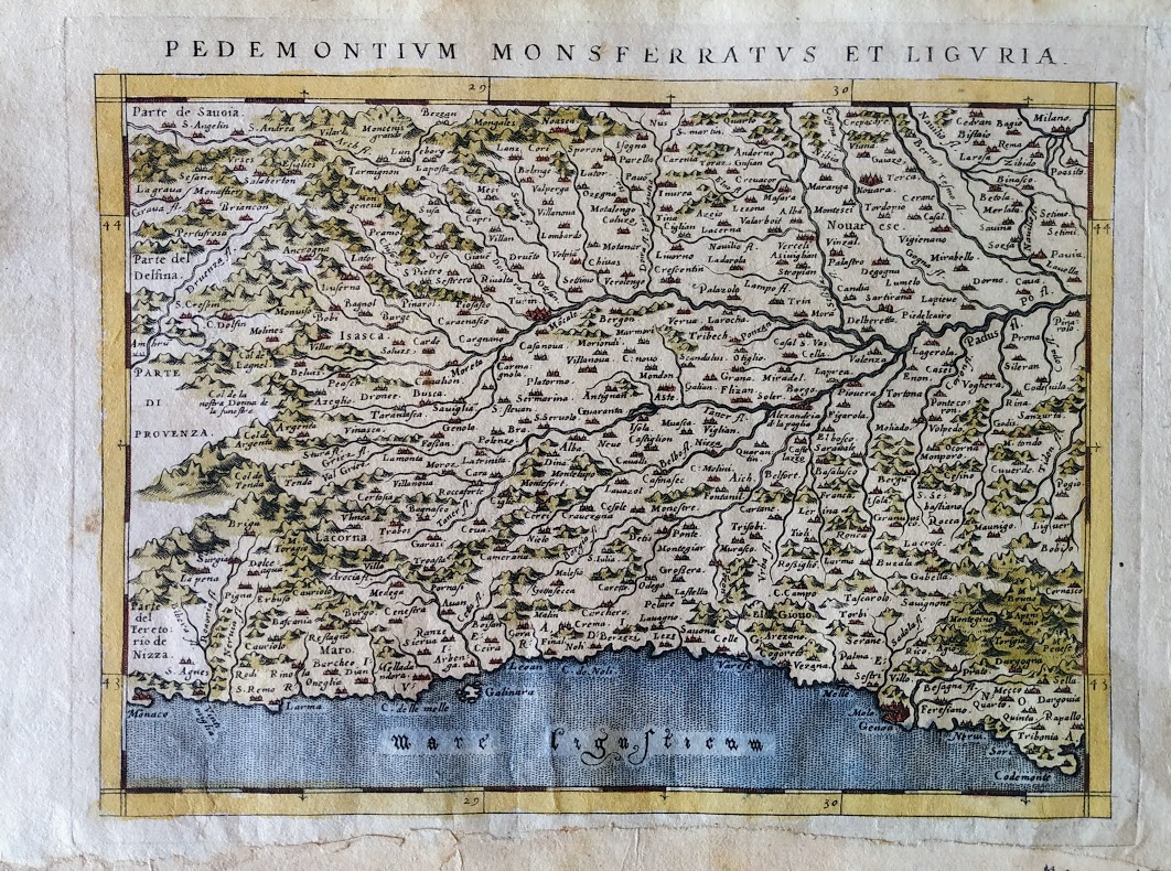
Map title
Pedemontium Monsferratus et Liguria
Author
Magini
Location shown in map
Piedmont & Liguria
Edition date
1596
Edition place
Venice
Editor
Heredes Simoni Galignani
Atlas
Geografia di Claudio Tolomeo -- Giovanni Antonio Magini
Price
300 Euro
State
[mint/excellent/VERY GOOD/good/fair/mediocre/poor] repaired
Color
Old colors
Verso
Latin text pag.106
Size
Plate: cm (17.8 x 14) inches (7.01 x 5.51) Paper: cm (22 x 16) inches (8.66 x 6.3)
Technique
Copper engraving
Note
No particular notes for this maps.
Reference
--
Wiki
Here for more info
In stock
Available
Info
info@thetreasuremaps.com
Code
#0716
×
![]()
Map title
Pedemontium Monsferratus et Liguria
Author
Magini
Location shown in map
Piedmont & Liguria
Edition date
1597
Edition place
Cologne
Editor
Petrus Keschedt
Atlas
Geografia di Claudio Tolomeo -- Giovanni Antonio Magini
Price
Please ask: info@thetreasuremaps.com
State
[mint/EXCELLENT/very good/good/fair/mediocre/poor]
Color
Black/white
Verso
Latin text pag 100
Size
Plate: cm (17.8 x 12.7) inches (7.01 x 5) Paper: cm (21.6 x 17.8) inches (8.5 x 7.01)
Technique
Copper engraving
Note
Maps pirated from those of Girolamo Poro in Magini's edition.
Reference
--
Wiki
Here for more info
In stock
Sold
Info
info@thetreasuremaps.com
Code
#0407
×
![]()
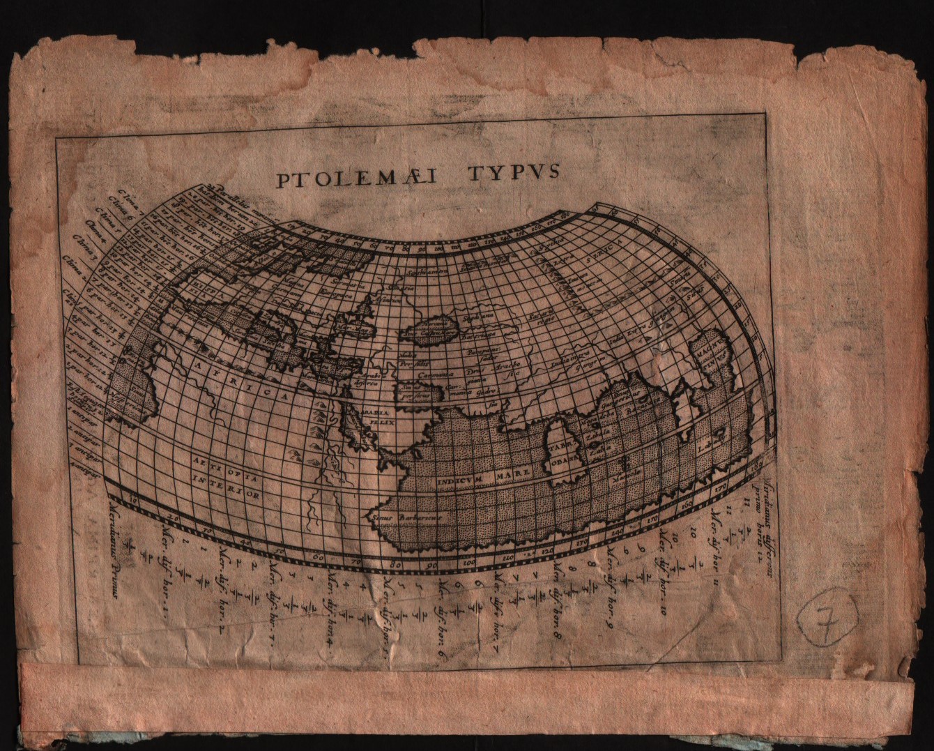
Map title
Ptolelaei Typus
Author
Magini
Location shown in map
World
Edition date
1597
Edition place
Colonia
Editor
Petrus Keschedt
Atlas
Geografia di Claudio Tolomeo -- Giovanni Antonio Magini
Price
Please ask: info@thetreasuremaps.com
State
[mint/excellent/VERY GOOD/good/fair/mediocre/poor]
Color
Black/white
Verso
Latin text pag.1
Size
Plate: cm (17.8 x 12.7) inches (7.01 x 5) Paper: cm (22.9 x 16.5) inches (9.02 x 6.5)
Technique
Copper engraving
Note
Maps pirated from those of Girolamo Poro in Magini's edition.
Reference
--
Wiki
Here for more info
In stock
Available
Info
info@thetreasuremaps.com
Code
#0512
×
![]()
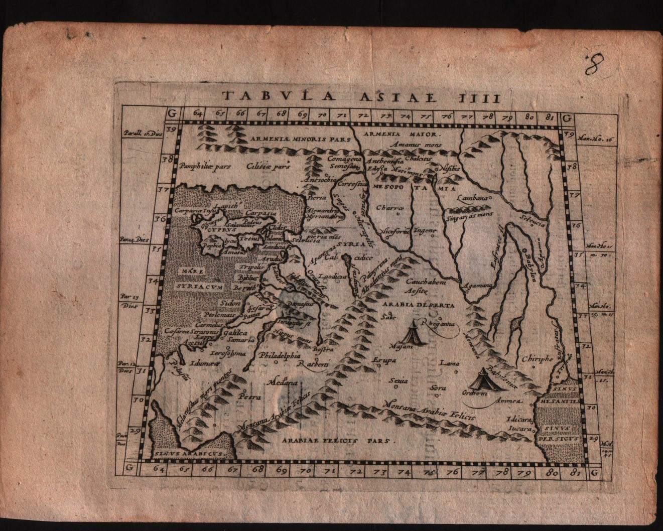
Map title
Tabula Asiae IIII
Author
Magini
Location shown in map
Middle east
Edition date
1597
Edition place
Colonia
Editor
Petrus Keschedt
Atlas
Geografia di Claudio Tolomeo -- Giovanni Antonio Magini
Price
Please ask: info@thetreasuremaps.com
State
[mint/EXCELLENT/very good/good/fair/mediocre/poor]
Color
Black/white
Verso
Latin text pag.19
Size
Plate: cm (17.8 x 12.7) inches (7.01 x 5) Paper: cm (22.9 x 16.5) inches (9.02 x 6.5)
Technique
Copper engraving
Note
Maps pirated from those of Girolamo Poro in Magini's edition.
Reference
--
Wiki
Here for more info
In stock
Available
Info
info@thetreasuremaps.com
Code
#0513
×
![]()
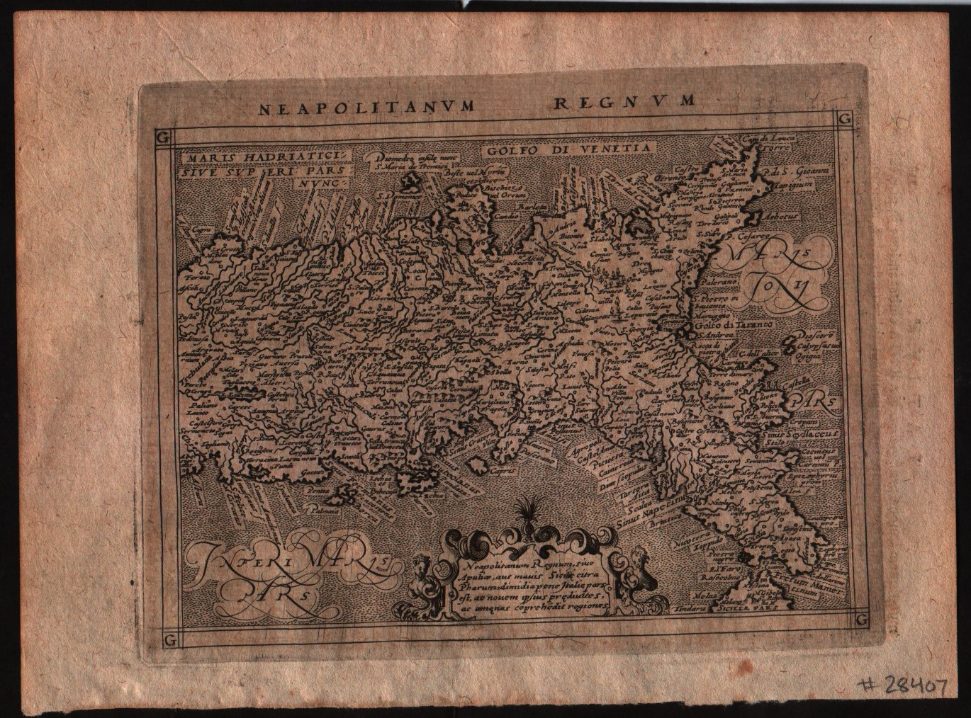
Map title
Neapolitanum Regnum
Author
Magini
Location shown in map
South Italy
Edition date
1597
Edition place
Colonia
Editor
Petrus Keschedt
Atlas
Geografia di Claudio Tolomeo -- Giovanni Antonio Magini
Price
Please ask: info@thetreasuremaps.com
State
[MINT/excellent/very good/good/fair/mediocre/poor]
Color
Black/white
Verso
Latin text pag 118
Size
Plate: cm (17.8 x 12.7) inches (7.01 x 5) Paper: cm (21.6 x 17.8) inches (8.5 x 7.01)
Technique
Copper engraving
Note
Maps pirated from those of Girolamo Poro in Magini's edition.
Reference
--
Wiki
Here for more info
In stock
Available
Info
info@thetreasuremaps.com
Code
#0521
×
![]()
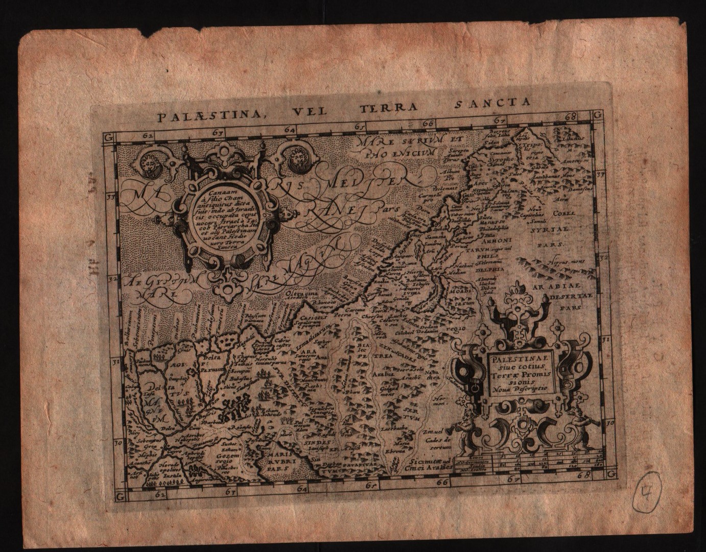
Map title
Palaestina vel terra sancta
Author
Magini
Location shown in map
Middle east
Edition date
1597
Edition place
Colonia
Editor
Petrus Keschedt
Atlas
Geografia di Claudio Tolomeo -- Giovanni Antonio Magini
Price
Please ask: info@thetreasuremaps.com
State
[mint/EXCELLENT/very good/good/fair/mediocre/poor]
Color
Black/white
Verso
Latin text pag.240
Size
Plate: cm (17.8 x 12.7) inches (7.01 x 5) Paper: cm (22.9 x 16.5) inches (9.02 x 6.5)
Technique
Copper engraving
Note
Maps pirated from those of Girolamo Poro in Magini's edition.
Reference
--
Wiki
Here for more info
In stock
Available
Info
info@thetreasuremaps.com
Code
#0515
×
![]()
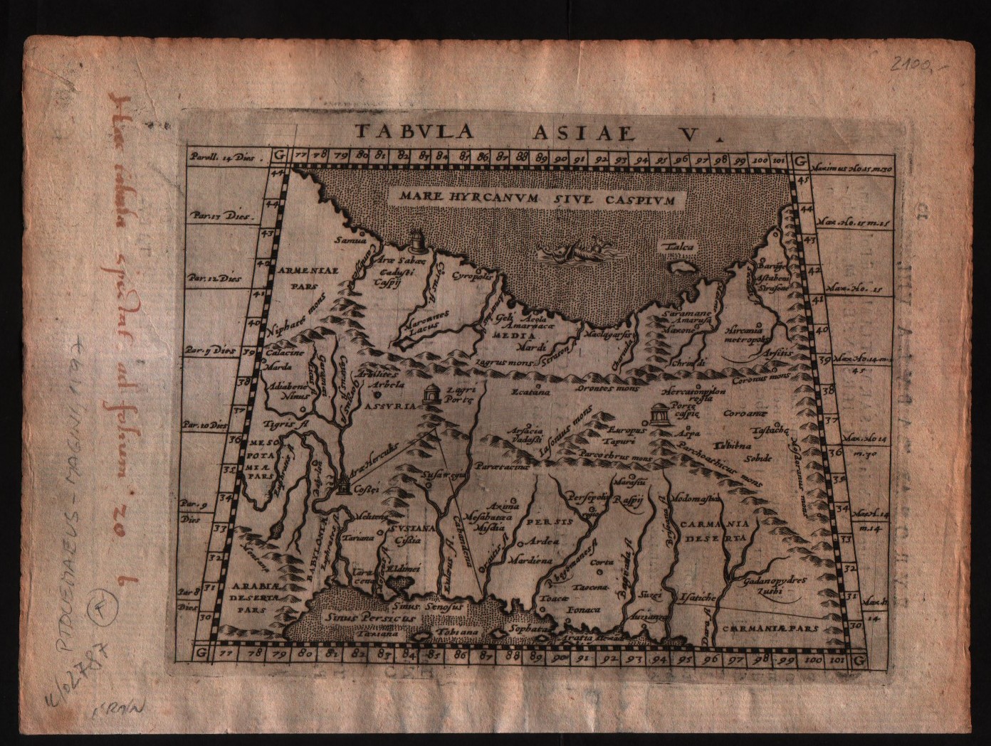
Map title
Tabula Asiae V
Author
Magini
Location shown in map
Persia
Edition date
1597
Edition place
Cologne
Editor
Petrus Keschedt
Atlas
Geografia di Claudio Tolomeo -- Giovanni Antonio Magini
Price
Please ask: info@thetreasuremaps.com
State
[mint/EXCELLENT/very good/good/fair/mediocre/poor]
Color
Black/white
Verso
Latin text pag 10
Size
Plate: cm (17.8 x 12.7) inches (7.01 x 5) Paper: cm (22.9 x 16.5) inches (9.02 x 6.5)
Technique
Copper engraving
Note
Maps pirated from those of Girolamo Poro in Magini's edition.
Reference
--
Wiki
Here for more info
In stock
Available
Info
info@thetreasuremaps.com
Code
#0518
×
![]()
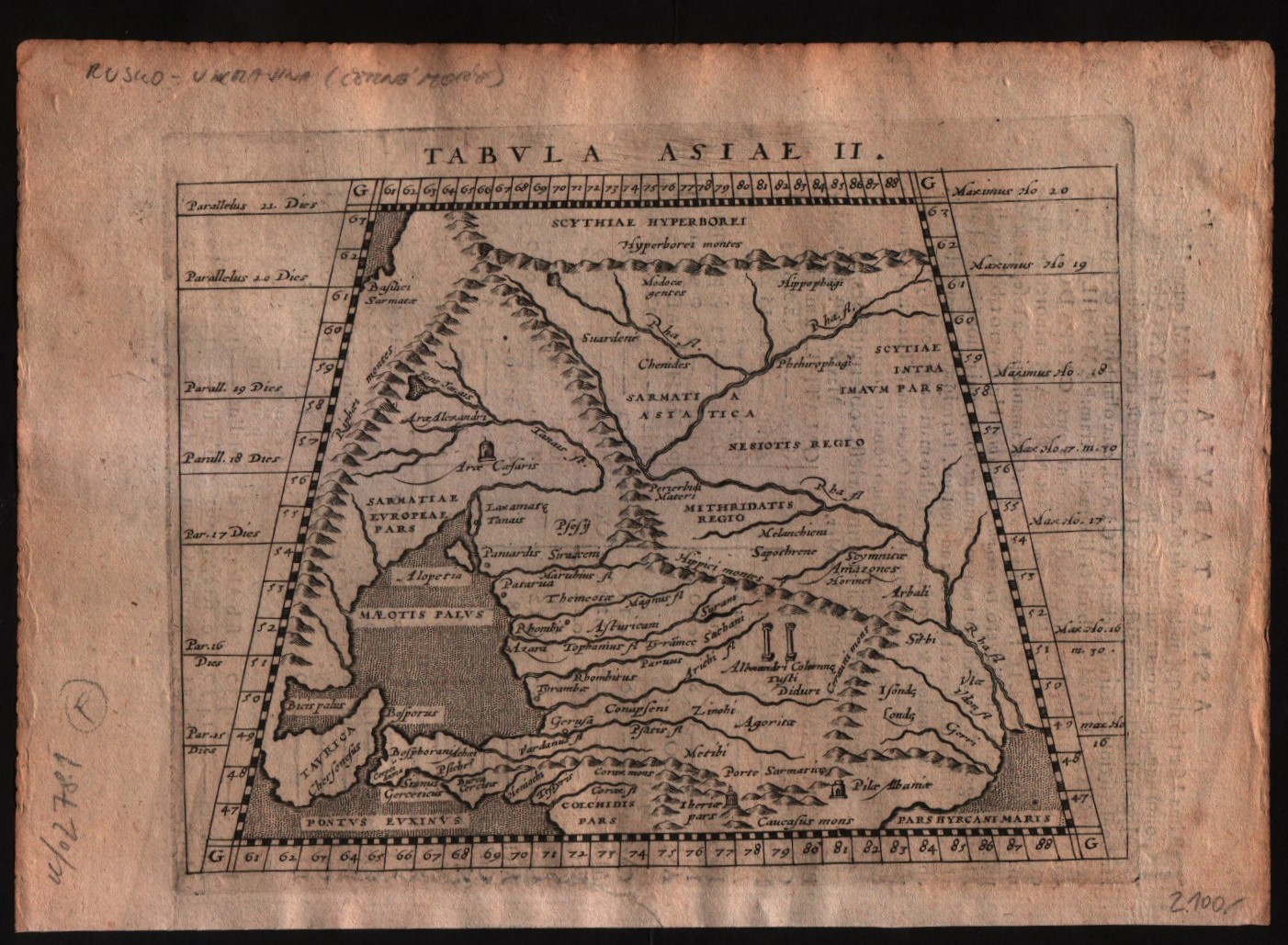
Map title
Tabula Asiae II
Author
Magini
Location shown in map
Russia
Edition date
1597
Edition place
Cologne
Editor
Petrus Keschedt
Atlas
Geografia di Claudio Tolomeo -- Giovanni Antonio Magini
Price
Please ask: info@thetreasuremaps.com
State
[mint/EXCELLENT/very good/good/fair/mediocre/poor]
Color
Black/white
Verso
Latin text pag 17
Size
Plate: cm (17.8 x 12.7) inches (7.01 x 5) Paper: cm (22.9 x 16.5) inches (9.02 x 6.5)
Technique
Copper engraving
Note
Maps pirated from those of Girolamo Poro in Magini's edition.
Reference
--
Wiki
Here for more info
In stock
Available
Info
info@thetreasuremaps.com
Code
#0519
×
![]()
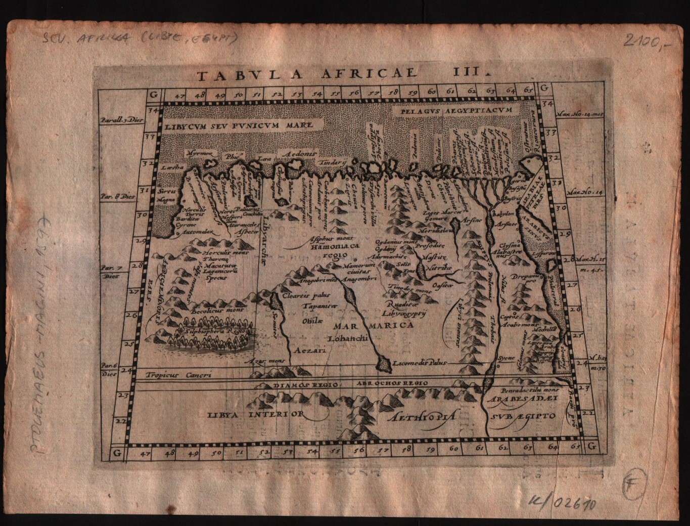
Map title
Tabula Africae III
Author
Magini
Location shown in map
Egypt
Edition date
1597
Edition place
Cologne
Editor
Petrus Keschedt
Atlas
Geografia di Claudio Tolomeo -- Giovanni Antonio Magini
Price
Please ask: info@thetreasuremaps.com
State
[mint/EXCELLENT/very good/good/fair/mediocre/poor]
Color
Black/white
Verso
Latin text pag 14
Size
Plate: cm (17.8 x 12.7) inches (7.01 x 5) Paper: cm (22.9 x 16.5) inches (9.02 x 6.5)
Technique
Copper engraving
Note
Maps pirated from those of Girolamo Poro in Magini's edition.
Reference
--
Wiki
Here for more info
In stock
Available
Info
info@thetreasuremaps.com
Code
#0520
×
![]()
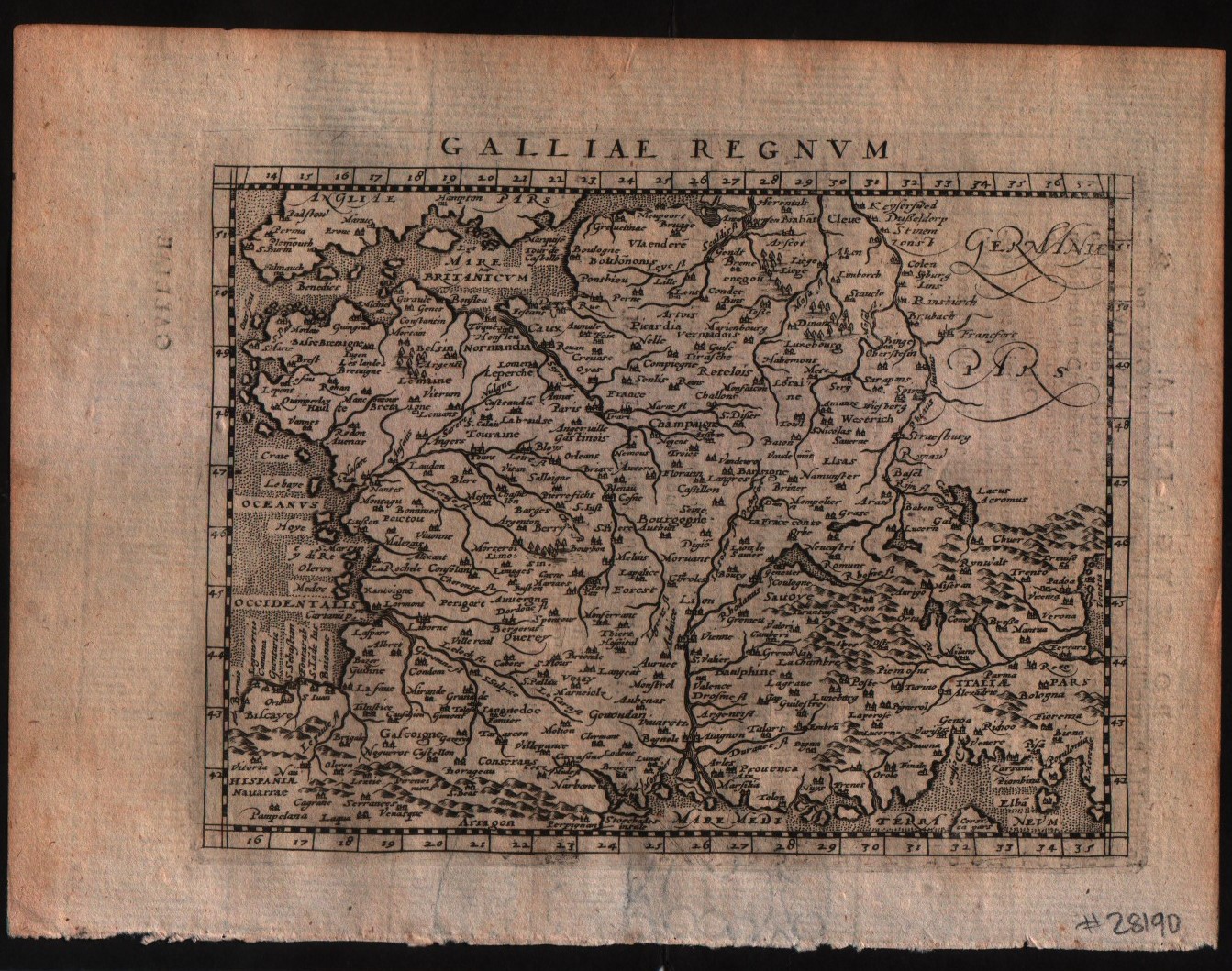
Map title
Galliae Regnum
Author
Magini
Location shown in map
France
Edition date
1597
Edition place
Colonia
Editor
Petrus Keschedt
Atlas
Geografia di Claudio Tolomeo -- Giovanni Antonio Magini
Price
Please ask: info@thetreasuremaps.com
State
[MINT/excellent/very good/good/fair/mediocre/poor]
Color
Black/white
Verso
Latin text pag 58
Size
Plate: cm (17.8 x 12.7) inches (7.01 x 5) Paper: cm (21.6 x 17.8) inches (8.5 x 7.01)
Technique
Copper engraving
Note
Maps pirated from those of Girolamo Poro in Magini's edition.
Reference
--
Wiki
Here for more info
In stock
Available
Info
info@thetreasuremaps.com
Code
#0522
×
![]()
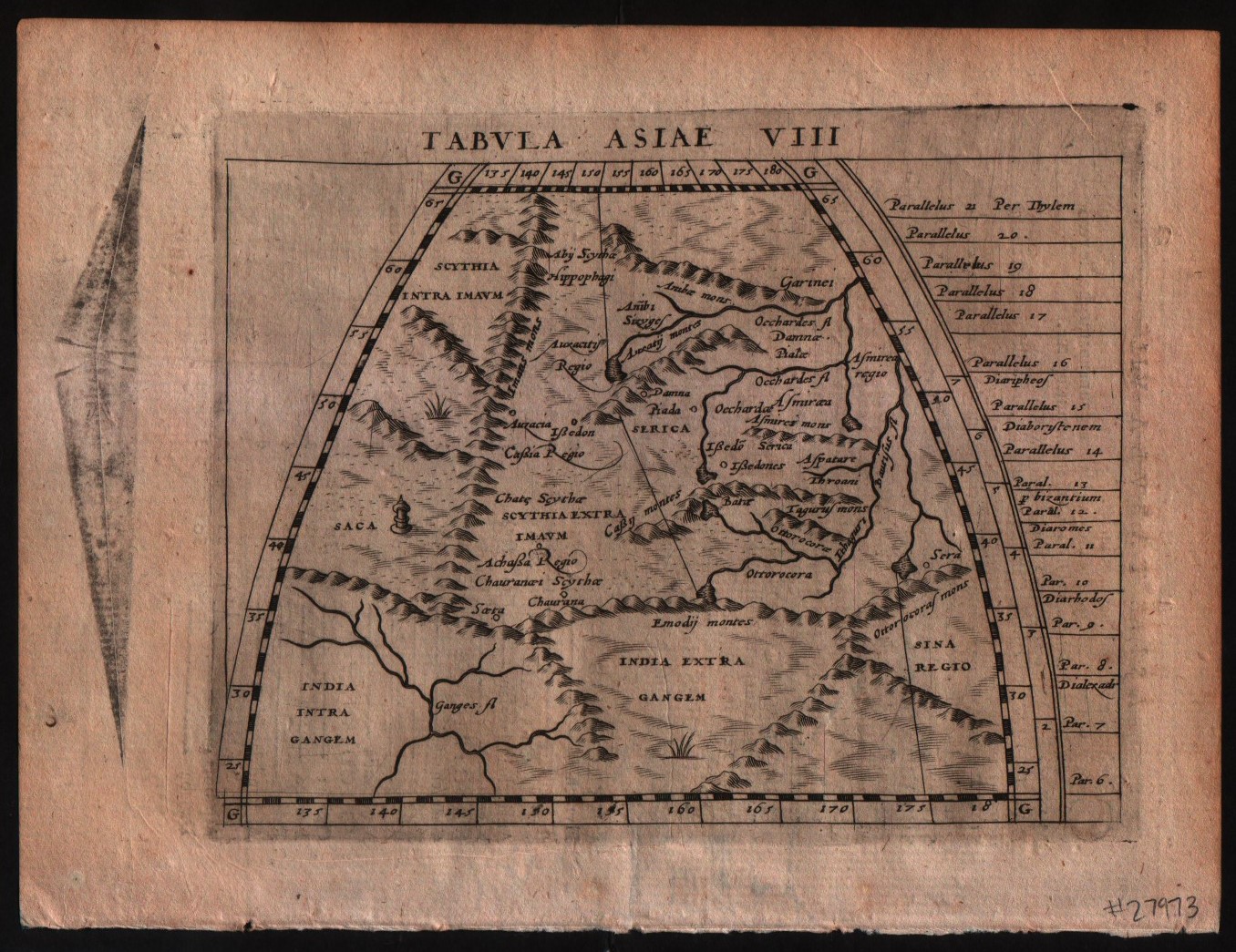
Map title
Tabula Asiae VIII
Author
Magini
Location shown in map
Central Asia
Edition date
1597
Edition place
Colonia
Editor
Petrus Keschedt
Atlas
Geografia di Claudio Tolomeo -- Giovanni Antonio Magini
Price
Please ask: info@thetreasuremaps.com
State
[MINT/excellent/very good/good/fair/mediocre/poor]
Color
Black/white
Verso
Latin text pag 23
Size
Plate: cm (17.8 x 12.7) inches (7.01 x 5) Paper: cm (21.6 x 17.8) inches (8.5 x 7.01)
Technique
Copper engraving
Note
Maps pirated from those of Girolamo Poro in Magini's edition.
Reference
--
Wiki
Here for more info
In stock
Available
Info
info@thetreasuremaps.com
Code
#0523
×
![]()
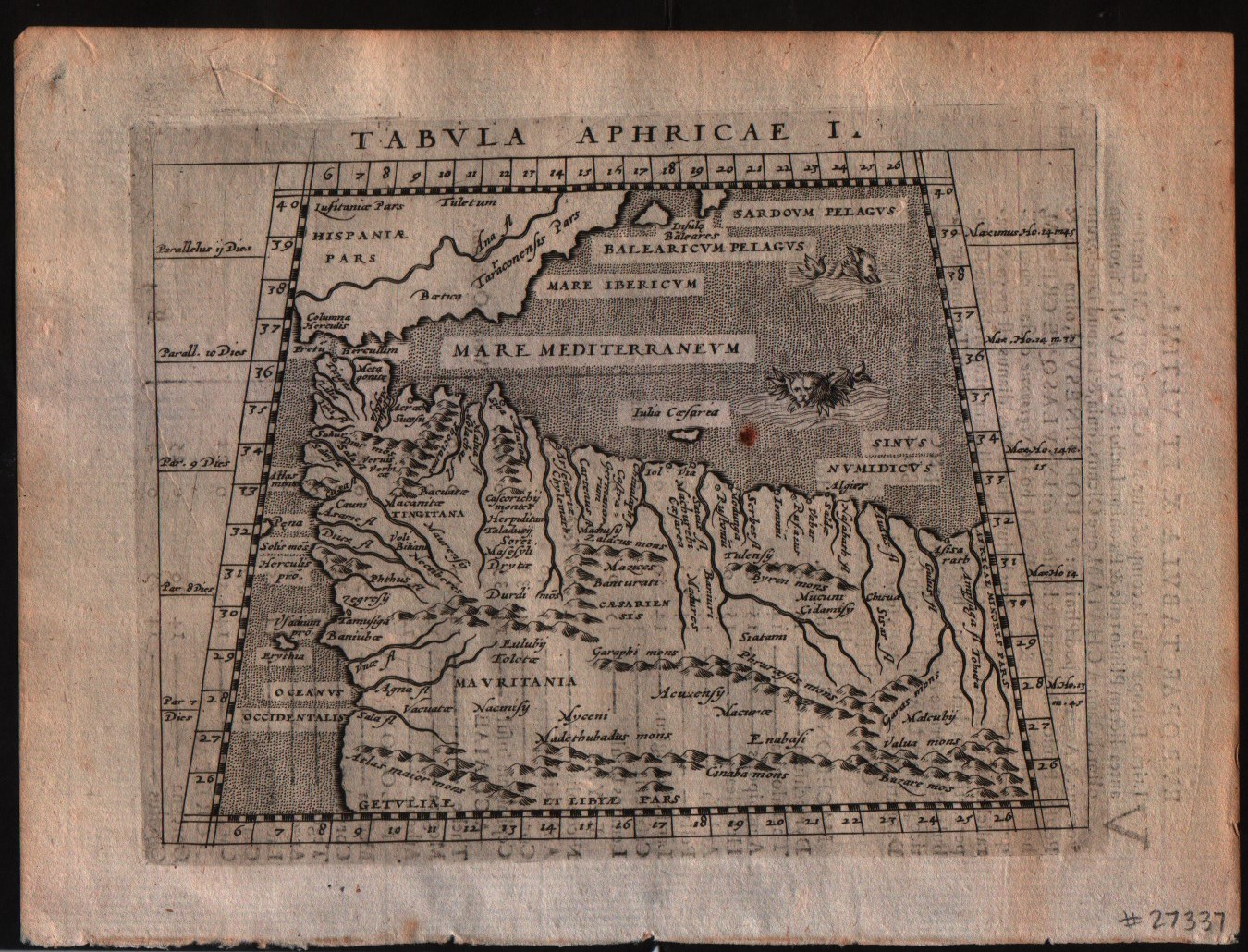
Map title
Tabula Africae I
Author
Magini
Location shown in map
Morocco
Edition date
1597
Edition place
Colonia
Editor
Petrus Keschedt
Atlas
Geografia di Claudio Tolomeo -- Giovanni Antonio Magini
Price
Please ask: info@thetreasuremaps.com
State
[MINT/excellent/very good/good/fair/mediocre/poor]
Color
Black/white
Verso
Latin text pag 12
Size
Plate: cm (17.8 x 12.7) inches (7.01 x 5) Paper: cm (21.6 x 17.8) inches (8.5 x 7.01)
Technique
Copper engraving
Note
Maps pirated from those of Girolamo Poro in Magini's edition.
Reference
--
Wiki
Here for more info
In stock
Available
Info
info@thetreasuremaps.com
Code
#0524
×
![]()
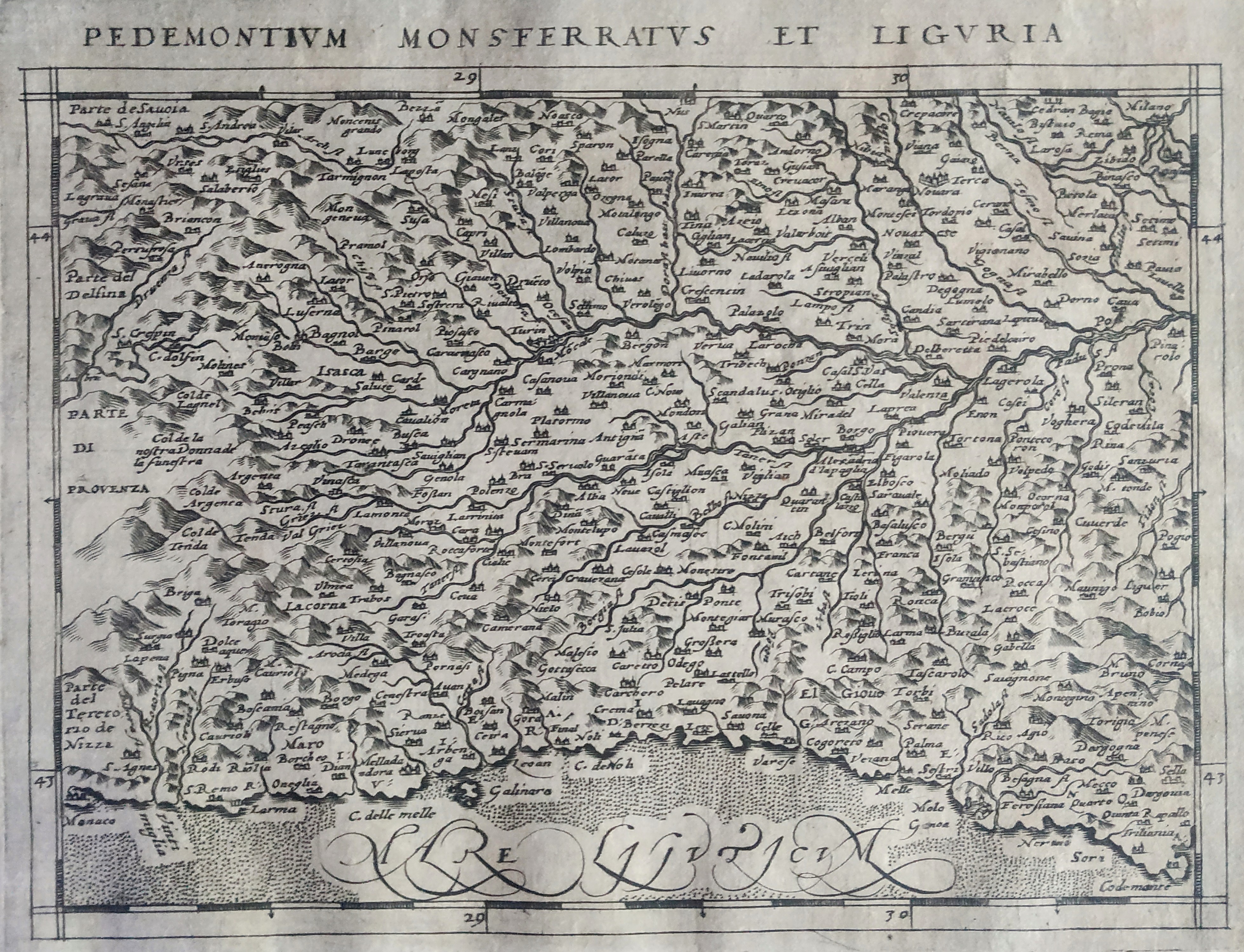
Map title
Pedemontium Monsferratus et Liguria
Author
Magini
Location shown in map
North-West Italy
Edition date
1597
Edition place
Cologne
Editor
Petrus Keschedt
Atlas
Geografia di Claudio Tolomeo -- Giovanni Antonio Magini
Price
Please ask: info@thetreasuremaps.com
State
[mint/EXCELLENT/very good/good/fair/mediocre/poor]
Color
Black/white
Verso
Latin text pag 106
Size
Plate: cm (18 x 13.5) inches (7.09 x 5.31) Paper: cm (23 x 16) inches (9.06 x 6.3)
Technique
Copper engraving
Note
Maps pirated from those of Girolamo Poro in Magini's edition.
Reference
--
Wiki
Here for more info
In stock
Available
Info
info@thetreasuremaps.com
Code
#0828
×
![]()
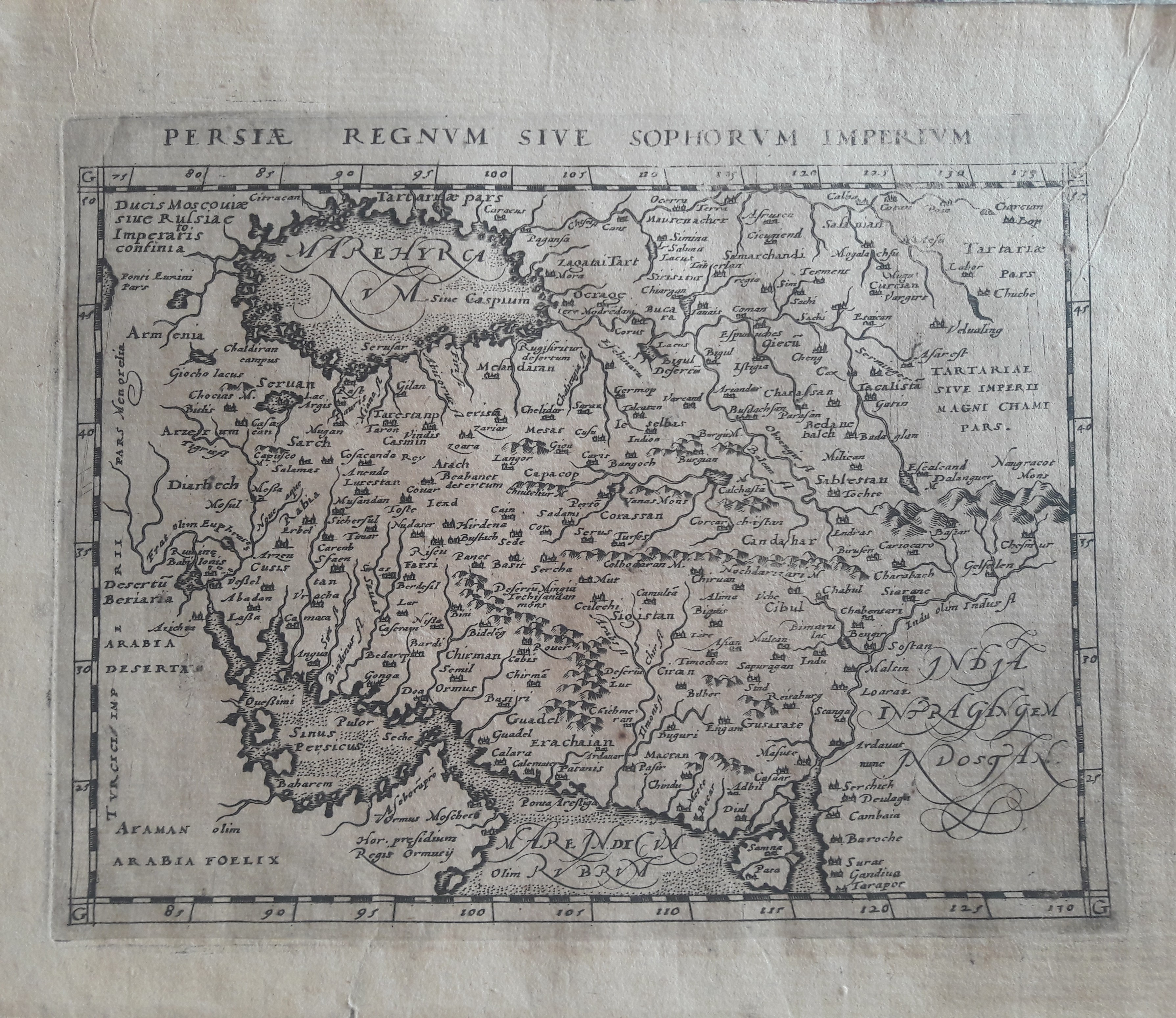
Map title
Persie Regnum
Author
Magini
Location shown in map
Iran
Edition date
1597
Edition place
Colonia
Editor
Petrus Keschedt
Atlas
Geografia di Claudio Tolomeo -- Giovanni Antonio Magini
Price
Please ask: info@thetreasuremaps.com
State
[mint/EXCELLENT/very good/good/fair/mediocre/poor]
Color
Black/white
Verso
Latin text pag 245
Size
Plate: cm (17.8 x 12.7) inches (7.01 x 5) Paper: cm (21.6 x 17.8) inches (8.5 x 7.01)
Technique
Copper engraving
Note
Maps pirated from those of Girolamo Poro in Magini's edition.
Reference
--
Wiki
Here for more info
In stock
Available
Info
info@thetreasuremaps.com
Code
#0645
×
![]()
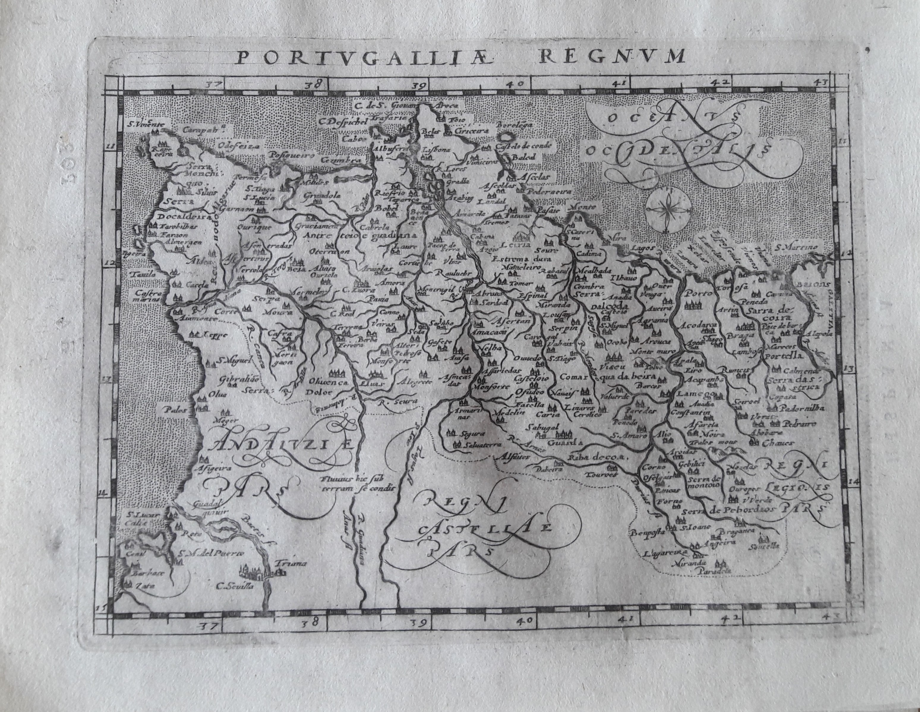
Map title
Portugalliae regnum
Author
Magini
Location shown in map
Portugal
Edition date
1597
Edition place
Colonia
Editor
Petrus Keschedt
Atlas
Geografia di Claudio Tolomeo -- Giovanni Antonio Magini
Price
Please ask: info@thetreasuremaps.com
State
[mint/EXCELLENT/very good/good/fair/mediocre/poor]
Color
Black/white
Verso
Latin text pag 56
Size
Plate: cm (17.8 x 12.7) inches (7.01 x 5) Paper: cm (21.6 x 17.8) inches (8.5 x 7.01)
Technique
Copper engraving
Note
Maps pirated from those of Girolamo Poro in Magini's edition.
Reference
--
Wiki
Here for more info
In stock
Available
Info
info@thetreasuremaps.com
Code
#0648
×
![]()
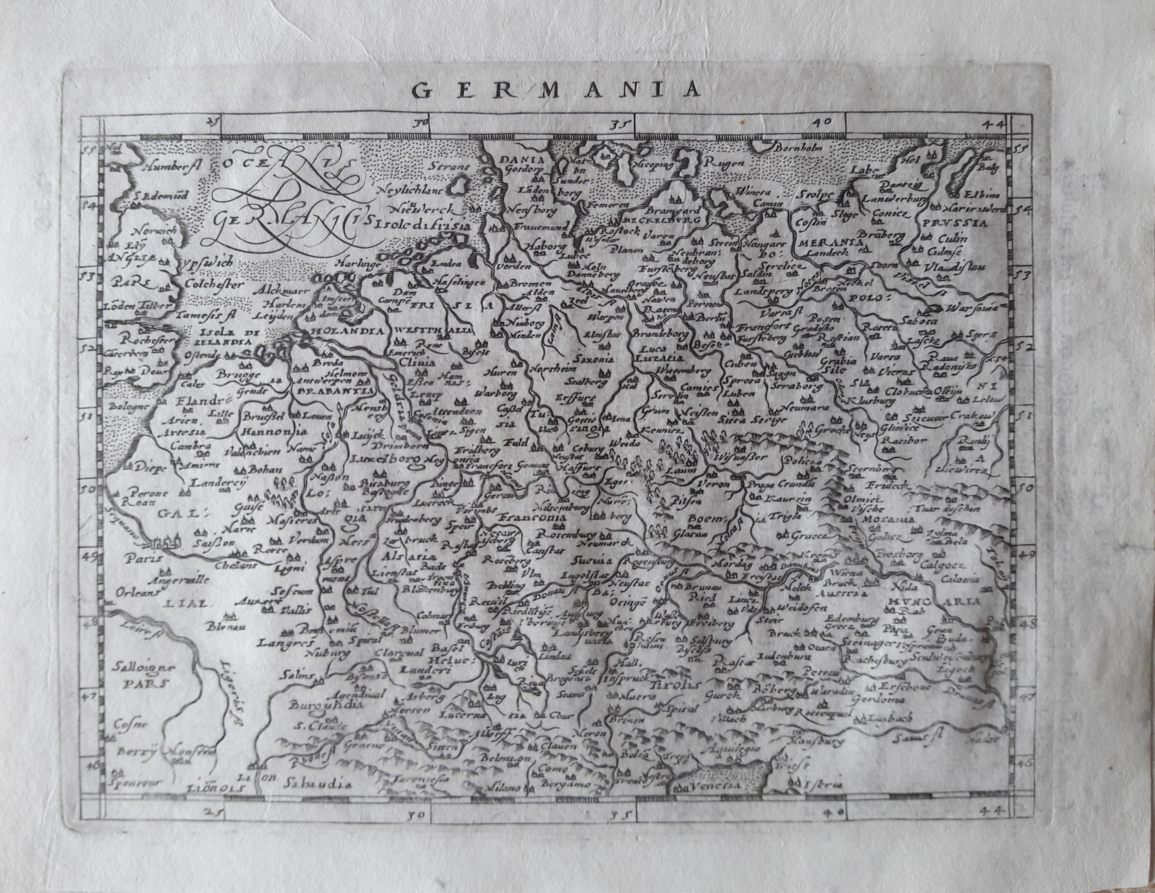
Map title
Germania
Author
Magini
Location shown in map
Germany
Edition date
1597
Edition place
Colonia
Editor
Petrus Keschedt
Atlas
Geografia di Claudio Tolomeo -- Giovanni Antonio Magini
Price
Please ask: info@thetreasuremaps.com
State
[mint/EXCELLENT/very good/good/fair/mediocre/poor]
Color
Black/white
Verso
Latin text pag 75
Size
Plate: cm (17.8 x 12.7) inches (7.01 x 5) Paper: cm (21.6 x 17.8) inches (8.5 x 7.01)
Technique
Copper engraving
Note
Maps pirated from those of Girolamo Poro in Magini's edition.
Reference
--
Wiki
Here for more info
In stock
Available
Info
info@thetreasuremaps.com
Code
#0651
×
![]()
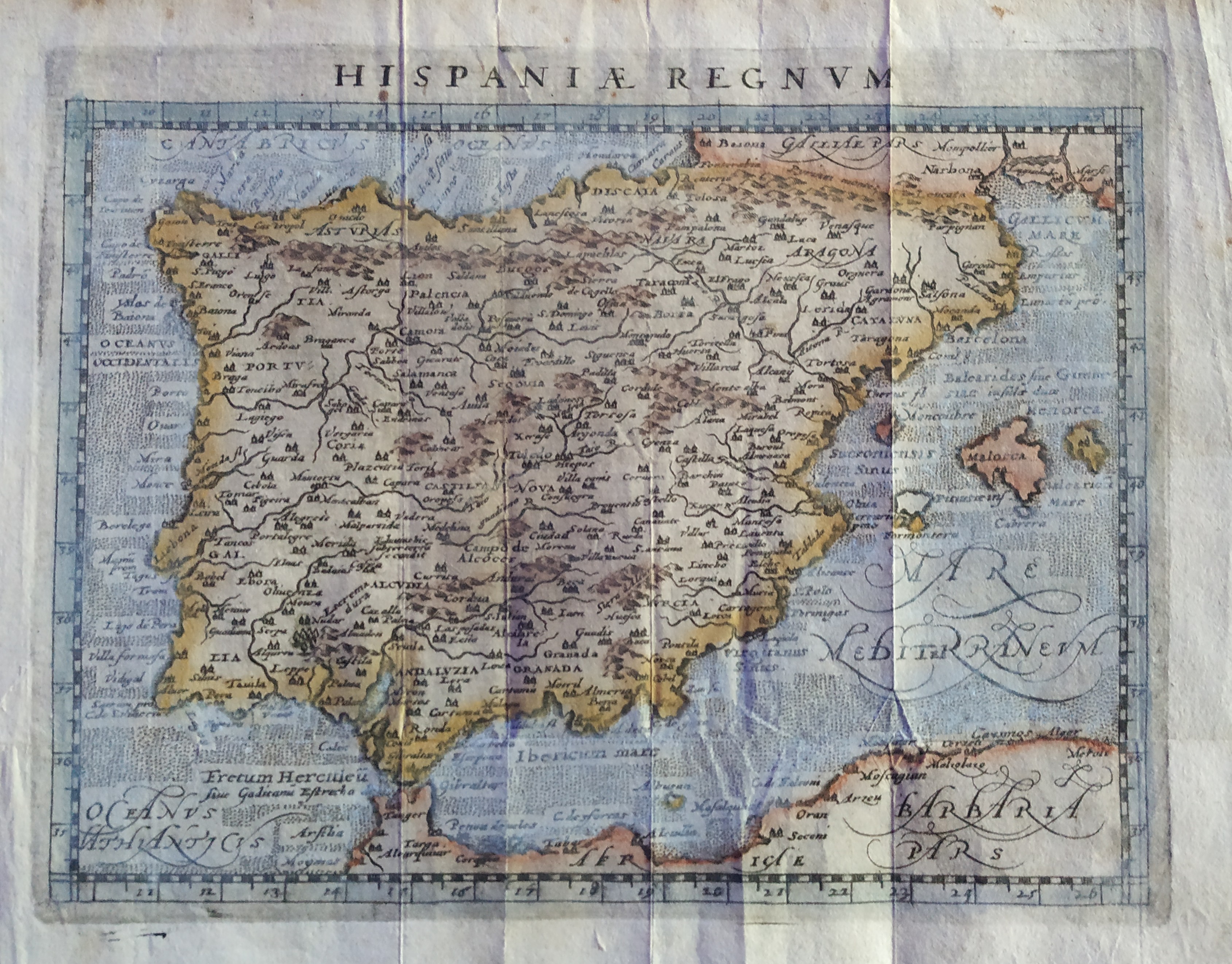
Map title
Hispania Regnum
Author
Magini
Location shown in map
Spain
Edition date
1597
Edition place
Colonia
Editor
Petrus Keschedt
Atlas
Geografia di Claudio Tolomeo -- Giovanni Antonio Magini
Price
Please ask: info@thetreasuremaps.com
State
[mint/excellent/VERY GOOD/good/fair/mediocre/poor]
Color
Old colors
Verso
Blank
Size
Plate: cm (17.8 x 12.7) inches (7.01 x 5) Paper: cm (20 x 16) inches (7.87 x 6.3)
Technique
Copper engraving
Note
Maps pirated from those of Girolamo Poro in Magini's edition.
Reference
--
Wiki
Here for more info
In stock
Available
Info
info@thetreasuremaps.com
Code
#0717
×
![]()
Map title
Tabula Asiae IX
Author
Magini
Location shown in map
Pakistan
Edition date
1597
Edition place
Cologne
Editor
Petrus Keschedt
Atlas
Geografia di Claudio Tolomeo -- Giovanni Antonio Magini
Price
Please ask: info@thetreasuremaps.com
State
[mint/EXCELLENT/very good/good/fair/mediocre/poor]
Color
Black/white
Verso
Latin text pag 24
Size
Plate: cm (17.8 x 15) inches (7.01 x 5.91) Paper: cm (22.9 x 16.5) inches (9.02 x 6.5)
Technique
Copper engraving
Note
Maps pirated from those of Girolamo Poro in Magini's edition.
Reference
--
Wiki
Here for more info
In stock
Available
Info
info@thetreasuremaps.com
Code
#0718
×
![]()
Map title
Tabula Asiae VII
Author
Magini
Location shown in map
Iran
Edition date
1597
Edition place
Cologne
Editor
Petrus Keschedt
Atlas
Geografia di Claudio Tolomeo -- Giovanni Antonio Magini
Price
Please ask: info@thetreasuremaps.com
State
[mint/EXCELLENT/very good/good/fair/mediocre/poor]
Color
Black/white
Verso
Latin text pag 22
Size
Plate: cm (17.8 x 12.7) inches (7.01 x 5) Paper: cm (22.9 x 16.5) inches (9.02 x 6.5)
Technique
Copper engraving
Note
Maps pirated from those of Girolamo Poro in Magini's edition.
Reference
--
Wiki
Here for more info
In stock
Available
Info
info@thetreasuremaps.com
Code
#0719
×
![]()
Map title
Italia
Author
Magini
Location shown in map
Italy
Edition date
1597
Edition place
Cologne
Editor
Petrus Keschedt
Atlas
Geografia di Claudio Tolomeo -- Giovanni Antonio Magini
Price
Please ask: info@thetreasuremaps.com
State
[mint/EXCELLENT/very good/good/fair/mediocre/poor]
Color
Black/white
Verso
Latin text pag 101
Size
Plate: cm (17.8 x 12.7) inches (7.01 x 5) Paper: cm (22.9 x 16.5) inches (9.02 x 6.5)
Technique
Copper engraving
Note
Maps pirated from those of Girolamo Poro in Magini's edition.
Reference
R.Borri L'Italia nelle antiche carte pag.78
Wiki
Here for more info
In stock
Available
Info
info@thetreasuremaps.com
Code
#0789
×
![]()
Map title
Italia
Author
De Bry
Location shown in map
Italy
Edition date
1597
Edition place
Frankfurt
Editor
Boissard, Jean Jacques
Atlas
Romanae Urbis Topographiae & Antiquitatum
Price
1500 Euro
State
[mint/EXCELLENT/very good/good/fair/mediocre/poor]
Color
Black/white
Verso
Blank
Size
Plate: cm (43 x 34) inches (16.93 x 13.39) Paper: cm (41 x 32) inches (16.14 x 12.6)
Technique
Copper engraving
Note
Based on the Mercator projection.
Reference
R.Borri L'Italia nelle antiche carte pag.94
Wiki
Here for more info
In stock
Available
Info
info@thetreasuremaps.com
Code
#0761
×
![]()
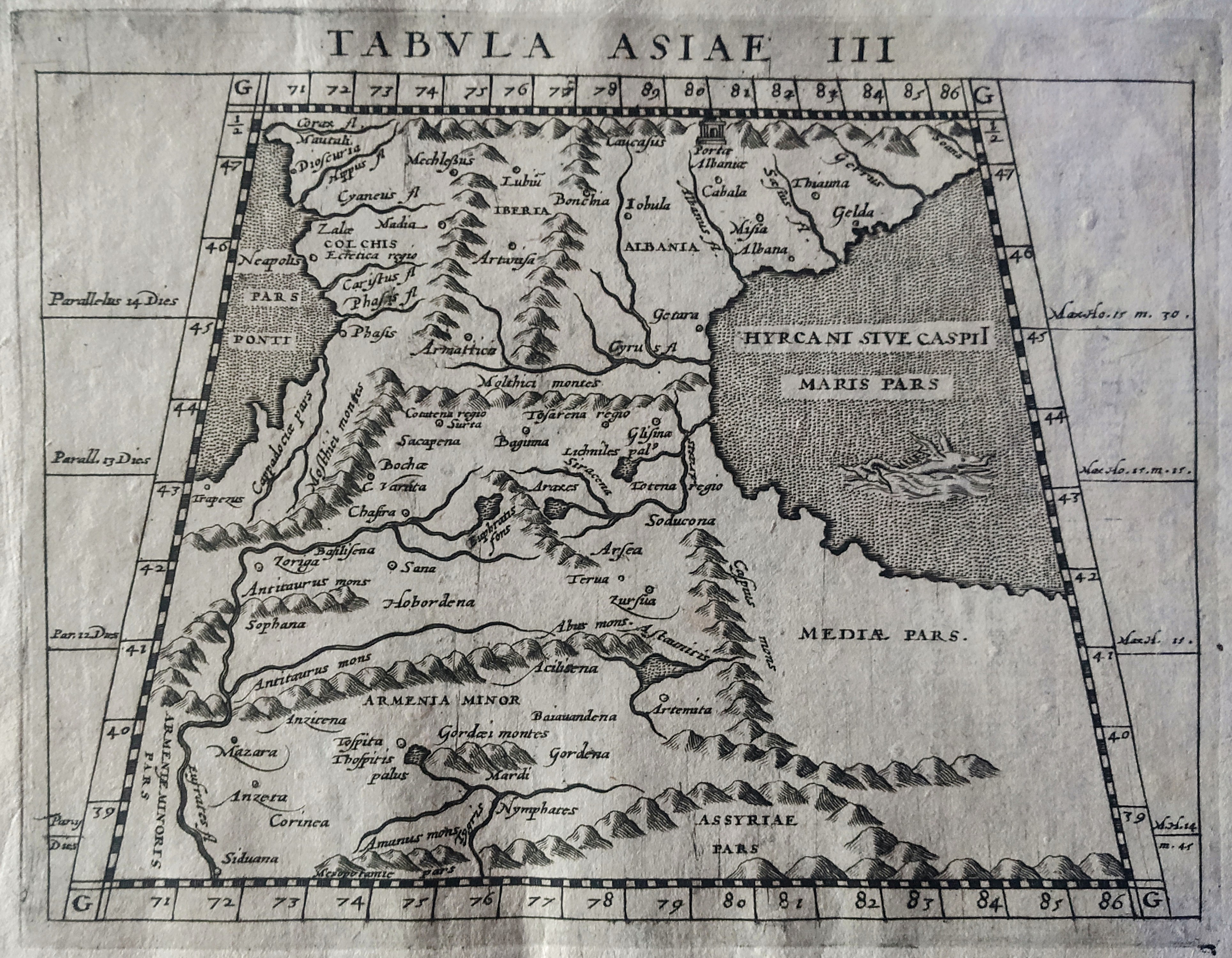
Map title
Tabula Asiae III
Author
Magini
Location shown in map
Armenia
Edition date
1597
Edition place
Cologne
Editor
Petrus Keschedt
Atlas
Geografia di Claudio Tolomeo -- Giovanni Antonio Magini
Price
Please ask: info@thetreasuremaps.com
State
[mint/EXCELLENT/very good/good/fair/mediocre/poor]
Color
Black/white
Verso
Latin text pag 18
Size
Plate: cm (18 x 13.5) inches (7.09 x 5.31) Paper: cm (23 x 16) inches (9.06 x 6.3)
Technique
Copper engraving
Note
Maps pirated from those of Girolamo Poro in Magini's edition.
Reference
--
Wiki
Here for more info
In stock
Available
Info
info@thetreasuremaps.com
Code
#0829
×
![]()
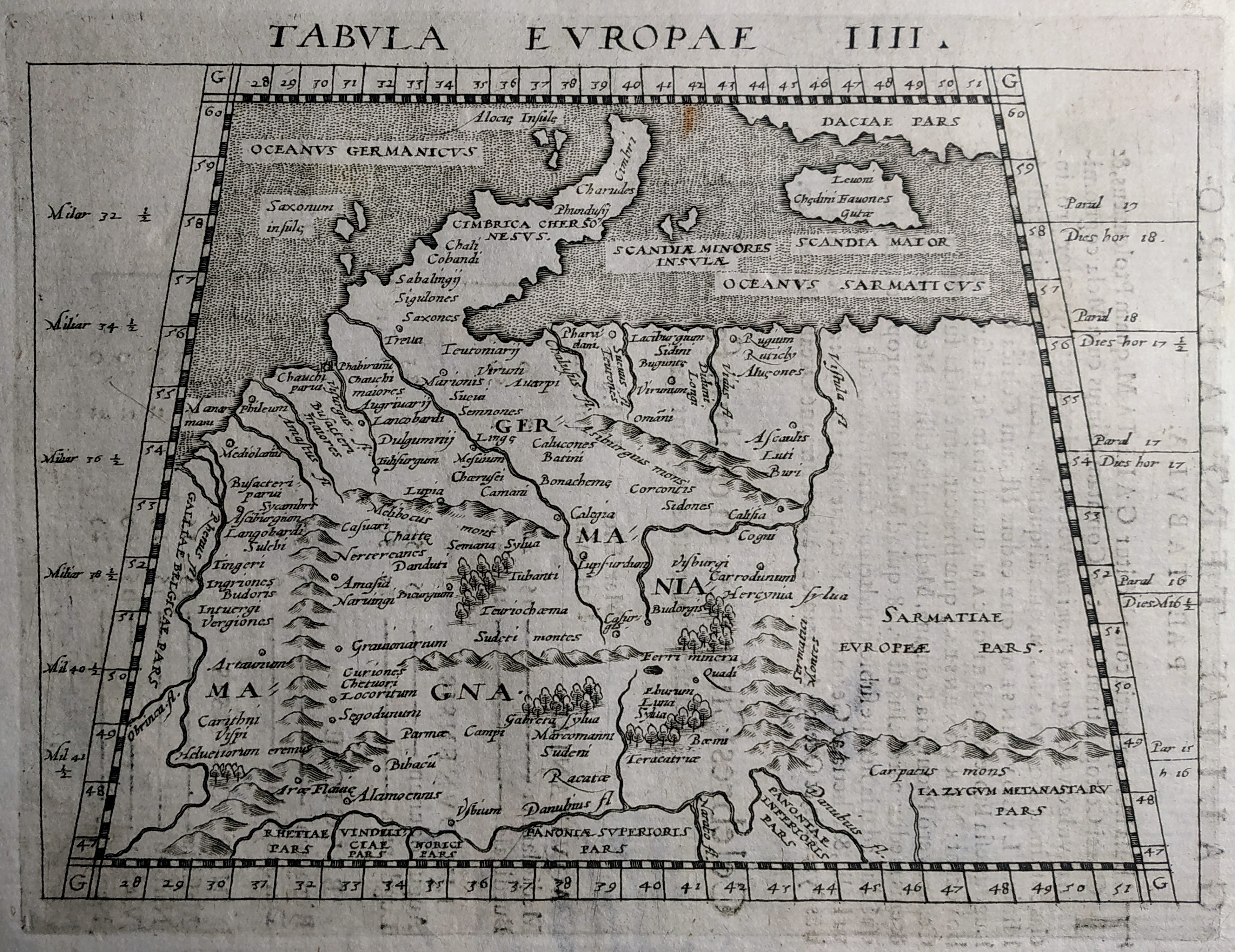
Map title
Tabula Europae IIII
Author
Magini
Location shown in map
Germany
Edition date
1597
Edition place
Cologne
Editor
Petrus Keschedt
Atlas
Geografia di Claudio Tolomeo -- Giovanni Antonio Magini
Price
Please ask: info@thetreasuremaps.com
State
[mint/EXCELLENT/very good/good/fair/mediocre/poor]
Color
Black/white
Verso
Latin text pag 5
Size
Plate: cm (18 x 13.5) inches (7.09 x 5.31) Paper: cm (23 x 16) inches (9.06 x 6.3)
Technique
Copper engraving
Note
Maps pirated from those of Girolamo Poro in Magini's edition.
Reference
--
Wiki
Here for more info
In stock
Available
Info
info@thetreasuremaps.com
Code
#0830
×
![]()
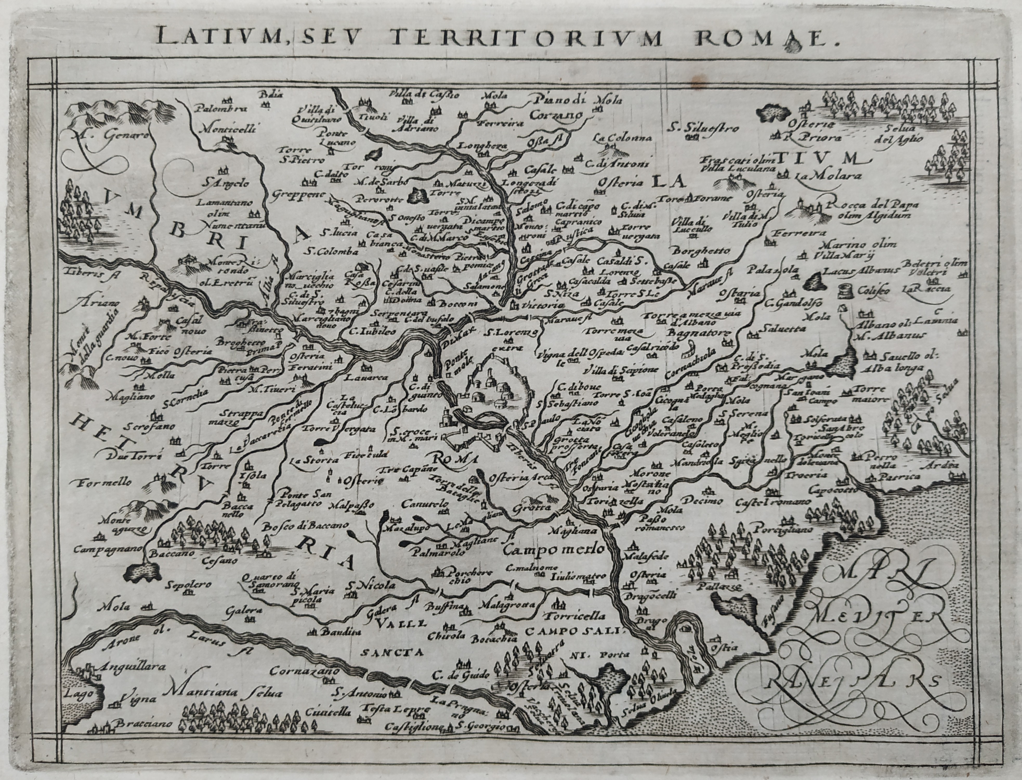
Map title
Latium sev territorium Romae
Author
Magini
Location shown in map
Latium
Edition date
1597
Edition place
Cologne
Editor
Petrus Keschedt
Atlas
Geografia di Claudio Tolomeo -- Giovanni Antonio Magini
Price
Please ask: info@thetreasuremaps.com
State
[mint/EXCELLENT/very good/good/fair/mediocre/poor]
Color
Black/white
Verso
Latin text pag 114
Size
Plate: cm (18 x 13.5) inches (7.09 x 5.31) Paper: cm (23 x 17) inches (9.06 x 6.69)
Technique
Copper engraving
Note
Maps pirated from those of Girolamo Poro in Magini's edition.
Reference
--
Wiki
Here for more info
In stock
Available
Info
info@thetreasuremaps.com
Code
#0831
×
![]()
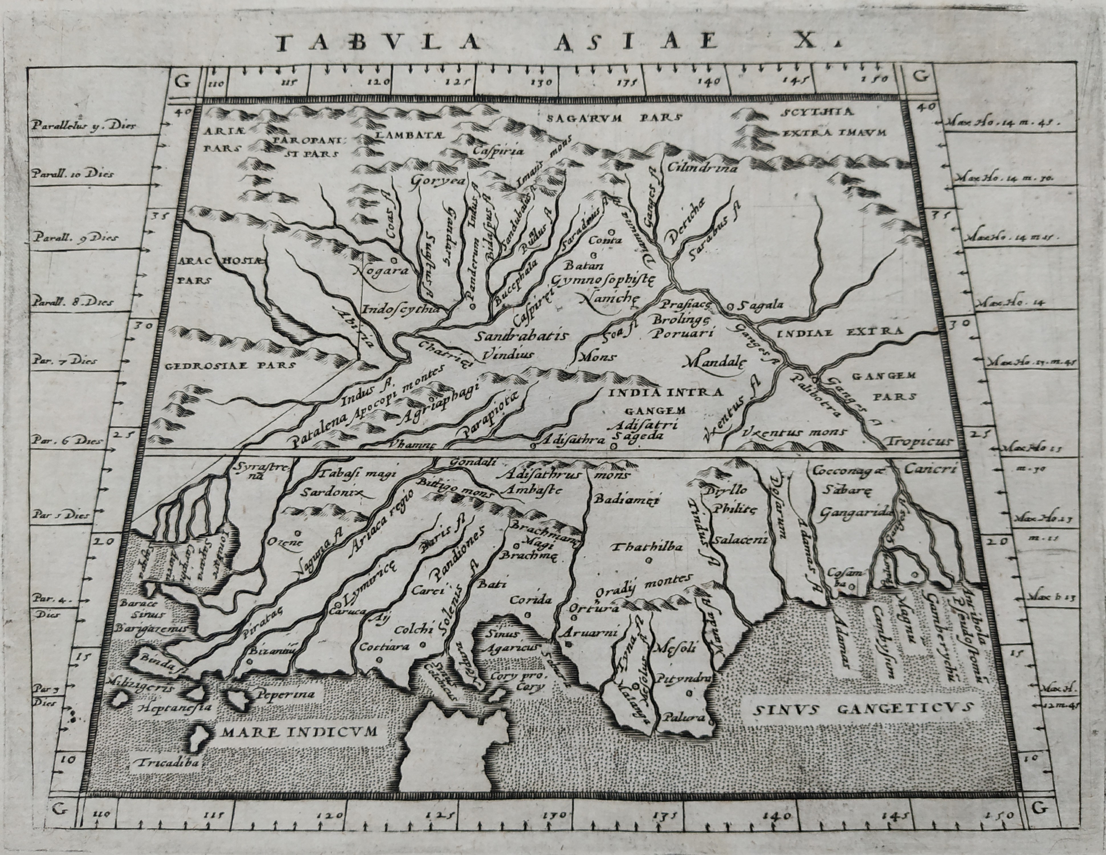
Map title
Tabula Asiae X
Author
Magini
Location shown in map
Indie
Edition date
1597
Edition place
Cologne
Editor
Petrus Keschedt
Atlas
Geografia di Claudio Tolomeo -- Giovanni Antonio Magini
Price
Please ask: info@thetreasuremaps.com
State
[mint/EXCELLENT/very good/good/fair/mediocre/poor]
Color
Black/white
Verso
Latin text pag 25
Size
Plate: cm (18 x 13.5) inches (7.09 x 5.31) Paper: cm (23 x 17) inches (9.06 x 6.69)
Technique
Copper engraving
Note
Maps pirated from those of Girolamo Poro in Magini's edition.
Reference
--
Wiki
Here for more info
In stock
Available
Info
info@thetreasuremaps.com
Code
#0832
×
![]()
Map title
Tartariae Imperium
Author
Magini
Location shown in map
Russia
Edition date
1597
Edition place
Cologne
Editor
Petrus Keschedt
Atlas
Geografia di Claudio Tolomeo -- Giovanni Antonio Magini
Price
Please ask: info@thetreasuremaps.com
State
[mint/EXCELLENT/very good/good/fair/mediocre/poor]
Color
Black/white
Verso
Latin text pag 229
Size
Plate: cm (18 x 13.5) inches (7.09 x 5.31) Paper: cm (23 x 17) inches (9.06 x 6.69)
Technique
Copper engraving
Note
Maps pirated from those of Girolamo Poro in Magini's edition.
Reference
--
Wiki
Here for more info
In stock
Available
Info
info@thetreasuremaps.com
Code
#0833
×
![]()
Map title
Germania
Author
Magini
Location shown in map
Germany
Edition date
1597
Edition place
Cologne
Editor
Petrus Keschedt
Atlas
Geografia di Claudio Tolomeo -- Giovanni Antonio Magini
Price
Please ask: info@thetreasuremaps.com
State
[mint/EXCELLENT/very good/good/fair/mediocre/poor]
Color
Black/white
Verso
Latin text pag 75
Size
Plate: cm (18 x 13.5) inches (7.09 x 5.31) Paper: cm (22 x 17) inches (8.66 x 6.69)
Technique
Copper engraving
Note
Maps pirated from those of Girolamo Poro in Magini's edition.
Reference
--
Wiki
Here for more info
In stock
Available
Info
info@thetreasuremaps.com
Code
#0898
×
![]()
Map title
Pedmontanae Vicinorumque Regionum Auctore Iacobo Castaldo Descrip.
Author
Ortelius
Location shown in map
Piedmont & Liguria, North west Italy
Edition date
1597
Edition place
Antwerp
Editor
--
Atlas
Theatrum Orbis Terrarum
Price
600 Euro
State
[mint/EXCELLENT/very good/good/fair/mediocre/poor]
Color
Old colors
Verso
Latin text pag 77
Size
Plate: cm (49 x 35.6) inches (19.29 x 14.02) Paper: cm (57 x 44) inches (22.44 x 17.32)
Technique
Copper engraving
Note
Reference
Van Den Broecke 175
Wiki
Here for more info
In stock
Available
Info
info@thetreasuremaps.com
Code
#1176
×
![]()
Map title
Italia
Author
Ortelius
Location shown in map
Italy
Edition date
1598
Edition place
Brescia
Editor
--
Atlas
Relationi universali -- Botero
Price
300 Euro
State
[MINT/excellent/very good/good/fair/mediocre/poor]
Color
Black/white
Verso
Italian text pag.68
Size
Plate: cm (10.2 x 7.6) inches (4.02 x 2.99) Paper: cm (15.2 x 20.3) inches (5.98 x 7.99)
Technique
Copper engraving
Note
Pirate copy of Ortelius Minor.
Reference
R.Borri L'Italia nelle antiche carte pag.63
Wiki
Here for more info
In stock
Available
Info
info@thetreasuremaps.com
Code
#0007
×
![]()
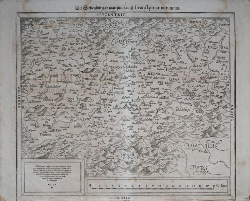
Map title
Die Siebenburg...
Author
Munster
Location shown in map
Transylvania and Bosnia
Edition date
1598
Edition place
Basel
Editor
Henrich Petri
Atlas
Cosmographia Universalis
Price
150 Euro
State
[mint/EXCELLENT/very good/good/fair/mediocre/poor]
Color
Black/white
Verso
German text pag.???
Size
Plate: cm (35.6 x 30.5) inches (14.02 x 12.01) Paper: cm (40.6 x 33) inches (15.98 x 12.99)
Technique
Woodcut
Note
Central Romania, Moldova at the top right and Wallachia at the bottom right.
Reference
--
Wiki
Here for more info
In stock
Available
Info
info@thetreasuremaps.com
Code
#0112
×
![]()
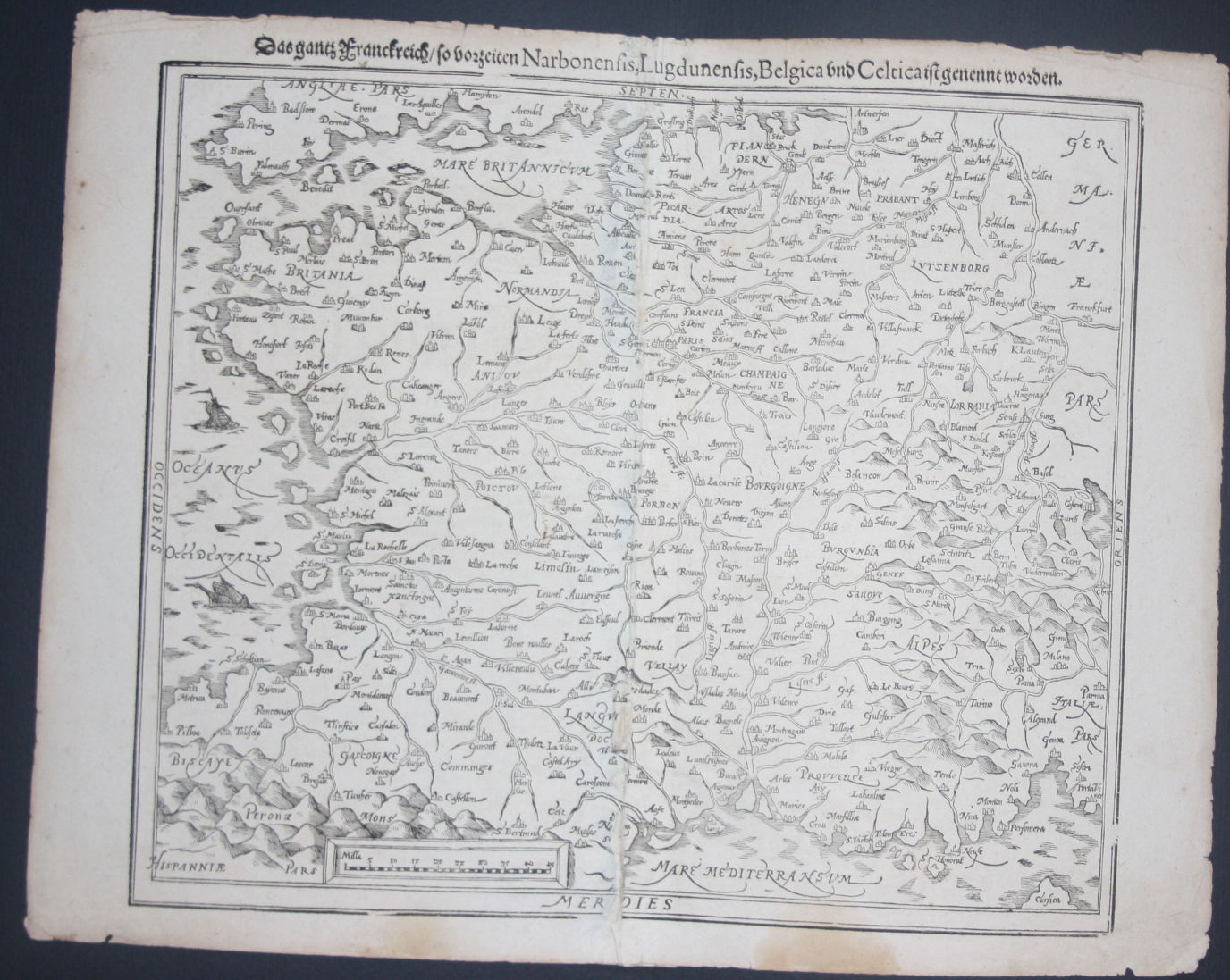
Map title
Narbonensis,Lugdunensis,Belgica and Celtica
Author
Munster
Location shown in map
France
Edition date
1598
Edition place
Basel
Editor
Henrich Petri
Atlas
Cosmographia Universalis
Price
150 Euro
State
[mint/excellent/very good/good/FAIR/mediocre/poor]
Color
Black/white
Verso
German text pag.???
Size
Plate: cm (35.6 x 30.5) inches (14.02 x 12.01) Paper: cm (43.2 x 33) inches (17.01 x 12.99)
Technique
Woodcut
Note
All France
Reference
--
Wiki
Here for more info
In stock
Available
Info
info@thetreasuremaps.com
Code
#0114
×
![]()
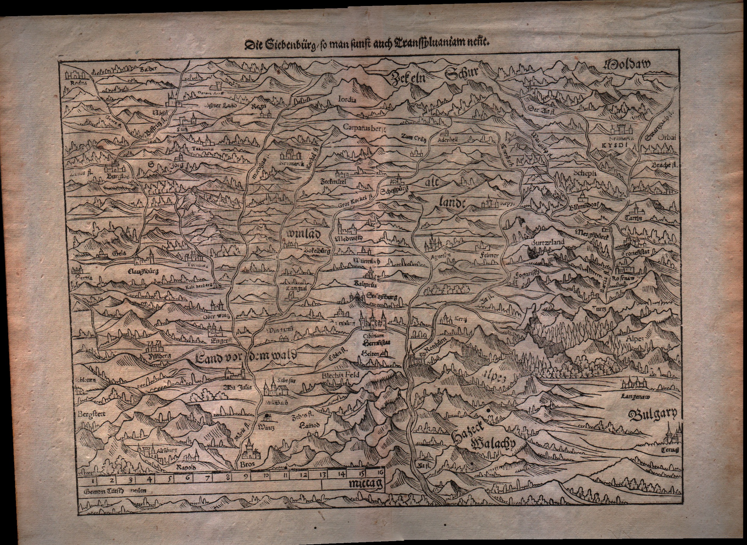
Map title
Die Siebenburg...
Author
Munster
Location shown in map
Transylvania and est Romania
Edition date
1598
Edition place
Basel
Editor
Henrich Petri
Atlas
Cosmographia Universalis
Price
150 Euro
State
[mint/EXCELLENT/very good/good/fair/mediocre/poor]
Color
Black/white
Verso
German text pag.???
Size
Plate: cm (34.3 x 25.4) inches (13.5 x 10) Paper: cm (40.6 x 33) inches (15.98 x 12.99)
Technique
Woodcut
Note
No particular notes for this maps
Reference
--
Wiki
Here for more info
In stock
Available
Info
info@thetreasuremaps.com
Code
#0115
×
![]()
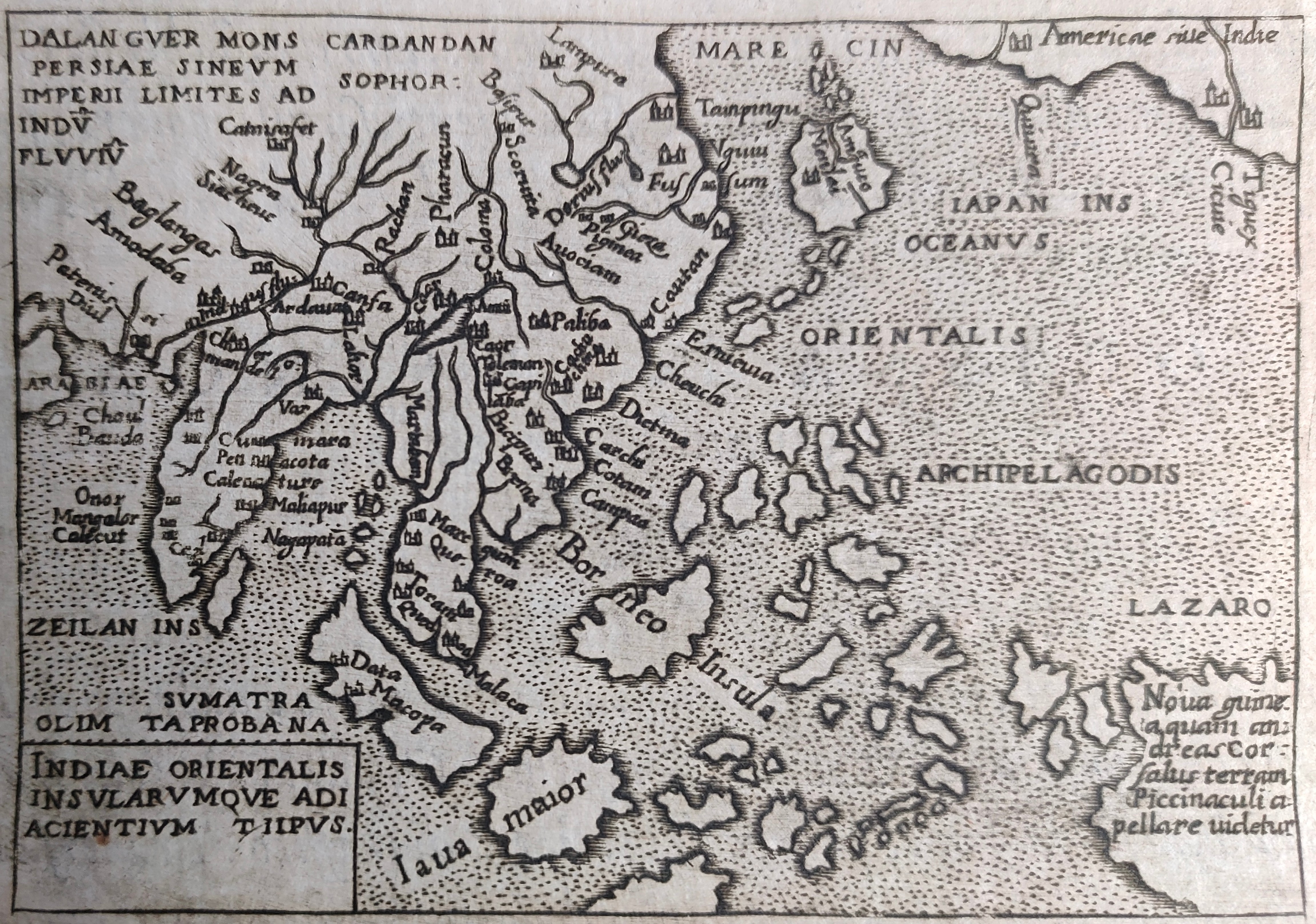
Map title
Indiae orientalis
Author
Ortelius
Location shown in map
Southeast Asia
Edition date
1598
Edition place
Brescia
Editor
Pietro Marchetti
Atlas
Theatro del mondo
Price
150 Euro
State
[mint/EXCELLENT/very good/good/fair/mediocre/poor]
Color
Black/white
Verso
Italian text
Size
Plate: cm (11 x 8) inches (4.33 x 3.15) Paper: cm (11 x 8) inches (4.33 x 3.15)
Technique
Copper engraving
Note
Reference
Wiki
Here for more info
In stock
Available
Info
info@thetreasuremaps.com
Code
#0861
×
![]()
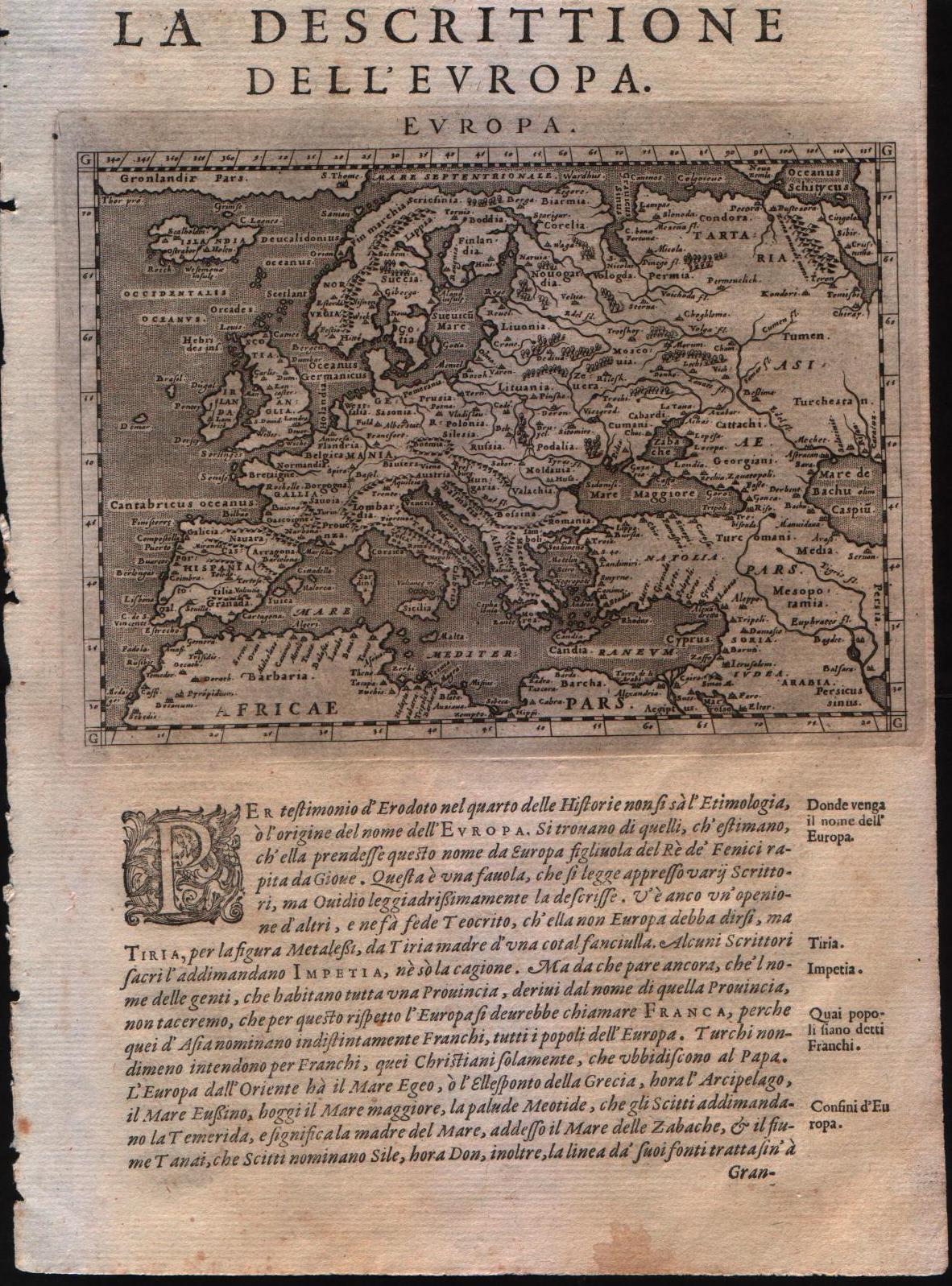
Map title
La descrittione dell'Europa
Author
Magini
Location shown in map
Europe
Edition date
1598
Edition place
Venice
Editor
Battista & Giorgio Galignani
Atlas
Geografia di Claudio Tolomeo -- Giovanni Antonio Magini
Price
300 Euro
State
[MINT/excellent/very good/good/fair/mediocre/poor]
Color
Black/white
Verso
Italian text pag.23
Size
Plate: cm (17.8 x 12.7) inches (7.01 x 5) Paper: cm (20.3 x 30.5) inches (7.99 x 12.01)
Technique
Copper engraving
Note
--
Reference
--
Wiki
Here for more info
In stock
Available
Info
info@thetreasuremaps.com
Code
#0133
×
![]()
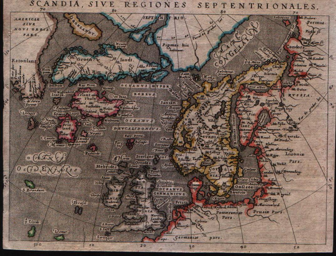
Map title
Scandia sive regiones septentrionales
Author
Magini
Location shown in map
North Europe
Edition date
1598
Edition place
Venice
Editor
Battista & Giorgio Galignani
Atlas
Geografia di Claudio Tolomeo -- Giovanni Antonio Magini
Price
300 Euro
State
[mint/excellent/VERY GOOD/good/fair/mediocre/poor]
Color
Old color
Verso
Italian text
Size
Plate: cm (14 x 17.8) inches (5.51 x 7.01) Paper: cm (14 x 17.8) inches (5.51 x 7.01)
Technique
Copper engraving
Note
--
Reference
--
Wiki
Here for more info
In stock
Available
Info
info@thetreasuremaps.com
Code
#0134
×
![]()
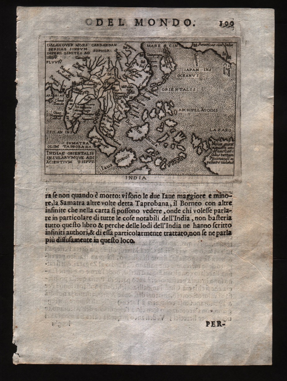
Map title
Indiae orientalis insularumque adiacientium typus
Author
Ortelius
Location shown in map
Southeast Asia
Edition date
1598
Edition place
Brescia
Editor
--
Atlas
Theatro del mondo -- Compania Bresciana
Price
200 Euro
State
[mint/EXCELLENT/very good/good/fair/mediocre/poor]
Color
Black/white
Verso
Italian text pag.199
Size
Plate: cm (11 x 8) inches (4.33 x 3.15) Paper: cm (14 x 19) inches (5.51 x 7.48)
Technique
Copper engraving
Note
No particular notes for this maps.
Reference
--
Wiki
Here for more info
In stock
Available
Info
info@thetreasuremaps.com
Code
#0199
×
![]()
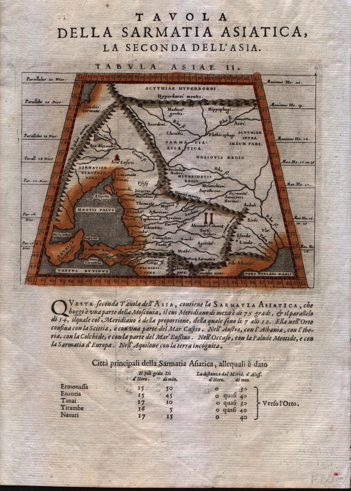
Map title
Tabula Asiae II
Author
Magini
Location shown in map
Crimea and sea of Azov
Edition date
1598
Edition place
Venice
Editor
Battista & Giorgio Galignani
Atlas
Geografia di Claudio Tolomeo -- Giovanni Antonio Magini
Price
125 Euro
State
[MINT/excellent/very good/good/fair/mediocre/poor]
Color
Modern color
Verso
Italian text pag.11
Size
Plate: cm (17.8 x 12.7) inches (7.01 x 5) Paper: cm (20.3 x 30.5) inches (7.99 x 12.01)
Technique
Copper engraving
Note
No particular notes for this maps.
Reference
--
Wiki
Here for more info
In stock
Available
Info
info@thetreasuremaps.com
Code
#0202
×
![]()
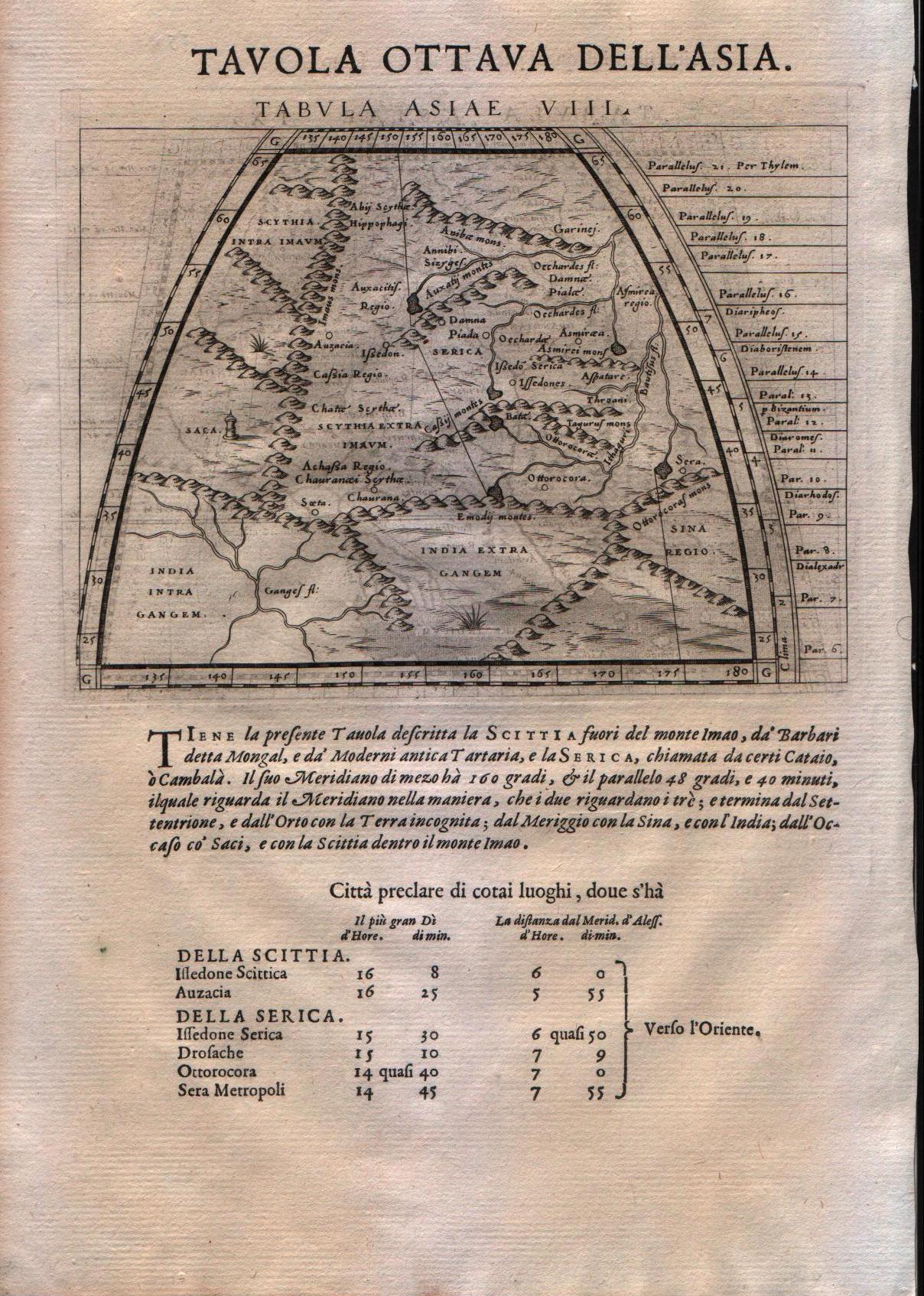
Map title
Tabula Asiae VIII
Author
Magini
Location shown in map
Central Asia
Edition date
1598
Edition place
Venice
Editor
Battista & Giorgio Galignani
Atlas
Geografia di Claudio Tolomeo -- Giovanni Antonio Magini
Price
125 Euro
State
[MINT/excellent/very good/good/fair/mediocre/poor]
Color
Black/white
Verso
Italian text pag.15
Size
Plate: cm (17.8 x 14) inches (7.01 x 5.51) Paper: cm (20.3 x 29.2) inches (7.99 x 11.5)
Technique
Copper engraving
Note
No particular notes for this maps.
Reference
--
Wiki
Here for more info
In stock
Available
Info
info@thetreasuremaps.com
Code
#0203
×
![]()
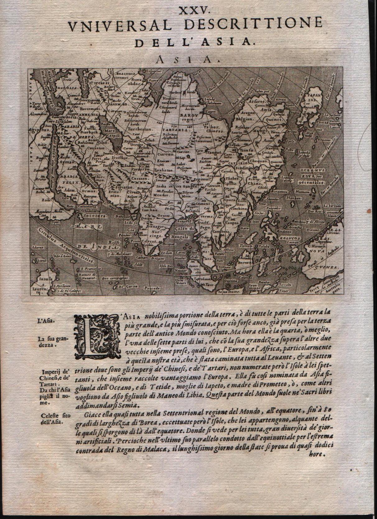
Map title
Asia
Author
Magini
Location shown in map
Asia
Edition date
1598
Edition place
Venice
Editor
Battista & Giorgio Galignani
Atlas
Geografia di Claudio Tolomeo -- Giovanni Antonio Magini
Price
500 Euro
State
[MINT/excellent/very good/good/fair/mediocre/poor]
Color
Black/white
Verso
Italian text pag.153
Size
Plate: cm (12.7 x 17.8) inches (5 x 7.01) Paper: cm (20.3 x 30.5) inches (7.99 x 12.01)
Technique
Copper engraving
Note
No particular notes for this maps.
Reference
--
Wiki
Here for more info
In stock
Available
Info
info@thetreasuremaps.com
Code
#0204
Asia
Author
Magini
Location shown in map
Asia
Edition date
1598
Edition place
Venice
Editor
Battista & Giorgio Galignani
Atlas
Geografia di Claudio Tolomeo -- Giovanni Antonio Magini
Price
500 Euro
State
[MINT/excellent/very good/good/fair/mediocre/poor]
Color
Black/white
Verso
Italian text pag.153
Size
Plate: cm (12.7 x 17.8) inches (5 x 7.01) Paper: cm (20.3 x 30.5) inches (7.99 x 12.01)
Technique
Copper engraving
Note
No particular notes for this maps.
Reference
--
Wiki
Here for more info
In stock
Available
Info
info@thetreasuremaps.com
Code
#0204
×
![]()
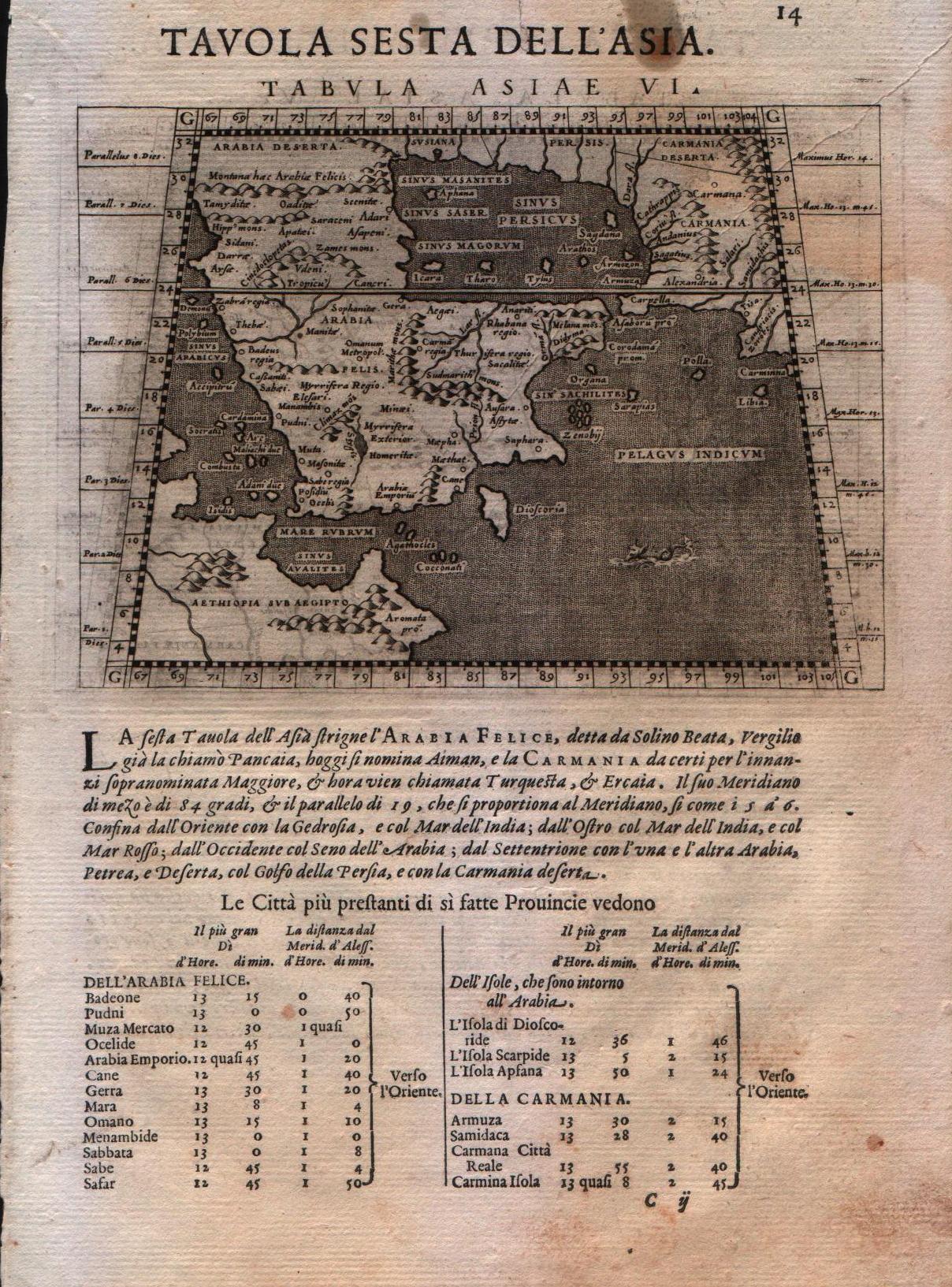
Map title
Tabula Asiae VI
Author
Magini
Location shown in map
Arabia
Edition date
1598
Edition place
Venice
Editor
Battista & Giorgio Galignani
Atlas
Geografia di Claudio Tolomeo -- Giovanni Antonio Magini
Price
125 Euro
State
[MINT/excellent/very good/good/fair/mediocre/poor]
Color
Black/white
Verso
Italian text pag.14
Size
Plate: cm (12.7 x 17.8) inches (5 x 7.01) Paper: cm (20.3 x 30.5) inches (7.99 x 12.01)
Technique
Copper engraving
Note
Ptolemaic map of the region.
Reference
--
Wiki
Here for more info
In stock
Available
Info
info@thetreasuremaps.com
Code
#0205
×
![]()
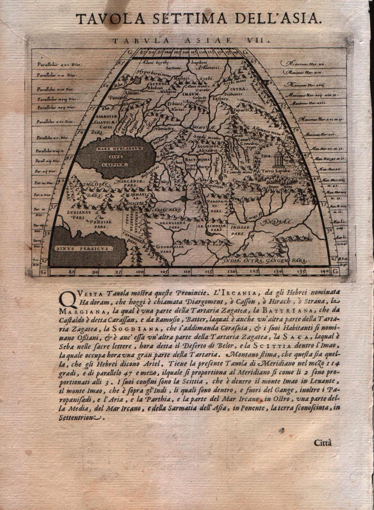
Map title
Tabula Asiae VII
Author
Magini
Location shown in map
Iran,Iraq,Armenia
Edition date
1598
Edition place
Venice
Editor
Battista & Giorgio Galignani
Atlas
Geografia di Claudio Tolomeo -- Giovanni Antonio Magini
Price
125 Euro
State
[MINT/excellent/very good/good/fair/mediocre/poor]
Color
Black/white
Verso
Italian text pag.14
Size
Plate: cm (12.7 x 17.8) inches (5 x 7.01) Paper: cm (20.3 x 30.5) inches (7.99 x 12.01)
Technique
Copper engraving
Note
Ptolemaic map of the region.
Reference
--
Wiki
Here for more info
In stock
Available
Info
info@thetreasuremaps.com
Code
#0206
×
![]()
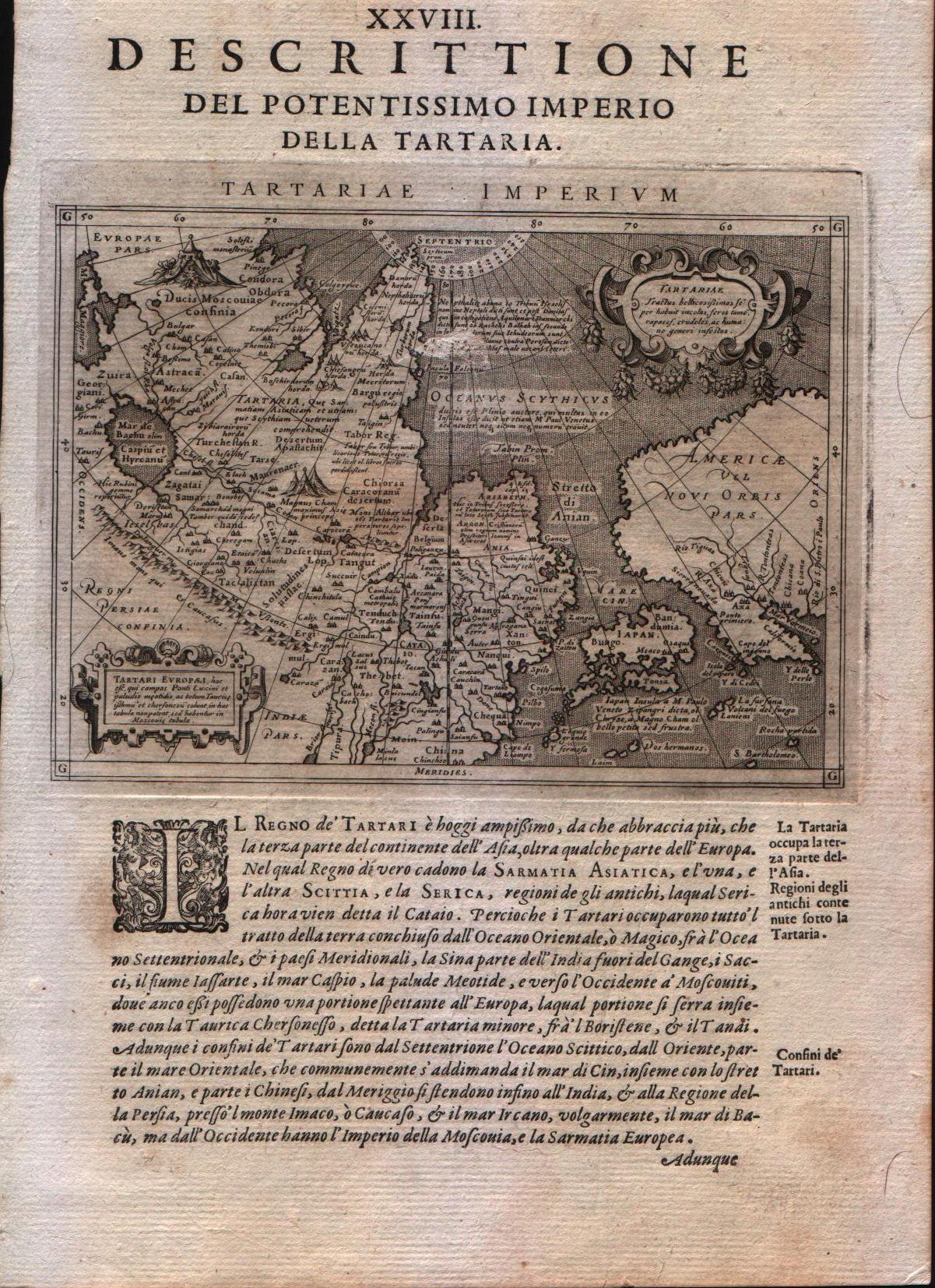
Map title
Descrittione del potentissimo imperio della Tartaria
Author
Magini
Location shown in map
East Asia, Japan, California
Edition date
1598
Edition place
Venice
Editor
Battista & Giorgio Galignani
Atlas
Geografia di Claudio Tolomeo -- Giovanni Antonio Magini
Price
350 Euro
State
[MINT/excellent/very good/good/fair/mediocre/poor]
Color
Black/white
Verso
Italian text
Size
Plate: cm (12.7 x 17.8) inches (5 x 7.01) Paper: cm (20.3 x 30.5) inches (7.99 x 12.01)
Technique
Copper engraving
Note
Very interesting map of East Asia and North West America.
Reference
--
Wiki
Here for more info
In stock
Available
Info
info@thetreasuremaps.com
Code
#0208
×
![]()
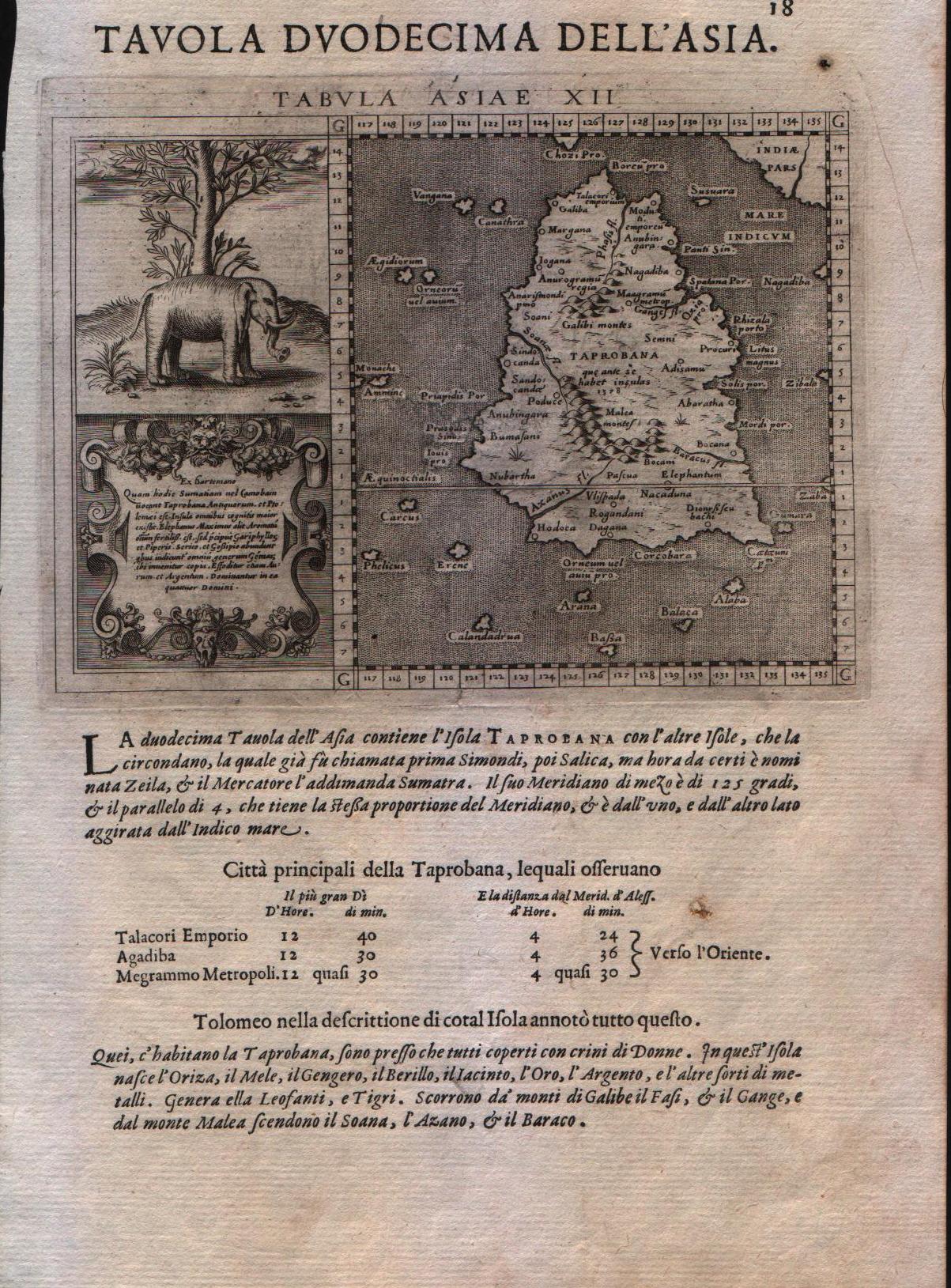
Map title
Tavola duodecima dell'Asia
Author
Magini
Location shown in map
Ceylon
Edition date
1598
Edition place
Venice
Editor
Battista & Giorgio Galignani
Atlas
Geografia di Claudio Tolomeo -- Giovanni Antonio Magini
Price
250 Euro
State
[MINT/excellent/very good/good/fair/mediocre/poor]
Color
Black/white
Verso
Italian text
Size
Plate: cm (12.7 x 17.8) inches (5 x 7.01) Paper: cm (20.3 x 30.5) inches (7.99 x 12.01)
Technique
Copper engraving
Note
With large elephant vignette. Tabulae Asiae XII.
Reference
--
Wiki
Here for more info
In stock
Available
Info
info@thetreasuremaps.com
Code
#0209
×
![]()
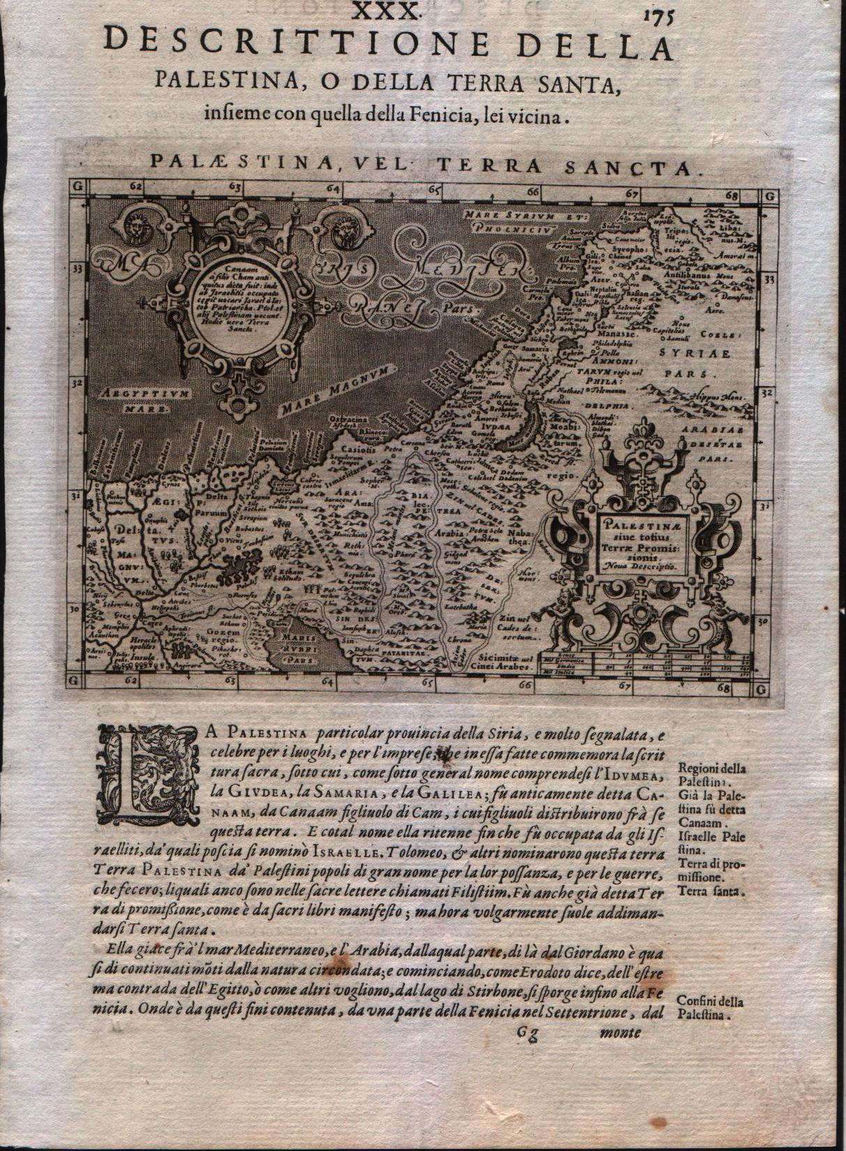
Map title
Palestina vel Terra Sancta
Author
Magini
Location shown in map
Holy Land
Edition date
1598
Edition place
Venice
Editor
Battista & Giorgio Galignani
Atlas
Geografia di Claudio Tolomeo -- Giovanni Antonio Magini
Price
200 Euro
State
[MINT/excellent/very good/good/fair/mediocre/poor]
Color
Black/white
Verso
Italian text pag 175
Size
Plate: cm (12.7 x 17.8) inches (5 x 7.01) Paper: cm (20.3 x 30.5) inches (7.99 x 12.01)
Technique
Copper engraving
Note
Magini's modern map of the Holy Land.
Reference
--
Wiki
Here for more info
In stock
Available
Info
info@thetreasuremaps.com
Code
#0210
×
![]()
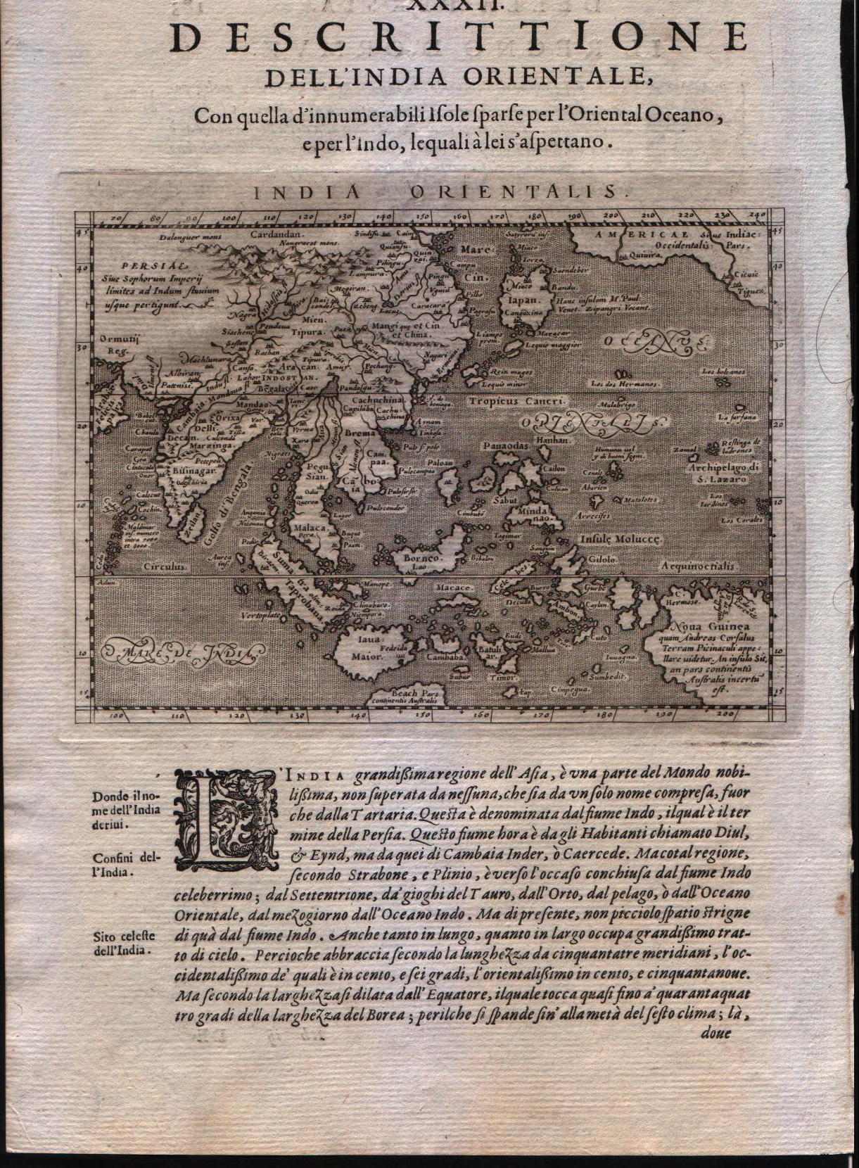
Map title
India orientalis
Author
Magini
Location shown in map
Southest Asia
Edition date
1598
Edition place
Venice
Editor
Battista & Giorgio Galignani
Atlas
Geografia di Claudio Tolomeo -- Giovanni Antonio Magini
Price
350 Euro
State
[MINT/excellent/very good/good/fair/mediocre/poor]
Color
Black/white
Verso
Italian text pag.183
Size
Plate: cm (12.7 x 17.8) inches (5 x 7.01) Paper: cm (20.3 x 30.5) inches (7.99 x 12.01)
Technique
Copper engraving
Note
The Far East.
Reference
--
Wiki
Here for more info
In stock
Available
Info
info@thetreasuremaps.com
Code
#0211
×
![]()
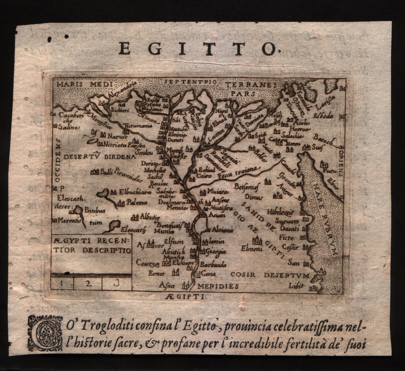
Map title
Egitto
Author
Ortelius
Location shown in map
Egypt
Edition date
1598
Edition place
Venice
Editor
--
Atlas
Theatrum Orbis Terrarum
Price
100 Euro
State
[mint/EXCELLENT/very good/good/fair/mediocre/poor]
Color
Black/white
Verso
Italian text
Size
Plate: cm (10.2 x 7.6) inches (4.02 x 2.99) Paper: cm (12.7 x 11.4) inches (5 x 4.49)
Technique
Copper engraving
Note
No particular notes for this maps
Reference
--
Wiki
Here for more info
In stock
Available
Info
info@thetreasuremaps.com
Code
#0288
×
![]()
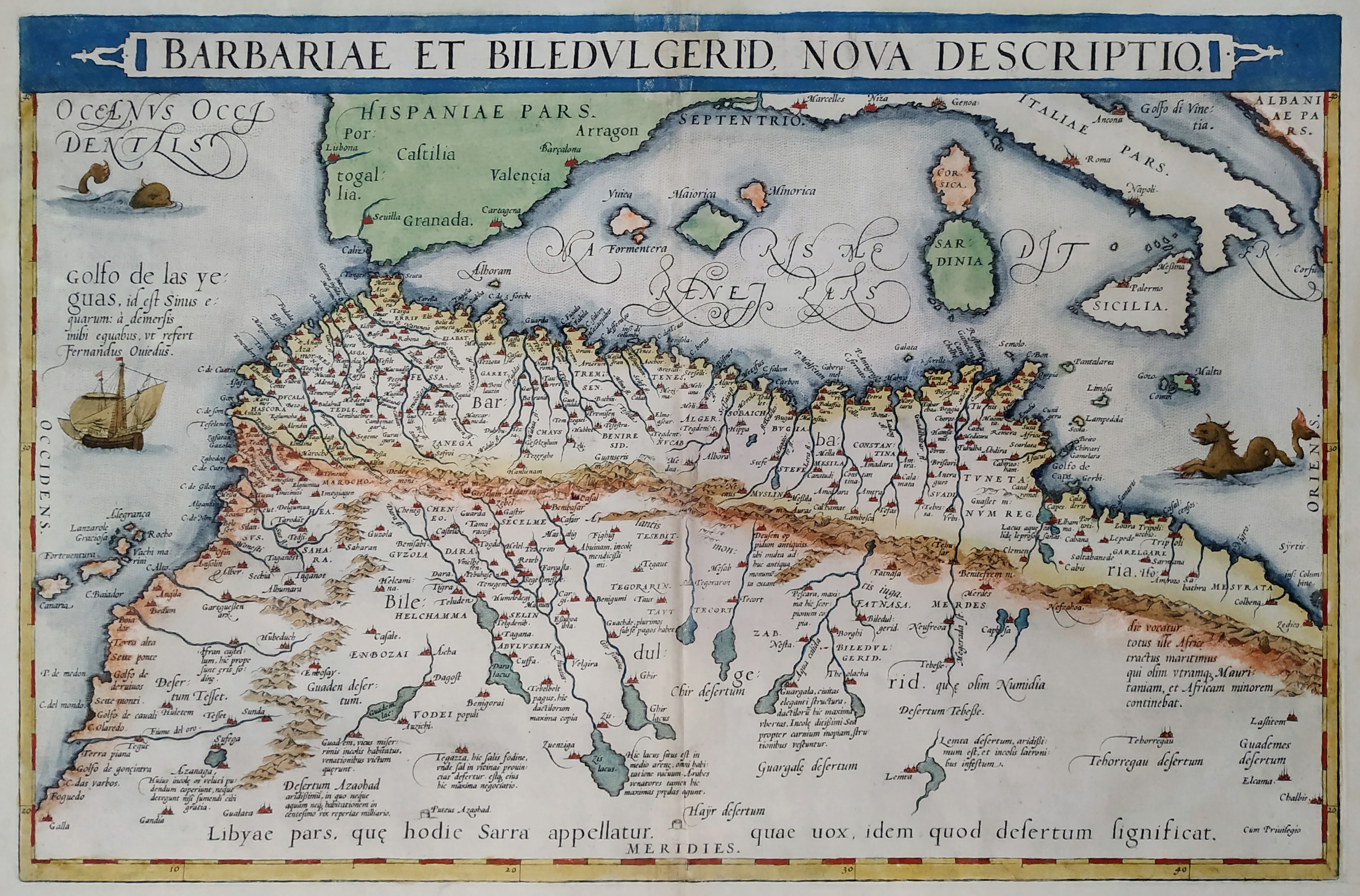
Map title
Barbariae et Biledulgerid Nova Descriptio
Author
Ortelius
Location shown in map
North Africa
Edition date
1598
Edition place
Anvers
Editor
--
Atlas
Theatrum Orbis Terrarum
Price
400 Euro
State
[mint/EXCELLENT/very good/good/fair/mediocre/poor]
Color
Modern color
Verso
Latin text
Size
Plate: cm (49.5 x 34.3) inches (19.49 x 13.5) Paper: cm (55.9 x 43.2) inches (22.01 x 17.01)
Technique
Copper engraving
Note
No particular notes for this maps
Reference
Van Den Broecke 176
Wiki
Here for more info
In stock
Available
Info
info@thetreasuremaps.com
Code
#0289
×
![]()
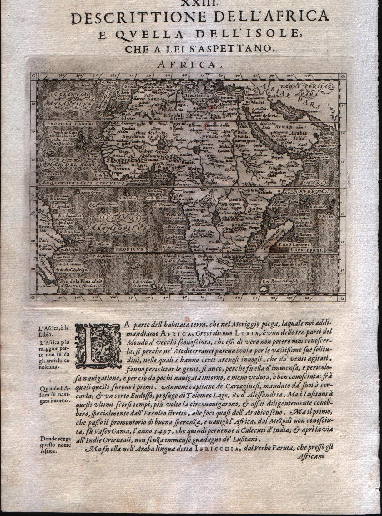
Map title
Africa
Author
Magini
Location shown in map
Africa
Edition date
1598
Edition place
Venice
Editor
Battista & Giorgio Galignani
Atlas
Geografia di Claudio Tolomeo -- Giovanni Antonio Magini
Price
350 Euro
State
[MINT/excellent/very good/good/fair/mediocre/poor]
Color
Black/white
Verso
Italian text pag.130
Size
Plate: cm (12.7 x 17.8) inches (5 x 7.01) Paper: cm (20.3 x 30.5) inches (7.99 x 12.01)
Technique
Copper engraving
Note
No particular notes for this maps
Reference
--
Wiki
Here for more info
In stock
Available
Info
info@thetreasuremaps.com
Code
#0290
Africa
Author
Magini
Location shown in map
Africa
Edition date
1598
Edition place
Venice
Editor
Battista & Giorgio Galignani
Atlas
Geografia di Claudio Tolomeo -- Giovanni Antonio Magini
Price
350 Euro
State
[MINT/excellent/very good/good/fair/mediocre/poor]
Color
Black/white
Verso
Italian text pag.130
Size
Plate: cm (12.7 x 17.8) inches (5 x 7.01) Paper: cm (20.3 x 30.5) inches (7.99 x 12.01)
Technique
Copper engraving
Note
No particular notes for this maps
Reference
--
Wiki
Here for more info
In stock
Available
Info
info@thetreasuremaps.com
Code
#0290
×
![]()
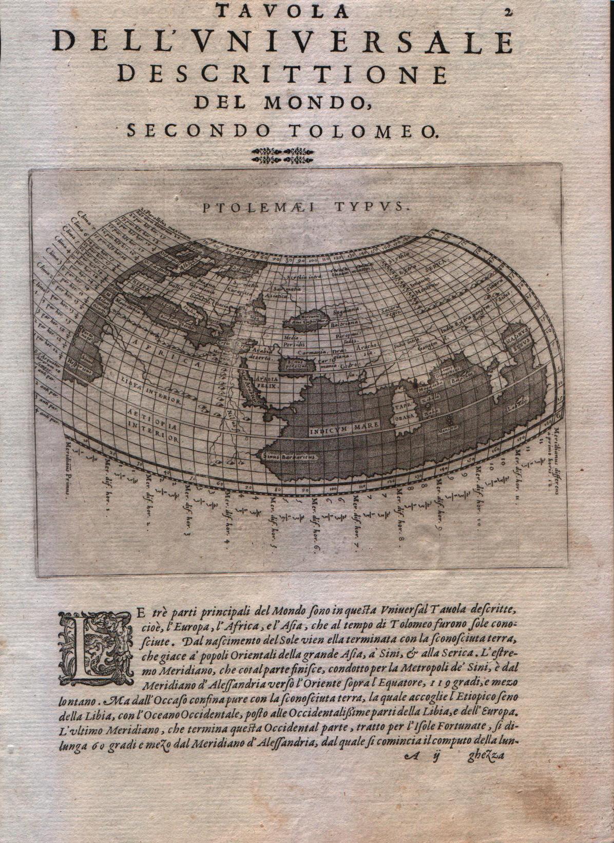
Map title
Ptolemaei Typus
Author
Magini
Location shown in map
World
Edition date
1598
Edition place
Venice
Editor
Battista & Giorgio Galignani
Atlas
Geografia di Claudio Tolomeo -- Giovanni Antonio Magini
Price
300 Euro
State
[MINT/excellent/very good/good/fair/mediocre/poor]
Color
Black/white
Verso
Italian text pag.2
Size
Plate: cm (17.8 x 12.7) inches (7.01 x 5) Paper: cm (20.3 x 30.5) inches (7.99 x 12.01)
Technique
Copper engraving
Note
A map of the Ptolemaic world
Reference
--
Wiki
Here for more info
In stock
Available
Info
info@thetreasuremaps.com
Code
#0335
×
![]()
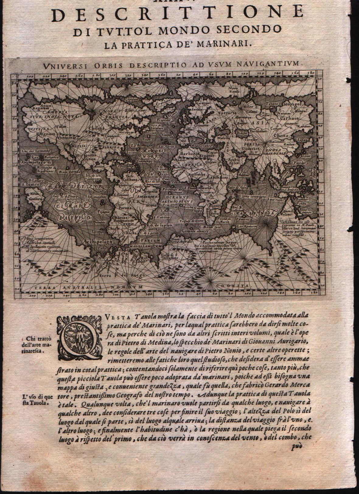
Map title
Universi Orbis Descriptio ad usum navigantium.
Author
Magini
Location shown in map
World
Edition date
1598
Edition place
Venice
Editor
Battista & Giorgio Galignani
Atlas
Geografia di Claudio Tolomeo -- Giovanni Antonio Magini
Price
700 Euro
State
[MINT/excellent/very good/good/fair/mediocre/poor]
Color
Black/white
Verso
Italian text pag.211
Size
Plate: cm (17.8 x 12.7) inches (7.01 x 5) Paper: cm (20.3 x 30.5) inches (7.99 x 12.01)
Technique
Copper engraving
Note
--
Reference
--
Wiki
Here for more info
In stock
Available
Info
info@thetreasuremaps.com
Code
#0336
×
![]()
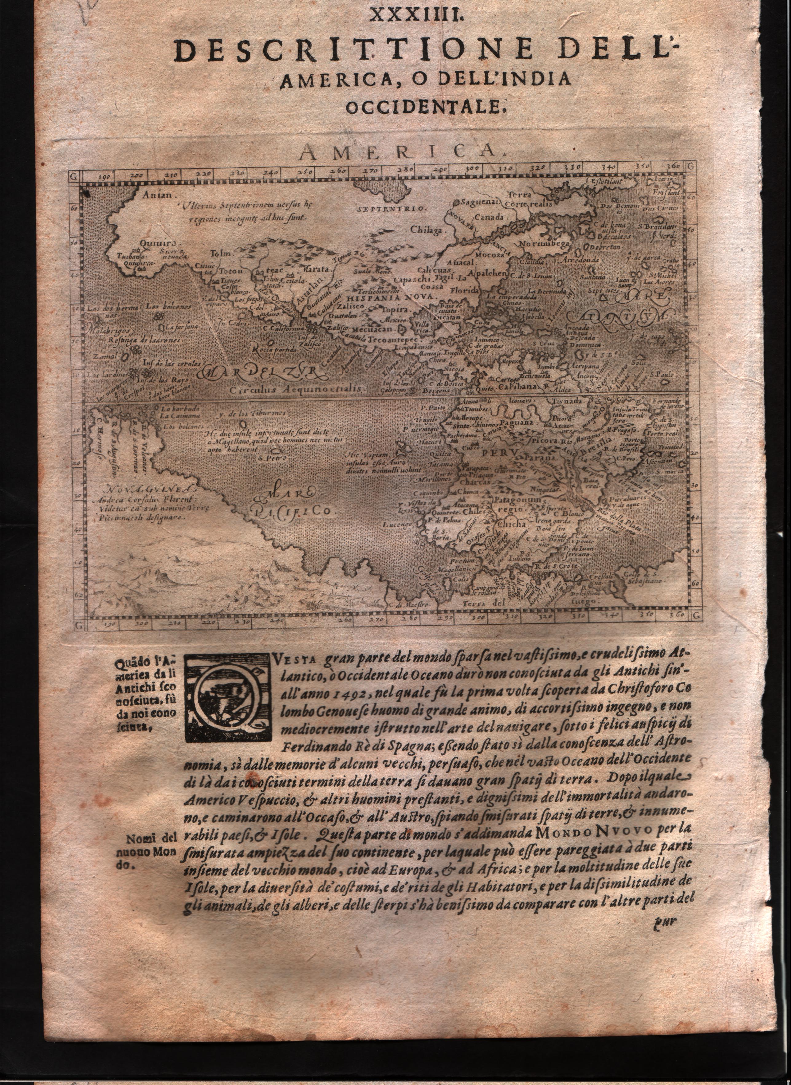
Map title
Descrittione dell'America, o dell'India Occidentale
Author
Magini
Location shown in map
Americas
Edition date
1598
Edition place
Venice
Editor
Battista & Giorgio Galignani
Atlas
Geografia di Claudio Tolomeo -- Giovanni Antonio Magini
Price
500 Euro
State
[mint/EXCELLENT/very good/good/fair/mediocre/poor]
Color
Black/white
Verso
Italian text pag 202
Size
Plate: cm (17.8 x 14) inches (7.01 x 5.51) Paper: cm (20.3 x 30.5) inches (7.99 x 12.01)
Technique
Copper engraving
Note
No particular notes for this maps.
Reference
--
Wiki
Here for more info
In stock
Available
Info
info@thetreasuremaps.com
Code
#0589
×
![]()
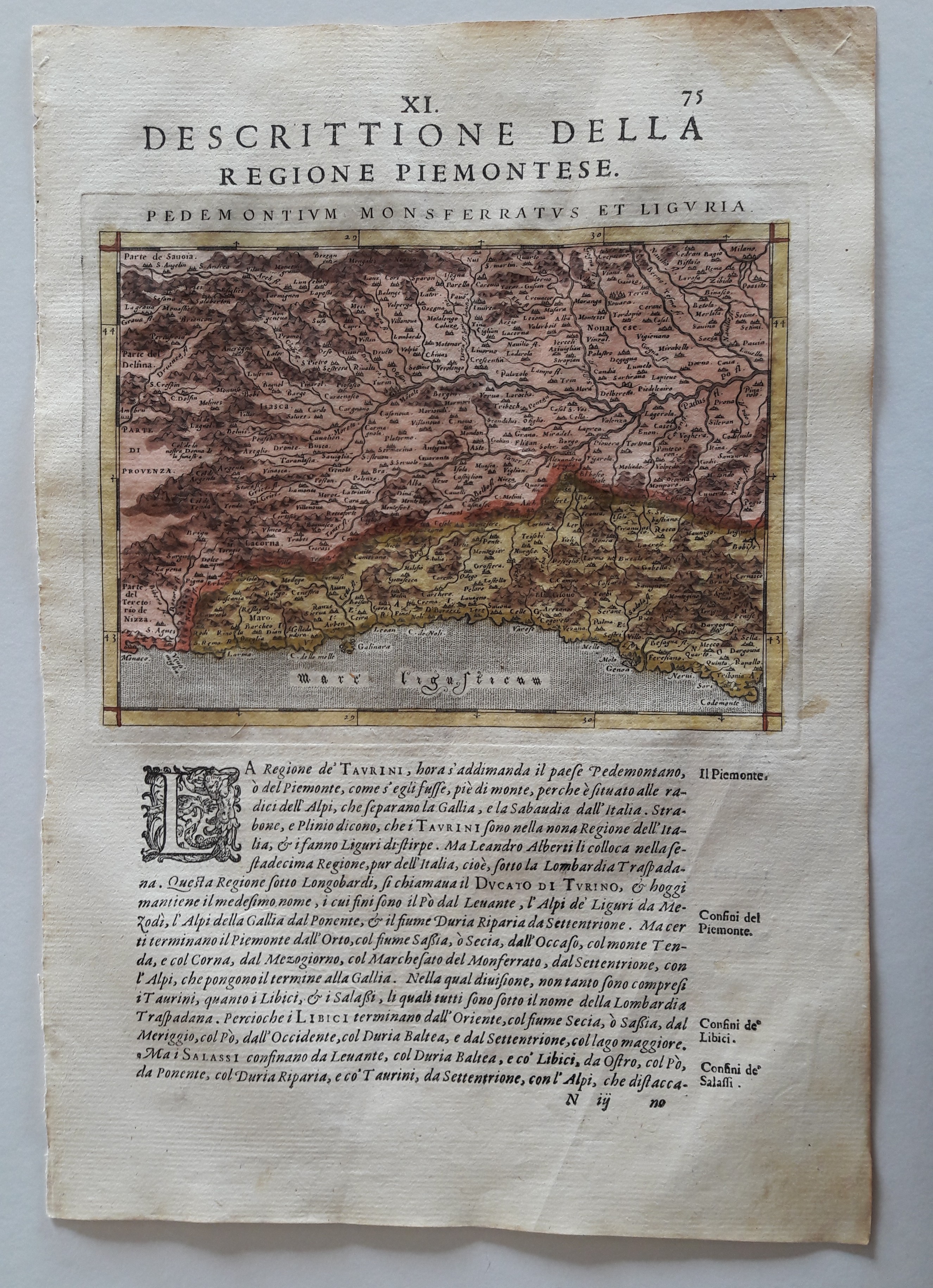
Map title
Descrittione della regione Piemontese
Author
Magini
Location shown in map
Piedmont & Liguria
Edition date
1598
Edition place
Venice
Editor
Battista & Giorgio Galignani
Atlas
Geografia di Claudio Tolomeo -- Giovanni Antonio Magini
Price
250 Euro
State
[mint/EXCELLENT/very good/good/fair/mediocre/poor]
Color
Old colors
Verso
Italian test pag.75
Size
Plate: cm (17 x 13) inches (6.69 x 5.12) Paper: cm (21 x 30) inches (8.27 x 11.81)
Technique
Copper engraving
Note
No particular notes for this maps.
Reference
--
Wiki
Here for more info
In stock
Available
Info
info@thetreasuremaps.com
Code
#0641
×
![]()
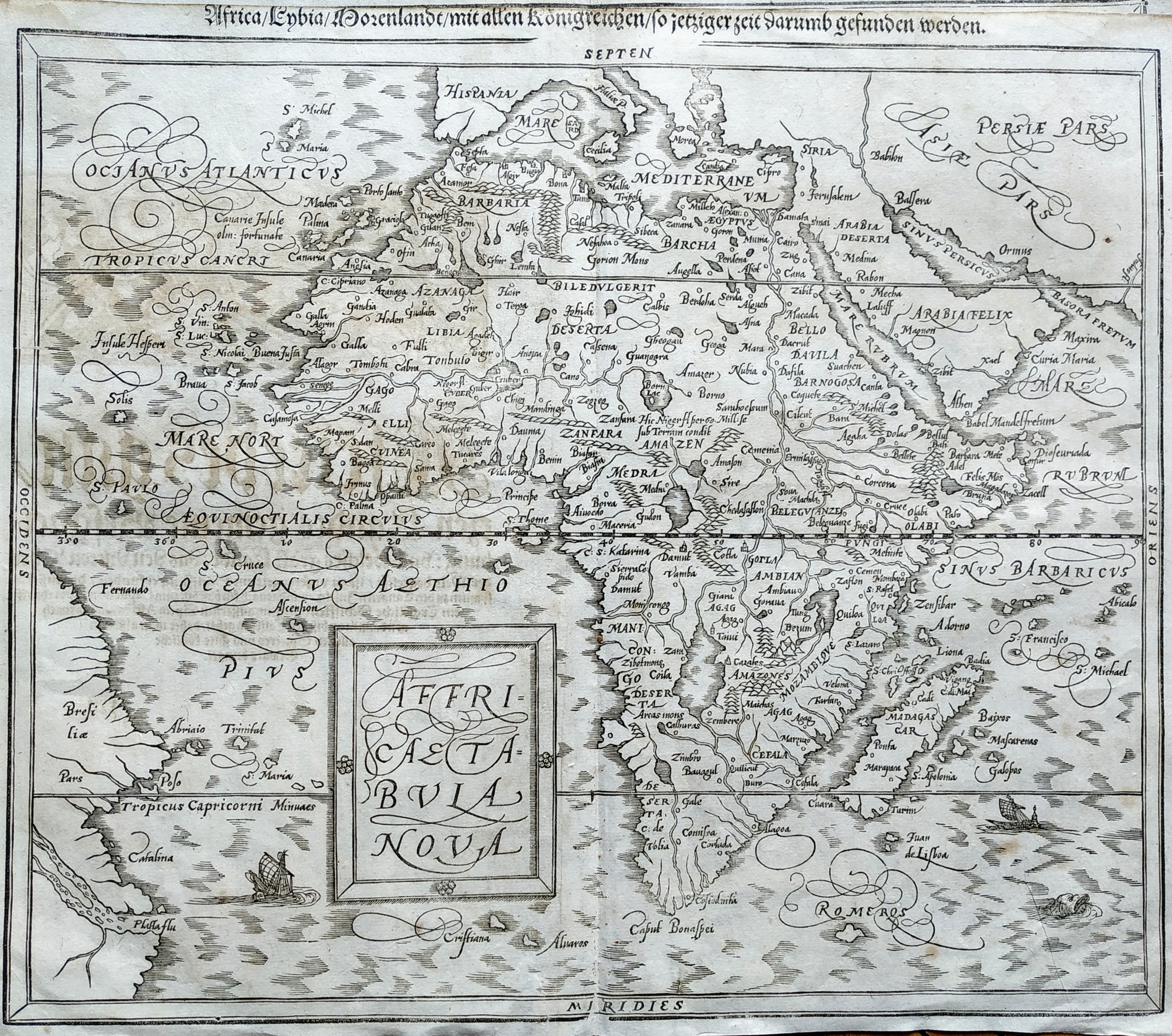
Map title
Africa Tabula Nova
Author
Munster
Location shown in map
Africa
Edition date
1598
Edition place
Basel
Editor
Henrich Petri
Atlas
Cosmographia Universalis
Price
400 Euro
State
[mint/excellent/VERY GOOD/good/fair/mediocre/poor]
Color
Black/white
Verso
German text
Size
Plate: cm (36 x 31) inches (14.17 x 12.2) Paper: cm (38 x 33) inches (14.96 x 12.99)
Technique
Woodcut
Note
No particular notes for this maps
Reference
--
Wiki
Here for more info
In stock
Available
Info
info@thetreasuremaps.com
Code
#0732
×
![]()
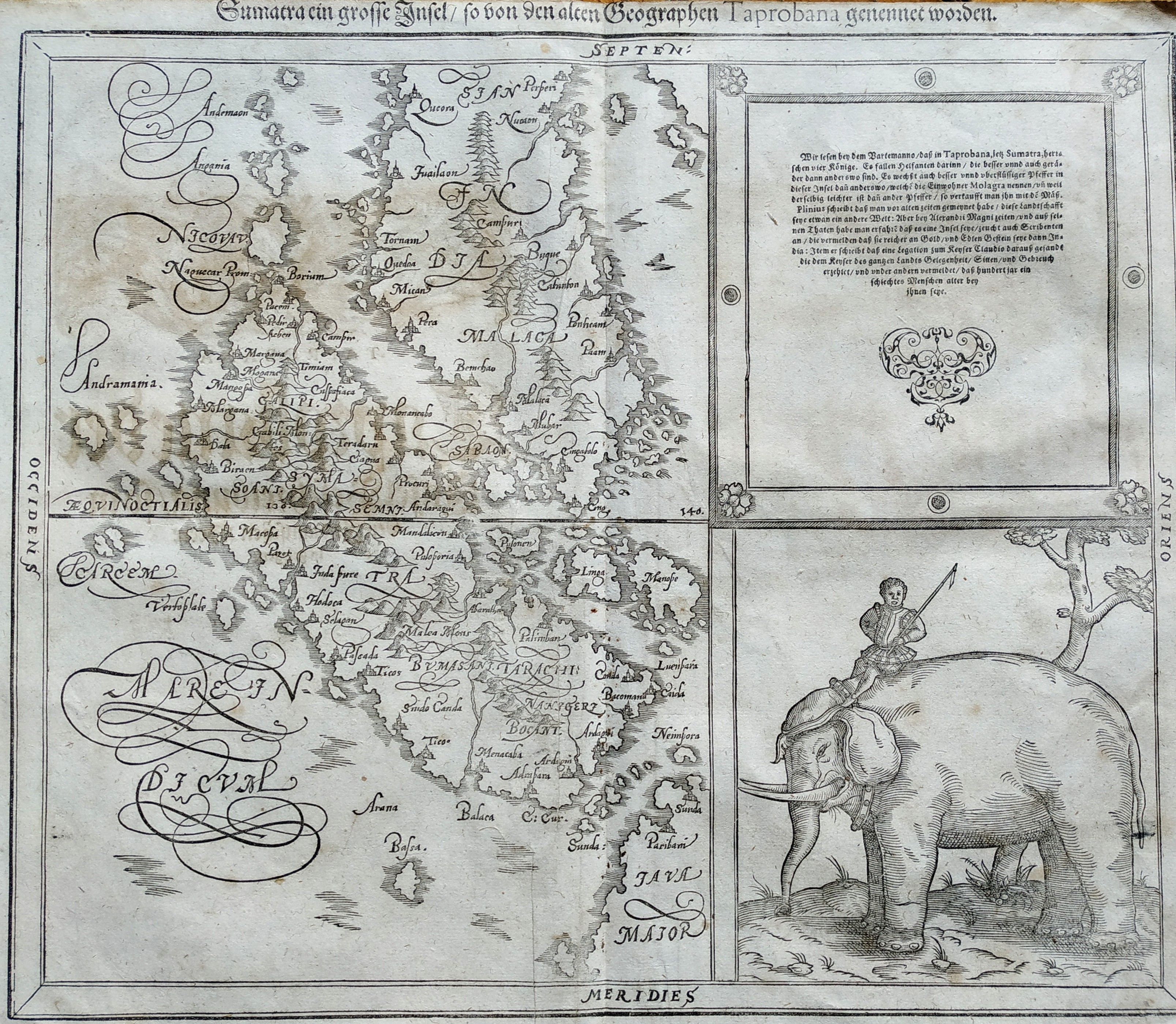
Map title
Sumatra
Author
Munster
Location shown in map
Sumatra
Edition date
1598
Edition place
Basel
Editor
Henrich Petri
Atlas
Cosmographia Universalis
Price
400 Euro
State
[mint/excellent/VERY GOOD/good/fair/mediocre/poor]
Color
Black/white
Verso
German text
Size
Plate: cm (57 x 47) inches (22.44 x 18.5) Paper: cm (66 x 55) inches (25.98 x 21.65)
Technique
Woodcut
Note
No particular notes for this maps
Reference
--
Wiki
Here for more info
In stock
Available
Info
info@thetreasuremaps.com
Code
#0733
Sumatra
Author
Munster
Location shown in map
Sumatra
Edition date
1598
Edition place
Basel
Editor
Henrich Petri
Atlas
Cosmographia Universalis
Price
400 Euro
State
[mint/excellent/VERY GOOD/good/fair/mediocre/poor]
Color
Black/white
Verso
German text
Size
Plate: cm (57 x 47) inches (22.44 x 18.5) Paper: cm (66 x 55) inches (25.98 x 21.65)
Technique
Woodcut
Note
No particular notes for this maps
Reference
--
Wiki
Here for more info
In stock
Available
Info
info@thetreasuremaps.com
Code
#0733
×
![]()
Map title
Descrittione dell impero Persiano
Author
Magini
Location shown in map
Iran
Edition date
1598
Edition place
Venice
Editor
Battista & Giorgio Galignani
Atlas
Geografia di Claudio Tolomeo -- Giovanni Antonio Magini
Price
125 Euro
State
[mint/EXCELLENT/very good/good/fair/mediocre/poor]
Color
Black/white
Verso
Italian test pag.179
Size
Plate: cm (17 x 13) inches (6.69 x 5.12) Paper: cm (21 x 30) inches (8.27 x 11.81)
Technique
Copper engraving
Note
No particular notes for this maps.
Reference
--
Wiki
Here for more info
In stock
Available
Info
info@thetreasuremaps.com
Code
#0763
×
![]()
Map title
Italia
Author
Magini
Location shown in map
Italy
Edition date
1598
Edition place
Venice
Editor
Battista & Giorgio Galignani
Atlas
Geografia di Claudio Tolomeo -- Giovanni Antonio Magini
Price
300 Euro
State
[MINT/excellent/very good/good/fair/mediocre/poor]
Color
Black/white
Verso
Italian text pag.71
Size
Plate: cm (17.8 x 12.7) inches (7.01 x 5) Paper: cm (19 x 15) inches (7.48 x 5.91)
Technique
Copper engraving
Note
--
Reference
R.Borri L'Italia nelle antiche carte pag.78
Wiki
Here for more info
In stock
Sold
Info
info@thetreasuremaps.com
Code
#0809
×
![]()
Map title
Zelandia
Author
Ortelius
Location shown in map
Nederland
Edition date
1598
Edition place
Brescia
Editor
Pietro Marchetti
Atlas
Il theatro del mondo
Price
150 Euro
State
[mint/EXCELLENT/very good/good/fair/mediocre/poor]
Color
Black/white
Verso
Italian text
Size
Plate: cm (11 x 8) inches (4.33 x 3.15) Paper: cm (11 x 8) inches (4.33 x 3.15)
Technique
Copper engraving
Note
Reference
Wiki
Here for more info
In stock
Available
Info
info@thetreasuremaps.com
Code
#0862
×
![]()
Map title
Tabula Aphricae I
Author
Magini
Location shown in map
Morocco
Edition date
1598
Edition place
Venice
Editor
Battista & Giorgio Galignani
Atlas
Geografia di Claudio Tolomeo -- Giovanni Antonio Magini
Price
125 Euro
State
[MINT/excellent/very good/good/fair/mediocre/poor]
Color
Black/white
Verso
Italian text pag.8
Size
Plate: cm (17.5 x 14) inches (6.89 x 5.51) Paper: cm (20.3 x 30.5) inches (7.99 x 12.01)
Technique
Copper engraving
Note
Reference
--
Wiki
Here for more info
In stock
Available
Info
info@thetreasuremaps.com
Code
#0999
×
![]()