1600-1699
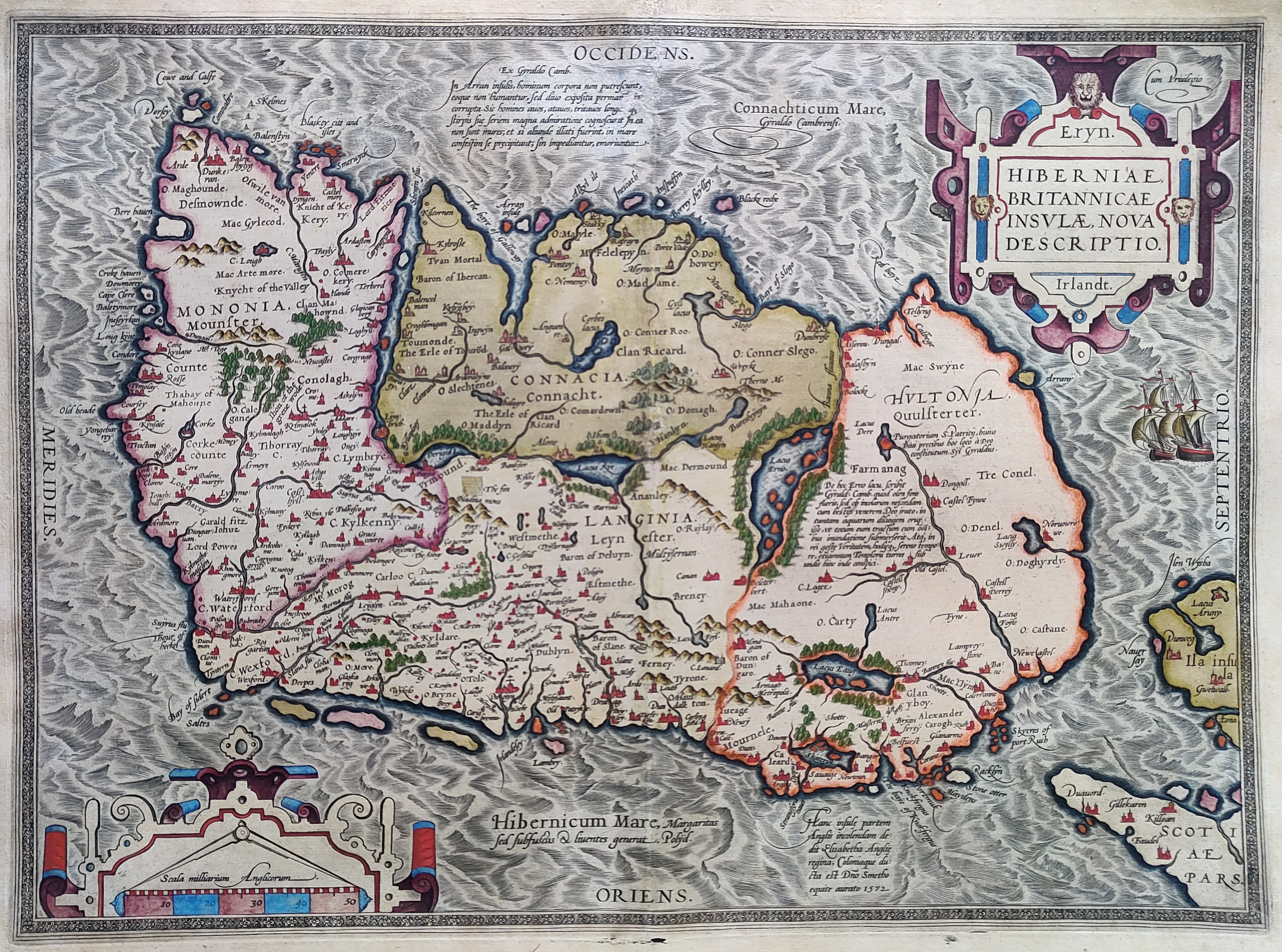
Map title
Hiberniae Britannicae insulae nova descriptio
Author
Ortelius
Location shown in map
Ireland
Edition date
1601
Edition place
Antwerp
Editor
--
Atlas
Theatrum Orbis Terrarum
Price
900 Euro
State
[mint/EXCELLENT/very good/good/fair/mediocre/poor]
Color
Old colors
Verso
Latin text pag.14
Size
Plate: cm (48 x 35) inches (18.9 x 13.78) Paper: cm (55 x 43) inches (21.65 x 16.93)
Technique
Copper engraving
Note
Reference
Van Den Broecke 63
Wiki
Here for more info
In stock
Sold
Info
info@thetreasuremaps.com
Code
#1019
×
![]()
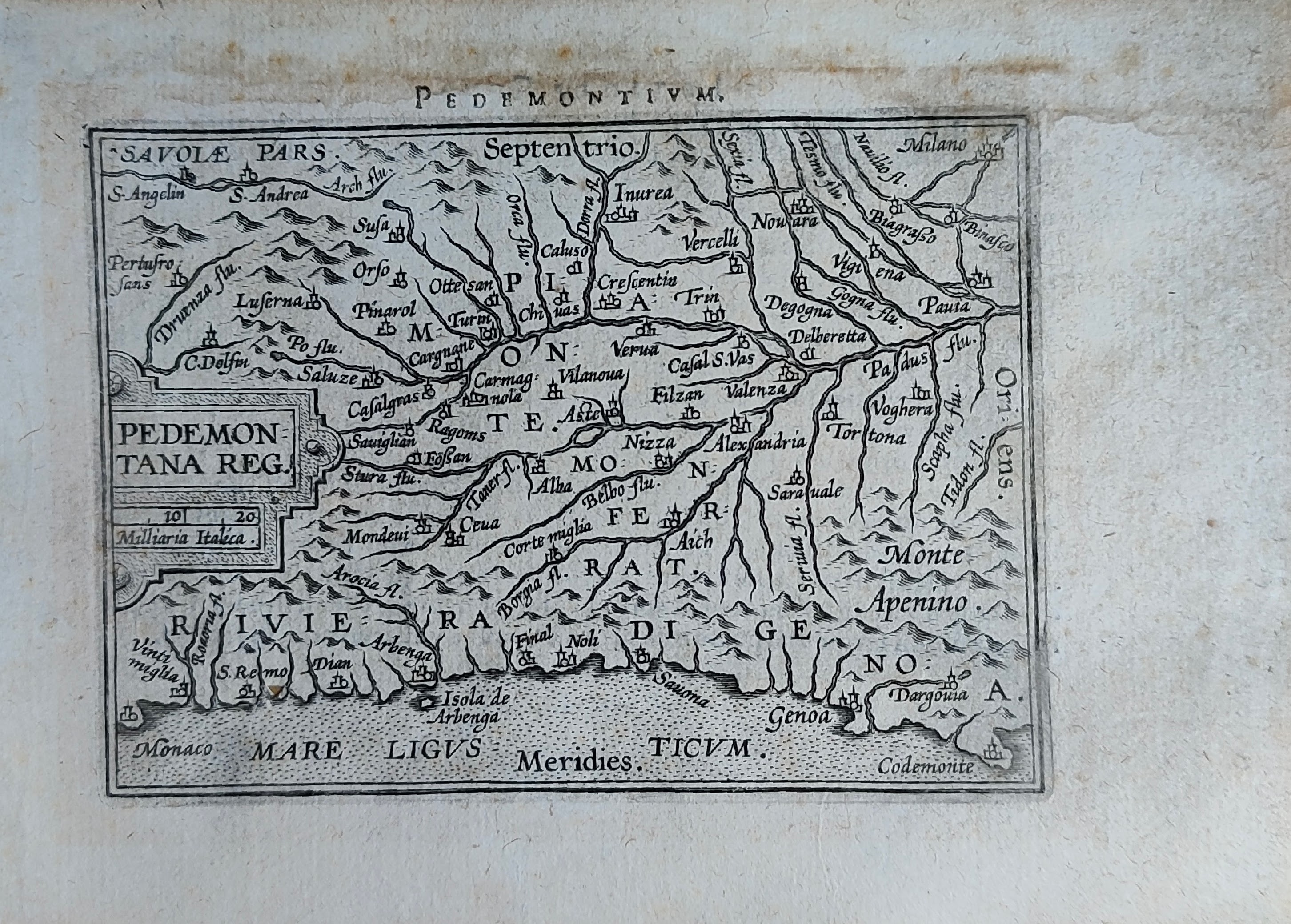
Map title
Pedemontanae vicinorumque
Author
Ortelius
Location shown in map
Liguria
Edition date
Circa 1601
Edition place
Antwerp
Editor
--
Atlas
Epitome Theatri Orteliani
Price
175 Euro
State
[mint/EXCELLENT/very good/good/fair/mediocre/poor]
Color
Black/white
Verso
French text
Size
Plate: cm (11 x 8) inches (4.33 x 3.15) Paper: cm (15.5 x 11) inches (6.1 x 4.33)
Technique
Copper engraving
Note
Reference
L.Tricerri, Catalog of Maps of Liguria R_020
Wiki
Here for more info
In stock
Available
Info
info@thetreasuremaps.com
Code
#1292
Pedemontanae vicinorumque
Author
Ortelius
Location shown in map
Liguria
Edition date
Circa 1601
Edition place
Antwerp
Editor
--
Atlas
Epitome Theatri Orteliani
Price
175 Euro
State
[mint/EXCELLENT/very good/good/fair/mediocre/poor]
Color
Black/white
Verso
French text
Size
Plate: cm (11 x 8) inches (4.33 x 3.15) Paper: cm (15.5 x 11) inches (6.1 x 4.33)
Technique
Copper engraving
Note
Reference
L.Tricerri, Catalog of Maps of Liguria R_020
Wiki
Here for more info
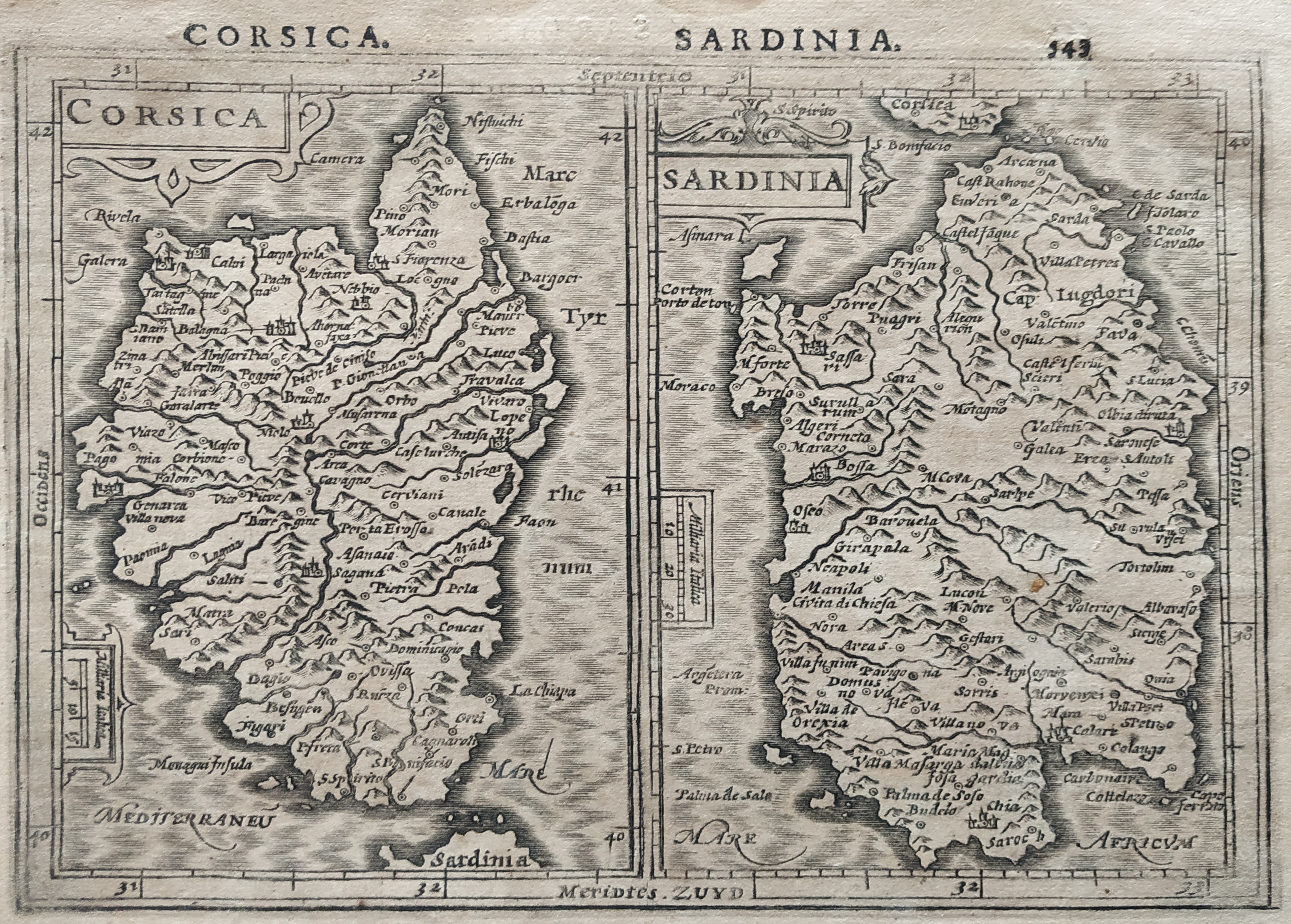
In stock
Available
Info
info@thetreasuremaps.com
Code
#1292
×
![]()
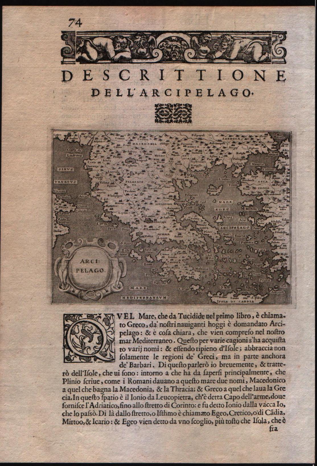
Map title
Descrittione dell'arcipelago
Author
Porcacchi
Location shown in map
Greece
Edition date
1602
Edition place
Venice
Editor
--
Atlas
L'Isole piu famose del mondo -- S. Galignani and G. Porro
Price
200 Euro
State
[MINT/excellent/very good/good/fair/mediocre/poor]
Color
Black/white
Verso
Italian text pag.74
Size
Plate: cm (15.2 x 11.4) inches (5.98 x 4.49) Paper: cm (19 x 29.2) inches (7.48 x 11.5)
Technique
Copper engraving
Note
No particular notes for this maps
Reference
--
Wiki
Here for more info
In stock
Available
Info
info@thetreasuremaps.com
Code
#0106
×
![]()
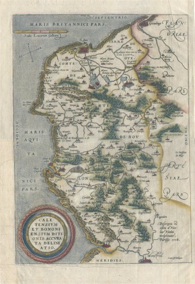
Map title
Caletensium et Bononiensium Ditionis Accurata Delineatio
Author
Ortelius
Location shown in map
--
Edition date
1602
Edition place
Anvers
Editor
--
Atlas
Theatrum Orbis Terrarum
Price
150 Euro
State
[mint/EXCELLENT/very good/good/fair/mediocre/poor]
Color
Modern color
Verso
French text
Size
Plate: cm (33 x 24.1) inches (12.99 x 9.49) Paper: cm (33 x 24.1) inches (12.99 x 9.49)
Technique
Copper engraving
Note
No particular notes for this maps
Reference
Van Den Broecke 44
Wiki
Here for more info
In stock
Available
Info
info@thetreasuremaps.com
Code
#0122
×
![]()
Map title
Descrittione dell'isola di Corsica
Author
Porcacchi
Location shown in map
Corse
Edition date
1602
Edition place
Venice
Editor
--
Atlas
L'Isole piu famose del mondo -- S. Galignani and G. Porro
Price
250 Euro
State
[mint/EXCELLENT/very good/good/fair/mediocre/poor]
Color
Black/white
Verso
Italian text pag.42
Size
Plate: cm (15.2 x 11.4) inches (5.98 x 4.49) Paper: cm (21 x 30) inches (8.27 x 11.81)
Technique
Copper engraving
Note
Reference
--
Wiki
Here for more info
In stock
Available
Info
info@thetreasuremaps.com
Code
#0972
×
![]()
Map title
Hibernia
Author
Ortelius
Location shown in map
Ireland
Edition date
1602
Edition place
Antwerp
Editor
Jean-Baptiste Uriens
Atlas
Abrege du Theatre d'Ortelius
Price
175 Euro
State
[mint/EXCELLENT/very good/good/fair/mediocre/poor]
Color
Old colors
Verso
French text
Size
Plate: cm (11 x 8) inches (4.33 x 3.15) Paper: cm (11 x 8) inches (4.33 x 3.15)
Technique
Copper engraving
Note
Plate 2 map
Reference
Wiki
Here for more info
In stock
Available
Info
info@thetreasuremaps.com
Code
#1079
×
![]()
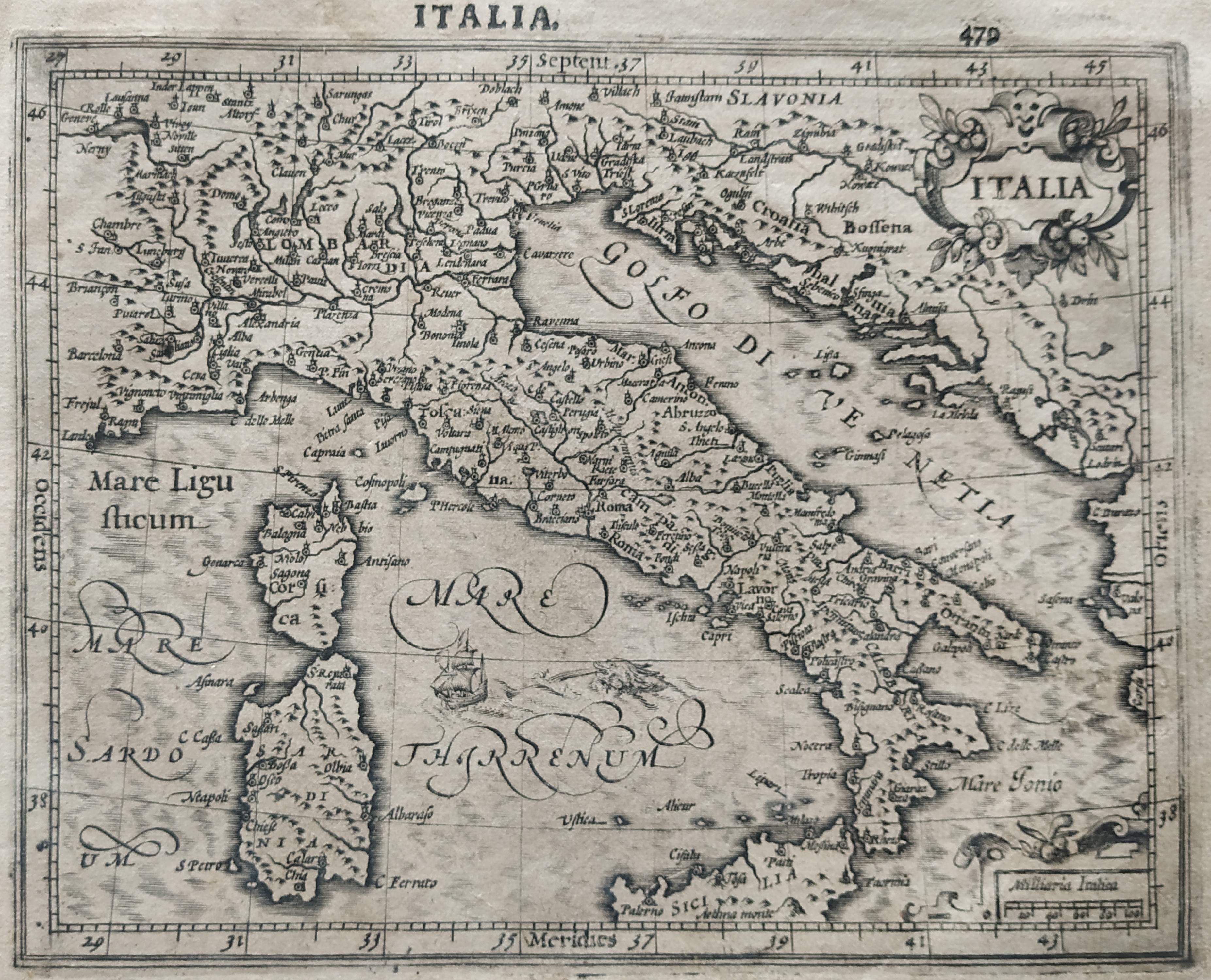
Map title
Italie Novissima Descriptio
Author
Ortelius
Location shown in map
Italy
Edition date
1603
Edition place
Antwerp
Editor
--
Atlas
Theatrum Orbis Terrarum
Price
700 Euro
State
[mint/EXCELLENT/very good/good/fair/mediocre/poor]
Color
Modern color
Verso
Latin text pag.74
Size
Plate: cm (50 x 35) inches (19.69 x 13.78) Paper: cm (56 x 46) inches (22.05 x 18.11)
Technique
Copper engraving
Note
Reference
Van Den Broecke 118
Wiki
Here for more info
In stock
Available
Info
info@thetreasuremaps.com
Code
#0802
×
![]()
Map title
Hungaria
Author
Mercator
Location shown in map
Hungary
Edition date
1606
Edition place
Amsterdam
Editor
--
Atlas
Mercator-Hondius Atlas.
Price
200 Euro
State
[mint/excellent/very good/GOOD/fair/mediocre/poor]
Color
Black/white
Verso
French text
Size
Plate: cm (41.9 x 36.8) inches (16.5 x 14.49) Paper: cm (55.9 x 45.7) inches (22.01 x 17.99)
Technique
Copper engraving
Note
No particular notes for this maps
Reference
--
Wiki
Here for more info
In stock
Available
Info
info@thetreasuremaps.com
Code
#0130
×
![]()
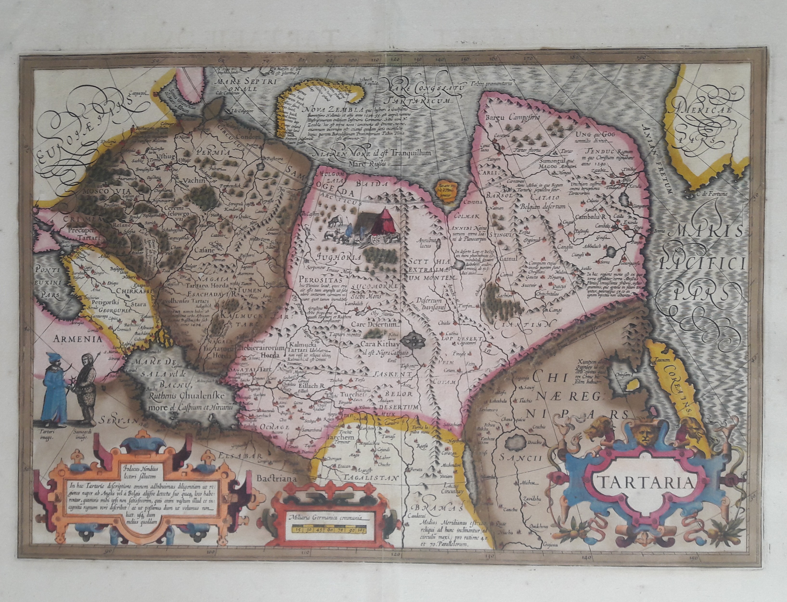
Map title
Tartaria
Author
Hondius
Location shown in map
Russia
Edition date
1606
Edition place
Amsterdam
Editor
Atlas
Atlas Maioris
Price
600 Euro
State
[mint/EXCELLENT/very good/good/fair/mediocre/poor]
Color
Old colors
Verso
Franch text 336
Size
Plate: cm (49 x 33) inches (19.29 x 12.99) Paper: cm (58 x 47) inches (22.83 x 18.5)
Technique
Copper engraving
Note
Professionally repaired
Reference
Wiki
Here for more info
In stock
Available
Info
info@thetreasuremaps.com
Code
#0656
×
![]()
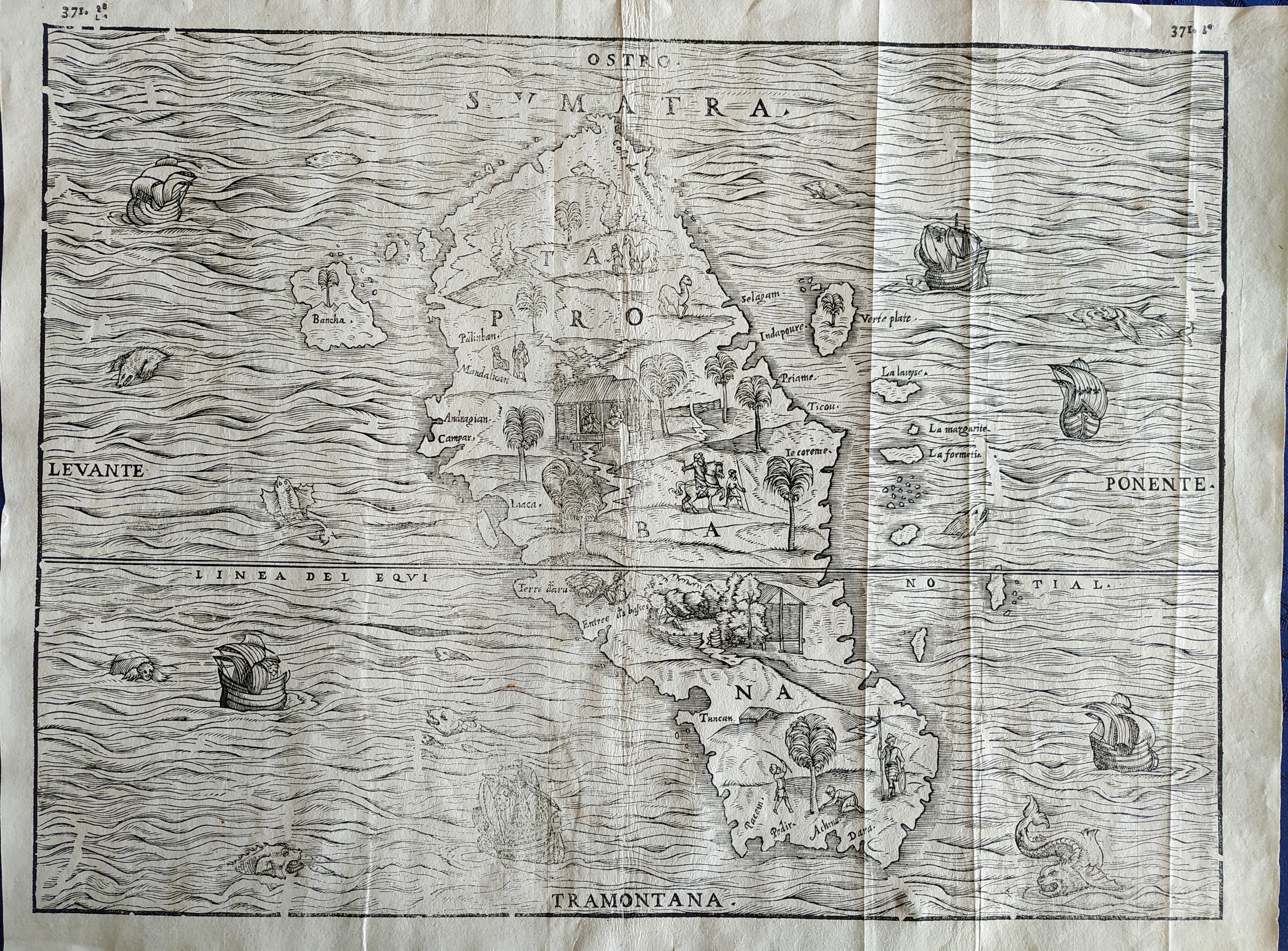
Map title
Sumatra
Author
Gastaldi
Location shown in map
Sumatra
Edition date
1606
Edition place
Venice
Editor
Giambattista Ramusio
Atlas
Delle navigazioni e viaggi
Price
Please ask: info@thetreasuremaps.com
State
[mint/excellent/VERY GOOD/good/fair/mediocre/poor]
Color
Black/white
Verso
pag.371
Size
Plate: cm (36 x 27) inches (14.17 x 10.63) Paper: cm (39 x 29) inches (15.35 x 11.42)
Technique
Woodcut
Note
Decorated with sea monsters and sailing ships.
Reference
--
Wiki
Here for more info
In stock
Available
Info
info@thetreasuremaps.com
Code
#0751
Sumatra
Author
Gastaldi
Location shown in map
Sumatra
Edition date
1606
Edition place
Venice
Editor
Giambattista Ramusio
Atlas
Delle navigazioni e viaggi
Price
Please ask: info@thetreasuremaps.com
State
[mint/excellent/VERY GOOD/good/fair/mediocre/poor]
Color
Black/white
Verso
pag.371
Size
Plate: cm (36 x 27) inches (14.17 x 10.63) Paper: cm (39 x 29) inches (15.35 x 11.42)
Technique
Woodcut
Note
Decorated with sea monsters and sailing ships.
Reference
--
Wiki
Here for more info
In stock
Available
Info
info@thetreasuremaps.com
Code
#0751
×
![]()
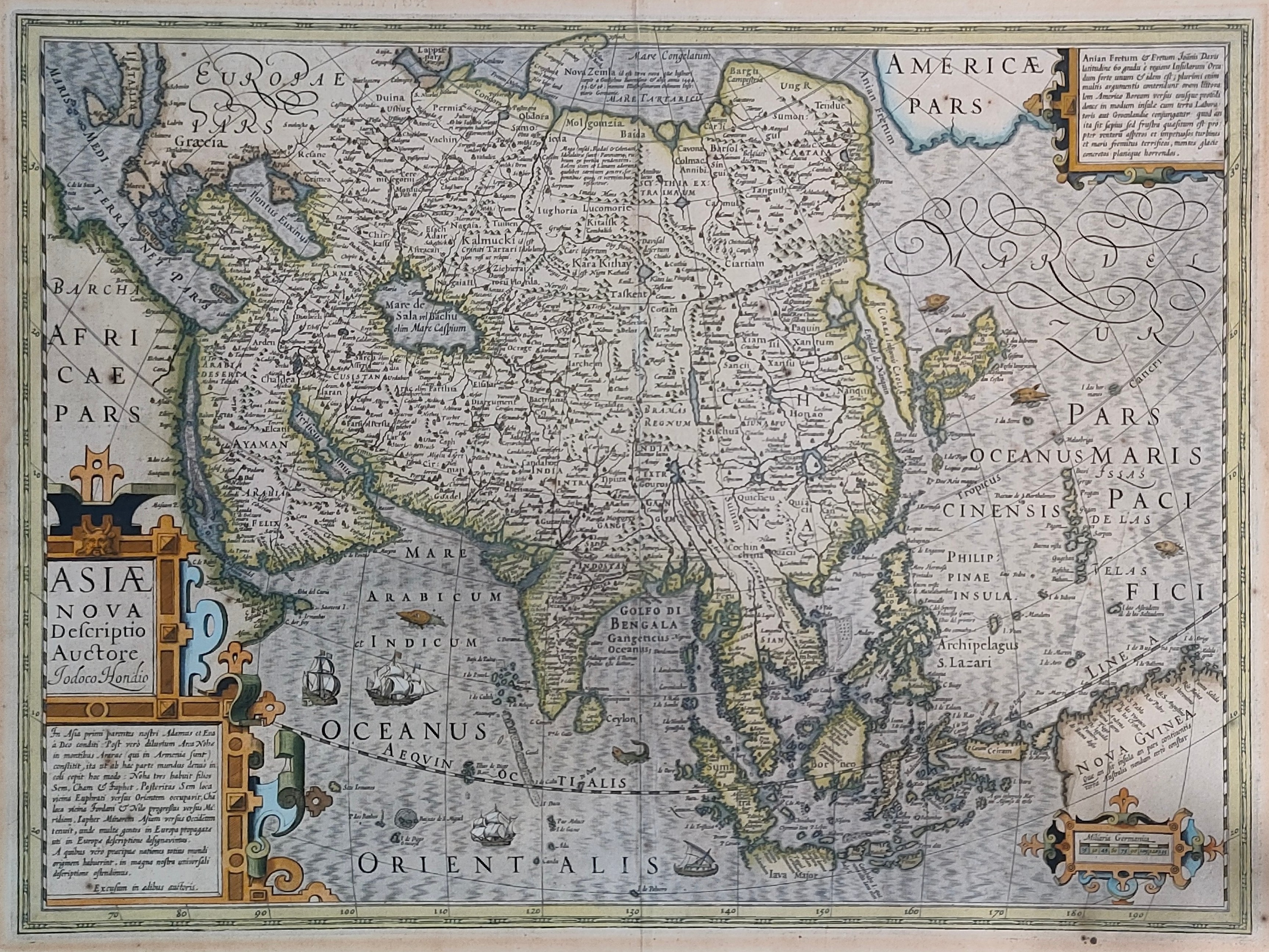
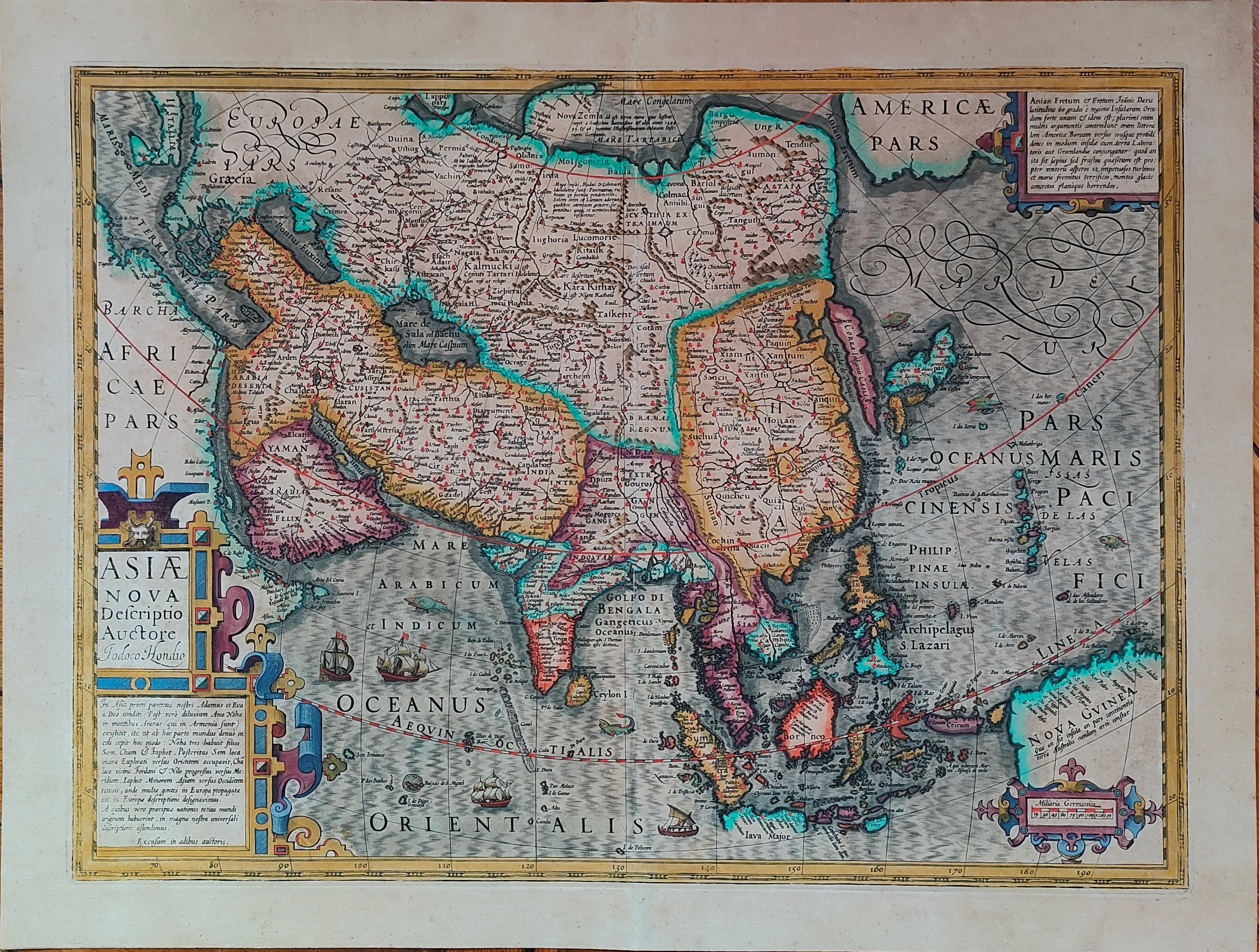
Map title
Asiae nova descriptio
Author
Hondius
Location shown in map
Asia
Edition date
Circa 1606
Edition place
Amsterdam
Editor
Hondius
Atlas
Price
1000 Euro
State
[mint/EXCELLENT/very good/good/fair/mediocre/poor]
Color
Old colors
Verso
Size
Plate: cm (50 x 37) inches (19.69 x 14.57) Paper: cm (57 x 47) inches (22.44 x 18.5)
Technique
Copper engraving
Note
Reference
Wiki
Here for more info
In stock
Available
Info
info@thetreasuremaps.com
Code
#0913
×
![]()
Map title
Asiae nova descriptio
Author
Hondius
Location shown in map
Asia
Edition date
Circa 1606
Edition place
Amsterdam
Editor
Hondius
Atlas
Price
1000 Euro
State
[mint/EXCELLENT/very good/good/fair/mediocre/poor]
Color
Old colors
Verso
Size
Plate: cm (50 x 37) inches (19.69 x 14.57) Paper: cm (57 x 47) inches (22.44 x 18.5)
Technique
Copper engraving
Note
Reference
Wiki
Here for more info
In stock
Available
Info
info@thetreasuremaps.com
Code
#1193
×
![]()
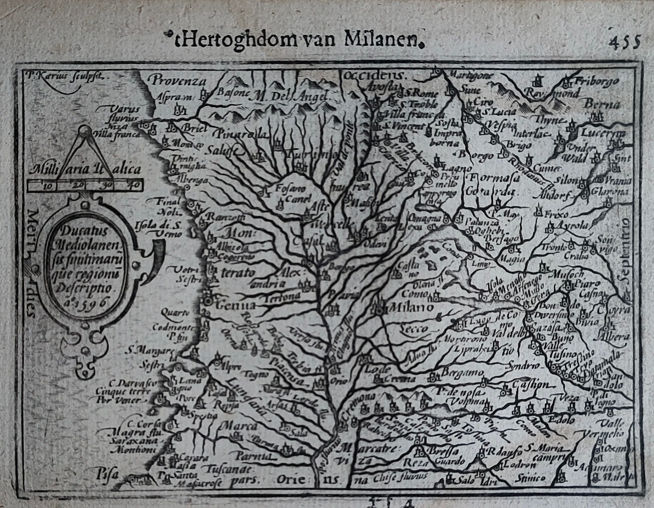
Map title
Hertoghdom van Milanen
Author
Bertius
Location shown in map
Liguria
Edition date
Circa 1606
Edition place
Amsterdam
Editor
Atlas
Price
200 Euro
State
[mint/EXCELLENT/very good/good/fair/mediocre/poor]
Color
Black/white
Verso
Duch text pag.456
Size
Plate: cm (12 x 9) inches (4.72 x 3.54) Paper: cm (18 x 11) inches (7.09 x 4.33)
Technique
Copper engraving
Note
Reference
Wiki
Here for more info
In stock
Available
Info
info@thetreasuremaps.com
Code
#1246
×
![]()
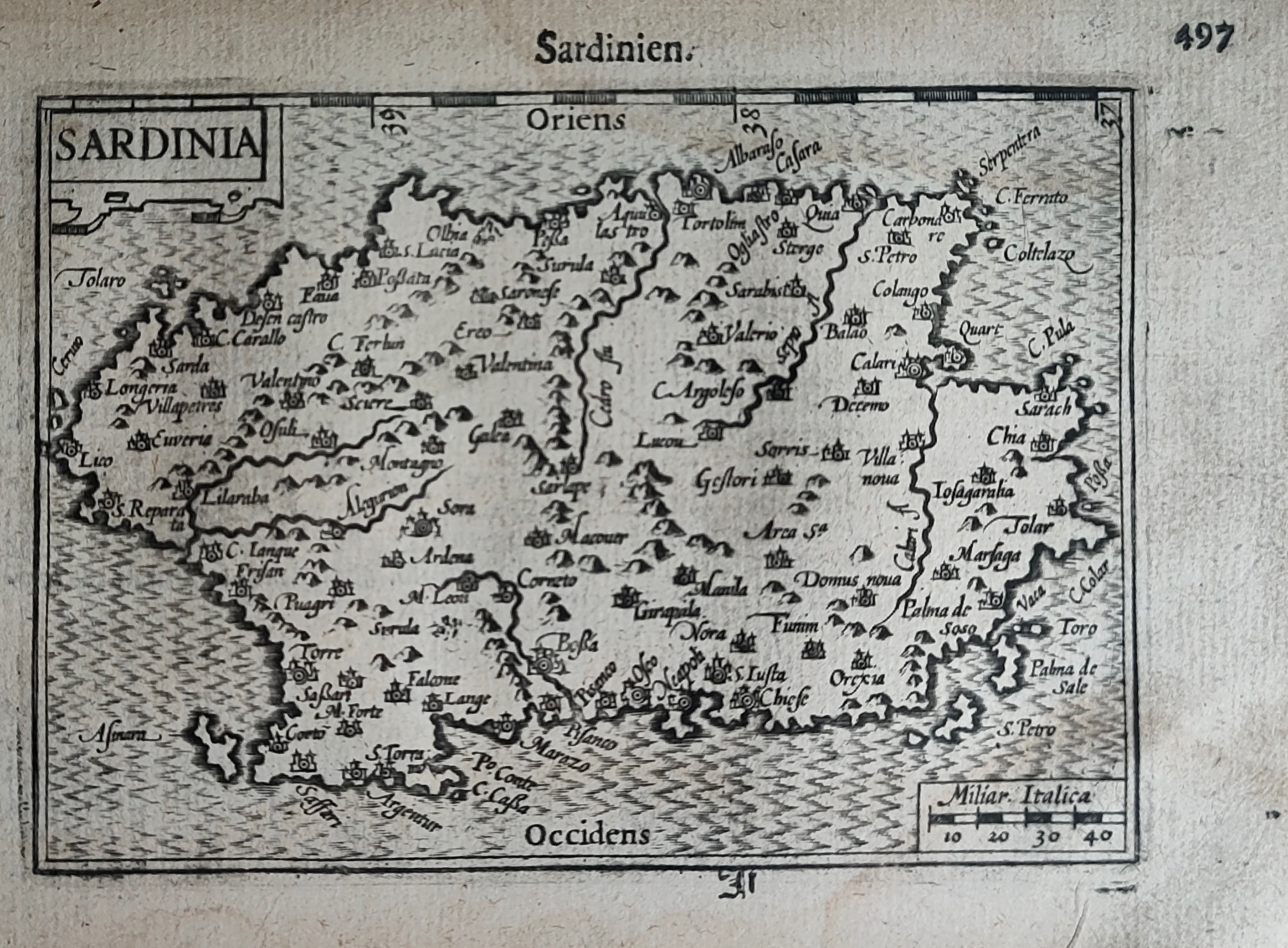
Map title
Sardinien
Author
Bertius
Location shown in map
Sardinia
Edition date
Circa 1606
Edition place
Amsterdam
Editor
Atlas
Price
250 Euro
State
[mint/EXCELLENT/very good/good/fair/mediocre/poor]
Color
Black/white
Verso
Duch text pag.498
Size
Plate: cm (12 x 9) inches (4.72 x 3.54) Paper: cm (18 x 11) inches (7.09 x 4.33)
Technique
Copper engraving
Note
Reference
Wiki
Here for more info
In stock
Available
Info
info@thetreasuremaps.com
Code
#1247
×
![]()
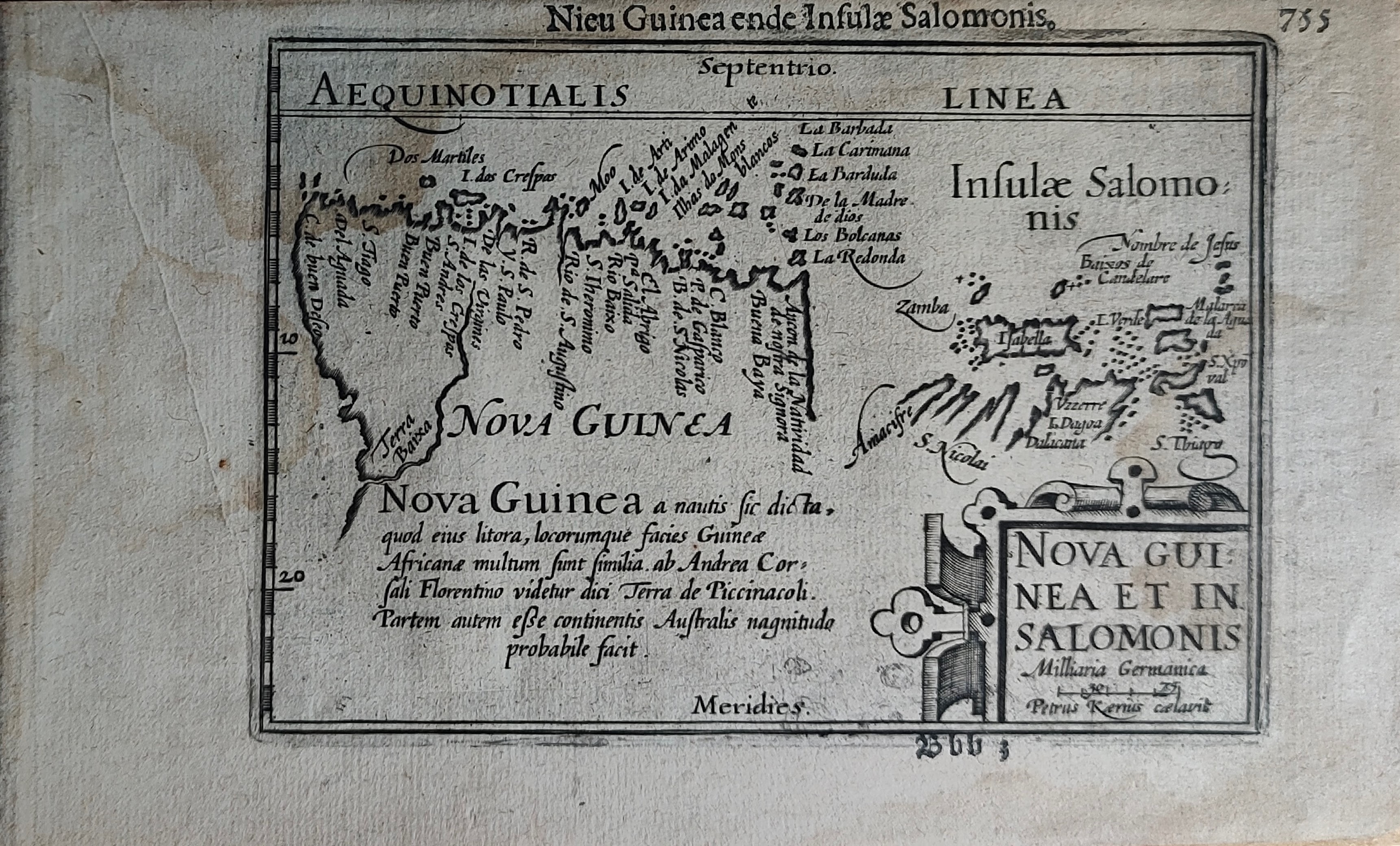
Map title
Nieu Guinea ende Insulae Salomonis
Author
Bertius
Location shown in map
New Guinea
Edition date
Circa 1606
Edition place
Amsterdam
Editor
Atlas
Price
300 Euro
State
[mint/EXCELLENT/very good/good/fair/mediocre/poor]
Color
Black/white
Verso
Duch text pag.756
Size
Plate: cm (12 x 9) inches (4.72 x 3.54) Paper: cm (18 x 11) inches (7.09 x 4.33)
Technique
Copper engraving
Note
Reference
Wiki
Here for more info
In stock
Available
Info
info@thetreasuremaps.com
Code
#1249
×
![]()
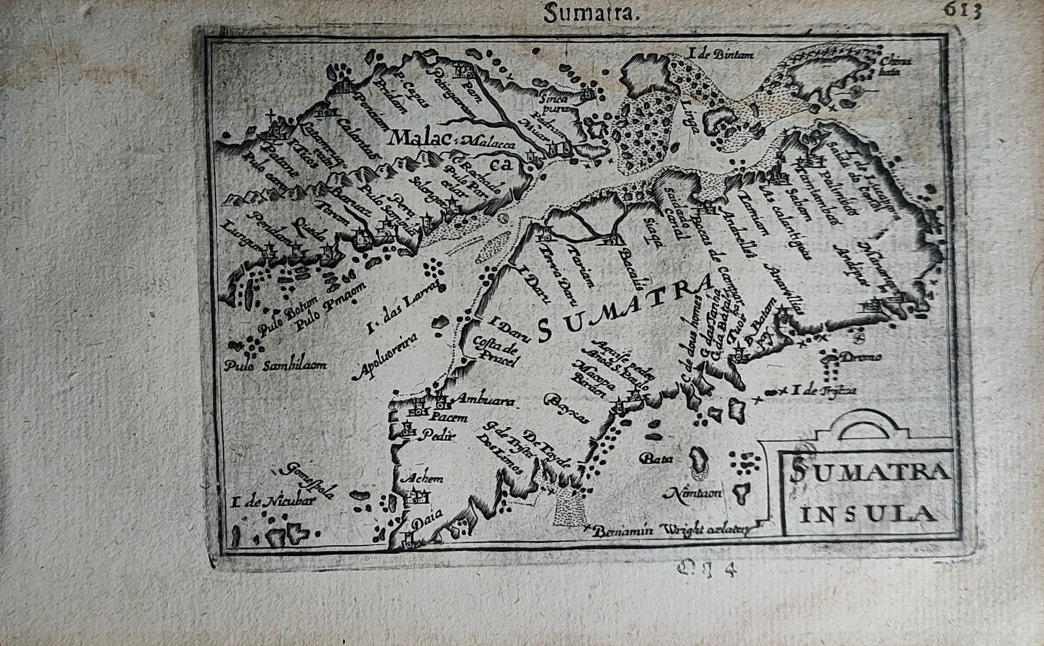
Map title
Sumatra
Author
Bertius
Location shown in map
Sumatra
Edition date
Circa 1606
Edition place
Amsterdam
Editor
Atlas
Price
300 Euro
State
[mint/EXCELLENT/very good/good/fair/mediocre/poor]
Color
Black/white
Verso
Duch text pag.614
Size
Plate: cm (12 x 9) inches (4.72 x 3.54) Paper: cm (18 x 11) inches (7.09 x 4.33)
Technique
Copper engraving
Note
Reference
Wiki
Here for more info
In stock
Available
Info
info@thetreasuremaps.com
Code
#1250
Sumatra
Author
Bertius
Location shown in map
Sumatra
Edition date
Circa 1606
Edition place
Amsterdam
Editor
Atlas
Price
300 Euro
State
[mint/EXCELLENT/very good/good/fair/mediocre/poor]
Color
Black/white
Verso
Duch text pag.614
Size
Plate: cm (12 x 9) inches (4.72 x 3.54) Paper: cm (18 x 11) inches (7.09 x 4.33)
Technique
Copper engraving
Note
Reference
Wiki
Here for more info
In stock
Available
Info
info@thetreasuremaps.com
Code
#1250
×
![]()
Map title
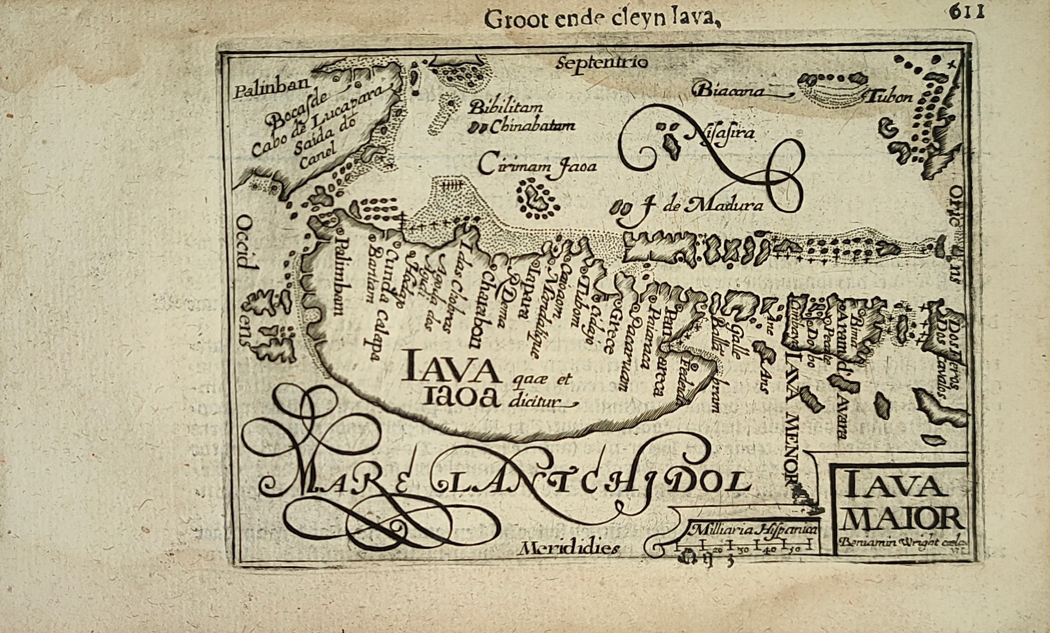
Groot ende cleyn Iava
Author
Bertius
Location shown in map
Java
Edition date
Circa 1606
Edition place
Amsterdam
Editor
Atlas
Price
300 Euro
State
[mint/EXCELLENT/very good/good/fair/mediocre/poor]
Color
Black/white
Verso
Duch text pag.612
Size
Plate: cm (12 x 9) inches (4.72 x 3.54) Paper: cm (18 x 11) inches (7.09 x 4.33)
Technique
Copper engraving
Note
Reference
Wiki
Here for more info
In stock
Available
Info
info@thetreasuremaps.com
Code
#1251
×
![]()
Map title
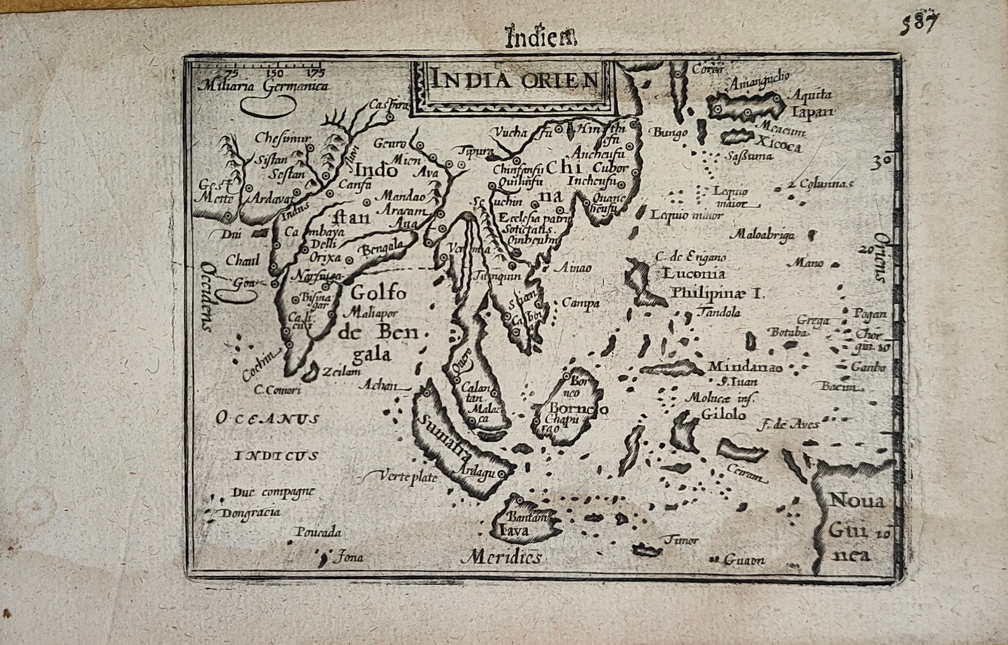
Indien
Author
Bertius
Location shown in map
South East
Edition date
Circa 1606
Edition place
Amsterdam
Editor
Atlas
Price
400 Euro
State
[mint/EXCELLENT/very good/good/fair/mediocre/poor]
Color
Black/white
Verso
Duch text pag.588
Size
Plate: cm (12 x 9) inches (4.72 x 3.54) Paper: cm (18 x 11) inches (7.09 x 4.33)
Technique
Copper engraving
Note
Reference
Wiki
Here for more info
In stock
Available
Info
info@thetreasuremaps.com
Code
#1252
×
![]()
Map title
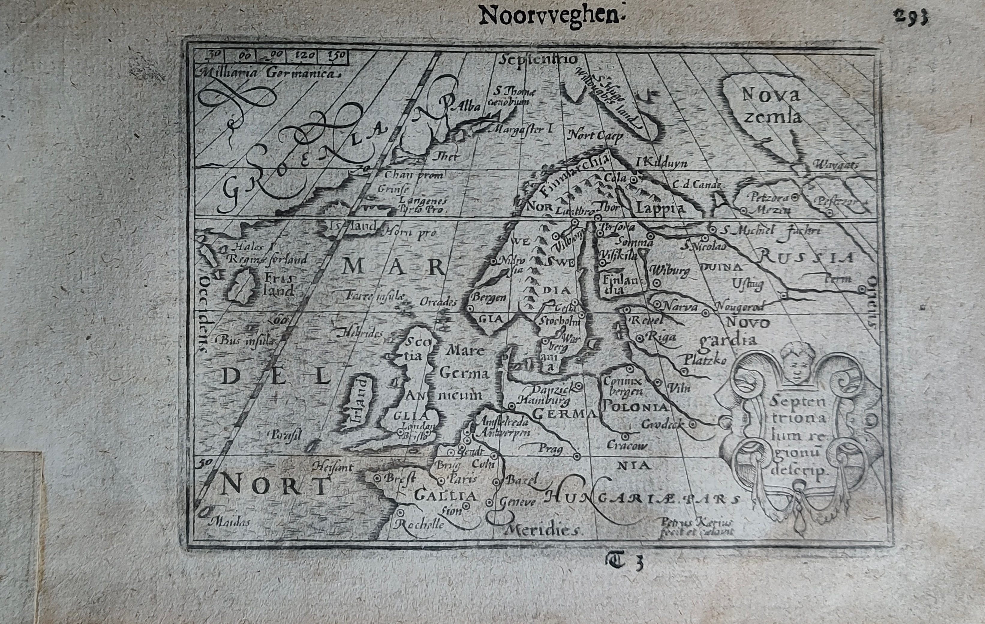
Noorvveghen
Author
Bertius
Location shown in map
North Europe
Edition date
Circa 1606
Edition place
Amsterdam
Editor
Atlas
Price
300 Euro
State
[mint/EXCELLENT/very good/good/fair/mediocre/poor]
Color
Black/white
Verso
Duch text pag.294
Size
Plate: cm (12 x 9) inches (4.72 x 3.54) Paper: cm (18 x 11) inches (7.09 x 4.33)
Technique
Copper engraving
Note
Reference
Wiki
Here for more info
In stock
Sold
Info
info@thetreasuremaps.com
Code
#1253
×
![]()
Map title
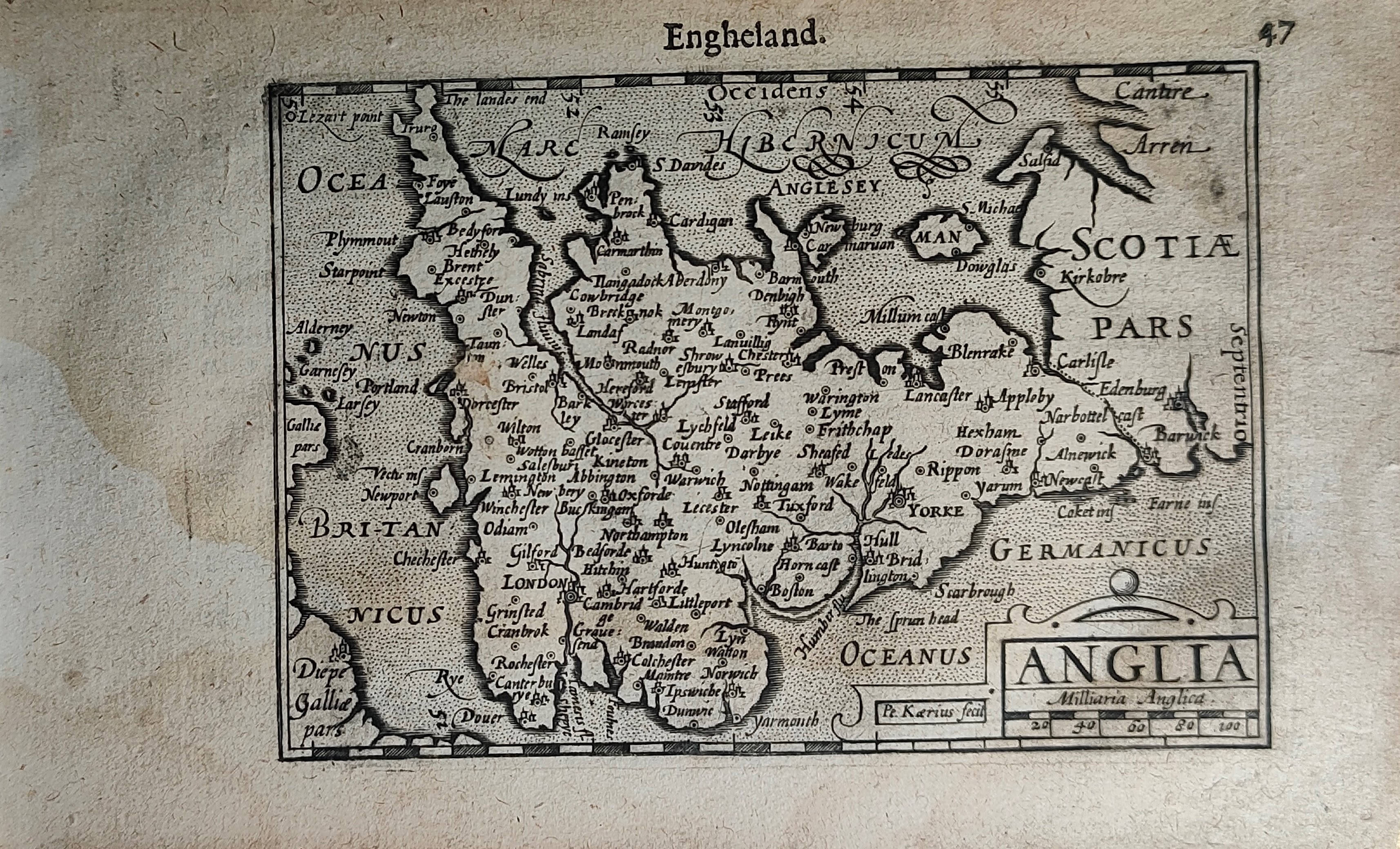
Engheland
Author
Bertius
Location shown in map
England
Edition date
Circa 1606
Edition place
Amsterdam
Editor
Atlas
Price
200 Euro
State
[mint/EXCELLENT/very good/good/fair/mediocre/poor]
Color
Black/white
Verso
Duch text pag.48
Size
Plate: cm (12 x 9) inches (4.72 x 3.54) Paper: cm (18 x 11) inches (7.09 x 4.33)
Technique
Copper engraving
Note
Reference
Wiki
Here for more info
In stock
Available
Info
info@thetreasuremaps.com
Code
#1254
×
![]()
Map title
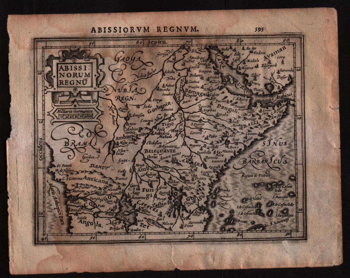
Abissinorum regnum
Author
Mercator
Location shown in map
East Africa
Edition date
1607
Edition place
Amsterdam
Editor
Janssonius
Atlas
Altas Minor Gerardi Mercatoris
Price
150 Euro
State
[mint/EXCELLENT/very good/good/fair/mediocre/poor]
Color
Black/white
Verso
Latin text pag.596
Size
Plate: cm (17.8 x 14) inches (7.01 x 5.51) Paper: cm (22.9 x 17.8) inches (9.02 x 7.01)
Technique
Copper engraving
Note
No particular notes for this maps
Reference
--
Wiki
Here for more info
In stock
Available
Info
info@thetreasuremaps.com
Code
#0291
×
![]()
Map title
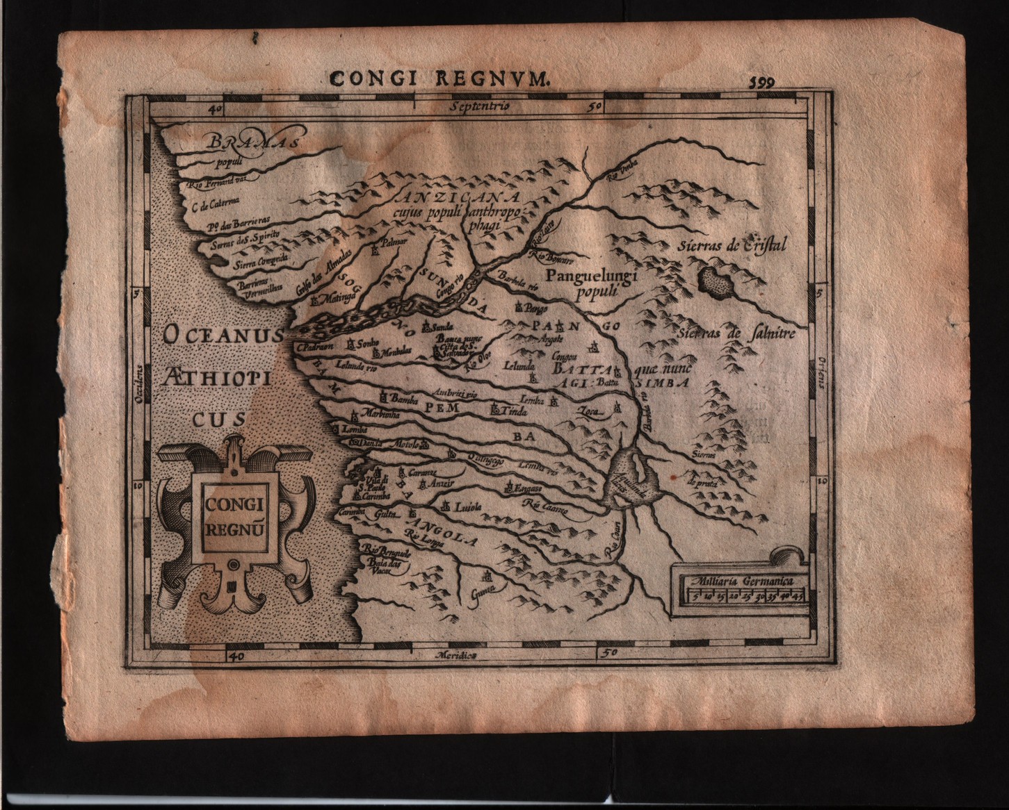
Congi regnum
Author
Mercator
Location shown in map
Congo
Edition date
1607
Edition place
Amsterdam
Editor
Janssonius
Atlas
Altas Minor Gerardi Mercatoris
Price
150 Euro
State
[mint/EXCELLENT/very good/good/fair/mediocre/poor]
Color
Black/white
Verso
Latin text pag.600
Size
Plate: cm (17.8 x 14) inches (7.01 x 5.51) Paper: cm (22.9 x 17.8) inches (9.02 x 7.01)
Technique
Copper engraving
Note
No particular notes for this maps
Reference
--
Wiki
Here for more info
In stock
Available
Info
info@thetreasuremaps.com
Code
#0292
×
![]()
Map title
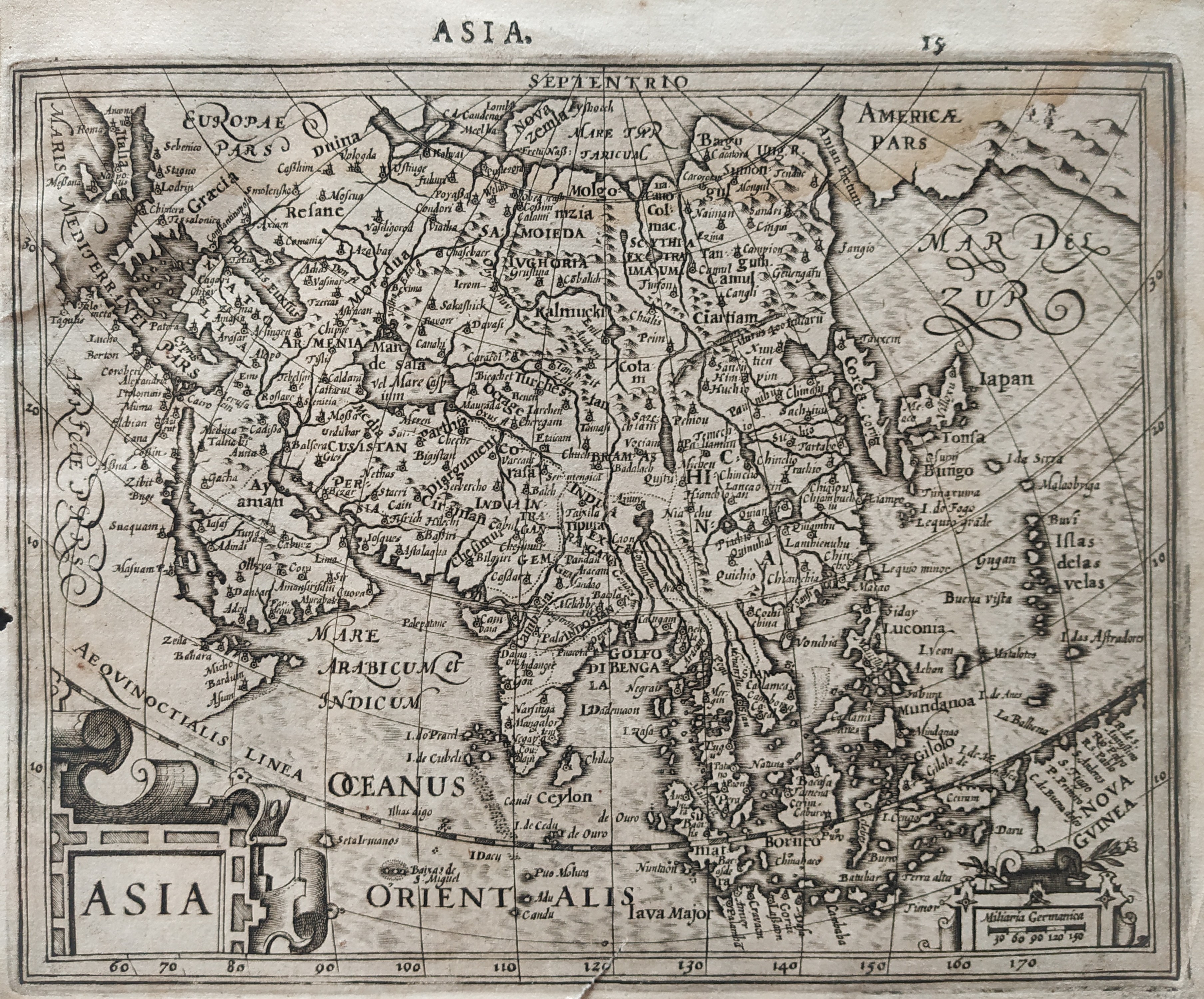
Asia
Author
Mercator
Location shown in map
Asia
Edition date
1610
Edition place
Amsterdam
Editor
Houndius
Atlas
Altas Minor Gerardi Mercatoris
Price
200 Euro
State
[mint/EXCELLENT/very good/good/fair/mediocre/poor]
Color
Black/white
Verso
Latin text 16
Size
Plate: cm (19 x 15) inches (7.48 x 5.91) Paper: cm (21 x 17.5) inches (8.27 x 6.89)
Technique
Copper engraving
Note
No particular notes for this maps.
Reference
Wiki
Here for more info
In stock
Available
Info
info@thetreasuremaps.com
Code
#0781
Asia
Author
Mercator
Location shown in map
Asia
Edition date
1610
Edition place
Amsterdam
Editor
Houndius
Atlas
Altas Minor Gerardi Mercatoris
Price
200 Euro
State
[mint/EXCELLENT/very good/good/fair/mediocre/poor]
Color
Black/white
Verso
Latin text 16
Size
Plate: cm (19 x 15) inches (7.48 x 5.91) Paper: cm (21 x 17.5) inches (8.27 x 6.89)
Technique
Copper engraving
Note
No particular notes for this maps.
Reference
Wiki
Here for more info
In stock
Available
Info
info@thetreasuremaps.com
Code
#0781
×
![]()
Map title
Corsica Sardinia
Author
Mercator
Location shown in map
Sardinia
Edition date
1610
Edition place
Amsterdam
Editor
Houndius
Atlas
Altas Minor Gerardi Mercatoris
Price
200 Euro
State
[mint/EXCELLENT/very good/good/fair/mediocre/poor]
Color
Black/white
Verso
Latin text 544
Size
Plate: cm (19 x 15) inches (7.48 x 5.91) Paper: cm (21 x 17.5) inches (8.27 x 6.89)
Technique
Copper engraving
Note
No particular notes for this maps.
Reference
Wiki
Here for more info
In stock
Available
Info
info@thetreasuremaps.com
Code
#0782
×
![]()
Map title
Italia
Author
Mercator
Location shown in map
Italy
Edition date
1610
Edition place
Amsterdam
Editor
Houndius
Atlas
Altas Minor Gerardi Mercatoris
Price
250 Euro
State
[mint/EXCELLENT/very good/good/fair/mediocre/poor]
Color
Black/white
Verso
Latin text 480
Size
Plate: cm (19 x 15) inches (7.48 x 5.91) Paper: cm (21 x 17.5) inches (8.27 x 6.89)
Technique
Copper engraving
Note
Reference
R.Borri L'Italia nelle antiche carte pag.66
Wiki
Here for more info
In stock
Available
Info
info@thetreasuremaps.com
Code
#0783
×
![]()
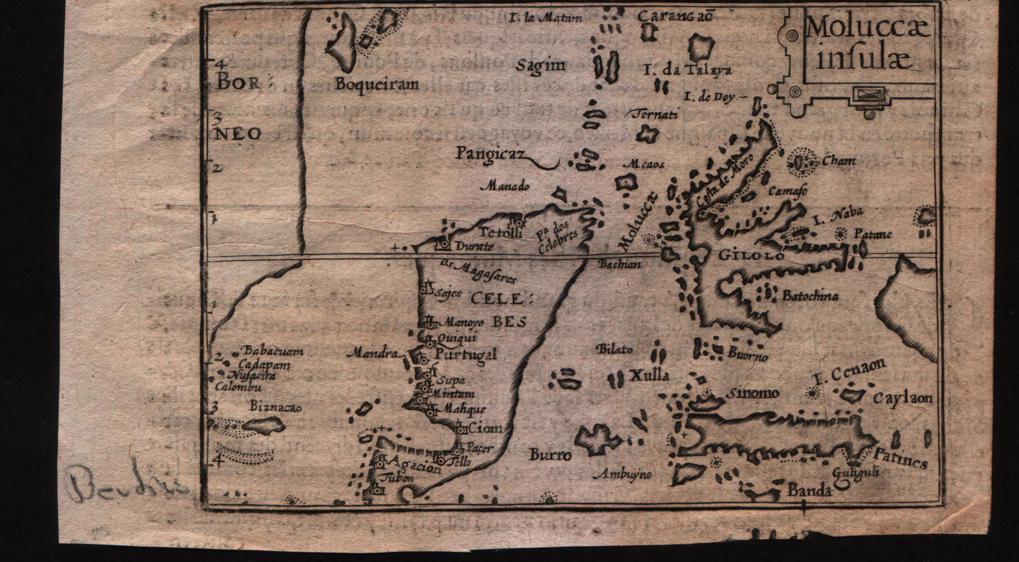
Map title
Moluccae insulae
Author
Bertius
Location shown in map
Moluccas
Edition date
Circa 1612
Edition place
Amsterdam
Editor
Jodocus Hondius
Atlas
Tabularum geographicarum contractarum
Price
Please ask: info@thetreasuremaps.com
State
[MINT/excellent/very good/good/fair/mediocre/poor]
Color
Black/white
Verso
French text pag 58
Size
Plate: cm (12.7 x 8.9) inches (5 x 3.5) Paper: cm (16.5 x 10.2) inches (6.5 x 4.02)
Technique
Copper engraving
Note
--
Reference
--
Wiki
Here for more info
In stock
Available
Info
info@thetreasuremaps.com
Code
#0596
×
![]()
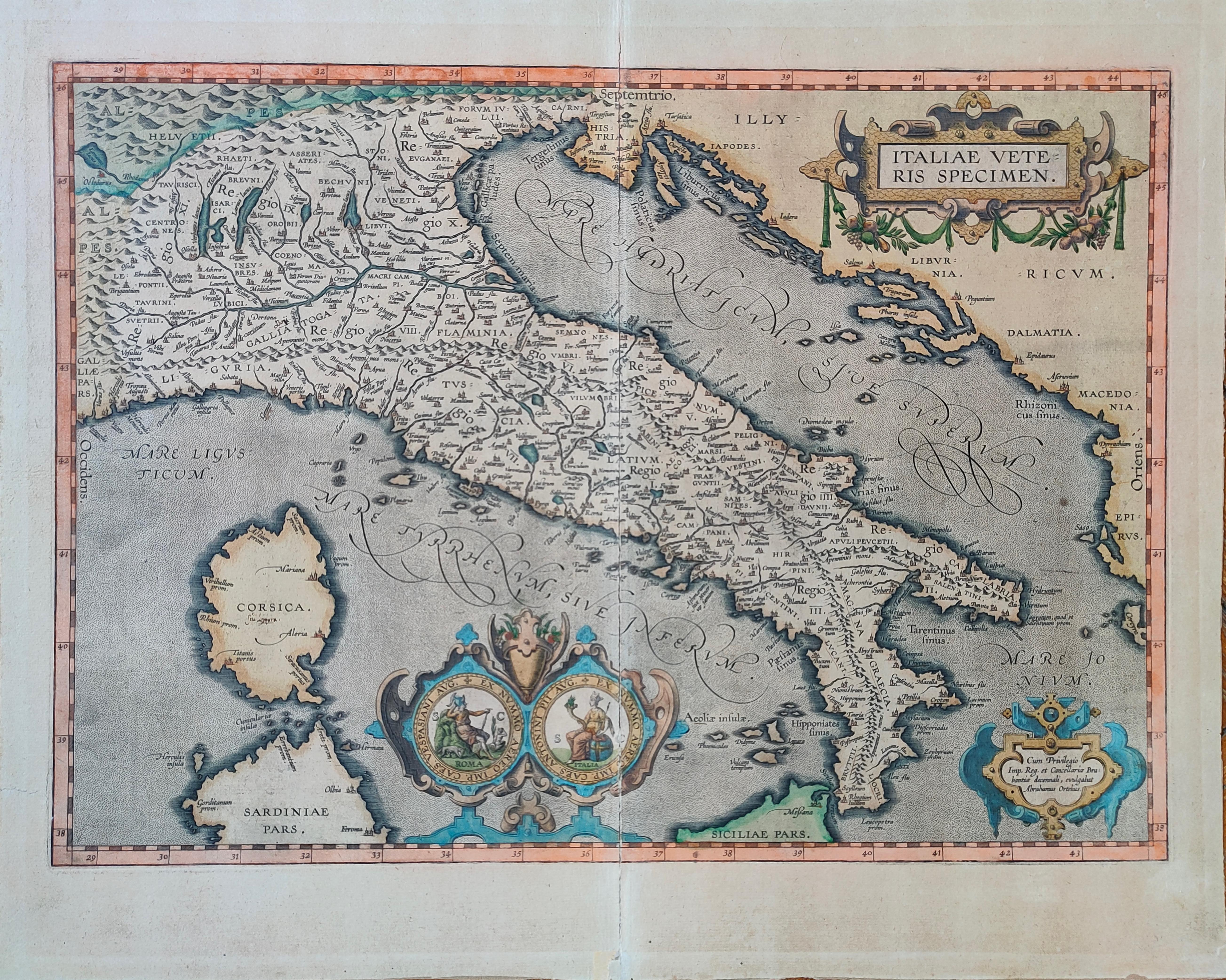
Map title
Italiae Veteris Speciem
Author
Ortelius
Location shown in map
Italy
Edition date
1612
Edition place
Antwerp
Editor
--
Atlas
Epitome theatri Orteliani
Price
900 Euro
State
[mint/EXCELLENT/very good/good/fair/mediocre/poor]
Color
Old colors
Verso
Latin Text pag.xx
Size
Plate: cm (48 x 35) inches (18.9 x 13.78) Paper: cm (55 x 43) inches (21.65 x 16.93)
Technique
Copper engraving
Note
Reference
Van Den Broecke 257
Wiki
Here for more info
In stock
Available
Info
info@thetreasuremaps.com
Code
#1272
×
![]()
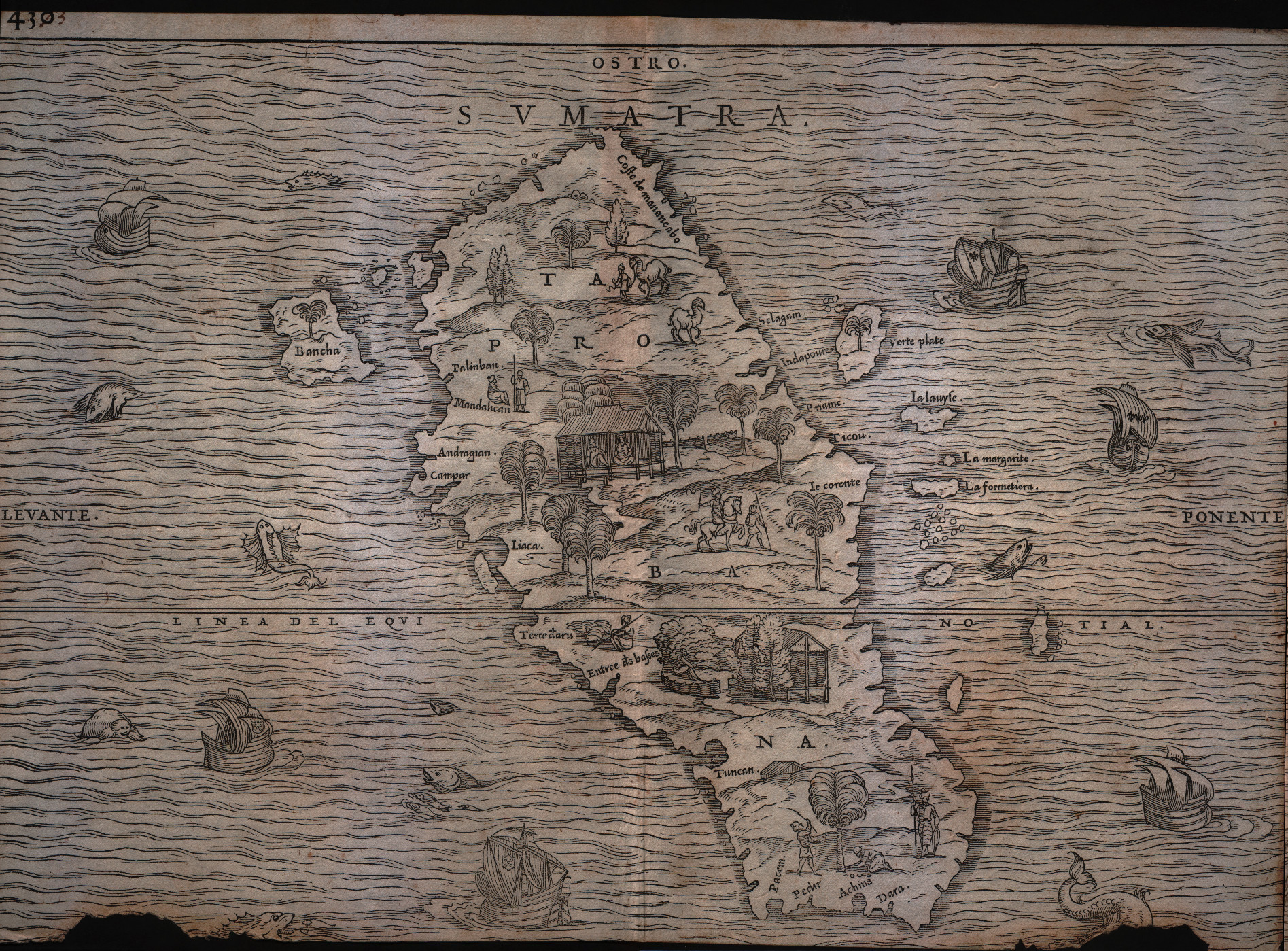
Map title
Sumatra
Author
Gastaldi
Location shown in map
Sumatra
Edition date
1613
Edition place
Venice
Editor
Giambattista Ramusio
Atlas
Delle navigazioni e viaggi
Price
Please ask: info@thetreasuremaps.com
State
[mint/excellent/very good/good/FAIR/mediocre/poor]
Color
Black/white
Verso
pag.430
Size
Plate: cm (36.8 x 26.7) inches (14.49 x 10.51) Paper: cm (36.8 x 26.7) inches (14.49 x 10.51)
Technique
Woodcut
Note
Decorated with sea monsters and sailing ships.
Reference
--
Wiki
Here for more info
In stock
Available
Info
info@thetreasuremaps.com
Code
#0179
Sumatra
Author
Gastaldi
Location shown in map
Sumatra
Edition date
1613
Edition place
Venice
Editor
Giambattista Ramusio
Atlas
Delle navigazioni e viaggi
Price
Please ask: info@thetreasuremaps.com
State
[mint/excellent/very good/good/FAIR/mediocre/poor]
Color
Black/white
Verso
pag.430
Size
Plate: cm (36.8 x 26.7) inches (14.49 x 10.51) Paper: cm (36.8 x 26.7) inches (14.49 x 10.51)
Technique
Woodcut
Note
Decorated with sea monsters and sailing ships.
Reference
--
Wiki
Here for more info
In stock
Available
Info
info@thetreasuremaps.com
Code
#0179
×
![]()
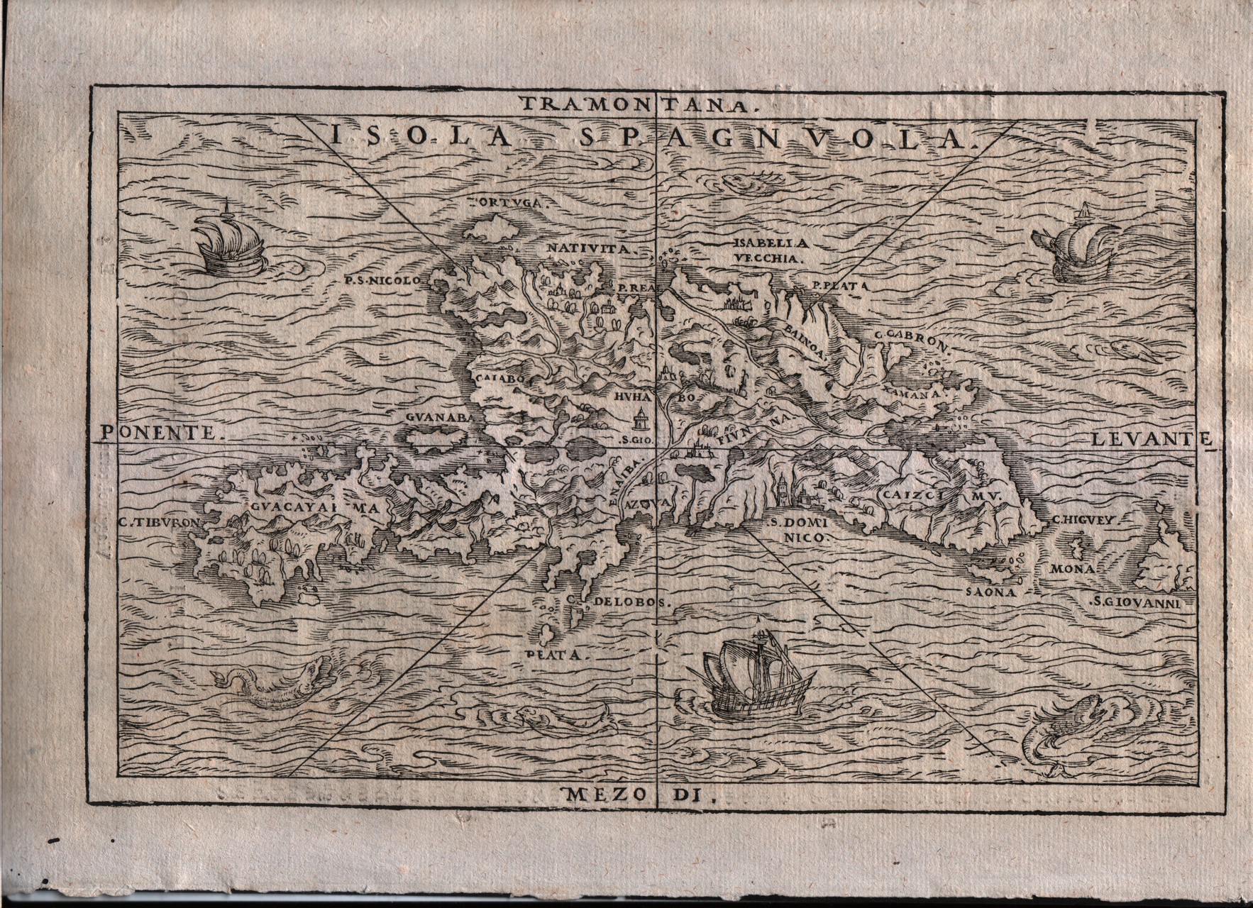
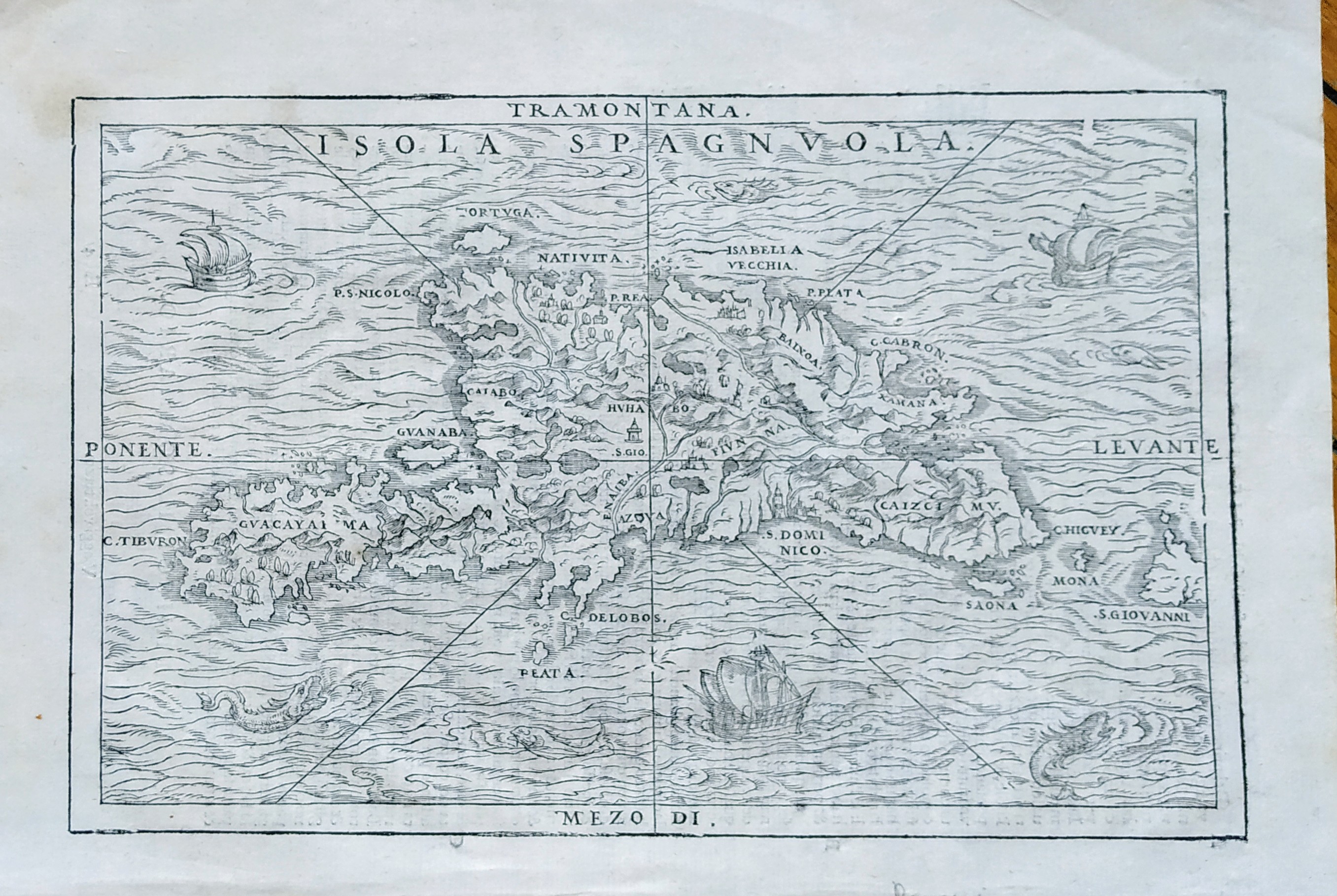
Map title
Isola Spaguola
Author
Gastaldi
Location shown in map
Haiti island
Edition date
1613
Edition place
Venice
Editor
Giambattista Ramusio
Atlas
Delle navigazioni e viaggi
Price
500 Euro
State
[mint/EXCELLENT/very good/good/fair/mediocre/poor]
Color
Black/white
Verso
Italian text pag.36
Size
Plate: cm (26.7 x 17.8) inches (10.51 x 7.01) Paper: cm (31.8 x 21.6) inches (12.52 x 8.5)
Technique
Woodcut
Note
Decorated with sea monsters and sailing ships.
Reference
--
Wiki
Here for more info
In stock
Available
Info
info@thetreasuremaps.com
Code
#0338
×
![]()
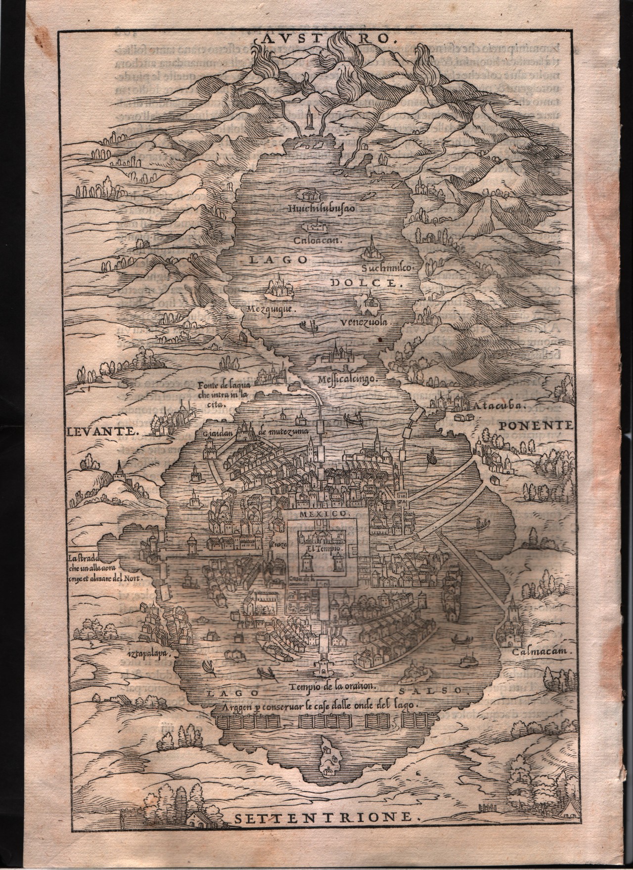
Map title
--
Author
Gastaldi
Location shown in map
Mexico city
Edition date
1613
Edition place
Venice
Editor
Giambattista Ramusio
Atlas
Delle navigazioni e viaggi
Price
200 Euro
State
[mint/EXCELLENT/very good/good/fair/mediocre/poor]
Color
Black/white
Verso
Italian text pag.309
Size
Plate: cm (17.8 x 26.7) inches (7.01 x 10.51) Paper: cm (20.3 x 30.5) inches (7.99 x 12.01)
Technique
Woodcut
Note
--
Reference
--
Wiki
Here for more info
In stock
Sold
Info
info@thetreasuremaps.com
Code
#0339
--
Author
Gastaldi
Location shown in map
Mexico city
Edition date
1613
Edition place
Venice
Editor
Giambattista Ramusio
Atlas
Delle navigazioni e viaggi
Price
200 Euro
State
[mint/EXCELLENT/very good/good/fair/mediocre/poor]
Color
Black/white
Verso
Italian text pag.309
Size
Plate: cm (17.8 x 26.7) inches (7.01 x 10.51) Paper: cm (20.3 x 30.5) inches (7.99 x 12.01)
Technique
Woodcut
Note
--
Reference
--
Wiki
Here for more info
In stock
Sold
Info
info@thetreasuremaps.com
Code
#0339
×
![]()
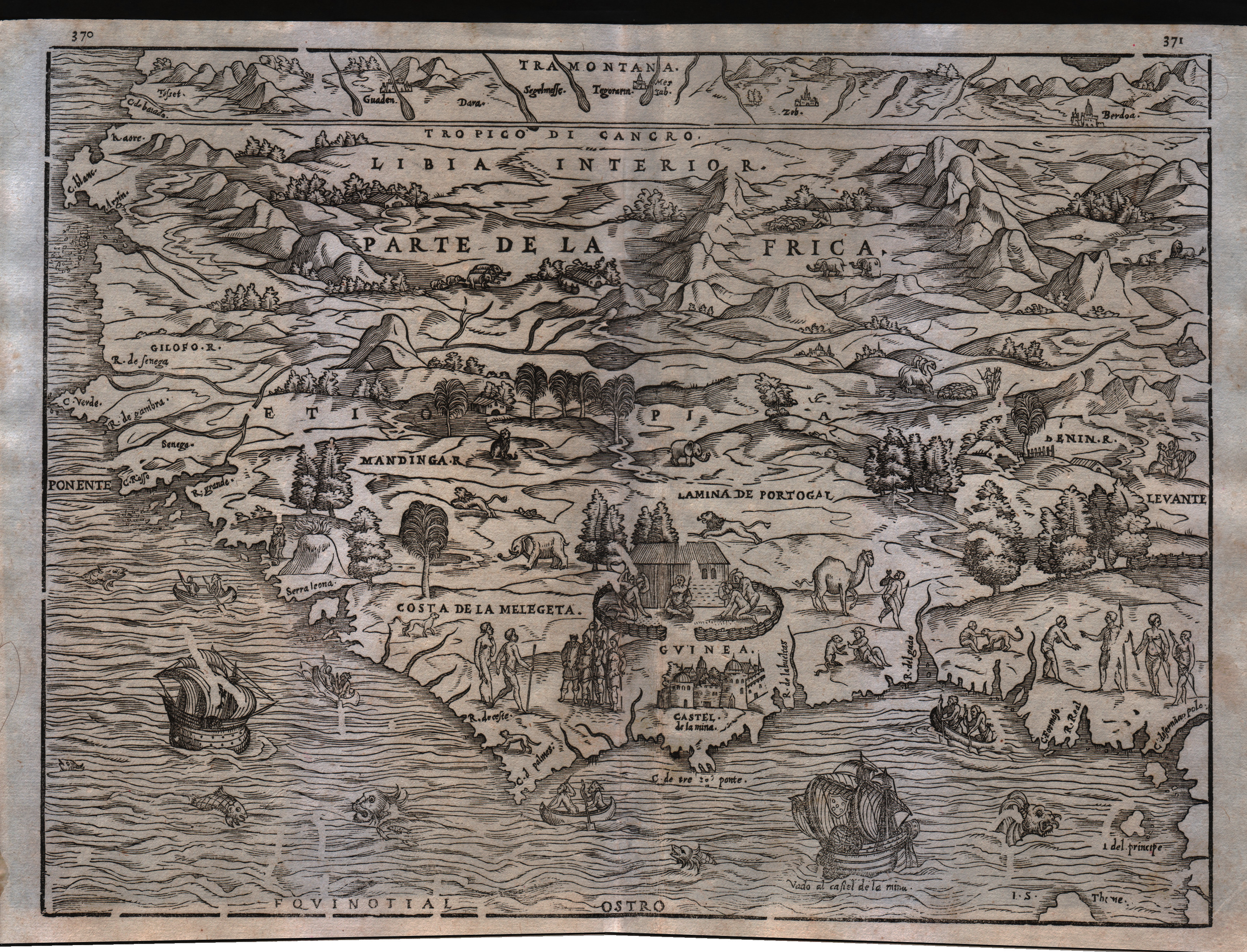
Map title
--
Author
Gastaldi
Location shown in map
Guinea
Edition date
1613
Edition place
Venice
Editor
Giambattista Ramusio
Atlas
Delle navigazioni e viaggi
Price
Please ask: info@thetreasuremaps.com
State
[mint/EXCELLENT/very good/good/fair/mediocre/poor]
Color
Black/white
Verso
Blank
Size
Plate: cm (35.6 x 26.7) inches (14.02 x 10.51) Paper: cm (39.4 x 30.5) inches (15.51 x 12.01)
Technique
Woodcut
Note
Decorated with sea monsters and sailing ships.
Reference
--
Wiki
Here for more info
In stock
Available
Info
info@thetreasuremaps.com
Code
#0545
--
Author
Gastaldi
Location shown in map
Guinea
Edition date
1613
Edition place
Venice
Editor
Giambattista Ramusio
Atlas
Delle navigazioni e viaggi
Price
Please ask: info@thetreasuremaps.com
State
[mint/EXCELLENT/very good/good/fair/mediocre/poor]
Color
Black/white
Verso
Blank
Size
Plate: cm (35.6 x 26.7) inches (14.02 x 10.51) Paper: cm (39.4 x 30.5) inches (15.51 x 12.01)
Technique
Woodcut
Note
Decorated with sea monsters and sailing ships.
Reference
--
Wiki
Here for more info
In stock
Available
Info
info@thetreasuremaps.com
Code
#0545
×
![]()
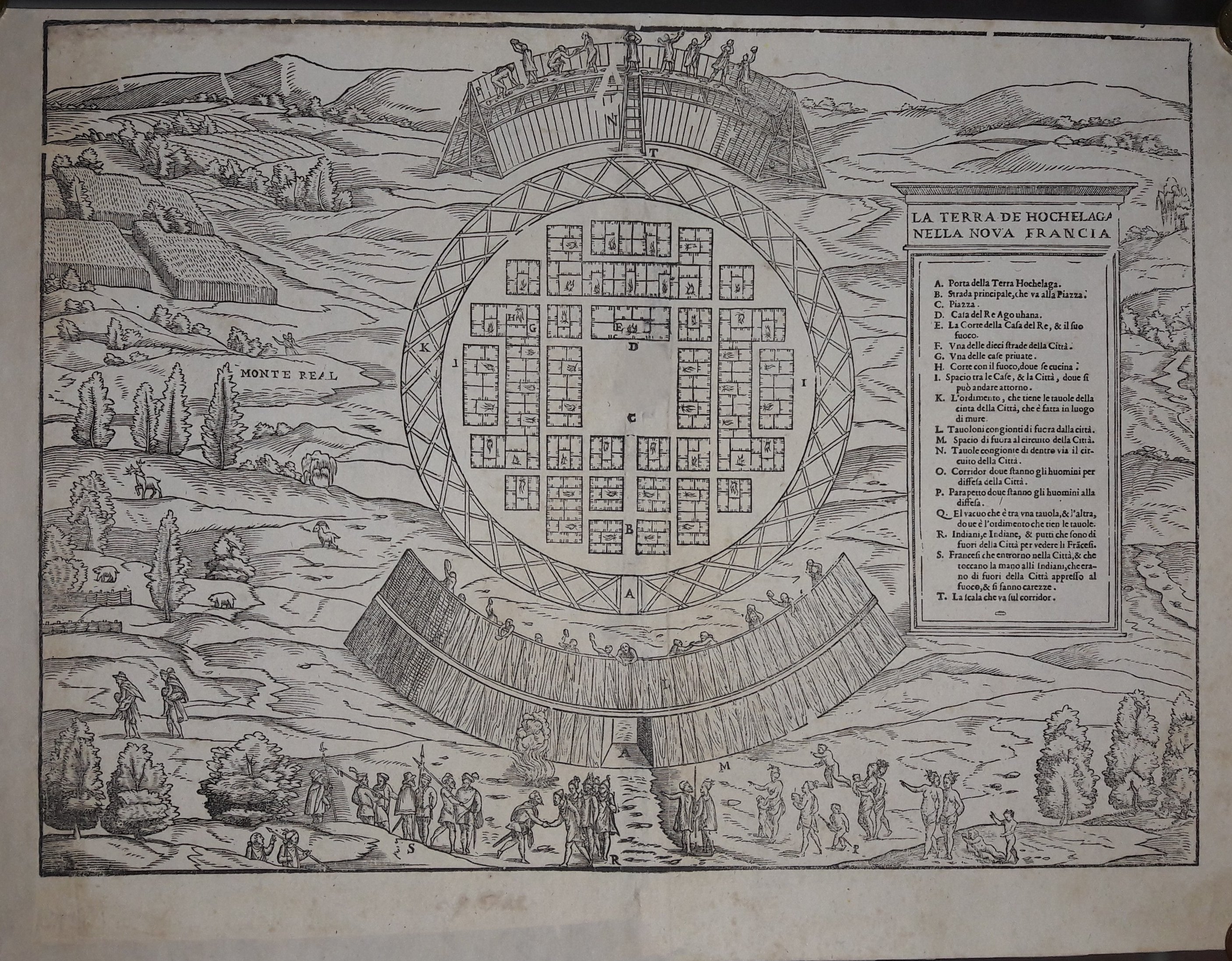
Map title
La terra de Hochelaga nella nuova Francia
Author
Gastaldi
Location shown in map
Canada
Edition date
1613
Edition place
Venice
Editor
Giambattista Ramusio
Atlas
Delle navigazioni e viaggi
Price
1500 Euro
State
[mint/EXCELLENT/very good/good/fair/mediocre/poor] professionally restored
Color
Black/white
Verso
Blank
Size
Plate: cm (35.6 x 26.7) inches (14.02 x 10.51) Paper: cm (40.6 x 30.5) inches (15.98 x 12.01)
Technique
Woodcut
Note
--
Reference
--
Wiki
Here for more info
In stock
Available
Info
info@thetreasuremaps.com
Code
#0546
×
![]()
Map title
Isola Spaguola
Author
Gastaldi
Location shown in map
Haiti island
Edition date
1613
Edition place
Venice
Editor
Giambattista Ramusio
Atlas
Delle navigazioni e viaggi
Price
500 Euro
State
[mint/EXCELLENT/very good/good/fair/mediocre/poor]
Color
Black/white
Verso
Italian text pag.36
Size
Plate: cm (26.7 x 17.8) inches (10.51 x 7.01) Paper: cm (31.8 x 21.6) inches (12.52 x 8.5)
Technique
Woodcut
Note
Decorated with sea monsters and sailing ships.
Reference
--
Wiki
Here for more info
In stock
Available
Info
info@thetreasuremaps.com
Code
#0729
×
![]()
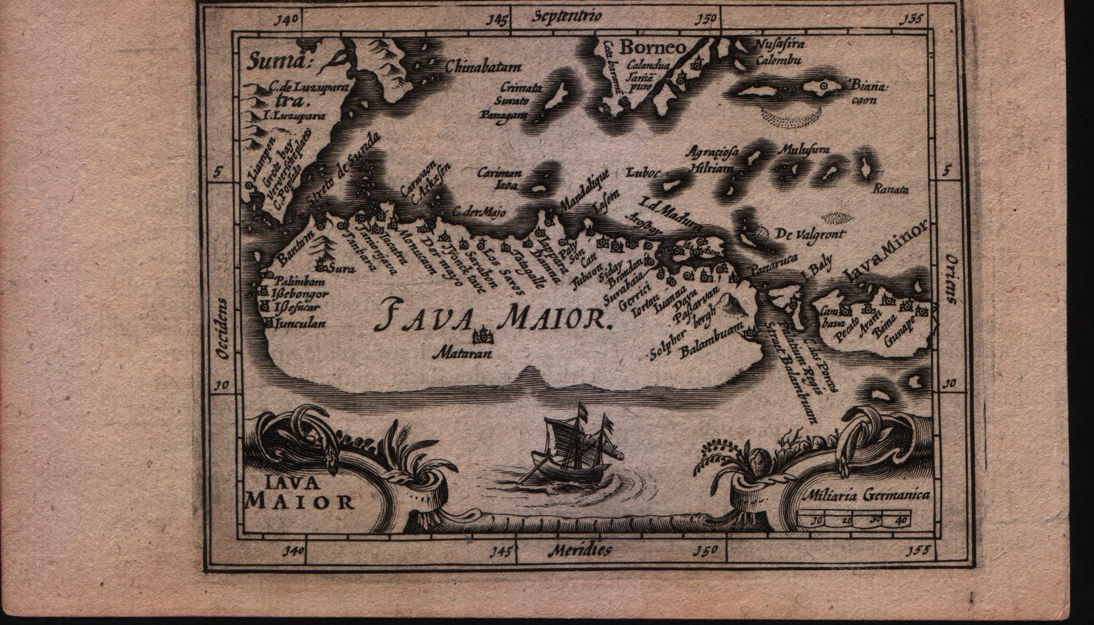
Map title
Description de Java
Author
Bertius
Location shown in map
Java Maior
Edition date
1617
Edition place
Amsterdam
Editor
Jodocus Hondius
Atlas
Tabularum geographicarum contractarum
Price
Please ask: info@thetreasuremaps.com
State
[MINT/excellent/very good/good/fair/mediocre/poor]
Color
Black/white
Verso
French text pag 747
Size
Plate: cm (14 x 10.2) inches (5.51 x 4.02) Paper: cm (17.8 x 11.4) inches (7.01 x 4.49)
Technique
Copper engraving
Note
--
Reference
--
Wiki
Here for more info
In stock
Sold
Info
info@thetreasuremaps.com
Code
#0591
×
![]()
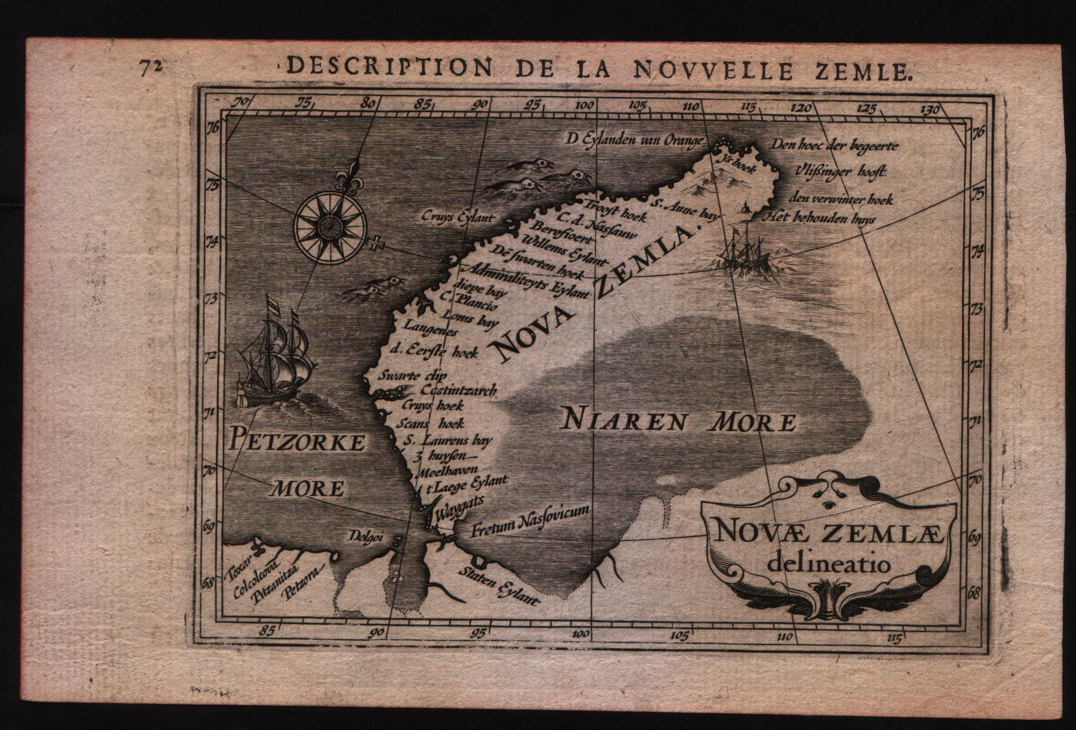
Map title
Description de la nouvelle Zemle
Author
Bertius
Location shown in map
New Zemlia
Edition date
1617
Edition place
Amsterdam
Editor
Jodocus Hondius
Atlas
Tabularum geographicarum contractarum
Price
Please ask: info@thetreasuremaps.com
State
[MINT/excellent/very good/good/fair/mediocre/poor]
Color
Black/white
Verso
French text pag 71
Size
Plate: cm (14 x 10.2) inches (5.51 x 4.02) Paper: cm (17.8 x 11.4) inches (7.01 x 4.49)
Technique
Copper engraving
Note
--
Reference
--
Wiki
Here for more info
In stock
Available
Info
info@thetreasuremaps.com
Code
#0592
×
![]()
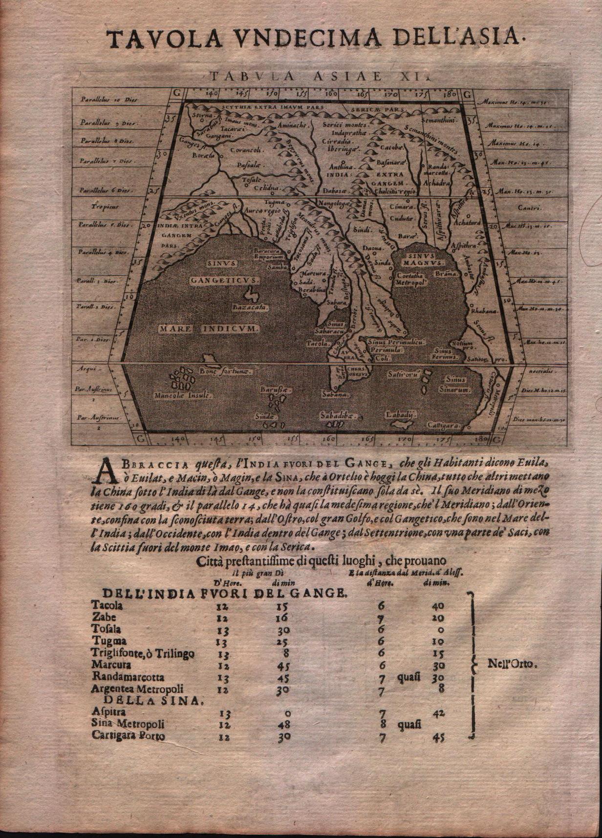
Map title
Tabula Asiae X
Author
Magini
Location shown in map
Indie
Edition date
1617
Edition place
Arnheim
Editor
Ioannes Ianssonius
Atlas
Geografia di Claudio Tolomeo -- Giovanni Antonio Magini
Price
Please ask: info@thetreasuremaps.com
State
[mint/EXCELLENT/very good/good/fair/mediocre/poor]
Color
Black/white
Verso
Latin text pag 25
Size
Plate: cm (17.8 x 12.7) inches (7.01 x 5) Paper: cm (21.6 x 17.8) inches (8.5 x 7.01)
Technique
Copper engraving
Note
No particular notes for this maps.
Reference
--
Wiki
Here for more info
In stock
Available
Info
info@thetreasuremaps.com
Code
#0643
×
![]()
Map title
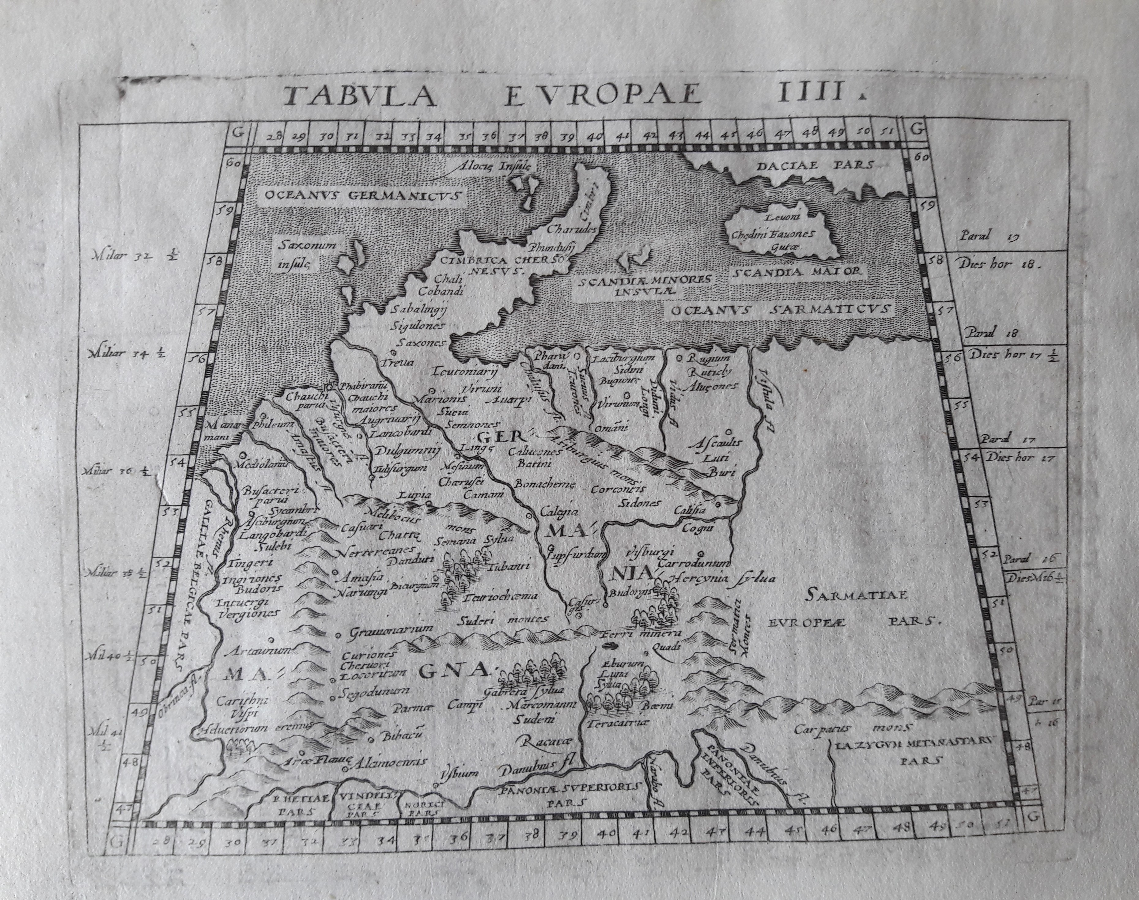
Tabula Europe IIII
Author
Magini
Location shown in map
Germany
Edition date
1617
Edition place
Arnheim
Editor
Ioannes Ianssonius
Atlas
Geografia di Claudio Tolomeo -- Giovanni Antonio Magini
Price
Please ask: info@thetreasuremaps.com
State
[mint/EXCELLENT/very good/good/fair/mediocre/poor]
Color
Black/white
Verso
Latin text pag 5
Size
Plate: cm (17.8 x 12.7) inches (7.01 x 5) Paper: cm (21.6 x 17.8) inches (8.5 x 7.01)
Technique
Copper engraving
Note
No particular notes for this maps.
Reference
--
Wiki
Here for more info
In stock
Available
Info
info@thetreasuremaps.com
Code
#0646
×
![]()
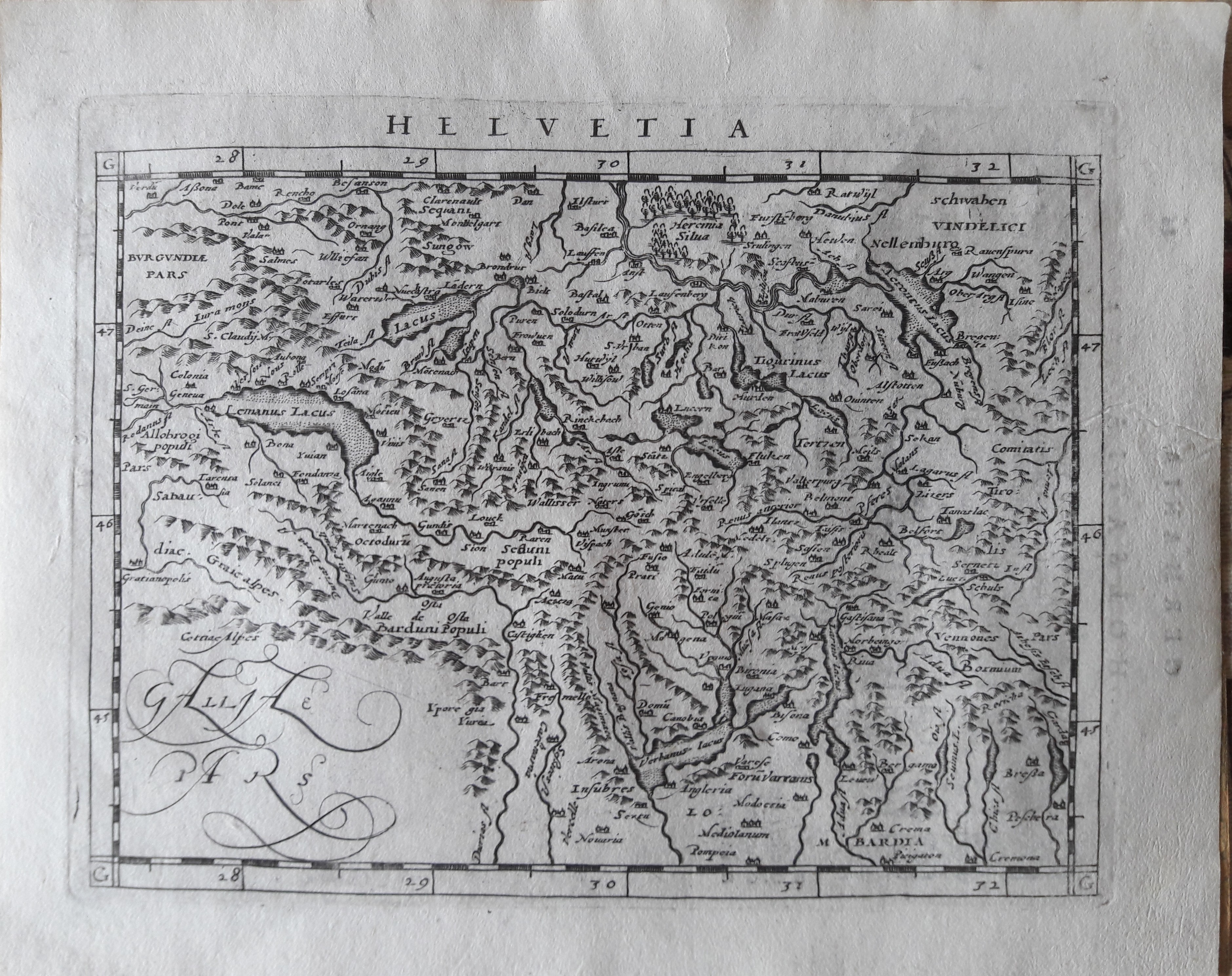
Map title
Helvetia
Author
Magini
Location shown in map
Switzerland
Edition date
1617
Edition place
Arnheim
Editor
Ioannes Ianssonius
Atlas
Geografia di Claudio Tolomeo -- Giovanni Antonio Magini
Price
300 Euro
State
[mint/EXCELLENT/very good/good/fair/mediocre/poor]
Color
Black/white
Verso
Latin text pag 86
Size
Plate: cm (17.8 x 12.7) inches (7.01 x 5) Paper: cm (21.6 x 17.8) inches (8.5 x 7.01)
Technique
Copper engraving
Note
Reference
--
Wiki
Here for more info
In stock
Available
Info
info@thetreasuremaps.com
Code
#0647
×
![]()
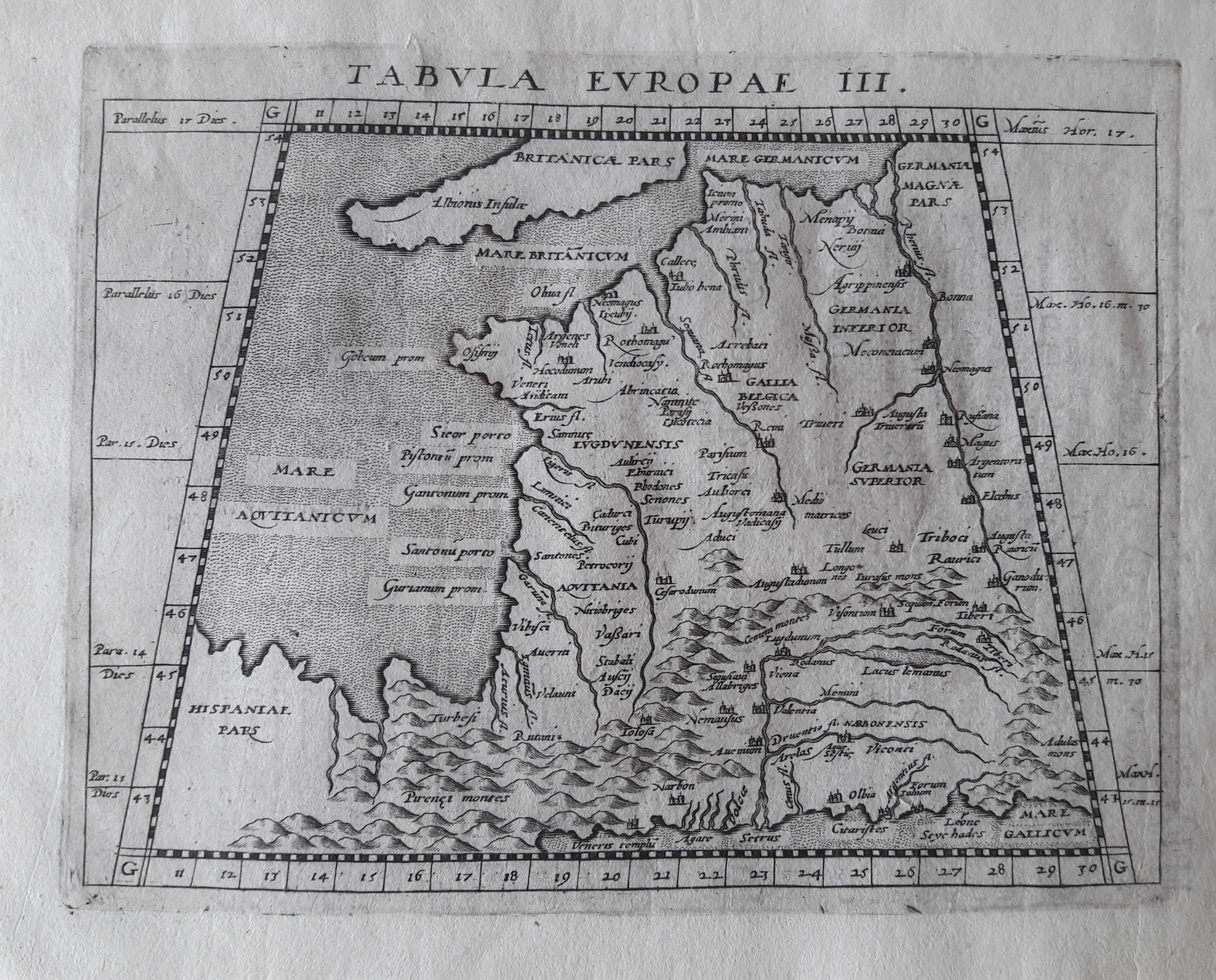
Map title
Tabula Europae III
Author
Magini
Location shown in map
France
Edition date
1617
Edition place
Arnheim
Editor
Ioannes Ianssonius
Atlas
Geografia di Claudio Tolomeo -- Giovanni Antonio Magini
Price
Please ask: info@thetreasuremaps.com
State
[mint/EXCELLENT/very good/good/fair/mediocre/poor]
Color
Black/white
Verso
Latin text pag 3
Size
Plate: cm (17.8 x 12.7) inches (7.01 x 5) Paper: cm (21.6 x 17.8) inches (8.5 x 7.01)
Technique
Copper engraving
Note
No particular notes for this maps.
Reference
--
Wiki
Here for more info
In stock
Available
Info
info@thetreasuremaps.com
Code
#0649
×
![]()
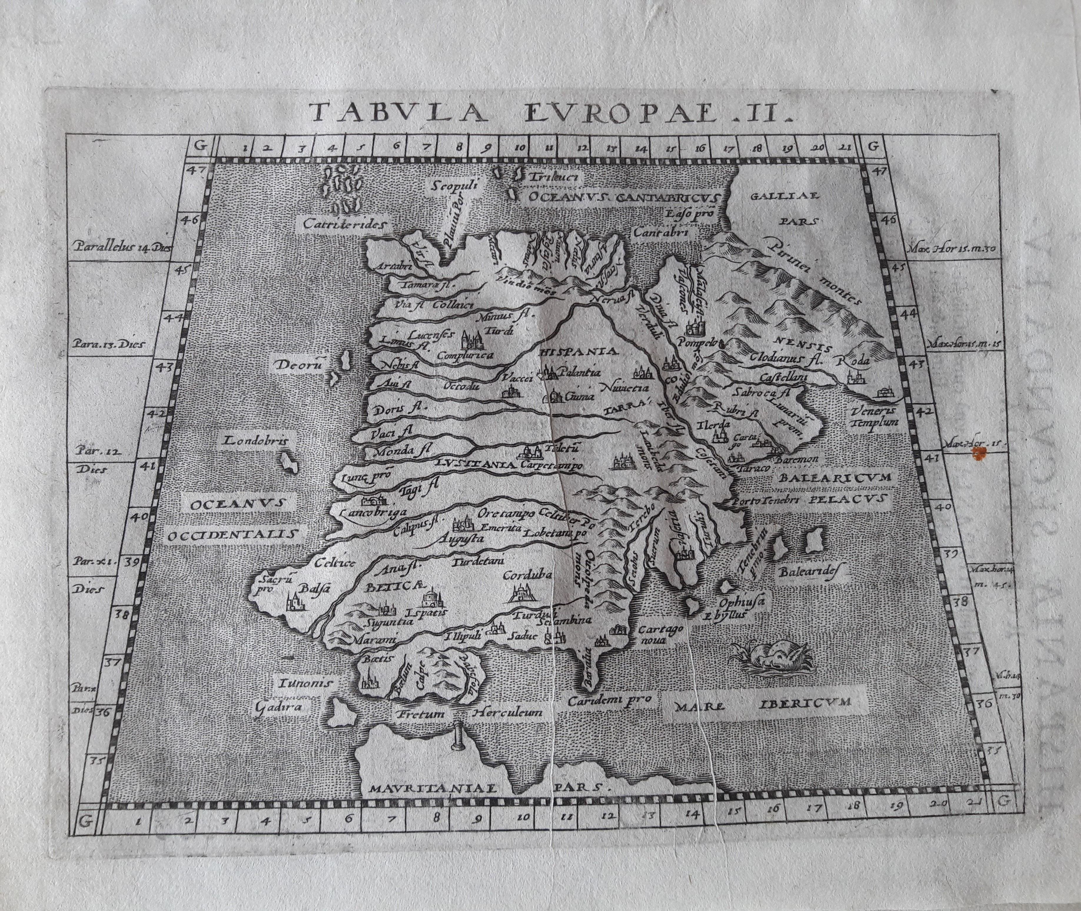
Map title
Tabula Europae II
Author
Magini
Location shown in map
Spain
Edition date
1617
Edition place
Arnheim
Editor
Ioannes Ianssonius
Atlas
Geografia di Claudio Tolomeo -- Giovanni Antonio Magini
Price
Please ask: info@thetreasuremaps.com
State
[mint/EXCELLENT/very good/good/fair/mediocre/poor]
Color
Black/white
Verso
Latin text pag 4
Size
Plate: cm (17.8 x 12.7) inches (7.01 x 5) Paper: cm (21.6 x 17.8) inches (8.5 x 7.01)
Technique
Copper engraving
Note
No particular notes for this maps.
Reference
--
Wiki
Here for more info
In stock
Available
Info
info@thetreasuremaps.com
Code
#0650
×
![]()
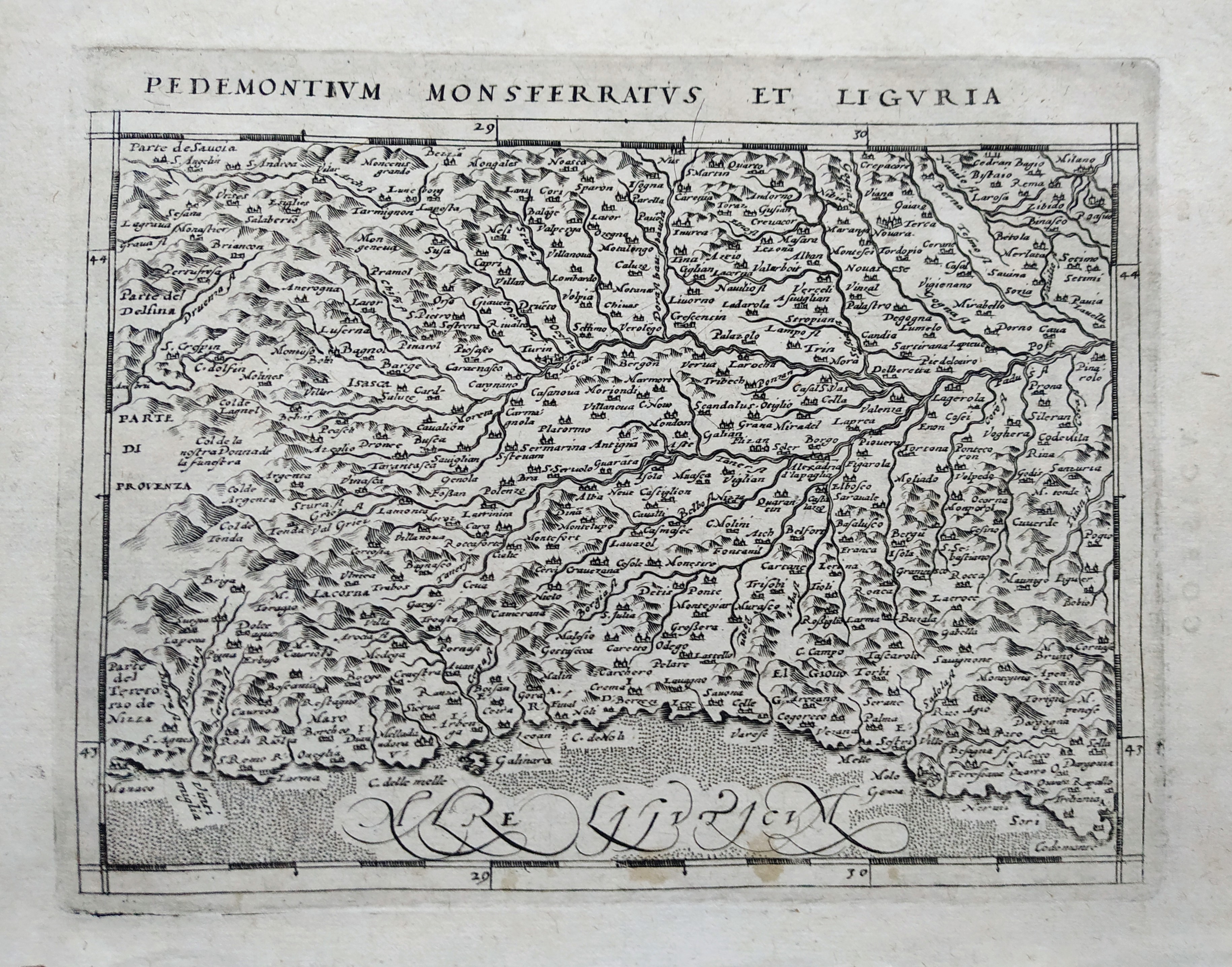
Map title
Pedemontium Monsferratus et Liguria
Author
Magini
Location shown in map
Piedmont & Liguria
Edition date
1617
Edition place
Arnheim
Editor
Ioannes Ianssonius
Atlas
Geografia di Claudio Tolomeo
Price
200 Euro
State
[mint/EXCELLENT/very good/good/fair/mediocre/poor]
Color
Black/white
Verso
Latin text pag 100
Size
Plate: cm (17.8 x 12.7) inches (7.01 x 5) Paper: cm (21.6 x 17.8) inches (8.5 x 7.01)
Technique
Copper engraving
Note
Reference
--
Wiki
Here for more info
In stock
Available
Info
info@thetreasuremaps.com
Code
#0770
×
![]()
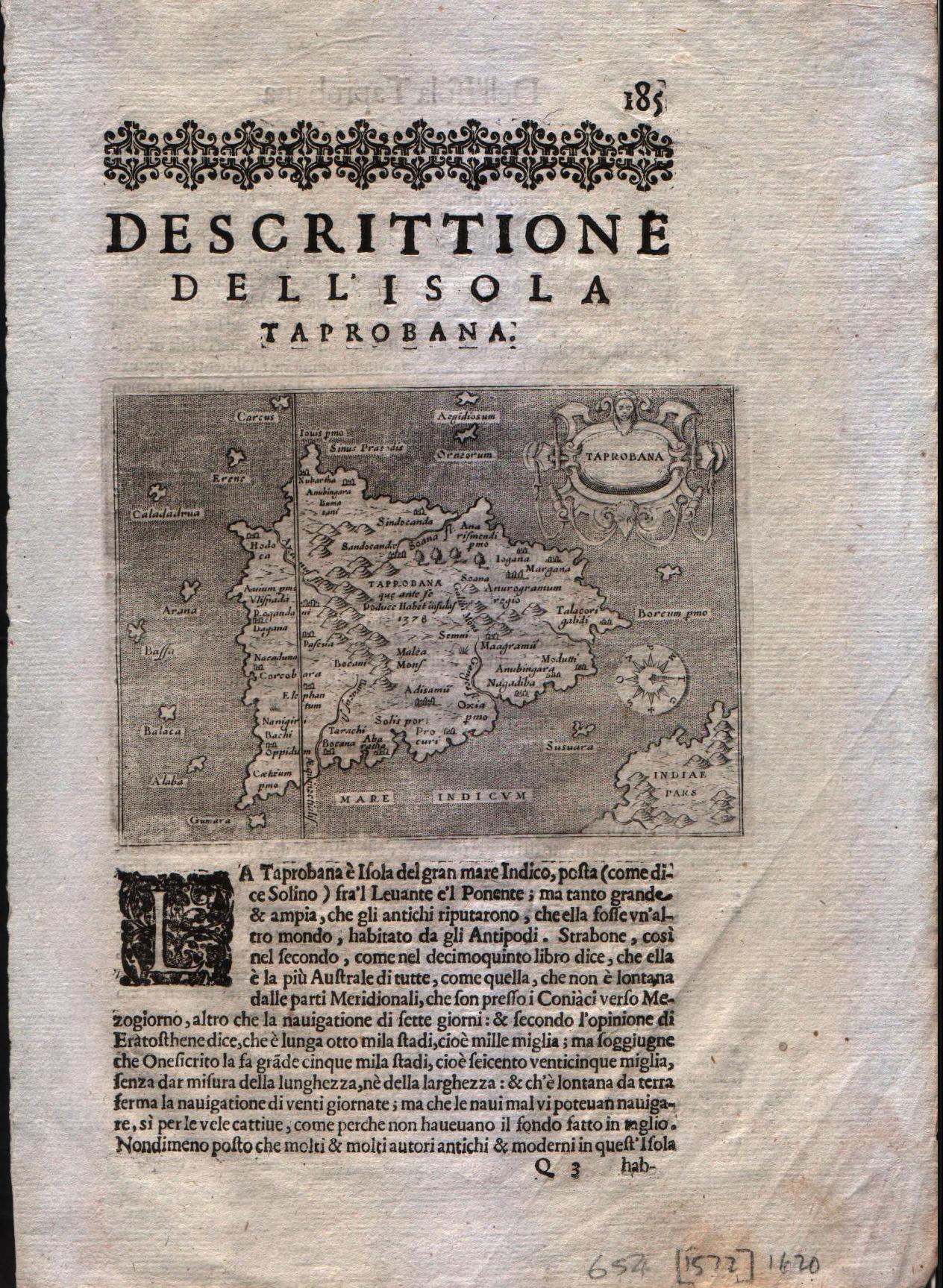
Map title
Descrittione dell'isole Taprobana
Author
Porcacchi
Location shown in map
Ceylon
Edition date
1620
Edition place
Venice
Editor
--
Atlas
L'Isole piu famose del mondo -- Pietr'Antonio Brigonci
Price
200 Euro
State
[MINT/excellent/very good/good/fair/mediocre/poor]
Color
Black/white
Verso
Italian text pag.186
Size
Plate: cm (14 x 11.4) inches (5.51 x 4.49) Paper: cm (20.3 x 30.5) inches (7.99 x 12.01)
Technique
Copper engraving
Note
No particular notes for this maps
Reference
--
Wiki
Here for more info
In stock
Available
Info
info@thetreasuremaps.com
Code
#0197
×
![]()
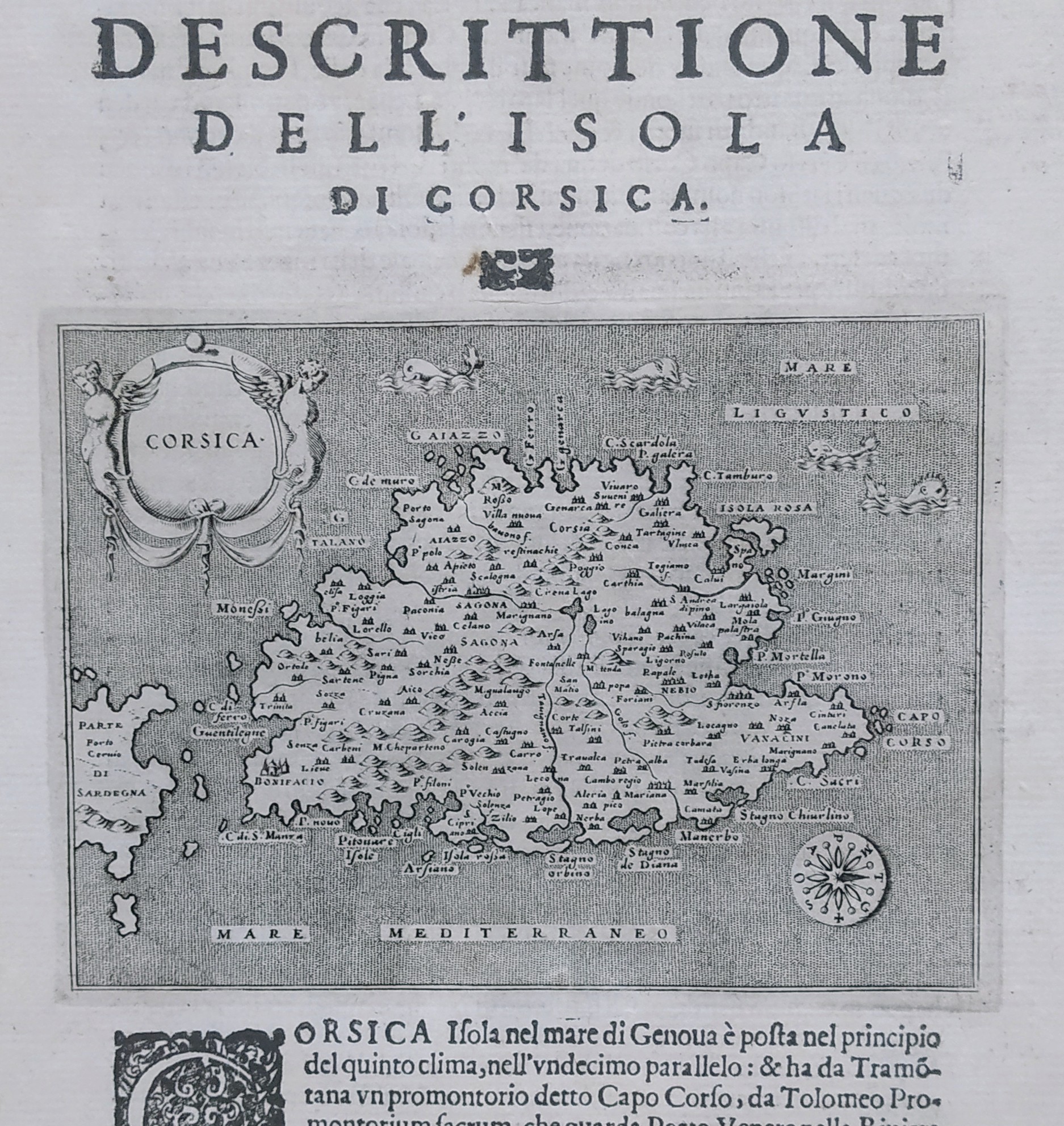
Map title
Descrittione dell'isola di Corsica
Author
Porcacchi
Location shown in map
Corse
Edition date
1620
Edition place
Venice
Editor
--
Atlas
L'Isole piu famose del mondo -- Pietr'Antonio Brigonci
Price
250 Euro
State
[MINT/excellent/very good/good/fair/mediocre/poor]
Color
Black/white
Verso
Italian text pag.42
Size
Plate: cm (14 x 11.4) inches (5.51 x 4.49) Paper: cm (20.3 x 29) inches (7.99 x 11.42)
Technique
Copper engraving
Note
No particular notes for this maps
Reference
--
Wiki
Here for more info
In stock
Available
Info
info@thetreasuremaps.com
Code
#0747
×
![]()
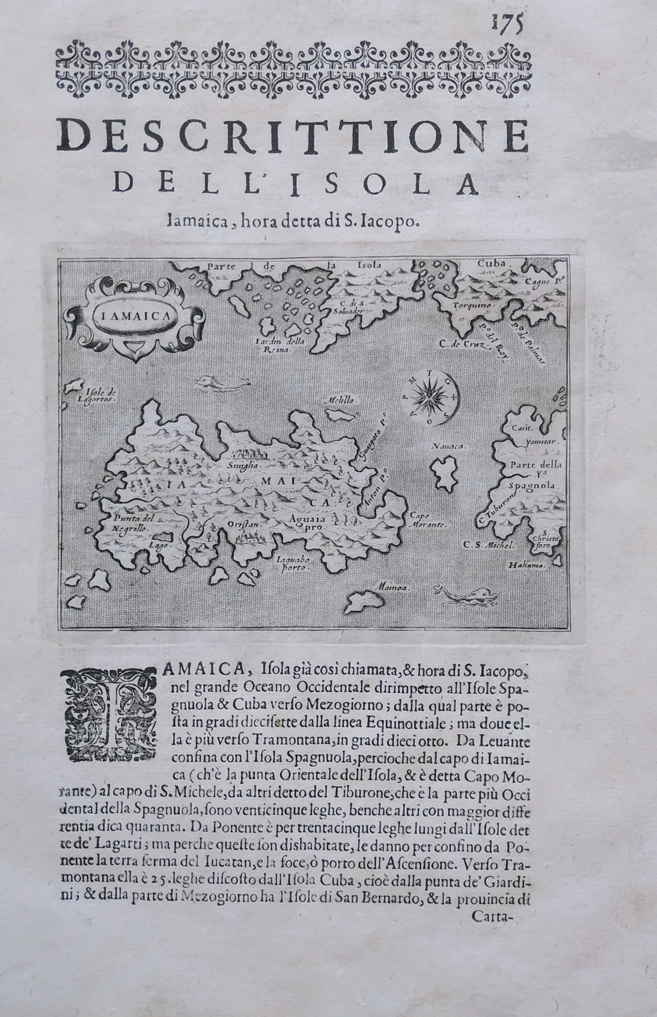
Map title
Descrittione dell'isola di Iamaica
Author
Porcacchi
Location shown in map
Jamaica
Edition date
1620
Edition place
Venice
Editor
--
Atlas
L'Isole piu famose del mondo -- Pietr'Antonio Brigonci
Price
200 Euro
State
[MINT/excellent/very good/good/fair/mediocre/poor]
Color
Black/white
Verso
Italian text pag.176
Size
Plate: cm (14 x 11.4) inches (5.51 x 4.49) Paper: cm (20.3 x 29) inches (7.99 x 11.42)
Technique
Copper engraving
Note
No particular notes for this maps
Reference
--
Wiki
Here for more info
In stock
Available
Info
info@thetreasuremaps.com
Code
#0746
×
![]()
Map title
Nova Italiae delineatio
Author
Hondius
Location shown in map
Italy
Edition date
Circa 1620
Edition place
Amsterdam
Editor
Atlas
Price
800 Euro
State
[mint/excellent/VERY GOOD/good/fair/mediocre/poor]
Color
Old colors
Verso
Blank
Size
Plate: cm (50 x 48) inches (19.69 x 18.9) Paper: cm (53 x 40) inches (20.87 x 15.75)
Technique
Copper engraving
Note
Reference
Wiki
Here for more info
In stock
Available
Info
info@thetreasuremaps.com
Code
#1053
×
![]()
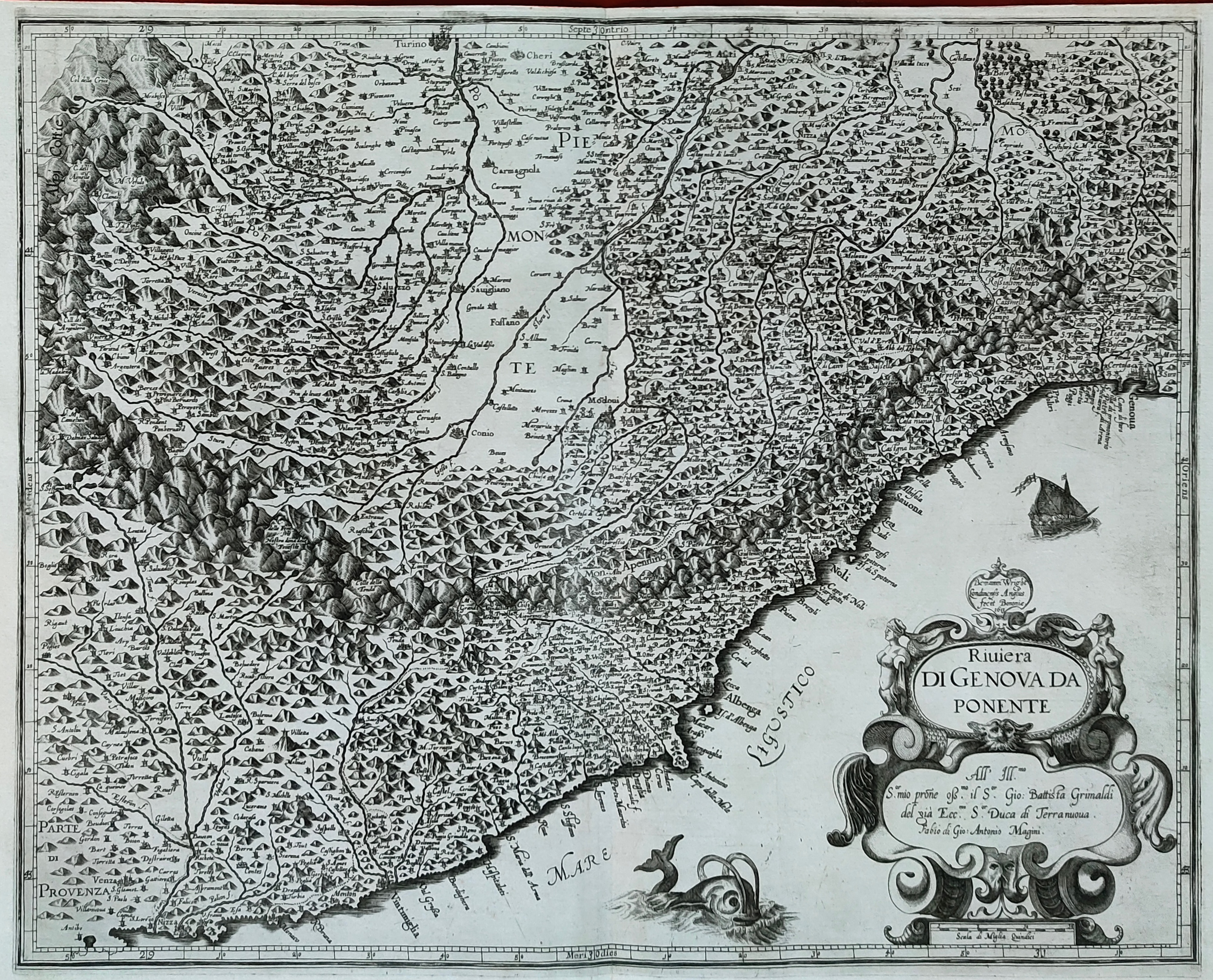
Map title
Riviera di Genova di Levante
Author
Magini
Location shown in map
Liguria
Edition date
1620
Edition place
Bolonia
Editor
Magini
Atlas
Italia
Price
500 Euro
State
[mint/EXCELLENT/very good/good/fair/mediocre/poor]
Color
Black/white
Verso
Blank
Size
Plate: cm (48 x 38) inches (18.9 x 14.96) Paper: cm (53 x 39) inches (20.87 x 15.35)
Technique
Copper engraving
Note
Reference
--
Wiki
Here for more info
In stock
Available
Info
info@thetreasuremaps.com
Code
#1243
×
![]()
Map title
Elba isola olim Ilua
Author
Magini
Location shown in map
Elba
Edition date
1620
Edition place
Bolonia
Editor
Magini
Atlas
Italia
Price
350 Euro
State
[mint/EXCELLENT/very good/good/fair/mediocre/poor]
Color
Black/white
Verso
Blank
Size
Plate: cm (23 x 17) inches (9.06 x 6.69) Paper: cm (41 x 28) inches (16.14 x 11.02)
Technique
Copper engraving
Note
Reference
--
Wiki
Here for more info
In stock
Available
Info
info@thetreasuremaps.com
Code
#1171
×
![]()
Map title
Nova Italiae delineatio
Author
Hondius
Location shown in map
Italy
Edition date
Circa 1620
Edition place
Amsterdam
Editor
Atlas
Price
800 Euro
State
[mint/excellent/VERY GOOD/good/fair/mediocre/poor]
Color
Old colors
Verso
Blank
Size
Plate: cm (50 x 48) inches (19.69 x 18.9) Paper: cm (53 x 40) inches (20.87 x 15.75)
Technique
Copper engraving
Note
Reference
Wiki
Here for more info
In stock
Available
Info
info@thetreasuremaps.com
Code
#1222
×
![]()
Map title
Riviera di Genova da Ponente
Author
Magini
Location shown in map
Liguria
Edition date
1620
Edition place
Bolonia
Editor
Magini
Atlas
Italia
Price
500 Euro
State
[mint/EXCELLENT/very good/good/fair/mediocre/poor]
Color
Black/white
Verso
Blank
Size
Plate: cm (48 x 38) inches (18.9 x 14.96) Paper: cm (53 x 39) inches (20.87 x 15.35)
Technique
Copper engraving
Note
Reference
--
Wiki
Here for more info
In stock
Available
Info
info@thetreasuremaps.com
Code
#1244
×
![]()
Map title
Tabula Asiae XI
Author
Magini
Location shown in map
India
Edition date
1621
Edition place
Padova
Editor
Paolo and Francesco Galignani
Atlas
Geografia di Claudio Tolomeo -- Giovanni Antonio Magini
Price
Please ask: info@thetreasuremaps.com
State
[MINT/excellent/very good/good/fair/mediocre/poor]
Color
Black/white
Verso
Italian text
Size
Plate: cm (12.7 x 17.8) inches (5 x 7.01) Paper: cm (20.3 x 30.5) inches (7.99 x 12.01)
Technique
Copper engraving
Note
--
Reference
--
Wiki
Here for more info
In stock
Available
Info
info@thetreasuremaps.com
Code
#0562
×
![]()
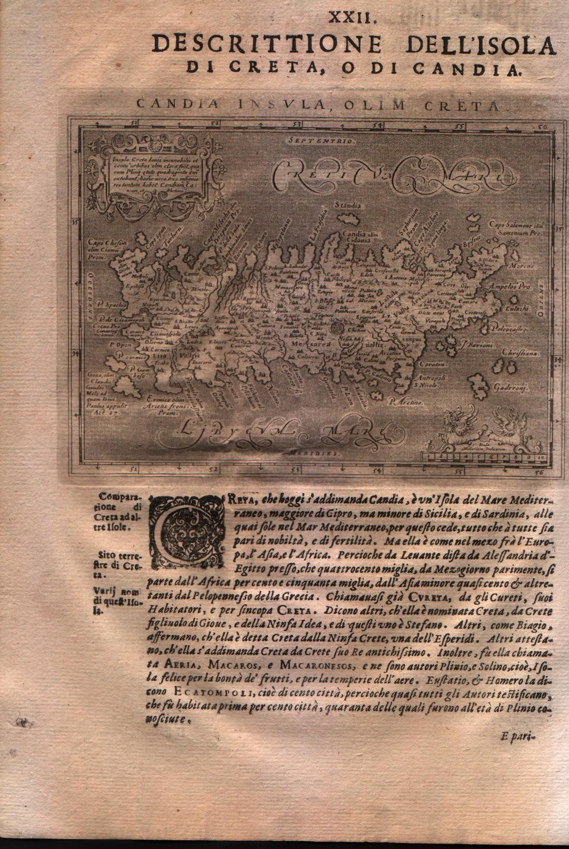
Map title
Descrittione dell'isola di Creta, o di Candia
Author
Magini
Location shown in map
Crete island
Edition date
1621
Edition place
Padova
Editor
Paolo and Francesco Galignani
Atlas
Geografia di Claudio Tolomeo -- Giovanni Antonio Magini
Price
200 Euro
State
[MINT/excellent/very good/good/fair/mediocre/poor]
Color
Black/white
Verso
Italian text pag 128
Size
Plate: cm (12.7 x 17.8) inches (5 x 7.01) Paper: cm (20.3 x 30.5) inches (7.99 x 12.01)
Technique
Copper engraving
Note
No particular notes for this maps.
Reference
--
Wiki
Here for more info
In stock
Available
Info
info@thetreasuremaps.com
Code
#0131
×
![]()
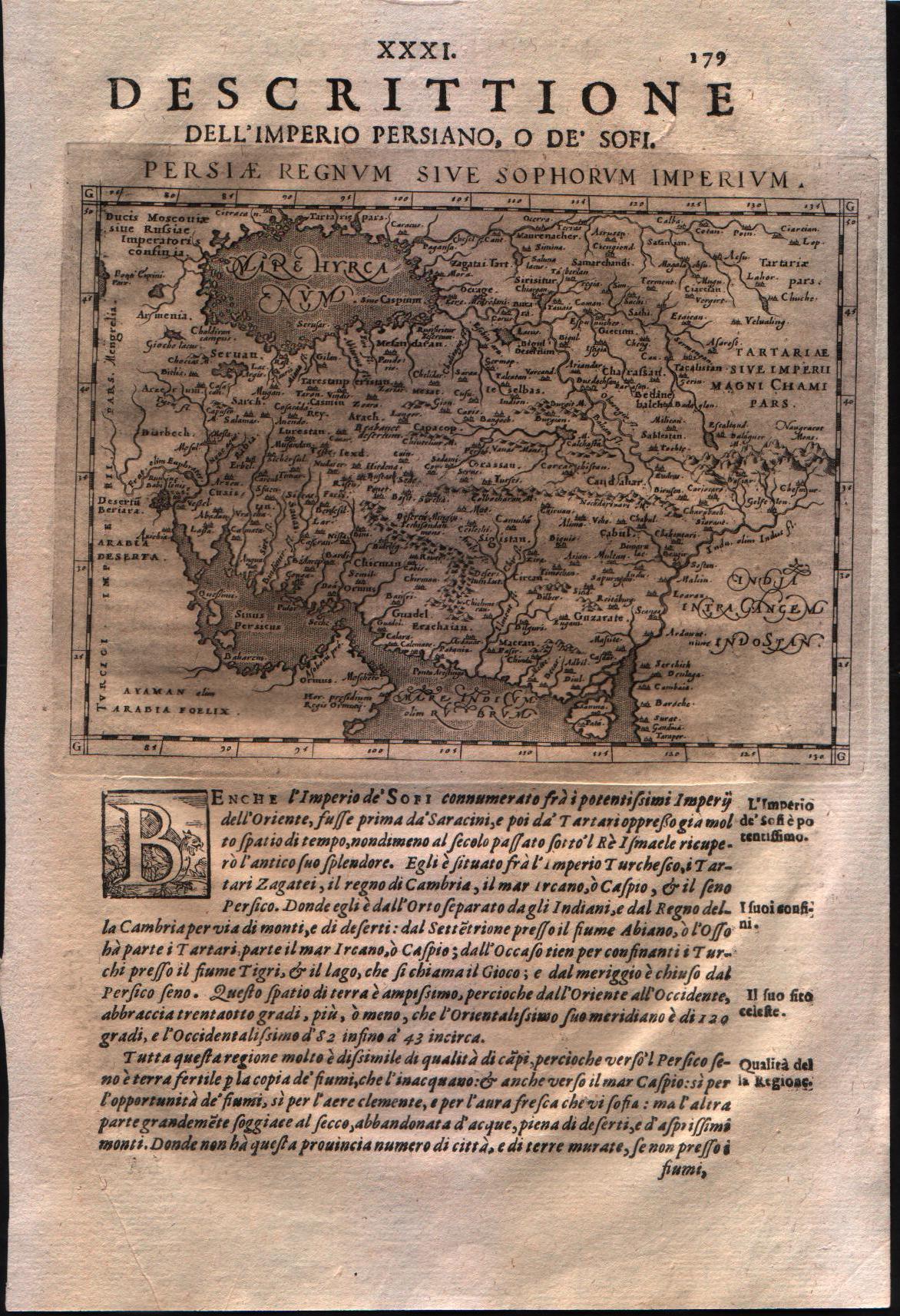
Map title
Descrittione dell'impero persiano o de' Sofri
Author
Magini
Location shown in map
Persia
Edition date
1621
Edition place
Padova
Editor
Paolo and Francesco Galignani
Atlas
Geografia di Claudio Tolomeo -- Giovanni Antonio Magini
Price
125 Euro
State
[MINT/excellent/very good/good/fair/mediocre/poor]
Color
Black/white
Verso
Italian text pag 179
Size
Plate: cm (12.7 x 17.8) inches (5 x 7.01) Paper: cm (20.3 x 30.5) inches (7.99 x 12.01)
Technique
Copper engraving
Note
No particular notes for this maps.
Reference
--
Wiki
Here for more info
In stock
Available
Info
info@thetreasuremaps.com
Code
#0132
×
![]()
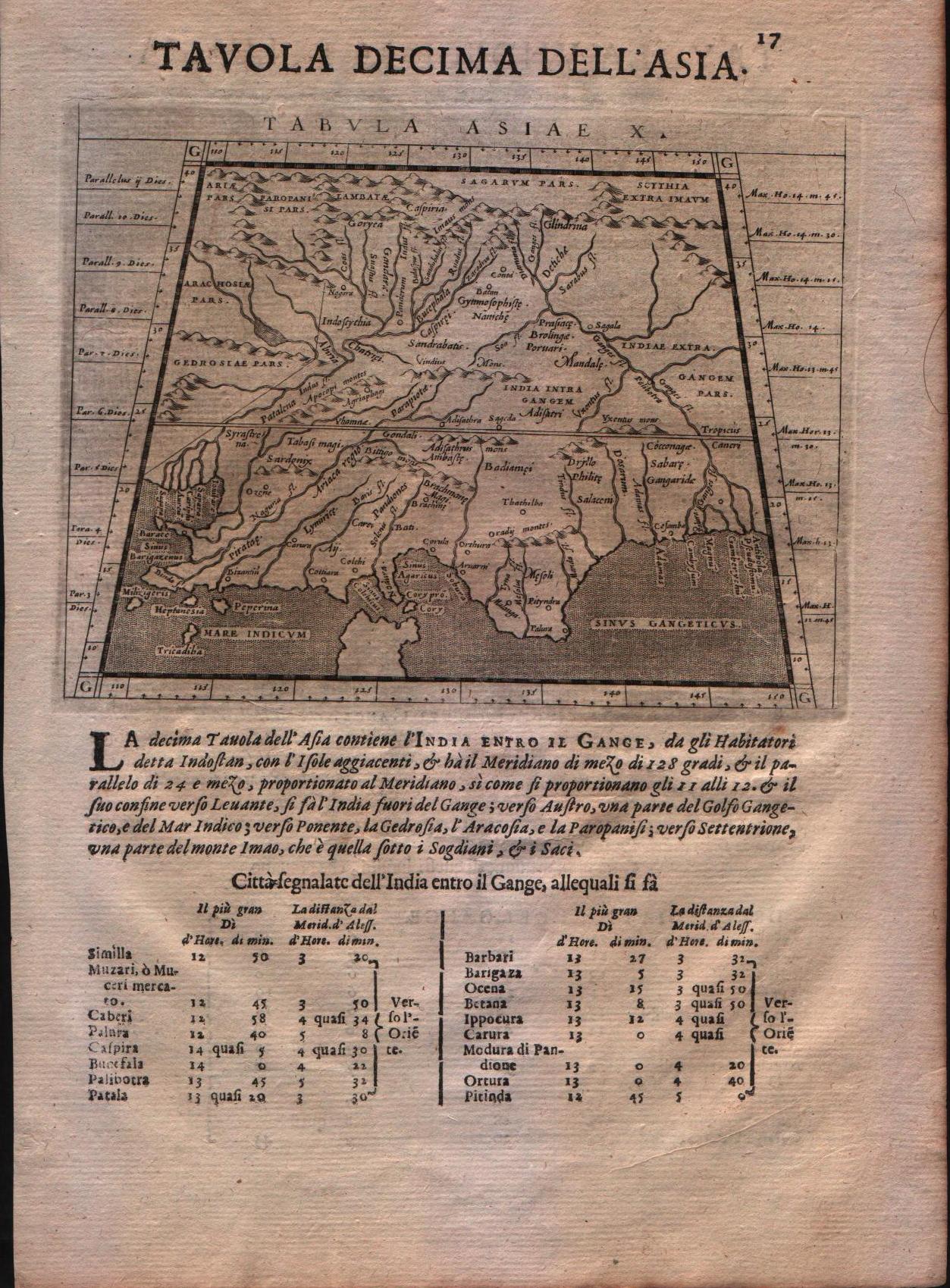
Map title
Tabula Asiae X
Author
Magini
Location shown in map
India
Edition date
1621
Edition place
Padova
Editor
Paolo and Francesco Galignani
Atlas
Geografia di Claudio Tolomeo -- Giovanni Antonio Magini
Price
125 Euro
State
[MINT/excellent/very good/good/fair/mediocre/poor]
Color
Black/white
Verso
Italian text
Size
Plate: cm (12.7 x 17.8) inches (5 x 7.01) Paper: cm (20.3 x 30.5) inches (7.99 x 12.01)
Technique
Copper engraving
Note
--
Reference
--
Wiki
Here for more info
In stock
Available
Info
info@thetreasuremaps.com
Code
#0207
×
![]()
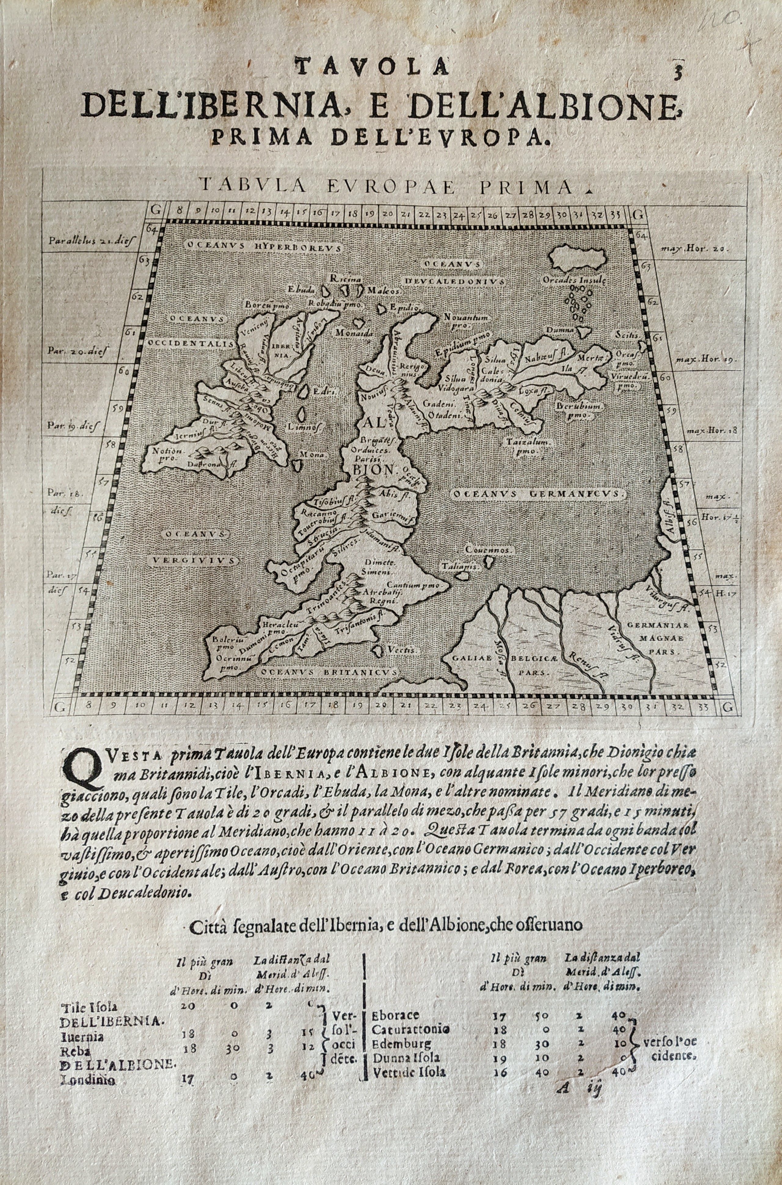
Map title
Tabula Europae prima
Author
Magini
Location shown in map
British Isles
Edition date
1621
Edition place
Padova
Editor
Paolo and Francesco Galignani
Atlas
Geografia di Claudio Tolomeo -- Giovanni Antonio Magini
Price
200 Euro
State
[MINT/excellent/very good/good/fair/mediocre/poor]
Color
Black/white
Verso
Italian text
Size
Plate: cm (12.7 x 17.8) inches (5 x 7.01) Paper: cm (20.3 x 30.5) inches (7.99 x 12.01)
Technique
Copper engraving
Note
No particular notes for this maps.
Reference
--
Wiki
Here for more info
In stock
Available
Info
info@thetreasuremaps.com
Code
#0711
×
![]()
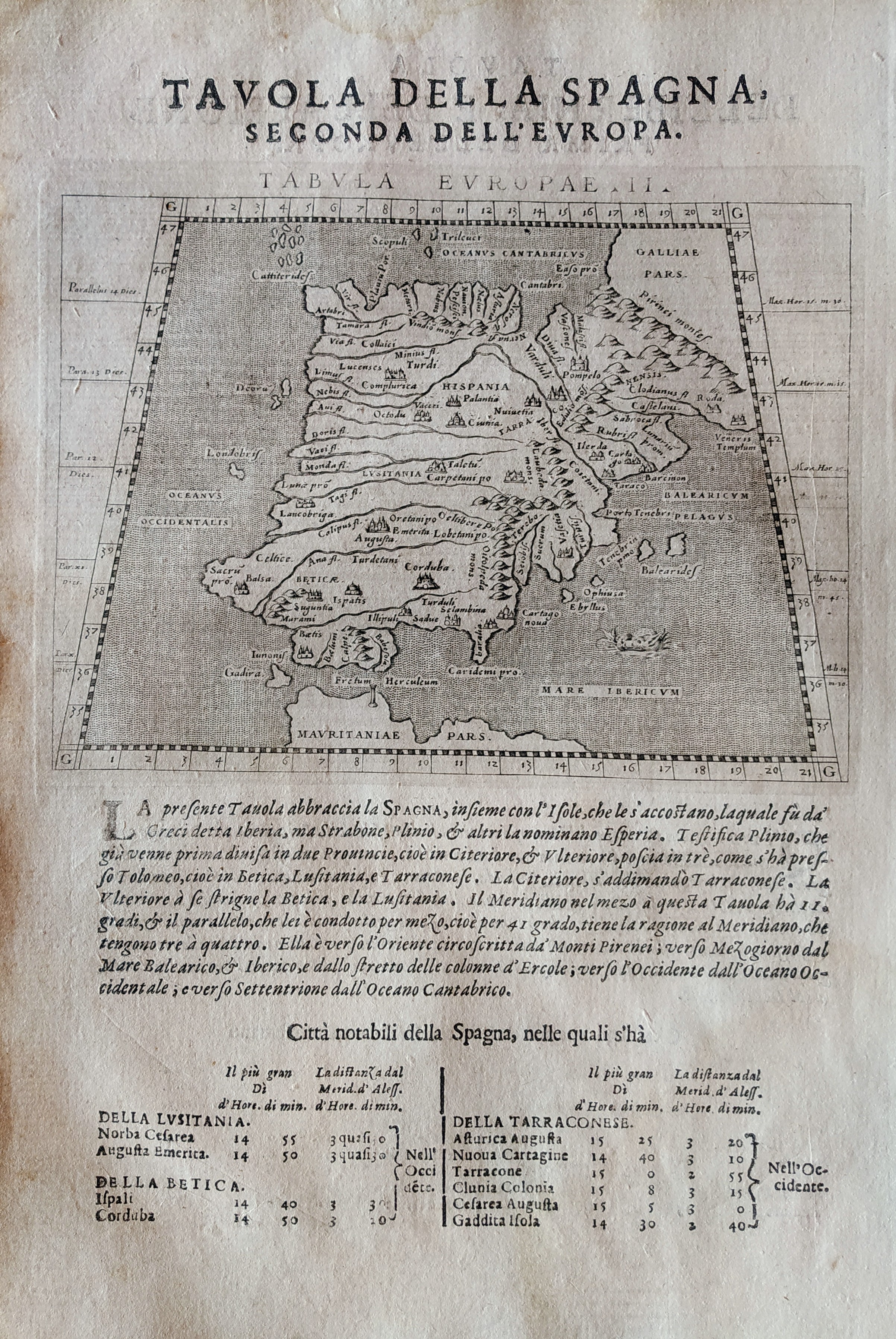
Map title
Tabula Europae II
Author
Magini
Location shown in map
Spain
Edition date
1621
Edition place
Padova
Editor
Paolo and Francesco Galignani
Atlas
Geografia di Claudio Tolomeo -- Giovanni Antonio Magini
Price
Please ask: info@thetreasuremaps.com
State
[MINT/excellent/very good/good/fair/mediocre/poor]
Color
Black/white
Verso
Italian text pag 3
Size
Plate: cm (12.7 x 17.8) inches (5 x 7.01) Paper: cm (20.3 x 30.5) inches (7.99 x 12.01)
Technique
Copper engraving
Note
No particular notes for this maps.
Reference
--
Wiki
Here for more info
In stock
Available
Info
info@thetreasuremaps.com
Code
#0712
×
![]()
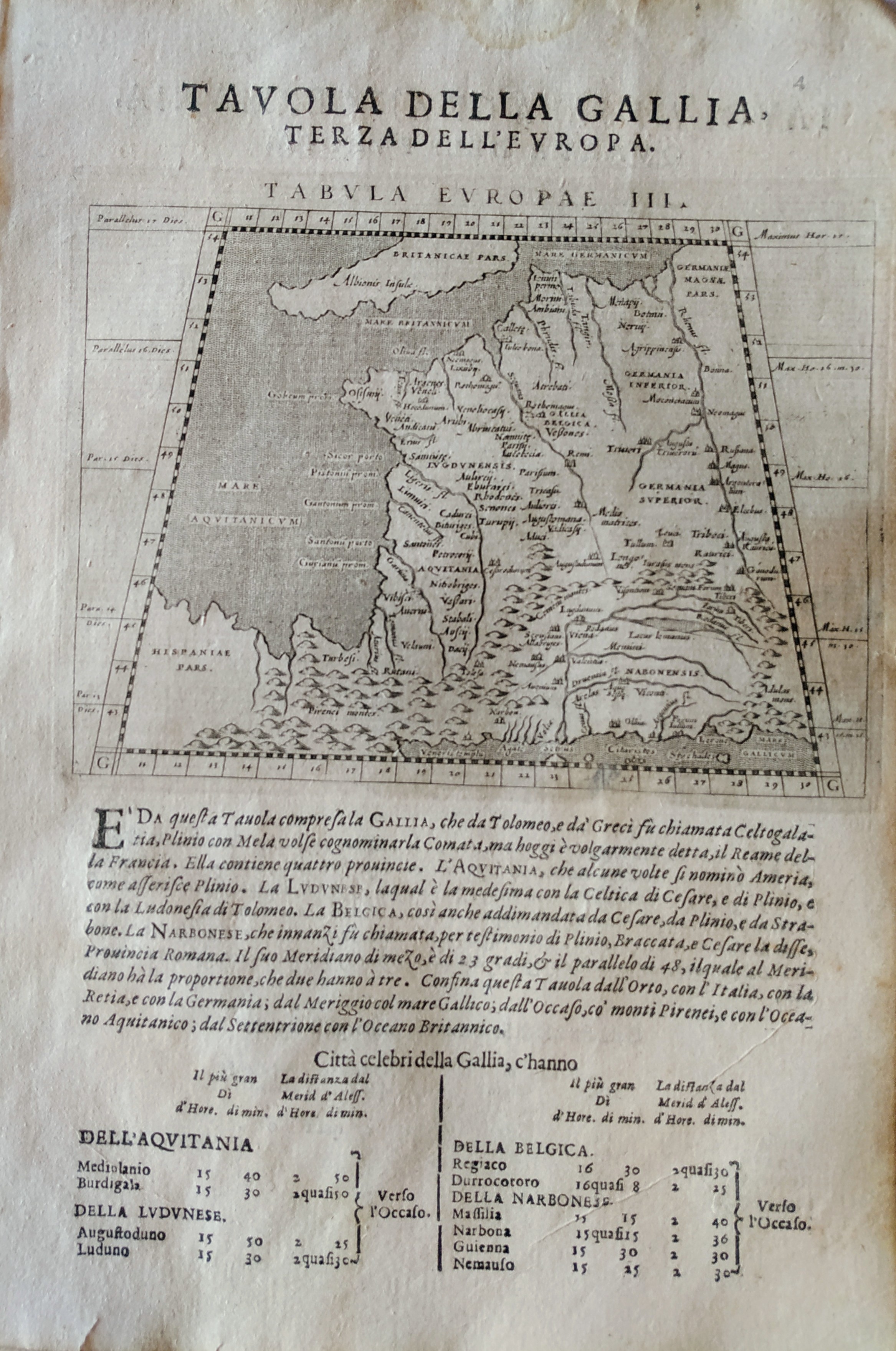
Map title
Tabula Europae III
Author
Magini
Location shown in map
France
Edition date
1621
Edition place
Padova
Editor
Paolo and Francesco Galignani
Atlas
Geografia di Claudio Tolomeo -- Giovanni Antonio Magini
Price
Please ask: info@thetreasuremaps.com
State
[MINT/excellent/very good/good/fair/mediocre/poor]
Color
Black/white
Verso
Italian text
Size
Plate: cm (12.7 x 17.8) inches (5 x 7.01) Paper: cm (20.3 x 30.5) inches (7.99 x 12.01)
Technique
Copper engraving
Note
No particular notes for this maps.
Reference
--
Wiki
Here for more info
In stock
Available
Info
info@thetreasuremaps.com
Code
#0713
×
![]()
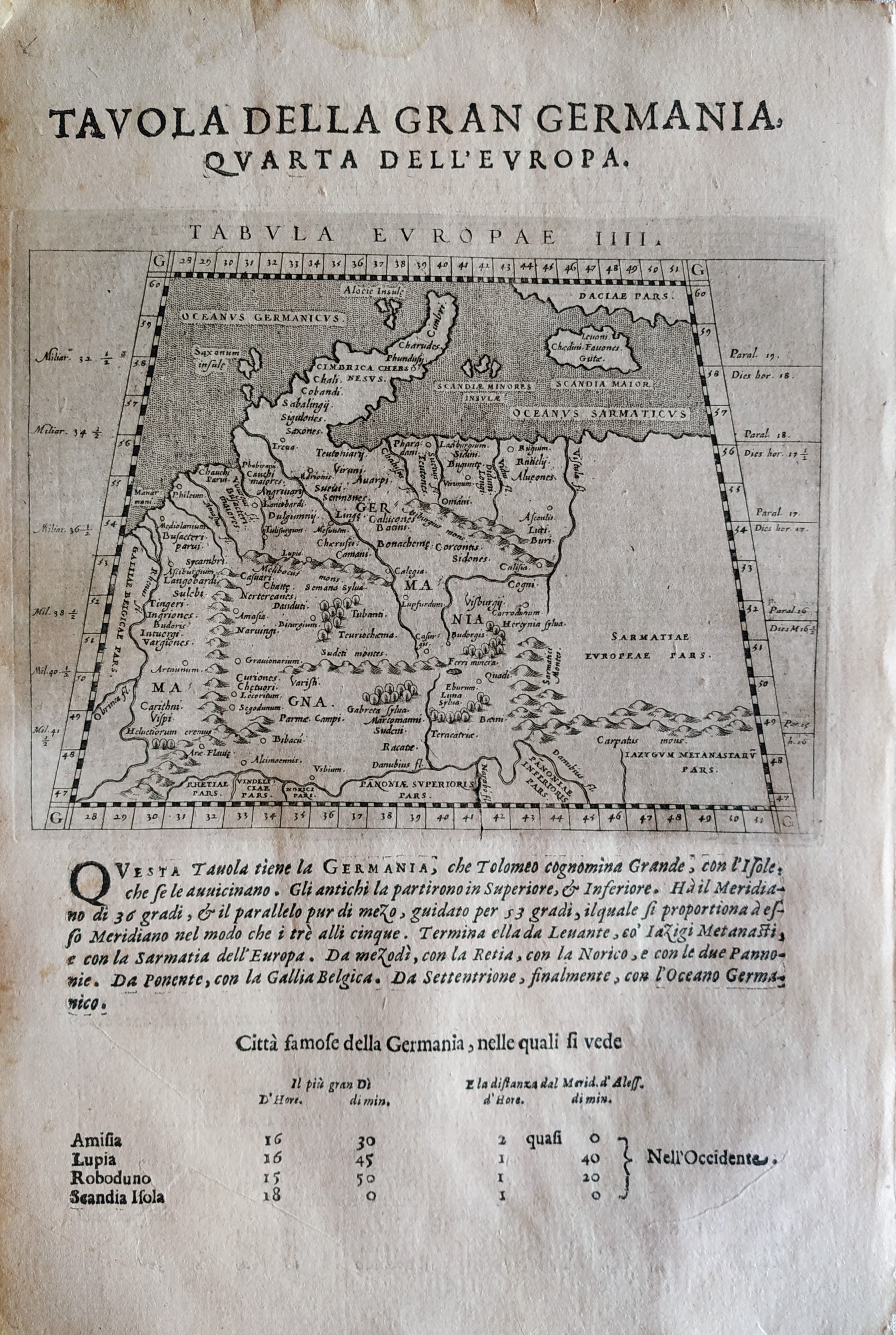
Map title
Tabula Europae IIII
Author
Magini
Location shown in map
Germany
Edition date
1621
Edition place
Padova
Editor
Paolo and Francesco Galignani
Atlas
Geografia di Claudio Tolomeo -- Giovanni Antonio Magini
Price
200 Euro
State
[MINT/excellent/very good/good/fair/mediocre/poor]
Color
Black/white
Verso
Italian text pag 4
Size
Plate: cm (12.7 x 17.8) inches (5 x 7.01) Paper: cm (20.3 x 30.5) inches (7.99 x 12.01)
Technique
Copper engraving
Note
No particular notes for this maps.
Reference
--
Wiki
Here for more info
In stock
Available
Info
info@thetreasuremaps.com
Code
#0714
×
![]()
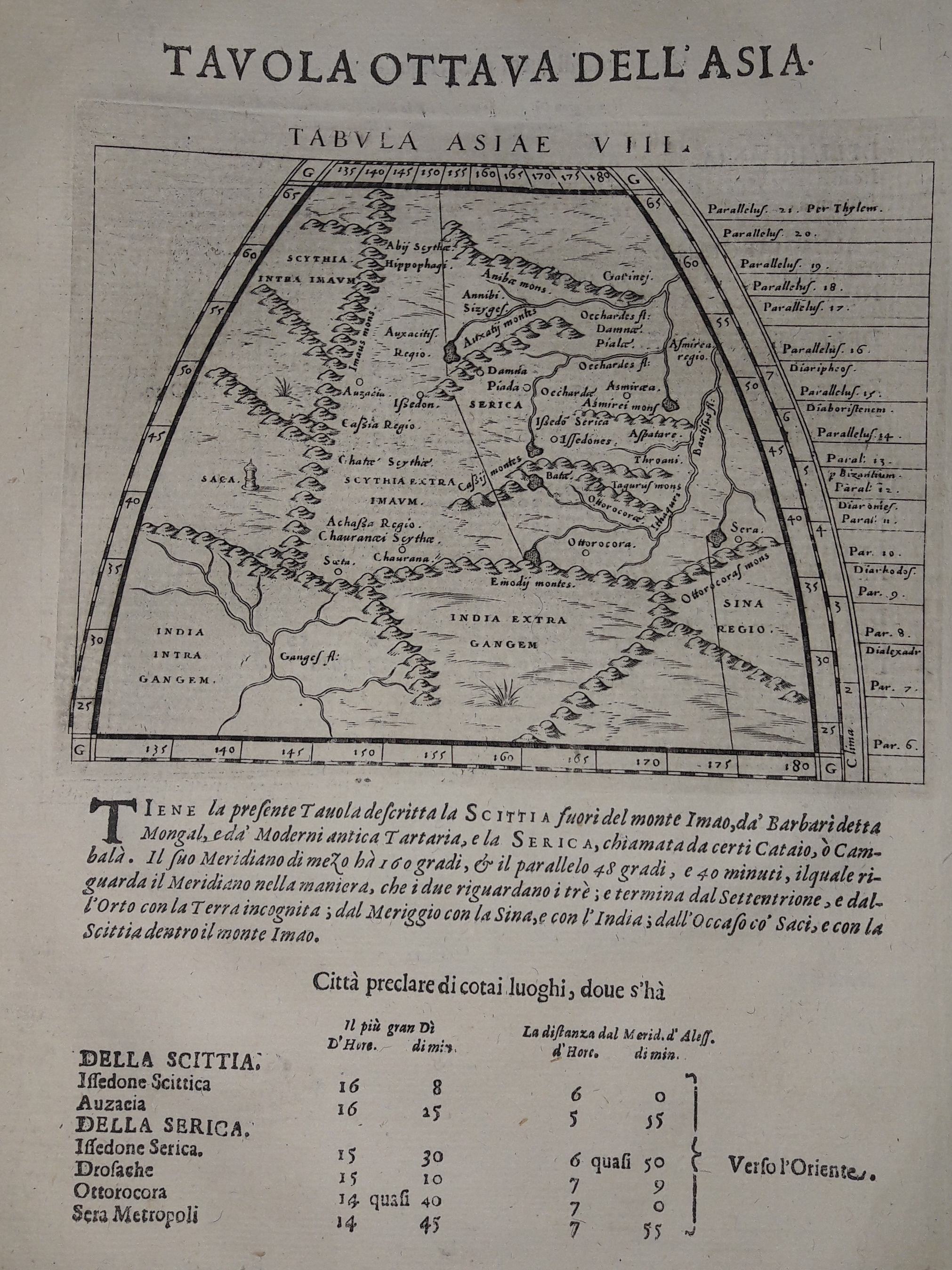
Map title
Tabula Asiae VIII
Author
Magini
Location shown in map
India
Edition date
1621
Edition place
Padova
Editor
Paolo and Francesco Galignani
Atlas
Geografia di Claudio Tolomeo -- Giovanni Antonio Magini
Price
125 Euro
State
[MINT/excellent/very good/good/fair/mediocre/poor]
Color
Black/white
Verso
Italian text pag 15
Size
Plate: cm (12.7 x 17.8) inches (5 x 7.01) Paper: cm (20.3 x 30.5) inches (7.99 x 12.01)
Technique
Copper engraving
Note
--
Reference
--
Wiki
Here for more info
In stock
Available
Info
info@thetreasuremaps.com
Code
#0631
×
![]()
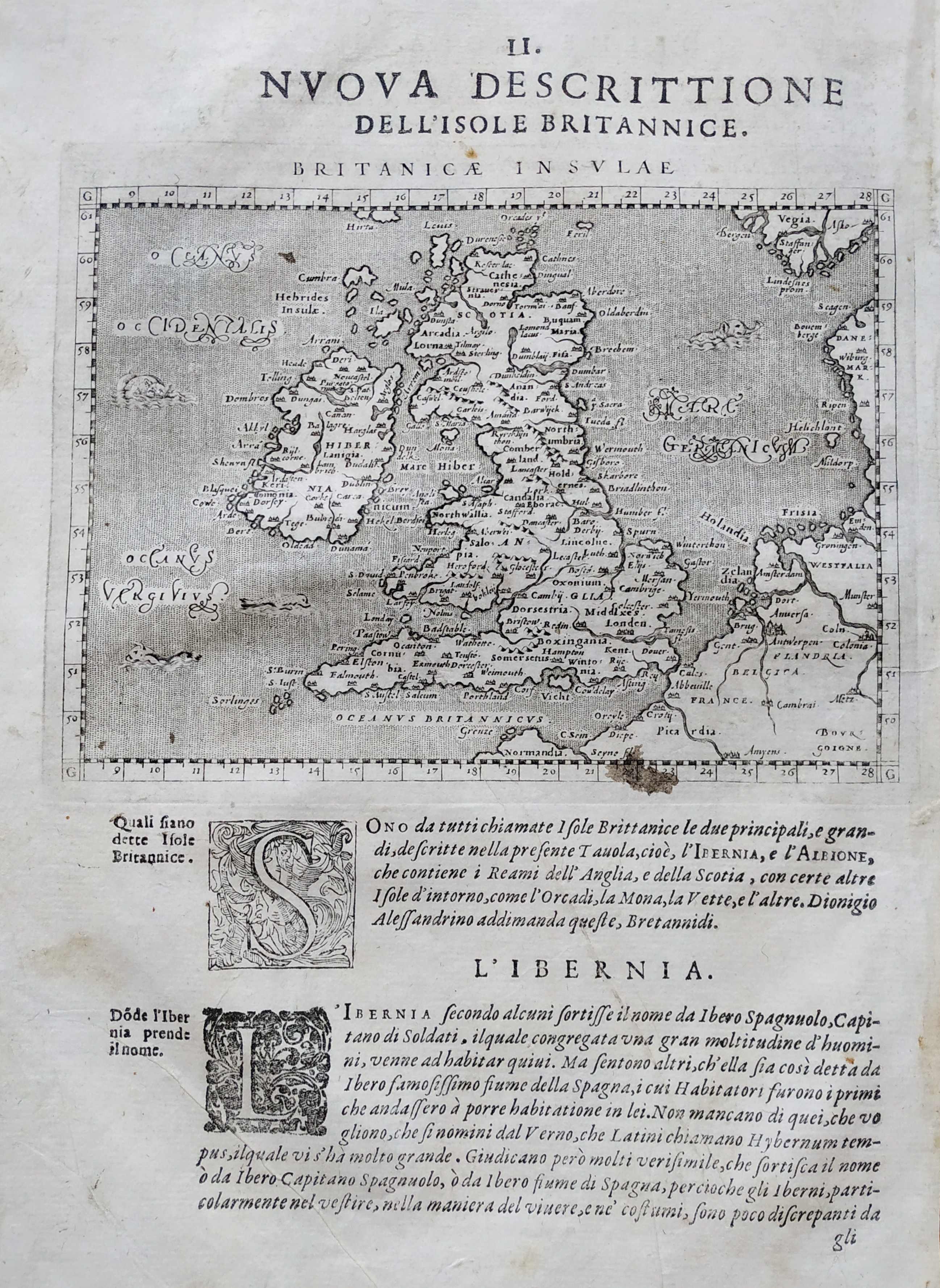
Map title
Nova descrittione dell isole britanniche
Author
Magini
Location shown in map
British Isles
Edition date
1621
Edition place
Padova
Editor
Paolo and Francesco Galignani
Atlas
Geografia di Claudio Tolomeo -- Giovanni Antonio Magini
Price
200 Euro
State
[MINT/excellent/very good/good/fair/mediocre/poor]
Color
Black/white
Verso
Italian text pag 24
Size
Plate: cm (17 x 12) inches (6.69 x 4.72) Paper: cm (20.3 x 30.5) inches (7.99 x 12.01)
Technique
Copper engraving
Note
No particular notes for this maps
Reference
--
Wiki
Here for more info
In stock
Available
Info
info@thetreasuremaps.com
Code
#0730
×
![]()
Map title
Britanicarum insularum
Author
Ortelius
Location shown in map
England
Edition date
1621
Edition place
Antwerp
Editor
--
Atlas
Theatrum Orbis Terrarum
Price
700 Euro
State
[mint/EXCELLENT/very good/good/fair/mediocre/poor]
Color
Black/white
Verso
Latin text pag.11
Size
Plate: cm (50 x 36) inches (19.69 x 14.17) Paper: cm (57 x 47) inches (22.44 x 18.5)
Technique
Copper engraving
Note
No particular notes for this maps.
Reference
Van Den Broecke 190
Wiki
Here for more info
In stock
Available
Info
info@thetreasuremaps.com
Code
#0778
×
![]()
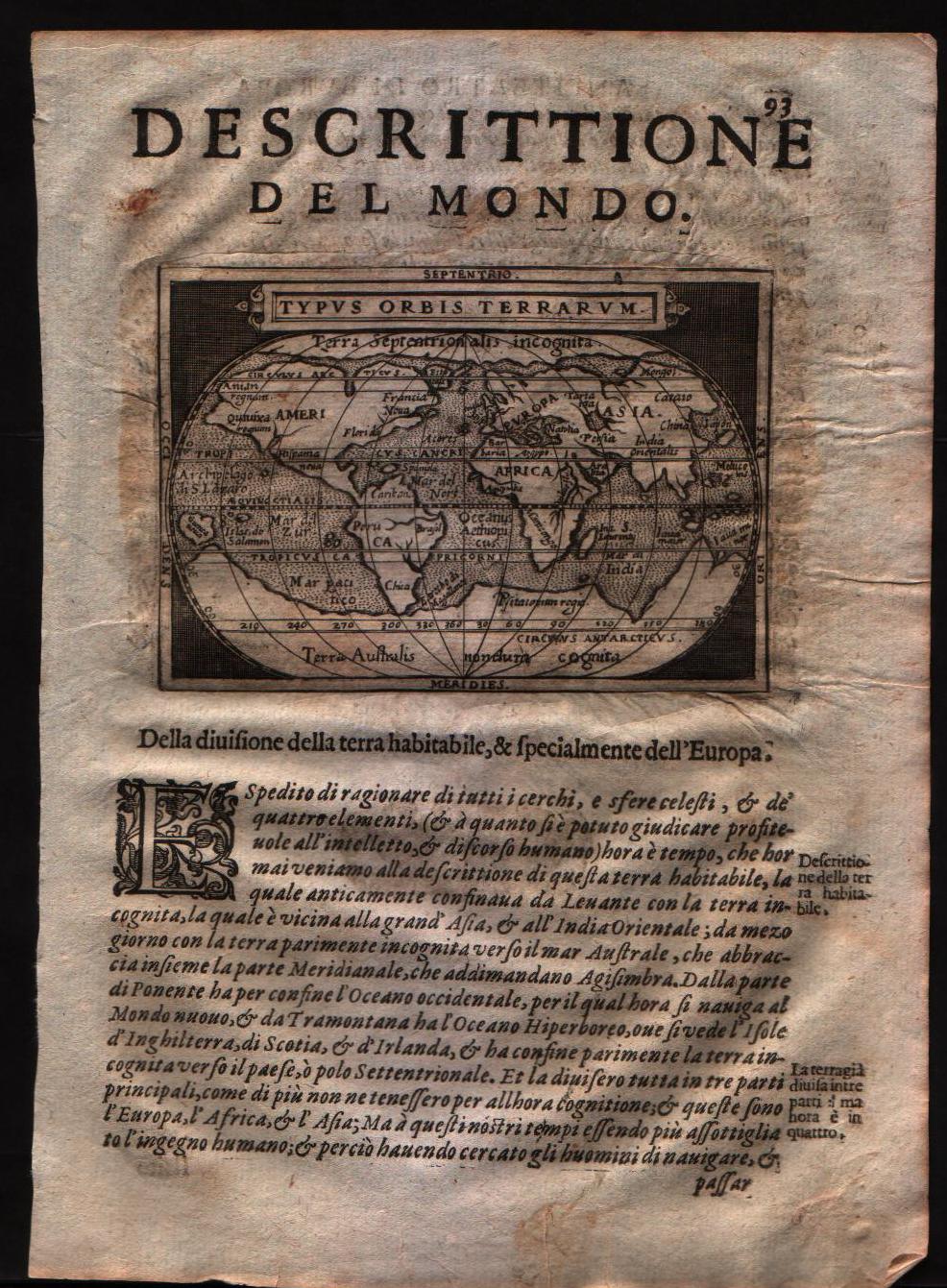
Map title
Typus orbis terrarum
Author
Doglioni
Location shown in map
World
Edition date
1623
Edition place
Venice
Editor
Giacomo Sarzina
Atlas
Anfiteatro di Europa
Price
Please ask: info@thetreasuremaps.com
State
[MINT/excellent/very good/good/fair/mediocre/poor]
Color
Black/white
Verso
Italian text pag.94
Size
Plate: cm (11.4 x 8.9) inches (4.49 x 3.5) Paper: cm (15.2 x 22.9) inches (5.98 x 9.02)
Technique
Copper engraving
Note
The maps are copies of the Galle (c.1595) edition of Ortelius.
Reference
--
Wiki
Here for more info
In stock
Sold
Info
info@thetreasuremaps.com
Code
#0558
×
![]()
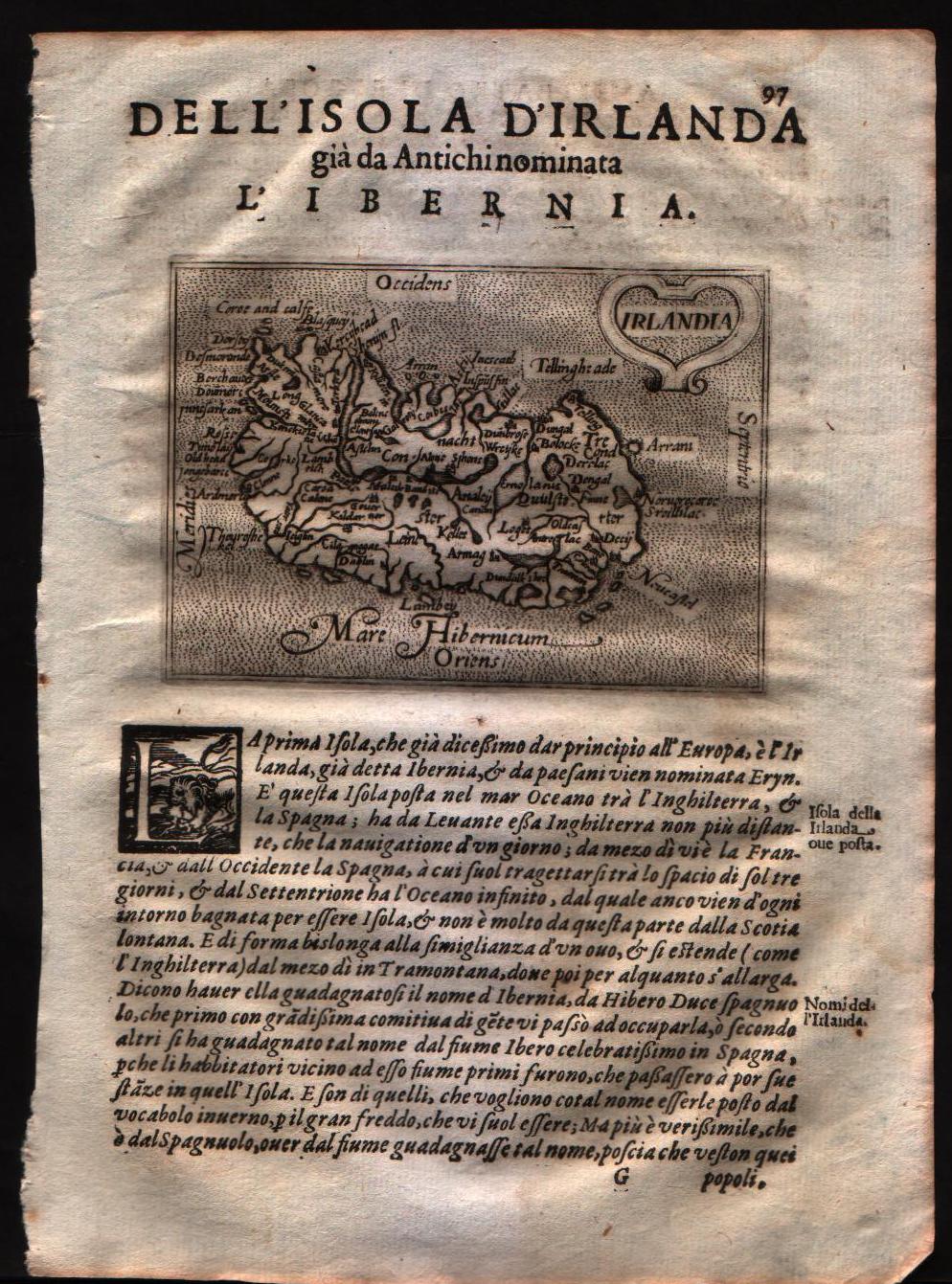
Map title
Irlandia
Author
Doglioni
Location shown in map
Ireland
Edition date
1623
Edition place
Venice
Editor
Giacomo Sarzina
Atlas
Anfiteatro di Europa
Price
Please ask: info@thetreasuremaps.com
State
[MINT/excellent/very good/good/fair/mediocre/poor]
Color
Black/white
Verso
Italian text pag.98
Size
Plate: cm (11.4 x 8.9) inches (4.49 x 3.5) Paper: cm (15.2 x 22.9) inches (5.98 x 9.02)
Technique
Copper engraving
Note
The maps are copies of the Galle (c.1595) edition of Ortelius.
Reference
--
Wiki
Here for more info
In stock
Sold
Info
info@thetreasuremaps.com
Code
#0559
×
![]()
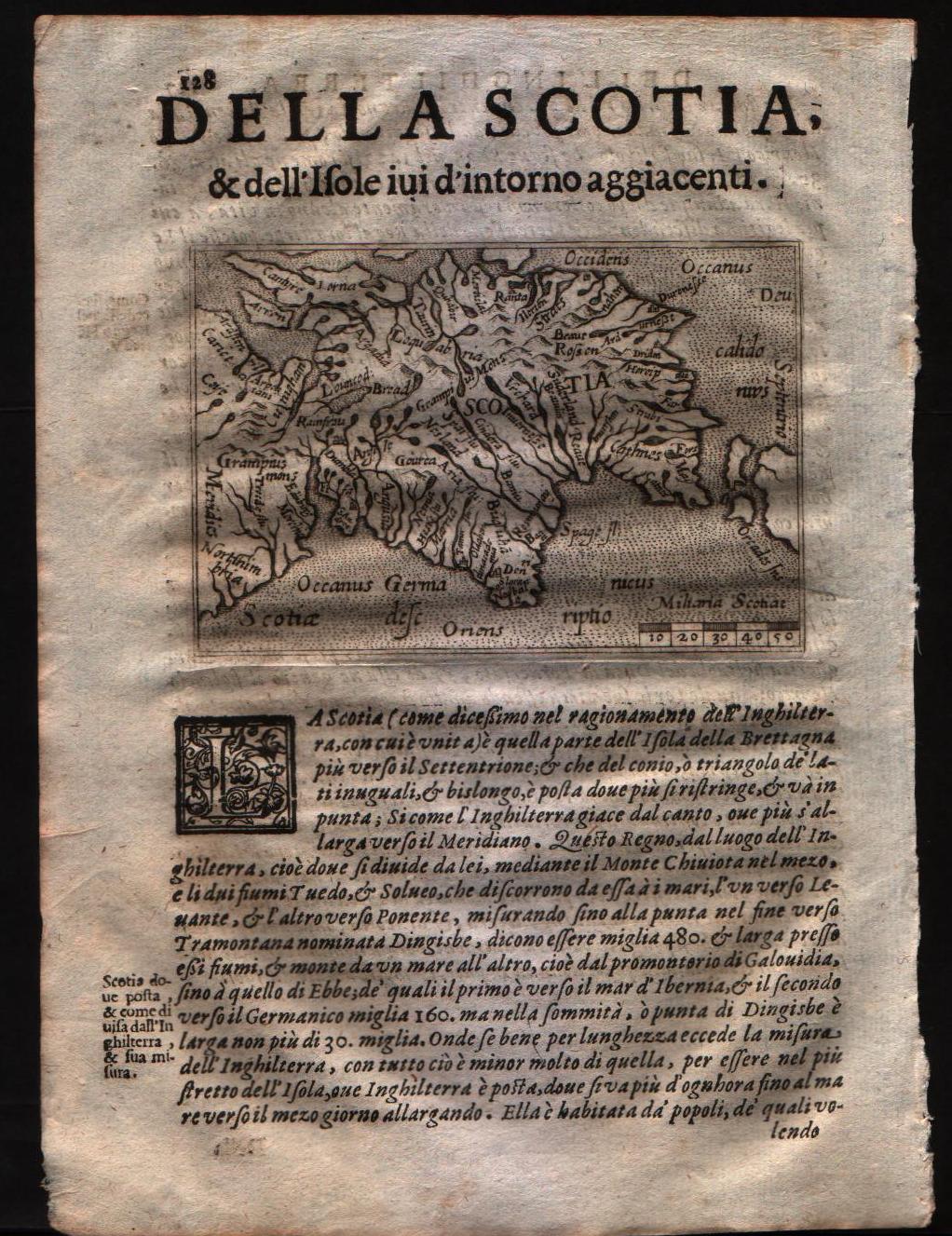
Map title
Scotia
Author
Doglioni
Location shown in map
Scotland
Edition date
1623
Edition place
Venice
Editor
Giacomo Sarzina
Atlas
Anfiteatro di Europa
Price
Please ask: info@thetreasuremaps.com
State
[MINT/excellent/very good/good/fair/mediocre/poor]
Color
Black/white
Verso
Italian text pag.127
Size
Plate: cm (11.4 x 8.9) inches (4.49 x 3.5) Paper: cm (15.2 x 22.9) inches (5.98 x 9.02)
Technique
Copper engraving
Note
The maps are copies of the Galle (c.1595) edition of Ortelius.
Reference
--
Wiki
Here for more info
In stock
Sold
Info
info@thetreasuremaps.com
Code
#0560
×
![]()
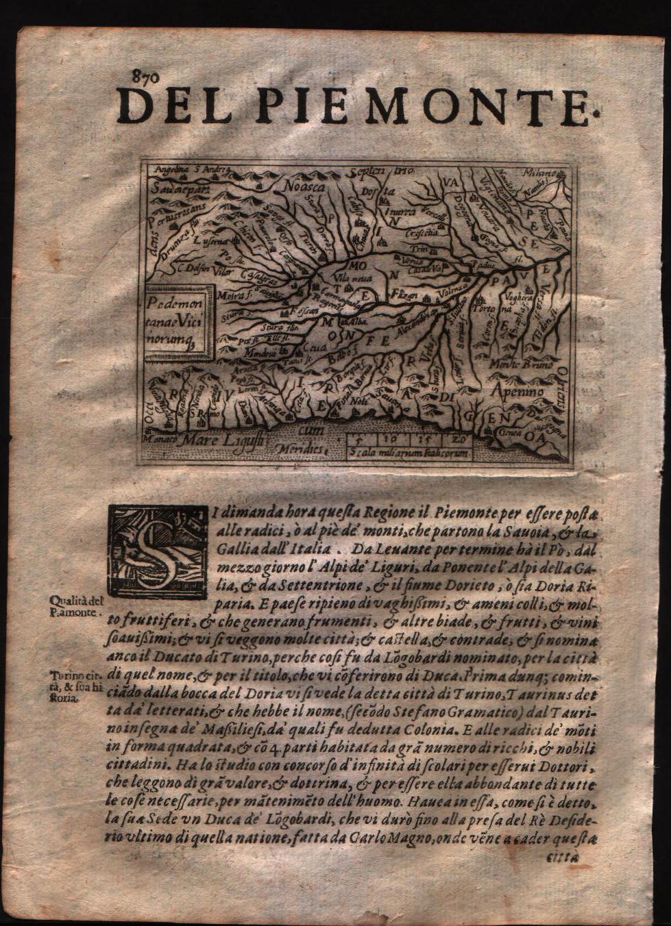
Map title
Pedemontanae vicinorumque
Author
Doglioni
Location shown in map
Piedmont
Edition date
1623
Edition place
Venice
Editor
Giacomo Sarzina
Atlas
Anfiteatro di Europa
Price
400 Euro
State
[mint/EXCELLENT/very good/good/fair/mediocre/poor]
Color
Black/white
Verso
Italian text pag.869
Size
Plate: cm (11.4 x 8.9) inches (4.49 x 3.5) Paper: cm (15.2 x 22.9) inches (5.98 x 9.02)
Technique
Copper engraving
Note
The maps are copies of the Galle (c.1595) edition of Ortelius.
Reference
--
Wiki
Here for more info
In stock
Available
Info
info@thetreasuremaps.com
Code
#0561
×
![]()
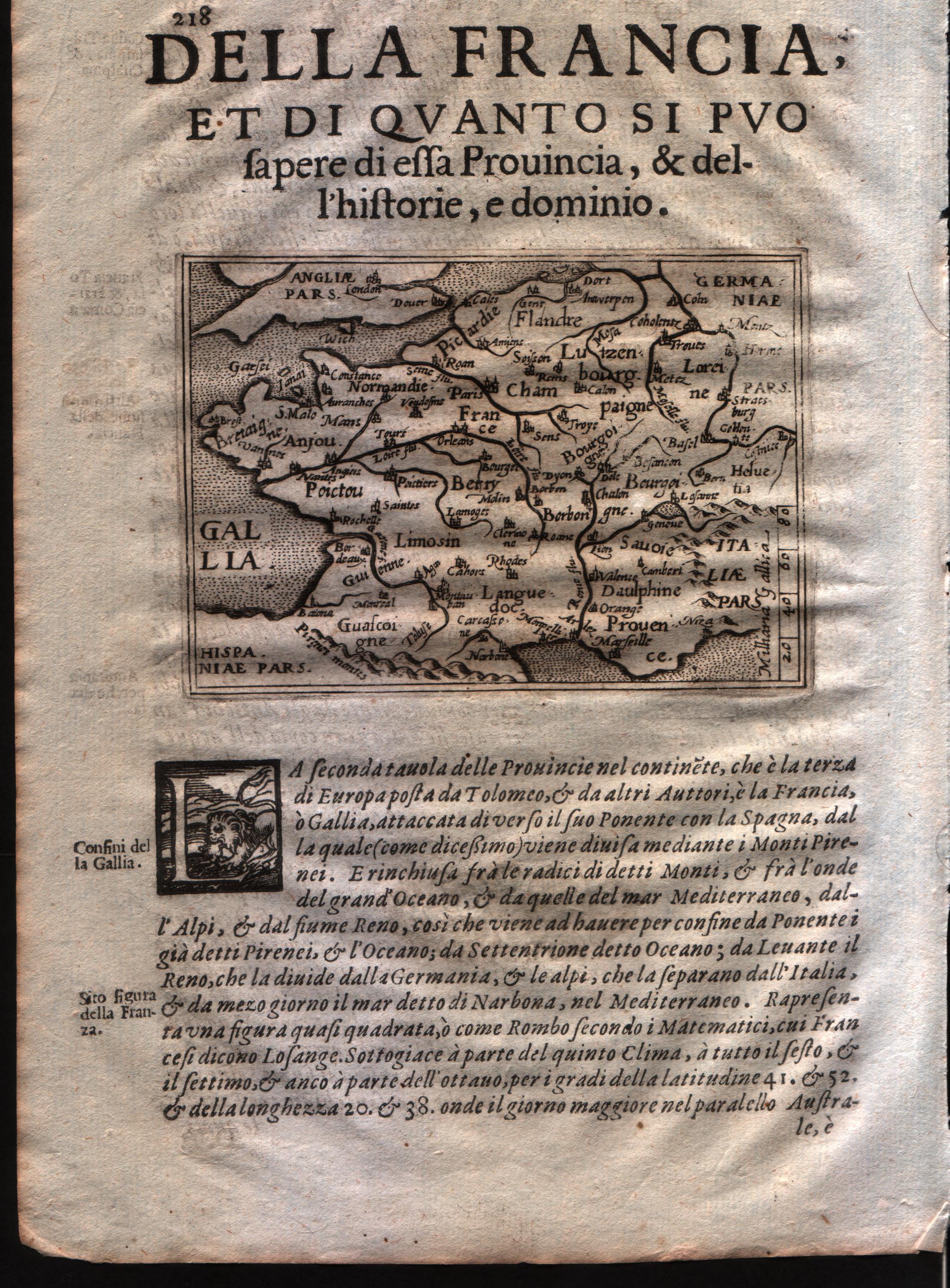
Map title
Gallia
Author
Doglioni
Location shown in map
France
Edition date
1623
Edition place
Venice
Editor
Giacomo Sarzina
Atlas
Anfiteatro di Europa
Price
Please ask: info@thetreasuremaps.com
State
[mint/EXCELLENT/very good/good/fair/mediocre/poor]
Color
Black/white
Verso
Italian text pag.218
Size
Plate: cm (11.4 x 8.9) inches (4.49 x 3.5) Paper: cm (15.2 x 22.9) inches (5.98 x 9.02)
Technique
Copper engraving
Note
The maps are copies of the Galle (c.1595) edition of Ortelius.
Reference
--
Wiki
Here for more info
In stock
Available
Info
info@thetreasuremaps.com
Code
#0585
×
![]()
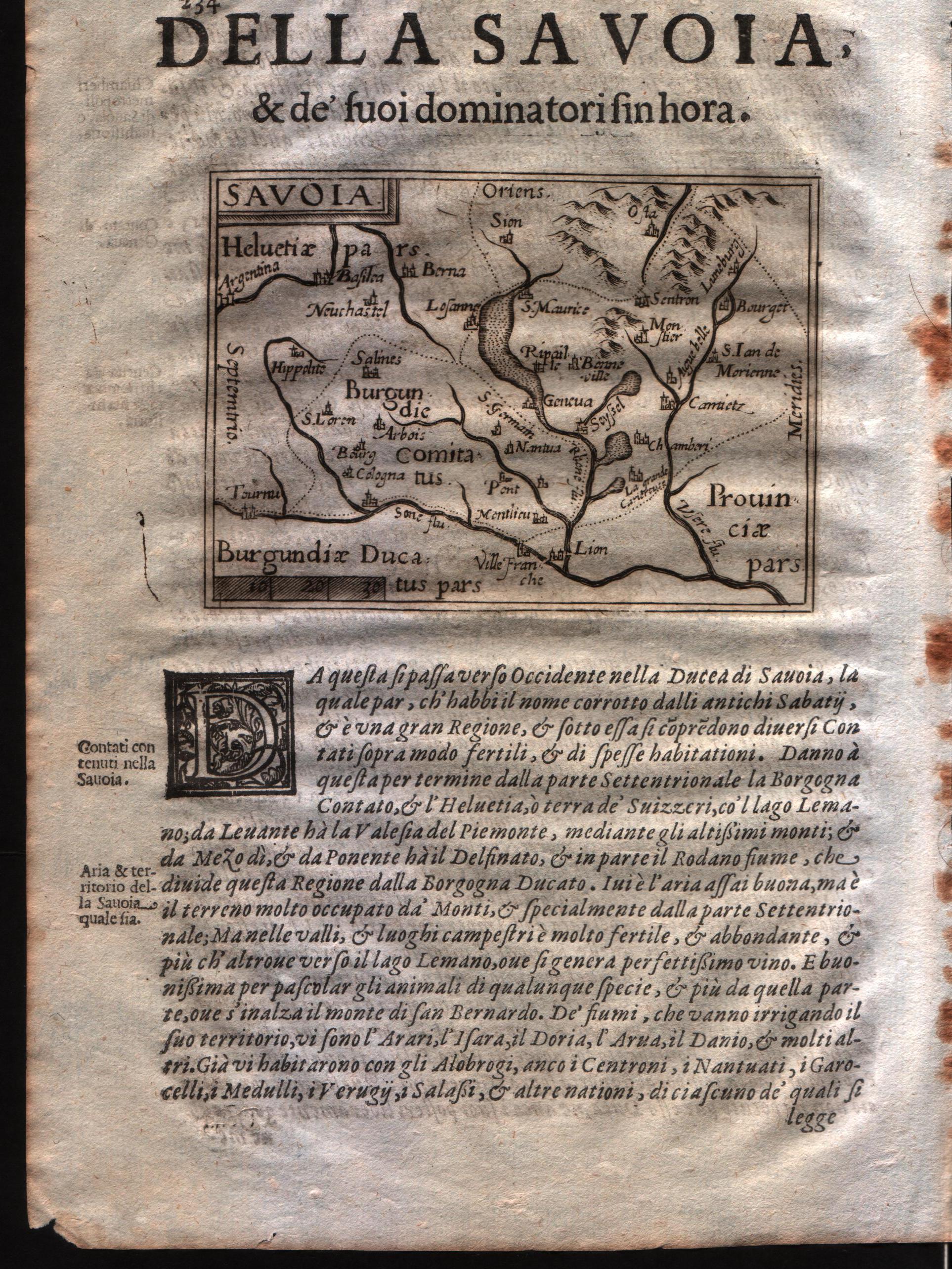
Map title
Savoia
Author
Doglioni
Location shown in map
Savoie
Edition date
1623
Edition place
Venice
Editor
Giacomo Sarzina
Atlas
Anfiteatro di Europa
Price
Please ask: info@thetreasuremaps.com
State
[mint/EXCELLENT/very good/good/fair/mediocre/poor]
Color
Black/white
Verso
Italian text pag.234
Size
Plate: cm (11.4 x 8.9) inches (4.49 x 3.5) Paper: cm (15.2 x 22.9) inches (5.98 x 9.02)
Technique
Copper engraving
Note
The maps are copies of the Galle (c.1595) edition of Ortelius.
Reference
--
Wiki
Here for more info
In stock
Available
Info
info@thetreasuremaps.com
Code
#0586
×
![]()
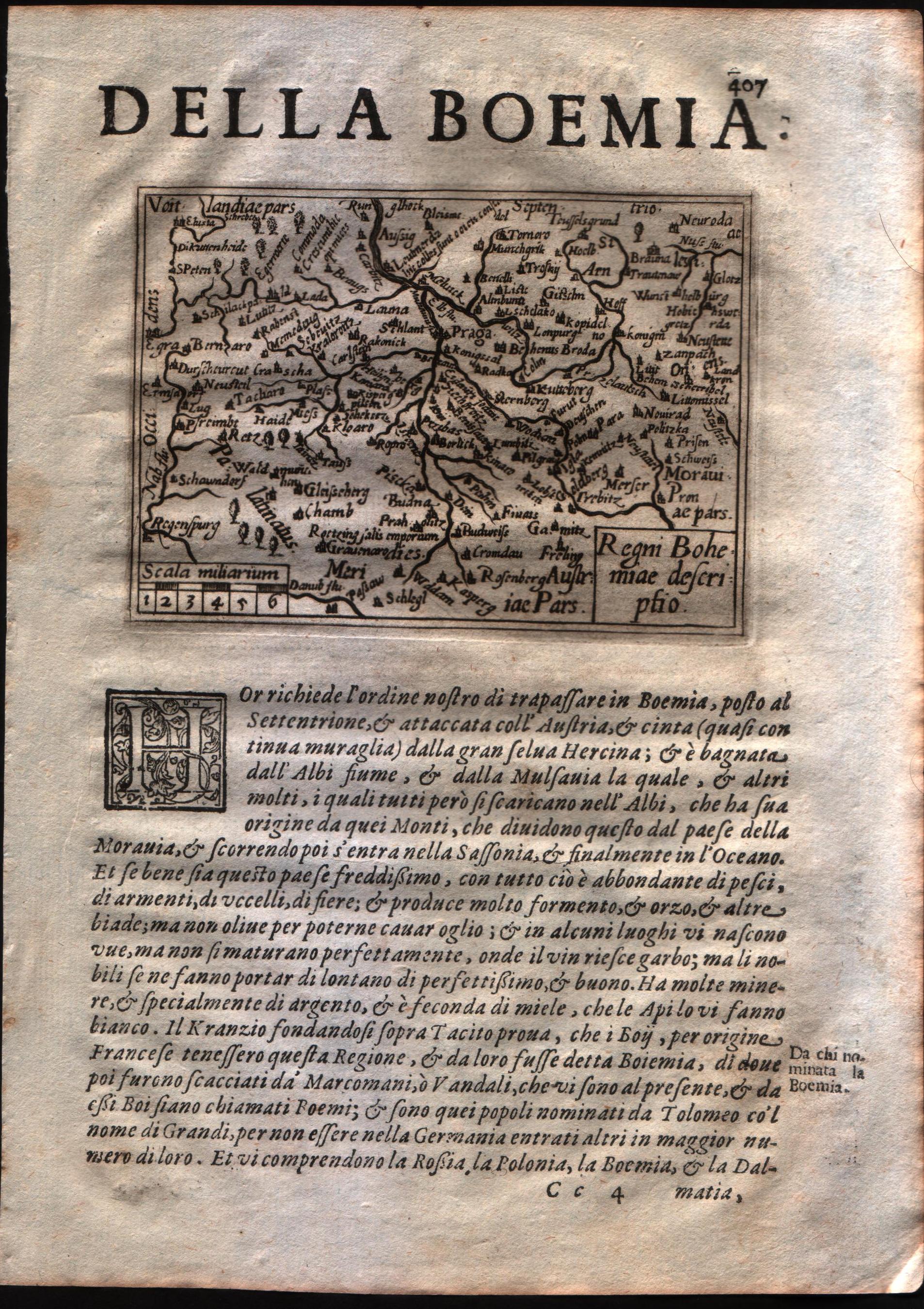
Map title
Regni Bohemie descriptio
Author
Doglioni
Location shown in map
Boemia
Edition date
1623
Edition place
Venice
Editor
Giacomo Sarzina
Atlas
Anfiteatro di Europa
Price
Please ask: info@thetreasuremaps.com
State
[mint/EXCELLENT/very good/good/fair/mediocre/poor]
Color
Black/white
Verso
Italian text pag.407
Size
Plate: cm (11.4 x 8.9) inches (4.49 x 3.5) Paper: cm (15.2 x 22.9) inches (5.98 x 9.02)
Technique
Copper engraving
Note
The maps are copies of the Galle (c.1595) edition of Ortelius.
Reference
--
Wiki
Here for more info
In stock
Available
Info
info@thetreasuremaps.com
Code
#0587
×
![]()
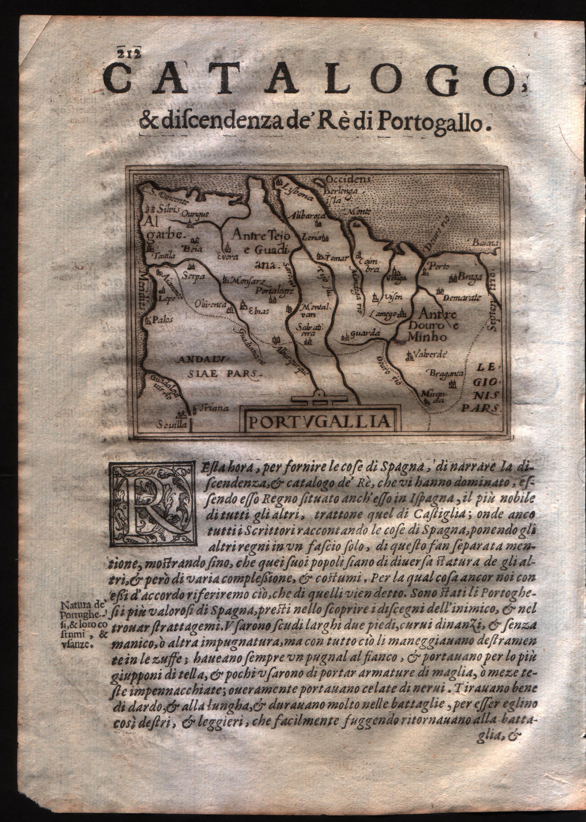
Map title
Portugallia
Author
Doglioni
Location shown in map
Portugal
Edition date
1623
Edition place
Venice
Editor
Giacomo Sarzina
Atlas
Anfiteatro di Europa
Price
Please ask: info@thetreasuremaps.com
State
[mint/EXCELLENT/very good/good/fair/mediocre/poor]
Color
Black/white
Verso
Italian text pag.212
Size
Plate: cm (11.4 x 8.9) inches (4.49 x 3.5) Paper: cm (15.2 x 22.9) inches (5.98 x 9.02)
Technique
Copper engraving
Note
The maps are copies of the Galle (c.1595) edition of Ortelius.
Reference
--
Wiki
Here for more info
In stock
Available
Info
info@thetreasuremaps.com
Code
#0588
×
![]()
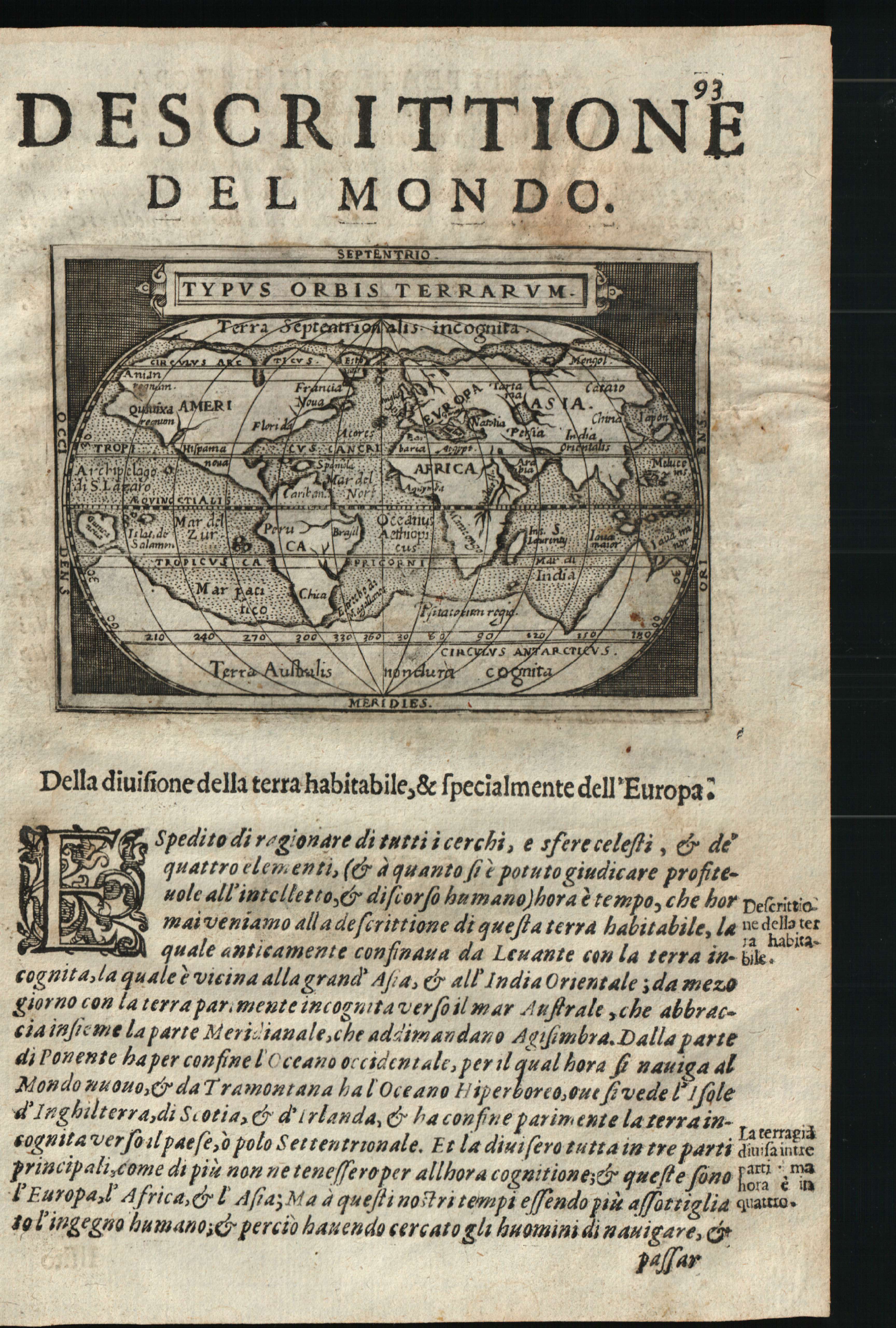
Map title
Descrittione del mondo
Author
Doglioni
Location shown in map
World
Edition date
1623
Edition place
Venice
Editor
Giacomo Sarzina
Atlas
Anfiteatro di Europa
Price
600 Euro
State
[mint/EXCELLENT/very good/good/fair/mediocre/poor]
Color
Black/white
Verso
Italian text pag.94
Size
Plate: cm (11.4 x 8.9) inches (4.49 x 3.5) Paper: cm (15.2 x 22.9) inches (5.98 x 9.02)
Technique
Copper engraving
Note
The maps are copies of the Galle (c.1595) edition of Ortelius.
Reference
--
Wiki
Here for more info
In stock
Available
Info
info@thetreasuremaps.com
Code
#0602
×
![]()
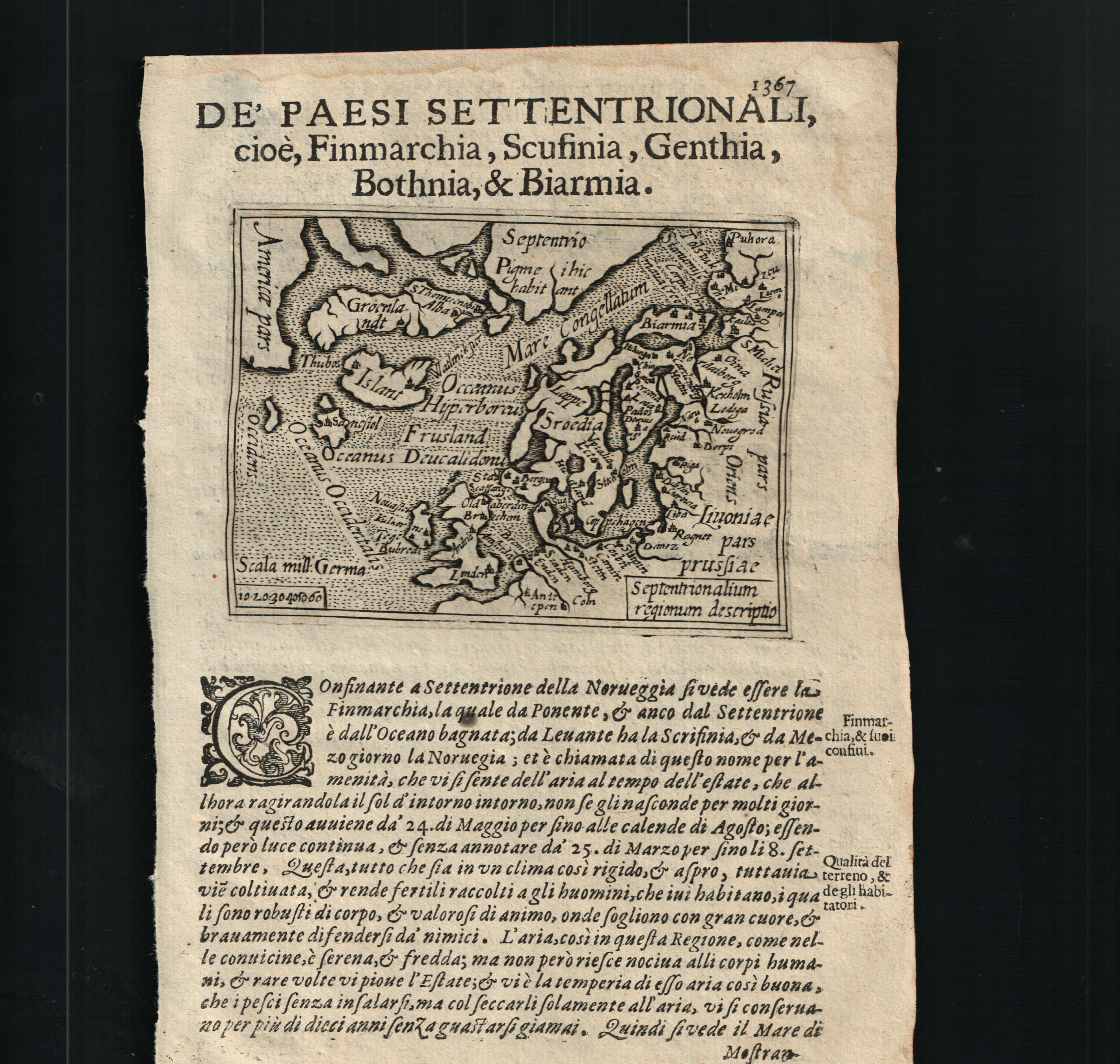
Map title
Septentrionalium regnorum descriptio
Author
Doglioni
Location shown in map
Scandinavia
Edition date
1623
Edition place
Venice
Editor
Giacomo Sarzina
Atlas
Anfiteatro di Europa
Price
700 Euro
State
[mint/EXCELLENT/very good/good/fair/mediocre/poor]
Color
Black/white
Verso
Italian text pag.1368
Size
Plate: cm (11.4 x 8.9) inches (4.49 x 3.5) Paper: cm (15.2 x 22.9) inches (5.98 x 9.02)
Technique
Copper engraving
Note
The maps are copies of the Galle (c.1595) edition of Ortelius.
Reference
--
Wiki
Here for more info
In stock
Available
Info
info@thetreasuremaps.com
Code
#0603
×
![]()
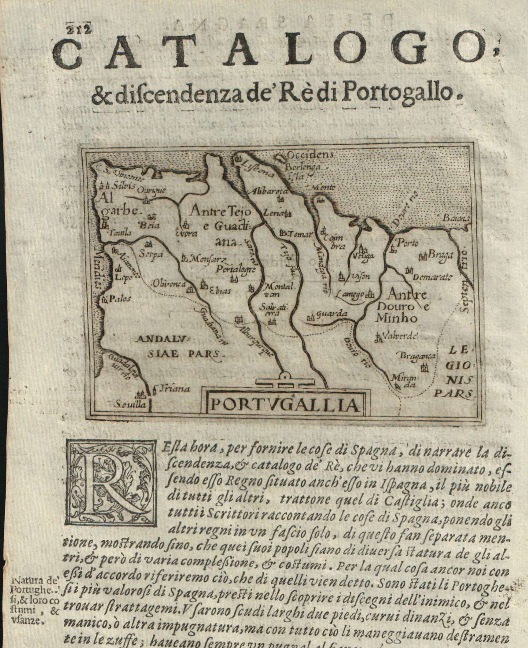
Map title
Portugallia
Author
Doglioni
Location shown in map
Portugal
Edition date
1623
Edition place
Venice
Editor
Giacomo Sarzina
Atlas
Anfiteatro di Europa
Price
Please ask: info@thetreasuremaps.com
State
[mint/EXCELLENT/very good/good/fair/mediocre/poor]
Color
Black/white
Verso
Italian text pag.211
Size
Plate: cm (11.4 x 8.9) inches (4.49 x 3.5) Paper: cm (15.2 x 22.9) inches (5.98 x 9.02)
Technique
Copper engraving
Note
The maps are copies of the Galle (c.1595) edition of Ortelius.
Reference
--
Wiki
Here for more info
In stock
Available
Info
info@thetreasuremaps.com
Code
#0608
×
![]()
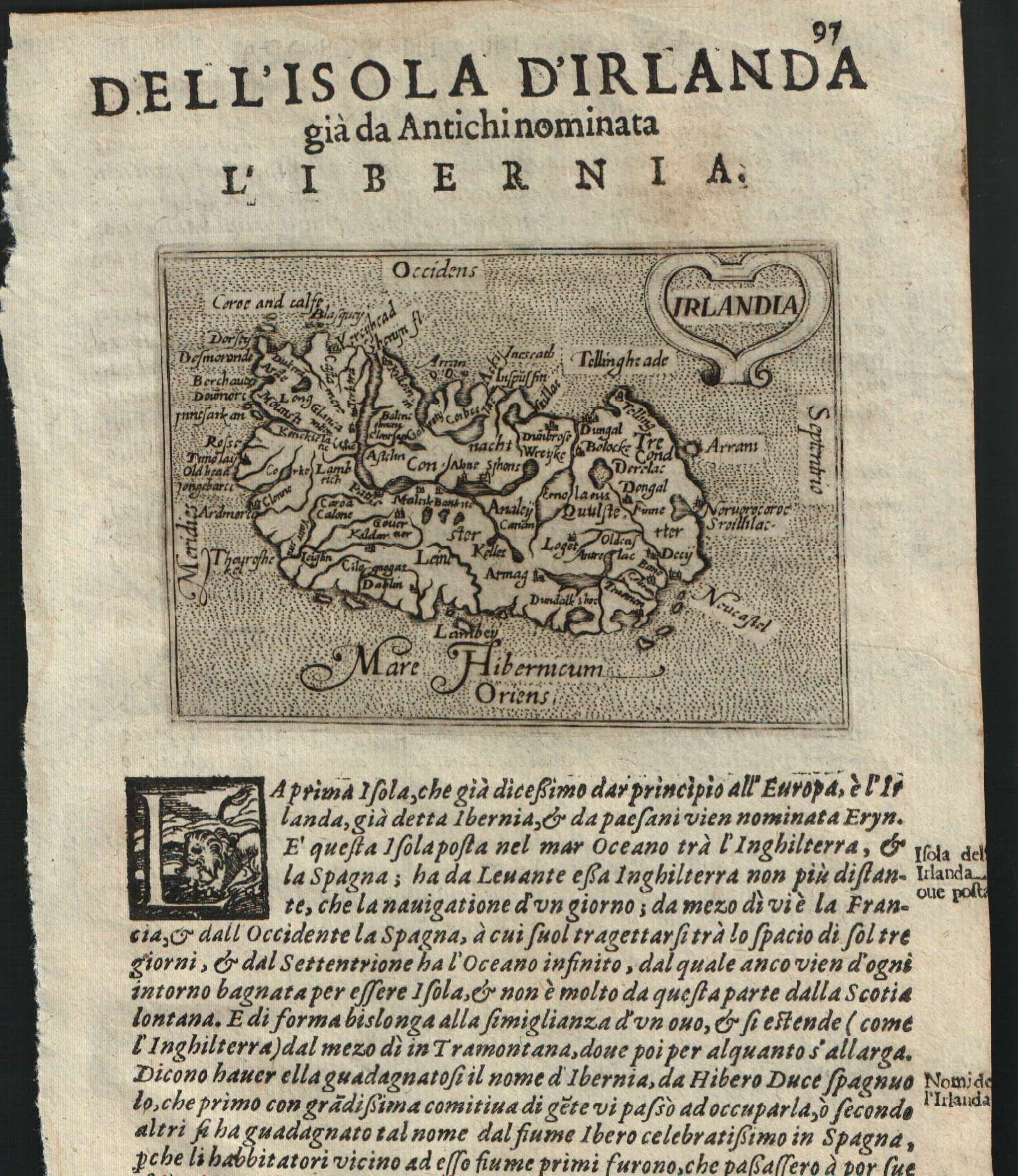
Map title
Irlandia
Author
Doglioni
Location shown in map
Ireland
Edition date
1623
Edition place
Venice
Editor
Giacomo Sarzina
Atlas
Anfiteatro di Europa
Price
Please ask: info@thetreasuremaps.com
State
[mint/EXCELLENT/very good/good/fair/mediocre/poor]
Color
Black/white
Verso
Italian text pag.98
Size
Plate: cm (11.4 x 8.9) inches (4.49 x 3.5) Paper: cm (15.2 x 22.9) inches (5.98 x 9.02)
Technique
Copper engraving
Note
The maps are copies of the Galle (c.1595) edition of Ortelius.
Reference
--
Wiki
Here for more info
In stock
Sold
Info
info@thetreasuremaps.com
Code
#0609
×
![]()
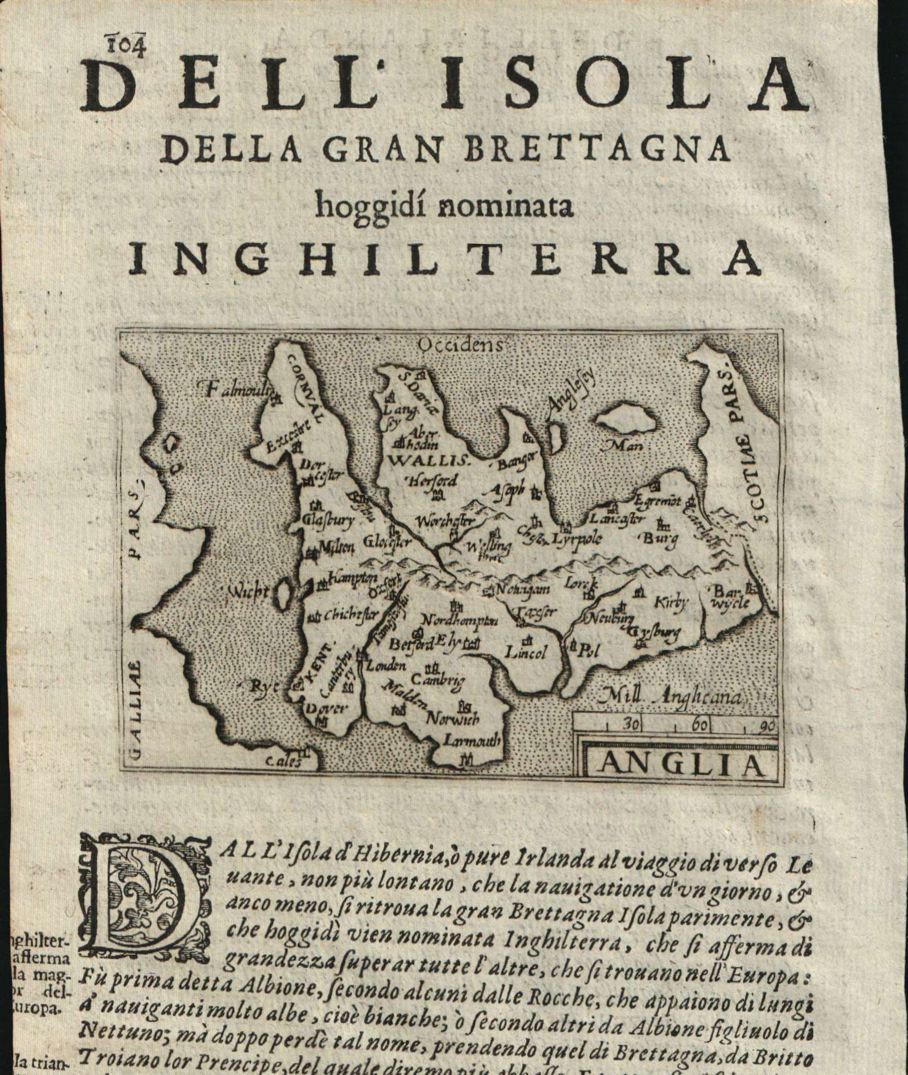
Map title
Anglia
Author
Doglioni
Location shown in map
England
Edition date
1623
Edition place
Venice
Editor
Giacomo Sarzina
Atlas
Anfiteatro di Europa
Price
900 Euro
State
[mint/EXCELLENT/very good/good/fair/mediocre/poor]
Color
Black/white
Verso
Italian text pag.103
Size
Plate: cm (11.4 x 8.9) inches (4.49 x 3.5) Paper: cm (15.2 x 22.9) inches (5.98 x 9.02)
Technique
Copper engraving
Note
The maps are copies of the Galle (c.1595) edition of Ortelius.
Reference
--
Wiki
Here for more info
In stock
Available
Info
info@thetreasuremaps.com
Code
#0610
×
![]()
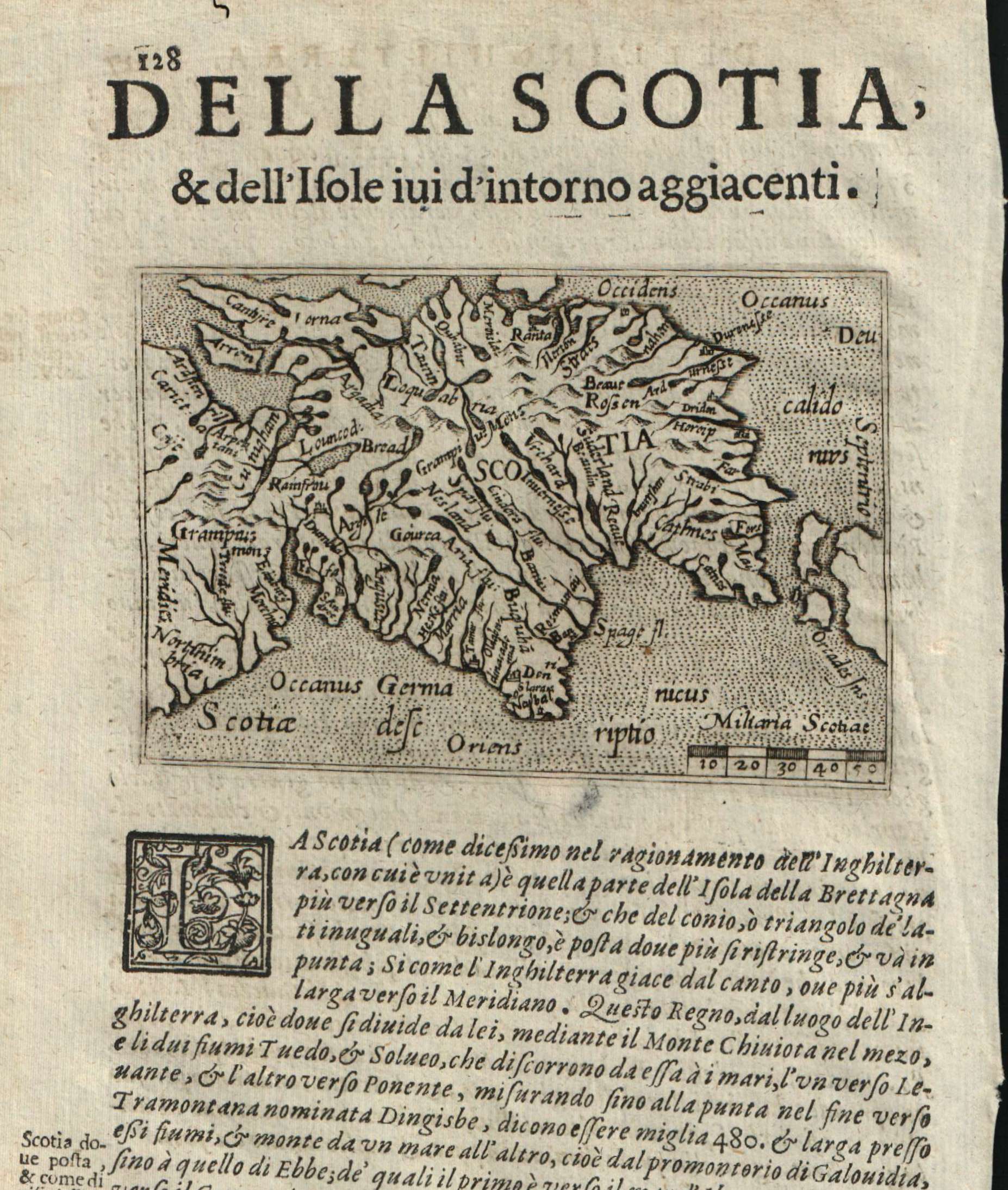
Map title
Scotiae
Author
Doglioni
Location shown in map
Scotland
Edition date
1623
Edition place
Venice
Editor
Giacomo Sarzina
Atlas
Anfiteatro di Europa
Price
Please ask: info@thetreasuremaps.com
State
[mint/EXCELLENT/very good/good/fair/mediocre/poor]
Color
Black/white
Verso
Italian text pag.127
Size
Plate: cm (11.4 x 8.9) inches (4.49 x 3.5) Paper: cm (15.2 x 22.9) inches (5.98 x 9.02)
Technique
Copper engraving
Note
The maps are copies of the Galle (c.1595) edition of Ortelius.
Reference
--
Wiki
Here for more info
In stock
Available
Info
info@thetreasuremaps.com
Code
#0611
×
![]()
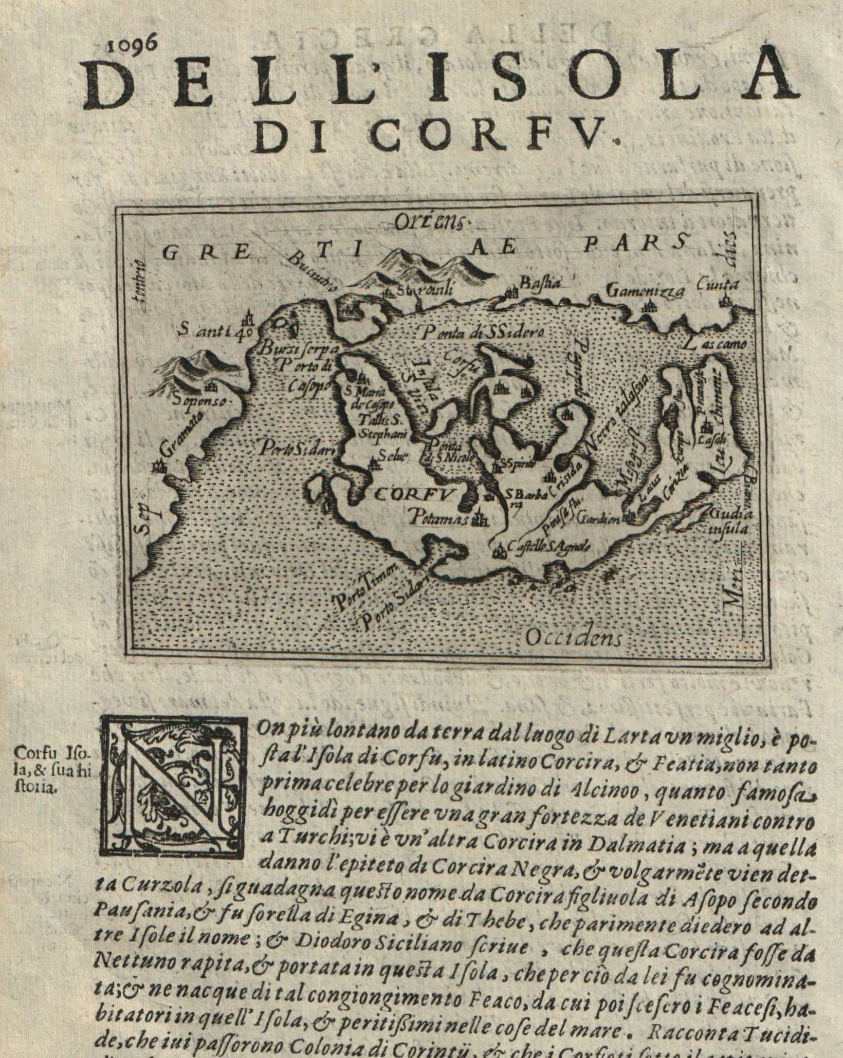
Map title
Corfu
Author
Doglioni
Location shown in map
Corfu
Edition date
1623
Edition place
Venice
Editor
Giacomo Sarzina
Atlas
Anfiteatro di Europa
Price
Please ask: info@thetreasuremaps.com
State
[mint/EXCELLENT/very good/good/fair/mediocre/poor]
Color
Black/white
Verso
Italian text pag.1095
Size
Plate: cm (11.4 x 8.9) inches (4.49 x 3.5) Paper: cm (15.2 x 22.9) inches (5.98 x 9.02)
Technique
Copper engraving
Note
The maps are copies of the Galle (c.1595) edition of Ortelius.
Reference
--
Wiki
Here for more info
In stock
Available
Info
info@thetreasuremaps.com
Code
#0612
Corfu
Author
Doglioni
Location shown in map
Corfu
Edition date
1623
Edition place
Venice
Editor
Giacomo Sarzina
Atlas
Anfiteatro di Europa
Price
Please ask: info@thetreasuremaps.com
State
[mint/EXCELLENT/very good/good/fair/mediocre/poor]
Color
Black/white
Verso
Italian text pag.1095
Size
Plate: cm (11.4 x 8.9) inches (4.49 x 3.5) Paper: cm (15.2 x 22.9) inches (5.98 x 9.02)
Technique
Copper engraving
Note
The maps are copies of the Galle (c.1595) edition of Ortelius.
Reference
--
Wiki
Here for more info
In stock
Available
Info
info@thetreasuremaps.com
Code
#0612
×
![]()
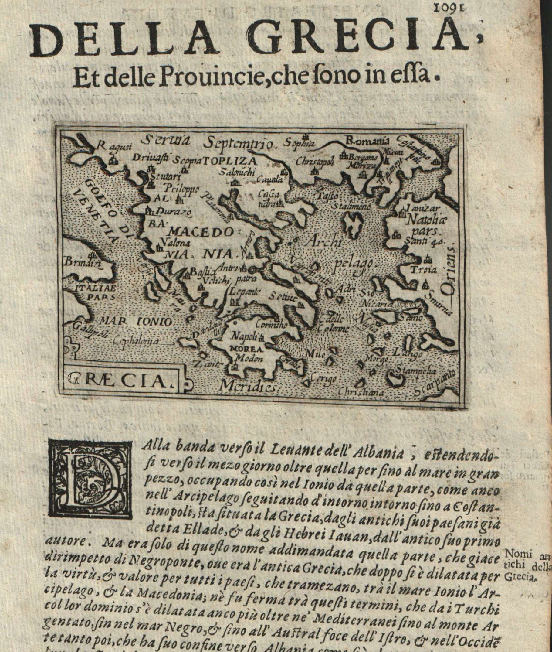
Map title
Graecia
Author
Doglioni
Location shown in map
Greece
Edition date
1623
Edition place
Venice
Editor
Giacomo Sarzina
Atlas
Anfiteatro di Europa
Price
Please ask: info@thetreasuremaps.com
State
[mint/EXCELLENT/very good/good/fair/mediocre/poor]
Color
Black/white
Verso
Italian text pag.1092
Size
Plate: cm (11.4 x 8.9) inches (4.49 x 3.5) Paper: cm (15.2 x 22.9) inches (5.98 x 9.02)
Technique
Copper engraving
Note
The maps are copies of the Galle (c.1595) edition of Ortelius.
Reference
--
Wiki
Here for more info
In stock
Available
Info
info@thetreasuremaps.com
Code
#0613
×
![]()
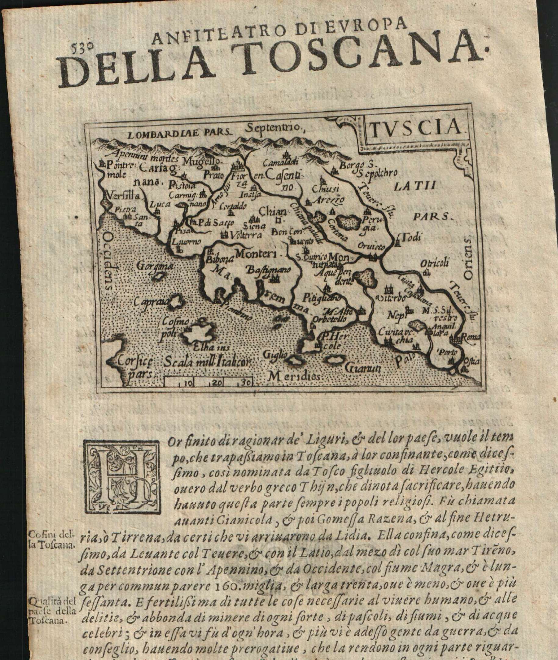
Map title
Tuscia
Author
Doglioni
Location shown in map
Tuscany
Edition date
1623
Edition place
Venice
Editor
Giacomo Sarzina
Atlas
Anfiteatro di Europa
Price
Please ask: info@thetreasuremaps.com
State
[mint/EXCELLENT/very good/good/fair/mediocre/poor]
Color
Black/white
Verso
Italian text pag.529
Size
Plate: cm (11.4 x 8.9) inches (4.49 x 3.5) Paper: cm (15.2 x 22.9) inches (5.98 x 9.02)
Technique
Copper engraving
Note
The maps are copies of the Galle (c.1595) edition of Ortelius.
Reference
--
Wiki
Here for more info
In stock
Available
Info
info@thetreasuremaps.com
Code
#0614
×
![]()
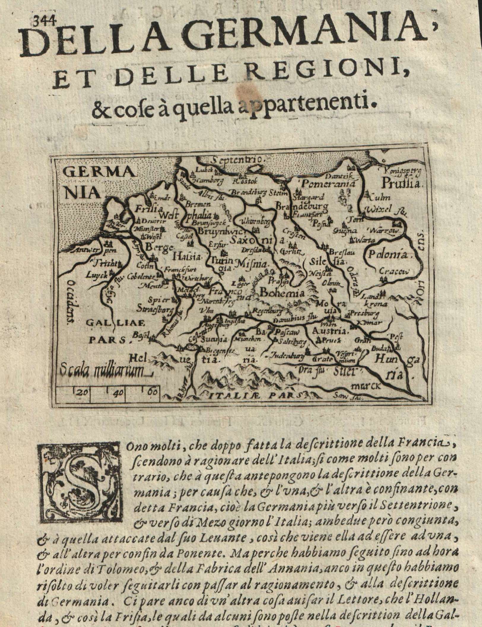
Map title
Germania
Author
Doglioni
Location shown in map
Germany
Edition date
1623
Edition place
Venice
Editor
Giacomo Sarzina
Atlas
Anfiteatro di Europa
Price
Please ask: info@thetreasuremaps.com
State
[mint/EXCELLENT/very good/good/fair/mediocre/poor]
Color
Black/white
Verso
Italian text pag.343
Size
Plate: cm (11.4 x 8.9) inches (4.49 x 3.5) Paper: cm (15.2 x 22.9) inches (5.98 x 9.02)
Technique
Copper engraving
Note
The maps are copies of the Galle (c.1595) edition of Ortelius.
Reference
--
Wiki
Here for more info
In stock
Available
Info
info@thetreasuremaps.com
Code
#0615
×
![]()
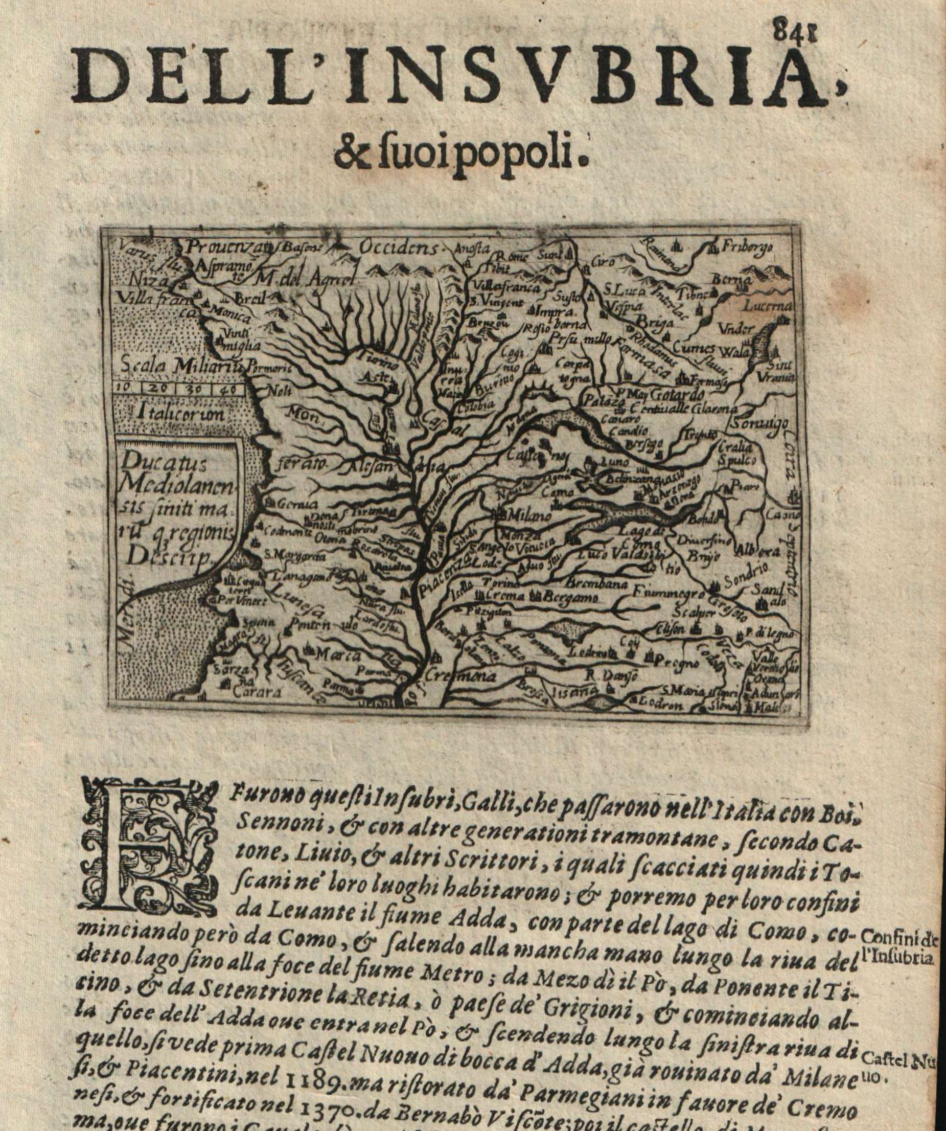
Map title
Ducatus Mediolanensis
Author
Doglioni
Location shown in map
Liguria
Edition date
1623
Edition place
Venice
Editor
Giacomo Sarzina
Atlas
Anfiteatro di Europa
Price
400 Euro
State
[mint/EXCELLENT/very good/good/fair/mediocre/poor]
Color
Black/white
Verso
Italian text pag.842
Size
Plate: cm (11.4 x 8.9) inches (4.49 x 3.5) Paper: cm (15.2 x 22.9) inches (5.98 x 9.02)
Technique
Copper engraving
Note
The maps are copies of the Galle (c.1595) edition of Ortelius.
Reference
--
Wiki
Here for more info
In stock
Available
Info
info@thetreasuremaps.com
Code
#0623
×
![]()
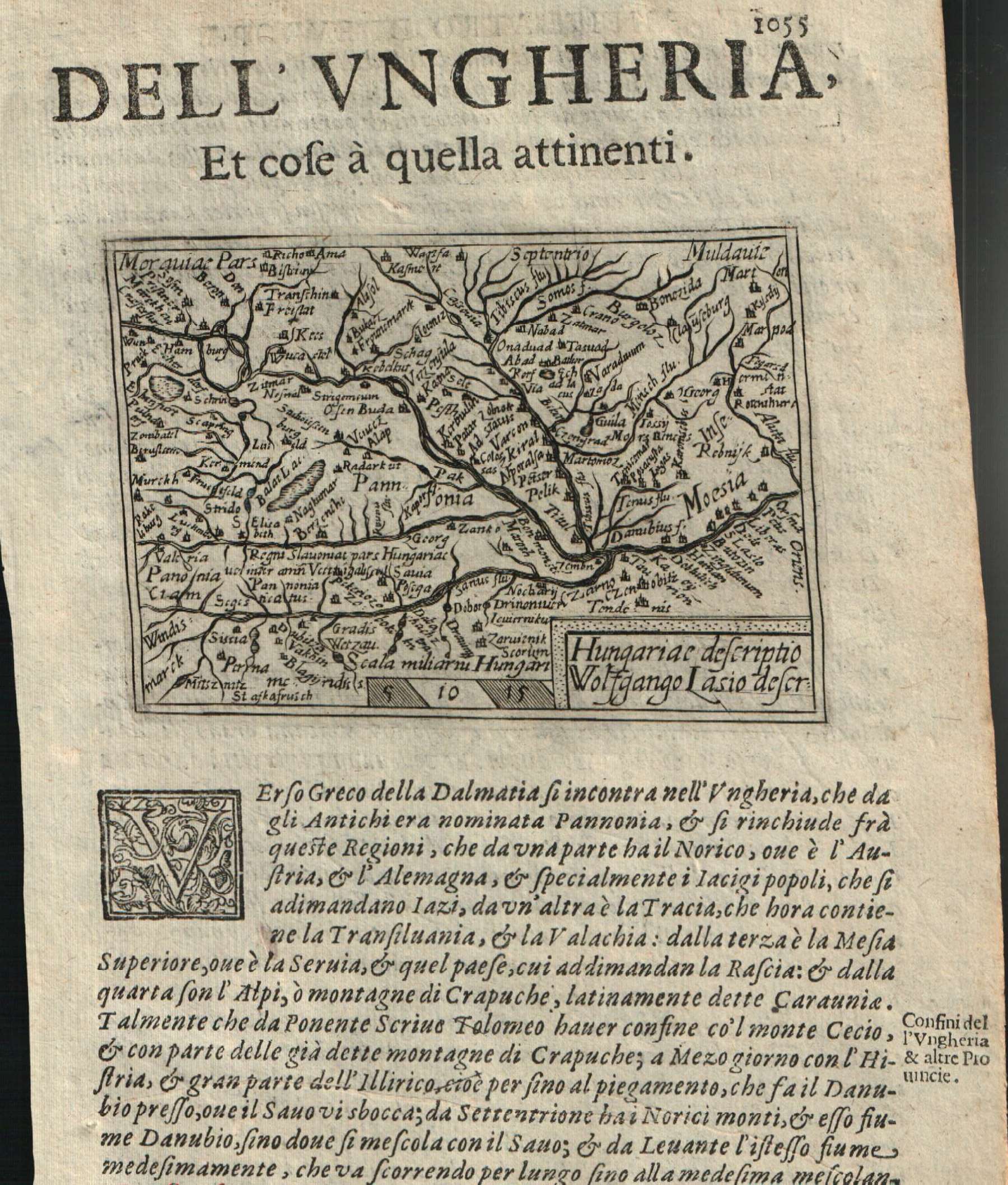
Map title
Hungaric descriptio
Author
Doglioni
Location shown in map
Hungary
Edition date
1623
Edition place
Venice
Editor
Giacomo Sarzina
Atlas
Anfiteatro di Europa
Price
Please ask: info@thetreasuremaps.com
State
[mint/EXCELLENT/very good/good/fair/mediocre/poor]
Color
Black/white
Verso
Italian text pag.1056
Size
Plate: cm (11.4 x 8.9) inches (4.49 x 3.5) Paper: cm (15.2 x 22.9) inches (5.98 x 9.02)
Technique
Copper engraving
Note
The maps are copies of the Galle (c.1595) edition of Ortelius.
Reference
--
Wiki
Here for more info
In stock
Available
Info
info@thetreasuremaps.com
Code
#0617
×
![]()
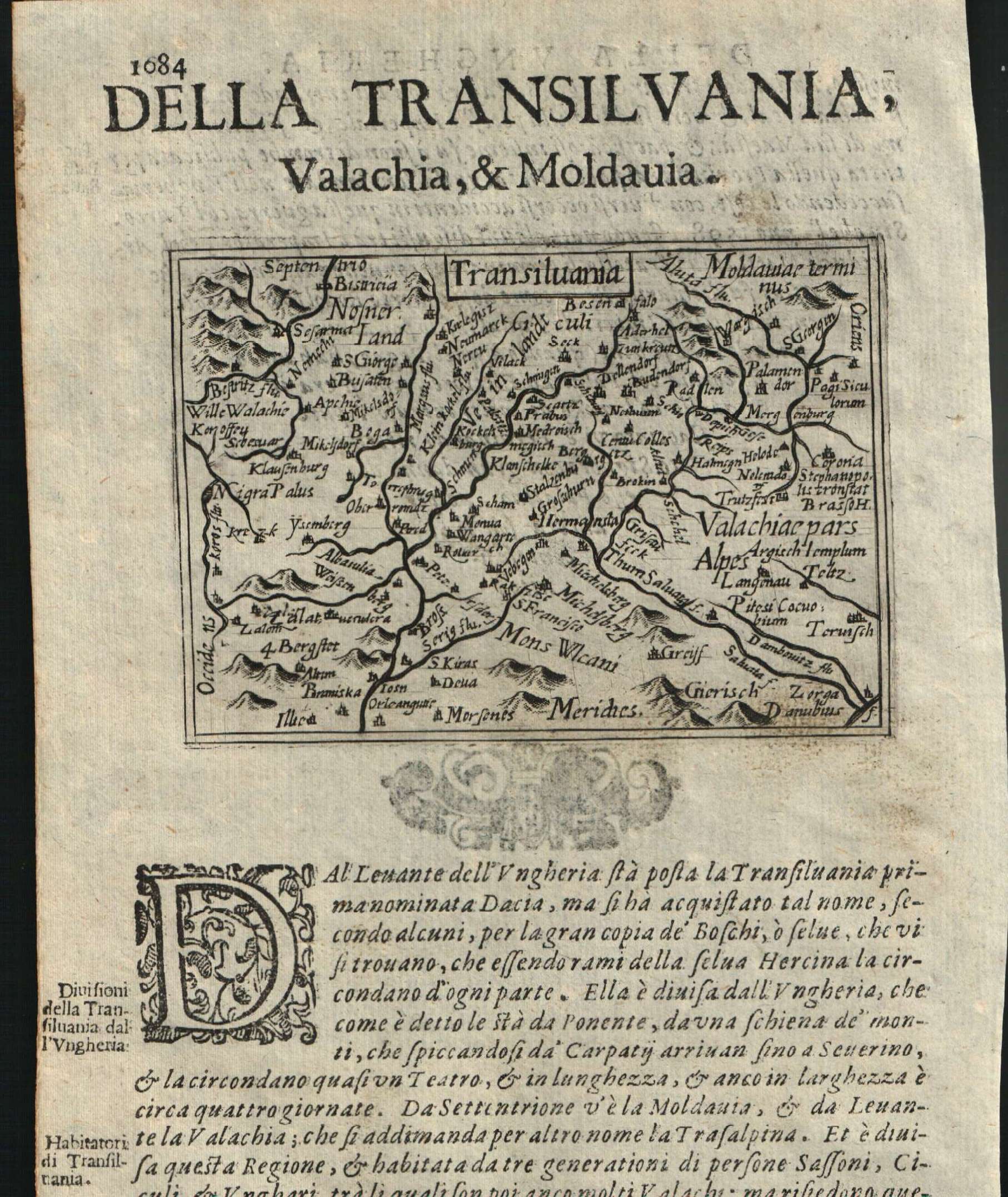
Map title
Transilvania
Author
Doglioni
Location shown in map
Transylvania
Edition date
1623
Edition place
Venice
Editor
Giacomo Sarzina
Atlas
Anfiteatro di Europa
Price
Please ask: info@thetreasuremaps.com
State
[mint/EXCELLENT/very good/good/fair/mediocre/poor]
Color
Black/white
Verso
Italian text pag.1083
Size
Plate: cm (11.4 x 8.9) inches (4.49 x 3.5) Paper: cm (15.2 x 22.9) inches (5.98 x 9.02)
Technique
Copper engraving
Note
The maps are copies of the Galle (c.1595) edition of Ortelius.
Reference
--
Wiki
Here for more info
In stock
Available
Info
info@thetreasuremaps.com
Code
#0616
×
![]()
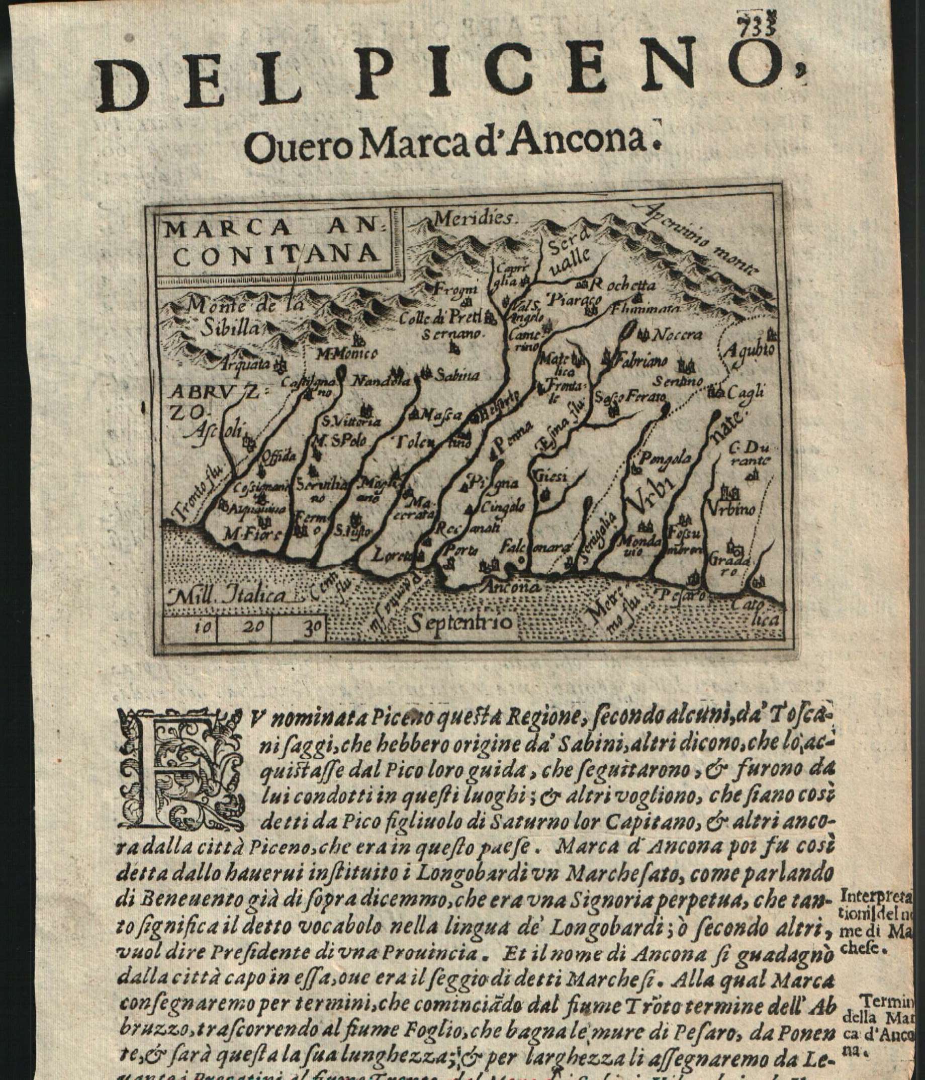
Map title
Marca Anconitana
Author
Doglioni
Location shown in map
Picenum
Edition date
1623
Edition place
Venice
Editor
Giacomo Sarzina
Atlas
Anfiteatro di Europa
Price
Please ask: info@thetreasuremaps.com
State
[mint/EXCELLENT/very good/good/fair/mediocre/poor]
Color
Black/white
Verso
Italian text pag.734
Size
Plate: cm (11.4 x 8.9) inches (4.49 x 3.5) Paper: cm (15.2 x 22.9) inches (5.98 x 9.02)
Technique
Copper engraving
Note
The maps are copies of the Galle (c.1595) edition of Ortelius.
Reference
--
Wiki
Here for more info
In stock
Available
Info
info@thetreasuremaps.com
Code
#0622
×
![]()
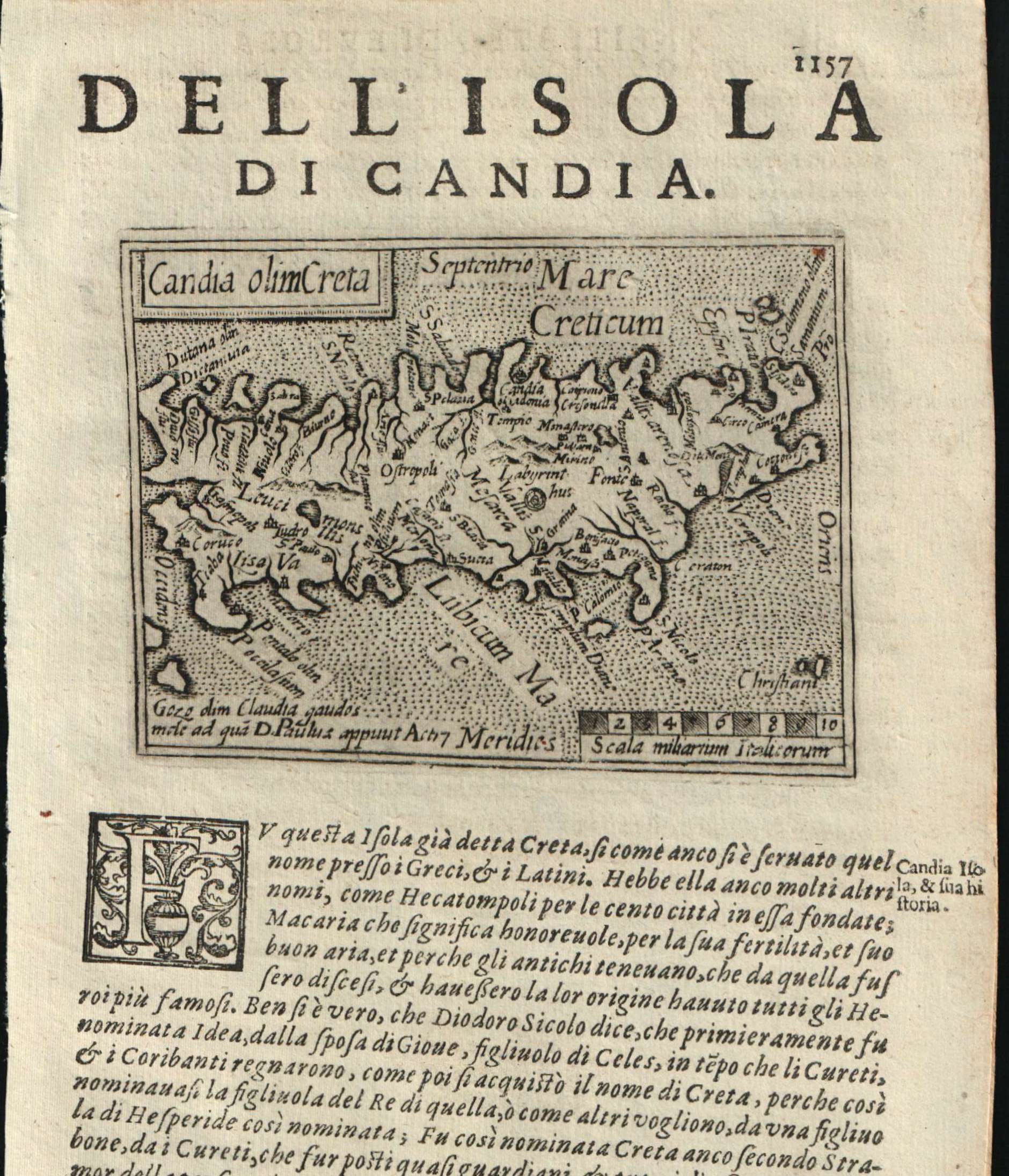
Map title
Candia olim Creta
Author
Doglioni
Location shown in map
Crete
Edition date
1623
Edition place
Venice
Editor
Giacomo Sarzina
Atlas
Anfiteatro di Europa
Price
Please ask: info@thetreasuremaps.com
State
[mint/EXCELLENT/very good/good/fair/mediocre/poor]
Color
Black/white
Verso
Italian text pag.1158
Size
Plate: cm (11.4 x 8.9) inches (4.49 x 3.5) Paper: cm (15.2 x 22.9) inches (5.98 x 9.02)
Technique
Copper engraving
Note
The maps are copies of the Galle (c.1595) edition of Ortelius.
Reference
--
Wiki
Here for more info
In stock
Available
Info
info@thetreasuremaps.com
Code
#0621
×
![]()
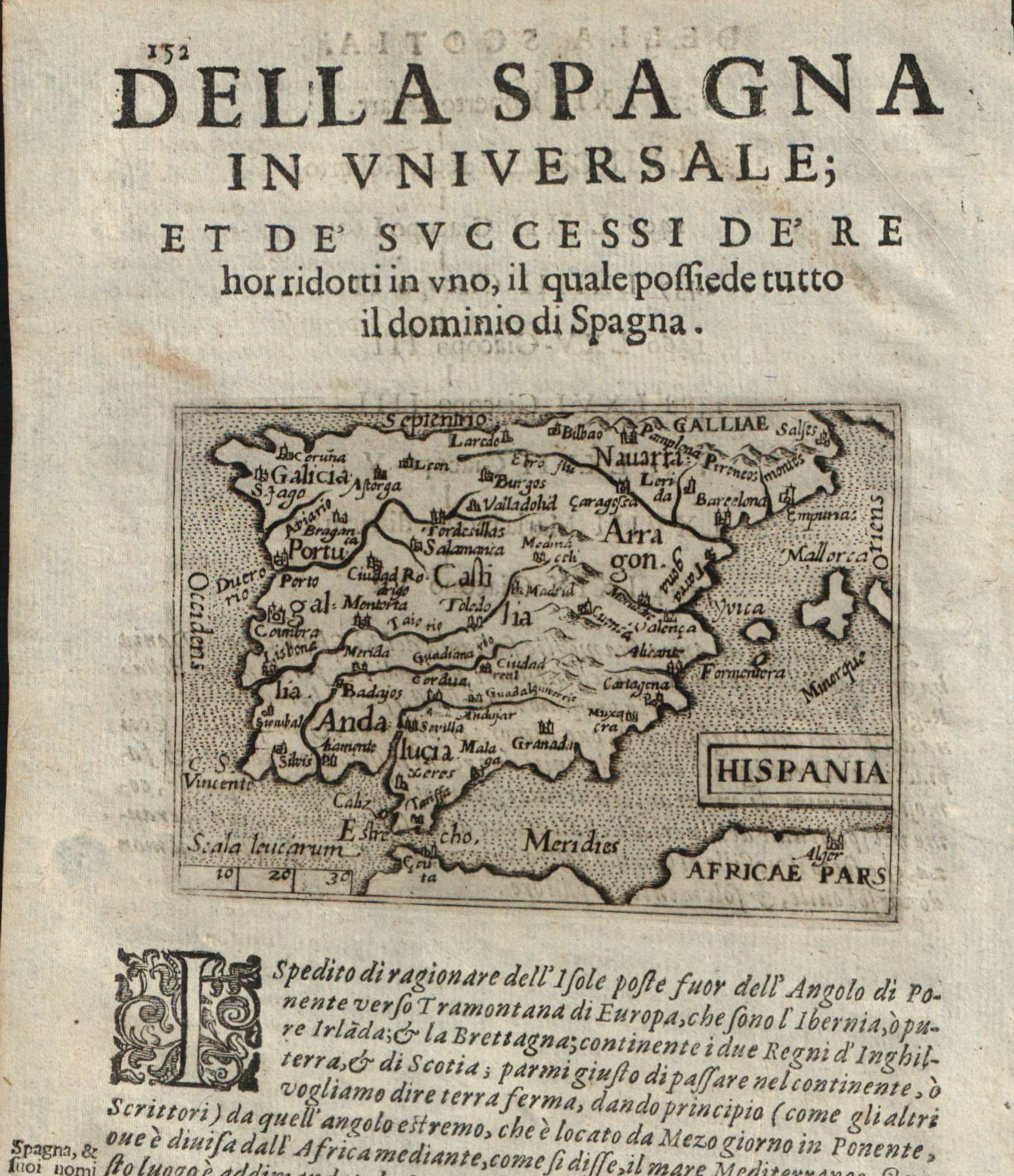
Map title
Hispania
Author
Doglioni
Location shown in map
Spain
Edition date
1623
Edition place
Venice
Editor
Giacomo Sarzina
Atlas
Anfiteatro di Europa
Price
Please ask: info@thetreasuremaps.com
State
[mint/EXCELLENT/very good/good/fair/mediocre/poor]
Color
Black/white
Verso
Italian text pag.151
Size
Plate: cm (11.4 x 8.9) inches (4.49 x 3.5) Paper: cm (15.2 x 22.9) inches (5.98 x 9.02)
Technique
Copper engraving
Note
The maps are copies of the Galle (c.1595) edition of Ortelius.
Reference
--
Wiki
Here for more info
In stock
Available
Info
info@thetreasuremaps.com
Code
#0620
×
![]()
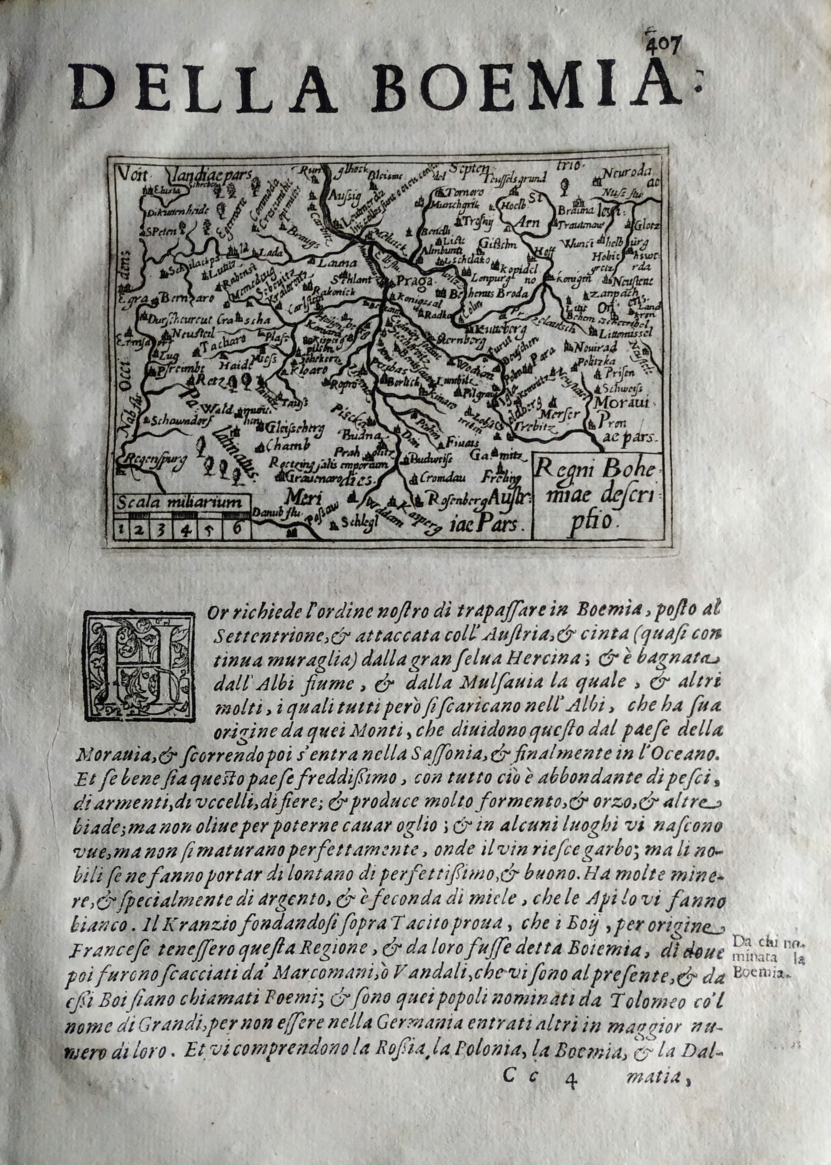
Map title
Regni Bohemie descriptio
Author
Doglioni
Location shown in map
Boemia
Edition date
1623
Edition place
Venice
Editor
Giacomo Sarzina
Atlas
Anfiteatro di Europa
Price
Please ask: info@thetreasuremaps.com
State
[mint/EXCELLENT/very good/good/fair/mediocre/poor]
Color
Black/white
Verso
Italian text pag.407
Size
Plate: cm (11.4 x 8.9) inches (4.49 x 3.5) Paper: cm (15.2 x 22.9) inches (5.98 x 9.02)
Technique
Copper engraving
Note
The maps are copies of the Galle (c.1595) edition of Ortelius.
Reference
--
Wiki
Here for more info
In stock
Available
Info
info@thetreasuremaps.com
Code
#0771
×
![]()
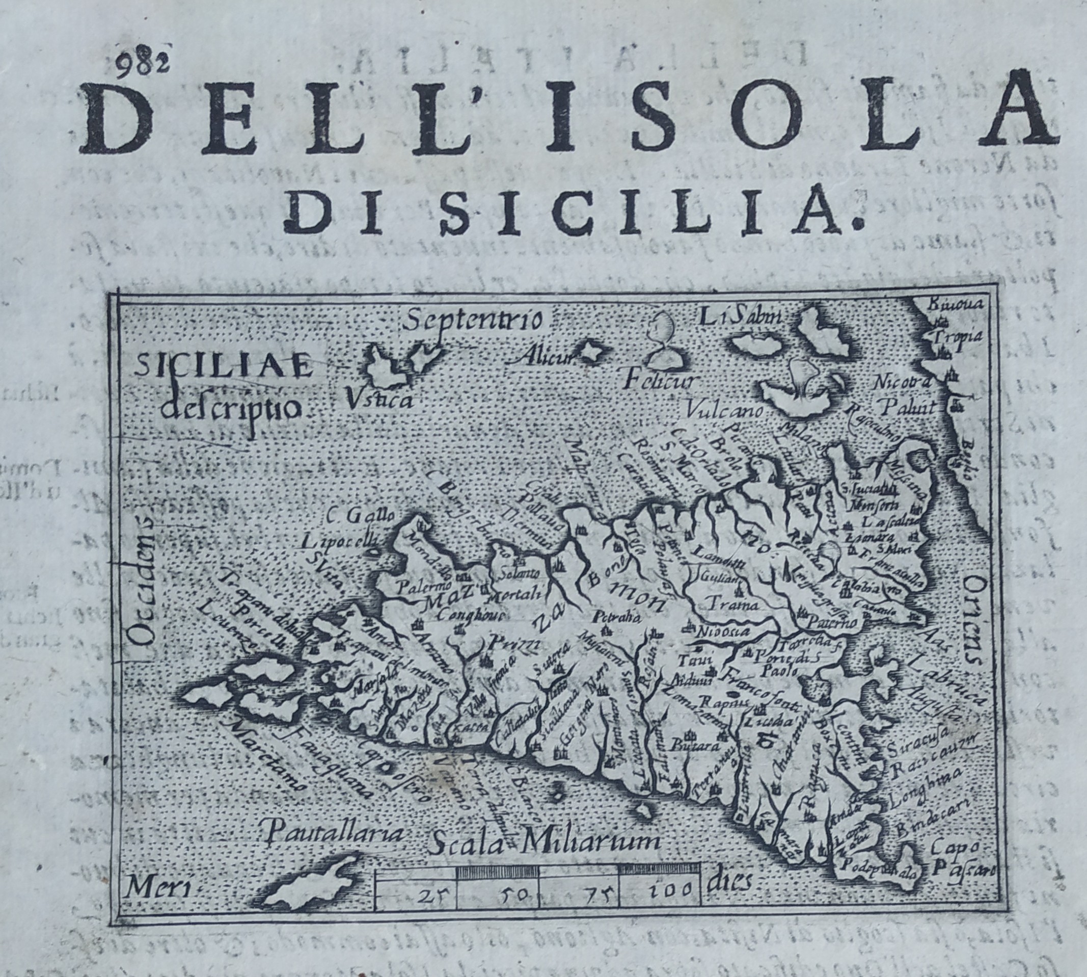
Map title
Dell'isola di Sicilia
Author
Doglioni
Location shown in map
Sicily
Edition date
1623
Edition place
Venice
Editor
Giacomo Sarzina
Atlas
Anfiteatro di Europa
Price
400 Euro
State
[mint/EXCELLENT/very good/good/fair/mediocre/poor]
Color
Black/white
Verso
Italian text pag.981
Size
Plate: cm (11.4 x 8.9) inches (4.49 x 3.5) Paper: cm (15.2 x 22.9) inches (5.98 x 9.02)
Technique
Copper engraving
Note
The maps are copies of the Galle (c.1595) edition of Ortelius.
Reference
--
Wiki
Here for more info
In stock
Available
Info
info@thetreasuremaps.com
Code
#0775
×
![]()
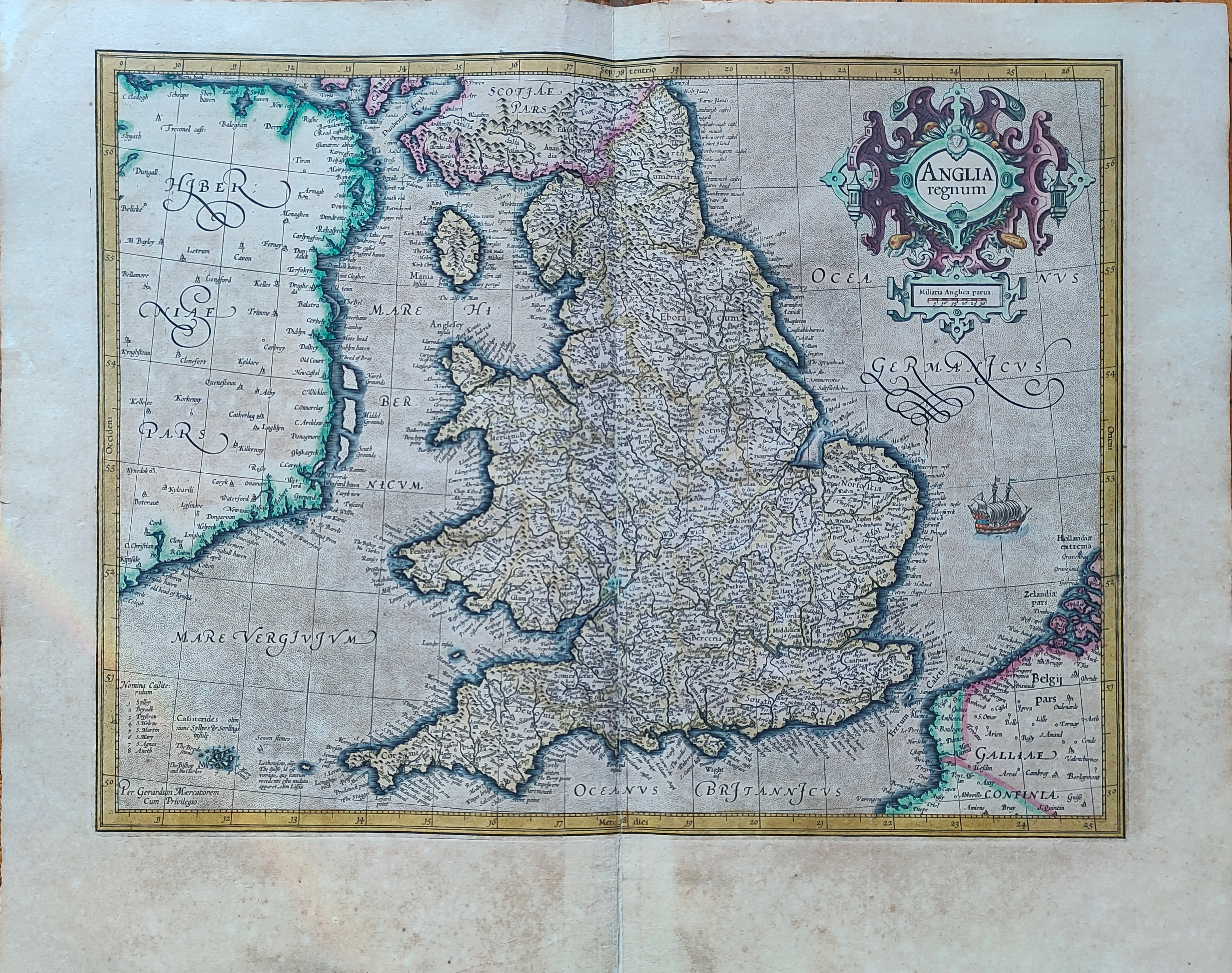
Map title
Anglia regnum
Author
Mercator
Location shown in map
England
Edition date
Circa 1623
Edition place
Amsterdam
Editor
Houndius
Atlas
Mercator-Hondius Atlas.
Price
400 Euro
State
[mint/EXCELLENT/very good/good/fair/mediocre/poor]
Color
Old colors
Verso
Franch text 117
Size
Plate: cm (46 x 36) inches (18.11 x 14.17) Paper: cm (56 x 44) inches (22.05 x 17.32)
Technique
Copper engraving
Note
Reference
Wiki
Here for more info
In stock
Available
Info
info@thetreasuremaps.com
Code
#1195
×
![]()
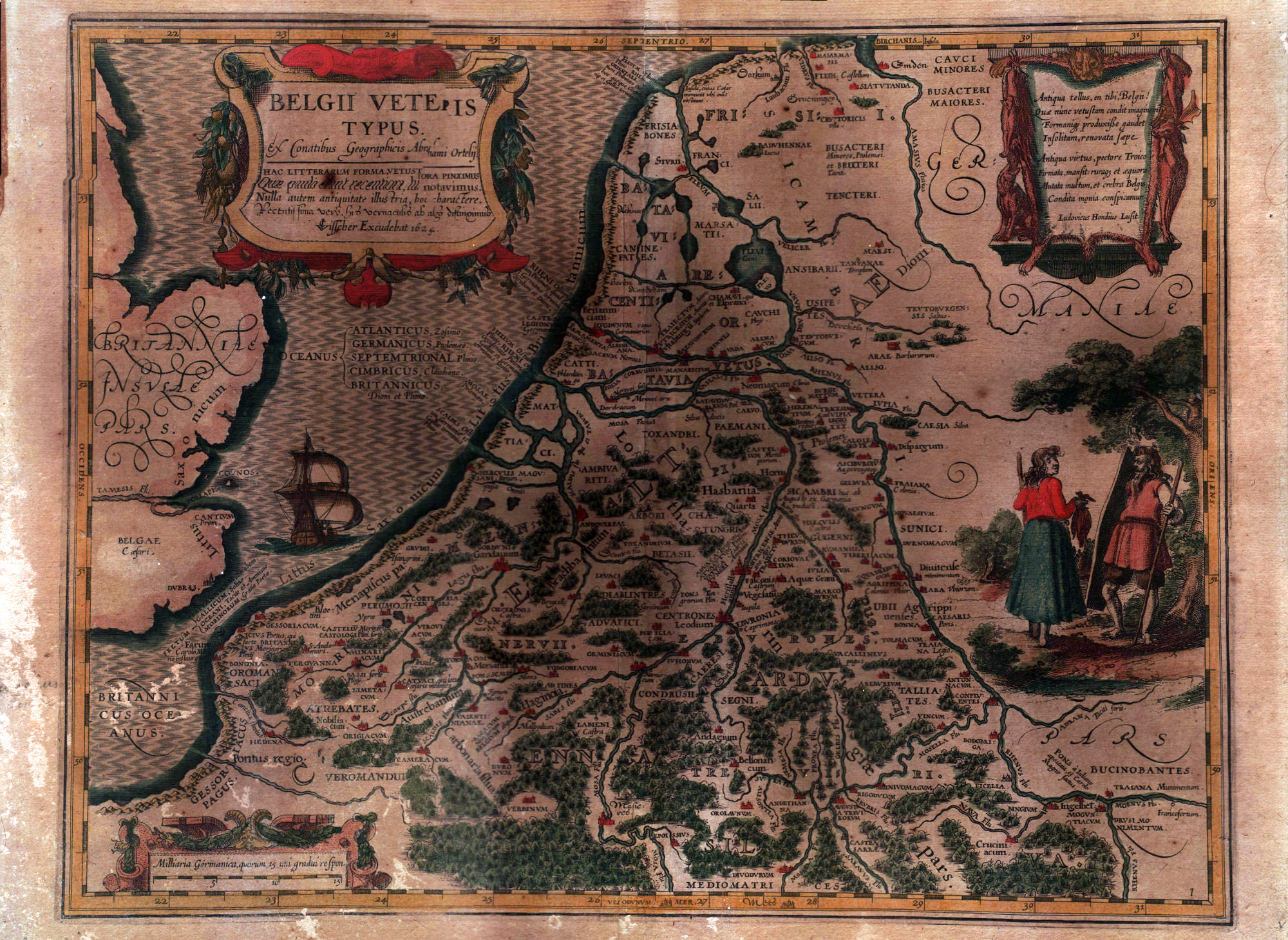
Map title
Belgii veteris typus
Author
Ortelius
Location shown in map
Belgium
Edition date
1624
Edition place
Amsterdam
Editor
--
Atlas
--
Price
Please ask: info@thetreasuremaps.com
State
[mint/excellent/very good/good/FAIR/mediocre/poor]
Color
Old colors
Verso
Blank
Size
Plate: cm (48.3 x 38.1) inches (19.02 x 15) Paper: cm (55.9 x 43.2) inches (22.01 x 17.01)
Technique
Copper engraving
Note
Glued to a cardboard
Reference
--
Wiki
Here for more info
In stock
Available
Info
info@thetreasuremaps.com
Code
#0567
×
![]()
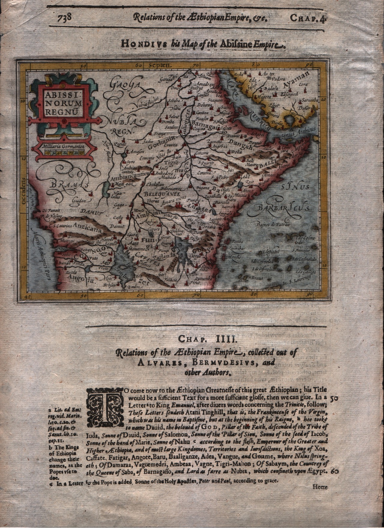
Map title
Abissinorum regnum
Author
Mercator
Location shown in map
East Africa
Edition date
1625
Edition place
London
Editor
--
Atlas
Purchas his Pilgrimes
Price
250 Euro
State
[mint/EXCELLENT/very good/good/fair/mediocre/poor]
Color
Modern colors
Verso
English text
Size
Plate: cm (17.8 x 14) inches (7.01 x 5.51) Paper: cm (21.6 x 33) inches (8.5 x 12.99)
Technique
Copper engraving
Note
No particular notes for this maps
Reference
--
Wiki
Here for more info
In stock
Available
Info
info@thetreasuremaps.com
Code
#0293
×
![]()
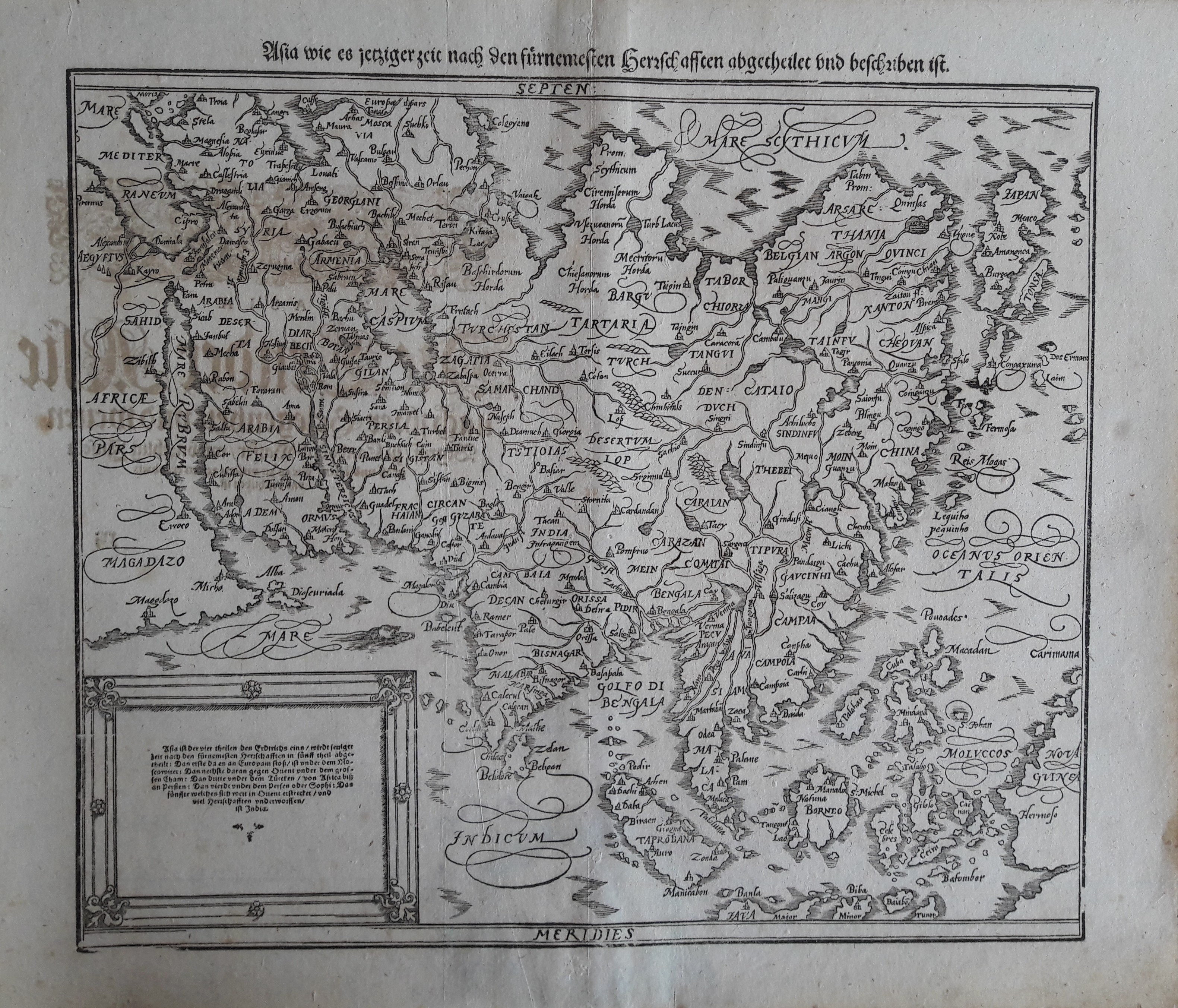
Map title
Asia
Author
Munster
Location shown in map
Asia
Edition date
1628
Edition place
Basel
Editor
Henrich Petri
Atlas
Cosmographia Universalis
Price
600 Euro
State
[mint/excellent/VERY GOOD/good/fair/mediocre/poor]
Color
Black/white
Verso
German text
Size
Plate: cm (35.6 x 30.5) inches (14.02 x 12.01) Paper: cm (43.2 x 36.8) inches (17.01 x 14.49)
Technique
Woodcut
Note
--
Reference
--
Wiki
Here for more info
In stock
Available
Info
info@thetreasuremaps.com
Code
#0213
Asia
Author
Munster
Location shown in map
Asia
Edition date
1628
Edition place
Basel
Editor
Henrich Petri
Atlas
Cosmographia Universalis
Price
600 Euro
State
[mint/excellent/VERY GOOD/good/fair/mediocre/poor]
Color
Black/white
Verso
German text
Size
Plate: cm (35.6 x 30.5) inches (14.02 x 12.01) Paper: cm (43.2 x 36.8) inches (17.01 x 14.49)
Technique
Woodcut
Note
--
Reference
--
Wiki
Here for more info
In stock
Available
Info
info@thetreasuremaps.com
Code
#0213
×
![]()
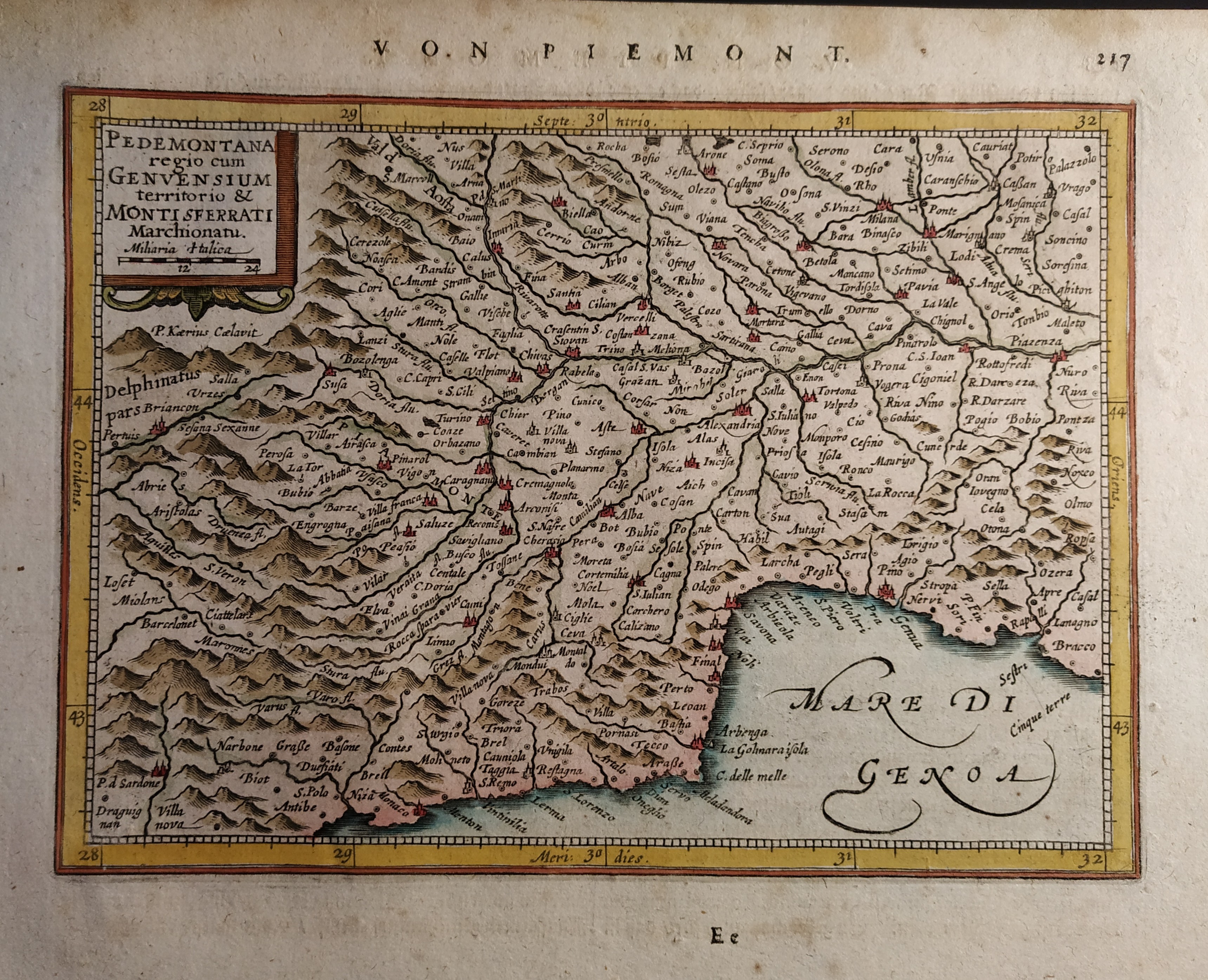
Map title
Pedemontana regio cum Genvensium territorio & Montisferrati marchionatu
Author
Mercator
Location shown in map
North-West Italy
Edition date
Circa 1628
Edition place
Amsterdam
Editor
Janssonius
Atlas
Altas Minor Gerardi Mercatoris
Price
150 Euro
State
[mint/EXCELLENT/very good/good/fair/mediocre/poor]
Color
Old colors
Verso
German text pag 218
Size
Plate: cm (19 x 14) inches (7.48 x 5.51) Paper: cm (23 x 19) inches (9.06 x 7.48)
Technique
Copper engraving
Note
No particular notes for this maps.
Reference
Wiki
Here for more info
In stock
Available
Info
info@thetreasuremaps.com
Code
#0660
×
![]()
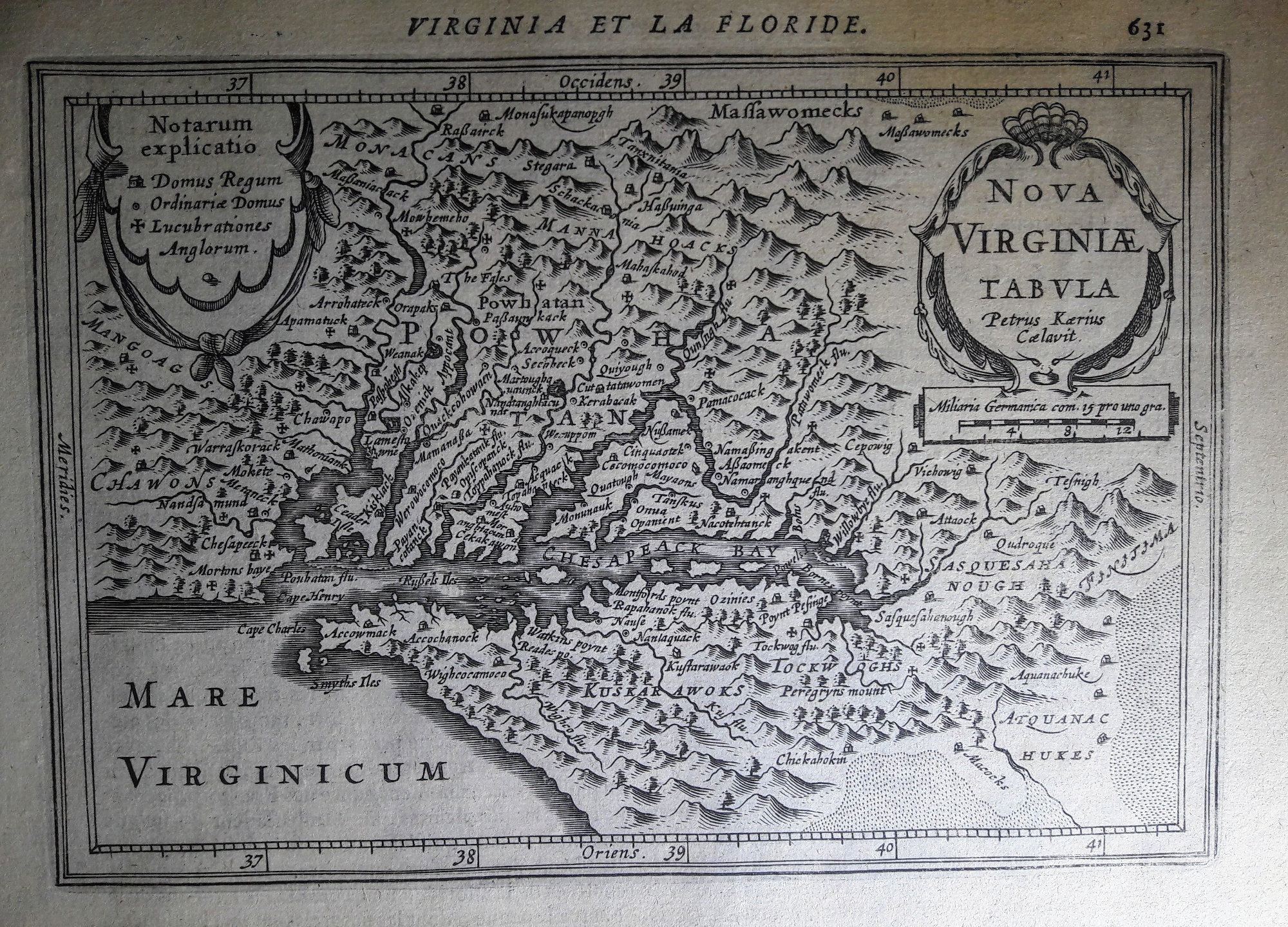
Map title
Nova Virginiae tabula
Author
Pieter van den Keere
Location shown in map
Virginiae
Edition date
1628
Edition place
Amsterdam
Editor
Janssonius
Atlas
Altas Minor Gerardi Mercatoris
Price
400 Euro
State
[mint/EXCELLENT/very good/good/fair/mediocre/poor]
Color
Black/white
Verso
French text pag.632
Size
Plate: cm (19 x 13) inches (7.48 x 5.12) Paper: cm (22 x 17) inches (8.66 x 6.69)
Technique
Copper engraving
Note
No particular notes for this maps.
Reference
--
Wiki
Here for more info
In stock
Available
Info
info@thetreasuremaps.com
Code
#0655
×
![]()
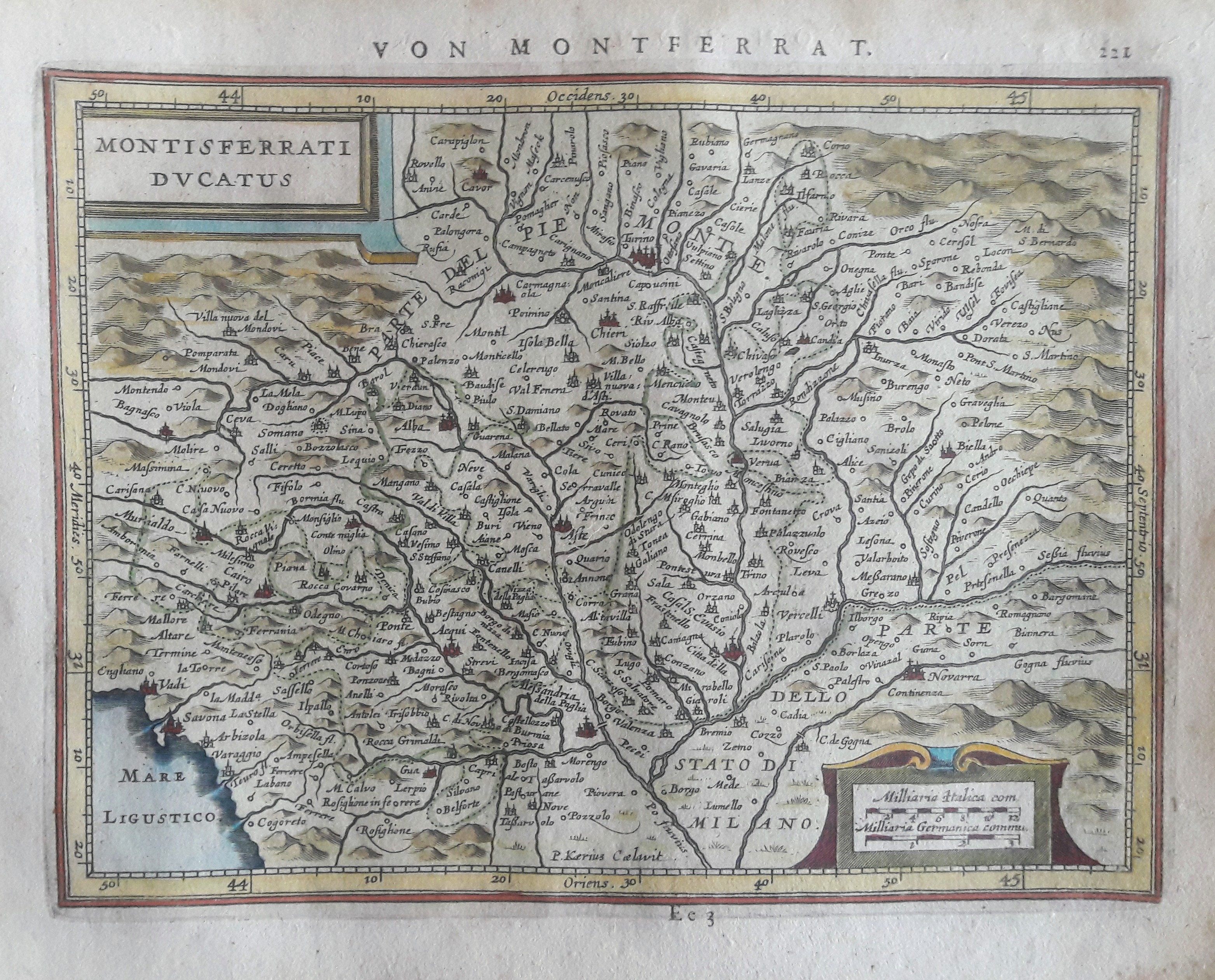
Map title
Montisferrati Ducatus
Author
Mercator
Location shown in map
North-West Italy
Edition date
Circa 1628
Edition place
Amsterdam
Editor
Janssonius
Atlas
Altas Minor Gerardi Mercatoris
Price
150 Euro
State
[mint/EXCELLENT/very good/good/fair/mediocre/poor]
Color
Old colors
Verso
German text 222
Size
Plate: cm (20 x 15) inches (7.87 x 5.91) Paper: cm (23 x 19) inches (9.06 x 7.48)
Technique
Copper engraving
Note
No particular notes for this maps.
Reference
Wiki
Here for more info
In stock
Available
Info
info@thetreasuremaps.com
Code
#0661
×
![]()
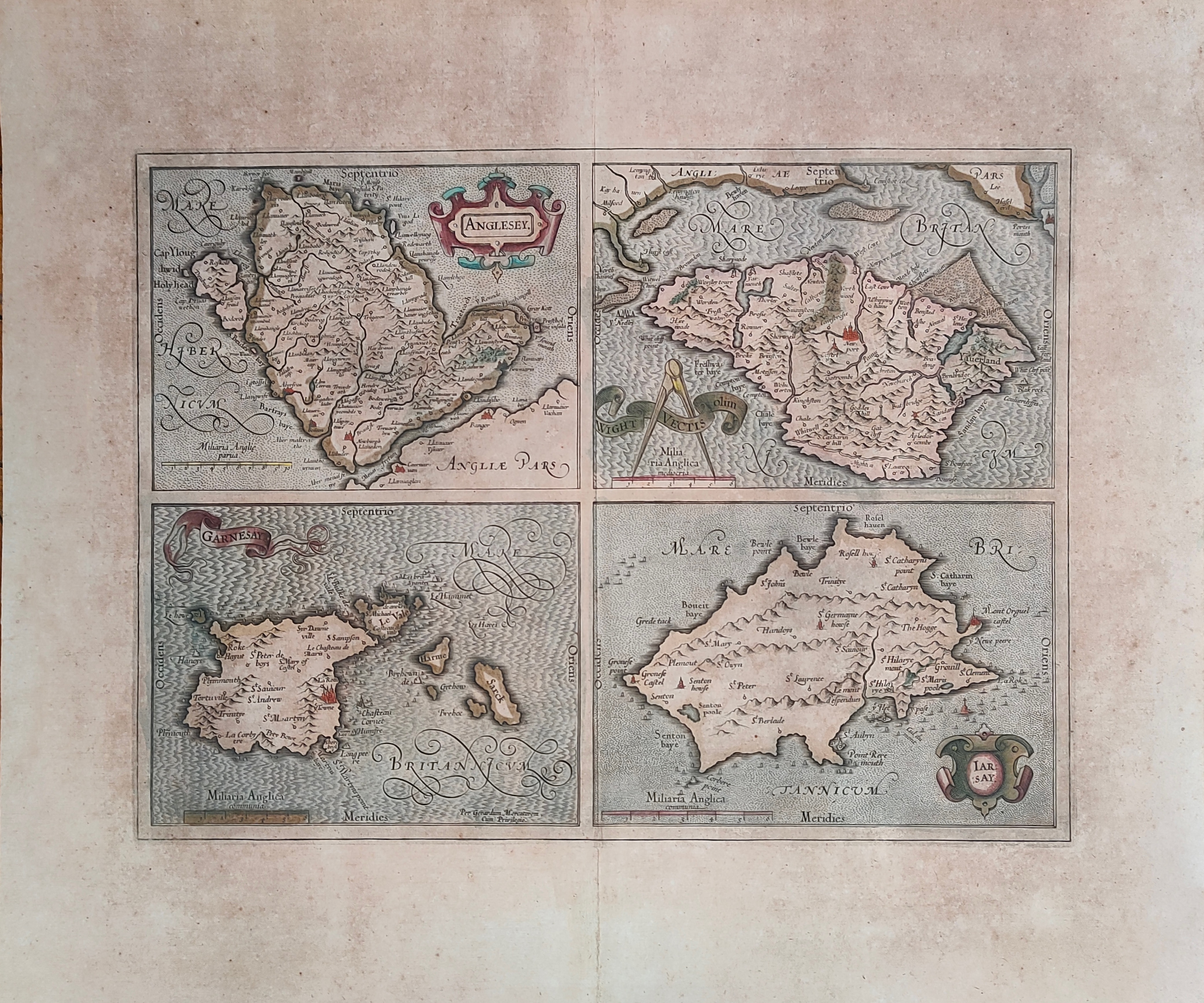
Map title
Anglesey, Garnesay, Wight olim Vectis, Iarsay
Author
Mercator
Location shown in map
Wight
Edition date
Circa 1628
Edition place
Amsterdam
Editor
Houndius
Atlas
Mercator-Hondius Atlas.
Price
250 Euro
State
[mint/EXCELLENT/very good/good/fair/mediocre/poor]
Color
Old colors
Verso
Latin text
Size
Plate: cm (42 x 32) inches (16.54 x 12.6) Paper: cm (55 x 47) inches (21.65 x 18.5)
Technique
Copper engraving
Note
Professionally repaired
Reference
Wiki
Here for more info
In stock
Available
Info
info@thetreasuremaps.com
Code
#1232
×
![]()
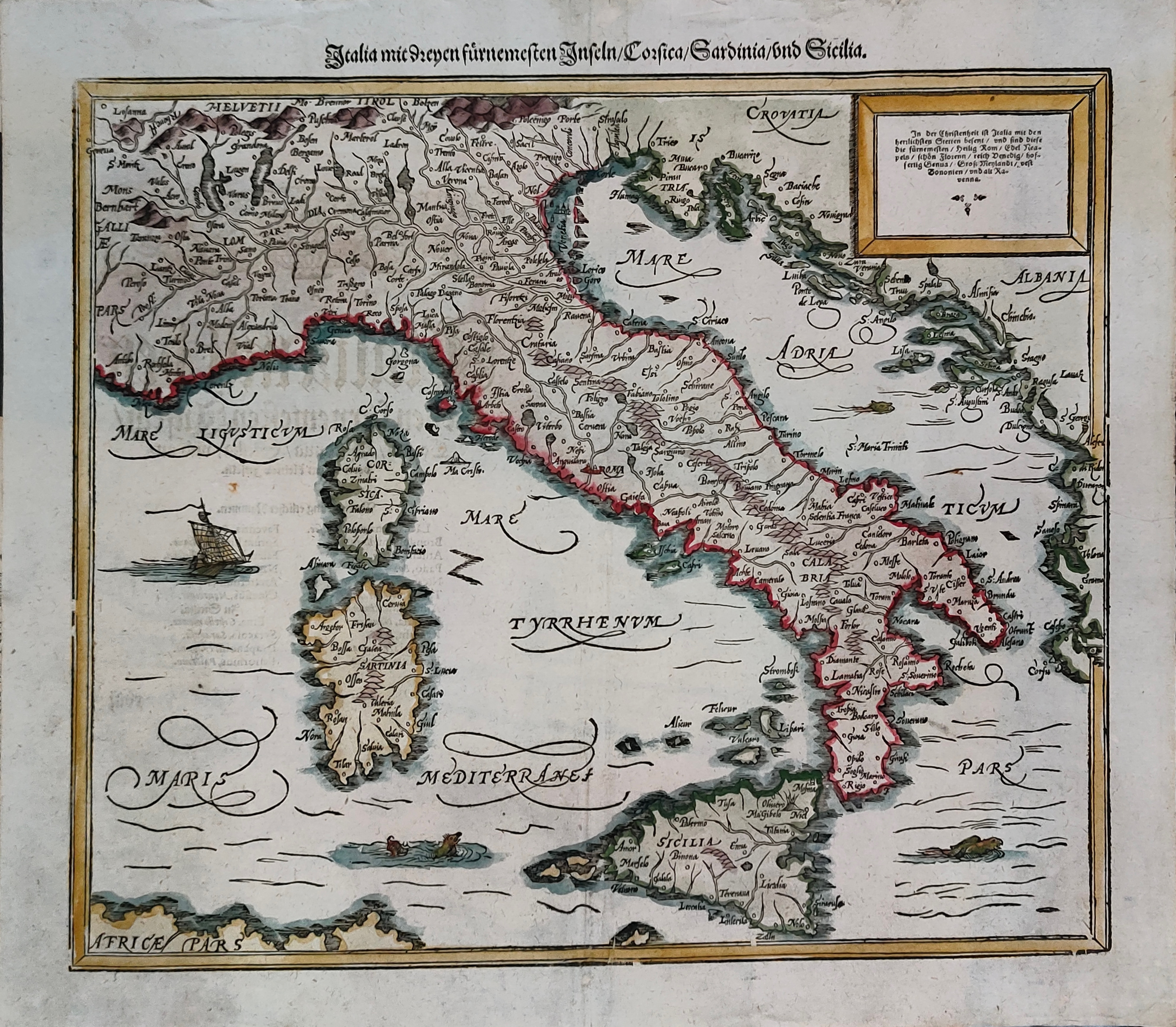
Map title
Italia mit Dreyen Furnemesten Inseln
Author
Munster
Location shown in map
Italy
Edition date
Circa 1628
Edition place
Basel
Editor
Henrich Petri
Atlas
Cosmographia Universalis
Price
450 Euro
State
[mint/EXCELLENT/very good/good/fair/mediocre/poor]
Color
Old colors
Verso
German text
Size
Plate: cm (37 x 30) inches (14.57 x 11.81) Paper: cm (41 x 36) inches (16.14 x 14.17)
Technique
Woodcut
Note
Reference
R.Borri L'Italia nelle antiche carte pag.50
Wiki
Here for more info
In stock
Available
Info
info@thetreasuremaps.com
Code
#1301
×
![]()
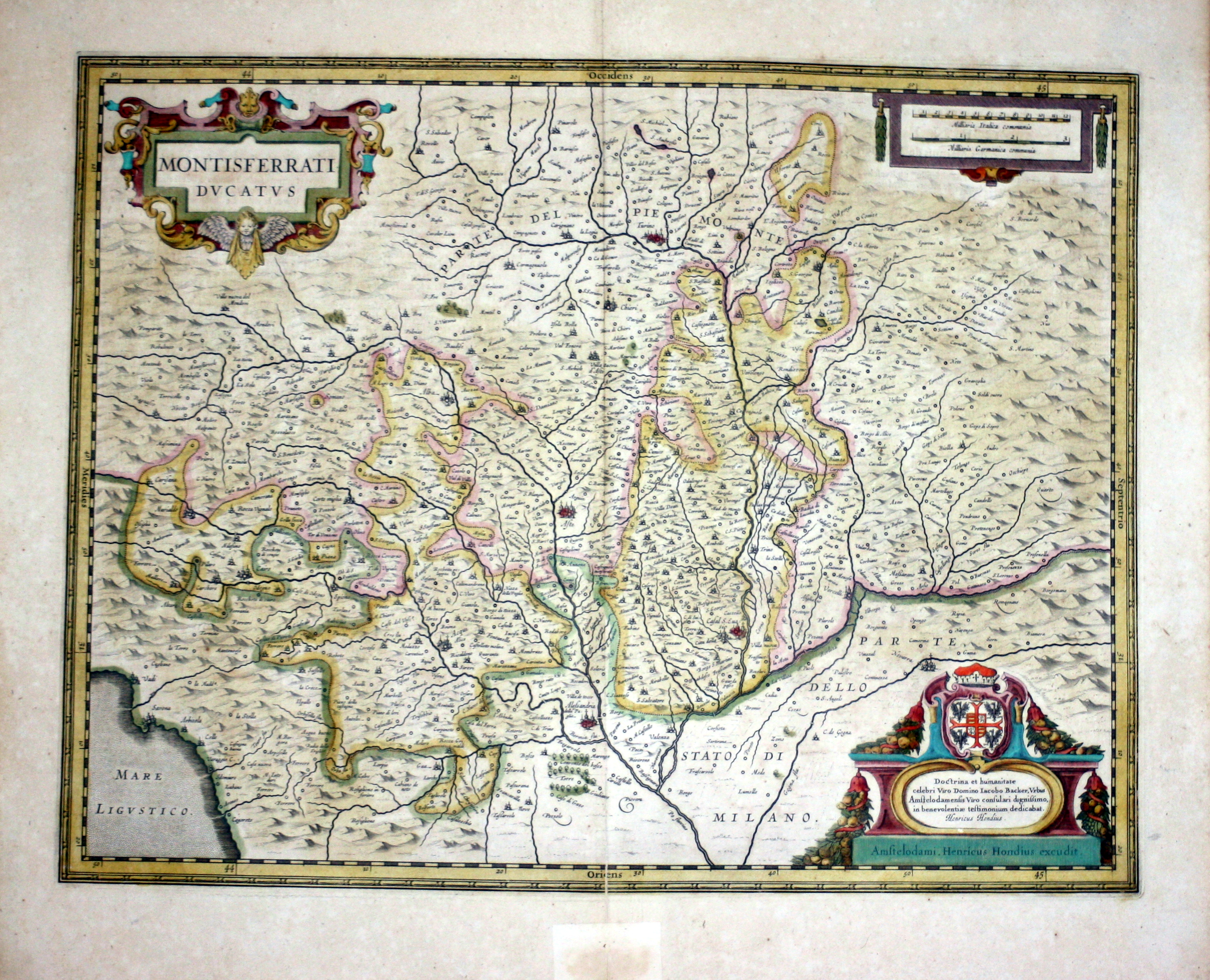
Map title
Montisferrati Ducatus
Author
Hondius
Location shown in map
Piedmont & Liguria, North west Italy
Edition date
1630
Edition place
Amsterdam
Editor
--
Atlas
Atlas Novus
Price
Please ask: info@thetreasuremaps.com
State
[mint/EXCELLENT/very good/good/fair/mediocre/poor]
Color
Old color
Verso
French text
Size
Plate: cm (48.3 x 36.8) inches (19.02 x 14.49) Paper: cm (54.6 x 47) inches (21.5 x 18.5)
Technique
Copper engraving
Note
No particular notes for this maps
Reference
--
Wiki
Here for more info
In stock
Available
Info
info@thetreasuremaps.com
Code
#0096
×
![]()
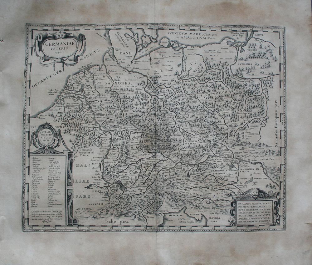
Map title
Germaniae veteris typus
Author
Blaeu
Location shown in map
Germany
Edition date
1630
Edition place
Amsterdam
Editor
--
Atlas
Appendix
Price
250 Euro
State
[mint/excellent/VERY GOOD/good/fair/mediocre/poor]
Color
Black/white
Verso
Latin text
Size
Plate: cm (48.3 x 35.6) inches (19.02 x 14.02) Paper: cm (58.4 x 50.8) inches (22.99 x 20)
Technique
Copper engraving
Note
Ancient Germany.
Reference
--
Wiki
Here for more info
In stock
Available
Info
info@thetreasuremaps.com
Code
#0137
×
![]()
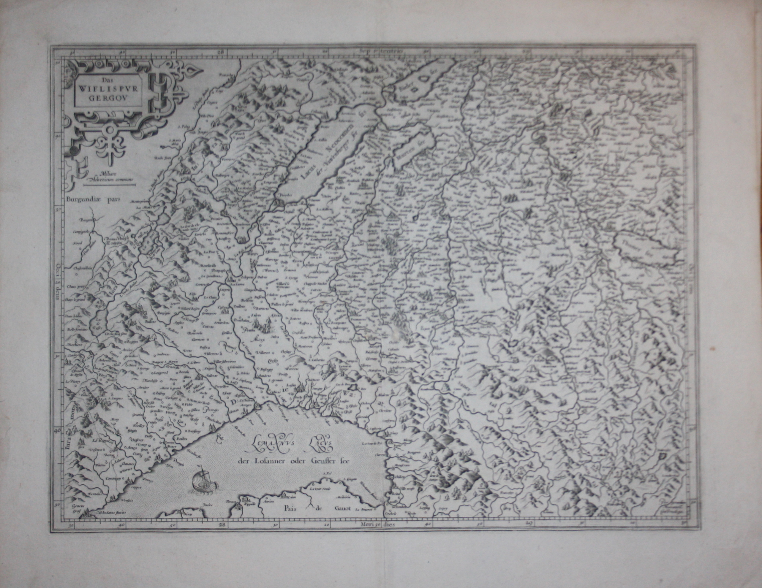
Map title
Das Wiflispvrgergow
Author
Mercator
Location shown in map
Switzerland
Edition date
Circa 1630
Edition place
--
Editor
--
Atlas
--
Price
200 Euro
State
[mint/excellent/VERY GOOD/good/fair/mediocre/poor]
Color
Black/white
Verso
Latin text pag.184
Size
Plate: cm (47 x 35.6) inches (18.5 x 14.02) Paper: cm (57.2 x 43.2) inches (22.52 x 17.01)
Technique
Copper engraving
Note
Reference
--
Wiki
Here for more info
In stock
Available
Info
info@thetreasuremaps.com
Code
#0503
×
![]()
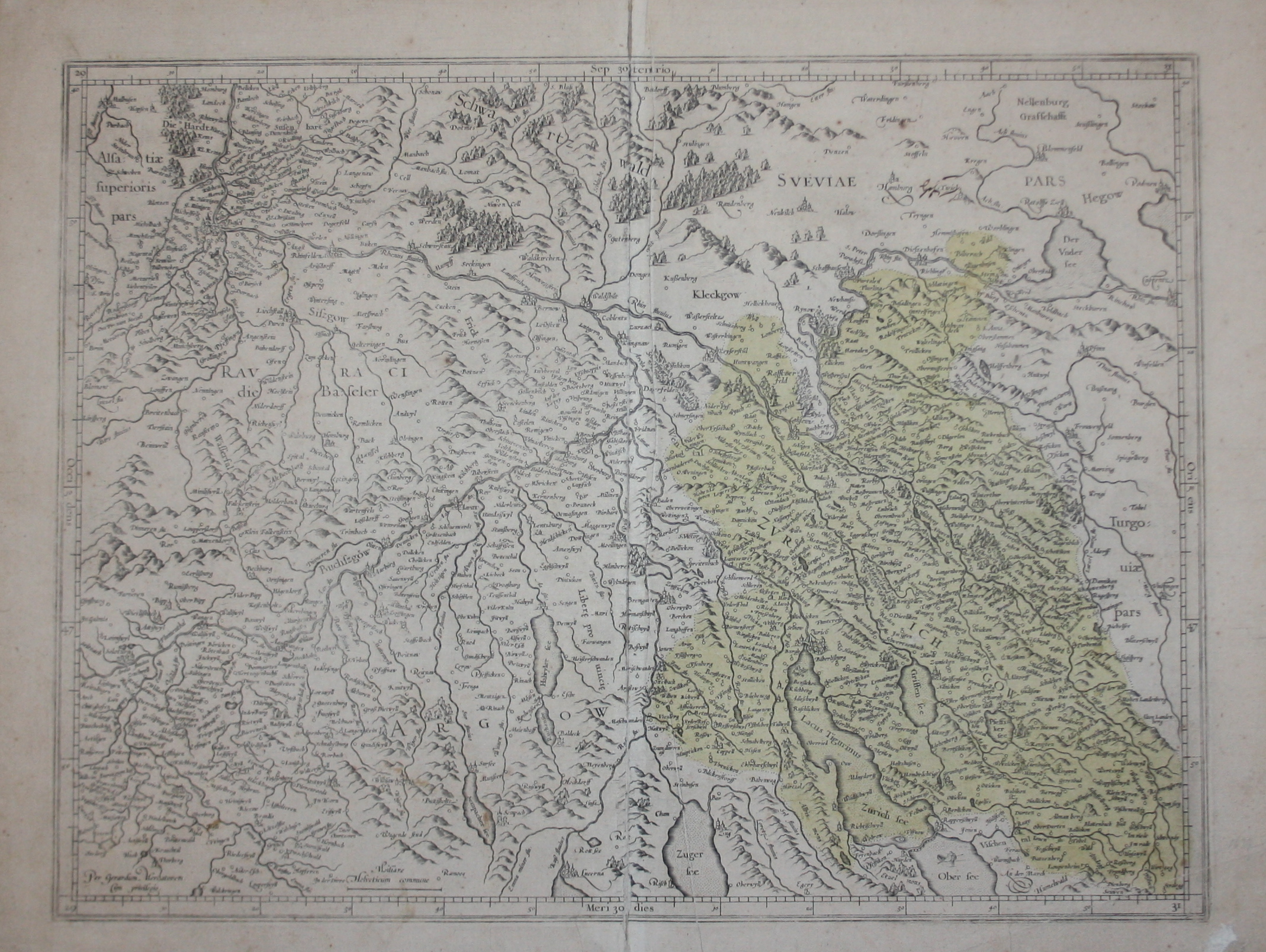
Map title
--
Author
Mercator
Location shown in map
Switzerland
Edition date
Circa 1630
Edition place
--
Editor
--
Atlas
--
Price
200 Euro
State
[mint/excellent/VERY GOOD/good/fair/mediocre/poor]
Color
Black/white
Verso
Blank
Size
Plate: cm (47 x 35.6) inches (18.5 x 14.02) Paper: cm (53.3 x 40.6) inches (20.98 x 15.98)
Technique
Copper engraving
Note
Reference
--
Wiki
Here for more info
In stock
Available
Info
info@thetreasuremaps.com
Code
#0504
--
Author
Mercator
Location shown in map
Switzerland
Edition date
Circa 1630
Edition place
--
Editor
--
Atlas
--
Price
200 Euro
State
[mint/excellent/VERY GOOD/good/fair/mediocre/poor]
Color
Black/white
Verso
Blank
Size
Plate: cm (47 x 35.6) inches (18.5 x 14.02) Paper: cm (53.3 x 40.6) inches (20.98 x 15.98)
Technique
Copper engraving
Note
Reference
--
Wiki
Here for more info
In stock
Available
Info
info@thetreasuremaps.com
Code
#0504
×
![]()
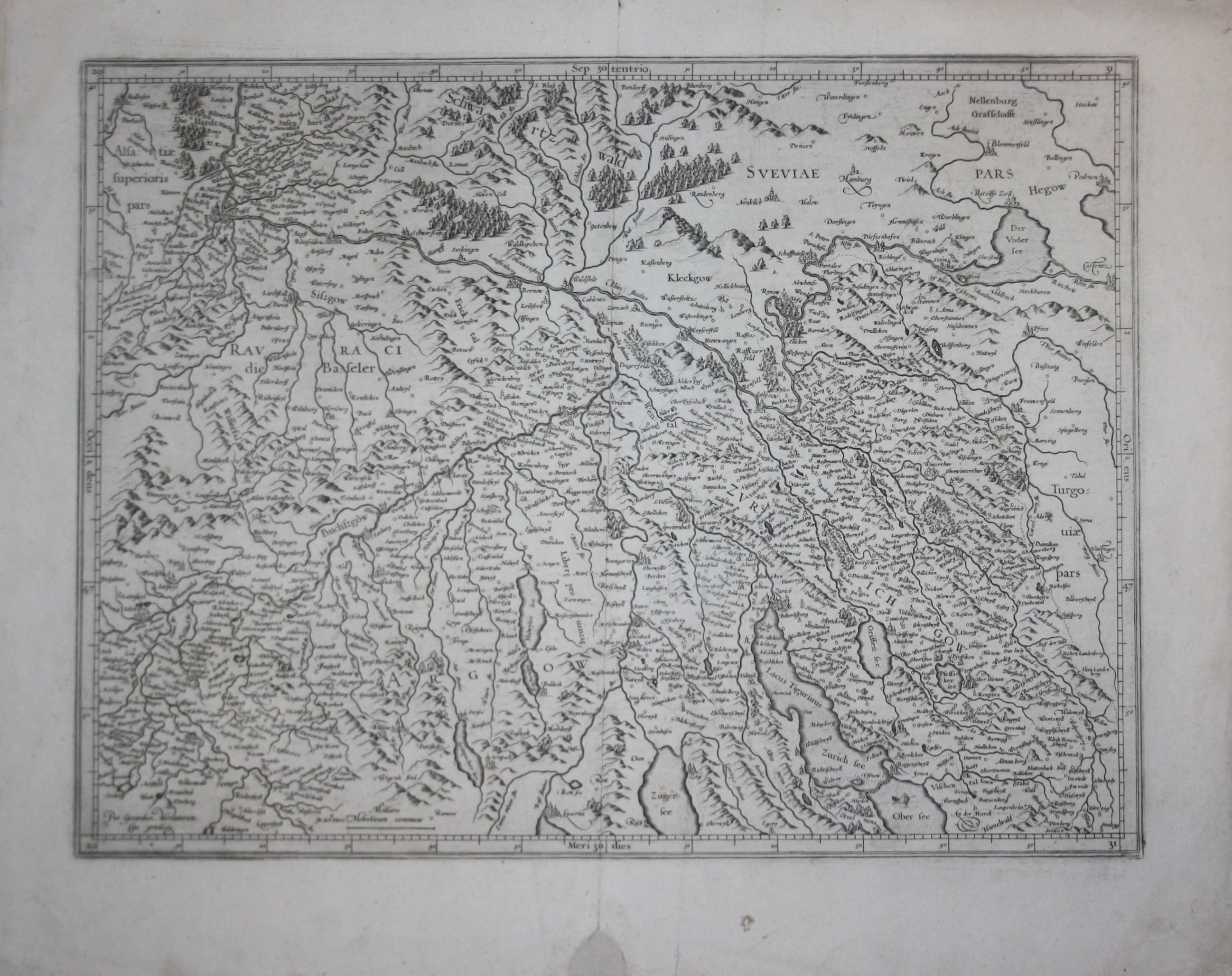
Map title
--
Author
Mercator
Location shown in map
Switzerland
Edition date
Circa 1630
Edition place
--
Editor
--
Atlas
--
Price
200 Euro
State
[mint/excellent/VERY GOOD/good/fair/mediocre/poor]
Color
Black/white
Verso
Latin text pag.182
Size
Plate: cm (47 x 35.6) inches (18.5 x 14.02) Paper: cm (55.9 x 45.7) inches (22.01 x 17.99)
Technique
Copper engraving
Note
Reference
--
Wiki
Here for more info
In stock
Available
Info
info@thetreasuremaps.com
Code
#0505
--
Author
Mercator
Location shown in map
Switzerland
Edition date
Circa 1630
Edition place
--
Editor
--
Atlas
--
Price
200 Euro
State
[mint/excellent/VERY GOOD/good/fair/mediocre/poor]
Color
Black/white
Verso
Latin text pag.182
Size
Plate: cm (47 x 35.6) inches (18.5 x 14.02) Paper: cm (55.9 x 45.7) inches (22.01 x 17.99)
Technique
Copper engraving
Note
Reference
--
Wiki
Here for more info
In stock
Available
Info
info@thetreasuremaps.com
Code
#0505
×
![]()
Map title
Italia
Author
Mercator
Location shown in map
Italy
Edition date
1630
Edition place
Amsterdam
Editor
Houndius
Atlas
Mercator-Hondius Atlas.
Price
900 Euro
State
[mint/EXCELLENT/very good/good/fair/mediocre/poor]
Color
Black/white
Verso
Latin text 299
Size
Plate: cm (46 x 36) inches (18.11 x 14.17) Paper: cm (57 x 47) inches (22.44 x 18.5)
Technique
Copper engraving
Note
Reference
R.Borri L'Italia nelle antiche carte pag.92
Wiki
Here for more info
In stock
Available
Info
info@thetreasuremaps.com
Code
#0790
×
![]()
Map title
Asia recens summa cura delineata
Author
Hondius
Location shown in map
Asia
Edition date
1631
Edition place
Amsterdam
Editor
Atlas
Price
1200 Euro
State
[mint/EXCELLENT/very good/good/fair/mediocre/poor]
Color
Old colors
Verso
Latin text
Size
Plate: cm (51 x 40) inches (20.08 x 15.75) Paper: cm (56 x 48) inches (22.05 x 18.9)
Technique
Copper engraving
Note
Reference
Wiki
Here for more info
In stock
Available
Info
info@thetreasuremaps.com
Code
#1175
×
![]()
Map title
GOWERNEMENT de Turin
Author
DuVal
Location shown in map
North-West Italy
Edition date
1632
Edition place
--
Editor
--
Atlas
--
Price
Please ask: info@thetreasuremaps.com
State
[mint/EXCELLENT/very good/good/fair/mediocre/poor]
Color
Black/white
Verso
Blank
Size
Plate: cm (15.2 x 10.2) inches (5.98 x 4.02) Paper: cm (20.3 x 15.2) inches (7.99 x 5.98)
Technique
Copper engraving
Note
No particular notes for this maps
Reference
--
Wiki
Here for more info
In stock
Available
Info
info@thetreasuremaps.com
Code
#0361
×
![]()
Map title
Nova Europae descriptio
Author
Mercator
Location shown in map
Europe
Edition date
1632
Edition place
Amsterdam
Editor
Hondius
Atlas
Atlas sive Cosmographicae Meditationes de Fabrica Mundi et fabricati figura
Price
300 Euro
State
[mint/EXCELLENT/very good/good/fair/mediocre/poor]
Color
Black/white
Verso
Blank
Size
Plate: cm (25 x 19) inches (9.84 x 7.48) Paper: cm (40 x 26) inches (15.75 x 10.24)
Technique
Copper engraving
Note
No particular notes for this maps.
Reference
Wiki
Here for more info
In stock
Available
Info
info@thetreasuremaps.com
Code
#0808
×
![]()

Map title
Pedemontana regio cum Genvensium territorio & Montisferrati marchionatu
Author
Mercator
Location shown in map
Liguria
Edition date
Circa 1633
Edition place
Amsterdam
Editor
Houndius
Atlas
Mercator-Hondius Atlas.
Price
400 Euro
State
[mint/EXCELLENT/very good/good/fair/mediocre/poor]
Color
Black/white
Verso
Franch text pag 545
Size
Plate: cm (44 x 35) inches (17.32 x 13.78) Paper: cm (54 x 45) inches (21.26 x 17.72)
Technique
Copper engraving
Note
No particular notes for this maps
Reference
--
Wiki
Here for more info
In stock
Available
Info
info@thetreasuremaps.com
Code
#0020
×
![]()
Map title
Tabula Islandiae Auctore Georgio Carolo Flandro
Author
Jansson
Location shown in map
Iceland
Edition date
Circa 1634
Edition place
Amsterdam
Editor
Jansson
Atlas
Atlantis Maioris Appendix
Price
1100 Euro
State
[mint/EXCELLENT/very good/good/fair/mediocre/poor]
Color
Old colors
Verso
Latin text pag 3
Size
Plate: cm (48 x 37) inches (18.9 x 14.57) Paper: cm (55 x 44) inches (21.65 x 17.32)
Technique
Copper engraving
Note
This map is one of the symbols of the intense rivalry between Jansson and Blaeu. Joris Carl's map was first engraved by Jodocus Hondius II (son of the firm's founder and Jansson's brother-in-law). When Jodocus died in 1629 many of his plates were sold to Willem Blaeu, who added his name to the plates and used them to publish his first atlas in 1630. Angered by the sale, Jansson had the Hondius plates slavishly copied. This plate, which only differs from Blaeu's by the lack of his name under the title, was first issued the same year.
Reference
Wiki
Here for more info
In stock
Available
Info
info@thetreasuremaps.com
Code
#0635
×
![]()
Map title
Moscovia
Author
Mercator
Location shown in map
Russia
Edition date
1635
Edition place
Amsterdam
Editor
Janssonius
Atlas
Altas Minor Gerardi Mercatoris
Price
100 Euro
State
[MINT/excellent/very good/good/fair/mediocre/poor]
Color
Later hand coloring.
Verso
German text
Size
Plate: cm (20.3 x 14) inches (7.99 x 5.51) Paper: cm (22.9 x 17.8) inches (9.02 x 7.01)
Technique
Copper engraving
Note
This map of Russia shows the regions of 'Chelmia', 'Wologda', 'Lithuanie' and 'Polocenis Ducatus' with the cities of Moscow.
Reference
--
Wiki
Here for more info
In stock
Available
Info
info@thetreasuremaps.com
Code
#0135
×
![]()
Map title
Territorie d'Orvieto
Author
Blaeu
Location shown in map
Orvieto
Edition date
1635
Edition place
Amsterdam
Editor
--
Atlas
Theatrum Orbis Terrarum, Sive Atlas Novis
Price
Please ask: info@thetreasuremaps.com
State
[mint/excellent/very good/GOOD/fair/mediocre/poor]
Color
Old color.
Verso
Blank
Size
Plate: cm (48.3 x 35.6) inches (19.02 x 14.02) Paper: cm (53.3 x 45.7) inches (20.98 x 17.99)
Technique
Copper engraving
Note
No particular notes for this maps
Reference
--
Wiki
Here for more info
In stock
Sold
Info
info@thetreasuremaps.com
Code
#0136
×
![]()
Map title
India que orientalis dicitur et insulae adiacentis
Author
Blaeu
Location shown in map
Southest Asia
Edition date
1635
Edition place
Amsterdam
Editor
--
Atlas
Theatrum Orbis Terrarum, Sive Atlas Novis
Price
1600 Euro
State
[mint/excellent/VERY GOOD/good/fair/mediocre/poor]
Color
Black/white
Verso
Latin text pag.2
Size
Plate: cm (50.8 x 40.6) inches (20 x 15.98) Paper: cm (58.4 x 45.7) inches (22.99 x 17.99)
Technique
Copper engraving
Note
Professionally restored
Reference
--
Wiki
Here for more info
In stock
Available
Info
info@thetreasuremaps.com
Code
#0212
×
![]()
Map title
Guinea
Author
Blaeu
Location shown in map
Gulf of Guinea
Edition date
1635
Edition place
Amsterdam
Editor
--
Atlas
Theatrum Orbis Terrarum, Sive Atlas Novis
Price
Please ask: info@thetreasuremaps.com
State
[mint/excellent/very good/GOOD/fair/mediocre/poor]
Color
Black/white
Verso
Franch text pag.4
Size
Plate: cm (53.3 x 38.1) inches (20.98 x 15) Paper: cm (61 x 50.8) inches (24.02 x 20)
Technique
Copper engraving
Note
No particular notes for this maps
Reference
--
Wiki
Here for more info
In stock
Available
Info
info@thetreasuremaps.com
Code
#0294
×
![]()
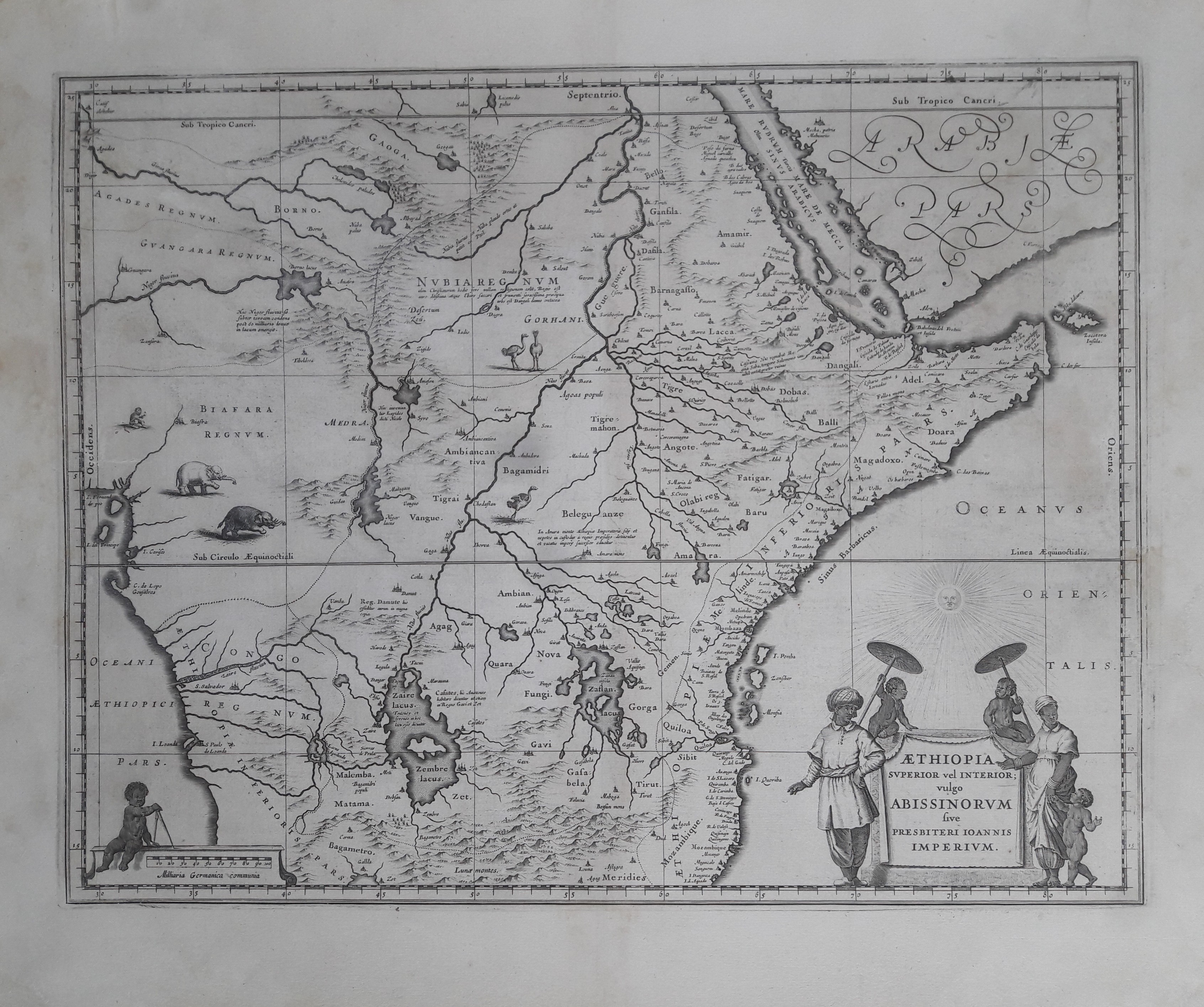
Map title
Aethiopia superior vel inferior
Author
Blaeu
Location shown in map
East Africa
Edition date
1635
Edition place
Amsterdam
Editor
--
Atlas
Theatrum Orbis Terrarum, Sive Atlas Novis
Price
Please ask: info@thetreasuremaps.com
State
[mint/excellent/very good/GOOD/fair/mediocre/poor]
Color
Black/white
Verso
Franch text pag.5
Size
Plate: cm (50.8 x 38.1) inches (20 x 15) Paper: cm (61 x 48.3) inches (24.02 x 19.02)
Technique
Copper engraving
Note
No particular notes for this maps
Reference
--
Wiki
Here for more info
In stock
Available
Info
info@thetreasuremaps.com
Code
#0295
×
![]()
Map title
Mantua Ducatus
Author
Blaeu
Location shown in map
Mantua
Edition date
1635
Edition place
Amsterdam
Editor
--
Atlas
Theatrum Orbis Terrarum, Sive Atlas Novis
Price
Please ask: info@thetreasuremaps.com
State
[mint/excellent/very good/GOOD/fair/mediocre/poor]
Color
Old color.
Verso
Latin text
Size
Plate: cm (49.5 x 36.8) inches (19.49 x 14.49) Paper: cm (63.5 x 53.3) inches (25 x 20.98)
Technique
Copper engraving
Note
Very decorative map of Mantua
Reference
--
Wiki
Here for more info
In stock
Sold
Info
info@thetreasuremaps.com
Code
#0445
×
![]()
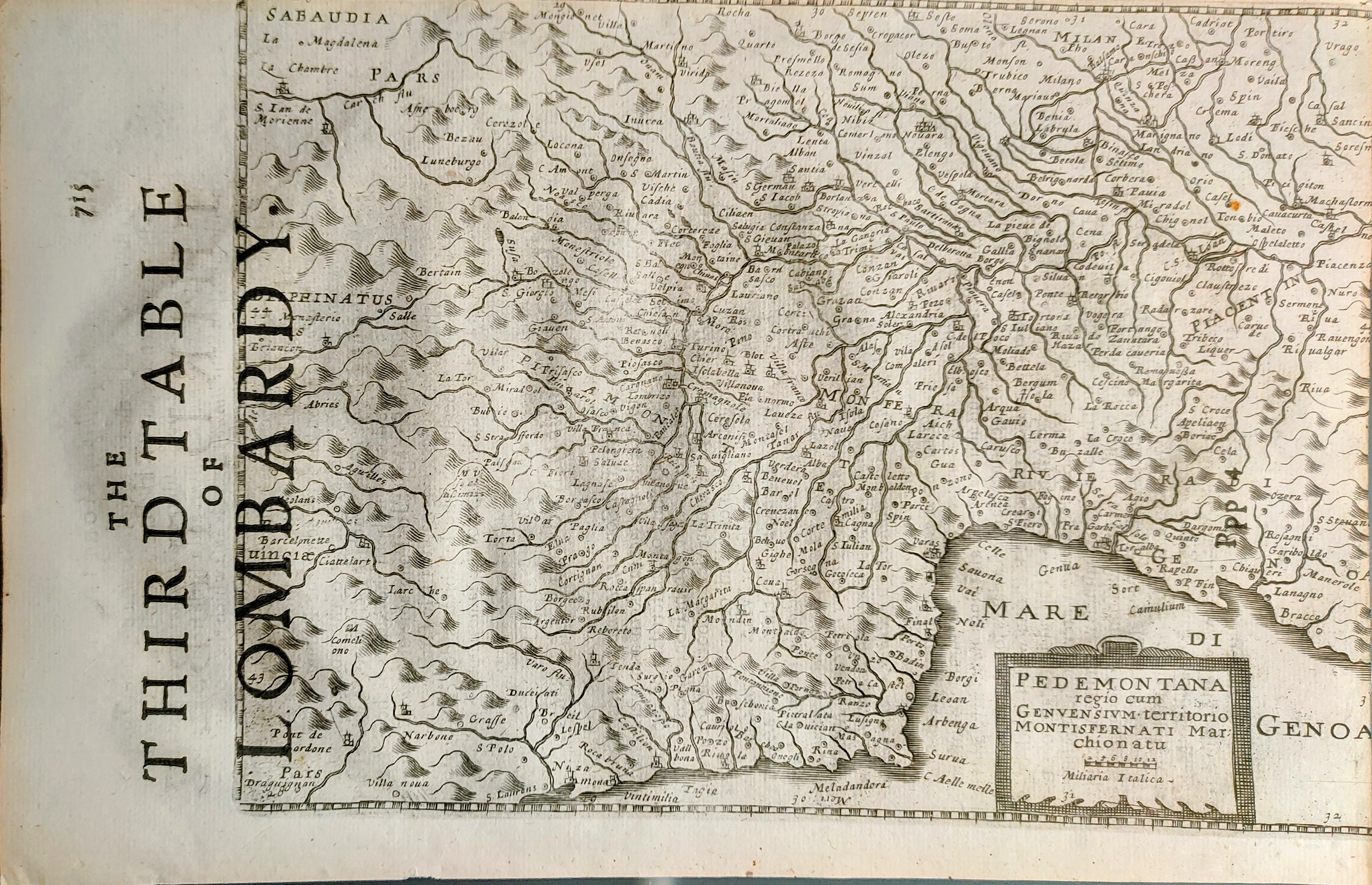
Map title
Pedemontana regio
Author
Mercator
Location shown in map
North-West Italy
Edition date
Circa 1635
Edition place
London
Editor
Michael Spark
Atlas
Historia Mundi or Mercators Atlas
Price
200 Euro
State
[mint/EXCELLENT/very good/good/fair/mediocre/poor]
Color
Black/white
Verso
English text pag 716
Size
Plate: cm (23 x 17) inches (9.06 x 6.69) Paper: cm (28 x 18) inches (11.02 x 7.09)
Technique
Copper engraving
Note
Reference
Wiki
Here for more info
In stock
Available
Info
info@thetreasuremaps.com
Code
#0863
×
![]()
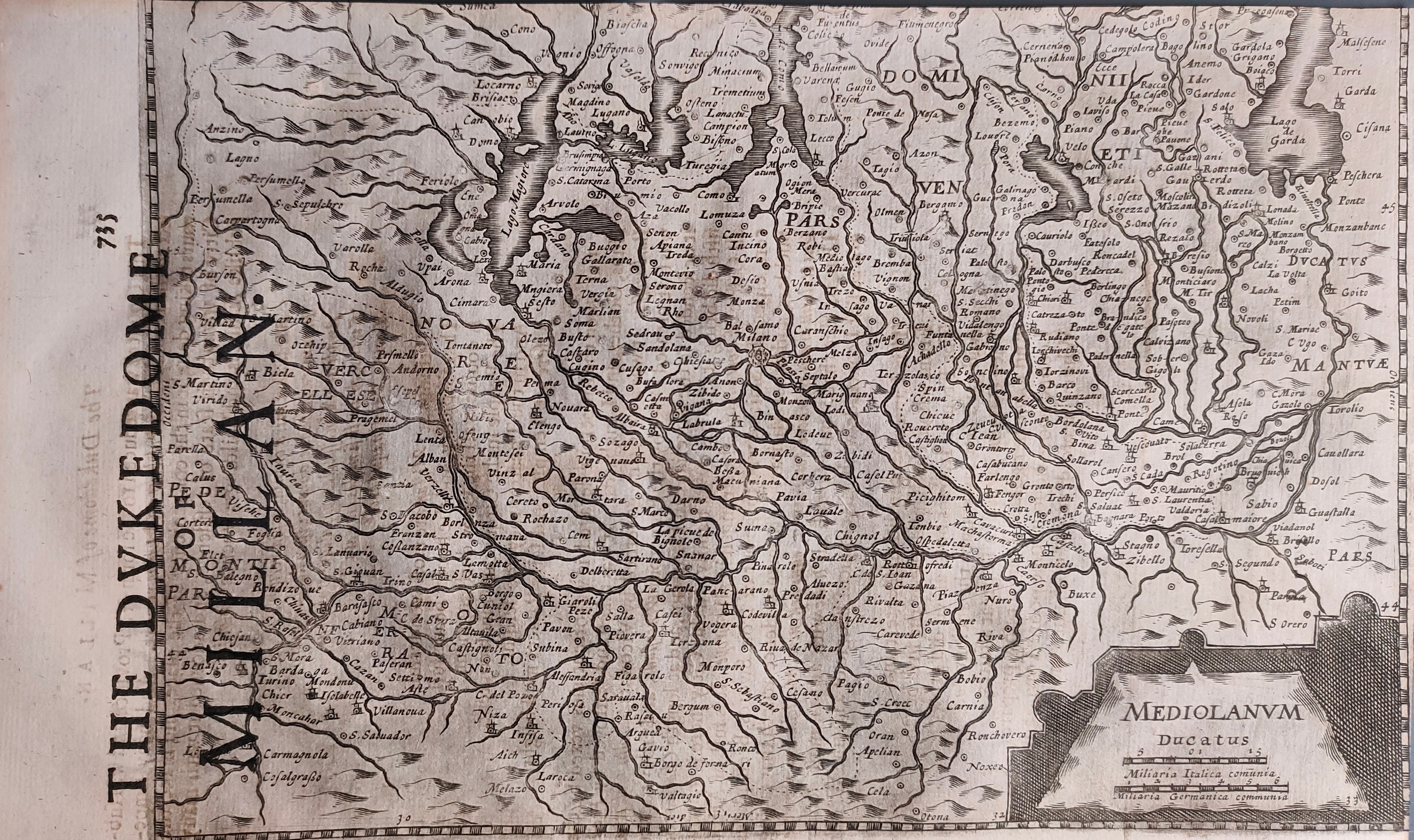
Map title
Mediolanum ducatus
Author
Mercator
Location shown in map
North-West Italy
Edition date
Circa 1635
Edition place
London
Editor
Michael Spark
Atlas
Historia Mundi or Mercators Atlas
Price
175 Euro
State
[mint/EXCELLENT/very good/good/fair/mediocre/poor]
Color
Black/white
Verso
English text pag 736
Size
Plate: cm (23 x 17) inches (9.06 x 6.69) Paper: cm (28 x 18) inches (11.02 x 7.09)
Technique
Copper engraving
Note
Reference
Wiki
Here for more info
In stock
Available
Info
info@thetreasuremaps.com
Code
#0864
×
![]()
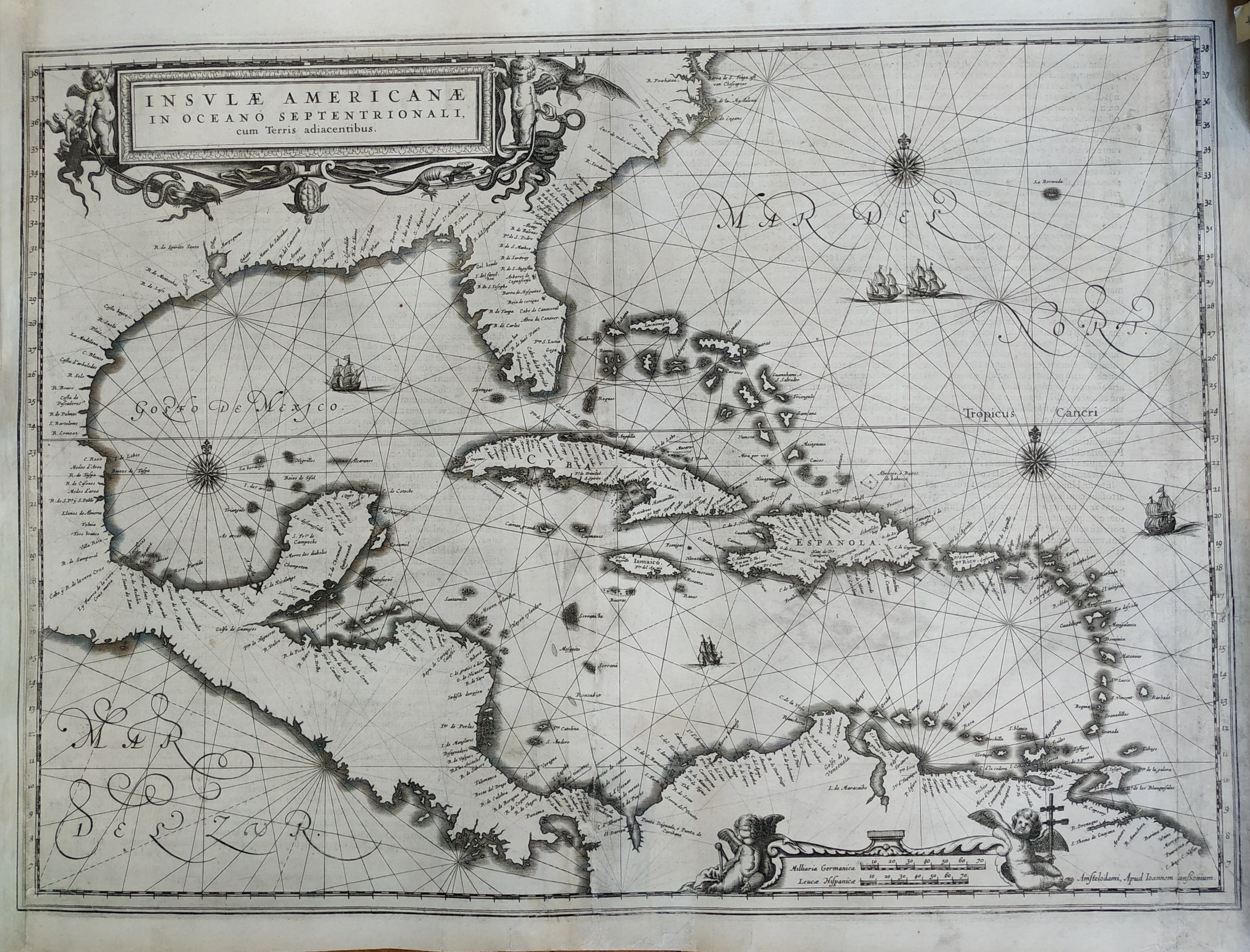
Map title
Insulae Americanae
Author
Jansson
Location shown in map
Florida & Antilles islands
Edition date
1636
Edition place
Amsterdam
Editor
--
Atlas
--
Price
900 Euro
State
[mint/EXCELLENT/verygood/good/fair/mediocre/poor] Professionally restored
Color
Black/white
Verso
Latin text
Size
Plate: cm (50.8 x 38.1) inches (20 x 15) Paper: cm (53.3 x 43.2) inches (20.98 x 17.01)
Technique
Copper engraving
Note
Professionally repaired
Reference
--
Wiki
Here for more info
In stock
Available
Info
info@thetreasuremaps.com
Code
#0344
×
![]()
Map title
Scotiae pars septentrionalis
Author
Hondius
Location shown in map
Scotland
Edition date
1638
Edition place
Amsterdam
Editor
Atlas
Price
400 Euro
State
[mint/EXCELLENT/very good/good/fair/mediocre/poor]
Color
Old colors
Verso
Latin text
Size
Plate: cm (45 x 35) inches (17.72 x 13.78) Paper: cm (55 x 46) inches (21.65 x 18.11)
Technique
Copper engraving
Note
Reference
Wiki
Here for more info
In stock
Available
Info
info@thetreasuremaps.com
Code
#1073
×
![]()
Map title
Italia
Author
Bertelli
Location shown in map
Italy
Edition date
1638
Edition place
Vicenza
Editor
Bolzetta
Atlas
Itineriarium nobiliorum Italiae
Price
250 Euro
State
[mint/excellent/very good/GOOD/fair/mediocre/poor]
Color
Black/white
Verso
Blank
Size
Plate: cm (18 x 13) inches (7.09 x 5.12) Paper: cm (19 x 15) inches (7.48 x 5.91)
Technique
Copper engraving
Note
Reference
R.Borri L'Italia nelle antiche carte pag.108
Wiki
Here for more info
In stock
Available
Info
info@thetreasuremaps.com
Code
#1168
×
![]()
Map title
Reipublicae Genuensis Ducatus Et Dominii.
Author
Jansson
Location shown in map
Liguria
Edition date
Circa 1638
Edition place
Amsterdam
Editor
Hondius
Atlas
Atlas sive Cosmographicae meditationes de fabrica mvndi et fabricati figvra
Price
600 Euro
State
[mint/EXCELLENT/very good/good/fair/mediocre/poor]
Color
Old colors
Verso
German text
Size
Plate: cm (49 x 38) inches (19.29 x 14.96) Paper: cm (58 x 51) inches (22.83 x 20.08)
Technique
Copper engraving
Note
Reference
Wiki
Here for more info
In stock
Available
Info
info@thetreasuremaps.com
Code
#1257
×
![]()
Map title
Pianta di Cremona e delle altre fortezze de Milano
Author
Homann
Location shown in map
Chateau de Seravalle
Edition date
Unknown
Edition place
--
Editor
--
Atlas
--
Price
Please ask: info@thetreasuremaps.com
State
[mint/excellent/very good/good/fair/mediocre/POOR] Only a small part of the map.
Color
Old outlined
Verso
Blank
Size
Plate: cm (14 x 12.7) inches (5.51 x 5) Paper: cm (16.5 x 15.2) inches (6.5 x 5.98)
Technique
Copper engraving
Note
No particular notes for this maps
Reference
--
Wiki
Here for more info
In stock
Available
Info
info@thetreasuremaps.com
Code
#0141
×
![]()
Map title
Carte generale des royaume d'Angleterre
Author
Sanson
Location shown in map
British Isles
Edition date
1640
Edition place
Paris
Editor
Melchior Tavenier
Atlas
Price
Please ask: info@thetreasuremaps.com
State
[mint/EXCELLENT/very good/good/fair/mediocre/poor]
Color
Old colors
Verso
Blank
Size
Plate: cm (52 x 39) inches (20.47 x 15.35) Paper: cm (57 x 44) inches (22.44 x 17.32)
Technique
Copper engraving
Note
No particular notes for this maps
Reference
Wiki
Here for more info
In stock
Available
Info
info@thetreasuremaps.com
Code
#0658
×
![]()
Map title
Nova Italiae delineatio
Author
Merian
Location shown in map
Italy
Edition date
Circa 1640
Edition place
Frankfurt
Editor
Atlas
Price
300 Euro
State
[mint/EXCELLENT/very good/good/fair/mediocre/poor]
Color
Black/white
Verso
Blank
Size
Plate: cm (36 x 28) inches (14.17 x 11.02) Paper: cm (37 x 34) inches (14.57 x 13.39)
Technique
Copper engraving
Note
Reference
R.Borri L'Italia nelle antiche carte pag.133
Wiki
Here for more info
In stock
Available
Info
info@thetreasuremaps.com
Code
#1068
×
![]()
Map title
Cyprus insula
Author
Blaeu
Location shown in map
Cyprus
Edition date
Circa 1640
Edition place
Amsterdam
Editor
Blaeu
Atlas
Theatrum Orbis Terrarum, Sive Atlas Novis
Price
1100 Euro
State
[mint/EXCELLENT/very good/good/fair/mediocre/poor]
Color
Old colors
Verso
Dutch text
Size
Plate: cm (50 x 38) inches (19.69 x 14.96) Paper: cm (56 x 44) inches (22.05 x 17.32)
Technique
Copper engraving
Note
Reference
--
Wiki
Here for more info
In stock
Available
Info
info@thetreasuremaps.com
Code
#1071
×
![]()
Map title
Peru
Author
Blaeu
Location shown in map
Peru
Edition date
Circa 1640
Edition place
Amsterdam
Editor
Blaeu
Atlas
Theatrum Orbis Terrarum, Sive Atlas Novis
Price
400 Euro
State
[mint/excellent/very good/good/fair/MEDIOCRE/poor]
Color
Old colors
Verso
French text
Size
Plate: cm (50 x 38) inches (19.69 x 14.96) Paper: cm (60 x 48) inches (23.62 x 18.9)
Technique
Copper engraving
Note
Reference
--
Wiki
Here for more info
In stock
Available
Info
info@thetreasuremaps.com
Code
#1075
Peru
Author
Blaeu
Location shown in map
Peru
Edition date
Circa 1640
Edition place
Amsterdam
Editor
Blaeu
Atlas
Theatrum Orbis Terrarum, Sive Atlas Novis
Price
400 Euro
State
[mint/excellent/very good/good/fair/MEDIOCRE/poor]
Color
Old colors
Verso
French text
Size
Plate: cm (50 x 38) inches (19.69 x 14.96) Paper: cm (60 x 48) inches (23.62 x 18.9)
Technique
Copper engraving
Note
Reference
--
Wiki
Here for more info
In stock
Available
Info
info@thetreasuremaps.com
Code
#1075
×
![]()
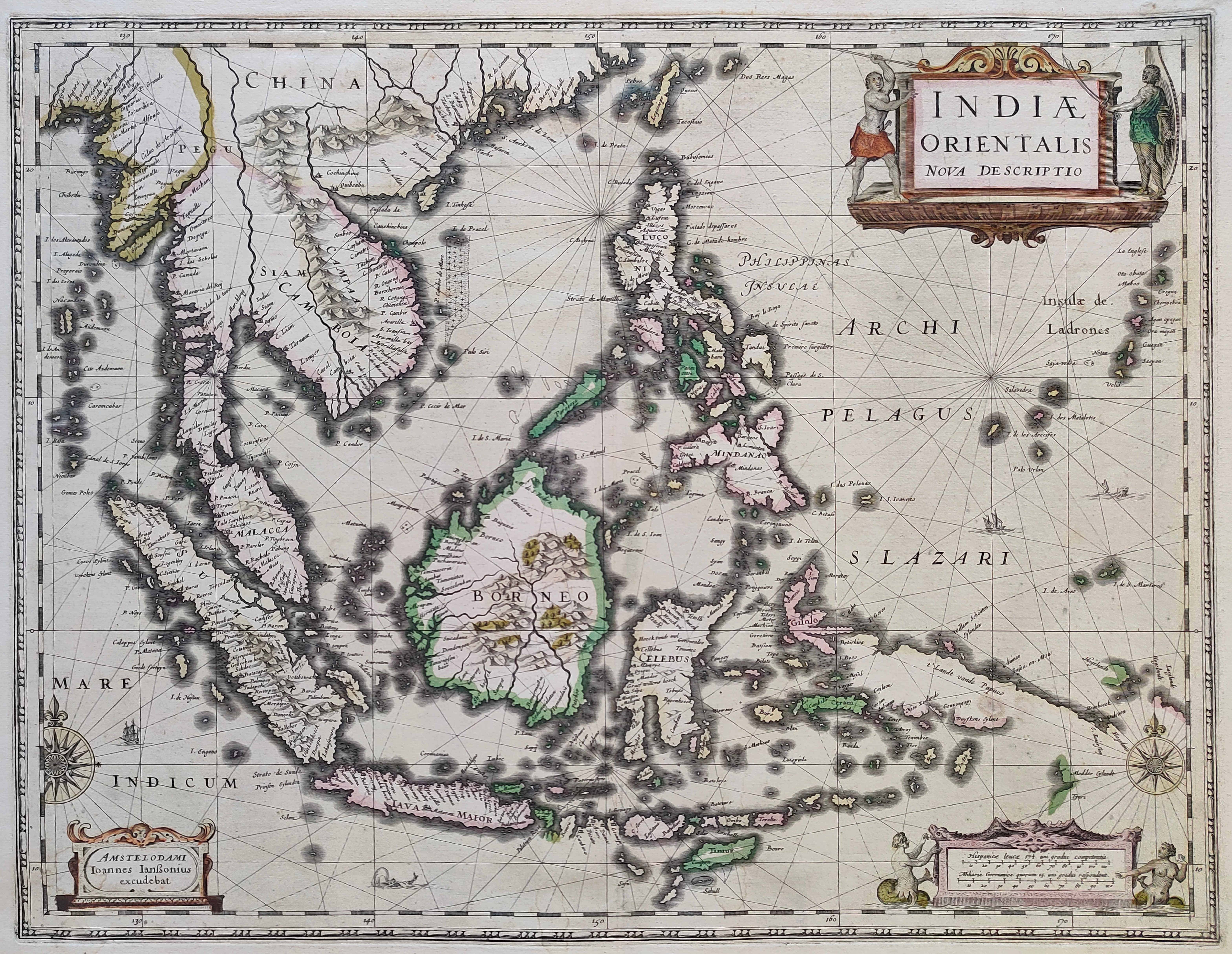
Map title
Indiae Orientalis Nova Descriptio
Author
Jansson
Location shown in map
Southest Asia
Edition date
Circa 1640
Edition place
Amsterdam
Editor
--
Atlas
Novus Atlas
Price
1300 Euro
State
[mint/EXCELLENT/very good/good/fair/mediocre/poor]
Color
Old colors
Verso
Franch text pag. 676
Size
Plate: cm (51 x 39) inches (20.08 x 15.35) Paper: cm (58 x 45) inches (22.83 x 17.72)
Technique
Copper engraving
Note
Reference
--
Wiki
Here for more info
In stock
Sold
Info
info@thetreasuremaps.com
Code
#1211
×
![]()
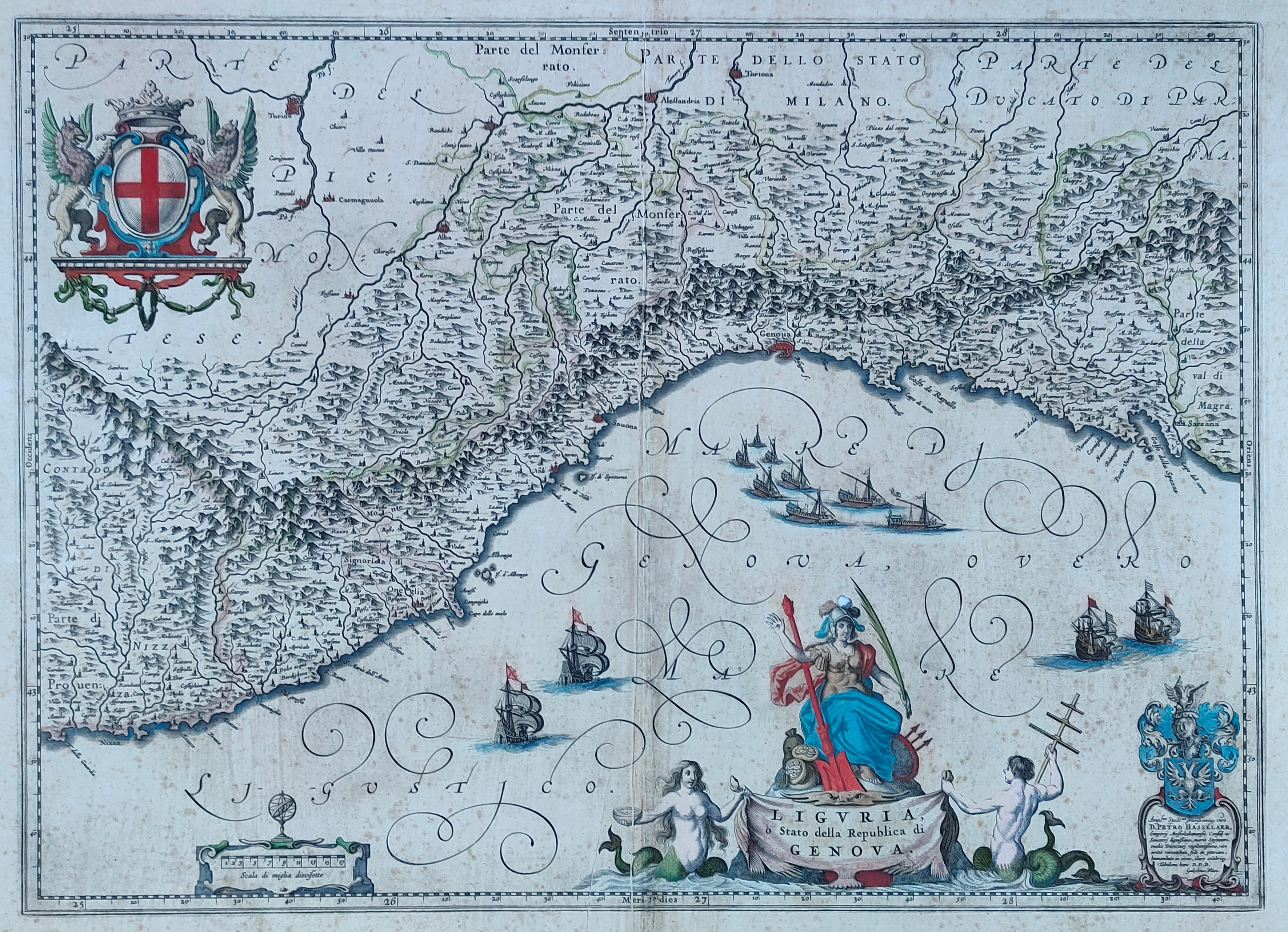
Map title
Liguria
Author
Blaeu
Location shown in map
Liguria
Edition date
Circa 1640
Edition place
Amsterdam
Editor
Atlas
Price
600 Euro
State
[mint/EXCELLENT/very good/good/fair/mediocre/poor]
Color
Old colors
Verso
Size
Plate: cm (51 x 38) inches (20.08 x 14.96) Paper: cm (58 x 50) inches (22.83 x 19.69)
Technique
Copper engraving
Note
Reference
Wiki
Here for more info
In stock
Available
Info
info@thetreasuremaps.com
Code
#1224
Liguria
Author
Blaeu
Location shown in map
Liguria
Edition date
Circa 1640
Edition place
Amsterdam
Editor
Atlas
Price
600 Euro
State
[mint/EXCELLENT/very good/good/fair/mediocre/poor]
Color
Old colors
Verso
Size
Plate: cm (51 x 38) inches (20.08 x 14.96) Paper: cm (58 x 50) inches (22.83 x 19.69)
Technique
Copper engraving
Note
Reference
Wiki
Here for more info
In stock
Available
Info
info@thetreasuremaps.com
Code
#1224
×
![]()
Map title
Riviera di Genova di Levante
Author
Jansson
Location shown in map
Liguria
Edition date
Circa 1640
Edition place
Editor
Atlas
Price
500 Euro
State
[mint/excellent/VERY GOOD/good/fair/mediocre/poor]
Color
Old colors
Verso
German text
Size
Plate: cm (50 x 39) inches (19.69 x 15.35) Paper: cm (55 x 44) inches (21.65 x 17.32)
Technique
Copper engraving
Note
Reference
Wiki
Here for more info
In stock
Available
Info
info@thetreasuremaps.com
Code
#1283
×
![]()
Map title
Capitanata olim Mesapiae et Iapigiae pars
Author
Jansson
Location shown in map
Puglia
Edition date
Circa 1640
Edition place
Amsterdam
Editor
Atlas
Atlas Novus
Price
200 Euro
State
[mint/excellent/very good/good/fair/mediocre/POOR]
Color
Old colors
Verso
Latin text
Size
Plate: cm (49 x 37) inches (19.29 x 14.57) Paper: cm (55 x 44) inches (21.65 x 17.32)
Technique
Copper engraving
Note
Reference
Wiki
Here for more info
In stock
Available
Info
info@thetreasuremaps.com
Code
#1294
×
![]()

Map title
Sclavonia, Croatia, Bosnia cum Dalmatiae Parte
Author
Mercator
Location shown in map
Balkan
Edition date
Circa 1640
Edition place
Amsterdam
Editor
Hondius
Atlas
Mercator-Hondius Atlas.
Price
200 Euro
State
[mint/excellent/VERY GOOD/good/fair/mediocre/poor]
Color
Old colors
Verso
Latin text
Size
Plate: cm (46 x 36) inches (18.11 x 14.17) Paper: cm (55 x 46) inches (21.65 x 18.11)
Technique
Copper engraving
Note
Reference
Wiki
Here for more info
In stock
Available
Info
info@thetreasuremaps.com
Code
#1297
×
![]()
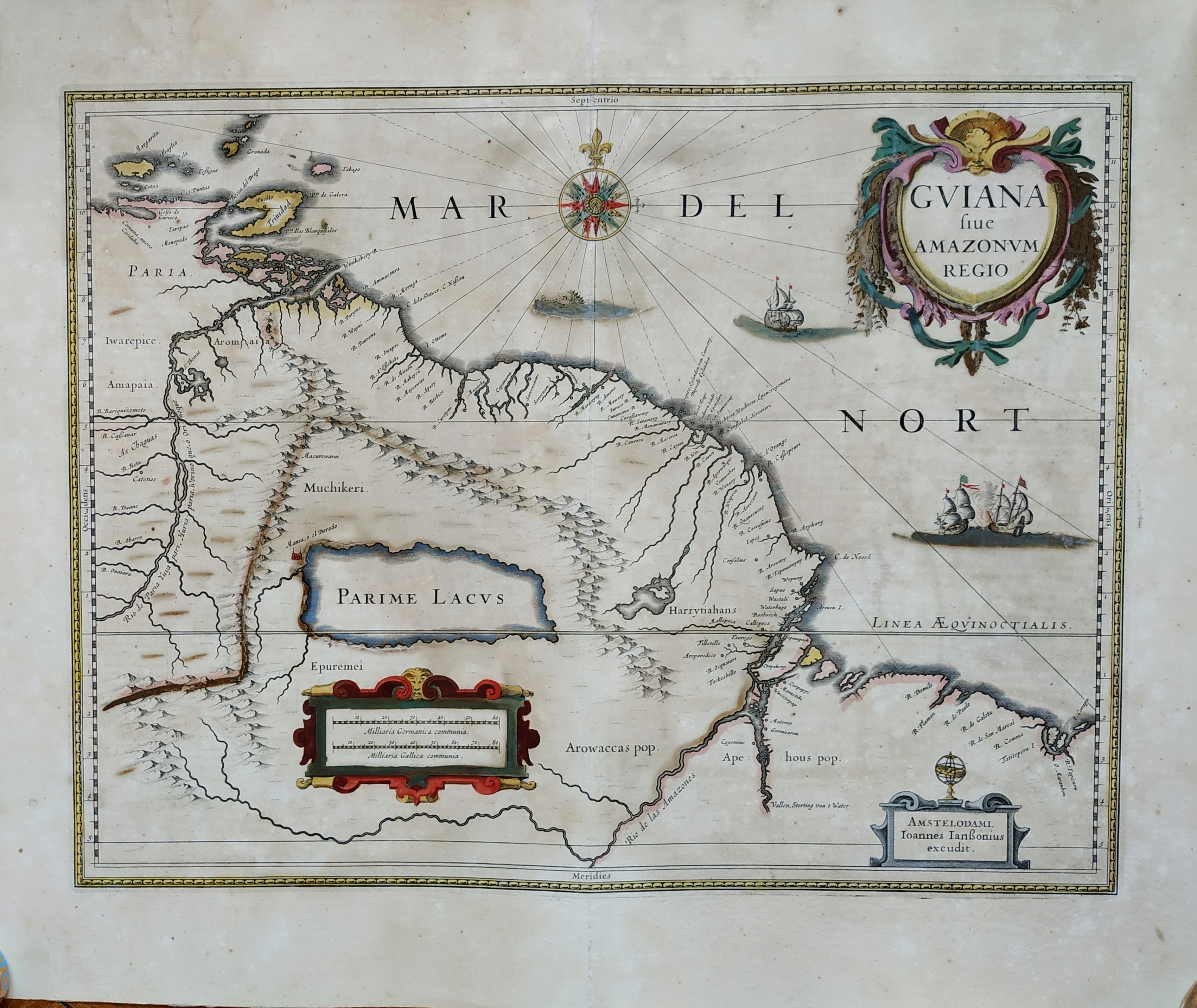
Map title
Guiana Sive Amazonum Regio
Author
Blaeu
Location shown in map
Guiana
Edition date
Circa 1641
Edition place
Amsterdam
Editor
Blaeu
Atlas
Price
400 Euro
State
[mint/EXCELLENT/very good/good/fair/mediocre/poor]
Color
Old colors
Verso
Latin text
Size
Plate: cm (48 x 37) inches (18.9 x 14.57) Paper: cm (59 x 48) inches (23.23 x 18.9)
Technique
Copper engraving
Note
No particular notes for this maps
Reference
Wiki
Here for more info
In stock
Available
Info
info@thetreasuremaps.com
Code
#0731
×
![]()
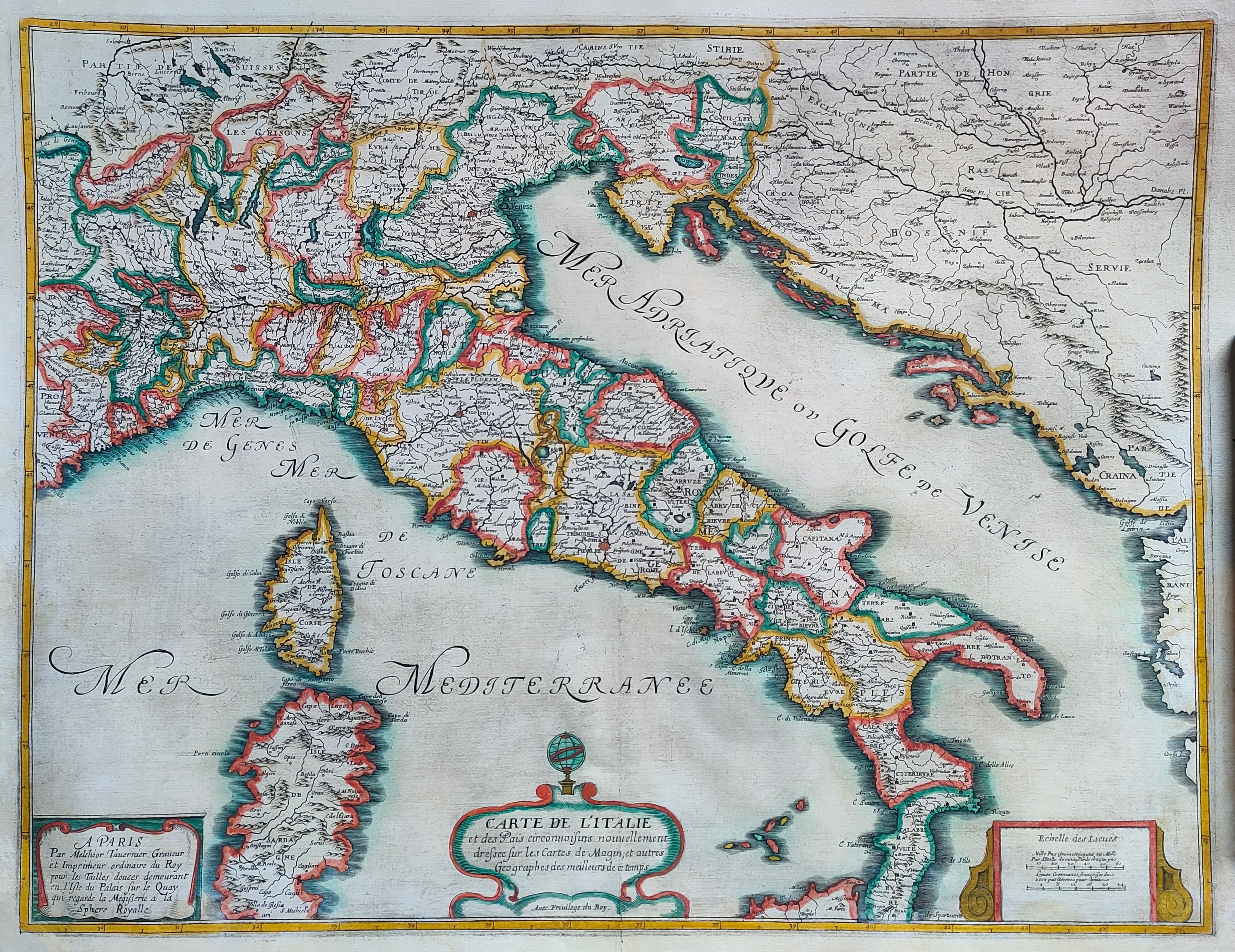
Map title
Carte de l'Italie
Author
Tavernier
Location shown in map
Italy
Edition date
Circa 1642
Edition place
Paris
Editor
Atlas
Price
800 Euro
State
[mint/EXCELLENT/very good/good/fair/mediocre/poor]
Color
Old colors
Verso
Blank
Size
Plate: cm (60 x 52) inches (23.62 x 20.47) Paper: cm (51 x 70) inches (20.08 x 27.56)
Technique
Copper engraving
Note
framed
Reference
R.Borri L'Italia nelle antiche carte pag.136
Wiki
Here for more info
In stock
Available
Info
info@thetreasuremaps.com
Code
#1226
×
![]()

Map title
Descriptio Fluminum Rheni, Vahalis et Mosae a Rheno Berca ad Goricomium usque
Author
Hondius
Location shown in map
Rhine
Edition date
Circa 1642
Edition place
Amsterdam
Editor
Hondius
Atlas
Price
175 Euro
State
[mint/EXCELLENT/very good/good/fair/mediocre/poor]
Color
Old colors
Verso
Latin text
Size
Plate: cm (49 x 37) inches (19.29 x 14.57) Paper: cm (56 x 48) inches (22.05 x 18.9)
Technique
Copper engraving
Note
Professionally repaired
Reference
Wiki
Here for more info
In stock
Available
Info
info@thetreasuremaps.com
Code
#1233
×
![]()
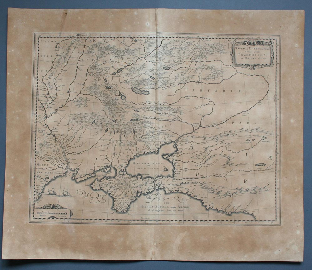
Map title
Taurica Chersonesus. Nostra aetate Przecopsca, et Gazara dicitur.
Author
Blaeu
Location shown in map
Russia and Black sea
Edition date
1645
Edition place
Amsterdam
Editor
--
Atlas
Theatrum Orbis Terrarum, Sive Atlas Novis
Price
200 Euro
State
[mint/excellent/VERY GOOD/good/fair/mediocre/poor]
Color
Black/white
Verso
Latin text
Size
Plate: cm (48.3 x 35.6) inches (19.02 x 14.02) Paper: cm (58.4 x 50.8) inches (22.99 x 20)
Technique
Copper engraving
Note
No particular notes for this maps
Reference
--
Wiki
Here for more info
In stock
Available
Info
info@thetreasuremaps.com
Code
#0217
×
![]()
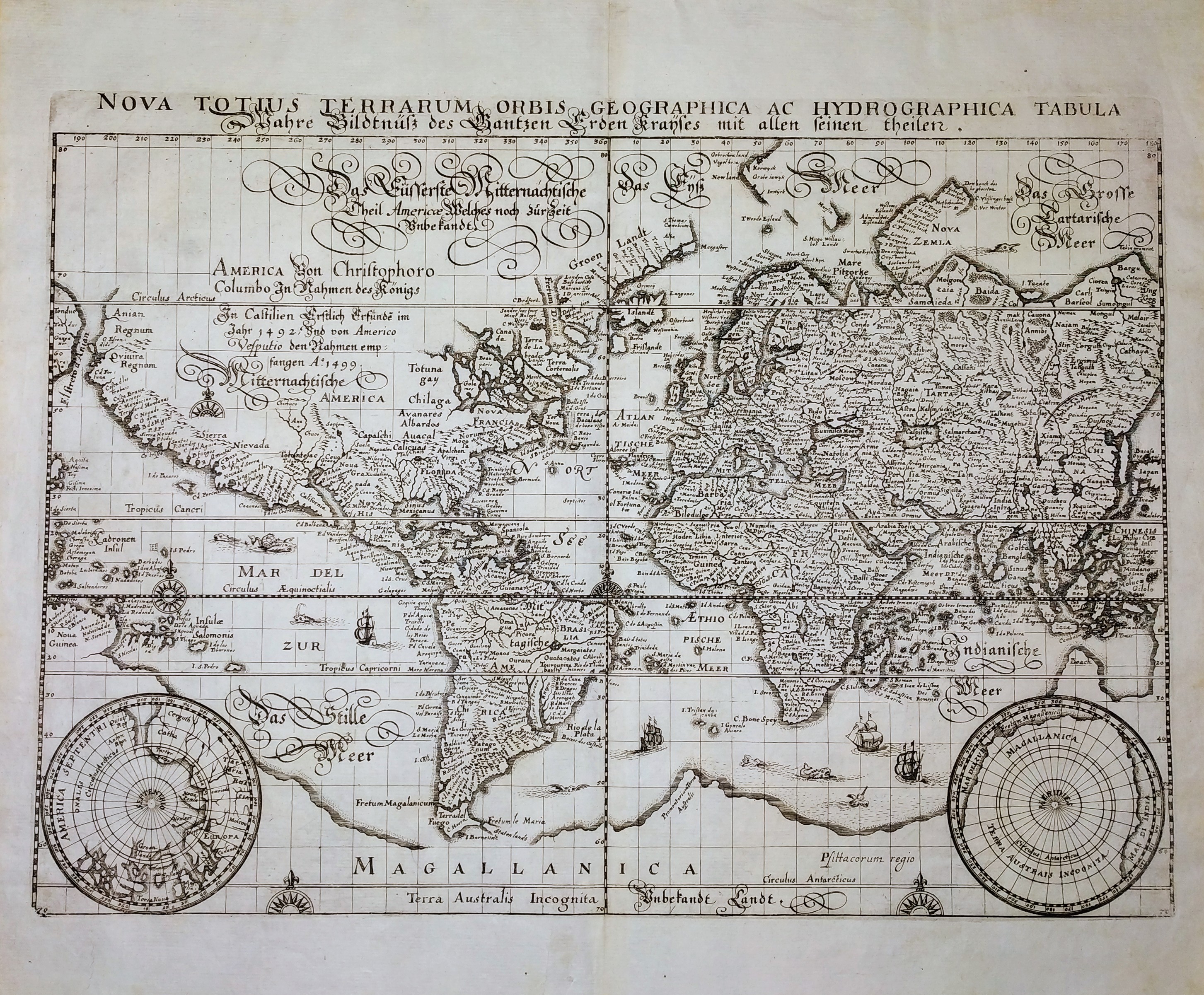
Map title
Nova Totius Terrarum Orbis Geographica ac Hydrographica Tabula
Author
Merian
Location shown in map
World
Edition date
Circa 1646
Edition place
Frankfurt
Editor
--
Atlas
Neuwe Archontologia Cosmica
Price
1000 Euro
State
[MINT/excellent/very good/good/fair/mediocre/poor]
Color
Black/white
Verso
Blank
Size
Plate: cm (35 x 26) inches (13.78 x 10.24) Paper: cm (39 x 33) inches (15.35 x 12.99)
Technique
Copper engraving
Note
No particular notes for this maps.
Reference
--
Wiki
Here for more info
In stock
Available
Info
info@thetreasuremaps.com
Code
#0705
×
![]()
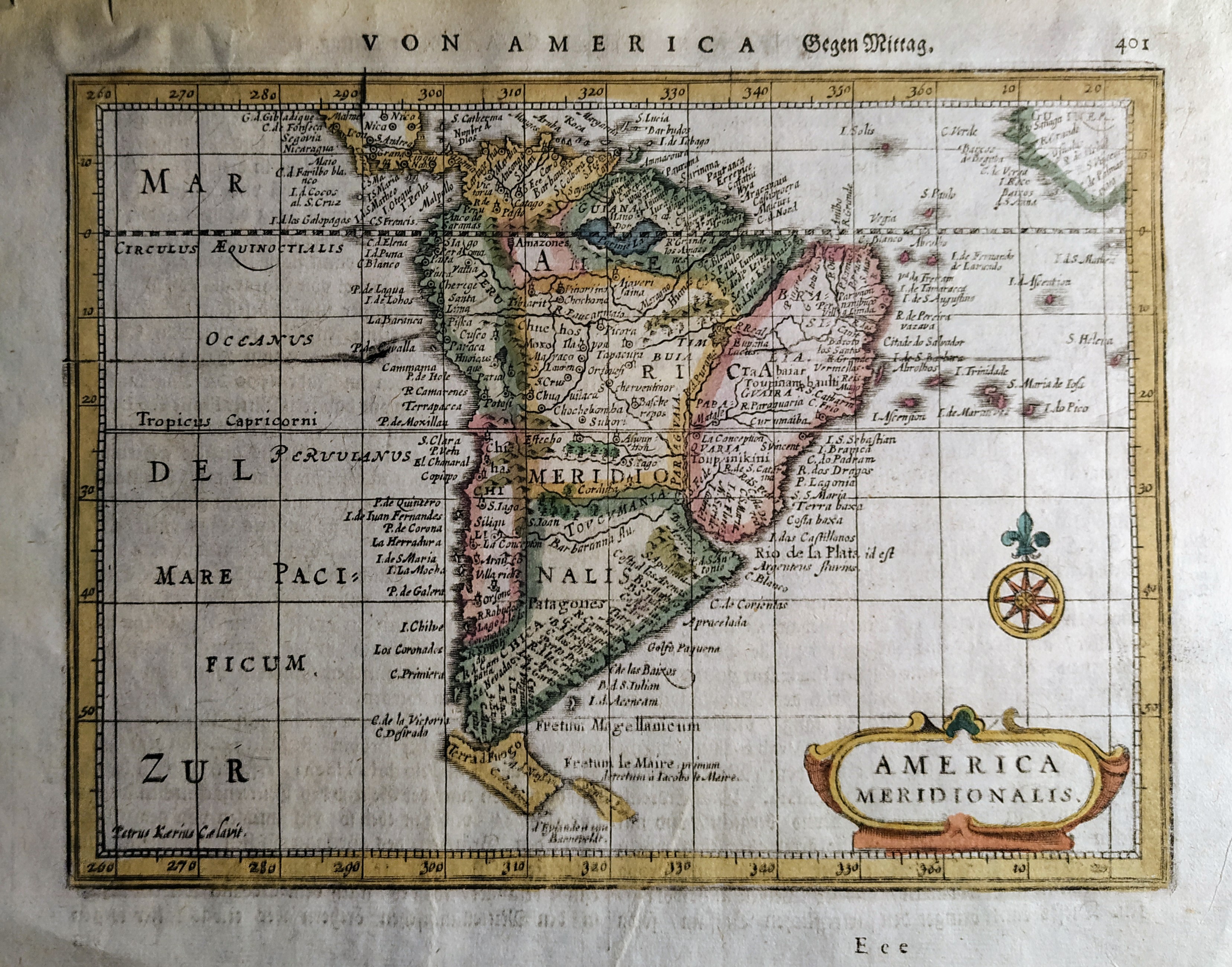
Map title
America Meridionalis
Author
Mercator
Location shown in map
South America
Edition date
Circa 1648
Edition place
Amsterdam
Editor
Janssonius
Atlas
Altas Minor Gerardi Mercatoris
Price
Please ask: info@thetreasuremaps.com
State
[mint/EXCELLENT/very good/good/fair/mediocre/poor]
Color
Old colors
Verso
German text pag 402
Size
Plate: cm (19 x 14) inches (7.48 x 5.51) Paper: cm (23 x 18) inches (9.06 x 7.09)
Technique
Copper engraving
Note
No particular notes for this maps
Reference
Wiki
Here for more info
In stock
Available
Info
info@thetreasuremaps.com
Code
#0726
×
![]()
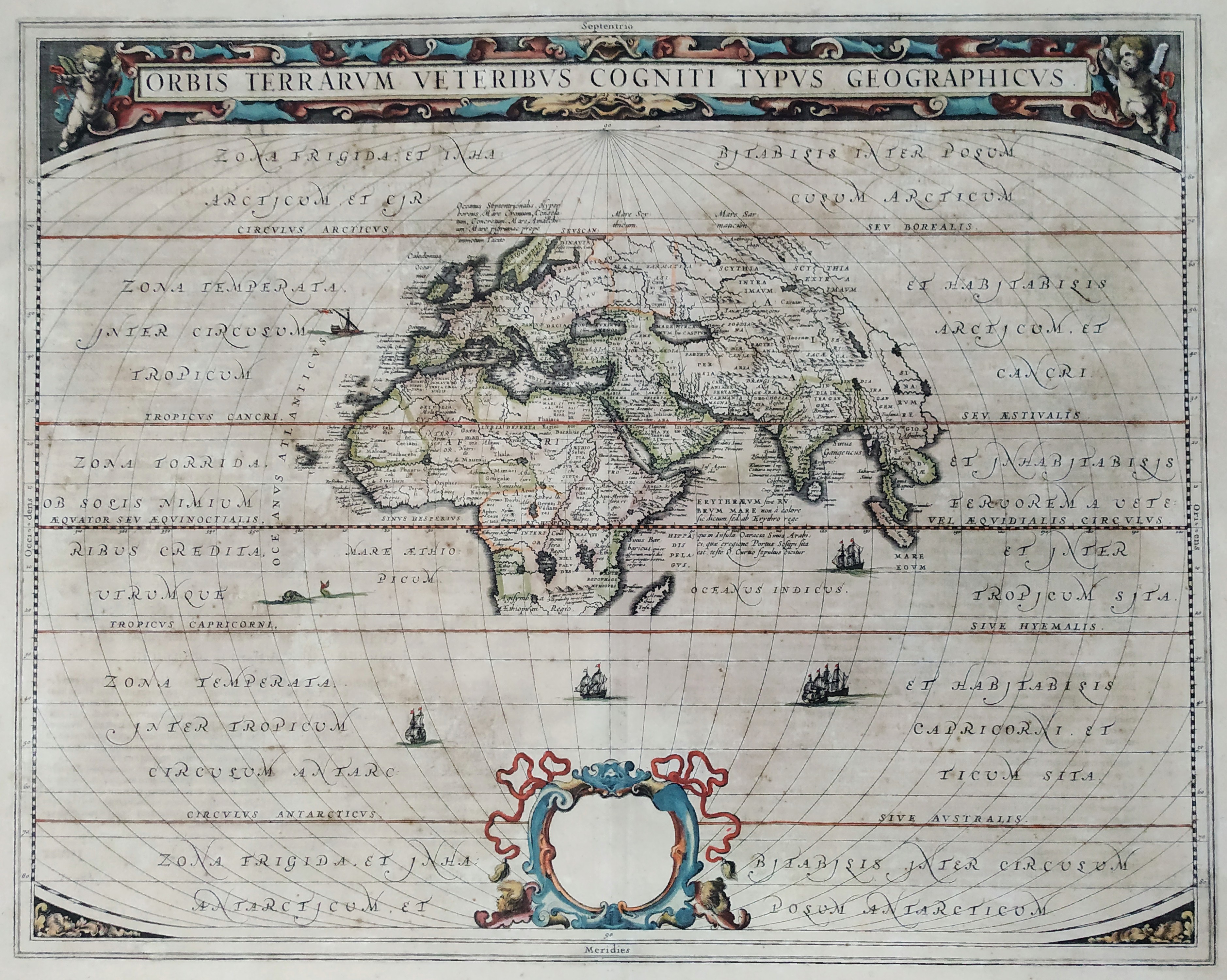
Map title
Orbis Terrarum Veteribus Cogniti Typus Geographicus
Author
Jansson
Location shown in map
World
Edition date
Circa 1650
Edition place
Amsterdam
Editor
Janssonius
Atlas
Atlas
Price
600 Euro
State
[mint/EXCELLENT/verygood/good/fair/mediocre/poor]
Color
Old colors
Verso
Latin
Size
Plate: cm (49.5 x 39.4) inches (19.49 x 15.51) Paper: cm (58.4 x 48.3) inches (22.99 x 19.02)
Technique
Copper engraving
Note
--
Reference
--
Wiki
Here for more info
In stock
Available
Info
info@thetreasuremaps.com
Code
#0599
×
![]()
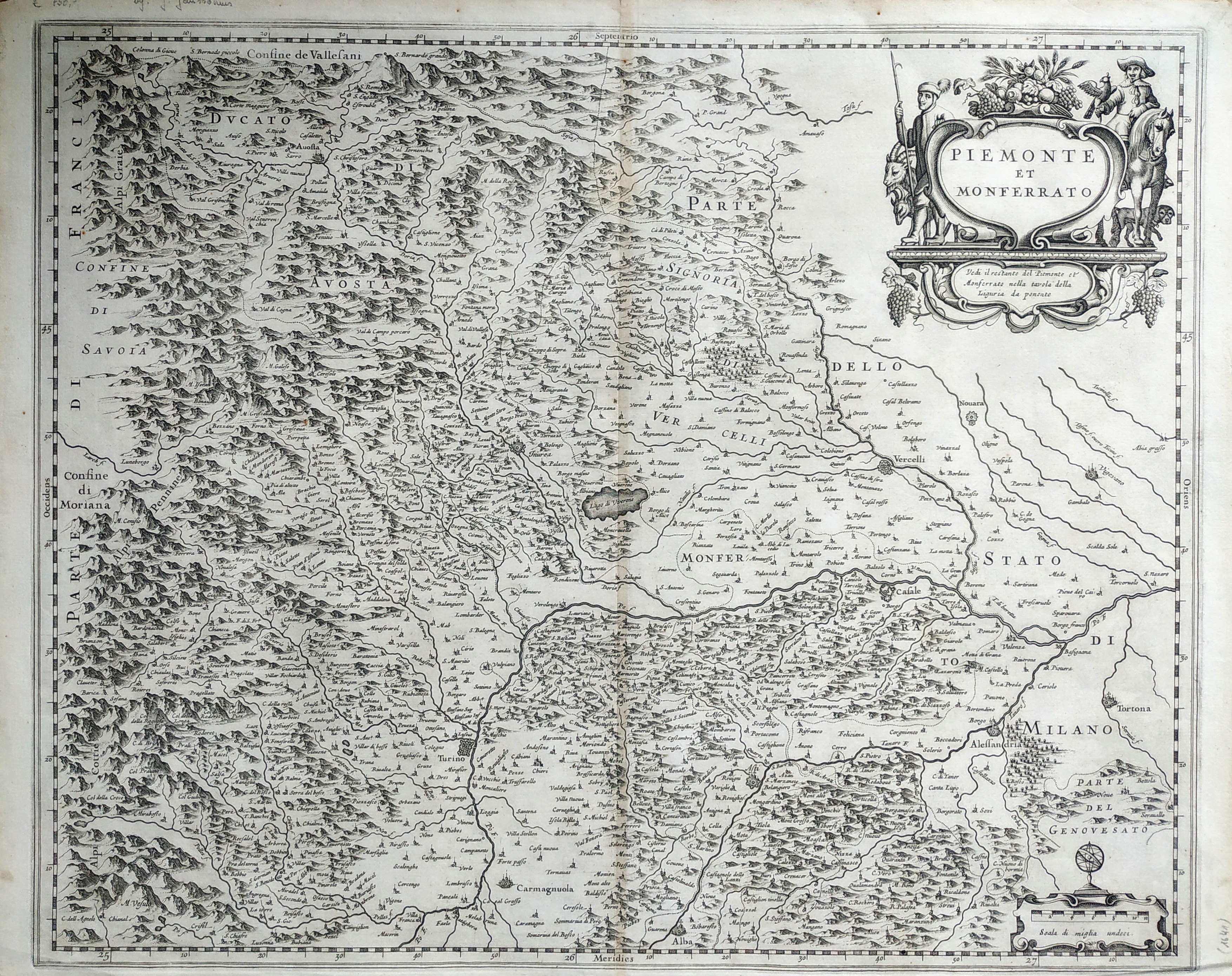
Map title
Piemonte et Monferrato
Author
Blaeu
Location shown in map
North-West Italy
Edition date
Circa 1650
Edition place
Amsterdam
Editor
Blaeu
Atlas
Atlas Maior
Price
300 Euro
State
[mint/EXCELLENT/very good/good/fair/mediocre/poor]
Color
Old colors
Verso
Blank
Size
Plate: cm (51 x 41) inches (20.08 x 16.14) Paper: cm (55 x 44) inches (21.65 x 17.32)
Technique
Copper engraving
Note
No particular notes for this maps
Reference
Wiki
Here for more info
In stock
Available
Info
info@thetreasuremaps.com
Code
#0728
×
![]()
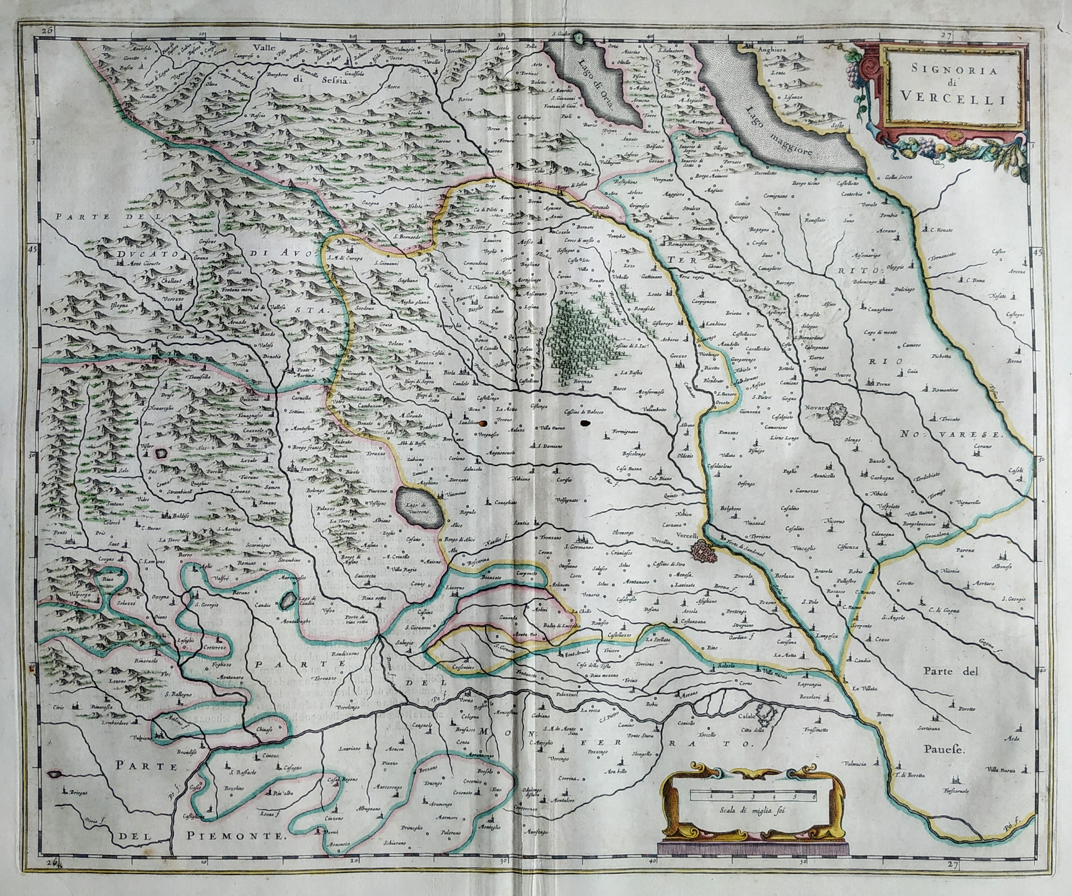
Map title
La signoria di Vercelli
Author
Blaeu
Location shown in map
North-West Italy
Edition date
Circa 1650
Edition place
Amsterdam
Editor
Blaeu
Atlas
Atlas Maior
Price
300 Euro
State
[mint/excellent/VERY GOOD/good/fair/mediocre/poor]
Color
Old colors
Verso
Duch text pag.17
Size
Plate: cm (51 x 41) inches (20.08 x 16.14) Paper: cm (55 x 44) inches (21.65 x 17.32)
Technique
Copper engraving
Note
No particular notes for this maps
Reference
Wiki
Here for more info
In stock
Available
Info
info@thetreasuremaps.com
Code
#0805
×
![]()
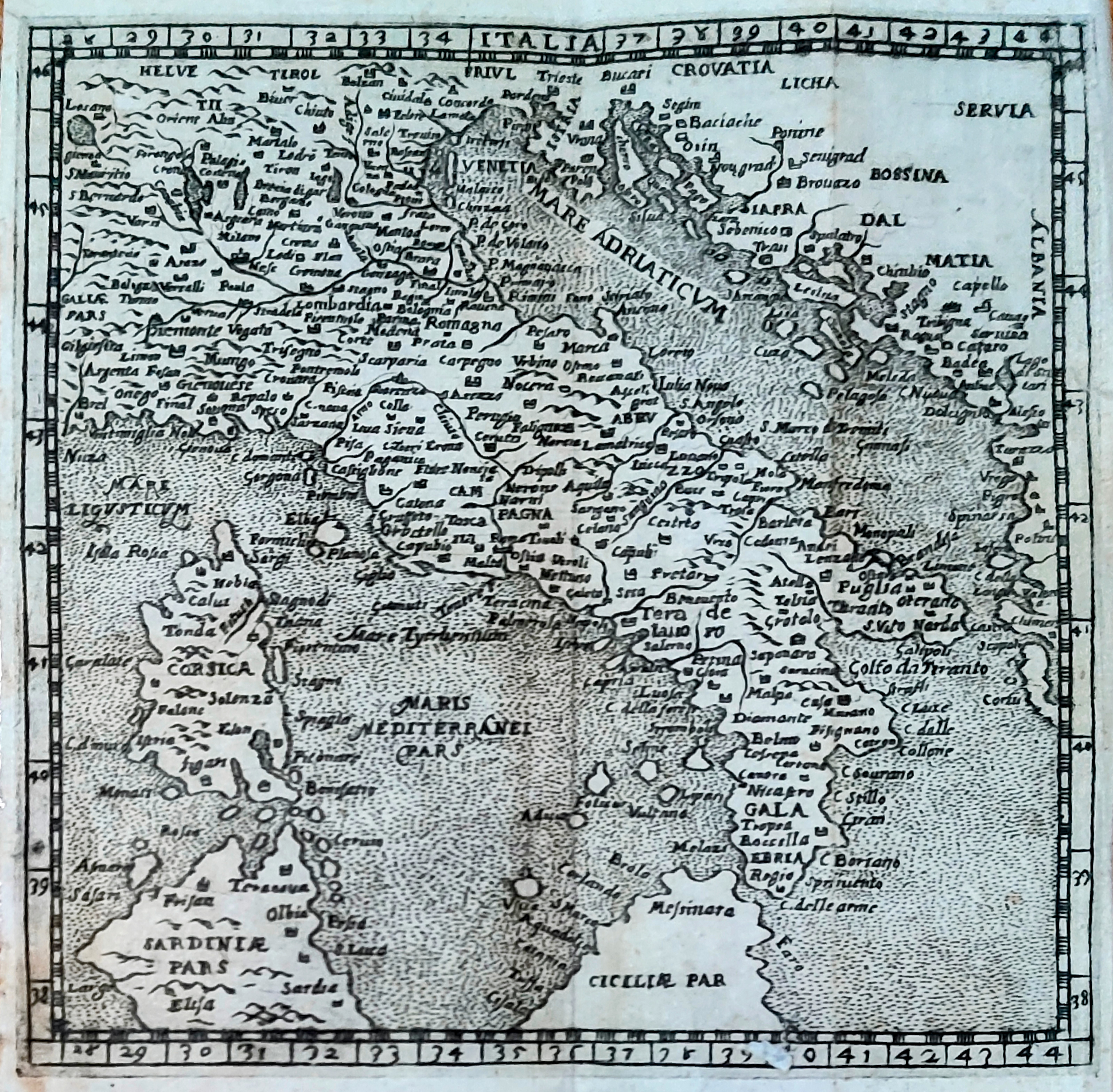
Map title
Italia
Author
Scotto
Location shown in map
Italy
Edition date
1650
Edition place
Venezia
Editor
Atlas
Itinerario
Price
Please ask: info@thetreasuremaps.com
State
[mint/EXCELLENT/very good/good/fair/mediocre/poor]
Color
Black/white
Verso
Blank
Size
Plate: cm (12 x 12) inches (4.72 x 4.72) Paper: cm (14 x 13) inches (5.51 x 5.12)
Technique
Copper engraving
Note
Reference
R.Borri L'Italia nelle antiche carte pag.86
Wiki
Here for more info
In stock
Sold
Info
info@thetreasuremaps.com
Code
#0934
×
![]()
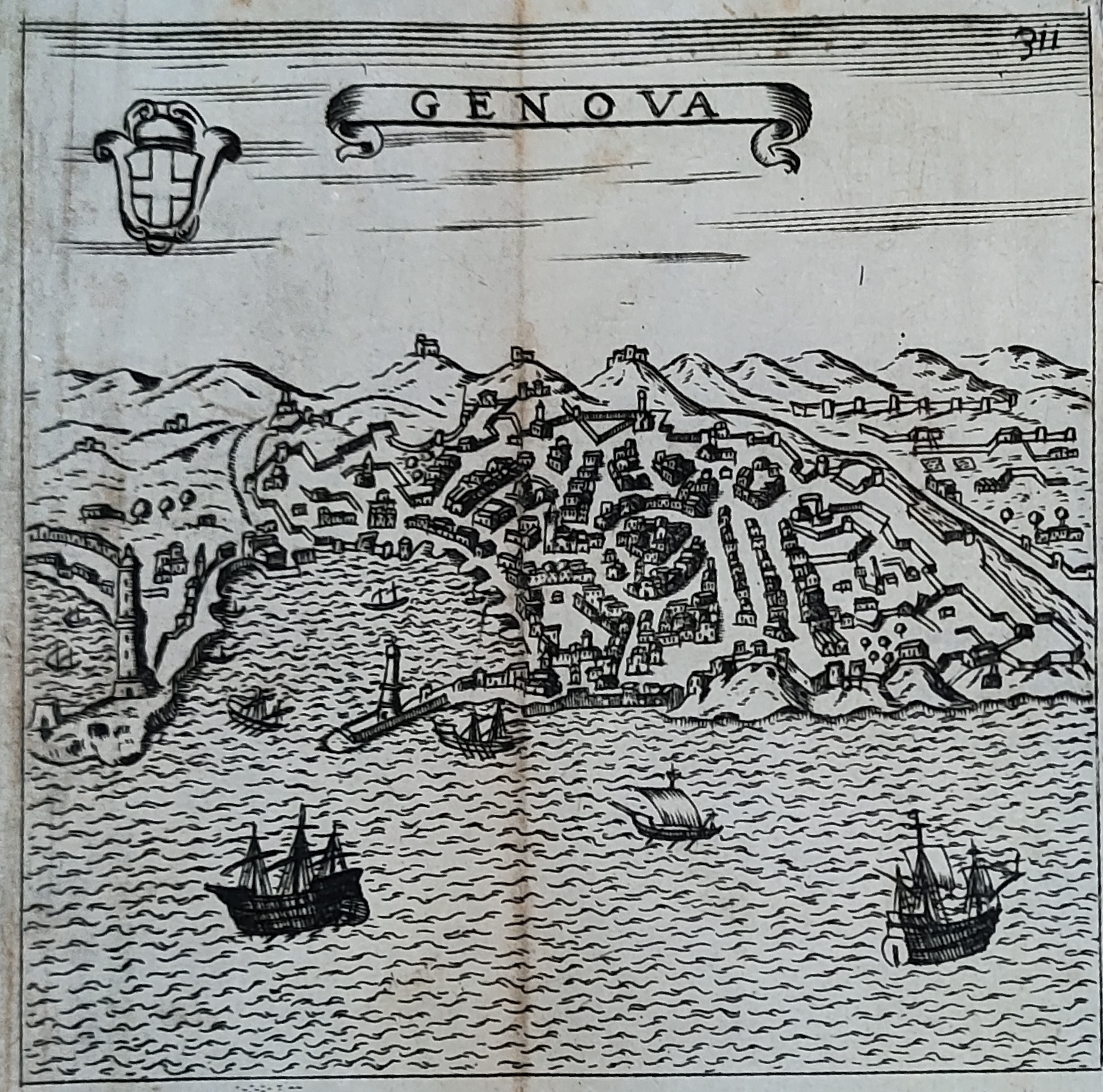
Map title
Genova
Author
Scoto
Location shown in map
Genoa
Edition date
1650
Edition place
Venezia
Editor
Atlas
Itinerario
Price
200 Euro
State
[mint/EXCELLENT/very good/good/fair/mediocre/poor]
Color
Black/white
Verso
Blank
Size
Plate: cm (12 x 12) inches (4.72 x 4.72) Paper: cm (14 x 13) inches (5.51 x 5.12)
Technique
Copper engraving
Note
Reference
Wiki
Here for more info
In stock
Available
Info
info@thetreasuremaps.com
Code
#0949
×
![]()
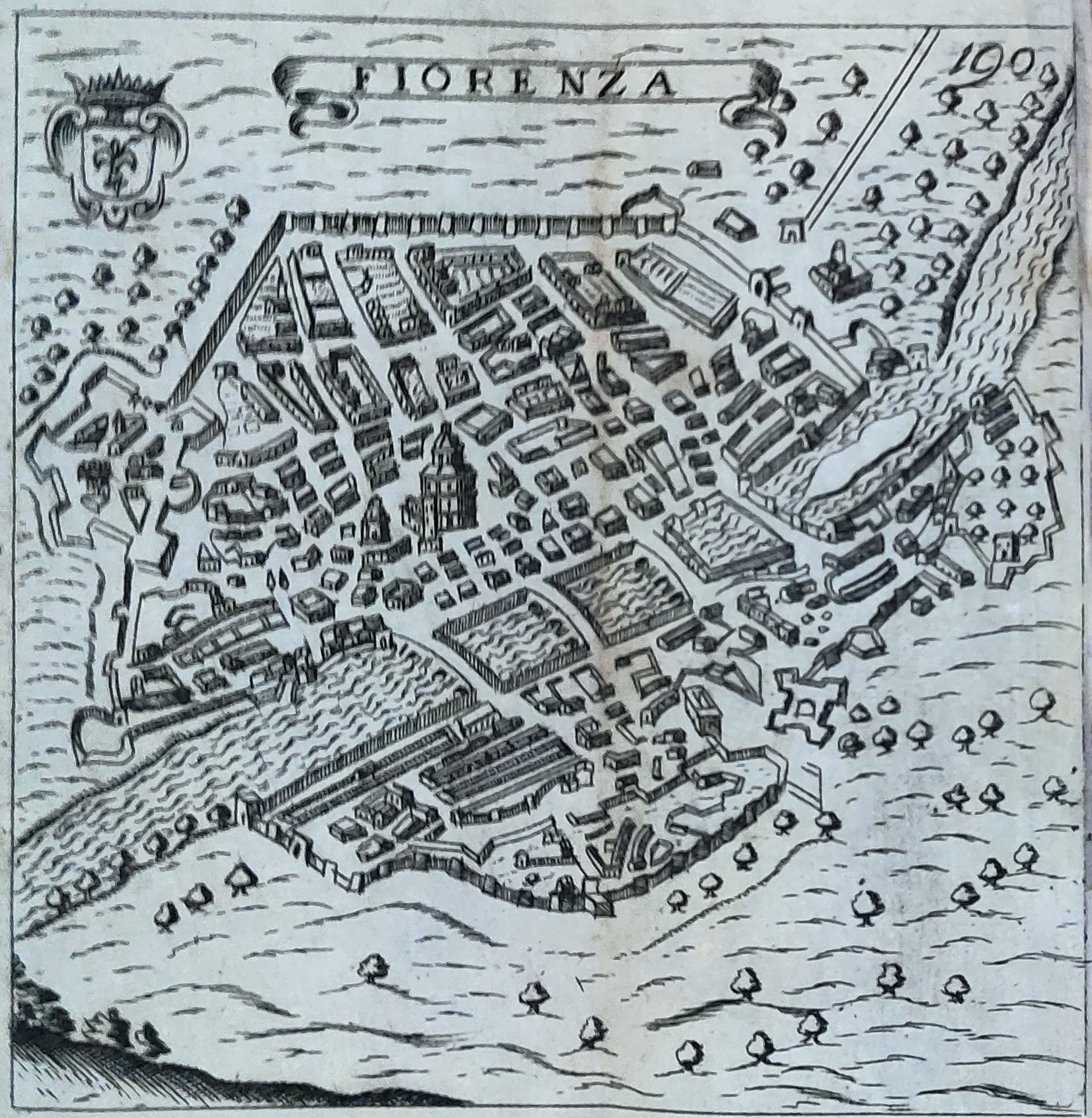
Map title
Florenza
Author
Scotto
Location shown in map
Florence
Edition date
1650
Edition place
Venezia
Editor
Atlas
Itinerario
Price
Please ask: info@thetreasuremaps.com
State
[mint/EXCELLENT/very good/good/fair/mediocre/poor]
Color
Black/white
Verso
Blank
Size
Plate: cm (12 x 12) inches (4.72 x 4.72) Paper: cm (14 x 13) inches (5.51 x 5.12)
Technique
Copper engraving
Note
Reference
Wiki
Here for more info
In stock
Available
Info
info@thetreasuremaps.com
Code
#0950
×
![]()
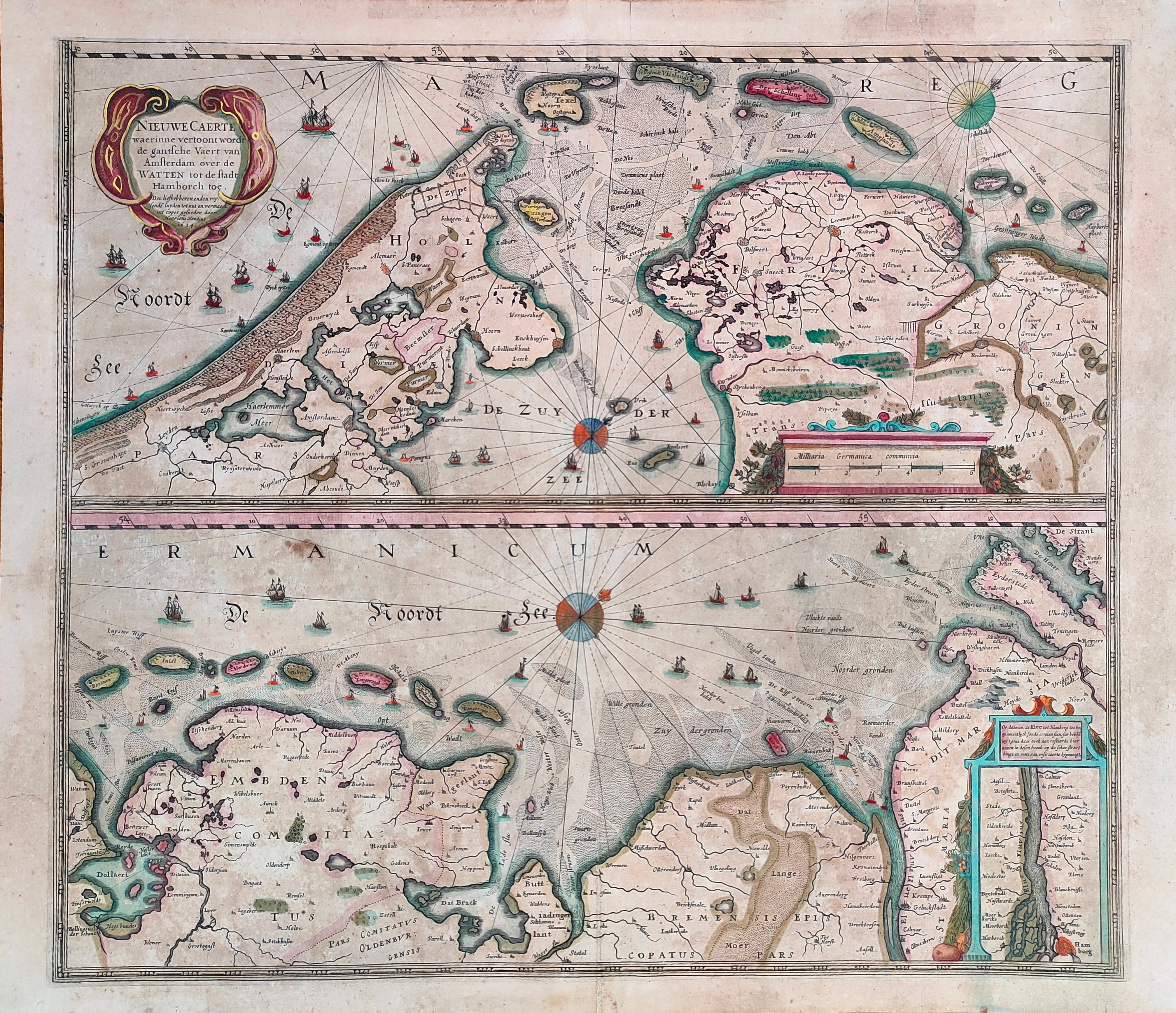
Map title
Nieuwe Caerte waerinne vertoont wordt de gantsche Vaert van Amsterdam
Author
Hondius
Location shown in map
Amsterdam
Edition date
Circa 1650
Edition place
Amsterdam
Editor
Hondius
Atlas
Price
400 Euro
State
[mint/EXCELLENT/very good/good/fair/mediocre/poor]
Color
Old colors
Verso
Size
Plate: cm (51 x 45) inches (20.08 x 17.72) Paper: cm (56 x 48) inches (22.05 x 18.9)
Technique
Copper engraving
Note
Reference
Wiki
Here for more info
In stock
Available
Info
info@thetreasuremaps.com
Code
#1231
×
![]()
Map title
Candia olim Creta
Author
Blaeu
Location shown in map
Crete
Edition date
Circa 1650
Edition place
Amsterdam
Editor
Blaeu
Atlas
Atlas Maior
Price
300 Euro
State
[mint/EXCELLENT/very good/good/fair/mediocre/poor]
Color
Black/white
Verso
Spanish text
Size
Plate: cm (53 x 39) inches (20.87 x 15.35) Paper: cm (64 x 55) inches (25.2 x 21.65)
Technique
Copper engraving
Note
No particular notes for this maps
Reference
Wiki
Here for more info
In stock
Available
Info
info@thetreasuremaps.com
Code
#1271
×
![]()
Map title
Pedemontana regio cum Genvensium territorio & Montisferrati marchionatu
Author
Mercator
Location shown in map
North-West Italy
Edition date
1651
Edition place
Amsterdam
Editor
Janssonius
Atlas
Altas Minor Gerardi Mercatoris
Price
Please ask: info@thetreasuremaps.com
State
[mint/EXCELLENT/very good/good/fair/mediocre/poor]
Color
Black/white
Verso
German text pag 218
Size
Plate: cm (20.3 x 14) inches (7.99 x 5.51) Paper: cm (22.9 x 17.8) inches (9.02 x 7.01)
Technique
Copper engraving
Note
No particular notes for this maps
Reference
--
Wiki
Here for more info
In stock
Sold
Info
info@thetreasuremaps.com
Code
#0447
×
![]()
Map title
Germaniae veteris nova descriptio
Author
Jansson
Location shown in map
Germany
Edition date
1652
Edition place
Amsterdam
Editor
--
Atlas
Accuratissima orbis antiqui delineatio.
Price
250 Euro
State
[mint/excellent/VERY GOOD/good/fair/mediocre/poor]
Color
Black/white
Verso
Blank
Size
Plate: cm (47 x 36.8) inches (18.5 x 14.49) Paper: cm (54.6 x 45.7) inches (21.5 x 17.99)
Technique
Copper engraving
Note
Map based on Ortelius' map of ancient Germany.
Reference
--
Wiki
Here for more info
In stock
Available
Info
info@thetreasuremaps.com
Code
#0138
×
![]()
Map title
Situs provinciarum imperii sinici
Author
Martini
Location shown in map
China
Edition date
1654
Edition place
Cologne
Editor
Atlas
De bello Tartarico historia
Price
400 Euro
State
[mint/EXCELLENT/very good/good/fair/mediocre/poor]
Color
Black/white
Verso
Blank
Size
Plate: cm (16 x 13) inches (6.3 x 5.12) Paper: cm (19 x 18) inches (7.48 x 7.09)
Technique
Copper engraving
Note
Reference
--
Wiki
Here for more info
In stock
Available
Info
info@thetreasuremaps.com
Code
#1202
×
![]()
Map title
Imperii Sinarum Nova Descriptio
Author
Blaeu
Location shown in map
China
Edition date
1655
Edition place
Amsterdam
Editor
Atlas
Atlas Sinensis
Price
1100 Euro
State
[mint/excellent/very good/good/fair/MEDIOCRE/poor]
Color
Old colors
Verso
Blank
Size
Plate: cm (60 x 46) inches (23.62 x 18.11) Paper: cm (60 x 46) inches (23.62 x 18.11)
Technique
Copper engraving
Note
No particular notes for this maps.
Reference
--
Wiki
Here for more info
In stock
Available
Info
info@thetreasuremaps.com
Code
#0938
×
![]()
Map title
Les isles Antilles
Author
Sanson
Location shown in map
Antilles islands
Edition date
1656
Edition place
Paris
Editor
--
Atlas
Cartes generales de toutes les parties du monde -- Pierre Mariette
Price
600 Euro
State
[mint/EXCELLENT/very good/good/fair/mediocre/poor]
Color
Black/white
Verso
Blank
Size
Plate: cm (53.3 x 38.1) inches (20.98 x 15) Paper: cm (53.3 x 43.2) inches (20.98 x 17.01)
Technique
Copper engraving
Note
Professionally repaired
Reference
--
Wiki
Here for more info
In stock
Available
Info
info@thetreasuremaps.com
Code
#0343
×
![]()
Map title
Carte generale des royaume d'Angleterre
Author
Sanson
Location shown in map
British Isles
Edition date
1658
Edition place
Paris
Editor
Melchior Tavenier
Atlas
Price
350 Euro
State
[mint/excellent/VERY GOOD/good/fair/mediocre/poor]
Color
Old colors
Verso
Blank
Size
Plate: cm (52 x 39) inches (20.47 x 15.35) Paper: cm (57 x 44) inches (22.44 x 17.32)
Technique
Copper engraving
Note
Reference
Wiki
Here for more info
In stock
Available
Info
info@thetreasuremaps.com
Code
#1173
×
![]()
Map title
Genova
Author
Scoto
Location shown in map
Genoa
Edition date
1659
Edition place
Padova
Editor
Cadorin
Atlas
Itinerario
Price
200 Euro
State
[mint/EXCELLENT/very good/good/fair/mediocre/poor]
Color
Black/white
Verso
Blank
Size
Plate: cm (17.8 x 12.7) inches (7.01 x 5) Paper: cm (20.3 x 16.5) inches (7.99 x 6.5)
Technique
Copper engraving
Note
--
Reference
--
Wiki
Here for more info
In stock
Available
Info
info@thetreasuremaps.com
Code
#0528
×
![]()
Map title
Trino preso dal generale marchese Villa
Author
Merian
Location shown in map
Trino
Edition date
1659
Edition place
Editor
--
Atlas
Historia di Leopoldo Cesari
Price
Please ask: info@thetreasuremaps.com
State
[mint/EXCELLENT/very good/good/fair/mediocre/poor]
Color
Black/white
Verso
White
Size
Plate: cm (39.4 x 31.8) inches (15.51 x 12.52) Paper: cm (41.9 x 34.3) inches (16.5 x 13.5)
Technique
Copper engraving
Note
No particular notes for this maps.
Reference
--
Wiki
Here for more info
In stock
Available
Info
info@thetreasuremaps.com
Code
#0542
×
![]()
Map title
Tabula Indiae Orientalis
Author
De Witt
Location shown in map
South East
Edition date
Circa 1662
Edition place
Amsterdam
Editor
Atlas
Price
1200 Euro
State
[mint/EXCELLENT/very good/good/fair/mediocre/poor]
Color
Old colors
Verso
Blank
Size
Plate: cm (58 x 46) inches (22.83 x 18.11) Paper: cm (62 x 53) inches (24.41 x 20.87)
Technique
Copper engraving
Note
Reference
Wiki
Here for more info
In stock
Available
Info
info@thetreasuremaps.com
Code
#1261
×
![]()
Map title
Typus communicationis Maris Caspy, cum Persico et Euxino.
Author
Kircher
Location shown in map
Black sea & Caspian sea
Edition date
1665
Edition place
Editor
--
Atlas
Mundus Subterraneus
Price
200 Euro
State
[mint/EXCELLENT/very good/good/fair/mediocre/poor]
Color
Black/white
Verso
Latin text
Size
Plate: cm (16.5 x 16.5) inches (6.5 x 6.5) Paper: cm (24.1 x 38.1) inches (9.49 x 15)
Technique
Copper engraving
Note
--
Reference
--
Wiki
Here for more info
In stock
Available
Info
info@thetreasuremaps.com
Code
#0216
×
![]()
Map title
L'Italie
Author
Sanson
Location shown in map
Italy
Edition date
1665
Edition place
Paris
Editor
Atlas
Price
600 Euro
State
[mint/excellent/VERY GOOD/good/fair/mediocre/poor]
Color
Old colors
Verso
Blank
Size
Plate: cm (0 x 0) inches (0 x 0) Paper: cm (0 x 0) inches (0 x 0)
Technique
Copper engraving
Note
Reference
R.Borri L'Italia nelle antiche carte pag.144
Wiki
Here for more info
In stock
Available
Info
info@thetreasuremaps.com
Code
#0918
×
![]()
Map title
Partie de Lithuanie
Author
Sanson
Location shown in map
Lituania
Edition date
1665
Edition place
Paris
Editor
Atlas
Price
500 Euro
State
[mint/excellent/very good/good/FAIR/mediocre/poor]
Color
Old colors
Verso
Blank
Size
Plate: cm (56 x 41) inches (22.05 x 16.14) Paper: cm (60 x 46) inches (23.62 x 18.11)
Technique
Copper engraving
Note
Reference
Wiki
Here for more info
In stock
Available
Info
info@thetreasuremaps.com
Code
#1191
×
![]()
Map title
Isle de Madagascar
Author
Sanson
Location shown in map
Madagascar
Edition date
Circa 1667
Edition place
Paris
Editor
Atlas
Price
150 Euro
State
[mint/EXCELLENT/very good/good/fair/mediocre/poor]
Color
Black/white
Verso
Blank
Size
Plate: cm (25 x 19) inches (9.84 x 7.48) Paper: cm (41 x 27) inches (16.14 x 10.63)
Technique
Copper engraving
Note
Reference
Wiki
Here for more info
In stock
Available
Info
info@thetreasuremaps.com
Code
#0662
×
![]()
Map title
Isles du CapVerd
Author
Sanson
Location shown in map
West Africa
Edition date
Circa 1667
Edition place
Paris
Editor
Atlas
Price
175 Euro
State
[mint/EXCELLENT/very good/good/fair/mediocre/poor]
Color
Black/white
Verso
Blank
Size
Plate: cm (29 x 19) inches (11.42 x 7.48) Paper: cm (41 x 27) inches (16.14 x 10.63)
Technique
Copper engraving
Note
Reference
Wiki
Here for more info
In stock
Available
Info
info@thetreasuremaps.com
Code
#0663
×
![]()
Map title
Apulia
Author
Ortelius
Location shown in map
Puglia
Edition date
Circa 1667
Edition place
Venice
Editor
--
Atlas
Theatro del mondo
Price
Please ask: info@thetreasuremaps.com
State
[mint/EXCELLENT/very good/good/fair/mediocre/poor]
Color
Old colors
Verso
Italian text
Size
Plate: cm (10 x 7) inches (3.94 x 2.76) Paper: cm (13 x 9) inches (5.12 x 3.54)
Technique
Copper engraving
Note
Reference
Wiki
Here for more info
In stock
Sold
Info
info@thetreasuremaps.com
Code
#0952
×
![]()
Map title
Tabula Regnorum Sueciae et Norvegiae
Author
Frederick de Wit
Location shown in map
Sweden
Edition date
Circa 1670
Edition place
Amsterdam
Editor
Atlas
Price
600 Euro
State
[mint/EXCELLENT/very good/good/fair/mediocre/poor]
Color
Black/white
Verso
Blank
Size
Plate: cm (55 x 44) inches (21.65 x 17.32) Paper: cm (60 x 52) inches (23.62 x 20.47)
Technique
Copper engraving
Note
Reference
Wiki
Here for more info
In stock
Available
Info
info@thetreasuremaps.com
Code
#0786
×
![]()
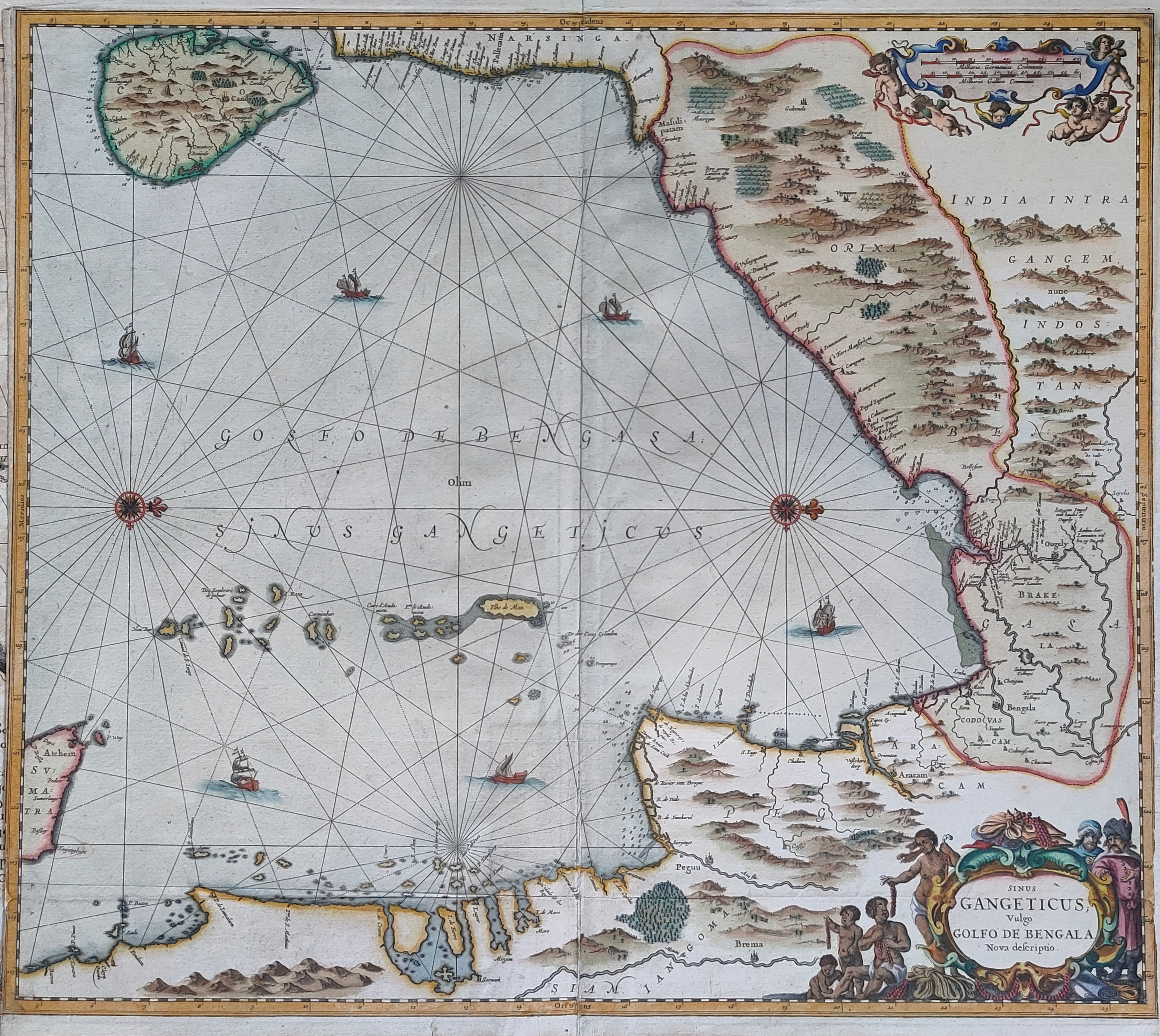
Map title
Sinus Gangeticus Vulgo Golfo De Bengala Nova descriptio
Author
Jansson
Location shown in map
India
Edition date
Circa 1670
Edition place
Amsterdam
Editor
Schenk
Atlas
Novus Atlas
Price
450 Euro
State
[mint/EXCELLENT/very good/good/fair/mediocre/poor] repaired
Color
Old colors
Verso
Blank
Size
Plate: cm (54 x 50) inches (21.26 x 19.69) Paper: cm (54 x 49) inches (21.26 x 19.29)
Technique
Copper engraving
Note
Reference
Wiki
Here for more info
In stock
Available
Info
info@thetreasuremaps.com
Code
#1200
×
![]()
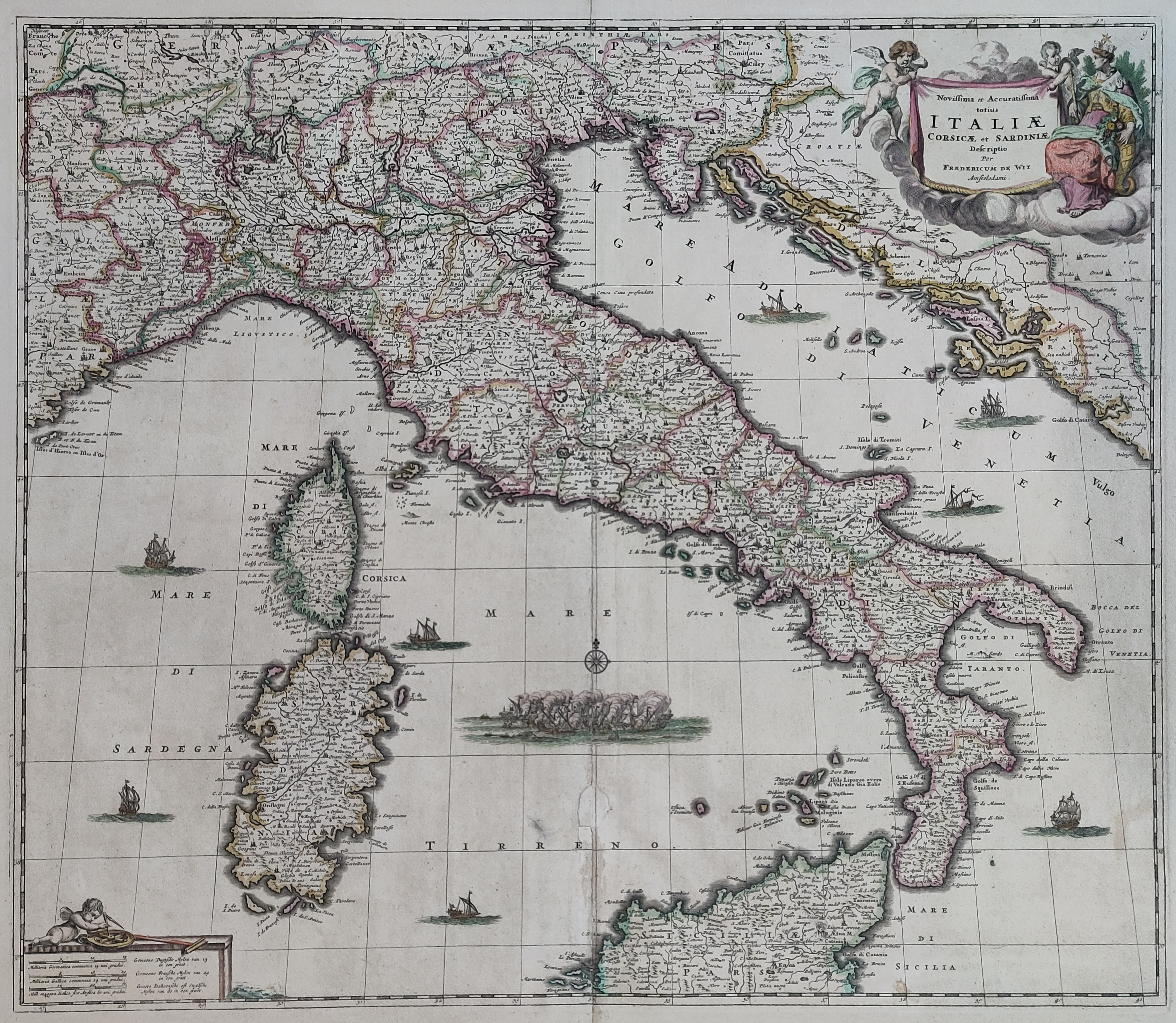
Map title
Novissima et accuratissima totius Italiae
Author
De Wit
Location shown in map
Italy
Edition date
Circa 1671
Edition place
Amsterdam
Editor
Atlas
Atlas Maior
Price
700 Euro
State
[mint/EXCELLENT/very good/good/fair/mediocre/poor]
Color
Old colors
Verso
Blank
Size
Plate: cm (56 x 49) inches (22.05 x 19.29) Paper: cm (63 x 53) inches (24.8 x 20.87)
Technique
Copper engraving
Note
Reference
R.Borri L'Italia nelle antiche carte pag.148
Wiki
Here for more info
In stock
Available
Info
info@thetreasuremaps.com
Code
#0896
×
![]()
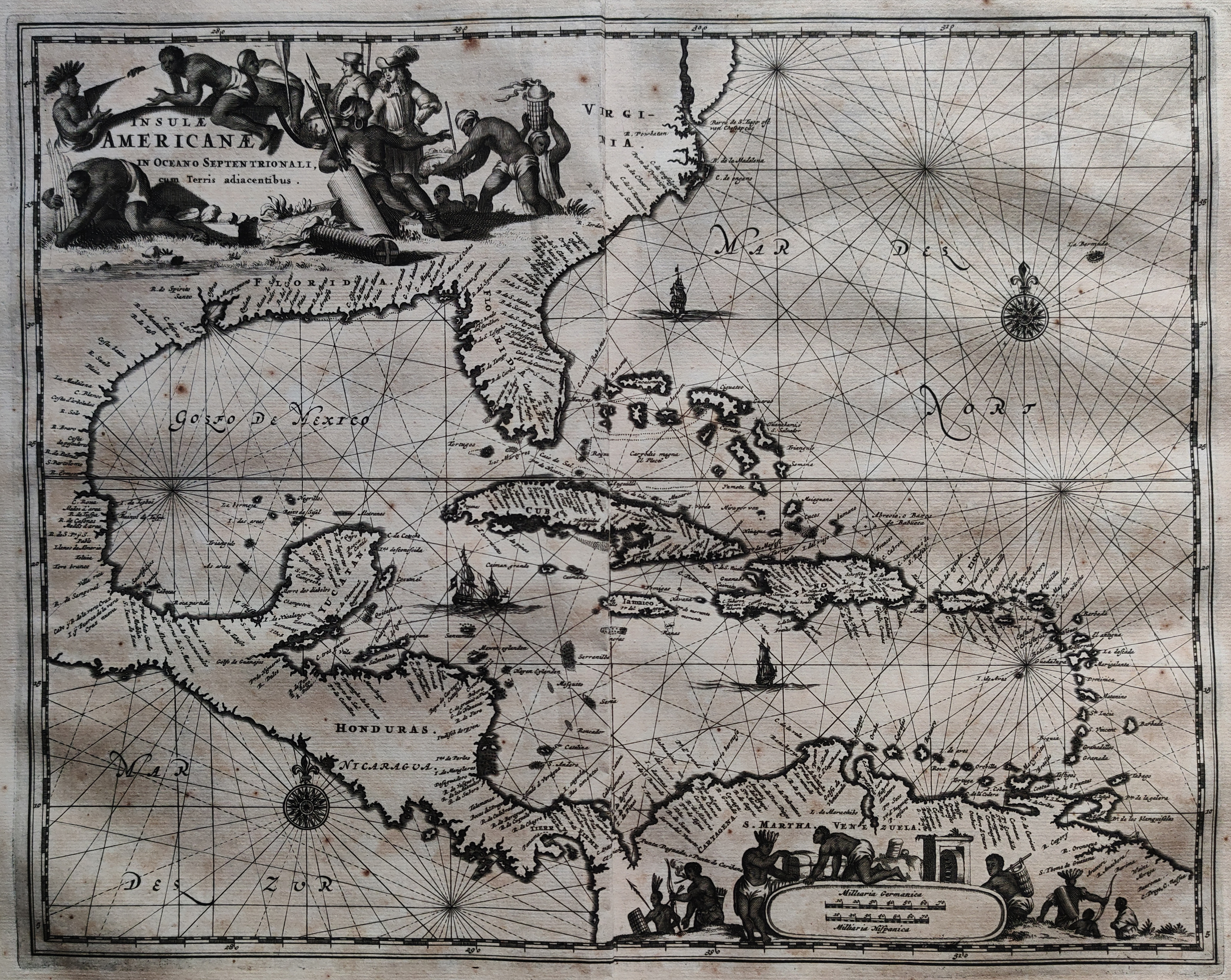
Map title
Insulae Americanae in Oceano Septentrionali, cum Terris adiacentibus.
Author
Ogilby
Location shown in map
Florida & Antilles islands
Edition date
1671
Edition place
London
Editor
Atlas
Price
500 Euro
State
[mint/EXCELLENT/very good/good/fair/mediocre/poor]
Color
Black/white
Verso
Blank
Size
Plate: cm (36 x 29) inches (14.17 x 11.42) Paper: cm (46 x 41) inches (18.11 x 16.14)
Technique
Copper engraving
Note
Reference
Wiki
Here for more info
In stock
Available
Info
info@thetreasuremaps.com
Code
#1094
×
![]()
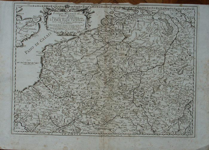
Map title
Provincie meridionali de Paesi Bassi intese sotto nome di Fiandra overo i Paesi Bassi cattolici
Author
Sanson
Location shown in map
Nederland
Edition date
1672
Edition place
Rome
Editor
--
Atlas
??? printed by Giacomo Rossi.
Price
200 Euro
State
[mint/excellent/VERY GOOD/good/fair/mediocre/poor]
Color
Black/white
Verso
Blank
Size
Plate: cm (50.8 x 36.8) inches (20 x 14.49) Paper: cm (59.7 x 41.9) inches (23.5 x 16.5)
Technique
Copper engraving
Note
Map based on Sanson map.
Reference
--
Wiki
Here for more info
In stock
Available
Info
info@thetreasuremaps.com
Code
#0139
×
![]()
Map title
L'Italie
Author
Sanson
Location shown in map
Italy
Edition date
1672
Edition place
Paris
Editor
Alexis Hubert Jaillot
Atlas
Wall map
Price
Please ask: info@thetreasuremaps.com
State
[mint/EXCELLENT/very good/good/fair/mediocre/poor]
Color
Old colors
Verso
Blank
Size
Plate: cm (78 x 59) inches (30.71 x 23.23) Paper: cm (79 x 61) inches (31.1 x 24.02)
Technique
Copper engraving
Note
Reference
R.Borri L'Italia nelle antiche carte pag.159
Wiki
Here for more info
In stock
Available
Info
info@thetreasuremaps.com
Code
#0994
×
![]()
Map title
Italia
Author
Sanson
Location shown in map
Italy
Edition date
1672
Edition place
Rome
Editor
De Rossi
Atlas
Price
400 Euro
State
[mint/EXCELLENT/very good/good/fair/mediocre/poor]
Color
Old colors
Verso
Blank
Size
Plate: cm (52 x 43) inches (20.47 x 16.93) Paper: cm (60 x 48) inches (23.62 x 18.9)
Technique
Copper engraving
Note
Reference
R.Borri L'Italia nelle antiche carte pag.149
Wiki
Here for more info
In stock
Available
Info
info@thetreasuremaps.com
Code
#1060
×
![]()
Map title
Genuense Territorium
Author
Jansson
Location shown in map
Genuense Territorium
Edition date
1673
Edition place
Amsterdam
Editor
--
Atlas
Atlas Minor
Price
250 Euro
State
[mint/EXCELLENT/very good/good/fair/mediocre/poor]
Color
Old colors
Verso
Blank
Size
Plate: cm (24 x 18) inches (9.45 x 7.09) Paper: cm (27 x 20) inches (10.63 x 7.87)
Technique
Copper engraving
Note
Reference
Wiki
Here for more info
In stock
Available
Info
info@thetreasuremaps.com
Code
#1180
Genuense Territorium
Author
Jansson
Location shown in map
Genuense Territorium
Edition date
1673
Edition place
Amsterdam
Editor
--
Atlas
Atlas Minor
Price
250 Euro
State
[mint/EXCELLENT/very good/good/fair/mediocre/poor]
Color
Old colors
Verso
Blank
Size
Plate: cm (24 x 18) inches (9.45 x 7.09) Paper: cm (27 x 20) inches (10.63 x 7.87)
Technique
Copper engraving
Note
Reference
Wiki
Here for more info
In stock
Available
Info
info@thetreasuremaps.com
Code
#1180
×
![]()
Map title
Poli Artici
Author
Jansson
Location shown in map
Polar
Edition date
1673
Edition place
Amsterdam
Editor
--
Atlas
Atlas Minor
Price
300 Euro
State
[mint/excellent/very good/good/FAIR/mediocre/poor]
Color
Old colors
Verso
Blank
Size
Plate: cm (26 x 20) inches (10.24 x 7.87) Paper: cm (24 x 18) inches (9.45 x 7.09)
Technique
Copper engraving
Note
Reference
Wiki
Here for more info
In stock
Available
Info
info@thetreasuremaps.com
Code
#1186
×
![]()
Map title
La Lombardie
Author
Du Val
Location shown in map
North Italy
Edition date
1676
Edition place
Paris
Editor
Atlas
Price
300 Euro
State
[mint/EXCELLENT/very good/good/fair/mediocre/poor]
Color
Old colors
Verso
Blank
Size
Plate: cm (54 x 42) inches (21.26 x 16.54) Paper: cm (59 x 43) inches (23.23 x 16.93)
Technique
Copper engraving
Note
Reference
Wiki
Here for more info
In stock
Available
Info
info@thetreasuremaps.com
Code
#1266
×
![]()
Map title
L'America Settentrionale
Author
De Rossi
Location shown in map
North America
Edition date
1677
Edition place
Rome
Editor
De Rossi
Atlas
Mercurio Geografico
Price
1600 Euro
State
[mint/EXCELLENT/very good/good/fair/mediocre/poor]
Color
Old colors
Verso
Blank
Size
Plate: cm (55 x 39) inches (21.65 x 15.35) Paper: cm (60 x 48) inches (23.62 x 18.9)
Technique
Copper engraving
Note
Reference
Wiki
Here for more info
In stock
Sold
Info
info@thetreasuremaps.com
Code
#0983
×
![]()
Map title
L'Asia
Author
De Rossi
Location shown in map
Asia
Edition date
1677
Edition place
Rome
Editor
De Rossi
Atlas
Mercurio Geografico
Price
600 Euro
State
[mint/EXCELLENT/very good/good/fair/mediocre/poor]
Color
Old colors
Verso
Blank
Size
Plate: cm (55 x 39) inches (21.65 x 15.35) Paper: cm (60 x 48) inches (23.62 x 18.9)
Technique
Copper engraving
Note
Reference
Wiki
Here for more info
In stock
Available
Info
info@thetreasuremaps.com
Code
#0985
×
![]()
Map title
Tabula geographico-hydrographica motus oceani currentes abyssos montes ...
Author
Kircher
Location shown in map
World
Edition date
1678
Edition place
Amsterdam
Editor
Jansson
Atlas
Mundus subterraneus
Price
1100 Euro
State
[mint/EXCELLENT/very good/good/fair/mediocre/poor]
Color
Modern color
Verso
Blank
Size
Plate: cm (54 x 34) inches (21.26 x 13.39) Paper: cm (57 x 39) inches (22.44 x 15.35)
Technique
Copper engraving
Note
Reference
Wiki
Here for more info
In stock
Available
Info
info@thetreasuremaps.com
Code
#0788
×
![]()
Map title
Carte des isles du Japon
Author
Tavernier
Location shown in map
Japan
Edition date
Circa 1679
Edition place
Paris
Editor
Atlas
Price
400 Euro
State
[mint/EXCELLENT/very good/good/fair/mediocre/poor] repaired
Color
Black/white
Verso
Blank
Size
Plate: cm (33 x 21) inches (12.99 x 8.27) Paper: cm (35 x 24) inches (13.78 x 9.45)
Technique
Copper engraving
Note
Reference
Wiki
Here for more info
In stock
Available
Info
info@thetreasuremaps.com
Code
#1201
×
![]()
Map title
America Settentrional
Author
Sanson
Location shown in map
North America
Edition date
1680
Edition place
--
Editor
--
Atlas
--
Price
Please ask: info@thetreasuremaps.com
State
[mint/excellent/VERY GOOD/good/fair/mediocre/poor]
Color
Black/white
Verso
Blank
Size
Plate: cm (16.5 x 14) inches (6.5 x 5.51) Paper: cm (20.3 x 20.3) inches (7.99 x 7.99)
Technique
Copper engraving
Note
California as an island
Reference
--
Wiki
Here for more info
In stock
Sold
Info
info@thetreasuremaps.com
Code
#0406
×
![]()
Map title
Carte des nouvelles decouvertes
Author
Hailler
Location shown in map
Italy
Edition date
Circa 1680
Edition place
Frankfurt
Editor
Atlas
Philippi Cluverii introductionis in universa geographiam tam veterem qua nova olim studio & opera Joh. Bunonis.
Price
175 Euro
State
[mint/EXCELLENT/very good/good/fair/mediocre/poor]
Color
Old colors
Verso
Blank
Size
Plate: cm (30 x 26) inches (11.81 x 10.24) Paper: cm (37 x 28) inches (14.57 x 11.02)
Technique
Copper engraving
Note
Reference
R.Borri L'Italia nelle antiche carte pag.150
Wiki
Here for more info
In stock
Available
Info
info@thetreasuremaps.com
Code
#0909
×
![]()
Map title
Nova et Accurata Wolgae Fluminis, Olim Rha Dicti Delineatio Auctore Adamo Oleario
Author
Jansson
Location shown in map
Russia
Edition date
Circa 1680
Edition place
Amsterdam
Editor
Jansson
Atlas
Price
400 Euro
State
[mint/excellent/very good/good/fair/MEDIOCRE/poor]
Color
Old colors
Verso
Size
Plate: cm (54 x 47) inches (21.26 x 18.5) Paper: cm (70 x 60) inches (27.56 x 23.62)
Technique
Copper engraving
Note
Reference
Wiki
Here for more info
In stock
Available
Info
info@thetreasuremaps.com
Code
#1076
×
![]()
Map title
Signoria di Vercelli
Author
Blaeu
Location shown in map
North-West Italy
Edition date
Circa 1680
Edition place
Amsterdam
Editor
Schenk
Atlas
Price
400 Euro
State
[mint/EXCELLENT/very good/good/fair/mediocre/poor]
Color
Old colors
Verso
Blank
Size
Plate: cm (0 x 0) inches (0 x 0) Paper: cm (48 x 37) inches (18.9 x 14.57)
Technique
Copper engraving
Note
Framed
Reference
Wiki
Here for more info
In stock
Available
Info
info@thetreasuremaps.com
Code
#1107
×
![]()
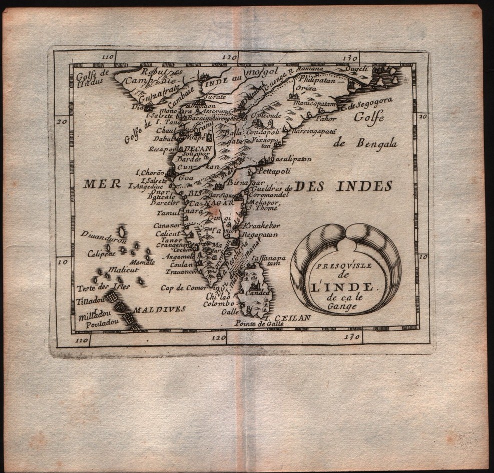
Map title
Presquisle de l'Inde de ca le Gange
Author
DuVal
Location shown in map
India
Edition date
1682
Edition place
Paris
Editor
--
Atlas
La geographie universelle - P. Du Val d'Abbeville
Price
100 Euro
State
[mint/EXCELLENT/very good/good/fair/mediocre/poor]
Color
Black/white
Verso
Blank
Size
Plate: cm (12.7 x 10.2) inches (5 x 4.02) Paper: cm (16.5 x 16.5) inches (6.5 x 6.5)
Technique
Copper engraving
Note
No particular notes for this maps
Reference
--
Wiki
Here for more info
In stock
Available
Info
info@thetreasuremaps.com
Code
#0218
×
![]()
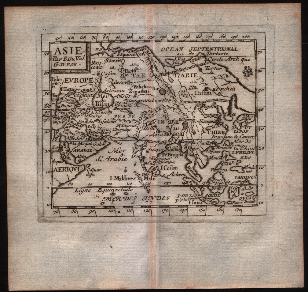
Map title
Asie
Author
DuVal
Location shown in map
Asia
Edition date
1682
Edition place
Paris
Editor
--
Atlas
La geographie universelle - P. Du Val d'Abbeville
Price
Please ask: info@thetreasuremaps.com
State
[mint/EXCELLENT/very good/good/fair/mediocre/poor]
Color
Black/white
Verso
Blank
Size
Plate: cm (12.7 x 10.2) inches (5 x 4.02) Paper: cm (16.5 x 16.5) inches (6.5 x 6.5)
Technique
Copper engraving
Note
No particular notes for this maps
Reference
--
Wiki
Here for more info
In stock
Sold
Info
info@thetreasuremaps.com
Code
#0219
×
![]()
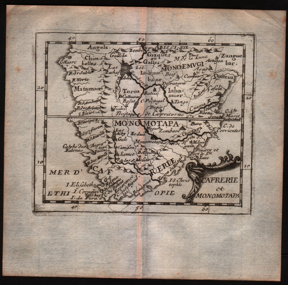
Map title
Cafrerie et Monomotapa
Author
DuVal
Location shown in map
South Africa
Edition date
1682
Edition place
Paris
Editor
--
Atlas
La geographie universelle - P. Du Val d'Abbeville
Price
Please ask: info@thetreasuremaps.com
State
[mint/EXCELLENT/very good/good/fair/mediocre/poor]
Color
Black/white
Verso
Blank
Size
Plate: cm (12.7 x 10.2) inches (5 x 4.02) Paper: cm (16.5 x 16.5) inches (6.5 x 6.5)
Technique
Copper engraving
Note
No particular notes for this maps
Reference
--
Wiki
Here for more info
In stock
Sold
Info
info@thetreasuremaps.com
Code
#0297
×
![]()
Map title
Trino
Author
Blaeu
Location shown in map
Trino
Edition date
1682
Edition place
Amsterdam
Editor
Blaeu
Atlas
Theatrum statuum regiae celsitudinis Sabaudiae
Price
Please ask: info@thetreasuremaps.com
State
[mint/excellent/VERY GOOD/good/fair/mediocre/poor]
Color
Black/white
Verso
Blank
Size
Plate: cm (58.4 x 50.8) inches (22.99 x 20) Paper: cm (68.6 x 55.9) inches (27.01 x 22.01)
Technique
Copper engraving
Note
No particular notes for this maps.
Reference
--
Wiki
Here for more info
In stock
Available
Info
info@thetreasuremaps.com
Code
#0563
Trino
Author
Blaeu
Location shown in map
Trino
Edition date
1682
Edition place
Amsterdam
Editor
Blaeu
Atlas
Theatrum statuum regiae celsitudinis Sabaudiae
Price
Please ask: info@thetreasuremaps.com
State
[mint/excellent/VERY GOOD/good/fair/mediocre/poor]
Color
Black/white
Verso
Blank
Size
Plate: cm (58.4 x 50.8) inches (22.99 x 20) Paper: cm (68.6 x 55.9) inches (27.01 x 22.01)
Technique
Copper engraving
Note
No particular notes for this maps.
Reference
--
Wiki
Here for more info
In stock
Available
Info
info@thetreasuremaps.com
Code
#0563
×
![]()
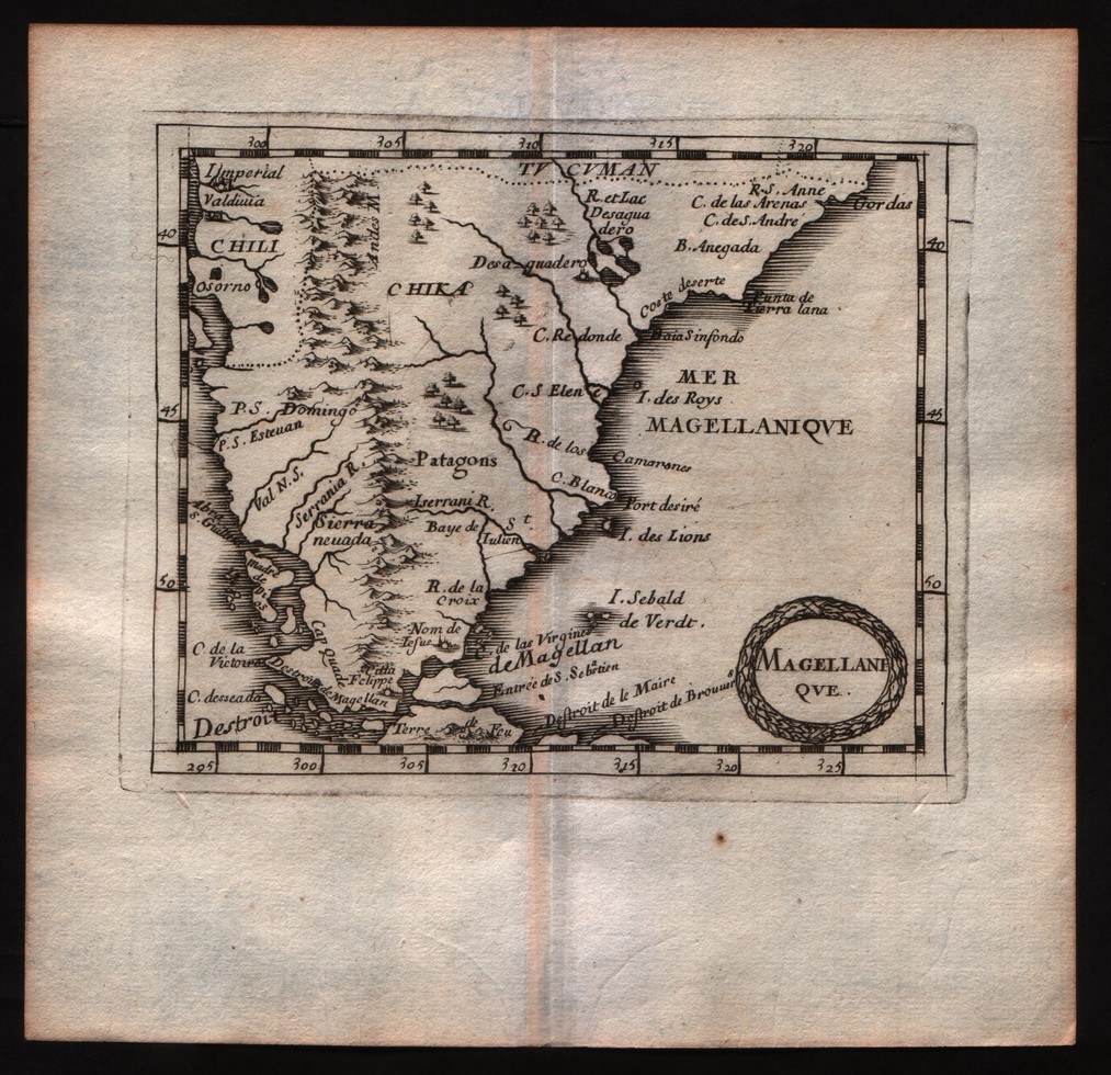
Map title
Magellanique
Author
DuVal
Location shown in map
Patagonia
Edition date
1682
Edition place
Paris
Editor
--
Atlas
La geographie universelle - P. Du Val d'Abbeville
Price
Please ask: info@thetreasuremaps.com
State
[mint/EXCELLENT/very good/good/fair/mediocre/poor]
Color
Black/white
Verso
Blank
Size
Plate: cm (12.7 x 10.2) inches (5 x 4.02) Paper: cm (16.5 x 16.5) inches (6.5 x 6.5)
Technique
Copper engraving
Note
No particular notes for this maps
Reference
--
Wiki
Here for more info
In stock
Sold
Info
info@thetreasuremaps.com
Code
#0508
×
![]()
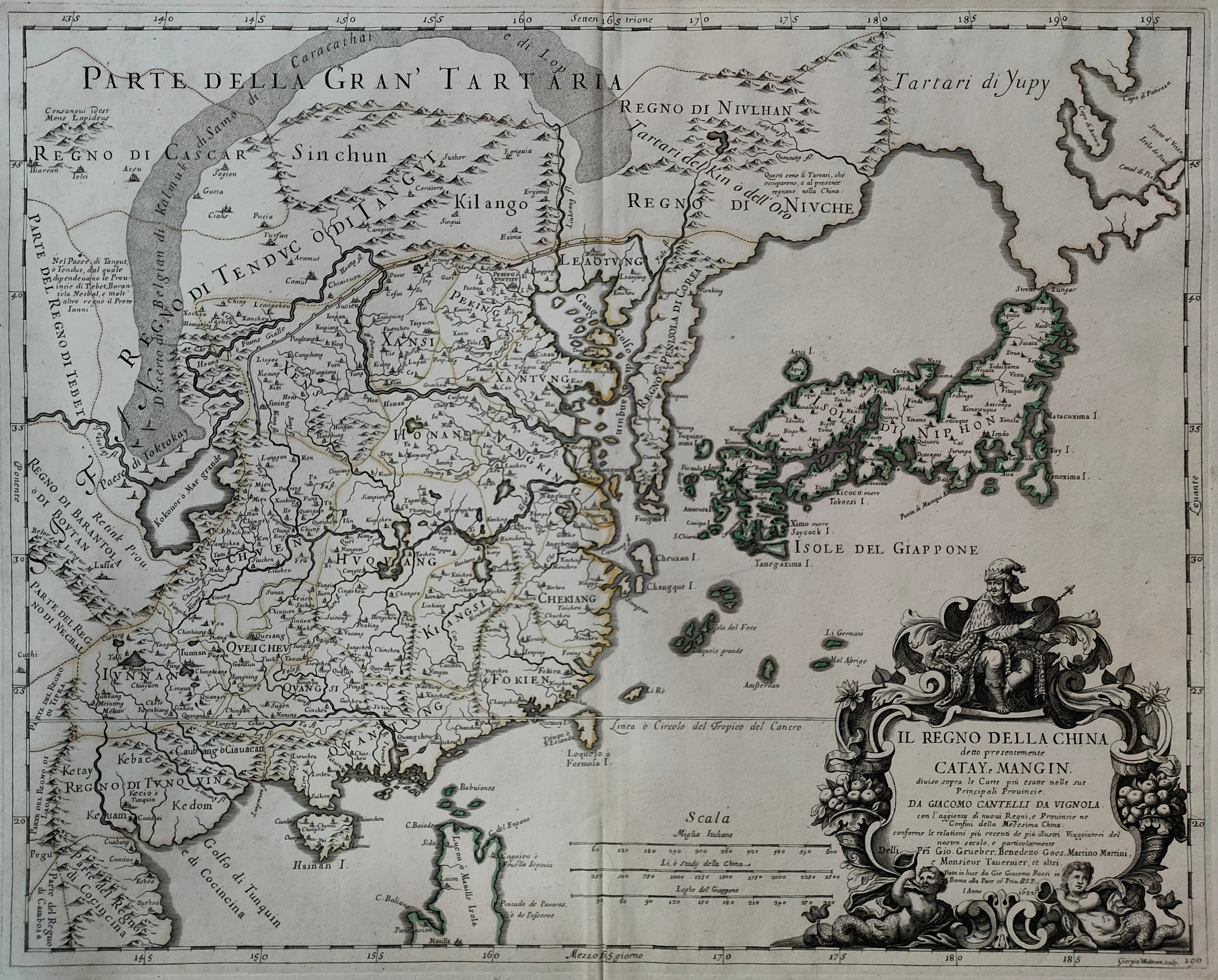
Map title
Il regno della China
Author
De Rossi
Location shown in map
China
Edition date
1682
Edition place
Rome
Editor
De Rossi
Atlas
Mercurio Geografico
Price
1600 Euro
State
[mint/EXCELLENT/very good/good/fair/mediocre/poor]
Color
Old colors
Verso
Blank
Size
Plate: cm (55 x 39) inches (21.65 x 15.35) Paper: cm (60 x 48) inches (23.62 x 18.9)
Technique
Copper engraving
Note
Reference
Wiki
Here for more info
In stock
Available
Info
info@thetreasuremaps.com
Code
#0984
×
![]()
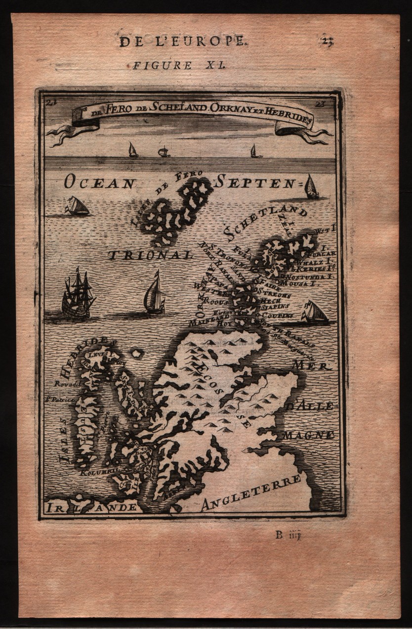
Map title
De Fero de Scheland Orknay et Hebrides
Author
Mallet
Location shown in map
North of England
Edition date
1683
Edition place
Paris
Editor
--
Atlas
Description de l'univers - Chez Denis Thierry
Price
75 Euro
State
[mint/EXCELLENT/very good/good/fair/mediocre/poor] Only a small part of the map.
Color
Black/white
Verso
French text pag 24
Size
Plate: cm (10.2 x 15.2) inches (4.02 x 5.98) Paper: cm (12.7 x 20.3) inches (5 x 7.99)
Technique
Copper engraving
Note
No particular notes for this maps
Reference
--
Wiki
Here for more info
In stock
Available
Info
info@thetreasuremaps.com
Code
#0140
×
![]()
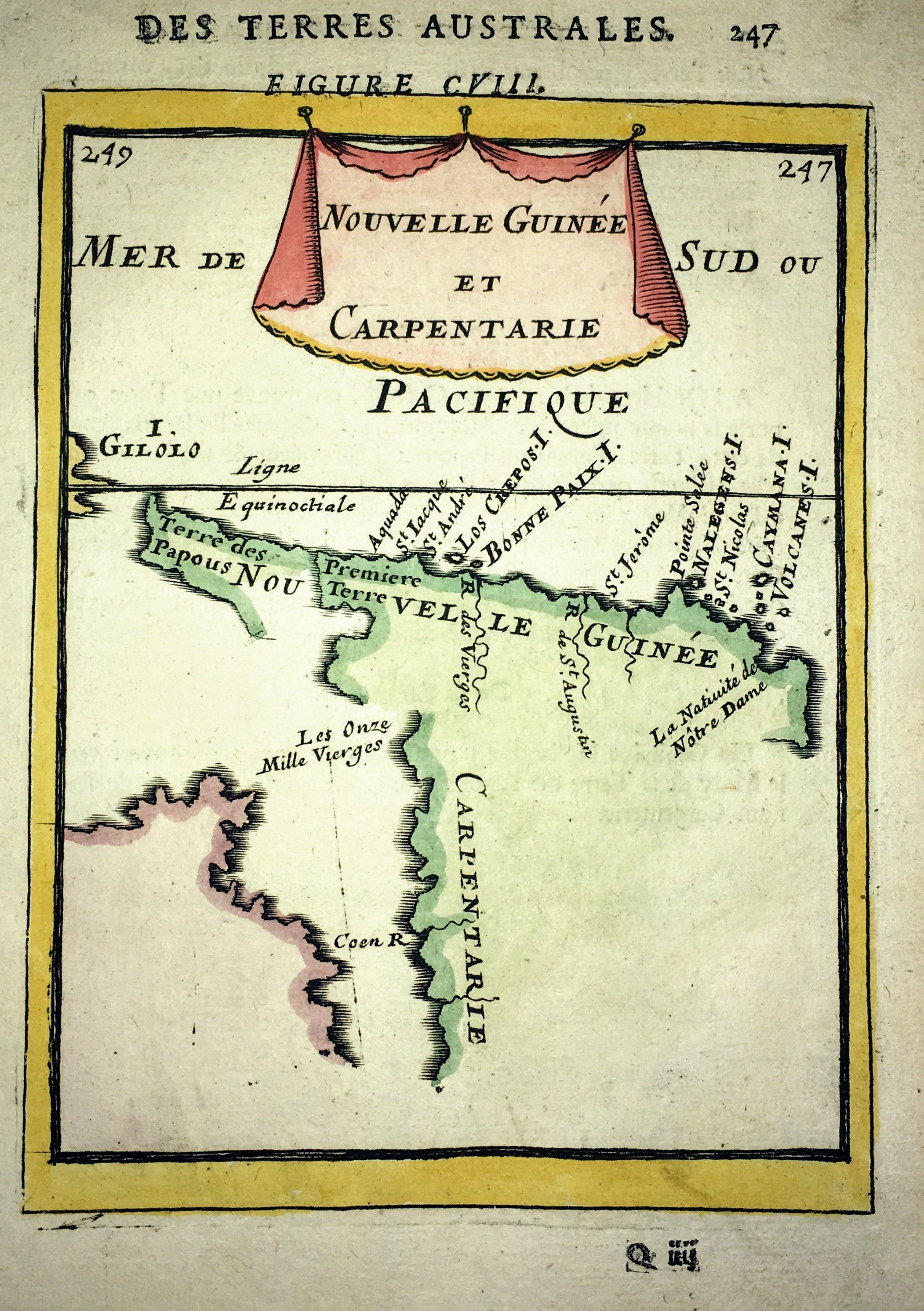
Map title
Nouvelle Guinee et Carpentarie
Author
Mallet
Location shown in map
New Guinea
Edition date
1683
Edition place
Paris
Editor
Atlas
Description de l'Univers
Price
75 Euro
State
[mint/EXCELLENT/very good/good/fair/mediocre/poor]
Color
Old colors
Verso
Blank
Size
Plate: cm (11 x 15) inches (4.33 x 5.91) Paper: cm (14 x 21) inches (5.51 x 8.27)
Technique
Copper engraving
Note
No particular notes for this maps
Reference
Wiki
Here for more info
In stock
Available
Info
info@thetreasuremaps.com
Code
#0666
×
![]()
Map title
Barbarie
Author
Mallet
Location shown in map
North Africa
Edition date
1683
Edition place
--
Editor
--
Atlas
Description de l'Univers
Price
50 Euro
State
[mint/EXCELLENT/very good/good/fair/mediocre/poor]
Color
Black/white
Verso
Blank
Size
Plate: cm (10.2 x 15.2) inches (4.02 x 5.98) Paper: cm (10.2 x 15.2) inches (4.02 x 5.98)
Technique
Copper engraving
Note
No particular notes for this maps
Reference
--
Wiki
Here for more info
In stock
Available
Info
info@thetreasuremaps.com
Code
#0296
×
![]()
Map title
Le Canada ou Novelle France
Author
Sanson
Location shown in map
North America
Edition date
Circa 1683
Edition place
Paris
Editor
Atlas
L'Europe en Plusieurs Cartes, et en divers Traittes de Geographie et d'Histoire.
Price
400 Euro
State
[mint/EXCELLENT/very good/good/fair/mediocre/poor]
Color
Old colors
Verso
Blank
Size
Plate: cm (30 x 21) inches (11.81 x 8.27) Paper: cm (32 x 22) inches (12.6 x 8.66)
Technique
Copper engraving
Note
Reference
Wiki
Here for more info
In stock
Available
Info
info@thetreasuremaps.com
Code
#0997
×
![]()
Map title
Ceylan et les Maldives
Author
Sanson
Location shown in map
Ceylon
Edition date
Circa 1683
Edition place
Paris
Editor
Atlas
L'Europe en Plusieurs Cartes, et en divers Traittes de Geographie et d'Histoire.
Price
200 Euro
State
[mint/EXCELLENT/very good/good/fair/mediocre/poor]
Color
Old colors
Verso
Blank
Size
Plate: cm (24 x 19) inches (9.45 x 7.48) Paper: cm (32 x 22) inches (12.6 x 8.66)
Technique
Copper engraving
Note
Reference
Wiki
Here for more info
In stock
Available
Info
info@thetreasuremaps.com
Code
#1007
×
![]()
Map title
Terre ferme, Nouveau Royme de Grenade
Author
Sanson
Location shown in map
Colombia
Edition date
Circa 1683
Edition place
Paris
Editor
Atlas
L'Europe en Plusieurs Cartes, et en divers Traittes de Geographie et d'Histoire.
Price
200 Euro
State
[mint/EXCELLENT/very good/good/fair/mediocre/poor]
Color
Old colors
Verso
Blank
Size
Plate: cm (29 x 19) inches (11.42 x 7.48) Paper: cm (32 x 22) inches (12.6 x 8.66)
Technique
Copper engraving
Note
Reference
Wiki
Here for more info
In stock
Available
Info
info@thetreasuremaps.com
Code
#1008
×
![]()
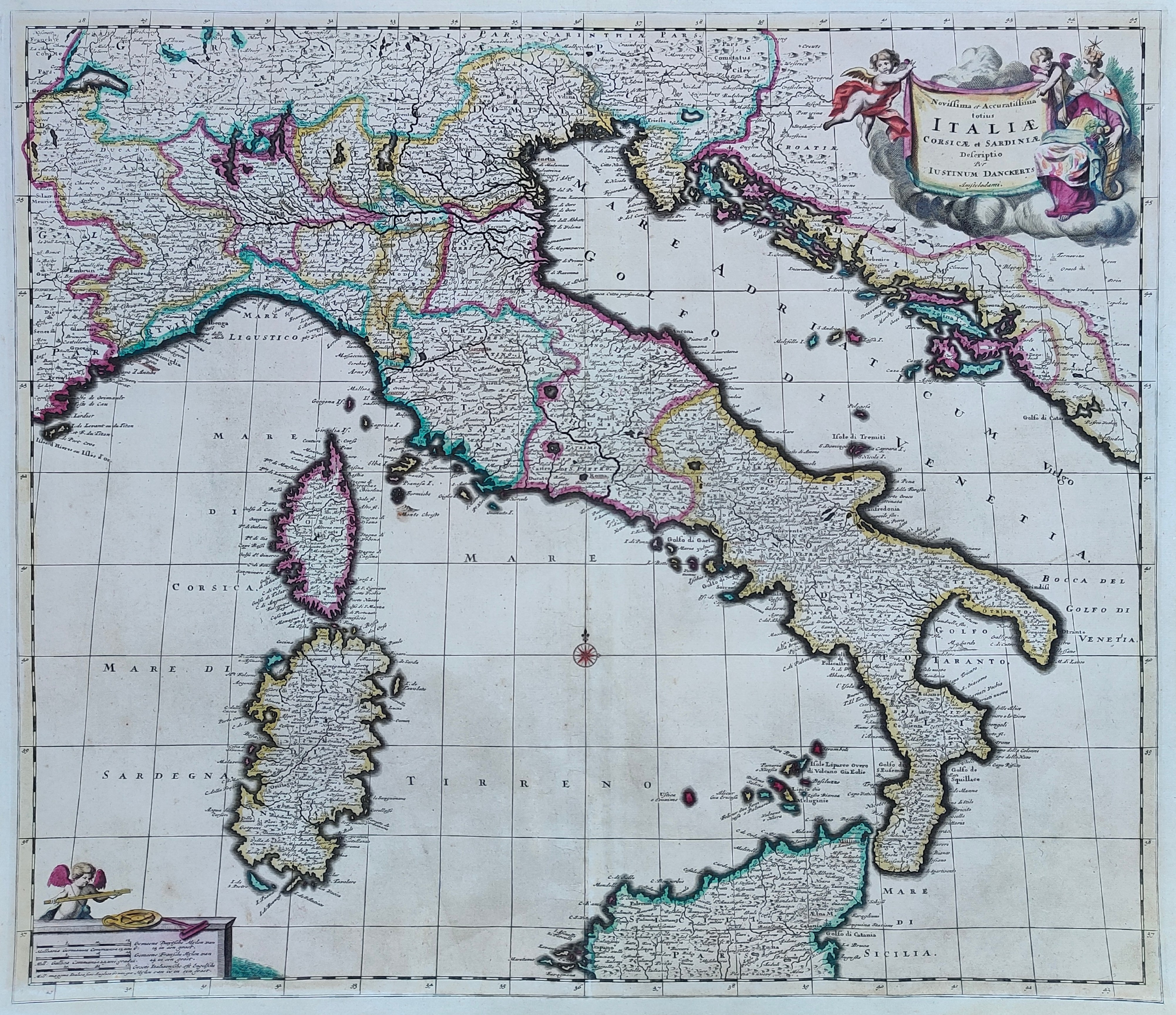
Map title
Novissima et accuratissima totius Italiae
Author
Danckerts
Location shown in map
Italy
Edition date
1685
Edition place
Amsterdam
Editor
Atlas
Price
600 Euro
State
[mint/EXCELLENT/very good/good/fair/mediocre/poor]
Color
Old colors
Verso
Blank
Size
Plate: cm (57 x 49) inches (22.44 x 19.29) Paper: cm (60 x 52) inches (23.62 x 20.47)
Technique
Copper engraving
Note
Professionally repaired
Reference
R.Borri L'Italia nelle antiche carte pag.154
Wiki
Here for more info
In stock
Available
Info
info@thetreasuremaps.com
Code
#0897
×
![]()
Map title
Mondo nuovo
Author
Porcacchi
Location shown in map
North America
Edition date
1686
Edition place
Venice
Editor
--
Atlas
L'Isole piu famose del mondo -- Pietr'Antonio Brigonci
Price
800 Euro
State
[mint/excellent/very good/good/fair/MEDIOCRE/poor]
Color
Black/white
Verso
Blank
Size
Plate: cm (14 x 11.4) inches (5.51 x 4.49) Paper: cm (17.8 x 16.5) inches (7.01 x 6.5)
Technique
Copper engraving
Note
Late edition for this beautiful map
Reference
--
Wiki
Here for more info
In stock
Available
Info
info@thetreasuremaps.com
Code
#0055
×
![]()
Map title
Americae sive Indiae Occidentalis Tabula Generalis
Author
Joannes De Laet
Location shown in map
America
Edition date
1686
Edition place
Amsterdam
Editor
Atlas
Introductio in universam geographiam
Price
Please ask: info@thetreasuremaps.com
State
[mint/EXCELLENT/very good/good/fair/mediocre/poor]
Color
Old colors
Verso
Blank
Size
Plate: cm (14 x 13) inches (5.51 x 5.12) Paper: cm (12 x 12) inches (4.72 x 4.72)
Technique
Copper engraving
Note
Reference
Wiki
Here for more info
In stock
Available
Info
info@thetreasuremaps.com
Code
#0844
×
![]()
Map title
Zea
Author
Drapper
Location shown in map
Kea
Edition date
1687
Edition place
Amsterdam
Editor
Atlas
Price
125 Euro
State
[mint/EXCELLENT/very good/good/fair/mediocre/poor]
Color
Black/white
Verso
Blank
Size
Plate: cm (17 x 12) inches (6.69 x 4.72) Paper: cm (20 x 14) inches (7.87 x 5.51)
Technique
Copper engraving
Note
Reference
Wiki
Here for more info
In stock
Available
Info
info@thetreasuremaps.com
Code
#0904
×
![]()
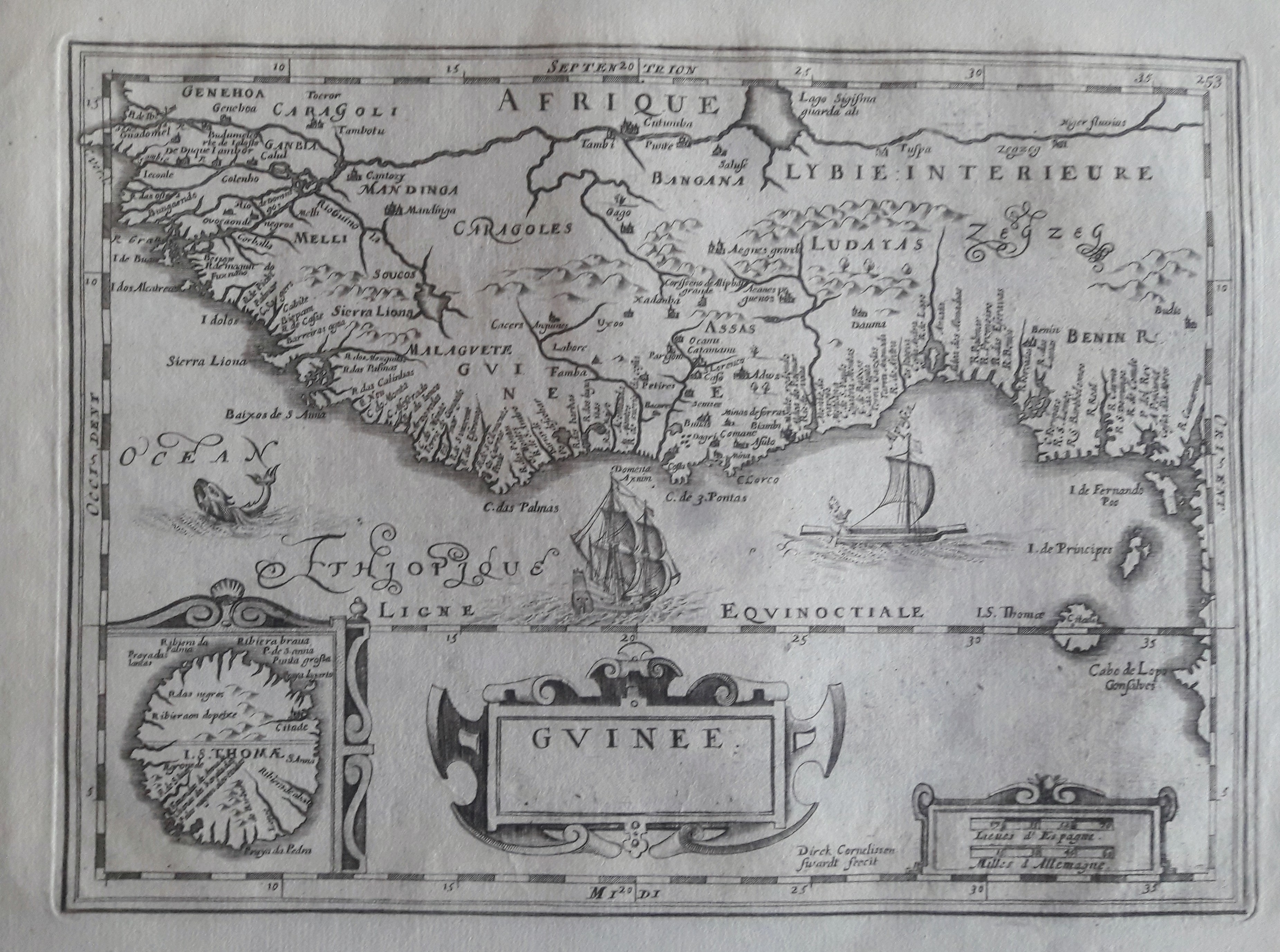
Map title
Guinee
Author
Direk Cornelissen
Location shown in map
West Africa
Edition date
Circa 1690
Edition place
Editor
--
Atlas
--
Price
150 Euro
State
[MINT/excellent/very good/good/fair/mediocre/poor]
Color
Black/white
Verso
Blank
Size
Plate: cm (25 x 28) inches (9.84 x 11.02) Paper: cm (41 x 27) inches (16.14 x 10.63)
Technique
Copper engraving
Note
No particular notes for this maps.
Reference
--
Wiki
Here for more info
In stock
Available
Info
info@thetreasuremaps.com
Code
#0659
×
![]()
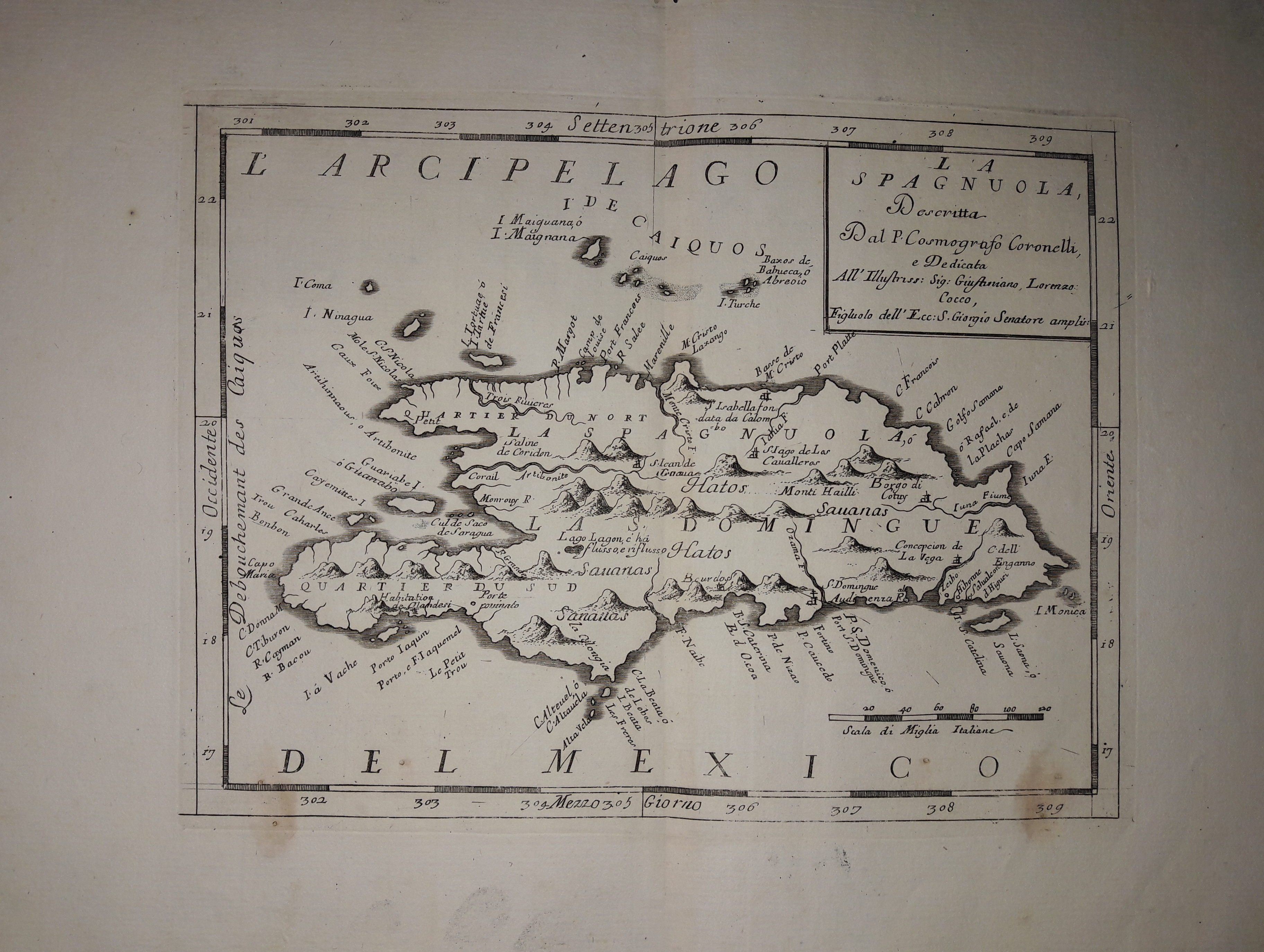
Map title
La Spagnuola
Author
Coronelli
Location shown in map
Haiti
Edition date
Circa 1690
Edition place
Venice
Editor
Atlas
Atlante veneto
Price
300 Euro
State
[mint/EXCELLENT/very good/good/fair/mediocre/poor]
Color
Black/white
Verso
Blank
Size
Plate: cm (30 x 22) inches (11.81 x 8.66) Paper: cm (43 x 32) inches (16.93 x 12.6)
Technique
Copper engraving
Note
No particular notes for this maps.
Reference
--
Wiki
Here for more info
In stock
Available
Info
info@thetreasuremaps.com
Code
#0636
×
![]()
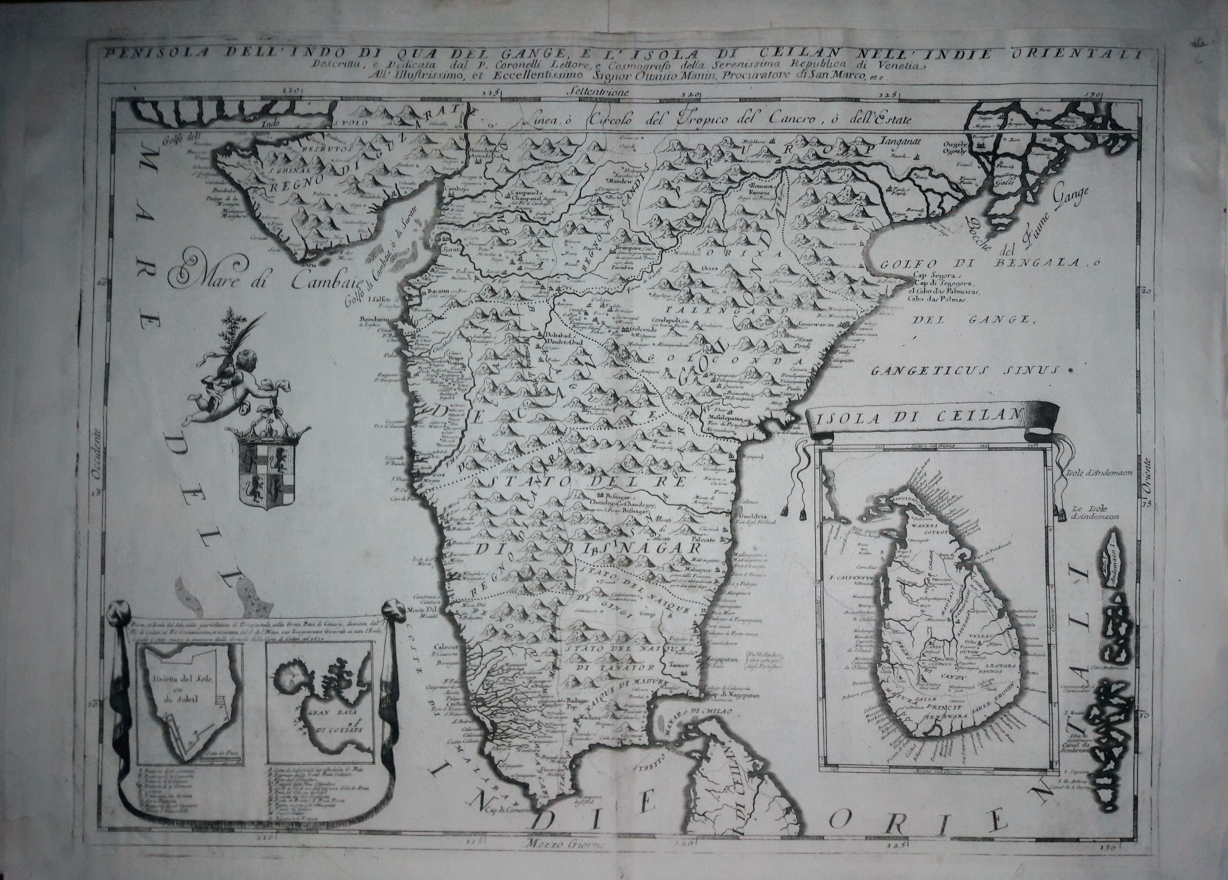
Map title
Penisola dell'Indo di qua del Gange e l'isola di Ceylan
Author
Coronelli
Location shown in map
Inde
Edition date
Circa 1690
Edition place
Venice
Editor
Atlas
Atlante veneto
Price
600 Euro
State
[mint/EXCELLENT/very good/good/fair/mediocre/poor]
Color
Black/white
Verso
Italian text pag.115
Size
Plate: cm (46 x 61) inches (18.11 x 24.02) Paper: cm (69 x 49) inches (27.17 x 19.29)
Technique
Copper engraving
Note
No particular notes for this maps.
Reference
--
Wiki
Here for more info
In stock
Available
Info
info@thetreasuremaps.com
Code
#0653
×
![]()
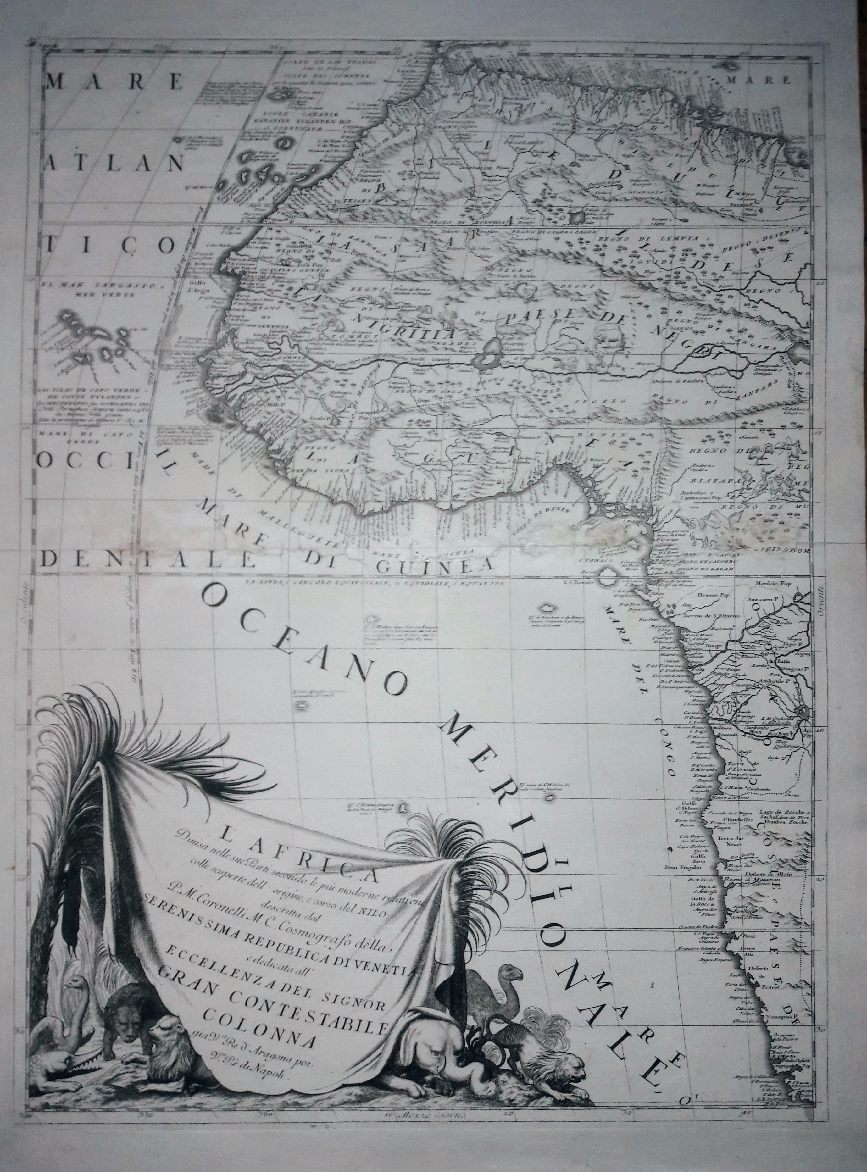
Map title
L'Africa
Author
Coronelli
Location shown in map
West Africa
Edition date
Circa 1690
Edition place
Venice
Editor
Atlas
Atlante veneto
Price
Please ask: info@thetreasuremaps.com
State
[mint/EXCELLENT/very good/good/fair/mediocre/poor]
Color
Black/white
Verso
Blank
Size
Plate: cm (45 x 60) inches (17.72 x 23.62) Paper: cm (71 x 50) inches (27.95 x 19.69)
Technique
Copper engraving
Note
No particular notes for this maps.
Reference
--
Wiki
Here for more info
In stock
Available
Info
info@thetreasuremaps.com
Code
#0654
×
![]()
Map title
North-sea
Author
Keulen, Joannes
Location shown in map
British Isles
Edition date
1690
Edition place
Amsterdam
Editor
Atlas
Price
Please ask: info@thetreasuremaps.com
State
[mint/excellent/VERY GOOD/good/fair/mediocre/poor]
Color
Black/white
Verso
Blank
Size
Plate: cm (55 x 95) inches (21.65 x 37.4) Paper: cm (55 x 95) inches (21.65 x 37.4)
Technique
Copper engraving
Note
Professionally repaired
Reference
Wiki
Here for more info
In stock
Available
Info
info@thetreasuremaps.com
Code
#0740
×
![]()
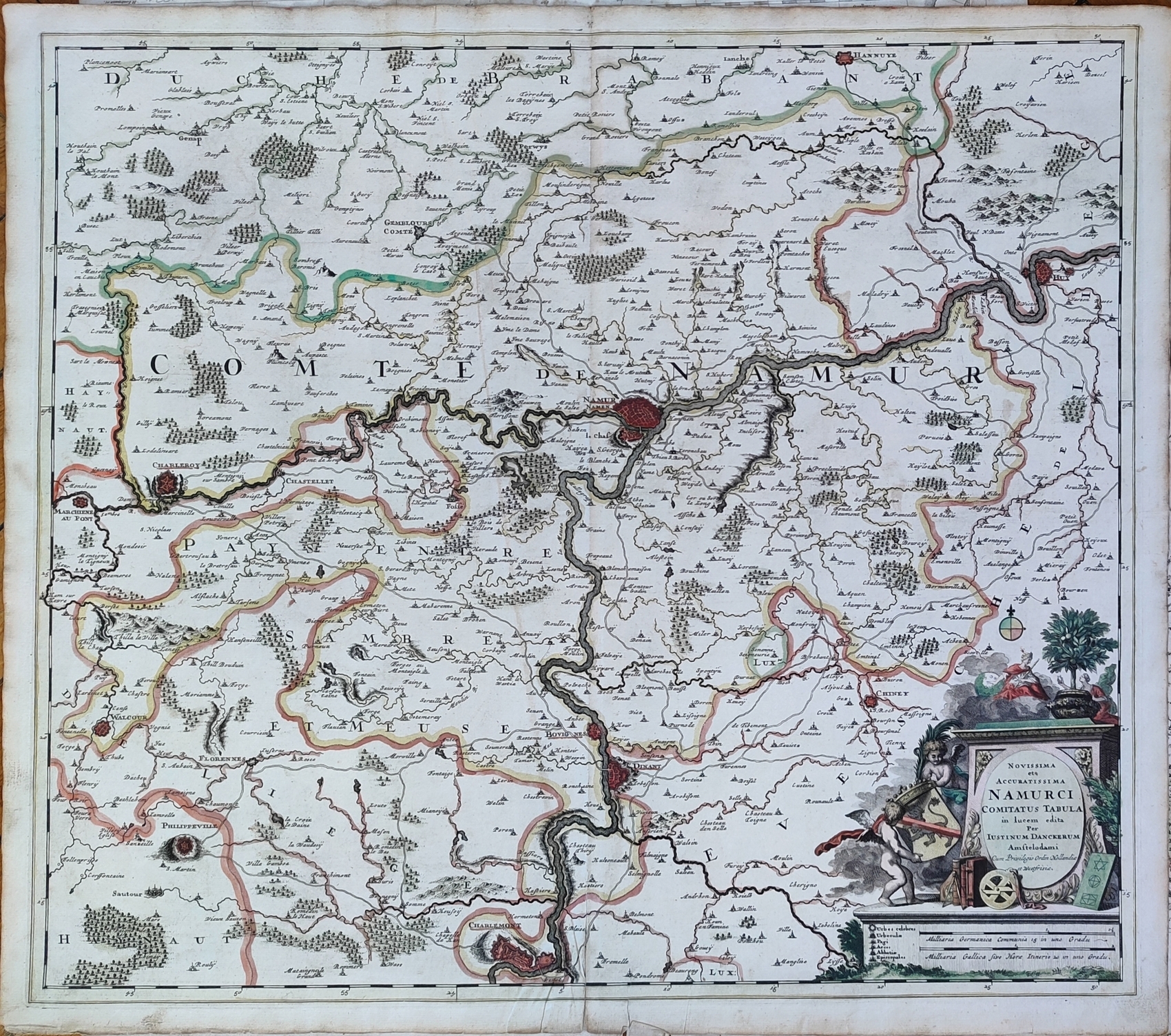
Map title
Novissima et accuratissima Namurci Comitatus tabula
Author
Danckerts
Location shown in map
Belgium
Edition date
Circa 1690
Edition place
Editor
Atlas
Price
150 Euro
State
[mint/EXCELLENT/very good/good/fair/mediocre/poor]
Color
Old colors
Verso
Blank
Size
Plate: cm (58 x 52) inches (22.83 x 20.47) Paper: cm (61 x 54) inches (24.02 x 21.26)
Technique
Copper engraving
Note
Reference
Wiki
Here for more info
In stock
Available
Info
info@thetreasuremaps.com
Code
#1237
×
![]()
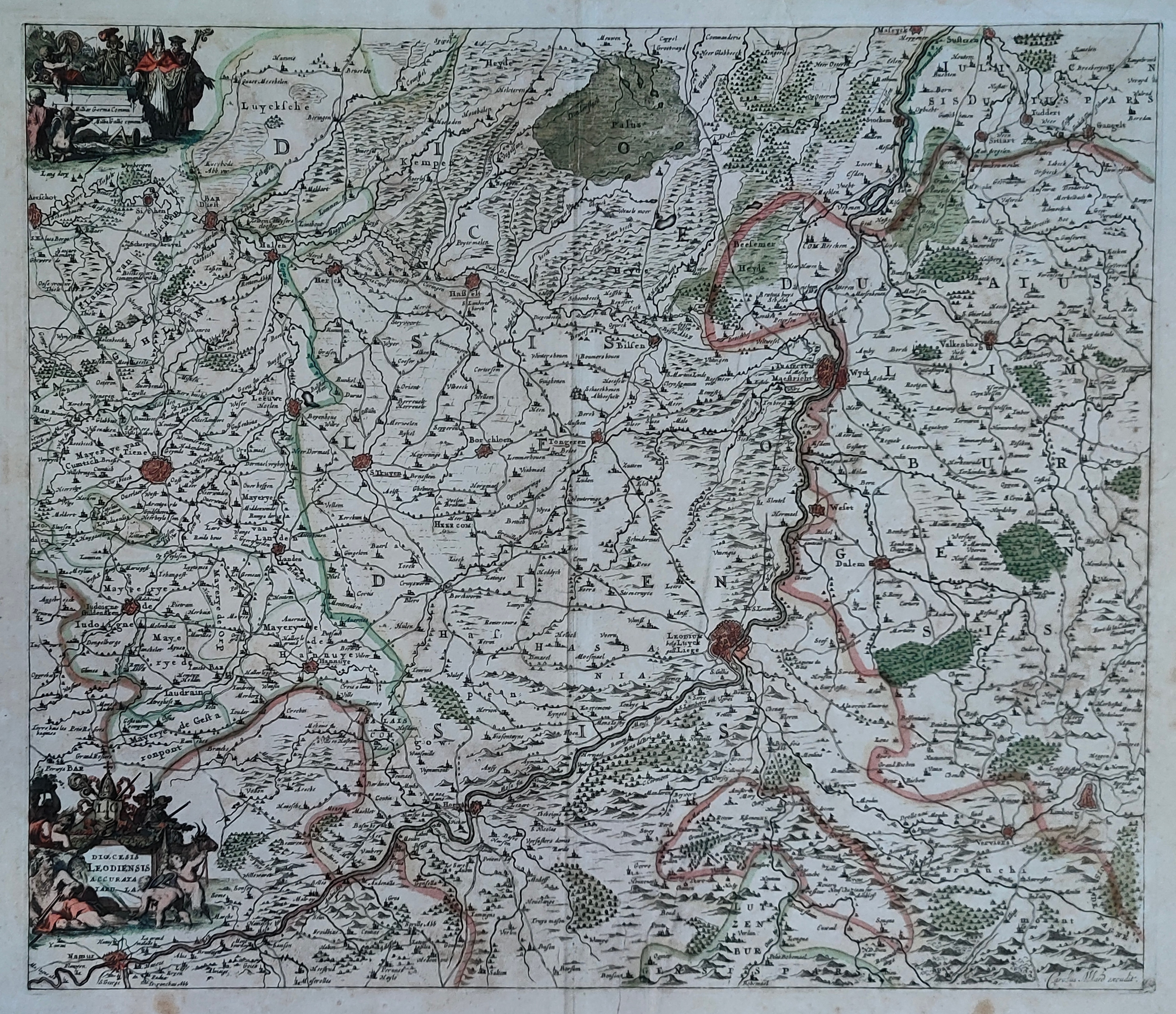
Map title
Dioecesis Leodiensis Accurata Tabula
Author
Schenk
Location shown in map
Belgium
Edition date
Circa 1690
Edition place
Editor
Atlas
Price
150 Euro
State
[mint/EXCELLENT/very good/good/fair/mediocre/poor]
Color
Old colors
Verso
Blank
Size
Plate: cm (54 x 45) inches (21.26 x 17.72) Paper: cm (60 x 53) inches (23.62 x 20.87)
Technique
Copper engraving
Note
Reference
Wiki
Here for more info
In stock
Available
Info
info@thetreasuremaps.com
Code
#1238
×
![]()
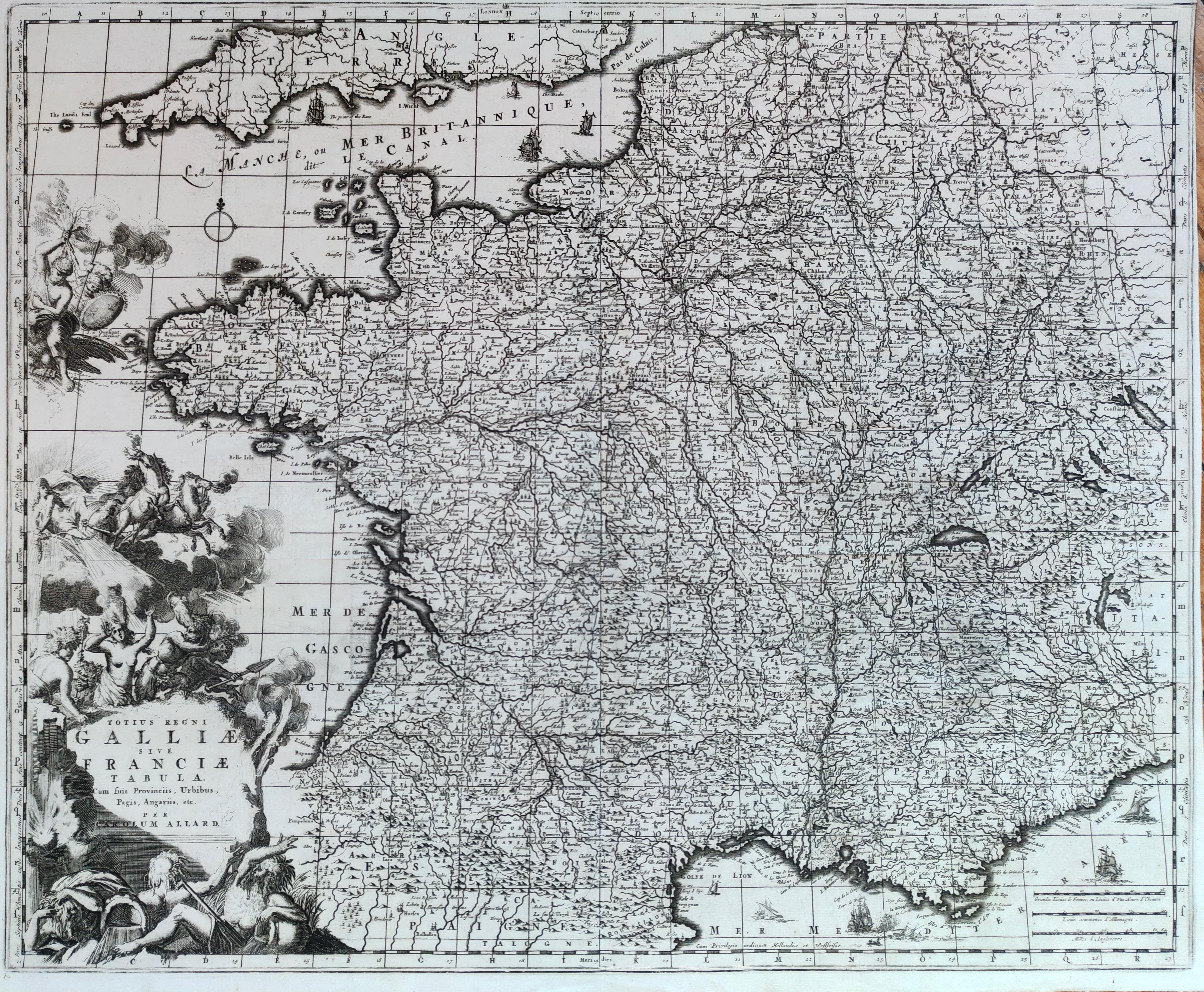
Map title
Totius regni Galliae sive Franciae tabula
Author
Allard
Location shown in map
France
Edition date
Circa 1690
Edition place
Amsterdam
Editor
--
Atlas
Atlas Major
Price
300 Euro
State
[mint/EXCELLENT/very good/good/fair/mediocre/poor]
Color
Black/white
Verso
Blank
Size
Plate: cm (57 x 46) inches (22.44 x 18.11) Paper: cm (56 x 45) inches (22.05 x 17.72)
Technique
Copper engraving
Note
Reference
Wiki
Here for more info
In stock
Available
Info
info@thetreasuremaps.com
Code
#1280
×
![]()
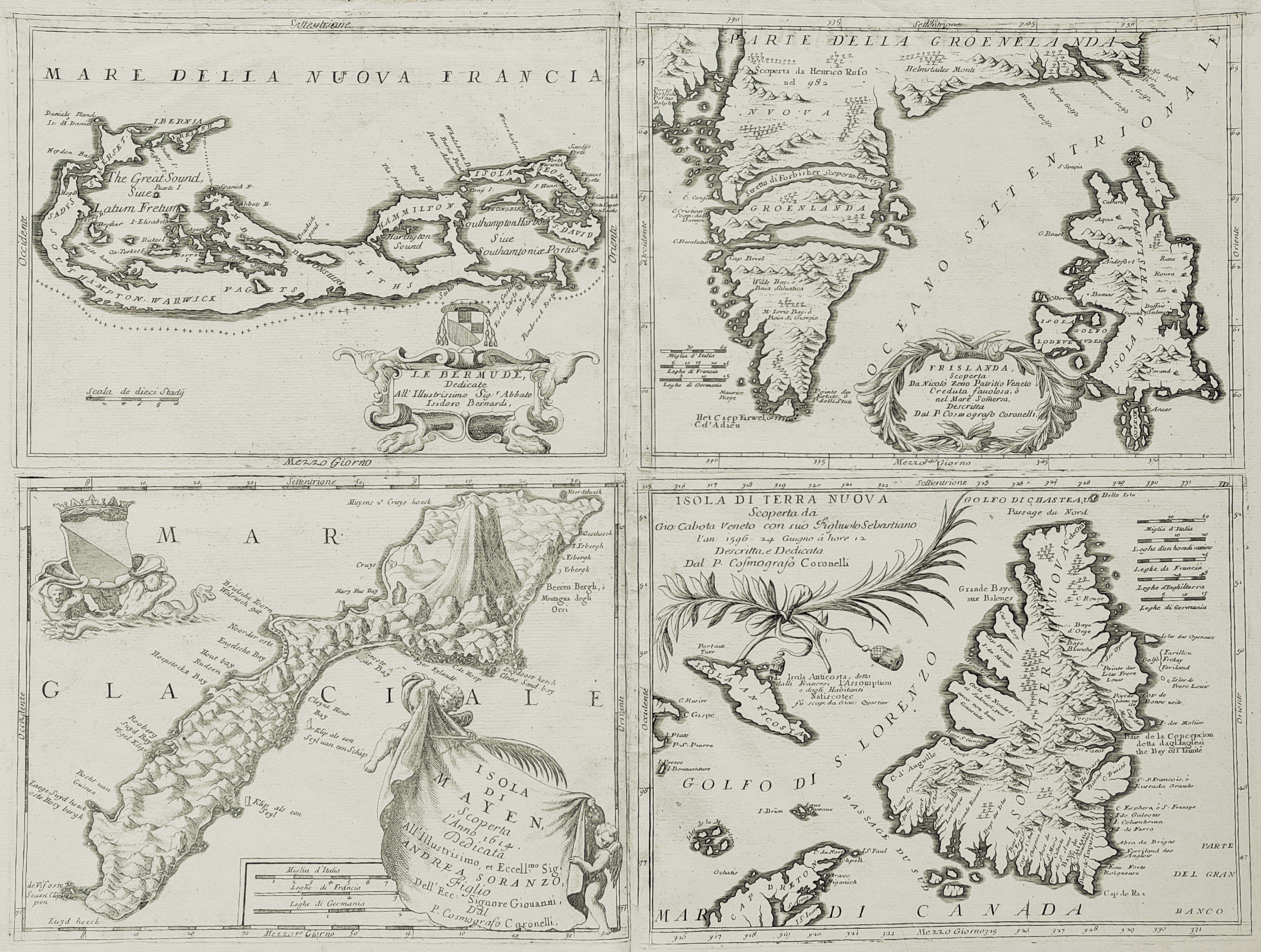
Map title
Islands
Author
Coronelli
Location shown in map
Bermuda, Iceland, Newfounland, Mayen
Edition date
Circa 1692
Edition place
Venice
Editor
--
Atlas
Atlante veneto
Price
1600 Euro
State
[mint/excellent/VERY GOOD/good/fair/mediocre/poor] Upper margin damaged
Color
Black/white
Verso
Blank
Size
Plate: cm (61 x 45.7) inches (24.02 x 17.99) Paper: cm (68.6 x 48.3) inches (27.01 x 19.02)
Technique
Copper engraving
Note
4 maps
Reference
--
Wiki
Here for more info
In stock
Available
Info
info@thetreasuremaps.com
Code
#0056
×
![]()
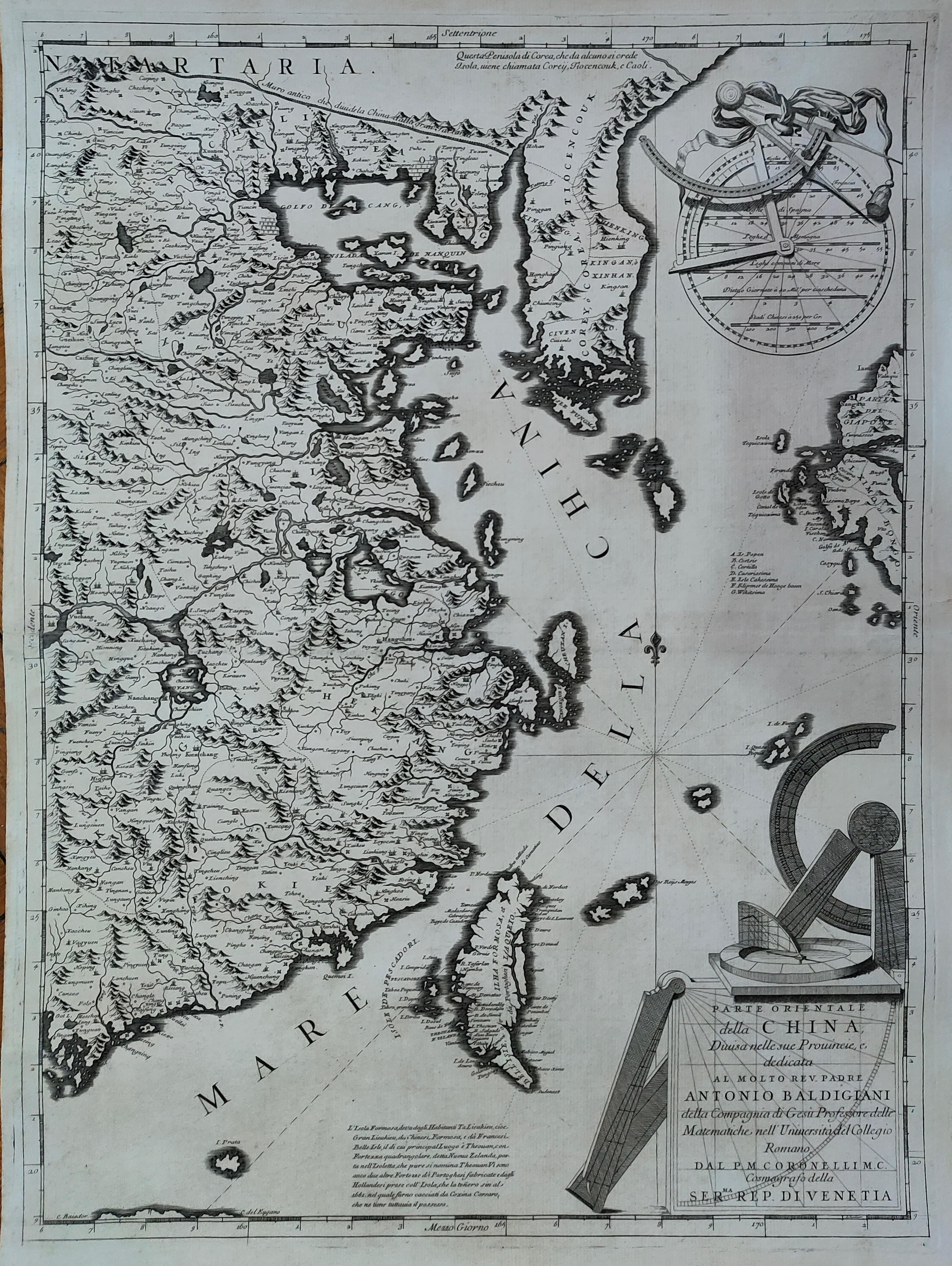
Map title
Parte orientale della China
Author
Coronelli
Location shown in map
China
Edition date
Circa 1692
Edition place
Venice
Editor
Atlas
Corso geografico universale
Price
2000 Euro
State
[mint/EXCELLENT/very good/good/fair/mediocre/poor]
Color
Black/white
Verso
Blank
Size
Plate: cm (45 x 60) inches (17.72 x 23.62) Paper: cm (71 x 50) inches (27.95 x 19.69)
Technique
Copper engraving
Note
No particular notes for this maps.
Reference
--
Wiki
Here for more info
In stock
Available
Info
info@thetreasuremaps.com
Code
#1275
×
![]()
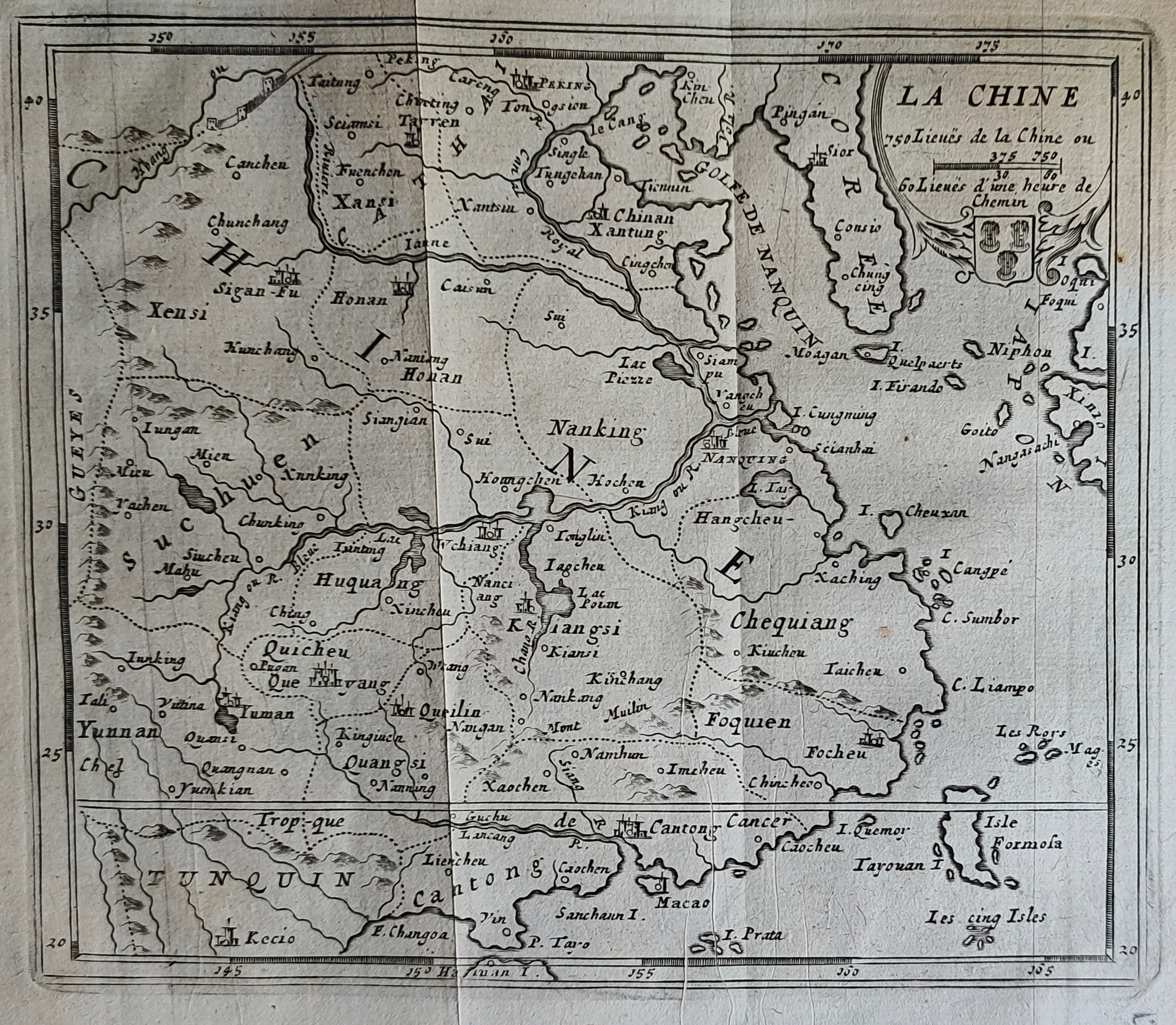
Map title
La Chine
Author
Peeters
Location shown in map
China
Edition date
1692
Edition place
Antwerp
Editor
Atlas
Imperii Sinarum nova descriptio
Price
150 Euro
State
[mint/EXCELLENT/very good/good/fair/mediocre/poor]
Color
Black/white
Verso
Blank
Size
Plate: cm (16 x 13) inches (6.3 x 5.12) Paper: cm (19 x 18) inches (7.48 x 7.09)
Technique
Copper engraving
Note
Reference
--
Wiki
Here for more info
In stock
Available
Info
info@thetreasuremaps.com
Code
#1185
×
![]()
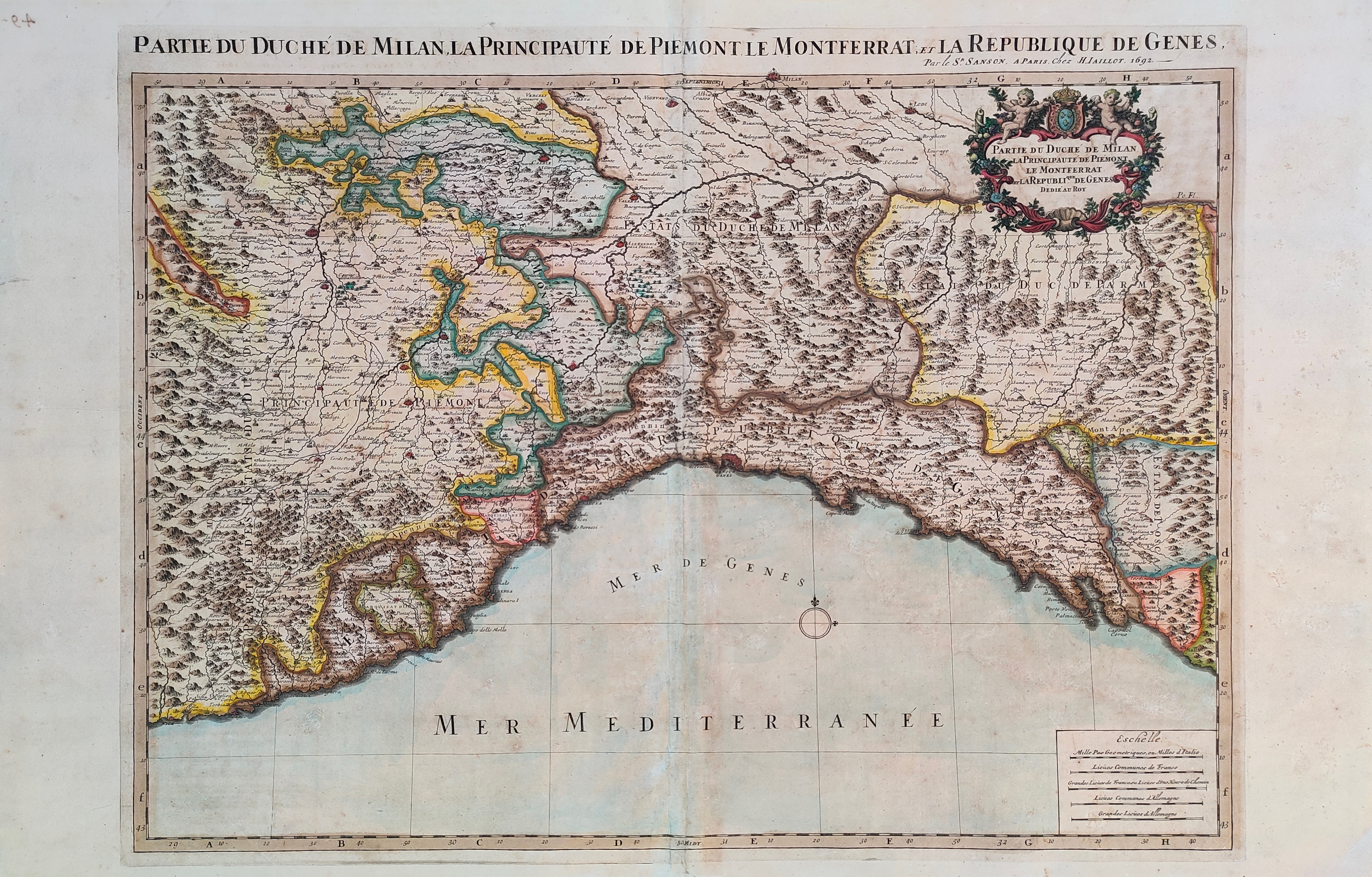
Map title
Partie de duche de Milan, la principaute de Piemont le Montferrat et la Republique de Gens
Author
Sanson
Location shown in map
Liguria
Edition date
1692
Edition place
Paris
Editor
Alexis Hubert Jaillot
Atlas
Tables geographiques des divisions du globe terrestre
Price
600 Euro
State
[mint/EXCELLENT/very good/good/fair/mediocre/poor]
Color
Old colors
Verso
Blank
Size
Plate: cm (73 x 54) inches (28.74 x 21.26) Paper: cm (89 x 57) inches (35.04 x 22.44)
Technique
Copper engraving
Note
Reference
Wiki
Here for more info
In stock
Available
Info
info@thetreasuremaps.com
Code
#1234
×
![]()
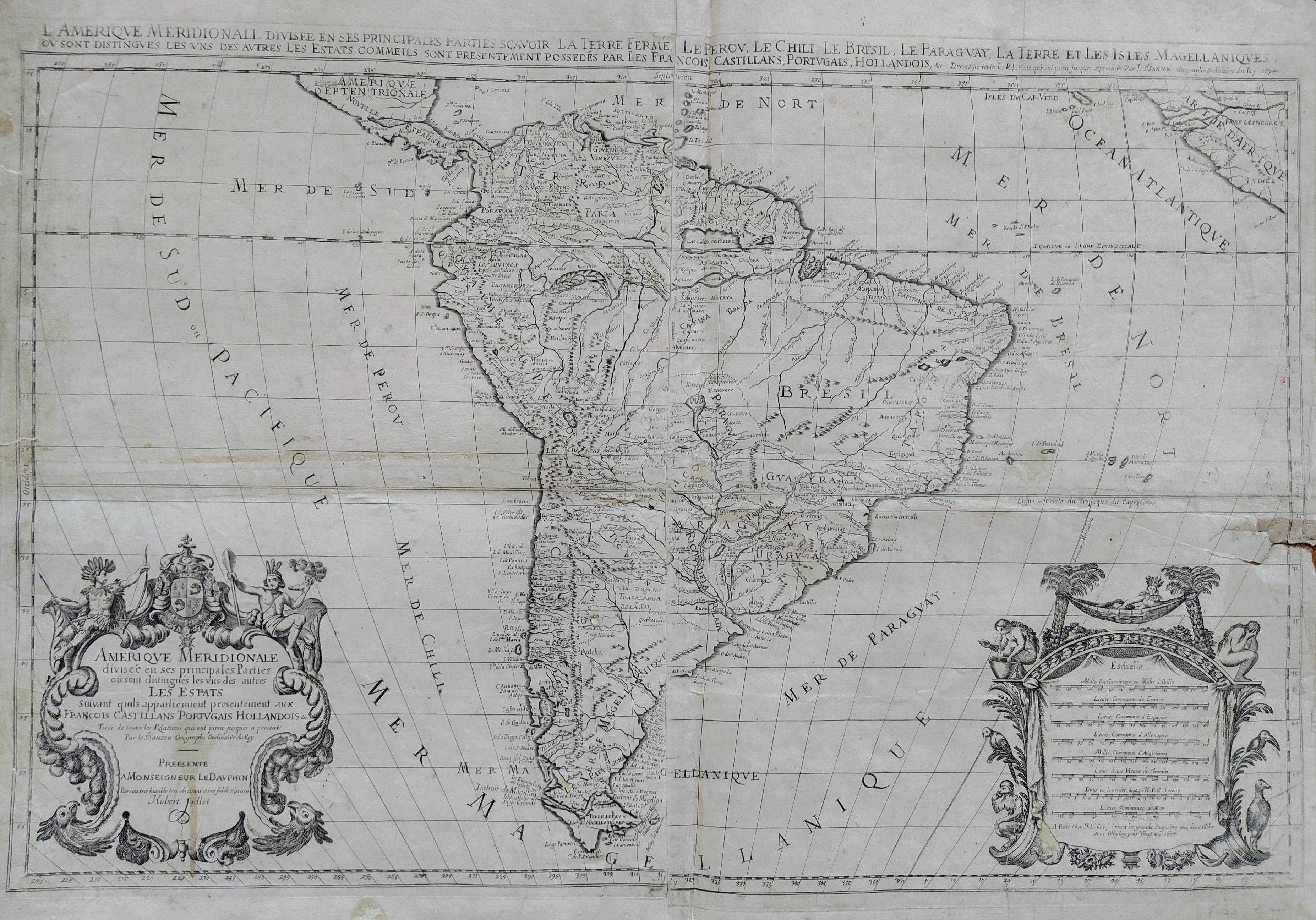
Map title
Amerique Meridionale
Author
Sanson
Location shown in map
South America
Edition date
1694
Edition place
Paris
Editor
Alexis Hubert Jaillot
Atlas
Tables geographiques des divisions du globe terrestre
Price
500 Euro
State
[mint/excellent/very good/GOOD/fair/mediocre/poor] Some repaire tears
Color
Black/white
Verso
Blank
Size
Plate: cm (86.4 x 55.9) inches (34.02 x 22.01) Paper: cm (91.4 x 66) inches (35.98 x 25.98)
Technique
Copper engraving
Note
Wall map
Reference
--
Wiki
Here for more info
In stock
Available
Info
info@thetreasuremaps.com
Code
#0019
×
![]()
Map title
Asia vetus
Author
Sanson
Location shown in map
Asia
Edition date
1694
Edition place
Padua
Editor
Atlas
Price
350 Euro
State
[mint/excellent/very good/good/FAIR/mediocre/poor]
Color
Old colors
Verso
Size
Plate: cm (56 x 41) inches (22.05 x 16.14) Paper: cm (62 x 52) inches (24.41 x 20.47)
Technique
Copper engraving
Note
Reference
Wiki
Here for more info
In stock
Available
Info
info@thetreasuremaps.com
Code
#1194
×
![]()
Map title
Utriusque Burgundiae, tum Ducatus tum Comitatus
Author
Merian
Location shown in map
Burgundia, France
Edition date
1695
Edition place
Frankfurt
Editor
--
Atlas
--
Price
Please ask: info@thetreasuremaps.com
State
[mint/excellent/very good/GOOD/fair/mediocre/poor]
Color
Black/white
Verso
Blank
Size
Plate: cm (35.6 x 26.7) inches (14.02 x 10.51) Paper: cm (36.8 x 33) inches (14.49 x 12.99)
Technique
Copper engraving
Note
--
Reference
--
Wiki
Here for more info
In stock
Available
Info
info@thetreasuremaps.com
Code
#0143
×
![]()
Map title
Lotharingia Ducatus Vulgo Lorraine
Author
Merian
Location shown in map
Loraine, France
Edition date
1695
Edition place
Frankfurt
Editor
--
Atlas
--
Price
Please ask: info@thetreasuremaps.com
State
[mint/excellent/very good/GOOD/fair/mediocre/poor]
Color
Black/white
Verso
Blank
Size
Plate: cm (35.6 x 26.7) inches (14.02 x 10.51) Paper: cm (36.8 x 33) inches (14.49 x 12.99)
Technique
Copper engraving
Note
--
Reference
--
Wiki
Here for more info
In stock
Available
Info
info@thetreasuremaps.com
Code
#0144
×
![]()
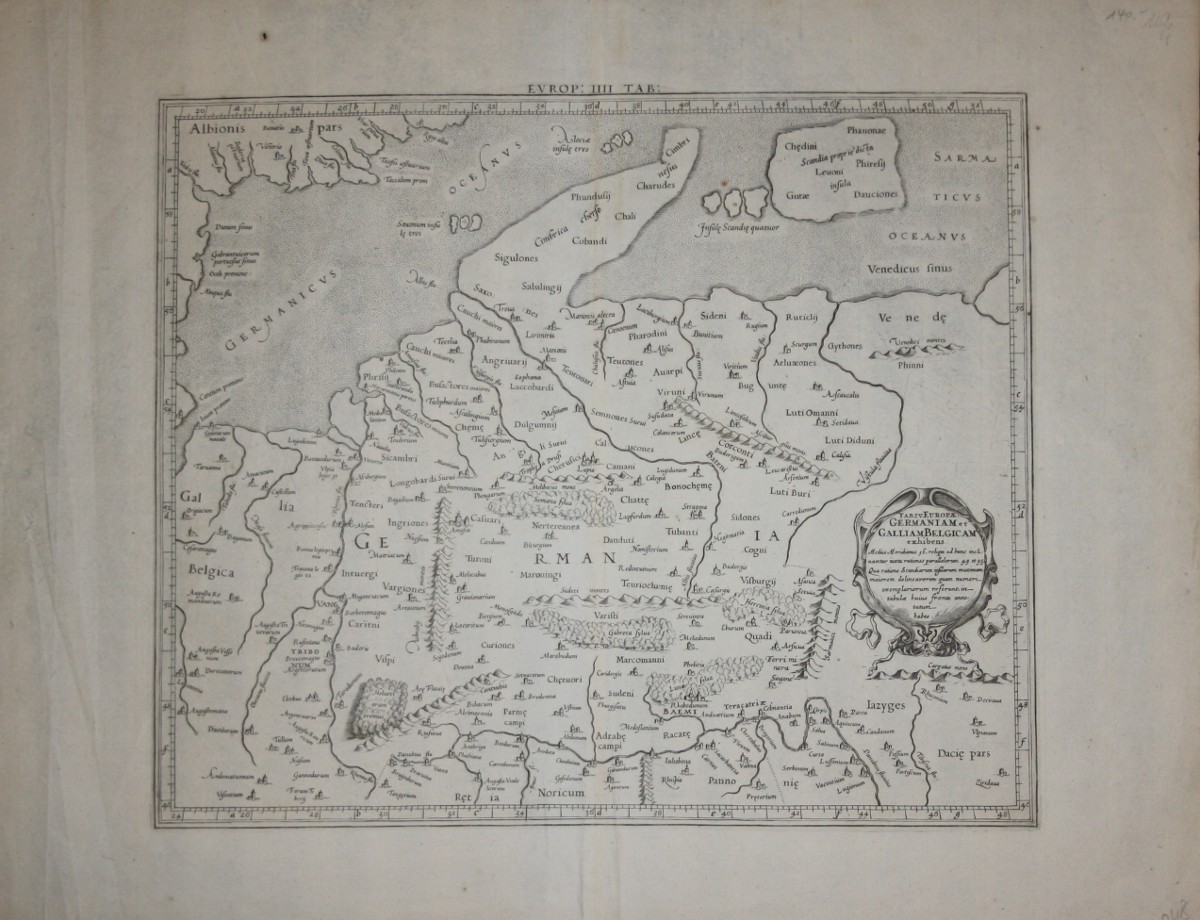
Map title
Tab IV Europae Germaniam et Galliam Belgicam exhibens
Author
Mercator
Location shown in map
Old Germany
Edition date
1695
Edition place
Utrecht
Editor
--
Atlas
Claudii Ptolemaei's Atlas Tabulae geographicae Orbis Terrarum - Francois Halma
Price
250 Euro
State
[mint/excellent/VERY GOOD/good/fair/mediocre/poor]
Color
Black/white
Verso
Blank
Size
Plate: cm (40.6 x 34.3) inches (15.98 x 13.5) Paper: cm (57.2 x 43.2) inches (22.52 x 17.01)
Technique
Copper engraving
Note
Ancient Germany.
Reference
--
Wiki
Here for more info
In stock
Available
Info
info@thetreasuremaps.com
Code
#0502
×
![]()
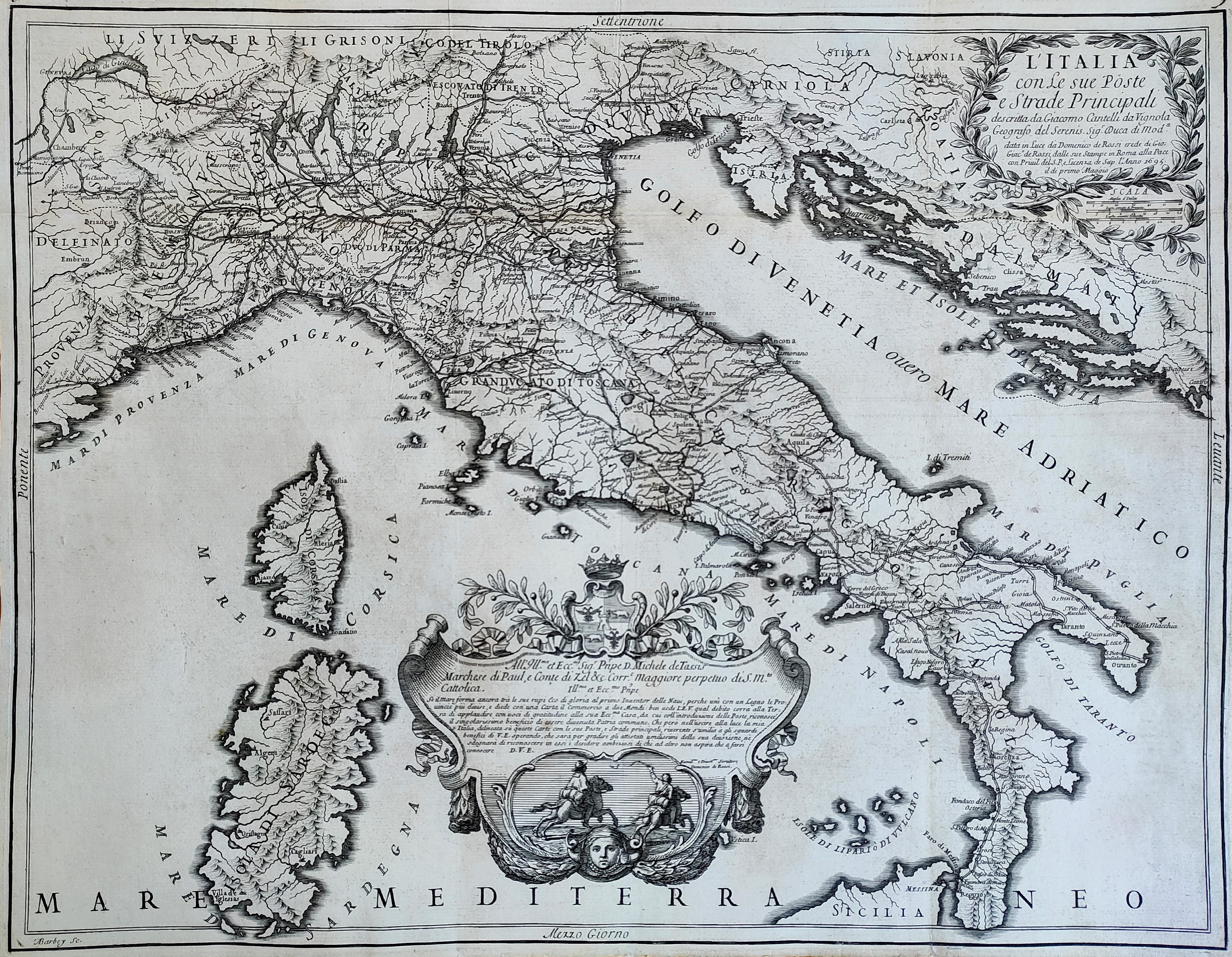
Map title
L'Italia con le sue Poste e strade principali
Author
Cantelli da Vignola
Location shown in map
Italy
Edition date
1695
Edition place
Rome
Editor
Rossi
Atlas
Mercurio Geografico
Price
Please ask: info@thetreasuremaps.com
State
[mint/EXCELLENT/very good/good/fair/mediocre/poor]
Color
Black/white
Verso
Blank
Size
Plate: cm (55 x 44) inches (21.65 x 17.32) Paper: cm (57 x 46) inches (22.44 x 18.11)
Technique
Copper engraving
Note
Reference
R.Borri L'Italia nelle antiche carte pag.161
Wiki
Here for more info
In stock
Available
Info
info@thetreasuremaps.com
Code
#0827
×
![]()
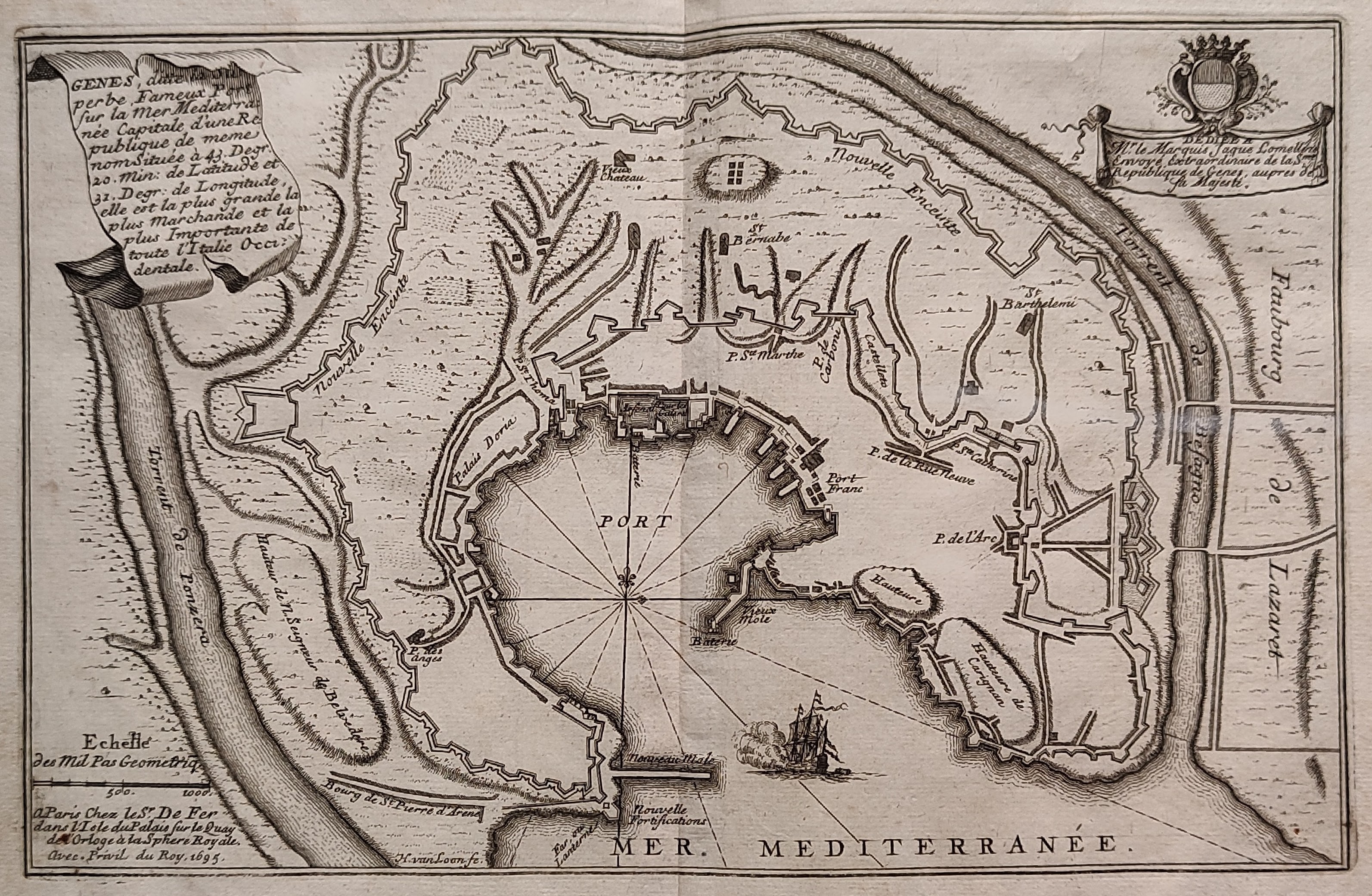
Map title
Genes
Author
De Fer
Location shown in map
Genoa
Edition date
1695
Edition place
Paris
Editor
--
Atlas
Introduction a la fortification
Price
150 Euro
State
[mint/EXCELLENT/very good/good/fair/mediocre/poor]
Color
Black/white
Verso
Blank
Size
Plate: cm (27 x 18) inches (10.63 x 7.09) Paper: cm (32 x 25) inches (12.6 x 9.84)
Technique
Copper engraving
Note
--
Reference
--
Wiki
Here for more info
In stock
Available
Info
info@thetreasuremaps.com
Code
#1106
×
![]()
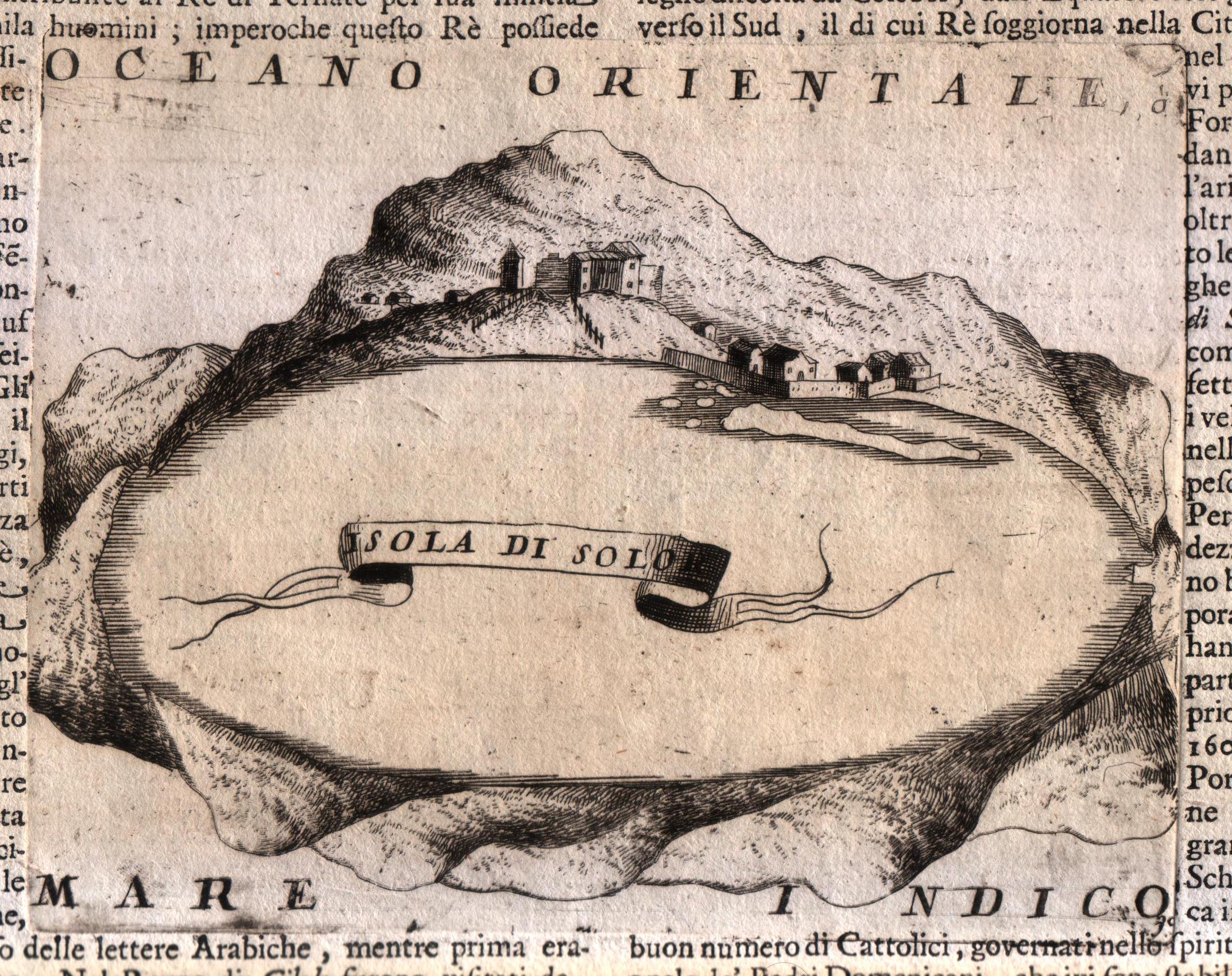
Map title
Isola di Solo
Author
Coronelli
Location shown in map
Sula island
Edition date
Circa 1696
Edition place
Venice
Editor
Coronelli
Atlas
Atlante veneto
Price
Please ask: info@thetreasuremaps.com
State
[MINT/excellent/very good/good/fair/mediocre/poor]
Color
Black/white
Verso
Italian text
Size
Plate: cm (17.8 x 14) inches (7.01 x 5.51) Paper: cm (50.8 x 35.6) inches (20 x 14.02)
Technique
Copper engraving
Note
No particular notes for this maps.
Reference
--
Wiki
Here for more info
In stock
Available
Info
info@thetreasuremaps.com
Code
#0572
×
![]()
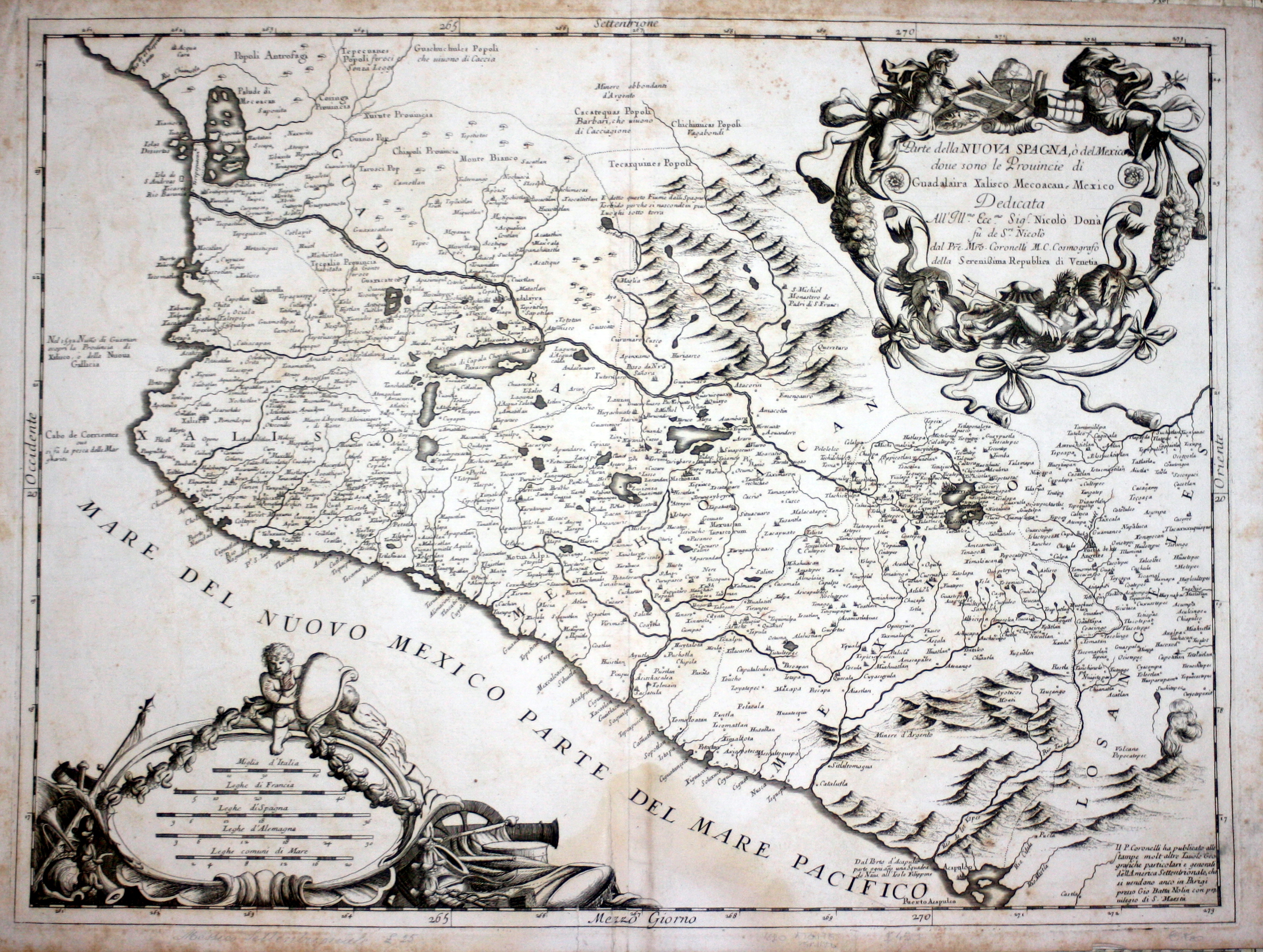
Map title
Parte della Nuova Spagna o del Messico
Author
Coronelli
Location shown in map
West Mexic
Edition date
Circa 1696
Edition place
Venice
Editor
--
Atlas
Atlante veneto
Price
600 Euro
State
[mint/EXCELLENT/very good/good/fair/mediocre/poor]
Color
Black/white
Verso
Blank
Size
Plate: cm (61 x 45.7) inches (24.02 x 17.99) Paper: cm (66 x 48.3) inches (25.98 x 19.02)
Technique
Copper engraving
Note
No particular notes for this maps
Reference
--
Wiki
Here for more info
In stock
Available
Info
info@thetreasuremaps.com
Code
#0345
×
![]()
Map title
Pianta iconografica di Venezia Descritta, e Dedicata Dal P. Maestro Coronelli Lettore, e Cosmografo della serenissima Repubblica all'illustrissimo, et Eccellentissimo Sig. CArlo Ruzini
Author
Coronelli
Location shown in map
Venice
Edition date
Circa 1696
Edition place
Venice
Editor
--
Atlas
Atlante veneto
Price
Please ask: info@thetreasuremaps.com
State
[mint/excellent/very good/good/fair/MEDIOCRE/poor] The map has some holes and tears.
Color
Black/white
Verso
Blank
Size
Plate: cm (40.6 x 26.7) inches (15.98 x 10.51) Paper: cm (40.6 x 26.7) inches (15.98 x 10.51)
Technique
Copper engraving
Note
Beautiful engraved map of Venice
Reference
--
Wiki
Here for more info
In stock
Sold
Info
info@thetreasuremaps.com
Code
#0400
×
![]()
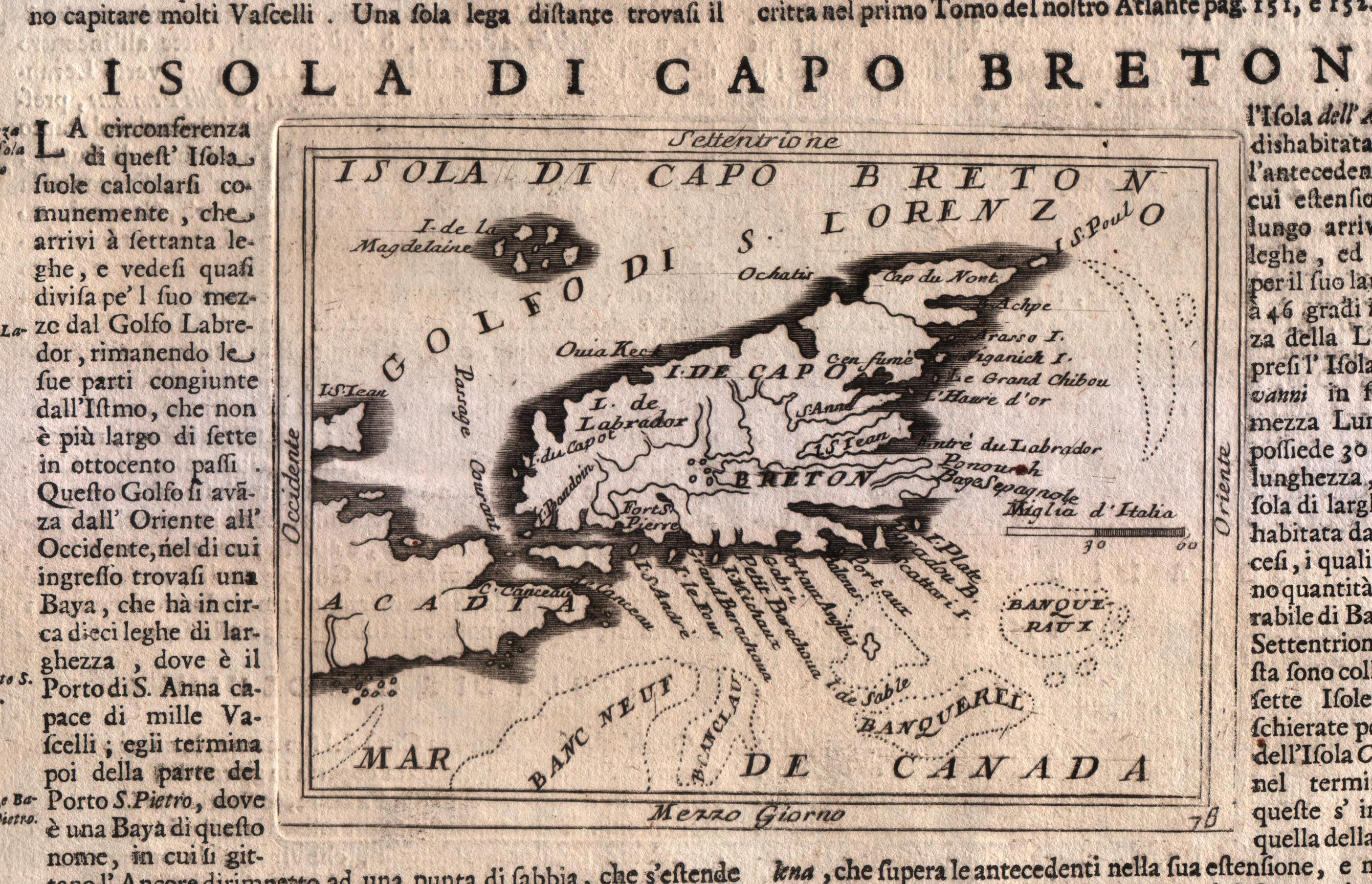
Map title
Isola di capo Breton
Author
Coronelli
Location shown in map
Cape Breton island
Edition date
Circa 1696
Edition place
Venice
Editor
Coronelli
Atlas
Atlante veneto
Price
Please ask: info@thetreasuremaps.com
State
[MINT/excellent/very good/good/fair/mediocre/poor]
Color
Black/white
Verso
Italian text
Size
Plate: cm (16.5 x 12.7) inches (6.5 x 5) Paper: cm (50.8 x 35.6) inches (20 x 14.02)
Technique
Copper engraving
Note
No particular notes for this maps.
Reference
--
Wiki
Here for more info
In stock
Available
Info
info@thetreasuremaps.com
Code
#0569
×
![]()
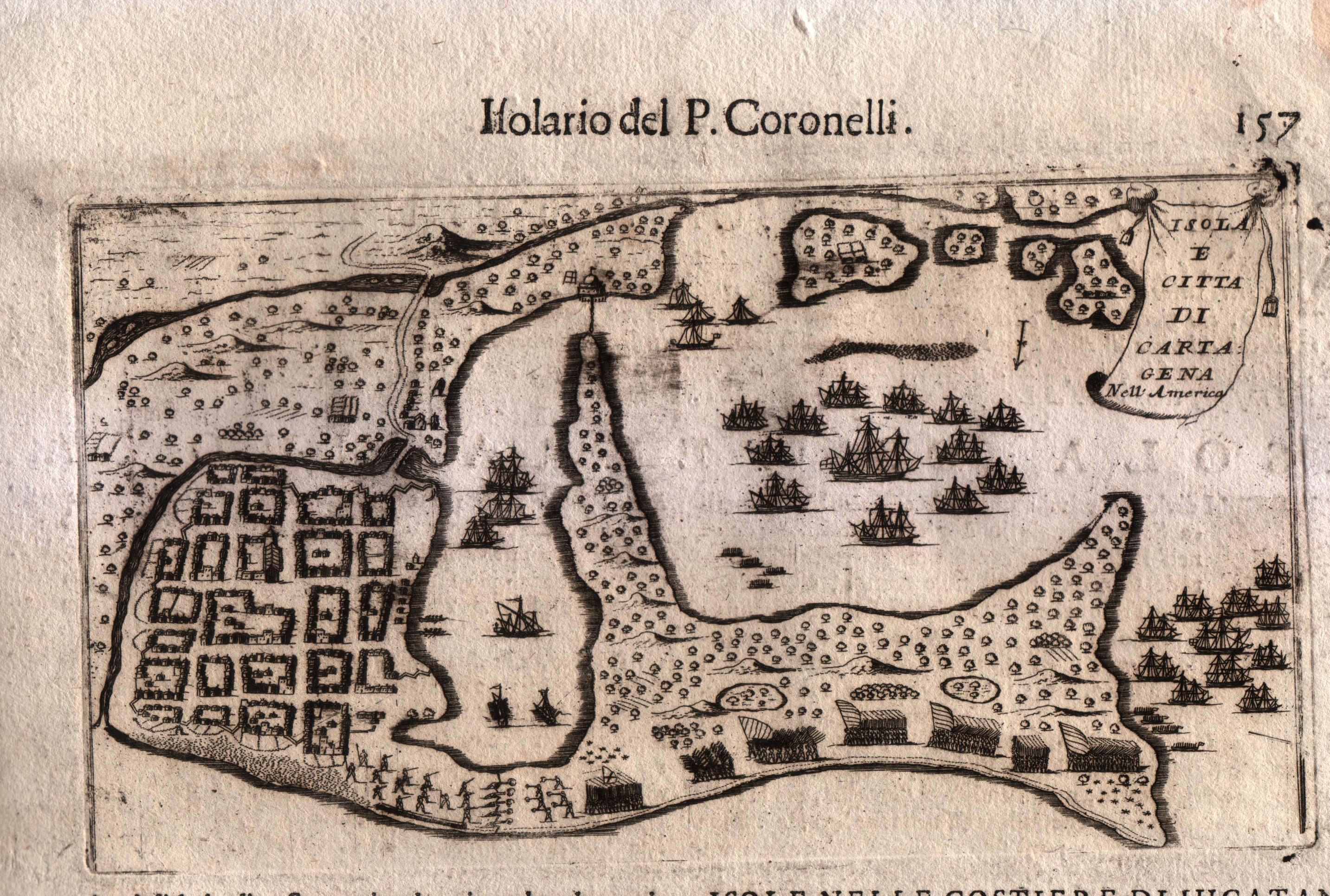
Map title
Isola e citta di Cartagena
Author
Coronelli
Location shown in map
City of Cartagena
Edition date
Circa 1696
Edition place
Venice
Editor
Coronelli
Atlas
Atlante veneto
Price
Please ask: info@thetreasuremaps.com
State
[MINT/excellent/very good/good/fair/mediocre/poor]
Color
Black/white
Verso
Italian text
Size
Plate: cm (22.9 x 14) inches (9.02 x 5.51) Paper: cm (50.8 x 35.6) inches (20 x 14.02)
Technique
Copper engraving
Note
No particular notes for this maps.
Reference
--
Wiki
Here for more info
In stock
Available
Info
info@thetreasuremaps.com
Code
#0570
×
![]()
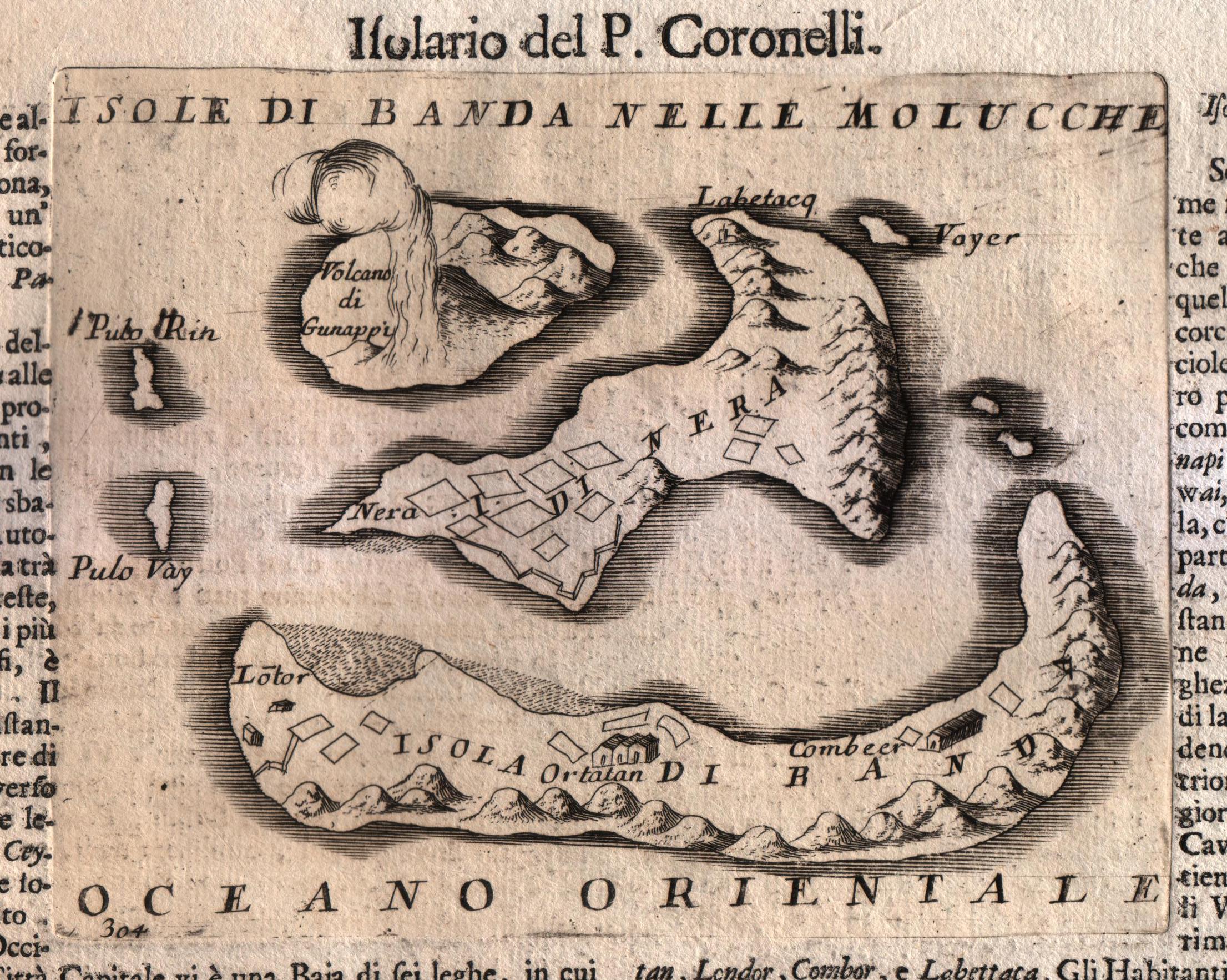
Map title
Isole di Banda nelle Molucche
Author
Coronelli
Location shown in map
Banda island
Edition date
Circa 1696
Edition place
Venice
Editor
Coronelli
Atlas
Atlante veneto
Price
250 Euro
State
[MINT/excellent/very good/good/fair/mediocre/poor]
Color
Black/white
Verso
Italian text
Size
Plate: cm (17.8 x 14) inches (7.01 x 5.51) Paper: cm (50.8 x 35.6) inches (20 x 14.02)
Technique
Copper engraving
Note
No particular notes for this maps.
Reference
--
Wiki
Here for more info
In stock
Available
Info
info@thetreasuremaps.com
Code
#0571
×
![]()
Map title
Arcipelago delle Molucche
Author
Coronelli
Location shown in map
Moluccas
Edition date
Circa 1696
Edition place
Venice
Editor
Coronelli
Atlas
Atlante veneto
Price
250 Euro
State
[MINT/excellent/very good/good/fair/mediocre/poor]
Color
Black/white
Verso
Italian text
Size
Plate: cm (30.5 x 22.9) inches (12.01 x 9.02) Paper: cm (50.8 x 35.6) inches (20 x 14.02)
Technique
Copper engraving
Note
No particular notes for this maps.
Reference
--
Wiki
Here for more info
In stock
Available
Info
info@thetreasuremaps.com
Code
#0573
×
![]()
Map title
La Guinea
Author
Coronelli
Location shown in map
West Africa
Edition date
Circa 1696
Edition place
Venice
Editor
Coronelli
Atlas
Atlante veneto
Price
200 Euro
State
[MINT/excellent/very good/good/fair/mediocre/poor]
Color
Black/white
Verso
Italian text
Size
Plate: cm (30.5 x 22.9) inches (12.01 x 9.02) Paper: cm (50.8 x 35.6) inches (20 x 14.02)
Technique
Copper engraving
Note
No particular notes for this maps.
Reference
--
Wiki
Here for more info
In stock
Available
Info
info@thetreasuremaps.com
Code
#0574
×
![]()
Map title
Capo Verde
Author
Coronelli
Location shown in map
Cape Verde island
Edition date
Circa 1696
Edition place
Venice
Editor
Coronelli
Atlas
Atlante veneto
Price
Please ask: info@thetreasuremaps.com
State
[MINT/excellent/very good/good/fair/mediocre/poor]
Color
Black/white
Verso
Italian text
Size
Plate: cm (17.8 x 14) inches (7.01 x 5.51) Paper: cm (50.8 x 35.6) inches (20 x 14.02)
Technique
Copper engraving
Note
No particular notes for this maps.
Reference
--
Wiki
Here for more info
In stock
Available
Info
info@thetreasuremaps.com
Code
#0575
×
![]()
Map title
Scotia parte settentrionale
Author
Coronelli
Location shown in map
North Scotland
Edition date
1696
Edition place
Venice
Editor
--
Atlas
Isolario dell'atlante veneto
Price
400 Euro
State
[mint/EXCELLENT/very good/good/fair/mediocre/poor]
Color
Old colors
Verso
Italian tesx pag.22
Size
Plate: cm (62 x 46) inches (24.41 x 18.11) Paper: cm (64 x 47) inches (25.2 x 18.5)
Technique
Copper engraving
Note
Reference
--
Wiki
Here for more info
In stock
Available
Info
info@thetreasuremaps.com
Code
#1021
×
![]()
Map title
Parte meridionale del regno d'Inghilterra
Author
Coronelli
Location shown in map
South England
Edition date
1696
Edition place
Venice
Editor
--
Atlas
Isolario dell'atlante veneto
Price
400 Euro
State
[mint/EXCELLENT/very good/good/fair/mediocre/poor]
Color
Old colors
Verso
Italian text pag.4
Size
Plate: cm (62 x 46) inches (24.41 x 18.11) Paper: cm (64 x 47) inches (25.2 x 18.5)
Technique
Copper engraving
Note
Reference
--
Wiki
Here for more info
In stock
Available
Info
info@thetreasuremaps.com
Code
#1020
×
![]()
Map title
Corso delli fiumi Drino e Boiana
Author
Coronelli
Location shown in map
Montenegro
Edition date
1696
Edition place
Venice
Editor
--
Atlas
Isolario dell'atlante veneto
Price
400 Euro
State
[mint/EXCELLENT/very good/good/fair/mediocre/poor]
Color
Old colors
Verso
Blank
Size
Plate: cm (62 x 46) inches (24.41 x 18.11) Paper: cm (64 x 47) inches (25.2 x 18.5)
Technique
Copper engraving
Note
Reference
--
Wiki
Here for more info
In stock
Sold
Info
info@thetreasuremaps.com
Code
#1022
×
![]()
Map title
Regno di Portogallo
Author
Coronelli
Location shown in map
Portugal
Edition date
1696
Edition place
Venice
Editor
--
Atlas
Isolario dell'atlante veneto
Price
400 Euro
State
[mint/EXCELLENT/very good/good/fair/mediocre/poor]
Color
Old colors
Verso
Italian text pag.81
Size
Plate: cm (62 x 46) inches (24.41 x 18.11) Paper: cm (64 x 47) inches (25.2 x 18.5)
Technique
Copper engraving
Note
Reference
--
Wiki
Here for more info
In stock
Available
Info
info@thetreasuremaps.com
Code
#1023
×
![]()
Map title
Ducato di Normandia
Author
Coronelli
Location shown in map
France
Edition date
1696
Edition place
Venice
Editor
--
Atlas
Isolario dell'atlante veneto
Price
400 Euro
State
[mint/EXCELLENT/very good/good/fair/mediocre/poor]
Color
Old colors
Verso
Italian text pag.64
Size
Plate: cm (62 x 46) inches (24.41 x 18.11) Paper: cm (64 x 47) inches (25.2 x 18.5)
Technique
Copper engraving
Note
Reference
--
Wiki
Here for more info
In stock
Available
Info
info@thetreasuremaps.com
Code
#1024
×
![]()
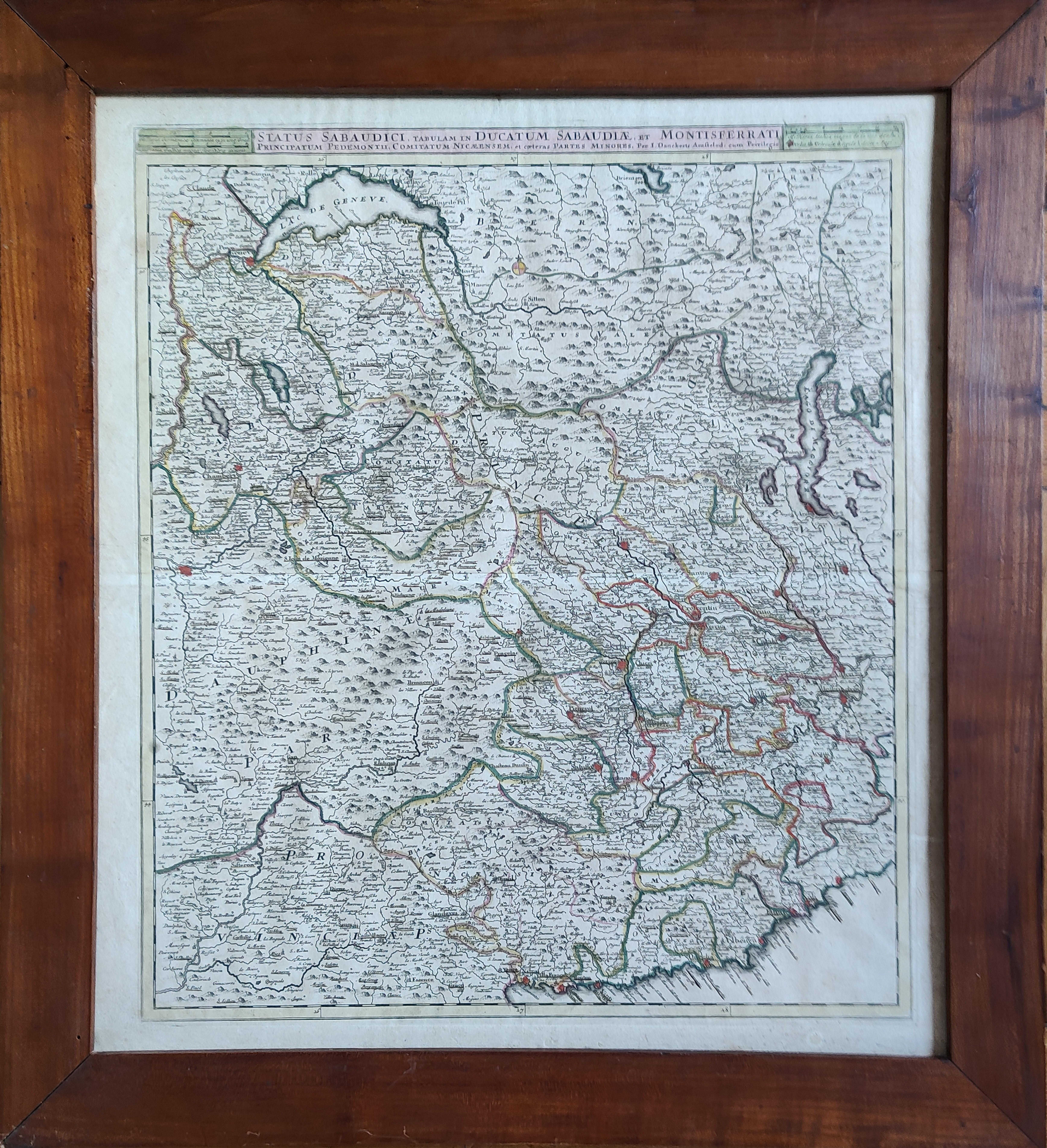
Map title
Status Sabaudici, tabulam in ducatum Sabaudiae, et Montisferrati ...
Author
Danckerts
Location shown in map
North-West Italy
Edition date
Circa 1696
Edition place
Amsterdam
Editor
Atlas
Price
400 Euro
State
[mint/EXCELLENT/very good/good/fair/mediocre/poor]
Color
Old colors
Verso
Blank
Size
Plate: cm (49 x 57) inches (19.29 x 22.44) Paper: cm (54 x 61) inches (21.26 x 24.02)
Technique
Copper engraving
Note
Framed
Reference
Wiki
Here for more info
In stock
Available
Info
info@thetreasuremaps.com
Code
#1113
×
![]()
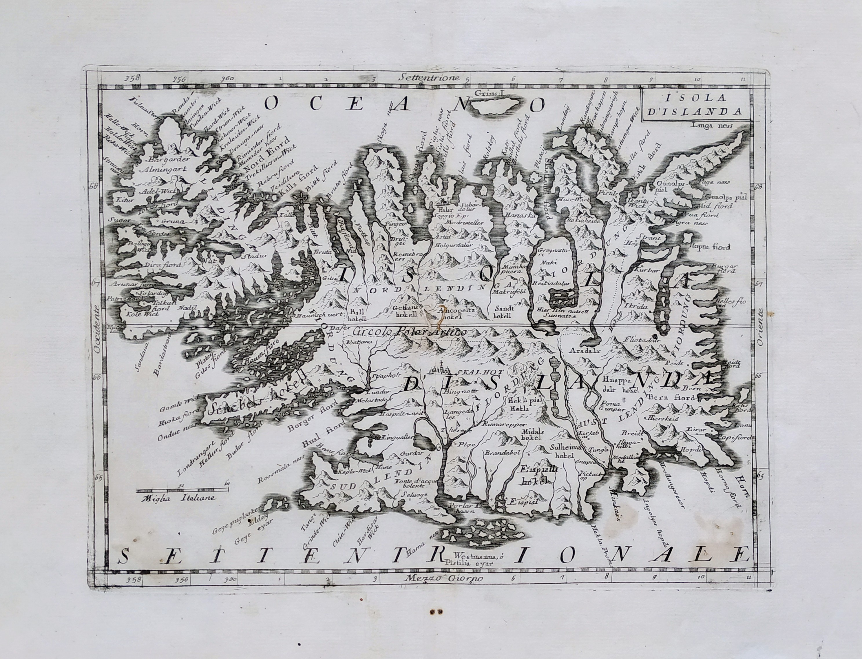
Map title
L'isola d'Islanda
Author
Coronelli
Location shown in map
Iceland
Edition date
Circa 1697
Edition place
Venice
Editor
Coronelli
Atlas
Atlante veneto
Price
400 Euro
State
[mint/EXCELLENT/very good/good/fair/mediocre/poor]
Color
Black/white
Verso
Blank
Size
Plate: cm (31 x 23) inches (12.2 x 9.06) Paper: cm (40 x 30) inches (15.75 x 11.81)
Technique
Copper engraving
Note
No particular notes for this maps.
Reference
--
Wiki
Here for more info
In stock
Available
Info
info@thetreasuremaps.com
Code
#0745
×
![]()
Map title
La partie meridionale des estats du duc de Savoye...
Author
Nolin
Location shown in map
Piedmont & Liguria, North west Italy
Edition date
1697
Edition place
Paris
Editor
--
Atlas
Price
400 Euro
State
[mint/EXCELLENT/very good/good/fair/mediocre/poor]
Color
Old colors
Verso
Blank
Size
Plate: cm (62 x 40) inches (24.41 x 15.75) Paper: cm (73 x 53) inches (28.74 x 20.87)
Technique
Copper engraving
Note
Reference
Wiki
Here for more info
In stock
Available
Info
info@thetreasuremaps.com
Code
#0852
×
![]()
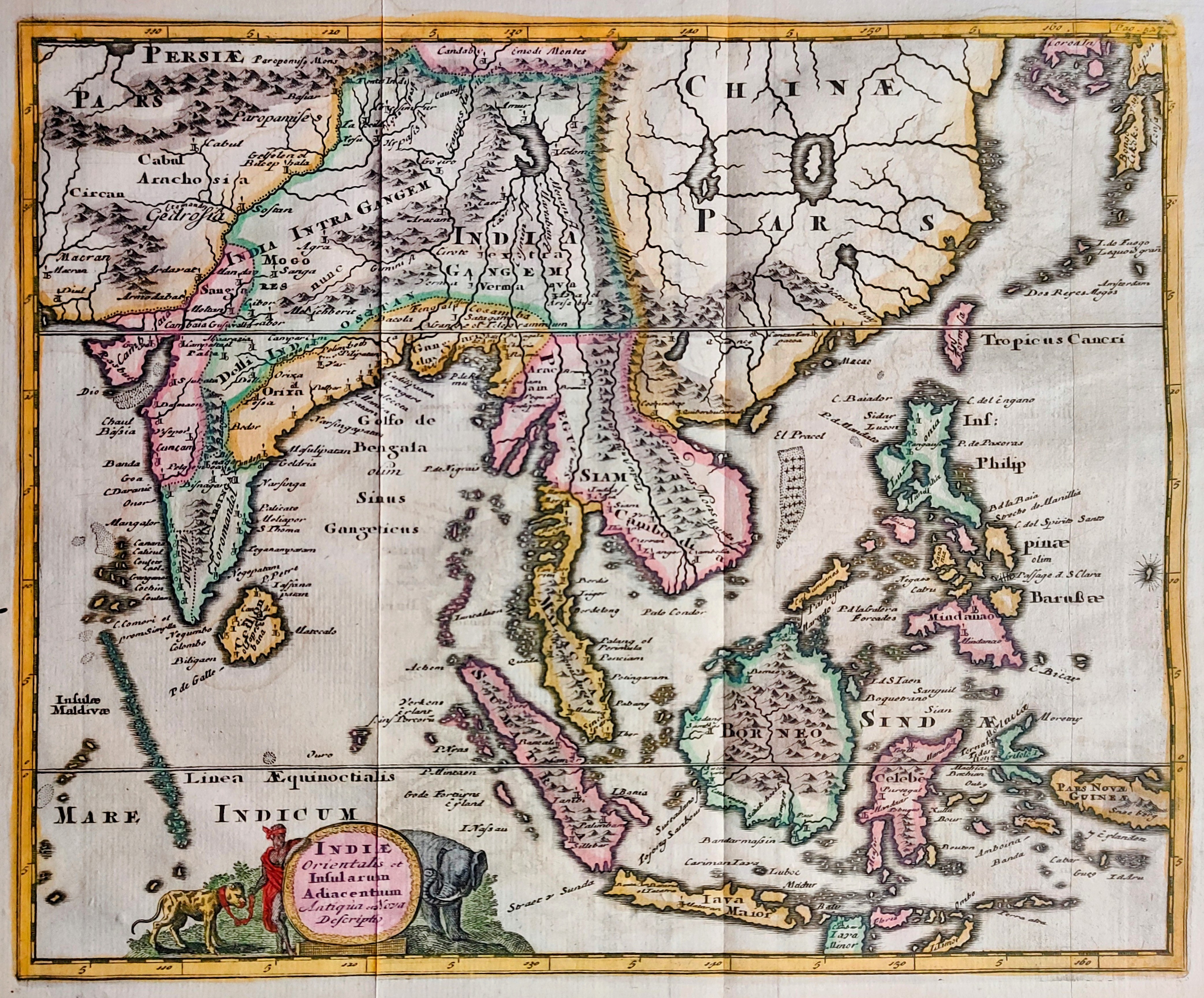
Map title
Indiae orientalis
Author
Cluver
Location shown in map
Southeast Asia
Edition date
1697
Edition place
Leiden
Editor
Atlas
Introductionis in Universam Geographiam ...
Price
200 Euro
State
[mint/EXCELLENT/very good/good/fair/mediocre/poor]
Color
Old colors
Verso
Blank
Size
Plate: cm (33 x 25) inches (12.99 x 9.84) Paper: cm (27 x 22) inches (10.63 x 8.66)
Technique
Copper engraving
Note
Reference
Wiki
Here for more info
In stock
Available
Info
info@thetreasuremaps.com
Code
#0865
×
![]()