1800-1899
Map title
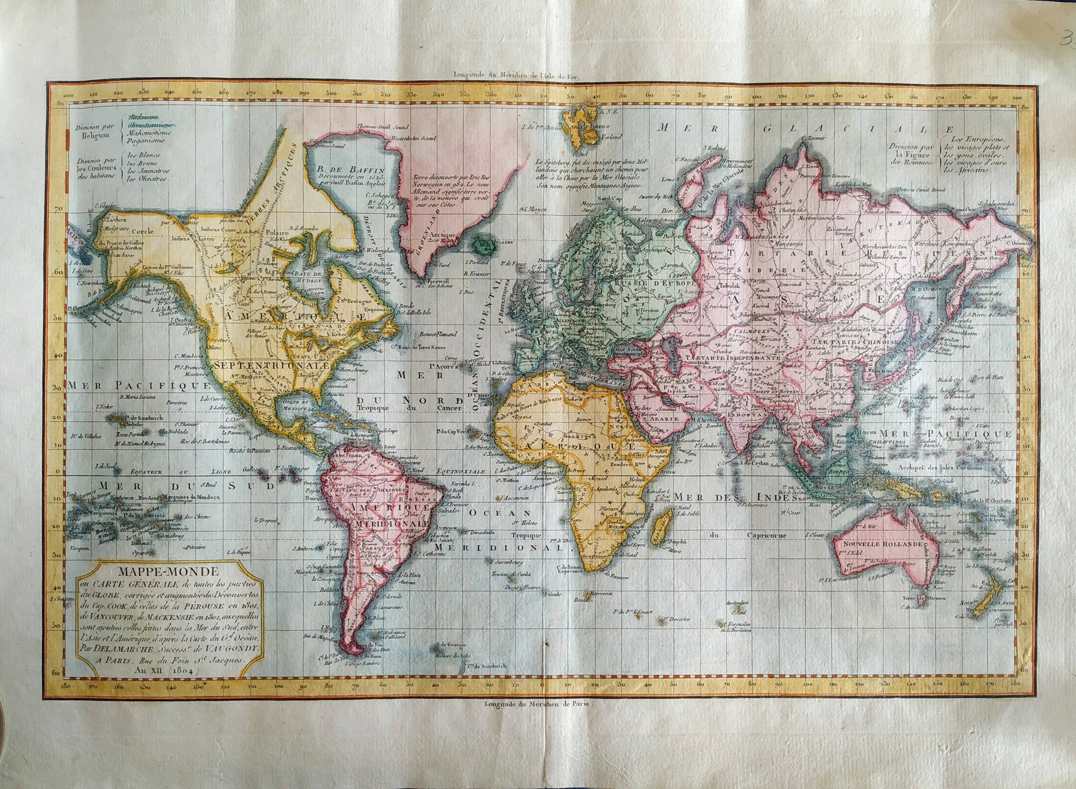
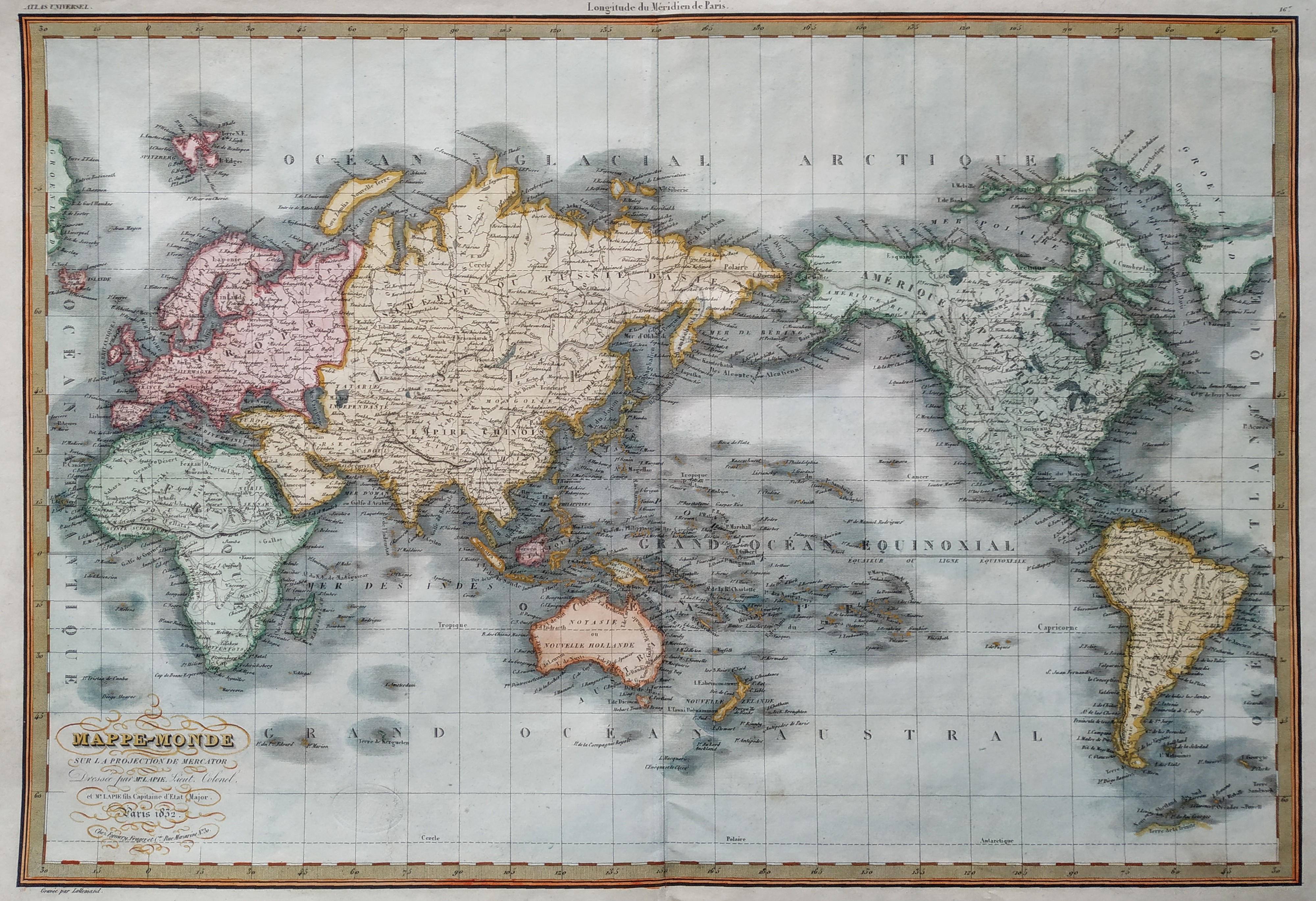
Mappe-Monde
Author
Delamarche
Location shown in map
World
Edition date
1804
Edition place
Paris
Editor
Delamarche
Atlas
Atlas Portatif de Vaugondy
Price
150 Euro
State
[MINT/excellent/very good/good/fair/mediocre/poor]
Color
Old color
Verso
Blank
Size
Plate: cm (38 x 24) inches (14.96 x 9.45) Paper: cm (44 x 30) inches (17.32 x 11.81)
Technique
Copper engraving
Note
Reference
--
Wiki
Here for more info
In stock
Available
Info
info@thetreasuremaps.com
Code
#0753
×
![]()
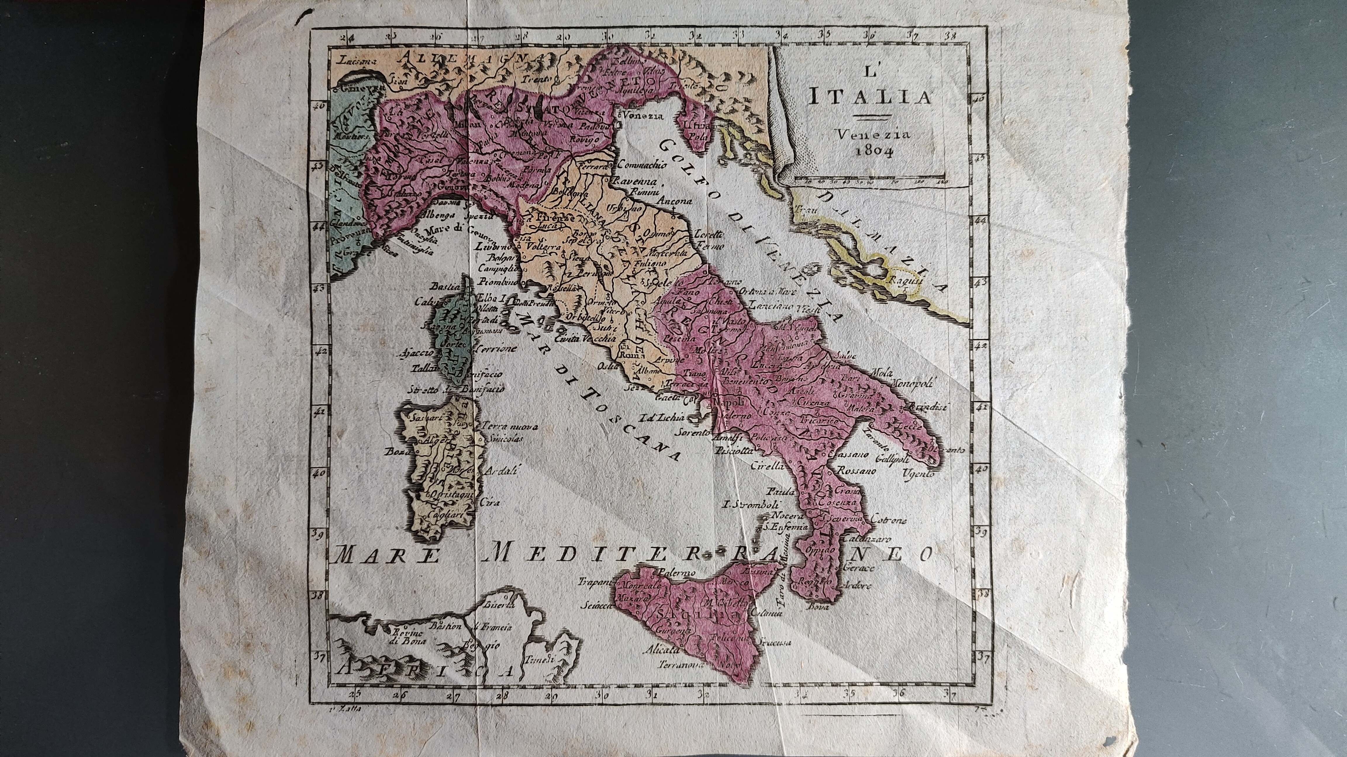
Map title
L'Italia
Author
Zatta
Location shown in map
Italy
Edition date
1804
Edition place
Venice
Editor
Atlas
Nuovo atlante
Price
150 Euro
State
[mint/excellent/VERY GOOD/good/fair/mediocre/poor]
Color
Old colors
Verso
Blank
Size
Plate: cm (16 x 16) inches (6.3 x 6.3) Paper: cm (18 x 28) inches (7.09 x 11.02)
Technique
Copper engraving
Note
Reference
Wiki
Here for more info
In stock
Available
Info
info@thetreasuremaps.com
Code
#0912
×
![]()
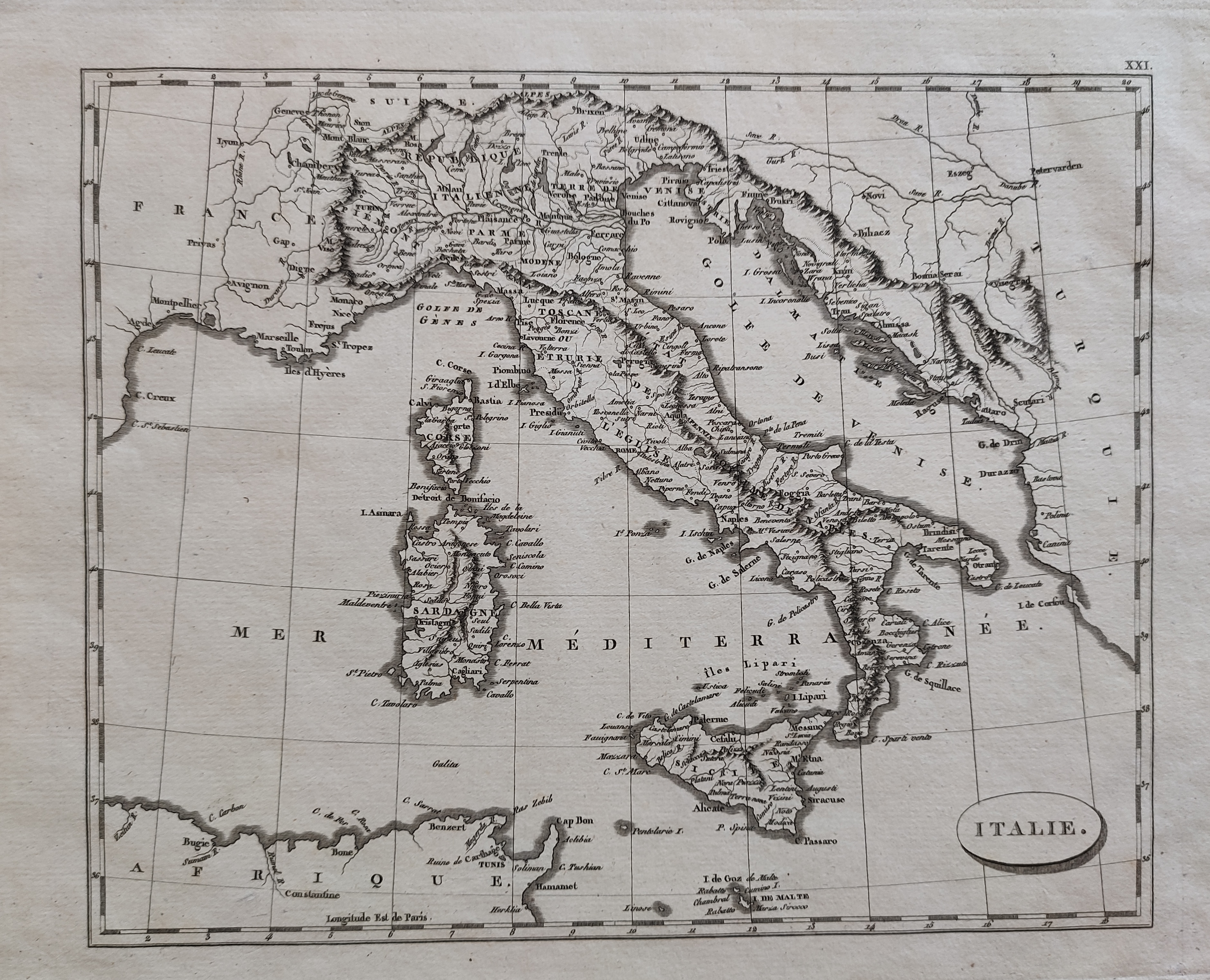
Map title
Italie
Author
Arrowsmith
Location shown in map
Italy
Edition date
Circa 1806
Edition place
Editor
--
Atlas
Price
75 Euro
State
[mint/EXCELLENT/very good/good/fair/mediocre/poor]
Color
Black/white
Verso
Blank
Size
Plate: cm (25 x 21) inches (9.84 x 8.27) Paper: cm (34 x 26) inches (13.39 x 10.24)
Technique
Copper engraving
Note
Reference
Wiki
Here for more info
In stock
Available
Info
info@thetreasuremaps.com
Code
#0937
×
![]()

Map title
Asia from the latest authorities
Author
Location shown in map
Asia
Edition date
1806
Edition place
London
Editor
Bungay
Atlas
Price
50 Euro
State
[mint/EXCELLENT/very good/good/fair/mediocre/poor]
Color
Black/white
Verso
Blank
Size
Plate: cm (23 x 19) inches (9.06 x 7.48) Paper: cm (25 x 21) inches (9.84 x 8.27)
Technique
Copper engraving
Note
Reference
Wiki
Here for more info
In stock
Available
Info
info@thetreasuremaps.com
Code
#1298
×
![]()
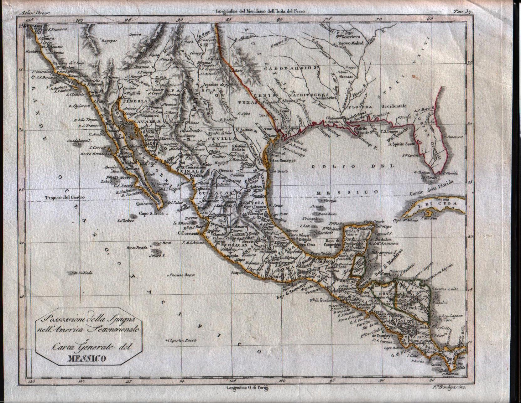
Map title
Possessioni della Spagna nell'america Settentrionale e Carta Generale del Messico
Author
Unknown
Location shown in map
South USA and Mexico
Edition date
1807
Edition place
Milan
Editor
--
Atlas
Barbiellini Atlante delle geografica antica e moderna
Price
125 Euro
State
[mint/EXCELLENT/very good/good/fair/mediocre/poor]
Color
Old outlined
Verso
Blank
Size
Plate: cm (24.8 x 19.7) inches (9.76 x 7.76) Paper: cm (27.9 x 22.9) inches (10.98 x 9.02)
Technique
Copper engraving
Note
Map of the Texas, Mexico, Upper California, Louisiana Territory and Florida. The cartography is certainly pre-1810, naming East and West Florida, showing a pre-Louisiana Purchase Louisiana and very early placenames in the Southwest, most notably Pimeria, Bagiopas, and Quivira, names which would disappear from the map within a few years. Another noteworthy feature is the listing of the Missions in Upper California, which do not generally appear in atlas maps of the period. Nice detail in Texas, including the appearance of the actual name Texas, another unusual early feature. A number of forts and Indian Tribes located. An interesting early map of the region.
Reference
--
Wiki
Here for more info
In stock
Available
Info
info@thetreasuremaps.com
Code
#0084
×
![]()
Map title
Italien
Author
Location shown in map
Italy
Edition date
1808
Edition place
Weimar
Editor
Atlas
Price
150 Euro
State
[mint/EXCELLENT/very good/good/fair/mediocre/poor]
Color
Old colors
Verso
Blank
Size
Plate: cm (33 x 44) inches (12.99 x 17.32) Paper: cm (31 x 42) inches (12.2 x 16.54)
Technique
Copper engraving
Note
Reference
Wiki
Here for more info
In stock
Available
Info
info@thetreasuremaps.com
Code
#0916
×
![]()
Map title
Kingdom of Italy, Etruria, Naples
Author
Location shown in map
Italy
Edition date
1808
Edition place
London
Editor
Atlas
Price
150 Euro
State
[mint/EXCELLENT/very good/good/fair/mediocre/poor]
Color
Old colors
Verso
Blank
Size
Plate: cm (51 x 43) inches (20.08 x 16.93) Paper: cm (39 x 34) inches (15.35 x 13.39)
Technique
Copper engraving
Note
Reference
Wiki
Here for more info
In stock
Available
Info
info@thetreasuremaps.com
Code
#0917
×
![]()
Map title
Charte von Asien
Author
Walch
Location shown in map
Asia
Edition date
1808
Edition place
Augsburg
Editor
Atlas
Price
200 Euro
State
[mint/excellent/VERY GOOD/good/fair/mediocre/poor]
Color
Old colors
Verso
Blank
Size
Plate: cm (43.2 x 59) inches (17.01 x 23.23) Paper: cm (62 x 51) inches (24.41 x 20.08)
Technique
Copper engraving
Note
Reference
--
Wiki
Here for more info
In stock
Available
Info
info@thetreasuremaps.com
Code
#1149
×
![]()
Map title
Le provincie settentrionali degli Stati Uniti
Author
Botta
Location shown in map
North East
Edition date
1809
Edition place
Firenze
Editor
Marchini
Atlas
Storia Della Guerra Dell' Independenza Degli Stati Uniti d'America
Price
150 Euro
State
[mint/EXCELLENT/very good/good/fair/mediocre/poor]
Color
Black/white
Verso
White
Size
Plate: cm (48.3 x 31.8) inches (19.02 x 12.52) Paper: cm (50.8 x 41.9) inches (20 x 16.5)
Technique
Copper engraving
Note
No particular notes for this maps.
Reference
--
Wiki
Here for more info
In stock
Available
Info
info@thetreasuremaps.com
Code
#0539
×
![]()
Map title
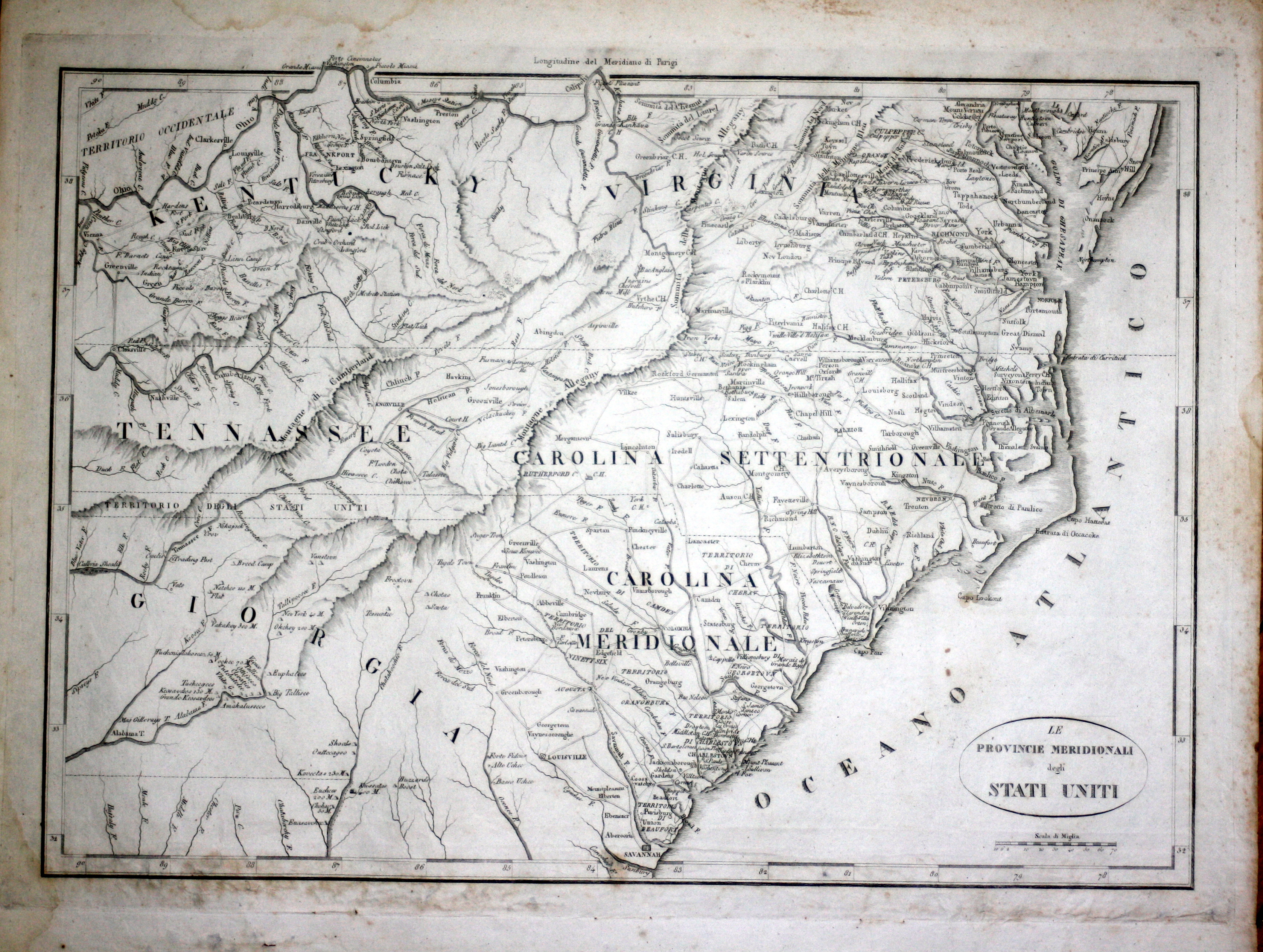
Le provincie meridionali degli Stati Uniti
Author
Botta
Location shown in map
South East coast
Edition date
1809
Edition place
Firenze
Editor
Marchini
Atlas
Storia Della Guerra Dell' Independenza Degli Stati Uniti d'America
Price
150 Euro
State
[mint/EXCELLENT/very good/good/fair/mediocre/poor]
Color
Black/white
Verso
White
Size
Plate: cm (48.3 x 31.8) inches (19.02 x 12.52) Paper: cm (50.8 x 41.9) inches (20 x 16.5)
Technique
Copper engraving
Note
No particular notes for this maps.
Reference
--
Wiki
Here for more info
In stock
Available
Info
info@thetreasuremaps.com
Code
#0540
×
![]()
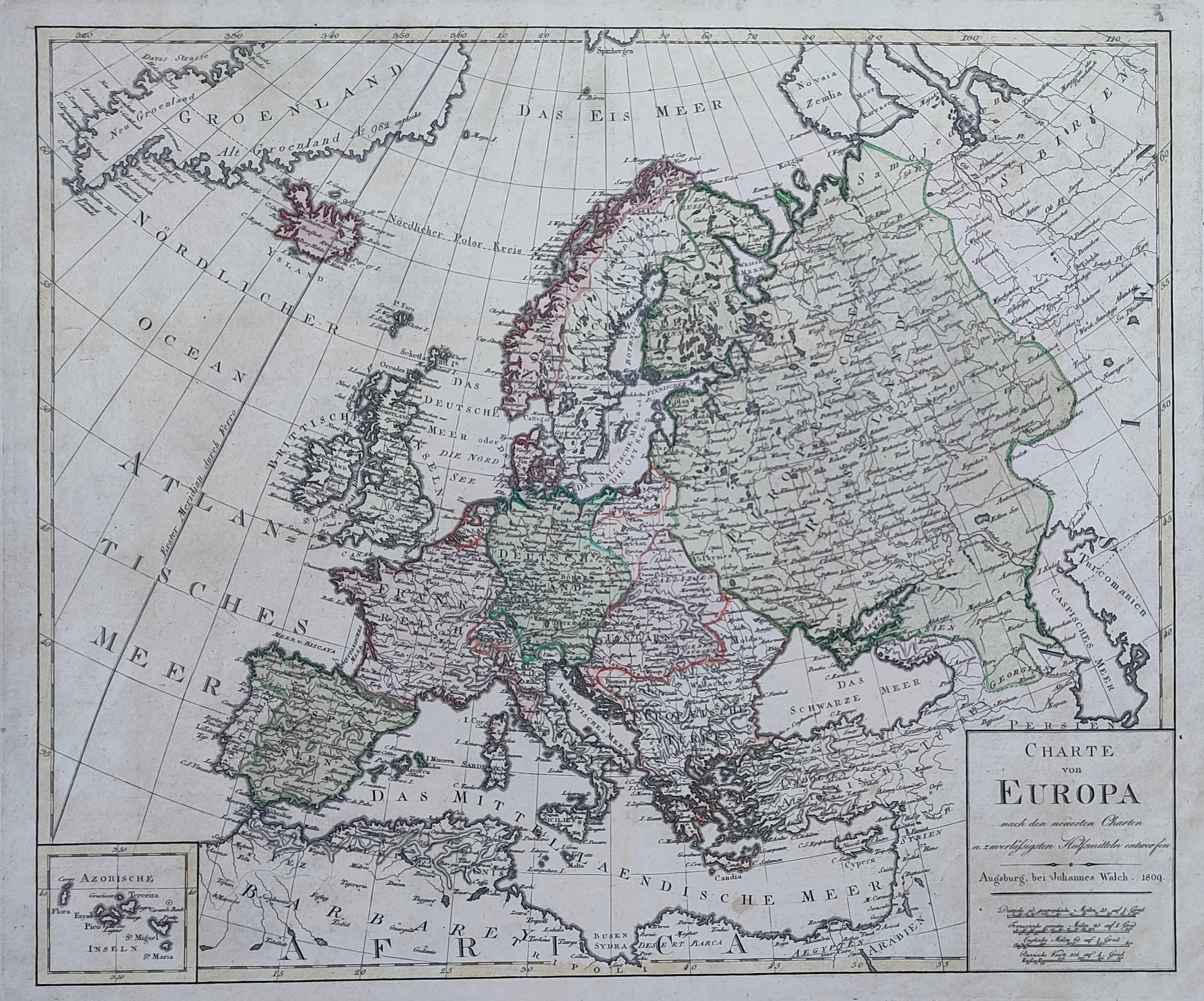
Map title
Charte von Europa
Author
Walch
Location shown in map
All Europe
Edition date
1809
Edition place
Augsburg
Editor
Atlas
Price
175 Euro
State
[mint/EXCELLENT/very good/good/fair/mediocre/poor]
Color
Old colors
Verso
Blank
Size
Plate: cm (56 x 47) inches (22.05 x 18.5) Paper: cm (71 x 59) inches (27.95 x 23.23)
Technique
Copper engraving
Note
Reference
Wiki
Here for more info
In stock
Available
Info
info@thetreasuremaps.com
Code
#1236
×
![]()
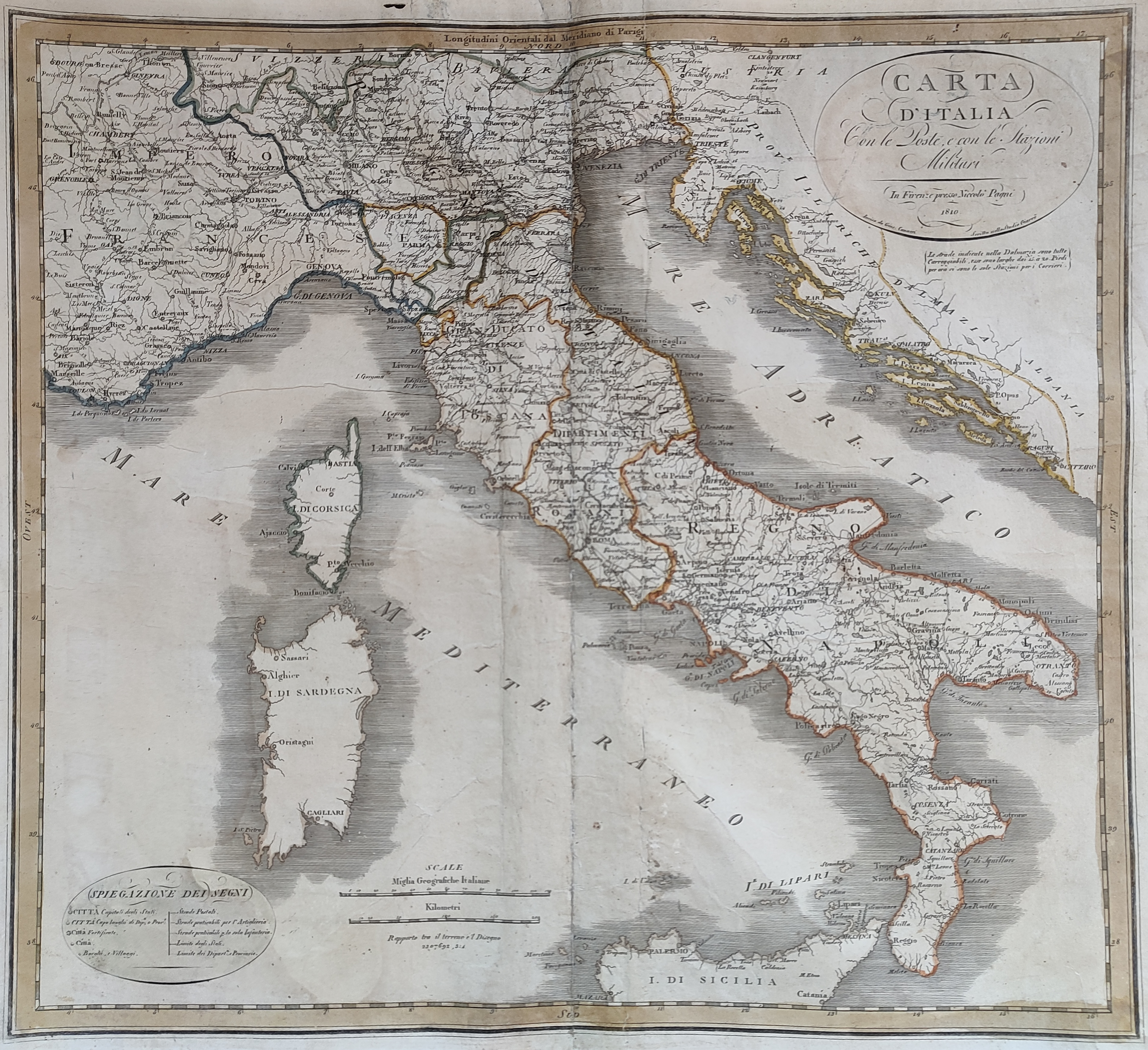
Map title
Carta d'Italia con le poste
Author
Location shown in map
Italy
Edition date
1810
Edition place
Florence
Editor
Pagni
Atlas
Price
150 Euro
State
[mint/excellent/VERY GOOD/good/fair/mediocre/poor]
Color
Old colors
Verso
Blank
Size
Plate: cm (54 x 52) inches (21.26 x 20.47) Paper: cm (48 x 45) inches (18.9 x 17.72)
Technique
Copper engraving
Note
Reference
Wiki
Here for more info
In stock
Available
Info
info@thetreasuremaps.com
Code
#0915
×
![]()
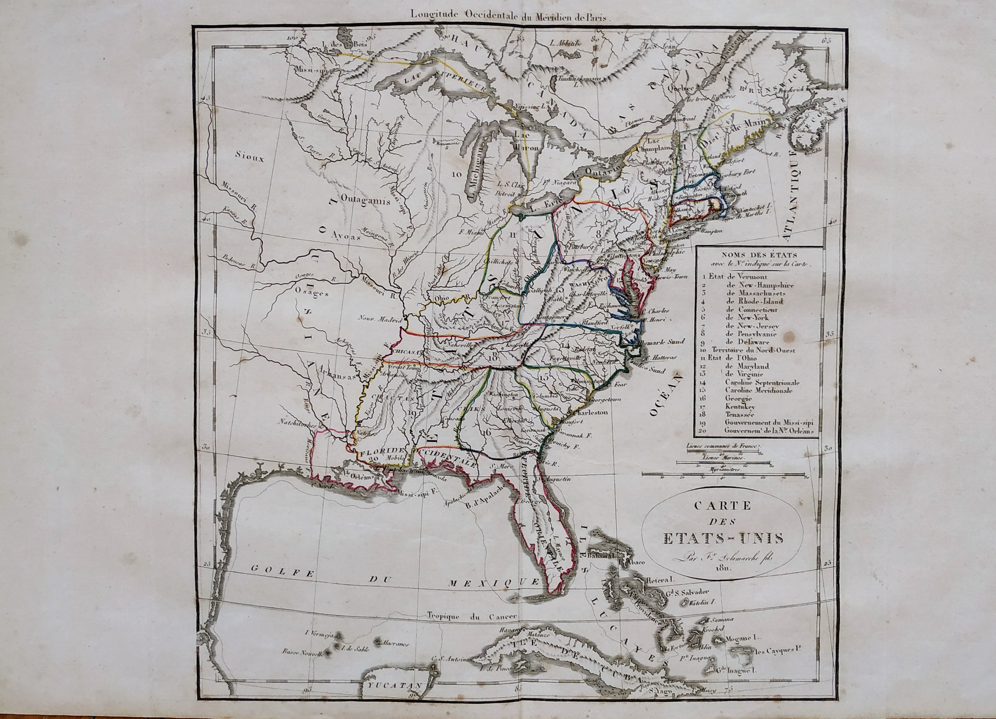
Map title
Carte des Etats-Unis
Author
Delamarche
Location shown in map
USA
Edition date
1811
Edition place
Paris
Editor
--
Atlas
Atlas Portatif de Vaugondy
Price
125 Euro
State
[mint/excellent/VERY GOOD/good/fair/mediocre/poor]
Color
Old outlined
Verso
Blank
Size
Plate: cm (27 x 29) inches (10.63 x 11.42) Paper: cm (48 x 31) inches (18.9 x 12.2)
Technique
Copper engraving
Note
Reference
--
Wiki
Here for more info
In stock
Available
Info
info@thetreasuremaps.com
Code
#0749
×
![]()
Map title
Italy
Author
Wallis
Location shown in map
Italy
Edition date
Circa 1811
Edition place
London
Editor
S.A.Oddy
Atlas
Price
100 Euro
State
[mint/EXCELLENT/very good/good/fair/mediocre/poor]
Color
Old colors
Verso
Blank
Size
Plate: cm (27 x 29) inches (10.63 x 11.42) Paper: cm (27 x 36) inches (10.63 x 14.17)
Technique
Copper engraving
Note
Reference
Wiki
Here for more info
In stock
Available
Info
info@thetreasuremaps.com
Code
#1112
Italy
Author
Wallis
Location shown in map
Italy
Edition date
Circa 1811
Edition place
London
Editor
S.A.Oddy
Atlas
Price
100 Euro
State
[mint/EXCELLENT/very good/good/fair/mediocre/poor]
Color
Old colors
Verso
Blank
Size
Plate: cm (27 x 29) inches (10.63 x 11.42) Paper: cm (27 x 36) inches (10.63 x 14.17)
Technique
Copper engraving
Note
Reference
Wiki
Here for more info
In stock
Available
Info
info@thetreasuremaps.com
Code
#1112
×
![]()
Map title
Nouvelle Espagne
Author
Delamarche
Location shown in map
Mexico
Edition date
1812
Edition place
Paris
Editor
--
Atlas
Atlas Portatif de Vaugondy
Price
125 Euro
State
[mint/excellent/VERY GOOD/good/fair/mediocre/poor]
Color
Old outlined
Verso
Blank
Size
Plate: cm (36 x 24) inches (14.17 x 9.45) Paper: cm (48 x 31) inches (18.9 x 12.2)
Technique
Copper engraving
Note
Reference
--
Wiki
Here for more info
In stock
Available
Info
info@thetreasuremaps.com
Code
#0750
×
![]()
Map title
Carte de l'Empire Francais
Author
Dufour
Location shown in map
Europe
Edition date
1812
Edition place
Paris
Editor
Atlas
Price
Please ask: info@thetreasuremaps.com
State
[mint/EXCELLENT/very good/good/fair/mediocre/poor]
Color
Old colors
Verso
Blank
Size
Plate: cm (0 x 0) inches (0 x 0) Paper: cm (0 x 0) inches (0 x 0)
Technique
Copper engraving
Note
Reference
Wiki
Here for more info
In stock
Available
Info
info@thetreasuremaps.com
Code
#0989
×
![]()
Map title
Partie septentrionale du Perou
Author
Bellin
Location shown in map
--
Edition date
1813
Edition place
Paris
Editor
--
Atlas
Nouvel Atlas Portatif
Price
Please ask: info@thetreasuremaps.com
State
[mint/excellent/very good/GOOD/fair/mediocre/poor]
Color
Old outlined
Verso
Blank
Size
Plate: cm (19 x 16.5) inches (7.48 x 6.5) Paper: cm (22.9 x 20.3) inches (9.02 x 7.99)
Technique
--
Note
No particular notes for this maps
Reference
--
Wiki
Here for more info
In stock
Available
Info
info@thetreasuremaps.com
Code
#0051
×
![]()
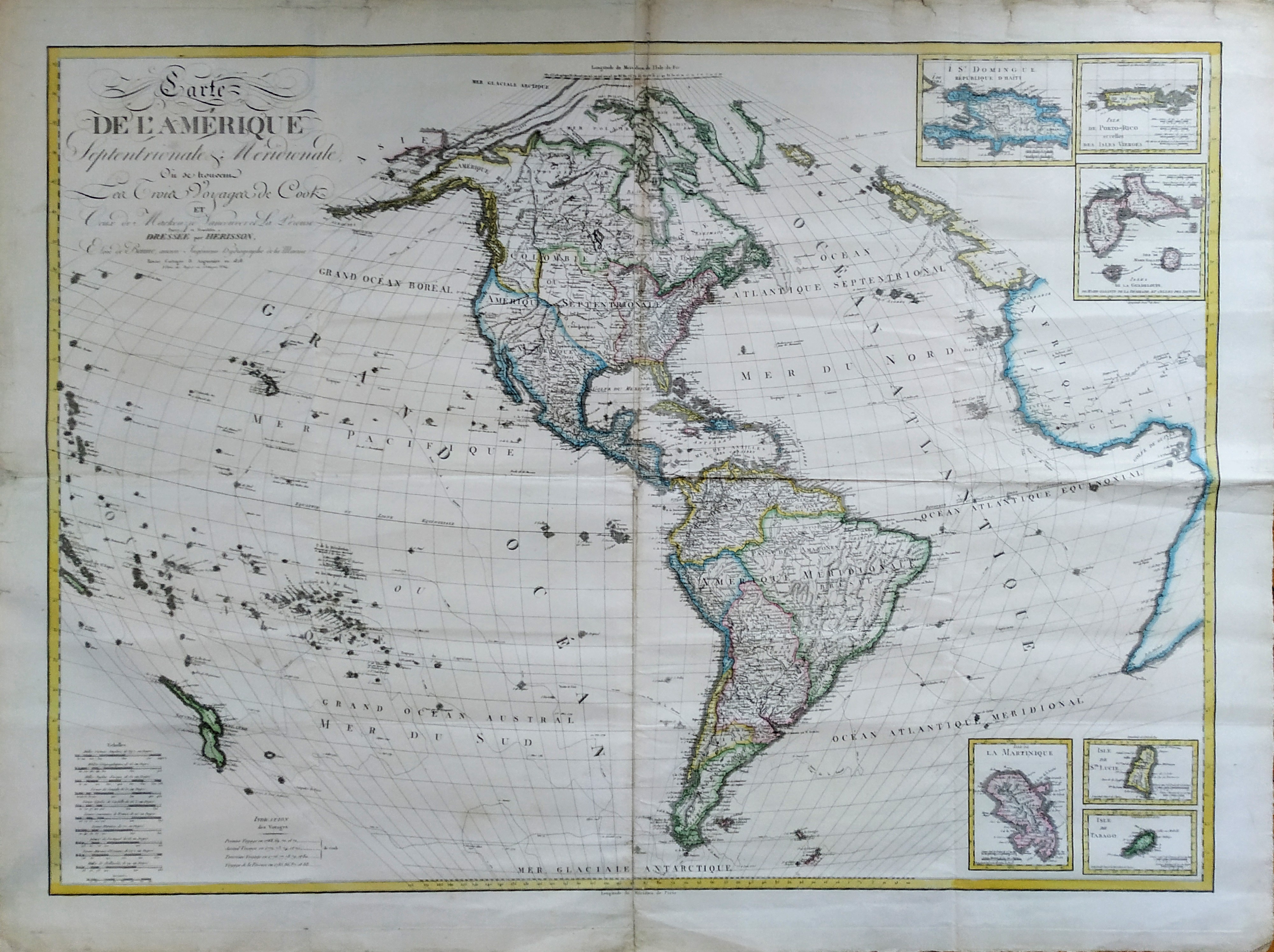
Map title
Mappe-monde ou le globe terrestre
Author
Herrison
Location shown in map
World
Edition date
1816
Edition place
Paris
Editor
Basset
Atlas
Price
600 Euro
State
[mint/EXCELLENT/very good/good/fair/mediocre/poor]
Color
Old colors
Verso
Size
Plate: cm (100 x 60) inches (39.37 x 23.62) Paper: cm (100 x 60) inches (39.37 x 23.62)
Technique
Copper engraving
Note
framed
Reference
Wiki
Here for more info
In stock
Available
Info
info@thetreasuremaps.com
Code
#1225
×
![]()
Map title
Italy
Author
Location shown in map
Italy
Edition date
1817
Edition place
Leeds
Editor
Atlas
Price
75 Euro
State
[mint/EXCELLENT/very good/good/fair/mediocre/poor]
Color
Black/white
Verso
Blank
Size
Plate: cm (19 x 24) inches (7.48 x 9.45) Paper: cm (21 x 27) inches (8.27 x 10.63)
Technique
Copper engraving
Note
Reference
Wiki
Here for more info
In stock
Available
Info
info@thetreasuremaps.com
Code
#1062
Italy
Author
Location shown in map
Italy
Edition date
1817
Edition place
Leeds
Editor
Atlas
Price
75 Euro
State
[mint/EXCELLENT/very good/good/fair/mediocre/poor]
Color
Black/white
Verso
Blank
Size
Plate: cm (19 x 24) inches (7.48 x 9.45) Paper: cm (21 x 27) inches (8.27 x 10.63)
Technique
Copper engraving
Note
Reference
Wiki
Here for more info
In stock
Available
Info
info@thetreasuremaps.com
Code
#1062
×
![]()
Map title
Nuova carta statistica dell'Alemagna
Author
Bordiga
Location shown in map
Germany
Edition date
1820
Edition place
Milan
Editor
Battelli e Fanfani
Atlas
Nuovo atlante di geografia universale
Price
Please ask: info@thetreasuremaps.com
State
[mint/EXCELLENT/very good/good/fair/mediocre/poor]
Color
Old color
Verso
White
Size
Plate: cm (38.1 x 33) inches (15 x 12.99) Paper: cm (58.4 x 45.7) inches (22.99 x 17.99)
Technique
Steel engraving
Note
No particular notes for this maps.
Reference
--
Wiki
Here for more info
In stock
Available
Info
info@thetreasuremaps.com
Code
#0544
×
![]()

Map title
Grande oceano ovvero quinta parte del mondo
Author
Location shown in map
--
Edition date
1820
Edition place
Milan
Editor
--
Atlas
Atlante Nuovo di Batelli & Fanfani
Price
Please ask: info@thetreasuremaps.com
State
[mint/EXCELLENT/very good/good/fair/mediocre/poor]
Color
Old outlined
Verso
Blank
Size
Plate: cm (25.4 x 20.3) inches (10 x 7.99) Paper: cm (25.4 x 20.3) inches (10 x 7.99)
Technique
Copper engraving
Note
No particular notes for this maps
Reference
--
Wiki
Here for more info
In stock
Sold
Info
info@thetreasuremaps.com
Code
#0377
×
![]()
Map title
Giappone
Author
Location shown in map
Japan
Edition date
1820
Edition place
Milan
Editor
--
Atlas
Atlante Nuovo di Batelli & Fanfani
Price
Please ask: info@thetreasuremaps.com
State
[mint/EXCELLENT/very good/good/fair/mediocre/poor]
Color
Old outlined
Verso
Blank
Size
Plate: cm (24.1 x 20.3) inches (9.49 x 7.99) Paper: cm (45.7 x 27.9) inches (17.99 x 10.98)
Technique
--
Note
No particular notes for this maps
Reference
--
Wiki
Here for more info
In stock
Sold
Info
info@thetreasuremaps.com
Code
#0379
×
![]()
Map title
Carta della parte della costa nord ovest dell'America
Author
Location shown in map
--
Edition date
1820
Edition place
Milan
Editor
--
Atlas
Atlante Nuovo di Batelli & Fanfani
Price
Please ask: info@thetreasuremaps.com
State
[mint/EXCELLENT/very good/good/fair/mediocre/poor]
Color
Black/white
Verso
Blank
Size
Plate: cm (21.6 x 26.7) inches (8.5 x 10.51) Paper: cm (21.6 x 26.7) inches (8.5 x 10.51)
Technique
Copper engraving
Note
No particular notes for this maps
Reference
--
Wiki
Here for more info
In stock
Sold
Info
info@thetreasuremaps.com
Code
#0381
×
![]()
Map title
Dominj Inglesi in America
Author
Location shown in map
--
Edition date
1820
Edition place
Milan
Editor
--
Atlas
Atlante Nuovo di Batelli & Fanfani
Price
Please ask: info@thetreasuremaps.com
State
[mint/EXCELLENT/very good/good/fair/mediocre/poor]
Color
Black/white
Verso
Blank
Size
Plate: cm (24.1 x 20.3) inches (9.49 x 7.99) Paper: cm (45.7 x 27.9) inches (17.99 x 10.98)
Technique
Copper engraving
Note
Very uncommon Copper engraving map with details in Canada and Alaska. The Monte Stoney o delle Pietre (Stoney Mountains) dominate the west where a hypothetical connection is shown between the Missouri and Columbia rivers. The longitude is measured from the island of Ferro.
Reference
--
Wiki
Here for more info
In stock
Sold
Info
info@thetreasuremaps.com
Code
#0382
×
![]()
Map title
United States
Author
Unknown
Location shown in map
USA
Edition date
1820
Edition place
London
Editor
--
Atlas
Published by Thomas Kelly
Price
Please ask: info@thetreasuremaps.com
State
[mint/EXCELLENT/very good/good/fair/mediocre/poor]
Color
Uncoloured
Verso
Blank
Size
Plate: cm (24.1 x 18.4) inches (9.49 x 7.24) Paper: cm (26.7 x 21) inches (10.51 x 8.27)
Technique
Copper engraving
Note
Map of United States in early XIX. Big Georgia, west and east Florida.
Reference
--
Wiki
Here for more info
In stock
Sold
Info
info@thetreasuremaps.com
Code
#0408
×
![]()
Map title
British colonies in north America
Author
Unknown
Location shown in map
North Usa & Canada
Edition date
1820
Edition place
London
Editor
--
Atlas
Published by Thomas Kelly
Price
Please ask: info@thetreasuremaps.com
State
[mint/EXCELLENT/very good/good/fair/mediocre/poor]
Color
Uncoloured
Verso
Blank
Size
Plate: cm (24.1 x 18.4) inches (9.49 x 7.24) Paper: cm (26.7 x 21) inches (10.51 x 8.27)
Technique
Copper engraving
Note
Map of English colonies in America
Reference
--
Wiki
Here for more info
In stock
Sold
Info
info@thetreasuremaps.com
Code
#0409
×
![]()
Map title
North America
Author
Unknown
Location shown in map
North America
Edition date
1820
Edition place
London
Editor
--
Atlas
Published by Thomas Kelly
Price
Please ask: info@thetreasuremaps.com
State
[mint/EXCELLENT/very good/good/fair/mediocre/poor]
Color
Uncoloured
Verso
Blank
Size
Plate: cm (19 x 24.1) inches (7.48 x 9.49) Paper: cm (21.6 x 26.7) inches (8.5 x 10.51)
Technique
Copper engraving
Note
Map of North America in early XIX.
Reference
--
Wiki
Here for more info
In stock
Sold
Info
info@thetreasuremaps.com
Code
#0410
North America
Author
Unknown
Location shown in map
North America
Edition date
1820
Edition place
London
Editor
--
Atlas
Published by Thomas Kelly
Price
Please ask: info@thetreasuremaps.com
State
[mint/EXCELLENT/very good/good/fair/mediocre/poor]
Color
Uncoloured
Verso
Blank
Size
Plate: cm (19 x 24.1) inches (7.48 x 9.49) Paper: cm (21.6 x 26.7) inches (8.5 x 10.51)
Technique
Copper engraving
Note
Map of North America in early XIX.
Reference
--
Wiki
Here for more info
In stock
Sold
Info
info@thetreasuremaps.com
Code
#0410
×
![]()
Map title
Carta dell'arcipelago delle Indie Orientali
Author
Unknown
Location shown in map
--
Edition date
1820
Edition place
Milan
Editor
--
Atlas
Atlante Nuovo di Batelli & Fanfani
Price
Please ask: info@thetreasuremaps.com
State
[mint/EXCELLENT/very good/good/fair/mediocre/poor]
Color
Old outlined
Verso
Blank
Size
Plate: cm (45.7 x 29.2) inches (17.99 x 11.5) Paper: cm (45.7 x 29.2) inches (17.99 x 11.5)
Technique
--
Note
No particular notes for this maps
Reference
--
Wiki
Here for more info
In stock
Sold
Info
info@thetreasuremaps.com
Code
#0434
×
![]()
Map title
Asia
Author
Unknown
Location shown in map
Asia
Edition date
1820
Edition place
Milan
Editor
--
Atlas
Atlante Nuovo di Batelli & Fanfani
Price
Please ask: info@thetreasuremaps.com
State
[mint/EXCELLENT/very good/good/fair/mediocre/poor]
Color
Old outlined
Verso
Blank
Size
Plate: cm (22.9 x 17.8) inches (9.02 x 7.01) Paper: cm (45.7 x 27.9) inches (17.99 x 10.98)
Technique
--
Note
No particular notes for this maps
Reference
--
Wiki
Here for more info
In stock
Sold
Info
info@thetreasuremaps.com
Code
#0435
Asia
Author
Unknown
Location shown in map
Asia
Edition date
1820
Edition place
Milan
Editor
--
Atlas
Atlante Nuovo di Batelli & Fanfani
Price
Please ask: info@thetreasuremaps.com
State
[mint/EXCELLENT/very good/good/fair/mediocre/poor]
Color
Old outlined
Verso
Blank
Size
Plate: cm (22.9 x 17.8) inches (9.02 x 7.01) Paper: cm (45.7 x 27.9) inches (17.99 x 10.98)
Technique
--
Note
No particular notes for this maps
Reference
--
Wiki
Here for more info
In stock
Sold
Info
info@thetreasuremaps.com
Code
#0435
×
![]()
Map title
Carta della Gujana francese ed olandese
Author
Unknown
Location shown in map
--
Edition date
1820
Edition place
Milan
Editor
--
Atlas
Atlante Nuovo di Batelli & Fanfani
Price
Please ask: info@thetreasuremaps.com
State
[mint/EXCELLENT/very good/good/fair/mediocre/poor]
Color
Old outlined
Verso
Blank
Size
Plate: cm (40.6 x 33) inches (15.98 x 12.99) Paper: cm (40.6 x 33) inches (15.98 x 12.99)
Technique
--
Note
No particular notes for this maps
Reference
--
Wiki
Here for more info
In stock
Sold
Info
info@thetreasuremaps.com
Code
#0464
×
![]()
Map title
America meridionale
Author
Unknown
Location shown in map
South America
Edition date
1820
Edition place
Milan
Editor
--
Atlas
??? - Civelli Giuseppe
Price
Please ask: info@thetreasuremaps.com
State
[mint/excellent/VERY GOOD/good/fair/mediocre/poor]
Color
Old outlined
Verso
Blank
Size
Plate: cm (38.1 x 30.5) inches (15 x 12.01) Paper: cm (41.9 x 33) inches (16.5 x 12.99)
Technique
--
Note
No particular notes for this maps
Reference
--
Wiki
Here for more info
In stock
Sold
Info
info@thetreasuremaps.com
Code
#0465
×
![]()
Map title
L'America meridionale
Author
Unknown
Location shown in map
South America
Edition date
1820
Edition place
Milan
Editor
--
Atlas
Atlante Nuovo di Batelli & Fanfani
Price
Please ask: info@thetreasuremaps.com
State
[mint/EXCELLENT/very good/good/fair/mediocre/poor]
Color
Old outlined
Verso
Blank
Size
Plate: cm (68.6 x 40.6) inches (27.01 x 15.98) Paper: cm (68.6 x 40.6) inches (27.01 x 15.98)
Technique
--
Note
No particular notes for this maps
Reference
--
Wiki
Here for more info
In stock
Sold
Info
info@thetreasuremaps.com
Code
#0466
×
![]()
Map title
Carta delle isole Antille
Author
Unknown
Location shown in map
--
Edition date
1820
Edition place
Milan
Editor
--
Atlas
Atlante Nuovo di Batelli & Fanfani
Price
Please ask: info@thetreasuremaps.com
State
[mint/EXCELLENT/very good/good/fair/mediocre/poor]
Color
Old outlined
Verso
Blank
Size
Plate: cm (41.9 x 34.3) inches (16.5 x 13.5) Paper: cm (41.9 x 34.3) inches (16.5 x 13.5)
Technique
--
Note
No particular notes for this maps
Reference
--
Wiki
Here for more info
In stock
Sold
Info
info@thetreasuremaps.com
Code
#0478
×
![]()
Map title
Carta di S.Domingo giusta quella di Poirson
Author
Unknown
Location shown in map
--
Edition date
1820
Edition place
Milan
Editor
--
Atlas
Atlante Nuovo di Batelli & Fanfani
Price
Please ask: info@thetreasuremaps.com
State
[mint/EXCELLENT/very good/good/fair/mediocre/poor]
Color
Old outlined
Verso
Blank
Size
Plate: cm (40.6 x 33) inches (15.98 x 12.99) Paper: cm (62.2 x 45.7) inches (24.49 x 17.99)
Technique
--
Note
No particular notes for this maps
Reference
--
Wiki
Here for more info
In stock
Sold
Info
info@thetreasuremaps.com
Code
#0479
×
![]()
Map title
Scozia
Author
Unknown
Location shown in map
Scotland
Edition date
1820
Edition place
Milan
Editor
--
Atlas
Atlante Nuovo di Batelli & Fanfani
Price
125 Euro
State
[mint/EXCELLENT/very good/good/fair/mediocre/poor]
Color
Old outlined
Verso
Blank
Size
Plate: cm (21.6 x 17.8) inches (8.5 x 7.01) Paper: cm (21.6 x 17.8) inches (8.5 x 7.01)
Technique
--
Note
No particular notes for this maps
Reference
--
Wiki
Here for more info
In stock
Sold
Info
info@thetreasuremaps.com
Code
#0491
×
![]()
Map title
Charte von west Indien
Author
Johann Walch
Location shown in map
West Indies
Edition date
1820
Edition place
Hamburg
Editor
Atlas
Price
Please ask: info@thetreasuremaps.com
State
[mint/EXCELLENT/very good/good/fair/mediocre/poor]
Color
Old colors
Verso
Blank
Size
Plate: cm (21 x 18) inches (8.27 x 7.09) Paper: cm (26 x 22) inches (10.24 x 8.66)
Technique
Steel engraving
Note
No particular notes for this maps
Reference
Wiki
Here for more info
In stock
Available
Info
info@thetreasuremaps.com
Code
#0700
×
![]()
Map title
America Settentrionale
Author
Unknown
Location shown in map
North America
Edition date
1822
Edition place
Milan
Editor
--
Atlas
Printed by Carlo Rossari from an unknown atlas.
Price
125 Euro
State
[mint/excellent/very good/GOOD/fair/mediocre/poor] It has a small hole in the center.
Color
Old outlined
Verso
Blank
Size
Plate: cm (20.3 x 31.8) inches (7.99 x 12.52) Paper: cm (38.1 x 26.7) inches (15 x 10.51)
Technique
Copper engraving
Note
Italian map of North America. Texas is still part of Mexico. Note the Columbia borders.
Reference
--
Wiki
Here for more info
In stock
Available
Info
info@thetreasuremaps.com
Code
#0089
×
![]()
Map title
Italien
Author
Mollo
Location shown in map
Italy
Edition date
Circa 1824
Edition place
Wien
Editor
Atlas
Price
125 Euro
State
[mint/EXCELLENT/very good/good/fair/mediocre/poor]
Color
Old colors
Verso
Blank
Size
Plate: cm (32 x 45) inches (12.6 x 17.72) Paper: cm (38 x 47) inches (14.96 x 18.5)
Technique
Steel engraving
Note
Reference
Wiki
Here for more info
In stock
Available
Info
info@thetreasuremaps.com
Code
#1015
×
![]()

Map title
L'America storica, fisica e politica
Author
Le Sage
Location shown in map
All America
Edition date
1825
Edition place
Venice
Editor
Le Sage
Atlas
Price
75 Euro
State
[mint/EXCELLENT/very good/good/fair/mediocre/poor]
Color
Old colors
Verso
Blank
Size
Plate: cm (49 x 44) inches (19.29 x 17.32) Paper: cm (54 x 39) inches (21.26 x 15.35)
Technique
Copper engraving
Note
Reference
Wiki
Here for more info
In stock
Available
Info
info@thetreasuremaps.com
Code
#1268
×
![]()
Map title
Carta per servire alla storia della guerra fra gli Statiuniti d'America e l'Inghilterra
Author
Brackenrige
Location shown in map
USA west coast
Edition date
1826
Edition place
Firenze
Editor
Bercherini
Atlas
History of the late War, between the United States and Great Britain
Price
100 Euro
State
[mint/EXCELLENT/very good/good/fair/mediocre/poor]
Color
Black/white
Verso
Blank
Size
Plate: cm (38.1 x 27.9) inches (15 x 10.98) Paper: cm (48.3 x 30.5) inches (19.02 x 12.01)
Technique
Copper engraving
Note
No particular notes for this maps.
Reference
--
Wiki
Here for more info
In stock
Available
Info
info@thetreasuremaps.com
Code
#0556
×
![]()
Map title
Carte de l'Amerique Septentrionale & Meridionale
Author
Bonne
Location shown in map
Americas
Edition date
1828
Edition place
Paris
Editor
Atlas
Price
Please ask: info@thetreasuremaps.com
State
[mint/excellent/VERY GOOD/good/fair/mediocre/poor]
Color
Old colors
Verso
Blank
Size
Plate: cm (118 x 85) inches (46.46 x 33.46) Paper: cm (130 x 97) inches (51.18 x 38.19)
Technique
Copper engraving
Note
No particular notes for this maps
Reference
Wiki
Here for more info
In stock
Available
Info
info@thetreasuremaps.com
Code
#0736
×
![]()
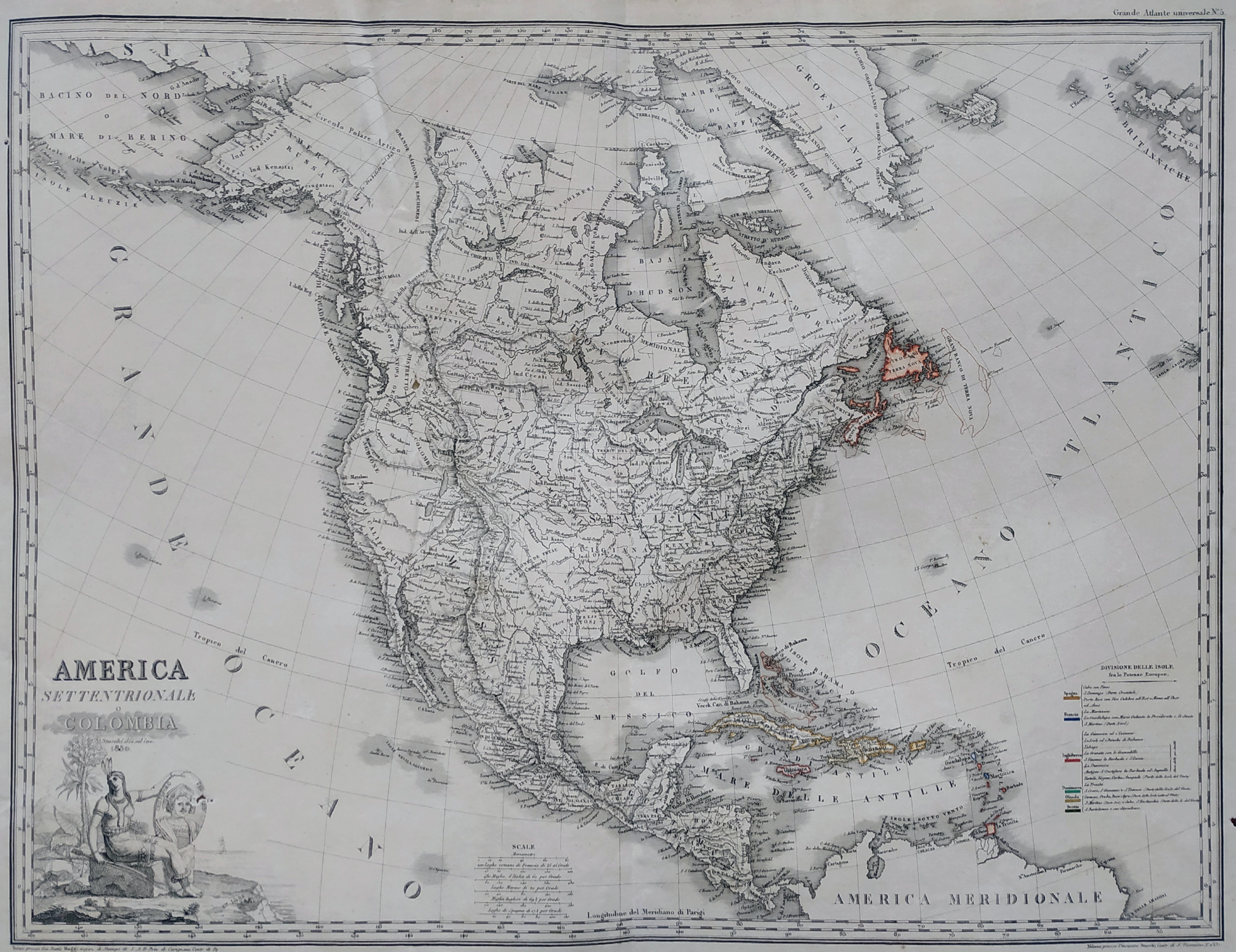
Map title
America settentrionale o Colombia
Author
Stucchi
Location shown in map
North America
Edition date
1830
Edition place
Torino
Editor
Maggi
Atlas
Grande atlante universale
Price
Please ask: info@thetreasuremaps.com
State
[mint/excellent/VERY GOOD/good/fair/mediocre/poor]
Color
Old colors
Verso
Blank
Size
Plate: cm (70.9 x 53.1) inches (27.91 x 20.91) Paper: cm (81.8 x 59.9) inches (32.2 x 23.58)
Technique
Steel engraving
Note
--
Reference
--
Wiki
Here for more info
In stock
Available
Info
info@thetreasuremaps.com
Code
#0525
×
![]()
Map title
L'Africa
Author
Stucchi
Location shown in map
Africa
Edition date
1830
Edition place
Torino
Editor
Maggi
Atlas
Grande atlante universale
Price
Please ask: info@thetreasuremaps.com
State
[mint/excellent/VERY GOOD/good/fair/mediocre/poor]
Color
Old colors
Verso
Blank
Size
Plate: cm (70.9 x 53.1) inches (27.91 x 20.91) Paper: cm (81.8 x 59.9) inches (32.2 x 23.58)
Technique
Steel engraving
Note
--
Reference
--
Wiki
Here for more info
In stock
Available
Info
info@thetreasuremaps.com
Code
#0526
×
![]()
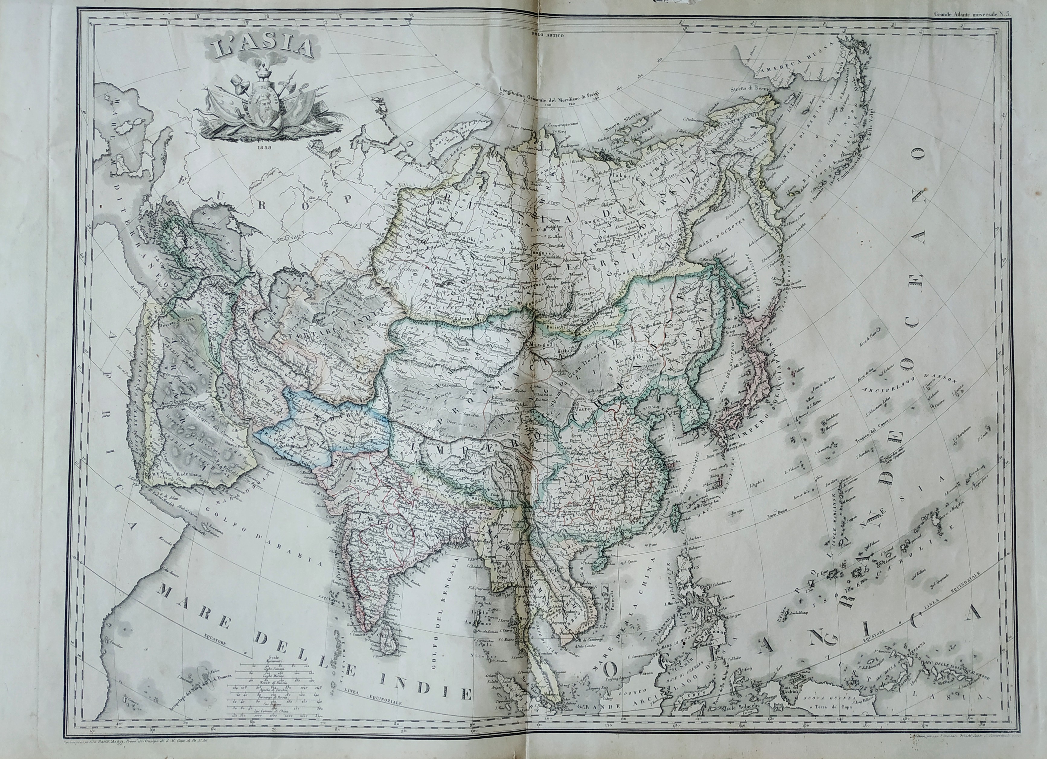
Map title
L'Asia
Author
Stucchi
Location shown in map
Asia
Edition date
1830
Edition place
Torino
Editor
Maggi
Atlas
Grande atlante universale
Price
Please ask: info@thetreasuremaps.com
State
[mint/excellent/VERY GOOD/good/fair/mediocre/poor]
Color
Old colors
Verso
Blank
Size
Plate: cm (70.9 x 53.1) inches (27.91 x 20.91) Paper: cm (81.8 x 59.9) inches (32.2 x 23.58)
Technique
Steel engraving
Note
--
Reference
--
Wiki
Here for more info
In stock
Available
Info
info@thetreasuremaps.com
Code
#0527
×
![]()
Map title
Mappemonde
Author
Lapie
Location shown in map
World
Edition date
1830
Edition place
Paris
Editor
Atlas
Price
175 Euro
State
[mint/EXCELLENT/very good/good/fair/mediocre/poor]
Color
Old color
Verso
Blank
Size
Plate: cm (53 x 39) inches (20.87 x 15.35) Paper: cm (64 x 46) inches (25.2 x 18.11)
Technique
Copper engraving
Note
Reference
Wiki
Here for more info
In stock
Available
Info
info@thetreasuremaps.com
Code
#0791
×
![]()
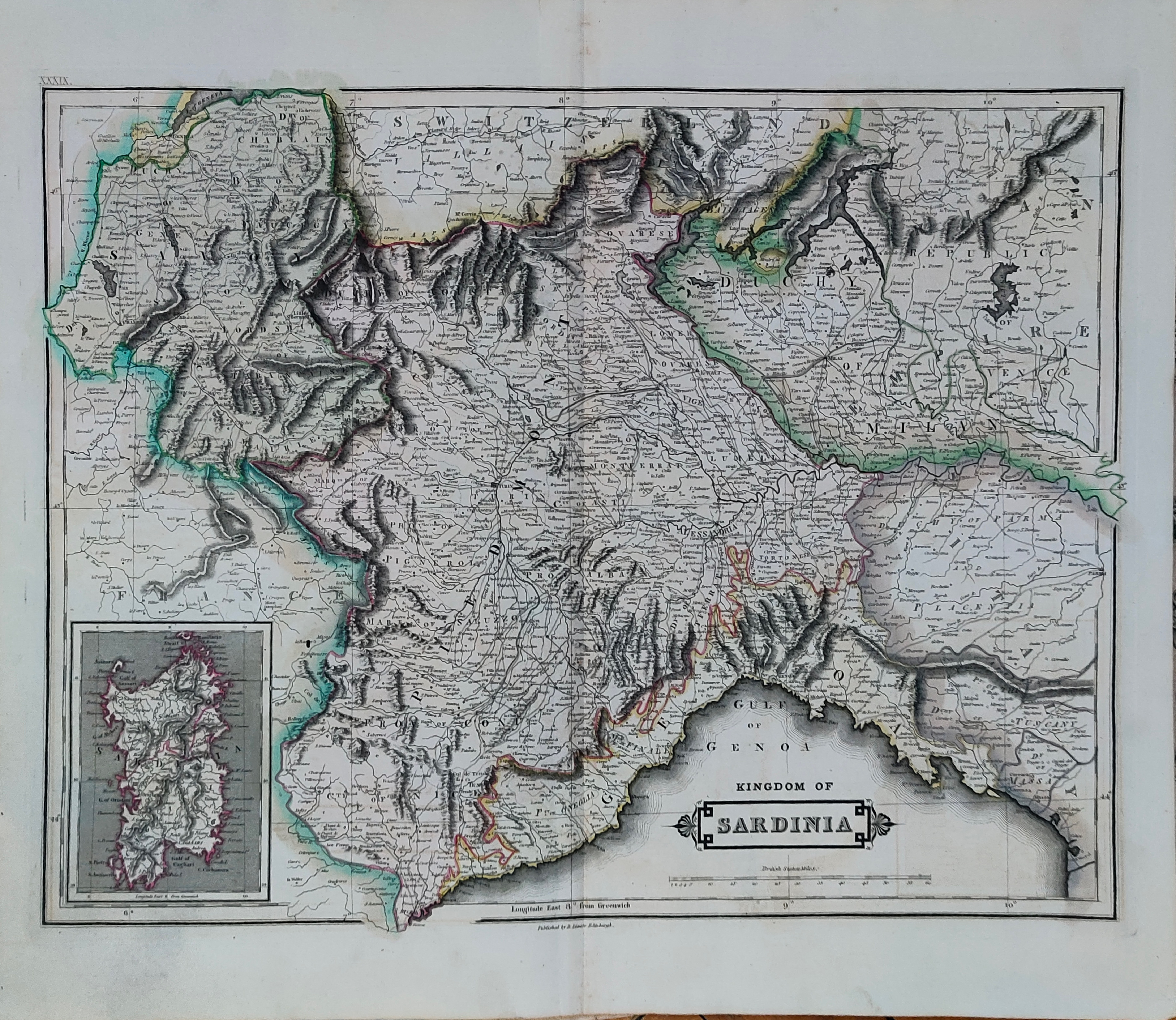
Map title
Kingdom of Sardinia
Author
Hamilton
Location shown in map
Liguria
Edition date
1831
Edition place
Edinburgh
Editor
Daniel Lizars
Atlas
The Edinburgh Geographical and Historical Atlas
Price
150 Euro
State
[mint/EXCELLENT/very good/good/fair/mediocre/poor]
Color
Old colors
Verso
Blank
Size
Plate: cm (49 x 38) inches (19.29 x 14.96) Paper: cm (55 x 47) inches (21.65 x 18.5)
Technique
Copper engraving
Note
Reference
Wiki
Here for more info
In stock
Available
Info
info@thetreasuremaps.com
Code
#1223
×
![]()
Map title
Oceania
Author
Cacciatore
Location shown in map
Oceania
Edition date
1832
Edition place
Firenze
Editor
Leonardo Cacciatori
Atlas
Nuovo atlante istorico
Price
100 Euro
State
[mint/EXCELLENT/very good/good/fair/mediocre/poor]
Color
Black/white
Verso
Blank
Size
Plate: cm (32 x 22) inches (12.6 x 8.66) Paper: cm (42 x 29) inches (16.54 x 11.42)
Technique
Copper engraving
Note
Reference
Wiki
Here for more info
In stock
Available
Info
info@thetreasuremaps.com
Code
#0776
Oceania
Author
Cacciatore
Location shown in map
Oceania
Edition date
1832
Edition place
Firenze
Editor
Leonardo Cacciatori
Atlas
Nuovo atlante istorico
Price
100 Euro
State
[mint/EXCELLENT/very good/good/fair/mediocre/poor]
Color
Black/white
Verso
Blank
Size
Plate: cm (32 x 22) inches (12.6 x 8.66) Paper: cm (42 x 29) inches (16.54 x 11.42)
Technique
Copper engraving
Note
Reference
Wiki
Here for more info
In stock
Available
Info
info@thetreasuremaps.com
Code
#0776
×
![]()
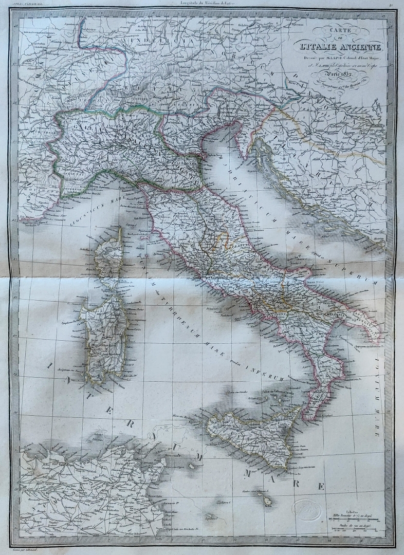
Map title
L'Italia Ancienne
Author
Lapie
Location shown in map
Italy
Edition date
1832
Edition place
Paris
Editor
Atlas
Price
Please ask: info@thetreasuremaps.com
State
[mint/EXCELLENT/very good/good/fair/mediocre/poor]
Color
Old colors
Verso
Blank
Size
Plate: cm (50 x 66) inches (19.69 x 25.98) Paper: cm (39 x 53) inches (15.35 x 20.87)
Technique
Steel engraving
Note
Reference
Wiki
Here for more info
In stock
Available
Info
info@thetreasuremaps.com
Code
#0860
×
![]()
Map title
Oceania
Author
Cacciatore
Location shown in map
Oceania
Edition date
1832
Edition place
Firenze
Editor
Leonardo Cacciatori
Atlas
Nuovo atlante istorico
Price
100 Euro
State
[mint/EXCELLENT/very good/good/fair/mediocre/poor]
Color
Black/white
Verso
Blank
Size
Plate: cm (32 x 22) inches (12.6 x 8.66) Paper: cm (42 x 29) inches (16.54 x 11.42)
Technique
Copper engraving
Note
Reference
Wiki
Here for more info
In stock
Available
Info
info@thetreasuremaps.com
Code
#1131
Oceania
Author
Cacciatore
Location shown in map
Oceania
Edition date
1832
Edition place
Firenze
Editor
Leonardo Cacciatori
Atlas
Nuovo atlante istorico
Price
100 Euro
State
[mint/EXCELLENT/very good/good/fair/mediocre/poor]
Color
Black/white
Verso
Blank
Size
Plate: cm (32 x 22) inches (12.6 x 8.66) Paper: cm (42 x 29) inches (16.54 x 11.42)
Technique
Copper engraving
Note
Reference
Wiki
Here for more info
In stock
Available
Info
info@thetreasuremaps.com
Code
#1131
×
![]()
Map title
Asien
Author
Streit
Location shown in map
Asia
Edition date
1834
Edition place
Leipzing
Editor
Atlas
Price
75 Euro
State
[mint/excellent/VERY GOOD/good/fair/mediocre/poor]
Color
Old colors
Verso
Blank
Size
Plate: cm (47 x 40) inches (18.5 x 15.75) Paper: cm (50 x 42) inches (19.69 x 16.54)
Technique
Steel engraving
Note
Reference
Wiki
Here for more info
In stock
Available
Info
info@thetreasuremaps.com
Code
#1256
×
![]()
Map title
Palazzo Doria presso la porta di S.Tommaso
Author
Audot
Location shown in map
Genoa
Edition date
1835
Edition place
Turin
Editor
Pomba
Atlas
L'Italia, la Sicilia, le isole Eolie, l'isola d'Elba, la Sardegna, Malta, l'isola di Calipso
Price
20 Euro
State
[mint/EXCELLENT/very good/good/fair/mediocre/poor]
Color
Black/white
Verso
Blank
Size
Plate: cm (16 x 12) inches (6.3 x 4.72) Paper: cm (25 x 17) inches (9.84 x 6.69)
Technique
Steel engraving
Note
Reference
Wiki
Here for more info
In stock
Available
Info
info@thetreasuremaps.com
Code
#1116
×
![]()
Map title
Vista della lanterna e del porto
Author
Audot
Location shown in map
Genoa
Edition date
1835
Edition place
Turin
Editor
Pomba
Atlas
L'Italia, la Sicilia, le isole Eolie, l'isola d'Elba, la Sardegna, Malta, l'isola di Calipso
Price
20 Euro
State
[mint/EXCELLENT/very good/good/fair/mediocre/poor]
Color
Black/white
Verso
Blank
Size
Plate: cm (16 x 12) inches (6.3 x 4.72) Paper: cm (25 x 17) inches (9.84 x 6.69)
Technique
Steel engraving
Note
Reference
Wiki
Here for more info
In stock
Available
Info
info@thetreasuremaps.com
Code
#1117
×
![]()
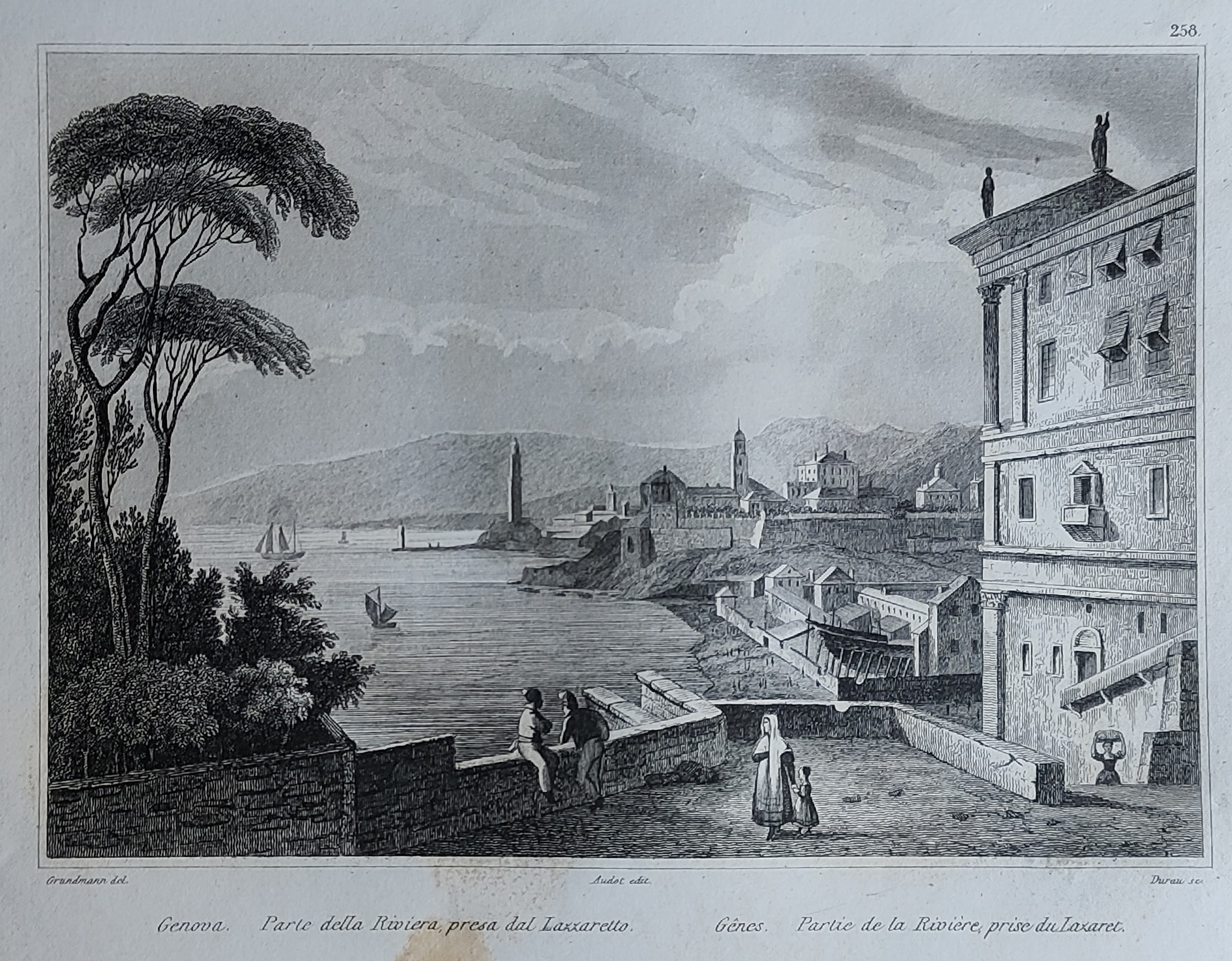
Map title
Parte della riviera presa dal lazzaretto
Author
Audot
Location shown in map
Genoa
Edition date
1835
Edition place
Turin
Editor
Pomba
Atlas
L'Italia, la Sicilia, le isole Eolie, l'isola d'Elba, la Sardegna, Malta, l'isola di Calipso
Price
20 Euro
State
[mint/EXCELLENT/very good/good/fair/mediocre/poor]
Color
Black/white
Verso
Blank
Size
Plate: cm (16 x 12) inches (6.3 x 4.72) Paper: cm (25 x 17) inches (9.84 x 6.69)
Technique
Steel engraving
Note
Reference
Wiki
Here for more info
In stock
Available
Info
info@thetreasuremaps.com
Code
#1118
×
![]()
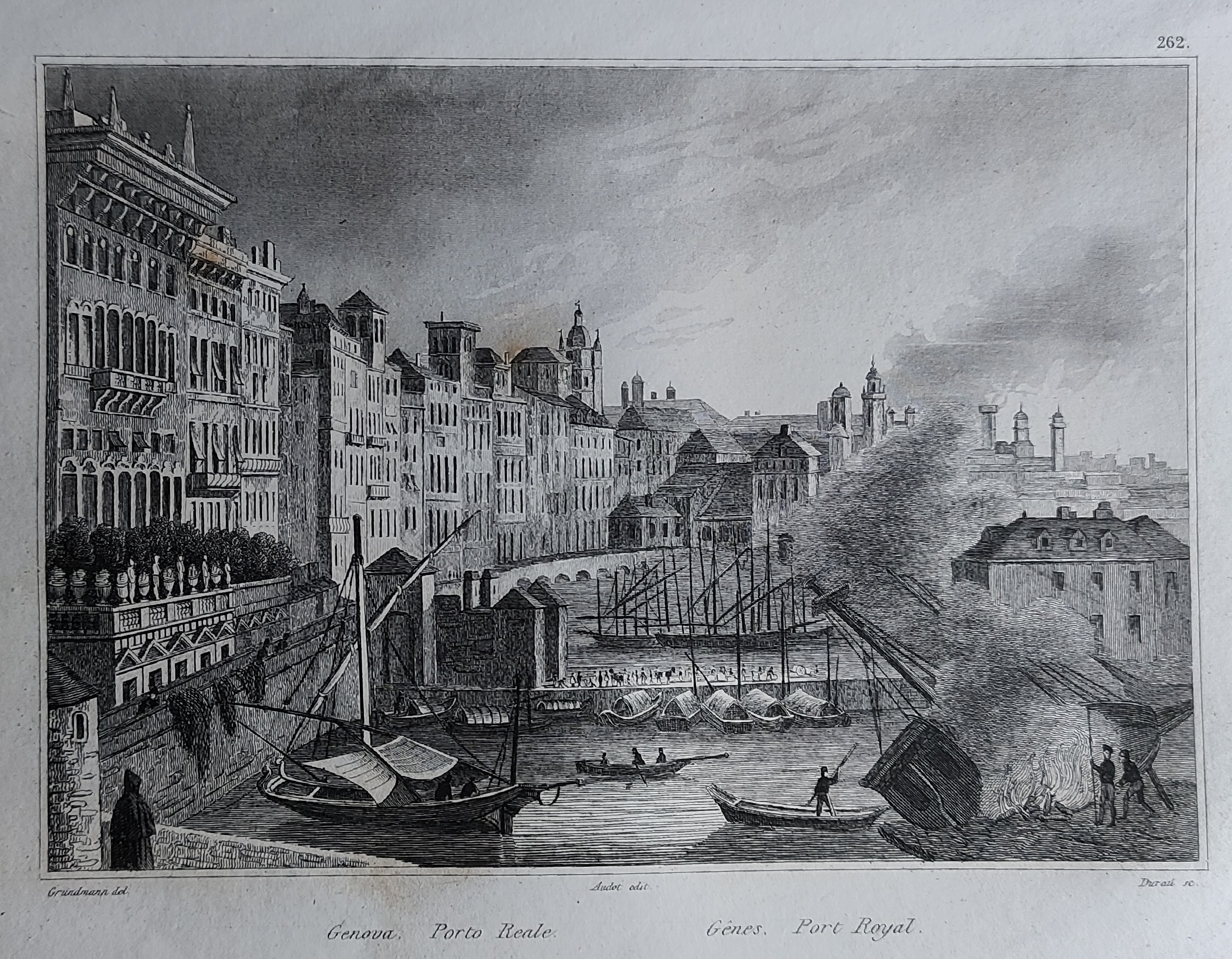
Map title
Porto Reale
Author
Audot
Location shown in map
Genoa
Edition date
1835
Edition place
Turin
Editor
Pomba
Atlas
L'Italia, la Sicilia, le isole Eolie, l'isola d'Elba, la Sardegna, Malta, l'isola di Calipso
Price
20 Euro
State
[mint/EXCELLENT/very good/good/fair/mediocre/poor]
Color
Black/white
Verso
Blank
Size
Plate: cm (16 x 12) inches (6.3 x 4.72) Paper: cm (25 x 17) inches (9.84 x 6.69)
Technique
Steel engraving
Note
Reference
Wiki
Here for more info
In stock
Available
Info
info@thetreasuremaps.com
Code
#1122
×
![]()
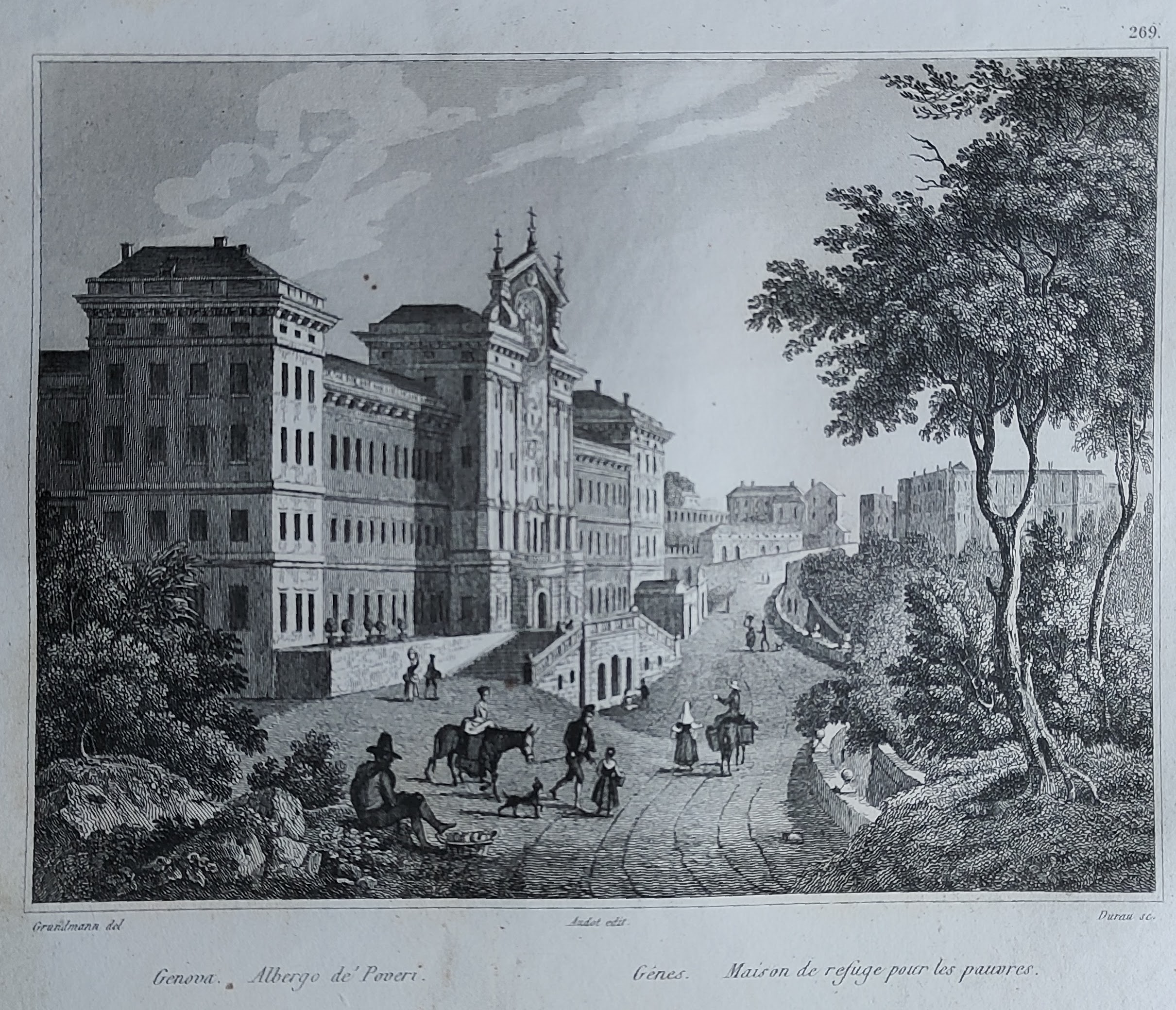
Map title
Albergo dei poveri
Author
Audot
Location shown in map
Genoa
Edition date
1835
Edition place
Turin
Editor
Pomba
Atlas
L'Italia, la Sicilia, le isole Eolie, l'isola d'Elba, la Sardegna, Malta, l'isola di Calipso
Price
20 Euro
State
[mint/EXCELLENT/very good/good/fair/mediocre/poor]
Color
Black/white
Verso
Blank
Size
Plate: cm (16 x 12) inches (6.3 x 4.72) Paper: cm (25 x 17) inches (9.84 x 6.69)
Technique
Steel engraving
Note
Reference
Wiki
Here for more info
In stock
Available
Info
info@thetreasuremaps.com
Code
#1123
×
![]()
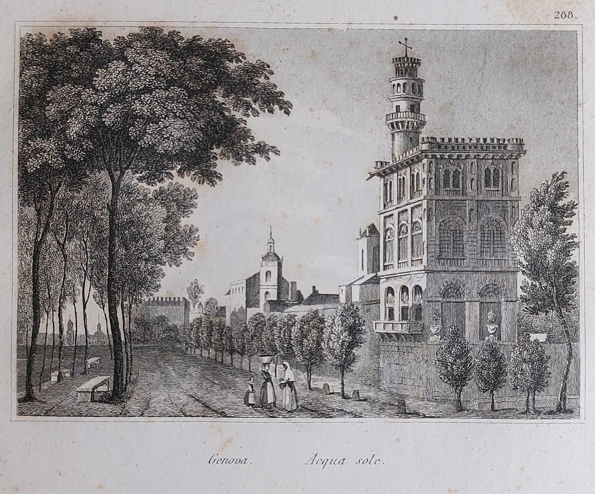
Map title
Acqua sole
Author
Audot
Location shown in map
Genoa
Edition date
1835
Edition place
Turin
Editor
Pomba
Atlas
L'Italia, la Sicilia, le isole Eolie, l'isola d'Elba, la Sardegna, Malta, l'isola di Calipso
Price
20 Euro
State
[mint/EXCELLENT/very good/good/fair/mediocre/poor]
Color
Black/white
Verso
Blank
Size
Plate: cm (12 x 9) inches (4.72 x 3.54) Paper: cm (14 x 12) inches (5.51 x 4.72)
Technique
Steel engraving
Note
Reference
Wiki
Here for more info
In stock
Available
Info
info@thetreasuremaps.com
Code
#1120
×
![]()
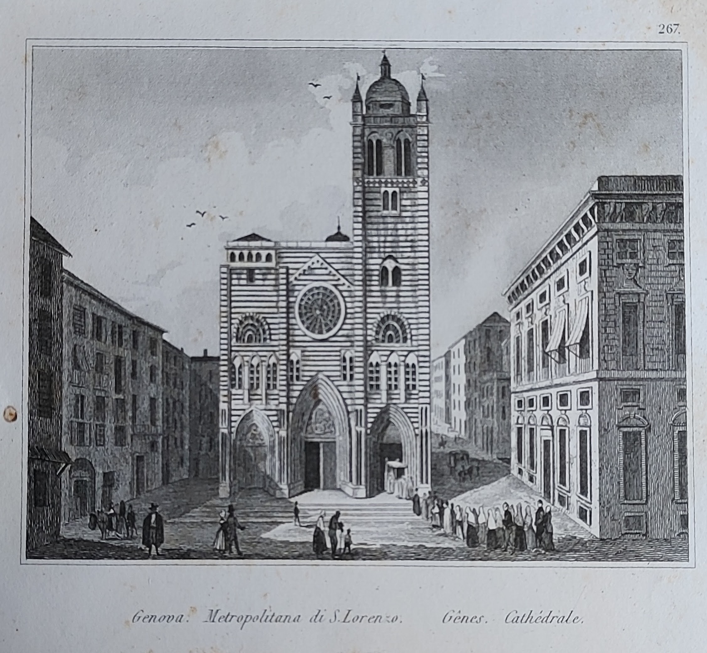
Map title
Metropolitana di S.Lorenzo
Author
Audot
Location shown in map
Genoa
Edition date
1835
Edition place
Turin
Editor
Pomba
Atlas
L'Italia, la Sicilia, le isole Eolie, l'isola d'Elba, la Sardegna, Malta, l'isola di Calipso
Price
20 Euro
State
[mint/EXCELLENT/very good/good/fair/mediocre/poor]
Color
Black/white
Verso
Blank
Size
Plate: cm (12 x 9) inches (4.72 x 3.54) Paper: cm (14 x 12) inches (5.51 x 4.72)
Technique
Steel engraving
Note
Reference
Wiki
Here for more info
In stock
Available
Info
info@thetreasuremaps.com
Code
#1121
×
![]()
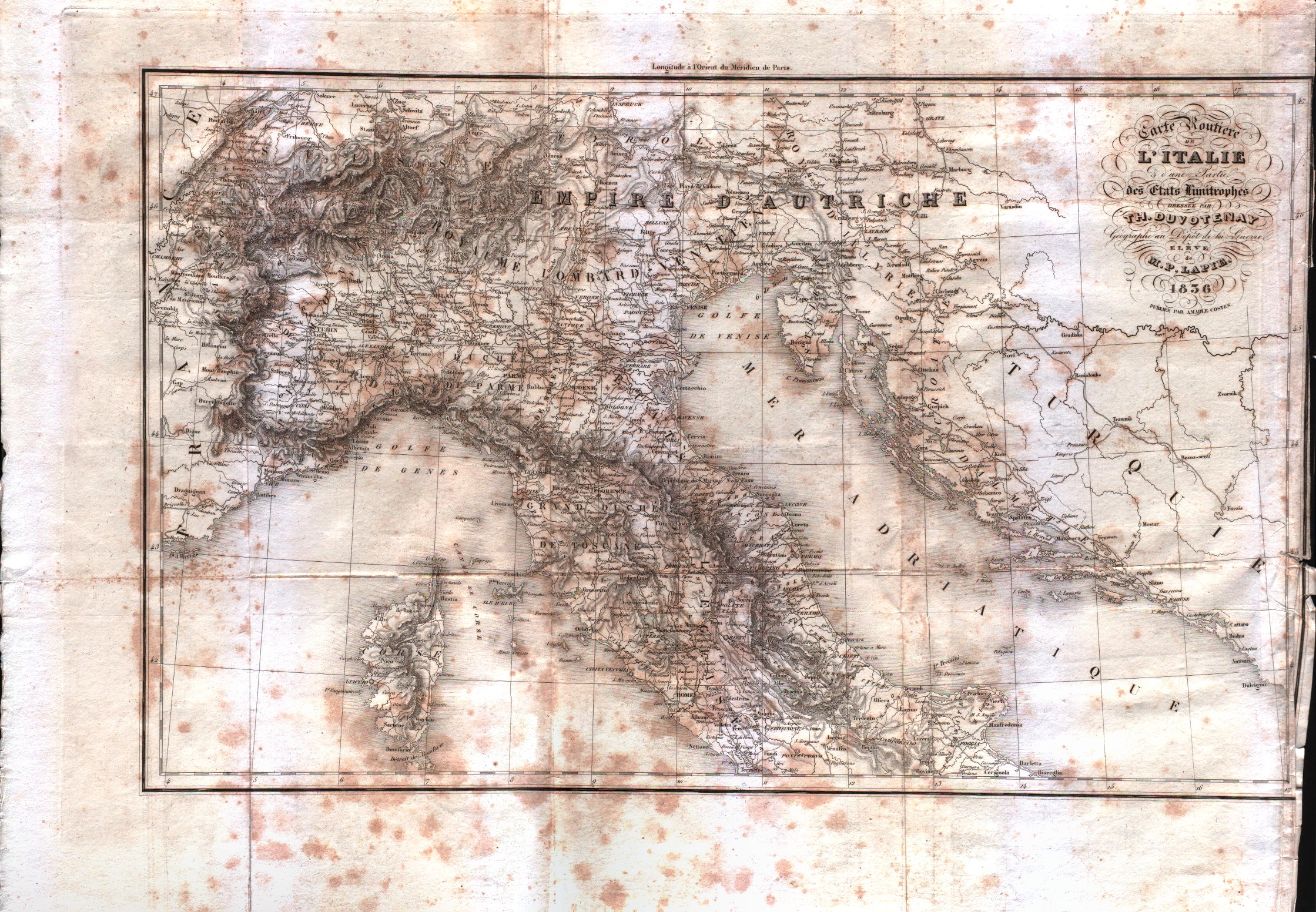
Map title
Carte routiere de l'Italie
Author
Duvotenay
Location shown in map
North Italy
Edition date
1836
Edition place
Paris
Editor
Amable Costes
Atlas
Itale pitoresque
Price
100 Euro
State
[mint/EXCELLENT/very good/good/fair/mediocre/poor]
Color
Black/white
Verso
Blank
Size
Plate: cm (45.7 x 29.2) inches (17.99 x 11.5) Paper: cm (53.3 x 40.6) inches (20.98 x 15.98)
Technique
Steel engraving
Note
No particular notes for this maps.
Reference
--
Wiki
Here for more info
In stock
Available
Info
info@thetreasuremaps.com
Code
#0551
×
![]()
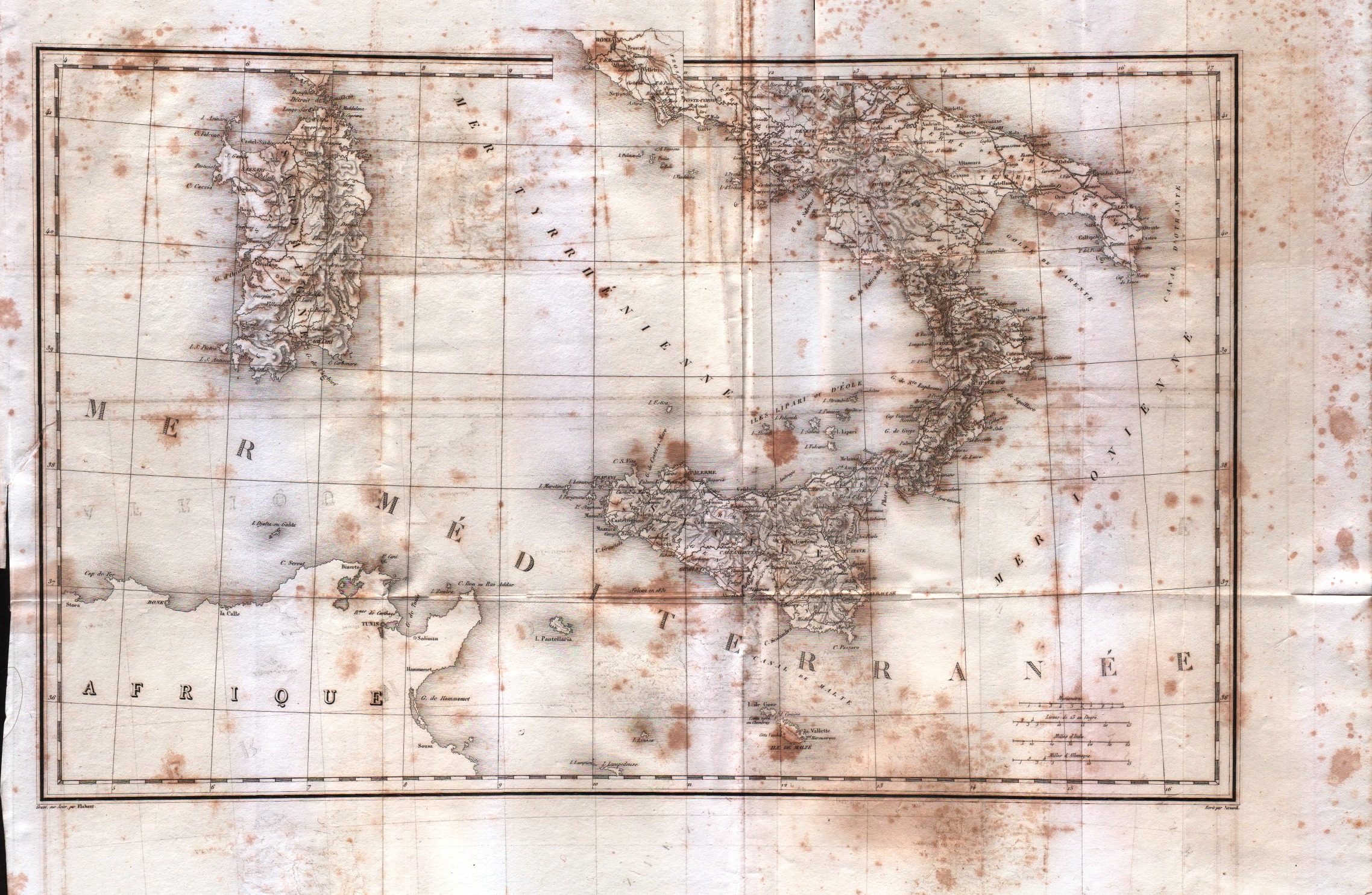
Map title
Carte routiere de l'Italie
Author
Duvotenay
Location shown in map
South Italy
Edition date
1836
Edition place
Paris
Editor
Amable Costes
Atlas
Itale pitoresque
Price
100 Euro
State
[mint/EXCELLENT/very good/good/fair/mediocre/poor]
Color
Black/white
Verso
Blank
Size
Plate: cm (45.7 x 29.2) inches (17.99 x 11.5) Paper: cm (53.3 x 40.6) inches (20.98 x 15.98)
Technique
Steel engraving
Note
No particular notes for this maps.
Reference
--
Wiki
Here for more info
In stock
Available
Info
info@thetreasuremaps.com
Code
#0552
×
![]()
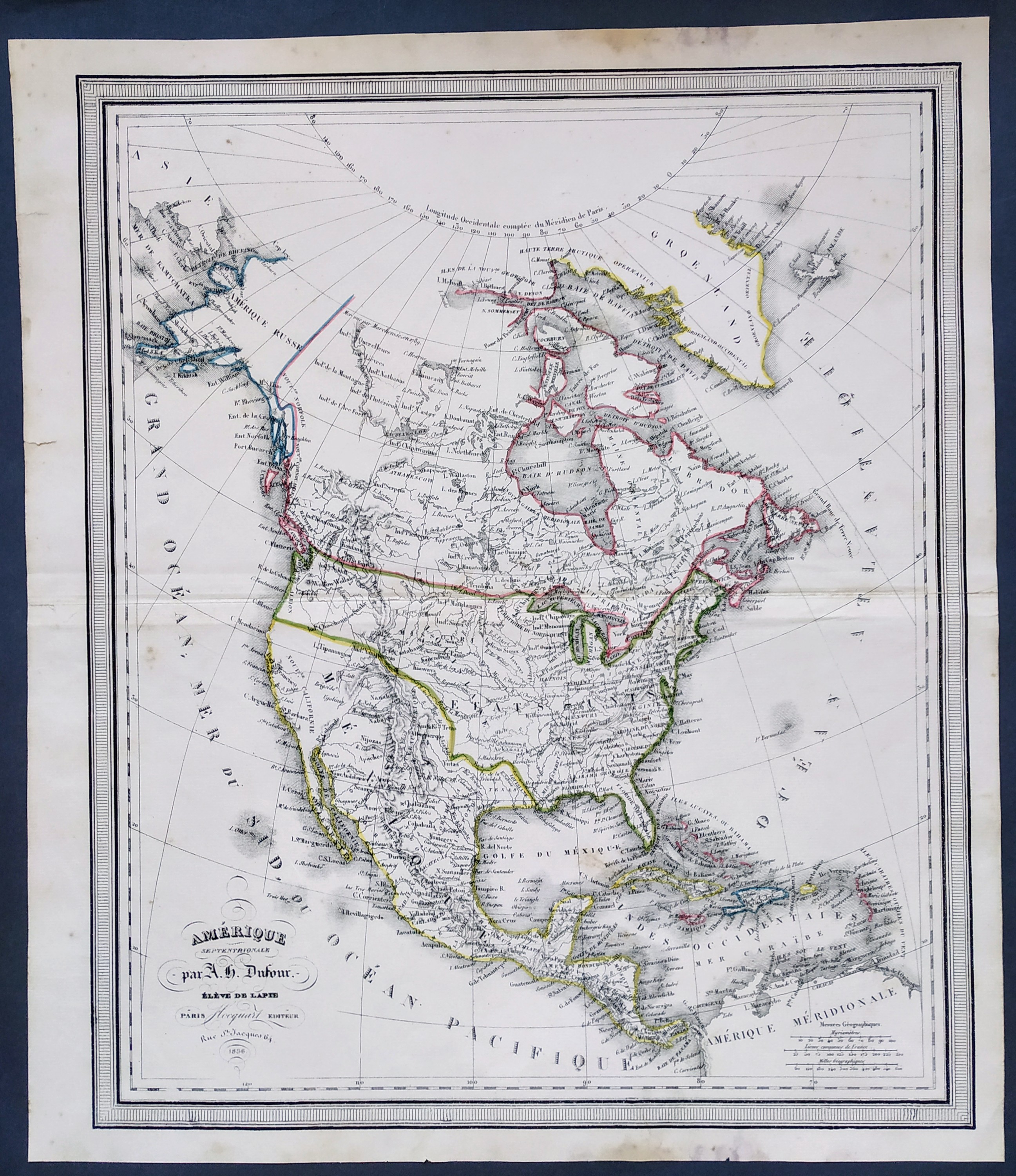
Map title
Amerique Septentrionale
Author
Dufour
Location shown in map
USA
Edition date
1836
Edition place
Paris
Editor
Flocquart
Atlas
--
Price
100 Euro
State
[mint/EXCELLENT/very good/good/fair/mediocre/poor]
Color
Old colors
Verso
Blank
Size
Plate: cm (0 x 0) inches (0 x 0) Paper: cm (0 x 0) inches (0 x 0)
Technique
Steel engraving
Note
No particular notes for this maps.
Reference
--
Wiki
Here for more info
In stock
Available
Info
info@thetreasuremaps.com
Code
#0715
×
![]()
Map title
Italien
Author
Streit
Location shown in map
Italy
Edition date
Circa 1836
Edition place
Berlin
Editor
Atlas
Price
75 Euro
State
[mint/EXCELLENT/very good/good/fair/mediocre/poor]
Color
Old colors
Verso
Blank
Size
Plate: cm (25 x 30) inches (9.84 x 11.81) Paper: cm (26 x 32) inches (10.24 x 12.6)
Technique
Steel engraving
Note
Reference
Wiki
Here for more info
In stock
Available
Info
info@thetreasuremaps.com
Code
#1016
×
![]()
Map title
L'Italia
Author
Borghi
Location shown in map
Italy
Edition date
1836
Edition place
Florence
Editor
Atlas
Price
50 Euro
State
[mint/EXCELLENT/very good/good/fair/mediocre/poor]
Color
Old colors
Verso
Blank
Size
Plate: cm (24 x 29) inches (9.45 x 11.42) Paper: cm (25 x 33) inches (9.84 x 12.99)
Technique
Copper engraving
Note
Reference
Wiki
Here for more info
In stock
Available
Info
info@thetreasuremaps.com
Code
#1061
×
![]()
Map title
Genoa
Author
Clarke
Location shown in map
Genoa
Edition date
1836
Edition place
London
Editor
Baldwin
Atlas
Price
175 Euro
State
[mint/EXCELLENT/very good/good/fair/mediocre/poor]
Color
Old colors
Verso
Blank
Size
Plate: cm (41 x 33) inches (16.14 x 12.99) Paper: cm (38 x 28) inches (14.96 x 11.02)
Technique
Steel engraving
Note
Reference
Wiki
Here for more info
In stock
Available
Info
info@thetreasuremaps.com
Code
#1189
Genoa
Author
Clarke
Location shown in map
Genoa
Edition date
1836
Edition place
London
Editor
Baldwin
Atlas
Price
175 Euro
State
[mint/EXCELLENT/very good/good/fair/mediocre/poor]
Color
Old colors
Verso
Blank
Size
Plate: cm (41 x 33) inches (16.14 x 12.99) Paper: cm (38 x 28) inches (14.96 x 11.02)
Technique
Steel engraving
Note
Reference
Wiki
Here for more info
In stock
Available
Info
info@thetreasuremaps.com
Code
#1189
×
![]()
Map title
Carta Nuovissima Attual Piemonte
Author
Nicola Ombrelaro
Location shown in map
Liguria
Edition date
1837
Edition place
Torino
Editor
--
Atlas
--
Price
Please ask: info@thetreasuremaps.com
State
[mint/excellent/VERY GOOD/good/fair/mediocre/poor]
Color
Black/white
Verso
Blank
Size
Plate: cm (61 x 50.8) inches (24.02 x 20) Paper: cm (71.1 x 55.9) inches (27.99 x 22.01)
Technique
Steel engraving
Note
--
Reference
--
Wiki
Here for more info
In stock
Available
Info
info@thetreasuremaps.com
Code
#0509
×
![]()
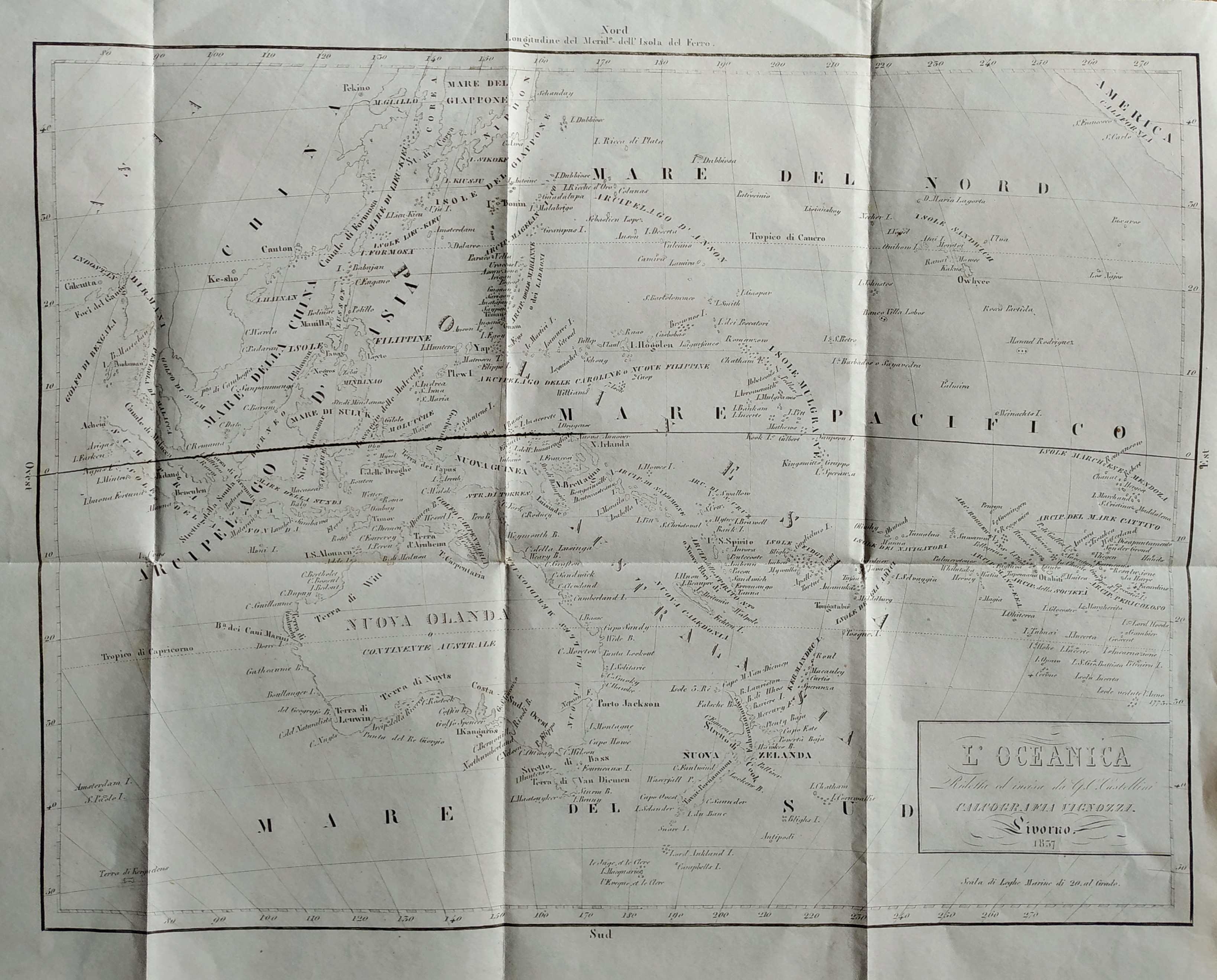
Map title
L'Oceanica
Author
Castellini
Location shown in map
Oceania
Edition date
1837
Edition place
Livorno
Editor
Vignozzi
Atlas
Price
100 Euro
State
[mint/EXCELLENT/very good/good/fair/mediocre/poor]
Color
Black/white
Verso
Blank
Size
Plate: cm (34 x 26) inches (13.39 x 10.24) Paper: cm (40 x 31) inches (15.75 x 12.2)
Technique
Steel engraving
Note
Reference
Wiki
Here for more info
In stock
Available
Info
info@thetreasuremaps.com
Code
#0777
×
![]()
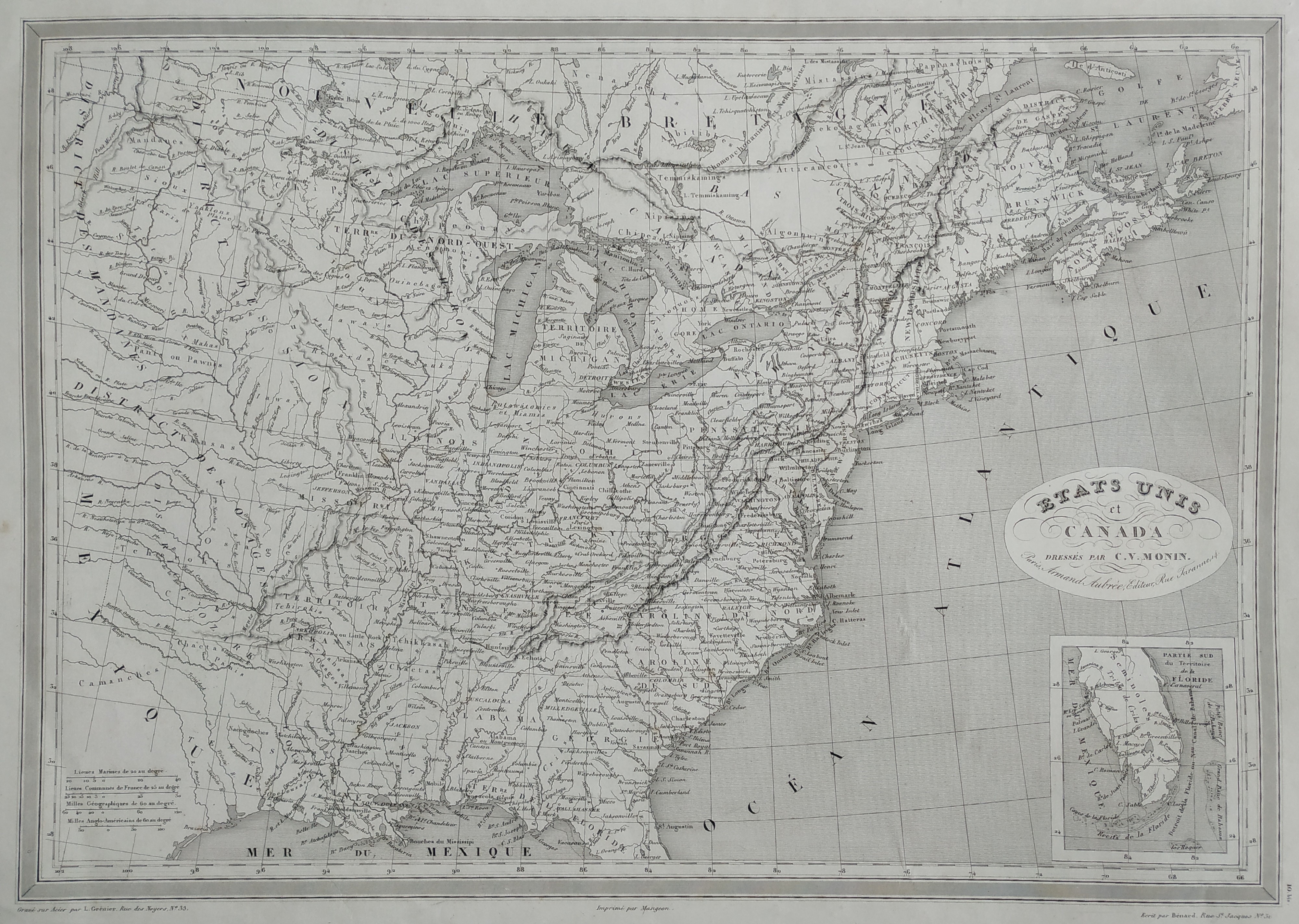
Map title
Etats Unis
Author
Monin
Location shown in map
East coast
Edition date
1837
Edition place
Paris
Editor
Atlas
Price
75 Euro
State
[mint/EXCELLENT/very good/good/fair/mediocre/poor]
Color
Black/white
Verso
Blank
Size
Plate: cm (45 x 32) inches (17.72 x 12.6) Paper: cm (55 x 38) inches (21.65 x 14.96)
Technique
Steel engraving
Note
Reference
Wiki
Here for more info
In stock
Available
Info
info@thetreasuremaps.com
Code
#0793
×
![]()
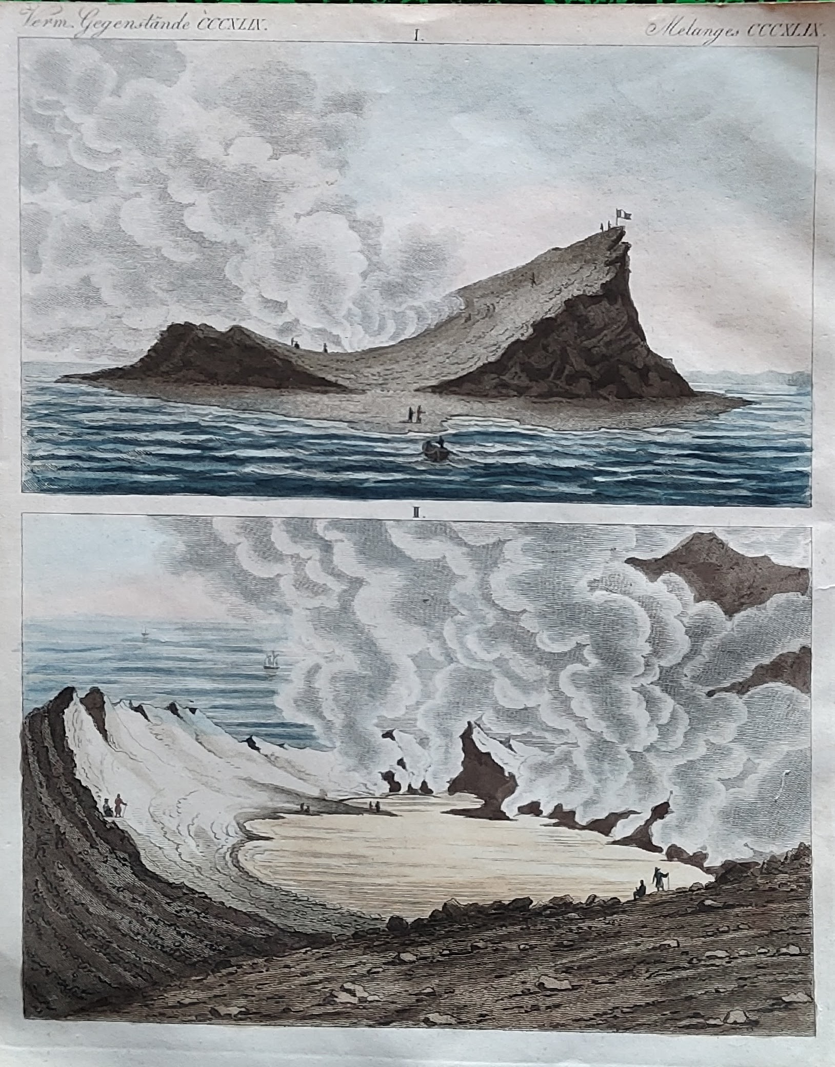
Map title
Author
Bertuch
Location shown in map
Ferdinandea island
Edition date
1837
Edition place
Editor
Atlas
Price
75 Euro
State
[mint/EXCELLENT/very good/good/fair/mediocre/poor]
Color
Old colors
Verso
Blank
Size
Plate: cm (0 x 0) inches (0 x 0) Paper: cm (23 x 17) inches (9.06 x 6.69)
Technique
Copper engraving
Note
Reference
Wiki
Here for more info
In stock
Sold
Info
info@thetreasuremaps.com
Code
#1093
×
![]()
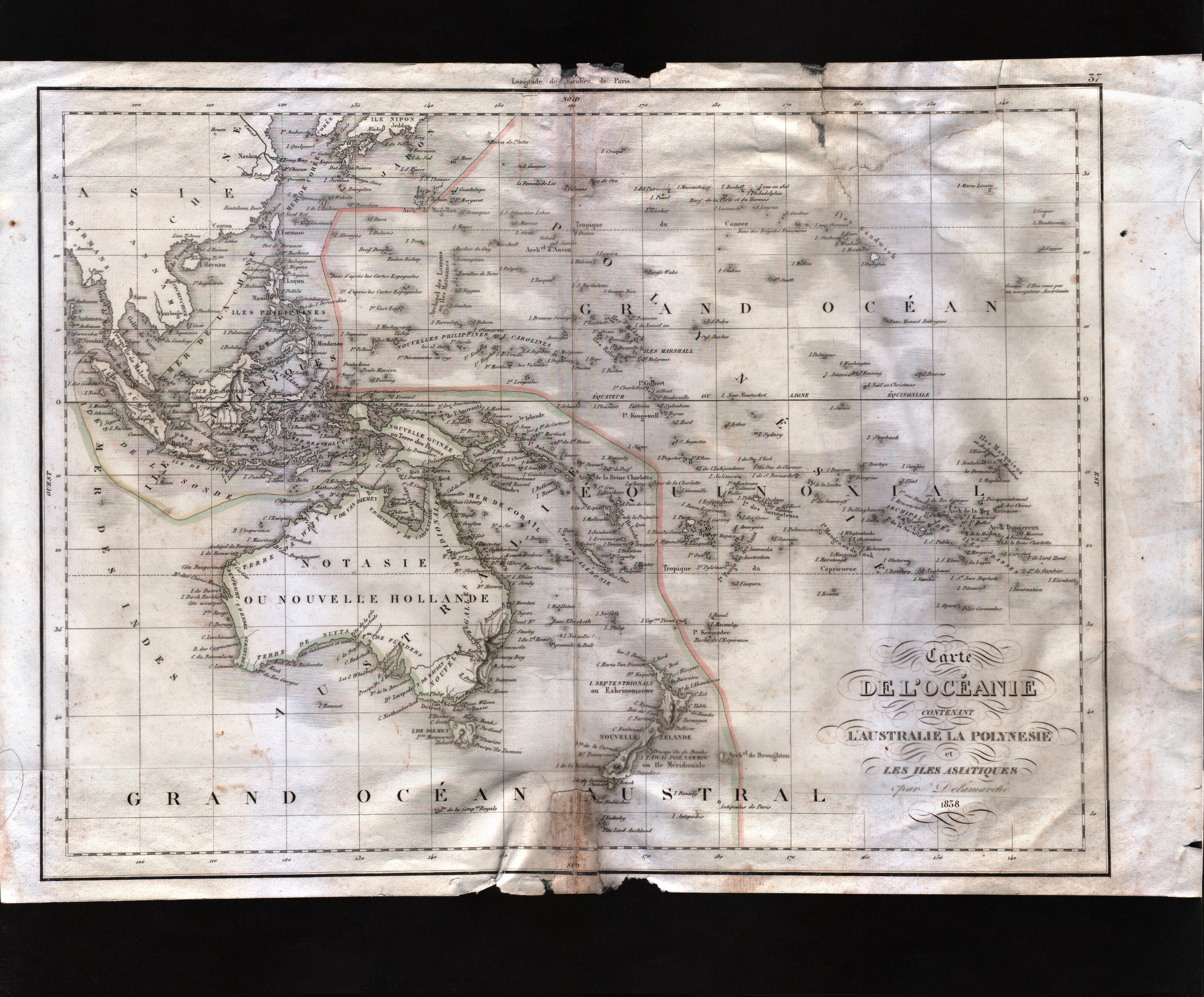
Map title
Carte dell'Oceanie contenant l'Australie la Polynesie et les isles Asiatiques
Author
Delamarche
Location shown in map
Oceania
Edition date
1838
Edition place
Paris
Editor
--
Atlas
--
Price
50 Euro
State
[mint/excellent/very good/good/FAIR/mediocre/poor]
Color
Old outlined
Verso
Blank
Size
Plate: cm (25.4 x 20.3) inches (10 x 7.99) Paper: cm (25.4 x 20.3) inches (10 x 7.99)
Technique
Copper engraving
Note
The map has been repaired. The upper rigth corner was cut off.
Reference
--
Wiki
Here for more info
In stock
Available
Info
info@thetreasuremaps.com
Code
#0473
×
![]()
Map title
Amerique septentrional
Author
Lorrain
Location shown in map
USA
Edition date
1840
Edition place
Paris
Editor
--
Atlas
?? - Depot de la Guerre
Price
Please ask: info@thetreasuremaps.com
State
[mint/excellent/very good/GOOD/fair/mediocre/poor]
Color
Old outlined
Verso
Blank
Size
Plate: cm (36.8 x 27.9) inches (14.49 x 10.98) Paper: cm (45.7 x 33) inches (17.99 x 12.99)
Technique
Copper engraving
Note
Texas as a republic, Russian America
Reference
--
Wiki
Here for more info
In stock
Sold
Info
info@thetreasuremaps.com
Code
#0085
×
![]()
Map title
Carte de l'Oceanie
Author
J. Andriveau-Goujon
Location shown in map
Oceania
Edition date
1840
Edition place
Paris
Editor
Goujon
Atlas
Atlas Classique et Universel de Geographie
Price
125 Euro
State
[mint/EXCELLENT/very good/good/fair/mediocre/poor]
Color
Old colors
Verso
Blank
Size
Plate: cm (51 x 38) inches (20.08 x 14.96) Paper: cm (66 x 52) inches (25.98 x 20.47)
Technique
Steel engraving
Note
Reference
Wiki
Here for more info
In stock
Available
Info
info@thetreasuremaps.com
Code
#0986
×
![]()
Map title
Oceanie
Author
Monin
Location shown in map
Oceania
Edition date
1840
Edition place
Paris
Editor
Atlas
Atlas Classique de la Geographie
Price
100 Euro
State
[mint/EXCELLENT/very good/good/fair/mediocre/poor]
Color
Old colors
Verso
Blank
Size
Plate: cm (39 x 28) inches (15.35 x 11.02) Paper: cm (45 x 33) inches (17.72 x 12.99)
Technique
Copper engraving
Note
Reference
Wiki
Here for more info
In stock
Available
Info
info@thetreasuremaps.com
Code
#1005
×
![]()
Map title
Asie
Author
Monin
Location shown in map
Asia
Edition date
1840
Edition place
Paris
Editor
Atlas
Atlas Classique de la Geographie
Price
75 Euro
State
[mint/EXCELLENT/very good/good/fair/mediocre/poor]
Color
Old colors
Verso
Blank
Size
Plate: cm (35 x 28) inches (13.78 x 11.02) Paper: cm (45 x 33) inches (17.72 x 12.99)
Technique
Copper engraving
Note
Reference
Wiki
Here for more info
In stock
Available
Info
info@thetreasuremaps.com
Code
#1009
×
![]()
Map title
Iles Britannique
Author
Monin
Location shown in map
British Isles
Edition date
1840
Edition place
Paris
Editor
Atlas
Atlas Classique de la Geographie
Price
75 Euro
State
[mint/EXCELLENT/very good/good/fair/mediocre/poor]
Color
Old colors
Verso
Blank
Size
Plate: cm (28 x 37) inches (11.02 x 14.57) Paper: cm (33 x 45) inches (12.99 x 17.72)
Technique
Copper engraving
Note
Reference
Wiki
Here for more info
In stock
Available
Info
info@thetreasuremaps.com
Code
#1010
×
![]()
Map title
Amerique Meridionale
Author
Monin
Location shown in map
South America
Edition date
1840
Edition place
Paris
Editor
Atlas
Atlas Classique de la Geographie
Price
75 Euro
State
[mint/EXCELLENT/very good/good/fair/mediocre/poor]
Color
Old colors
Verso
Blank
Size
Plate: cm (27 x 37) inches (10.63 x 14.57) Paper: cm (33 x 45) inches (12.99 x 17.72)
Technique
Copper engraving
Note
Reference
Wiki
Here for more info
In stock
Available
Info
info@thetreasuremaps.com
Code
#1011
×
![]()
Map title
Siberie
Author
Monin
Location shown in map
Siberia
Edition date
1840
Edition place
Paris
Editor
Atlas
Atlas Classique de la Geographie
Price
75 Euro
State
[mint/EXCELLENT/very good/good/fair/mediocre/poor]
Color
Old colors
Verso
Blank
Size
Plate: cm (39 x 28) inches (15.35 x 11.02) Paper: cm (45 x 33) inches (17.72 x 12.99)
Technique
Copper engraving
Note
Reference
Wiki
Here for more info
In stock
Available
Info
info@thetreasuremaps.com
Code
#1012
×
![]()
Map title
Grece Ancienne
Author
Monin
Location shown in map
Greece
Edition date
1840
Edition place
Paris
Editor
Atlas
Atlas Classique de la Geographie
Price
50 Euro
State
[mint/EXCELLENT/very good/good/fair/mediocre/poor]
Color
Old colors
Verso
Blank
Size
Plate: cm (27 x 37) inches (10.63 x 14.57) Paper: cm (33 x 45) inches (12.99 x 17.72)
Technique
Copper engraving
Note
Reference
Wiki
Here for more info
In stock
Available
Info
info@thetreasuremaps.com
Code
#1014
×
![]()
Map title
Alemagne
Author
Monin
Location shown in map
Germany
Edition date
1840
Edition place
Paris
Editor
Atlas
Atlas Classique de la Geographie
Price
50 Euro
State
[mint/EXCELLENT/very good/good/fair/mediocre/poor]
Color
Old colors
Verso
Blank
Size
Plate: cm (39 x 28) inches (15.35 x 11.02) Paper: cm (45 x 33) inches (17.72 x 12.99)
Technique
Copper engraving
Note
Reference
Wiki
Here for more info
In stock
Available
Info
info@thetreasuremaps.com
Code
#1034
×
![]()
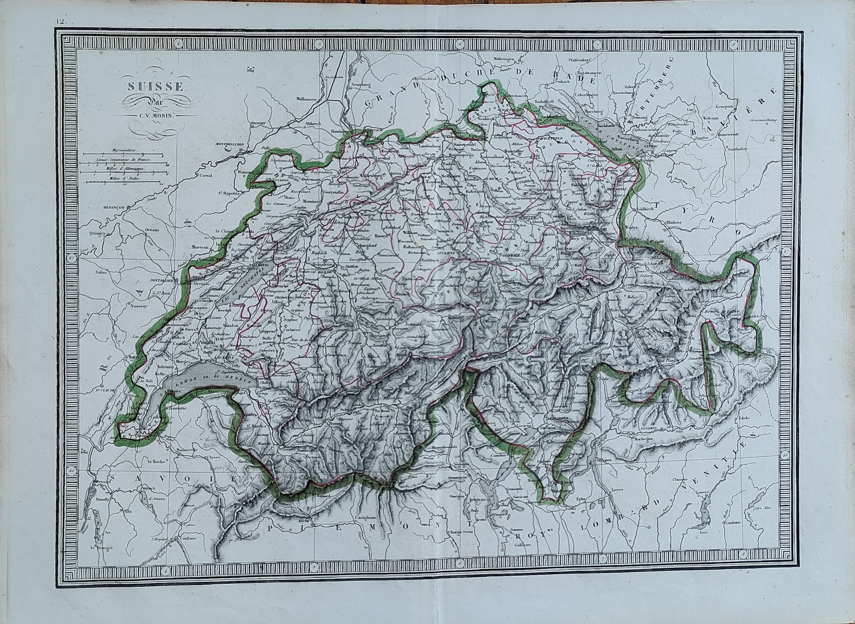
Map title
Suisse
Author
Monin
Location shown in map
Switzerland
Edition date
1840
Edition place
Paris
Editor
Atlas
Atlas Classique de la Geographie
Price
50 Euro
State
[mint/EXCELLENT/very good/good/fair/mediocre/poor]
Color
Old colors
Verso
Blank
Size
Plate: cm (39 x 28) inches (15.35 x 11.02) Paper: cm (45 x 33) inches (17.72 x 12.99)
Technique
Copper engraving
Note
Reference
Wiki
Here for more info
In stock
Available
Info
info@thetreasuremaps.com
Code
#1035
×
![]()
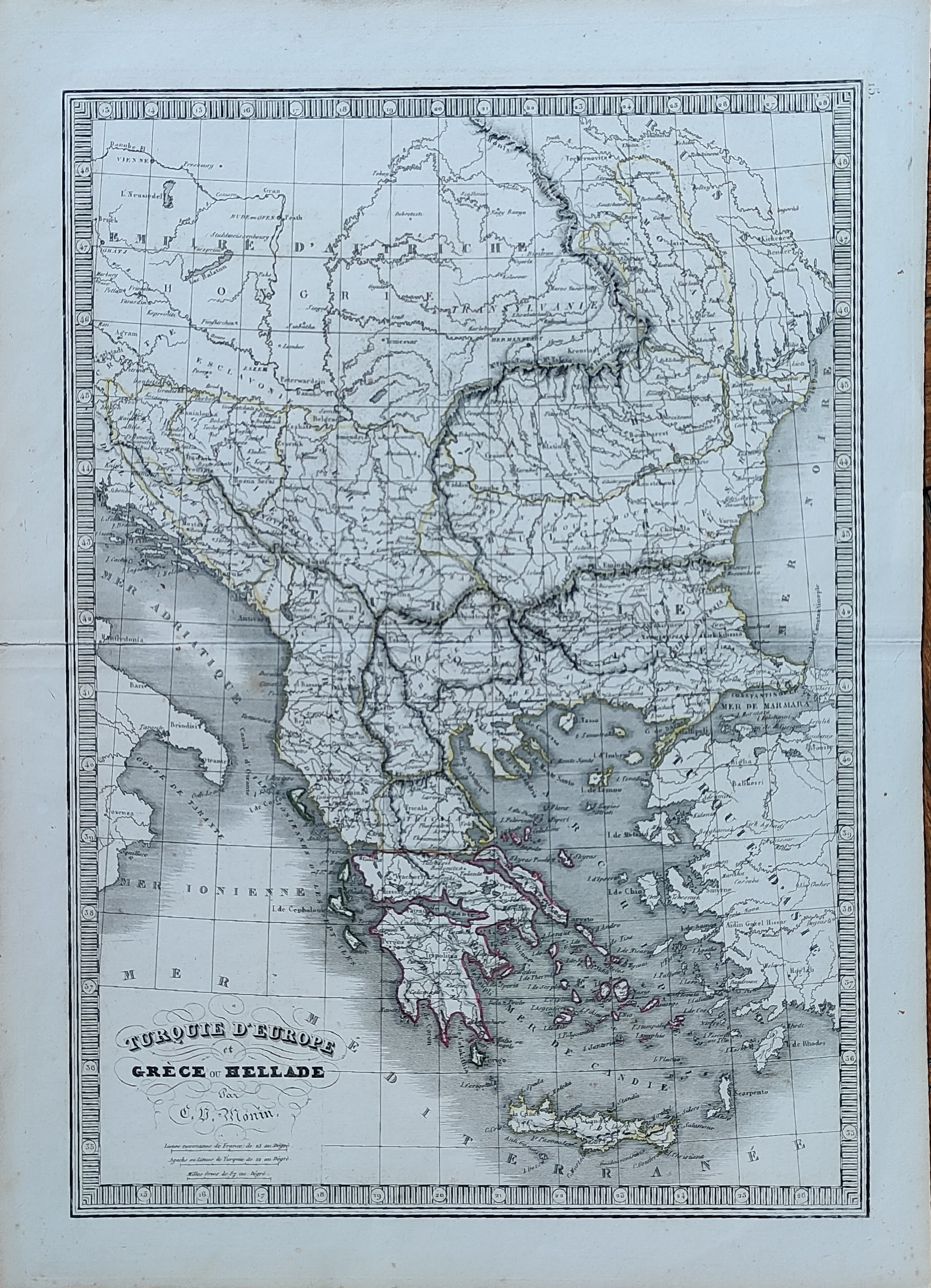
Map title
Turquie d'Europe
Author
Monin
Location shown in map
Greece
Edition date
1840
Edition place
Paris
Editor
Atlas
Atlas Classique de la Geographie
Price
50 Euro
State
[mint/EXCELLENT/very good/good/fair/mediocre/poor]
Color
Old colors
Verso
Blank
Size
Plate: cm (28 x 39) inches (11.02 x 15.35) Paper: cm (33 x 45) inches (12.99 x 17.72)
Technique
Copper engraving
Note
Reference
Wiki
Here for more info
In stock
Available
Info
info@thetreasuremaps.com
Code
#1036
×
![]()
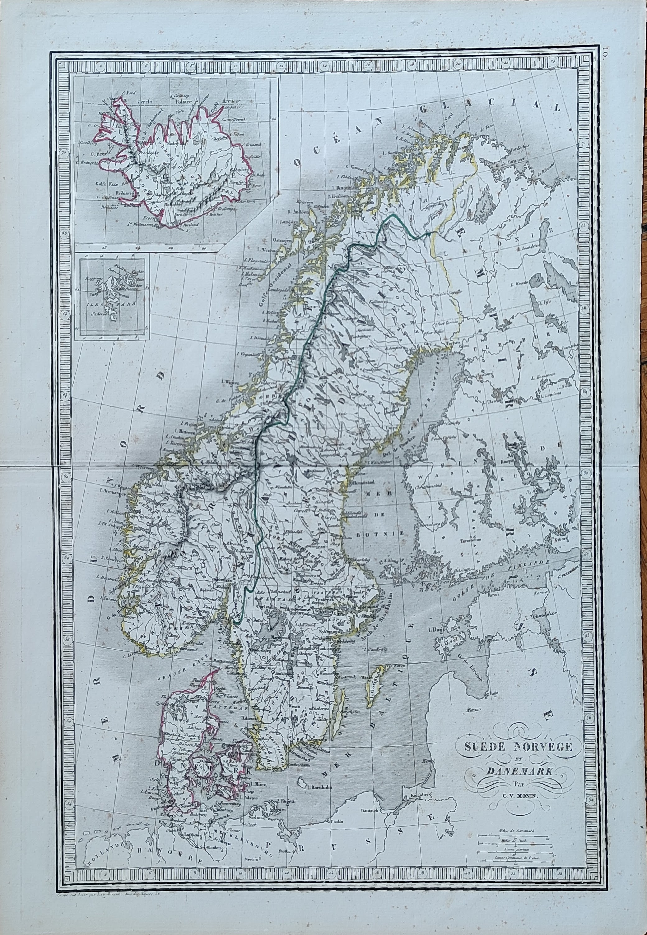
Map title
Suede Norvege et Danemark
Author
Monin
Location shown in map
Scandinavia
Edition date
1840
Edition place
Paris
Editor
Atlas
Atlas Classique de la Geographie
Price
50 Euro
State
[mint/EXCELLENT/very good/good/fair/mediocre/poor]
Color
Old colors
Verso
Blank
Size
Plate: cm (28 x 39) inches (11.02 x 15.35) Paper: cm (33 x 45) inches (12.99 x 17.72)
Technique
Copper engraving
Note
Reference
Wiki
Here for more info
In stock
Available
Info
info@thetreasuremaps.com
Code
#1037
×
![]()
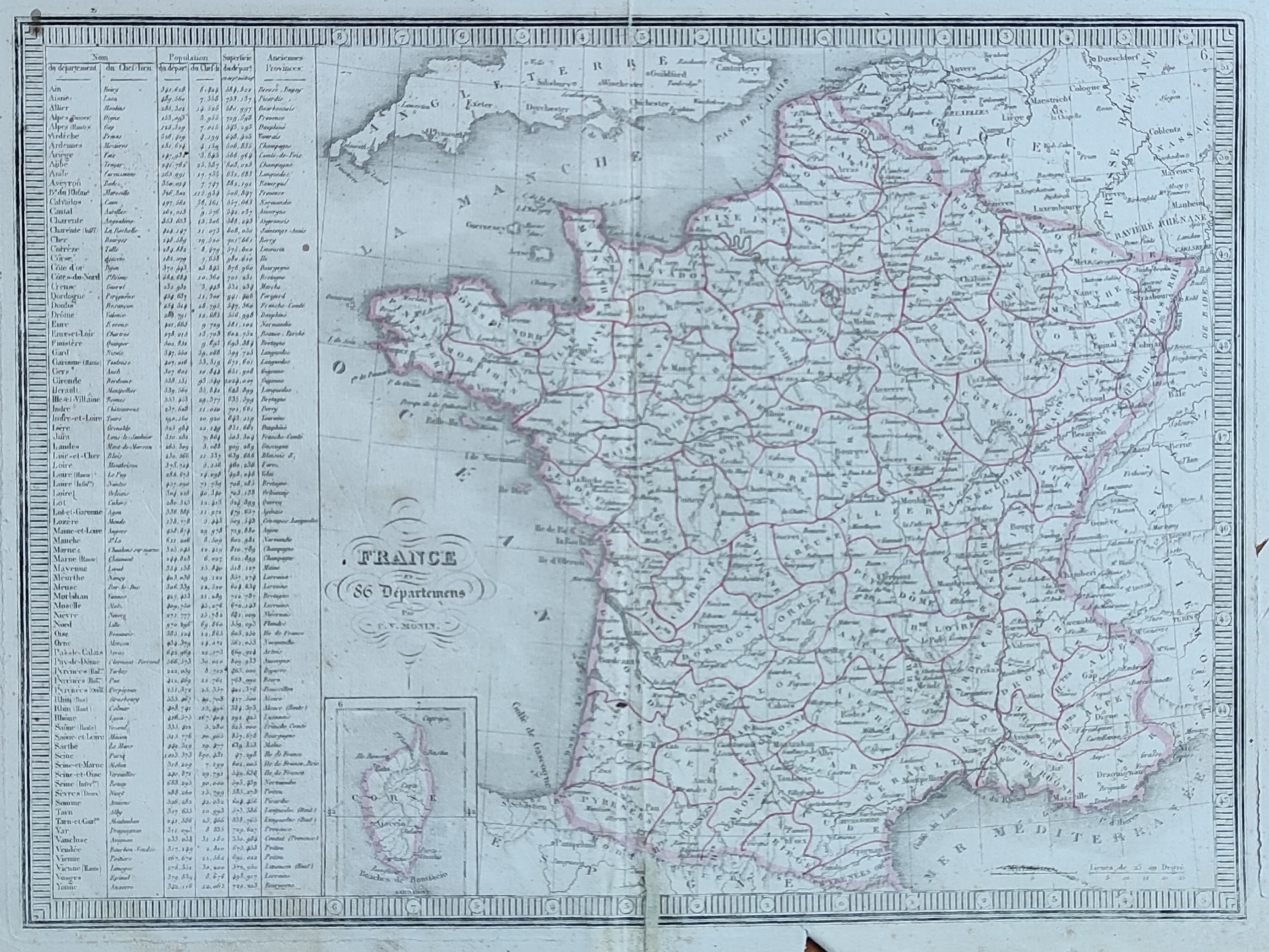
Map title
France
Author
Monin
Location shown in map
France
Edition date
1840
Edition place
Paris
Editor
Atlas
Atlas Classique de la Geographie
Price
50 Euro
State
[mint/EXCELLENT/very good/good/fair/mediocre/poor]
Color
Old colors
Verso
Blank
Size
Plate: cm (39 x 28) inches (15.35 x 11.02) Paper: cm (45 x 33) inches (17.72 x 12.99)
Technique
Copper engraving
Note
Reference
Wiki
Here for more info
In stock
Available
Info
info@thetreasuremaps.com
Code
#1038
France
Author
Monin
Location shown in map
France
Edition date
1840
Edition place
Paris
Editor
Atlas
Atlas Classique de la Geographie
Price
50 Euro
State
[mint/EXCELLENT/very good/good/fair/mediocre/poor]
Color
Old colors
Verso
Blank
Size
Plate: cm (39 x 28) inches (15.35 x 11.02) Paper: cm (45 x 33) inches (17.72 x 12.99)
Technique
Copper engraving
Note
Reference
Wiki
Here for more info
In stock
Available
Info
info@thetreasuremaps.com
Code
#1038
×
![]()
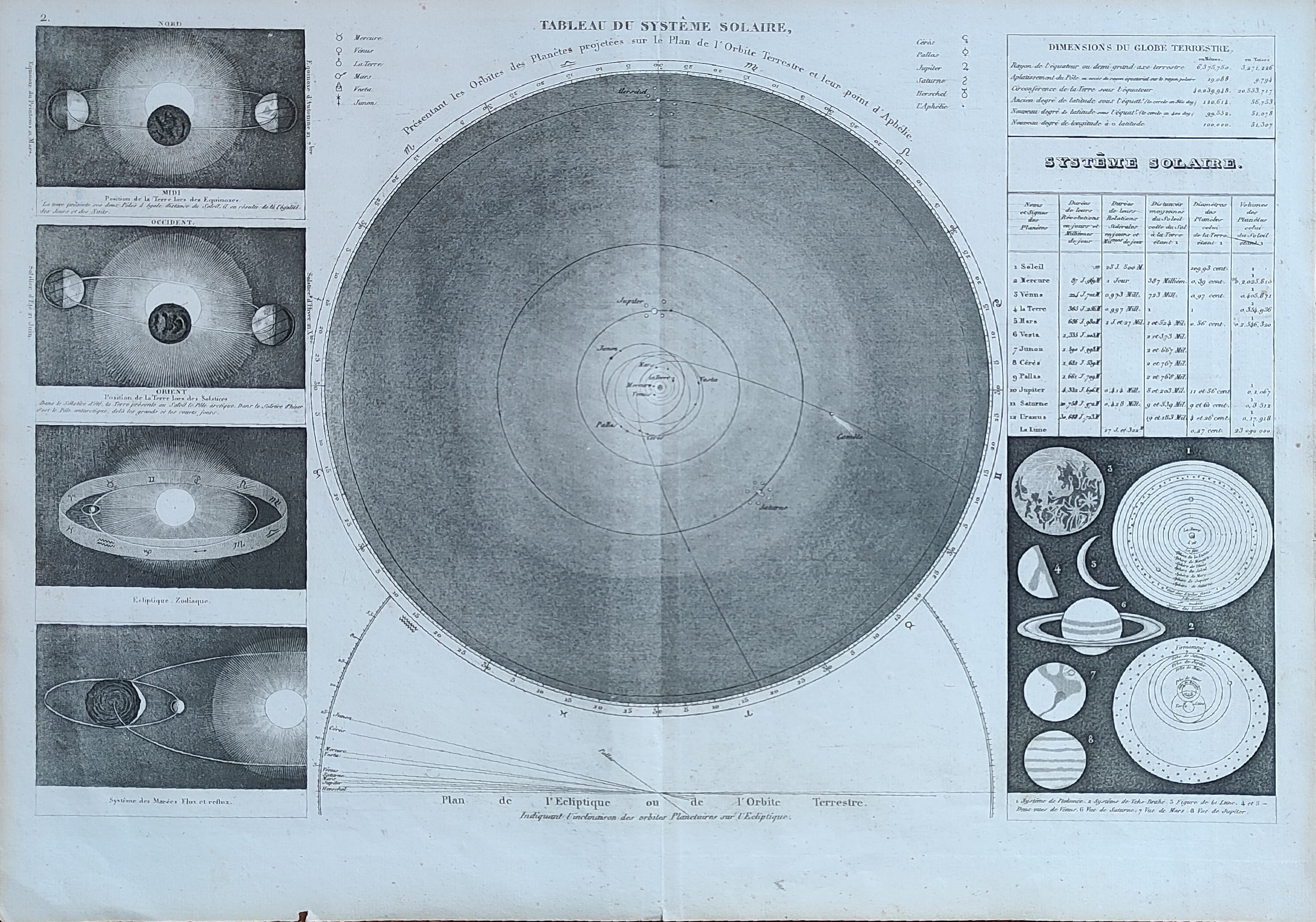
Map title
Tableau du system solaire
Author
Monin
Location shown in map
Celestial
Edition date
1840
Edition place
Paris
Editor
Atlas
Atlas Classique de la Geographie
Price
50 Euro
State
[mint/EXCELLENT/very good/good/fair/mediocre/poor]
Color
Old colors
Verso
Blank
Size
Plate: cm (39 x 28) inches (15.35 x 11.02) Paper: cm (45 x 33) inches (17.72 x 12.99)
Technique
Copper engraving
Note
Reference
Wiki
Here for more info
In stock
Available
Info
info@thetreasuremaps.com
Code
#1041
×
![]()
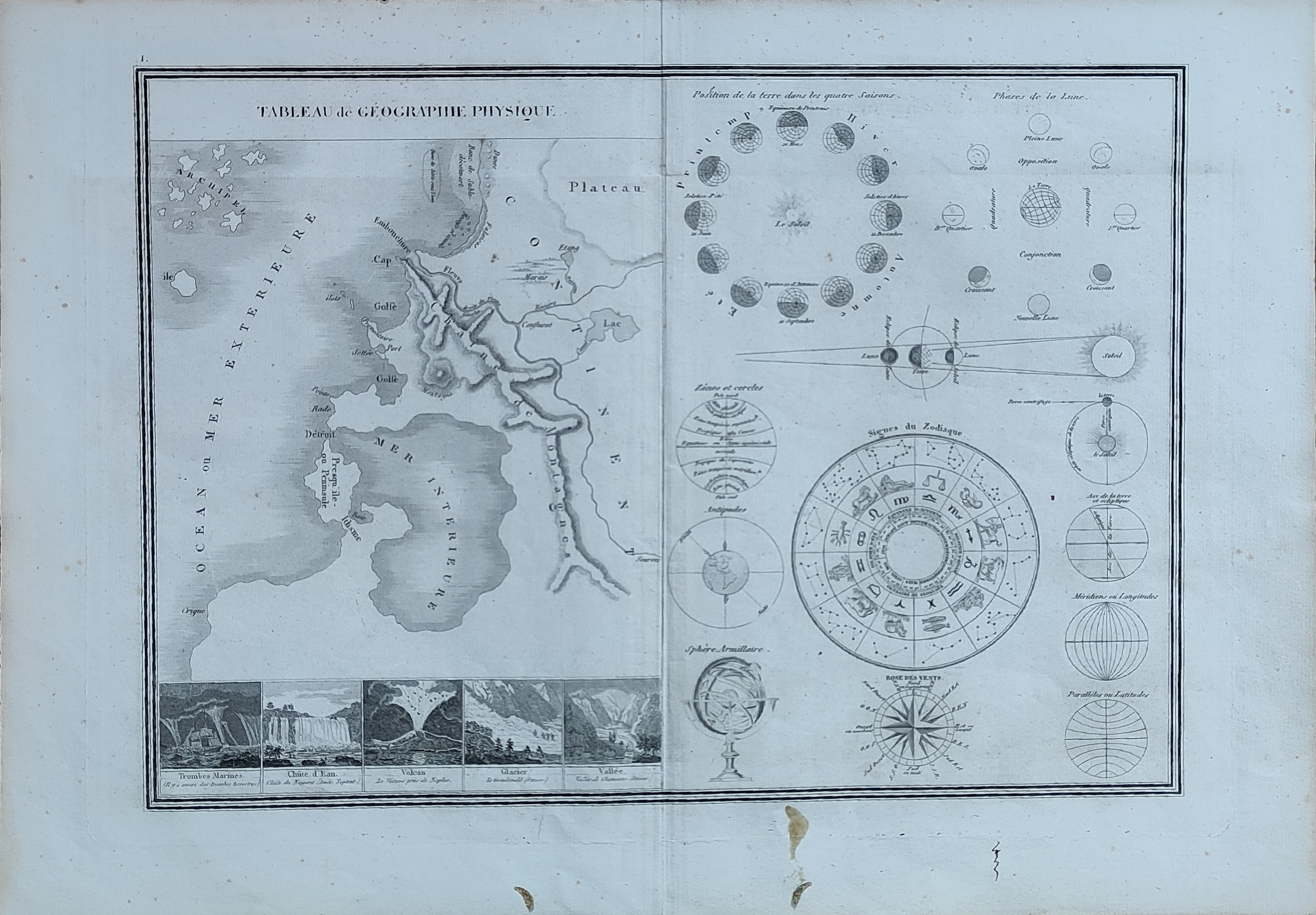
Map title
Tableau de geographie physique
Author
Monin
Location shown in map
Celestial
Edition date
1840
Edition place
Paris
Editor
Atlas
Atlas Classique de la Geographie
Price
50 Euro
State
[mint/EXCELLENT/very good/good/fair/mediocre/poor]
Color
Old colors
Verso
Blank
Size
Plate: cm (39 x 28) inches (15.35 x 11.02) Paper: cm (45 x 33) inches (17.72 x 12.99)
Technique
Copper engraving
Note
Reference
Wiki
Here for more info
In stock
Available
Info
info@thetreasuremaps.com
Code
#1042
×
![]()
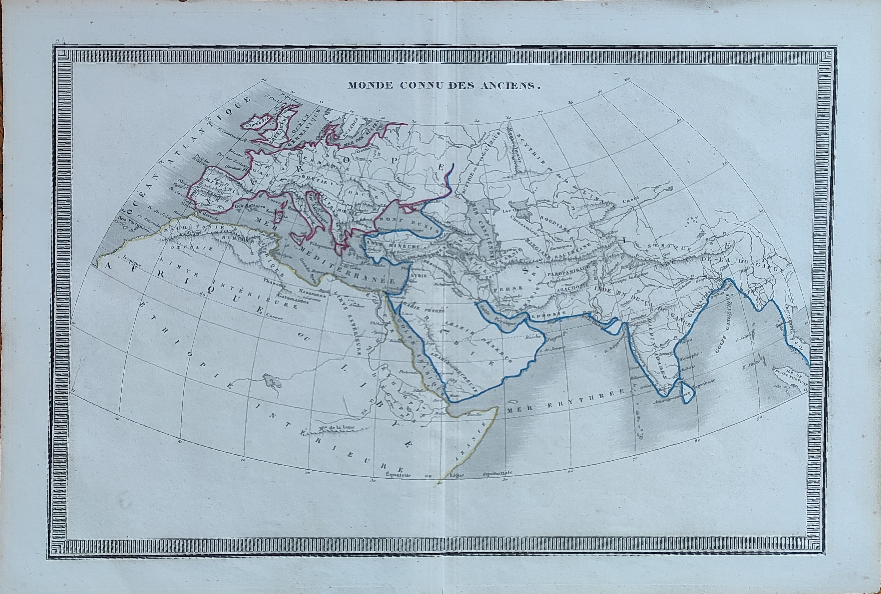
Map title
Monde connu des anciens
Author
Monin
Location shown in map
World
Edition date
1840
Edition place
Paris
Editor
Atlas
Atlas Classique de la Geographie
Price
50 Euro
State
[mint/EXCELLENT/very good/good/fair/mediocre/poor]
Color
Old colors
Verso
Blank
Size
Plate: cm (39 x 28) inches (15.35 x 11.02) Paper: cm (45 x 33) inches (17.72 x 12.99)
Technique
Copper engraving
Note
Reference
Wiki
Here for more info
In stock
Available
Info
info@thetreasuremaps.com
Code
#1043
×
![]()
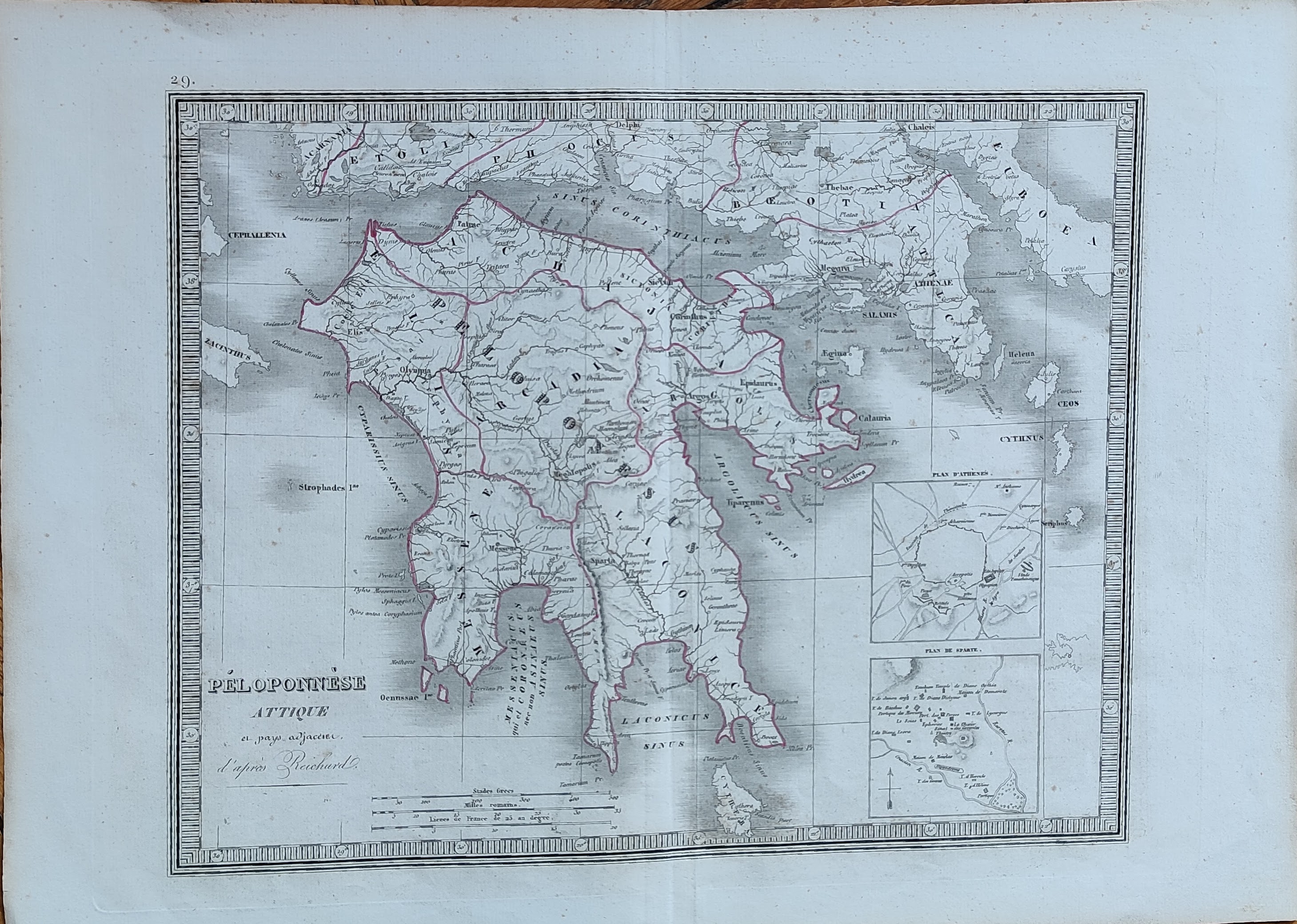
Map title
Peloponnese
Author
Monin
Location shown in map
Greece
Edition date
1840
Edition place
Paris
Editor
Atlas
Atlas Classique de la Geographie
Price
50 Euro
State
[mint/EXCELLENT/very good/good/fair/mediocre/poor]
Color
Old colors
Verso
Blank
Size
Plate: cm (39 x 28) inches (15.35 x 11.02) Paper: cm (45 x 33) inches (17.72 x 12.99)
Technique
Copper engraving
Note
Reference
Wiki
Here for more info
In stock
Available
Info
info@thetreasuremaps.com
Code
#1044
×
![]()
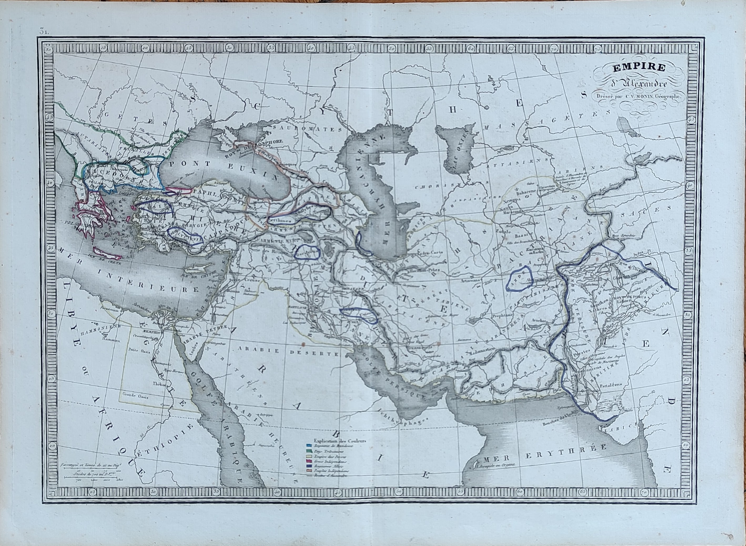
Map title
Empire d'Alexandre
Author
Monin
Location shown in map
Middle East
Edition date
1840
Edition place
Paris
Editor
Atlas
Atlas Classique de la Geographie
Price
50 Euro
State
[mint/EXCELLENT/very good/good/fair/mediocre/poor]
Color
Old colors
Verso
Blank
Size
Plate: cm (39 x 28) inches (15.35 x 11.02) Paper: cm (45 x 33) inches (17.72 x 12.99)
Technique
Copper engraving
Note
Reference
Wiki
Here for more info
In stock
Available
Info
info@thetreasuremaps.com
Code
#1045
×
![]()
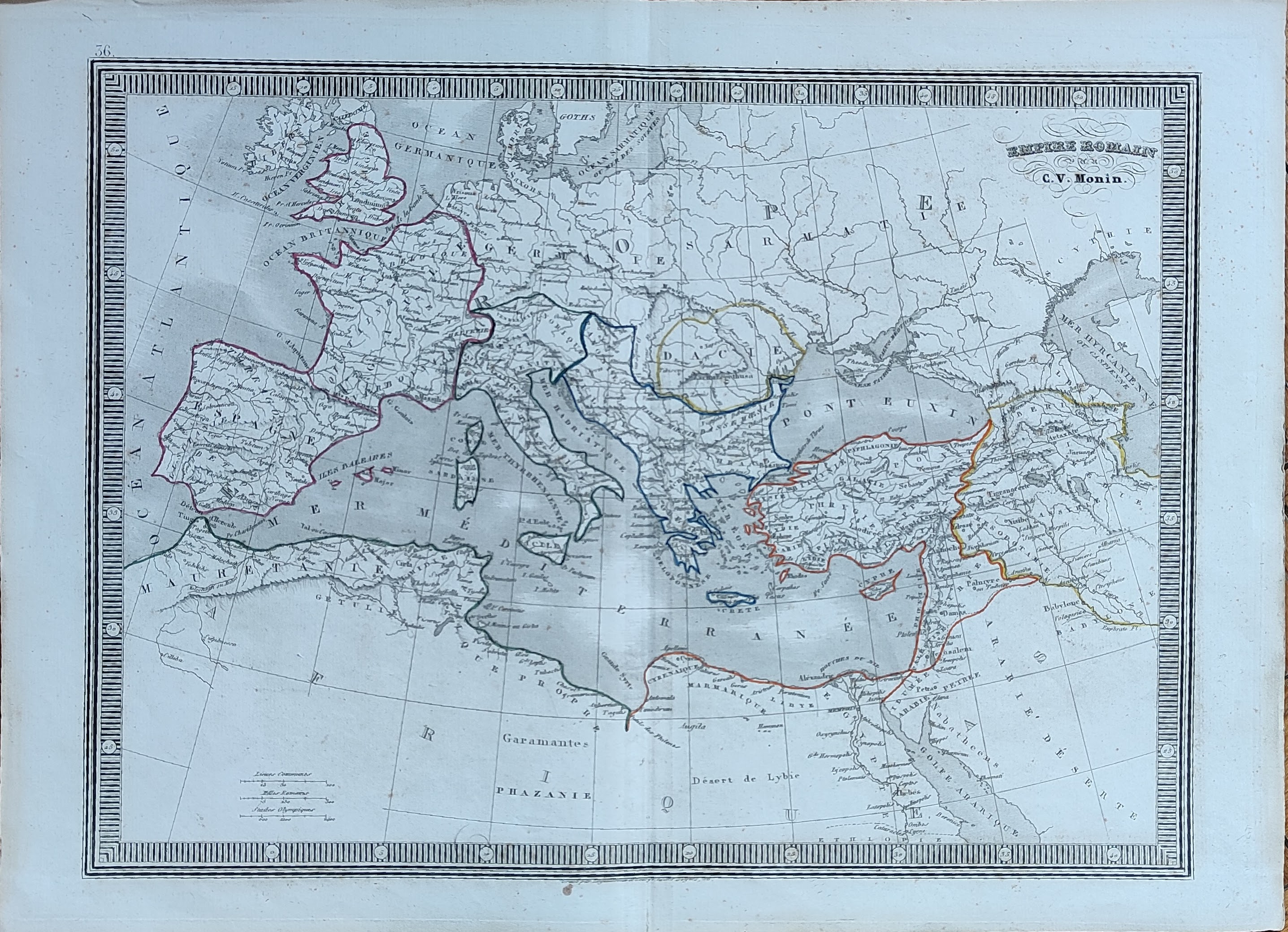
Map title
Empire Romain
Author
Monin
Location shown in map
Europe
Edition date
1840
Edition place
Paris
Editor
Atlas
Atlas Classique de la Geographie
Price
50 Euro
State
[mint/EXCELLENT/very good/good/fair/mediocre/poor]
Color
Old colors
Verso
Blank
Size
Plate: cm (39 x 28) inches (15.35 x 11.02) Paper: cm (45 x 33) inches (17.72 x 12.99)
Technique
Copper engraving
Note
Reference
Wiki
Here for more info
In stock
Available
Info
info@thetreasuremaps.com
Code
#1046
×
![]()
Map title
Palestine
Author
Monin
Location shown in map
Middle East
Edition date
1840
Edition place
Paris
Editor
Atlas
Atlas Classique de la Geographie
Price
50 Euro
State
[mint/EXCELLENT/very good/good/fair/mediocre/poor]
Color
Old colors
Verso
Blank
Size
Plate: cm (39 x 28) inches (15.35 x 11.02) Paper: cm (45 x 33) inches (17.72 x 12.99)
Technique
Copper engraving
Note
Reference
Wiki
Here for more info
In stock
Available
Info
info@thetreasuremaps.com
Code
#1047
×
![]()
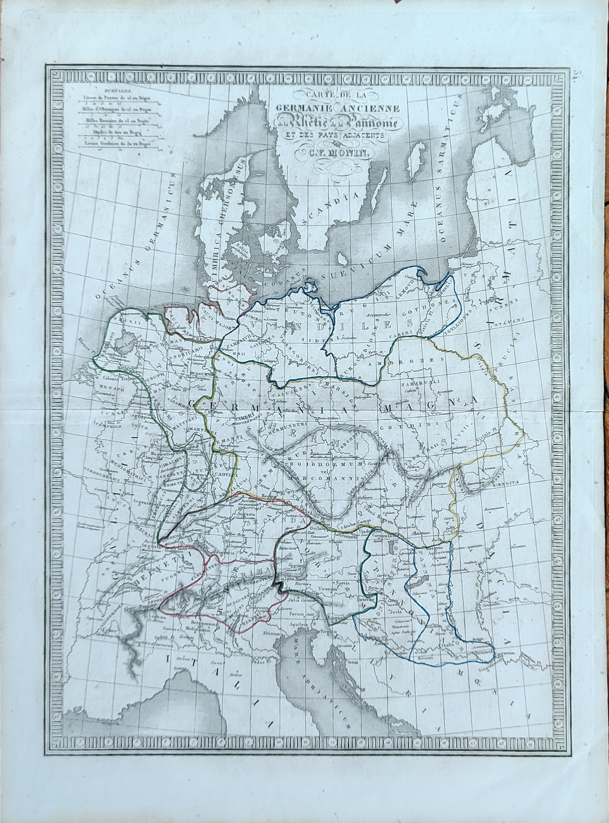
Map title
Carte de la Germanie Ancienne
Author
Monin
Location shown in map
Germany
Edition date
1840
Edition place
Paris
Editor
Atlas
Atlas Classique de la Geographie
Price
50 Euro
State
[mint/EXCELLENT/very good/good/fair/mediocre/poor]
Color
Old colors
Verso
Blank
Size
Plate: cm (28 x 39) inches (11.02 x 15.35) Paper: cm (33 x 45) inches (12.99 x 17.72)
Technique
Copper engraving
Note
Reference
Wiki
Here for more info
In stock
Available
Info
info@thetreasuremaps.com
Code
#1048
×
![]()
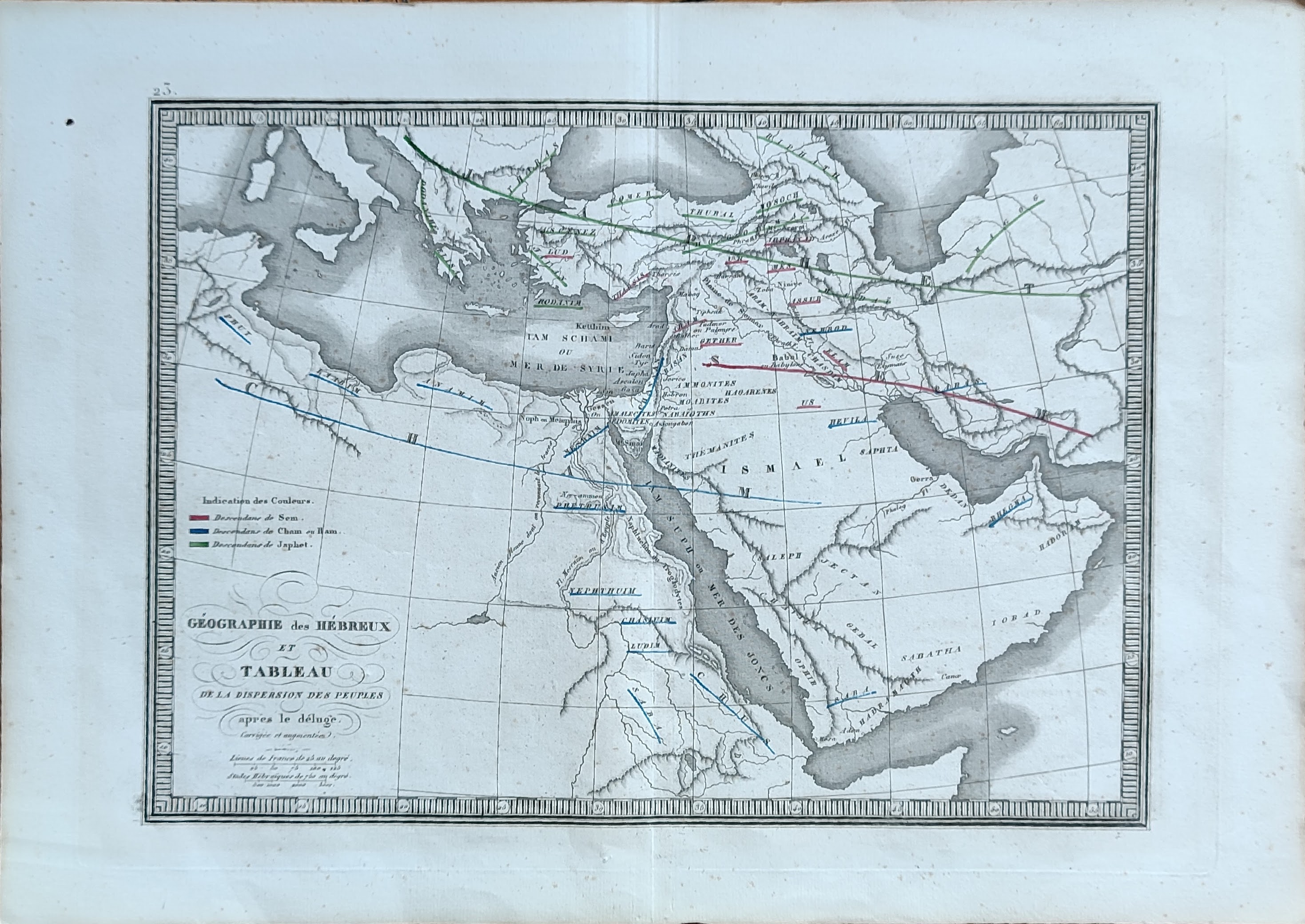
Map title
Geographie des Hebreux
Author
Monin
Location shown in map
Middle East
Edition date
1840
Edition place
Paris
Editor
Atlas
Atlas Classique de la Geographie
Price
50 Euro
State
[mint/EXCELLENT/very good/good/fair/mediocre/poor]
Color
Old colors
Verso
Blank
Size
Plate: cm (39 x 28) inches (15.35 x 11.02) Paper: cm (45 x 33) inches (17.72 x 12.99)
Technique
Copper engraving
Note
Reference
Wiki
Here for more info
In stock
Available
Info
info@thetreasuremaps.com
Code
#1049
×
![]()
Map title
La Gaule
Author
Monin
Location shown in map
France
Edition date
1840
Edition place
Paris
Editor
Atlas
Atlas Classique de la Geographie
Price
50 Euro
State
[mint/EXCELLENT/very good/good/fair/mediocre/poor]
Color
Old colors
Verso
Blank
Size
Plate: cm (39 x 28) inches (15.35 x 11.02) Paper: cm (45 x 33) inches (17.72 x 12.99)
Technique
Copper engraving
Note
Reference
Wiki
Here for more info
In stock
Available
Info
info@thetreasuremaps.com
Code
#1050
×
![]()
Map title
Europe
Author
Monin
Location shown in map
Europe
Edition date
1840
Edition place
Paris
Editor
Atlas
Atlas Classique de la Geographie
Price
50 Euro
State
[mint/EXCELLENT/very good/good/fair/mediocre/poor]
Color
Old colors
Verso
Blank
Size
Plate: cm (28 x 39) inches (11.02 x 15.35) Paper: cm (33 x 45) inches (12.99 x 17.72)
Technique
Copper engraving
Note
Reference
Wiki
Here for more info
In stock
Available
Info
info@thetreasuremaps.com
Code
#1051
Europe
Author
Monin
Location shown in map
Europe
Edition date
1840
Edition place
Paris
Editor
Atlas
Atlas Classique de la Geographie
Price
50 Euro
State
[mint/EXCELLENT/very good/good/fair/mediocre/poor]
Color
Old colors
Verso
Blank
Size
Plate: cm (28 x 39) inches (11.02 x 15.35) Paper: cm (33 x 45) inches (12.99 x 17.72)
Technique
Copper engraving
Note
Reference
Wiki
Here for more info
In stock
Available
Info
info@thetreasuremaps.com
Code
#1051
×
![]()
Map title
Europe
Author
Monin
Location shown in map
Europe
Edition date
1840
Edition place
Paris
Editor
Atlas
Atlas Classique de la Geographie
Price
50 Euro
State
[mint/EXCELLENT/very good/good/fair/mediocre/poor]
Color
Old colors
Verso
Blank
Size
Plate: cm (28 x 39) inches (11.02 x 15.35) Paper: cm (33 x 45) inches (12.99 x 17.72)
Technique
Copper engraving
Note
Reference
Wiki
Here for more info
In stock
Available
Info
info@thetreasuremaps.com
Code
#1052
Europe
Author
Monin
Location shown in map
Europe
Edition date
1840
Edition place
Paris
Editor
Atlas
Atlas Classique de la Geographie
Price
50 Euro
State
[mint/EXCELLENT/very good/good/fair/mediocre/poor]
Color
Old colors
Verso
Blank
Size
Plate: cm (28 x 39) inches (11.02 x 15.35) Paper: cm (33 x 45) inches (12.99 x 17.72)
Technique
Copper engraving
Note
Reference
Wiki
Here for more info
In stock
Available
Info
info@thetreasuremaps.com
Code
#1052
×
![]()
Map title
Munchen
Author
Seitz
Location shown in map
Munich
Edition date
Circa 1840
Edition place
Munch
Editor
Atlas
Price
150 Euro
State
[mint/EXCELLENT/very good/good/fair/mediocre/poor]
Color
Black/white
Verso
Blank
Size
Plate: cm (39 x 38) inches (15.35 x 14.96) Paper: cm (48 x 43) inches (18.9 x 16.93)
Technique
Copper engraving
Note
Reference
Wiki
Here for more info
In stock
Available
Info
info@thetreasuremaps.com
Code
#1162
×
![]()
Map title
Carte du Nouveau Continent...
Author
Buffon
Location shown in map
All America
Edition date
Circa 1840
Edition place
Paris
Editor
Garnier Freres
Atlas
Price
75 Euro
State
[MINT/excellent/very good/good/fair/mediocre/poor]
Color
Old colors
Verso
Blank
Size
Plate: cm (15 x 20) inches (5.91 x 7.87) Paper: cm (15 x 20) inches (5.91 x 7.87)
Technique
Steel engraving
Note
framed
Reference
Wiki
Here for more info
In stock
Available
Info
info@thetreasuremaps.com
Code
#1240
×
![]()
Map title
Carte du Ancient Continent...
Author
Buffon
Location shown in map
World
Edition date
Circa 1840
Edition place
Paris
Editor
Garnier Freres
Atlas
Price
75 Euro
State
[MINT/excellent/very good/good/fair/mediocre/poor]
Color
Old colors
Verso
Blank
Size
Plate: cm (15 x 20) inches (5.91 x 7.87) Paper: cm (15 x 20) inches (5.91 x 7.87)
Technique
Steel engraving
Note
framed
Reference
Wiki
Here for more info
In stock
Available
Info
info@thetreasuremaps.com
Code
#1241
×
![]()

Map title
Hindostan
Author
Location shown in map
India
Edition date
Circa 1840
Edition place
Basel
Editor
Hindermann
Atlas
Price
50 Euro
State
[mint/EXCELLENT/very good/good/fair/mediocre/poor] repaired
Color
Black/white
Verso
Blank
Size
Plate: cm (21 x 25) inches (8.27 x 9.84) Paper: cm (24 x 29) inches (9.45 x 11.42)
Technique
Copper engraving
Note
Reference
Wiki
Here for more info
In stock
Available
Info
info@thetreasuremaps.com
Code
#1300
×
![]()
Map title
Liguria
Author
Duvotenay
Location shown in map
Liguria
Edition date
Circa 1840
Edition place
Paris
Editor
Atlas
Price
50 Euro
State
[mint/excellent/very good/good/FAIR/mediocre/poor]
Color
Black/white
Verso
Blank
Size
Plate: cm (36 x 21) inches (14.17 x 8.27) Paper: cm (43 x 28) inches (16.93 x 11.02)
Technique
Steel engraving
Note
Reference
Wiki
Here for more info
In stock
Available
Info
info@thetreasuremaps.com
Code
#1306
Liguria
Author
Duvotenay
Location shown in map
Liguria
Edition date
Circa 1840
Edition place
Paris
Editor
Atlas
Price
50 Euro
State
[mint/excellent/very good/good/FAIR/mediocre/poor]
Color
Black/white
Verso
Blank
Size
Plate: cm (36 x 21) inches (14.17 x 8.27) Paper: cm (43 x 28) inches (16.93 x 11.02)
Technique
Steel engraving
Note
Reference
Wiki
Here for more info
In stock
Available
Info
info@thetreasuremaps.com
Code
#1306
×
![]()
Map title
Italien
Author
Kohler
Location shown in map
Italy
Edition date
1842
Edition place
Leipzing
Editor
--
Atlas
Price
150 Euro
State
[mint/EXCELLENT/very good/good/fair/mediocre/poor]
Color
Old colors
Verso
Blank
Size
Plate: cm (41 x 48) inches (16.14 x 18.9) Paper: cm (43 x 50) inches (16.93 x 19.69)
Technique
Copper engraving
Note
Reference
Wiki
Here for more info
In stock
Available
Info
info@thetreasuremaps.com
Code
#0936
×
![]()
Map title
Mappamondo
Author
Marmocchi
Location shown in map
World
Edition date
1842
Edition place
Florence
Editor
Marmocchi
Atlas
Price
125 Euro
State
[mint/EXCELLENT/very good/good/fair/mediocre/poor]
Color
Old colors
Verso
Blank
Size
Plate: cm (45 x 29) inches (17.72 x 11.42) Paper: cm (56 x 43) inches (22.05 x 16.93)
Technique
Copper engraving
Note
Reference
Wiki
Here for more info
In stock
Available
Info
info@thetreasuremaps.com
Code
#1267
×
![]()
Map title
London
Author
Benjamin Rees Davies
Location shown in map
London
Edition date
1843
Edition place
London
Editor
S.D.U.K.
Atlas
Price
250 Euro
State
[mint/EXCELLENT/very good/good/fair/mediocre/poor]
Color
Old color
Verso
Blank
Size
Plate: cm (65 x 39) inches (25.59 x 15.35) Paper: cm (67 x 40) inches (26.38 x 15.75)
Technique
Steel engraving
Note
No particular notes for this maps.
Reference
Wiki
Here for more info
In stock
Sold
Info
info@thetreasuremaps.com
Code
#0743
London
Author
Benjamin Rees Davies
Location shown in map
London
Edition date
1843
Edition place
London
Editor
S.D.U.K.
Atlas
Price
250 Euro
State
[mint/EXCELLENT/very good/good/fair/mediocre/poor]
Color
Old color
Verso
Blank
Size
Plate: cm (65 x 39) inches (25.59 x 15.35) Paper: cm (67 x 40) inches (26.38 x 15.75)
Technique
Steel engraving
Note
No particular notes for this maps.
Reference
Wiki
Here for more info
In stock
Sold
Info
info@thetreasuremaps.com
Code
#0743
×
![]()
Map title
Carte de l'Amerique Septentrionale
Author
Delamarche
Location shown in map
USA
Edition date
1844
Edition place
Paris
Editor
--
Atlas
?? - Delamarche
Price
50 Euro
State
[mint/EXCELLENT/very good/good/fair/mediocre/poor]
Color
Old outlined
Verso
Blank
Size
Plate: cm (29.2 x 43.2) inches (11.5 x 17.01) Paper: cm (33 x 48.3) inches (12.99 x 19.02)
Technique
Copper engraving
Note
--
Reference
--
Wiki
Here for more info
In stock
Available
Info
info@thetreasuremaps.com
Code
#0087
×
![]()
Map title
Carta moderna degli stati sardi di terraferme
Author
Zuccagni
Location shown in map
Liguria
Edition date
1844
Edition place
Firenze
Editor
Vallardi
Atlas
Atlante Geografico dell'Italia
Price
175 Euro
State
[mint/EXCELLENT/very good/good/fair/mediocre/poor]
Color
Old colors
Verso
Blank
Size
Plate: cm (70 x 54) inches (27.56 x 21.26) Paper: cm (82 x 58) inches (32.28 x 22.83)
Technique
Steel engraving
Note
No particular notes for this maps.
Reference
Wiki
Here for more info
In stock
Available
Info
info@thetreasuremaps.com
Code
#1115
×
![]()
Map title
Amerique Septentrionale
Author
Herisson
Location shown in map
North America
Edition date
Circa 1845
Edition place
Paris
Editor
Atlas
Price
125 Euro
State
[mint/EXCELLENT/very good/good/fair/mediocre/poor]
Color
Old colors
Verso
Blank
Size
Plate: cm (24 x 20) inches (9.45 x 7.87) Paper: cm (34 x 26) inches (13.39 x 10.24)
Technique
Steel engraving
Note
Texas as indipendent repubblic
Reference
--
Wiki
Here for more info
In stock
Available
Info
info@thetreasuremaps.com
Code
#1145
×
![]()
Map title
Oceanie
Author
Herisson
Location shown in map
Oceania
Edition date
Circa 1845
Edition place
Paris
Editor
Atlas
Price
125 Euro
State
[mint/EXCELLENT/very good/good/fair/mediocre/poor]
Color
Old colors
Verso
Blank
Size
Plate: cm (25 x 20) inches (9.84 x 7.87) Paper: cm (34 x 26) inches (13.39 x 10.24)
Technique
Steel engraving
Note
Reference
--
Wiki
Here for more info
In stock
Available
Info
info@thetreasuremaps.com
Code
#1146
×
![]()
Map title
Etats-Unis
Author
Unknown
Location shown in map
USA
Edition date
1846
Edition place
Paris
Editor
--
Atlas
Geographie Moderne
Price
Please ask: info@thetreasuremaps.com
State
[mint/EXCELLENT/very good/good/fair/mediocre/poor]
Color
Old color
Verso
Blank
Size
Plate: cm (23.6 x 38.1) inches (9.29 x 15) Paper: cm (41.3 x 26.7) inches (16.26 x 10.51)
Technique
Copper engraving
Note
Long gazetteer inset along left border with an added note alluding to the Treaty of 1846 that settled the Oregon border with Canada.
Reference
--
Wiki
Here for more info
In stock
Sold
Info
info@thetreasuremaps.com
Code
#0412
×
![]()
Map title
Antilles
Author
Unknown
Location shown in map
--
Edition date
1846
Edition place
Paris
Editor
--
Atlas
Geographie Moderne
Price
Please ask: info@thetreasuremaps.com
State
[mint/EXCELLENT/very good/good/fair/mediocre/poor]
Color
Old color
Verso
Blank
Size
Plate: cm (23.6 x 38.1) inches (9.29 x 15) Paper: cm (23.6 x 38.1) inches (9.29 x 15)
Technique
--
Note
No particular notes for this maps
Reference
--
Wiki
Here for more info
In stock
Sold
Info
info@thetreasuremaps.com
Code
#0480
×
![]()
Map title
Carta del ducato di Genova
Author
Doyen
Location shown in map
Liguria
Edition date
1846
Edition place
Turin
Editor
Atlas
Price
250 Euro
State
[mint/EXCELLENT/very good/good/fair/mediocre/poor]
Color
Black/white
Verso
Blank
Size
Plate: cm (0 x 0) inches (0 x 0) Paper: cm (0 x 0) inches (0 x 0)
Technique
Steel engraving
Note
Reference
Wiki
Here for more info
In stock
Available
Info
info@thetreasuremaps.com
Code
#1025
×
![]()
Map title
Divisa nelle quattro sue magne parti
Author
Batelli
Location shown in map
Oceania
Edition date
1846
Edition place
Florence
Editor
Batelli
Atlas
Price
75 Euro
State
[mint/EXCELLENT/very good/good/fair/mediocre/poor]
Color
Old colors
Verso
Blank
Size
Plate: cm (32 x 22) inches (12.6 x 8.66) Paper: cm (44 x 28) inches (17.32 x 11.02)
Technique
Copper engraving
Note
Reference
Wiki
Here for more info
In stock
Available
Info
info@thetreasuremaps.com
Code
#1269
×
![]()
Map title
America Settentrionale
Author
Unknown
Location shown in map
North America
Edition date
1850
Edition place
Milan
Editor
--
Atlas
Francesco Pagnoni. Atlante di geografia universale. Cronologico, storico, statistico, lettterario.
Price
Please ask: info@thetreasuremaps.com
State
[mint/excellent/very good/GOOD/fair/mediocre/poor]
Color
Old outlined
Verso
Blank
Size
Plate: cm (33 x 41.9) inches (12.99 x 16.5) Paper: cm (35.6 x 44.4) inches (14.02 x 17.48)
Technique
--
Note
North America, with Alaska marked 'America Russa' and Texas marked 'Rep. di Texas', although it is coloured as part of the US.
Reference
--
Wiki
Here for more info
In stock
Sold
Info
info@thetreasuremaps.com
Code
#0413
×
![]()
Map title
London
Author
Unknown
Location shown in map
The city of London
Edition date
1850
Edition place
Germany
Editor
--
Atlas
--
Price
Please ask: info@thetreasuremaps.com
State
[mint/excellent/very good/good/FAIR/mediocre/poor] The map is damaged in the border.
Color
Black/white
Verso
Blank
Size
Plate: cm (49.5 x 40.6) inches (19.49 x 15.98) Paper: cm (49.5 x 40.6) inches (19.49 x 15.98)
Technique
--
Note
No particular notes for this maps
Reference
--
Wiki
Here for more info
In stock
Sold
Info
info@thetreasuremaps.com
Code
#0462
×
![]()
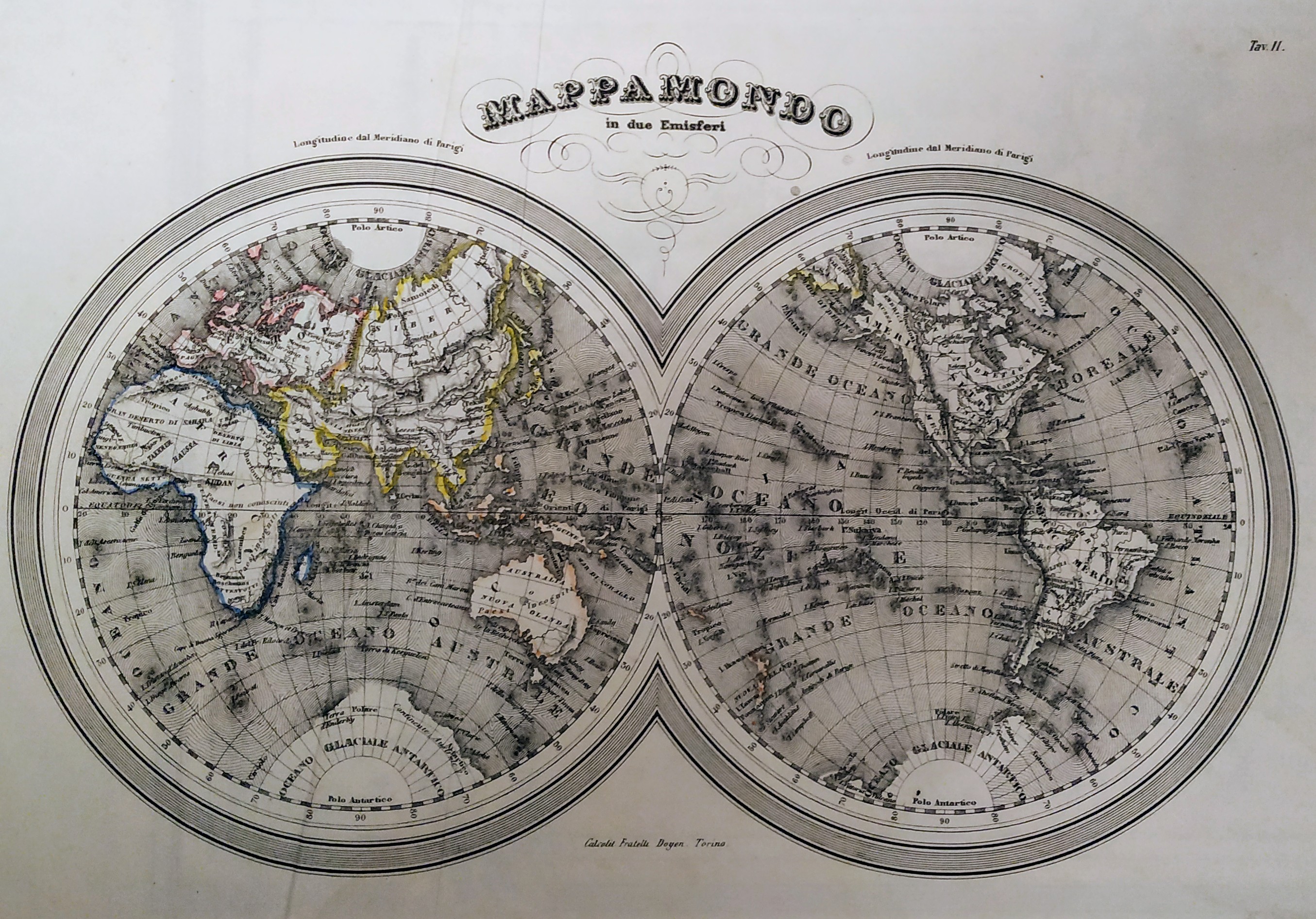
Map title
Mappamondo in due emisferi
Author
Unknown
Location shown in map
World
Edition date
Circa 1850
Edition place
Torino
Editor
F.lli Doyen
Atlas
--
Price
Please ask: info@thetreasuremaps.com
State
[mint/excellent/VERY GOOD/good/fair/mediocre/poor]
Color
Old colors
Verso
Blank
Size
Plate: cm (29 x 20) inches (11.42 x 7.87) Paper: cm (35 x 28) inches (13.78 x 11.02)
Technique
Steel engraving
Note
No particular notes for this maps.
Reference
Wiki
Here for more info
In stock
Available
Info
info@thetreasuremaps.com
Code
#0708
×
![]()
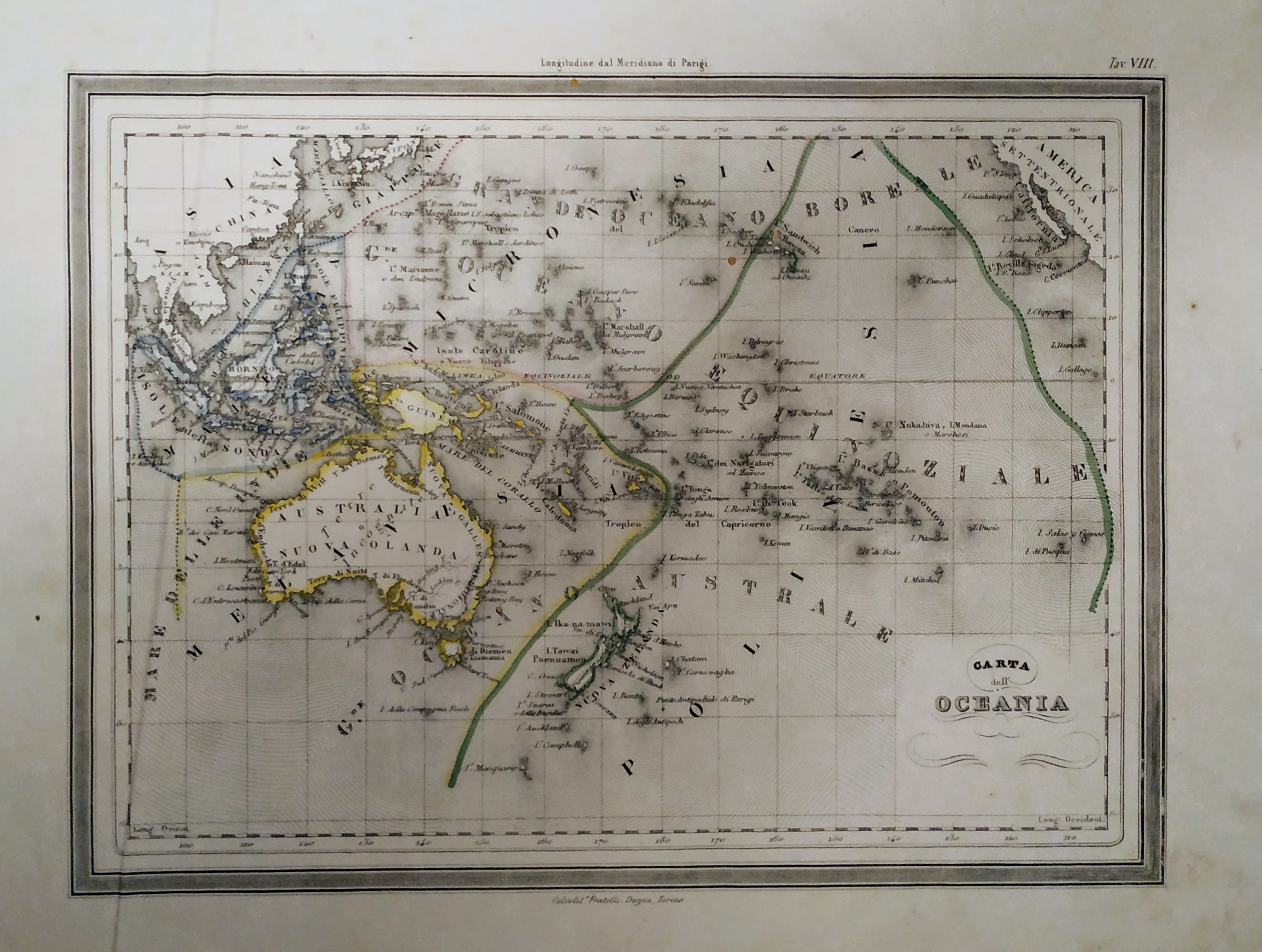
Map title
Carta dell'Oceania
Author
Unknown
Location shown in map
Oceania
Edition date
Circa 1850
Edition place
Torino
Editor
F.lli Doyen
Atlas
--
Price
75 Euro
State
[mint/excellent/VERY GOOD/good/fair/mediocre/poor]
Color
Old colors
Verso
Blank
Size
Plate: cm (29 x 21) inches (11.42 x 8.27) Paper: cm (37 x 29) inches (14.57 x 11.42)
Technique
Steel engraving
Note
No particular notes for this maps.
Reference
Wiki
Here for more info
In stock
Available
Info
info@thetreasuremaps.com
Code
#0707
×
![]()
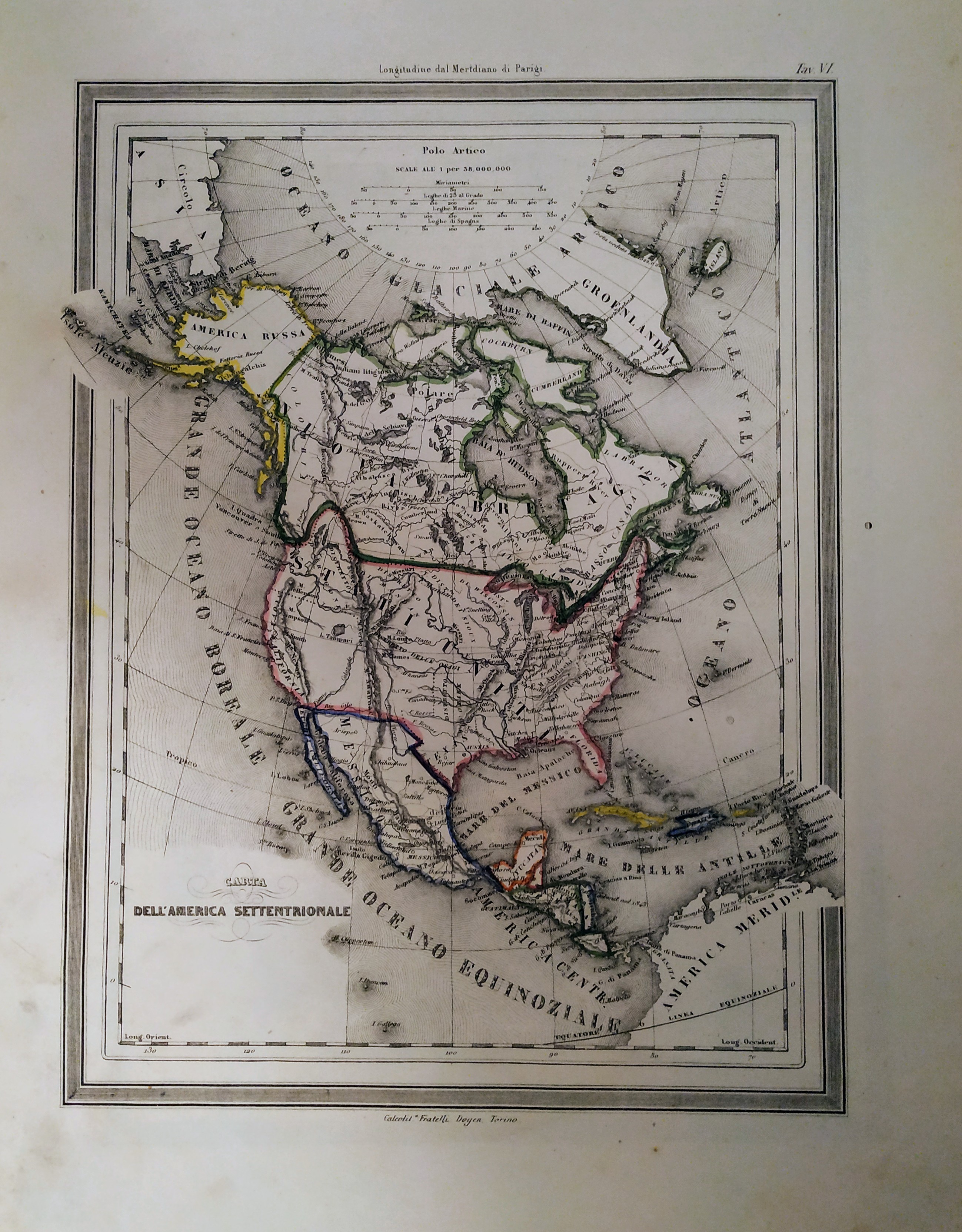
Map title
Cara dell'America settentrionale
Author
Unknown
Location shown in map
North America
Edition date
Circa 1850
Edition place
Torino
Editor
F.lli Doyen
Atlas
--
Price
75 Euro
State
[mint/excellent/VERY GOOD/good/fair/mediocre/poor]
Color
Old colors
Verso
Blank
Size
Plate: cm (22 x 19) inches (8.66 x 7.48) Paper: cm (28 x 38) inches (11.02 x 14.96)
Technique
Steel engraving
Note
No particular notes for this maps.
Reference
Wiki
Here for more info
In stock
Available
Info
info@thetreasuremaps.com
Code
#0706
×
![]()
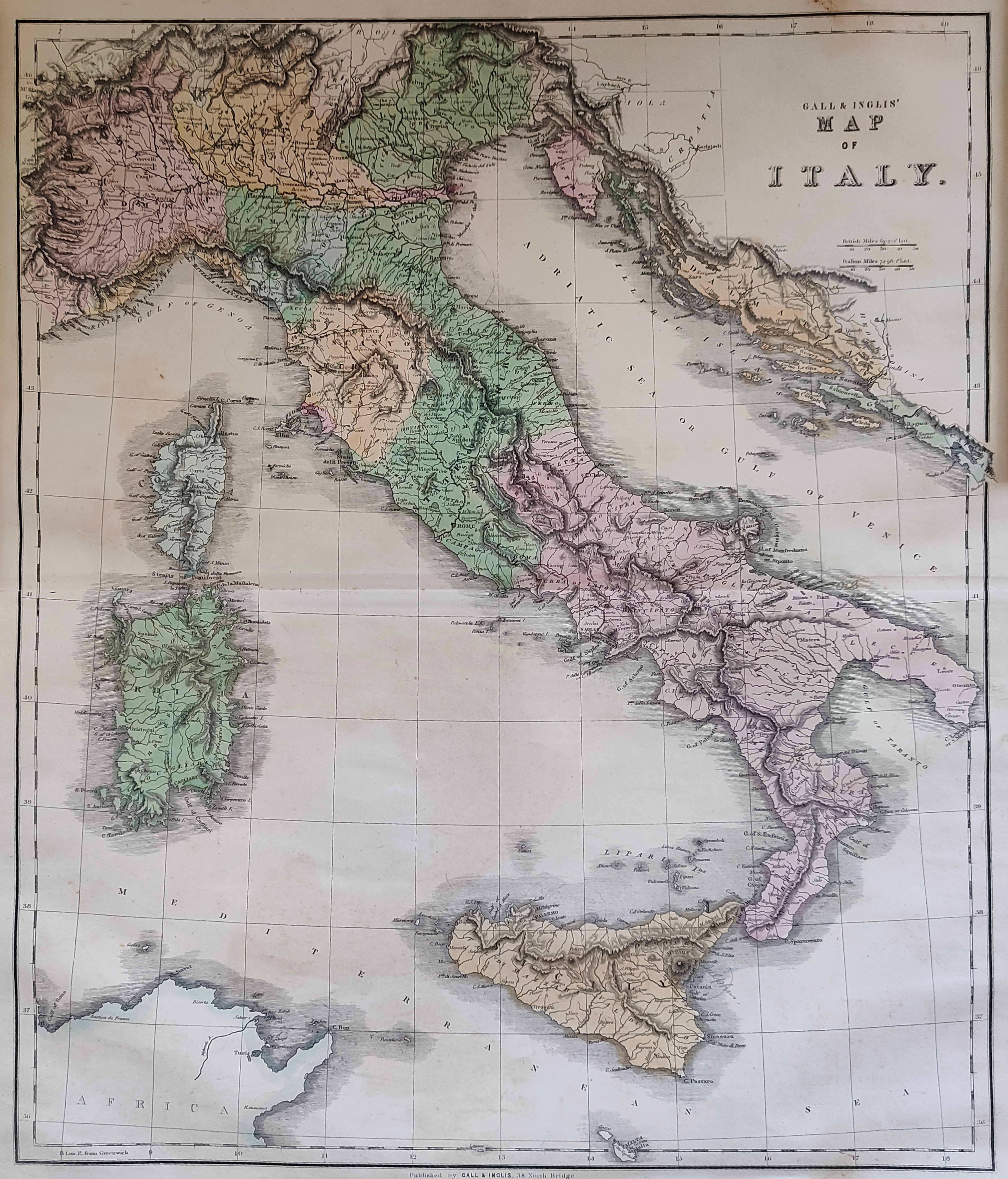
Map title
Map of Italy
Author
Gall and Inglis
Location shown in map
Italy
Edition date
Circa 1850
Edition place
Edinburgh
Editor
Atlas
Price
200 Euro
State
[mint/EXCELLENT/very good/good/fair/mediocre/poor]
Color
Old colors
Verso
Blank
Size
Plate: cm (64 x 54) inches (25.2 x 21.26) Paper: cm (57 x 47) inches (22.44 x 18.5)
Technique
Steel engraving
Note
Reference
Wiki
Here for more info
In stock
Available
Info
info@thetreasuremaps.com
Code
#0927
×
![]()
Map title
Carte de l'Oceanie
Author
J. Andriveau-Goujon
Location shown in map
Oceania
Edition date
1850
Edition place
Paris
Editor
Goujon
Atlas
Atlas Classique et Universel de Geographie
Price
125 Euro
State
[mint/EXCELLENT/very good/good/fair/mediocre/poor]
Color
Old colors
Verso
Blank
Size
Plate: cm (50 x 38) inches (19.69 x 14.96) Paper: cm (66 x 52) inches (25.98 x 20.47)
Technique
Steel engraving
Note
Reference
Wiki
Here for more info
In stock
Available
Info
info@thetreasuremaps.com
Code
#1124
×
![]()
Map title
Sardinia, Piedmont, Savoy
Author
Dower
Location shown in map
Liguria
Edition date
Circa 1850
Edition place
London
Editor
Atlas
Weekly dispatch atlas
Price
100 Euro
State
[mint/EXCELLENT/very good/good/fair/mediocre/poor]
Color
Old colors
Verso
Blank
Size
Plate: cm (43 x 31) inches (16.93 x 12.2) Paper: cm (49 x 33) inches (19.29 x 12.99)
Technique
Steel engraving
Note
No particular notes for this maps.
Reference
Wiki
Here for more info
In stock
Available
Info
info@thetreasuremaps.com
Code
#1125
×
![]()
Map title
Oceania
Author
Dufour
Location shown in map
Oceania
Edition date
Circa 1850
Edition place
Paris
Editor
Atlas
Atlas Populair
Price
100 Euro
State
[mint/EXCELLENT/very good/good/fair/mediocre/poor]
Color
Old colors
Verso
Blank
Size
Plate: cm (39 x 24) inches (15.35 x 9.45) Paper: cm (43 x 27) inches (16.93 x 10.63)
Technique
Steel engraving
Note
Reference
Wiki
Here for more info
In stock
Available
Info
info@thetreasuremaps.com
Code
#1144
Oceania
Author
Dufour
Location shown in map
Oceania
Edition date
Circa 1850
Edition place
Paris
Editor
Atlas
Atlas Populair
Price
100 Euro
State
[mint/EXCELLENT/very good/good/fair/mediocre/poor]
Color
Old colors
Verso
Blank
Size
Plate: cm (39 x 24) inches (15.35 x 9.45) Paper: cm (43 x 27) inches (16.93 x 10.63)
Technique
Steel engraving
Note
Reference
Wiki
Here for more info
In stock
Available
Info
info@thetreasuremaps.com
Code
#1144
×
![]()
Map title
Italy North Part
Author
Adam Black
Location shown in map
North Italy
Edition date
Circa 1851
Edition place
Edimburgh
Editor
Atlas
Black's general atlas
Price
50 Euro
State
[mint/EXCELLENT/very good/good/fair/mediocre/poor]
Color
Old colors
Verso
Blank
Size
Plate: cm (0 x 0) inches (0 x 0) Paper: cm (0 x 0) inches (0 x 0)
Technique
Steel engraving
Note
Reference
Wiki
Here for more info
In stock
Available
Info
info@thetreasuremaps.com
Code
#0822
×
![]()
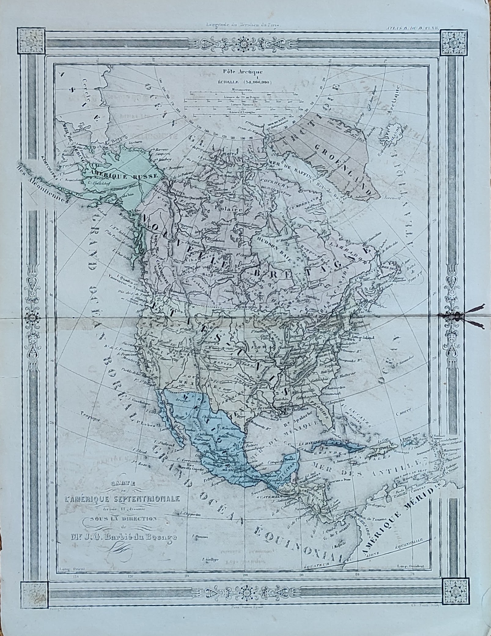
Map title
Carte de l'Amerique Septentrionale
Author
Barbie
Location shown in map
North America
Edition date
Circa 1852
Edition place
Paris
Editor
Atlas
Price
75 Euro
State
[mint/excellent/VERY GOOD/good/fair/mediocre/poor]
Color
Old colors
Verso
Blank
Size
Plate: cm (23 x 30) inches (9.06 x 11.81) Paper: cm (25 x 35) inches (9.84 x 13.78)
Technique
Copper engraving
Note
Reference
Wiki
Here for more info
In stock
Available
Info
info@thetreasuremaps.com
Code
#1039
×
![]()
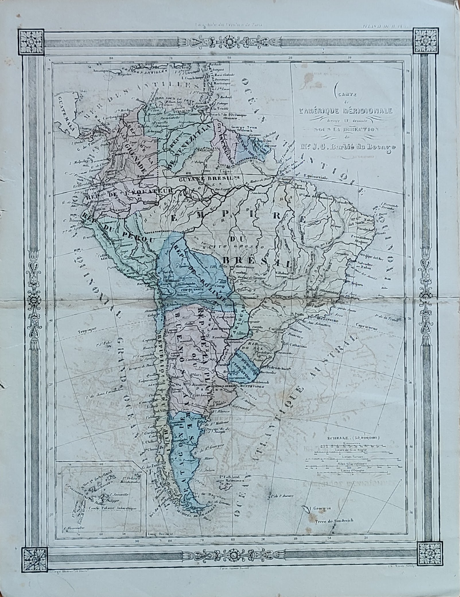
Map title
Carte de l'Amerique Meridionale
Author
Barbie
Location shown in map
South America
Edition date
Circa 1852
Edition place
Paris
Editor
Atlas
Price
75 Euro
State
[mint/excellent/VERY GOOD/good/fair/mediocre/poor]
Color
Old colors
Verso
Blank
Size
Plate: cm (23 x 30) inches (9.06 x 11.81) Paper: cm (25 x 35) inches (9.84 x 13.78)
Technique
Copper engraving
Note
Reference
Wiki
Here for more info
In stock
Available
Info
info@thetreasuremaps.com
Code
#1040
×
![]()
Map title
Amerique Septentrionale
Author
Unknown
Location shown in map
North America
Edition date
1853
Edition place
Paris
Editor
--
Atlas
--
Price
Please ask: info@thetreasuremaps.com
State
[mint/excellent/VERY GOOD/good/fair/mediocre/poor]
Color
Outlined
Verso
Blank
Size
Plate: cm (29.2 x 21.6) inches (11.5 x 8.5) Paper: cm (29.2 x 21.6) inches (11.5 x 8.5)
Technique
--
Note
No particular notes for this maps
Reference
--
Wiki
Here for more info
In stock
Sold
Info
info@thetreasuremaps.com
Code
#0474
×
![]()
Map title
Carta generale dell'America Settentrionale
Author
Maggi
Location shown in map
USA
Edition date
1854
Edition place
Torino
Editor
--
Atlas
--
Price
Please ask: info@thetreasuremaps.com
State
[mint/excellent/VERY GOOD/good/fair/mediocre/poor]
Color
Old outlined
Verso
Blank
Size
Plate: cm (35.6 x 45.7) inches (14.02 x 17.99) Paper: cm (40.6 x 55.9) inches (15.98 x 22.01)
Technique
Copper engraving
Note
--
Reference
--
Wiki
Here for more info
In stock
Sold
Info
info@thetreasuremaps.com
Code
#0088
×
![]()
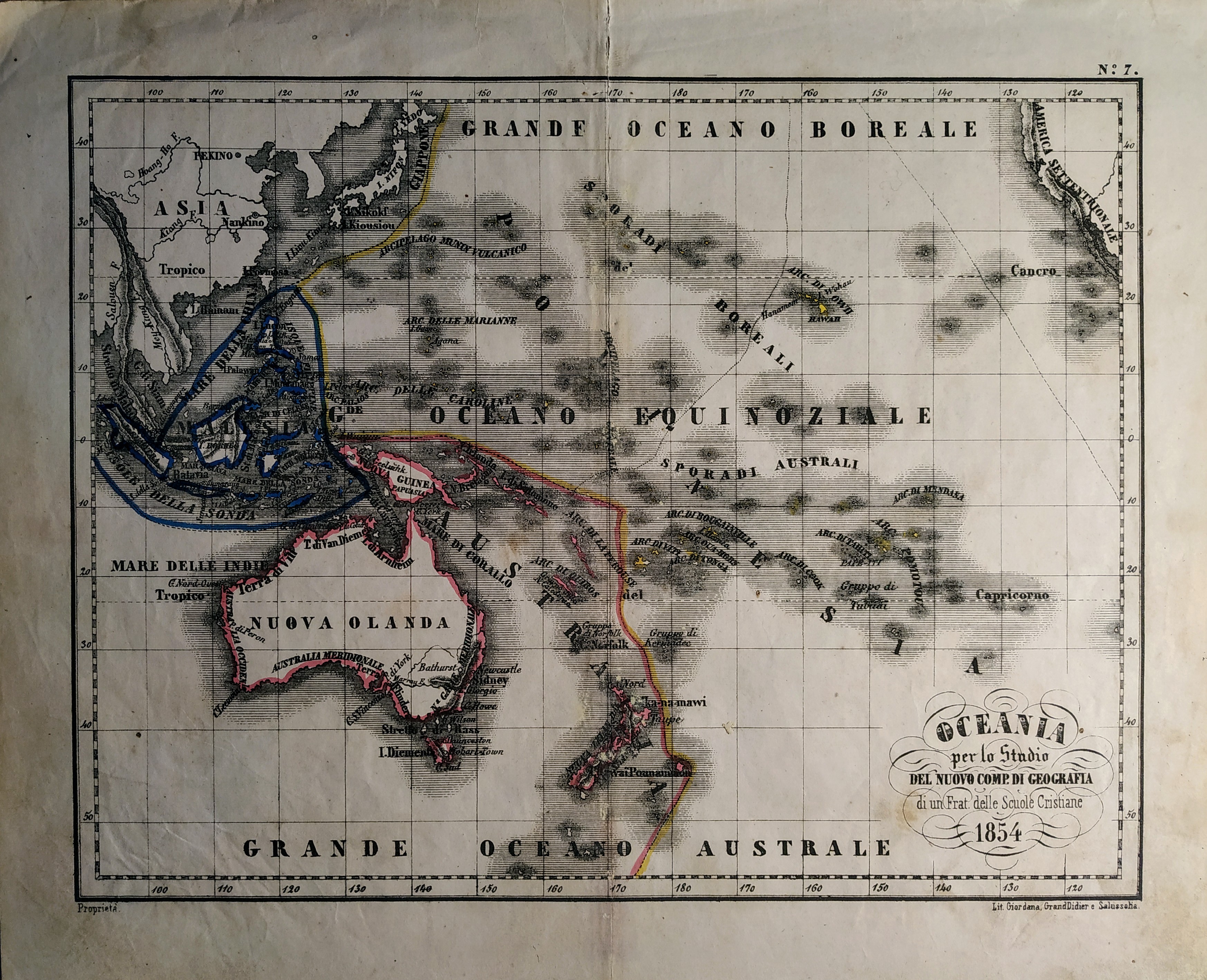
Map title
Oceania
Author
Unknown
Location shown in map
Oceania
Edition date
1854
Edition place
Torino
Editor
Unione tipografico editrice
Atlas
Atlente geografico per lo studio del nuovo compendio di geografia di un Frat. delle scuole cristiane
Price
50 Euro
State
[mint/excellent/VERY GOOD/good/fair/mediocre/poor]
Color
Old colors
Verso
Blank
Size
Plate: cm (27 x 21) inches (10.63 x 8.27) Paper: cm (32 x 25) inches (12.6 x 9.84)
Technique
Steel engraving
Note
No particular notes for this maps.
Reference
Wiki
Here for more info
In stock
Available
Info
info@thetreasuremaps.com
Code
#0710
Oceania
Author
Unknown
Location shown in map
Oceania
Edition date
1854
Edition place
Torino
Editor
Unione tipografico editrice
Atlas
Atlente geografico per lo studio del nuovo compendio di geografia di un Frat. delle scuole cristiane
Price
50 Euro
State
[mint/excellent/VERY GOOD/good/fair/mediocre/poor]
Color
Old colors
Verso
Blank
Size
Plate: cm (27 x 21) inches (10.63 x 8.27) Paper: cm (32 x 25) inches (12.6 x 9.84)
Technique
Steel engraving
Note
No particular notes for this maps.
Reference
Wiki
Here for more info
In stock
Available
Info
info@thetreasuremaps.com
Code
#0710
×
![]()
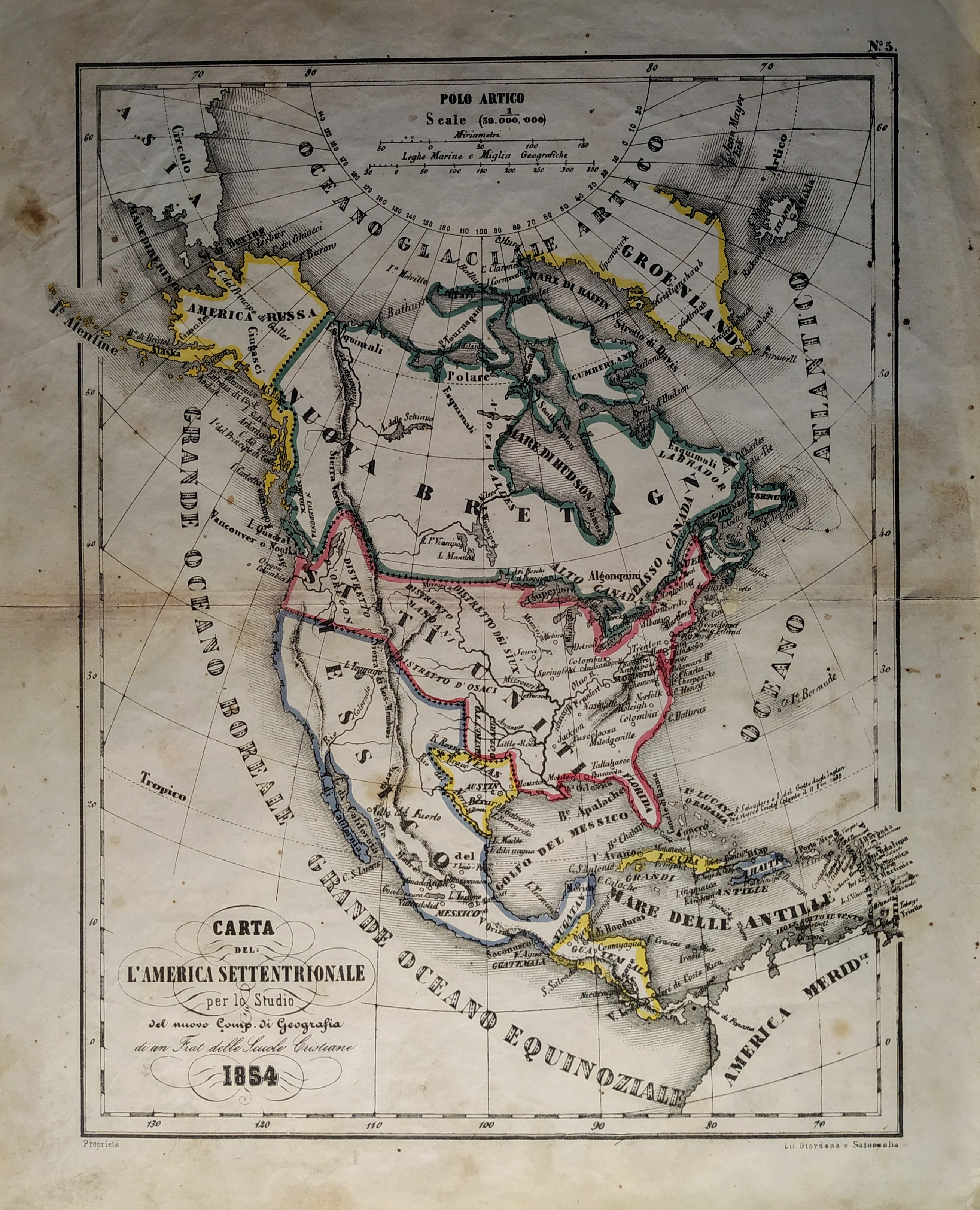
Map title
Carta dell'America settentrionale
Author
Unknown
Location shown in map
North America
Edition date
1854
Edition place
Torino
Editor
Unione tipografico editrice
Atlas
Atlente geografico per lo studio del nuovo compendio di geografia di un Frat. delle scuole cristiane
Price
150 Euro
State
[mint/excellent/VERY GOOD/good/fair/mediocre/poor]
Color
Old colors
Verso
Blank
Size
Plate: cm (21 x 27) inches (8.27 x 10.63) Paper: cm (26 x 32) inches (10.24 x 12.6)
Technique
Steel engraving
Note
Texas as indipendent repubblic
Reference
Wiki
Here for more info
In stock
Available
Info
info@thetreasuremaps.com
Code
#0709
×
![]()
Map title
Carta postale itineraria amministrativa
Author
Allodi
Location shown in map
North Italy
Edition date
1855
Edition place
Milano
Editor
Vallardi
Atlas
Price
Please ask: info@thetreasuremaps.com
State
[mint/excellent/VERY GOOD/good/fair/mediocre/poor]
Color
Old colors
Verso
Blank
Size
Plate: cm (0 x 0) inches (0 x 0) Paper: cm (0 x 0) inches (0 x 0)
Technique
Copper engraving
Note
Reference
Wiki
Here for more info
In stock
Available
Info
info@thetreasuremaps.com
Code
#0988
×
![]()
Map title
Italie
Author
Dufour
Location shown in map
Italy
Edition date
Circa 1855
Edition place
Paris
Editor
Atlas
Atlas Populair
Price
100 Euro
State
[mint/EXCELLENT/very good/good/fair/mediocre/poor]
Color
Old colors
Verso
Blank
Size
Plate: cm (28 x 36) inches (11.02 x 14.17) Paper: cm (24.5 x 32) inches (9.65 x 12.6)
Technique
Steel engraving
Note
Reference
Wiki
Here for more info
In stock
Available
Info
info@thetreasuremaps.com
Code
#1129
×
![]()
Map title
Nouvelle Hollande ou Australie
Author
Dufour
Location shown in map
Oceania
Edition date
Circa 1855
Edition place
Paris
Editor
Atlas
Atlas Populair
Price
75 Euro
State
[mint/EXCELLENT/very good/good/fair/mediocre/poor]
Color
Old colors
Verso
Blank
Size
Plate: cm (32 x 25) inches (12.6 x 9.84) Paper: cm (35 x 28) inches (13.78 x 11.02)
Technique
Steel engraving
Note
Reference
Wiki
Here for more info
In stock
Available
Info
info@thetreasuremaps.com
Code
#1130
×
![]()
Map title
Mappemonde
Author
Dufour
Location shown in map
World
Edition date
Circa 1855
Edition place
Paris
Editor
Atlas
Atlas Populair
Price
125 Euro
State
[mint/EXCELLENT/very good/good/fair/mediocre/poor]
Color
Old colors
Verso
Blank
Size
Plate: cm (56 x 38) inches (22.05 x 14.96) Paper: cm (56 x 38) inches (22.05 x 14.96)
Technique
Steel engraving
Note
Reference
Wiki
Here for more info
In stock
Available
Info
info@thetreasuremaps.com
Code
#1134
×
![]()
Map title
America Settentrionale
Author
Allodi
Location shown in map
North America
Edition date
1857
Edition place
Milan
Editor
Pagnoni Marghieri
Atlas
Geografia storica moderna universale
Price
50 Euro
State
[mint/EXCELLENT/very good/good/fair/mediocre/poor]
Color
Old colors
Verso
Blank
Size
Plate: cm (15 x 21) inches (5.91 x 8.27) Paper: cm (17 x 25) inches (6.69 x 9.84)
Technique
Steel engraving
Note
No particular notes for this maps
Reference
--
Wiki
Here for more info
In stock
Available
Info
info@thetreasuremaps.com
Code
#0644
×
![]()
Map title
La polinesia francese
Author
Unknown
Location shown in map
South America
Edition date
1858
Edition place
Genoa
Editor
--
Atlas
Atlante di geografia universale. Paolo Rivara
Price
Please ask: info@thetreasuremaps.com
State
[mint/EXCELLENT/very good/good/fair/mediocre/poor]
Color
Old outlined
Verso
Blank
Size
Plate: cm (33 x 26.7) inches (12.99 x 10.51) Paper: cm (50.8 x 38.1) inches (20 x 15)
Technique
Steel engraving
Note
No particular notes for this maps
Reference
--
Wiki
Here for more info
In stock
Sold
Info
info@thetreasuremaps.com
Code
#0378
×
![]()
Map title
America Russa
Author
Unknown
Location shown in map
Alaska
Edition date
1858
Edition place
Genoa
Editor
--
Atlas
Atlante di geografia universale. Paolo Rivara
Price
Please ask: info@thetreasuremaps.com
State
[mint/EXCELLENT/very good/good/fair/mediocre/poor]
Color
Old outlined
Verso
Blank
Size
Plate: cm (33 x 26.7) inches (12.99 x 10.51) Paper: cm (50.8 x 38.1) inches (20 x 15)
Technique
Steel engraving
Note
No particular notes for this maps
Reference
--
Wiki
Here for more info
In stock
Sold
Info
info@thetreasuremaps.com
Code
#0385
×
![]()
Map title
Stati orientali della Unione Americana
Author
Unknown
Location shown in map
East USA
Edition date
1858
Edition place
Genoa
Editor
--
Atlas
Atlante di geografia universale. Paolo Rivara
Price
Please ask: info@thetreasuremaps.com
State
[mint/EXCELLENT/very good/good/fair/mediocre/poor]
Color
Old outlined
Verso
Blank
Size
Plate: cm (33 x 27.9) inches (12.99 x 10.98) Paper: cm (50.8 x 38.1) inches (20 x 15)
Technique
Steel engraving
Note
No particular notes for this maps
Reference
--
Wiki
Here for more info
In stock
Sold
Info
info@thetreasuremaps.com
Code
#0386
×
![]()
Map title
Stati e territori occidentali della Unione Americana.
Author
Unknown
Location shown in map
West USA
Edition date
1858
Edition place
Genoa
Editor
--
Atlas
Atlante di geografia universale. Paolo Rivara
Price
Please ask: info@thetreasuremaps.com
State
[mint/EXCELLENT/very good/good/fair/mediocre/poor]
Color
Old outlined
Verso
Blank
Size
Plate: cm (26.7 x 33) inches (10.51 x 12.99) Paper: cm (38.1 x 50.8) inches (15 x 20)
Technique
Steel engraving
Note
No particular notes for this maps
Reference
--
Wiki
Here for more info
In stock
Sold
Info
info@thetreasuremaps.com
Code
#0414
×
![]()
Map title
Egitto
Author
Unknown
Location shown in map
Egypt
Edition date
1858
Edition place
Genoa
Editor
--
Atlas
Atlante di geografia universale. Paolo Rivara
Price
Please ask: info@thetreasuremaps.com
State
[mint/EXCELLENT/very good/good/fair/mediocre/poor]
Color
Old outlined
Verso
Blank
Size
Plate: cm (33 x 26.7) inches (12.99 x 10.51) Paper: cm (50.8 x 38.1) inches (20 x 15)
Technique
Steel engraving
Note
No particular notes for this maps
Reference
--
Wiki
Here for more info
In stock
Sold
Info
info@thetreasuremaps.com
Code
#0453
×
![]()
Map title
Africa mappa d'insieme
Author
Unknown
Location shown in map
Africa
Edition date
1858
Edition place
Genoa
Editor
--
Atlas
Atlante di geografia universale. Paolo Rivara
Price
Please ask: info@thetreasuremaps.com
State
[mint/EXCELLENT/very good/good/fair/mediocre/poor]
Color
Old outlined
Verso
Blank
Size
Plate: cm (33 x 26.7) inches (12.99 x 10.51) Paper: cm (50.8 x 38.1) inches (20 x 15)
Technique
Steel engraving
Note
No particular notes for this maps
Reference
--
Wiki
Here for more info
In stock
Sold
Info
info@thetreasuremaps.com
Code
#0455
×
![]()
Map title
Distribuzione geografica delle piante coltivate che forniscono i principali mezzi di nutrimento
Author
Unknown
Location shown in map
World
Edition date
1858
Edition place
Genoa
Editor
--
Atlas
Atlante di geografia universale. Paolo Rivara
Price
Please ask: info@thetreasuremaps.com
State
[mint/EXCELLENT/very good/good/fair/mediocre/poor]
Color
Old outlined
Verso
Blank
Size
Plate: cm (34.3 x 27.9) inches (13.5 x 10.98) Paper: cm (50.8 x 38.1) inches (20 x 15)
Technique
Steel engraving
Note
No particular notes for this maps
Reference
--
Wiki
Here for more info
In stock
Sold
Info
info@thetreasuremaps.com
Code
#0457
×
![]()
Map title
Le terre magellaniche e le Antartiche.
Author
Unknown
Location shown in map
South part of south America
Edition date
1858
Edition place
Genoa
Editor
--
Atlas
Atlante di geografia universale. Paolo Rivara
Price
Please ask: info@thetreasuremaps.com
State
[mint/EXCELLENT/very good/good/fair/mediocre/poor]
Color
Old outlined
Verso
Blank
Size
Plate: cm (26.7 x 33) inches (10.51 x 12.99) Paper: cm (50.8 x 38.1) inches (20 x 15)
Technique
Steel engraving
Note
No particular notes for this maps
Reference
--
Wiki
Here for more info
In stock
Sold
Info
info@thetreasuremaps.com
Code
#0467
×
![]()
Map title
Nuovo mondo parte meridionale
Author
Unknown
Location shown in map
South America
Edition date
1858
Edition place
Genoa
Editor
--
Atlas
Atlante di geografia universale. Paolo Rivara
Price
Please ask: info@thetreasuremaps.com
State
[mint/EXCELLENT/very good/good/fair/mediocre/poor]
Color
Old outlined
Verso
Blank
Size
Plate: cm (33 x 26.7) inches (12.99 x 10.51) Paper: cm (50.8 x 38.1) inches (20 x 15)
Technique
Steel engraving
Note
No particular notes for this maps
Reference
--
Wiki
Here for more info
In stock
Sold
Info
info@thetreasuremaps.com
Code
#0468
×
![]()
Map title
Mari e Arcipelaghi polari artici della baia d'Hudson
Author
Unknown
Location shown in map
North Canada
Edition date
1858
Edition place
Genoa
Editor
--
Atlas
Atlante di geografia universale. Paolo Rivara
Price
Please ask: info@thetreasuremaps.com
State
[mint/EXCELLENT/very good/good/fair/mediocre/poor]
Color
Old outlined
Verso
Blank
Size
Plate: cm (33 x 26.7) inches (12.99 x 10.51) Paper: cm (50.8 x 38.1) inches (20 x 15)
Technique
Steel engraving
Note
No particular notes for this maps
Reference
--
Wiki
Here for more info
In stock
Sold
Info
info@thetreasuremaps.com
Code
#0475
×
![]()
Map title
La Cina propriamente detta e sue isole
Author
Unknown
Location shown in map
China
Edition date
1858
Edition place
Genoa
Editor
--
Atlas
Atlante di geografia universale. Paolo Rivara
Price
Please ask: info@thetreasuremaps.com
State
[mint/EXCELLENT/very good/good/fair/mediocre/poor]
Color
Old outlined
Verso
Blank
Size
Plate: cm (32.4 x 26.7) inches (12.76 x 10.51) Paper: cm (50.8 x 38.1) inches (20 x 15)
Technique
Steel engraving
Note
No particular notes for this maps
Reference
--
Wiki
Here for more info
In stock
Sold
Info
info@thetreasuremaps.com
Code
#0483
×
![]()
Map title
Siberia occidentale
Author
Unknown
Location shown in map
East Russia
Edition date
1858
Edition place
Genoa
Editor
--
Atlas
Atlante di geografia universale. Paolo Rivara
Price
Please ask: info@thetreasuremaps.com
State
[mint/EXCELLENT/very good/good/fair/mediocre/poor]
Color
Old outlined
Verso
Blank
Size
Plate: cm (32.4 x 26.7) inches (12.76 x 10.51) Paper: cm (50.8 x 38.1) inches (20 x 15)
Technique
Steel engraving
Note
No particular notes for this maps
Reference
--
Wiki
Here for more info
In stock
Sold
Info
info@thetreasuremaps.com
Code
#0484
×
![]()
Map title
Africa Australe e capo di buona Speranza
Author
Unknown
Location shown in map
South Africa
Edition date
1858
Edition place
Genoa
Editor
--
Atlas
Atlante di geografia universale. Paolo Rivara
Price
Please ask: info@thetreasuremaps.com
State
[mint/EXCELLENT/very good/good/fair/mediocre/poor]
Color
Old outlined
Verso
Blank
Size
Plate: cm (33 x 26.7) inches (12.99 x 10.51) Paper: cm (50.8 x 38.1) inches (20 x 15)
Technique
Steel engraving
Note
No particular notes for this maps
Reference
--
Wiki
Here for more info
In stock
Sold
Info
info@thetreasuremaps.com
Code
#0489
×
![]()
Map title
Le vie ferrate e le postali dell'Inghilterra
Author
Unknown
Location shown in map
South England
Edition date
1858
Edition place
Genoa
Editor
--
Atlas
Atlante di geografia universale. Paolo Rivara
Price
Please ask: info@thetreasuremaps.com
State
[mint/EXCELLENT/very good/good/fair/mediocre/poor]
Color
Old outlined
Verso
Blank
Size
Plate: cm (33 x 26.7) inches (12.99 x 10.51) Paper: cm (50.8 x 38.1) inches (20 x 15)
Technique
Steel engraving
Note
No particular notes for this maps
Reference
--
Wiki
Here for more info
In stock
Sold
Info
info@thetreasuremaps.com
Code
#0492
×
![]()
Map title
Mar Baltico sue isole e paesi circostanti
Author
Unknown
Location shown in map
Baltic sea
Edition date
1858
Edition place
Genoa
Editor
--
Atlas
Atlante di geografia universale. Paolo Rivara
Price
Please ask: info@thetreasuremaps.com
State
[mint/EXCELLENT/very good/good/fair/mediocre/poor]
Color
Old outlined
Verso
Blank
Size
Plate: cm (33 x 26.7) inches (12.99 x 10.51) Paper: cm (50.8 x 38.1) inches (20 x 15)
Technique
Steel engraving
Note
No particular notes for this maps
Reference
--
Wiki
Here for more info
In stock
Sold
Info
info@thetreasuremaps.com
Code
#0493
×
![]()
Map title
Le vie ferrate e le postali della Francia meridionale
Author
Unknown
Location shown in map
South France
Edition date
1858
Edition place
Genoa
Editor
--
Atlas
Atlante di geografia universale. Paolo Rivara
Price
Please ask: info@thetreasuremaps.com
State
[mint/EXCELLENT/very good/good/fair/mediocre/poor]
Color
Old outlined
Verso
Blank
Size
Plate: cm (33 x 26.7) inches (12.99 x 10.51) Paper: cm (50.8 x 38.1) inches (20 x 15)
Technique
Steel engraving
Note
No particular notes for this maps
Reference
--
Wiki
Here for more info
In stock
Sold
Info
info@thetreasuremaps.com
Code
#0494
×
![]()
Map title
Le vie ferrate e le postali della Germania centrale e meridionale
Author
Unknown
Location shown in map
South Germany
Edition date
1858
Edition place
Genoa
Editor
--
Atlas
Atlante di geografia universale. Paolo Rivara
Price
Please ask: info@thetreasuremaps.com
State
[mint/EXCELLENT/very good/good/fair/mediocre/poor]
Color
Old outlined
Verso
Blank
Size
Plate: cm (33 x 26.7) inches (12.99 x 10.51) Paper: cm (50.8 x 38.1) inches (20 x 15)
Technique
Steel engraving
Note
No particular notes for this maps
Reference
--
Wiki
Here for more info
In stock
Sold
Info
info@thetreasuremaps.com
Code
#0495
×
![]()
Map title
Le vie ferrate e le postali della Francia settentrionale e della Belgica
Author
Unknown
Location shown in map
North France
Edition date
1858
Edition place
Genoa
Editor
--
Atlas
Atlante di geografia universale. Paolo Rivara
Price
Please ask: info@thetreasuremaps.com
State
[mint/EXCELLENT/very good/good/fair/mediocre/poor]
Color
Old outlined
Verso
Blank
Size
Plate: cm (33 x 26.7) inches (12.99 x 10.51) Paper: cm (50.8 x 38.1) inches (20 x 15)
Technique
Steel engraving
Note
No particular notes for this maps
Reference
--
Wiki
Here for more info
In stock
Sold
Info
info@thetreasuremaps.com
Code
#0496
×
![]()
Map title
Le vie ferrate e le postali della Germania orientale
Author
Unknown
Location shown in map
East Germany
Edition date
1858
Edition place
Genoa
Editor
--
Atlas
Atlante di geografia universale. Paolo Rivara
Price
Please ask: info@thetreasuremaps.com
State
[mint/EXCELLENT/very good/good/fair/mediocre/poor]
Color
Old outlined
Verso
Blank
Size
Plate: cm (33 x 26.7) inches (12.99 x 10.51) Paper: cm (50.8 x 38.1) inches (20 x 15)
Technique
Steel engraving
Note
No particular notes for this maps
Reference
--
Wiki
Here for more info
In stock
Sold
Info
info@thetreasuremaps.com
Code
#0497
×
![]()
Map title
Confederazione Messicana
Author
Unknown
Location shown in map
--
Edition date
1859
Edition place
Genoa
Editor
--
Atlas
Atlante di geografia universale. Paolo Rivara
Price
Please ask: info@thetreasuremaps.com
State
[mint/EXCELLENT/very good/good/fair/mediocre/poor]
Color
Old outlined
Verso
Blank
Size
Plate: cm (33 x 26.7) inches (12.99 x 10.51) Paper: cm (50.8 x 38.1) inches (20 x 15)
Technique
--
Note
No particular notes for this maps
Reference
--
Wiki
Here for more info
In stock
Sold
Info
info@thetreasuremaps.com
Code
#0481
×
![]()
Map title
Nuova carta geografica statistica e postale dell'Italia
Author
Pozzi
Location shown in map
Italy
Edition date
1859
Edition place
Milan
Editor
Artaria
Atlas
Price
Please ask: info@thetreasuremaps.com
State
[mint/excellent/very good/good/FAIR/mediocre/poor]
Color
Old colors
Verso
Blank
Size
Plate: cm (61 x 81) inches (24.02 x 31.89) Paper: cm (61 x 81) inches (24.02 x 31.89)
Technique
Steel engraving
Note
Foldable map
Reference
Wiki
Here for more info
In stock
Available
Info
info@thetreasuremaps.com
Code
#0856
×
![]()
Map title
Map of Italy
Author
Ggall and Inglis
Location shown in map
Italy
Edition date
Circa 1859
Edition place
Edinburgh
Editor
Atlas
Price
200 Euro
State
[mint/EXCELLENT/very good/good/fair/mediocre/poor]
Color
Old colors
Verso
Blank
Size
Plate: cm (47 x 56) inches (18.5 x 22.05) Paper: cm (53 x 63) inches (20.87 x 24.8)
Technique
Steel engraving
Note
Reference
Wiki
Here for more info
In stock
Available
Info
info@thetreasuremaps.com
Code
#0928
×
![]()
Map title
Carte topographique du theatre de la guerre in Italie
Author
Location shown in map
Italy
Edition date
1859
Edition place
Paris
Editor
Andriveau-Goujon
Atlas
Price
Please ask: info@thetreasuremaps.com
State
[mint/EXCELLENT/very good/good/fair/mediocre/poor]
Color
Old colors
Verso
Blank
Size
Plate: cm (111 x 77) inches (43.7 x 30.31) Paper: cm (111 x 77) inches (43.7 x 30.31)
Technique
Steel engraving
Note
Reference
Wiki
Here for more info
In stock
Available
Info
info@thetreasuremaps.com
Code
#0956
×
![]()
Map title
Northern Italy the seat of war
Author
Location shown in map
North Italy
Edition date
1859
Edition place
London
Editor
Atlas
The illustrated London news
Price
150 Euro
State
[mint/EXCELLENT/very good/good/fair/mediocre/poor]
Color
Black/white
Verso
English text
Size
Plate: cm (0 x 0) inches (0 x 0) Paper: cm (0 x 0) inches (0 x 0)
Technique
Copper engraving
Note
Reference
Wiki
Here for more info
In stock
Available
Info
info@thetreasuremaps.com
Code
#0987
×
![]()
Map title
Carta geografica e postale del regno Lombardo Veneto
Author
Brenna
Location shown in map
North-East Italy
Edition date
1859
Edition place
Milano
Editor
Crivelli
Atlas
Price
500 Euro
State
[mint/EXCELLENT/very good/good/fair/mediocre/poor]
Color
Old colors
Verso
Blank
Size
Plate: cm (0 x 0) inches (0 x 0) Paper: cm (131 x 85) inches (51.57 x 33.46)
Technique
Copper engraving
Note
Reference
Wiki
Here for more info
In stock
Available
Info
info@thetreasuremaps.com
Code
#1092
×
![]()
Map title
Turchia europea Grecia e principati danubiani
Author
Unknown
Location shown in map
Geece
Edition date
Circa 1860
Edition place
Milano
Editor
Civelli
Atlas
Price
Please ask: info@thetreasuremaps.com
State
[mint/excellent/very good/good/fair/MEDIOCRE/poor]
Color
Old colors
Verso
Blank
Size
Plate: cm (30.5 x 40.6) inches (12.01 x 15.98) Paper: cm (30.5 x 40.6) inches (12.01 x 15.98)
Technique
Steel engraving
Note
No particular notes for this maps.
Reference
--
Wiki
Here for more info
In stock
Available
Info
info@thetreasuremaps.com
Code
#0576
×
![]()
Map title
Imperi cinese e giapponese
Author
Unknown
Location shown in map
China
Edition date
Circa 1860
Edition place
Milano
Editor
Civelli
Atlas
Price
Please ask: info@thetreasuremaps.com
State
[mint/excellent/very good/good/fair/MEDIOCRE/poor]
Color
Old colors
Verso
Blank
Size
Plate: cm (30.5 x 40.6) inches (12.01 x 15.98) Paper: cm (30.5 x 40.6) inches (12.01 x 15.98)
Technique
Steel engraving
Note
No particular notes for this maps.
Reference
--
Wiki
Here for more info
In stock
Available
Info
info@thetreasuremaps.com
Code
#0577
×
![]()
Map title
America Settentrionale
Author
Unknown
Location shown in map
North America
Edition date
1860
Edition place
Venice
Editor
--
Atlas
--
Price
Please ask: info@thetreasuremaps.com
State
[mint/excellent/very good/good/FAIR/mediocre/poor]
Color
Old outlined
Verso
Blank
Size
Plate: cm (24.1 x 19) inches (9.49 x 7.48) Paper: cm (24.1 x 19) inches (9.49 x 7.48)
Technique
Steel engraving
Note
No particular notes for this maps
Reference
--
Wiki
Here for more info
In stock
Sold
Info
info@thetreasuremaps.com
Code
#0476
×
![]()
Map title
Australia
Author
Capietti
Location shown in map
Australia
Edition date
1860
Edition place
Turin
Editor
Dalla societa l'unione tipografico
Atlas
Nuova enciclopedia popolare italiana
Price
100 Euro
State
[mint/EXCELLENT/very good/good/fair/mediocre/poor]
Color
Old color
Verso
Blank
Size
Plate: cm (37 x 25) inches (14.57 x 9.84) Paper: cm (42 x 28) inches (16.54 x 11.02)
Technique
Steel engraving
Note
No particular notes for this maps
Reference
--
Wiki
Here for more info
In stock
Available
Info
info@thetreasuremaps.com
Code
#0734
Australia
Author
Capietti
Location shown in map
Australia
Edition date
1860
Edition place
Turin
Editor
Dalla societa l'unione tipografico
Atlas
Nuova enciclopedia popolare italiana
Price
100 Euro
State
[mint/EXCELLENT/very good/good/fair/mediocre/poor]
Color
Old color
Verso
Blank
Size
Plate: cm (37 x 25) inches (14.57 x 9.84) Paper: cm (42 x 28) inches (16.54 x 11.02)
Technique
Steel engraving
Note
No particular notes for this maps
Reference
--
Wiki
Here for more info
In stock
Available
Info
info@thetreasuremaps.com
Code
#0734
×
![]()
Map title
Map of Italy and Switzerland
Author
Ettling
Location shown in map
Italy
Edition date
1860
Edition place
London
Editor
Atlas
Illustrated London News
Price
150 Euro
State
[mint/EXCELLENT/very good/good/fair/mediocre/poor]
Color
Old colors
Verso
Blank
Size
Plate: cm (48 x 68) inches (18.9 x 26.77) Paper: cm (58 x 83) inches (22.83 x 32.68)
Technique
Steel engraving
Note
Reference
Wiki
Here for more info
In stock
Available
Info
info@thetreasuremaps.com
Code
#0964
×
![]()
Map title
Carte de l'Oceanie
Author
Malte Brun
Location shown in map
Oceania
Edition date
Circa 1860
Edition place
Paris
Editor
Atlas
Geographie moderne
Price
100 Euro
State
[mint/EXCELLENT/very good/good/fair/mediocre/poor]
Color
Old colors
Verso
Blank
Size
Plate: cm (42 x 30) inches (16.54 x 11.81) Paper: cm (54 x 39) inches (21.26 x 15.35)
Technique
Steel engraving
Note
Reference
Wiki
Here for more info
In stock
Available
Info
info@thetreasuremaps.com
Code
#1132
×
![]()
Map title
America Meridionale
Author
Bonatti
Location shown in map
South America
Edition date
1861
Edition place
Italy
Editor
--
Atlas
Atlante
Price
Please ask: info@thetreasuremaps.com
State
[mint/EXCELLENT/very good/good/fair/mediocre/poor]
Color
Black/white
Verso
Blank
Size
Plate: cm (31.8 x 21) inches (12.52 x 8.27) Paper: cm (31.8 x 21) inches (12.52 x 8.27)
Technique
--
Note
No particular notes for this maps
Reference
--
Wiki
Here for more info
In stock
Sold
Info
info@thetreasuremaps.com
Code
#0463
×
![]()
Map title
America Settentrionale
Author
Unknown
Location shown in map
North America
Edition date
1861
Edition place
Milan
Editor
--
Atlas
--
Price
Please ask: info@thetreasuremaps.com
State
[mint/EXCELLENT/very good/good/fair/mediocre/poor]
Color
Black/white
Verso
Blank
Size
Plate: cm (25.4 x 36.8) inches (10 x 14.49) Paper: cm (25.4 x 36.8) inches (10 x 14.49)
Technique
Steel engraving
Note
No particular notes for this maps
Reference
--
Wiki
Here for more info
In stock
Sold
Info
info@thetreasuremaps.com
Code
#0477
×
![]()

Map title
Piano della rada Vado
Author
Santoni
Location shown in map
Savona-Vado
Edition date
1861
Edition place
Pisa
Editor
Atlas
Price
50 Euro
State
[mint/EXCELLENT/very good/good/fair/mediocre/poor]
Color
Black/white
Verso
Blank
Size
Plate: cm (22 x 16) inches (8.66 x 6.3) Paper: cm (28 x 19) inches (11.02 x 7.48)
Technique
Steel engraving
Note
Reference
Wiki
Here for more info
In stock
Available
Info
info@thetreasuremaps.com
Code
#1303
×
![]()
Map title
Mappamondo secondo la proiezione di Mercatore
Author
Capietti
Location shown in map
World
Edition date
1862
Edition place
Turin
Editor
Dalla societa l'unione tipografico
Atlas
Nuova enciclopedia popolare italiana
Price
50 Euro
State
[mint/EXCELLENT/very good/good/fair/mediocre/poor]
Color
Black/white
Verso
Blank
Size
Plate: cm (39 x 25) inches (15.35 x 9.84) Paper: cm (45 x 29) inches (17.72 x 11.42)
Technique
Steel engraving
Note
No particular notes for this maps
Reference
--
Wiki
Here for more info
In stock
Available
Info
info@thetreasuremaps.com
Code
#0725
×
![]()
Map title
Italy
Author
Johnson
Location shown in map
Italy
Edition date
1862
Edition place
NewYork
Editor
--
Atlas
New Family Atlas of the World.
Price
150 Euro
State
[mint/EXCELLENT/very good/good/fair/mediocre/poor]
Color
Old colors
Verso
Blank
Size
Plate: cm (61 x 39) inches (24.02 x 15.35) Paper: cm (69 x 46) inches (27.17 x 18.11)
Technique
Steel engraving
Note
Reference
Wiki
Here for more info
In stock
Available
Info
info@thetreasuremaps.com
Code
#0948
Italy
Author
Johnson
Location shown in map
Italy
Edition date
1862
Edition place
NewYork
Editor
--
Atlas
New Family Atlas of the World.
Price
150 Euro
State
[mint/EXCELLENT/very good/good/fair/mediocre/poor]
Color
Old colors
Verso
Blank
Size
Plate: cm (61 x 39) inches (24.02 x 15.35) Paper: cm (69 x 46) inches (27.17 x 18.11)
Technique
Steel engraving
Note
Reference
Wiki
Here for more info
In stock
Available
Info
info@thetreasuremaps.com
Code
#0948
×
![]()
Map title
Italy
Author
Johnson
Location shown in map
Italy
Edition date
1862
Edition place
NewYork
Editor
--
Atlas
New Family Atlas of the World.
Price
150 Euro
State
[mint/EXCELLENT/very good/good/fair/mediocre/poor]
Color
Old colors
Verso
Blank
Size
Plate: cm (61 x 39) inches (24.02 x 15.35) Paper: cm (69 x 46) inches (27.17 x 18.11)
Technique
Steel engraving
Note
Reference
Wiki
Here for more info
In stock
Available
Info
info@thetreasuremaps.com
Code
#0953
Italy
Author
Johnson
Location shown in map
Italy
Edition date
1862
Edition place
NewYork
Editor
--
Atlas
New Family Atlas of the World.
Price
150 Euro
State
[mint/EXCELLENT/very good/good/fair/mediocre/poor]
Color
Old colors
Verso
Blank
Size
Plate: cm (61 x 39) inches (24.02 x 15.35) Paper: cm (69 x 46) inches (27.17 x 18.11)
Technique
Steel engraving
Note
Reference
Wiki
Here for more info
In stock
Available
Info
info@thetreasuremaps.com
Code
#0953
×
![]()
Map title
Carta dell'Italia
Author
Location shown in map
Italy
Edition date
1862
Edition place
Turin
Editor
Direzione Generale delle poste Italiane
Atlas
Price
200 Euro
State
[mint/excellent/VERY GOOD/good/fair/mediocre/poor]
Color
Black/white
Verso
Blank
Size
Plate: cm (59 x 76) inches (23.23 x 29.92) Paper: cm (68 x 86) inches (26.77 x 33.86)
Technique
Steel engraving
Note
Reference
Wiki
Here for more info
In stock
Available
Info
info@thetreasuremaps.com
Code
#1296
×
![]()

Map title
Venetia, Kingdom of Italy
Author
Johnson
Location shown in map
Italy
Edition date
1863
Edition place
NewYork
Editor
--
Atlas
New Family Atlas of the World.
Price
200 Euro
State
[mint/EXCELLENT/very good/good/fair/mediocre/poor]
Color
Old colors
Verso
Blank
Size
Plate: cm (61 x 39) inches (24.02 x 15.35) Paper: cm (69 x 46) inches (27.17 x 18.11)
Technique
Steel engraving
Note
Reference
Wiki
Here for more info
In stock
Available
Info
info@thetreasuremaps.com
Code
#0957
×
![]()
Map title
Venetia, Kingdom of Italy
Author
Johnson
Location shown in map
Italy
Edition date
1863
Edition place
NewYork
Editor
--
Atlas
New Family Atlas of the World.
Price
200 Euro
State
[mint/EXCELLENT/very good/good/fair/mediocre/poor]
Color
Old colors
Verso
Blank
Size
Plate: cm (61 x 39) inches (24.02 x 15.35) Paper: cm (69 x 46) inches (27.17 x 18.11)
Technique
Steel engraving
Note
Reference
Wiki
Here for more info
In stock
Available
Info
info@thetreasuremaps.com
Code
#1230
×
![]()
Map title
Italie
Author
Dufour
Location shown in map
Italy
Edition date
Circa 1864
Edition place
Paris
Editor
Pilon
Atlas
Price
125 Euro
State
[mint/EXCELLENT/very good/good/fair/mediocre/poor]
Color
Old colors
Verso
Blank
Size
Plate: cm (55 x 75) inches (21.65 x 29.53) Paper: cm (60 x 83) inches (23.62 x 32.68)
Technique
Steel engraving
Note
Reference
Wiki
Here for more info
In stock
Available
Info
info@thetreasuremaps.com
Code
#0859
×
![]()
Map title
Italie
Author
Dufour
Location shown in map
Italy
Edition date
Circa 1864
Edition place
Paris
Editor
Pilon
Atlas
Price
125 Euro
State
[mint/EXCELLENT/very good/good/fair/mediocre/poor]
Color
Old colors
Verso
Blank
Size
Plate: cm (55 x 75) inches (21.65 x 29.53) Paper: cm (60 x 83) inches (23.62 x 32.68)
Technique
Steel engraving
Note
Reference
Wiki
Here for more info
In stock
Available
Info
info@thetreasuremaps.com
Code
#1147
×
![]()
Map title
Indie occidentali ed America centrale
Author
Location shown in map
Florida & Central America
Edition date
1865
Edition place
Milan
Editor
--
Atlas
Atlante geografico
Price
Please ask: info@thetreasuremaps.com
State
[mint/EXCELLENT/very good/good/fair/mediocre/poor]
Color
Old colors
Verso
Blank
Size
Plate: cm (0 x 0) inches (0 x 0) Paper: cm (0 x 0) inches (0 x 0)
Technique
Copper engraving
Note
No particular notes for this maps
Reference
--
Wiki
Here for more info
In stock
Sold
Info
info@thetreasuremaps.com
Code
#0383
×
![]()
Map title
Konigreich Italien
Author
Location shown in map
Italy
Edition date
Circa 1865
Edition place
Lexikon
Editor
Meyers Konversations
Atlas
Price
50 Euro
State
[mint/EXCELLENT/very good/good/fair/mediocre/poor]
Color
Old colors
Verso
Blank
Size
Plate: cm (22 x 27) inches (8.66 x 10.63) Paper: cm (23 x 29) inches (9.06 x 11.42)
Technique
Steel engraving
Note
Reference
Wiki
Here for more info
In stock
Available
Info
info@thetreasuremaps.com
Code
#1063
×
![]()
Map title
Carta d'Italia
Author
Kiepert
Location shown in map
Italy
Edition date
1866
Edition place
Berlin
Editor
Atlas
Price
50 Euro
State
[mint/EXCELLENT/very good/good/fair/mediocre/poor]
Color
Old color
Verso
Blank
Size
Plate: cm (34 x 42) inches (13.39 x 16.54) Paper: cm (37 x 44) inches (14.57 x 17.32)
Technique
Steel engraving
Note
Reference
Wiki
Here for more info
In stock
Available
Info
info@thetreasuremaps.com
Code
#0792
×
![]()
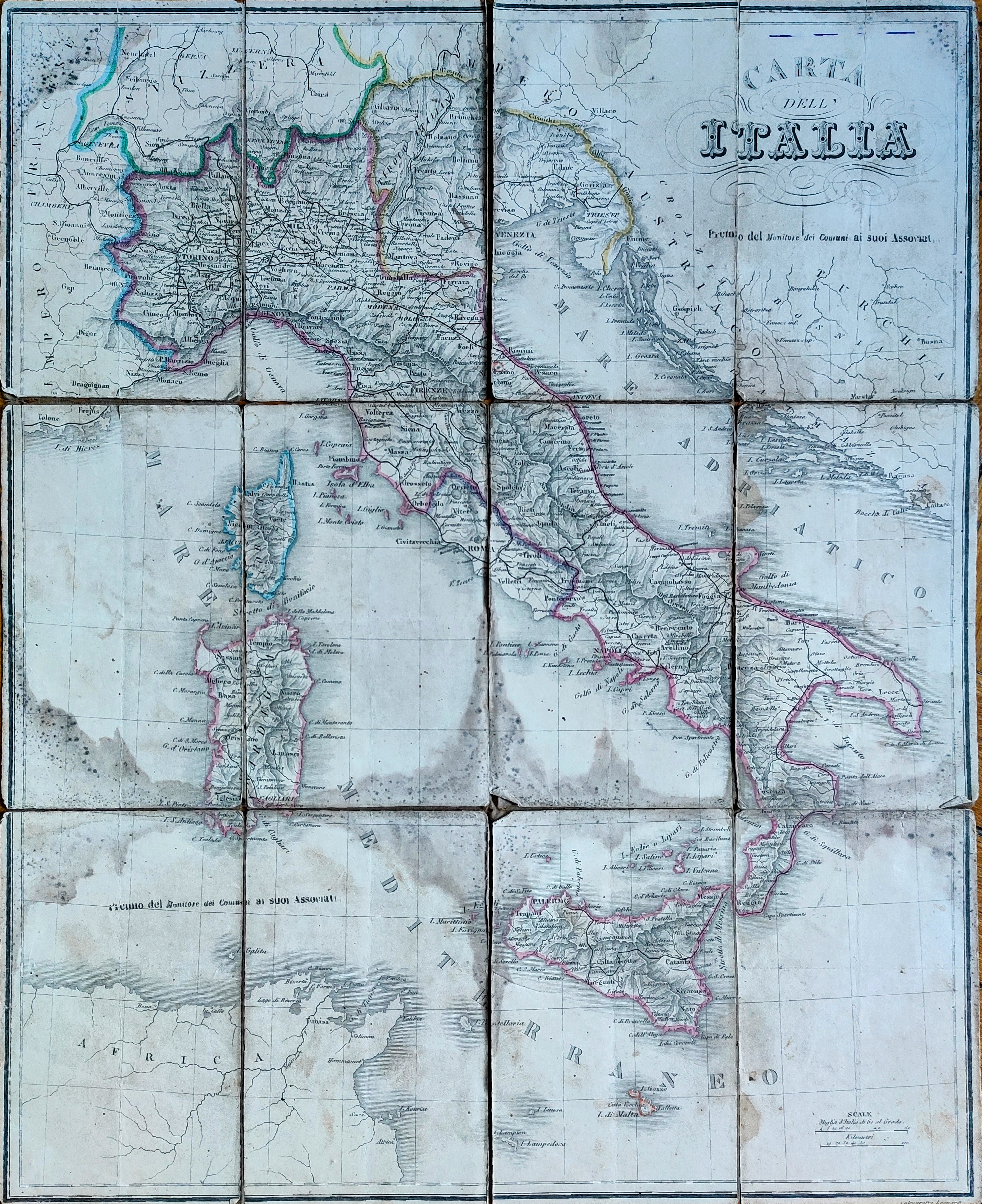
Map title
Carta dell Italia
Author
Angeli
Location shown in map
Italy
Edition date
Circa 1866
Edition place
Editor
Atlas
Price
50 Euro
State
[mint/excellent/very good/good/FAIR/mediocre/poor]
Color
Old colors
Verso
Blank
Size
Plate: cm (52 x 43) inches (20.47 x 16.93) Paper: cm (52 x 43) inches (20.47 x 16.93)
Technique
Steel engraving
Note
Foldable map
Reference
Wiki
Here for more info
In stock
Available
Info
info@thetreasuremaps.com
Code
#0857
×
![]()
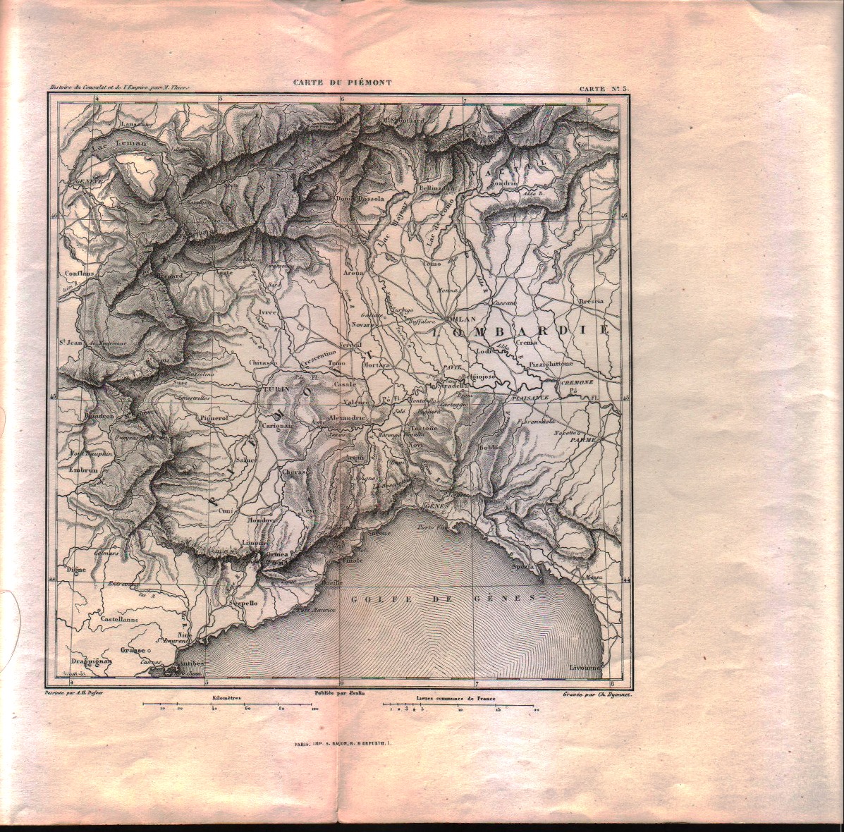
Map title
Carte du Piemont
Author
Dufour
Location shown in map
Liguria
Edition date
1869
Edition place
Paris
Editor
Laffont
Atlas
Historie du consulat et de l'Empire
Price
50 Euro
State
[MINT/excellent/very good/good/fair/mediocre/poor]
Color
Black/white
Verso
Blank
Size
Plate: cm (20.3 x 20.3) inches (7.99 x 7.99) Paper: cm (44.4 x 27.9) inches (17.48 x 10.98)
Technique
Steel engraving
Note
No particular notes for this maps.
Reference
--
Wiki
Here for more info
In stock
Available
Info
info@thetreasuremaps.com
Code
#0553
×
![]()
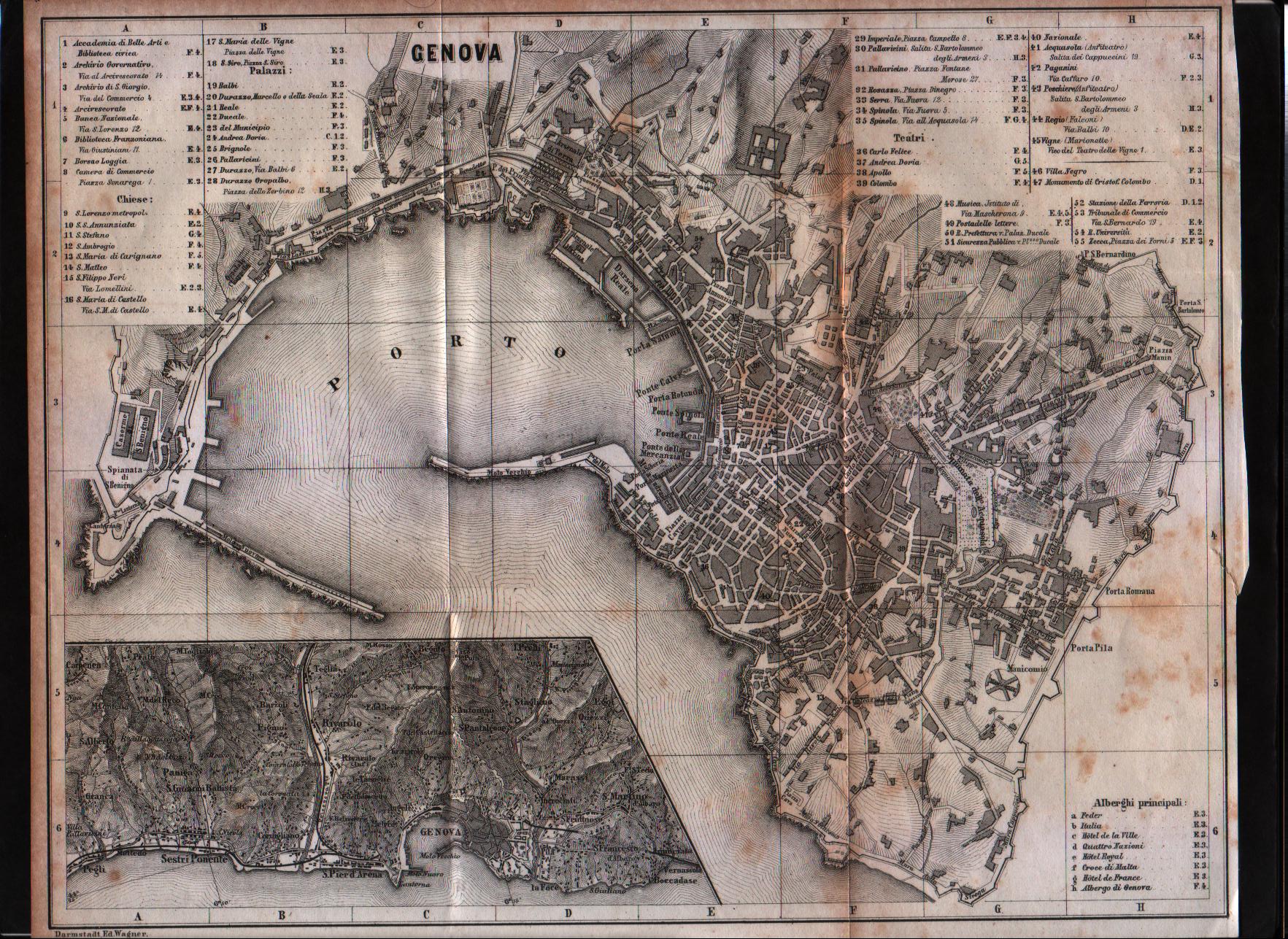
Map title
Genova
Author
Unknown
Location shown in map
Genoa
Edition date
1870
Edition place
Coblenz
Editor
Baedeker
Atlas
Italie Septentrionale
Price
50 Euro
State
[mint/EXCELLENT/very good/good/fair/mediocre/poor]
Color
Black/white
Verso
Blank
Size
Plate: cm (27.9 x 21.6) inches (10.98 x 8.5) Paper: cm (29.2 x 22.9) inches (11.5 x 9.02)
Technique
Steel engraving
Note
No particular notes for this maps
Reference
--
Wiki
Here for more info
In stock
Available
Info
info@thetreasuremaps.com
Code
#0360
×
![]()
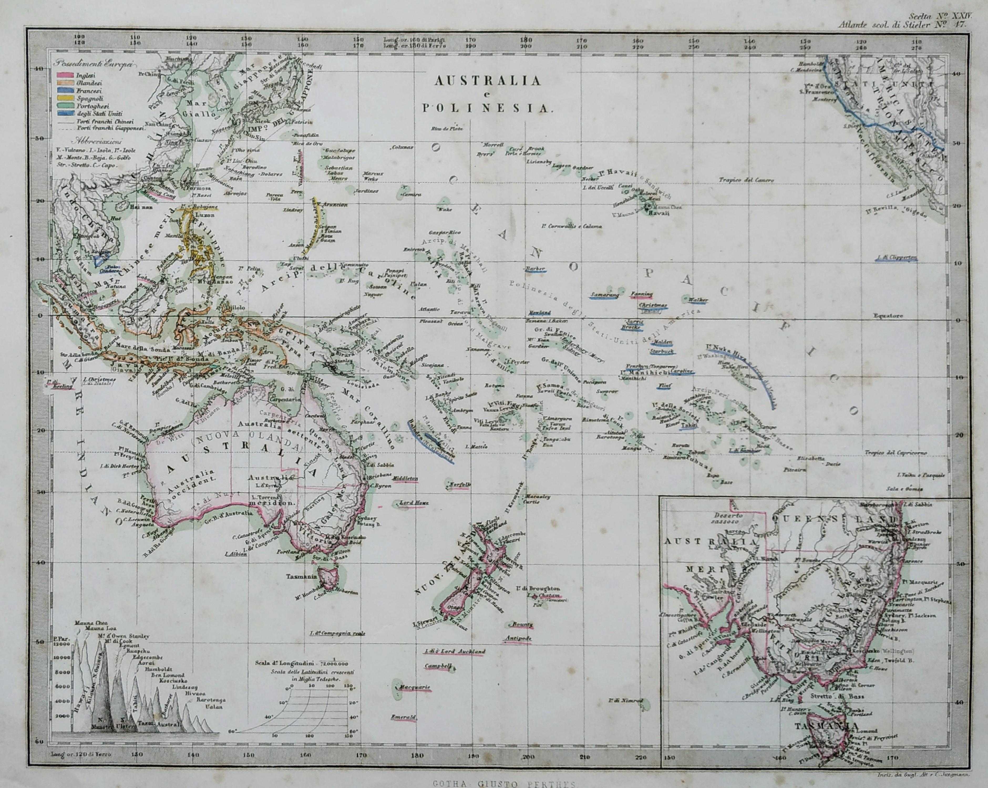
Map title
Australia e Polinesia
Author
Stieler
Location shown in map
Oceania
Edition date
Circa 1870
Edition place
Gotha
Editor
Stieler
Atlas
Atlante scolastico Stieler
Price
50 Euro
State
[mint/excellent/VERY GOOD/good/fair/mediocre/poor]
Color
Old color
Verso
Blank
Size
Plate: cm (25 x 20) inches (9.84 x 7.87) Paper: cm (30 x 24) inches (11.81 x 9.45)
Technique
Steel engraving
Note
Reference
Wiki
Here for more info
In stock
Available
Info
info@thetreasuremaps.com
Code
#0780
×
![]()
Map title
Carta itineraria-commerciale dell'Italia
Author
Arrigoni
Location shown in map
Italy
Edition date
Circa 1870
Edition place
Milan
Editor
Civelli
Atlas
Price
Please ask: info@thetreasuremaps.com
State
[mint/excellent/VERY GOOD/good/fair/mediocre/poor]
Color
Old colors
Verso
Blank
Size
Plate: cm (113 x 141) inches (44.49 x 55.51) Paper: cm (113 x 141) inches (44.49 x 55.51)
Technique
Steel engraving
Note
Foldable map
Reference
Wiki
Here for more info
In stock
Available
Info
info@thetreasuremaps.com
Code
#0858
×
![]()
Map title
Australia e Polinesia
Author
Stieler
Location shown in map
Oceania
Edition date
Circa 1870
Edition place
Gotha
Editor
Stieler
Atlas
Atlante scolastico Stieler
Price
50 Euro
State
[mint/excellent/very good/good/fair/mediocre/POOR]
Color
Old color
Verso
Blank
Size
Plate: cm (25 x 20) inches (9.84 x 7.87) Paper: cm (30 x 24) inches (11.81 x 9.45)
Technique
Steel engraving
Note
Reference
Wiki
Here for more info
In stock
Available
Info
info@thetreasuremaps.com
Code
#1065
×
![]()
Map title
Asien
Author
Location shown in map
Asia
Edition date
Circa 1870
Edition place
Editor
Gotha
Atlas
VON SYDOWS' SCHUL-ATLAS
Price
50 Euro
State
[mint/EXCELLENT/very good/good/fair/mediocre/poor]
Color
Old colors
Verso
Blank
Size
Plate: cm (24 x 19) inches (9.45 x 7.48) Paper: cm (30 x 23) inches (11.81 x 9.06)
Technique
Steel engraving
Note
Reference
Wiki
Here for more info
In stock
Available
Info
info@thetreasuremaps.com
Code
#1299
×
![]()
Map title
Nuova carta geografica statistica e postale del regno d'Italia
Author
Giuseppe Pozzi
Location shown in map
Italy
Edition date
1872
Edition place
Milano
Editor
Atlas
Price
200 Euro
State
[mint/excellent/VERY GOOD/good/fair/mediocre/poor]
Color
Black/white
Verso
Blank
Size
Plate: cm (60 x 80) inches (23.62 x 31.5) Paper: cm (60 x 80) inches (23.62 x 31.5)
Technique
Steel engraving
Note
Foldable map
Reference
Wiki
Here for more info
In stock
Available
Info
info@thetreasuremaps.com
Code
#1078
×
![]()
Map title
Spezialkarte von Australien
Author
Petermann, August
Location shown in map
Australia
Edition date
1875
Edition place
Editor
Gotha, Perthes
Atlas
Price
Please ask: info@thetreasuremaps.com
State
[mint/excellent/VERY GOOD/good/fair/mediocre/poor]
Color
Old colors
Verso
Size
Plate: cm (126 x 147) inches (49.61 x 57.87) Paper: cm (126 x 147) inches (49.61 x 57.87)
Technique
Steel engraving
Note
Wall map
Reference
Wiki
Here for more info
In stock
Available
Info
info@thetreasuremaps.com
Code
#0652
×
![]()
Map title
Australia e polinesia
Author
Stieler
Location shown in map
Oceania
Edition date
1876
Edition place
Editor
Gotha
Atlas
Price
50 Euro
State
[mint/excellent/VERY GOOD/good/fair/mediocre/poor]
Color
Black/white
Verso
Blank
Size
Plate: cm (26 x 20) inches (10.24 x 7.87) Paper: cm (32 x 25) inches (12.6 x 9.84)
Technique
Steel engraving
Note
No particular notes for this maps.
Reference
Wiki
Here for more info
In stock
Available
Info
info@thetreasuremaps.com
Code
#0703
×
![]()
Map title
Italia
Author
Juan Vilanova
Location shown in map
Italy
Edition date
1877
Edition place
Madrid
Editor
Astort Hermanos
Atlas
Atlas Geografico Universal
Price
150 Euro
State
[mint/EXCELLENT/very good/good/fair/mediocre/poor]
Color
Old colors
Verso
Blank
Size
Plate: cm (34 x 28) inches (13.39 x 11.02) Paper: cm (80 x 59) inches (31.5 x 23.23)
Technique
Steel engraving
Note
Reference
Wiki
Here for more info
In stock
Available
Info
info@thetreasuremaps.com
Code
#1177
×
![]()
Map title
Pianta Topografica di Genova
Author
Casabona
Location shown in map
Genoa
Edition date
1877
Edition place
Genoa
Editor
--
Atlas
Price
175 Euro
State
[mint/EXCELLENT/very good/good/fair/mediocre/poor]
Color
Old colors
Verso
Blank
Size
Plate: cm (65 x 48) inches (25.59 x 18.9) Paper: cm (58 x 42) inches (22.83 x 16.54)
Technique
Steel engraving
Note
Reference
Wiki
Here for more info
In stock
Available
Info
info@thetreasuremaps.com
Code
#1188
×
![]()
Map title
America
Author
Unknown
Location shown in map
America
Edition date
Circa 1880
Edition place
--
Editor
--
Atlas
--
Price
50 Euro
State
[mint/excellent/VERY GOOD/good/fair/mediocre/poor]
Color
Uncoloured
Verso
Blank
Size
Plate: cm (16.5 x 21.6) inches (6.5 x 8.5) Paper: cm (17.8 x 22.9) inches (7.01 x 9.02)
Technique
Copper engraving
Note
No particular notes for this maps
Reference
--
Wiki
Here for more info
In stock
Available
Info
info@thetreasuremaps.com
Code
#0090
America
Author
Unknown
Location shown in map
America
Edition date
Circa 1880
Edition place
--
Editor
--
Atlas
--
Price
50 Euro
State
[mint/excellent/VERY GOOD/good/fair/mediocre/poor]
Color
Uncoloured
Verso
Blank
Size
Plate: cm (16.5 x 21.6) inches (6.5 x 8.5) Paper: cm (17.8 x 22.9) inches (7.01 x 9.02)
Technique
Copper engraving
Note
No particular notes for this maps
Reference
--
Wiki
Here for more info
In stock
Available
Info
info@thetreasuremaps.com
Code
#0090
×
![]()
Map title
Pianta di NuovaYork
Author
Location shown in map
NewYork
Edition date
Circa 1880
Edition place
Editor
--
Atlas
Price
100 Euro
State
[mint/EXCELLENT/very good/good/fair/mediocre/poor]
Color
Black/white
Verso
Blank
Size
Plate: cm (22 x 35) inches (8.66 x 13.78) Paper: cm (25 x 41) inches (9.84 x 16.14)
Technique
Steel engraving
Note
Reference
--
Wiki
Here for more info
In stock
Available
Info
info@thetreasuremaps.com
Code
#0943
×
![]()
Map title
Pianta di Chicago
Author
Location shown in map
Chicago
Edition date
Circa 1880
Edition place
Editor
--
Atlas
Price
Please ask: info@thetreasuremaps.com
State
[mint/EXCELLENT/very good/good/fair/mediocre/poor]
Color
Black/white
Verso
Blank
Size
Plate: cm (34 x 25) inches (13.39 x 9.84) Paper: cm (39 x 30) inches (15.35 x 11.81)
Technique
Steel engraving
Note
Reference
--
Wiki
Here for more info
In stock
Available
Info
info@thetreasuremaps.com
Code
#0944
×
![]()
Map title
Pianta di Cincinnati
Author
Location shown in map
Cincinnati
Edition date
Circa 1880
Edition place
Editor
--
Atlas
Price
Please ask: info@thetreasuremaps.com
State
[mint/EXCELLENT/very good/good/fair/mediocre/poor]
Color
Black/white
Verso
Blank
Size
Plate: cm (27 x 21) inches (10.63 x 8.27) Paper: cm (32 x 26) inches (12.6 x 10.24)
Technique
Steel engraving
Note
Reference
--
Wiki
Here for more info
In stock
Available
Info
info@thetreasuremaps.com
Code
#0945
×
![]()
Map title
Pianta di San Francisco
Author
Location shown in map
San Francisco
Edition date
Circa 1880
Edition place
Editor
--
Atlas
Price
Please ask: info@thetreasuremaps.com
State
[mint/EXCELLENT/very good/good/fair/mediocre/poor]
Color
Black/white
Verso
Blank
Size
Plate: cm (26 x 27) inches (10.24 x 10.63) Paper: cm (30 x 31) inches (11.81 x 12.2)
Technique
Steel engraving
Note
Reference
--
Wiki
Here for more info
In stock
Available
Info
info@thetreasuremaps.com
Code
#0946
×
![]()
Map title
Pianta della Nuova Orleans
Author
Location shown in map
New Orleans
Edition date
Circa 1880
Edition place
Editor
--
Atlas
Price
75 Euro
State
[mint/EXCELLENT/very good/good/fair/mediocre/poor]
Color
Black/white
Verso
Blank
Size
Plate: cm (27 x 22) inches (10.63 x 8.66) Paper: cm (31 x 26) inches (12.2 x 10.24)
Technique
Steel engraving
Note
Reference
--
Wiki
Here for more info
In stock
Available
Info
info@thetreasuremaps.com
Code
#0947
×
![]()
Map title
None
Author
Location shown in map
Globe
Edition date
Circa 1880
Edition place
Berlin
Editor
Ernst Schotte
Atlas
Price
700 Euro
State
[mint/excellent/VERY GOOD/good/fair/mediocre/poor]
Color
Old colors
Verso
Blank
Size
Plate: cm (0 x 0) inches (0 x 0) Paper: cm (25 x 25) inches (9.84 x 9.84)
Technique
Note
Reference
Wiki
Here for more info
In stock
Sold
Info
info@thetreasuremaps.com
Code
#0991
×
![]()
Map title
Genua
Author
Unknown
Location shown in map
Genoa
Edition date
Circa 1880
Edition place
Laipzing
Editor
Atlas
Meyers Konversations Lexikon
Price
50 Euro
State
[mint/EXCELLENT/very good/good/fair/mediocre/poor]
Color
Old color.
Verso
Blank
Size
Plate: cm (27 x 21) inches (10.63 x 8.27) Paper: cm (30 x 24) inches (11.81 x 9.45)
Technique
Steel engraving
Note
Reference
--
Wiki
Here for more info
In stock
Available
Info
info@thetreasuremaps.com
Code
#1000
×
![]()
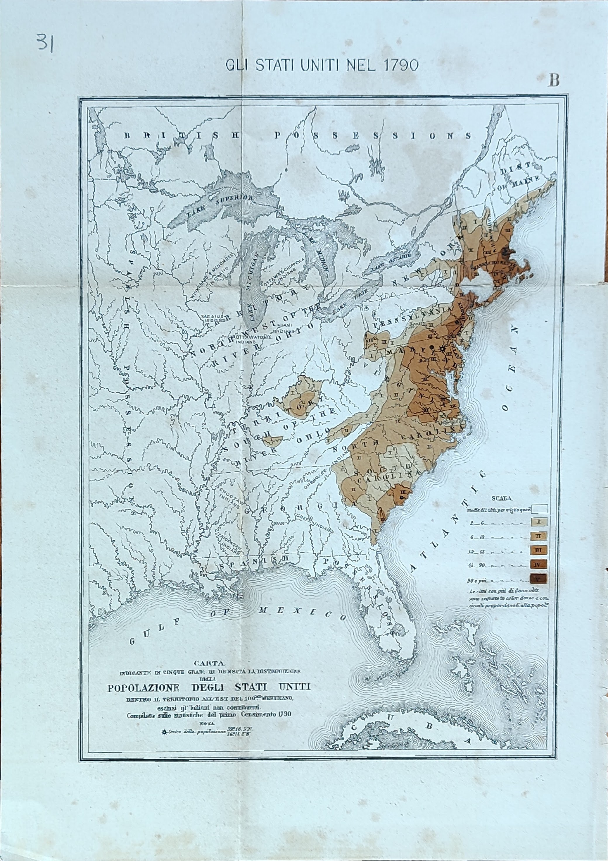
Map title
Carta indicante in cinque gradi di intensita la distribuzione ...
Author
Location shown in map
USA
Edition date
Circa 1880
Edition place
Editor
Atlas
Price
50 Euro
State
[mint/EXCELLENT/very good/good/fair/mediocre/poor]
Color
Old colors
Verso
Blank
Size
Plate: cm (41 x 26) inches (16.14 x 10.24) Paper: cm (46 x 32) inches (18.11 x 12.6)
Technique
Steel engraving
Note
Reference
Wiki
Here for more info
In stock
Available
Info
info@thetreasuremaps.com
Code
#1028
×
![]()
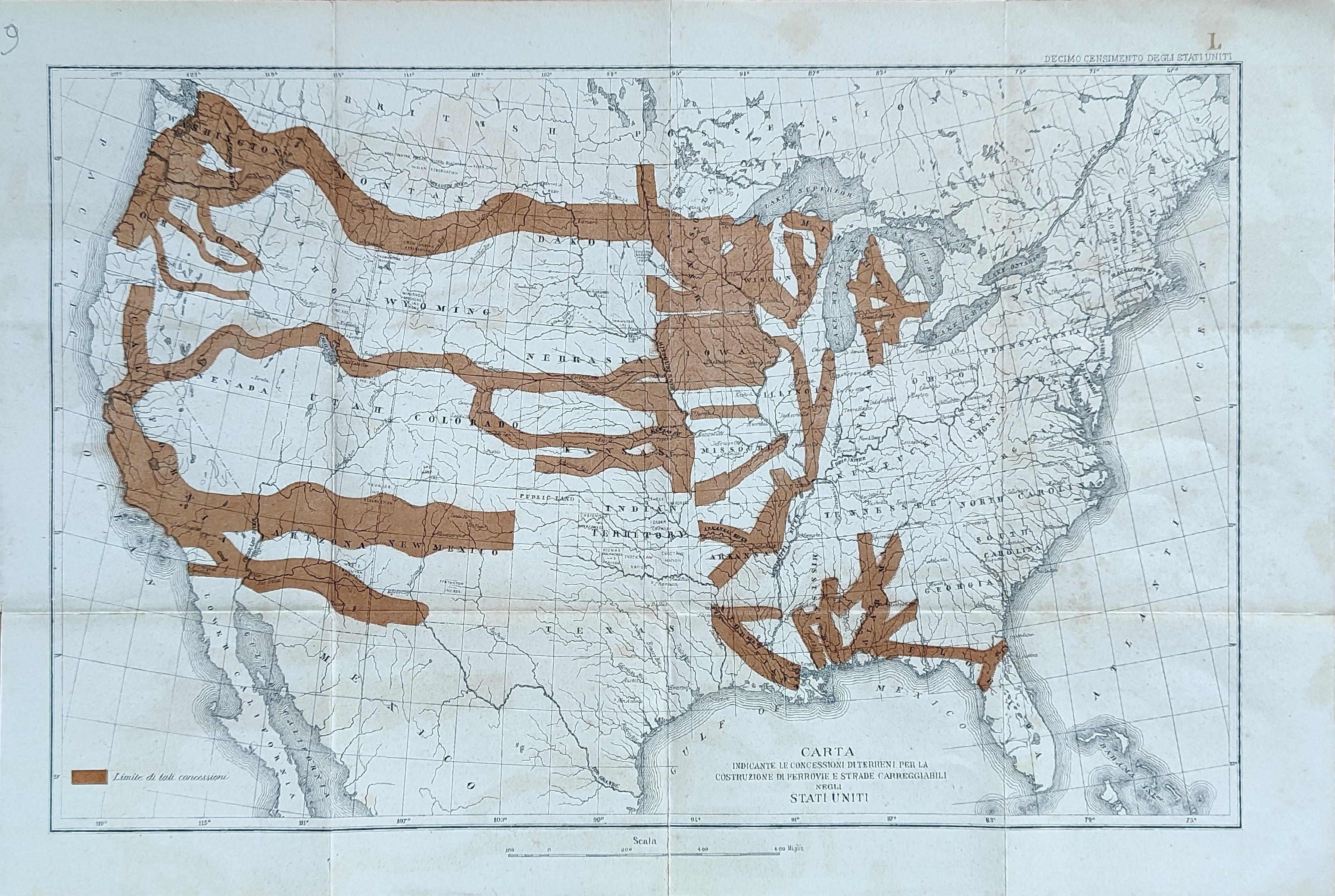
Map title
Carta indicante le concessioni di terreni ...
Author
Location shown in map
USA
Edition date
Circa 1880
Edition place
Editor
Atlas
Price
50 Euro
State
[mint/EXCELLENT/very good/good/fair/mediocre/poor]
Color
Old colors
Verso
Blank
Size
Plate: cm (41 x 26) inches (16.14 x 10.24) Paper: cm (46 x 32) inches (18.11 x 12.6)
Technique
Steel engraving
Note
Reference
Wiki
Here for more info
In stock
Available
Info
info@thetreasuremaps.com
Code
#1029
×
![]()
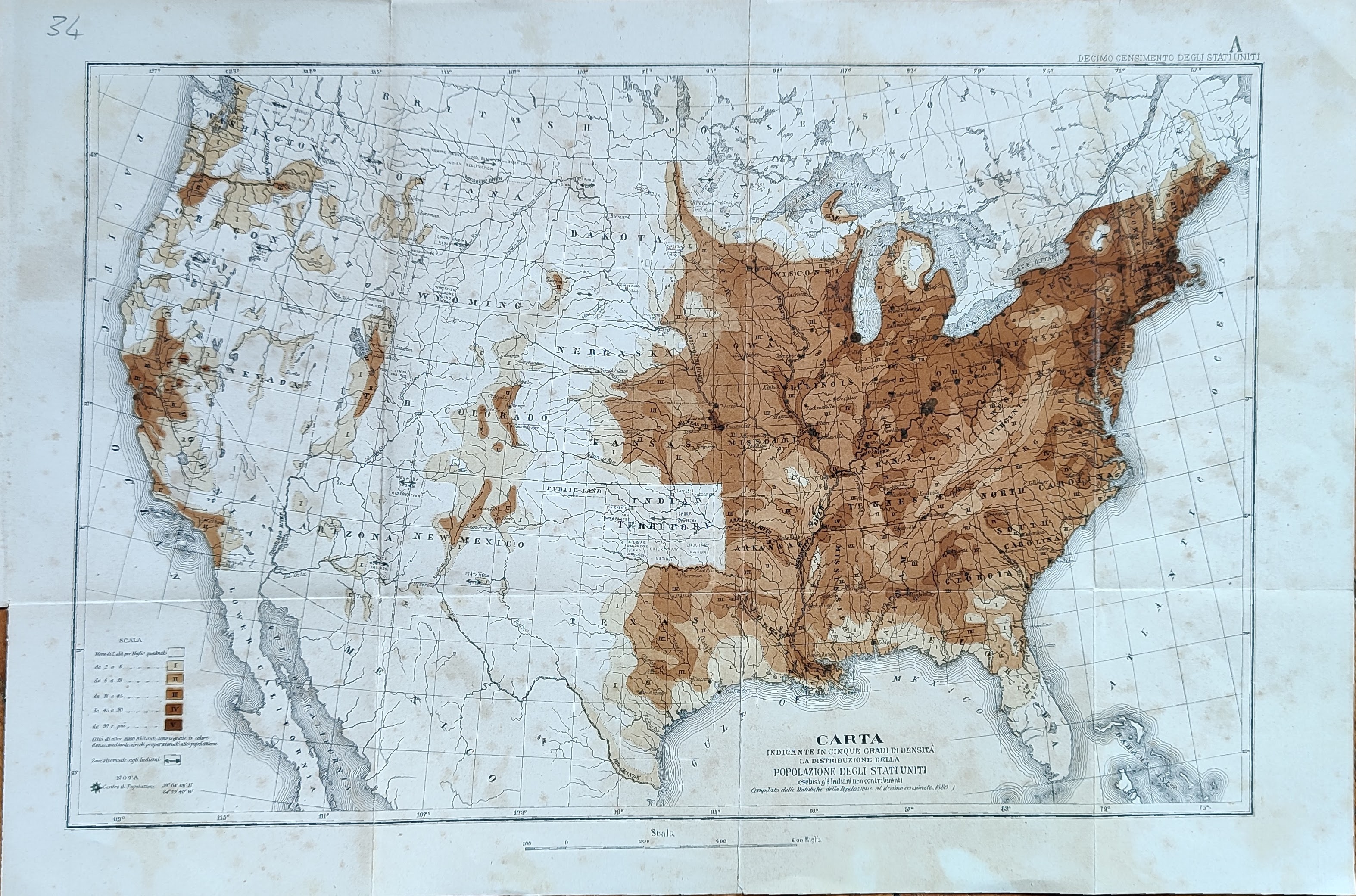
Map title
Carta indicante in cinque gradi di densita ...
Author
Location shown in map
USA
Edition date
Circa 1880
Edition place
Editor
Atlas
Price
50 Euro
State
[mint/EXCELLENT/very good/good/fair/mediocre/poor]
Color
Old colors
Verso
Blank
Size
Plate: cm (17 x 24) inches (6.69 x 9.45) Paper: cm (22 x 30) inches (8.66 x 11.81)
Technique
Steel engraving
Note
Reference
Wiki
Here for more info
In stock
Available
Info
info@thetreasuremaps.com
Code
#1030
×
![]()
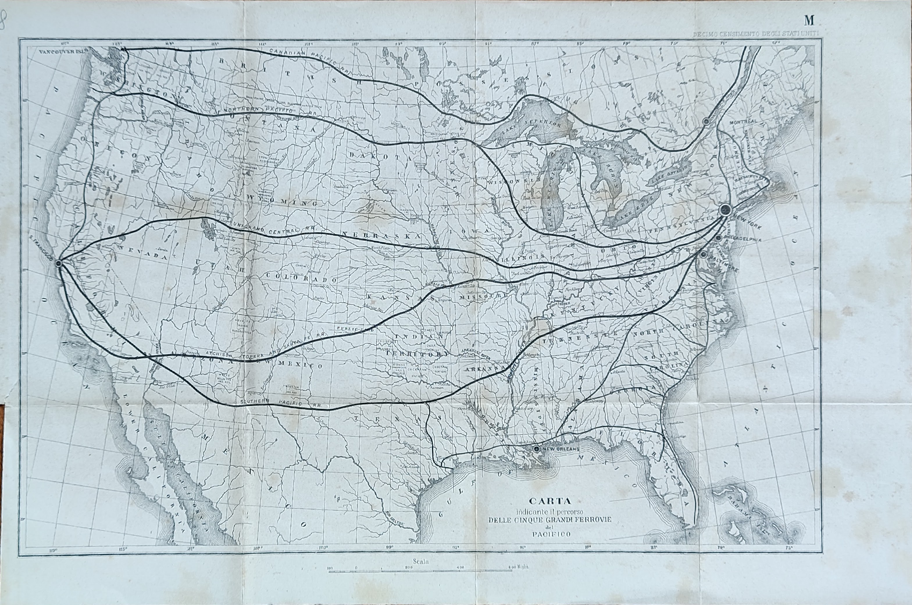
Map title
Carta indicante il percorso delle cinque ...
Author
Location shown in map
USA
Edition date
Circa 1880
Edition place
Editor
Atlas
Price
50 Euro
State
[mint/EXCELLENT/very good/good/fair/mediocre/poor]
Color
Old colors
Verso
Blank
Size
Plate: cm (41 x 26) inches (16.14 x 10.24) Paper: cm (46 x 32) inches (18.11 x 12.6)
Technique
Steel engraving
Note
Reference
Wiki
Here for more info
In stock
Available
Info
info@thetreasuremaps.com
Code
#1031
×
![]()
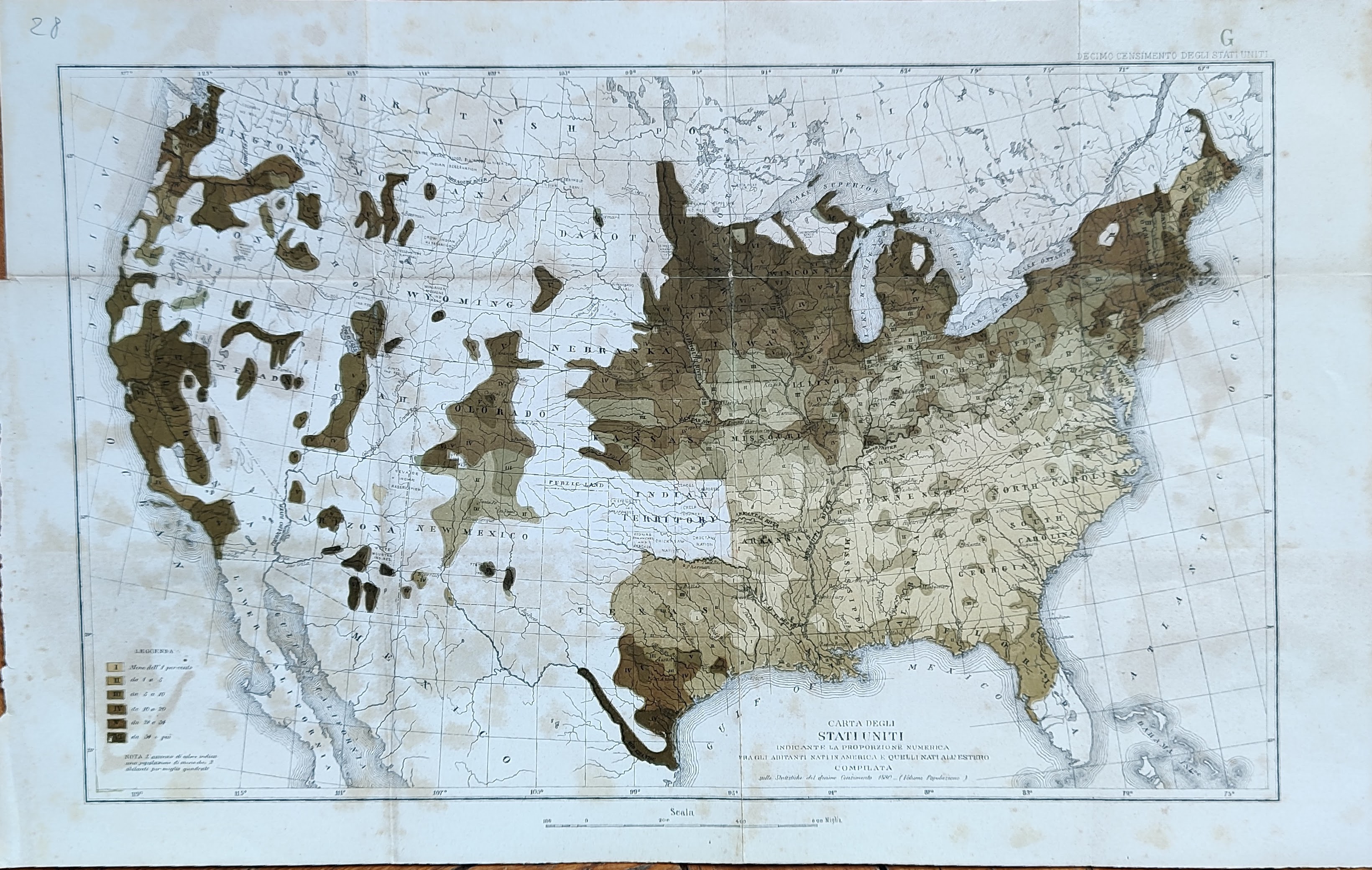
Map title
Carta indicante la proporzione numerica ...
Author
Location shown in map
USA
Edition date
Circa 1880
Edition place
Editor
Atlas
Price
50 Euro
State
[mint/EXCELLENT/very good/good/fair/mediocre/poor]
Color
Old colors
Verso
Blank
Size
Plate: cm (41 x 26) inches (16.14 x 10.24) Paper: cm (46 x 32) inches (18.11 x 12.6)
Technique
Steel engraving
Note
Reference
Wiki
Here for more info
In stock
Available
Info
info@thetreasuremaps.com
Code
#1032
×
![]()
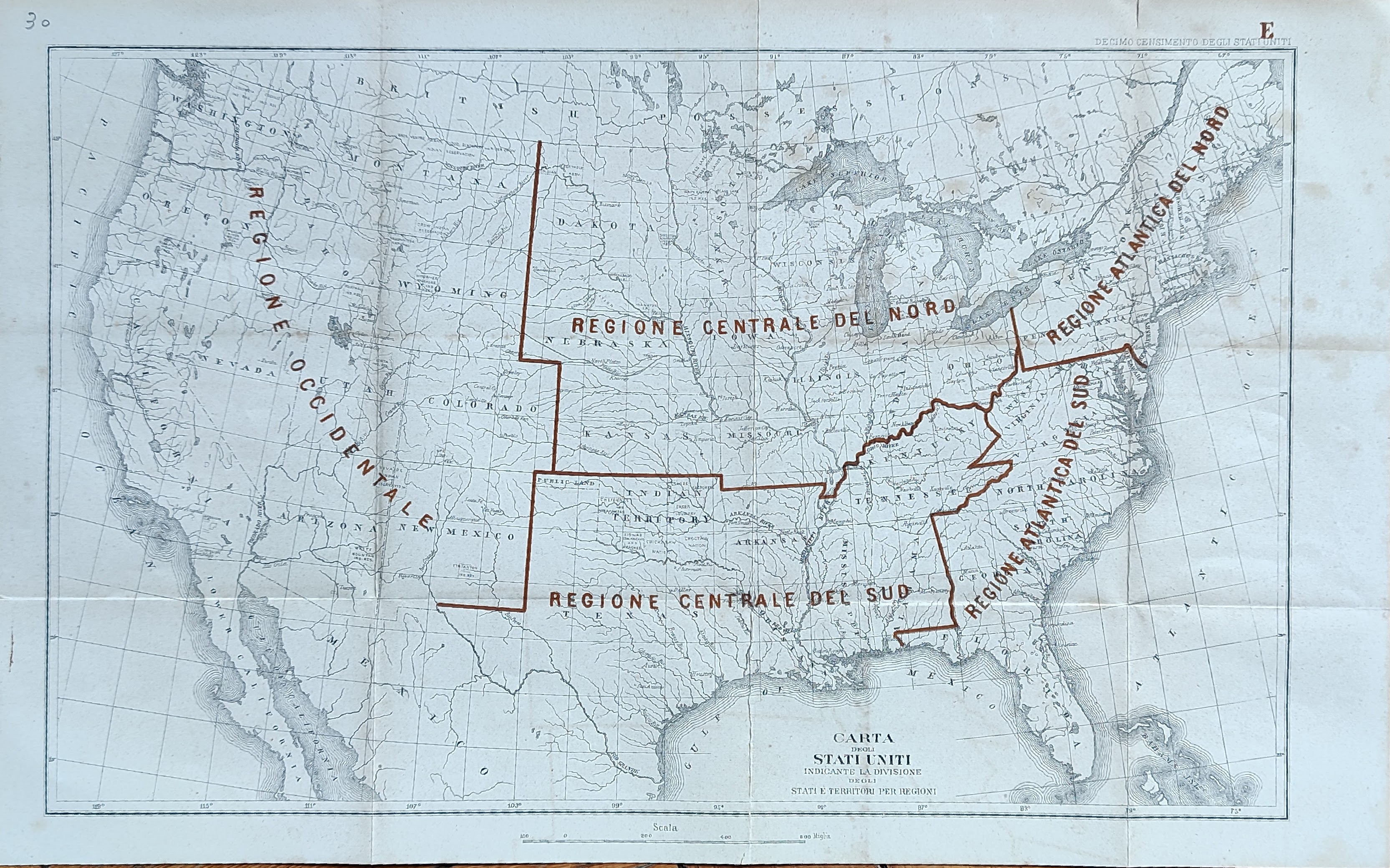
Map title
Carta indicante la divisione ...
Author
Location shown in map
USA
Edition date
Circa 1880
Edition place
Editor
Atlas
Price
50 Euro
State
[mint/EXCELLENT/very good/good/fair/mediocre/poor]
Color
Old colors
Verso
Blank
Size
Plate: cm (41 x 26) inches (16.14 x 10.24) Paper: cm (46 x 32) inches (18.11 x 12.6)
Technique
Steel engraving
Note
Reference
Wiki
Here for more info
In stock
Available
Info
info@thetreasuremaps.com
Code
#1033
×
![]()
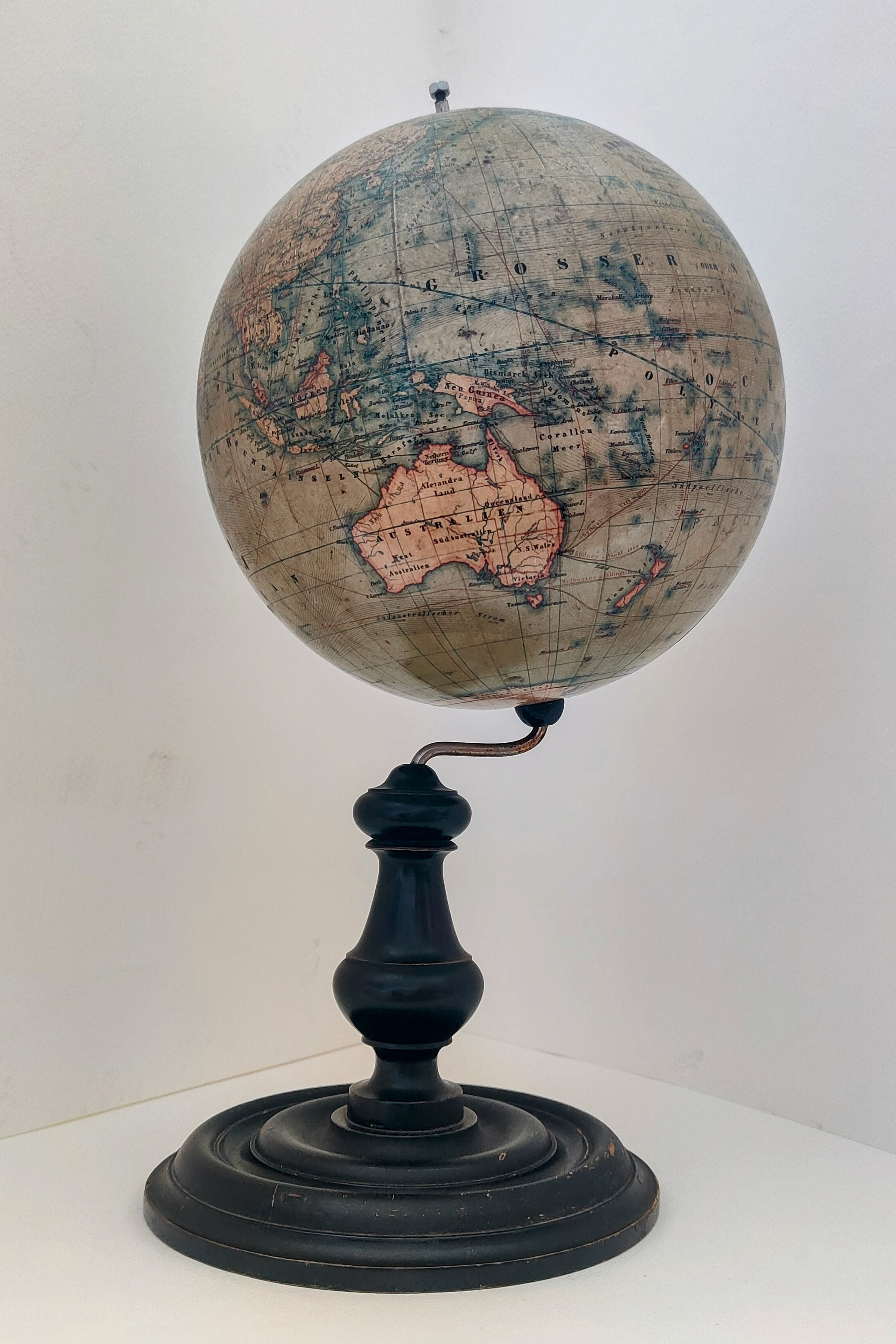
Map title
Erdglobus gezeichnet von H. KIEPERT BERLIN Geogr. Verl. D. Reimer.
Author
H.Kiepert
Location shown in map
Globe
Edition date
Circa 1880
Edition place
Berlin
Editor
Atlas
Price
700 Euro
State
[mint/excellent/VERY GOOD/good/fair/mediocre/poor]
Color
Old colors
Verso
Blank
Size
Plate: cm (0 x 0) inches (0 x 0) Paper: cm (20.3 x 20.3) inches (7.99 x 7.99)
Technique
Note
Scale 1/63000000
Reference
Wiki
Here for more info
In stock
Sold
Info
info@thetreasuremaps.com
Code
#1080
×
![]()
Map title
Carte pour le passage de Venus sur le soleil
Author
Unknown
Location shown in map
World
Edition date
1882
Edition place
Paris
Editor
--
Atlas
xxx
Price
Please ask: info@thetreasuremaps.com
State
[mint/EXCELLENT/very good/good/fair/mediocre/poor]
Color
Black/white
Verso
Blank
Size
Plate: cm (35.6 x 20.3) inches (14.02 x 7.99) Paper: cm (45.7 x 24.1) inches (17.99 x 9.49)
Technique
Steel engraving
Note
No particular notes for this maps
Reference
--
Wiki
Here for more info
In stock
Sold
Info
info@thetreasuremaps.com
Code
#0458
×
![]()
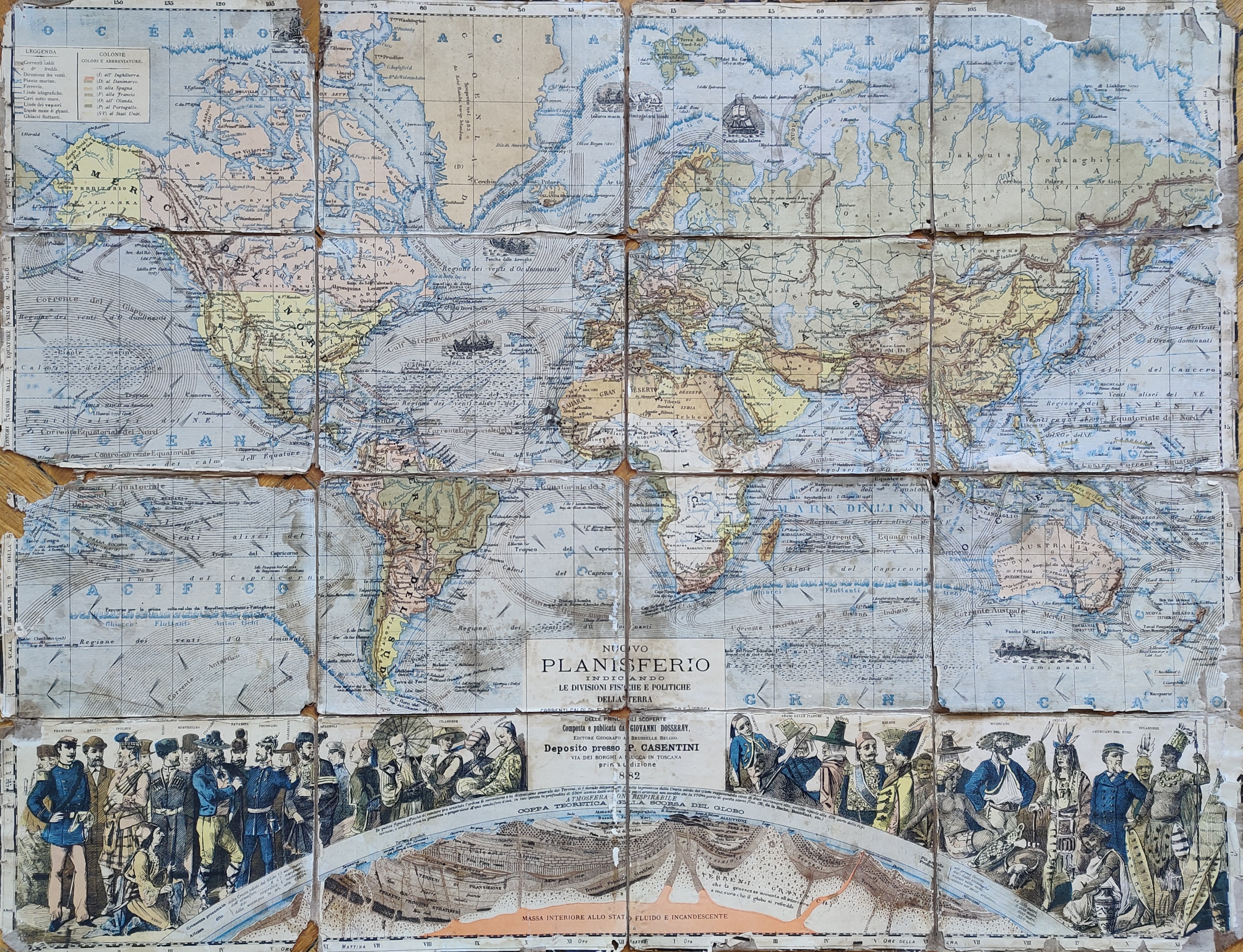
Map title
Nuovo planisfero
Author
Dosseray
Location shown in map
World
Edition date
1882
Edition place
Lucca
Editor
Atlas
Price
300 Euro
State
[mint/excellent/very good/good/fair/MEDIOCRE/poor]
Color
Old colors
Verso
Blank
Size
Plate: cm (0 x 0) inches (0 x 0) Paper: cm (0 x 0) inches (0 x 0)
Technique
Copper engraving
Note
Reference
Wiki
Here for more info
In stock
Available
Info
info@thetreasuremaps.com
Code
#1086
×
![]()
Map title
Italia
Author
Sacchi
Location shown in map
Italy
Edition date
1883
Edition place
Milan
Editor
Sacchi
Atlas
Price
50 Euro
State
[mint/excellent/VERY GOOD/good/fair/mediocre/poor]
Color
Black/white
Verso
Blank
Size
Plate: cm (37 x 48) inches (14.57 x 18.9) Paper: cm (37 x 48) inches (14.57 x 18.9)
Technique
Copper engraving
Note
Reference
Wiki
Here for more info
In stock
Available
Info
info@thetreasuremaps.com
Code
#0773
×
![]()
Map title
Plan du port de Genes
Author
Darondaut
Location shown in map
Genoa
Edition date
1883
Edition place
Paris
Editor
Atlas
Price
400 Euro
State
[mint/EXCELLENT/very good/good/fair/mediocre/poor]
Color
Old color.
Verso
Blank
Size
Plate: cm (91 x 62) inches (35.83 x 24.41) Paper: cm (96 x 66) inches (37.8 x 25.98)
Technique
Steel engraving
Note
Reference
--
Wiki
Here for more info
In stock
Available
Info
info@thetreasuremaps.com
Code
#1018
×
![]()
Map title
Nuova carta dell'Italia
Author
Location shown in map
Italy
Edition date
1884
Edition place
Lucca
Editor
Casentini
Atlas
Wall map
Price
Please ask: info@thetreasuremaps.com
State
[mint/excellent/VERY GOOD/good/fair/mediocre/poor]
Color
Old colors
Verso
Blank
Size
Plate: cm (104 x 65) inches (40.94 x 25.59) Paper: cm (104 x 65) inches (40.94 x 25.59)
Technique
Steel engraving
Note
Reference
Wiki
Here for more info
In stock
Available
Info
info@thetreasuremaps.com
Code
#0823
×
![]()
Map title
South-west USA
Author
Unknown
Location shown in map
South-west USA
Edition date
1885
Edition place
Gotha
Editor
--
Atlas
Hand atlas
Price
Please ask: info@thetreasuremaps.com
State
[mint/EXCELLENT/very good/good/fair/mediocre/poor]
Color
Old outlined
Verso
Blank
Size
Plate: cm (40.6 x 33) inches (15.98 x 12.99) Paper: cm (48.3 x 38.1) inches (19.02 x 15)
Technique
Steel engraving
Note
No particular notes for this maps
Reference
--
Wiki
Here for more info
In stock
Sold
Info
info@thetreasuremaps.com
Code
#0416
South-west USA
Author
Unknown
Location shown in map
South-west USA
Edition date
1885
Edition place
Gotha
Editor
--
Atlas
Hand atlas
Price
Please ask: info@thetreasuremaps.com
State
[mint/EXCELLENT/very good/good/fair/mediocre/poor]
Color
Old outlined
Verso
Blank
Size
Plate: cm (40.6 x 33) inches (15.98 x 12.99) Paper: cm (48.3 x 38.1) inches (19.02 x 15)
Technique
Steel engraving
Note
No particular notes for this maps
Reference
--
Wiki
Here for more info
In stock
Sold
Info
info@thetreasuremaps.com
Code
#0416
×
![]()
Map title
Central-north USA
Author
Unknown
Location shown in map
Central-north USA
Edition date
1885
Edition place
Gotha
Editor
--
Atlas
Hand atlas
Price
Please ask: info@thetreasuremaps.com
State
[mint/EXCELLENT/very good/good/fair/mediocre/poor]
Color
Old outlined
Verso
Blank
Size
Plate: cm (40.6 x 33) inches (15.98 x 12.99) Paper: cm (48.3 x 38.1) inches (19.02 x 15)
Technique
Steel engraving
Note
No particular notes for this maps
Reference
--
Wiki
Here for more info
In stock
Sold
Info
info@thetreasuremaps.com
Code
#0417
Central-north USA
Author
Unknown
Location shown in map
Central-north USA
Edition date
1885
Edition place
Gotha
Editor
--
Atlas
Hand atlas
Price
Please ask: info@thetreasuremaps.com
State
[mint/EXCELLENT/very good/good/fair/mediocre/poor]
Color
Old outlined
Verso
Blank
Size
Plate: cm (40.6 x 33) inches (15.98 x 12.99) Paper: cm (48.3 x 38.1) inches (19.02 x 15)
Technique
Steel engraving
Note
No particular notes for this maps
Reference
--
Wiki
Here for more info
In stock
Sold
Info
info@thetreasuremaps.com
Code
#0417
×
![]()
Map title
South-west USA
Author
Unknown
Location shown in map
South-west USA
Edition date
1885
Edition place
Gotha
Editor
--
Atlas
Hand atlas
Price
Please ask: info@thetreasuremaps.com
State
[mint/EXCELLENT/very good/good/fair/mediocre/poor]
Color
Old outlined
Verso
Blank
Size
Plate: cm (40.6 x 33) inches (15.98 x 12.99) Paper: cm (48.3 x 38.1) inches (19.02 x 15)
Technique
Steel engraving
Note
No particular notes for this maps
Reference
--
Wiki
Here for more info
In stock
Sold
Info
info@thetreasuremaps.com
Code
#0418
South-west USA
Author
Unknown
Location shown in map
South-west USA
Edition date
1885
Edition place
Gotha
Editor
--
Atlas
Hand atlas
Price
Please ask: info@thetreasuremaps.com
State
[mint/EXCELLENT/very good/good/fair/mediocre/poor]
Color
Old outlined
Verso
Blank
Size
Plate: cm (40.6 x 33) inches (15.98 x 12.99) Paper: cm (48.3 x 38.1) inches (19.02 x 15)
Technique
Steel engraving
Note
No particular notes for this maps
Reference
--
Wiki
Here for more info
In stock
Sold
Info
info@thetreasuremaps.com
Code
#0418
×
![]()
Map title
South-east USA
Author
Unknown
Location shown in map
South-east USA
Edition date
1885
Edition place
Gotha
Editor
--
Atlas
Hand atlas
Price
Please ask: info@thetreasuremaps.com
State
[mint/EXCELLENT/very good/good/fair/mediocre/poor]
Color
Old outlined
Verso
Blank
Size
Plate: cm (40.6 x 33) inches (15.98 x 12.99) Paper: cm (48.3 x 38.1) inches (19.02 x 15)
Technique
Steel engraving
Note
No particular notes for this maps
Reference
--
Wiki
Here for more info
In stock
Sold
Info
info@thetreasuremaps.com
Code
#0419
South-east USA
Author
Unknown
Location shown in map
South-east USA
Edition date
1885
Edition place
Gotha
Editor
--
Atlas
Hand atlas
Price
Please ask: info@thetreasuremaps.com
State
[mint/EXCELLENT/very good/good/fair/mediocre/poor]
Color
Old outlined
Verso
Blank
Size
Plate: cm (40.6 x 33) inches (15.98 x 12.99) Paper: cm (48.3 x 38.1) inches (19.02 x 15)
Technique
Steel engraving
Note
No particular notes for this maps
Reference
--
Wiki
Here for more info
In stock
Sold
Info
info@thetreasuremaps.com
Code
#0419
×
![]()
Map title
Central-south USA
Author
Unknown
Location shown in map
Central-south USA
Edition date
1885
Edition place
Gotha
Editor
--
Atlas
Hand atlas
Price
Please ask: info@thetreasuremaps.com
State
[mint/EXCELLENT/very good/good/fair/mediocre/poor]
Color
Old outlined
Verso
Blank
Size
Plate: cm (40.6 x 33) inches (15.98 x 12.99) Paper: cm (48.3 x 38.1) inches (19.02 x 15)
Technique
Steel engraving
Note
No particular notes for this maps
Reference
--
Wiki
Here for more info
In stock
Sold
Info
info@thetreasuremaps.com
Code
#0420
Central-south USA
Author
Unknown
Location shown in map
Central-south USA
Edition date
1885
Edition place
Gotha
Editor
--
Atlas
Hand atlas
Price
Please ask: info@thetreasuremaps.com
State
[mint/EXCELLENT/very good/good/fair/mediocre/poor]
Color
Old outlined
Verso
Blank
Size
Plate: cm (40.6 x 33) inches (15.98 x 12.99) Paper: cm (48.3 x 38.1) inches (19.02 x 15)
Technique
Steel engraving
Note
No particular notes for this maps
Reference
--
Wiki
Here for more info
In stock
Sold
Info
info@thetreasuremaps.com
Code
#0420
×
![]()
Map title
Perou
Author
Unknown
Location shown in map
--
Edition date
1885
Edition place
Gotha
Editor
--
Atlas
Hand atlas
Price
Please ask: info@thetreasuremaps.com
State
[mint/EXCELLENT/very good/good/fair/mediocre/poor]
Color
Old outlined
Verso
Blank
Size
Plate: cm (40.6 x 33) inches (15.98 x 12.99) Paper: cm (48.3 x 38.1) inches (19.02 x 15)
Technique
--
Note
No particular notes for this maps
Reference
--
Wiki
Here for more info
In stock
Sold
Info
info@thetreasuremaps.com
Code
#0469
×
![]()
Map title
Bresil
Author
Unknown
Location shown in map
--
Edition date
1885
Edition place
Gotha
Editor
--
Atlas
Hand atlas
Price
Please ask: info@thetreasuremaps.com
State
[MINT/excellent/very good/good/fair/mediocre/poor]
Color
Old outlined
Verso
Blank
Size
Plate: cm (40.6 x 33) inches (15.98 x 12.99) Paper: cm (48.3 x 38.1) inches (19.02 x 15)
Technique
--
Note
No particular notes for this maps
Reference
--
Wiki
Here for more info
In stock
Sold
Info
info@thetreasuremaps.com
Code
#0470
×
![]()
Map title
Patagonia
Author
Unknown
Location shown in map
--
Edition date
1885
Edition place
Gotha
Editor
--
Atlas
Hand atlas
Price
Please ask: info@thetreasuremaps.com
State
[MINT/excellent/very good/good/fair/mediocre/poor]
Color
Old outlined
Verso
Blank
Size
Plate: cm (40.6 x 33) inches (15.98 x 12.99) Paper: cm (48.3 x 38.1) inches (19.02 x 15)
Technique
--
Note
No particular notes for this maps
Reference
--
Wiki
Here for more info
In stock
Sold
Info
info@thetreasuremaps.com
Code
#0471
×
![]()
Map title
West Indien Central Amerika
Author
Unknown
Location shown in map
--
Edition date
1885
Edition place
Gotha
Editor
--
Atlas
Hand atlas
Price
Please ask: info@thetreasuremaps.com
State
[mint/EXCELLENT/very good/good/fair/mediocre/poor]
Color
Old outlined
Verso
Blank
Size
Plate: cm (40.6 x 33) inches (15.98 x 12.99) Paper: cm (48.3 x 38.1) inches (19.02 x 15)
Technique
--
Note
No particular notes for this maps
Reference
--
Wiki
Here for more info
In stock
Sold
Info
info@thetreasuremaps.com
Code
#0482
×
![]()
Map title
South-east Asia
Author
Unknown
Location shown in map
--
Edition date
1885
Edition place
Gotha
Editor
--
Atlas
Hand atlas
Price
Please ask: info@thetreasuremaps.com
State
[mint/EXCELLENT/very good/good/fair/mediocre/poor]
Color
Old outlined
Verso
Blank
Size
Plate: cm (40.6 x 33) inches (15.98 x 12.99) Paper: cm (48.3 x 38.1) inches (19.02 x 15)
Technique
--
Note
No particular notes for this maps
Reference
--
Wiki
Here for more info
In stock
Sold
Info
info@thetreasuremaps.com
Code
#0485
×
![]()
Map title
Arabia
Author
Unknown
Location shown in map
--
Edition date
1885
Edition place
Gotha
Editor
--
Atlas
Hand atlas
Price
Please ask: info@thetreasuremaps.com
State
[mint/EXCELLENT/very good/good/fair/mediocre/poor]
Color
Old outlined
Verso
Blank
Size
Plate: cm (40.6 x 33) inches (15.98 x 12.99) Paper: cm (48.3 x 38.1) inches (19.02 x 15)
Technique
--
Note
No particular notes for this maps
Reference
--
Wiki
Here for more info
In stock
Sold
Info
info@thetreasuremaps.com
Code
#0486
×
![]()
Map title
Black sea
Author
Unknown
Location shown in map
--
Edition date
1885
Edition place
Gotha
Editor
--
Atlas
Hand atlas
Price
Please ask: info@thetreasuremaps.com
State
[mint/EXCELLENT/very good/good/fair/mediocre/poor]
Color
Old outlined
Verso
Blank
Size
Plate: cm (40.6 x 33) inches (15.98 x 12.99) Paper: cm (48.3 x 38.1) inches (19.02 x 15)
Technique
--
Note
No particular notes for this maps
Reference
--
Wiki
Here for more info
In stock
Sold
Info
info@thetreasuremaps.com
Code
#0487
×
![]()
Map title
North-west Africa
Author
Unknown
Location shown in map
North-west Africa 20/07/2003 21.06
Edition date
1885
Edition place
Gotha
Editor
--
Atlas
Hand atlas
Price
Please ask: info@thetreasuremaps.com
State
[mint/EXCELLENT/very good/good/fair/mediocre/poor]
Color
Old outlined
Verso
Blank
Size
Plate: cm (40.6 x 33) inches (15.98 x 12.99) Paper: cm (48.3 x 38.1) inches (19.02 x 15)
Technique
--
Note
No particular notes for this maps
Reference
--
Wiki
Here for more info
In stock
Sold
Info
info@thetreasuremaps.com
Code
#0490
×
![]()
Map title
Nederland
Author
Unknown
Location shown in map
--
Edition date
1885
Edition place
Gotha
Editor
--
Atlas
Hand atlas
Price
Please ask: info@thetreasuremaps.com
State
[mint/EXCELLENT/very good/good/fair/mediocre/poor]
Color
Old outlined
Verso
Blank
Size
Plate: cm (40.6 x 33) inches (15.98 x 12.99) Paper: cm (48.3 x 38.1) inches (19.02 x 15)
Technique
--
Note
No particular notes for this maps
Reference
--
Wiki
Here for more info
In stock
Sold
Info
info@thetreasuremaps.com
Code
#0498
×
![]()
Map title
Middle Europe
Author
Unknown
Location shown in map
--
Edition date
1885
Edition place
Gotha
Editor
--
Atlas
Hand atlas
Price
Please ask: info@thetreasuremaps.com
State
[mint/EXCELLENT/very good/good/fair/mediocre/poor]
Color
Old outlined
Verso
Blank
Size
Plate: cm (40.6 x 33) inches (15.98 x 12.99) Paper: cm (48.3 x 38.1) inches (19.02 x 15)
Technique
--
Note
No particular notes for this maps
Reference
--
Wiki
Here for more info
In stock
Sold
Info
info@thetreasuremaps.com
Code
#0499
×
![]()
Map title
Hungaria
Author
Unknown
Location shown in map
Hungary
Edition date
1885
Edition place
Gotha
Editor
--
Atlas
Hand atlas
Price
Please ask: info@thetreasuremaps.com
State
[mint/EXCELLENT/very good/good/fair/mediocre/poor]
Color
Old outlined
Verso
Blank
Size
Plate: cm (40.6 x 33) inches (15.98 x 12.99) Paper: cm (48.3 x 38.1) inches (19.02 x 15)
Technique
--
Note
No particular notes for this maps
Reference
--
Wiki
Here for more info
In stock
Sold
Info
info@thetreasuremaps.com
Code
#0500
×
![]()
Map title
Italia parlamentare
Author
Location shown in map
Italy
Edition date
1886
Edition place
Rome
Editor
Atlas
Price
300 Euro
State
[mint/EXCELLENT/very good/good/fair/mediocre/poor]
Color
Old colors
Verso
Blank
Size
Plate: cm (68 x 57) inches (26.77 x 22.44) Paper: cm (56 x 50) inches (22.05 x 19.69)
Technique
Steel engraving
Note
Reference
Wiki
Here for more info
In stock
Available
Info
info@thetreasuremaps.com
Code
#0919
×
![]()
Map title
Italia geografica statistica e postale
Author
Location shown in map
Italy
Edition date
Circa 1890
Edition place
Rome
Editor
Atlas
Price
300 Euro
State
[mint/EXCELLENT/very good/good/fair/mediocre/poor]
Color
Old colors
Verso
Blank
Size
Plate: cm (88 x 69) inches (34.65 x 27.17) Paper: cm (81 x 61) inches (31.89 x 24.02)
Technique
Steel engraving
Note
Reference
Wiki
Here for more info
In stock
Available
Info
info@thetreasuremaps.com
Code
#0926
×
![]()
Map title
Schotte's Schul&Familien Globus
Author
E.Schotte
Location shown in map
Globe
Edition date
Circa 1890
Edition place
Berlin
Editor
Ernst Schotte
Atlas
Price
600 Euro
State
[mint/excellent/VERY GOOD/good/fair/mediocre/poor]
Color
Old colors
Verso
Blank
Size
Plate: cm (0 x 0) inches (0 x 0) Paper: cm (32 x 32) inches (12.6 x 12.6)
Technique
Note
Scale 1/40000000
Reference
Wiki
Here for more info
In stock
Sold
Info
info@thetreasuremaps.com
Code
#1135
×
![]()
Map title
The New York central
Author
Location shown in map
New York
Edition date
1893
Edition place
New York
Editor
Atlas
Price
250 Euro
State
[mint/EXCELLENT/very good/good/fair/mediocre/poor]
Color
Old colors
Verso
English text
Size
Plate: cm (110 x 41) inches (43.31 x 16.14) Paper: cm (110 x 41) inches (43.31 x 16.14)
Technique
Steel engraving
Note
Reference
Wiki
Here for more info
In stock
Available
Info
info@thetreasuremaps.com
Code
#1026
×
![]()
Map title
Erdglobus
Author
P.Oestergaard
Location shown in map
Globe
Edition date
Circa 1895
Edition place
Berlin
Editor
Atlas
Price
400 Euro
State
[mint/excellent/VERY GOOD/good/fair/mediocre/poor]
Color
Old colors
Verso
Blank
Size
Plate: cm (0 x 0) inches (0 x 0) Paper: cm (34 x 34) inches (13.39 x 13.39)
Technique
Note
Reference
Wiki
Here for more info
In stock
Available
Info
info@thetreasuremaps.com
Code
#1150
×
![]()
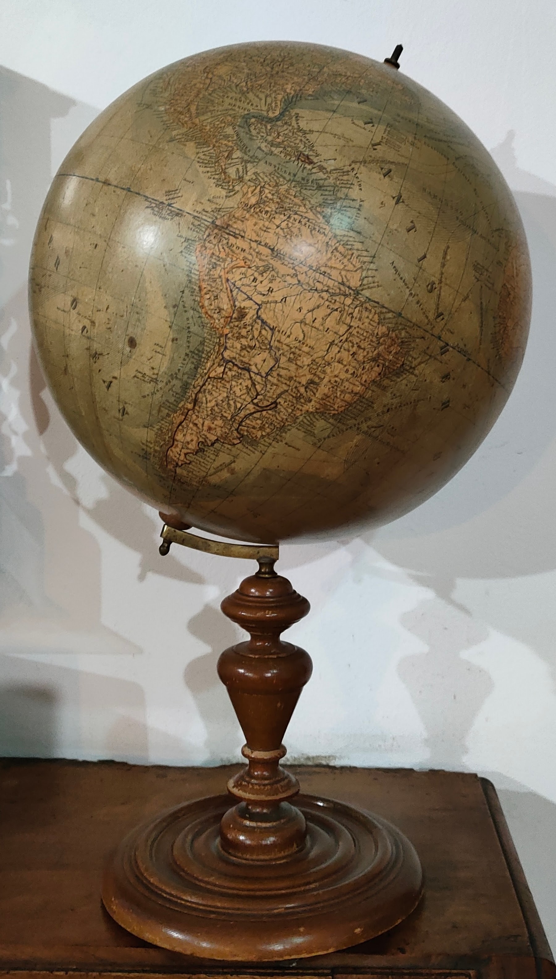
Map title
Erd-globus
Author
Ludw. Jul. Heyman
Location shown in map
Globe
Edition date
Circa 1895
Edition place
Berlin
Editor
Ludw. Jul. Heyman
Atlas
Price
500 Euro
State
[mint/EXCELLENT/very good/good/fair/mediocre/poor]
Color
Old colors
Verso
Blank
Size
Plate: cm (0 x 0) inches (0 x 0) Paper: cm (36 x 36) inches (14.17 x 14.17)
Technique
Note
Reference
Wiki
Here for more info
In stock
Available
Info
info@thetreasuremaps.com
Code
#1161
×
![]()
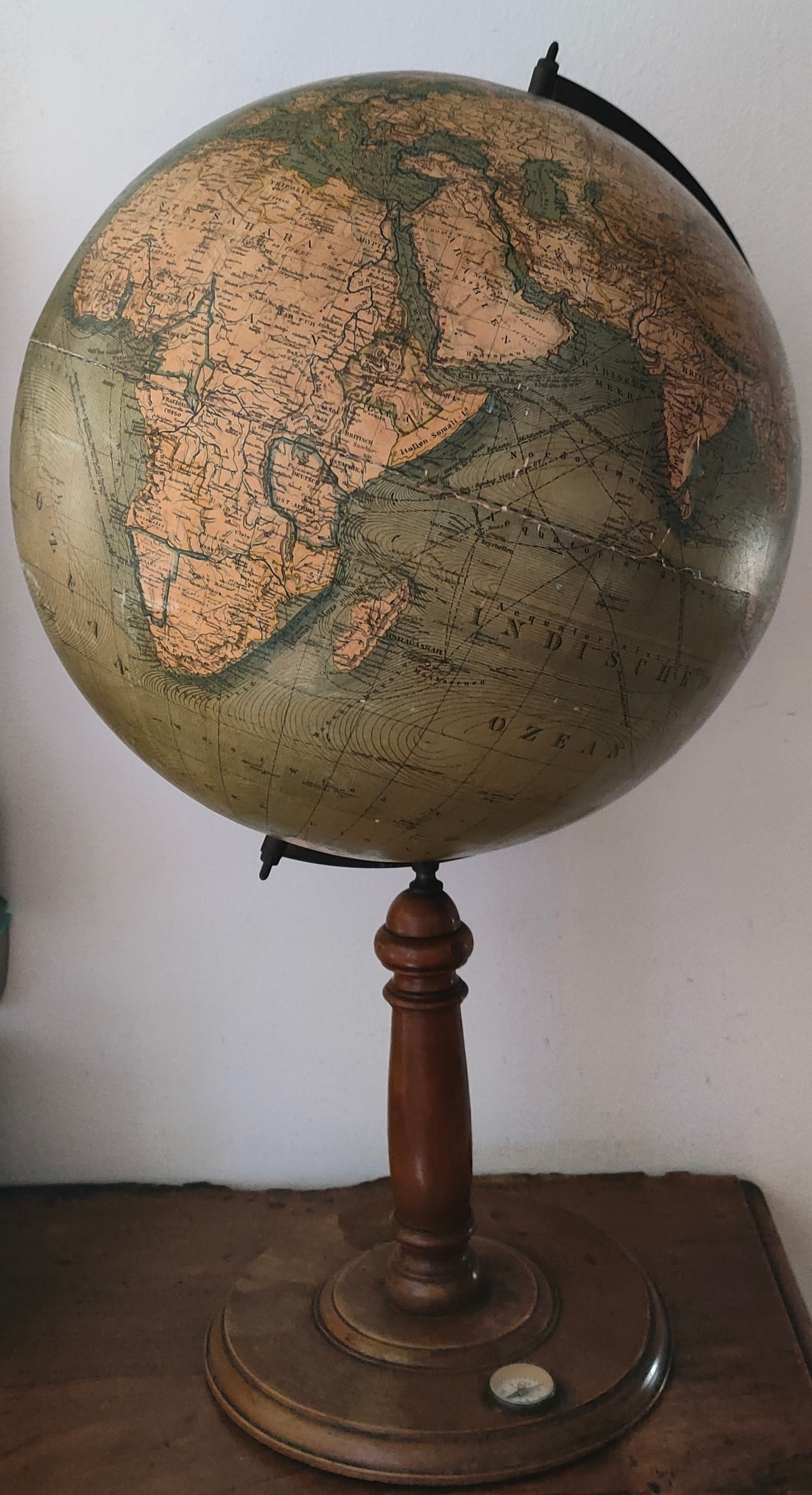
Map title
Erd-globus
Author
Ludw. Jul. Heyman
Location shown in map
Globe
Edition date
Circa 1895
Edition place
Berlin
Editor
Ludw. Jul. Heyman
Atlas
Price
500 Euro
State
[mint/EXCELLENT/very good/good/fair/mediocre/poor]
Color
Old colors
Verso
Blank
Size
Plate: cm (0 x 0) inches (0 x 0) Paper: cm (36 x 36) inches (14.17 x 14.17)
Technique
Note
Reference
Wiki
Here for more info
In stock
Available
Info
info@thetreasuremaps.com
Code
#1205
×
![]()
Map title
Stati Uniti d'America e Messico
Author
Unknown
Location shown in map
USA and Mexico
Edition date
1897
Edition place
Milan
Editor
--
Atlas
Atlante Geografico Universale
Price
Please ask: info@thetreasuremaps.com
State
[mint/EXCELLENT/very good/good/fair/mediocre/poor]
Color
Old outlined
Verso
Blank
Size
Plate: cm (16.5 x 12.7) inches (6.5 x 5) Paper: cm (16.5 x 12.7) inches (6.5 x 5)
Technique
Steel engraving
Note
No particular notes for this maps
Reference
--
Wiki
Here for more info
In stock
Sold
Info
info@thetreasuremaps.com
Code
#0422
×
![]()
Map title
America Settentrionale
Author
Unknown
Location shown in map
North America
Edition date
1897
Edition place
Milan
Editor
--
Atlas
Atlante Geografico Universale
Price
Please ask: info@thetreasuremaps.com
State
[mint/EXCELLENT/very good/good/fair/mediocre/poor]
Color
Old outlined
Verso
Blank
Size
Plate: cm (16.5 x 12.7) inches (6.5 x 5) Paper: cm (16.5 x 12.7) inches (6.5 x 5)
Technique
Steel engraving
Note
No particular notes for this maps
Reference
--
Wiki
Here for more info
In stock
Sold
Info
info@thetreasuremaps.com
Code
#0488
×
![]()