France
Pages: 1 2
Map title
Tabula europae III
Author
Gastaldi
Location shown in map
France
Edition date
1548
Edition place
Venice
Editor
Nicolo Bascarini
Atlas
Geographia
Price
300 Euro
State
[mint/excellent/VERY GOOD/good/fair/mediocre/poor] repaired
Color
Black/white
Verso
Italian text pag.5
Size
Plate: cm (17.8 x 12.7) inches (7.01 x 5) Paper: cm (20.3 x 16.5) inches (7.99 x 6.5)
Technique
Copper engraving
Note
No particular notes for this maps
Reference
--
Wiki
Here for more info
In stock
Available
Info
info@thetreasuremaps.com
Code
#0619
×
![Tabula europae III by Gastaldi, France, 1548]()
Map title
Tabula Europae III
Author
Ruscelli
Location shown in map
France
Edition date
1564
Edition place
Venice
Editor
Girolamo Ziletti
Atlas
La Geographia di Claudio Tolomeo
Price
150 Euro
State
[mint/excellent/very good/GOOD/fair/mediocre/poor]
Color
Black/white
Verso
Latin text pag.8
Size
Plate: cm (26 x 20.3) inches (10.24 x 7.99) Paper: cm (30.5 x 22.9) inches (12.01 x 9.02)
Technique
Copper engraving
Note
Based on Gastaldi map.
Reference
--
Wiki
Here for more info
In stock
Available
Info
info@thetreasuremaps.com
Code
#0120
×
![Tabula Europae III by Ruscelli, France, 1564]()
Map title
Corsica
Author
Camocio
Location shown in map
Corse
Edition date
Circa 1571
Edition place
Venice
Editor
Atlas
Isole famose porti, fortezze, e terre maritime
Price
1100 Euro
State
[mint/EXCELLENT/very good/good/fair/mediocre/poor]
Color
Black/white
Verso
Size
Plate: cm (21 x 16) inches (8.27 x 6.3) Paper: cm (28 x 21) inches (11.02 x 8.27)
Technique
Copper engraving
Note
Reference
Wiki
Here for more info
In stock
Available
Info
info@thetreasuremaps.com
Code
#1102
×
![Corsica by Camocio, Corse, Circa 1571]()
Map title
Descrittione dell'isola di Corsica
Author
Porcacchi
Location shown in map
Corse
Edition date
1576
Edition place
Venice
Editor
--
Atlas
L'Isole piu famose del mondo -- S. Galignani and G. Porro
Price
Please ask: info@thetreasuremaps.com
State
[MINT/excellent/very good/good/fair/mediocre/poor]
Color
Black/white
Verso
Italian text pag.42
Size
Plate: cm (15.2 x 11.4) inches (5.98 x 4.49) Paper: cm (19 x 27.9) inches (7.48 x 10.98)
Technique
Copper engraving
Note
No particular notes for this maps
Reference
Genoa pubblic library "Civica Berio"
Wiki
Here for more info
In stock
Available
Info
info@thetreasuremaps.com
Code
#0794
×
![Descrittione dell'isola di Corsica by Porcacchi, Corse, 1576]()
Map title
Galliae regni potentiss: nuova descriptio Ioanne Ioliveto auctore
Author
Ortelius
Location shown in map
France
Edition date
1588
Edition place
Anvers
Editor
--
Atlas
Theatrum Orbis Terrarum
Price
400 Euro
State
[mint/EXCELLENT/very good/good/fair/mediocre/poor]
Color
Black/white
Verso
Spanish text pag.22
Size
Plate: cm (48.3 x 34.3) inches (19.02 x 13.5) Paper: cm (53.3 x 40.6) inches (20.98 x 15.98)
Technique
Copper engraving
Note
No particular notes for this maps
Reference
Van Den Broecke 34
Wiki
Here for more info
In stock
Available
Info
info@thetreasuremaps.com
Code
#0123
×
![Galliae regni potentiss: nuova descriptio Ioanne Ioliveto auctore by Ortelius, France, 1588]()
Map title
Galliae Regnum
Author
Magini
Location shown in map
France
Edition date
1597
Edition place
Colonia
Editor
Petrus Keschedt
Atlas
Geografia di Claudio Tolomeo -- Giovanni Antonio Magini
Price
Please ask: info@thetreasuremaps.com
State
[MINT/excellent/very good/good/fair/mediocre/poor]
Color
Black/white
Verso
Latin text pag 58
Size
Plate: cm (17.8 x 12.7) inches (7.01 x 5) Paper: cm (21.6 x 17.8) inches (8.5 x 7.01)
Technique
Copper engraving
Note
Maps pirated from those of Girolamo Poro in Magini's edition.
Reference
--
Wiki
Here for more info
In stock
Available
Info
info@thetreasuremaps.com
Code
#0522
×
![Galliae Regnum by Magini, France, 1597]()
Map title
Narbonensis,Lugdunensis,Belgica and Celtica
Author
Munster
Location shown in map
France
Edition date
1598
Edition place
Basel
Editor
Henrich Petri
Atlas
Cosmographia Universalis
Price
150 Euro
State
[mint/excellent/very good/good/FAIR/mediocre/poor]
Color
Black/white
Verso
German text pag.???
Size
Plate: cm (35.6 x 30.5) inches (14.02 x 12.01) Paper: cm (43.2 x 33) inches (17.01 x 12.99)
Technique
Woodcut
Note
All France
Reference
--
Wiki
Here for more info
In stock
Available
Info
info@thetreasuremaps.com
Code
#0114
×
![Narbonensis,Lugdunensis,Belgica and Celtica by Munster, France, 1598]()
Map title
Descrittione dell'isola di Corsica
Author
Porcacchi
Location shown in map
Corse
Edition date
1602
Edition place
Venice
Editor
--
Atlas
L'Isole piu famose del mondo -- S. Galignani and G. Porro
Price
250 Euro
State
[mint/EXCELLENT/very good/good/fair/mediocre/poor]
Color
Black/white
Verso
Italian text pag.42
Size
Plate: cm (15.2 x 11.4) inches (5.98 x 4.49) Paper: cm (21 x 30) inches (8.27 x 11.81)
Technique
Copper engraving
Note
Reference
--
Wiki
Here for more info
In stock
Available
Info
info@thetreasuremaps.com
Code
#0972
×
![Descrittione dell'isola di Corsica by Porcacchi, Corse, 1602]()
Map title
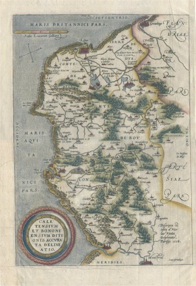
Caletensium et Bononiensium Ditionis Accurata Delineatio
Author
Ortelius
Location shown in map
--
Edition date
1602
Edition place
Anvers
Editor
--
Atlas
Theatrum Orbis Terrarum
Price
150 Euro
State
[mint/EXCELLENT/very good/good/fair/mediocre/poor]
Color
Modern color
Verso
French text
Size
Plate: cm (33 x 24.1) inches (12.99 x 9.49) Paper: cm (33 x 24.1) inches (12.99 x 9.49)
Technique
Copper engraving
Note
No particular notes for this maps
Reference
Van Den Broecke 44
Wiki
Here for more info
In stock
Available
Info
info@thetreasuremaps.com
Code
#0122
×
![Caletensium et Bononiensium Ditionis Accurata Delineatio by Ortelius, --, 1602]()
Map title
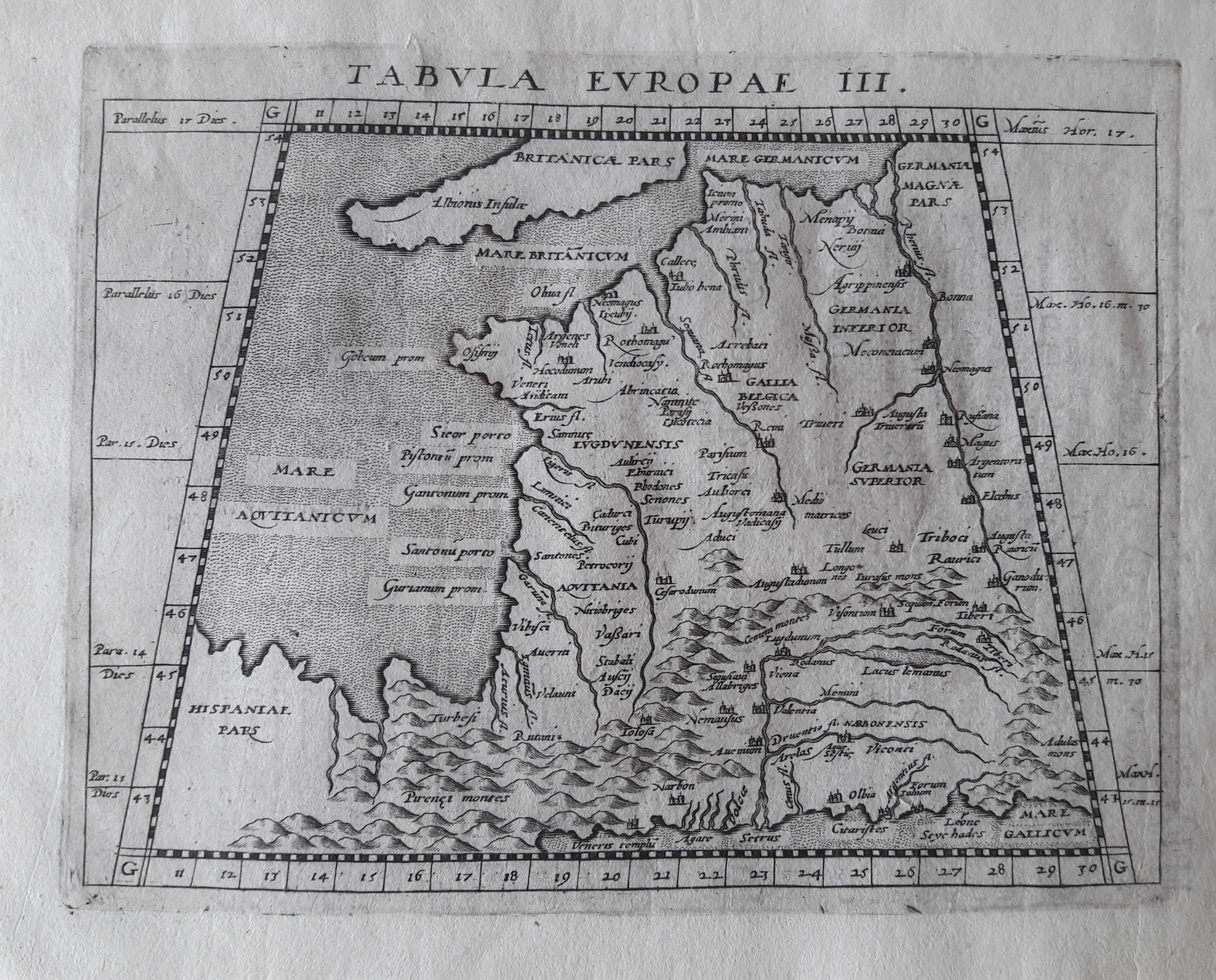
Tabula Europae III
Author
Magini
Location shown in map
France
Edition date
1617
Edition place
Arnheim
Editor
Ioannes Ianssonius
Atlas
Geografia di Claudio Tolomeo -- Giovanni Antonio Magini
Price
Please ask: info@thetreasuremaps.com
State
[mint/EXCELLENT/very good/good/fair/mediocre/poor]
Color
Black/white
Verso
Latin text pag 3
Size
Plate: cm (17.8 x 12.7) inches (7.01 x 5) Paper: cm (21.6 x 17.8) inches (8.5 x 7.01)
Technique
Copper engraving
Note
No particular notes for this maps.
Reference
--
Wiki
Here for more info
In stock
Available
Info
info@thetreasuremaps.com
Code
#0649
×
![Tabula Europae III by Magini, France, 1617]()
Map title
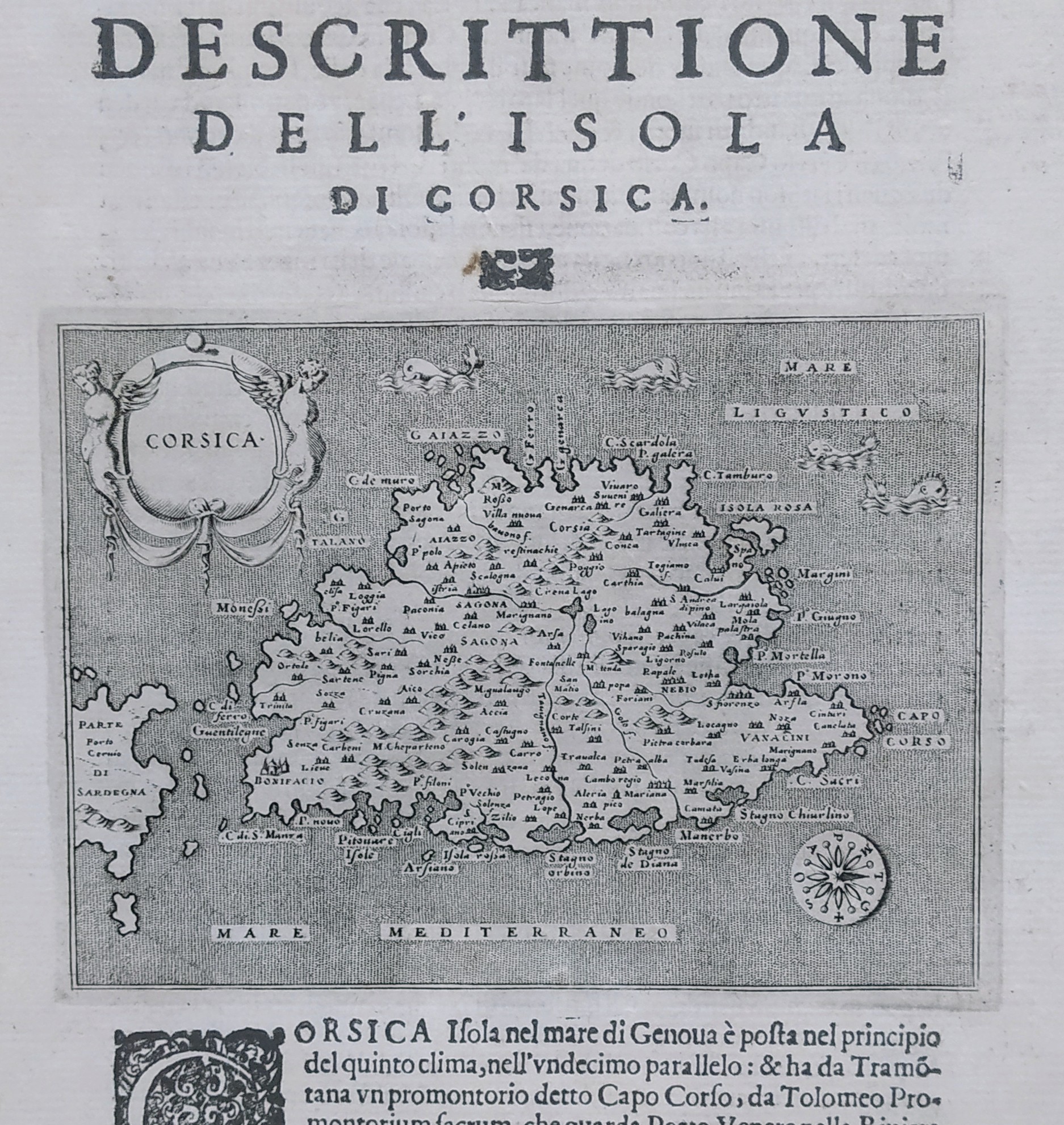
Descrittione dell'isola di Corsica
Author
Porcacchi
Location shown in map
Corse
Edition date
1620
Edition place
Venice
Editor
--
Atlas
L'Isole piu famose del mondo -- Pietr'Antonio Brigonci
Price
250 Euro
State
[MINT/excellent/very good/good/fair/mediocre/poor]
Color
Black/white
Verso
Italian text pag.42
Size
Plate: cm (14 x 11.4) inches (5.51 x 4.49) Paper: cm (20.3 x 29) inches (7.99 x 11.42)
Technique
Copper engraving
Note
No particular notes for this maps
Reference
--
Wiki
Here for more info
In stock
Available
Info
info@thetreasuremaps.com
Code
#0747
×
![Descrittione dell'isola di Corsica by Porcacchi, Corse, 1620]()
Map title
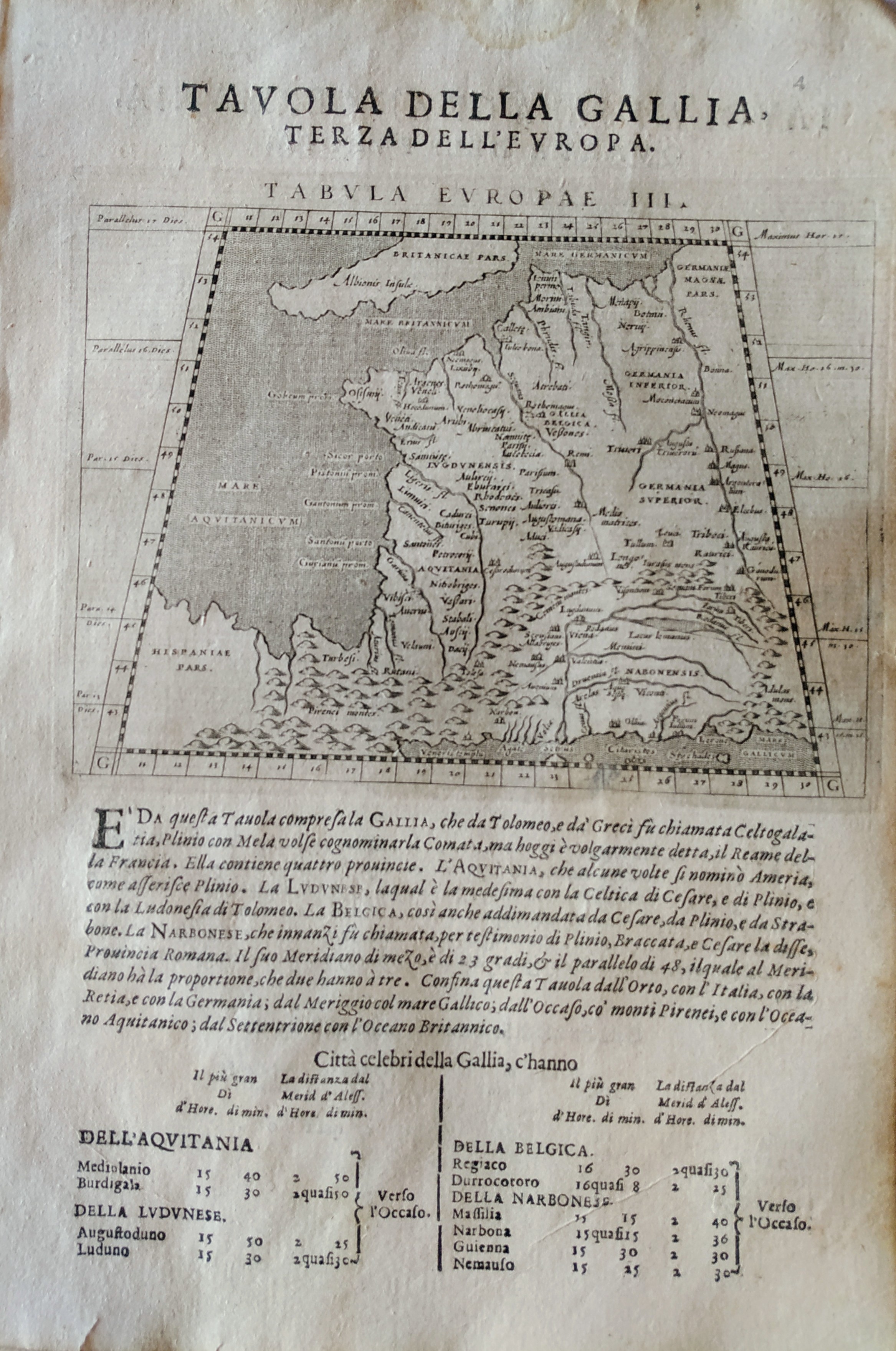
Tabula Europae III
Author
Magini
Location shown in map
France
Edition date
1621
Edition place
Padova
Editor
Paolo and Francesco Galignani
Atlas
Geografia di Claudio Tolomeo -- Giovanni Antonio Magini
Price
Please ask: info@thetreasuremaps.com
State
[MINT/excellent/very good/good/fair/mediocre/poor]
Color
Black/white
Verso
Italian text
Size
Plate: cm (12.7 x 17.8) inches (5 x 7.01) Paper: cm (20.3 x 30.5) inches (7.99 x 12.01)
Technique
Copper engraving
Note
No particular notes for this maps.
Reference
--
Wiki
Here for more info
In stock
Available
Info
info@thetreasuremaps.com
Code
#0713
×
![Tabula Europae III by Magini, France, 1621]()
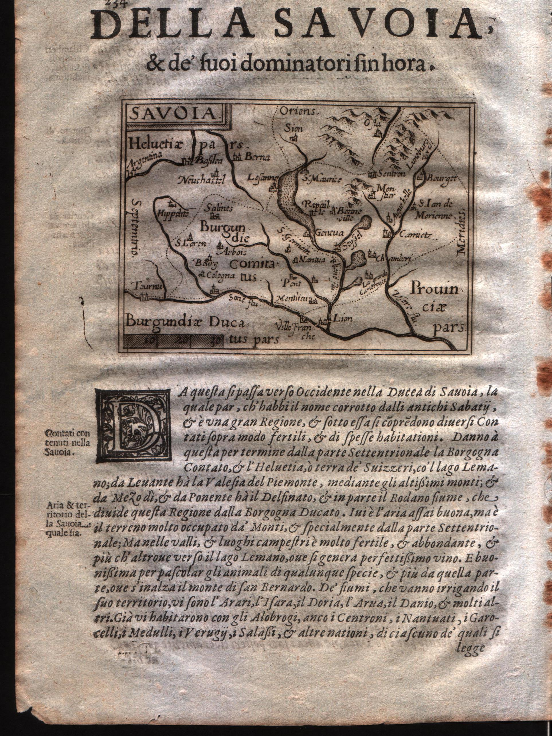
Map title
Savoia
Author
Doglioni
Location shown in map
Savoie
Edition date
1623
Edition place
Venice
Editor
Giacomo Sarzina
Atlas
Anfiteatro di Europa
Price
Please ask: info@thetreasuremaps.com
State
[mint/EXCELLENT/very good/good/fair/mediocre/poor]
Color
Black/white
Verso
Italian text pag.234
Size
Plate: cm (11.4 x 8.9) inches (4.49 x 3.5) Paper: cm (15.2 x 22.9) inches (5.98 x 9.02)
Technique
Copper engraving
Note
The maps are copies of the Galle (c.1595) edition of Ortelius.
Reference
--
Wiki
Here for more info
In stock
Available
Info
info@thetreasuremaps.com
Code
#0586
×
![Savoia by Doglioni, Savoie, 1623]()
Map title
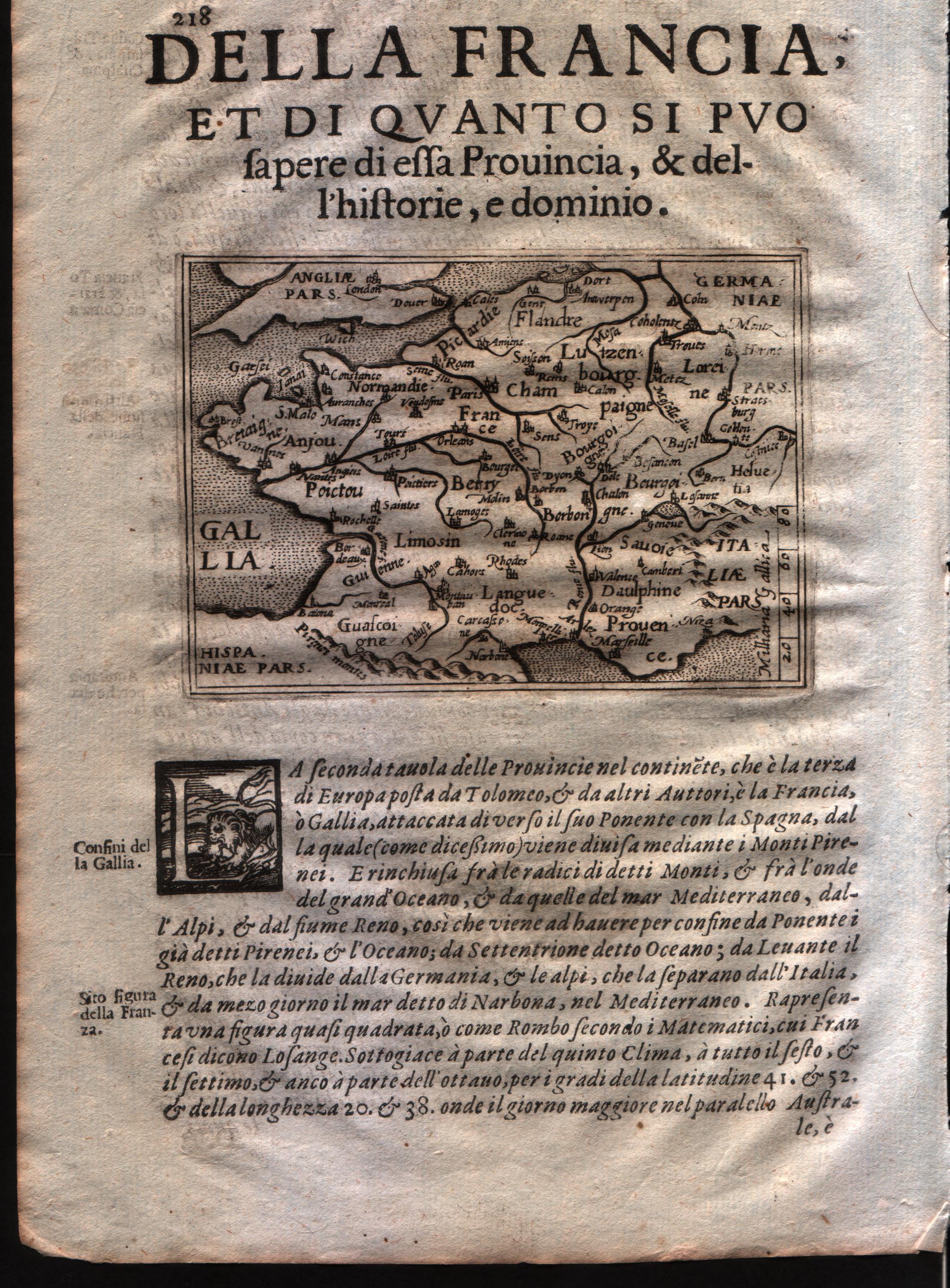
Gallia
Author
Doglioni
Location shown in map
France
Edition date
1623
Edition place
Venice
Editor
Giacomo Sarzina
Atlas
Anfiteatro di Europa
Price
Please ask: info@thetreasuremaps.com
State
[mint/EXCELLENT/very good/good/fair/mediocre/poor]
Color
Black/white
Verso
Italian text pag.218
Size
Plate: cm (11.4 x 8.9) inches (4.49 x 3.5) Paper: cm (15.2 x 22.9) inches (5.98 x 9.02)
Technique
Copper engraving
Note
The maps are copies of the Galle (c.1595) edition of Ortelius.
Reference
--
Wiki
Here for more info
In stock
Available
Info
info@thetreasuremaps.com
Code
#0585
×
![Gallia by Doglioni, France, 1623]()
Map title
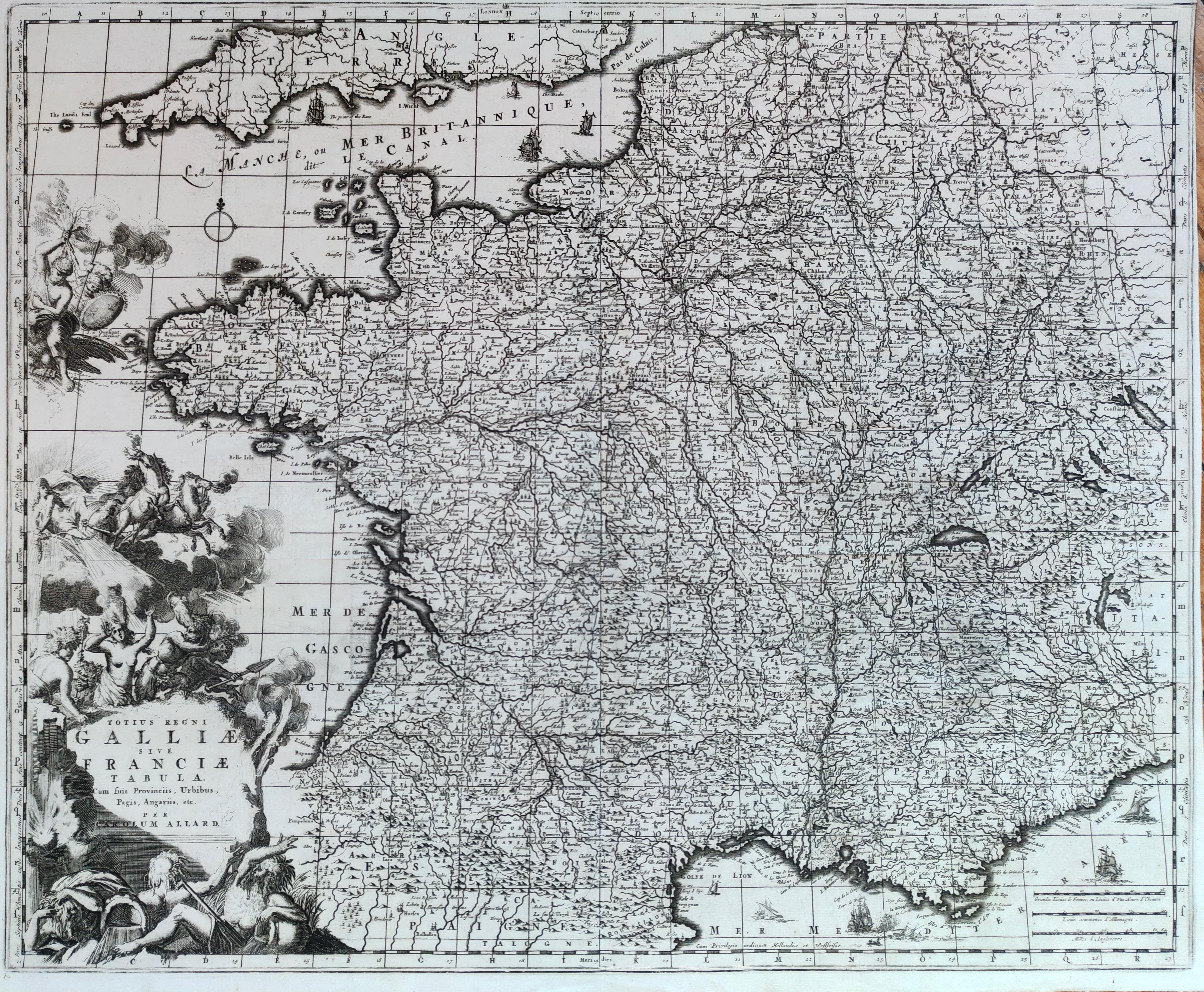
Totius regni Galliae sive Franciae tabula
Author
Allard
Location shown in map
France
Edition date
Circa 1690
Edition place
Amsterdam
Editor
--
Atlas
Atlas Major
Price
300 Euro
State
[mint/EXCELLENT/very good/good/fair/mediocre/poor]
Color
Black/white
Verso
Blank
Size
Plate: cm (57 x 46) inches (22.44 x 18.11) Paper: cm (56 x 45) inches (22.05 x 17.72)
Technique
Copper engraving
Note
Reference
Wiki
Here for more info
In stock
Available
Info
info@thetreasuremaps.com
Code
#1280
×
![Totius regni Galliae sive Franciae tabula by Allard, France, Circa 1690]()

Map title
Utriusque Burgundiae, tum Ducatus tum Comitatus
Author
Merian
Location shown in map
Burgundia, France
Edition date
1695
Edition place
Frankfurt
Editor
--
Atlas
--
Price
Please ask: info@thetreasuremaps.com
State
[mint/excellent/very good/GOOD/fair/mediocre/poor]
Color
Black/white
Verso
Blank
Size
Plate: cm (35.6 x 26.7) inches (14.02 x 10.51) Paper: cm (36.8 x 33) inches (14.49 x 12.99)
Technique
Copper engraving
Note
--
Reference
--
Wiki
Here for more info
In stock
Available
Info
info@thetreasuremaps.com
Code
#0143
×
![Utriusque Burgundiae, tum Ducatus tum Comitatus by Merian, Burgundia, France, 1695]()
Map title
Lotharingia Ducatus Vulgo Lorraine
Author
Merian
Location shown in map
Loraine, France
Edition date
1695
Edition place
Frankfurt
Editor
--
Atlas
--
Price
Please ask: info@thetreasuremaps.com
State
[mint/excellent/very good/GOOD/fair/mediocre/poor]
Color
Black/white
Verso
Blank
Size
Plate: cm (35.6 x 26.7) inches (14.02 x 10.51) Paper: cm (36.8 x 33) inches (14.49 x 12.99)
Technique
Copper engraving
Note
--
Reference
--
Wiki
Here for more info
In stock
Available
Info
info@thetreasuremaps.com
Code
#0144
×
![Lotharingia Ducatus Vulgo Lorraine by Merian, Loraine, France, 1695]()
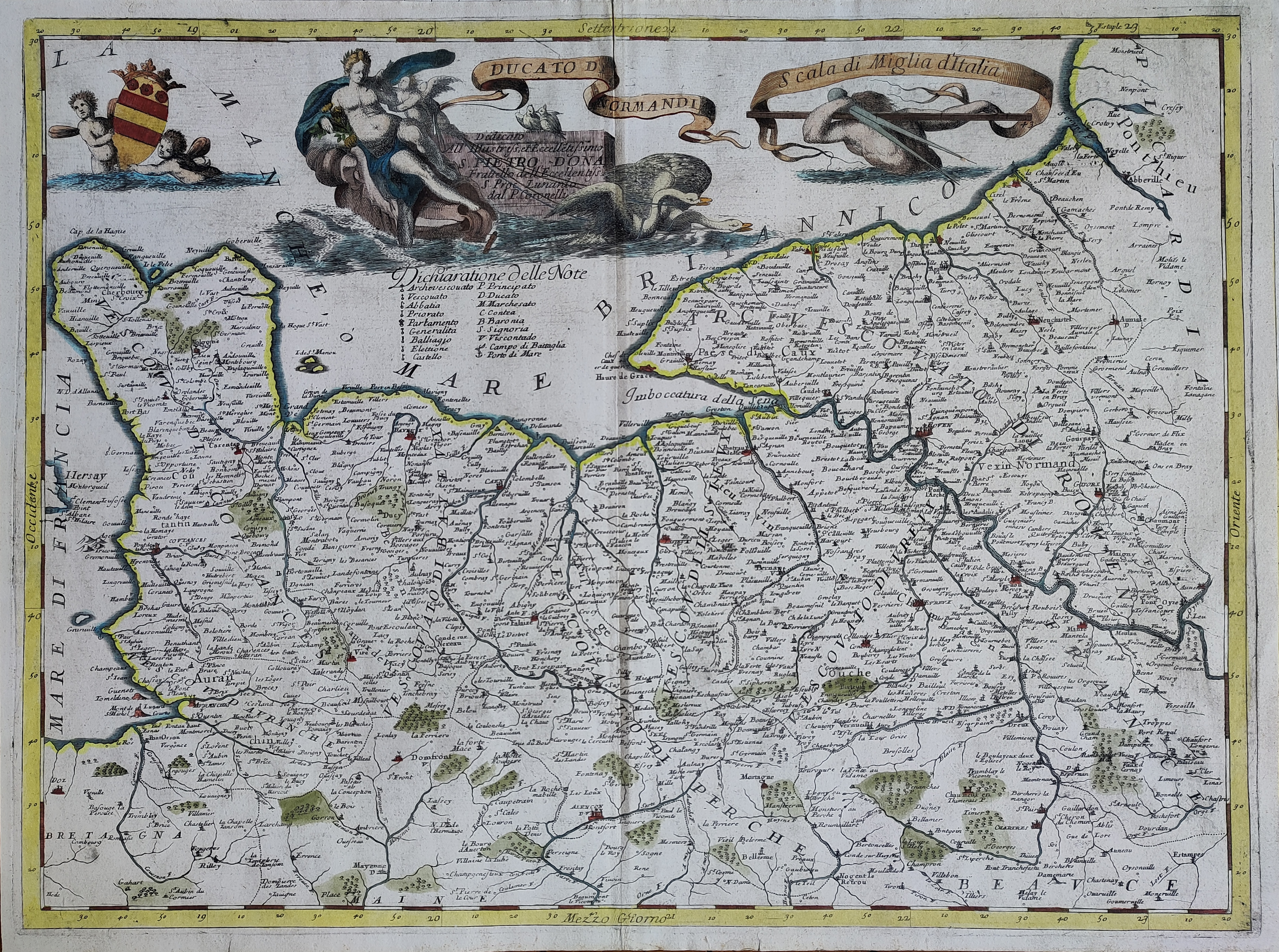
Map title
Ducato di Normandia
Author
Coronelli
Location shown in map
France
Edition date
1696
Edition place
Venice
Editor
--
Atlas
Isolario dell'atlante veneto
Price
400 Euro
State
[mint/EXCELLENT/very good/good/fair/mediocre/poor]
Color
Old colors
Verso
Italian text pag.64
Size
Plate: cm (62 x 46) inches (24.41 x 18.11) Paper: cm (64 x 47) inches (25.2 x 18.5)
Technique
Copper engraving
Note
Reference
--
Wiki
Here for more info
In stock
Available
Info
info@thetreasuremaps.com
Code
#1024
×
![Ducato di Normandia by Coronelli, France, 1696]()
Map title
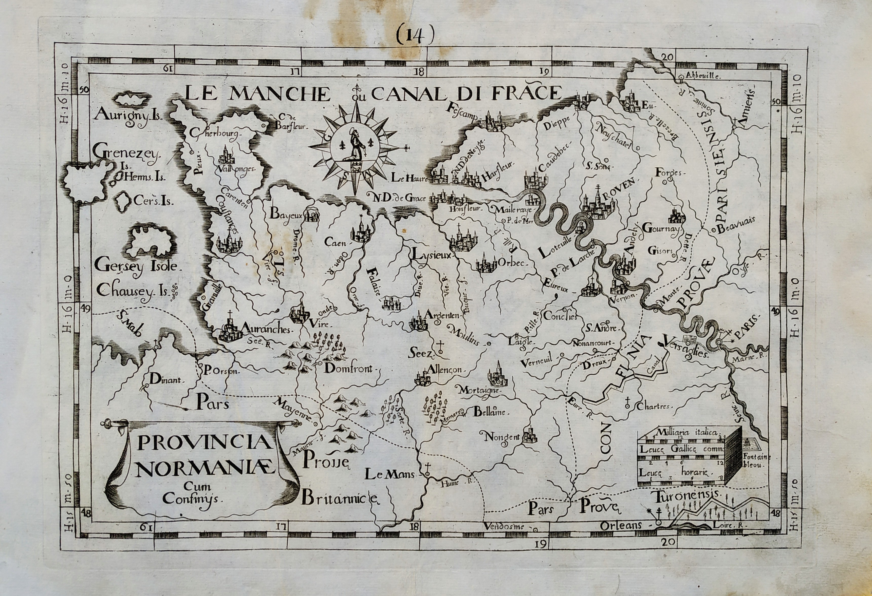
Provincia Normaniae
Author
Giovanni Battista de Cassine
Location shown in map
Normandie
Edition date
1712
Edition place
Milan
Editor
Ambrosii Ramellati
Atlas
Chorographica descriptio Provinciarum, et Conventuum FF. Min. S. Francisci Capucinorum
Price
Please ask: info@thetreasuremaps.com
State
[mint/EXCELLENT/very good/good/fair/mediocre/poor]
Color
Black/white
Verso
Blank
Size
Plate: cm (32 x 22) inches (12.6 x 8.66) Paper: cm (38 x 27) inches (14.96 x 10.63)
Technique
Copper engraving
Note
No particular notes for this maps.
Reference
--
Wiki
Here for more info
In stock
Available
Info
info@thetreasuremaps.com
Code
#0720
×
![Provincia Normaniae by Giovanni Battista de Cassine, Normandie, 1712]()
Map title
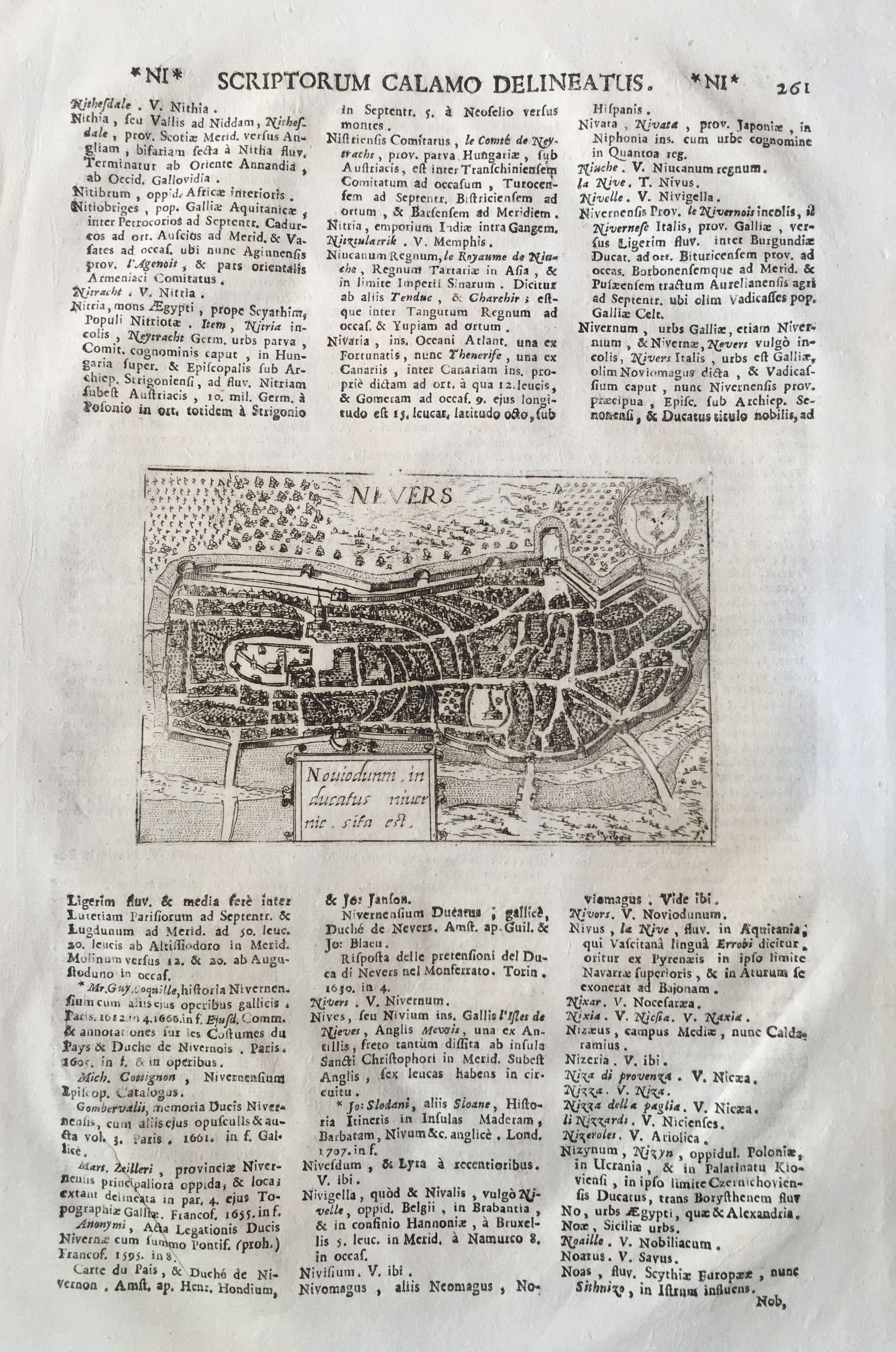
Nevers
Author
Magini
Location shown in map
Nevers
Edition date
1713
Edition place
Padua
Editor
Cadorin
Atlas
Universus terrarum orbis scriptorum calamo delineatus
Price
100 Euro
State
[mint/EXCELLENT/very good/good/fair/mediocre/poor]
Color
Black/white
Verso
Latin text pag.262
Size
Plate: cm (14 x 9) inches (5.51 x 3.54) Paper: cm (21 x 33) inches (8.27 x 12.99)
Technique
Copper engraving
Note
Alphonse Lasor a Varea
Reference
Wiki
Here for more info
In stock
Available
Info
info@thetreasuremaps.com
Code
#0665
Nevers
Author
Magini
Location shown in map
Nevers
Edition date
1713
Edition place
Padua
Editor
Cadorin
Atlas
Universus terrarum orbis scriptorum calamo delineatus
Price
100 Euro
State
[mint/EXCELLENT/very good/good/fair/mediocre/poor]
Color
Black/white
Verso
Latin text pag.262
Size
Plate: cm (14 x 9) inches (5.51 x 3.54) Paper: cm (21 x 33) inches (8.27 x 12.99)
Technique
Copper engraving
Note
Alphonse Lasor a Varea
Reference
Wiki
Here for more info
In stock
Available
Info
info@thetreasuremaps.com
Code
#0665
×
![Nevers by Magini, Nevers, 1713]()
Pages: 1 2