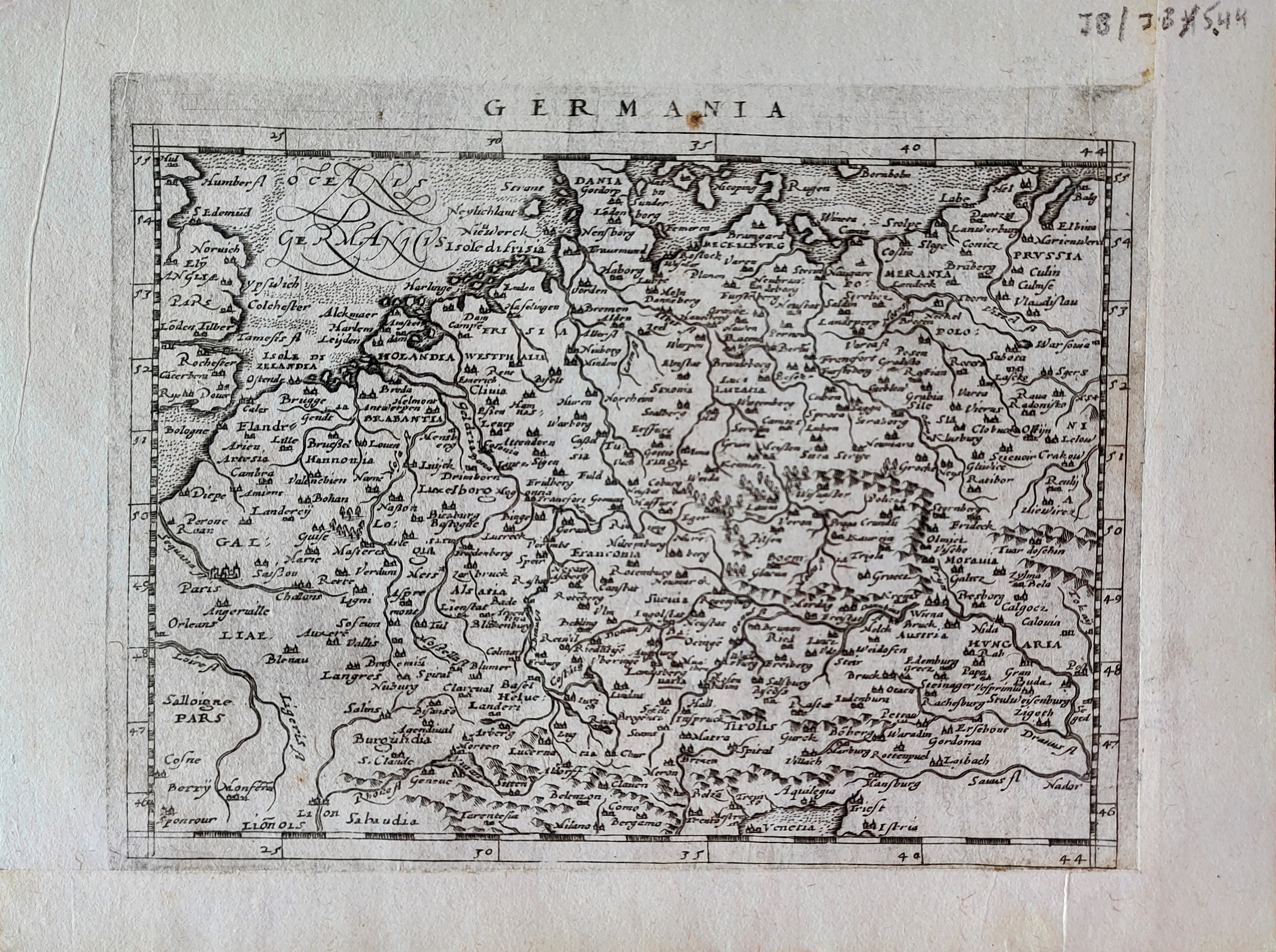
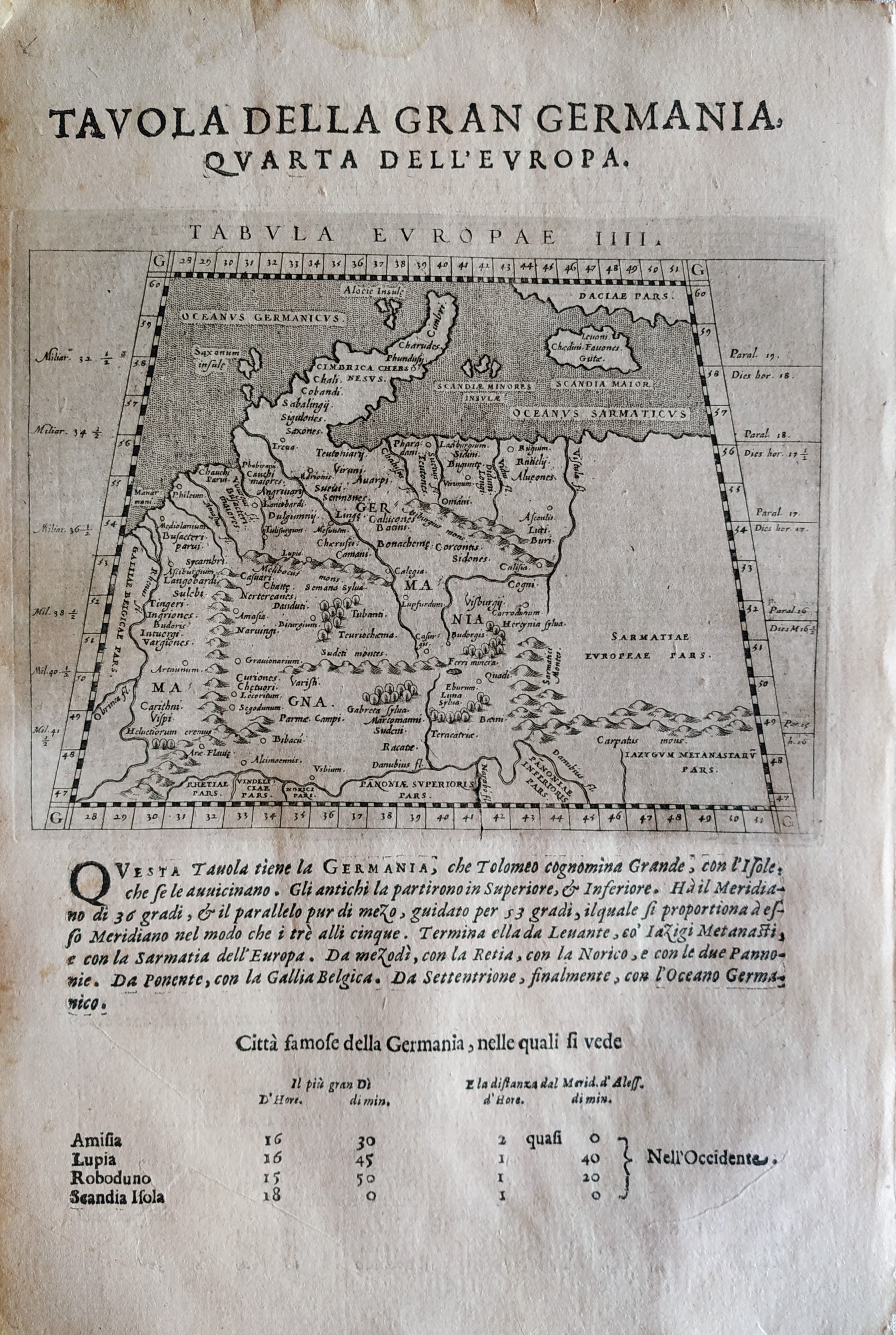
Germany
Pages: 1 2
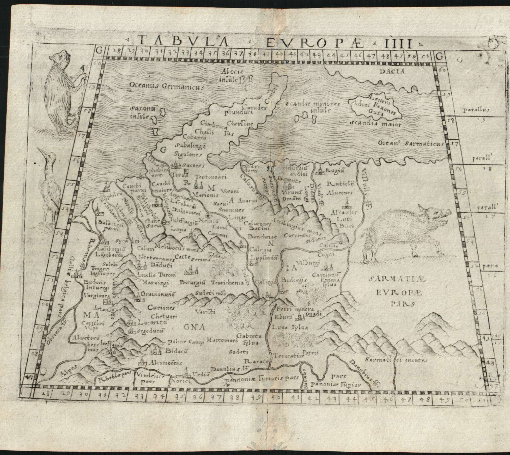
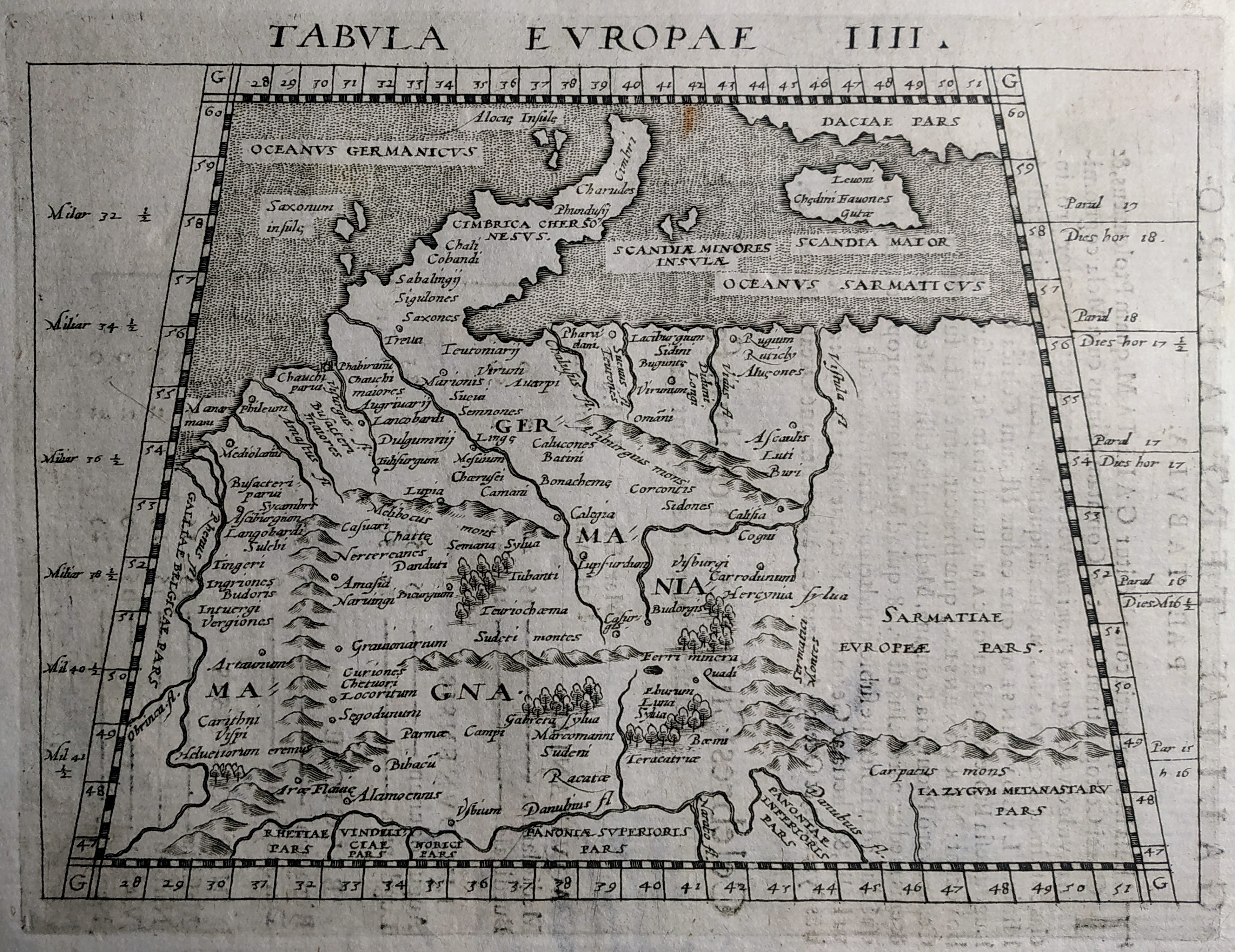
Map title
Tabula europae IIII
Author
Gastaldi
Location shown in map
Germany
Edition date
1548
Edition place
Venice
Editor
Nicolo Bascarini
Atlas
Geographia
Price
400 Euro
State
[mint/excellent/VERY GOOD/good/fair/mediocre/poor] repaired
Color
Black/white
Verso
Italian text pag.8
Size
Plate: cm (17.8 x 12.7) inches (7.01 x 5) Paper: cm (20.3 x 16.5) inches (7.99 x 6.5)
Technique
Copper engraving
Note
No particular notes for this maps
Reference
--
Wiki
Here for more info
In stock
Available
Info
info@thetreasuremaps.com
Code
#0618
×
![Tabula europae IIII by Gastaldi, Germany, 1548]()
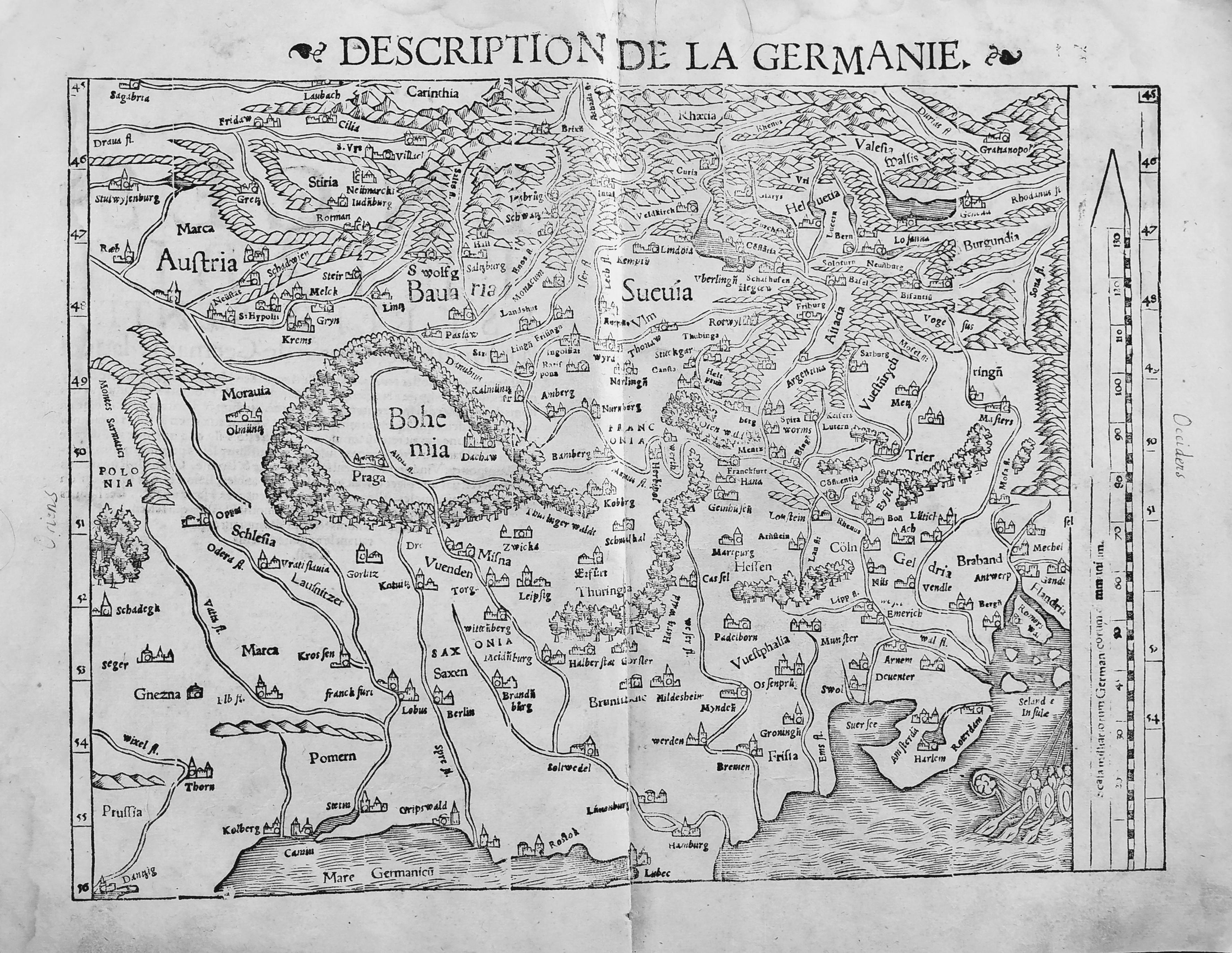
Map title
Description de la Germanie
Author
Munster
Location shown in map
Germany
Edition date
1552
Edition place
Basel
Editor
Henrich Petri
Atlas
Cosmographia Universalis
Price
300 Euro
State
[mint/EXCELLENT/very good/good/fair/mediocre/poor]
Color
Black/white
Verso
Franch text pag.6
Size
Plate: cm (34 x 25) inches (13.39 x 9.84) Paper: cm (39 x 30) inches (15.35 x 11.81)
Technique
Woodcut
Note
No particular notes for this maps.
Reference
--
Wiki
Here for more info
In stock
Available
Info
info@thetreasuremaps.com
Code
#0722
×
![Description de la Germanie by Munster, Germany, 1552]()
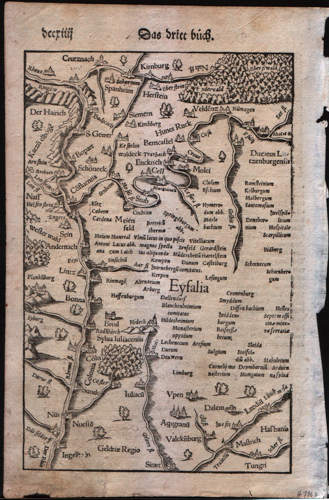
Map title
German Rhine
Author
Munster
Location shown in map
The Rhine Valley in Germany
Edition date
1560
Edition place
???
Editor
Henrich Petri
Atlas
Cosmographia Universalis
Price
Please ask: info@thetreasuremaps.com
State
[mint/EXCELLENT/very good/good/fair/mediocre/poor]
Color
Black/white
Verso
German text
Size
Plate: cm (16.5 x 25.4) inches (6.5 x 10) Paper: cm (19 x 29.2) inches (7.48 x 11.5)
Technique
Woodcut
Note
No particular notes for this maps
Reference
--
Wiki
Here for more info
In stock
Available
Info
info@thetreasuremaps.com
Code
#0097
×
![German Rhine by Munster, The Rhine Valley in Germany, 1560]()
Map title
Germania
Author
Magini
Location shown in map
Germany
Edition date
1597
Edition place
Cologne
Editor
Petrus Keschedt
Atlas
Geografia di Claudio Tolomeo -- Giovanni Antonio Magini
Price
Please ask: info@thetreasuremaps.com
State
[mint/EXCELLENT/very good/good/fair/mediocre/poor]
Color
Black/white
Verso
Latin text pag 75
Size
Plate: cm (18 x 13.5) inches (7.09 x 5.31) Paper: cm (22 x 17) inches (8.66 x 6.69)
Technique
Copper engraving
Note
Maps pirated from those of Girolamo Poro in Magini's edition.
Reference
--
Wiki
Here for more info
In stock
Available
Info
info@thetreasuremaps.com
Code
#0898
×
![Germania by Magini, Germany, 1597]()
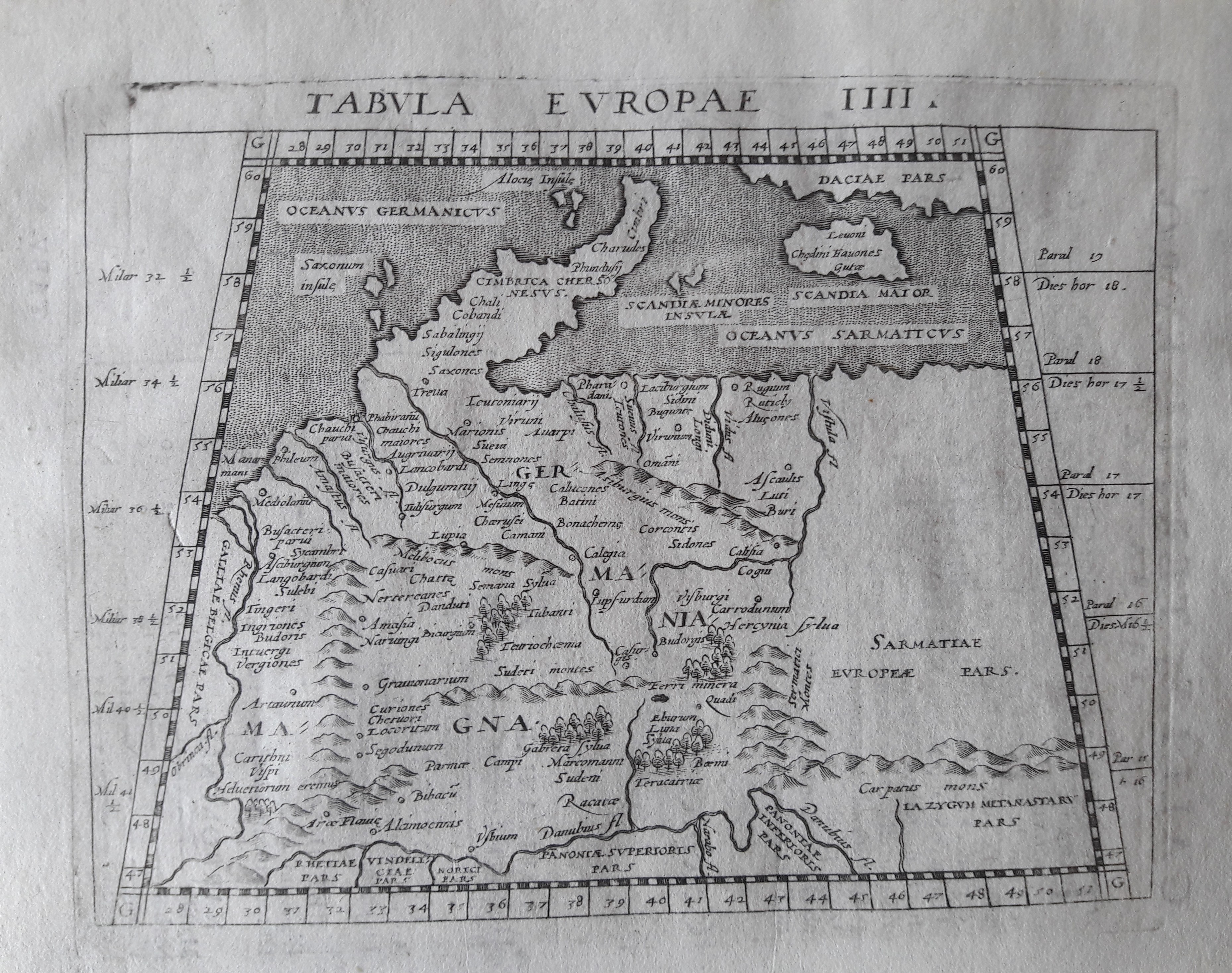
Map title
Tabula Europae IIII
Author
Magini
Location shown in map
Germany
Edition date
1597
Edition place
Cologne
Editor
Petrus Keschedt
Atlas
Geografia di Claudio Tolomeo -- Giovanni Antonio Magini
Price
Please ask: info@thetreasuremaps.com
State
[mint/EXCELLENT/very good/good/fair/mediocre/poor]
Color
Black/white
Verso
Latin text pag 5
Size
Plate: cm (18 x 13.5) inches (7.09 x 5.31) Paper: cm (23 x 16) inches (9.06 x 6.3)
Technique
Copper engraving
Note
Maps pirated from those of Girolamo Poro in Magini's edition.
Reference
--
Wiki
Here for more info
In stock
Available
Info
info@thetreasuremaps.com
Code
#0830
×
![Tabula Europae IIII by Magini, Germany, 1597]()
Map title
Germania
Author
Magini
Location shown in map
Germany
Edition date
1597
Edition place
Colonia
Editor
Petrus Keschedt
Atlas
Geografia di Claudio Tolomeo -- Giovanni Antonio Magini
Price
Please ask: info@thetreasuremaps.com
State
[mint/EXCELLENT/very good/good/fair/mediocre/poor]
Color
Black/white
Verso
Latin text pag 75
Size
Plate: cm (17.8 x 12.7) inches (7.01 x 5) Paper: cm (21.6 x 17.8) inches (8.5 x 7.01)
Technique
Copper engraving
Note
Maps pirated from those of Girolamo Poro in Magini's edition.
Reference
--
Wiki
Here for more info
In stock
Available
Info
info@thetreasuremaps.com
Code
#0651
×
![Germania by Magini, Germany, 1597]()
Map title
Tabula Europe IIII
Author
Magini
Location shown in map
Germany
Edition date
1617
Edition place
Arnheim
Editor
Ioannes Ianssonius
Atlas
Geografia di Claudio Tolomeo -- Giovanni Antonio Magini
Price
Please ask: info@thetreasuremaps.com
State
[mint/EXCELLENT/very good/good/fair/mediocre/poor]
Color
Black/white
Verso
Latin text pag 5
Size
Plate: cm (17.8 x 12.7) inches (7.01 x 5) Paper: cm (21.6 x 17.8) inches (8.5 x 7.01)
Technique
Copper engraving
Note
No particular notes for this maps.
Reference
--
Wiki
Here for more info
In stock
Available
Info
info@thetreasuremaps.com
Code
#0646
×
![Tabula Europe IIII by Magini, Germany, 1617]()
Map title
Tabula Europae IIII
Author
Magini
Location shown in map
Germany
Edition date
1621
Edition place
Padova
Editor
Paolo and Francesco Galignani
Atlas
Geografia di Claudio Tolomeo -- Giovanni Antonio Magini
Price
200 Euro
State
[MINT/excellent/very good/good/fair/mediocre/poor]
Color
Black/white
Verso
Italian text pag 4
Size
Plate: cm (12.7 x 17.8) inches (5 x 7.01) Paper: cm (20.3 x 30.5) inches (7.99 x 12.01)
Technique
Copper engraving
Note
No particular notes for this maps.
Reference
--
Wiki
Here for more info
In stock
Available
Info
info@thetreasuremaps.com
Code
#0714
×
![Tabula Europae IIII by Magini, Germany, 1621]()
Map title
Germania
Author
Doglioni
Location shown in map
Germany
Edition date
1623
Edition place
Venice
Editor
Giacomo Sarzina
Atlas
Anfiteatro di Europa
Price
Please ask: info@thetreasuremaps.com
State
[mint/EXCELLENT/very good/good/fair/mediocre/poor]
Color
Black/white
Verso
Italian text pag.343
Size
Plate: cm (11.4 x 8.9) inches (4.49 x 3.5) Paper: cm (15.2 x 22.9) inches (5.98 x 9.02)
Technique
Copper engraving
Note
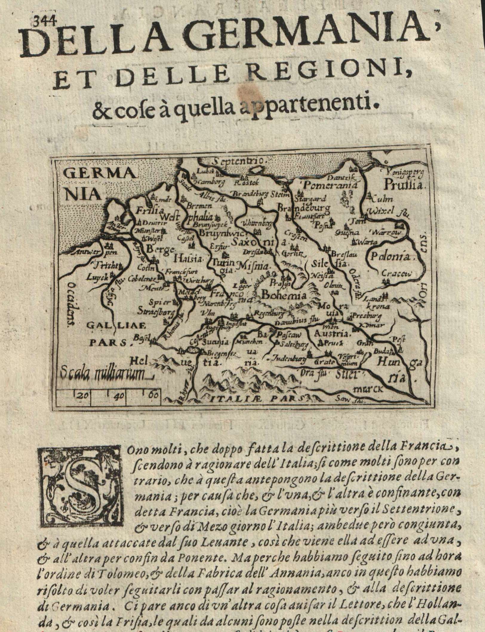
The maps are copies of the Galle (c.1595) edition of Ortelius.
Reference
--
Wiki
Here for more info
In stock
Available
Info
info@thetreasuremaps.com
Code
#0615
Germania
Author
Doglioni
Location shown in map
Germany
Edition date
1623
Edition place
Venice
Editor
Giacomo Sarzina
Atlas
Anfiteatro di Europa
Price
Please ask: info@thetreasuremaps.com
State
[mint/EXCELLENT/very good/good/fair/mediocre/poor]
Color
Black/white
Verso
Italian text pag.343
Size
Plate: cm (11.4 x 8.9) inches (4.49 x 3.5) Paper: cm (15.2 x 22.9) inches (5.98 x 9.02)
Technique
Copper engraving
Note
The maps are copies of the Galle (c.1595) edition of Ortelius.
Reference
--
Wiki
Here for more info
In stock
Available
Info
info@thetreasuremaps.com
Code
#0615
×
![Germania by Doglioni, Germany, 1623]()
Map title
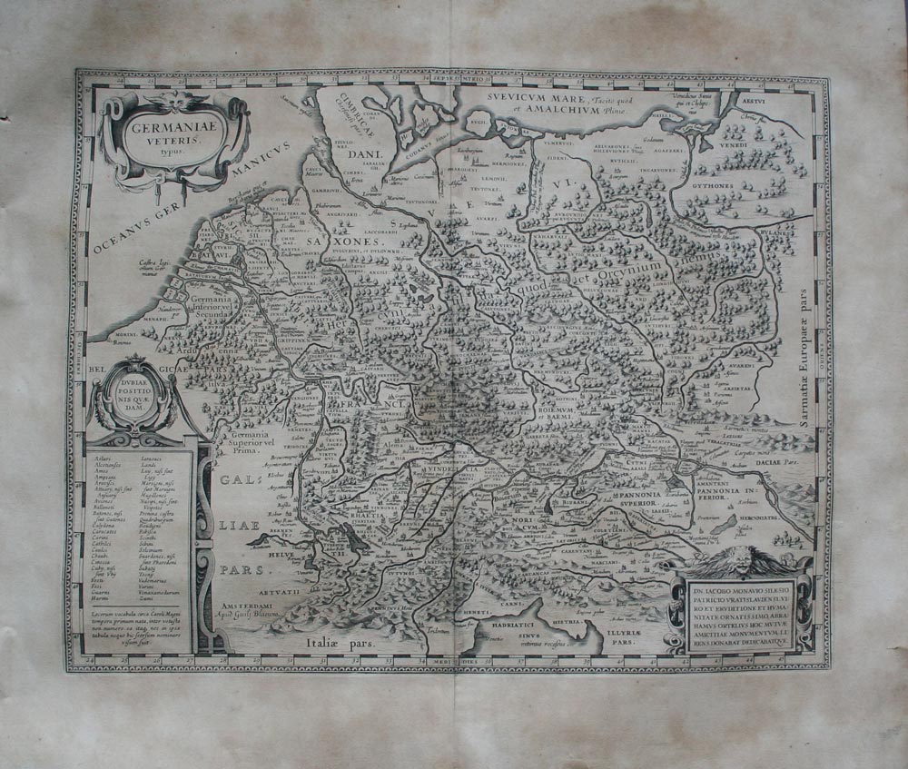
Germaniae veteris typus
Author
Blaeu
Location shown in map
Germany
Edition date
1630
Edition place
Amsterdam
Editor
--
Atlas
Appendix
Price
250 Euro
State
[mint/excellent/VERY GOOD/good/fair/mediocre/poor]
Color
Black/white
Verso
Latin text
Size
Plate: cm (48.3 x 35.6) inches (19.02 x 14.02) Paper: cm (58.4 x 50.8) inches (22.99 x 20)
Technique
Copper engraving
Note
Ancient Germany.
Reference
--
Wiki
Here for more info
In stock
Available
Info
info@thetreasuremaps.com
Code
#0137
×
![Germaniae veteris typus by Blaeu, Germany, 1630]()

Map title
Descriptio Fluminum Rheni, Vahalis et Mosae a Rheno Berca ad Goricomium usque
Author
Hondius
Location shown in map
Rhine
Edition date
Circa 1642
Edition place
Amsterdam
Editor
Hondius
Atlas
Price
175 Euro
State
[mint/EXCELLENT/very good/good/fair/mediocre/poor]
Color
Old colors
Verso
Latin text
Size
Plate: cm (49 x 37) inches (19.29 x 14.57) Paper: cm (56 x 48) inches (22.05 x 18.9)
Technique
Copper engraving
Note
Professionally repaired
Reference
Wiki
Here for more info
In stock
Available
Info
info@thetreasuremaps.com
Code
#1233
×
![Descriptio Fluminum Rheni, Vahalis et Mosae a Rheno Berca ad Goricomium usque by Hondius, Rhine, Circa 1642]()
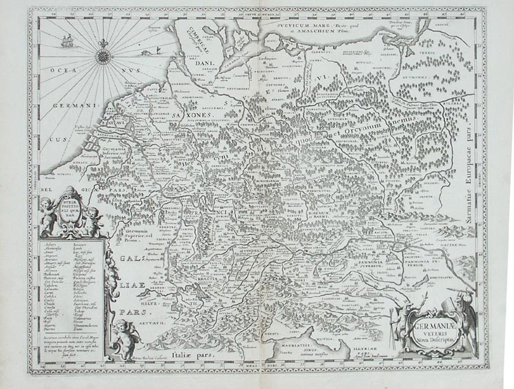
Map title
Germaniae veteris nova descriptio
Author
Jansson
Location shown in map
Germany
Edition date
1652
Edition place
Amsterdam
Editor
--
Atlas
Accuratissima orbis antiqui delineatio.
Price
250 Euro
State
[mint/excellent/VERY GOOD/good/fair/mediocre/poor]
Color
Black/white
Verso
Blank
Size
Plate: cm (47 x 36.8) inches (18.5 x 14.49) Paper: cm (54.6 x 45.7) inches (21.5 x 17.99)
Technique
Copper engraving
Note
Map based on Ortelius' map of ancient Germany.
Reference
--
Wiki
Here for more info
In stock
Available
Info
info@thetreasuremaps.com
Code
#0138
×
![Germaniae veteris nova descriptio by Jansson, Germany, 1652]()
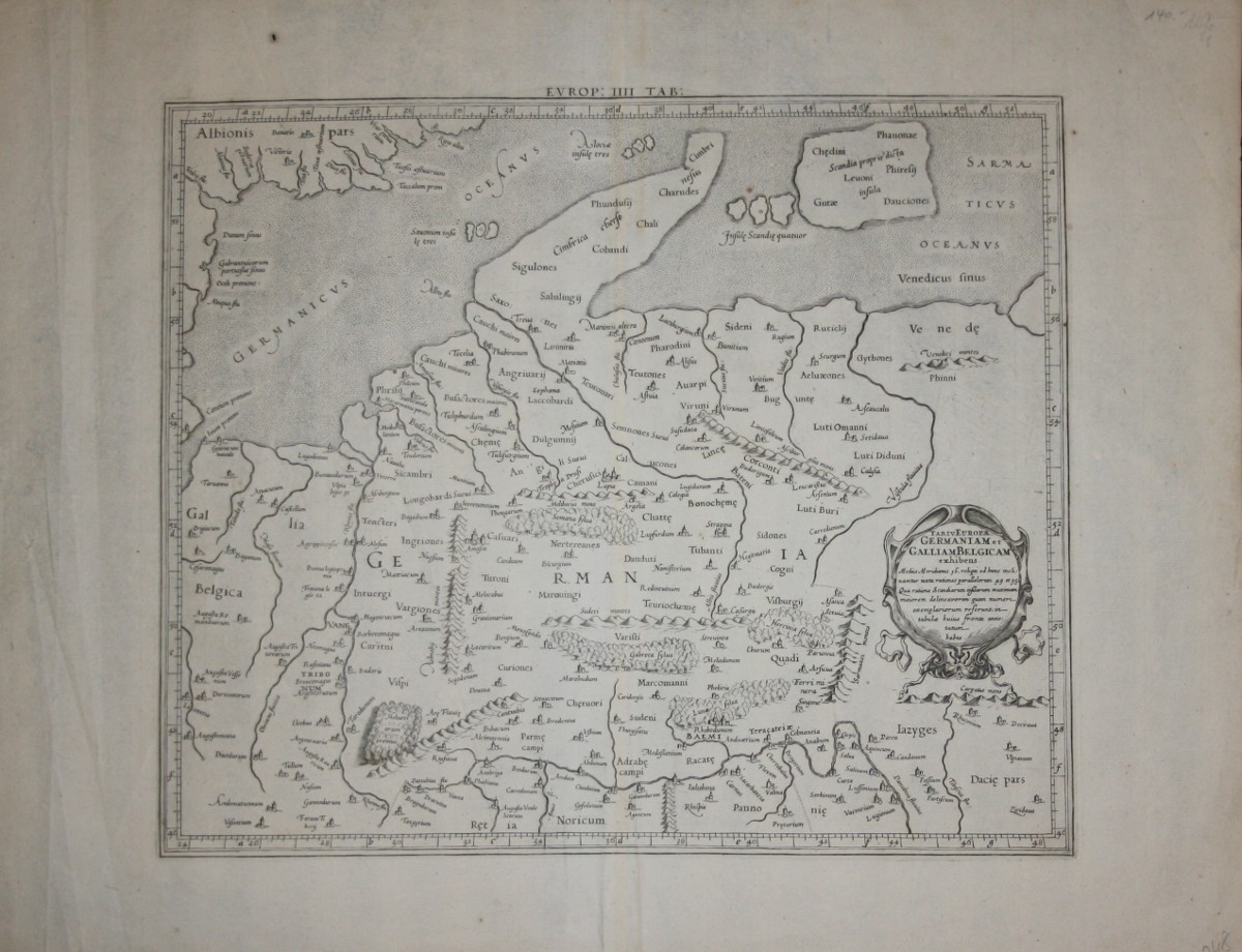
Map title
Tab IV Europae Germaniam et Galliam Belgicam exhibens
Author
Mercator
Location shown in map
Old Germany
Edition date
1695
Edition place
Utrecht
Editor
--
Atlas
Claudii Ptolemaei's Atlas Tabulae geographicae Orbis Terrarum - Francois Halma
Price
250 Euro
State
[mint/excellent/VERY GOOD/good/fair/mediocre/poor]
Color
Black/white
Verso
Blank
Size
Plate: cm (40.6 x 34.3) inches (15.98 x 13.5) Paper: cm (57.2 x 43.2) inches (22.52 x 17.01)
Technique
Copper engraving
Note
Ancient Germany.
Reference
--
Wiki
Here for more info
In stock
Available
Info
info@thetreasuremaps.com
Code
#0502
×
![Tab IV Europae Germaniam et Galliam Belgicam exhibens by Mercator, Old Germany, 1695]()
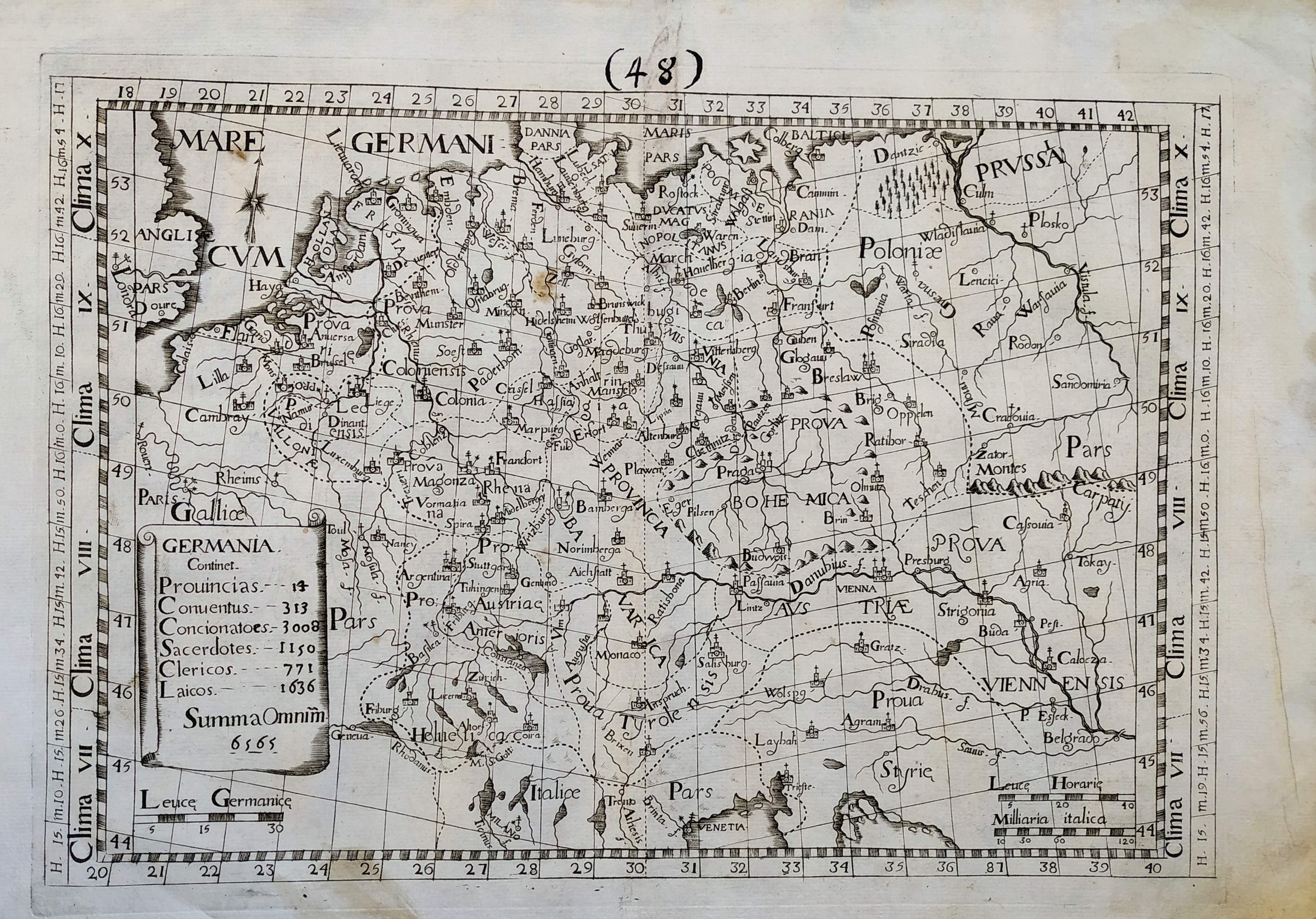
Map title
Germania
Author
Giovanni Battista de Cassine
Location shown in map
Germany
Edition date
1712
Edition place
Milan
Editor
Ambrosii Ramellati
Atlas
Chorographica descriptio Provinciarum, et Conventuum FF. Min. S. Francisci Capucinorum
Price
Please ask: info@thetreasuremaps.com
State
[mint/EXCELLENT/very good/good/fair/mediocre/poor]
Color
Black/white
Verso
Blank
Size
Plate: cm (32 x 22) inches (12.6 x 8.66) Paper: cm (38 x 27) inches (14.96 x 10.63)
Technique
Copper engraving
Note
No particular notes for this maps.
Reference
--
Wiki
Here for more info
In stock
Available
Info
info@thetreasuremaps.com
Code
#0721
×
![Germania by Giovanni Battista de Cassine, Germany, 1712]()
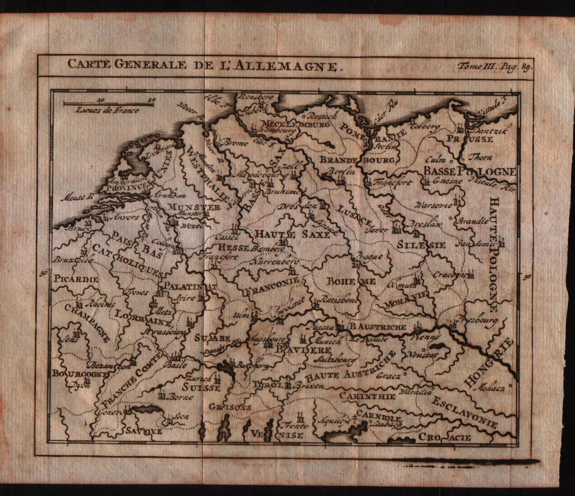
Map title
Carte generale de l'Alemagne
Author
Sanson
Location shown in map
Germany
Edition date
1743
Edition place
Amsterdam
Editor
--
Atlas
Introduction A L'Historie General Et Politique De L'Univeri
Price
Please ask: info@thetreasuremaps.com
State
[mint/EXCELLENT/very good/good/fair/mediocre/poor]
Color
Black/white
Verso
Blank
Size
Plate: cm (16.5 x 14) inches (6.5 x 5.51) Paper: cm (20.3 x 16.5) inches (7.99 x 6.5)
Technique
Copper engraving
Note
No particular notes for this maps
Reference
--
Wiki
Here for more info
In stock
Available
Info
info@thetreasuremaps.com
Code
#0155
×
![Carte generale de l'Alemagne by Sanson, Germany, 1743]()

Map title
L'Allemagne, la Boheme et la Hongrie avec une partie de la Pologne
Author
Bonne
Location shown in map
--
Edition date
1787
Edition place
Paris
Editor
--
Atlas
Atlas Encyclopedique
Price
Please ask: info@thetreasuremaps.com
State
[mint/excellent/VERY GOOD/good/fair/mediocre/poor]
Color
Black/white
Verso
Blank
Size
Plate: cm (31.8 x 21) inches (12.52 x 8.27) Paper: cm (36.8 x 25.4) inches (14.49 x 10)
Technique
Copper engraving
Note
No particular notes for this maps
Reference
--
Wiki
Here for more info
In stock
Sold
Info
info@thetreasuremaps.com
Code
#0426
×
![L'Allemagne, la Boheme et la Hongrie avec une partie de la Pologne by Bonne, --, 1787]()
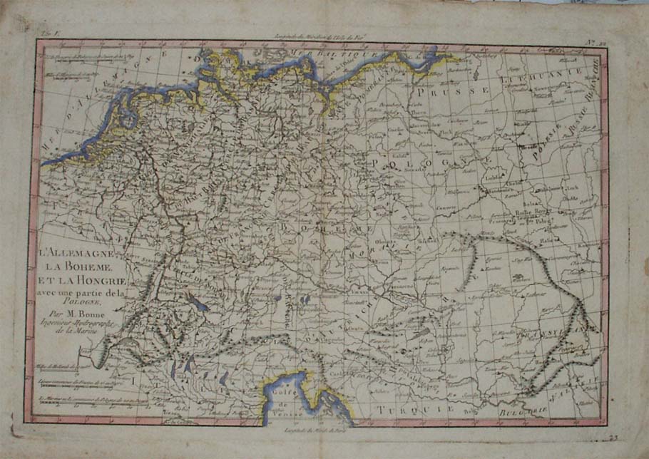
Map title
L'Allemagne, la Boheme et la Hongrie avec une partie de la Pologne
Author
Bonne
Location shown in map
Germany
Edition date
1787
Edition place
Paris
Editor
--
Atlas
Atlas Encyclopedique
Price
Please ask: info@thetreasuremaps.com
State
[mint/excellent/very good/good/FAIR/mediocre/poor]
Color
Modern outlined
Verso
Blank
Size
Plate: cm (31.8 x 21) inches (12.52 x 8.27) Paper: cm (36.8 x 25.4) inches (14.49 x 10)
Technique
Copper engraving
Note
No particular notes for this maps
Reference
--
Wiki
Here for more info
In stock
Available
Info
info@thetreasuremaps.com
Code
#0167
×
![L'Allemagne, la Boheme et la Hongrie avec une partie de la Pologne by Bonne, Germany, 1787]()
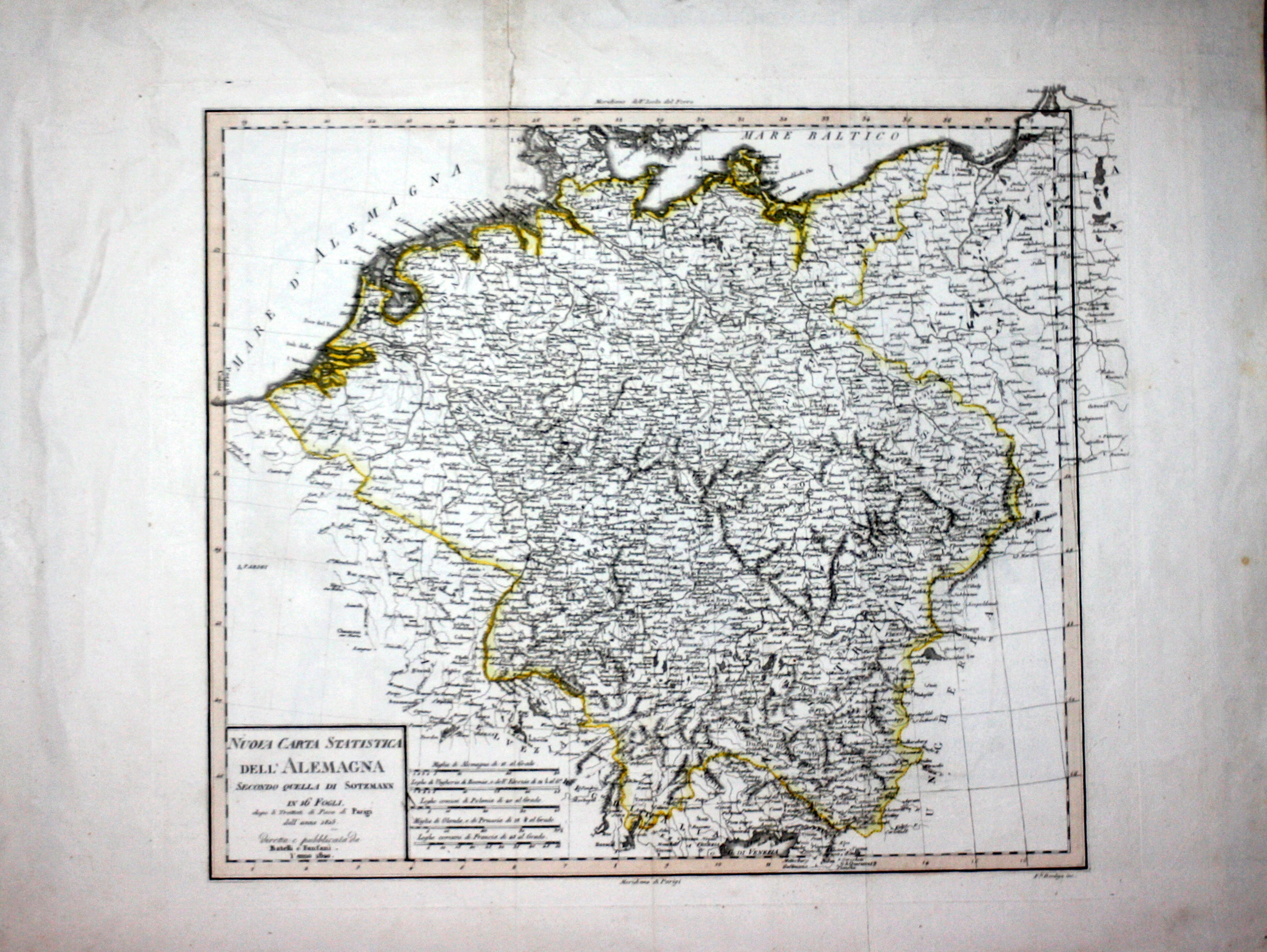
Map title
Nuova carta statistica dell'Alemagna
Author
Bordiga
Location shown in map
Germany
Edition date
1820
Edition place
Milan
Editor
Battelli e Fanfani
Atlas
Nuovo atlante di geografia universale
Price
50 Euro
State
[mint/EXCELLENT/very good/good/fair/mediocre/poor]
Color
Old color
Verso
White
Size
Plate: cm (38.1 x 33) inches (15 x 12.99) Paper: cm (58.4 x 45.7) inches (22.99 x 17.99)
Technique
Steel engraving
Note
No particular notes for this maps.
Reference
--
Wiki
Here for more info
In stock
Available
Info
info@thetreasuremaps.com
Code
#0544
×
![Nuova carta statistica dell'Alemagna by Bordiga, Germany, 1820]()
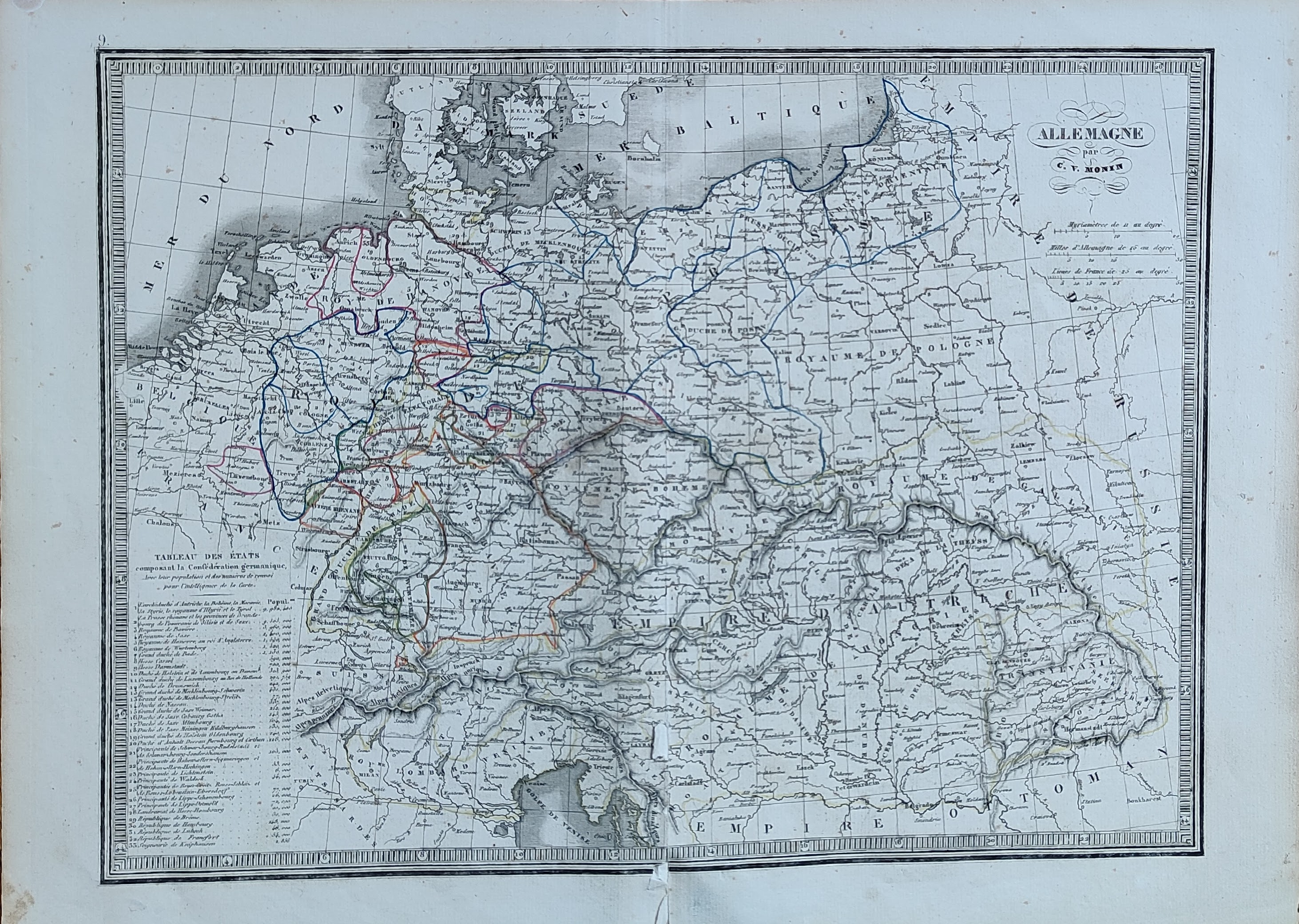
Map title
Alemagne
Author
Monin
Location shown in map
Germany
Edition date
1840
Edition place
Paris
Editor
Atlas
Atlas Classique de la Geographie
Price
50 Euro
State
[mint/EXCELLENT/very good/good/fair/mediocre/poor]
Color
Old colors
Verso
Blank
Size
Plate: cm (39 x 28) inches (15.35 x 11.02) Paper: cm (45 x 33) inches (17.72 x 12.99)
Technique
Copper engraving
Note
Reference
Wiki
Here for more info
In stock
Available
Info
info@thetreasuremaps.com
Code
#1034
×
![Alemagne by Monin, Germany, 1840]()
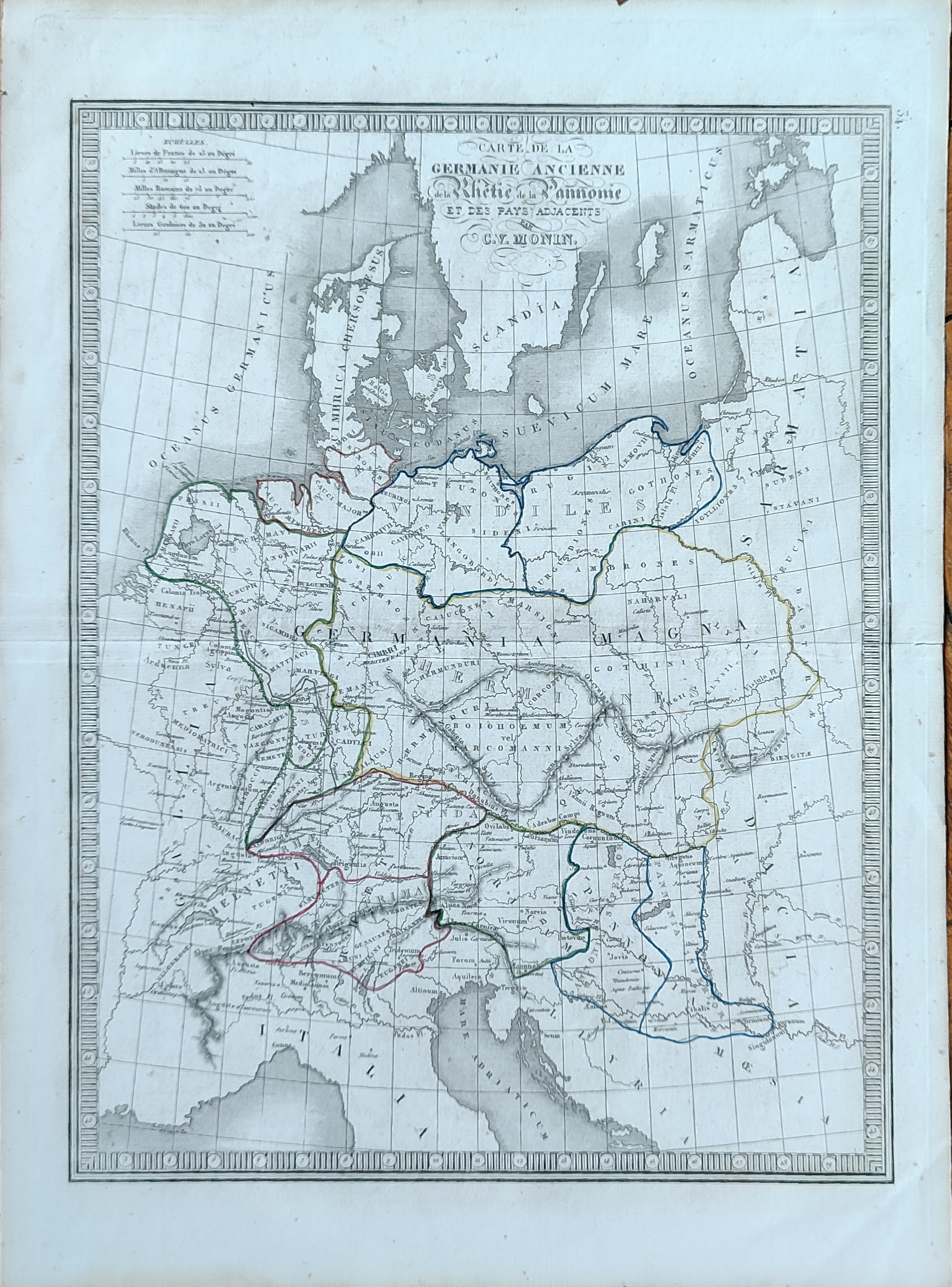
Map title
Carte de la Germanie Ancienne
Author
Monin
Location shown in map
Germany
Edition date
1840
Edition place
Paris
Editor
Atlas
Atlas Classique de la Geographie
Price
50 Euro
State
[mint/EXCELLENT/very good/good/fair/mediocre/poor]
Color
Old colors
Verso
Blank
Size
Plate: cm (28 x 39) inches (11.02 x 15.35) Paper: cm (33 x 45) inches (12.99 x 17.72)
Technique
Copper engraving
Note
Reference
Wiki
Here for more info
In stock
Available
Info
info@thetreasuremaps.com
Code
#1048
×
![Carte de la Germanie Ancienne by Monin, Germany, 1840]()
Pages: 1 2