Middle East
Map title
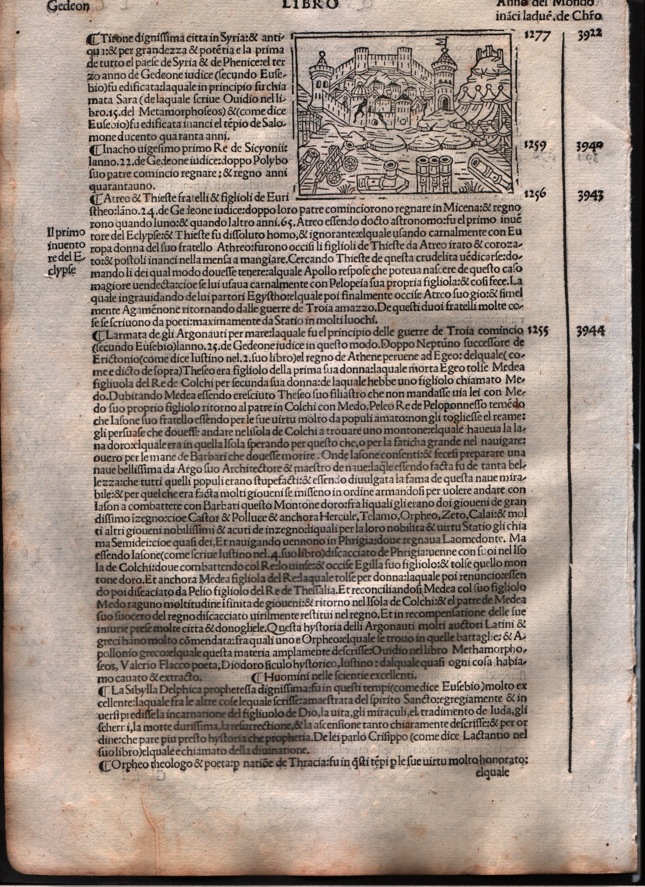
Tyre
Author
Foresti
Location shown in map
City of Tirone - Lebanon
Edition date
1508
Edition place
Venice
Editor
Georgii de Rusconibus
Atlas
Supplementum supplementi cronicarum
Price
Please ask: info@thetreasuremaps.com
State
[MINT/excellent/very good/good/fair/mediocre/poor]
Color
Black/white
Verso
Italian text
Size
Plate: cm (7.6 x 6.4) inches (2.99 x 2.52) Paper: cm (21.6 x 30.5) inches (8.5 x 12.01)
Technique
Woodcut
Note
No particular notes for this maps.
Reference
--
Wiki
Here for more info
In stock
Available
Info
info@thetreasuremaps.com
Code
#0004
×
![]()
Map title
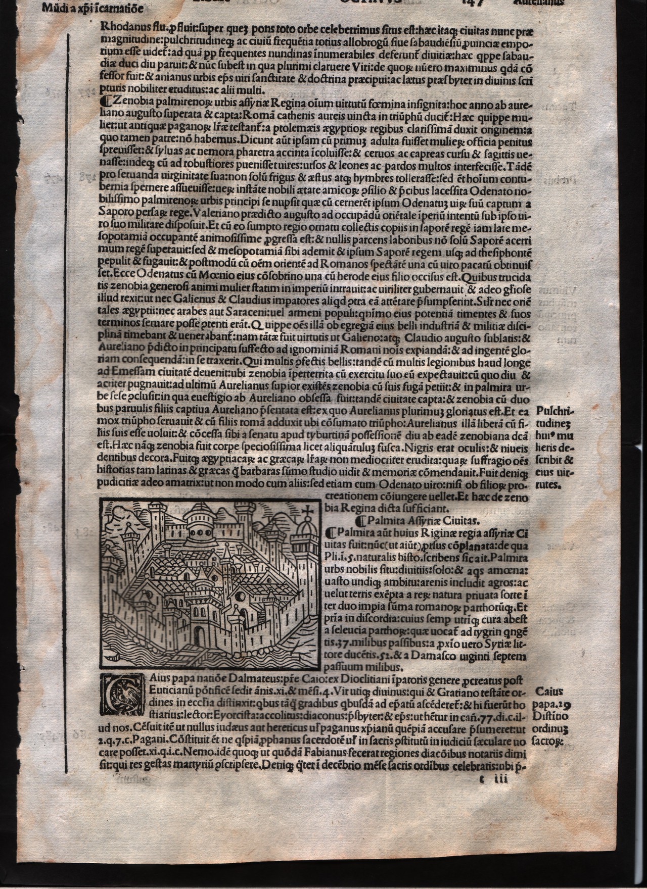
Palmiria
Author
Foresti
Location shown in map
City of Tadmor - Syria
Edition date
1508
Edition place
Venice
Editor
Georgii de Rusconibus
Atlas
Supplementum supplementi cronicarum
Price
Please ask: info@thetreasuremaps.com
State
[MINT/excellent/very good/good/fair/mediocre/poor]
Color
Black/white
Verso
Latin text
Size
Plate: cm (7.6 x 6.4) inches (2.99 x 2.52) Paper: cm (20.3 x 29.2) inches (7.99 x 11.5)
Technique
Woodcut
Note
No particular notes for this maps.
Reference
--
Wiki
Here for more info
In stock
Available
Info
info@thetreasuremaps.com
Code
#0008
×
![]()
Map title
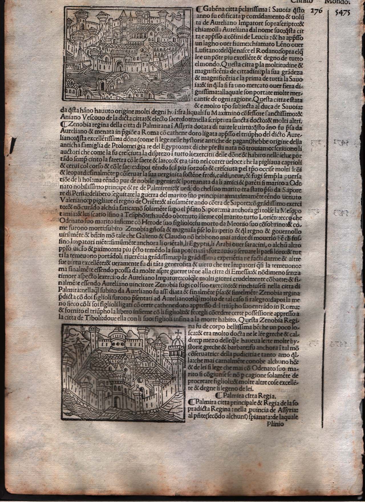
Palmiria & Gabena
Author
Foresti
Location shown in map
City of Palmiria - Syria
Edition date
1508
Edition place
Venice
Editor
Georgii de Rusconibus
Atlas
Supplementum supplementi cronicarum
Price
Please ask: info@thetreasuremaps.com
State
[MINT/excellent/very good/good/fair/mediocre/poor]
Color
Black/white
Verso
Italian text
Size
Plate: cm (7.6 x 6.4) inches (2.99 x 2.52) Paper: cm (20.3 x 30.5) inches (7.99 x 12.01)
Technique
Woodcut
Note
No particular notes for this maps.
Reference
--
Wiki
Here for more info
In stock
Available
Info
info@thetreasuremaps.com
Code
#0009
×
![]()
Map title
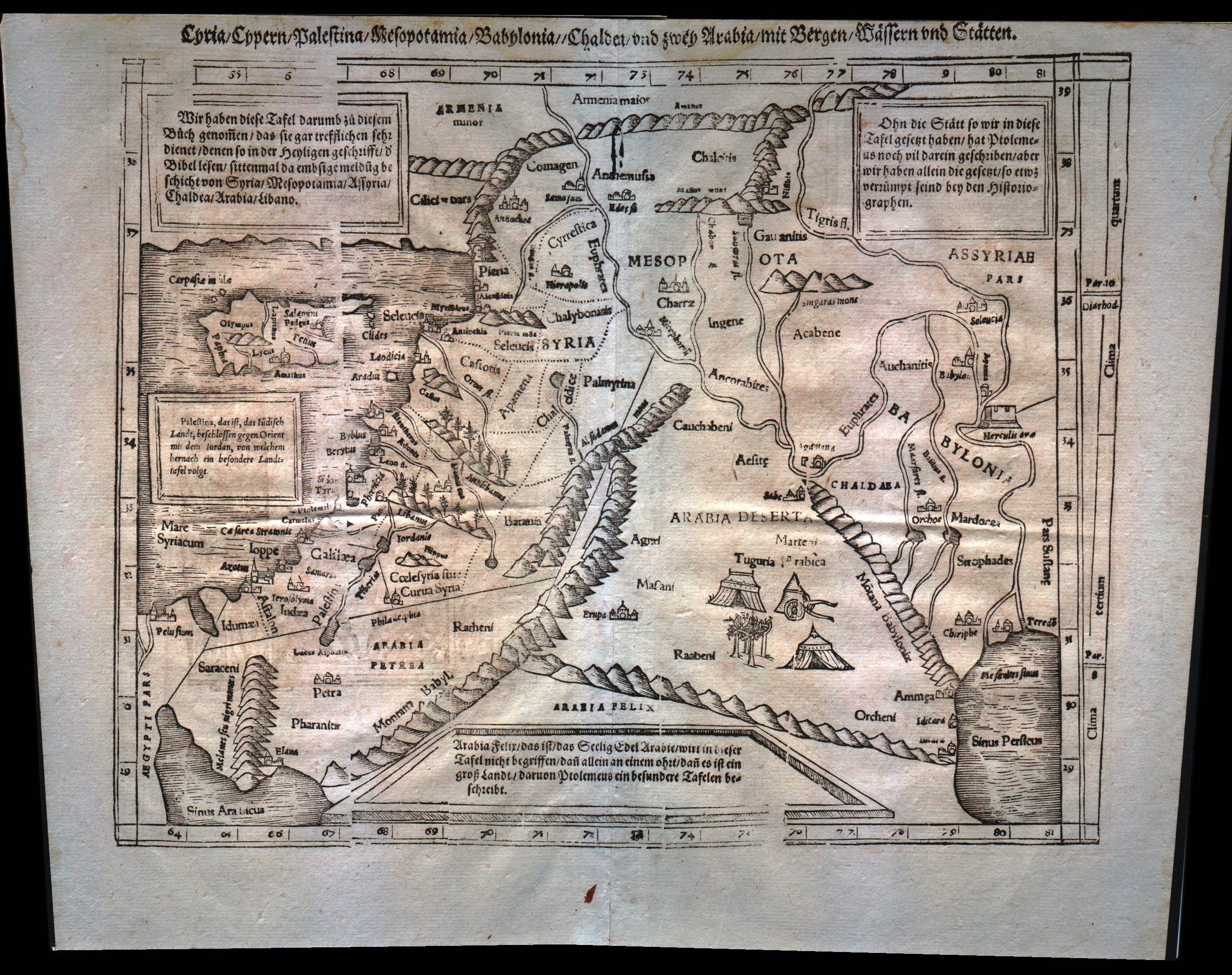
Syria Cypern Palestina Mesopotamia Babylonia Chaldea und zwey Arabia mit Bergen Wassern und Statten
Author
Munster
Location shown in map
Holy Land
Edition date
1555
Edition place
Basel
Editor
Henrich Petri
Atlas
Cosmographia Universalis
Price
300 Euro
State
[mint/excellent/very good/GOOD/fair/mediocre/poor]
Color
Black/white
Verso
German text
Size
Plate: cm (34.3 x 25.4) inches (13.5 x 10) Paper: cm (40.6 x 31.8) inches (15.98 x 12.52)
Technique
Woodcut
Note
Middle East from the Nile Delta to the southern coast of Turkey. Tabulae Asiae IV.
Reference
--
Wiki
Here for more info
In stock
Available
Info
info@thetreasuremaps.com
Code
#0178
×
![]()
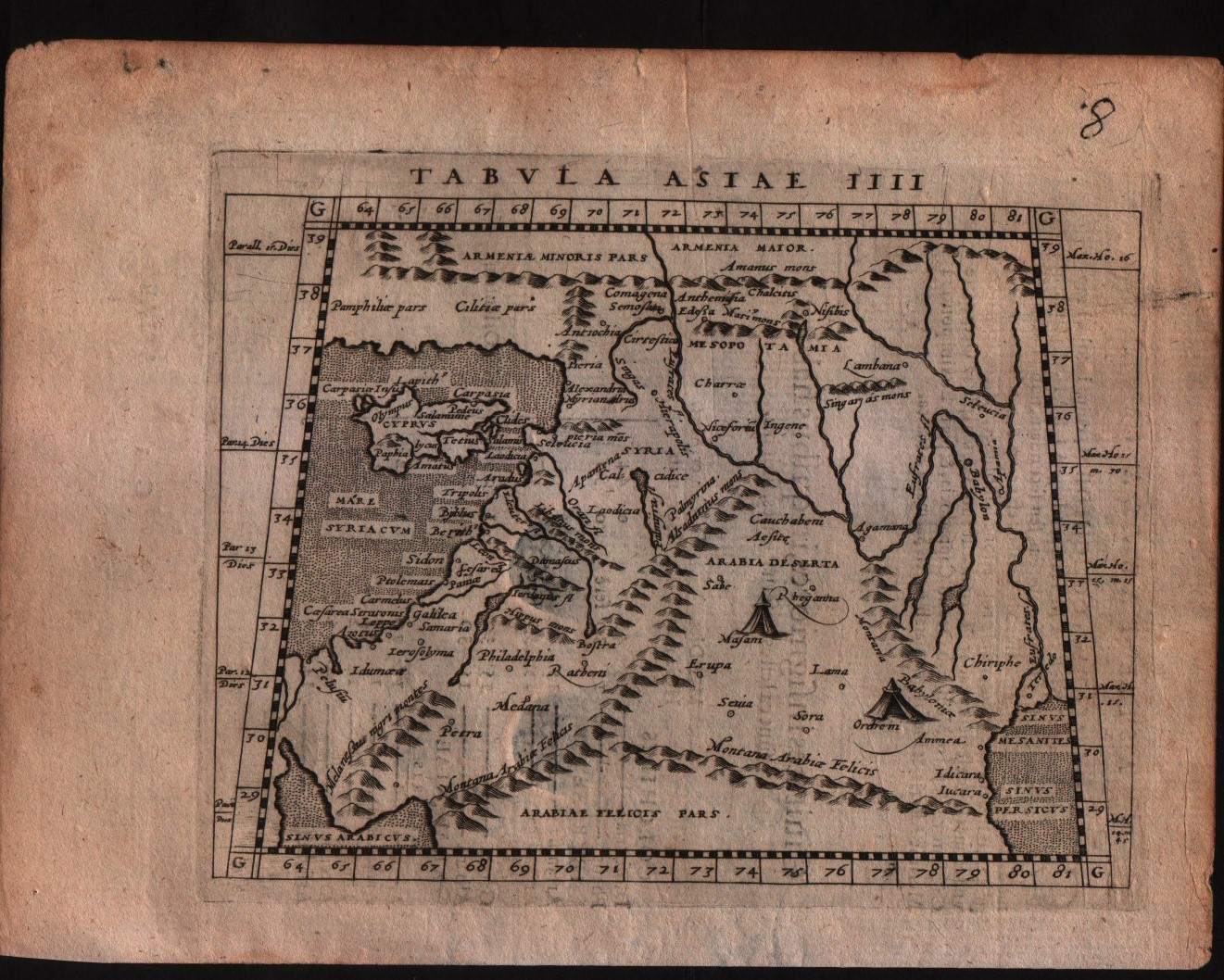
Map title
Tabula Asiae IIII
Author
Magini
Location shown in map
Middle east
Edition date
1597
Edition place
Colonia
Editor
Petrus Keschedt
Atlas
Geografia di Claudio Tolomeo -- Giovanni Antonio Magini
Price
Please ask: info@thetreasuremaps.com
State
[mint/EXCELLENT/very good/good/fair/mediocre/poor]
Color
Black/white
Verso
Latin text pag.19
Size
Plate: cm (17.8 x 12.7) inches (7.01 x 5) Paper: cm (22.9 x 16.5) inches (9.02 x 6.5)
Technique
Copper engraving
Note
Maps pirated from those of Girolamo Poro in Magini's edition.
Reference
--
Wiki
Here for more info
In stock
Available
Info
info@thetreasuremaps.com
Code
#0513
×
![]()
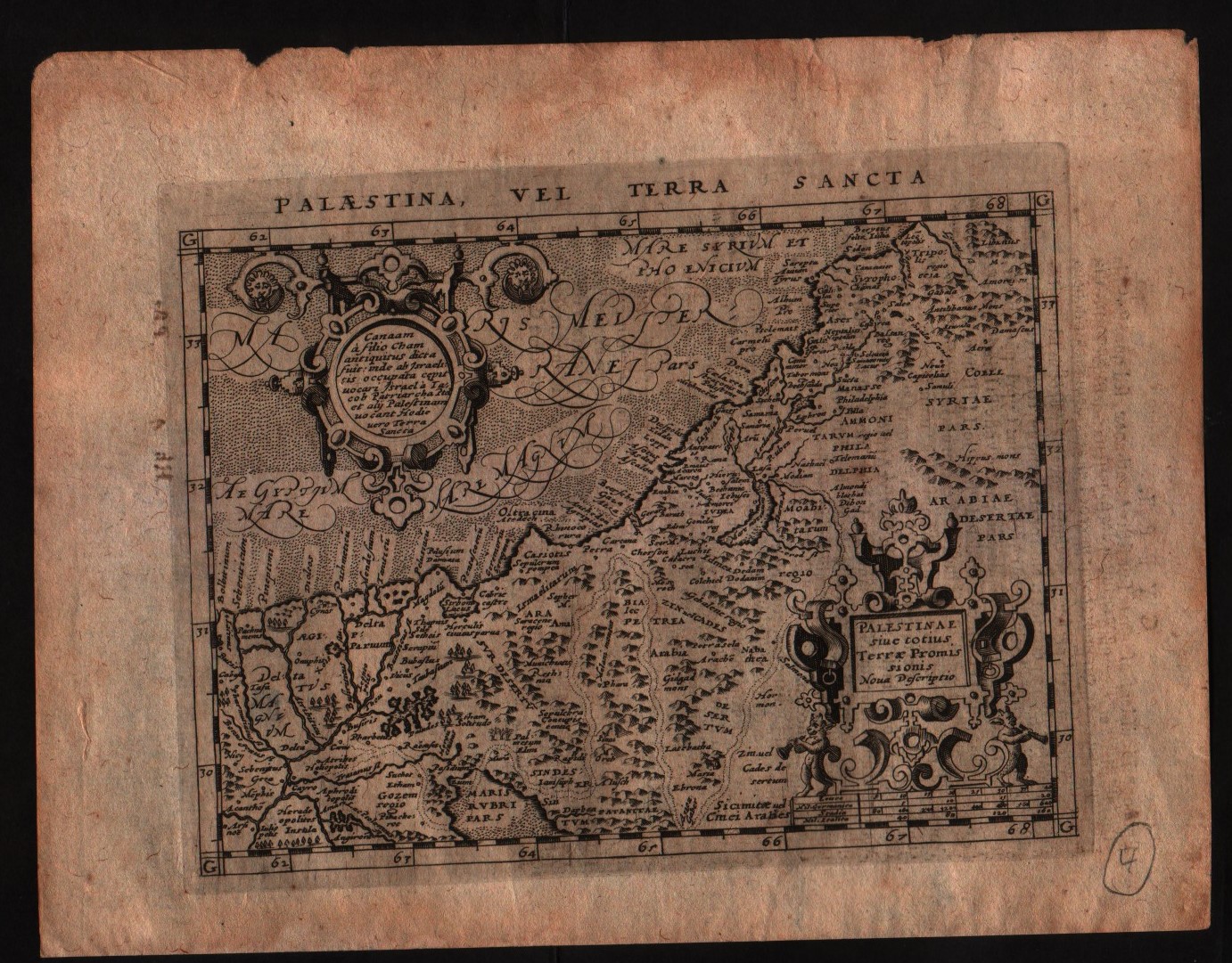
Map title
Palaestina vel terra sancta
Author
Magini
Location shown in map
Middle east
Edition date
1597
Edition place
Colonia
Editor
Petrus Keschedt
Atlas
Geografia di Claudio Tolomeo -- Giovanni Antonio Magini
Price
Please ask: info@thetreasuremaps.com
State
[mint/EXCELLENT/very good/good/fair/mediocre/poor]
Color
Black/white
Verso
Latin text pag.240
Size
Plate: cm (17.8 x 12.7) inches (7.01 x 5) Paper: cm (22.9 x 16.5) inches (9.02 x 6.5)
Technique
Copper engraving
Note
Maps pirated from those of Girolamo Poro in Magini's edition.
Reference
--
Wiki
Here for more info
In stock
Available
Info
info@thetreasuremaps.com
Code
#0515
×
![]()
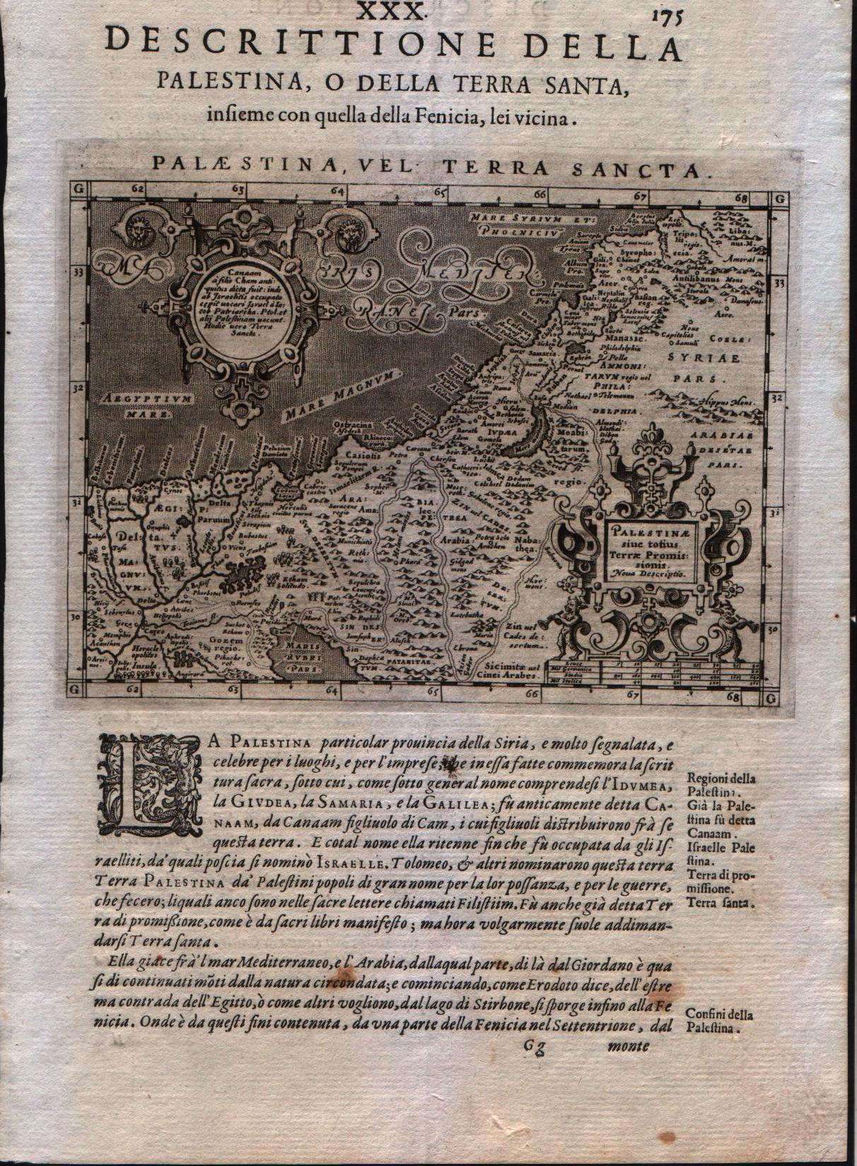
Map title
Palestina vel Terra Sancta
Author
Magini
Location shown in map
Holy Land
Edition date
1598
Edition place
Venice
Editor
Battista & Giorgio Galignani
Atlas
Geografia di Claudio Tolomeo -- Giovanni Antonio Magini
Price
200 Euro
State
[MINT/excellent/very good/good/fair/mediocre/poor]
Color
Black/white
Verso
Italian text pag 175
Size
Plate: cm (12.7 x 17.8) inches (5 x 7.01) Paper: cm (20.3 x 30.5) inches (7.99 x 12.01)
Technique
Copper engraving
Note
Magini's modern map of the Holy Land.
Reference
--
Wiki
Here for more info
In stock
Available
Info
info@thetreasuremaps.com
Code
#0210
×
![]()

Map title
Arabia Petraea et Deserta
Author
Unknown
Location shown in map
Israel and Arabia
Edition date
1732
Edition place
Leipzig
Editor
--
Atlas
Geographia Antiqua
Price
Please ask: info@thetreasuremaps.com
State
[mint/EXCELLENT/very good/good/fair/mediocre/poor]
Color
Black/white
Verso
Blank
Size
Plate: cm (30.5 x 20.3) inches (12.01 x 7.99) Paper: cm (36.8 x 24.1) inches (14.49 x 9.49)
Technique
Copper engraving
Note
No particular notes for this maps
Reference
--
Wiki
Here for more info
In stock
Sold
Info
info@thetreasuremaps.com
Code
#0221
×
![]()
Map title
La Palestine
Author
Le Rouge
Location shown in map
--
Edition date
1748
Edition place
Paris
Editor
--
Atlas
Atlas Nouveau Portatif l'usage des militaries et du voyageur
Price
Please ask: info@thetreasuremaps.com
State
[mint/EXCELLENT/very good/good/fair/mediocre/poor]
Color
Old outlined
Verso
Blank
Size
Plate: cm (20.3 x 27.9) inches (7.99 x 10.98) Paper: cm (24.1 x 34.9) inches (9.49 x 13.74)
Technique
Copper engraving
Note
No particular notes for this maps
Reference
--
Wiki
Here for more info
In stock
Sold
Info
info@thetreasuremaps.com
Code
#0392
×
![]()
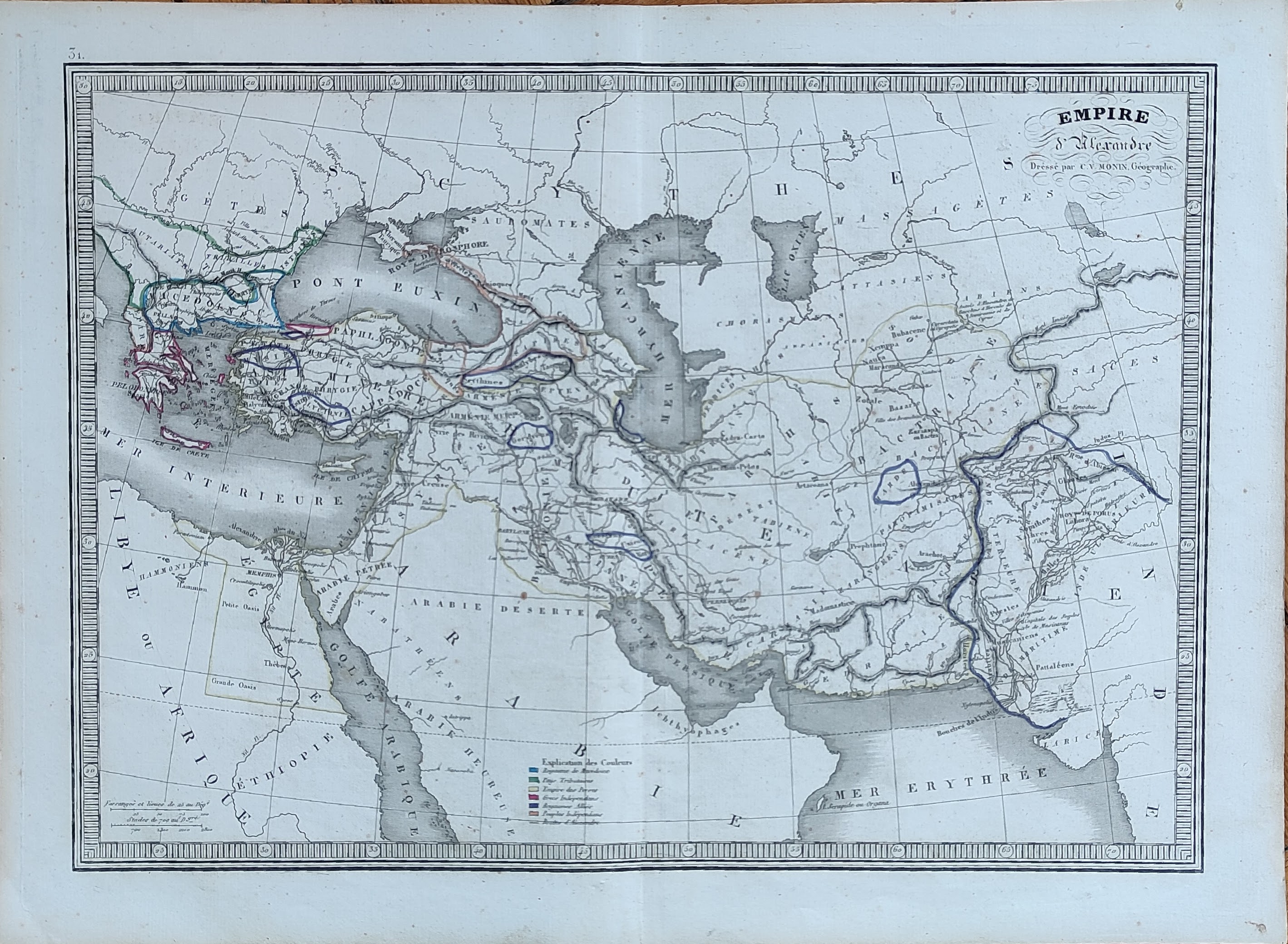
Map title
Empire d'Alexandre
Author
Monin
Location shown in map
Middle East
Edition date
1840
Edition place
Paris
Editor
Atlas
Atlas Classique de la Geographie
Price
50 Euro
State
[mint/EXCELLENT/very good/good/fair/mediocre/poor]
Color
Old colors
Verso
Blank
Size
Plate: cm (39 x 28) inches (15.35 x 11.02) Paper: cm (45 x 33) inches (17.72 x 12.99)
Technique
Copper engraving
Note
Reference
Wiki
Here for more info
In stock
Available
Info
info@thetreasuremaps.com
Code
#1045
×
![]()
Map title
Palestine
Author
Monin
Location shown in map
Middle East
Edition date
1840
Edition place
Paris
Editor
Atlas
Atlas Classique de la Geographie
Price
50 Euro
State
[mint/EXCELLENT/very good/good/fair/mediocre/poor]
Color
Old colors
Verso
Blank
Size
Plate: cm (39 x 28) inches (15.35 x 11.02) Paper: cm (45 x 33) inches (17.72 x 12.99)
Technique
Copper engraving
Note
Reference
Wiki
Here for more info
In stock
Available
Info
info@thetreasuremaps.com
Code
#1047
×
![]()
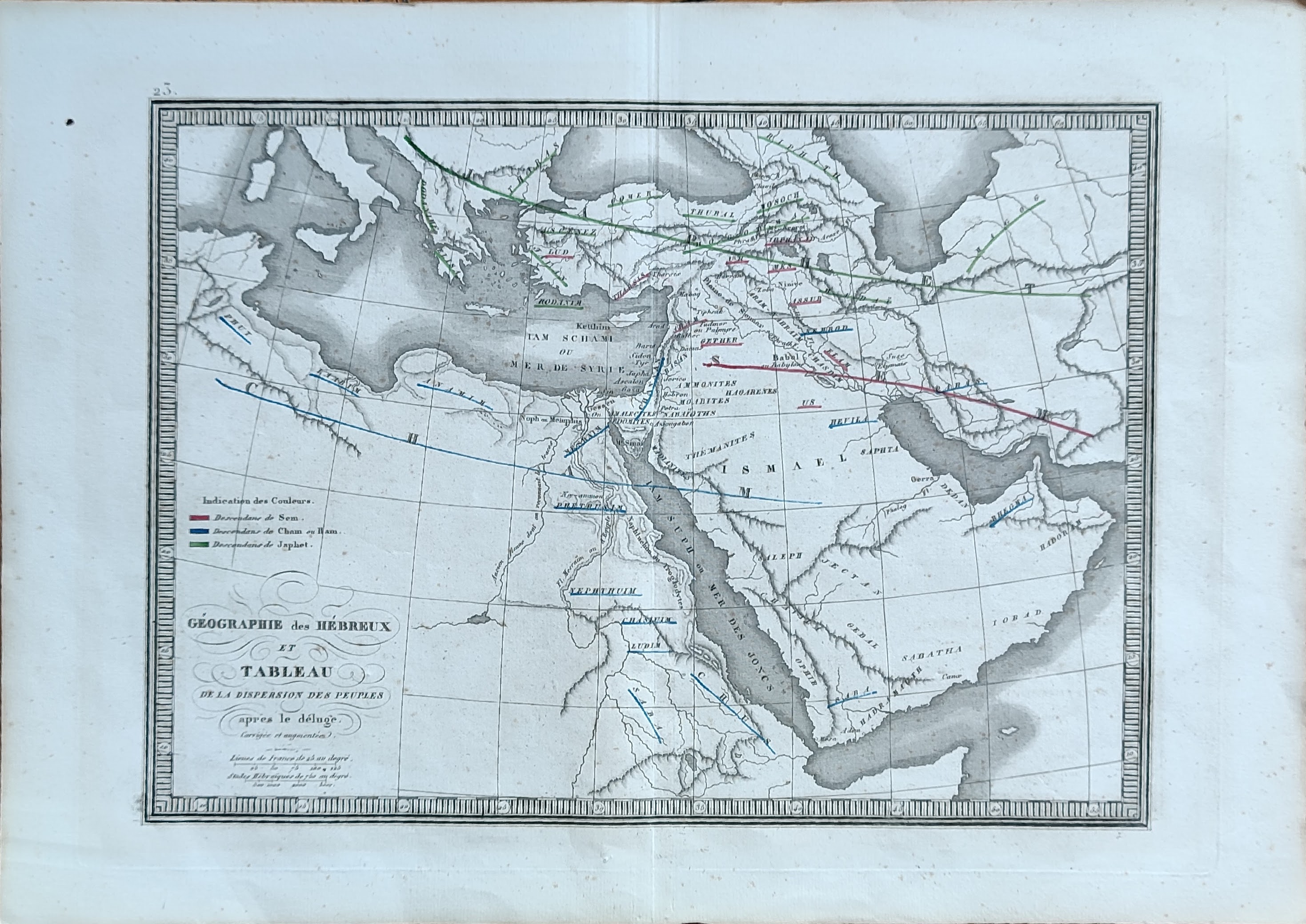
Map title
Geographie des Hebreux
Author
Monin
Location shown in map
Middle East
Edition date
1840
Edition place
Paris
Editor
Atlas
Atlas Classique de la Geographie
Price
50 Euro
State
[mint/EXCELLENT/very good/good/fair/mediocre/poor]
Color
Old colors
Verso
Blank
Size
Plate: cm (39 x 28) inches (15.35 x 11.02) Paper: cm (45 x 33) inches (17.72 x 12.99)
Technique
Copper engraving
Note
Reference
Wiki
Here for more info
In stock
Available
Info
info@thetreasuremaps.com
Code
#1049
×
![]()