Russia
Map title
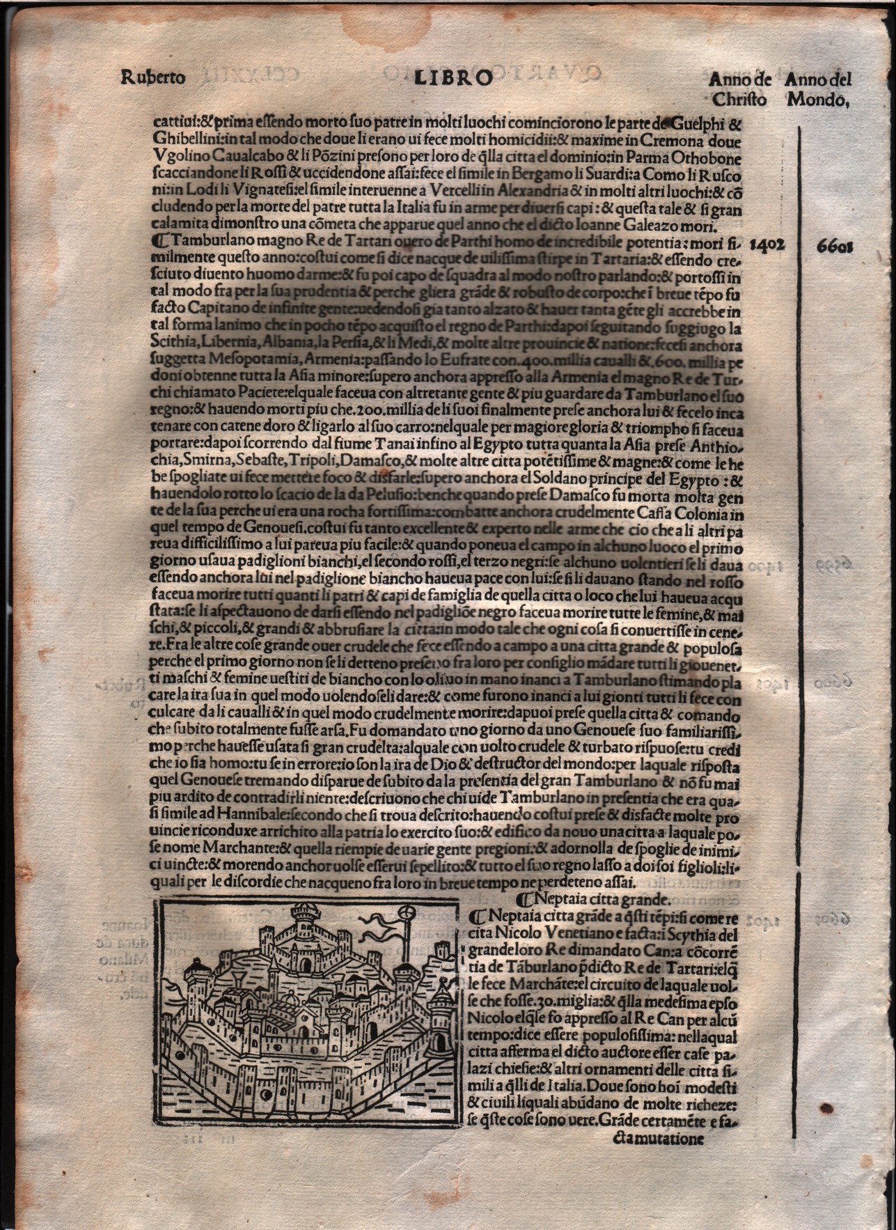
Neptaia
Author
Foresti
Location shown in map
City of Neptaia - Asia
Edition date
1508
Edition place
Venice
Editor
Georgii de Rusconibus
Atlas
Supplementum supplementi cronicarum
Price
Please ask: info@thetreasuremaps.com
State
[MINT/excellent/very good/good/fair/mediocre/poor]
Color
Black/white
Verso
Italian text
Size
Plate: cm (7.6 x 6.4) inches (2.99 x 2.52) Paper: cm (21.6 x 30.5) inches (8.5 x 12.01)
Technique
Woodcut
Note
No particular notes for this maps.
Reference
--
Wiki
Here for more info
In stock
Available
Info
info@thetreasuremaps.com
Code
#0005
×
![]()
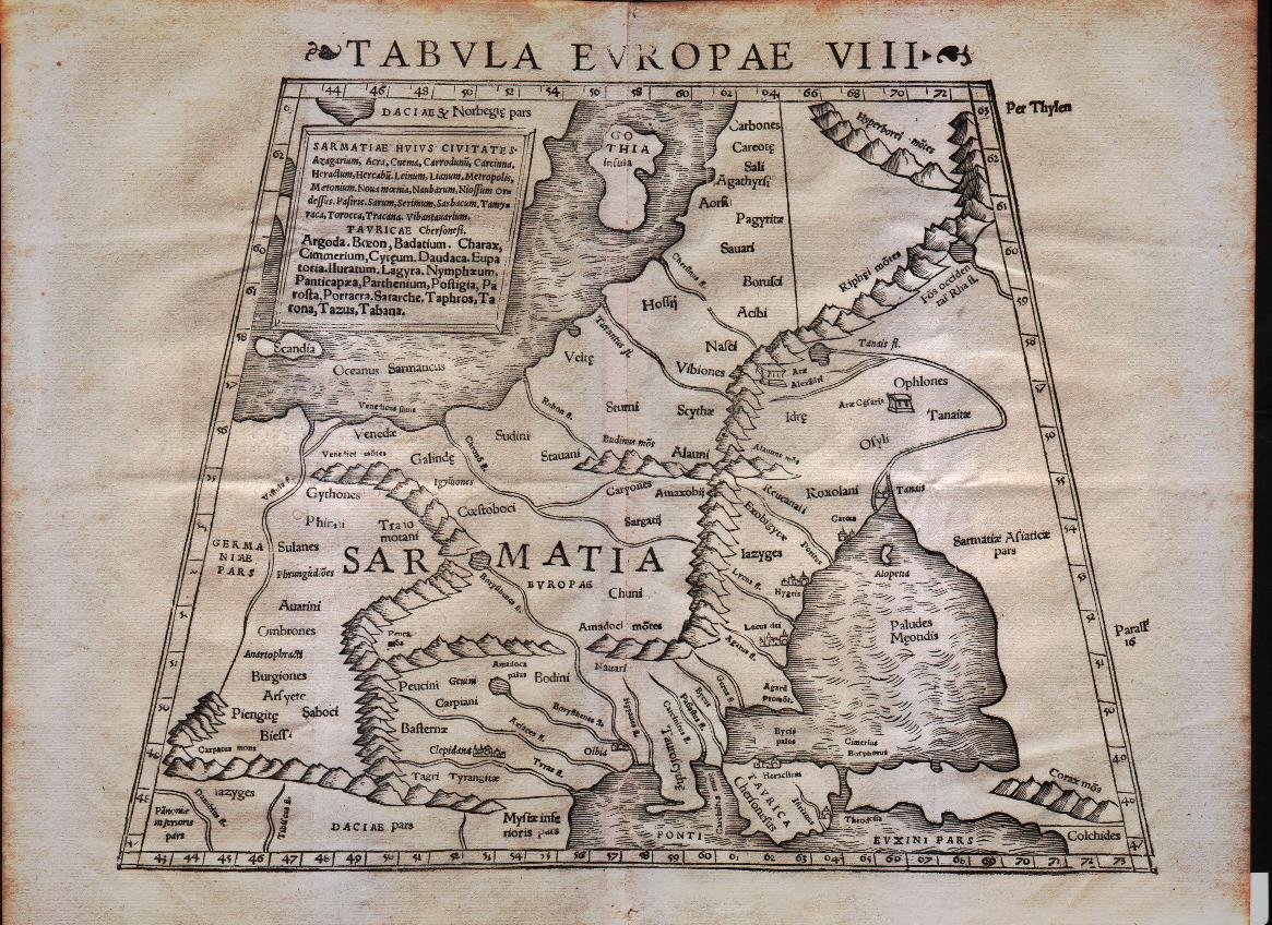
Map title
Tabula Europae VIII
Author
Munster
Location shown in map
Russia
Edition date
1545
Edition place
Basel
Editor
Henrich Petri
Atlas
Cosmographia Universalis
Price
Please ask: info@thetreasuremaps.com
State
[mint/excellent/VERY GOOD/good/fair/mediocre/poor]
Color
Black/white
Verso
Latin text pag.10
Size
Plate: cm (33 x 25.4) inches (12.99 x 10) Paper: cm (40.6 x 30.5) inches (15.98 x 12.01)
Technique
Woodcut
Note
No particular notes for this maps
Reference
--
Wiki
Here for more info
In stock
Sold
Info
info@thetreasuremaps.com
Code
#0094
×
![]()
Map title
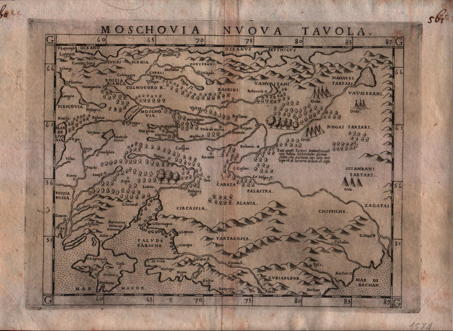
Moschovia nuova tavola
Author
Ruscelli
Location shown in map
Russia
Edition date
1574
Edition place
Venice
Editor
Giordano Ziletti
Atlas
La Geographia di Claudio Tolomeo
Price
300 Euro
State
[mint/EXCELLENT/very good/good/fair/mediocre/poor]
Color
Black/white
Verso
Italian text pag.25
Size
Plate: cm (26 x 19) inches (10.24 x 7.48) Paper: cm (30.5 x 22.9) inches (12.01 x 9.02)
Technique
Copper engraving
Note
Based on Gastaldi map.
Reference
Genoa pubblic library "Civica Berio"
Wiki
Here for more info
In stock
Available
Info
info@thetreasuremaps.com
Code
#0118
×
![]()
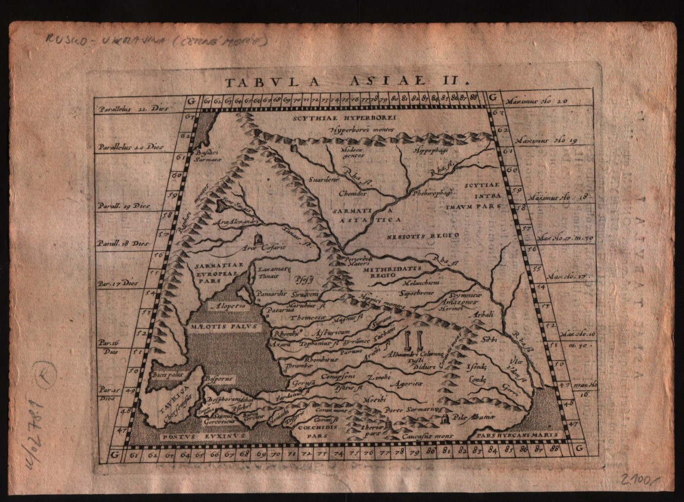
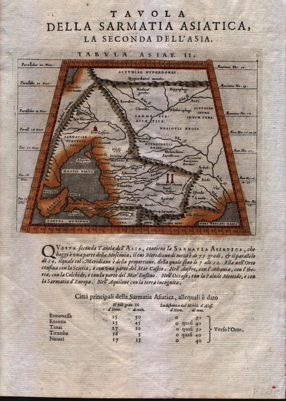
Map title
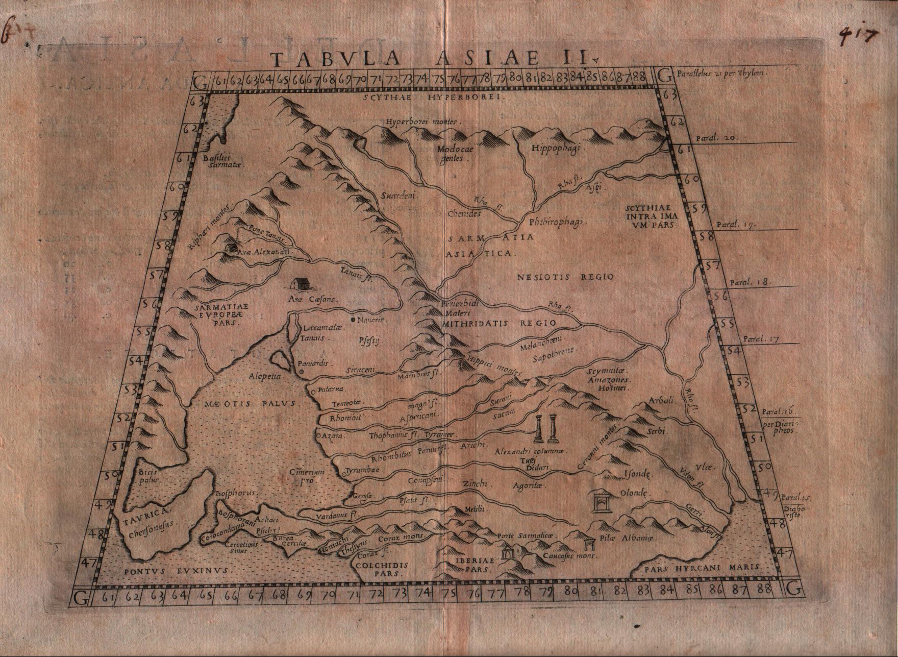
Tabula Asiae II
Author
Ruscelli
Location shown in map
South Russia
Edition date
1574
Edition place
Venice
Editor
Giordano Ziletti
Atlas
La Geographia di Claudio Tolomeo
Price
125 Euro
State
[mint/EXCELLENT/very good/good/fair/mediocre/poor]
Color
Black/white
Verso
Italian text pag.17
Size
Plate: cm (25.4 x 19) inches (10 x 7.48) Paper: cm (30.5 x 22.9) inches (12.01 x 9.02)
Technique
Copper engraving
Note
--
Reference
Genoa pubblic library "Civica Berio"
Wiki
Here for more info
In stock
Available
Info
info@thetreasuremaps.com
Code
#0185
×
![]()
Map title
Tabula Asiae II
Author
Magini
Location shown in map
Russia
Edition date
1597
Edition place
Cologne
Editor
Petrus Keschedt
Atlas
Geografia di Claudio Tolomeo -- Giovanni Antonio Magini
Price
Please ask: info@thetreasuremaps.com
State
[mint/EXCELLENT/very good/good/fair/mediocre/poor]
Color
Black/white
Verso
Latin text pag 17
Size
Plate: cm (17.8 x 12.7) inches (7.01 x 5) Paper: cm (22.9 x 16.5) inches (9.02 x 6.5)
Technique
Copper engraving
Note
Maps pirated from those of Girolamo Poro in Magini's edition.
Reference
--
Wiki
Here for more info
In stock
Available
Info
info@thetreasuremaps.com
Code
#0519
×
![]()
Map title
Tabula Asiae II
Author
Magini
Location shown in map
Crimea and sea of Azov
Edition date
1598
Edition place
Venice
Editor
Battista & Giorgio Galignani
Atlas
Geografia di Claudio Tolomeo -- Giovanni Antonio Magini
Price
125 Euro
State
[MINT/excellent/very good/good/fair/mediocre/poor]
Color
Modern color
Verso
Italian text pag.11
Size
Plate: cm (17.8 x 12.7) inches (7.01 x 5) Paper: cm (20.3 x 30.5) inches (7.99 x 12.01)
Technique
Copper engraving
Note
No particular notes for this maps.
Reference
--
Wiki
Here for more info
In stock
Available
Info
info@thetreasuremaps.com
Code
#0202
×
![]()
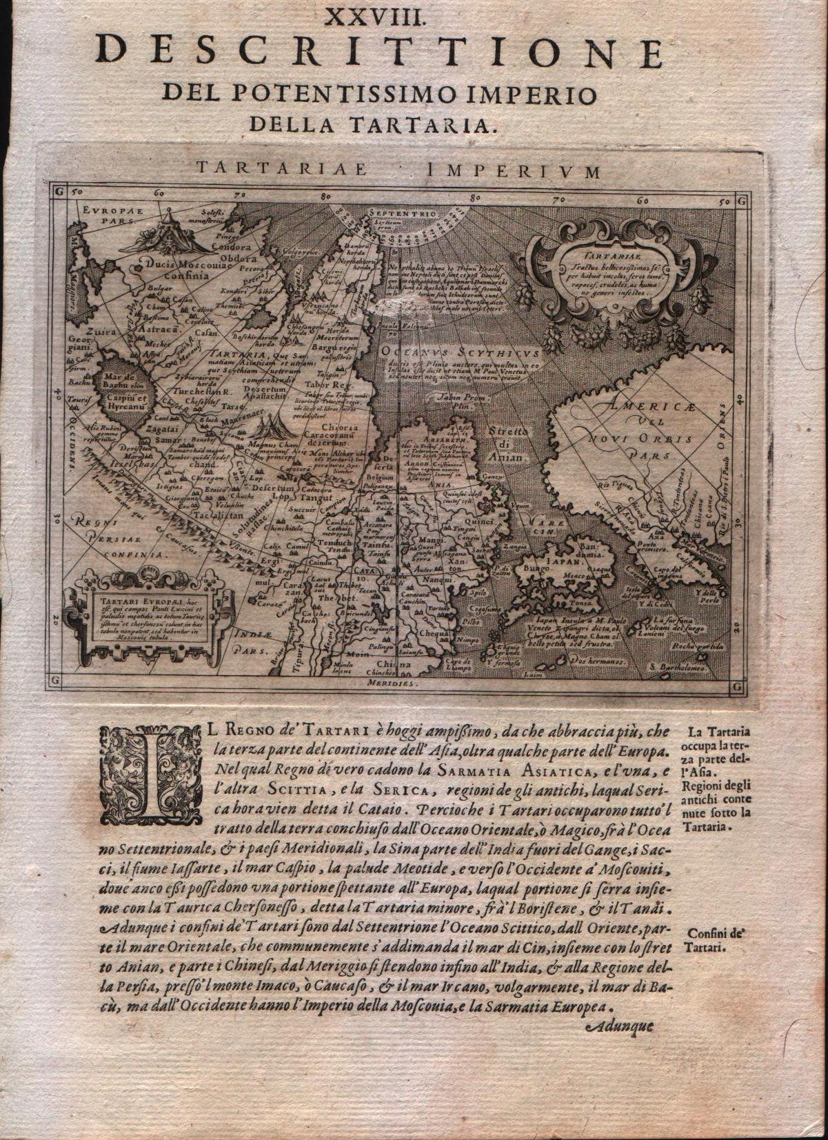
Map title
Descrittione del potentissimo imperio della Tartaria
Author
Magini
Location shown in map
East Asia, Japan, California
Edition date
1598
Edition place
Venice
Editor
Battista & Giorgio Galignani
Atlas
Geografia di Claudio Tolomeo -- Giovanni Antonio Magini
Price
350 Euro
State
[MINT/excellent/very good/good/fair/mediocre/poor]
Color
Black/white
Verso
Italian text
Size
Plate: cm (12.7 x 17.8) inches (5 x 7.01) Paper: cm (20.3 x 30.5) inches (7.99 x 12.01)
Technique
Copper engraving
Note
Very interesting map of East Asia and North West America.
Reference
--
Wiki
Here for more info
In stock
Available
Info
info@thetreasuremaps.com
Code
#0208
×
![]()
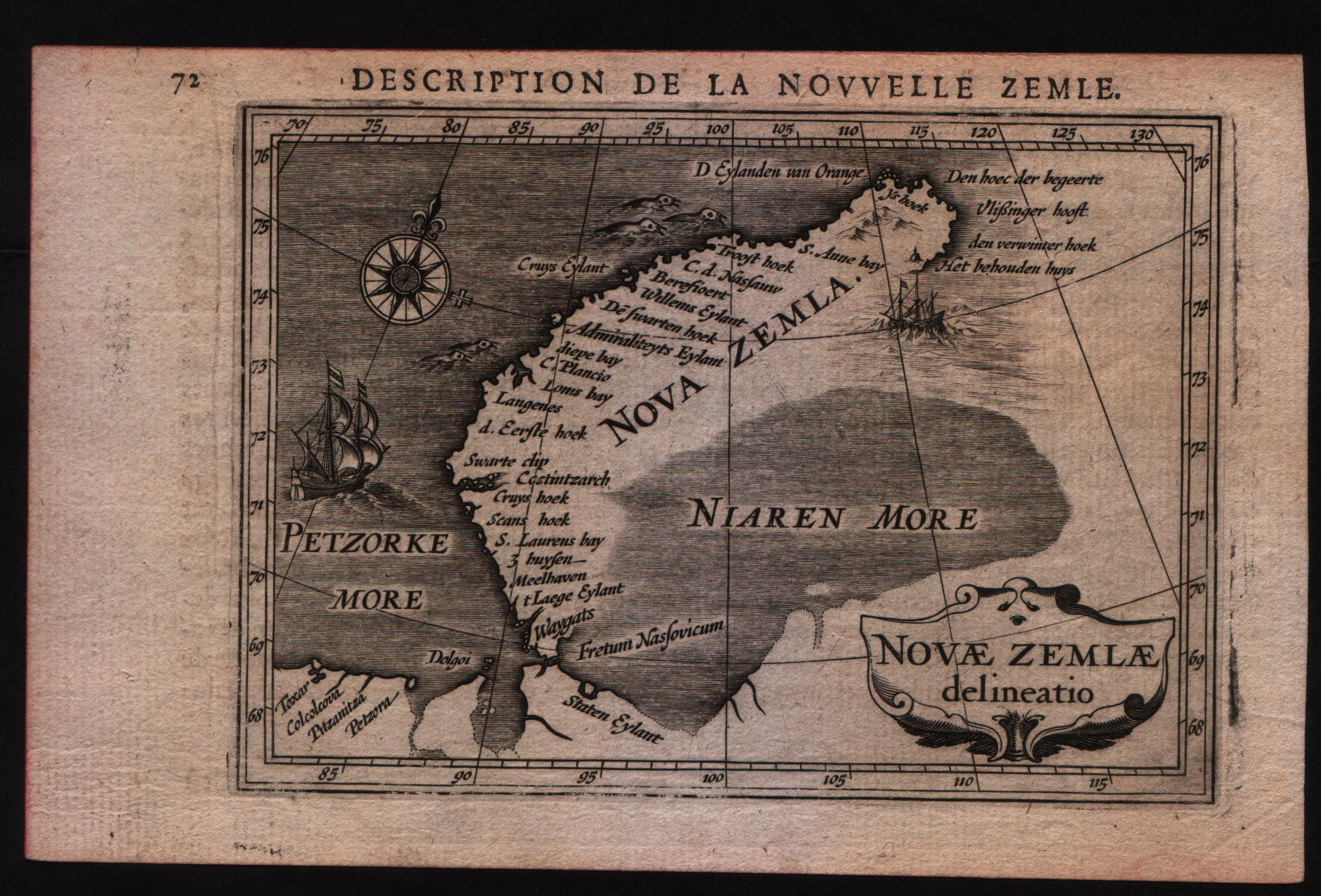
Map title
Description de la nouvelle Zemle
Author
Bertius
Location shown in map
New Zemlia
Edition date
1617
Edition place
Amsterdam
Editor
Jodocus Hondius
Atlas
Tabularum geographicarum contractarum
Price
Please ask: info@thetreasuremaps.com
State
[MINT/excellent/very good/good/fair/mediocre/poor]
Color
Black/white
Verso
French text pag 71
Size
Plate: cm (14 x 10.2) inches (5.51 x 4.02) Paper: cm (17.8 x 11.4) inches (7.01 x 4.49)
Technique
Copper engraving
Note
--
Reference
--
Wiki
Here for more info
In stock
Available
Info
info@thetreasuremaps.com
Code
#0592
×
![]()
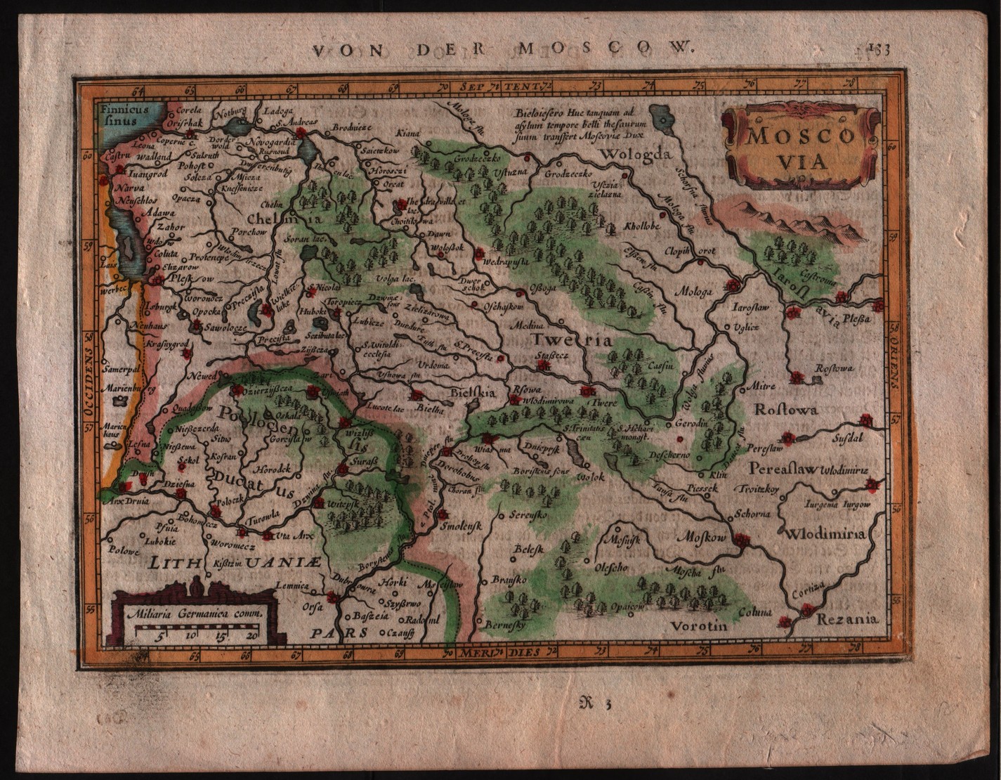
Map title
Moscovia
Author
Mercator
Location shown in map
Russia
Edition date
1635
Edition place
Amsterdam
Editor
Janssonius
Atlas
Altas Minor Gerardi Mercatoris
Price
100 Euro
State
[MINT/excellent/very good/good/fair/mediocre/poor]
Color
Later hand coloring.
Verso
German text
Size
Plate: cm (20.3 x 14) inches (7.99 x 5.51) Paper: cm (22.9 x 17.8) inches (9.02 x 7.01)
Technique
Copper engraving
Note
This map of Russia shows the regions of 'Chelmia', 'Wologda', 'Lithuanie' and 'Polocenis Ducatus' with the cities of Moscow.
Reference
--
Wiki
Here for more info
In stock
Available
Info
info@thetreasuremaps.com
Code
#0135
×
![]()
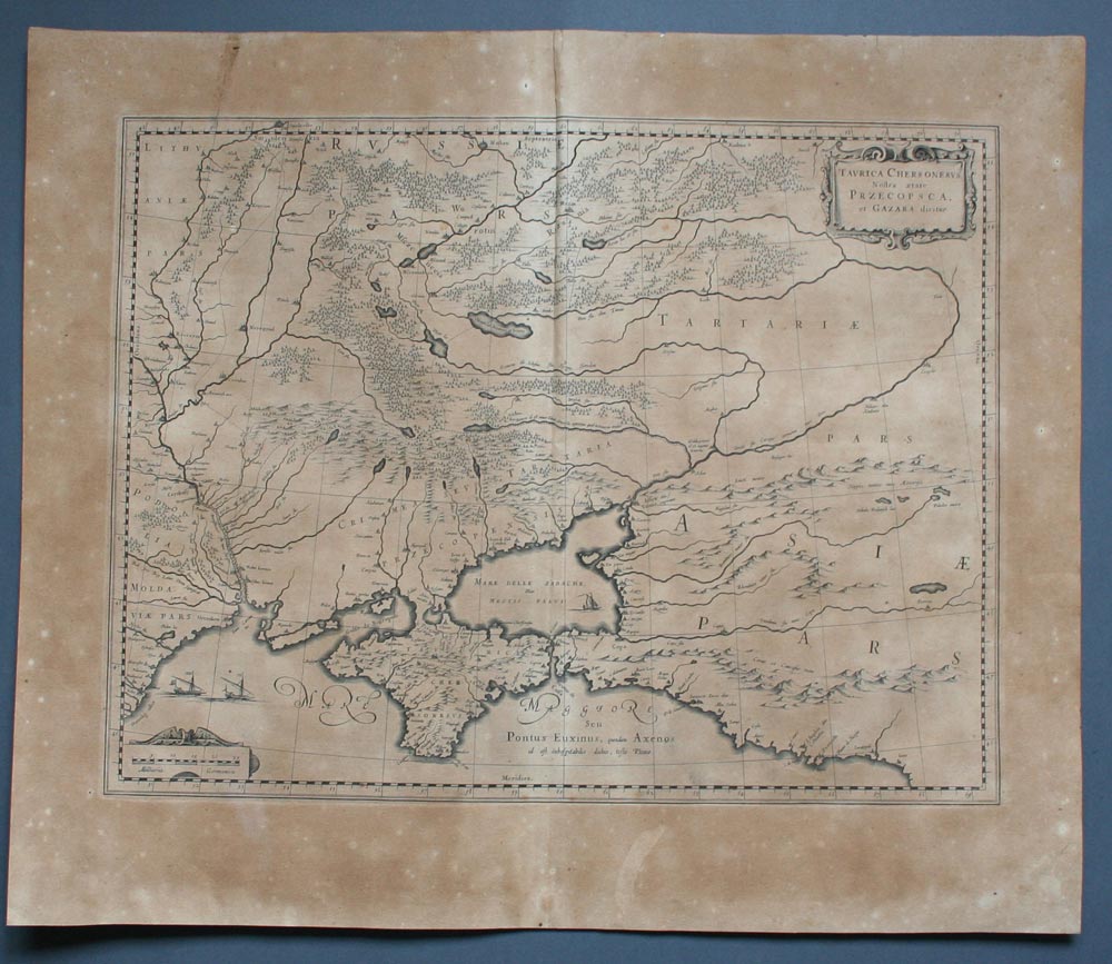
Map title
Taurica Chersonesus. Nostra aetate Przecopsca, et Gazara dicitur.
Author
Blaeu
Location shown in map
Russia and Black sea
Edition date
1645
Edition place
Amsterdam
Editor
--
Atlas
Theatrum Orbis Terrarum, Sive Atlas Novis
Price
200 Euro
State
[mint/excellent/VERY GOOD/good/fair/mediocre/poor]
Color
Black/white
Verso
Latin text
Size
Plate: cm (48.3 x 35.6) inches (19.02 x 14.02) Paper: cm (58.4 x 50.8) inches (22.99 x 20)
Technique
Copper engraving
Note
No particular notes for this maps
Reference
--
Wiki
Here for more info
In stock
Available
Info
info@thetreasuremaps.com
Code
#0217
×
![]()
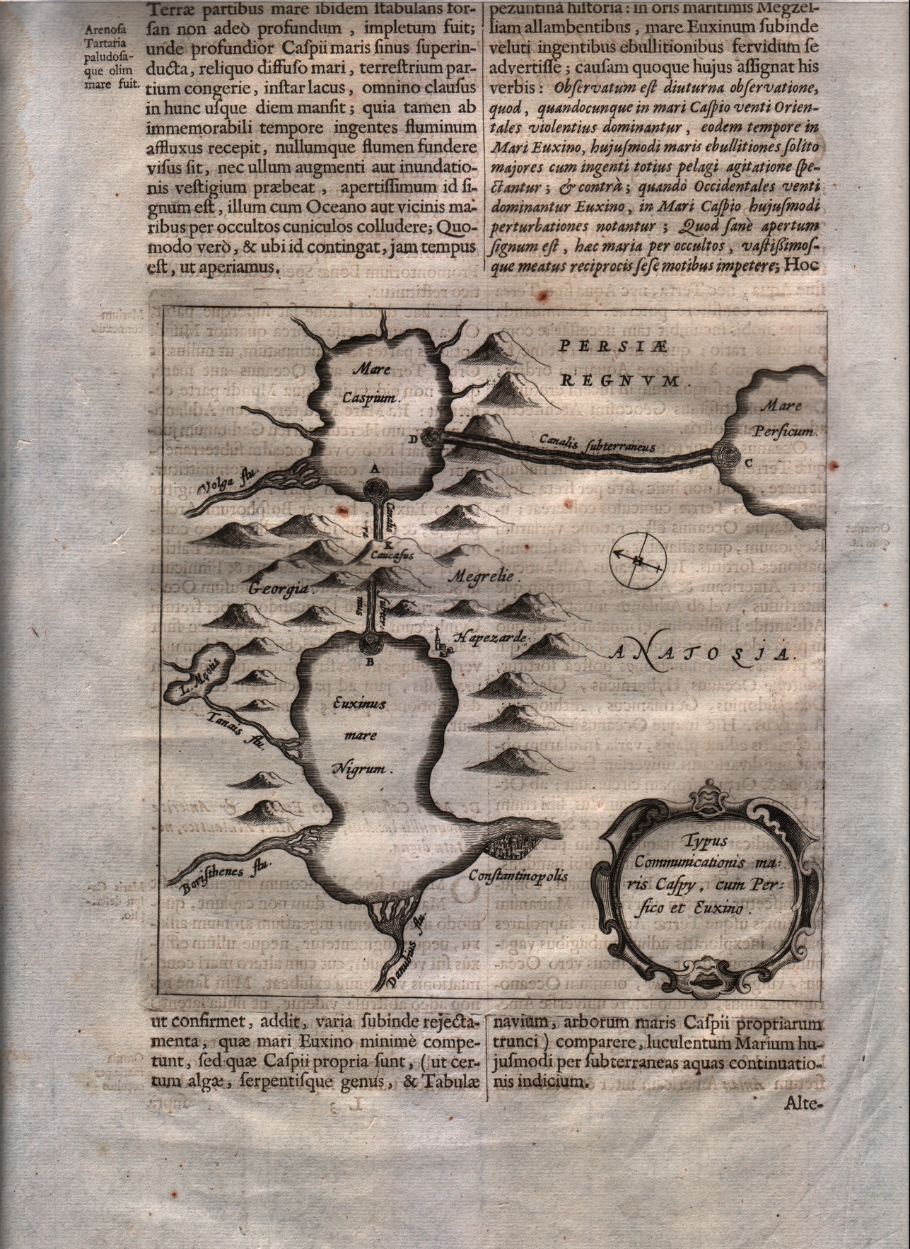
Map title
Typus communicationis Maris Caspy, cum Persico et Euxino.
Author
Kircher
Location shown in map
Black sea & Caspian sea
Edition date
1665
Edition place
Editor
--
Atlas
Mundus Subterraneus
Price
200 Euro
State
[mint/EXCELLENT/very good/good/fair/mediocre/poor]
Color
Black/white
Verso
Latin text
Size
Plate: cm (16.5 x 16.5) inches (6.5 x 6.5) Paper: cm (24.1 x 38.1) inches (9.49 x 15)
Technique
Copper engraving
Note
--
Reference
--
Wiki
Here for more info
In stock
Available
Info
info@thetreasuremaps.com
Code
#0216
×
![]()
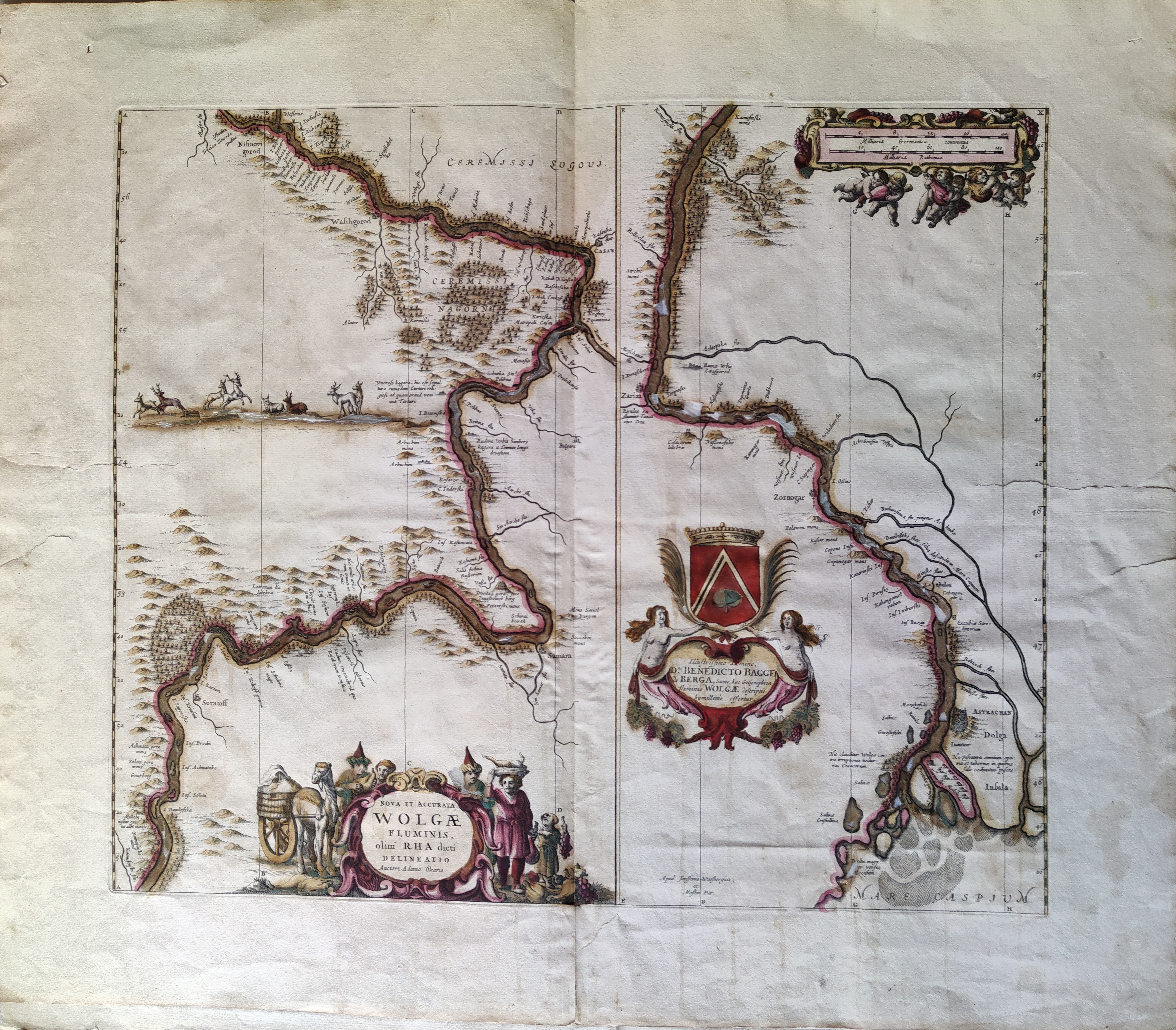
Map title
Nova et Accurata Wolgae Fluminis, Olim Rha Dicti Delineatio Auctore Adamo Oleario
Author
Jansson
Location shown in map
Russia
Edition date
Circa 1680
Edition place
Amsterdam
Editor
Jansson
Atlas
Price
400 Euro
State
[mint/excellent/very good/good/fair/MEDIOCRE/poor]
Color
Old colors
Verso
Size
Plate: cm (54 x 47) inches (21.26 x 18.5) Paper: cm (70 x 60) inches (27.56 x 23.62)
Technique
Copper engraving
Note
Reference
Wiki
Here for more info
In stock
Available
Info
info@thetreasuremaps.com
Code
#1076
×
![]()
Map title
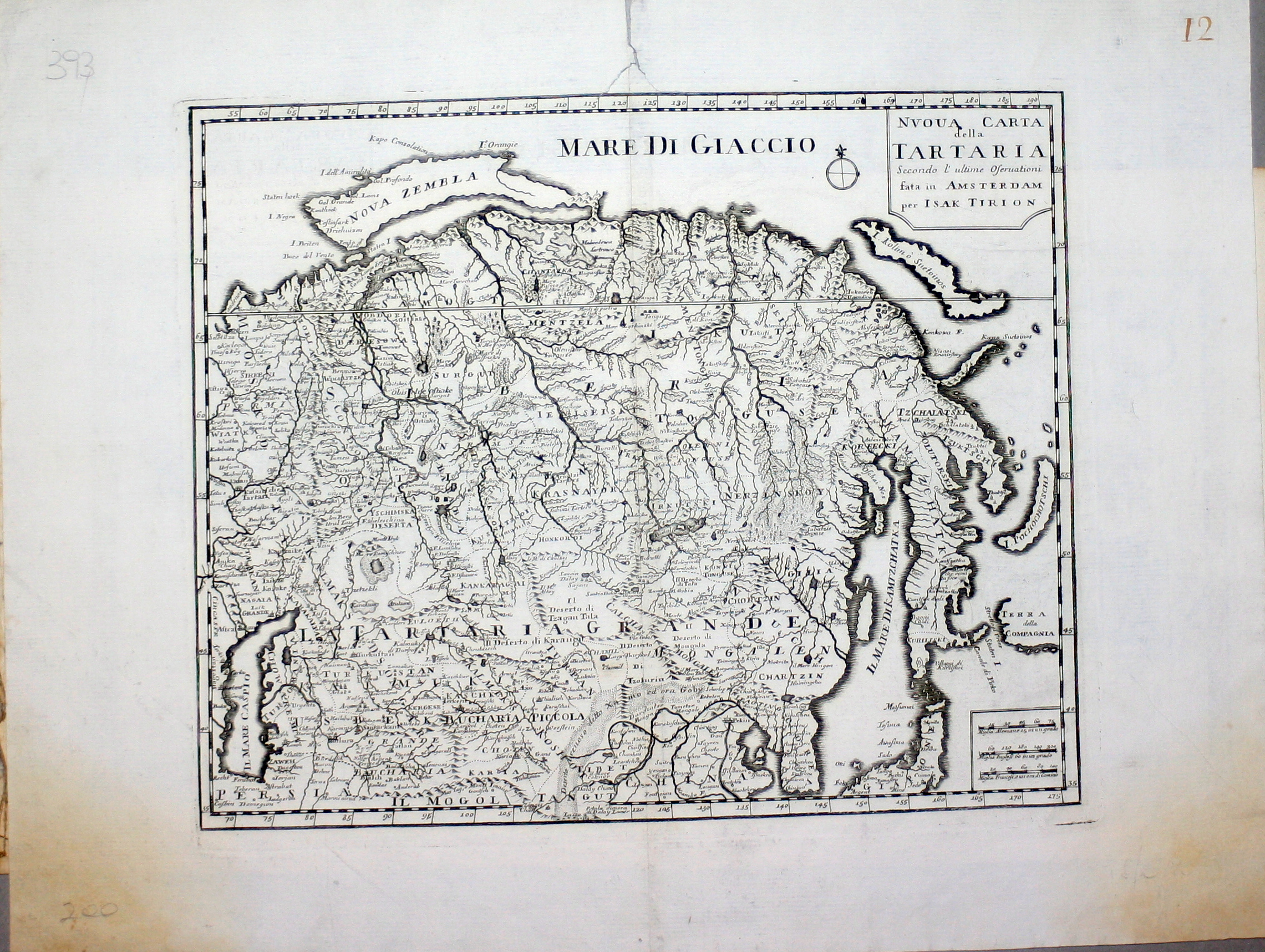
Nuova carta della Tartaria
Author
Tirion
Location shown in map
East Asia
Edition date
1740
Edition place
Amsterdam
Editor
--
Atlas
Atlante Novissimo. Giambattista Albrizzi
Price
150 Euro
State
[mint/excellent/VERY GOOD/good/fair/mediocre/poor]
Color
Black/white
Verso
Blank
Size
Plate: cm (33 x 27.9) inches (12.99 x 10.98) Paper: cm (48.3 x 38.1) inches (19.02 x 15)
Technique
Copper engraving
Note
No particular notes for this maps
Reference
--
Wiki
Here for more info
In stock
Available
Info
info@thetreasuremaps.com
Code
#0222
×
![]()
Map title
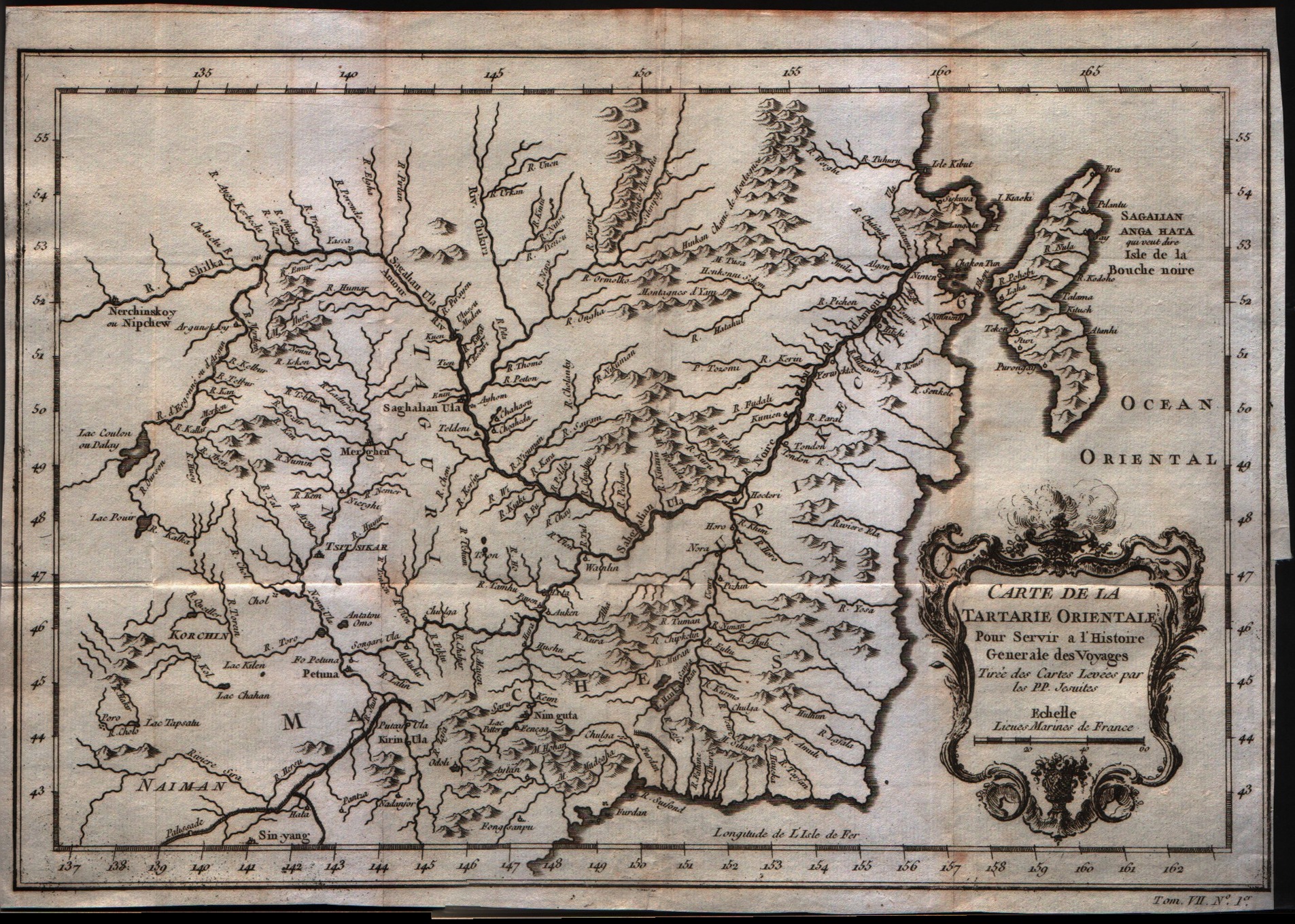
Carte de la Tartarie orientale
Author
Bellin
Location shown in map
--
Edition date
1757
Edition place
Paris
Editor
--
Atlas
Historie General des Voyages -- Prevost
Price
Please ask: info@thetreasuremaps.com
State
[mint/EXCELLENT/very good/good/fair/mediocre/poor]
Color
Black/white
Verso
Blank
Size
Plate: cm (30.5 x 20.3) inches (12.01 x 7.99) Paper: cm (30.5 x 22.9) inches (12.01 x 9.02)
Technique
Copper engraving
Note
No particular notes for this maps
Reference
--
Wiki
Here for more info
In stock
Available
Info
info@thetreasuremaps.com
Code
#0257
×
![]()
Map title
Partie de la mer Glaciale contenant la Nouvelle Zemle et le pais des Samoidedes
Author
Bellin
Location shown in map
--
Edition date
1757
Edition place
Paris
Editor
--
Atlas
Historie General des Voyages -- Prevost
Price
Please ask: info@thetreasuremaps.com
State
[mint/EXCELLENT/very good/good/fair/mediocre/poor]
Color
Black/white
Verso
Blank
Size
Plate: cm (33 x 21.6) inches (12.99 x 8.5) Paper: cm (39.4 x 25.4) inches (15.51 x 10)
Technique
Copper engraving
Note
No particular notes for this maps
Reference
--
Wiki
Here for more info
In stock
Available
Info
info@thetreasuremaps.com
Code
#0238
×
![]()
Map title
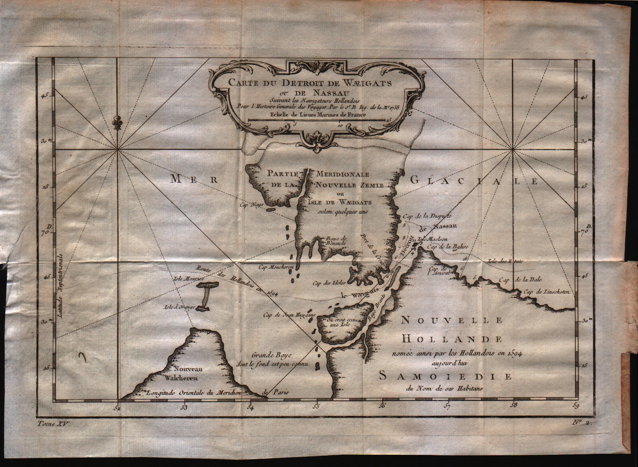
Carte du detroit de Waeigats ou de Nassau
Author
Bellin
Location shown in map
--
Edition date
1757
Edition place
Paris
Editor
--
Atlas
Historie General des Voyages -- Prevost
Price
125 Euro
State
[mint/EXCELLENT/very good/good/fair/mediocre/poor]
Color
Black/white
Verso
Blank
Size
Plate: cm (30.5 x 20.3) inches (12.01 x 7.99) Paper: cm (33 x 25.4) inches (12.99 x 10)
Technique
Copper engraving
Note
No particular notes for this maps
Reference
--
Wiki
Here for more info
In stock
Available
Info
info@thetreasuremaps.com
Code
#0225
×
![]()
Map title
Nouvelle Representation Des Cotes Nord et Est De L'Asie, pour servir ... Articles du Supplement de l'Encyclopedie qui concerent le Passage aux Indes par le Nord … 1772
Author
Diderot
Location shown in map
Asia
Edition date
1772
Edition place
Paris
Editor
--
Atlas
Encyclopedie -- De Vaugondy
Price
100 Euro
State
[mint/EXCELLENT/very good/good/fair/mediocre/poor]
Color
Black/white
Verso
Blank
Size
Plate: cm (40.6 x 33) inches (15.98 x 12.99) Paper: cm (50.8 x 40.6) inches (20 x 15.98)
Technique
Copper engraving
Note
No particular notes for this maps
Reference
--
Wiki
Here for more info
In stock
Available
Info
info@thetreasuremaps.com
Code
#0274
×
![]()
Map title
Carte des environs de la mer Noire o se trouvent l'Ukraine, la petite Tartarie, et les confins de la Russie Europ�ne, et de la Turquie
Author
Unknown
Location shown in map
--
Edition date
1784
Edition place
Venise
Editor
--
Atlas
Atlas Universel dresse sur les meilleures cartes modernes. Printed by Santini & Remondini.
Price
Please ask: info@thetreasuremaps.com
State
[mint/excellent/very good/good/fair/MEDIOCRE/poor] the map is damaged.
Color
Old outlined
Verso
Blank
Size
Plate: cm (48.3 x 63.5) inches (19.02 x 25) Paper: cm (54.6 x 76.2) inches (21.5 x 30)
Technique
Copper engraving
Note
The atlas is effectively an Italian copy of the Robert de Vaugondy Atlas Universel, and contains 123 maps, variously dated 1775 to 1780. The atlas was reprinted in 1784 by Remondini, which gives a relatively short career span for Santini.
Reference
--
Wiki
Here for more info
In stock
Available
Info
info@thetreasuremaps.com
Code
#0277
×
![]()

Map title
Carte de l'Empire de Russie en Europe et en Asie
Author
Bonne
Location shown in map
Russie
Edition date
1787
Edition place
Paris
Editor
--
Atlas
Atlas Encyclopedique
Price
Please ask: info@thetreasuremaps.com
State
[mint/excellent/very good/good/FAIR/mediocre/poor]
Color
Modern outlined
Verso
Blank
Size
Plate: cm (31.8 x 21) inches (12.52 x 8.27) Paper: cm (36.8 x 25.4) inches (14.49 x 10)
Technique
Copper engraving
Note
No particular notes for this maps
Reference
--
Wiki
Here for more info
In stock
Sold
Info
info@thetreasuremaps.com
Code
#0397
×
![]()
Map title
Siberie
Author
Monin
Location shown in map
Siberia
Edition date
1840
Edition place
Paris
Editor
Atlas
Atlas Classique de la Geographie
Price
75 Euro
State
[mint/EXCELLENT/very good/good/fair/mediocre/poor]
Color
Old colors
Verso
Blank
Size
Plate: cm (39 x 28) inches (15.35 x 11.02) Paper: cm (45 x 33) inches (17.72 x 12.99)
Technique
Copper engraving
Note
Reference
Wiki
Here for more info
In stock
Available
Info
info@thetreasuremaps.com
Code
#1012
×
![]()