The Netherlands
Map title
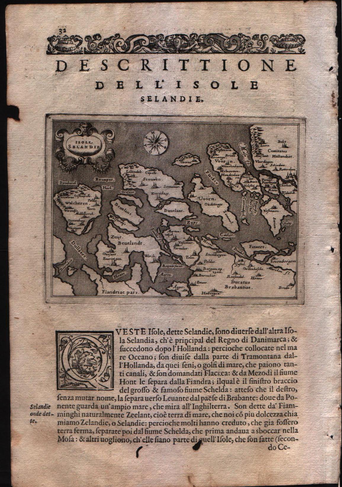
Descrittione dell'isole Selandie
Author
Porcacchi
Location shown in map
Zeeland islands
Edition date
1576
Edition place
Venice
Editor
--
Atlas
L'Isole piu famose del mondo -- S. Galignani and G. Porro
Price
Please ask: info@thetreasuremaps.com
State
[mint/EXCELLENT/Vvery good/good/fair/mediocre/poor]
Color
Black/white
Verso
Italian text pag.31
Size
Plate: cm (15.2 x 11.4) inches (5.98 x 4.49) Paper: cm (19 x 29.2) inches (7.48 x 11.5)
Technique
Copper engraving
Note
No particular notes for this maps
Reference
Genoa pubblic library "Civica Berio"
Wiki
Here for more info
In stock
Available
Info
info@thetreasuremaps.com
Code
#0111
×
![]()
Map title
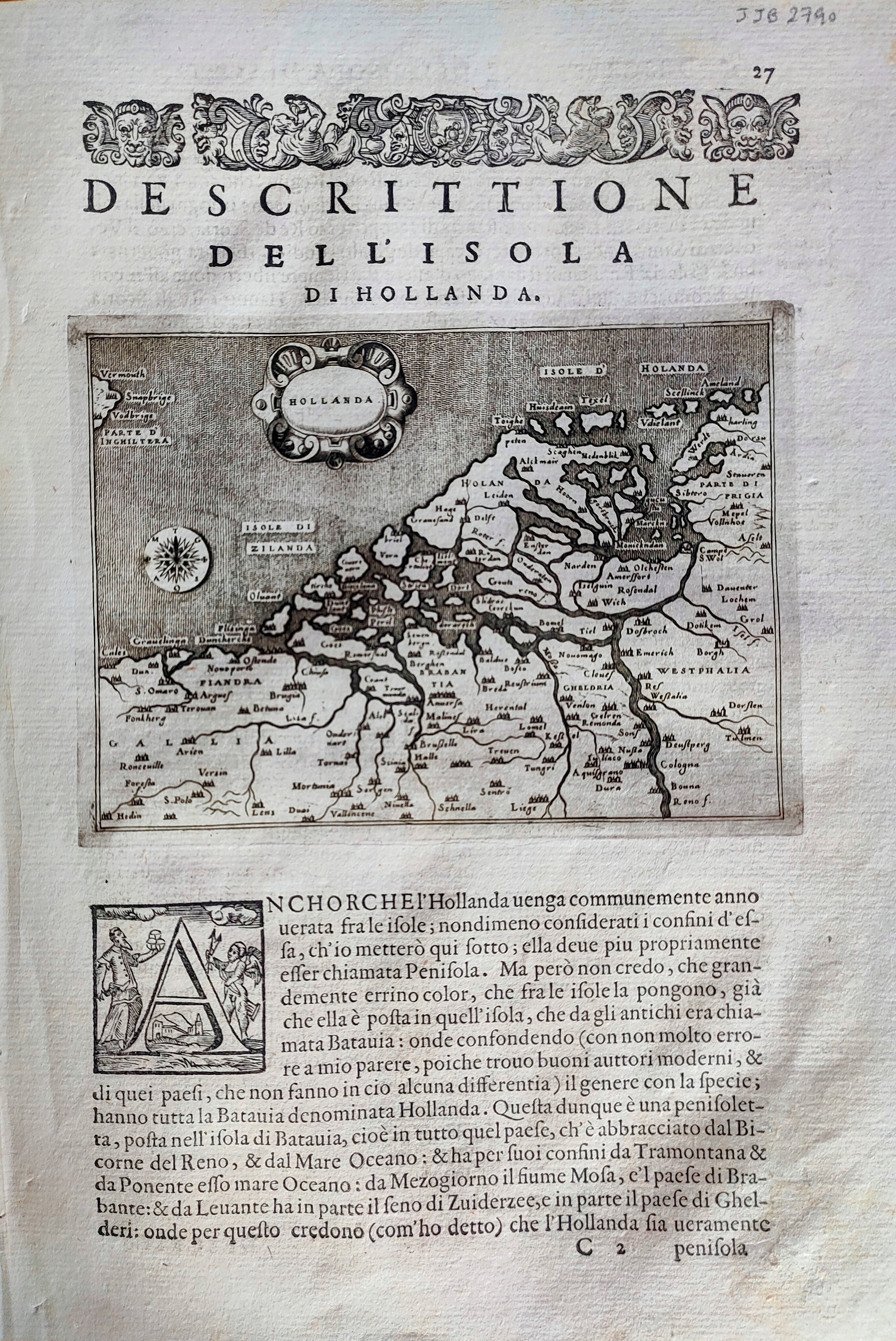
Descrittione dell'isola di Hollanda
Author
Porcacchi
Location shown in map
Netherlands
Edition date
1576
Edition place
Venice
Editor
--
Atlas
L'Isole piu famose del mondo -- S. Galignani and G. Porro
Price
Please ask: info@thetreasuremaps.com
State
[mint/EXCELLENT/very good/good/fair/mediocre/poor]
Color
Black/white
Verso
Italian text pag.28
Size
Plate: cm (15.2 x 11.4) inches (5.98 x 4.49) Paper: cm (20.3 x 29.2) inches (7.99 x 11.5)
Technique
Copper engraving
Note
Reference
--
Wiki
Here for more info
In stock
Available
Info
info@thetreasuremaps.com
Code
#0868
×
![]()
Map title
Zelandia
Author
Ortelius
Location shown in map
Nederland
Edition date
1598
Edition place
Brescia
Editor
Pietro Marchetti
Atlas
Il theatro del mondo
Price
150 Euro
State
[mint/EXCELLENT/very good/good/fair/mediocre/poor]
Color
Black/white
Verso
Italian text
Size
Plate: cm (11 x 8) inches (4.33 x 3.15) Paper: cm (11 x 8) inches (4.33 x 3.15)
Technique
Copper engraving
Note
Reference
Wiki
Here for more info
In stock
Available
Info
info@thetreasuremaps.com
Code
#0862
×
![]()
Map title
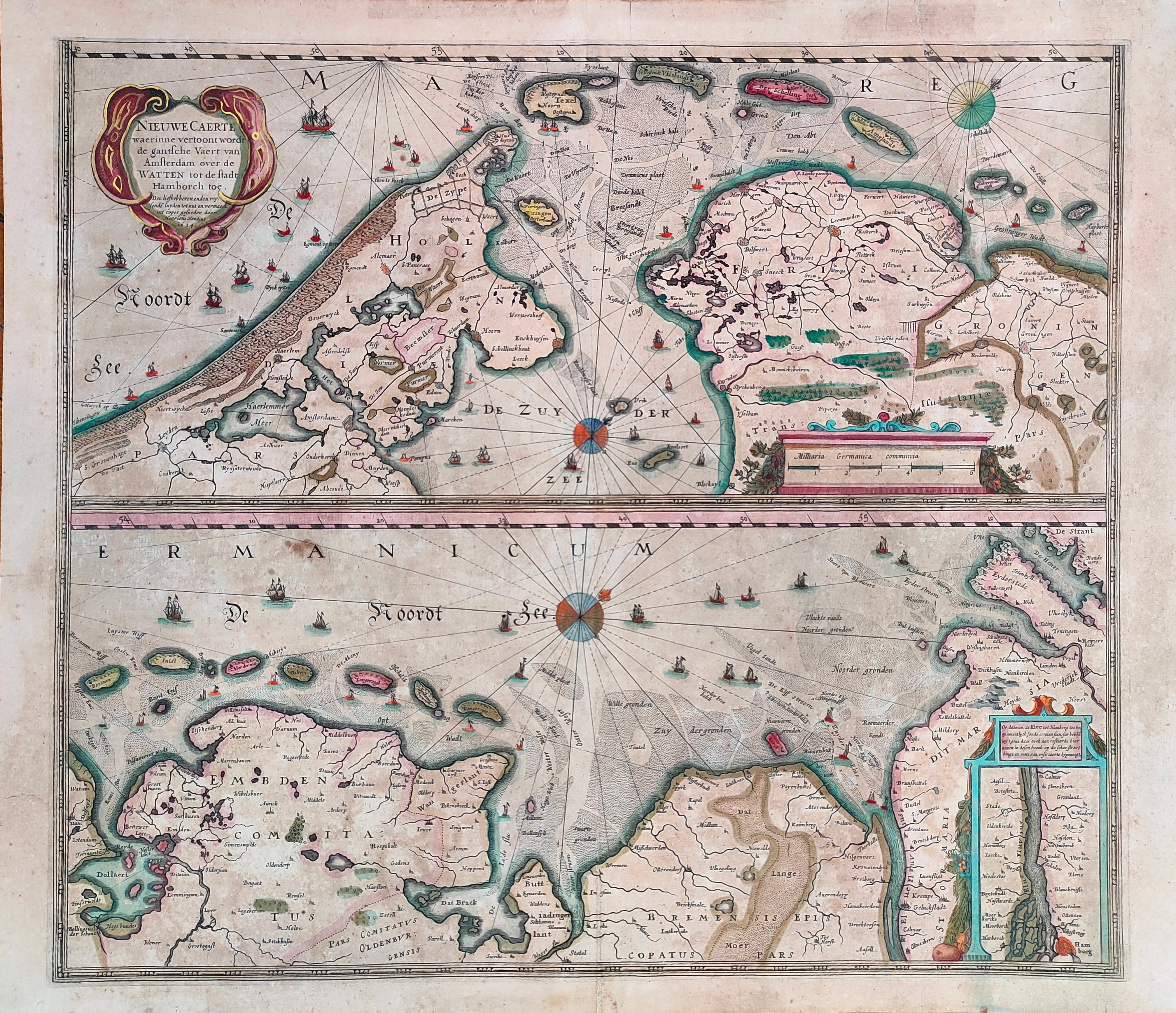
Nieuwe Caerte waerinne vertoont wordt de gantsche Vaert van Amsterdam
Author
Hondius
Location shown in map
Amsterdam
Edition date
Circa 1650
Edition place
Amsterdam
Editor
Hondius
Atlas
Price
400 Euro
State
[mint/EXCELLENT/very good/good/fair/mediocre/poor]
Color
Old colors
Verso
Size
Plate: cm (51 x 45) inches (20.08 x 17.72) Paper: cm (56 x 48) inches (22.05 x 18.9)
Technique
Copper engraving
Note
Reference
Wiki
Here for more info
In stock
Available
Info
info@thetreasuremaps.com
Code
#1231
×
![]()
Map title
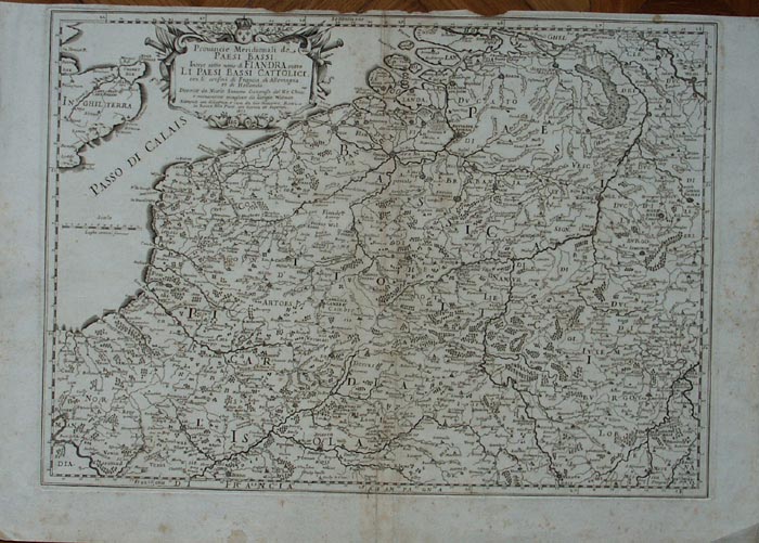
Provincie meridionali de Paesi Bassi intese sotto nome di Fiandra overo i Paesi Bassi cattolici
Author
Sanson
Location shown in map
Nederland
Edition date
1672
Edition place
Rome
Editor
--
Atlas
??? printed by Giacomo Rossi.
Price
200 Euro
State
[mint/excellent/VERY GOOD/good/fair/mediocre/poor]
Color
Black/white
Verso
Blank
Size
Plate: cm (50.8 x 36.8) inches (20 x 14.49) Paper: cm (59.7 x 41.9) inches (23.5 x 16.5)
Technique
Copper engraving
Note
Map based on Sanson map.
Reference
--
Wiki
Here for more info
In stock
Available
Info
info@thetreasuremaps.com
Code
#0139
×
![]()