1500-1599
Map title
La figure de la place de Rome...
Author
Munster
Location shown in map
Rome
Edition date
1550
Edition place
Basel
Editor
Henrich Petri
Atlas
Cosmographia Universalis
Price
200 Euro
State
[mint/EXCELLENT/very good/good/fair/mediocre/poor]
Color
Black/white
Verso
French text pag.550
Size
Plate: cm (22.9 x 21.6) inches (9.02 x 8.5) Paper: cm (41.9 x 34.3) inches (16.5 x 13.5)
Technique
Woodcut
Note
No particular notes for this maps
Reference
--
Wiki
Here for more info
In stock
Available
Info
info@thetreasuremaps.com
Code
#0095
×
![La figure de la place de Rome... by Munster, Rome, 1550]()
Map title
Description de la Germanie
Author
Munster
Location shown in map
Germany
Edition date
1552
Edition place
Basel
Editor
Henrich Petri
Atlas
Cosmographia Universalis
Price
300 Euro
State
[mint/EXCELLENT/very good/good/fair/mediocre/poor]
Color
Black/white
Verso
Franch text pag.6
Size
Plate: cm (34 x 25) inches (13.39 x 9.84) Paper: cm (39 x 30) inches (15.35 x 11.81)
Technique
Woodcut
Note
No particular notes for this maps.
Reference
--
Wiki
Here for more info
In stock
Available
Info
info@thetreasuremaps.com
Code
#0722
×
![Description de la Germanie by Munster, Germany, 1552]()
Map title
--
Author
Munster
Location shown in map
Italy
Edition date
Circa 1552
Edition place
Basel
Editor
Henrich Petri
Atlas
Cosmographia Universalis
Price
250 Euro
State
[mint/EXCELLENT/very good/good/fair/mediocre/poor]
Color
Black/white
Verso
German text pag.105
Size
Plate: cm (13 x 16) inches (5.12 x 6.3) Paper: cm (21 x 31) inches (8.27 x 12.2)
Technique
Woodcut
Note
Reference
Wiki
Here for more info
In stock
Available
Info
info@thetreasuremaps.com
Code
#1101
×
![-- by Munster, Italy, Circa 1552]()
Map title
--
Author
Munster
Location shown in map
Italy
Edition date
Circa 1552
Edition place
Basel
Editor
Henrich Petri
Atlas
Cosmographia Universalis
Price
250 Euro
State
[mint/EXCELLENT/very good/good/fair/mediocre/poor]
Color
Black/white
Verso
French text pag.142
Size
Plate: cm (13 x 8) inches (5.12 x 3.15) Paper: cm (21 x 31) inches (8.27 x 12.2)
Technique
Woodcut
Note
Reference
R.Borri L'Italia nelle antiche carte pag.40
Wiki
Here for more info
In stock
Available
Info
info@thetreasuremaps.com
Code
#0630
×
![-- by Munster, Italy, Circa 1552]()
Map title
Espaigne
Author
Munster
Location shown in map
Spain
Edition date
Circa 1552
Edition place
Basel
Editor
Henrich Petri
Atlas
Cosmographia Universalis
Price
125 Euro
State
[mint/EXCELLENT/very good/good/fair/mediocre/poor]
Color
Black/white
Verso
French text pag.60
Size
Plate: cm (13 x 8) inches (5.12 x 3.15) Paper: cm (20 x 31) inches (7.87 x 12.2)
Technique
Woodcut
Note
Reference
Wiki
Here for more info
In stock
Available
Info
info@thetreasuremaps.com
Code
#0955
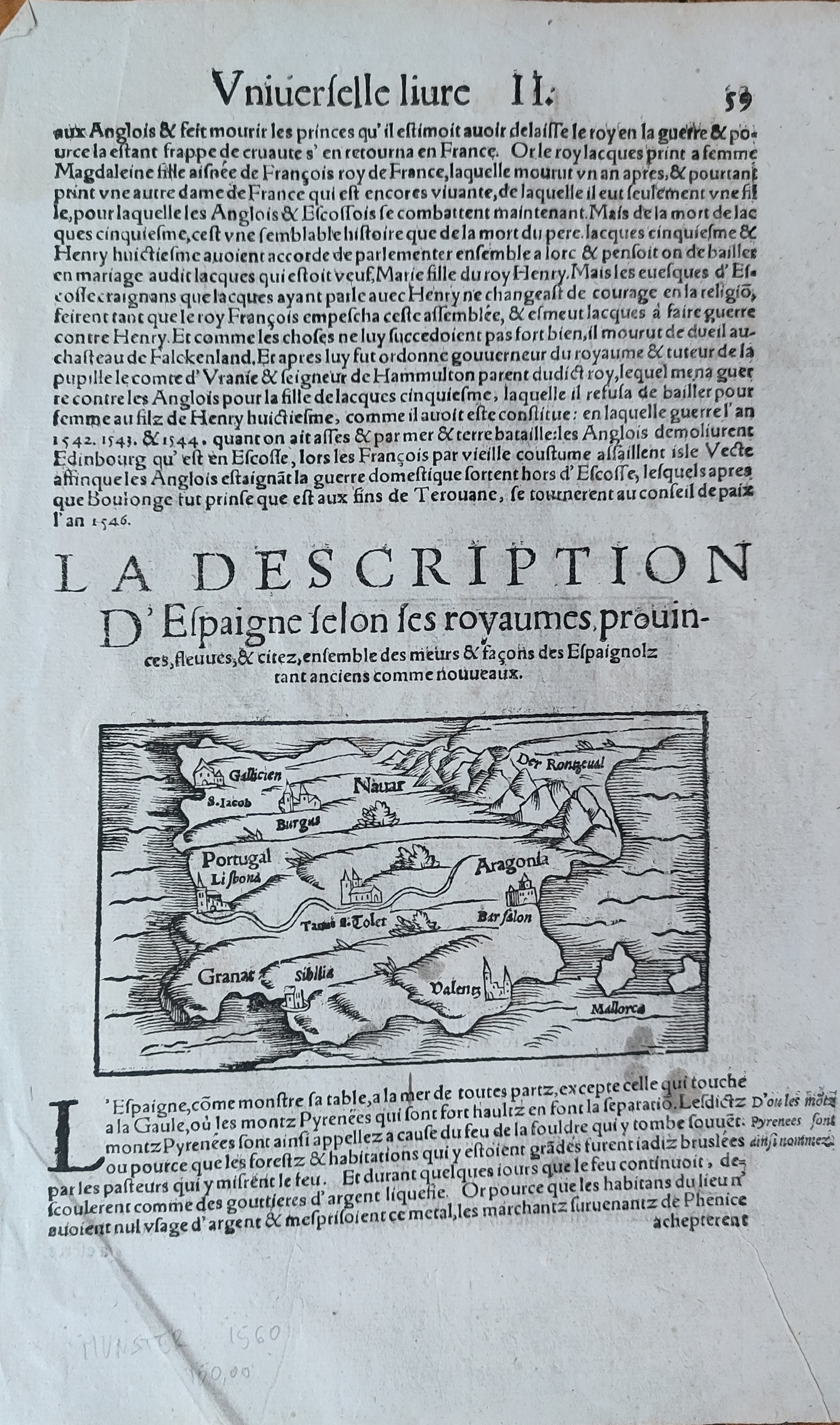
×
![Espaigne by Munster, Spain, Circa 1552]()
Map title
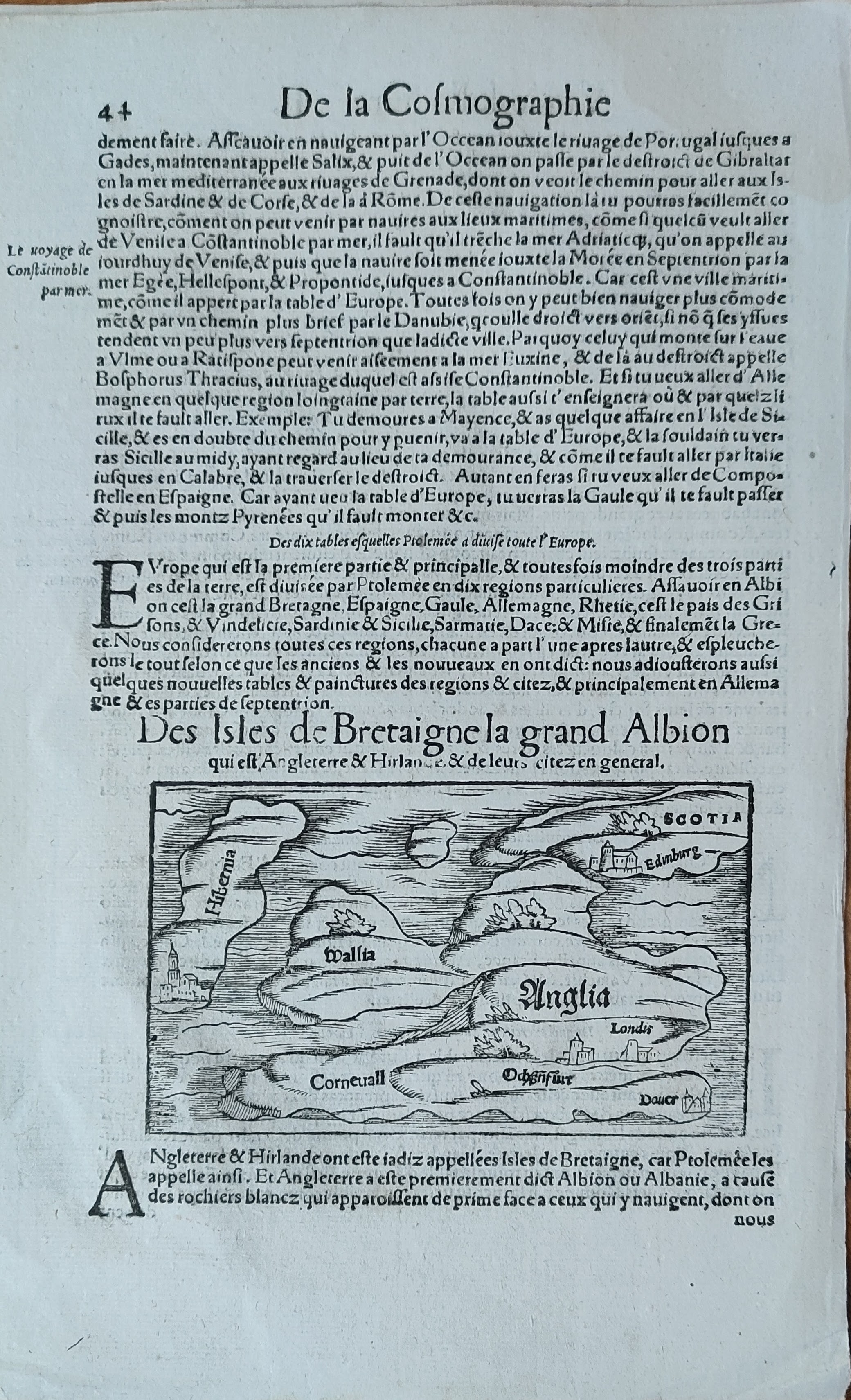
Des isles de Bretaigne la gran Albion
Author
Munster
Location shown in map
England
Edition date
Circa 1552
Edition place
Basel
Editor
Henrich Petri
Atlas
Cosmographia Universalis
Price
150 Euro
State
[mint/EXCELLENT/very good/good/fair/mediocre/poor]
Color
Black/white
Verso
French text pag.43
Size
Plate: cm (13 x 8) inches (5.12 x 3.15) Paper: cm (20 x 31) inches (7.87 x 12.2)
Technique
Woodcut
Note
Reference
Wiki
Here for more info
In stock
Available
Info
info@thetreasuremaps.com
Code
#0954
×
![Des isles de Bretaigne la gran Albion by Munster, England, Circa 1552]()
Map title
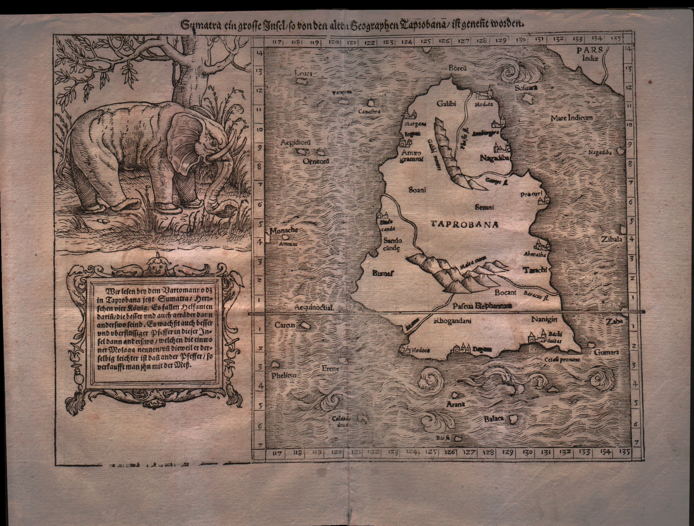
Sumatra ein grosse Inseln so von den alten Geographen Taprobana ist genent worden
Author
Munster
Location shown in map
Ceylon
Edition date
1555
Edition place
Basel
Editor
Henrich Petri
Atlas
Cosmographia Universalis
Price
500 Euro
State
[mint/EXCELLENT/very good/good/fair/mediocre/poor]
Color
Black/white
Verso
German text
Size
Plate: cm (33 x 24.1) inches (12.99 x 9.49) Paper: cm (30.5 x 40.6) inches (12.01 x 15.98)
Technique
Woodcut
Note
With large elephant vignette. Tabulae Asiae XII.
Reference
--
Wiki
Here for more info
In stock
Available
Info
info@thetreasuremaps.com
Code
#0177
×
![Sumatra ein grosse Inseln so von den alten Geographen Taprobana ist genent worden by Munster, Ceylon, 1555]()
Map title
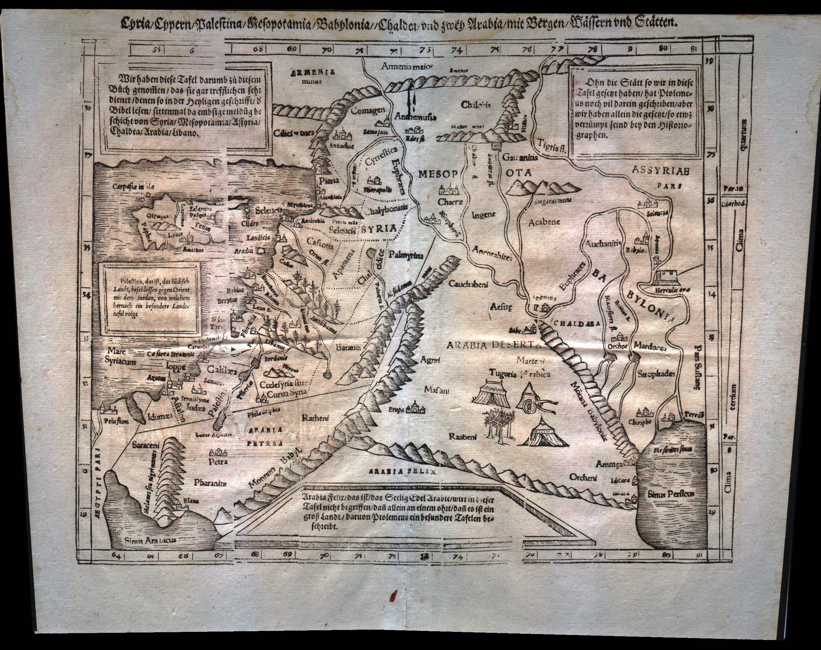
Syria Cypern Palestina Mesopotamia Babylonia Chaldea und zwey Arabia mit Bergen Wassern und Statten
Author
Munster
Location shown in map
Holy Land
Edition date
1555
Edition place
Basel
Editor
Henrich Petri
Atlas
Cosmographia Universalis
Price
300 Euro
State
[mint/excellent/very good/GOOD/fair/mediocre/poor]
Color
Black/white
Verso
German text
Size
Plate: cm (34.3 x 25.4) inches (13.5 x 10) Paper: cm (40.6 x 31.8) inches (15.98 x 12.52)
Technique
Woodcut
Note
Middle East from the Nile Delta to the southern coast of Turkey. Tabulae Asiae IV.
Reference
--
Wiki
Here for more info
In stock
Available
Info
info@thetreasuremaps.com
Code
#0178
×
![Syria Cypern Palestina Mesopotamia Babylonia Chaldea und zwey Arabia mit Bergen Wassern und Statten by Munster, Holy Land, 1555]()
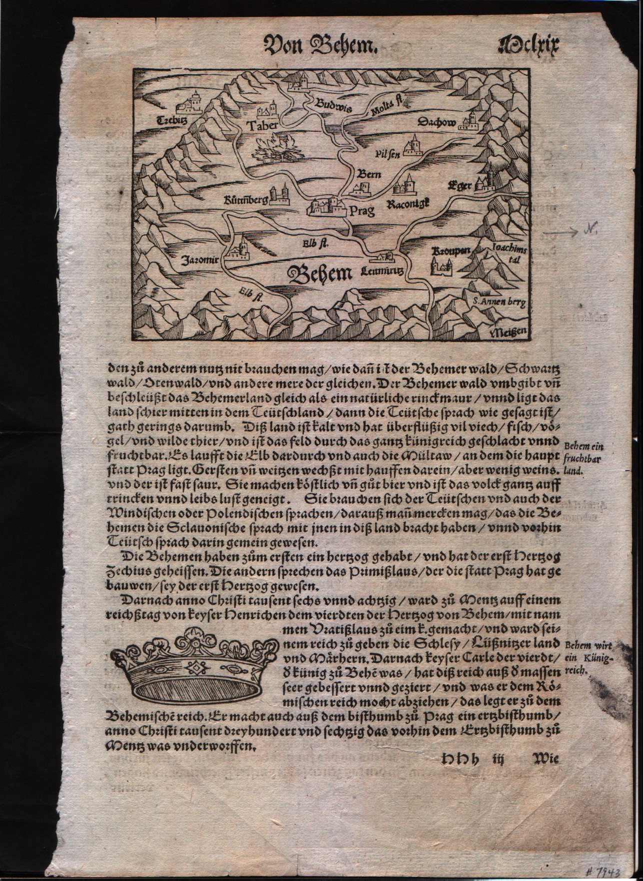
Map title
Prag area
Author
Munster
Location shown in map
Prag area
Edition date
1560
Edition place
???
Editor
Henrich Petri
Atlas
Cosmographia Universalis
Price
Please ask: info@thetreasuremaps.com
State
[mint/EXCELLENT/very good/good/fair/mediocre/poor]
Color
Black/white
Verso
German text
Size
Plate: cm (8.9 x 14) inches (3.5 x 5.51) Paper: cm (44.4 x 29.2) inches (17.48 x 11.5)
Technique
Woodcut
Note
No particular notes for this maps
Reference
--
Wiki
Here for more info
In stock
Available
Info
info@thetreasuremaps.com
Code
#0098
Prag area
Author
Munster
Location shown in map
Prag area
Edition date
1560
Edition place
???
Editor
Henrich Petri
Atlas
Cosmographia Universalis
Price
Please ask: info@thetreasuremaps.com
State
[mint/EXCELLENT/very good/good/fair/mediocre/poor]
Color
Black/white
Verso
German text
Size
Plate: cm (8.9 x 14) inches (3.5 x 5.51) Paper: cm (44.4 x 29.2) inches (17.48 x 11.5)
Technique
Woodcut
Note
No particular notes for this maps
Reference
--
Wiki
Here for more info
In stock
Available
Info
info@thetreasuremaps.com
Code
#0098
×
![Prag area by Munster, Prag area, 1560]()
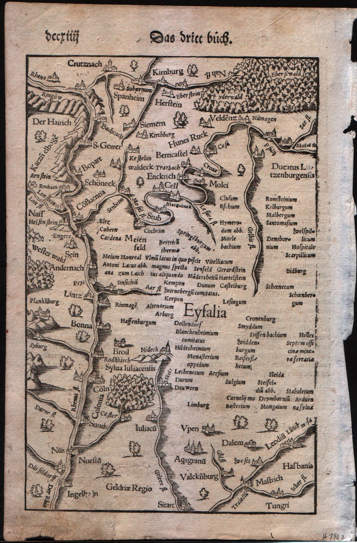
Map title
German Rhine
Author
Munster
Location shown in map
The Rhine Valley in Germany
Edition date
1560
Edition place
???
Editor
Henrich Petri
Atlas
Cosmographia Universalis
Price
Please ask: info@thetreasuremaps.com
State
[mint/EXCELLENT/very good/good/fair/mediocre/poor]
Color
Black/white
Verso
German text
Size
Plate: cm (16.5 x 25.4) inches (6.5 x 10) Paper: cm (19 x 29.2) inches (7.48 x 11.5)
Technique
Woodcut
Note
No particular notes for this maps
Reference
--
Wiki
Here for more info
In stock
Available
Info
info@thetreasuremaps.com
Code
#0097
×
![German Rhine by Munster, The Rhine Valley in Germany, 1560]()
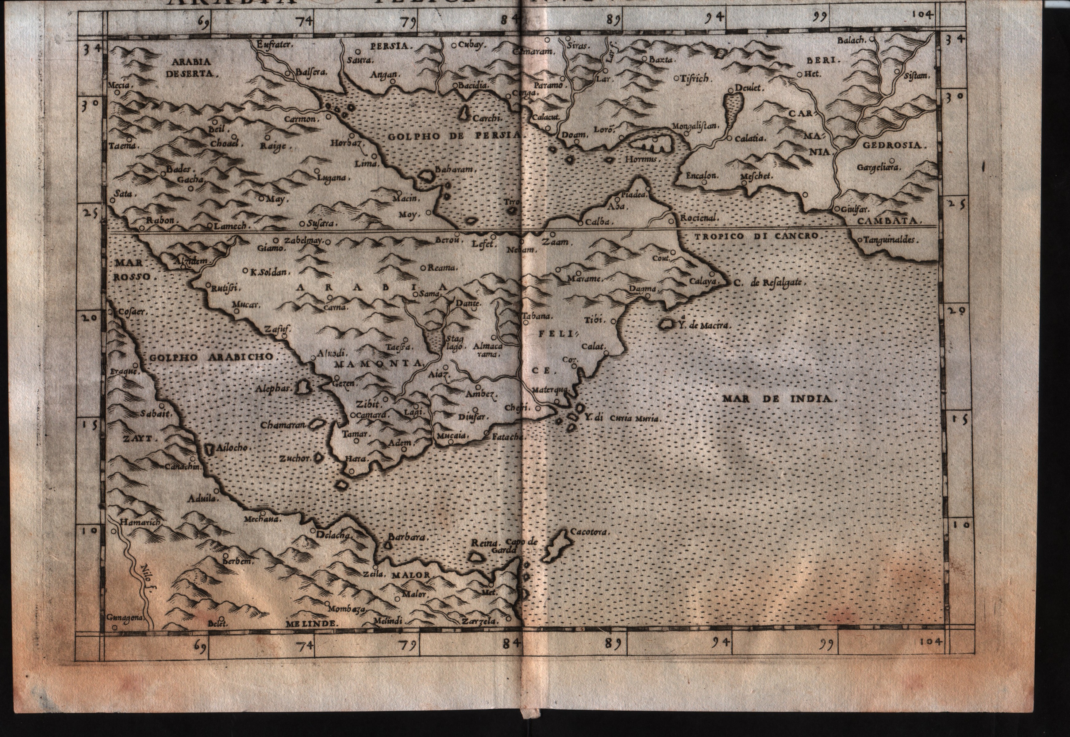
Map title
Arabia Felice Nuova Tavola
Author
Ruscelli
Location shown in map
Arabia
Edition date
1561
Edition place
Venice
Editor
Vincenzo Valgrisi
Atlas
La Geographia di Claudio Tolomeo
Price
300 Euro
State
[mint/excellent/very good/GOOD/fair/mediocre/poor]
Color
Black/white
Verso
Italian text pag.26
Size
Plate: cm (26 x 19) inches (10.24 x 7.48) Paper: cm (27.9 x 20.3) inches (10.98 x 7.99)
Technique
Copper engraving
Note
No particular notes for this maps.
Reference
--
Wiki
Here for more info
In stock
Available
Info
info@thetreasuremaps.com
Code
#0532
×
![Arabia Felice Nuova Tavola by Ruscelli, Arabia, 1561]()
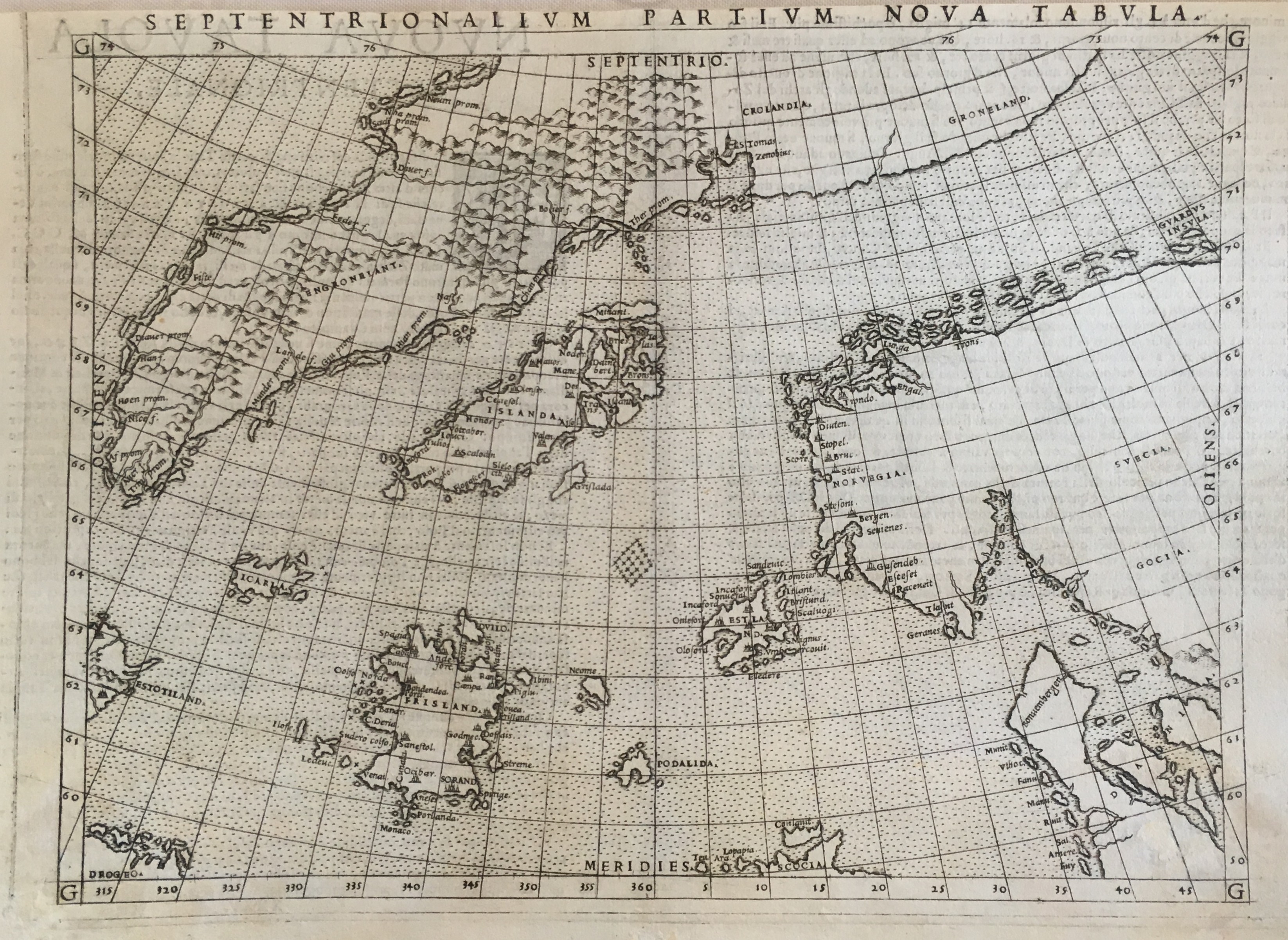
Map title
Septentrionalium partium nova tabula
Author
Ruscelli
Location shown in map
North Atlantic
Edition date
1561
Edition place
Venice
Editor
Vincenzo Valgrisi
Atlas
La Geographia di Claudio Tolomeo
Price
500 Euro
State
[mint/EXCELLENT/very good/good/fair/mediocre/poor]
Color
Black/white
Verso
Italian text pag.35
Size
Plate: cm (25.4 x 19) inches (10 x 7.48) Paper: cm (27.9 x 20.3) inches (10.98 x 7.99)
Technique
Copper engraving
Note
No particular notes for this maps.
Reference
--
Wiki
Here for more info
In stock
Available
Info
info@thetreasuremaps.com
Code
#0530
×
![Septentrionalium partium nova tabula by Ruscelli, North Atlantic, 1561]()
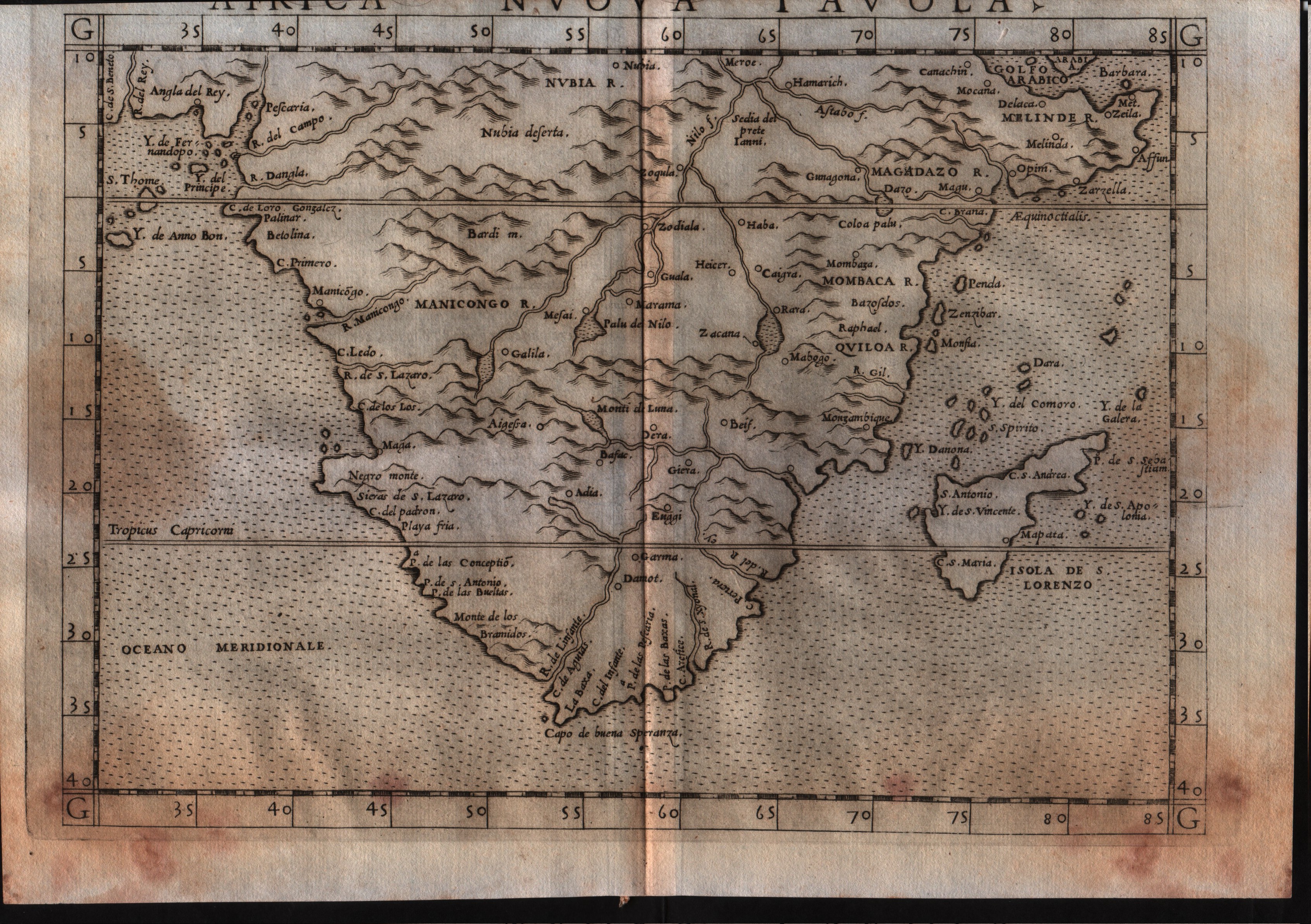
Map title
Africa Nuova Tavola
Author
Ruscelli
Location shown in map
South Africa
Edition date
1561
Edition place
Venice
Editor
Vincenzo Valgrisi
Atlas
La Geographia di Claudio Tolomeo
Price
300 Euro
State
[mint/excellent/very good/GOOD/fair/mediocre/poor]
Color
Black/white
Verso
Italian text pag.22
Size
Plate: cm (26 x 19) inches (10.24 x 7.48) Paper: cm (27.9 x 20.3) inches (10.98 x 7.99)
Technique
Copper engraving
Note
No particular notes for this maps.
Reference
--
Wiki
Here for more info
In stock
Available
Info
info@thetreasuremaps.com
Code
#0531
×
![Africa Nuova Tavola by Ruscelli, South Africa , 1561]()
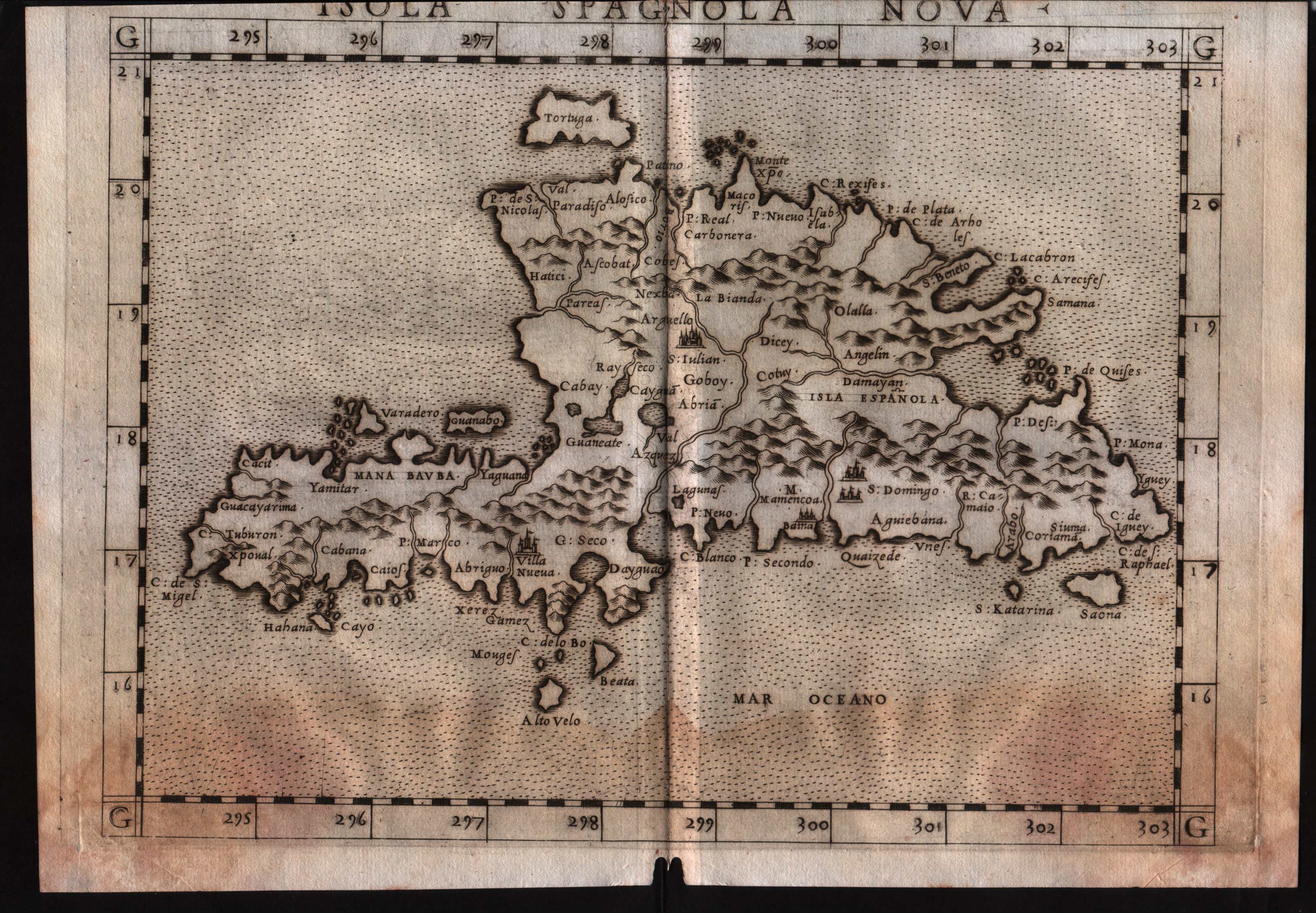
Map title
Isola Spagnola Nova
Author
Ruscelli
Location shown in map
Haiti
Edition date
1561
Edition place
Venice
Editor
Vincenzo Valgrisi
Atlas
La Geographia di Claudio Tolomeo
Price
300 Euro
State
[mint/excellent/VERY GOOD/good/fair/mediocre/poor]
Color
Black/white
Verso
Italian text pag.34
Size
Plate: cm (26 x 19) inches (10.24 x 7.48) Paper: cm (27.9 x 20.3) inches (10.98 x 7.99)
Technique
Copper engraving
Note
No particular notes for this maps.
Reference
--
Wiki
Here for more info
In stock
Available
Info
info@thetreasuremaps.com
Code
#0536
×
![Isola Spagnola Nova by Ruscelli, Haiti, 1561]()
Map title
Tierra Nueva
Author
Ruscelli
Location shown in map
East coast
Edition date
1561
Edition place
Venice
Editor
Vincenzo Valgrisi
Atlas
La Geographia di Claudio Tolomeo
Price
900 Euro
State
[mint/excellent/VERY GOOD/good/fair/mediocre/poor]
Color
Black/white
Verso
Italian text pag.59
Size
Plate: cm (25.4 x 19) inches (10 x 7.48) Paper: cm (27.9 x 20.3) inches (10.98 x 7.99)
Technique
Copper engraving
Note
No particular notes for this maps.
Reference
--
Wiki
Here for more info
In stock
Available
Info
info@thetreasuremaps.com
Code
#0529
×
![Tierra Nueva by Ruscelli, East coast, 1561]()
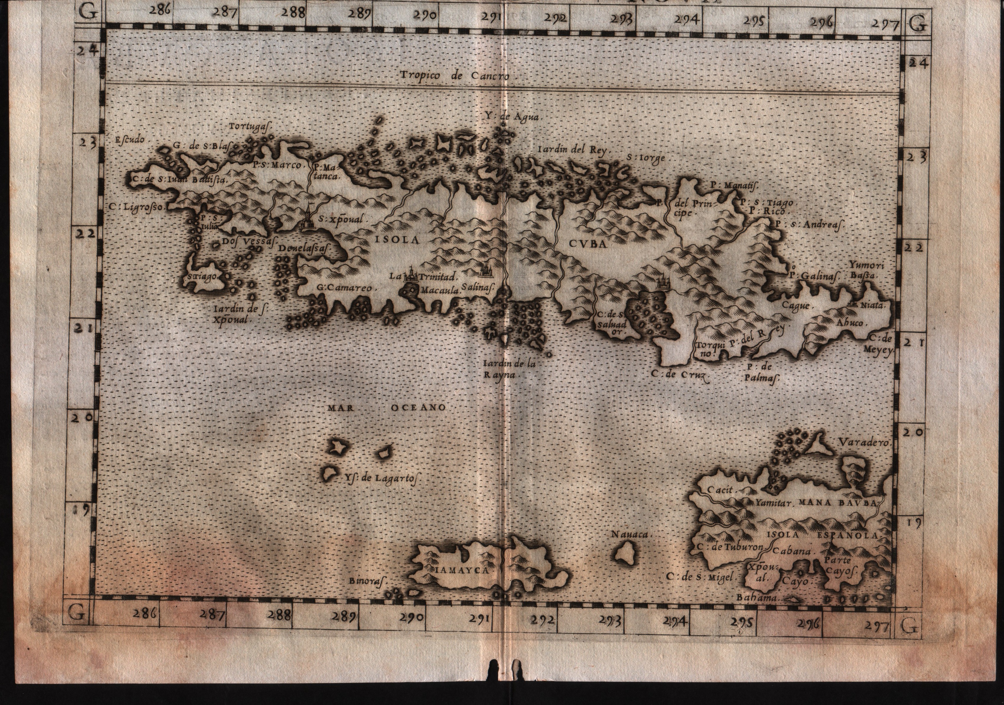
Map title
Isola Cuba Nova
Author
Ruscelli
Location shown in map
Cuba
Edition date
1561
Edition place
Venice
Editor
Vincenzo Valgrisi
Atlas
La Geographia di Claudio Tolomeo
Price
300 Euro
State
[mint/excellent/very good/GOOD/fair/mediocre/poor]
Color
Black/white
Verso
Italian text pag.33
Size
Plate: cm (26 x 19) inches (10.24 x 7.48) Paper: cm (27.9 x 20.3) inches (10.98 x 7.99)
Technique
Copper engraving
Note
--
Reference
--
Wiki
Here for more info
In stock
Available
Info
info@thetreasuremaps.com
Code
#0534
×
![Isola Cuba Nova by Ruscelli, Cuba, 1561]()
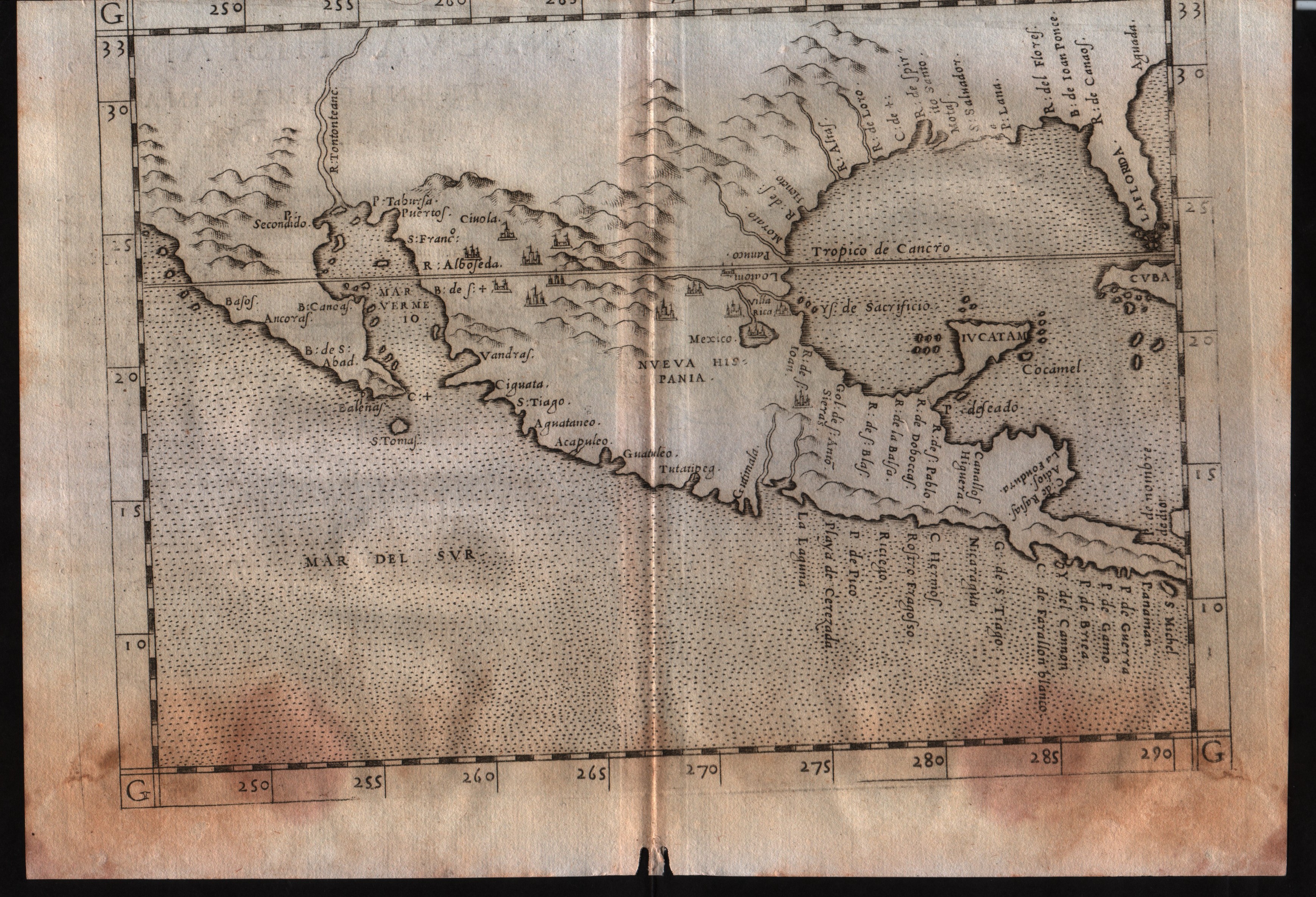
Map title
Nueva Hispania tabula nova
Author
Ruscelli
Location shown in map
Mexico
Edition date
1561
Edition place
Venice
Editor
Vincenzo Valgrisi
Atlas
La Geographia di Claudio Tolomeo
Price
400 Euro
State
[mint/excellent/very good/GOOD/fair/mediocre/poor]
Color
Black/white
Verso
Italian text pag.31
Size
Plate: cm (26 x 19) inches (10.24 x 7.48) Paper: cm (27.9 x 20.3) inches (10.98 x 7.99)
Technique
Copper engraving
Note
--
Reference
--
Wiki
Here for more info
In stock
Available
Info
info@thetreasuremaps.com
Code
#0535
×
![Nueva Hispania tabula nova by Ruscelli, Mexico, 1561]()
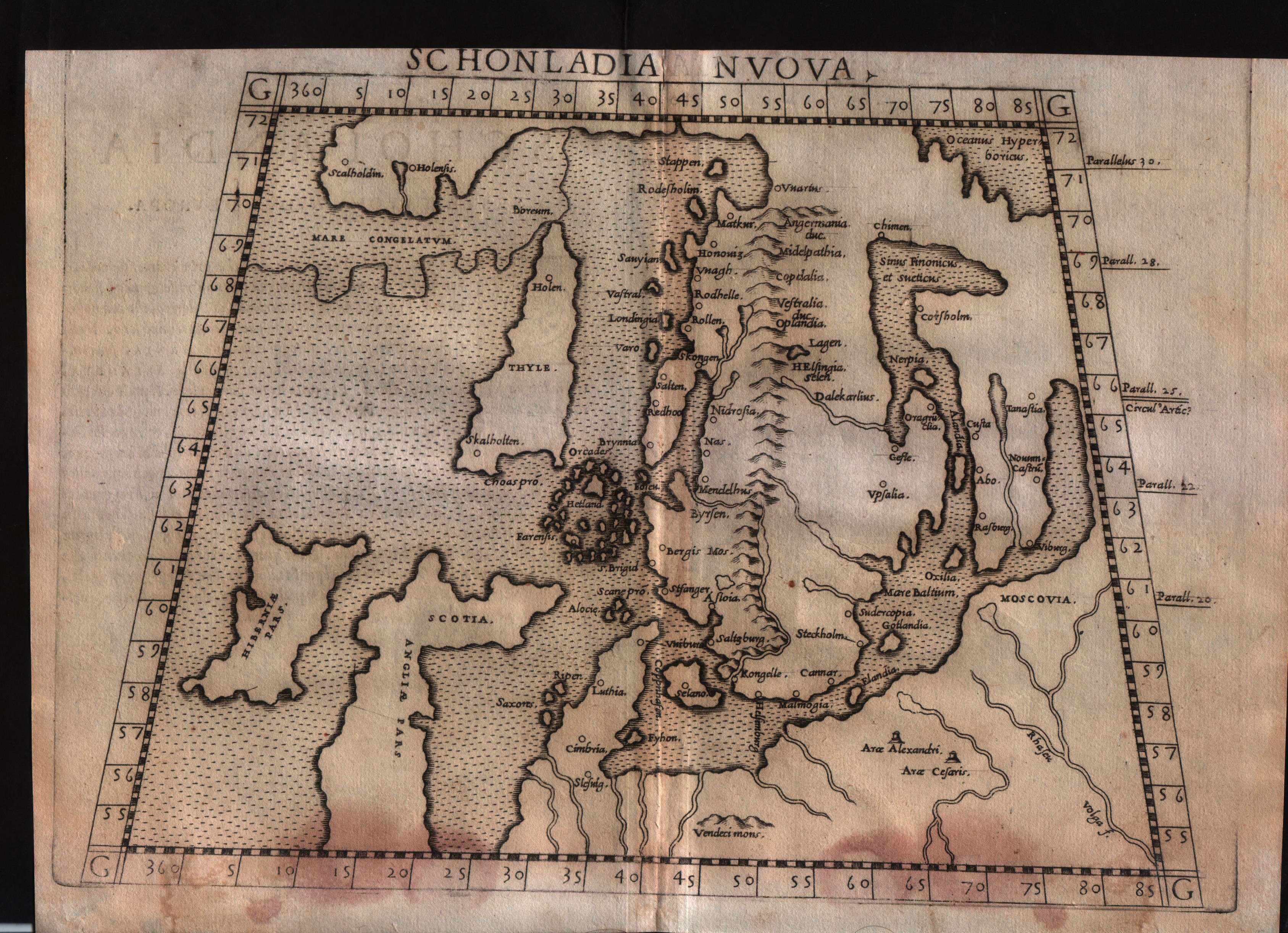
Map title
Schonlandia Nuova
Author
Ruscelli
Location shown in map
Scandinavia
Edition date
1561
Edition place
Venice
Editor
Vincenzo Valgrisi
Atlas
La Geographia di Claudio Tolomeo
Price
600 Euro
State
[mint/excellent/VERY GOOD/good/fair/mediocre/poor]
Color
Black/white
Verso
Italian text pag.6
Size
Plate: cm (26 x 19) inches (10.24 x 7.48) Paper: cm (27.9 x 20.3) inches (10.98 x 7.99)
Technique
Copper engraving
Note
No particular notes for this maps.
Reference
--
Wiki
Here for more info
In stock
Available
Info
info@thetreasuremaps.com
Code
#0533
×
![Schonlandia Nuova by Ruscelli, Scandinavia, 1561]()
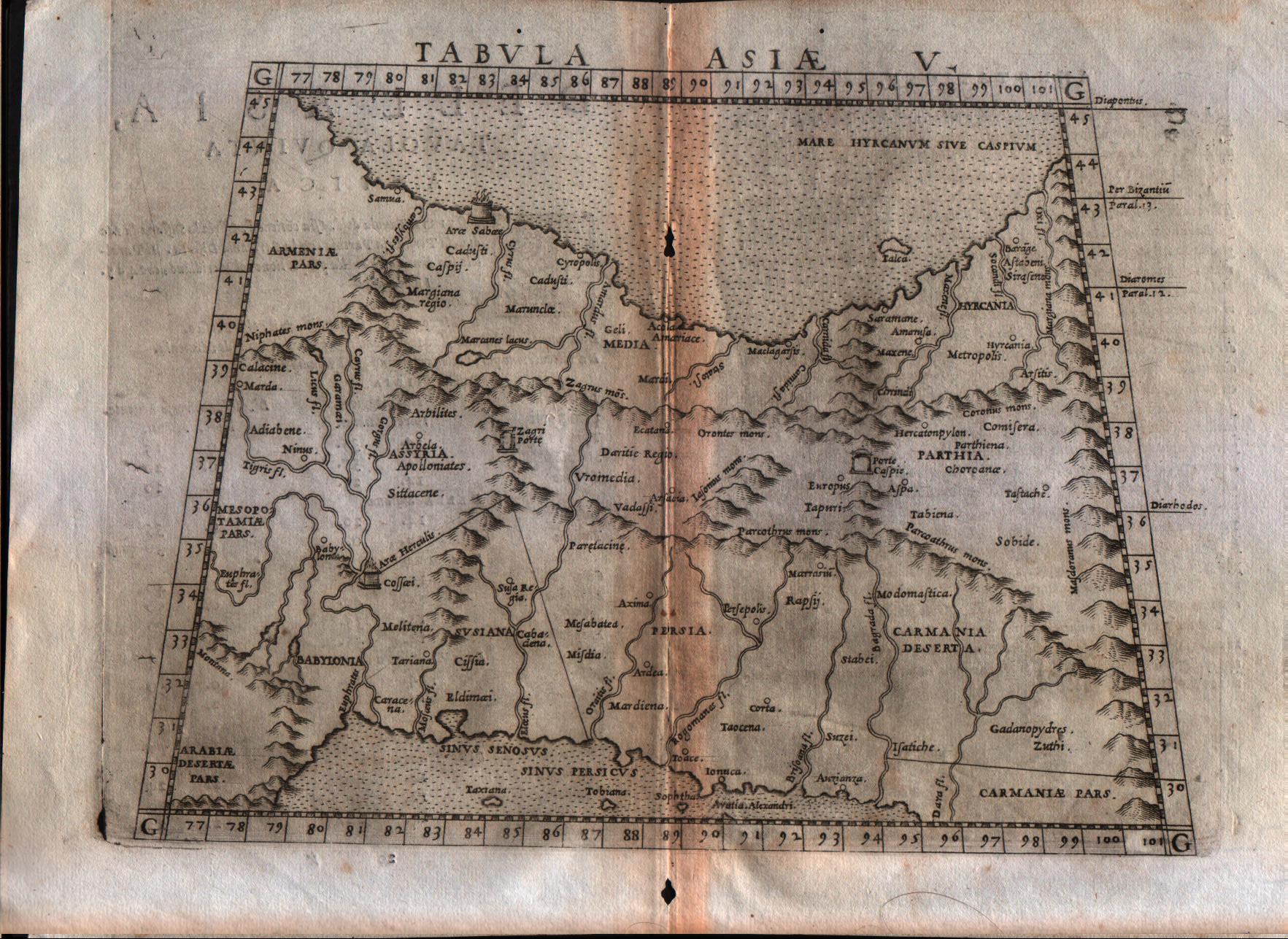
Map title
Tabula Asiae V
Author
Ruscelli
Location shown in map
Persia and west Pakistan
Edition date
1561
Edition place
Venice
Editor
Vincenzo Valgrisi
Atlas
La Geographia di Claudio Tolomeo
Price
150 Euro
State
[mint/excellent/very good/GOOD/fair/mediocre/poor]
Color
Black/white
Verso
Italian text pag.20
Size
Plate: cm (25.4 x 19) inches (10 x 7.48) Paper: cm (30.5 x 22.9) inches (12.01 x 9.02)
Technique
Copper engraving
Note
Persia and west Pakistan shown.
Reference
Genoa pubblic library "Civica Berio"
Wiki
Here for more info
In stock
Available
Info
info@thetreasuremaps.com
Code
#0506
×
![Tabula Asiae V by Ruscelli, Persia and west Pakistan, 1561]()
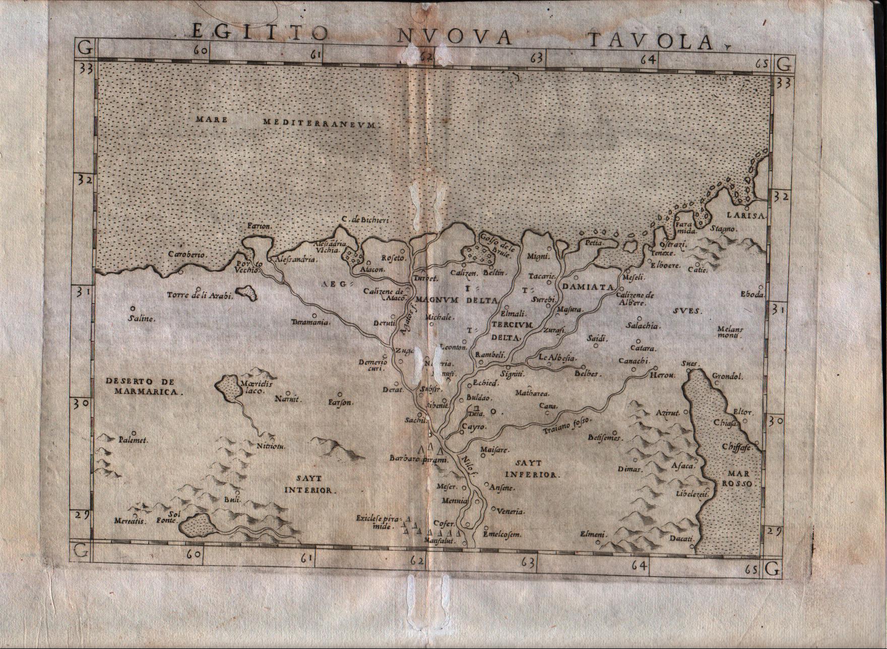
Map title
Egitto nuova tavola
Author
Ruscelli
Location shown in map
Egypt
Edition date
1561
Edition place
Venice
Editor
Vincenzo Valgrisi
Atlas
La Geographia di Claudio Tolomeo
Price
150 Euro
State
[mint/excellent/very good/good/FAIR/mediocre/poor] repaired
Color
Black/white
Verso
Italian text
Size
Plate: cm (26 x 20.3) inches (10.24 x 7.99) Paper: cm (30.5 x 22.9) inches (12.01 x 9.02)
Technique
Copper engraving
Note
Based on Gastaldi map.
Reference
Genoa pubblic library "Civica Berio"
Wiki
Here for more info
In stock
Available
Info
info@thetreasuremaps.com
Code
#0280
×
![Egitto nuova tavola by Ruscelli, Egypt, 1561]()