1600-1699
Map title
L'America Settentrionale
Author
De Rossi
Location shown in map
North America
Edition date
1677
Edition place
Rome
Editor
De Rossi
Atlas
Mercurio Geografico
Price
1600 Euro
State
[mint/EXCELLENT/very good/good/fair/mediocre/poor]
Color
Old colors
Verso
Blank
Size
Plate: cm (55 x 39) inches (21.65 x 15.35) Paper: cm (60 x 48) inches (23.62 x 18.9)
Technique
Copper engraving
Note
Reference
Wiki
Here for more info
In stock
Sold
Info
info@thetreasuremaps.com
Code
#0983
×
![L'America Settentrionale by De Rossi, North America, 1677]()
Map title
L'Asia
Author
De Rossi
Location shown in map
Asia
Edition date
1677
Edition place
Rome
Editor
De Rossi
Atlas
Mercurio Geografico
Price
600 Euro
State
[mint/EXCELLENT/very good/good/fair/mediocre/poor]
Color
Old colors
Verso
Blank
Size
Plate: cm (55 x 39) inches (21.65 x 15.35) Paper: cm (60 x 48) inches (23.62 x 18.9)
Technique
Copper engraving
Note
Reference
Wiki
Here for more info
In stock
Available
Info
info@thetreasuremaps.com
Code
#0985
×
![L'Asia by De Rossi, Asia, 1677]()
Map title
Tabula geographico-hydrographica motus oceani currentes abyssos montes ...
Author
Kircher
Location shown in map
World
Edition date
1678
Edition place
Amsterdam
Editor
Jansson
Atlas
Mundus subterraneus
Price
1100 Euro
State
[mint/EXCELLENT/very good/good/fair/mediocre/poor]
Color
Modern color
Verso
Blank
Size
Plate: cm (54 x 34) inches (21.26 x 13.39) Paper: cm (57 x 39) inches (22.44 x 15.35)
Technique
Copper engraving
Note
Reference
Wiki
Here for more info
In stock
Available
Info
info@thetreasuremaps.com
Code
#0788
×
![Tabula geographico-hydrographica motus oceani currentes abyssos montes ... by Kircher, World, 1678]()
Map title
Carte des isles du Japon
Author
Tavernier
Location shown in map
Japan
Edition date
Circa 1679
Edition place
Paris
Editor
Atlas
Price
400 Euro
State
[mint/EXCELLENT/very good/good/fair/mediocre/poor] repaired
Color
Black/white
Verso
Blank
Size
Plate: cm (33 x 21) inches (12.99 x 8.27) Paper: cm (35 x 24) inches (13.78 x 9.45)
Technique
Copper engraving
Note
Reference
Wiki
Here for more info
In stock
Available
Info
info@thetreasuremaps.com
Code
#1201
×
![Carte des isles du Japon by Tavernier, Japan, Circa 1679]()

Map title
America Settentrional
Author
Sanson
Location shown in map
North America
Edition date
1680
Edition place
--
Editor
--
Atlas
--
Price
Please ask: info@thetreasuremaps.com
State
[mint/excellent/VERY GOOD/good/fair/mediocre/poor]
Color
Black/white
Verso
Blank
Size
Plate: cm (16.5 x 14) inches (6.5 x 5.51) Paper: cm (20.3 x 20.3) inches (7.99 x 7.99)
Technique
Copper engraving
Note
California as an island
Reference
--
Wiki
Here for more info
In stock
Sold
Info
info@thetreasuremaps.com
Code
#0406
×
![America Settentrional by Sanson, North America, 1680]()
Map title
Carte des nouvelles decouvertes
Author
Hailler
Location shown in map
Italy
Edition date
Circa 1680
Edition place
Frankfurt
Editor
Atlas
Philippi Cluverii introductionis in universa geographiam tam veterem qua nova olim studio & opera Joh. Bunonis.
Price
175 Euro
State
[mint/EXCELLENT/very good/good/fair/mediocre/poor]
Color
Old colors
Verso
Blank
Size
Plate: cm (30 x 26) inches (11.81 x 10.24) Paper: cm (37 x 28) inches (14.57 x 11.02)
Technique
Copper engraving
Note
Reference
R.Borri L'Italia nelle antiche carte pag.150
Wiki
Here for more info
In stock
Available
Info
info@thetreasuremaps.com
Code
#0909
×
![Carte des nouvelles decouvertes by Hailler, Italy, Circa 1680]()
Map title
Nova et Accurata Wolgae Fluminis, Olim Rha Dicti Delineatio Auctore Adamo Oleario
Author
Jansson
Location shown in map
Russia
Edition date
Circa 1680
Edition place
Amsterdam
Editor
Jansson
Atlas
Price
400 Euro
State
[mint/excellent/very good/good/fair/MEDIOCRE/poor]
Color
Old colors
Verso
Size
Plate: cm (54 x 47) inches (21.26 x 18.5) Paper: cm (70 x 60) inches (27.56 x 23.62)
Technique
Copper engraving
Note
Reference
Wiki
Here for more info
In stock
Available
Info
info@thetreasuremaps.com
Code
#1076
×
![Nova et Accurata Wolgae Fluminis, Olim Rha Dicti Delineatio Auctore Adamo Oleario by Jansson, Russia, Circa 1680]()
Map title
Signoria di Vercelli
Author
Blaeu
Location shown in map
North-West Italy
Edition date
Circa 1680
Edition place
Amsterdam
Editor
Schenk
Atlas
Price
400 Euro
State
[mint/EXCELLENT/very good/good/fair/mediocre/poor]
Color
Old colors
Verso
Blank
Size
Plate: cm (0 x 0) inches (0 x 0) Paper: cm (48 x 37) inches (18.9 x 14.57)
Technique
Copper engraving
Note
Framed
Reference
Wiki
Here for more info
In stock
Available
Info
info@thetreasuremaps.com
Code
#1107
×
![Signoria di Vercelli by Blaeu, North-West Italy, Circa 1680]()
Map title
Presquisle de l'Inde de ca le Gange
Author
DuVal
Location shown in map
India
Edition date
1682
Edition place
Paris
Editor
--
Atlas
La geographie universelle - P. Du Val d'Abbeville
Price
100 Euro
State
[mint/EXCELLENT/very good/good/fair/mediocre/poor]
Color
Black/white
Verso
Blank
Size
Plate: cm (12.7 x 10.2) inches (5 x 4.02) Paper: cm (16.5 x 16.5) inches (6.5 x 6.5)
Technique
Copper engraving
Note
No particular notes for this maps
Reference
--
Wiki
Here for more info
In stock
Available
Info
info@thetreasuremaps.com
Code
#0218
×
![Presquisle de l'Inde de ca le Gange by DuVal, India, 1682]()
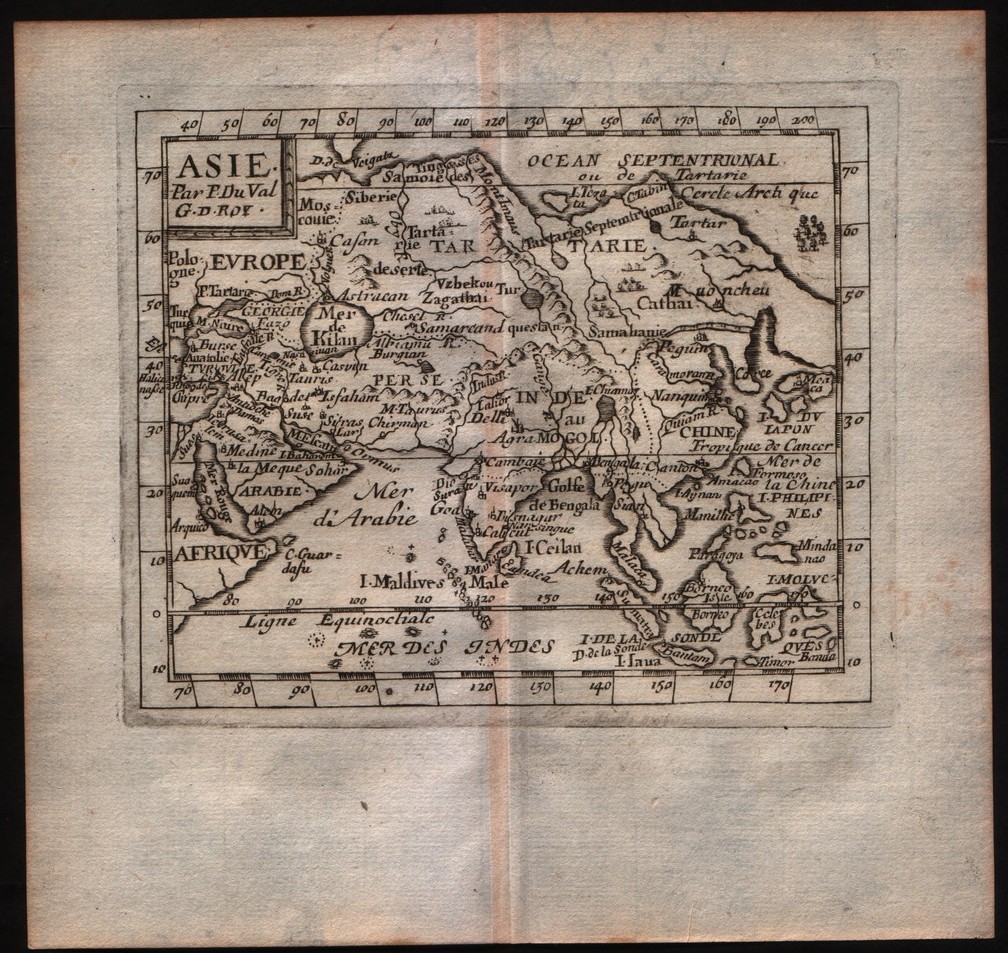
Map title
Asie
Author
DuVal
Location shown in map
Asia
Edition date
1682
Edition place
Paris
Editor
--
Atlas
La geographie universelle - P. Du Val d'Abbeville
Price
Please ask: info@thetreasuremaps.com
State
[mint/EXCELLENT/very good/good/fair/mediocre/poor]
Color
Black/white
Verso
Blank
Size
Plate: cm (12.7 x 10.2) inches (5 x 4.02) Paper: cm (16.5 x 16.5) inches (6.5 x 6.5)
Technique
Copper engraving
Note
No particular notes for this maps
Reference
--
Wiki
Here for more info
In stock
Sold
Info
info@thetreasuremaps.com
Code
#0219
×
![Asie by DuVal, Asia, 1682]()
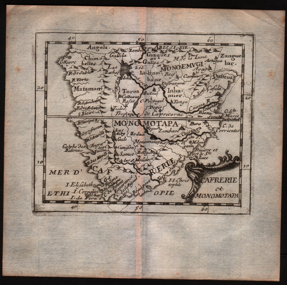
Map title
Cafrerie et Monomotapa
Author
DuVal
Location shown in map
South Africa
Edition date
1682
Edition place
Paris
Editor
--
Atlas
La geographie universelle - P. Du Val d'Abbeville
Price
Please ask: info@thetreasuremaps.com
State
[mint/EXCELLENT/very good/good/fair/mediocre/poor]
Color
Black/white
Verso
Blank
Size
Plate: cm (12.7 x 10.2) inches (5 x 4.02) Paper: cm (16.5 x 16.5) inches (6.5 x 6.5)
Technique
Copper engraving
Note
No particular notes for this maps
Reference
--
Wiki
Here for more info
In stock
Sold
Info
info@thetreasuremaps.com
Code
#0297
×
![Cafrerie et Monomotapa by DuVal, South Africa, 1682]()
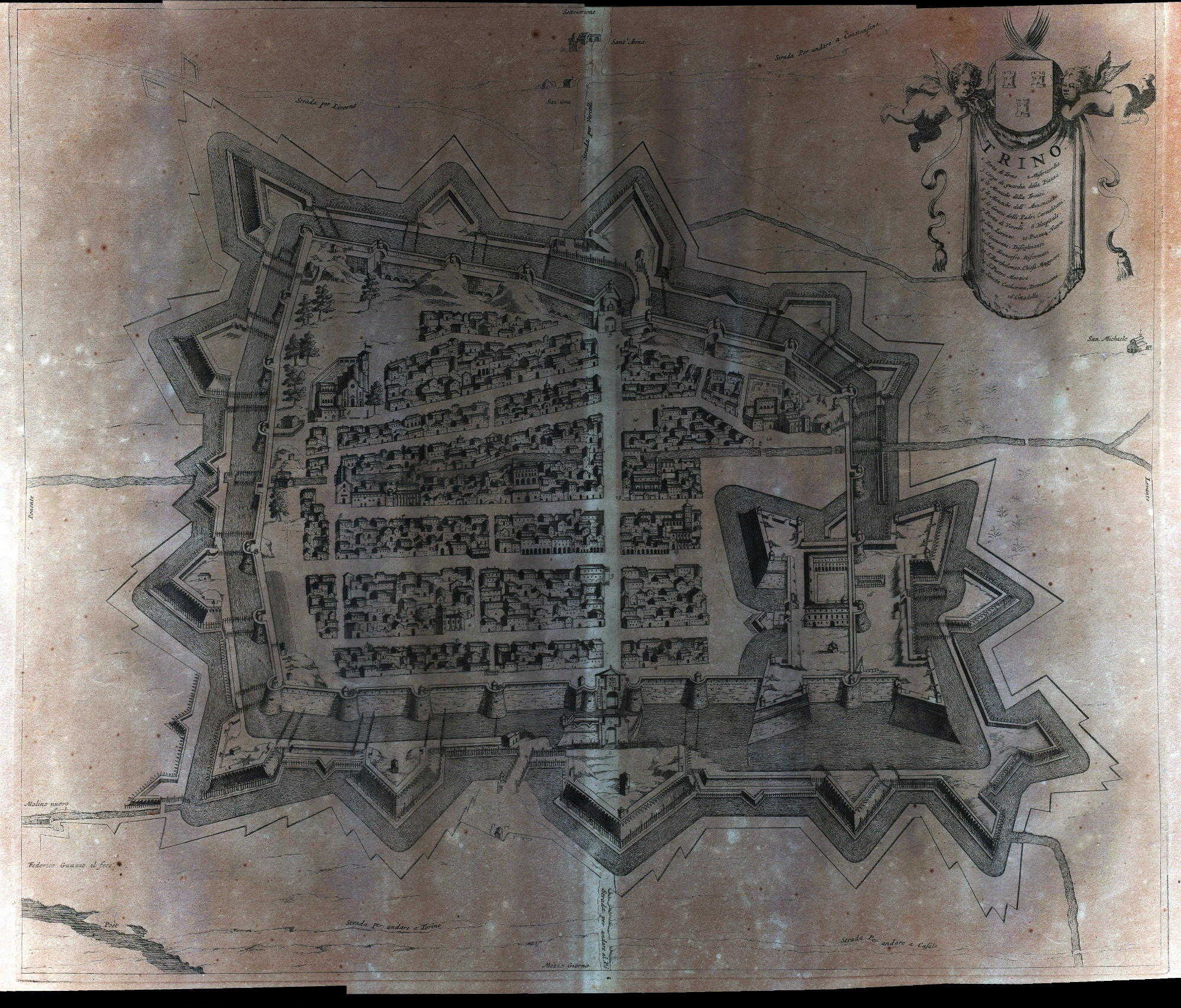
Map title
Trino
Author
Blaeu
Location shown in map
Trino
Edition date
1682
Edition place
Amsterdam
Editor
Blaeu
Atlas
Theatrum statuum regiae celsitudinis Sabaudiae
Price
Please ask: info@thetreasuremaps.com
State
[mint/excellent/VERY GOOD/good/fair/mediocre/poor]
Color
Black/white
Verso
Blank
Size
Plate: cm (58.4 x 50.8) inches (22.99 x 20) Paper: cm (68.6 x 55.9) inches (27.01 x 22.01)
Technique
Copper engraving
Note
No particular notes for this maps.
Reference
--
Wiki
Here for more info
In stock
Available
Info
info@thetreasuremaps.com
Code
#0563
Trino
Author
Blaeu
Location shown in map
Trino
Edition date
1682
Edition place
Amsterdam
Editor
Blaeu
Atlas
Theatrum statuum regiae celsitudinis Sabaudiae
Price
Please ask: info@thetreasuremaps.com
State
[mint/excellent/VERY GOOD/good/fair/mediocre/poor]
Color
Black/white
Verso
Blank
Size
Plate: cm (58.4 x 50.8) inches (22.99 x 20) Paper: cm (68.6 x 55.9) inches (27.01 x 22.01)
Technique
Copper engraving
Note
No particular notes for this maps.
Reference
--
Wiki
Here for more info
In stock
Available
Info
info@thetreasuremaps.com
Code
#0563
×
![Trino by Blaeu, Trino, 1682]()
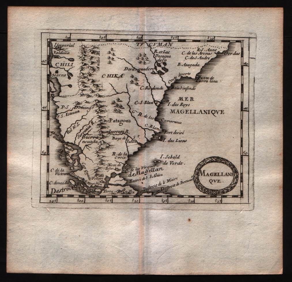
Map title
Magellanique
Author
DuVal
Location shown in map
Patagonia
Edition date
1682
Edition place
Paris
Editor
--
Atlas
La geographie universelle - P. Du Val d'Abbeville
Price
Please ask: info@thetreasuremaps.com
State
[mint/EXCELLENT/very good/good/fair/mediocre/poor]
Color
Black/white
Verso
Blank
Size
Plate: cm (12.7 x 10.2) inches (5 x 4.02) Paper: cm (16.5 x 16.5) inches (6.5 x 6.5)
Technique
Copper engraving
Note
No particular notes for this maps
Reference
--
Wiki
Here for more info
In stock
Sold
Info
info@thetreasuremaps.com
Code
#0508
×
![Magellanique by DuVal, Patagonia, 1682]()
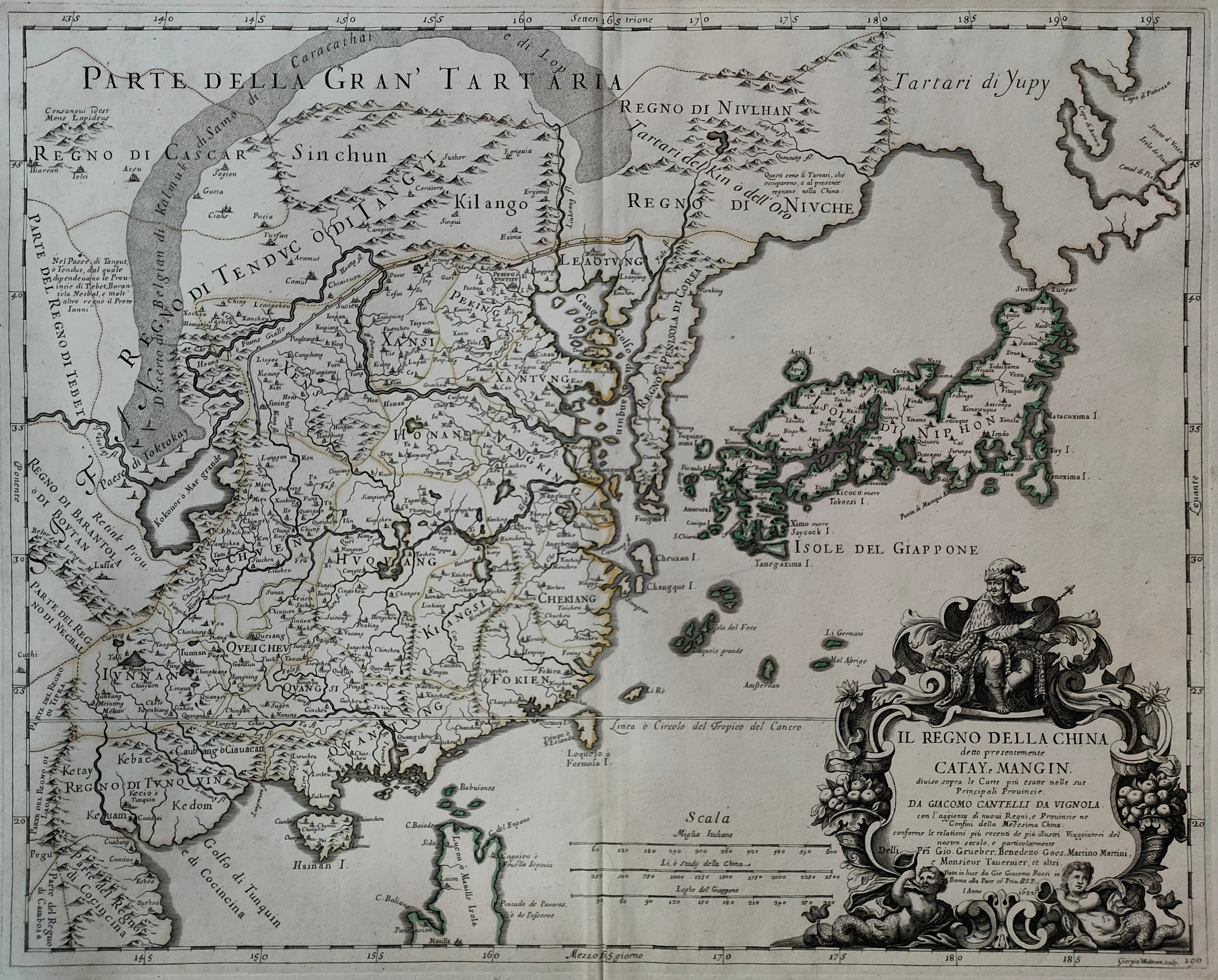
Map title
Il regno della China
Author
De Rossi
Location shown in map
China
Edition date
1682
Edition place
Rome
Editor
De Rossi
Atlas
Mercurio Geografico
Price
1600 Euro
State
[mint/EXCELLENT/very good/good/fair/mediocre/poor]
Color
Old colors
Verso
Blank
Size
Plate: cm (55 x 39) inches (21.65 x 15.35) Paper: cm (60 x 48) inches (23.62 x 18.9)
Technique
Copper engraving
Note
Reference
Wiki
Here for more info
In stock
Available
Info
info@thetreasuremaps.com
Code
#0984
×
![Il regno della China by De Rossi, China, 1682]()
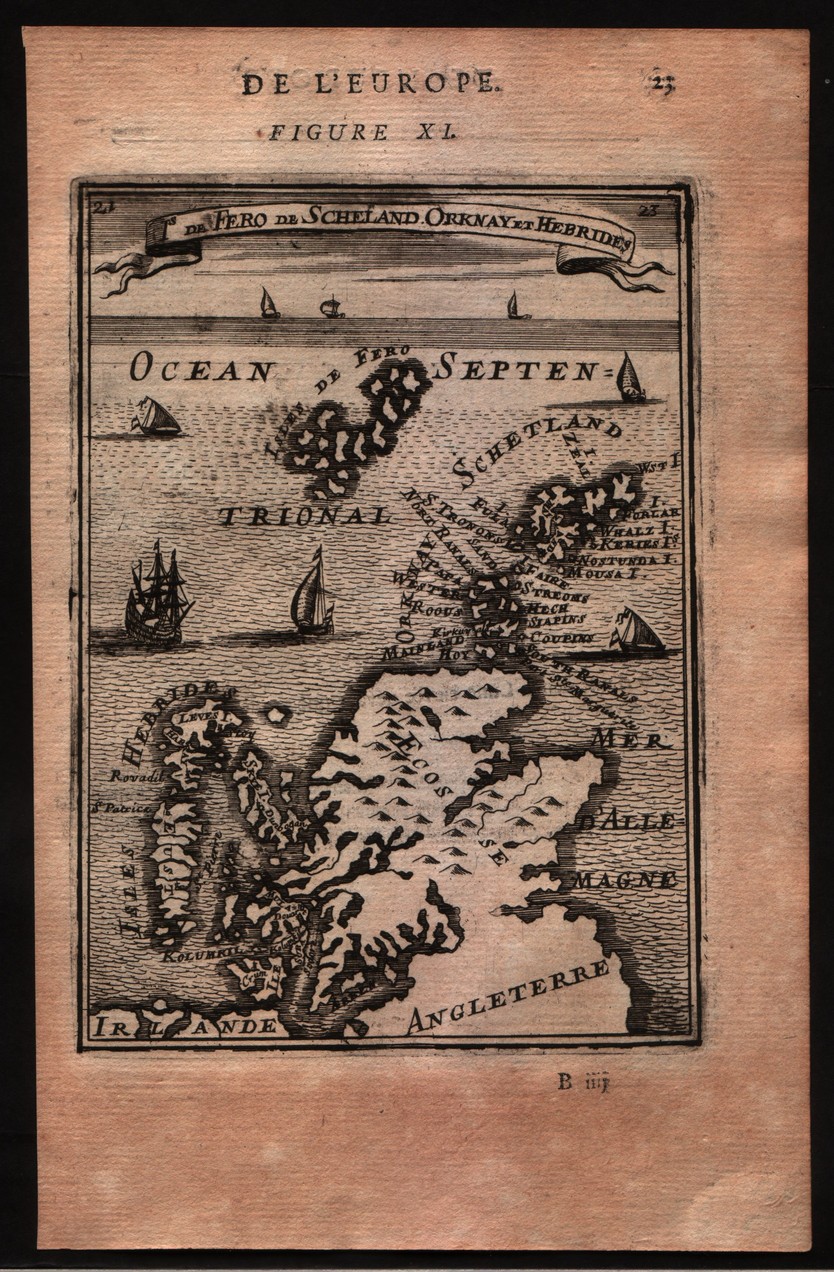
Map title
De Fero de Scheland Orknay et Hebrides
Author
Mallet
Location shown in map
North of England
Edition date
1683
Edition place
Paris
Editor
--
Atlas
Description de l'univers - Chez Denis Thierry
Price
75 Euro
State
[mint/EXCELLENT/very good/good/fair/mediocre/poor] Only a small part of the map.
Color
Black/white
Verso
French text pag 24
Size
Plate: cm (10.2 x 15.2) inches (4.02 x 5.98) Paper: cm (12.7 x 20.3) inches (5 x 7.99)
Technique
Copper engraving
Note
No particular notes for this maps
Reference
--
Wiki
Here for more info
In stock
Available
Info
info@thetreasuremaps.com
Code
#0140
×
![De Fero de Scheland Orknay et Hebrides by Mallet, North of England, 1683]()
Map title
Nouvelle Guinee et Carpentarie
Author
Mallet
Location shown in map
New Guinea
Edition date
1683
Edition place
Paris
Editor
Atlas
Description de l'Univers
Price
75 Euro
State
[mint/EXCELLENT/very good/good/fair/mediocre/poor]
Color
Old colors
Verso
Blank
Size
Plate: cm (11 x 15) inches (4.33 x 5.91) Paper: cm (14 x 21) inches (5.51 x 8.27)
Technique
Copper engraving
Note
No particular notes for this maps
Reference
Wiki
Here for more info
In stock
Available
Info
info@thetreasuremaps.com
Code
#0666
×
![Nouvelle Guinee et Carpentarie by Mallet, New Guinea, 1683]()
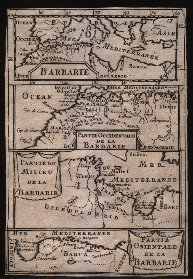
Map title
Barbarie
Author
Mallet
Location shown in map
North Africa
Edition date
1683
Edition place
--
Editor
--
Atlas
Description de l'Univers
Price
50 Euro
State
[mint/EXCELLENT/very good/good/fair/mediocre/poor]
Color
Black/white
Verso
Blank
Size
Plate: cm (10.2 x 15.2) inches (4.02 x 5.98) Paper: cm (10.2 x 15.2) inches (4.02 x 5.98)
Technique
Copper engraving
Note
No particular notes for this maps
Reference
--
Wiki
Here for more info
In stock
Available
Info
info@thetreasuremaps.com
Code
#0296
×
![Barbarie by Mallet, North Africa, 1683]()
Map title
Le Canada ou Novelle France
Author
Sanson
Location shown in map
North America
Edition date
Circa 1683
Edition place
Paris
Editor
Atlas
L'Europe en Plusieurs Cartes, et en divers Traittes de Geographie et d'Histoire.
Price
400 Euro
State
[mint/EXCELLENT/very good/good/fair/mediocre/poor]
Color
Old colors
Verso
Blank
Size
Plate: cm (30 x 21) inches (11.81 x 8.27) Paper: cm (32 x 22) inches (12.6 x 8.66)
Technique
Copper engraving
Note
Reference
Wiki
Here for more info
In stock
Available
Info
info@thetreasuremaps.com
Code
#0997
×
![Le Canada ou Novelle France by Sanson, North America, Circa 1683]()
Map title
Ceylan et les Maldives
Author
Sanson
Location shown in map
Ceylon
Edition date
Circa 1683
Edition place
Paris
Editor
Atlas
L'Europe en Plusieurs Cartes, et en divers Traittes de Geographie et d'Histoire.
Price
200 Euro
State
[mint/EXCELLENT/very good/good/fair/mediocre/poor]
Color
Old colors
Verso
Blank
Size
Plate: cm (24 x 19) inches (9.45 x 7.48) Paper: cm (32 x 22) inches (12.6 x 8.66)
Technique
Copper engraving
Note
Reference
Wiki
Here for more info
In stock
Available
Info
info@thetreasuremaps.com
Code
#1007
×
![Ceylan et les Maldives by Sanson, Ceylon, Circa 1683]()
Map title
Terre ferme, Nouveau Royme de Grenade
Author
Sanson
Location shown in map
Colombia
Edition date
Circa 1683
Edition place
Paris
Editor
Atlas
L'Europe en Plusieurs Cartes, et en divers Traittes de Geographie et d'Histoire.
Price
200 Euro
State
[mint/EXCELLENT/very good/good/fair/mediocre/poor]
Color
Old colors
Verso
Blank
Size
Plate: cm (29 x 19) inches (11.42 x 7.48) Paper: cm (32 x 22) inches (12.6 x 8.66)
Technique
Copper engraving
Note
Reference
Wiki
Here for more info
In stock
Available
Info
info@thetreasuremaps.com
Code
#1008
×
![Terre ferme, Nouveau Royme de Grenade by Sanson, Colombia, Circa 1683]()