1600-1699
Map title
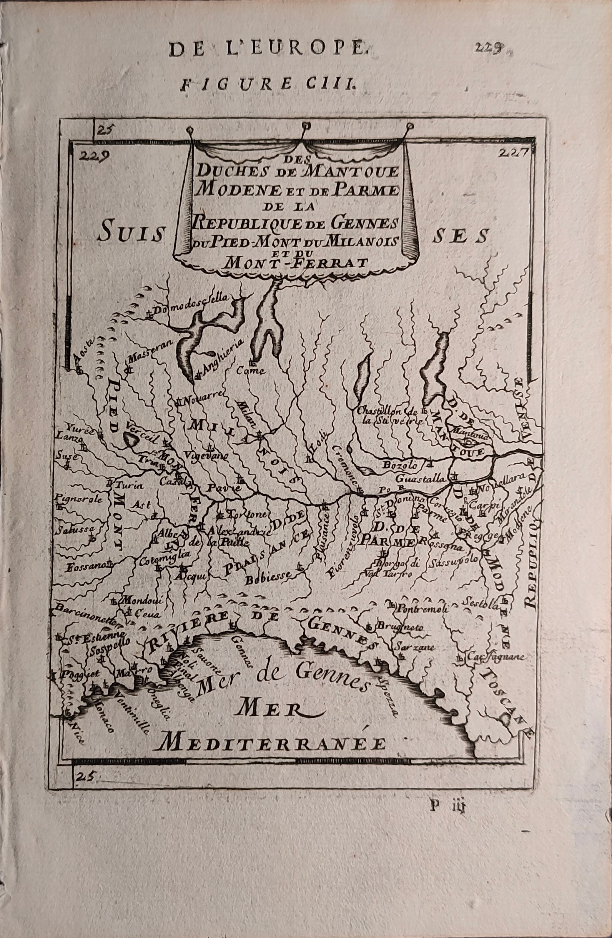
Des Duches De Mantoue Modene et de Parme, De La Republique de Gennes Du Pied-Mont du Milanois et du Mont- Ferrat
Author
Mallet
Location shown in map
Liguria
Edition date
1683
Edition place
Paris
Editor
--
Atlas
Description de l'univers - Chez Denis Thierry
Price
75 Euro
State
[mint/EXCELLENT/very good/good/fair/mediocre/poor]
Color
Black/white
Verso
French text pag 24
Size
Plate: cm (11 x 15) inches (4.33 x 5.91) Paper: cm (14 x 21) inches (5.51 x 8.27)
Technique
Copper engraving
Note
Reference
--
Wiki
Here for more info
In stock
Available
Info
info@thetreasuremaps.com
Code
#1353
×
![Des Duches De Mantoue Modene et de Parme, De La Republique de Gennes Du Pied-Mont du Milanois et du Mont- Ferrat by Mallet, Liguria, 1683]()
Map title
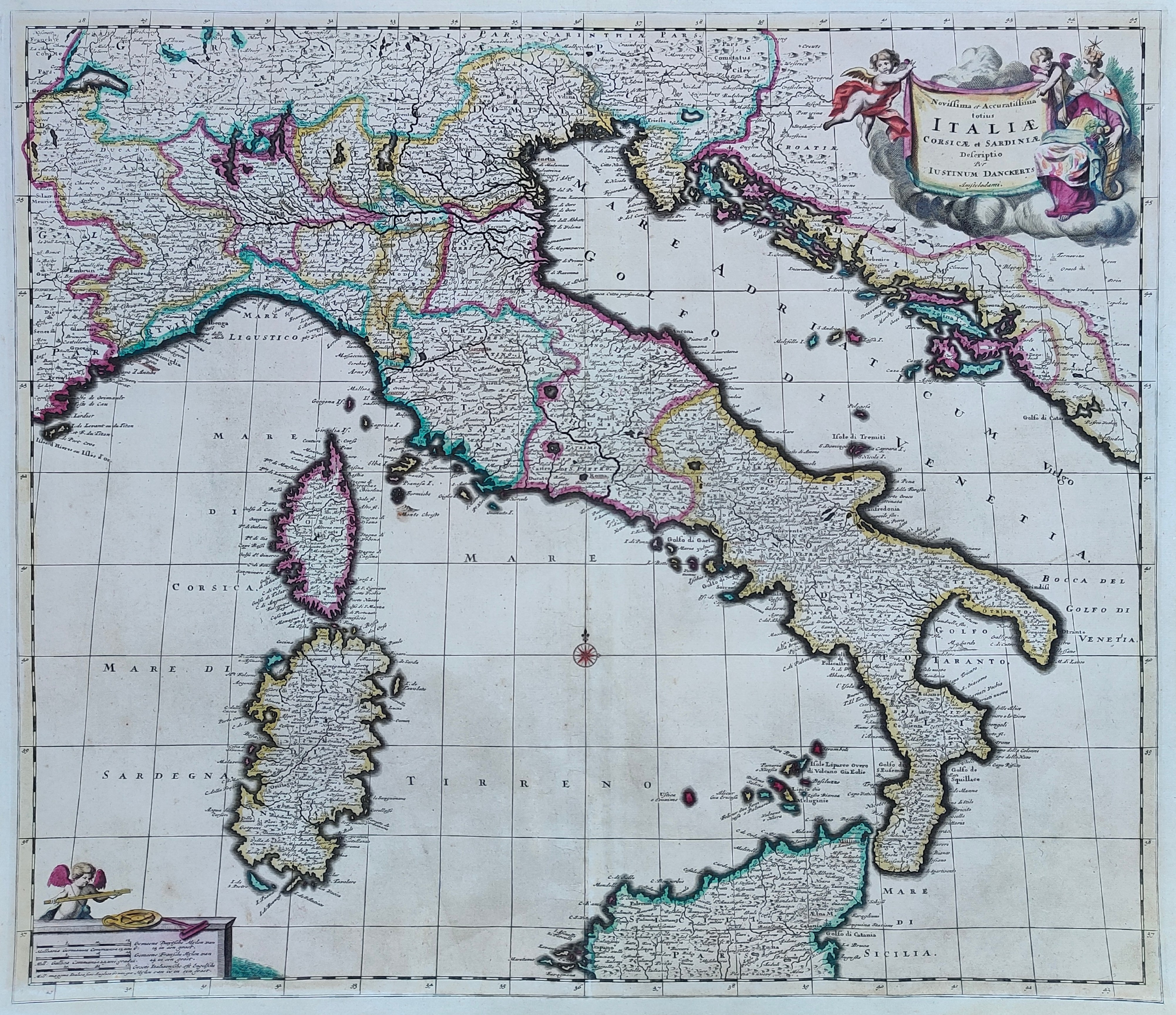
Novissima et accuratissima totius Italiae
Author
Danckerts
Location shown in map
Italy
Edition date
1685
Edition place
Amsterdam
Editor
Atlas
Price
600 Euro
State
[mint/EXCELLENT/very good/good/fair/mediocre/poor]
Color
Old colors
Verso
Blank
Size
Plate: cm (57 x 49) inches (22.44 x 19.29) Paper: cm (60 x 52) inches (23.62 x 20.47)
Technique
Copper engraving
Note
Professionally repaired
Reference
R.Borri L'Italia nelle antiche carte pag.154
Wiki
Here for more info
In stock
Available
Info
info@thetreasuremaps.com
Code
#0897
×
![Novissima et accuratissima totius Italiae by Danckerts, Italy, 1685]()
Map title
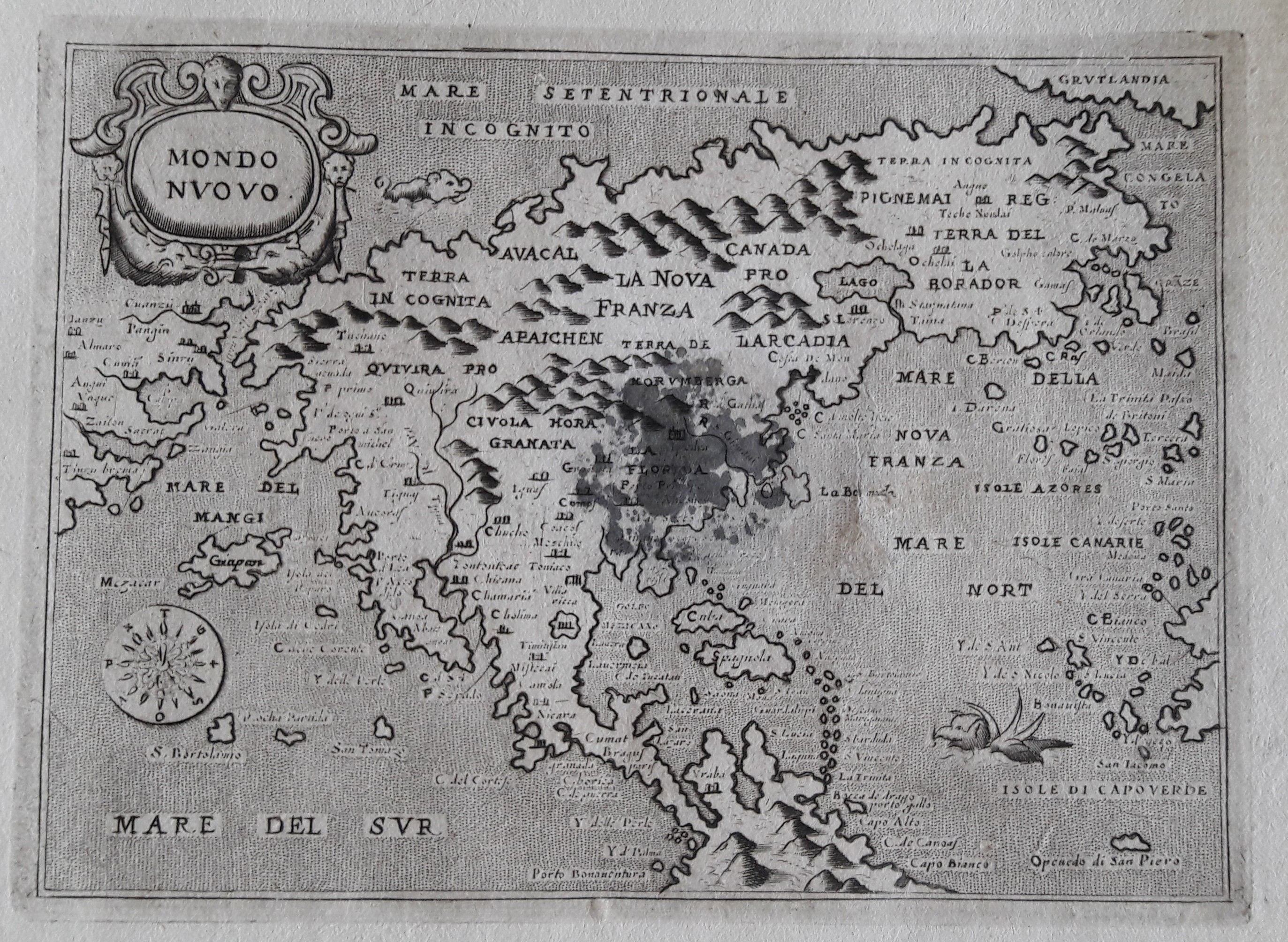
Mondo nuovo
Author
Porcacchi
Location shown in map
North America
Edition date
1686
Edition place
Venice
Editor
--
Atlas
L'Isole piu famose del mondo -- Pietr'Antonio Brigonci
Price
800 Euro
State
[mint/excellent/very good/good/fair/MEDIOCRE/poor]
Color
Black/white
Verso
Blank
Size
Plate: cm (14 x 11.4) inches (5.51 x 4.49) Paper: cm (17.8 x 16.5) inches (7.01 x 6.5)
Technique
Copper engraving
Note
Late edition for this beautiful map
Reference
--
Wiki
Here for more info
In stock
Available
Info
info@thetreasuremaps.com
Code
#0055
×
![Mondo nuovo by Porcacchi, North America, 1686]()
Map title
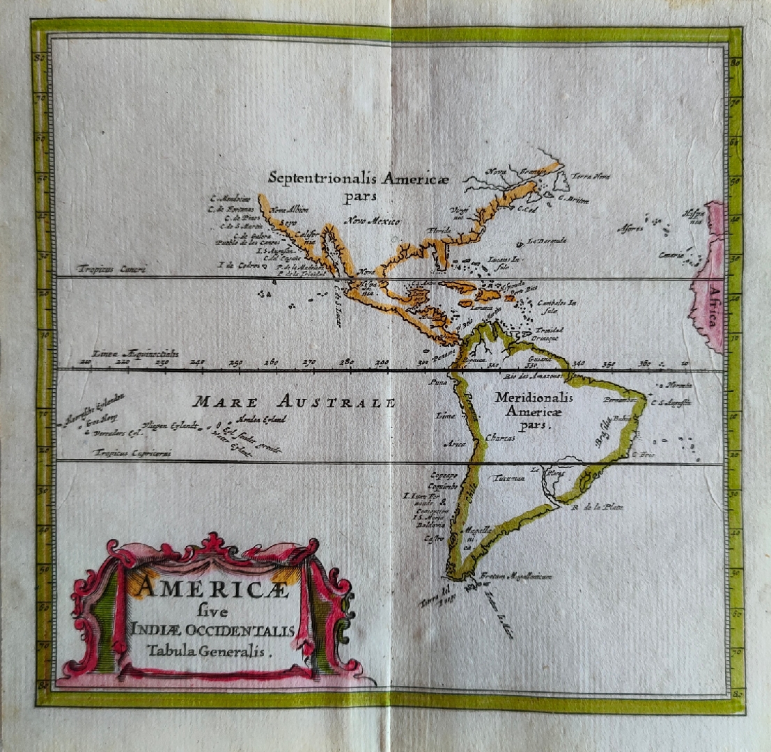
Americae sive Indiae Occidentalis Tabula Generalis
Author
Joannes De Laet
Location shown in map
America
Edition date
1686
Edition place
Amsterdam
Editor
Atlas
Introductio in universam geographiam
Price
Please ask: info@thetreasuremaps.com
State
[mint/EXCELLENT/very good/good/fair/mediocre/poor]
Color
Old colors
Verso
Blank
Size
Plate: cm (14 x 13) inches (5.51 x 5.12) Paper: cm (12 x 12) inches (4.72 x 4.72)
Technique
Copper engraving
Note
Reference
Wiki
Here for more info
In stock
Available
Info
info@thetreasuremaps.com
Code
#0844
×
![Americae sive Indiae Occidentalis Tabula Generalis by Joannes De Laet, America, 1686]()
Map title
Zea
Author
Drapper
Location shown in map
Kea
Edition date
1687
Edition place
Amsterdam
Editor
Atlas
Price
125 Euro
State
[mint/EXCELLENT/very good/good/fair/mediocre/poor]
Color
Black/white
Verso
Blank
Size
Plate: cm (17 x 12) inches (6.69 x 4.72) Paper: cm (20 x 14) inches (7.87 x 5.51)
Technique
Copper engraving
Note
Reference
Wiki
Here for more info
In stock
Available
Info
info@thetreasuremaps.com
Code
#0904
×
![Zea by Drapper, Kea, 1687]()
Map title
Dalmatia maritima occidentale
Author
Cantelli da Vignola
Location shown in map
Dalmatia
Edition date
1689
Edition place
Rome
Editor
De Rossi
Atlas
Mercurio Geografico
Price
700 Euro
State
[mint/EXCELLENT/very good/good/fair/mediocre/poor]
Color
Old colors
Verso
Blank
Size
Plate: cm (41 x 56) inches (16.14 x 22.05) Paper: cm (45 x 60) inches (17.72 x 23.62)
Technique
Copper engraving
Note
Reference
Wiki
Here for more info
In stock
Available
Info
info@thetreasuremaps.com
Code
#1312
×
![Dalmatia maritima occidentale by Cantelli da Vignola, Dalmatia, 1689]()
Map title
La gran Tartaria
Author
Cantelli da Vignola
Location shown in map
Tartaria
Edition date
1689
Edition place
Rome
Editor
De Rossi
Atlas
Mercurio Geografico
Price
700 Euro
State
[mint/EXCELLENT/very good/good/fair/mediocre/poor]
Color
Old colors
Verso
Blank
Size
Plate: cm (53 x 43) inches (20.87 x 16.93) Paper: cm (60 x 45) inches (23.62 x 17.72)
Technique
Copper engraving
Note
Reference
Wiki
Here for more info
In stock
Available
Info
info@thetreasuremaps.com
Code
#1316
×
![La gran Tartaria by Cantelli da Vignola, Tartaria, 1689]()
Map title
Penisola dell'India di qua dal Gange
Author
Cantelli da Vignola
Location shown in map
India
Edition date
1689
Edition place
Rome
Editor
De Rossi
Atlas
Mercurio Geografico
Price
800 Euro
State
[mint/EXCELLENT/very good/good/fair/mediocre/poor]
Color
Old colors
Verso
Blank
Size
Plate: cm (59 x 45) inches (23.23 x 17.72) Paper: cm (53 x 43) inches (20.87 x 16.93)
Technique
Copper engraving
Note
Reference
Wiki
Here for more info
In stock
Sold
Info
info@thetreasuremaps.com
Code
#1327
×
![Penisola dell'India di qua dal Gange by Cantelli da Vignola, India, 1689]()
Map title
Penisola dell'India di la dal Gange
Author
Cantelli da Vignola
Location shown in map
Indonesia
Edition date
1689
Edition place
Rome
Editor
De Rossi
Atlas
Mercurio Geografico
Price
1300 Euro
State
[mint/EXCELLENT/very good/good/fair/mediocre/poor]
Color
Old colors
Verso
Blank
Size
Plate: cm (49 x 53) inches (19.29 x 20.87) Paper: cm (53 x 42) inches (20.87 x 16.54)
Technique
Copper engraving
Note
Reference
Wiki
Here for more info
In stock
Sold
Info
info@thetreasuremaps.com
Code
#1328
×
![Penisola dell'India di la dal Gange by Cantelli da Vignola, Indonesia, 1689]()
Map title
Isola di Malta
Author
Cantelli da Vignola
Location shown in map
Malta
Edition date
1689
Edition place
Rome
Editor
De Rossi
Atlas
Mercurio Geografico
Price
1300 Euro
State
[mint/EXCELLENT/very good/good/fair/mediocre/poor]
Color
Old colors
Verso
Blank
Size
Plate: cm (55 x 42) inches (21.65 x 16.54) Paper: cm (60 x 47) inches (23.62 x 18.5)
Technique
Copper engraving
Note
Reference
Wiki
Here for more info
In stock
Sold
Info
info@thetreasuremaps.com
Code
#1329
×
![Isola di Malta by Cantelli da Vignola, Malta, 1689]()
Map title
Guinee
Author
Direk Cornelissen
Location shown in map
West Africa
Edition date
Circa 1690
Edition place
Editor
--
Atlas
--
Price
150 Euro
State
[MINT/excellent/very good/good/fair/mediocre/poor]
Color
Black/white
Verso
Blank
Size
Plate: cm (25 x 28) inches (9.84 x 11.02) Paper: cm (41 x 27) inches (16.14 x 10.63)
Technique
Copper engraving
Note
No particular notes for this maps.
Reference
--
Wiki
Here for more info
In stock
Available
Info
info@thetreasuremaps.com
Code
#0659
×
![Guinee by Direk Cornelissen, West Africa, Circa 1690]()
Map title
La Spagnuola
Author
Coronelli
Location shown in map
Haiti
Edition date
Circa 1690
Edition place
Venice
Editor
Atlas
Atlante veneto
Price
300 Euro
State
[mint/EXCELLENT/very good/good/fair/mediocre/poor]
Color
Black/white
Verso
Blank
Size
Plate: cm (30 x 22) inches (11.81 x 8.66) Paper: cm (43 x 32) inches (16.93 x 12.6)
Technique
Copper engraving
Note
No particular notes for this maps.
Reference
--
Wiki
Here for more info
In stock
Available
Info
info@thetreasuremaps.com
Code
#0636
×
![La Spagnuola by Coronelli, Haiti, Circa 1690]()
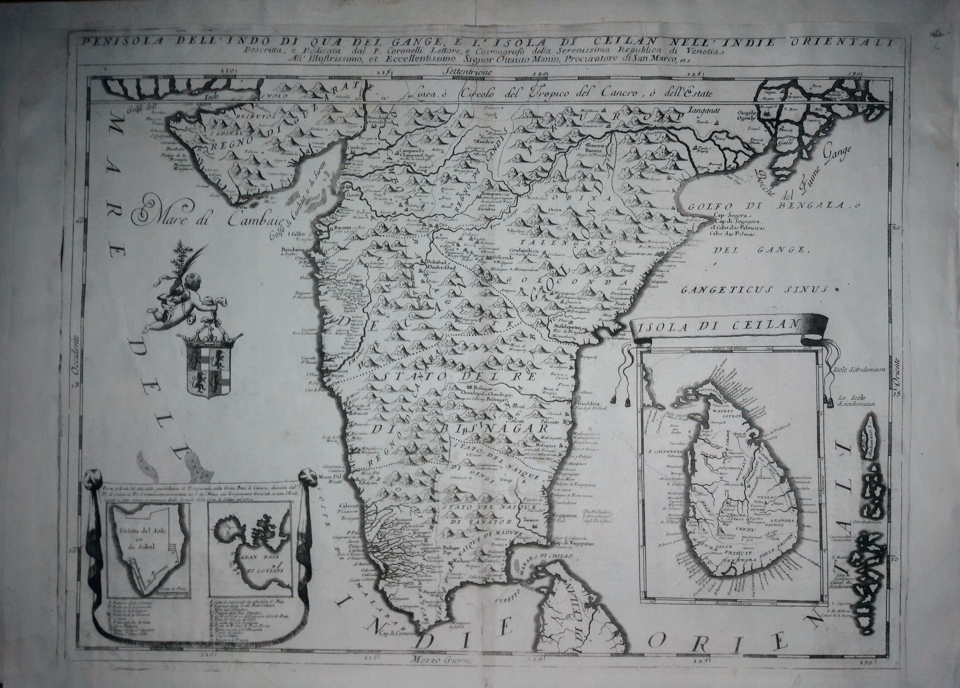
Map title
Penisola dell'Indo di qua del Gange e l'isola di Ceylan
Author
Coronelli
Location shown in map
Inde
Edition date
Circa 1690
Edition place
Venice
Editor
Atlas
Atlante veneto
Price
600 Euro
State
[mint/EXCELLENT/very good/good/fair/mediocre/poor]
Color
Black/white
Verso
Italian text pag.115
Size
Plate: cm (46 x 61) inches (18.11 x 24.02) Paper: cm (69 x 49) inches (27.17 x 19.29)
Technique
Copper engraving
Note
No particular notes for this maps.
Reference
--
Wiki
Here for more info
In stock
Available
Info
info@thetreasuremaps.com
Code
#0653
×
![Penisola dell'Indo di qua del Gange e l'isola di Ceylan by Coronelli, Inde, Circa 1690]()
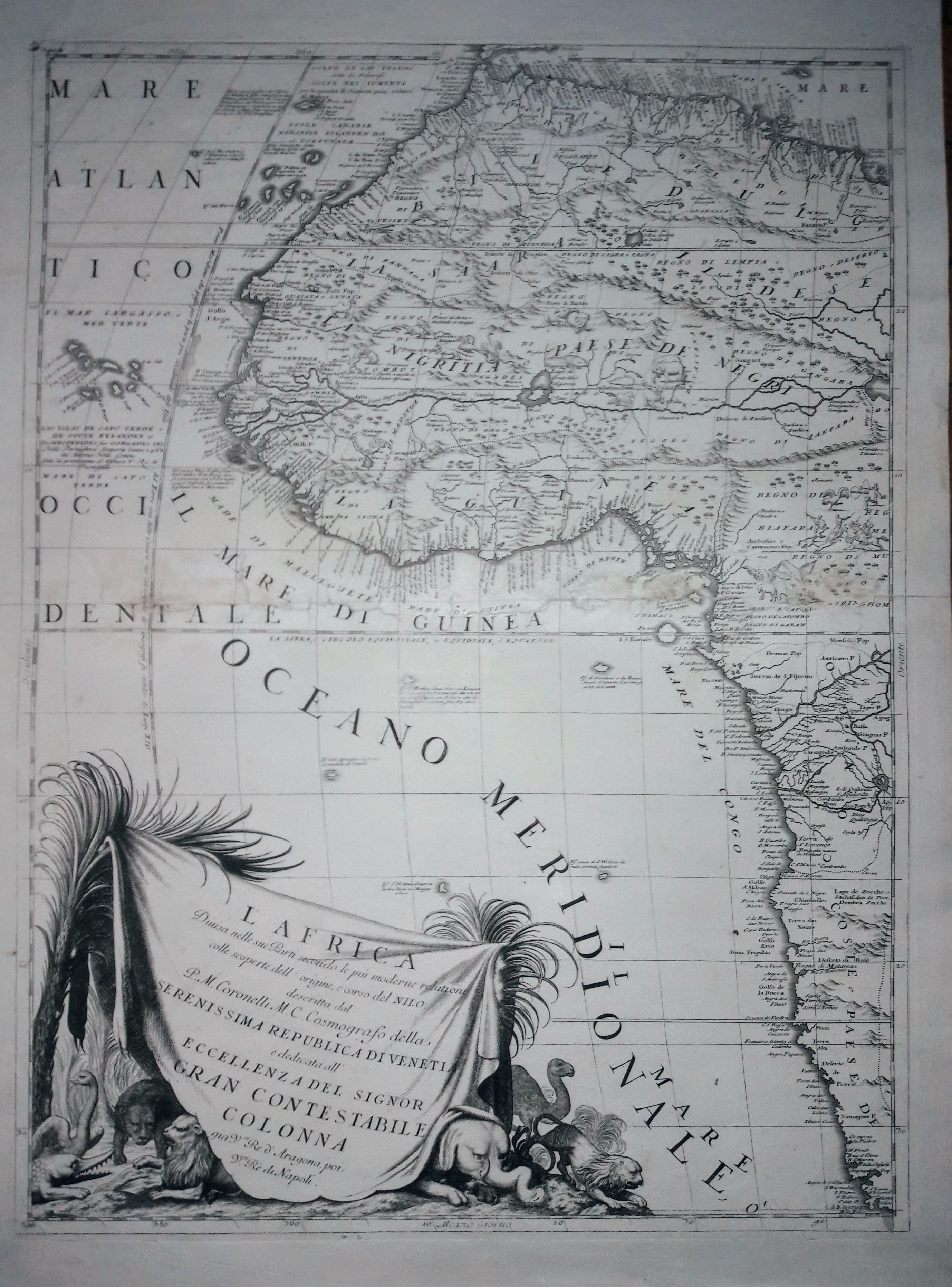
Map title
L'Africa
Author
Coronelli
Location shown in map
West Africa
Edition date
Circa 1690
Edition place
Venice
Editor
Atlas
Atlante veneto
Price
Please ask: info@thetreasuremaps.com
State
[mint/EXCELLENT/very good/good/fair/mediocre/poor]
Color
Black/white
Verso
Blank
Size
Plate: cm (45 x 60) inches (17.72 x 23.62) Paper: cm (71 x 50) inches (27.95 x 19.69)
Technique
Copper engraving
Note
No particular notes for this maps.
Reference
--
Wiki
Here for more info
In stock
Available
Info
info@thetreasuremaps.com
Code
#0654
×
![L'Africa by Coronelli, West Africa, Circa 1690]()

Map title
North-sea
Author
Keulen, Joannes
Location shown in map
British Isles
Edition date
1690
Edition place
Amsterdam
Editor
Atlas
Price
Please ask: info@thetreasuremaps.com
State
[mint/excellent/VERY GOOD/good/fair/mediocre/poor]
Color
Black/white
Verso
Blank
Size
Plate: cm (55 x 95) inches (21.65 x 37.4) Paper: cm (55 x 95) inches (21.65 x 37.4)
Technique
Copper engraving
Note
Professionally repaired
Reference
Wiki
Here for more info
In stock
Available
Info
info@thetreasuremaps.com
Code
#0740
×
![North-sea by Keulen, Joannes, British Isles, 1690]()
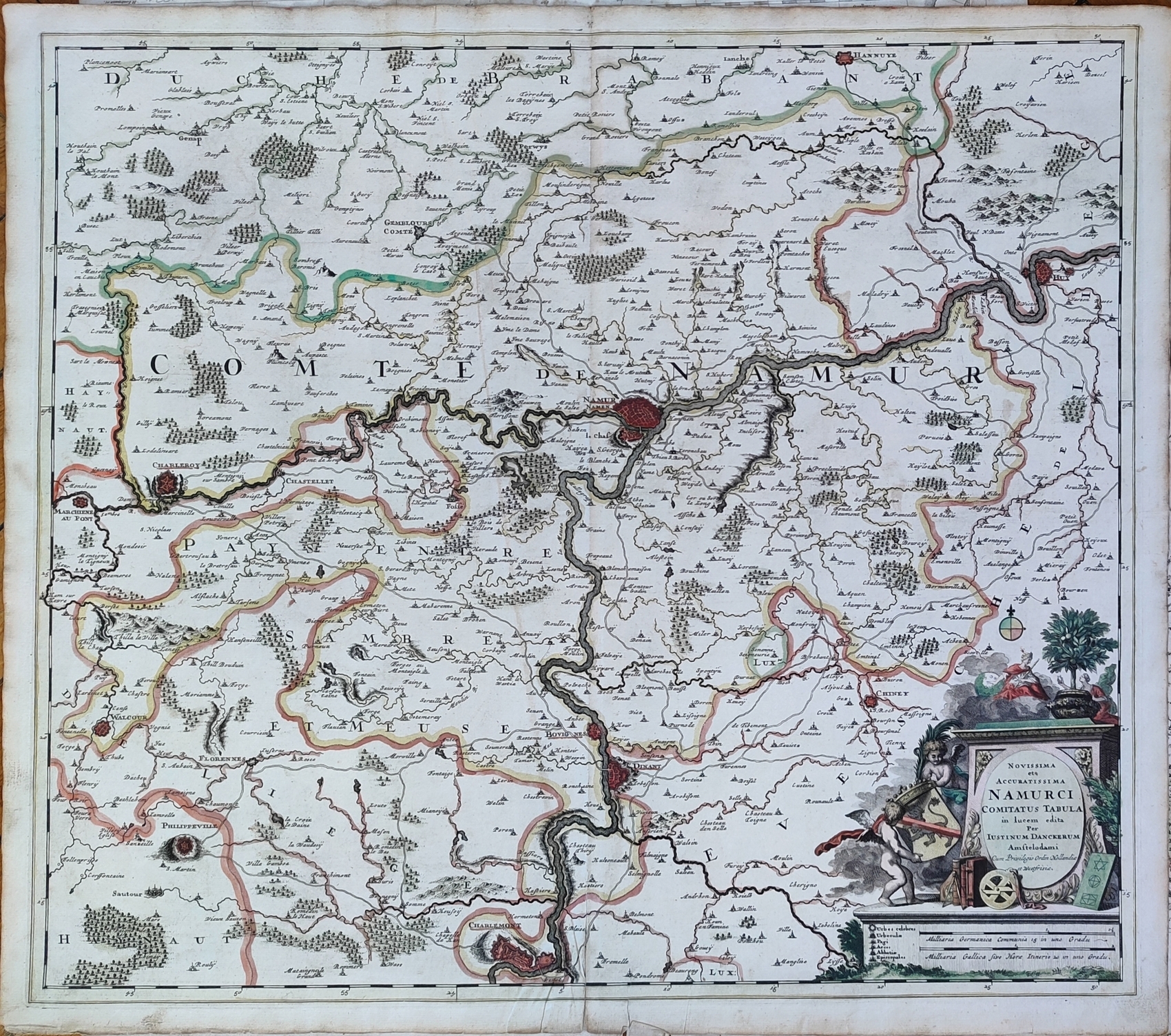
Map title
Novissima et accuratissima Namurci Comitatus tabula
Author
Danckerts
Location shown in map
Belgium
Edition date
Circa 1690
Edition place
Editor
Atlas
Price
150 Euro
State
[mint/EXCELLENT/very good/good/fair/mediocre/poor]
Color
Old colors
Verso
Blank
Size
Plate: cm (58 x 52) inches (22.83 x 20.47) Paper: cm (61 x 54) inches (24.02 x 21.26)
Technique
Copper engraving
Note
Reference
Wiki
Here for more info
In stock
Available
Info
info@thetreasuremaps.com
Code
#1237
×
![Novissima et accuratissima Namurci Comitatus tabula by Danckerts, Belgium, Circa 1690]()
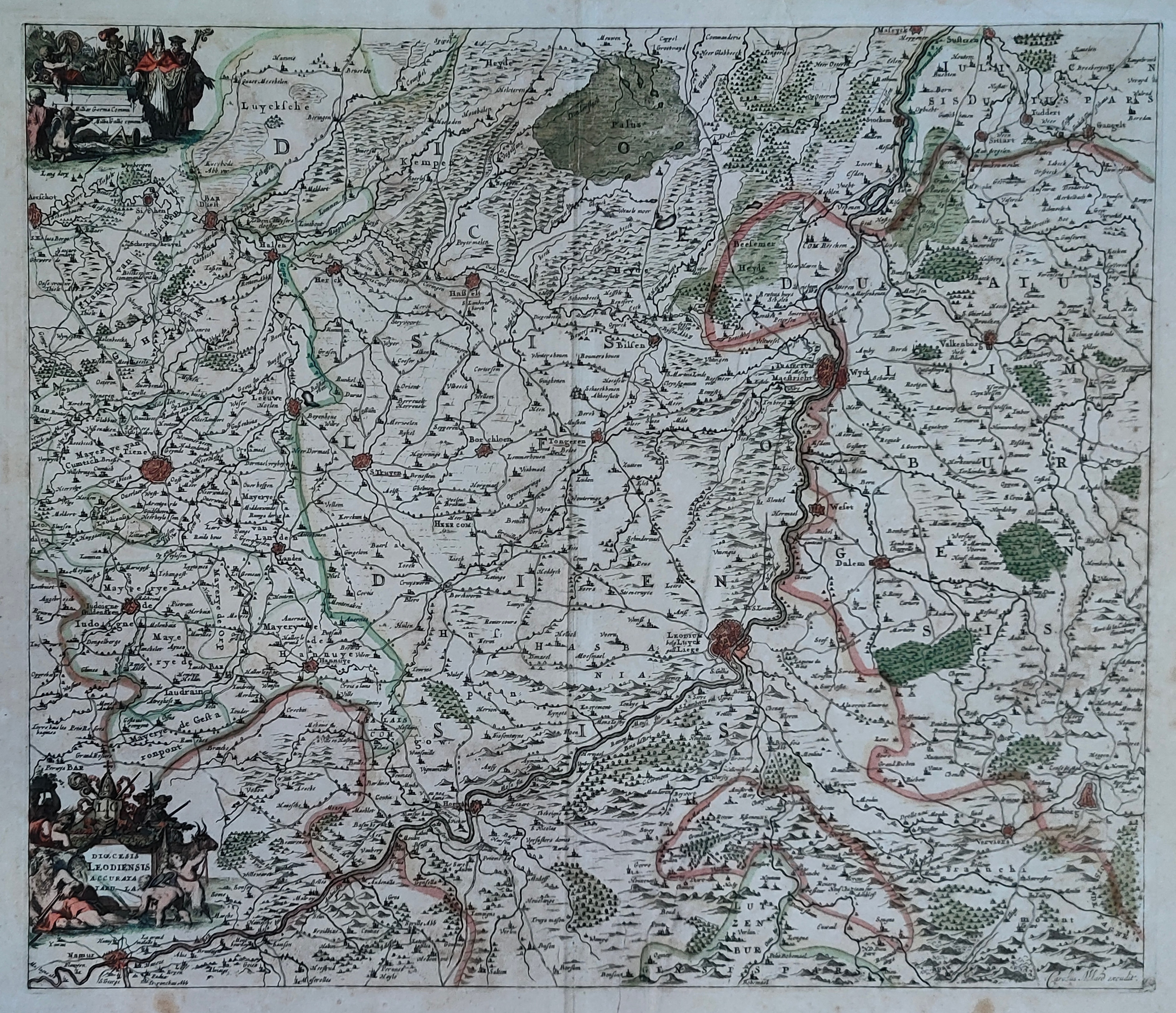
Map title
Dioecesis Leodiensis Accurata Tabula
Author
Schenk
Location shown in map
Belgium
Edition date
Circa 1690
Edition place
Editor
Atlas
Price
150 Euro
State
[mint/EXCELLENT/very good/good/fair/mediocre/poor]
Color
Old colors
Verso
Blank
Size
Plate: cm (54 x 45) inches (21.26 x 17.72) Paper: cm (60 x 53) inches (23.62 x 20.87)
Technique
Copper engraving
Note
Reference
Wiki
Here for more info
In stock
Available
Info
info@thetreasuremaps.com
Code
#1238
×
![Dioecesis Leodiensis Accurata Tabula by Schenk, Belgium, Circa 1690]()
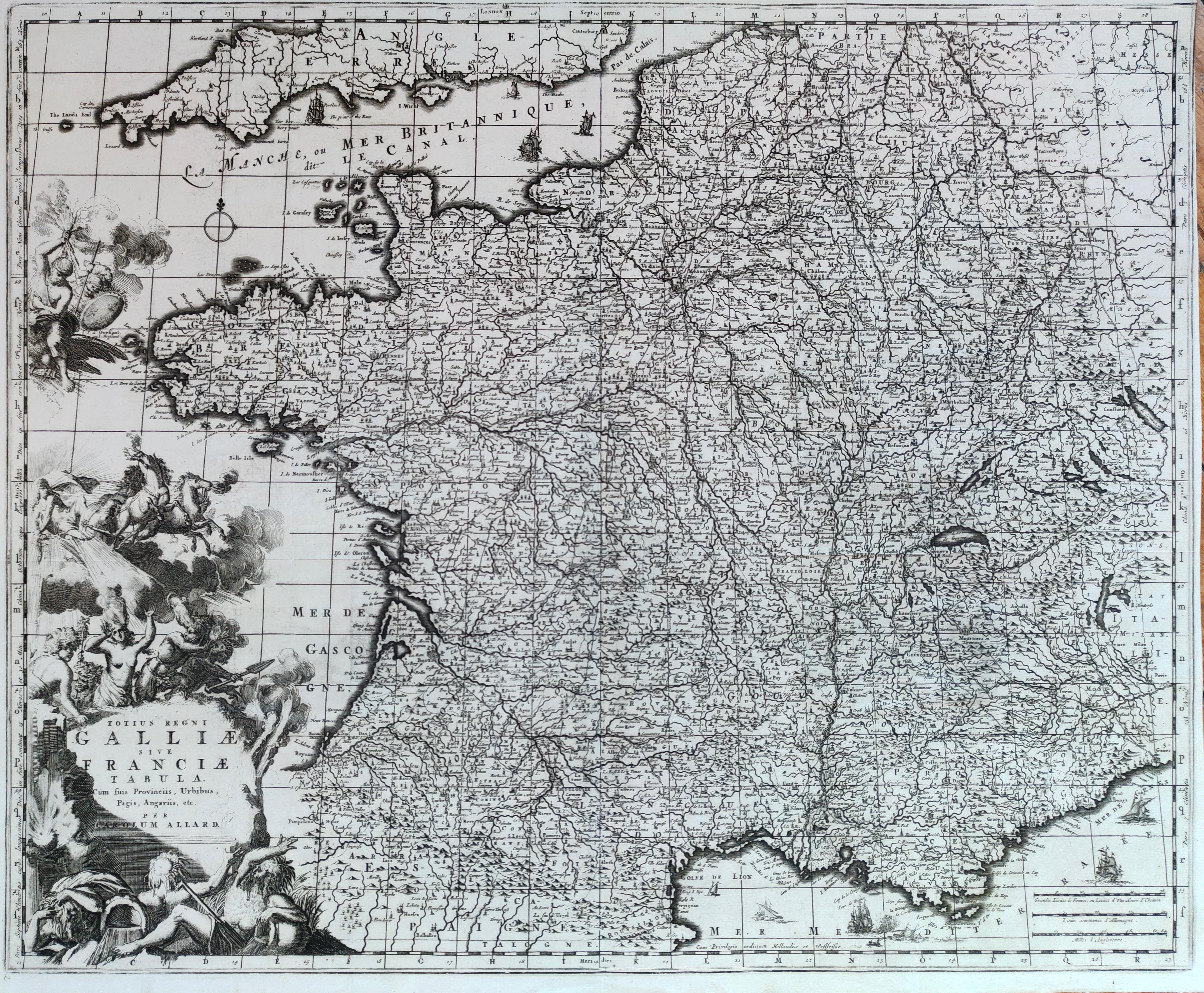
Map title
Totius regni Galliae sive Franciae tabula
Author
Allard
Location shown in map
France
Edition date
Circa 1690
Edition place
Amsterdam
Editor
--
Atlas
Atlas Major
Price
300 Euro
State
[mint/EXCELLENT/very good/good/fair/mediocre/poor]
Color
Black/white
Verso
Blank
Size
Plate: cm (57 x 46) inches (22.44 x 18.11) Paper: cm (56 x 45) inches (22.05 x 17.72)
Technique
Copper engraving
Note
Reference
Wiki
Here for more info
In stock
Available
Info
info@thetreasuremaps.com
Code
#1280
×
![Totius regni Galliae sive Franciae tabula by Allard, France, Circa 1690]()
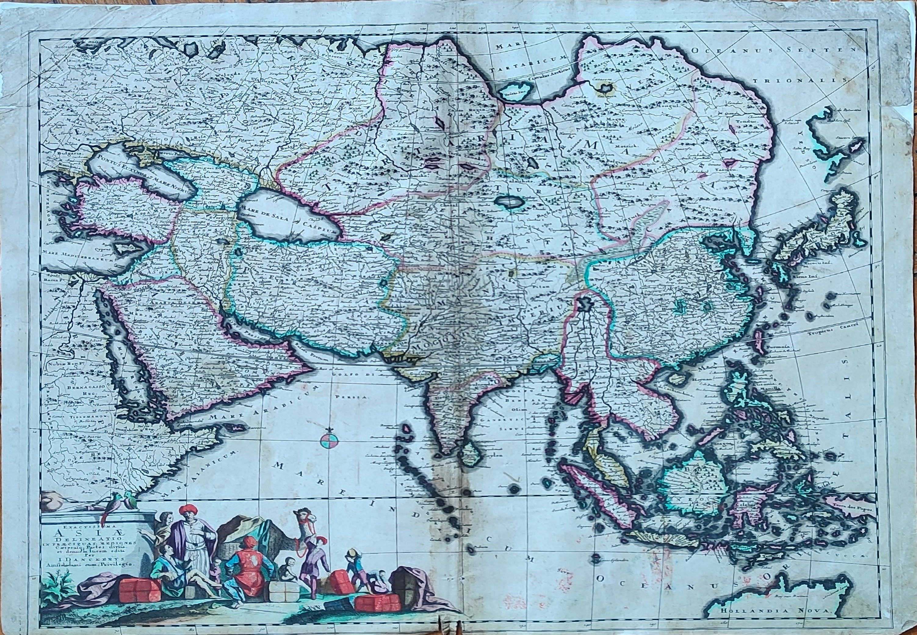
Map title
Exactissima Asiae Delineatio in praecipuas regiones Caeterasq Partes divisa.
Author
Danckerts
Location shown in map
All Asia
Edition date
Circa 1690
Edition place
Amsterdam
Editor
Atlas
Price
600 Euro
State
[mint/excellent/very good/GOOD/fair/mediocre/poor]
Color
Old colors
Verso
Blank
Size
Plate: cm (58 x 49) inches (22.83 x 19.29) Paper: cm (61 x 52) inches (24.02 x 20.47)
Technique
Copper engraving
Note
Reference
Wiki
Here for more info
In stock
Available
Info
info@thetreasuremaps.com
Code
#1344
×
![Exactissima Asiae Delineatio in praecipuas regiones Caeterasq Partes divisa. by Danckerts, All Asia, Circa 1690]()
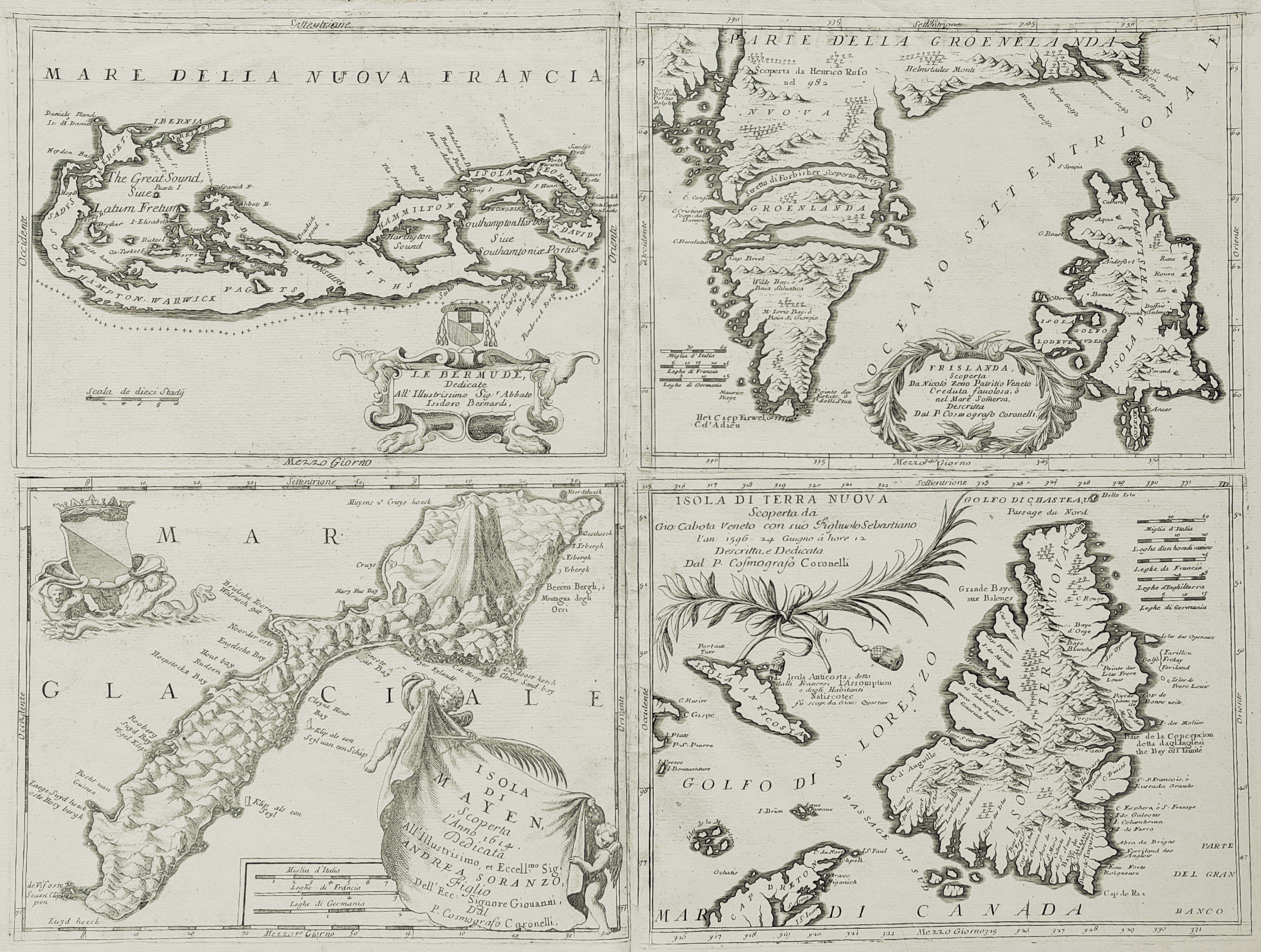
Map title
Islands
Author
Coronelli
Location shown in map
Bermuda, Iceland, Newfounland, Mayen
Edition date
Circa 1692
Edition place
Venice
Editor
--
Atlas
Atlante veneto
Price
1600 Euro
State
[mint/excellent/VERY GOOD/good/fair/mediocre/poor] Upper margin damaged
Color
Black/white
Verso
Blank
Size
Plate: cm (61 x 45.7) inches (24.02 x 17.99) Paper: cm (68.6 x 48.3) inches (27.01 x 19.02)
Technique
Copper engraving
Note
4 maps
Reference
--
Wiki
Here for more info
In stock
Available
Info
info@thetreasuremaps.com
Code
#0056
×
![Islands by Coronelli, Bermuda, Iceland, Newfounland, Mayen, Circa 1692]()