1600-1699
Map title
Scotia parte settentrionale
Author
Coronelli
Location shown in map
North Scotland
Edition date
1696
Edition place
Venice
Editor
--
Atlas
Isolario dell'atlante veneto
Price
400 Euro
State
[mint/EXCELLENT/very good/good/fair/mediocre/poor]
Color
Old colors
Verso
Italian tesx pag.22
Size
Plate: cm (62 x 46) inches (24.41 x 18.11) Paper: cm (64 x 47) inches (25.2 x 18.5)
Technique
Copper engraving
Note
Reference
--
Wiki
Here for more info
In stock
Available
Info
info@thetreasuremaps.com
Code
#1021
×
![Scotia parte settentrionale by Coronelli, North Scotland, 1696]()
Map title
Parte meridionale del regno d'Inghilterra
Author
Coronelli
Location shown in map
South England
Edition date
1696
Edition place
Venice
Editor
--
Atlas
Isolario dell'atlante veneto
Price
400 Euro
State
[mint/EXCELLENT/very good/good/fair/mediocre/poor]
Color
Old colors
Verso
Italian text pag.4
Size
Plate: cm (62 x 46) inches (24.41 x 18.11) Paper: cm (64 x 47) inches (25.2 x 18.5)
Technique
Copper engraving
Note
Reference
--
Wiki
Here for more info
In stock
Available
Info
info@thetreasuremaps.com
Code
#1020
×
![Parte meridionale del regno d'Inghilterra by Coronelli, South England, 1696]()
Map title
Corso delli fiumi Drino e Boiana
Author
Coronelli
Location shown in map
Montenegro
Edition date
1696
Edition place
Venice
Editor
--
Atlas
Isolario dell'atlante veneto
Price
400 Euro
State
[mint/EXCELLENT/very good/good/fair/mediocre/poor]
Color
Old colors
Verso
Blank
Size
Plate: cm (62 x 46) inches (24.41 x 18.11) Paper: cm (64 x 47) inches (25.2 x 18.5)
Technique
Copper engraving
Note
Reference
--
Wiki
Here for more info
In stock
Sold
Info
info@thetreasuremaps.com
Code
#1022
×
![Corso delli fiumi Drino e Boiana by Coronelli, Montenegro, 1696]()
Map title
Regno di Portogallo
Author
Coronelli
Location shown in map
Portugal
Edition date
1696
Edition place
Venice
Editor
--
Atlas
Isolario dell'atlante veneto
Price
400 Euro
State
[mint/EXCELLENT/very good/good/fair/mediocre/poor]
Color
Old colors
Verso
Italian text pag.81
Size
Plate: cm (62 x 46) inches (24.41 x 18.11) Paper: cm (64 x 47) inches (25.2 x 18.5)
Technique
Copper engraving
Note
Reference
--
Wiki
Here for more info
In stock
Available
Info
info@thetreasuremaps.com
Code
#1023
×
![Regno di Portogallo by Coronelli, Portugal, 1696]()
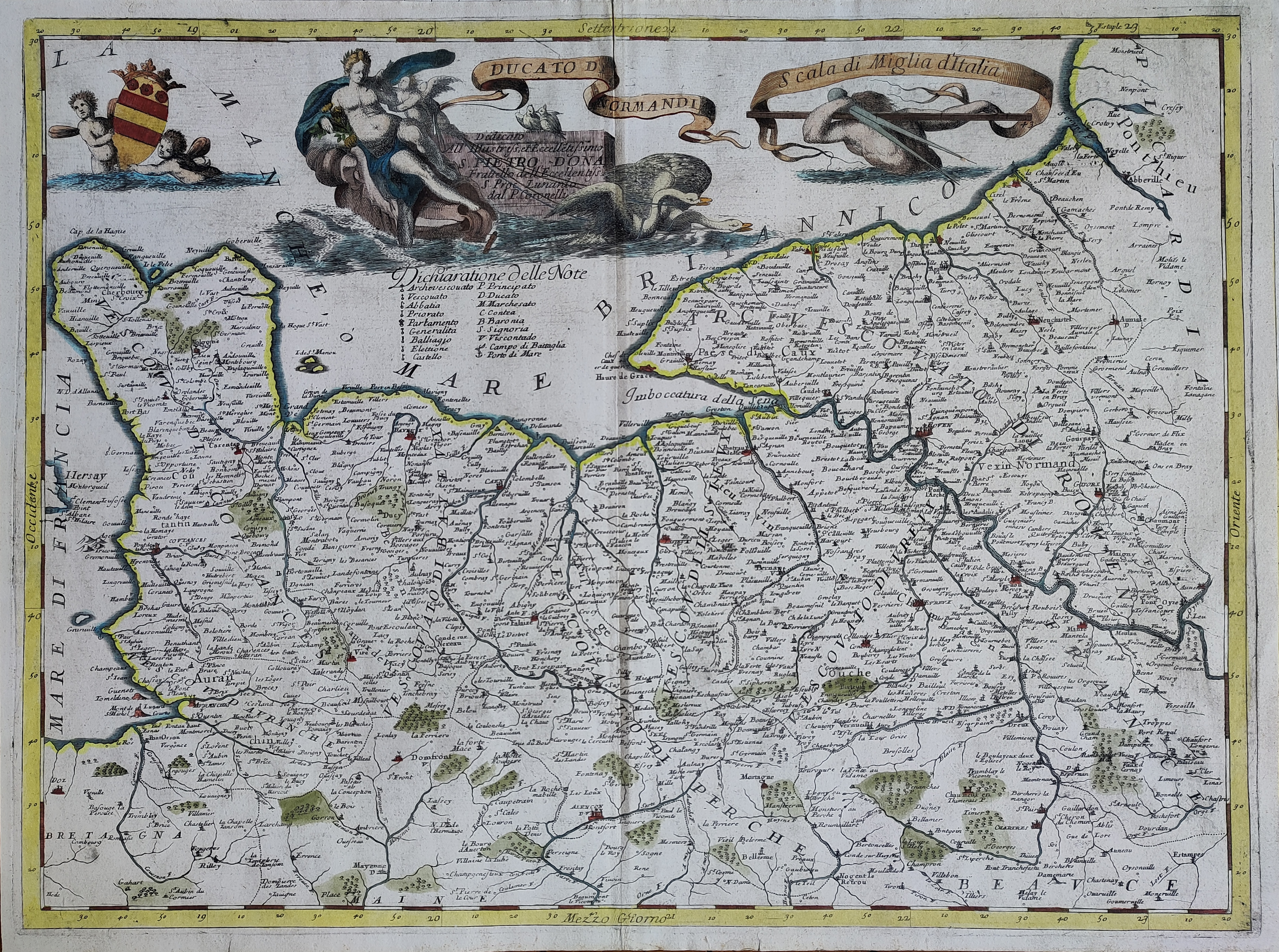
Map title
Ducato di Normandia
Author
Coronelli
Location shown in map
France
Edition date
1696
Edition place
Venice
Editor
--
Atlas
Isolario dell'atlante veneto
Price
400 Euro
State
[mint/EXCELLENT/very good/good/fair/mediocre/poor]
Color
Old colors
Verso
Italian text pag.64
Size
Plate: cm (62 x 46) inches (24.41 x 18.11) Paper: cm (64 x 47) inches (25.2 x 18.5)
Technique
Copper engraving
Note
Reference
--
Wiki
Here for more info
In stock
Available
Info
info@thetreasuremaps.com
Code
#1024
×
![Ducato di Normandia by Coronelli, France, 1696]()
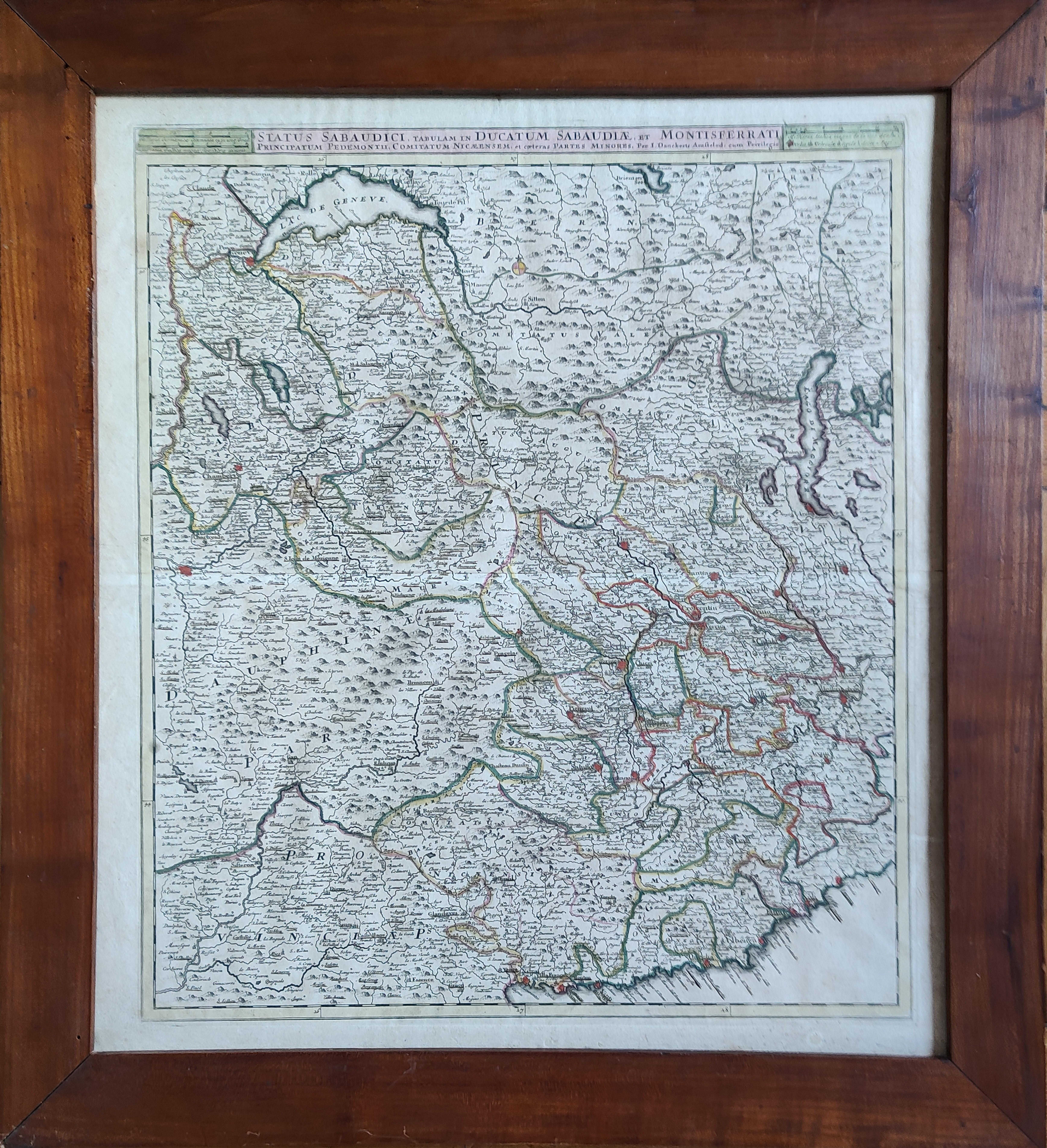
Map title
Status Sabaudici, tabulam in ducatum Sabaudiae, et Montisferrati ...
Author
Danckerts
Location shown in map
North-West Italy
Edition date
Circa 1696
Edition place
Amsterdam
Editor
Atlas
Price
400 Euro
State
[mint/EXCELLENT/very good/good/fair/mediocre/poor]
Color
Old colors
Verso
Blank
Size
Plate: cm (49 x 57) inches (19.29 x 22.44) Paper: cm (54 x 61) inches (21.26 x 24.02)
Technique
Copper engraving
Note
Framed
Reference
Wiki
Here for more info
In stock
Available
Info
info@thetreasuremaps.com
Code
#1113
×
![Status Sabaudici, tabulam in ducatum Sabaudiae, et Montisferrati ... by Danckerts, North-West Italy, Circa 1696]()
Map title
L'isola d'Islanda
Author
Coronelli
Location shown in map
Iceland
Edition date
Circa 1697
Edition place
Venice
Editor
Coronelli
Atlas
Atlante veneto
Price
400 Euro
State
[mint/EXCELLENT/very good/good/fair/mediocre/poor]
Color
Black/white
Verso
Blank
Size
Plate: cm (31 x 23) inches (12.2 x 9.06) Paper: cm (40 x 30) inches (15.75 x 11.81)
Technique
Copper engraving
Note
No particular notes for this maps.
Reference
--
Wiki
Here for more info
In stock
Available
Info
info@thetreasuremaps.com
Code
#0745
×
![L'isola d'Islanda by Coronelli, Iceland, Circa 1697]()

Map title
La partie meridionale des estats du duc de Savoye...
Author
Nolin
Location shown in map
Piedmont & Liguria, North west Italy
Edition date
1697
Edition place
Paris
Editor
--
Atlas
Price
400 Euro
State
[mint/EXCELLENT/very good/good/fair/mediocre/poor]
Color
Old colors
Verso
Blank
Size
Plate: cm (62 x 40) inches (24.41 x 15.75) Paper: cm (73 x 53) inches (28.74 x 20.87)
Technique
Copper engraving
Note
Reference
Wiki
Here for more info
In stock
Available
Info
info@thetreasuremaps.com
Code
#0852
×
![La partie meridionale des estats du duc de Savoye... by Nolin, Piedmont & Liguria, North west Italy, 1697]()
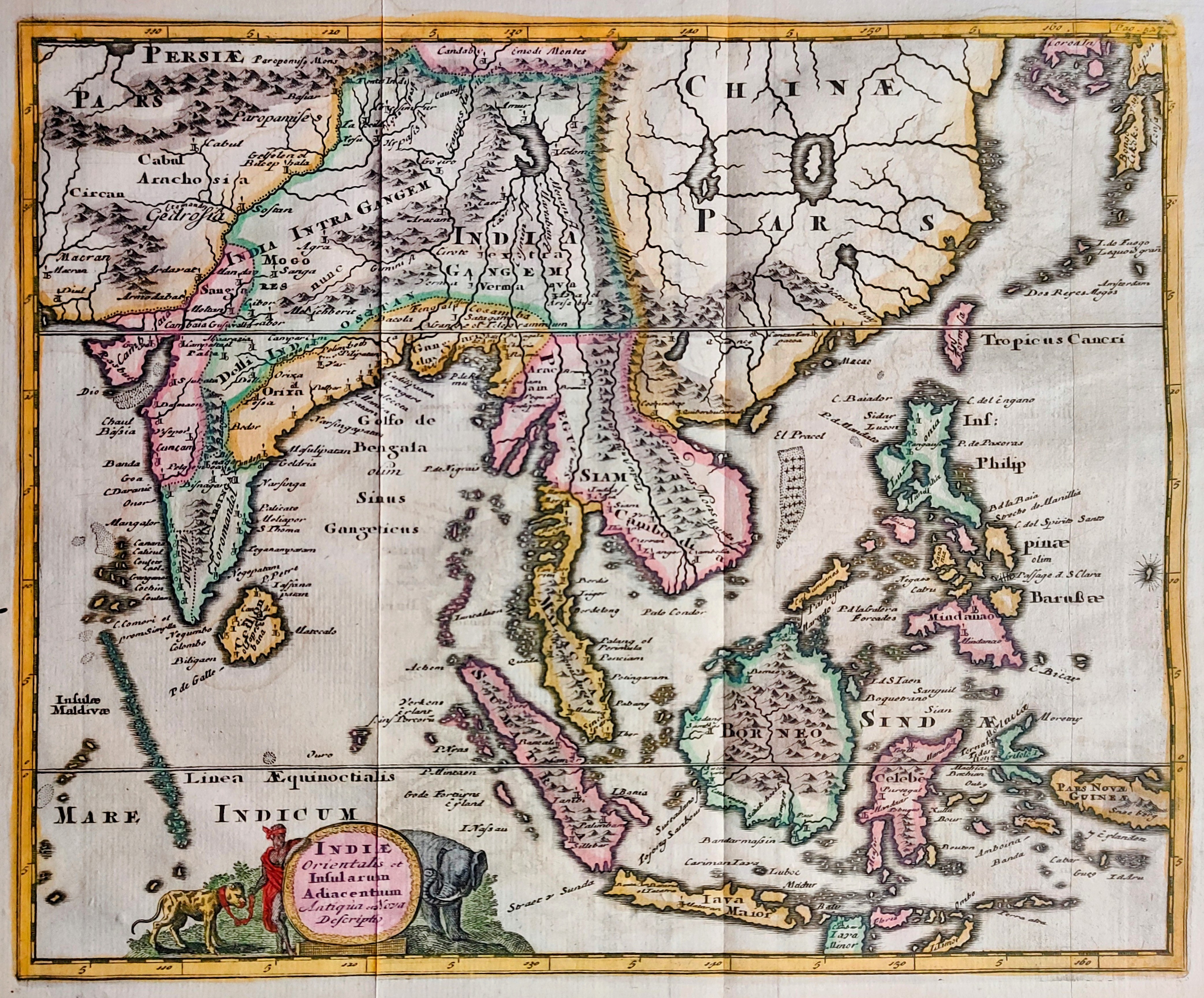
Map title
Indiae orientalis
Author
Cluver
Location shown in map
Southeast Asia
Edition date
1697
Edition place
Leiden
Editor
Atlas
Introductionis in Universam Geographiam ...
Price
200 Euro
State
[mint/EXCELLENT/very good/good/fair/mediocre/poor]
Color
Old colors
Verso
Blank
Size
Plate: cm (33 x 25) inches (12.99 x 9.84) Paper: cm (27 x 22) inches (10.63 x 8.66)
Technique
Copper engraving
Note
Reference
Wiki
Here for more info
In stock
Available
Info
info@thetreasuremaps.com
Code
#0865
×
![Indiae orientalis by Cluver, Southeast Asia, 1697]()
Map title
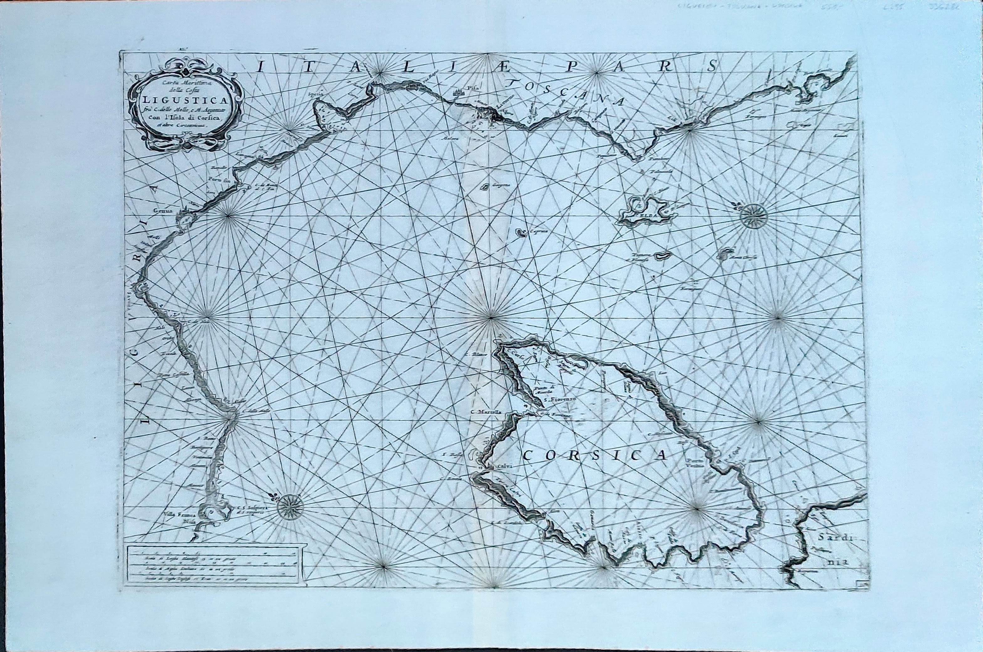
Carta Marittima della Costa Ligustica
Author
Coronelli
Location shown in map
Liguria
Edition date
1697
Edition place
Venice
Editor
Coronelli
Atlas
Atlante veneto
Price
800 Euro
State
[mint/EXCELLENT/very good/good/fair/mediocre/poor]
Color
Black/white
Verso
Blank
Size
Plate: cm (31 x 23) inches (12.2 x 9.06) Paper: cm (40 x 30) inches (15.75 x 11.81)
Technique
Copper engraving
Note
Reference
--
Wiki
Here for more info
In stock
Available
Info
info@thetreasuremaps.com
Code
#1337
×
![Carta Marittima della Costa Ligustica by Coronelli, Liguria, 1697]()