1600-1699
Map title
Vera lombardia come fu terminata da Carlo Magno
Author
Berey
Location shown in map
North Italy
Edition date
1664
Edition place
Turin
Editor
Zavatta
Atlas
Del regno d'Italia sotto i barbari epitome
Price
700 Euro
State
[mint/EXCELLENT/very good/good/fair/mediocre/poor]
Color
Old colors
Verso
Blank
Size
Plate: cm (36 x 28) inches (14.17 x 11.02) Paper: cm (40 x 32) inches (15.75 x 12.6)
Technique
Copper engraving
Note
Reference
Wiki
Here for more info
In stock
Available
Info
info@thetreasuremaps.com
Code
#1308
×
![Vera lombardia come fu terminata da Carlo Magno by Berey, North Italy, 1664]()

Map title
Totius Italiae tabula
Author
Visscher
Location shown in map
Italy
Edition date
1664
Edition place
Amsterdam
Editor
Atlas
Atlas
Price
800 Euro
State
[mint/EXCELLENT/very good/good/fair/mediocre/poor]
Color
Old colors
Verso
Blank
Size
Plate: cm (56 x 45) inches (22.05 x 17.72) Paper: cm (59 x 47) inches (23.23 x 18.5)
Technique
Copper engraving
Note
Reference
R.Borri L'Italia nelle antiche carte pag.143
Wiki
Here for more info
In stock
Available
Info
info@thetreasuremaps.com
Code
#1348
×
![Totius Italiae tabula by Visscher, Italy, 1664]()
Map title
Typus communicationis Maris Caspy, cum Persico et Euxino.
Author
Kircher
Location shown in map
Black sea & Caspian sea
Edition date
1665
Edition place
Editor
--
Atlas
Mundus Subterraneus
Price
200 Euro
State
[mint/EXCELLENT/very good/good/fair/mediocre/poor]
Color
Black/white
Verso
Latin text
Size
Plate: cm (16.5 x 16.5) inches (6.5 x 6.5) Paper: cm (24.1 x 38.1) inches (9.49 x 15)
Technique
Copper engraving
Note
--
Reference
--
Wiki
Here for more info
In stock
Available
Info
info@thetreasuremaps.com
Code
#0216
×
![Typus communicationis Maris Caspy, cum Persico et Euxino. by Kircher, Black sea & Caspian sea, 1665]()
Map title
L'Italie
Author
Sanson
Location shown in map
Italy
Edition date
1665
Edition place
Paris
Editor
Atlas
Price
600 Euro
State
[mint/excellent/VERY GOOD/good/fair/mediocre/poor]
Color
Old colors
Verso
Blank
Size
Plate: cm (0 x 0) inches (0 x 0) Paper: cm (0 x 0) inches (0 x 0)
Technique
Copper engraving
Note
Reference
R.Borri L'Italia nelle antiche carte pag.144
Wiki
Here for more info
In stock
Available
Info
info@thetreasuremaps.com
Code
#0918
×
![L'Italie by Sanson, Italy, 1665]()
Map title
Partie de Lithuanie
Author
Sanson
Location shown in map
Lituania
Edition date
1665
Edition place
Paris
Editor
Atlas
Price
500 Euro
State
[mint/excellent/very good/good/FAIR/mediocre/poor]
Color
Old colors
Verso
Blank
Size
Plate: cm (56 x 41) inches (22.05 x 16.14) Paper: cm (60 x 46) inches (23.62 x 18.11)
Technique
Copper engraving
Note
Reference
Wiki
Here for more info
In stock
Available
Info
info@thetreasuremaps.com
Code
#1191
×
![Partie de Lithuanie by Sanson, Lituania, 1665]()
Map title
Isle de Madagascar
Author
Sanson
Location shown in map
Madagascar
Edition date
Circa 1667
Edition place
Paris
Editor
Atlas
Price
150 Euro
State
[mint/EXCELLENT/very good/good/fair/mediocre/poor]
Color
Black/white
Verso
Blank
Size
Plate: cm (25 x 19) inches (9.84 x 7.48) Paper: cm (41 x 27) inches (16.14 x 10.63)
Technique
Copper engraving
Note
Reference
Wiki
Here for more info
In stock
Available
Info
info@thetreasuremaps.com
Code
#0662
×
![Isle de Madagascar by Sanson, Madagascar, Circa 1667]()
Map title
Isles du CapVerd
Author
Sanson
Location shown in map
West Africa
Edition date
Circa 1667
Edition place
Paris
Editor
Atlas
Price
175 Euro
State
[mint/EXCELLENT/very good/good/fair/mediocre/poor]
Color
Black/white
Verso
Blank
Size
Plate: cm (29 x 19) inches (11.42 x 7.48) Paper: cm (41 x 27) inches (16.14 x 10.63)
Technique
Copper engraving
Note
Reference
Wiki
Here for more info
In stock
Available
Info
info@thetreasuremaps.com
Code
#0663
×
![Isles du CapVerd by Sanson, West Africa, Circa 1667]()
Map title
Apulia
Author
Ortelius
Location shown in map
Puglia
Edition date
Circa 1667
Edition place
Venice
Editor
--
Atlas
Theatro del mondo
Price
Please ask: info@thetreasuremaps.com
State
[mint/EXCELLENT/very good/good/fair/mediocre/poor]
Color
Old colors
Verso
Italian text
Size
Plate: cm (10 x 7) inches (3.94 x 2.76) Paper: cm (13 x 9) inches (5.12 x 3.54)
Technique
Copper engraving
Note
Reference
Wiki
Here for more info
In stock
Sold
Info
info@thetreasuremaps.com
Code
#0952
×
![Apulia by Ortelius, Puglia, Circa 1667]()
Map title
A generall mapp of Asia designed by Monsieur Sanson
Author
Blome
Location shown in map
Asia
Edition date
1669
Edition place
London
Editor
Blome
Atlas
Price
700 Euro
State
[mint/excellent/very good/GOOD/fair/mediocre/poor]
Color
Old colors
Verso
Blank
Size
Plate: cm (57 x 37) inches (22.44 x 14.57) Paper: cm (57 x 37) inches (22.44 x 14.57)
Technique
Copper engraving
Note
Reference
Wiki
Here for more info
In stock
Available
Info
info@thetreasuremaps.com
Code
#1310
×
![A generall mapp of Asia designed by Monsieur Sanson by Blome, Asia, 1669]()
Map title
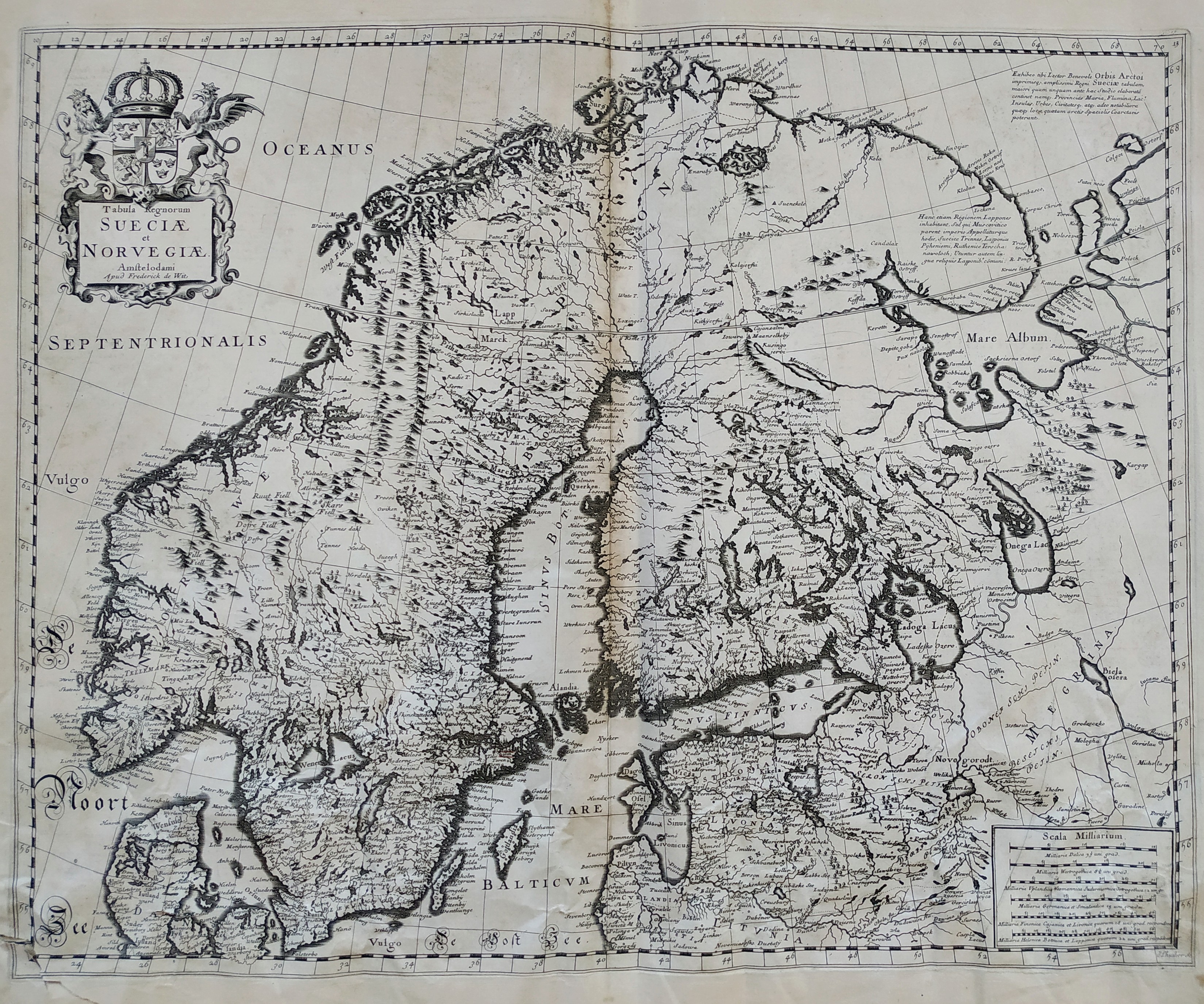
Tabula Regnorum Sueciae et Norvegiae
Author
Frederick de Wit
Location shown in map
Sweden
Edition date
Circa 1670
Edition place
Amsterdam
Editor
Atlas
Price
600 Euro
State
[mint/EXCELLENT/very good/good/fair/mediocre/poor]
Color
Black/white
Verso
Blank
Size
Plate: cm (55 x 44) inches (21.65 x 17.32) Paper: cm (60 x 52) inches (23.62 x 20.47)
Technique
Copper engraving
Note
Reference
Wiki
Here for more info
In stock
Available
Info
info@thetreasuremaps.com
Code
#0786
×
![Tabula Regnorum Sueciae et Norvegiae by Frederick de Wit, Sweden, Circa 1670]()
Map title
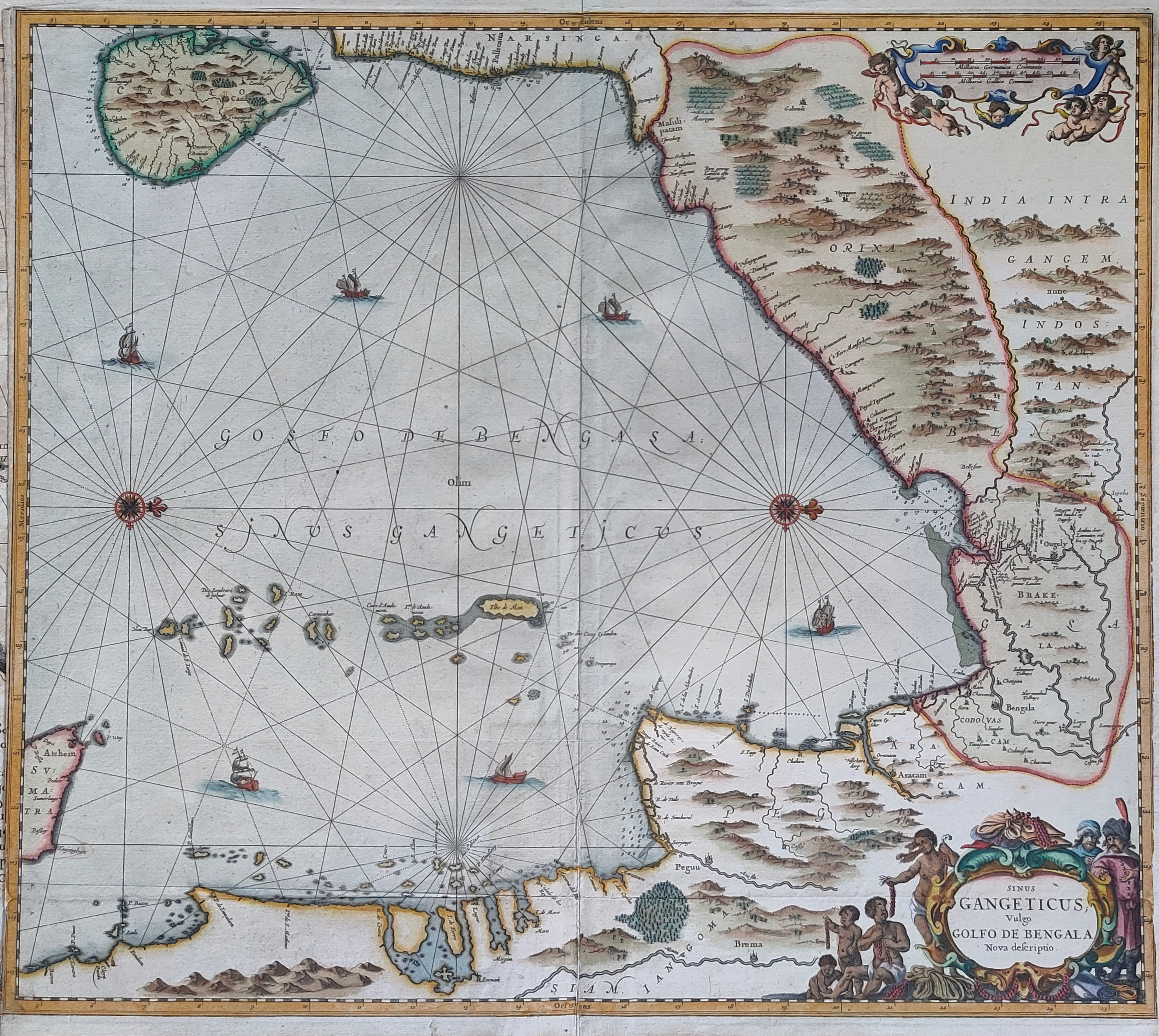
Sinus Gangeticus Vulgo Golfo De Bengala Nova descriptio
Author
Jansson
Location shown in map
India
Edition date
Circa 1670
Edition place
Amsterdam
Editor
Schenk
Atlas
Novus Atlas
Price
450 Euro
State
[mint/EXCELLENT/very good/good/fair/mediocre/poor] repaired
Color
Old colors
Verso
Blank
Size
Plate: cm (54 x 50) inches (21.26 x 19.69) Paper: cm (54 x 49) inches (21.26 x 19.29)
Technique
Copper engraving
Note
Reference
Wiki
Here for more info
In stock
Available
Info
info@thetreasuremaps.com
Code
#1200
×
![Sinus Gangeticus Vulgo Golfo De Bengala Nova descriptio by Jansson, India, Circa 1670]()
Map title
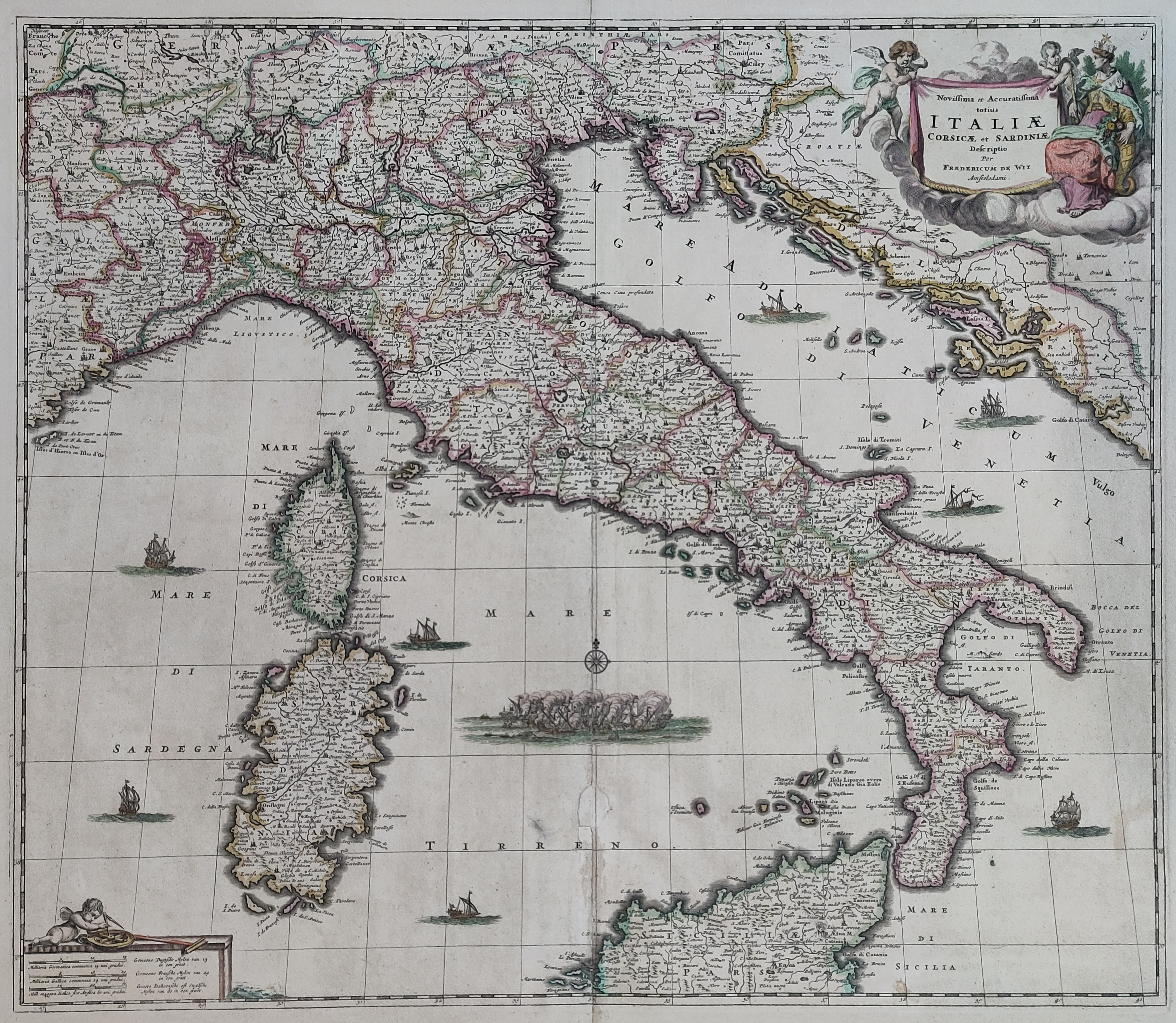
Novissima et accuratissima totius Italiae
Author
De Wit
Location shown in map
Italy
Edition date
Circa 1671
Edition place
Amsterdam
Editor
Atlas
Atlas Maior
Price
700 Euro
State
[mint/EXCELLENT/very good/good/fair/mediocre/poor]
Color
Old colors
Verso
Blank
Size
Plate: cm (56 x 49) inches (22.05 x 19.29) Paper: cm (63 x 53) inches (24.8 x 20.87)
Technique
Copper engraving
Note
Reference
R.Borri L'Italia nelle antiche carte pag.148
Wiki
Here for more info
In stock
Available
Info
info@thetreasuremaps.com
Code
#0896
×
![Novissima et accuratissima totius Italiae by De Wit, Italy, Circa 1671]()
Map title
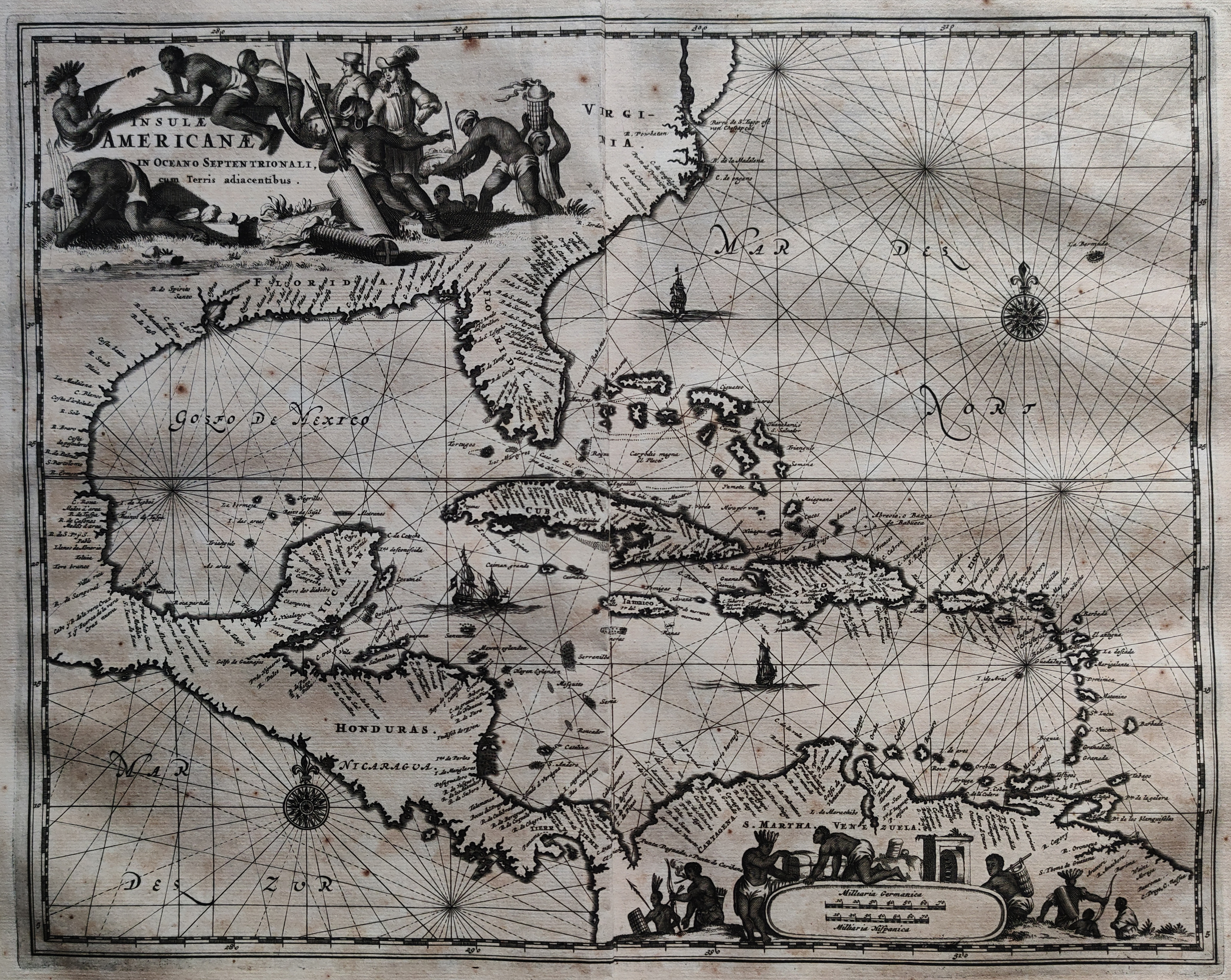
Insulae Americanae in Oceano Septentrionali, cum Terris adiacentibus.
Author
Ogilby
Location shown in map
Florida & Antilles islands
Edition date
1671
Edition place
London
Editor
Atlas
Price
500 Euro
State
[mint/EXCELLENT/very good/good/fair/mediocre/poor]
Color
Black/white
Verso
Blank
Size
Plate: cm (36 x 29) inches (14.17 x 11.42) Paper: cm (46 x 41) inches (18.11 x 16.14)
Technique
Copper engraving
Note
Reference
Wiki
Here for more info
In stock
Available
Info
info@thetreasuremaps.com
Code
#1094
×
![Insulae Americanae in Oceano Septentrionali, cum Terris adiacentibus. by Ogilby, Florida & Antilles islands, 1671]()
Map title
Provincie meridionali de Paesi Bassi intese sotto nome di Fiandra overo i Paesi Bassi cattolici
Author
Sanson
Location shown in map
Nederland
Edition date
1672
Edition place
Rome
Editor
--
Atlas
??? printed by Giacomo Rossi.
Price
200 Euro
State
[mint/excellent/VERY GOOD/good/fair/mediocre/poor]
Color
Black/white
Verso
Blank
Size
Plate: cm (50.8 x 36.8) inches (20 x 14.49) Paper: cm (59.7 x 41.9) inches (23.5 x 16.5)
Technique
Copper engraving
Note
Map based on Sanson map.
Reference
--
Wiki
Here for more info
In stock
Available
Info
info@thetreasuremaps.com
Code
#0139
×
![Provincie meridionali de Paesi Bassi intese sotto nome di Fiandra overo i Paesi Bassi cattolici by Sanson, Nederland, 1672]()
Map title
L'Italie
Author
Sanson
Location shown in map
Italy
Edition date
1672
Edition place
Paris
Editor
Alexis Hubert Jaillot
Atlas
Wall map
Price
Please ask: info@thetreasuremaps.com
State
[mint/EXCELLENT/very good/good/fair/mediocre/poor]
Color
Old colors
Verso
Blank
Size
Plate: cm (78 x 59) inches (30.71 x 23.23) Paper: cm (79 x 61) inches (31.1 x 24.02)
Technique
Copper engraving
Note
Reference
R.Borri L'Italia nelle antiche carte pag.159
Wiki
Here for more info
In stock
Available
Info
info@thetreasuremaps.com
Code
#0994
×
![L'Italie by Sanson, Italy, 1672]()
Map title
Italia
Author
Sanson
Location shown in map
Italy
Edition date
1672
Edition place
Rome
Editor
De Rossi
Atlas
Price
400 Euro
State
[mint/EXCELLENT/very good/good/fair/mediocre/poor]
Color
Old colors
Verso
Blank
Size
Plate: cm (52 x 43) inches (20.47 x 16.93) Paper: cm (60 x 48) inches (23.62 x 18.9)
Technique
Copper engraving
Note
Reference
R.Borri L'Italia nelle antiche carte pag.149
Wiki
Here for more info
In stock
Available
Info
info@thetreasuremaps.com
Code
#1060
×
![Italia by Sanson, Italy, 1672]()
Map title
Genuense Territorium
Author
Jansson
Location shown in map
Genuense Territorium
Edition date
1673
Edition place
Amsterdam
Editor
--
Atlas
Atlas Minor
Price
250 Euro
State
[mint/EXCELLENT/very good/good/fair/mediocre/poor]
Color
Old colors
Verso
Blank
Size
Plate: cm (24 x 18) inches (9.45 x 7.09) Paper: cm (27 x 20) inches (10.63 x 7.87)
Technique
Copper engraving
Note
Reference
Wiki
Here for more info
In stock
Available
Info
info@thetreasuremaps.com
Code
#1180
Genuense Territorium
Author
Jansson
Location shown in map
Genuense Territorium
Edition date
1673
Edition place
Amsterdam
Editor
--
Atlas
Atlas Minor
Price
250 Euro
State
[mint/EXCELLENT/very good/good/fair/mediocre/poor]
Color
Old colors
Verso
Blank
Size
Plate: cm (24 x 18) inches (9.45 x 7.09) Paper: cm (27 x 20) inches (10.63 x 7.87)
Technique
Copper engraving
Note
Reference
Wiki
Here for more info
In stock
Available
Info
info@thetreasuremaps.com
Code
#1180
×
![Genuense Territorium by Jansson, Genuense Territorium, 1673]()
Map title
Poli Artici
Author
Jansson
Location shown in map
Polar
Edition date
1673
Edition place
Amsterdam
Editor
--
Atlas
Atlas Minor
Price
300 Euro
State
[mint/excellent/very good/good/FAIR/mediocre/poor]
Color
Old colors
Verso
Blank
Size
Plate: cm (26 x 20) inches (10.24 x 7.87) Paper: cm (24 x 18) inches (9.45 x 7.09)
Technique
Copper engraving
Note
Reference
Wiki
Here for more info
In stock
Available
Info
info@thetreasuremaps.com
Code
#1186
×
![Poli Artici by Jansson, Polar, 1673]()
Map title
La Lombardie
Author
Du Val
Location shown in map
North Italy
Edition date
1676
Edition place
Paris
Editor
Atlas
Price
300 Euro
State
[mint/EXCELLENT/very good/good/fair/mediocre/poor]
Color
Old colors
Verso
Blank
Size
Plate: cm (54 x 42) inches (21.26 x 16.54) Paper: cm (59 x 43) inches (23.23 x 16.93)
Technique
Copper engraving
Note
Reference
Wiki
Here for more info
In stock
Available
Info
info@thetreasuremaps.com
Code
#1266
×
![La Lombardie by Du Val, North Italy, 1676]()
Map title
Italia
Author
Speed
Location shown in map
Italy
Edition date
1676
Edition place
London
Editor
Bassett
Atlas
A Prospect of the Most Famous Parts of the World
Price
2500 Euro
State
[mint/EXCELLENT/very good/good/fair/mediocre/poor]
Color
Old colors
Verso
English text
Size
Plate: cm (51 x 39) inches (20.08 x 15.35) Paper: cm (54 x 43) inches (21.26 x 16.93)
Technique
Copper engraving
Note
Reference
R.Borri L'Italia nelle antiche carte pag.120
Wiki
Here for more info
In stock
Available
Info
info@thetreasuremaps.com
Code
#1346
×
![Italia by Speed, Italy, 1676]()