1700-1799
Map title
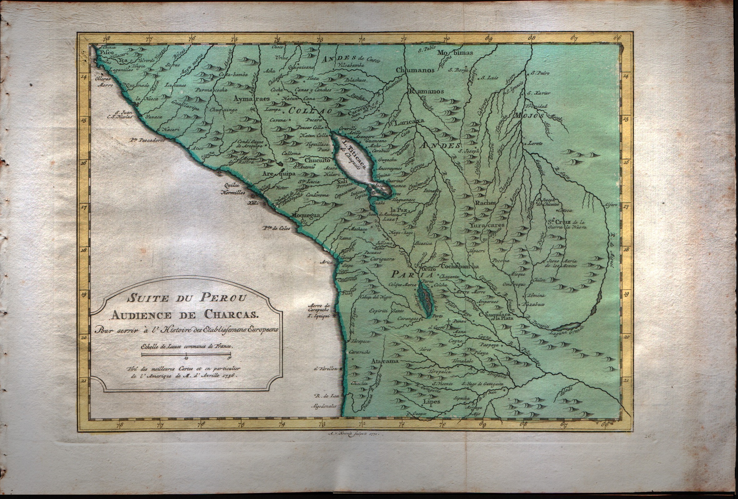
Suit du Perou audience de Charcas
Author
Bellin
Location shown in map
Peru
Edition date
1773
Edition place
Amsterdam
Editor
--
Atlas
Atlas Portatif -- E. van Harrevelt
Price
Please ask: info@thetreasuremaps.com
State
[mint/EXCELLENT/very good/good/fair/mediocre/poor]
Color
Old colors
Verso
Blank
Size
Plate: cm (30.5 x 21.6) inches (12.01 x 8.5) Paper: cm (38.1 x 26.7) inches (15 x 10.51)
Technique
Copper engraving
Note
No particular notes for this maps
Reference
--
Wiki
Here for more info
In stock
Available
Info
info@thetreasuremaps.com
Code
#0040
×
![Suit du Perou audience de Charcas by Bellin, Peru, 1773]()
Map title
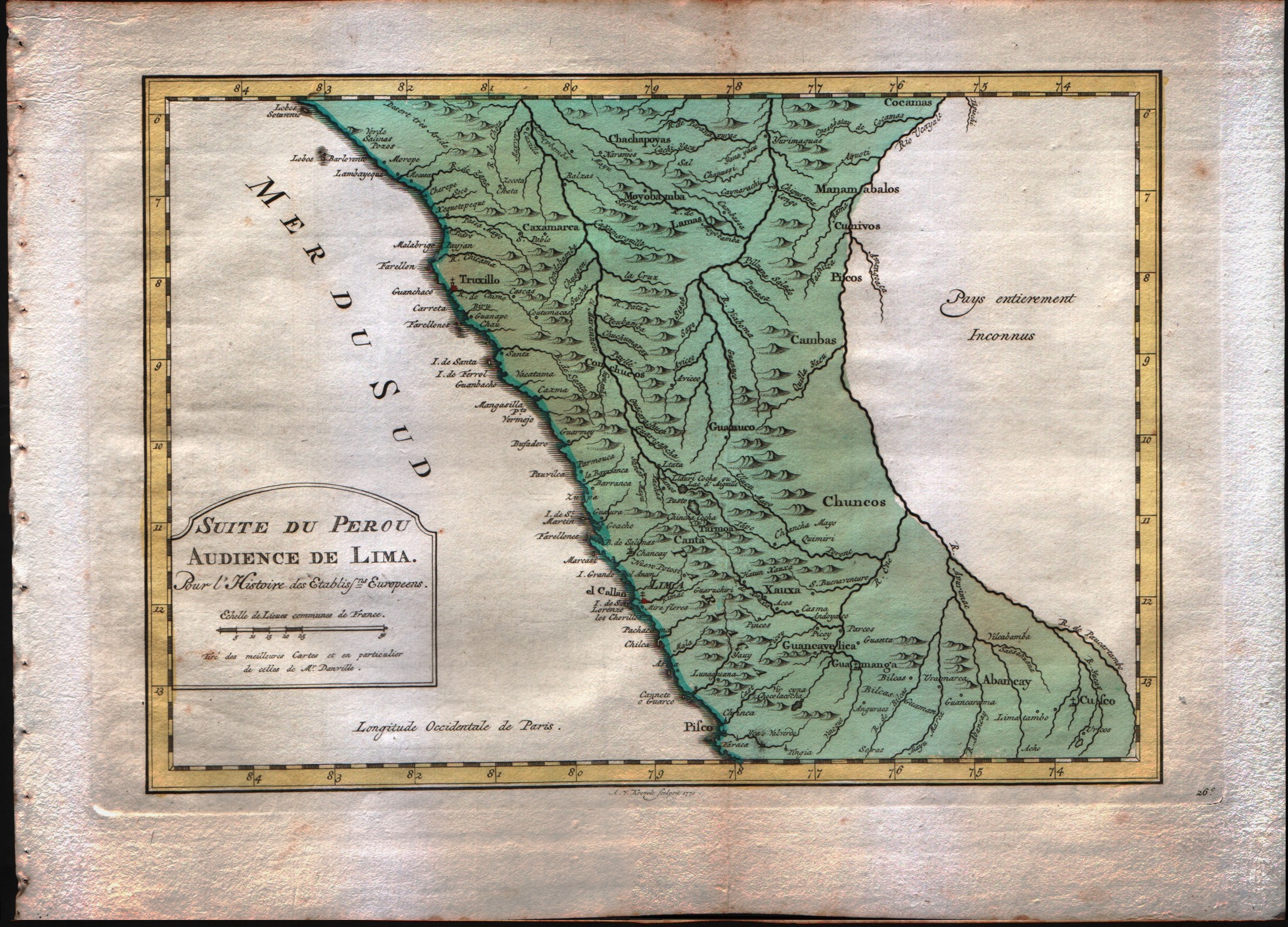
Suit du Perou audience de Lima
Author
Bellin
Location shown in map
Peru
Edition date
1773
Edition place
Amsterdam
Editor
--
Atlas
Atlas Portatif -- E. van Harrevelt
Price
Please ask: info@thetreasuremaps.com
State
[mint/EXCELLENT/very good/good/fair/mediocre/poor]
Color
Old colors
Verso
Blank
Size
Plate: cm (29.2 x 20.3) inches (11.5 x 7.99) Paper: cm (36.8 x 26.7) inches (14.49 x 10.51)
Technique
Copper engraving
Note
No particular notes for this maps
Reference
--
Wiki
Here for more info
In stock
Available
Info
info@thetreasuremaps.com
Code
#0041
×
![Suit du Perou audience de Lima by Bellin, Peru, 1773]()
Map title
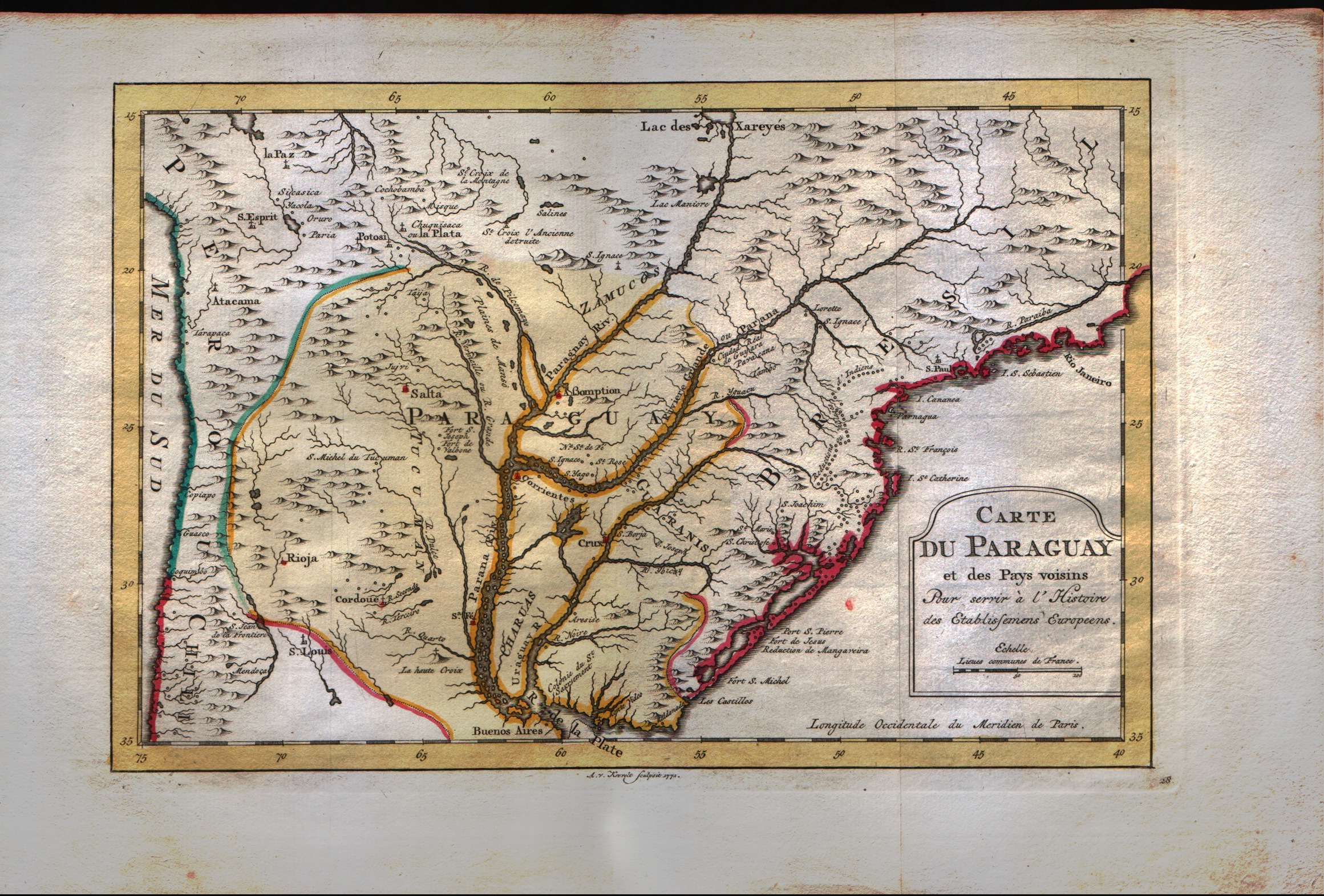
Carte du Paraguay et des pays voisins
Author
Bellin
Location shown in map
--
Edition date
1773
Edition place
Amsterdam
Editor
--
Atlas
Atlas Portatif -- E. van Harrevelt
Price
Please ask: info@thetreasuremaps.com
State
[mint/EXCELLENT/very good/good/fair/mediocre/poor]
Color
Old colors
Verso
Blank
Size
Plate: cm (30.5 x 20.3) inches (12.01 x 7.99) Paper: cm (39.4 x 26.7) inches (15.51 x 10.51)
Technique
Copper engraving
Note
No particular notes for this maps
Reference
--
Wiki
Here for more info
In stock
Available
Info
info@thetreasuremaps.com
Code
#0042
×
![Carte du Paraguay et des pays voisins by Bellin, --, 1773]()
Map title
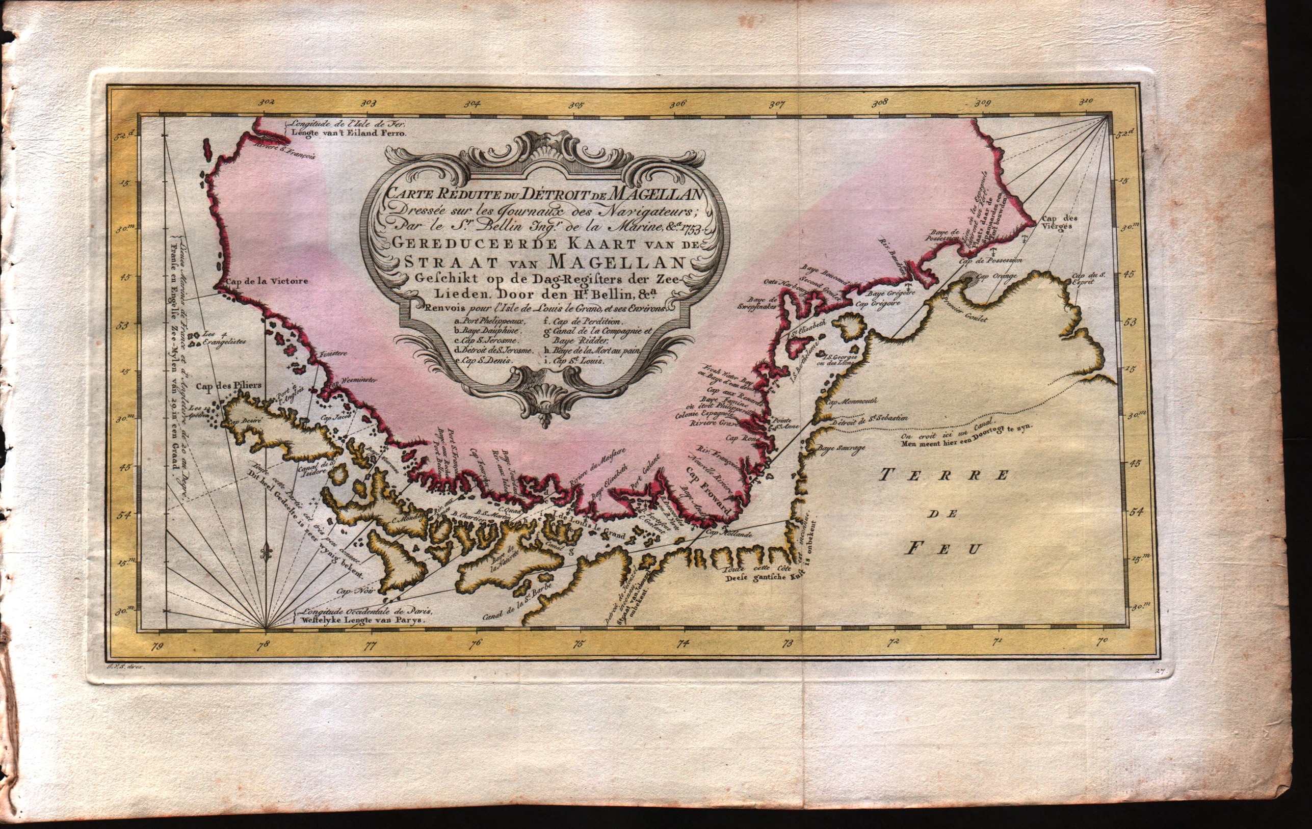
Carte reduite du detroit de Magellan dressee sur les jouraux des navigateurs
Author
Bellin
Location shown in map
Strait of Magellan
Edition date
1773
Edition place
Amsterdam
Editor
--
Atlas
Atlas Portatif -- E. van Harrevelt
Price
175 Euro
State
[mint/EXCELLENT/very good/good/fair/mediocre/poor]
Color
Old colors
Verso
Blank
Size
Plate: cm (34.3 x 19) inches (13.5 x 7.48) Paper: cm (40.6 x 26.7) inches (15.98 x 10.51)
Technique
Copper engraving
Note
No particular notes for this maps
Reference
--
Wiki
Here for more info
In stock
Available
Info
info@thetreasuremaps.com
Code
#0043
×
![Carte reduite du detroit de Magellan dressee sur les jouraux des navigateurs by Bellin, Strait of Magellan, 1773]()
Map title
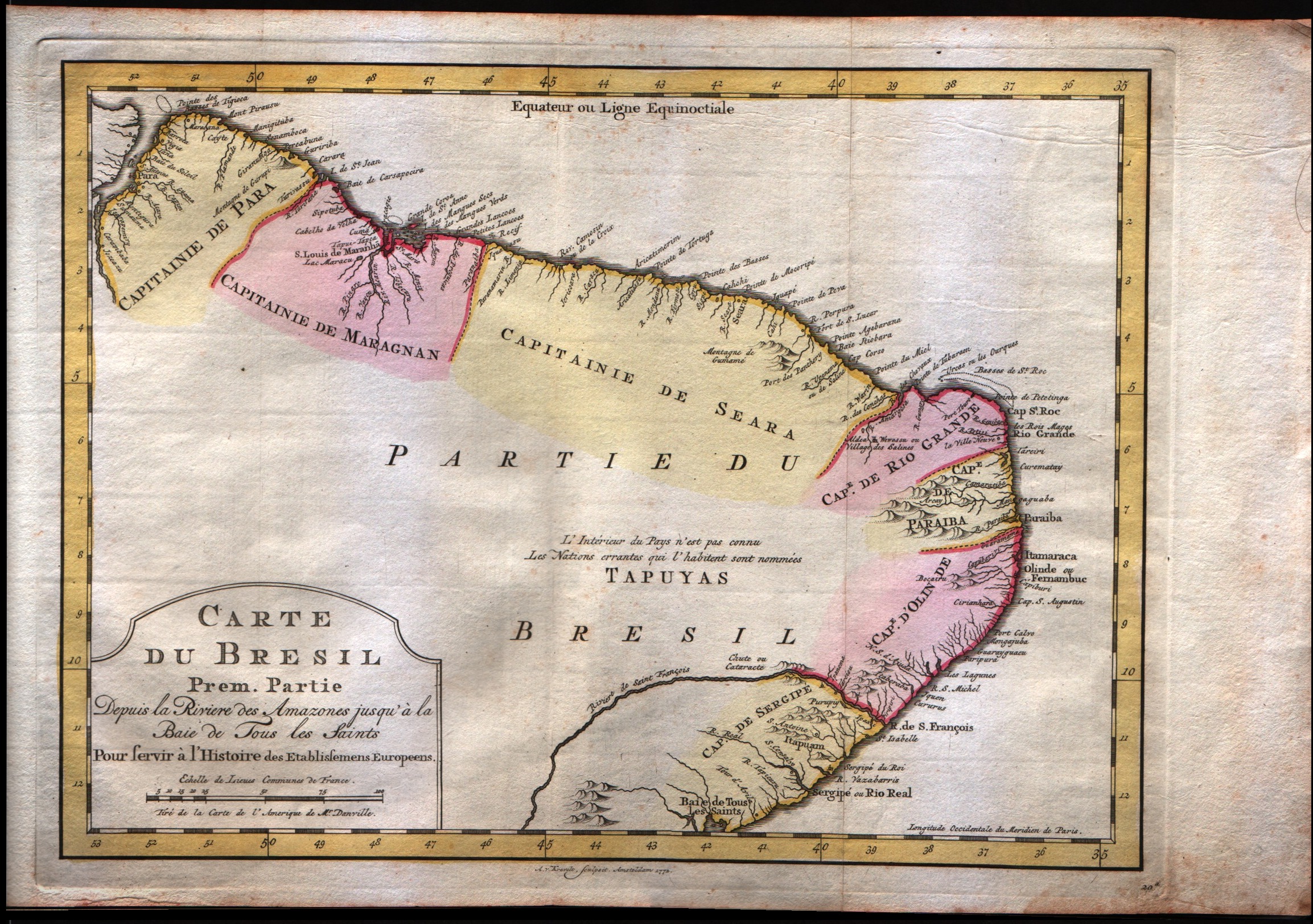
Carte du Bresil Prem.Partie
Author
Bellin
Location shown in map
--
Edition date
1773
Edition place
Amsterdam
Editor
--
Atlas
Atlas Portatif -- E. van Harrevelt
Price
150 Euro
State
[mint/EXCELLENT/very good/good/fair/mediocre/poor]
Color
Old colors
Verso
Blank
Size
Plate: cm (31.8 x 24.1) inches (12.52 x 9.49) Paper: cm (40.6 x 26.7) inches (15.98 x 10.51)
Technique
Copper engraving
Note
No particular notes for this maps
Reference
--
Wiki
Here for more info
In stock
Available
Info
info@thetreasuremaps.com
Code
#0044
×
![Carte du Bresil Prem.Partie by Bellin, --, 1773]()
Map title
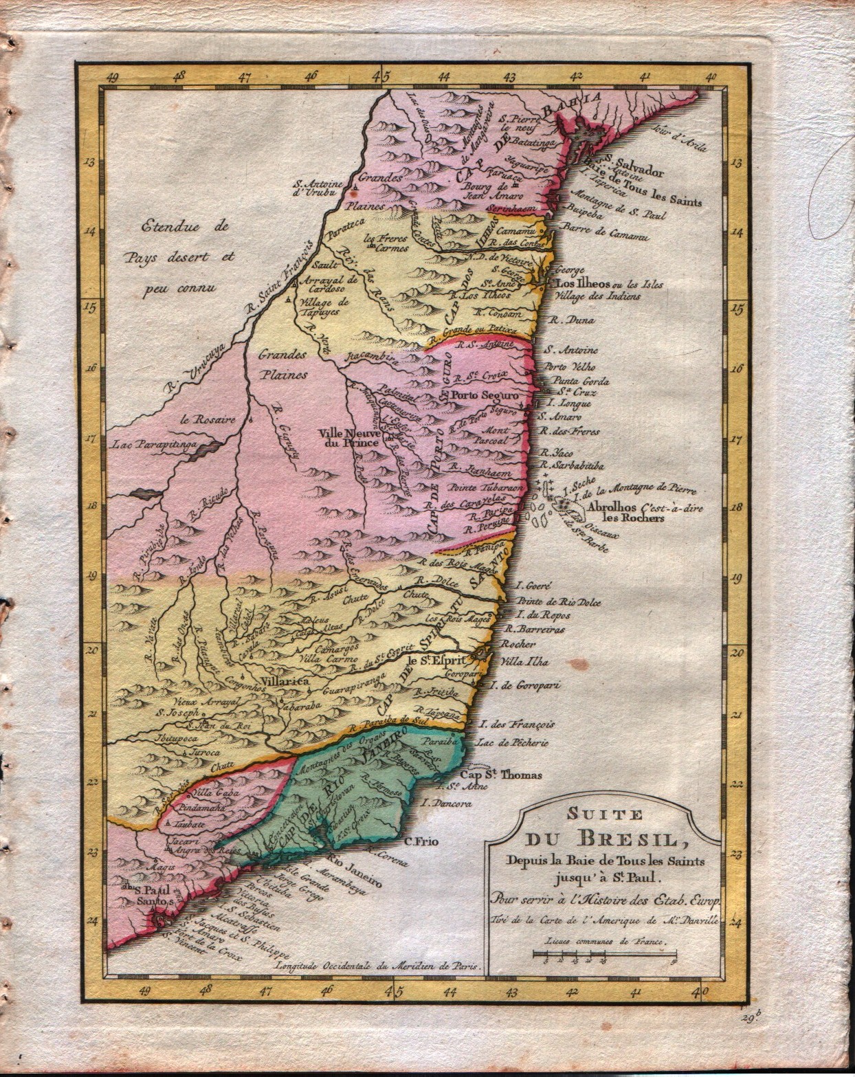
Carte du Bresil depuis la Baie de Tous les Saints jusqui St.Paul
Author
Bellin
Location shown in map
--
Edition date
1773
Edition place
Amsterdam
Editor
--
Atlas
Atlas Portatif -- E. van Harrevelt
Price
Please ask: info@thetreasuremaps.com
State
[mint/EXCELLENT/very good/good/fair/mediocre/poor]
Color
Old colors
Verso
Blank
Size
Plate: cm (16.5 x 22.9) inches (6.5 x 9.02) Paper: cm (21.6 x 26.7) inches (8.5 x 10.51)
Technique
Copper engraving
Note
No particular notes for this maps
Reference
--
Wiki
Here for more info
In stock
Available
Info
info@thetreasuremaps.com
Code
#0045
×
![Carte du Bresil depuis la Baie de Tous les Saints jusqui St.Paul by Bellin, --, 1773]()
Map title
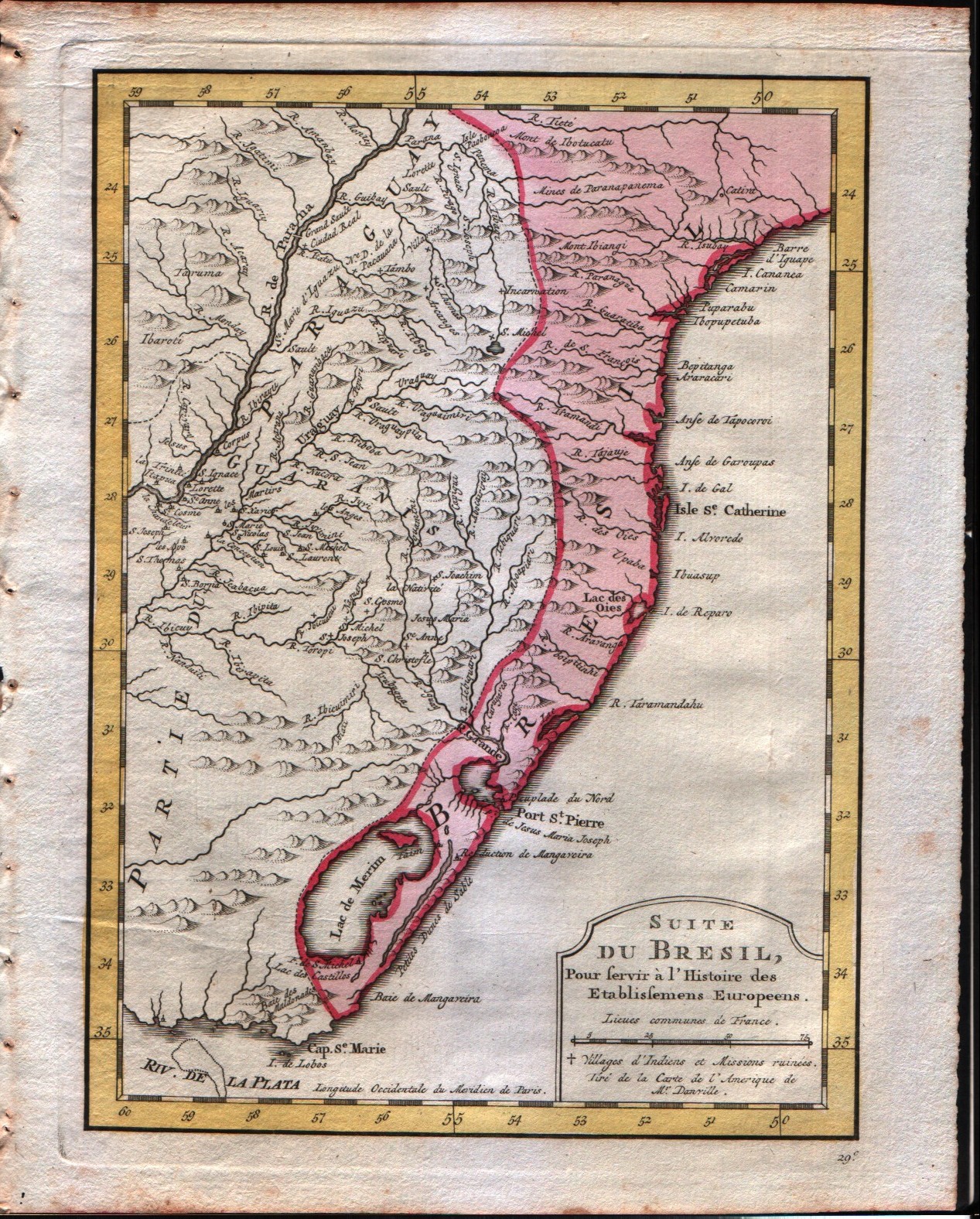
Carte du Bresil
Author
Bellin
Location shown in map
--
Edition date
1773
Edition place
Amsterdam
Editor
--
Atlas
Atlas Portatif -- E. van Harrevelt
Price
Please ask: info@thetreasuremaps.com
State
[mint/EXCELLENT/very good/good/fair/mediocre/poor]
Color
Old colors
Verso
Blank
Size
Plate: cm (16.5 x 22.9) inches (6.5 x 9.02) Paper: cm (21.6 x 26.7) inches (8.5 x 10.51)
Technique
Copper engraving
Note
No particular notes for this maps
Reference
--
Wiki
Here for more info
In stock
Available
Info
info@thetreasuremaps.com
Code
#0046
×
![Carte du Bresil by Bellin, --, 1773]()
Map title
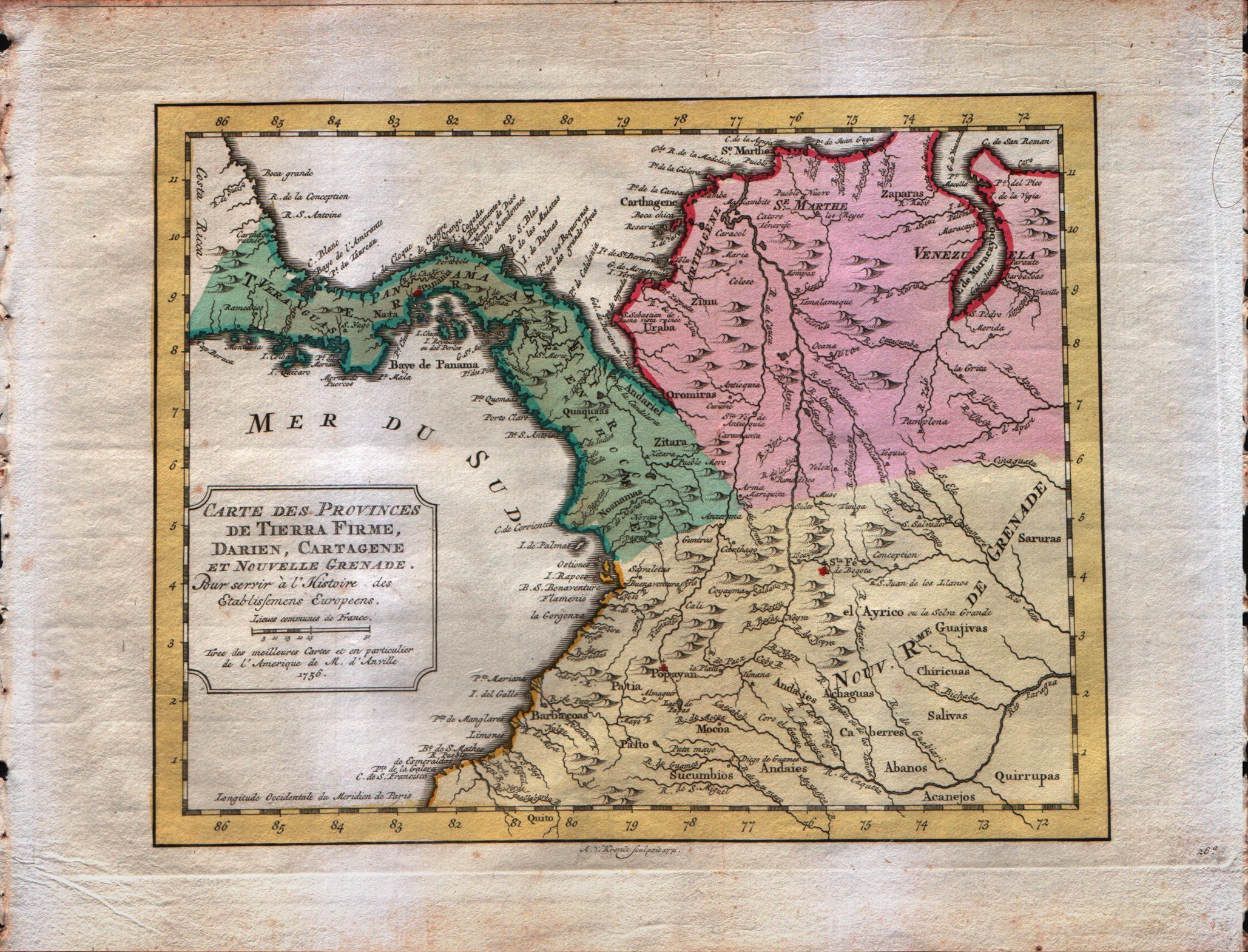
Carte des Provinces de Tierra Firme, Darien, Cartagene et Nouvelle Grenade
Author
Bellin
Location shown in map
--
Edition date
1773
Edition place
Amsterdam
Editor
--
Atlas
Atlas Portatif -- E. van Harrevelt
Price
Please ask: info@thetreasuremaps.com
State
[mint/EXCELLENT/very good/good/fair/mediocre/poor]
Color
Old colors
Verso
Blank
Size
Plate: cm (25.4 x 20.3) inches (10 x 7.99) Paper: cm (25.4 x 20.3) inches (10 x 7.99)
Technique
Copper engraving
Note
No particular notes for this maps
Reference
--
Wiki
Here for more info
In stock
Available
Info
info@thetreasuremaps.com
Code
#0047
×
![Carte des Provinces de Tierra Firme, Darien, Cartagene et Nouvelle Grenade by Bellin, --, 1773]()
Map title
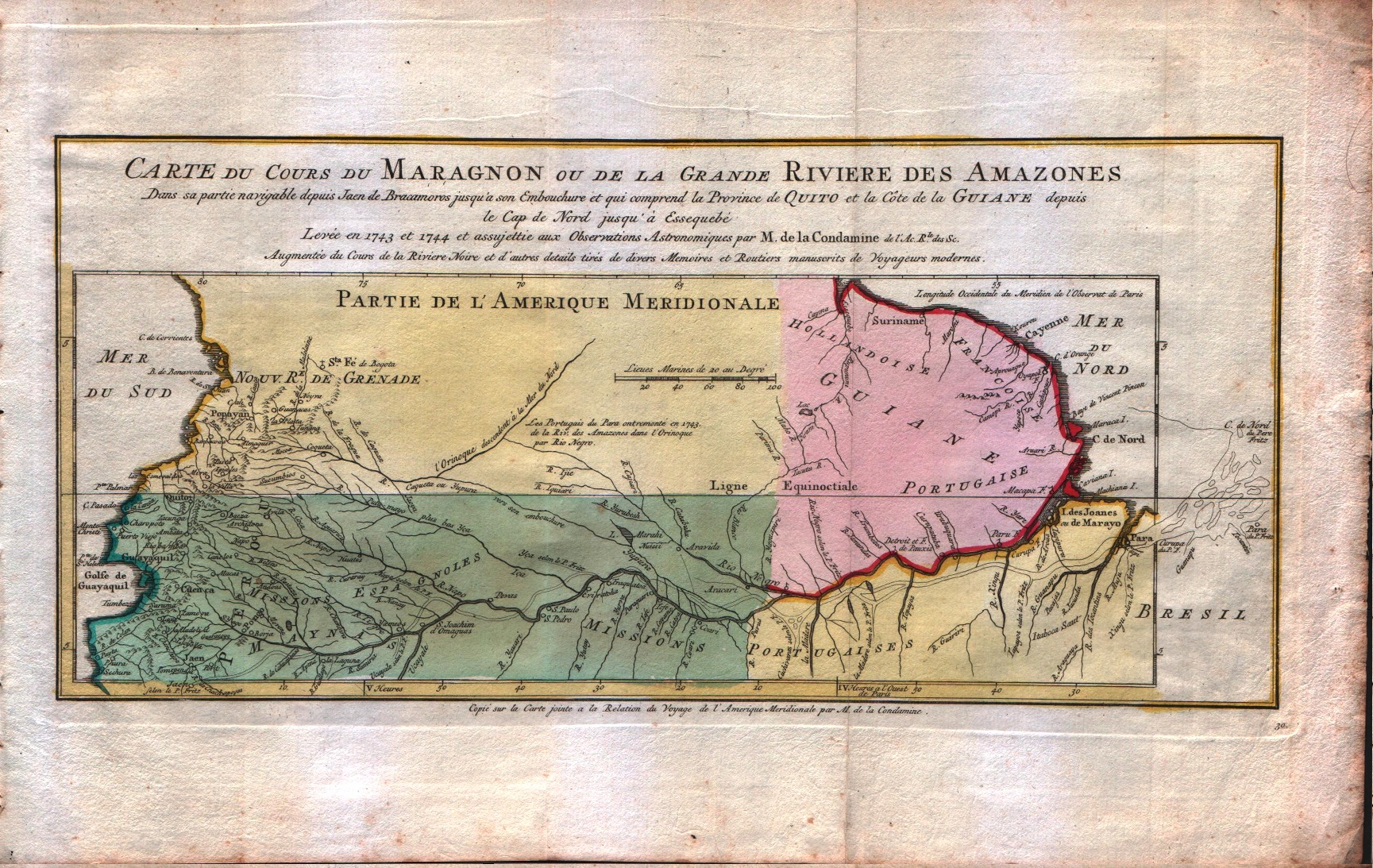
Carte du cours du Maragnon ou de la Grande Riviere des Amazones
Author
Bellin
Location shown in map
--
Edition date
1773
Edition place
Amsterdam
Editor
--
Atlas
Atlas Portatif -- E. van Harrevelt
Price
Please ask: info@thetreasuremaps.com
State
[mint/EXCELLENT/very good/good/fair/mediocre/poor]
Color
Old colors
Verso
Blank
Size
Plate: cm (36.8 x 17.8) inches (14.49 x 7.01) Paper: cm (41.9 x 26.7) inches (16.5 x 10.51)
Technique
Copper engraving
Note
No particular notes for this maps
Reference
--
Wiki
Here for more info
In stock
Available
Info
info@thetreasuremaps.com
Code
#0048
×
![Carte du cours du Maragnon ou de la Grande Riviere des Amazones by Bellin, --, 1773]()
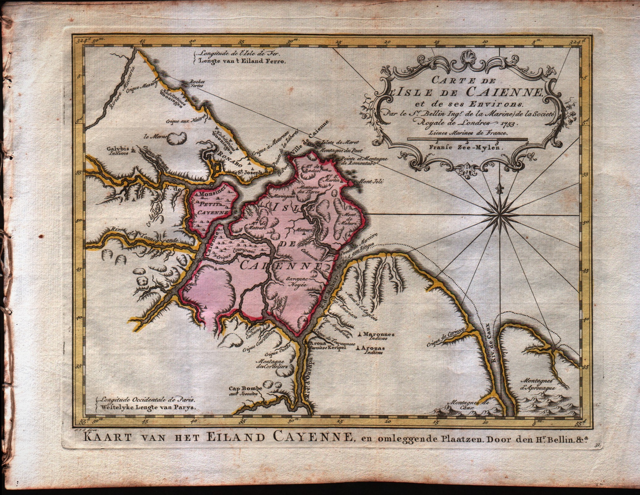
Map title
Carte de l'Isle de Caienne, et de ses Environs
Author
Bellin
Location shown in map
--
Edition date
1773
Edition place
Amsterdam
Editor
--
Atlas
Atlas Portatif -- E. van Harrevelt
Price
Please ask: info@thetreasuremaps.com
State
[mint/EXCELLENT/very good/good/fair/mediocre/poor]
Color
Old colors
Verso
Blank
Size
Plate: cm (27.9 x 21.6) inches (10.98 x 8.5) Paper: cm (36.8 x 26.7) inches (14.49 x 10.51)
Technique
Copper engraving
Note
No particular notes for this maps
Reference
--
Wiki
Here for more info
In stock
Available
Info
info@thetreasuremaps.com
Code
#0049
×
![Carte de l'Isle de Caienne, et de ses Environs by Bellin, --, 1773]()
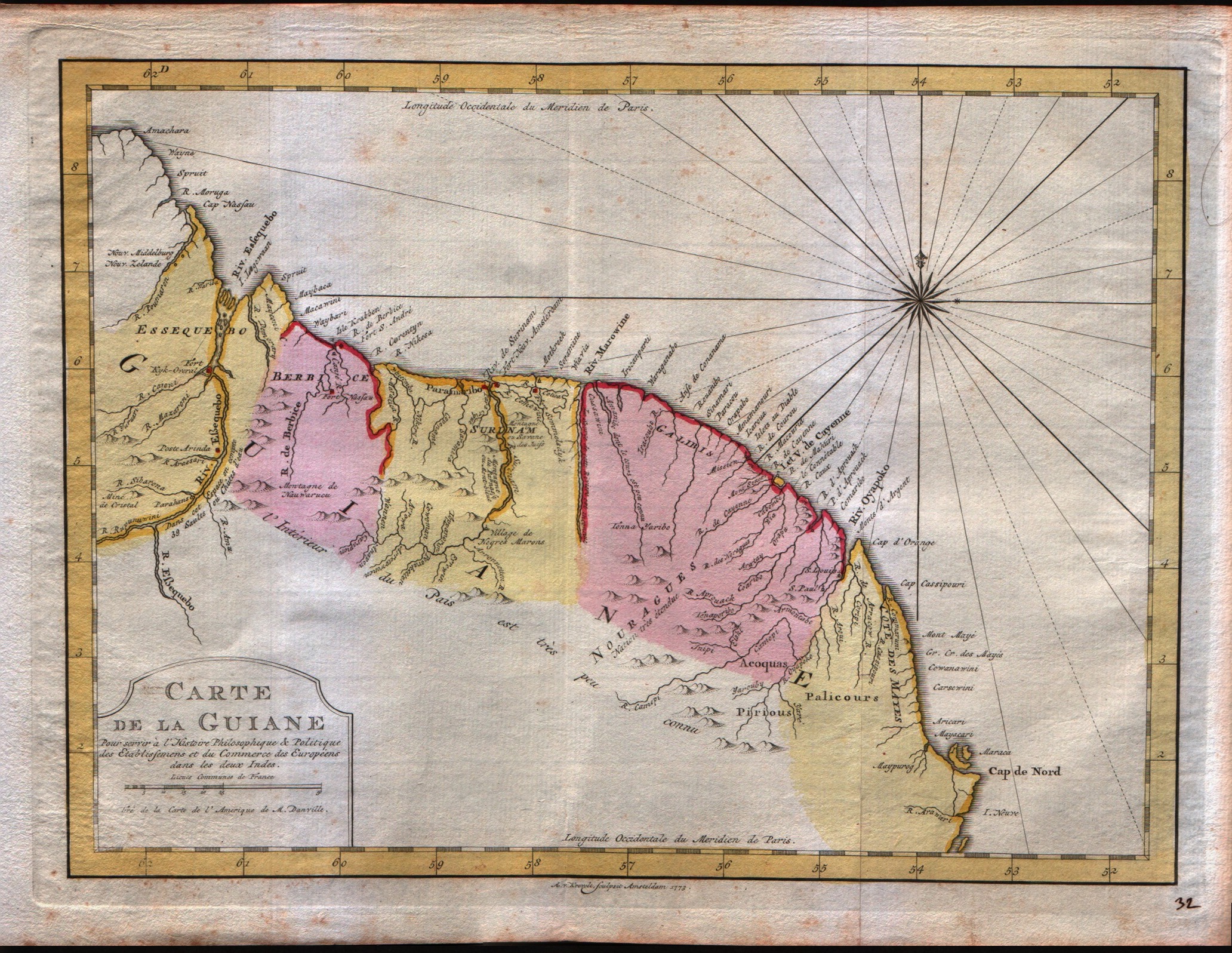
Map title
Carte de la Guiane
Author
Bellin
Location shown in map
--
Edition date
1773
Edition place
Amsterdam
Editor
--
Atlas
Atlas Portatif -- E. van Harrevelt
Price
Please ask: info@thetreasuremaps.com
State
[mint/EXCELLENT/very good/good/fair/mediocre/poor]
Color
Old colors
Verso
Blank
Size
Plate: cm (31.8 x 24.1) inches (12.52 x 9.49) Paper: cm (40.6 x 26.7) inches (15.98 x 10.51)
Technique
Copper engraving
Note
No particular notes for this maps
Reference
--
Wiki
Here for more info
In stock
Available
Info
info@thetreasuremaps.com
Code
#0050
×
![Carte de la Guiane by Bellin, --, 1773]()
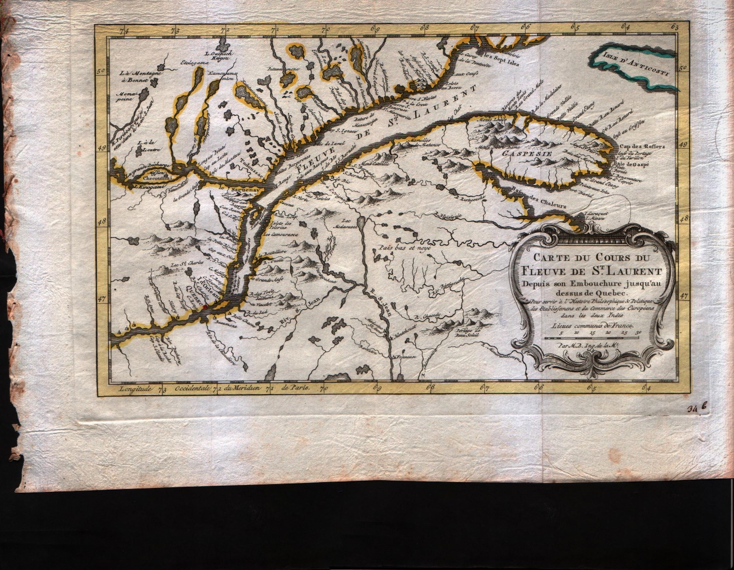
Map title
Carte du cours du Fleuve de S.Laurent depuis son embouchure jusqu'au dessus de Quebec
Author
Bellin
Location shown in map
--
Edition date
1773
Edition place
Amsterdam
Editor
--
Atlas
Atlas Portatif -- E. van Harrevelt
Price
150 Euro
State
[mint/EXCELLENT/very good/good/fair/mediocre/poor]
Color
Old colors
Verso
Blank
Size
Plate: cm (29.2 x 19) inches (11.5 x 7.48) Paper: cm (39.4 x 26.7) inches (15.51 x 10.51)
Technique
Copper engraving
Note
No particular notes for this maps
Reference
--
Wiki
Here for more info
In stock
Available
Info
info@thetreasuremaps.com
Code
#0070
×
![Carte du cours du Fleuve de S.Laurent depuis son embouchure jusqu'au dessus de Quebec by Bellin, --, 1773]()
Map title
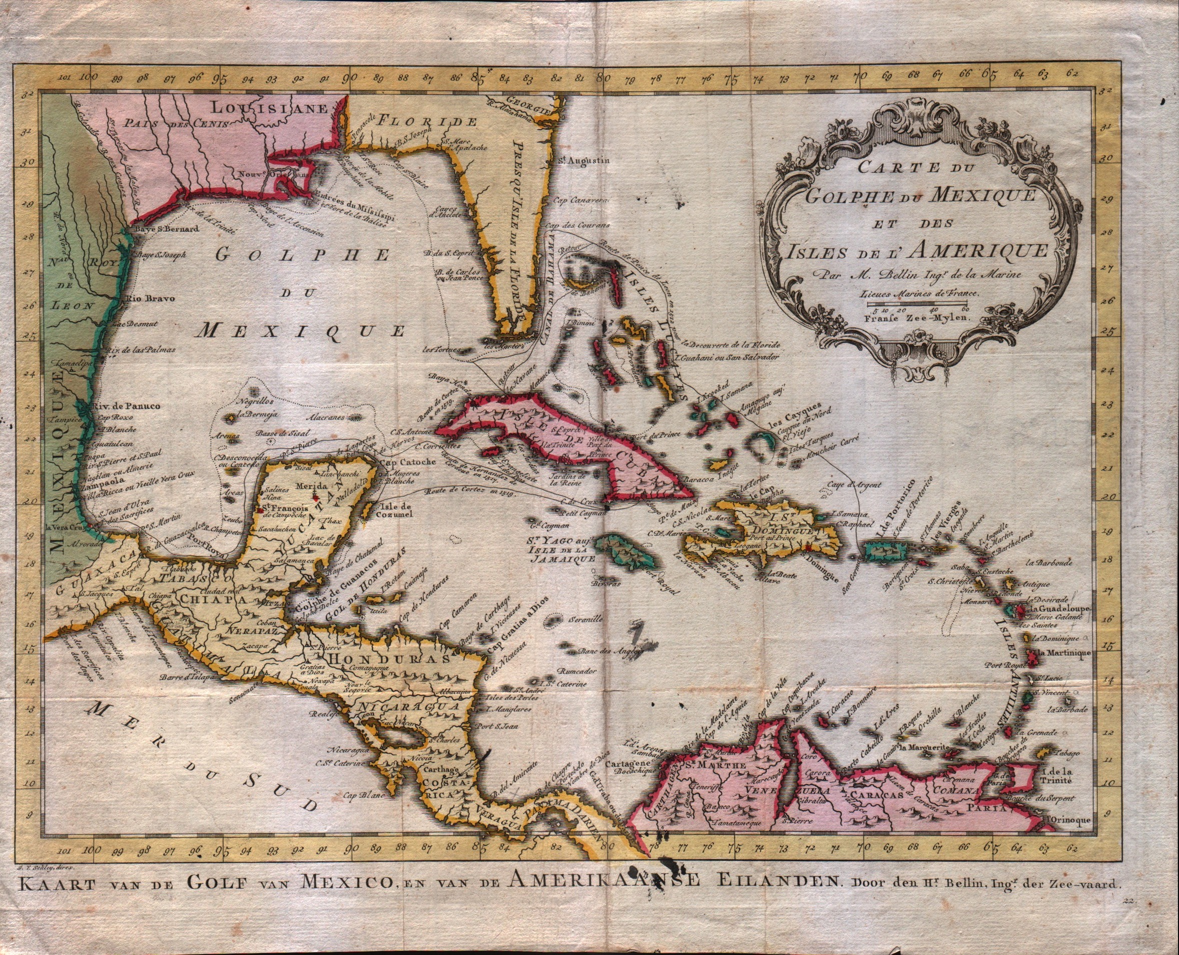
Carte du Golphe du Mexique et des Isles de l'Amerique
Author
Bellin
Location shown in map
--
Edition date
1773
Edition place
Amsterdam
Editor
--
Atlas
Atlas Portatif -- E. van Harrevelt
Price
275 Euro
State
[mint/EXCELLENT/very good/good/fair/mediocre/poor]
Color
Old colors
Verso
Blank
Size
Plate: cm (36.8 x 26.7) inches (14.49 x 10.51) Paper: cm (39.4 x 31.8) inches (15.51 x 12.52)
Technique
Copper engraving
Note
No particular notes for this maps
Reference
--
Wiki
Here for more info
In stock
Available
Info
info@thetreasuremaps.com
Code
#0071
×
![Carte du Golphe du Mexique et des Isles de l'Amerique by Bellin, --, 1773]()
Map title
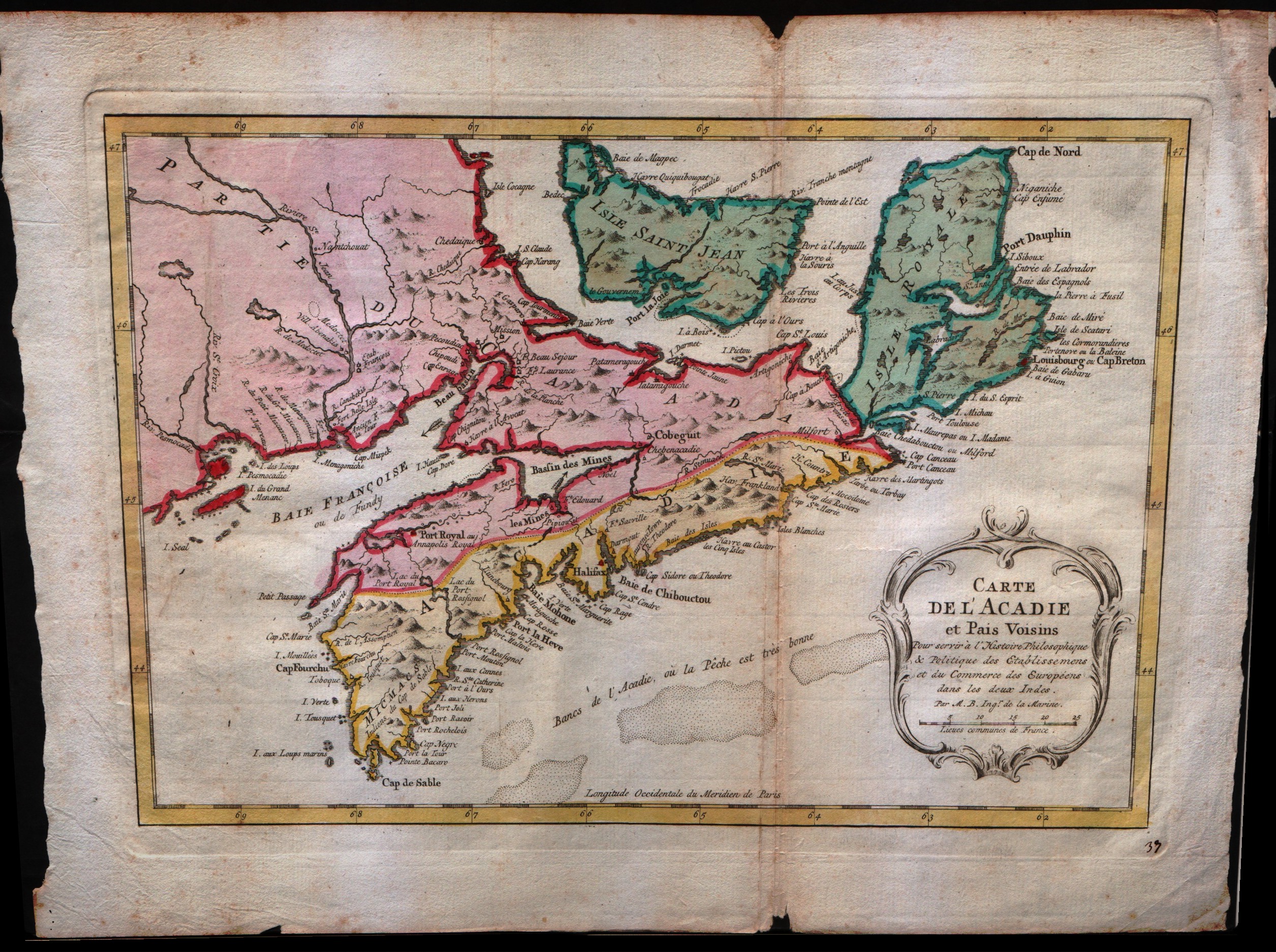
Carte de l'Acadie et pais voisins
Author
Bellin
Location shown in map
--
Edition date
1773
Edition place
Amsterdam
Editor
--
Atlas
Atlas Portatif -- E. van Harrevelt
Price
200 Euro
State
[mint/excellent/VERY GOOD/good/fair/mediocre/poor]
Color
Old colors
Verso
Blank
Size
Plate: cm (31.8 x 20.3) inches (12.52 x 7.99) Paper: cm (38.1 x 26.7) inches (15 x 10.51)
Technique
Copper engraving
Note
No particular notes for this maps
Reference
--
Wiki
Here for more info
In stock
Available
Info
info@thetreasuremaps.com
Code
#0072
×
![Carte de l'Acadie et pais voisins by Bellin, --, 1773]()
Map title
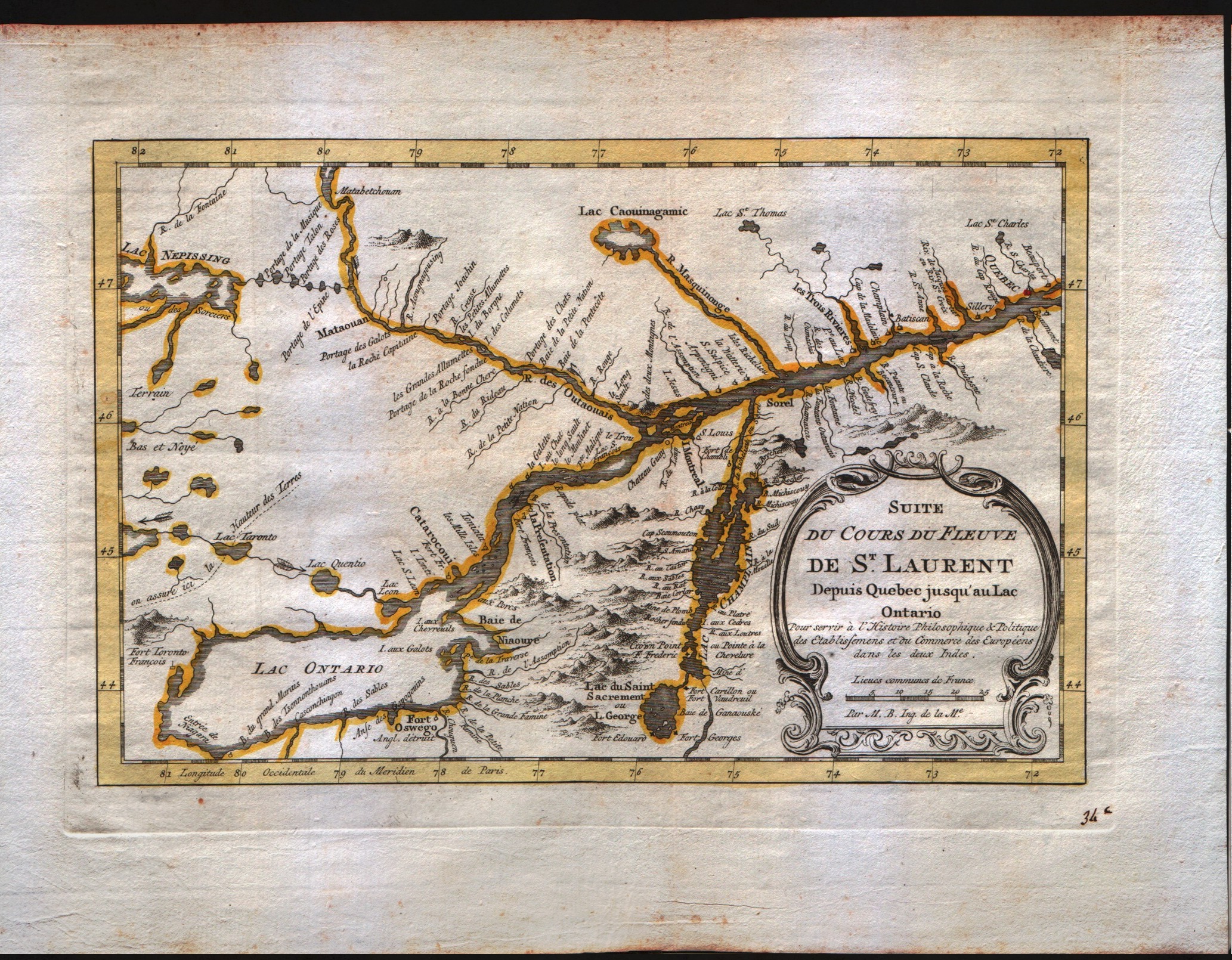
Suite du cours du Fleuve de S.Laurent depuis Quebec jusqu'au Lac Ontario
Author
Bellin
Location shown in map
--
Edition date
1773
Edition place
Amsterdam
Editor
--
Atlas
Atlas Portatif -- E. van Harrevelt
Price
200 Euro
State
[mint/EXCELLENT/very good/good/fair/mediocre/poor]
Color
Old colors
Verso
Blank
Size
Plate: cm (27.9 x 17.8) inches (10.98 x 7.01) Paper: cm (35.6 x 26.7) inches (14.02 x 10.51)
Technique
Copper engraving
Note
No particular notes for this maps
Reference
--
Wiki
Here for more info
In stock
Available
Info
info@thetreasuremaps.com
Code
#0073
×
![Suite du cours du Fleuve de S.Laurent depuis Quebec jusqu'au Lac Ontario by Bellin, --, 1773]()
Map title
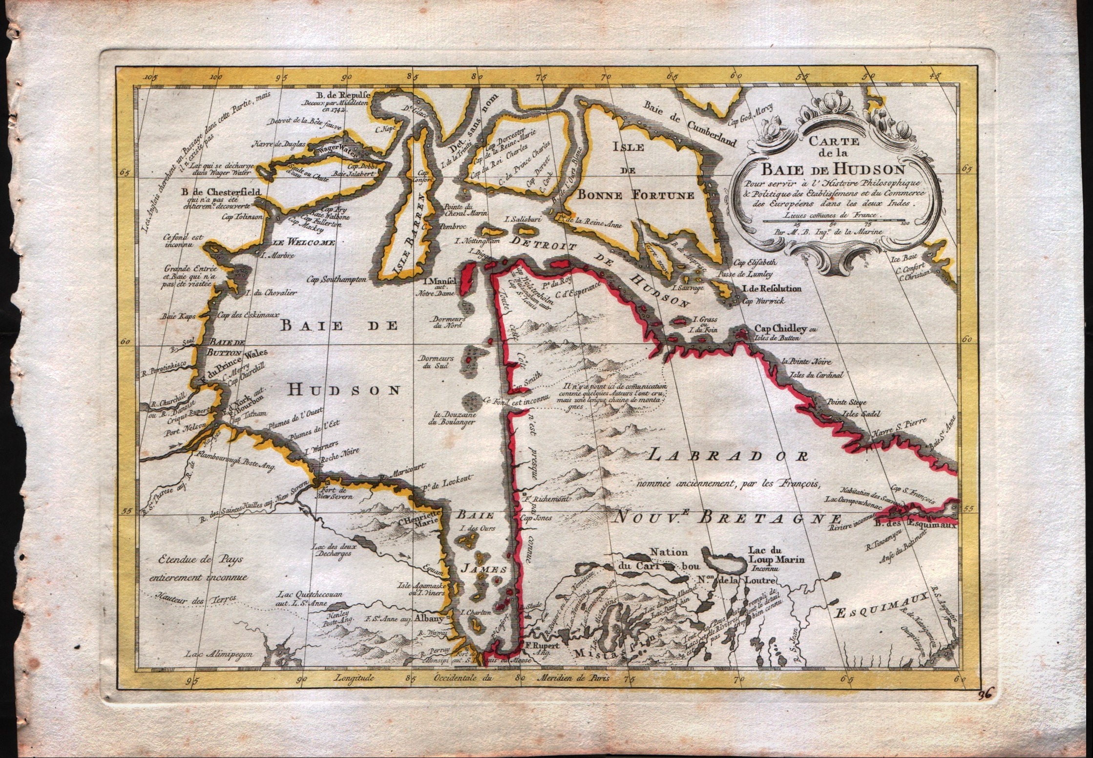
Carte de la baie de Hudson
Author
Bellin
Location shown in map
--
Edition date
1773
Edition place
Amsterdam
Editor
--
Atlas
Atlas Portatif -- E. van Harrevelt
Price
175 Euro
State
[mint/EXCELLENT/very good/good/fair/mediocre/poor]
Color
Old colors
Verso
Blank
Size
Plate: cm (29.2 x 21.6) inches (11.5 x 8.5) Paper: cm (36.8 x 26.7) inches (14.49 x 10.51)
Technique
Copper engraving
Note
No particular notes for this maps
Reference
--
Wiki
Here for more info
In stock
Available
Info
info@thetreasuremaps.com
Code
#0074
×
![Carte de la baie de Hudson by Bellin, --, 1773]()
Map title
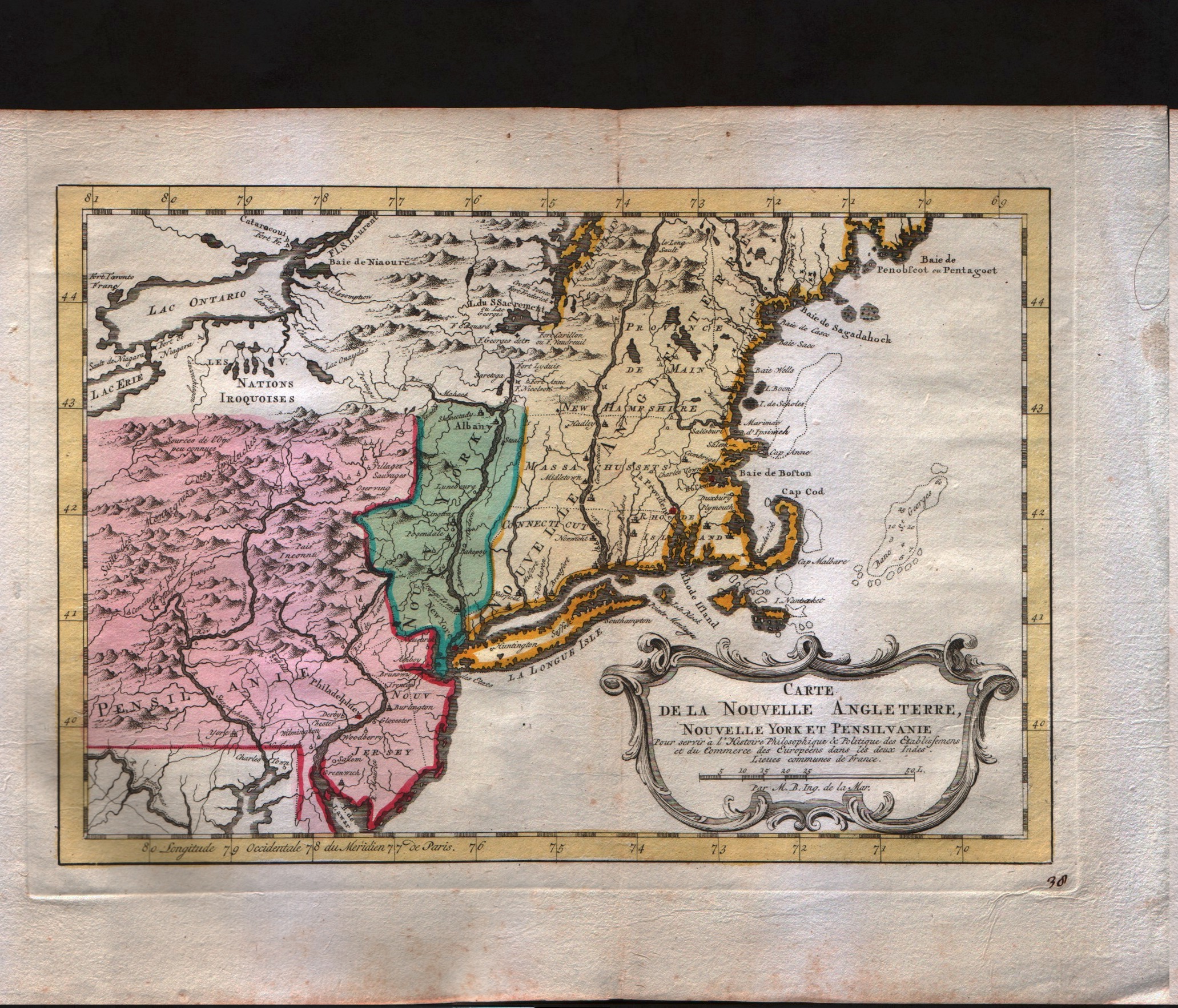
Carte de la nouvelle Angleterre
Author
Bellin
Location shown in map
--
Edition date
1773
Edition place
Amsterdam
Editor
--
Atlas
Atlas Portatif -- E. van Harrevelt
Price
300 Euro
State
[mint/EXCELLENT/very good/good/fair/mediocre/poor]
Color
Old colors
Verso
Blank
Size
Plate: cm (29.2 x 20.3) inches (11.5 x 7.99) Paper: cm (36.8 x 26.7) inches (14.49 x 10.51)
Technique
Copper engraving
Note
The New England colonies are named except Vermont which is still the unnamed disputed territory between New Hampshire and New York. The area covered as a whole extends from Penobscot Bay south to Chesapeake Bay and west to Lake Erie. The map illustrates provinces, towns, forts, rivers, Native American lands and relief.
Reference
--
Wiki
Here for more info
In stock
Sold
Info
info@thetreasuremaps.com
Code
#0075
×
![Carte de la nouvelle Angleterre by Bellin, --, 1773]()
Map title
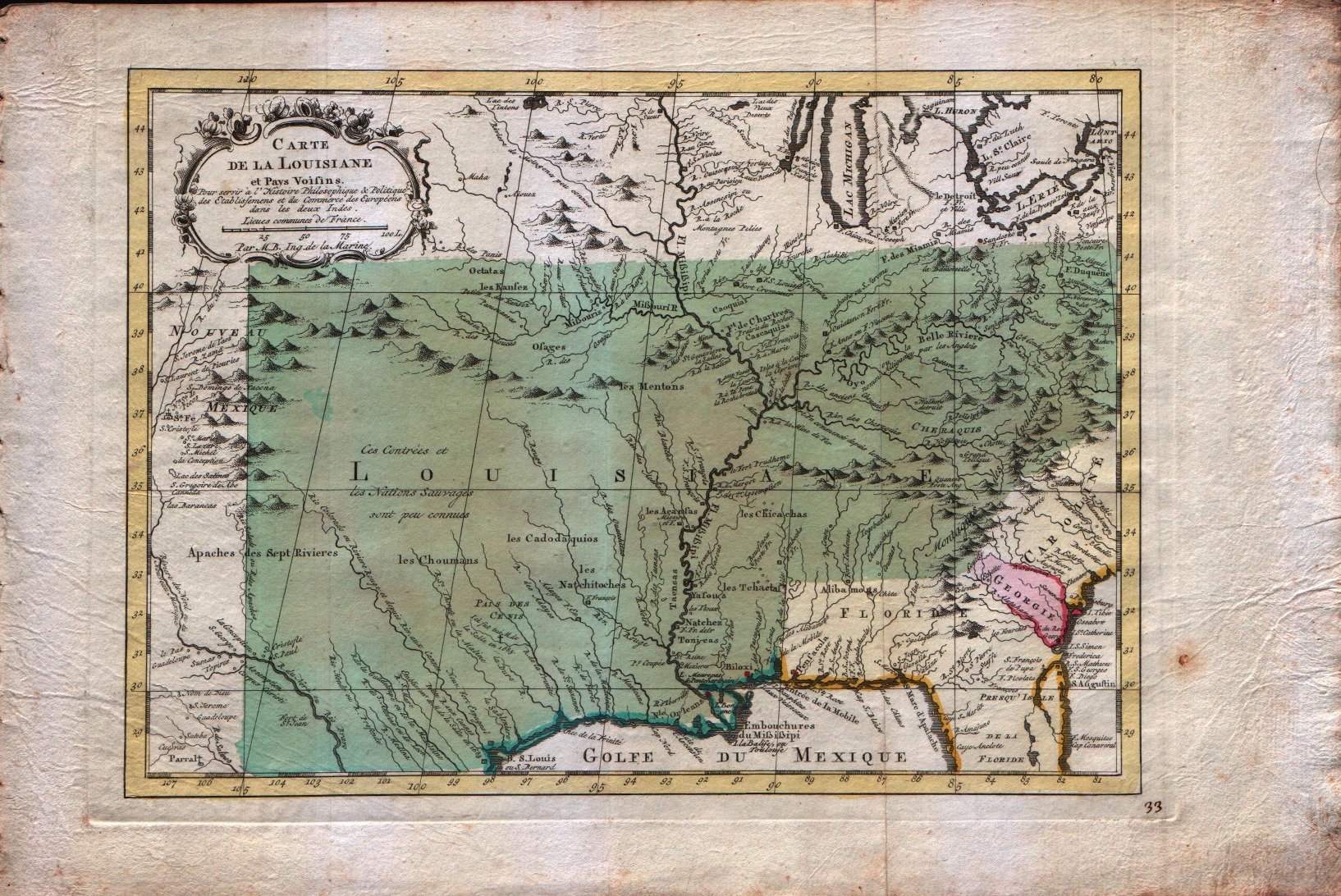
Carte de la Louisiane
Author
Bellin
Location shown in map
Louisiane
Edition date
1773
Edition place
Amsterdam
Editor
--
Atlas
Atlas Portatif -- E. van Harrevelt
Price
350 Euro
State
[mint/EXCELLENT/very good/good/fair/mediocre/poor]
Color
Old colors
Verso
Blank
Size
Plate: cm (30.5 x 21.6) inches (12.01 x 8.5) Paper: cm (39.4 x 26.7) inches (15.51 x 10.51)
Technique
Copper engraving
Note
Bellin notes all major river systems, especially the Mississippi system upon which their claims rested, and many of the French forts, including Detroit, Fort Duquesne (Pittsburgh), Fort de la Presque Isle (Erie), Sandoske, and Fort Checagou.
Reference
--
Wiki
Here for more info
In stock
Sold
Info
info@thetreasuremaps.com
Code
#0076
×
![Carte de la Louisiane by Bellin, Louisiane, 1773]()
Map title
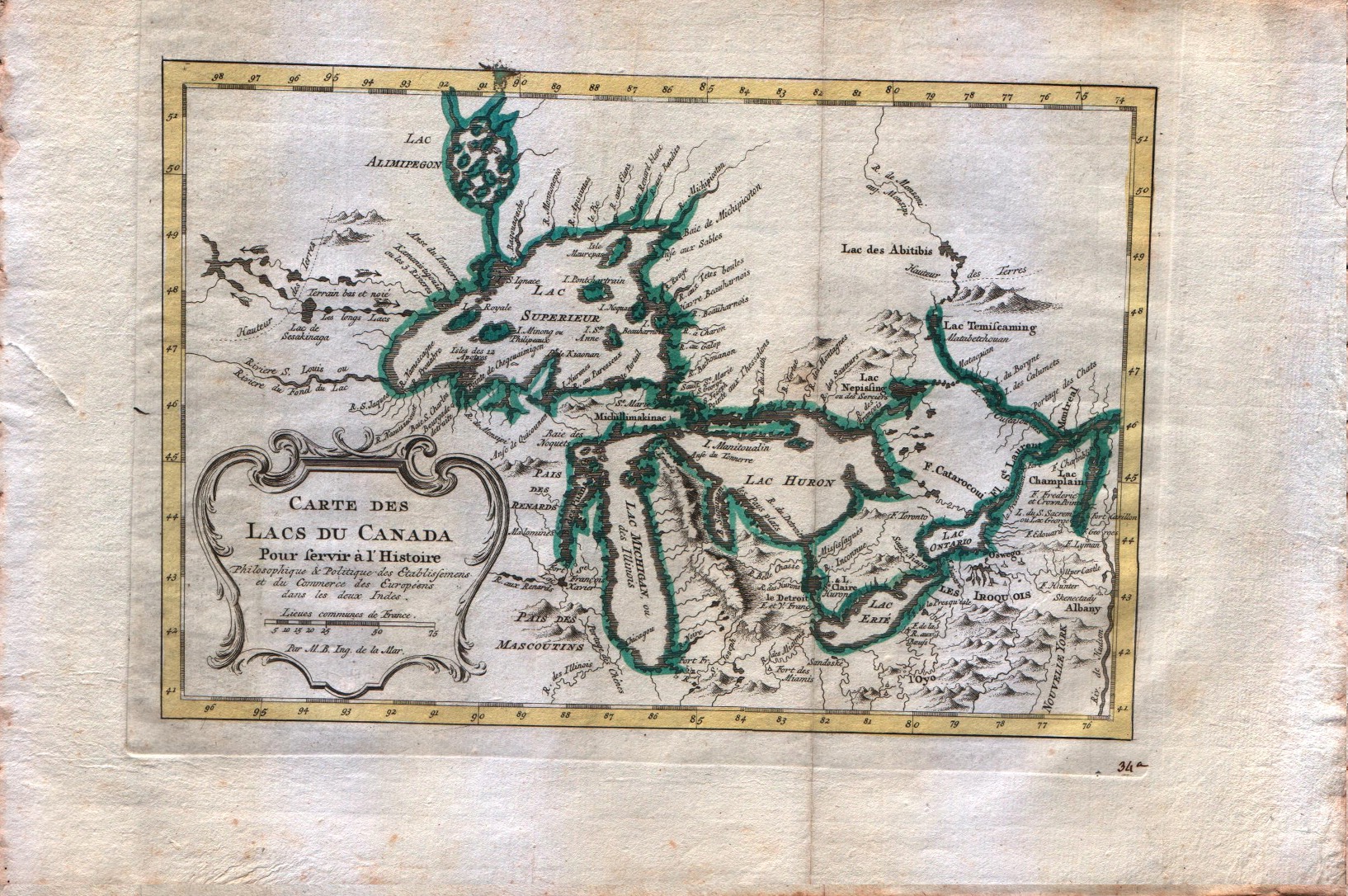
Carte des lacs du Canada
Author
Bellin
Location shown in map
--
Edition date
1773
Edition place
Amsterdam
Editor
--
Atlas
Atlas Portatif -- E. van Harrevelt
Price
350 Euro
State
[mint/EXCELLENT/very good/good/fair/mediocre/poor]
Color
Old colors
Verso
Blank
Size
Plate: cm (27.9 x 19) inches (10.98 x 7.48) Paper: cm (39.4 x 26.7) inches (15.51 x 10.51)
Technique
Copper engraving
Note
Bellin's map has the five lakes in an appropriate scale and with the names that we know today.
Reference
--
Wiki
Here for more info
In stock
Sold
Info
info@thetreasuremaps.com
Code
#0077
×
![Carte des lacs du Canada by Bellin, --, 1773]()
Map title
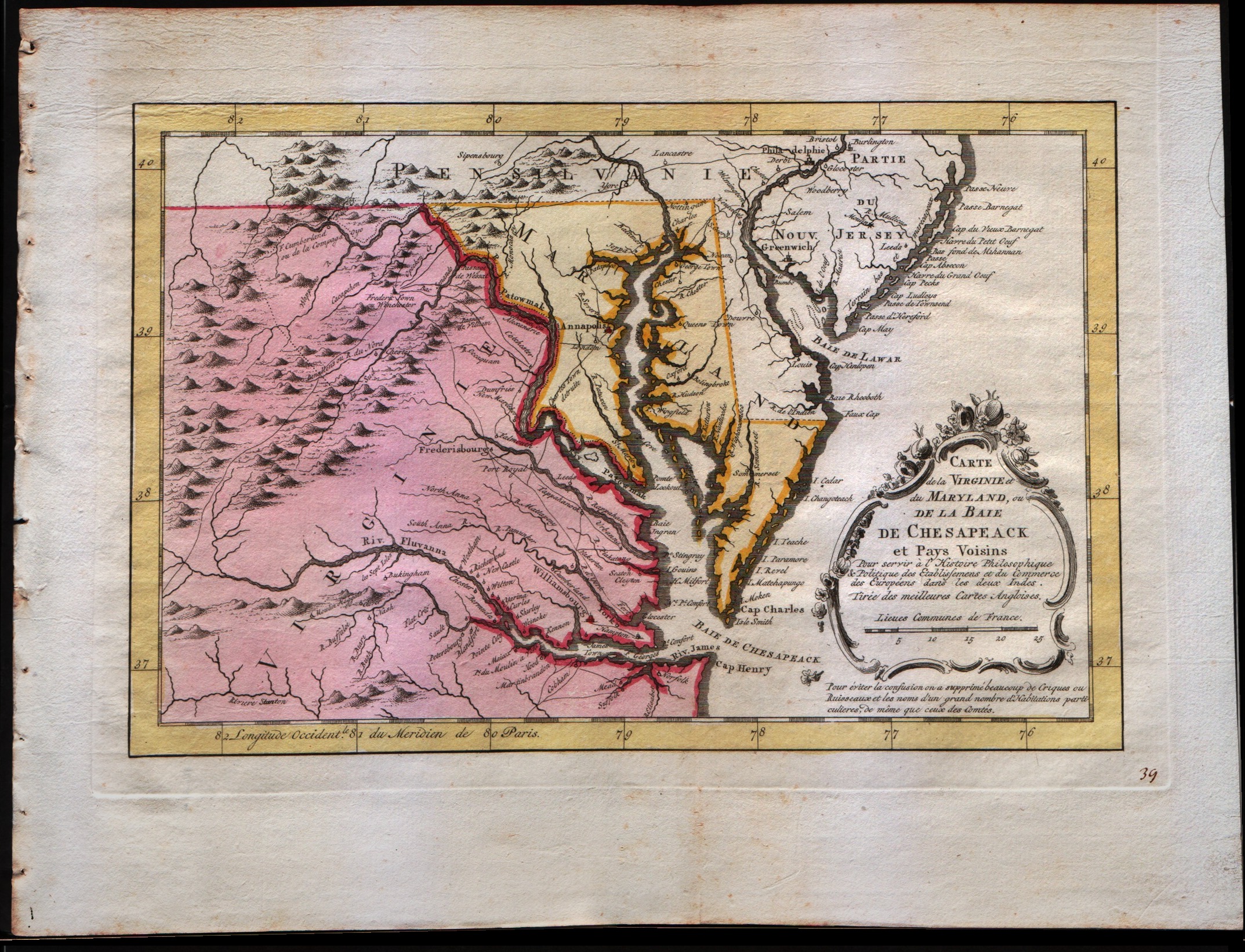
Carte de la Virginie et du Maryland.
Author
Bellin
Location shown in map
Virginie Meryland
Edition date
1773
Edition place
Amsterdam
Editor
--
Atlas
Atlas Portatif -- E. van Harrevelt
Price
350 Euro
State
[mint/EXCELLENT/very good/good/fair/mediocre/poor]
Color
Old colors
Verso
Blank
Size
Plate: cm (27.9 x 19) inches (10.98 x 7.48) Paper: cm (34.3 x 26.7) inches (13.5 x 10.51)
Technique
Copper engraving
Note
Same as Carte de la baye de Chesapeack et Pays Voisins
Reference
--
Wiki
Here for more info
In stock
Sold
Info
info@thetreasuremaps.com
Code
#0078
×
![Carte de la Virginie et du Maryland. by Bellin, Virginie Meryland, 1773]()