1700-1799
Map title
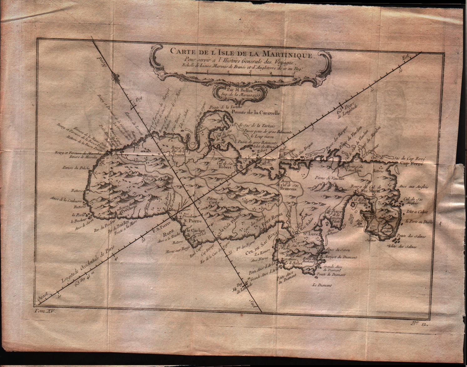
Carte de l'isle de la Martinique
Author
Bellin
Location shown in map
Martinique
Edition date
1757
Edition place
Paris
Editor
--
Atlas
Historie General des Voyages -- Prevost
Price
150 Euro
State
[mint/EXCELLENT/very good/good/fair/mediocre/poor]
Color
Black/white
Verso
Blank
Size
Plate: cm (29.2 x 20.3) inches (11.5 x 7.99) Paper: cm (34.3 x 25.4) inches (13.5 x 10)
Technique
Copper engraving
Note
No particular notes for this maps
Reference
--
Wiki
Here for more info
In stock
Available
Info
info@thetreasuremaps.com
Code
#0357
×
![Carte de l'isle de la Martinique by Bellin, Martinique, 1757]()
Map title
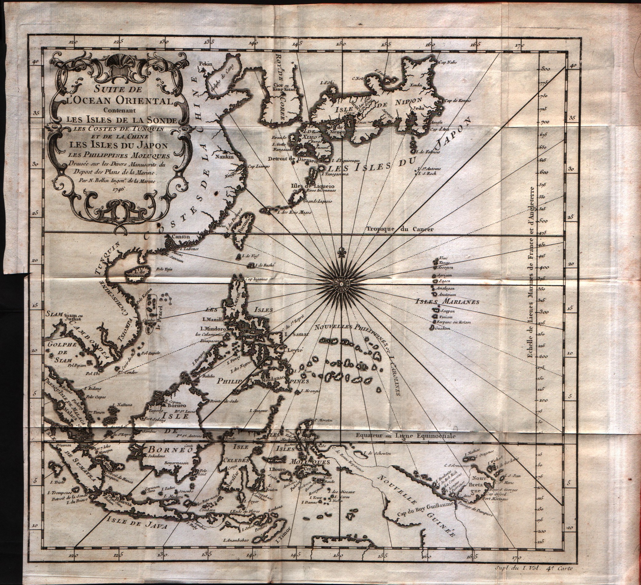
Suite de l'Ocean Oriental
Author
Bellin
Location shown in map
Inde
Edition date
1757
Edition place
Paris
Editor
--
Atlas
Historie General des Voyages -- Prevost
Price
250 Euro
State
[mint/EXCELLENT/very good/good/fair/mediocre/poor]
Color
Black/white
Verso
Blank
Size
Plate: cm (30.5 x 29.2) inches (12.01 x 11.5) Paper: cm (35.6 x 33) inches (14.02 x 12.99)
Technique
Copper engraving
Note
No particular notes for this maps
Reference
--
Wiki
Here for more info
In stock
Available
Info
info@thetreasuremaps.com
Code
#0548
×
![Suite de l'Ocean Oriental by Bellin, Inde, 1757]()
Map title
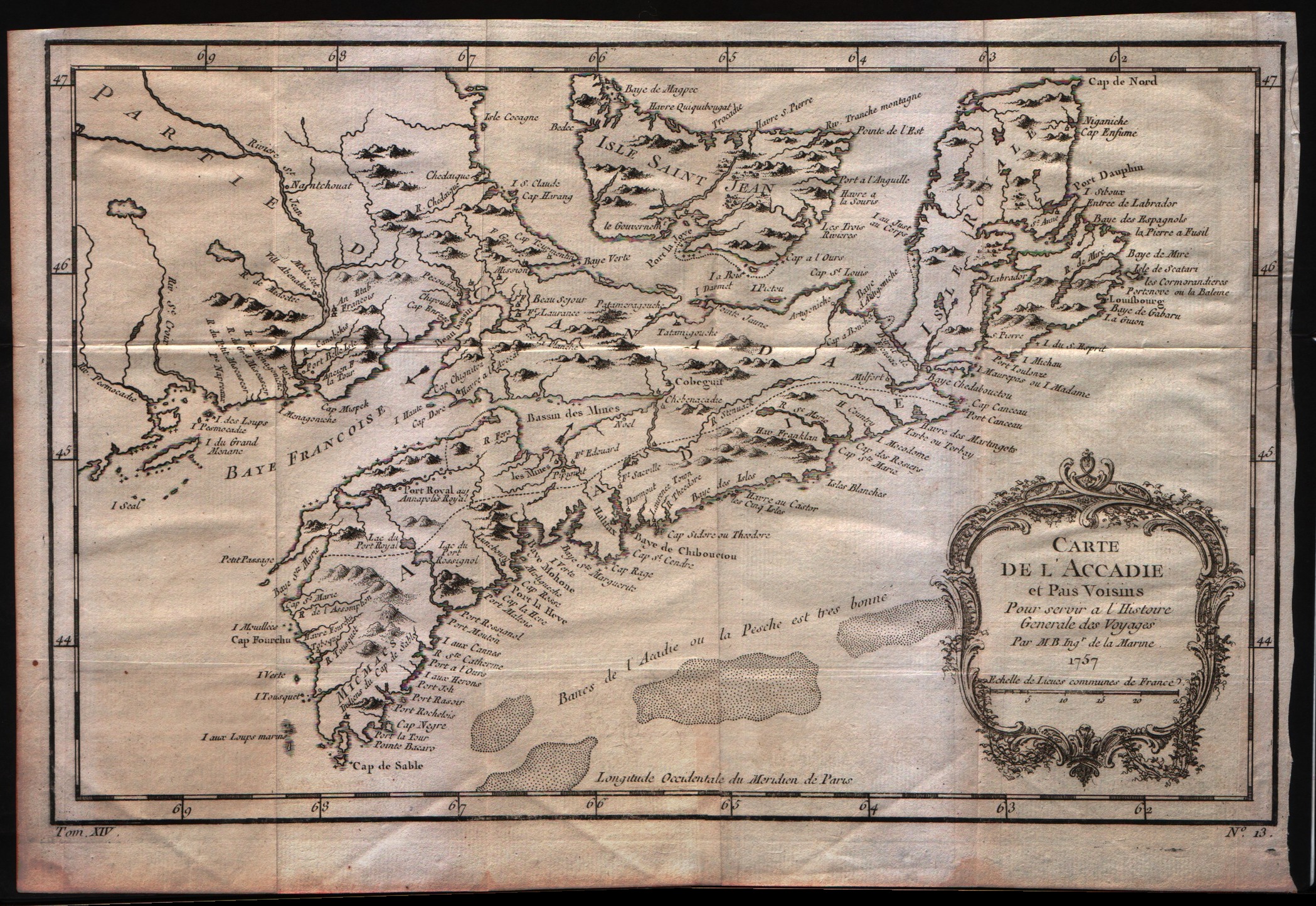
Carte de l'Acadie et pais voisins
Author
Bellin
Location shown in map
--
Edition date
1757
Edition place
Paris
Editor
--
Atlas
Historie General des Voyages -- Prevost
Price
200 Euro
State
[mint/excellent/VERY GOOD/good/fair/mediocre/poor]
Color
Black/white
Verso
Blank
Size
Plate: cm (31.8 x 20.3) inches (12.52 x 7.99) Paper: cm (34.3 x 24.1) inches (13.5 x 9.49)
Technique
Copper engraving
Note
No particular notes for this maps
Reference
--
Wiki
Here for more info
In stock
Available
Info
info@thetreasuremaps.com
Code
#0069
×
![Carte de l'Acadie et pais voisins by Bellin, --, 1757]()
Map title
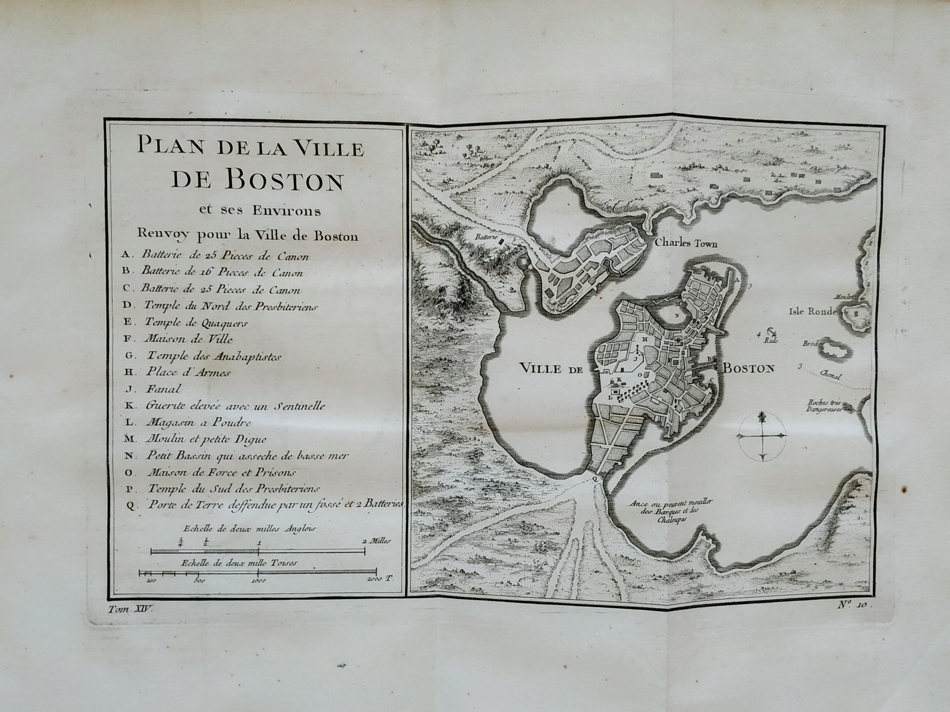
Plan de la ville de Boston
Author
Bellin
Location shown in map
Boston
Edition date
1757
Edition place
Paris
Editor
Prevost
Atlas
Historie General des Voyages -- Prevost
Price
300 Euro
State
[mint/EXCELLENT/very good/good/fair/mediocre/poor]
Color
Black/white
Verso
Blank
Size
Plate: cm (27 x 16) inches (10.63 x 6.3) Paper: cm (36 x 28) inches (14.17 x 11.02)
Technique
Copper engraving
Note
No particular notes for this maps
Reference
--
Wiki
Here for more info
In stock
Sold
Info
info@thetreasuremaps.com
Code
#0757
×
![Plan de la ville de Boston by Bellin, Boston, 1757]()

Map title
Plan de la Ville de Quebec
Author
Bellin
Location shown in map
Map of Quebec city
Edition date
1757
Edition place
Paris
Editor
--
Atlas
Historie General des Voyages -- Prevost
Price
Please ask: info@thetreasuremaps.com
State
[mint/EXCELLENT/very good/good/fair/mediocre/poor]
Color
Black/white
Verso
Blank
Size
Plate: cm (29.2 x 21.6) inches (11.5 x 8.5) Paper: cm (27.9 x 19.7) inches (10.98 x 7.76)
Technique
Copper engraving
Note
No particular notes for this maps
Reference
--
Wiki
Here for more info
In stock
Sold
Info
info@thetreasuremaps.com
Code
#0374
×
![Plan de la Ville de Quebec by Bellin, Map of Quebec city, 1757]()
Map title
Plan de Jedo
Author
Bellin
Location shown in map
Japan
Edition date
1757
Edition place
Paris
Editor
--
Atlas
Historie General des Voyages -- Prevost
Price
Please ask: info@thetreasuremaps.com
State
[mint/EXCELLENT/very good/good/fair/mediocre/poor]
Color
Black/white
Verso
Blank
Size
Plate: cm (26.7 x 25.4) inches (10.51 x 10) Paper: cm (24.1 x 24.1) inches (9.49 x 9.49)
Technique
Copper engraving
Note
Map of Tokyo
Reference
--
Wiki
Here for more info
In stock
Sold
Info
info@thetreasuremaps.com
Code
#0375
×
![Plan de Jedo by Bellin, Japan, 1757]()
Map title
Plan du Port et de la Ville de Nangasaki
Author
Bellin
Location shown in map
Japan
Edition date
1757
Edition place
Paris
Editor
--
Atlas
Historie General des Voyages -- Prevost
Price
Please ask: info@thetreasuremaps.com
State
[mint/EXCELLENT/very good/good/fair/mediocre/poor]
Color
Black/white
Verso
Blank
Size
Plate: cm (35.6 x 21.6) inches (14.02 x 8.5) Paper: cm (33 x 20.3) inches (12.99 x 7.99)
Technique
Copper engraving
Note
No particular notes for this maps
Reference
--
Wiki
Here for more info
In stock
Sold
Info
info@thetreasuremaps.com
Code
#0376
×
![Plan du Port et de la Ville de Nangasaki by Bellin, Japan, 1757]()
Map title
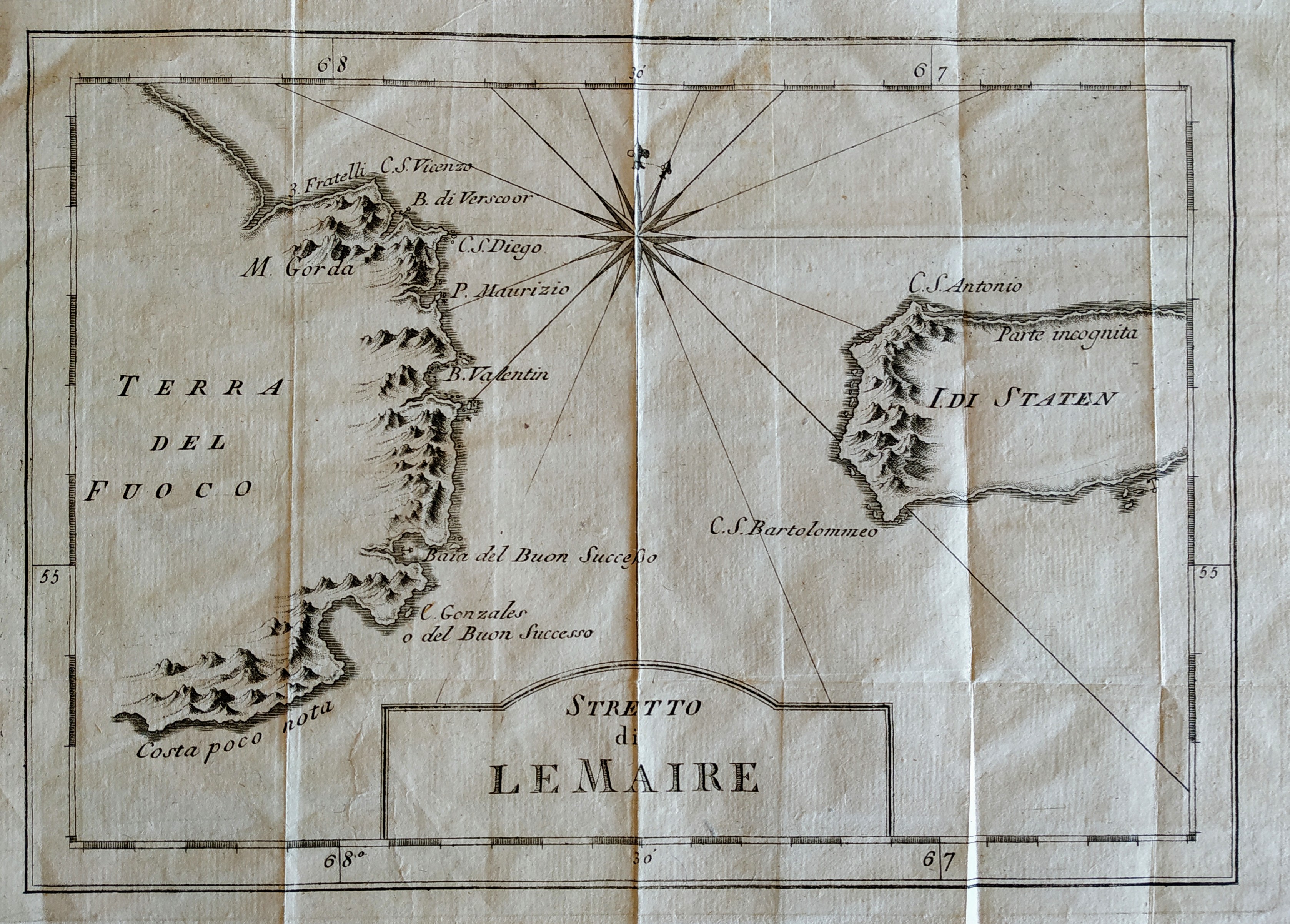
Stretto di Le Maire
Author
Bellin
Location shown in map
Magellan straits
Edition date
1757
Edition place
Paris
Editor
Prevost
Atlas
Historie General des Voyages -- Prevost
Price
75 Euro
State
[mint/EXCELLENT/very good/good/fair/mediocre/poor]
Color
Black/white
Verso
Blank
Size
Plate: cm (27 x 19) inches (10.63 x 7.48) Paper: cm (32 x 26) inches (12.6 x 10.24)
Technique
Copper engraving
Note
No particular notes for this maps
Reference
--
Wiki
Here for more info
In stock
Available
Info
info@thetreasuremaps.com
Code
#0669
×
![Stretto di Le Maire by Bellin, Magellan straits, 1757]()
Map title
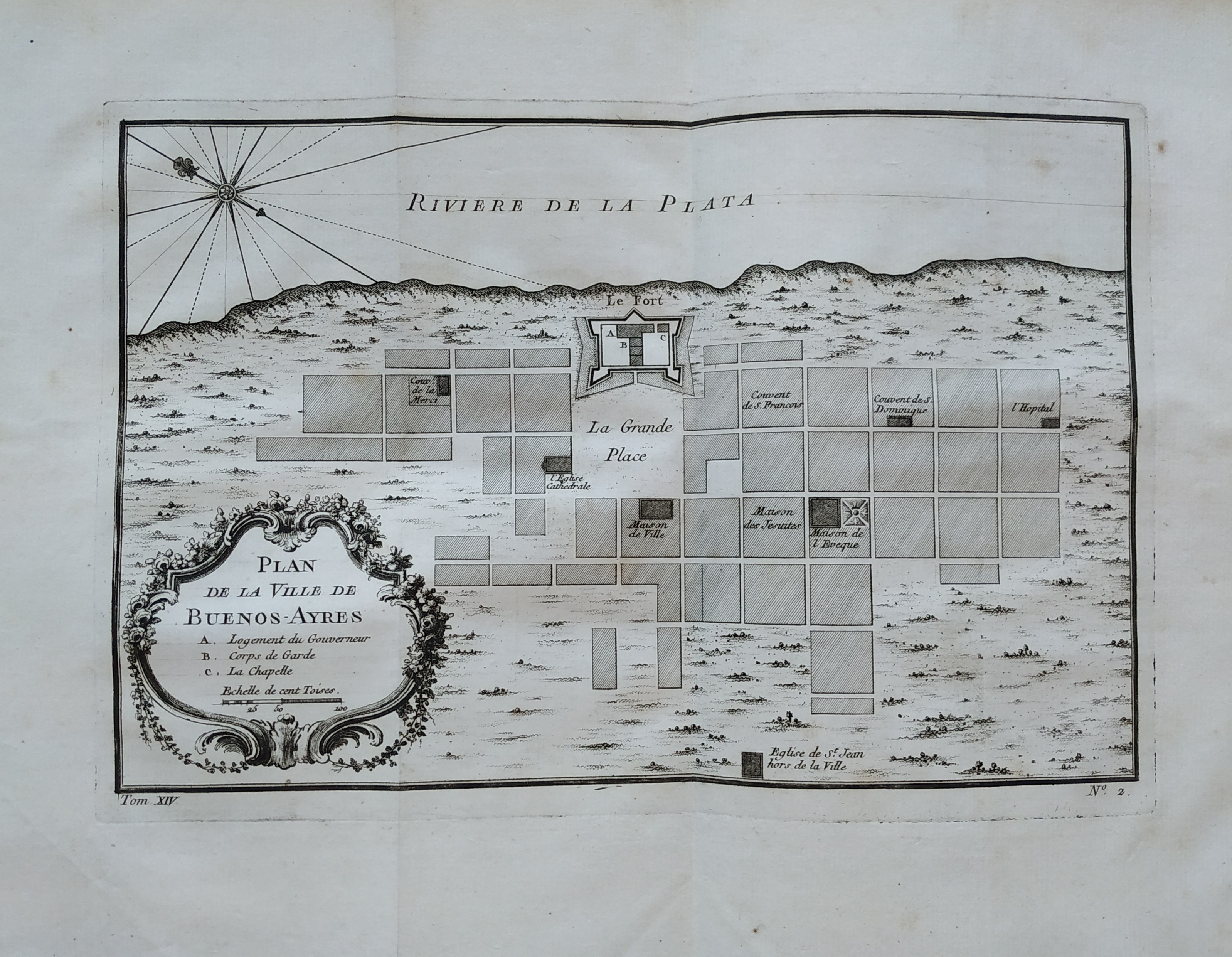
Plan de la ville de Buenos-Ayres
Author
Bellin
Location shown in map
Buenos Aires
Edition date
1757
Edition place
Paris
Editor
Prevost
Atlas
Historie General des Voyages -- Prevost
Price
150 Euro
State
[mint/EXCELLENT/very good/good/fair/mediocre/poor]
Color
Black/white
Verso
Blank
Size
Plate: cm (27 x 18) inches (10.63 x 7.09) Paper: cm (36 x 51) inches (14.17 x 20.08)
Technique
Copper engraving
Note
No particular notes for this maps
Reference
--
Wiki
Here for more info
In stock
Available
Info
info@thetreasuremaps.com
Code
#0758
×
![Plan de la ville de Buenos-Ayres by Bellin, Buenos Aires, 1757]()
Map title
Plan de la Ville de Peking
Author
Bellin
Location shown in map
Pekin
Edition date
1757
Edition place
Paris
Editor
--
Atlas
Historie General des Voyages -- Prevost
Price
Please ask: info@thetreasuremaps.com
State
[mint/EXCELLENT/very good/good/fair/mediocre/poor]
Color
Black/white
Verso
Blank
Size
Plate: cm (15.2 x 21.6) inches (5.98 x 8.5) Paper: cm (16.5 x 22.9) inches (6.5 x 9.02)
Technique
Copper engraving
Note
No particular notes for this maps
Reference
--
Wiki
Here for more info
In stock
Sold
Info
info@thetreasuremaps.com
Code
#0396
×
![Plan de la Ville de Peking by Bellin, Pekin, 1757]()
Map title
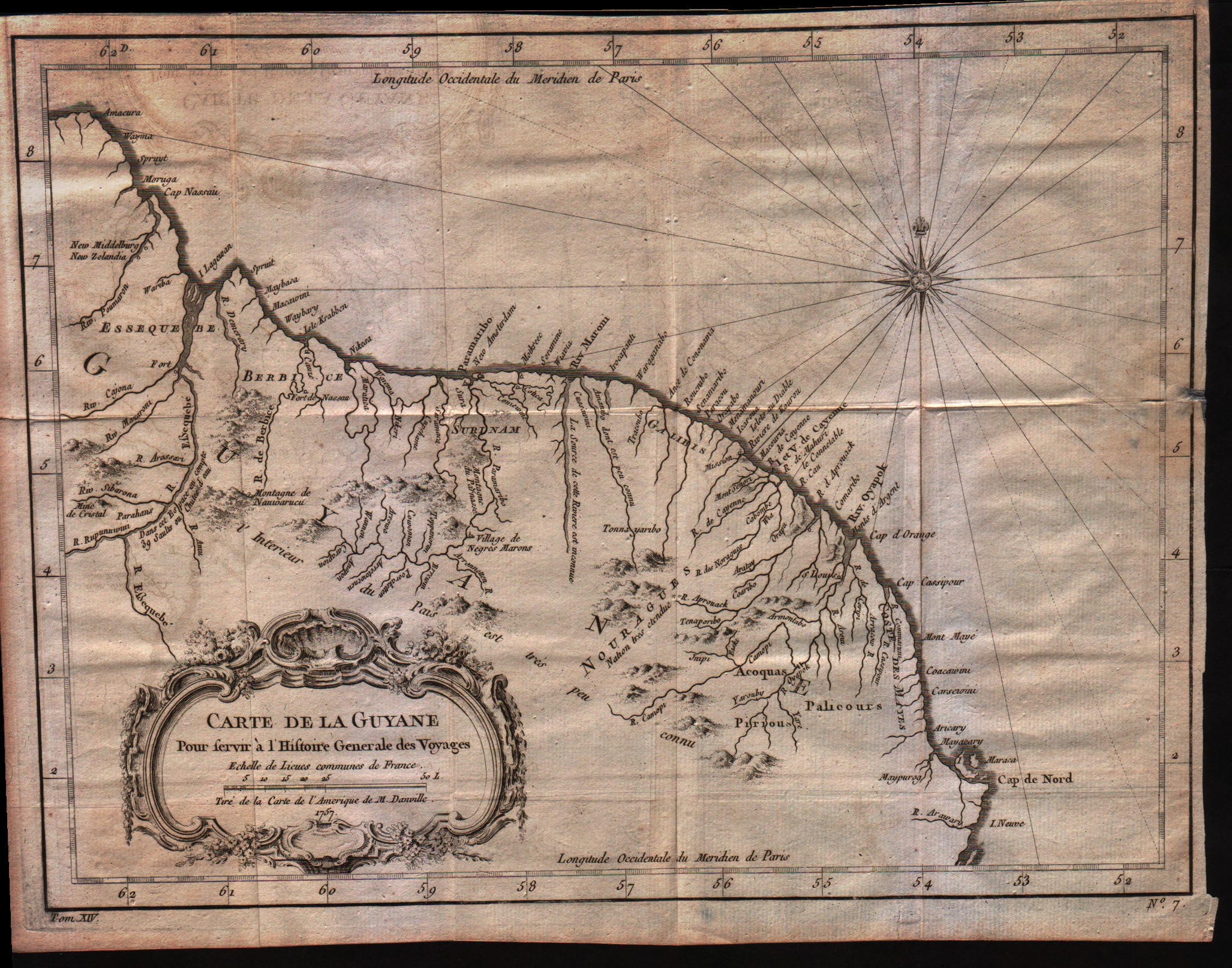
Carte de la Guyane
Author
Bellin
Location shown in map
Guyane
Edition date
1757
Edition place
Paris
Editor
--
Atlas
Historie General des Voyages -- Prevost
Price
Please ask: info@thetreasuremaps.com
State
[mint/EXCELLENT/very good/good/fair/mediocre/poor]
Color
Black/white
Verso
Blank
Size
Plate: cm (30.5 x 22.9) inches (12.01 x 9.02) Paper: cm (33 x 25.4) inches (12.99 x 10)
Technique
Copper engraving
Note
No particular notes for this maps
Reference
--
Wiki
Here for more info
In stock
Available
Info
info@thetreasuremaps.com
Code
#0021
×
![Carte de la Guyane by Bellin, Guyane, 1757]()
Map title
La ville de Cayenne
Author
Bellin
Location shown in map
Cayenna
Edition date
1757
Edition place
Paris
Editor
--
Atlas
Historie General des Voyages -- Prevost
Price
Please ask: info@thetreasuremaps.com
State
[mint/EXCELLENT/very good/good/fair/mediocre/poor]
Color
Black/white
Verso
Blank
Size
Plate: cm (29.2 x 24.1) inches (11.5 x 9.49) Paper: cm (26.7 x 22.9) inches (10.51 x 9.02)
Technique
Copper engraving
Note
No particular notes for this maps
Reference
--
Wiki
Here for more info
In stock
Sold
Info
info@thetreasuremaps.com
Code
#0022
×
![La ville de Cayenne by Bellin, Cayenna, 1757]()
Map title
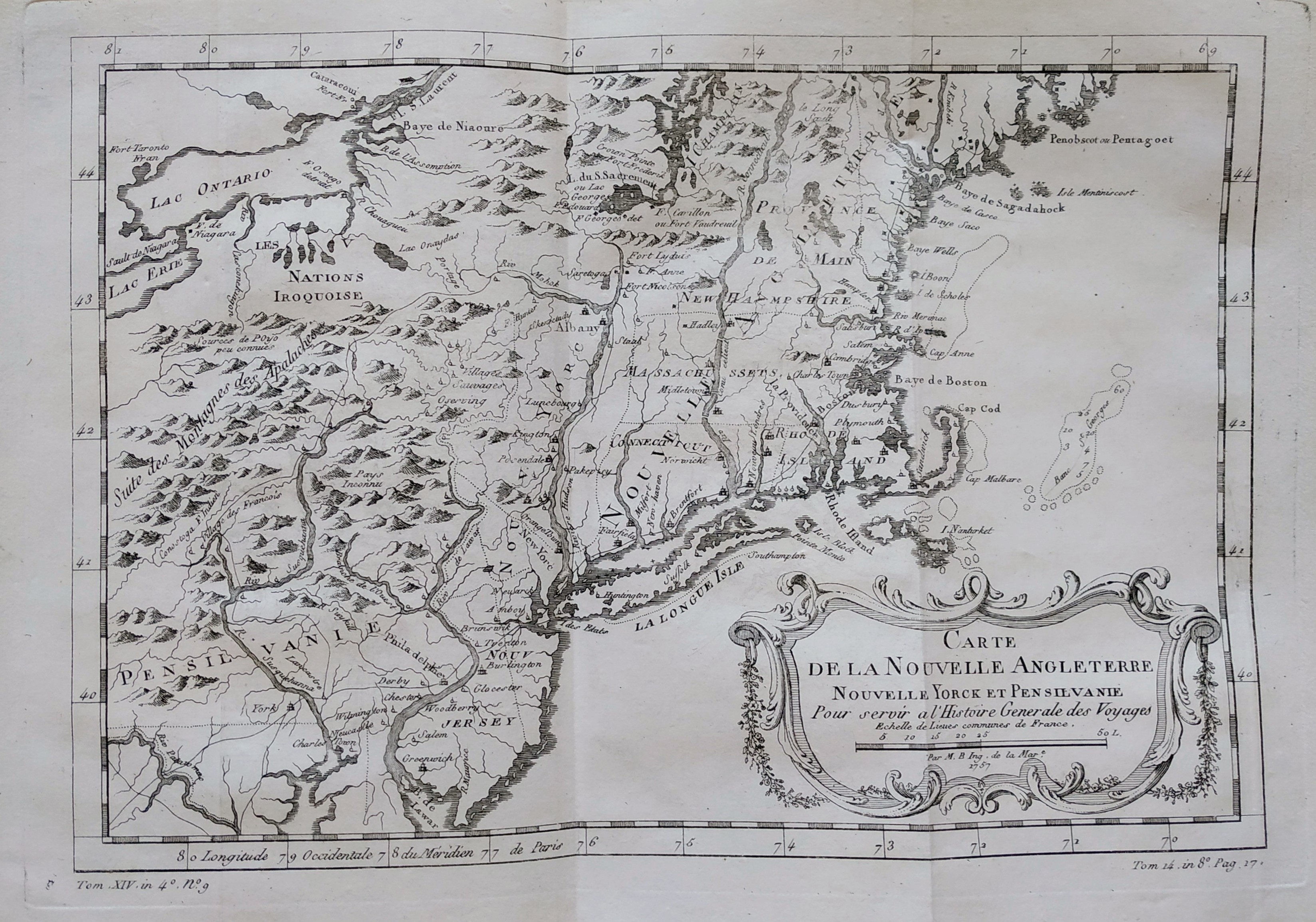
Carte de la nouvelle Angleterre
Author
Bellin
Location shown in map
New England
Edition date
1757
Edition place
Paris
Editor
Prevost
Atlas
Historie General des Voyages -- Prevost
Price
300 Euro
State
[mint/EXCELLENT/very good/good/fair/mediocre/poor]
Color
Black/white
Verso
Blank
Size
Plate: cm (29 x 20) inches (11.42 x 7.87) Paper: cm (37 x 25) inches (14.57 x 9.84)
Technique
Copper engraving
Note
The New England colonies are named except Vermont which is still the unnamed disputed territory between New Hampshire and New York. The area covered as a whole extends from Penobscot Bay south to Chesapeake Bay and west to Lake Erie. The map illustrates provinces, towns, forts, rivers, Native American lands and relief.
Reference
--
Wiki
Here for more info
In stock
Available
Info
info@thetreasuremaps.com
Code
#0762
×
![Carte de la nouvelle Angleterre by Bellin, New England, 1757]()
Map title
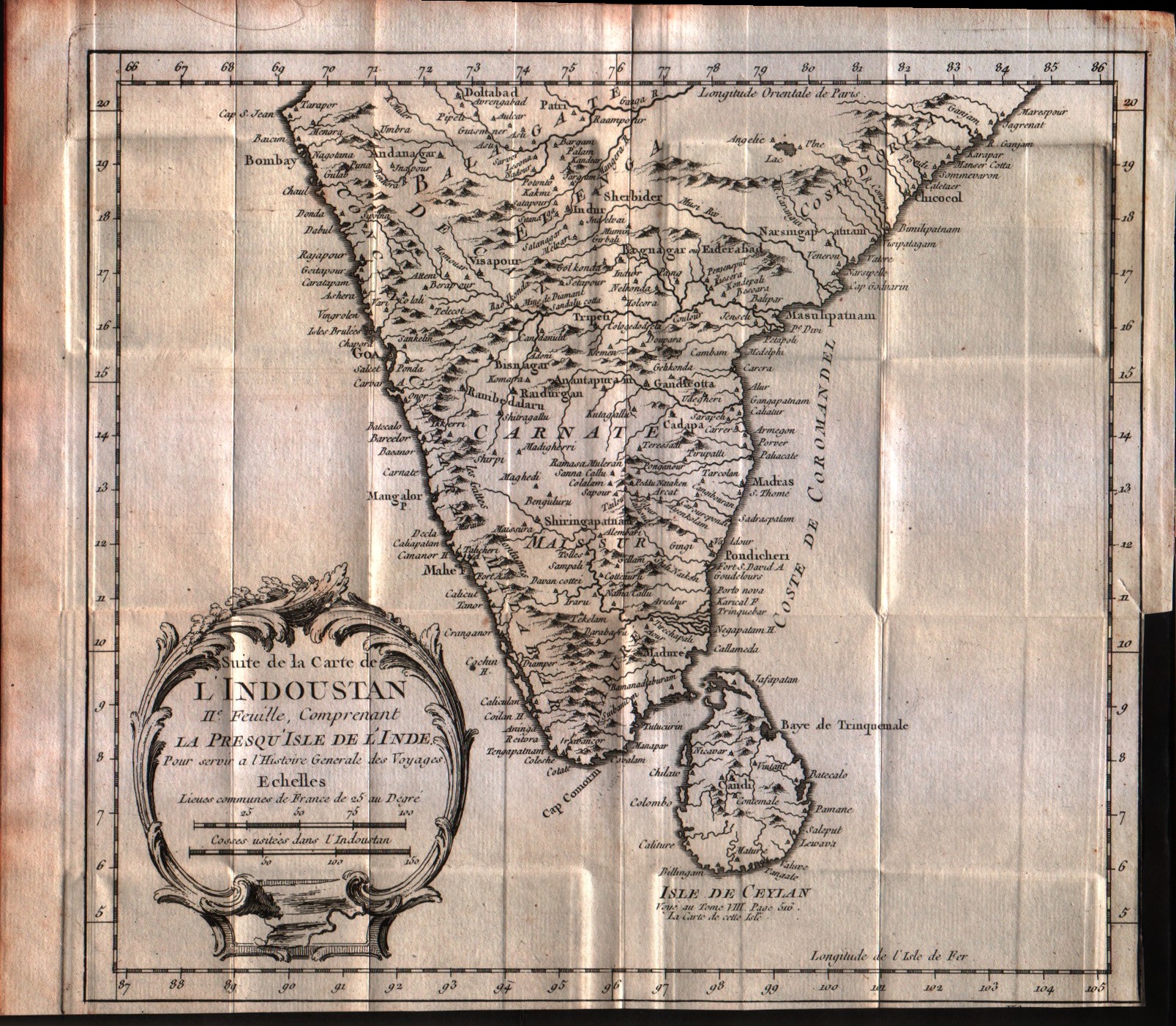
Suite de la carte de l'Indoustan, II feuille, comprendant la presqu'isle de l'Inde
Author
Bellin
Location shown in map
India
Edition date
1757
Edition place
Paris
Editor
--
Atlas
Historie General des Voyages -- Prevost
Price
125 Euro
State
[mint/EXCELLENT/very good/good/fair/mediocre/poor]
Color
Black/white
Verso
Blank
Size
Plate: cm (24.1 x 21.6) inches (9.49 x 8.5) Paper: cm (33 x 26.7) inches (12.99 x 10.51)
Technique
Copper engraving
Note
No particular notes for this maps
Reference
--
Wiki
Here for more info
In stock
Available
Info
info@thetreasuremaps.com
Code
#0547
×
![Suite de la carte de l'Indoustan, II feuille, comprendant la presqu'isle de l'Inde by Bellin, India, 1757]()
Map title
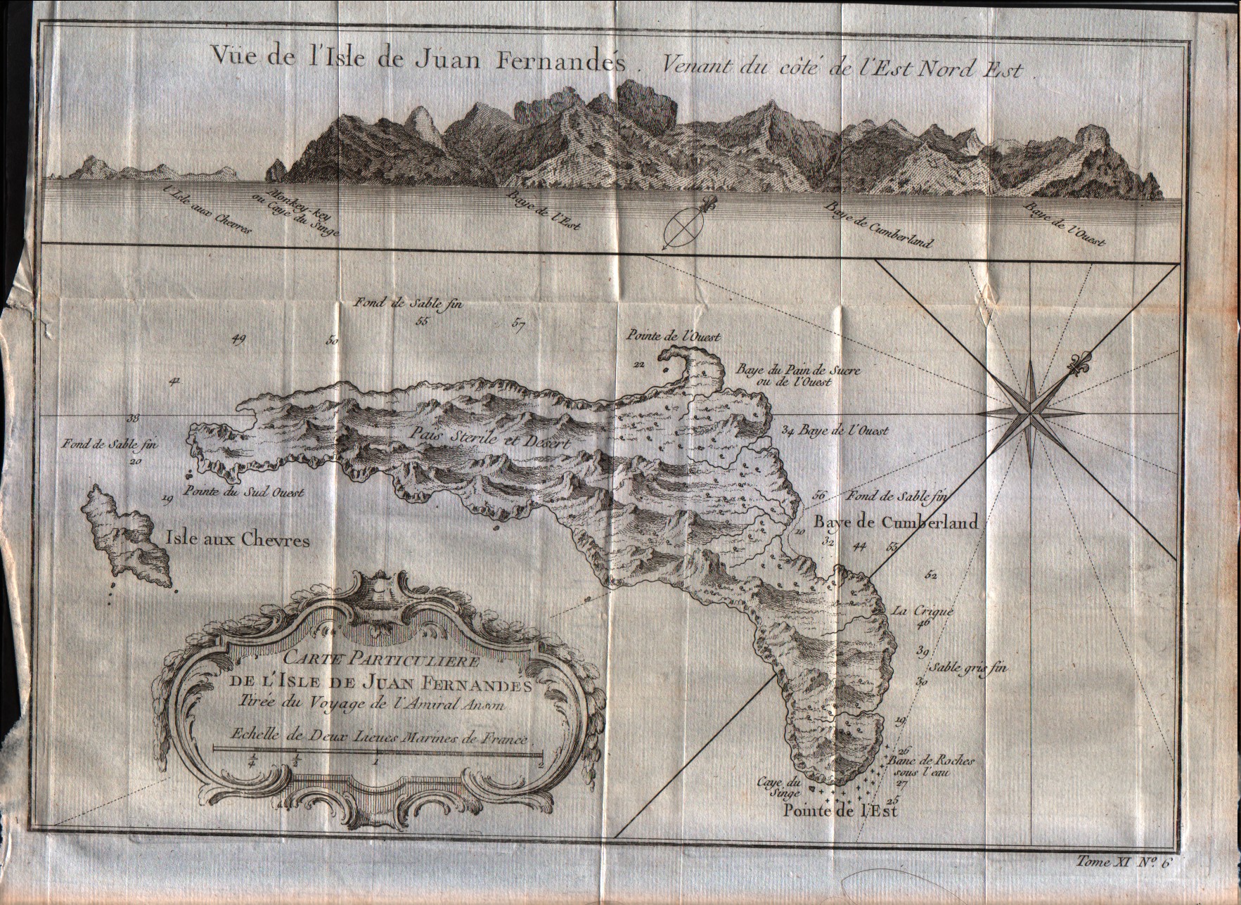
Carte particulier de l'isle de Juan Fernandes
Author
Bellin
Location shown in map
Juan Fernandez island
Edition date
1757
Edition place
Paris
Editor
--
Atlas
Historie General des Voyages -- Prevost
Price
50 Euro
State
[mint/EXCELLENT/very good/good/fair/mediocre/poor]
Color
Black/white
Verso
Blank
Size
Plate: cm (27.9 x 20.3) inches (10.98 x 7.99) Paper: cm (30.5 x 22.9) inches (12.01 x 9.02)
Technique
Copper engraving
Note
No particular notes for this maps
Reference
--
Wiki
Here for more info
In stock
Available
Info
info@thetreasuremaps.com
Code
#0039
×
![Carte particulier de l'isle de Juan Fernandes by Bellin, Juan Fernandez island, 1757]()
Map title
Carte reduite du detroit de Magellan dressee sur les jouraux des navigateurs
Author
Bellin
Location shown in map
Strait of Magellan
Edition date
1757
Edition place
Paris
Editor
--
Atlas
Historie General des Voyages -- Prevost
Price
Please ask: info@thetreasuremaps.com
State
[mint/EXCELLENT/very good/good/fair/mediocre/poor]
Color
Black/white
Verso
Blank
Size
Plate: cm (34.3 x 19) inches (13.5 x 7.48) Paper: cm (35.6 x 22.9) inches (14.02 x 9.02)
Technique
Copper engraving
Note
No particular notes for this maps
Reference
--
Wiki
Here for more info
In stock
Sold
Info
info@thetreasuremaps.com
Code
#0035
×
![Carte reduite du detroit de Magellan dressee sur les jouraux des navigateurs by Bellin, Strait of Magellan, 1757]()
Map title
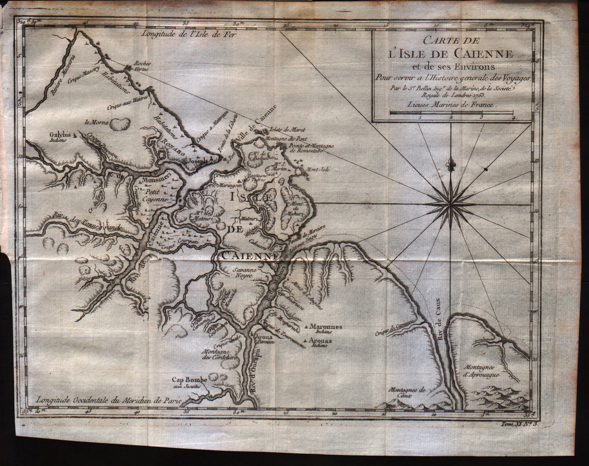
Carte de l'Isle de Caienne, et de ses Environs
Author
Bellin
Location shown in map
Cayenne
Edition date
1757
Edition place
Paris
Editor
--
Atlas
Historie General des Voyages -- Prevost
Price
Please ask: info@thetreasuremaps.com
State
[mint/EXCELLENT/very good/good/fair/mediocre/poor]
Color
Black/white
Verso
Blank
Size
Plate: cm (27.9 x 21.6) inches (10.98 x 8.5) Paper: cm (30.5 x 24.1) inches (12.01 x 9.49)
Technique
Copper engraving
Note
No particular notes for this maps
Reference
--
Wiki
Here for more info
In stock
Available
Info
info@thetreasuremaps.com
Code
#0034
×
![Carte de l'Isle de Caienne, et de ses Environs by Bellin, Cayenne, 1757]()
Map title
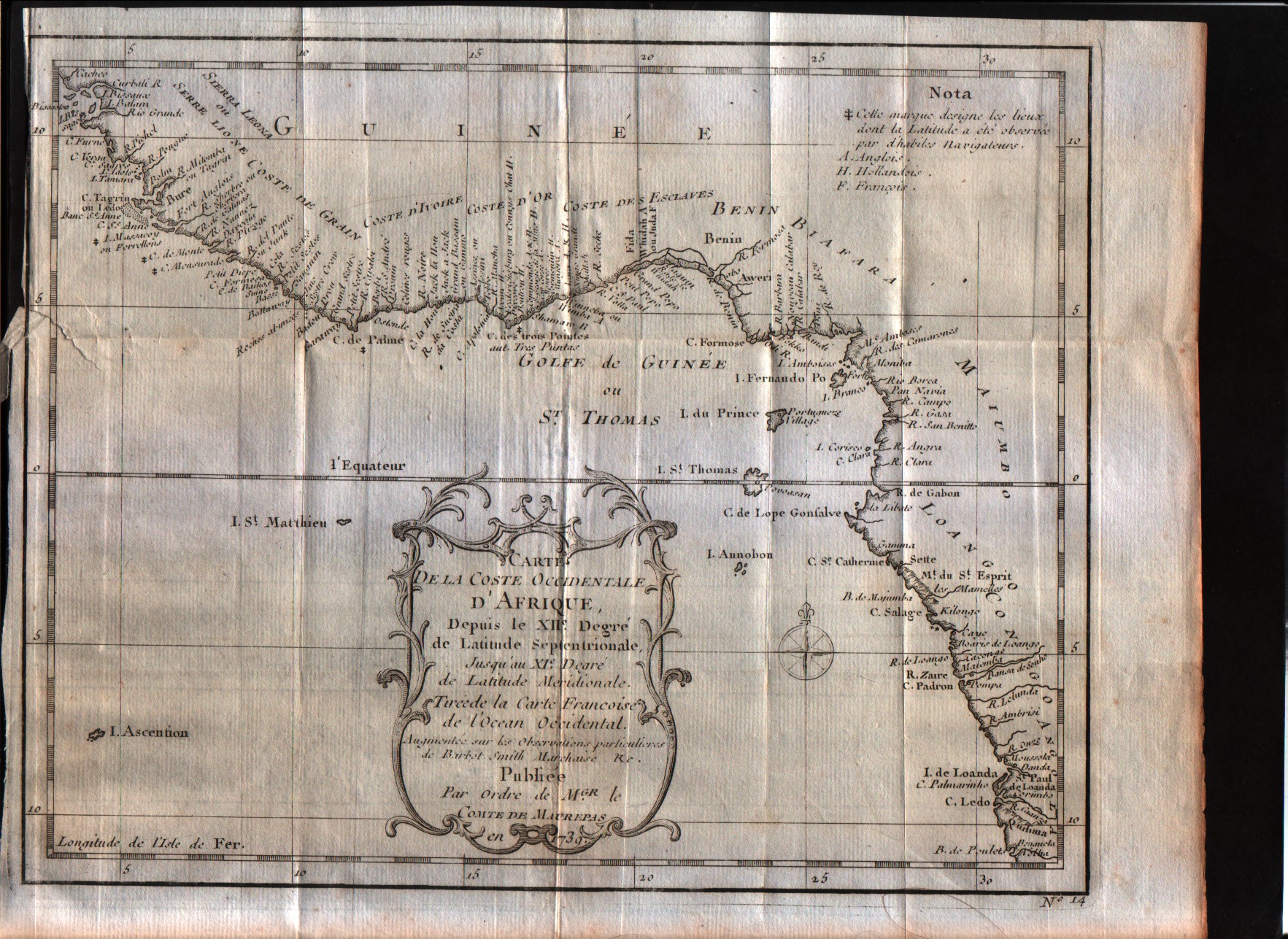
Carte de la coste Occidentale d'Afrique Depuis le XII degree de latitude Septentrionale
Author
Bellin
Location shown in map
West Africa
Edition date
1757
Edition place
Paris
Editor
--
Atlas
--
Price
Please ask: info@thetreasuremaps.com
State
[mint/excellent/VERY GOOD/good/fair/mediocre/poor]
Color
Black/white
Verso
Blank
Size
Plate: cm (24.1 x 19) inches (9.49 x 7.48) Paper: cm (27.9 x 22.9) inches (10.98 x 9.02)
Technique
Copper engraving
Note
No particular notes for this maps
Reference
--
Wiki
Here for more info
In stock
Available
Info
info@thetreasuremaps.com
Code
#0550
×
![Carte de la coste Occidentale d'Afrique Depuis le XII degree de latitude Septentrionale by Bellin, West Africa, 1757]()
Map title
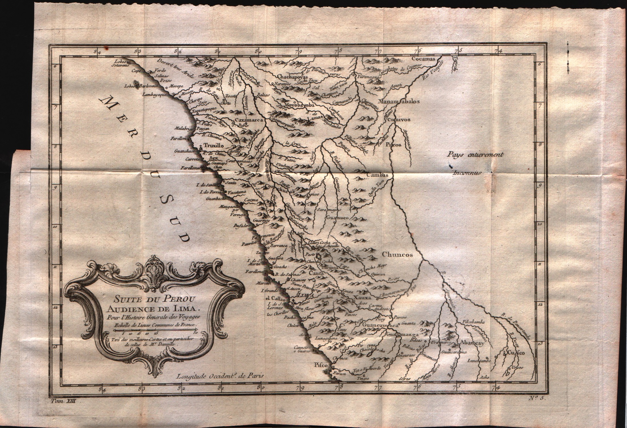
Suit du Perou audience de Lima
Author
Bellin
Location shown in map
Peru
Edition date
1757
Edition place
Paris
Editor
--
Atlas
Historie General des Voyages -- Prevost
Price
Please ask: info@thetreasuremaps.com
State
[mint/EXCELLENT/very good/good/fair/mediocre/poor]
Color
Black/white
Verso
Blank
Size
Plate: cm (30.5 x 21.6) inches (12.01 x 8.5) Paper: cm (38.1 x 26.7) inches (15 x 10.51)
Technique
Copper engraving
Note
No particular notes for this maps
Reference
--
Wiki
Here for more info
In stock
Available
Info
info@thetreasuremaps.com
Code
#0033
×
![Suit du Perou audience de Lima by Bellin, Peru, 1757]()
Map title
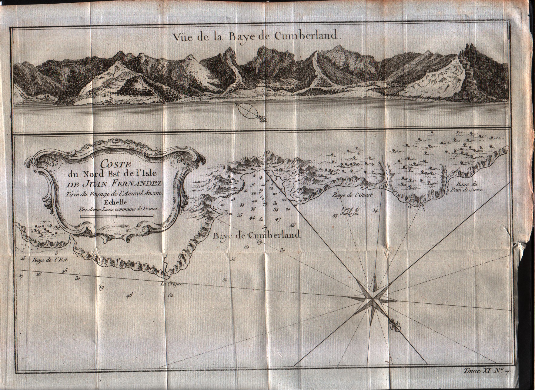
Cote du Nord Est de l'isle de Juan Fernandes
Author
Bellin
Location shown in map
Juan Fernandez island
Edition date
1757
Edition place
Paris
Editor
--
Atlas
Historie General des Voyages -- Prevost
Price
50 Euro
State
[mint/EXCELLENT/very good/good/fair/mediocre/poor]
Color
Black/white
Verso
Blank
Size
Plate: cm (27.9 x 20.3) inches (10.98 x 7.99) Paper: cm (30.5 x 22.9) inches (12.01 x 9.02)
Technique
Copper engraving
Note
No particular notes for this maps
Reference
--
Wiki
Here for more info
In stock
Available
Info
info@thetreasuremaps.com
Code
#0038
×
![Cote du Nord Est de l'isle de Juan Fernandes by Bellin, Juan Fernandez island, 1757]()