News
Map title
Carta Geographica, la quale rappresenta lo Stato della Republica di Genova
Author
Homann
Location shown in map
Liguria
Edition date
1743
Edition place
Nuremberg
Editor
Atlas
Price
900 Euro
State
[mint/EXCELLENT/very good/good/fair/mediocre/poor]
Color
Old colors
Verso
Blank
Size
Plate: cm (56 x 50) inches (22.05 x 19.69) Paper: cm (63 x 52) inches (24.8 x 20.47)
Technique
Copper engraving
Note
Reference
Wiki
Here for more info
In stock
Available
Info
info@thetreasuremaps.com
Code
#1198
×
![Carta Geographica, la quale rappresenta lo Stato della Republica di Genova by Homann, Liguria, 1743]()
Map title
Sinus Gangeticus Vulgo Golfo De Bengala Nova descriptio
Author
Jansson
Location shown in map
India
Edition date
Circa 1670
Edition place
Amsterdam
Editor
Schenk
Atlas
Novus Atlas
Price
450 Euro
State
[mint/EXCELLENT/very good/good/fair/mediocre/poor] repaired
Color
Old colors
Verso
Blank
Size
Plate: cm (54 x 50) inches (21.26 x 19.69) Paper: cm (54 x 49) inches (21.26 x 19.29)
Technique
Copper engraving
Note
Reference
Wiki
Here for more info
In stock
Available
Info
info@thetreasuremaps.com
Code
#1200
×
![Sinus Gangeticus Vulgo Golfo De Bengala Nova descriptio by Jansson, India, Circa 1670]()
Map title
Carte des isles du Japon
Author
Tavernier
Location shown in map
Japan
Edition date
Circa 1679
Edition place
Paris
Editor
Atlas
Price
400 Euro
State
[mint/EXCELLENT/very good/good/fair/mediocre/poor] repaired
Color
Black/white
Verso
Blank
Size
Plate: cm (33 x 21) inches (12.99 x 8.27) Paper: cm (35 x 24) inches (13.78 x 9.45)
Technique
Copper engraving
Note
Reference
Wiki
Here for more info
In stock
Available
Info
info@thetreasuremaps.com
Code
#1201
×
![Carte des isles du Japon by Tavernier, Japan, Circa 1679]()
Map title
Situs provinciarum imperii sinici
Author
Martini
Location shown in map
China
Edition date
1654
Edition place
Cologne
Editor
Atlas
De bello Tartarico historia
Price
400 Euro
State
[mint/EXCELLENT/very good/good/fair/mediocre/poor]
Color
Black/white
Verso
Blank
Size
Plate: cm (16 x 13) inches (6.3 x 5.12) Paper: cm (19 x 18) inches (7.48 x 7.09)
Technique
Copper engraving
Note
Reference
--
Wiki
Here for more info
In stock
Available
Info
info@thetreasuremaps.com
Code
#1202
×
![Situs provinciarum imperii sinici by Martini, China, 1654]()
Map title
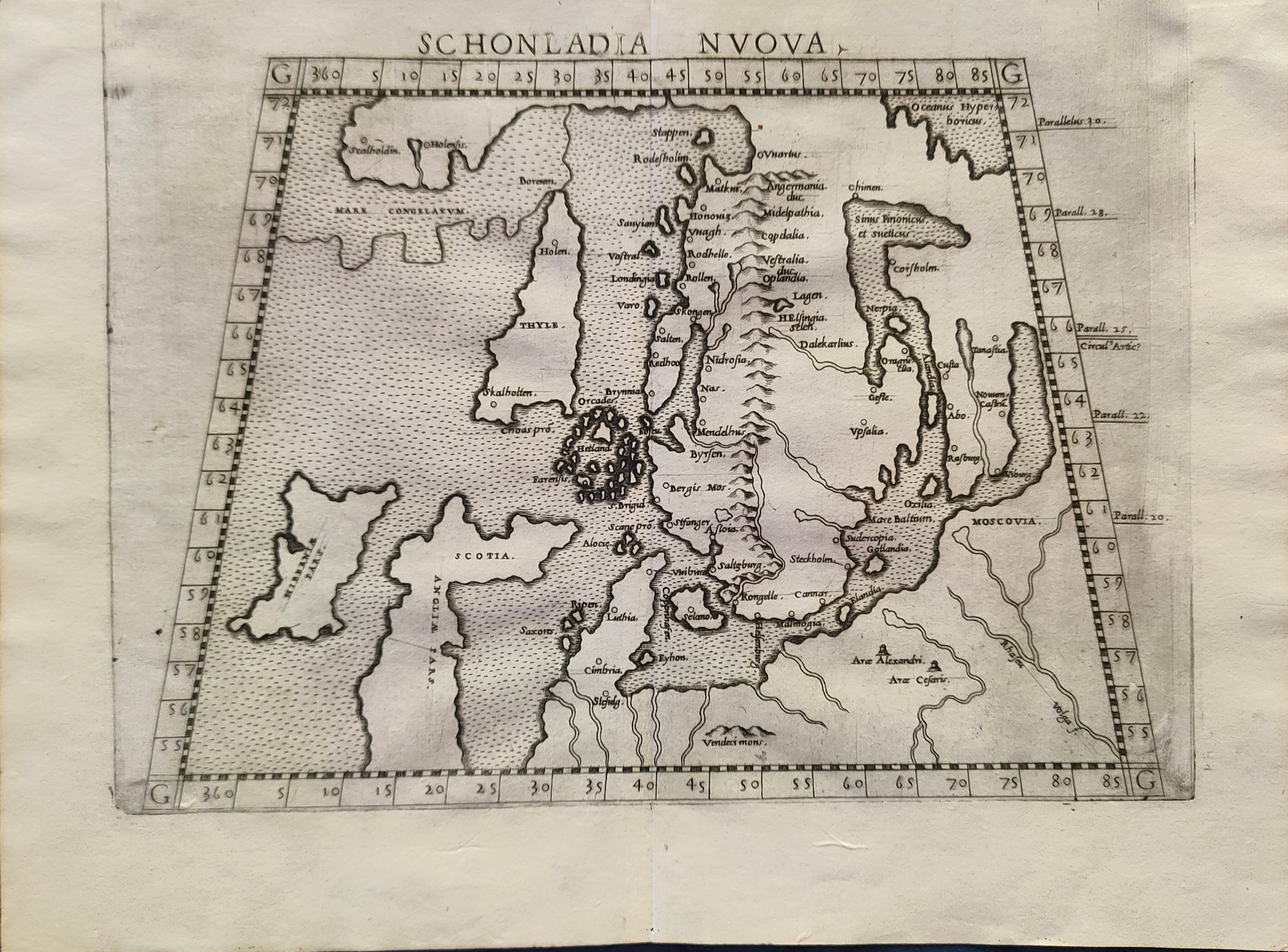
Schonlandia Nuova
Author
Ruscelli
Location shown in map
Scandinavia
Edition date
1562
Edition place
Venice
Editor
Vincenzo Valgrisi
Atlas
La Geographia di Claudio Tolomeo
Price
600 Euro
State
[mint/EXCELLENT/very good/good/fair/mediocre/poor]
Color
Black/white
Verso
Latin text pag.25
Size
Plate: cm (26 x 20) inches (10.24 x 7.87) Paper: cm (31 x 24) inches (12.2 x 9.45)
Technique
Copper engraving
Note
Reference
--
Wiki
Here for more info
In stock
Available
Info
info@thetreasuremaps.com
Code
#1204
×
![Schonlandia Nuova by Ruscelli, Scandinavia, 1562]()
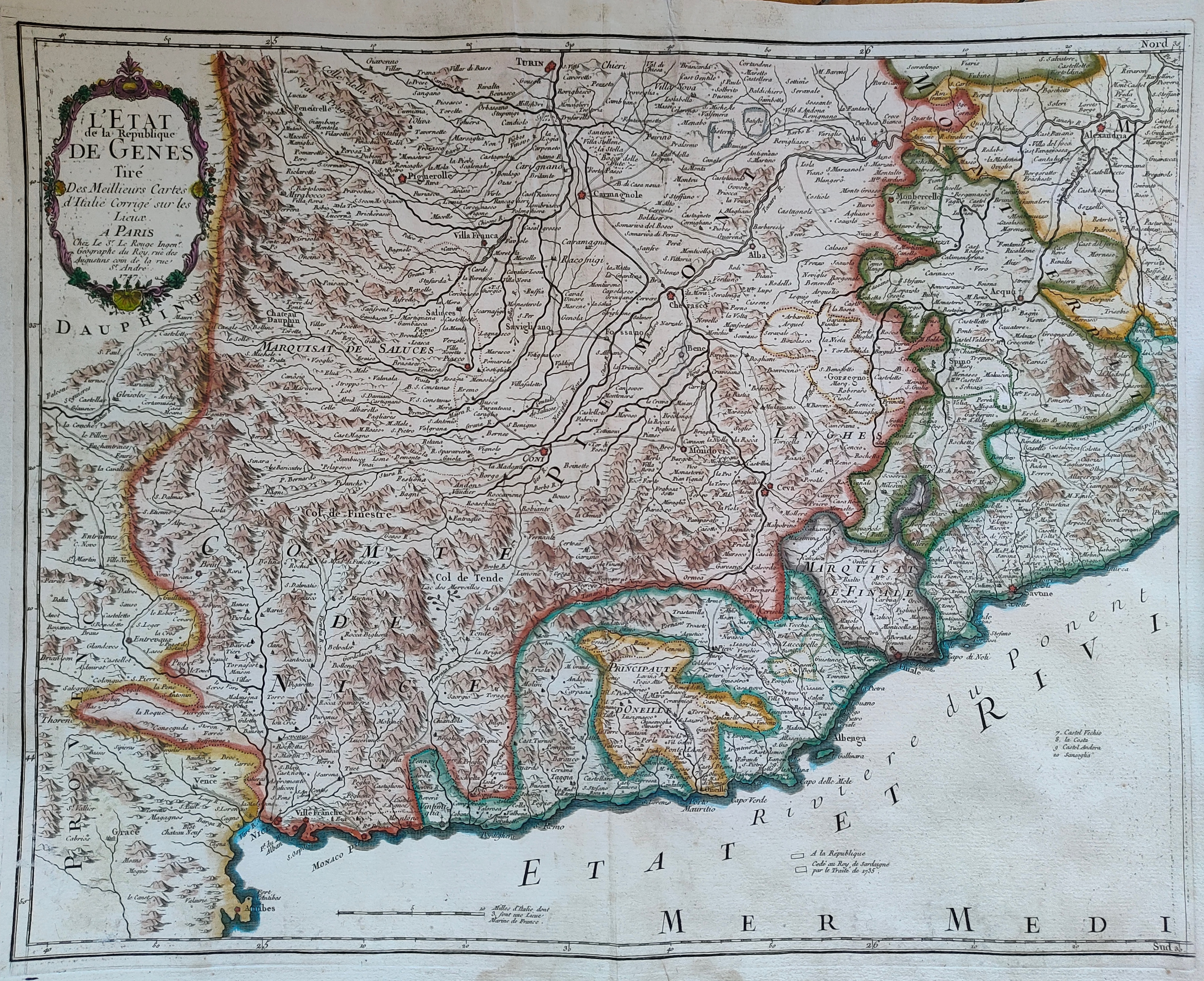
Map title
L'Etat de la republique de Genes
Author
Le Rouge
Location shown in map
Liguria
Edition date
1747
Edition place
Paris
Editor
Atlas
Price
300 Euro
State
[mint/EXCELLENT/very good/good/fair/mediocre/poor]
Color
Old colors
Verso
Blank
Size
Plate: cm (55 x 44) inches (21.65 x 17.32) Paper: cm (60 x 49) inches (23.62 x 19.29)
Technique
Copper engraving
Note
Reference
Wiki
Here for more info
In stock
Available
Info
info@thetreasuremaps.com
Code
#1203
×
![L'Etat de la republique de Genes by Le Rouge, Liguria, 1747]()
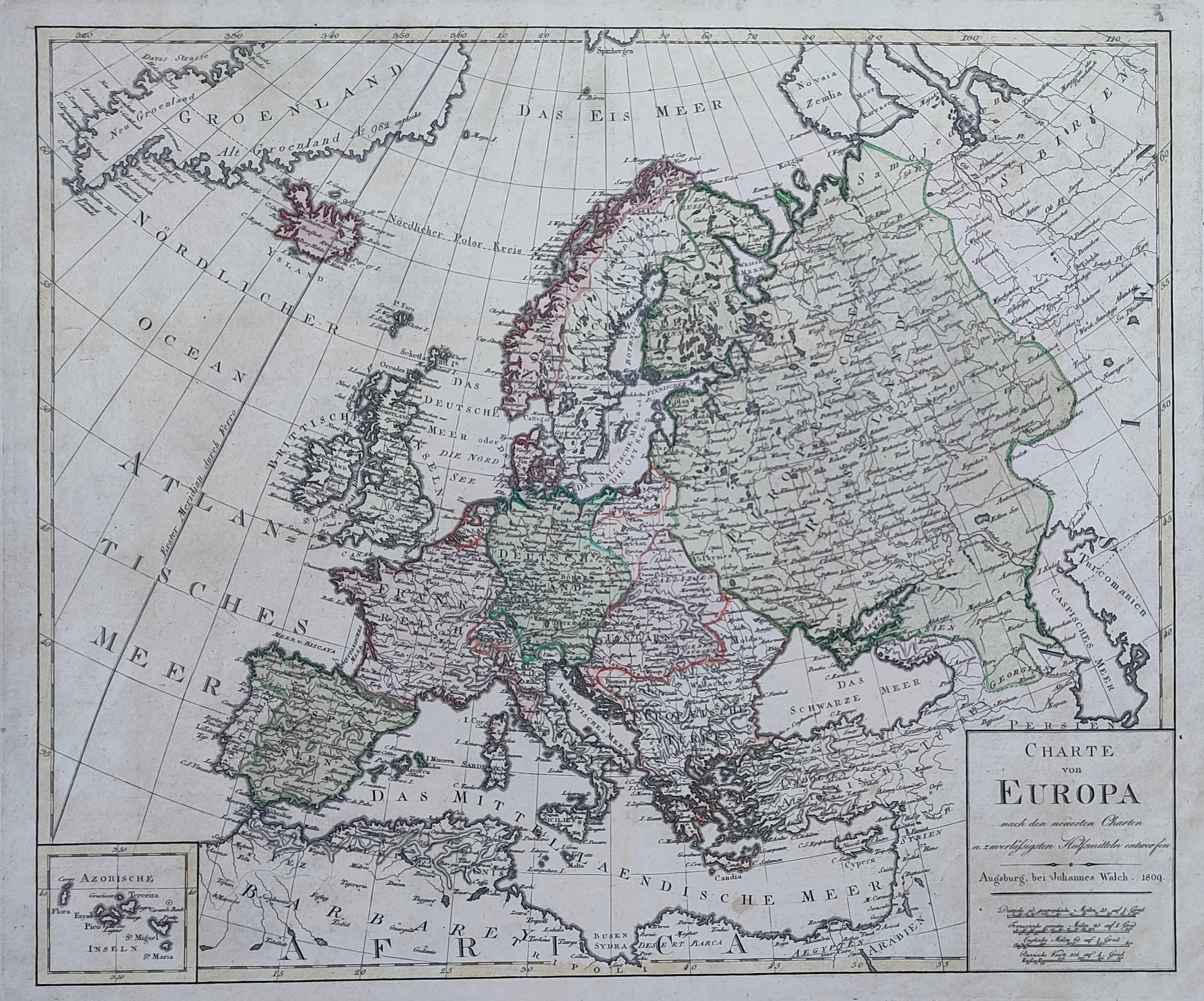
Map title
Charte von Europa
Author
Walch
Location shown in map
All Europe
Edition date
1809
Edition place
Augsburg
Editor
Atlas
Price
175 Euro
State
[mint/EXCELLENT/very good/good/fair/mediocre/poor]
Color
Old colors
Verso
Blank
Size
Plate: cm (56 x 47) inches (22.05 x 18.5) Paper: cm (71 x 59) inches (27.95 x 23.23)
Technique
Copper engraving
Note
Reference
Wiki
Here for more info
In stock
Available
Info
info@thetreasuremaps.com
Code
#1236
×
![Charte von Europa by Walch, All Europe, 1809]()
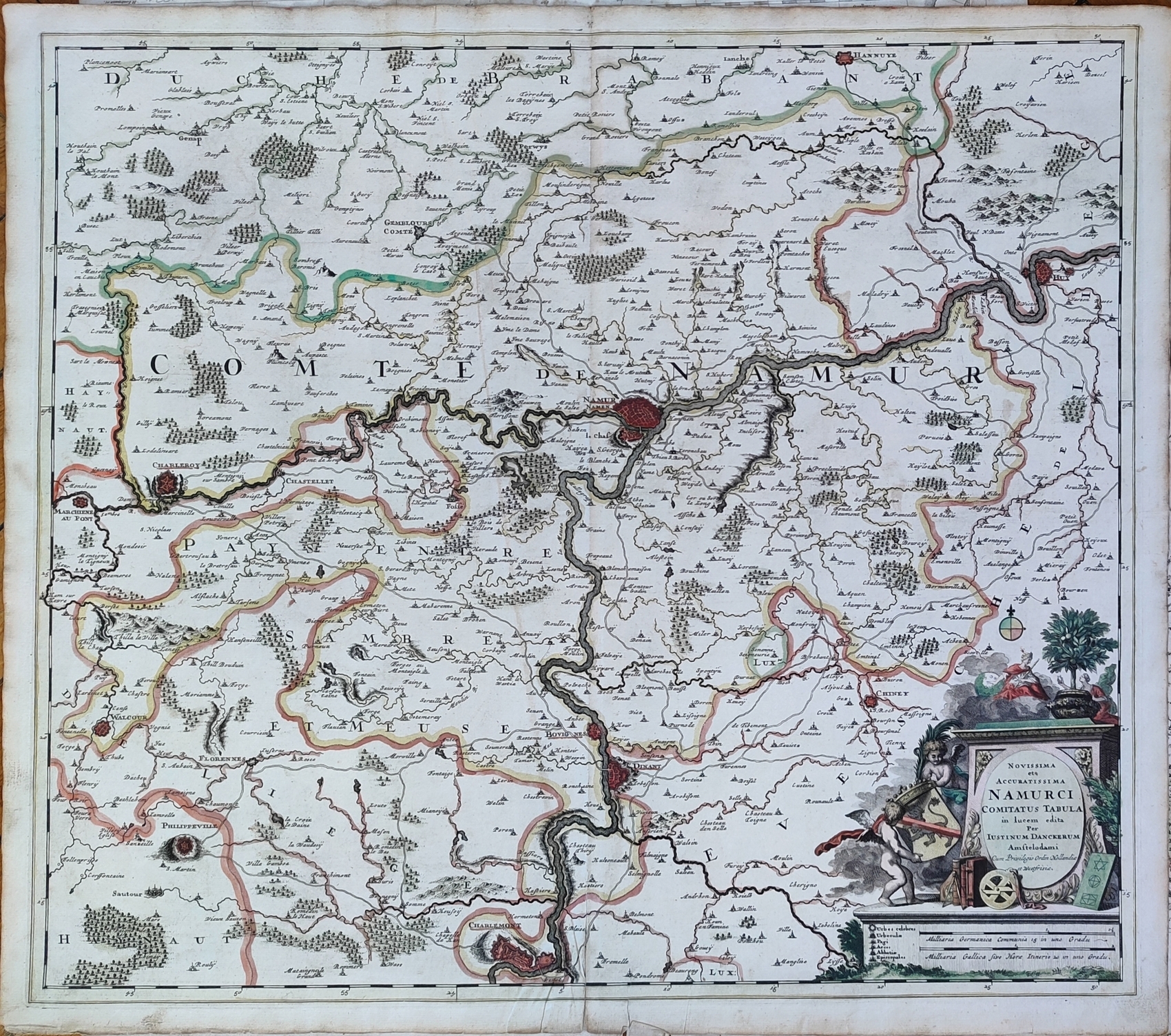
Map title
Novissima et accuratissima Namurci Comitatus tabula
Author
Danckerts
Location shown in map
Belgium
Edition date
Circa 1690
Edition place
Editor
Atlas
Price
150 Euro
State
[mint/EXCELLENT/very good/good/fair/mediocre/poor]
Color
Old colors
Verso
Blank
Size
Plate: cm (58 x 52) inches (22.83 x 20.47) Paper: cm (61 x 54) inches (24.02 x 21.26)
Technique
Copper engraving
Note
Reference
Wiki
Here for more info
In stock
Available
Info
info@thetreasuremaps.com
Code
#1237
×
![Novissima et accuratissima Namurci Comitatus tabula by Danckerts, Belgium, Circa 1690]()
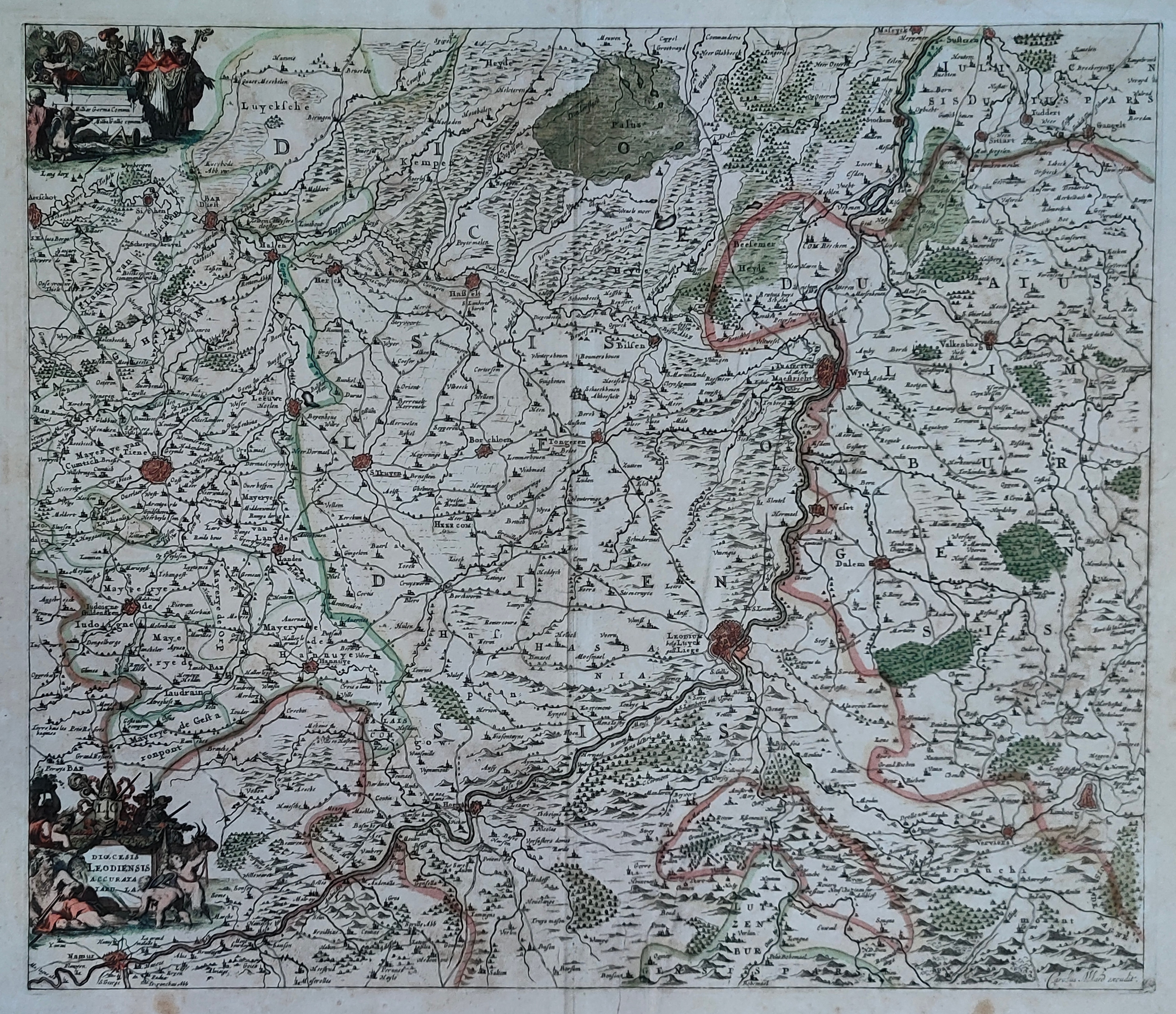
Map title
Dioecesis Leodiensis Accurata Tabula
Author
Schenk
Location shown in map
Belgium
Edition date
Circa 1690
Edition place
Editor
Atlas
Price
150 Euro
State
[mint/EXCELLENT/very good/good/fair/mediocre/poor]
Color
Old colors
Verso
Blank
Size
Plate: cm (54 x 45) inches (21.26 x 17.72) Paper: cm (60 x 53) inches (23.62 x 20.87)
Technique
Copper engraving
Note
Reference
Wiki
Here for more info
In stock
Available
Info
info@thetreasuremaps.com
Code
#1238
×
![Dioecesis Leodiensis Accurata Tabula by Schenk, Belgium, Circa 1690]()
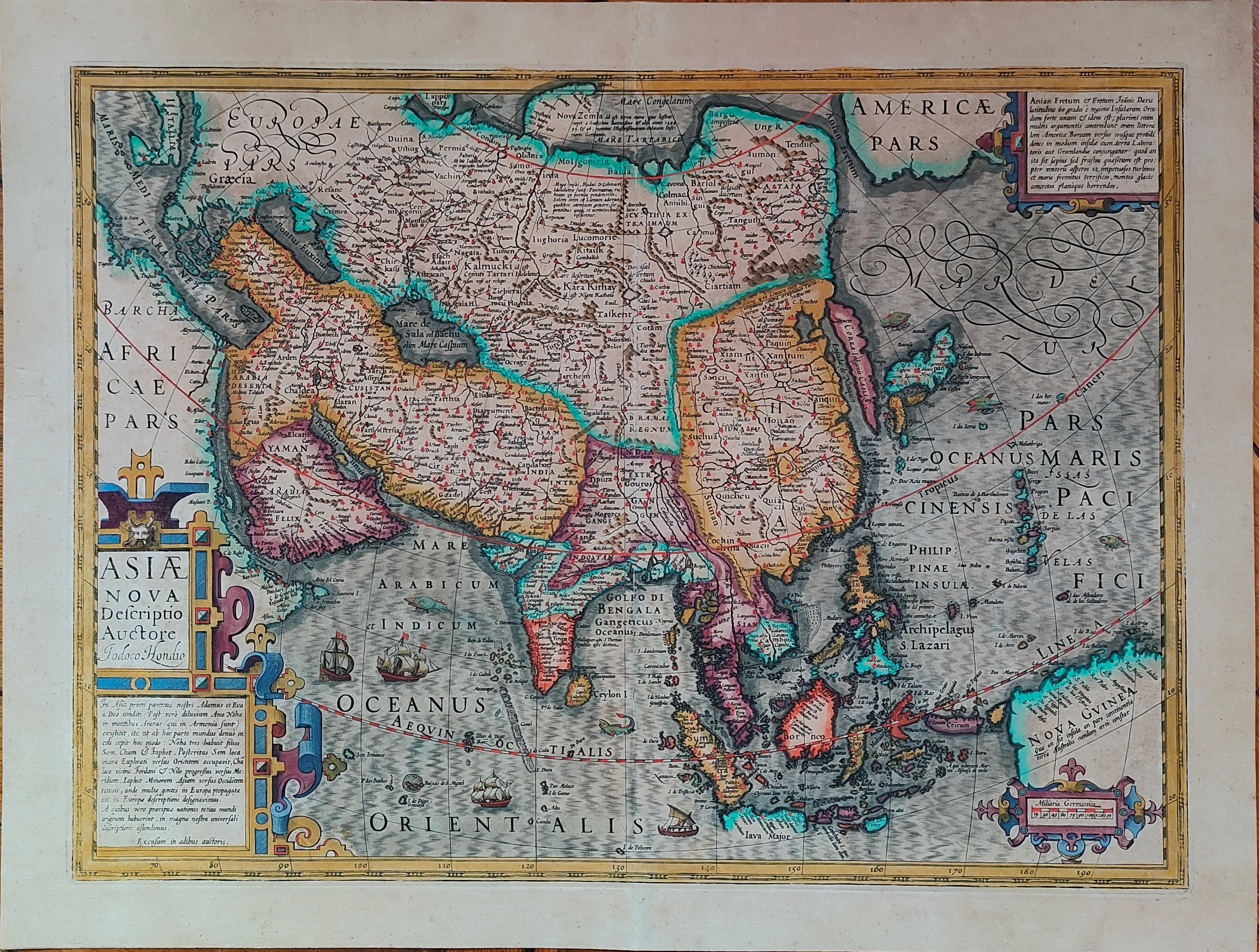
Map title
Asiae nova descriptio
Author
Hondius
Location shown in map
Asia
Edition date
Circa 1606
Edition place
Amsterdam
Editor
Hondius
Atlas
Price
1000 Euro
State
[mint/EXCELLENT/very good/good/fair/mediocre/poor]
Color
Old colors
Verso
Size
Plate: cm (50 x 37) inches (19.69 x 14.57) Paper: cm (57 x 47) inches (22.44 x 18.5)
Technique
Copper engraving
Note
Reference
Wiki
Here for more info
In stock
Available
Info
info@thetreasuremaps.com
Code
#1193
×
![Asiae nova descriptio by Hondius, Asia, Circa 1606]()

Map title
Asia vetus
Author
Sanson
Location shown in map
Asia
Edition date
1694
Edition place
Padua
Editor
Atlas
Price
350 Euro
State
[mint/excellent/very good/good/FAIR/mediocre/poor]
Color
Old colors
Verso
Size
Plate: cm (56 x 41) inches (22.05 x 16.14) Paper: cm (62 x 52) inches (24.41 x 20.47)
Technique
Copper engraving
Note
Reference
Wiki
Here for more info
In stock
Available
Info
info@thetreasuremaps.com
Code
#1194
×
![Asia vetus by Sanson, Asia, 1694]()
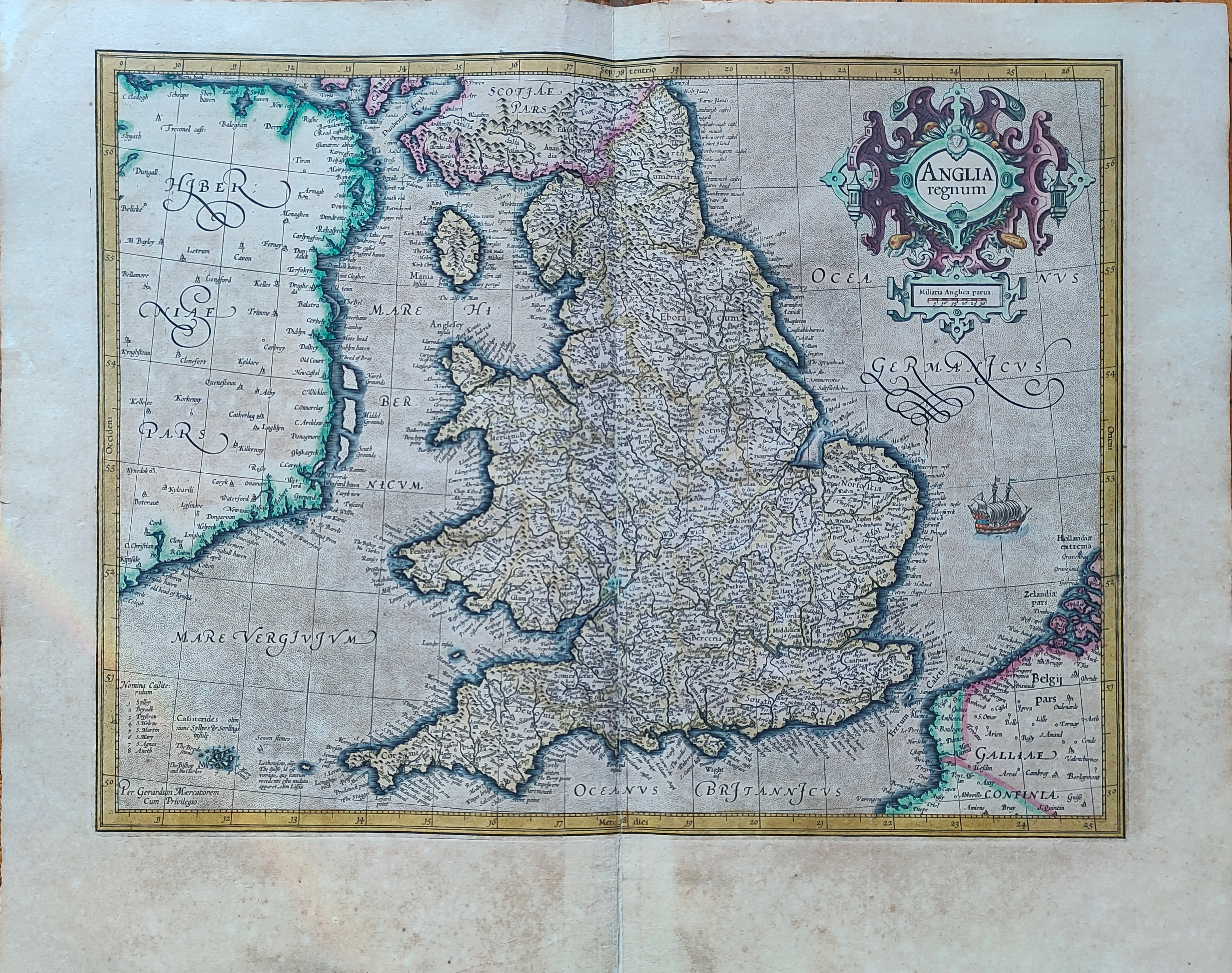
Map title
Anglia regnum
Author
Mercator
Location shown in map
England
Edition date
Circa 1623
Edition place
Amsterdam
Editor
Houndius
Atlas
Mercator-Hondius Atlas.
Price
400 Euro
State
[mint/EXCELLENT/very good/good/fair/mediocre/poor]
Color
Old colors
Verso
Franch text 117
Size
Plate: cm (46 x 36) inches (18.11 x 14.17) Paper: cm (56 x 44) inches (22.05 x 17.32)
Technique
Copper engraving
Note
Reference
Wiki
Here for more info
In stock
Available
Info
info@thetreasuremaps.com
Code
#1195
×
![Anglia regnum by Mercator, England, Circa 1623]()
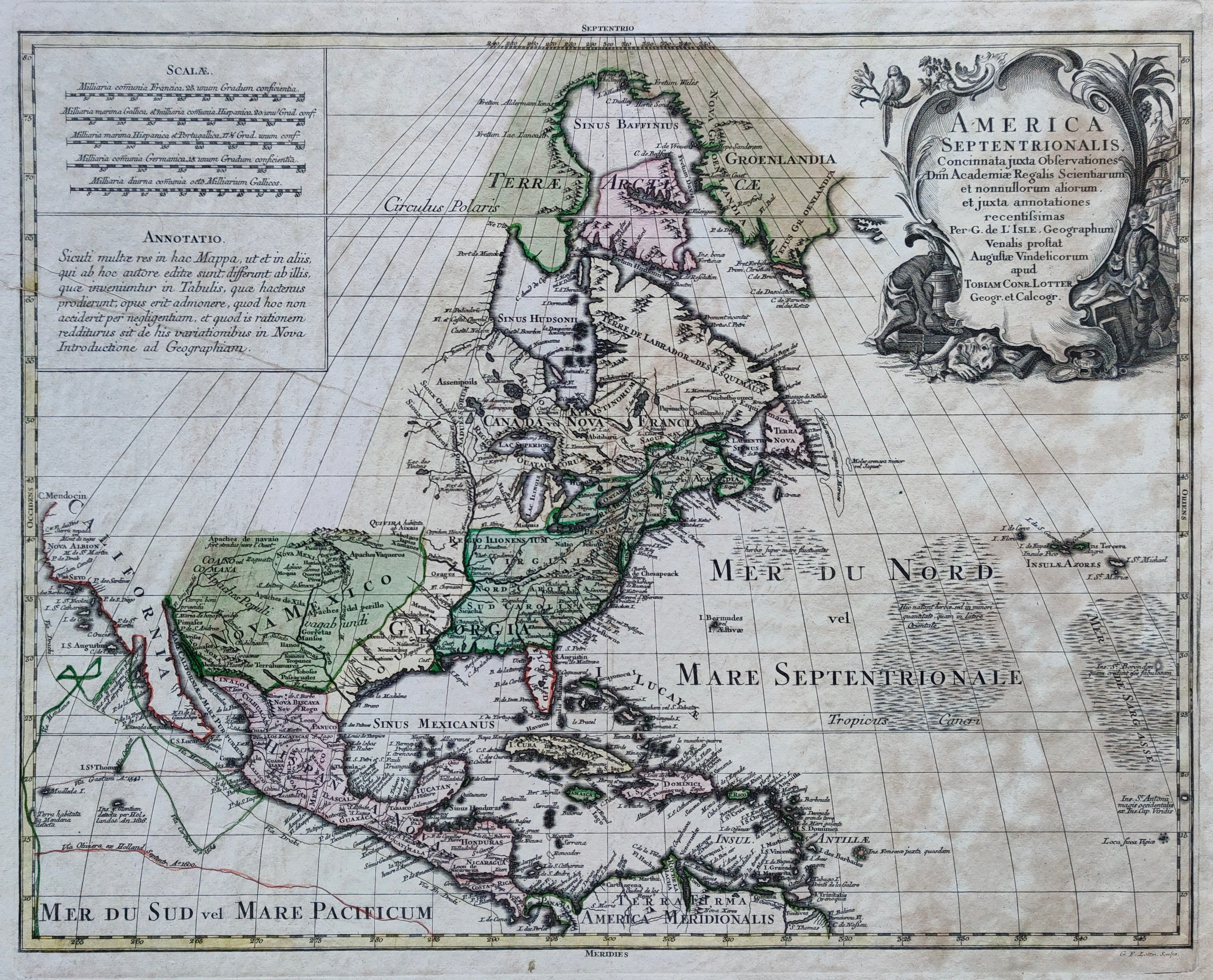
Map title
America Septentrionalis
Author
Lotter
Location shown in map
North America
Edition date
Circa 1770
Edition place
Augsburg
Editor
Atlas
Price
600 Euro
State
[mint/EXCELLENT/very good/good/fair/mediocre/poor]
Color
Old colors
Verso
Blank
Size
Plate: cm (59 x 45) inches (23.23 x 17.72) Paper: cm (74 x 59) inches (29.13 x 23.23)
Technique
Copper engraving
Note
Reference
--
Wiki
Here for more info
In stock
Available
Info
info@thetreasuremaps.com
Code
#1209
×
![America Septentrionalis by Lotter, North America, Circa 1770]()
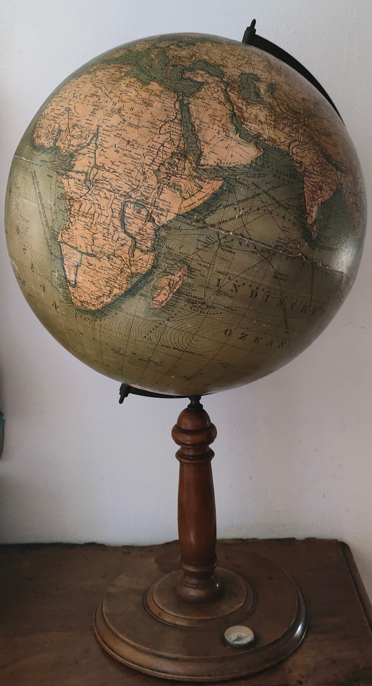
Map title
Author
Klinger
Location shown in map
Globe
Edition date
Circa 1920
Edition place
Nurimberg
Editor
Klinger
Atlas
Price
350 Euro
State
[mint/EXCELLENT/very good/good/fair/mediocre/poor]
Color
Old colors
Verso
Blank
Size
Plate: cm (0 x 0) inches (0 x 0) Paper: cm (14 x 14) inches (5.51 x 5.51)
Technique
Note
Reference
Wiki
Here for more info
In stock
Available
Info
info@thetreasuremaps.com
Code
#1208
×
![by Klinger, Globe, Circa 1920]()
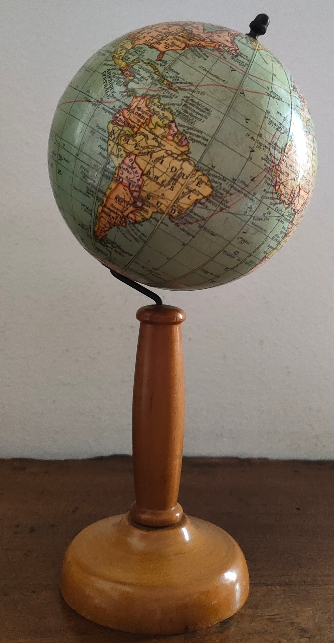
Map title
Author
Thomas
Location shown in map
Globe
Edition date
Circa 1930
Edition place
Paris
Editor
Thomas
Atlas
Price
350 Euro
State
[mint/EXCELLENT/very good/good/fair/mediocre/poor]
Color
Old colors
Verso
Blank
Size
Plate: cm (0 x 0) inches (0 x 0) Paper: cm (12 x 12) inches (4.72 x 4.72)
Technique
Note
Reference
Wiki
Here for more info
In stock
Available
Info
info@thetreasuremaps.com
Code
#1207
×
![by Thomas, Globe, Circa 1930]()
Map title
Erd-globus
Author
Ludw. Jul. Heyman
Location shown in map
Globe
Edition date
Circa 1895
Edition place
Berlin
Editor
Ludw. Jul. Heyman
Atlas
Price
500 Euro
State
[mint/EXCELLENT/very good/good/fair/mediocre/poor]
Color
Old colors
Verso
Blank
Size
Plate: cm (0 x 0) inches (0 x 0) Paper: cm (36 x 36) inches (14.17 x 14.17)
Technique
Note
Reference
Wiki
Here for more info
In stock
Available
Info
info@thetreasuremaps.com
Code
#1205
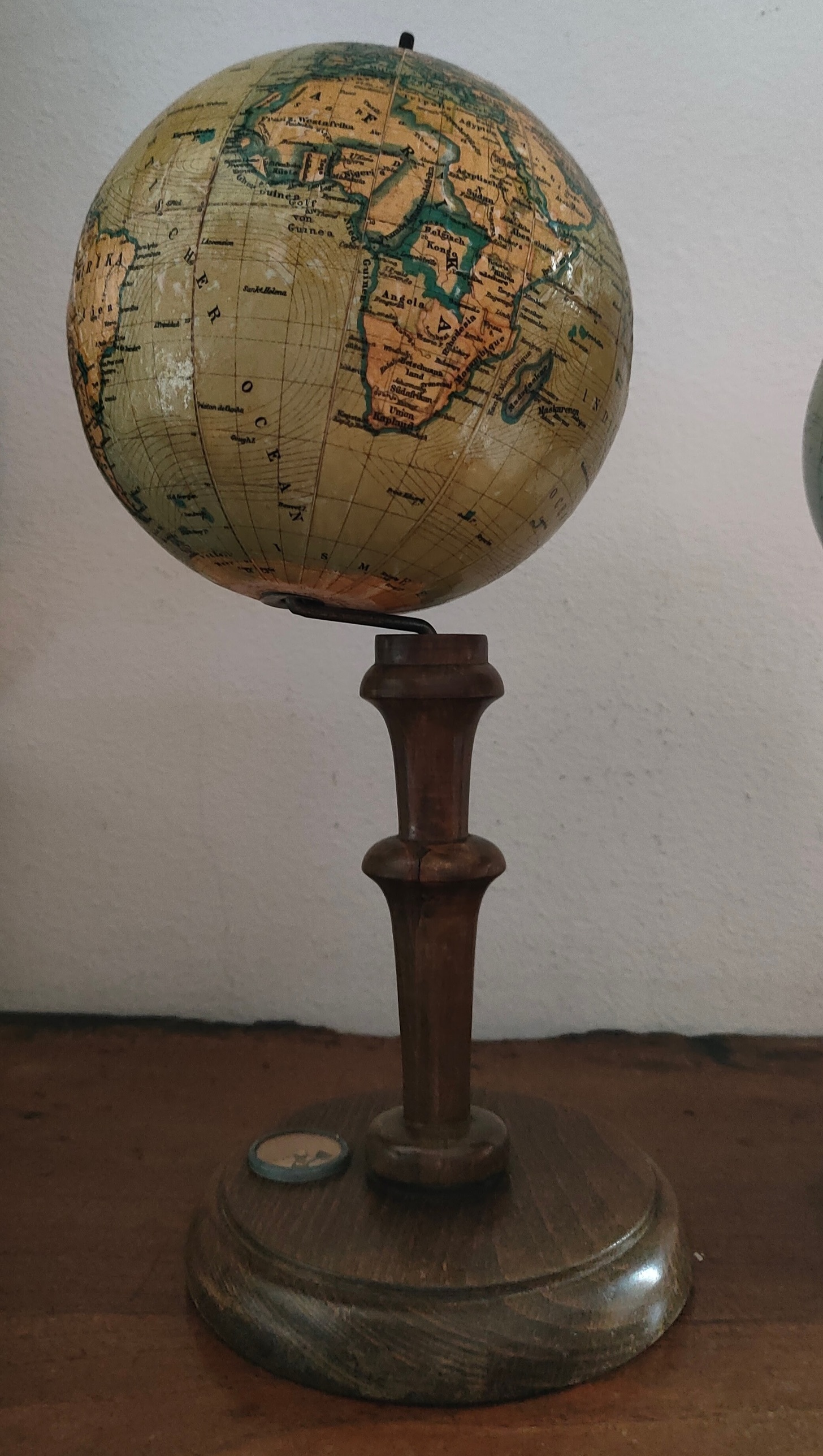
×
![Erd-globus by Ludw. Jul. Heyman, Globe, Circa 1895]()
Map title
L' Asia
Author
Sanson
Location shown in map
Asia
Edition date
Circa 1725
Edition place
Venice
Editor
Atlas
Price
125 Euro
State
[mint/EXCELLENT/very good/good/fair/mediocre/poor]
Color
Black/white
Verso
Blank
Size
Plate: cm (17 x 17) inches (6.69 x 6.69) Paper: cm (16 x 14) inches (6.3 x 5.51)
Technique
Copper engraving
Note
Reference
Wiki
Here for more info
In stock
Available
Info
info@thetreasuremaps.com
Code
#1190
×
![L' Asia by Sanson, Asia, Circa 1725]()
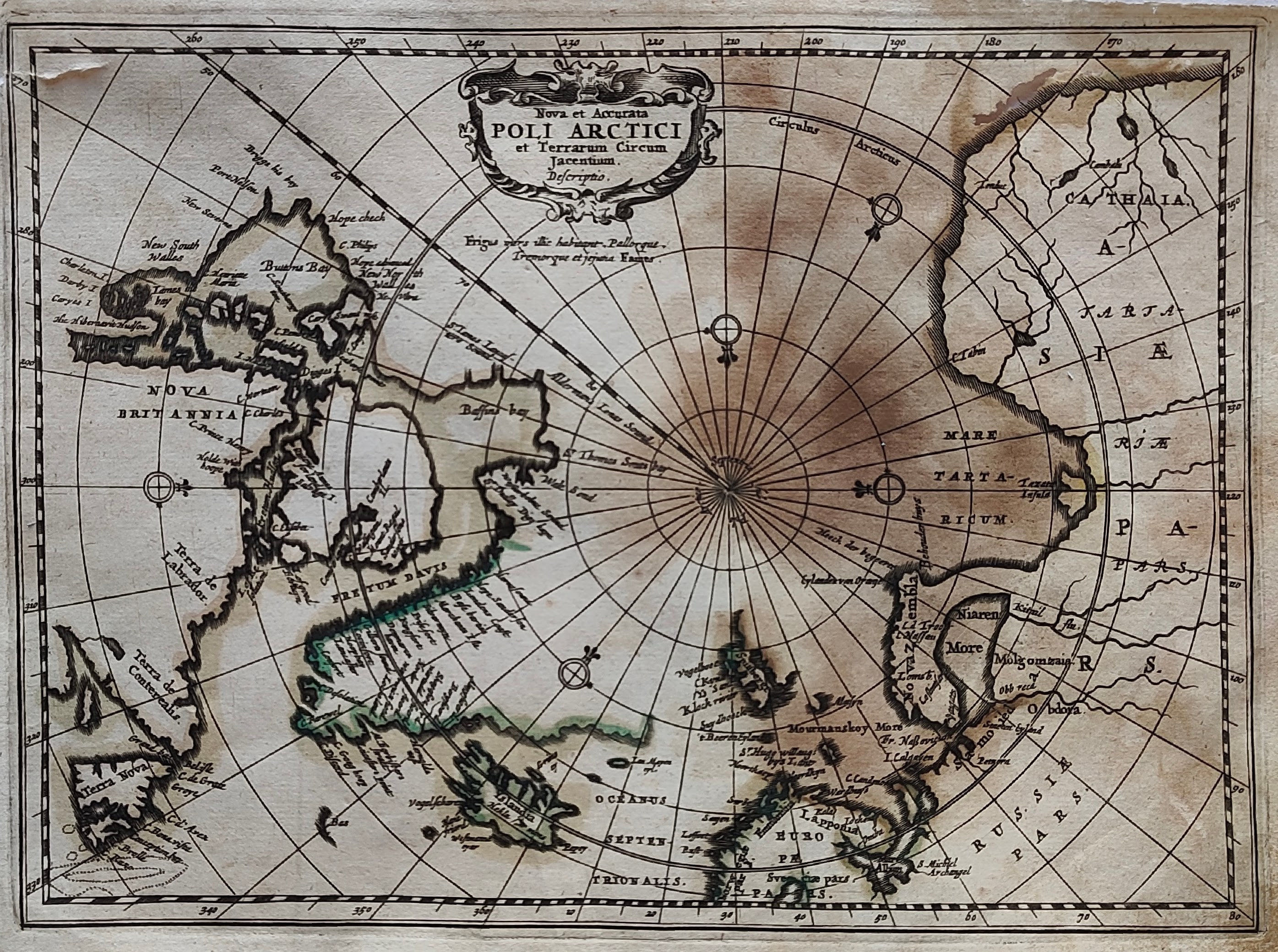
Map title
Poli Artici
Author
Jansson
Location shown in map
Polar
Edition date
1673
Edition place
Amsterdam
Editor
--
Atlas
Atlas Minor
Price
300 Euro
State
[mint/excellent/very good/good/FAIR/mediocre/poor]
Color
Old colors
Verso
Blank
Size
Plate: cm (26 x 20) inches (10.24 x 7.87) Paper: cm (24 x 18) inches (9.45 x 7.09)
Technique
Copper engraving
Note
Reference
Wiki
Here for more info
In stock
Available
Info
info@thetreasuremaps.com
Code
#1186
×
![Poli Artici by Jansson, Polar, 1673]()
Map title
Prussiae
Author
Ortelius
Location shown in map
Poland
Edition date
1588
Edition place
Antwerp
Editor
Atlas
Theatrum Orbis Terrarum
Price
350 Euro
State
[mint/excellent/very good/good/FAIR/mediocre/poor]
Color
Old colors
Verso
Spanish text
Size
Plate: cm (51 x 42) inches (20.08 x 16.54) Paper: cm (42 x 36) inches (16.54 x 14.17)
Technique
Copper engraving
Note
Reference
Van Den Broecke 206
Wiki
Here for more info
In stock
Available
Info
info@thetreasuremaps.com
Code
#1187
×
![Prussiae by Ortelius, Poland, 1588]()
Map title
Genoa
Author
Clarke
Location shown in map
Genoa
Edition date
1836
Edition place
London
Editor
Baldwin
Atlas
Price
175 Euro
State
[mint/EXCELLENT/very good/good/fair/mediocre/poor]
Color
Old colors
Verso
Blank
Size
Plate: cm (41 x 33) inches (16.14 x 12.99) Paper: cm (38 x 28) inches (14.96 x 11.02)
Technique
Steel engraving
Note
Reference
Wiki
Here for more info
In stock
Available
Info
info@thetreasuremaps.com
Code
#1189
Genoa
Author
Clarke
Location shown in map
Genoa
Edition date
1836
Edition place
London
Editor
Baldwin
Atlas
Price
175 Euro
State
[mint/EXCELLENT/very good/good/fair/mediocre/poor]
Color
Old colors
Verso
Blank
Size
Plate: cm (41 x 33) inches (16.14 x 12.99) Paper: cm (38 x 28) inches (14.96 x 11.02)
Technique
Steel engraving
Note
Reference
Wiki
Here for more info
In stock
Available
Info
info@thetreasuremaps.com
Code
#1189
×
![Genoa by Clarke, Genoa, 1836]()