News
Map title
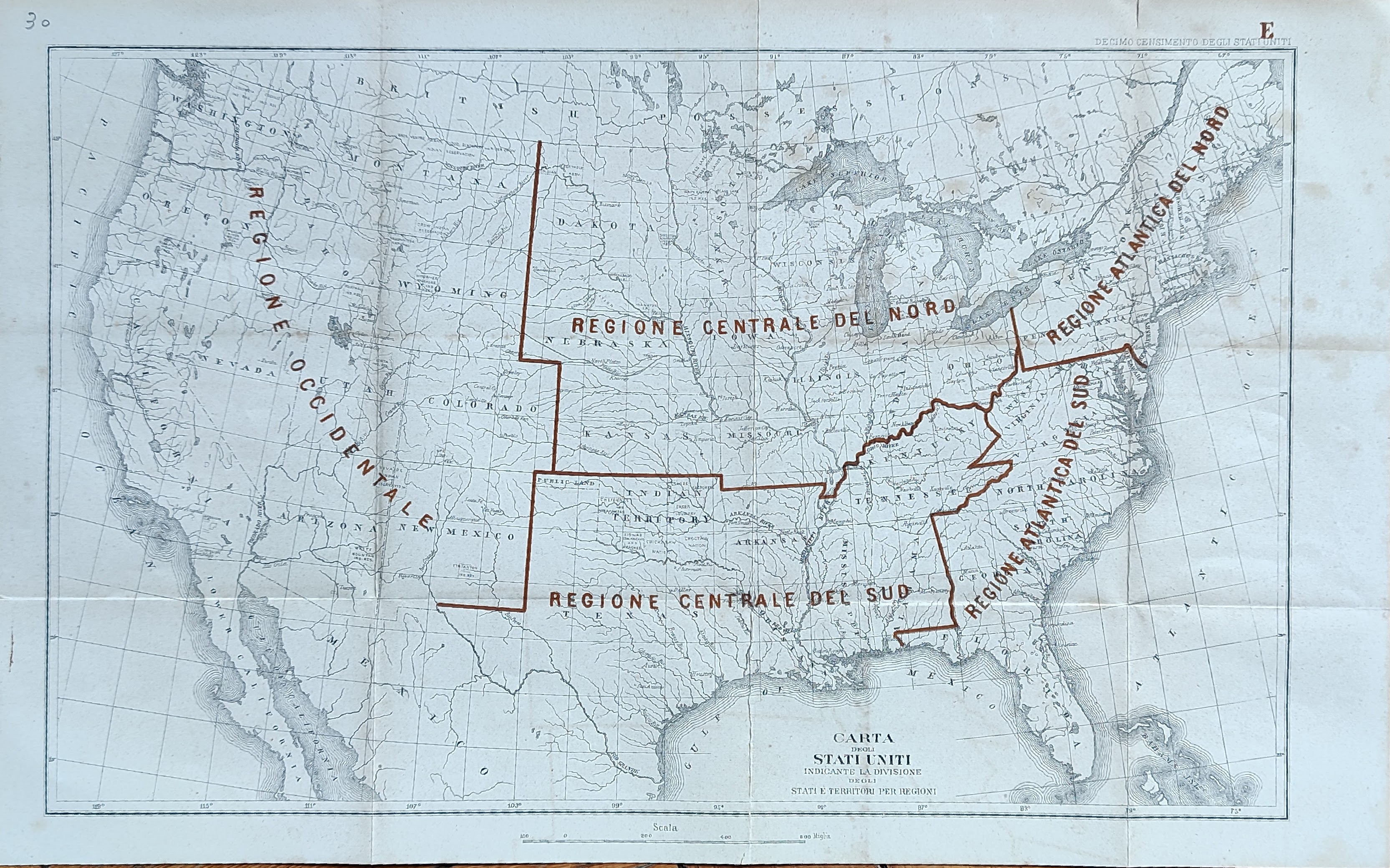
Carta indicante la divisione ...
Author
Location shown in map
USA
Edition date
Circa 1880
Edition place
Editor
Atlas
Price
50 Euro
State
[mint/EXCELLENT/very good/good/fair/mediocre/poor]
Color
Old colors
Verso
Blank
Size
Plate: cm (41 x 26) inches (16.14 x 10.24) Paper: cm (46 x 32) inches (18.11 x 12.6)
Technique
Steel engraving
Note
Reference
Wiki
Here for more info
In stock
Available
Info
info@thetreasuremaps.com
Code
#1033
×
![Carta indicante la divisione ... by , USA, Circa 1880]()
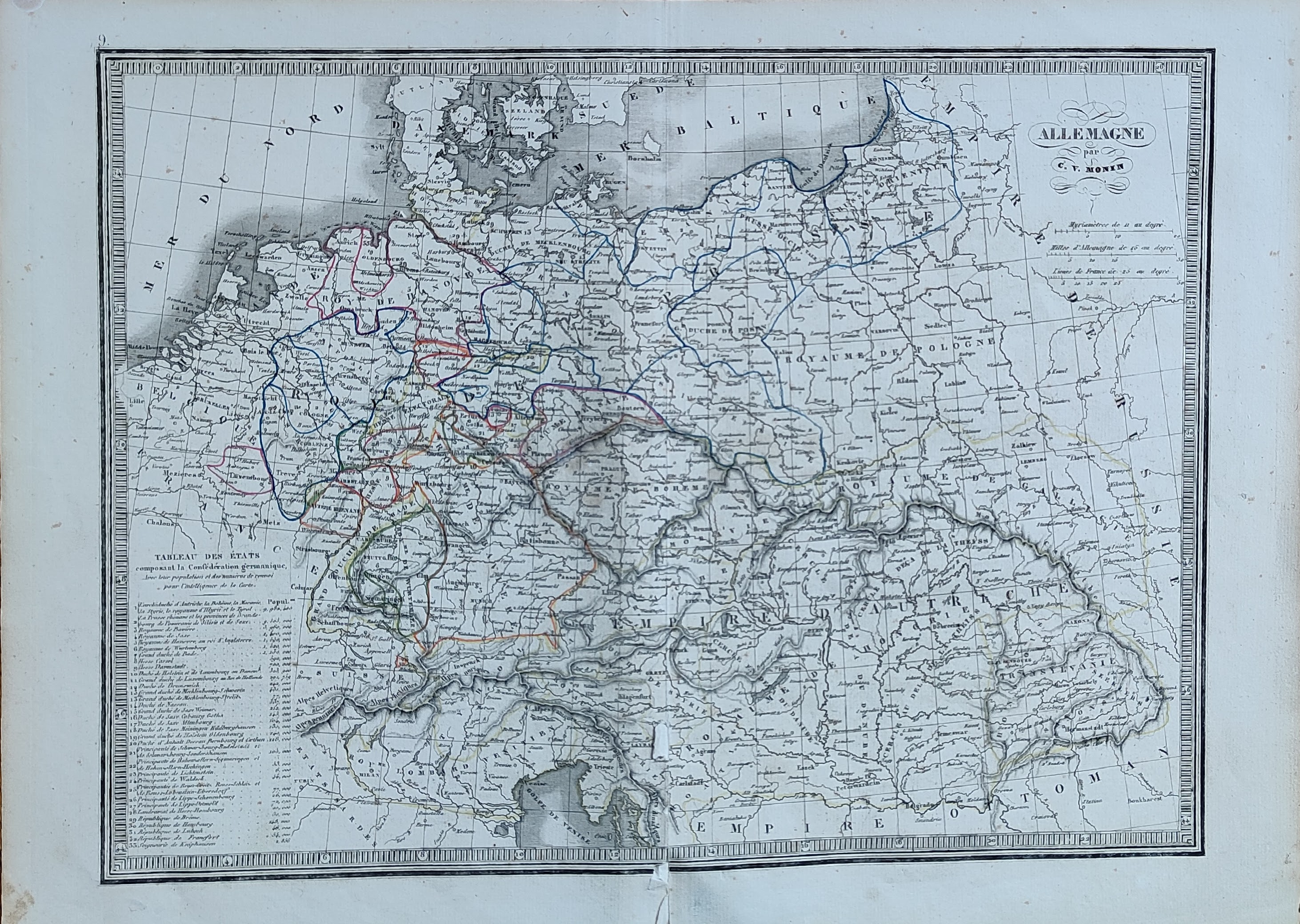
Map title
Alemagne
Author
Monin
Location shown in map
Germany
Edition date
1840
Edition place
Paris
Editor
Atlas
Atlas Classique de la Geographie
Price
50 Euro
State
[mint/EXCELLENT/very good/good/fair/mediocre/poor]
Color
Old colors
Verso
Blank
Size
Plate: cm (39 x 28) inches (15.35 x 11.02) Paper: cm (45 x 33) inches (17.72 x 12.99)
Technique
Copper engraving
Note
Reference
Wiki
Here for more info
In stock
Available
Info
info@thetreasuremaps.com
Code
#1034
×
![Alemagne by Monin, Germany, 1840]()
Map title
Suisse
Author
Monin
Location shown in map
Switzerland
Edition date
1840
Edition place
Paris
Editor
Atlas
Atlas Classique de la Geographie
Price
50 Euro
State
[mint/EXCELLENT/very good/good/fair/mediocre/poor]
Color
Old colors
Verso
Blank
Size
Plate: cm (39 x 28) inches (15.35 x 11.02) Paper: cm (45 x 33) inches (17.72 x 12.99)
Technique
Copper engraving
Note
Reference
Wiki
Here for more info
In stock
Available
Info
info@thetreasuremaps.com
Code
#1035
×
![Suisse by Monin, Switzerland, 1840]()
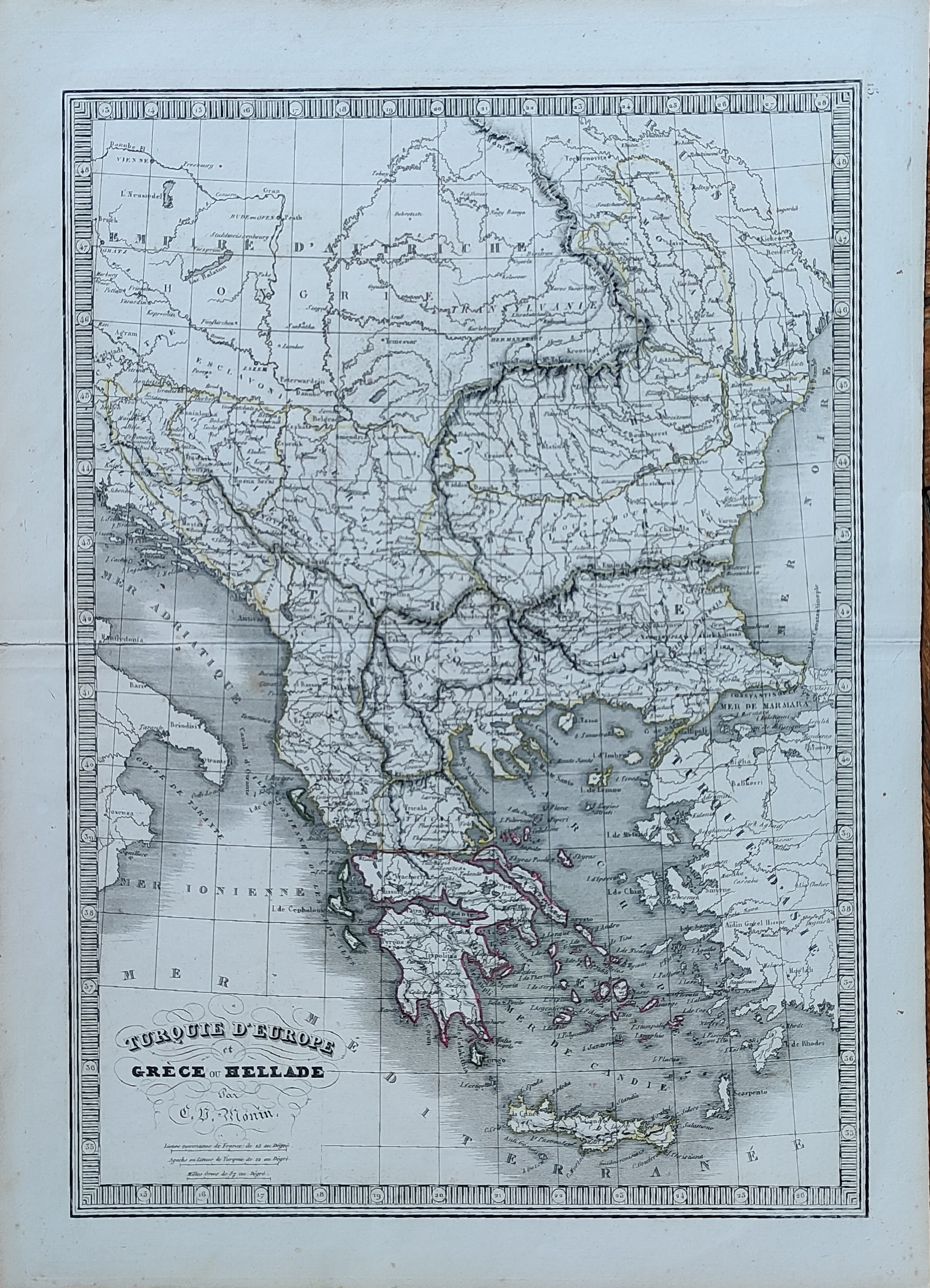
Map title
Turquie d'Europe
Author
Monin
Location shown in map
Greece
Edition date
1840
Edition place
Paris
Editor
Atlas
Atlas Classique de la Geographie
Price
50 Euro
State
[mint/EXCELLENT/very good/good/fair/mediocre/poor]
Color
Old colors
Verso
Blank
Size
Plate: cm (28 x 39) inches (11.02 x 15.35) Paper: cm (33 x 45) inches (12.99 x 17.72)
Technique
Copper engraving
Note
Reference
Wiki
Here for more info
In stock
Available
Info
info@thetreasuremaps.com
Code
#1036
×
![Turquie d'Europe by Monin, Greece, 1840]()
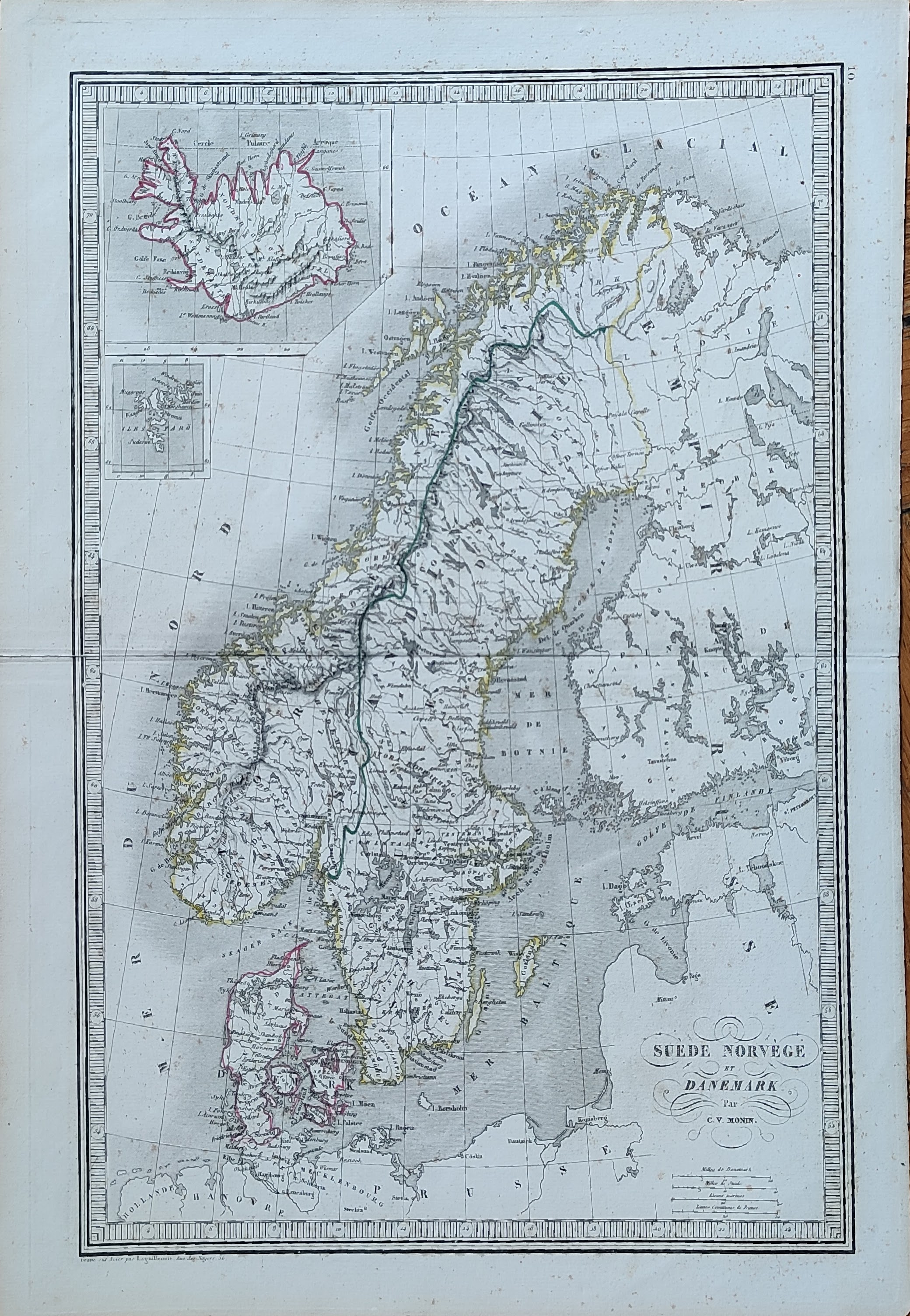
Map title
Suede Norvege et Danemark
Author
Monin
Location shown in map
Scandinavia
Edition date
1840
Edition place
Paris
Editor
Atlas
Atlas Classique de la Geographie
Price
50 Euro
State
[mint/EXCELLENT/very good/good/fair/mediocre/poor]
Color
Old colors
Verso
Blank
Size
Plate: cm (28 x 39) inches (11.02 x 15.35) Paper: cm (33 x 45) inches (12.99 x 17.72)
Technique
Copper engraving
Note
Reference
Wiki
Here for more info
In stock
Available
Info
info@thetreasuremaps.com
Code
#1037
×
![Suede Norvege et Danemark by Monin, Scandinavia, 1840]()
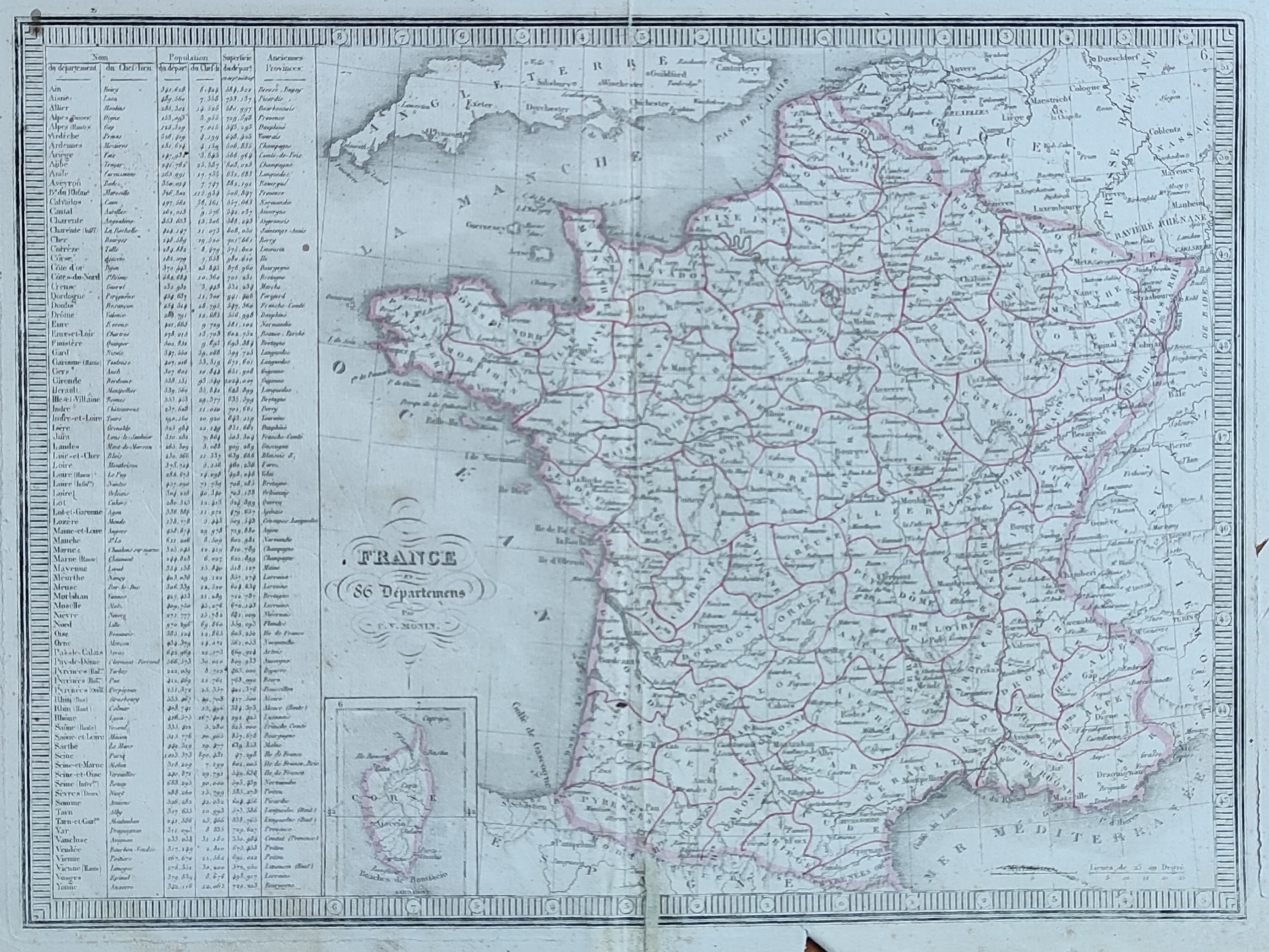
Map title
France
Author
Monin
Location shown in map
France
Edition date
1840
Edition place
Paris
Editor
Atlas
Atlas Classique de la Geographie
Price
50 Euro
State
[mint/EXCELLENT/very good/good/fair/mediocre/poor]
Color
Old colors
Verso
Blank
Size
Plate: cm (39 x 28) inches (15.35 x 11.02) Paper: cm (45 x 33) inches (17.72 x 12.99)
Technique
Copper engraving
Note
Reference
Wiki
Here for more info
In stock
Available
Info
info@thetreasuremaps.com
Code
#1038
France
Author
Monin
Location shown in map
France
Edition date
1840
Edition place
Paris
Editor
Atlas
Atlas Classique de la Geographie
Price
50 Euro
State
[mint/EXCELLENT/very good/good/fair/mediocre/poor]
Color
Old colors
Verso
Blank
Size
Plate: cm (39 x 28) inches (15.35 x 11.02) Paper: cm (45 x 33) inches (17.72 x 12.99)
Technique
Copper engraving
Note
Reference
Wiki
Here for more info
In stock
Available
Info
info@thetreasuremaps.com
Code
#1038
×
![France by Monin, France, 1840]()
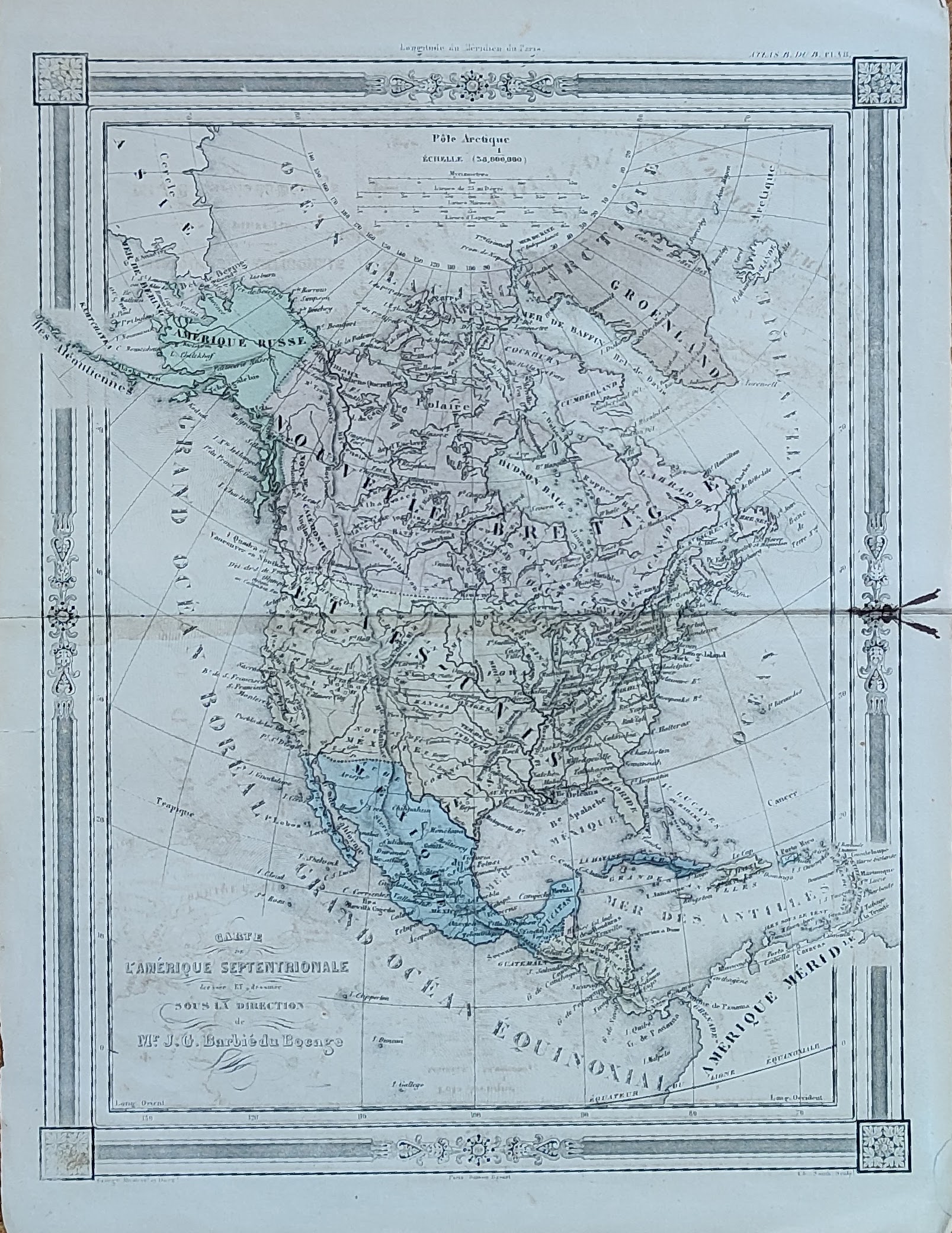
Map title
Carte de l'Amerique Septentrionale
Author
Barbie
Location shown in map
North America
Edition date
Circa 1852
Edition place
Paris
Editor
Atlas
Price
75 Euro
State
[mint/excellent/VERY GOOD/good/fair/mediocre/poor]
Color
Old colors
Verso
Blank
Size
Plate: cm (23 x 30) inches (9.06 x 11.81) Paper: cm (25 x 35) inches (9.84 x 13.78)
Technique
Copper engraving
Note
Reference
Wiki
Here for more info
In stock
Available
Info
info@thetreasuremaps.com
Code
#1039
×
![Carte de l'Amerique Septentrionale by Barbie, North America, Circa 1852]()
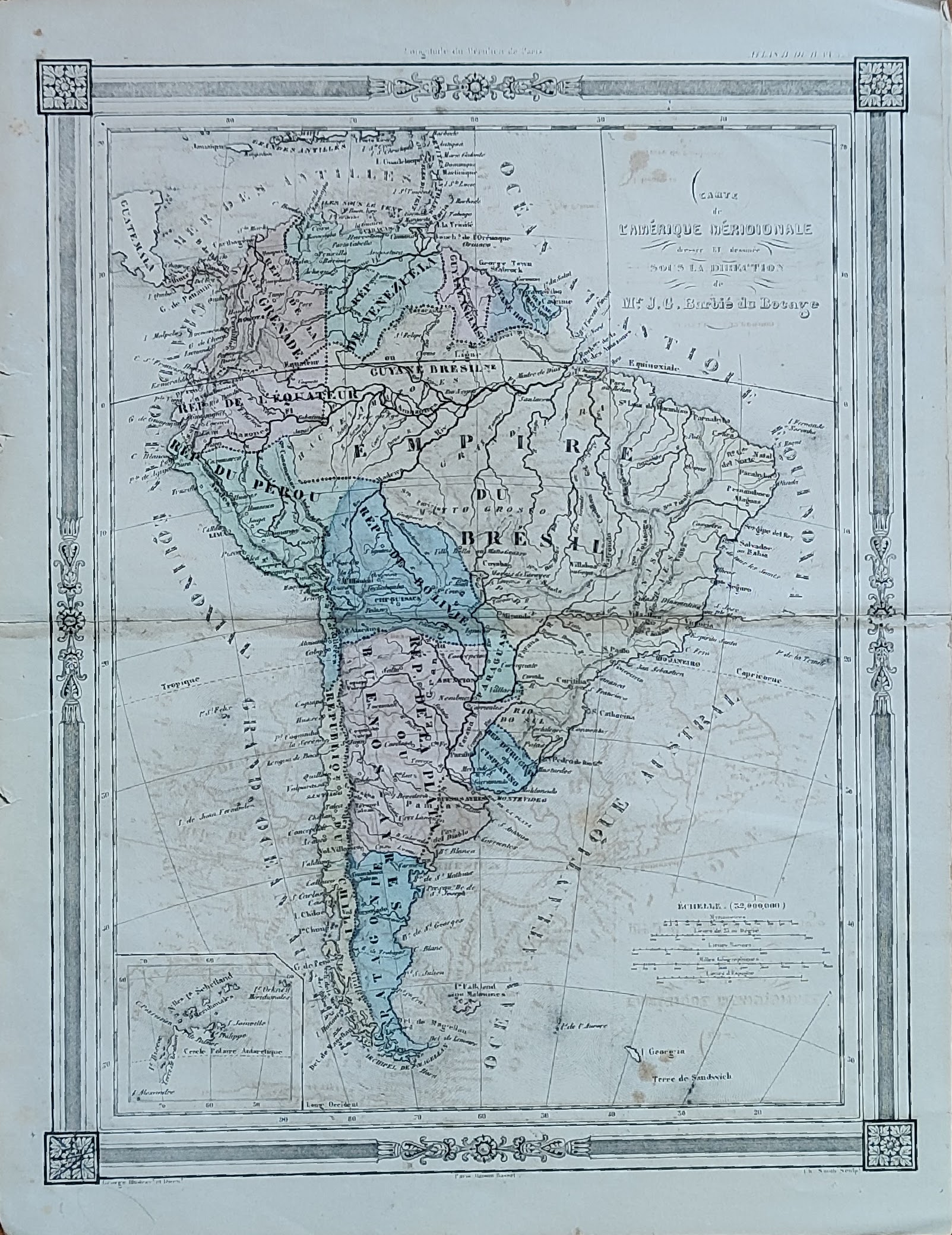
Map title
Carte de l'Amerique Meridionale
Author
Barbie
Location shown in map
South America
Edition date
Circa 1852
Edition place
Paris
Editor
Atlas
Price
50 Euro
State
[mint/excellent/VERY GOOD/good/fair/mediocre/poor]
Color
Old colors
Verso
Blank
Size
Plate: cm (23 x 30) inches (9.06 x 11.81) Paper: cm (25 x 35) inches (9.84 x 13.78)
Technique
Copper engraving
Note
Reference
Wiki
Here for more info
In stock
Available
Info
info@thetreasuremaps.com
Code
#1040
×
![Carte de l'Amerique Meridionale by Barbie, South America, Circa 1852]()
Map title
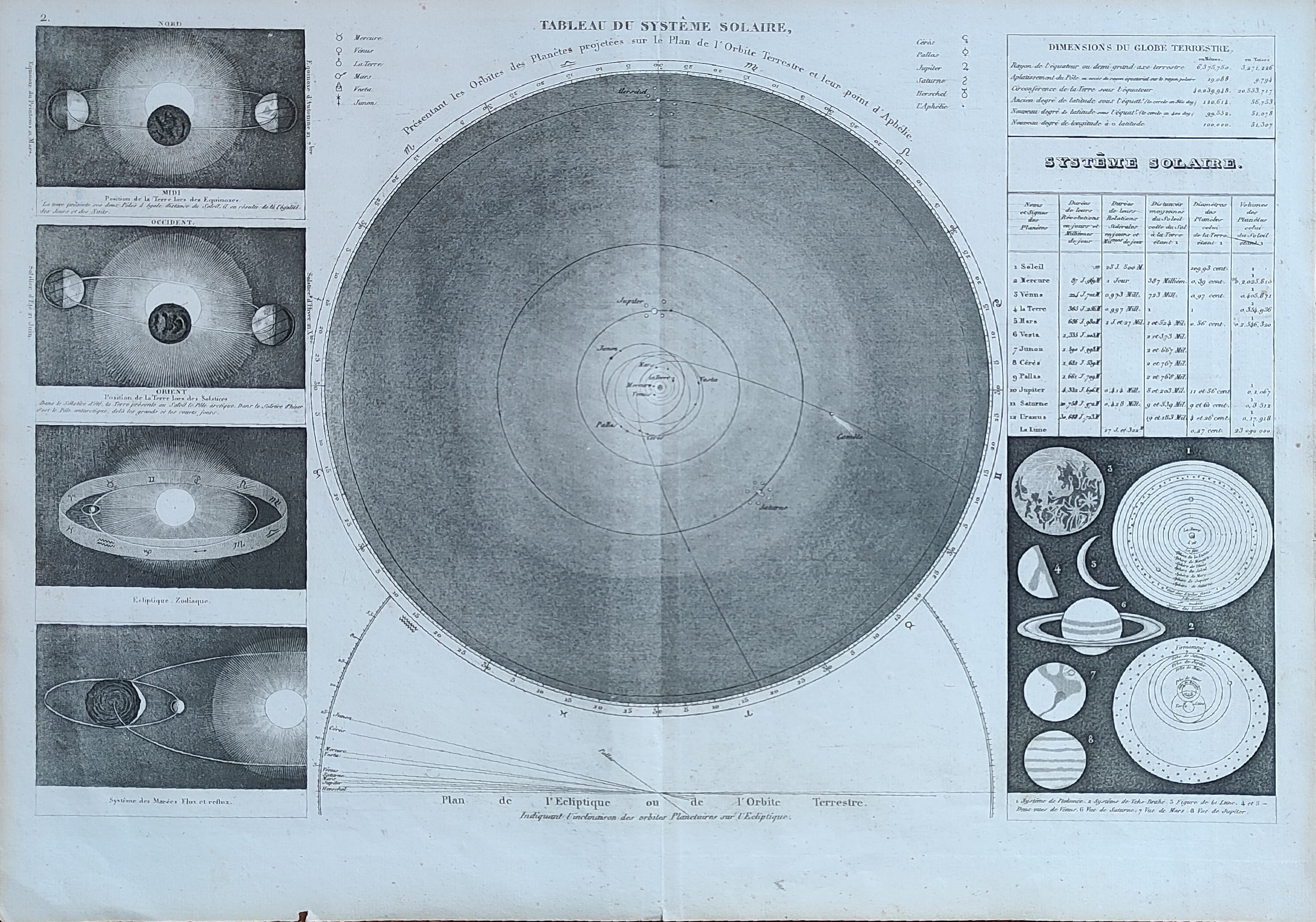
Tableau du system solaire
Author
Monin
Location shown in map
Celestial
Edition date
1840
Edition place
Paris
Editor
Atlas
Atlas Classique de la Geographie
Price
50 Euro
State
[mint/EXCELLENT/very good/good/fair/mediocre/poor]
Color
Old colors
Verso
Blank
Size
Plate: cm (39 x 28) inches (15.35 x 11.02) Paper: cm (45 x 33) inches (17.72 x 12.99)
Technique
Copper engraving
Note
Reference
Wiki
Here for more info
In stock
Available
Info
info@thetreasuremaps.com
Code
#1041
×
![Tableau du system solaire by Monin, Celestial, 1840]()
Map title
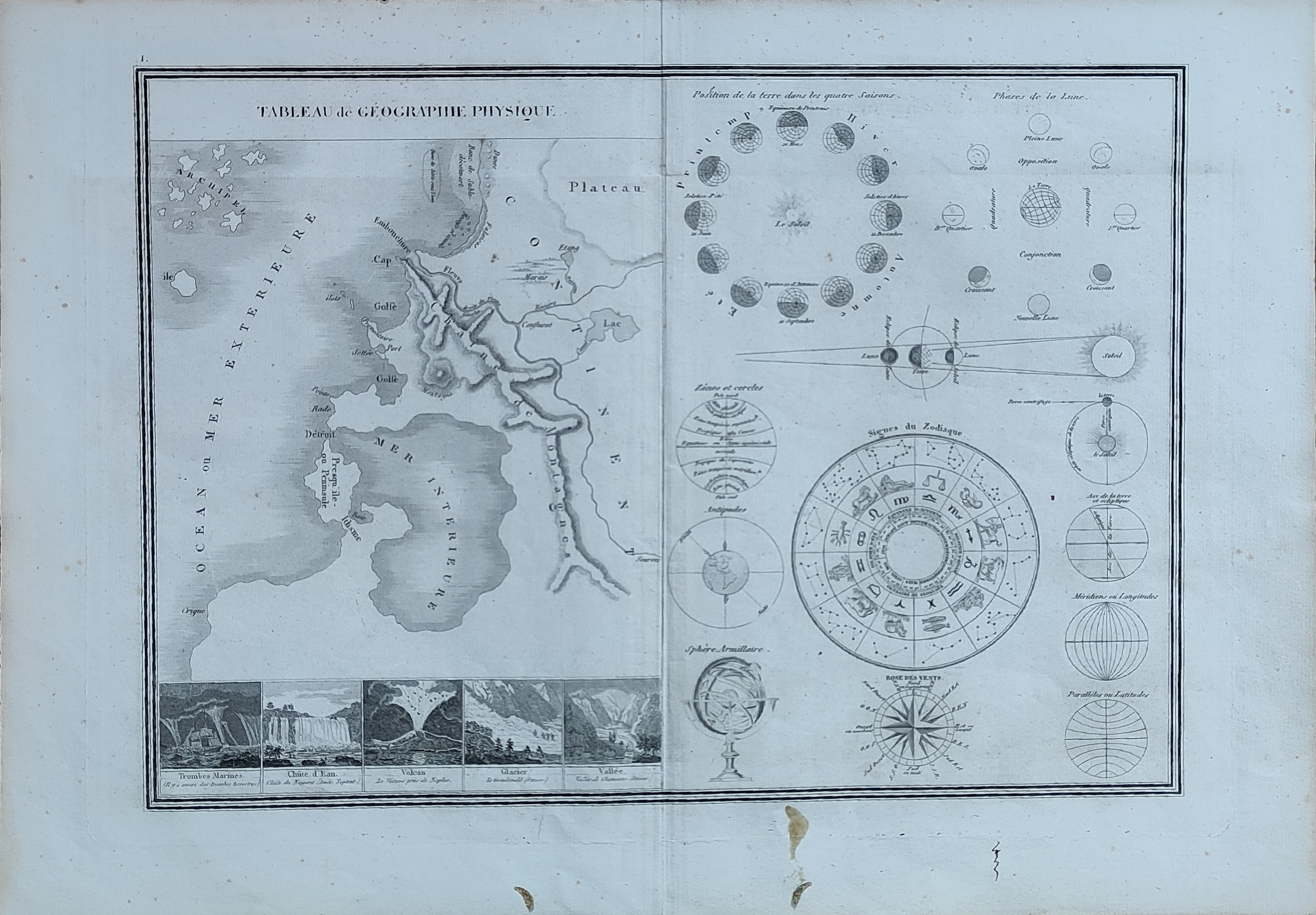
Tableau de geographie physique
Author
Monin
Location shown in map
Celestial
Edition date
1840
Edition place
Paris
Editor
Atlas
Atlas Classique de la Geographie
Price
50 Euro
State
[mint/EXCELLENT/very good/good/fair/mediocre/poor]
Color
Old colors
Verso
Blank
Size
Plate: cm (39 x 28) inches (15.35 x 11.02) Paper: cm (45 x 33) inches (17.72 x 12.99)
Technique
Copper engraving
Note
Reference
Wiki
Here for more info
In stock
Available
Info
info@thetreasuremaps.com
Code
#1042
×
![Tableau de geographie physique by Monin, Celestial, 1840]()
Map title
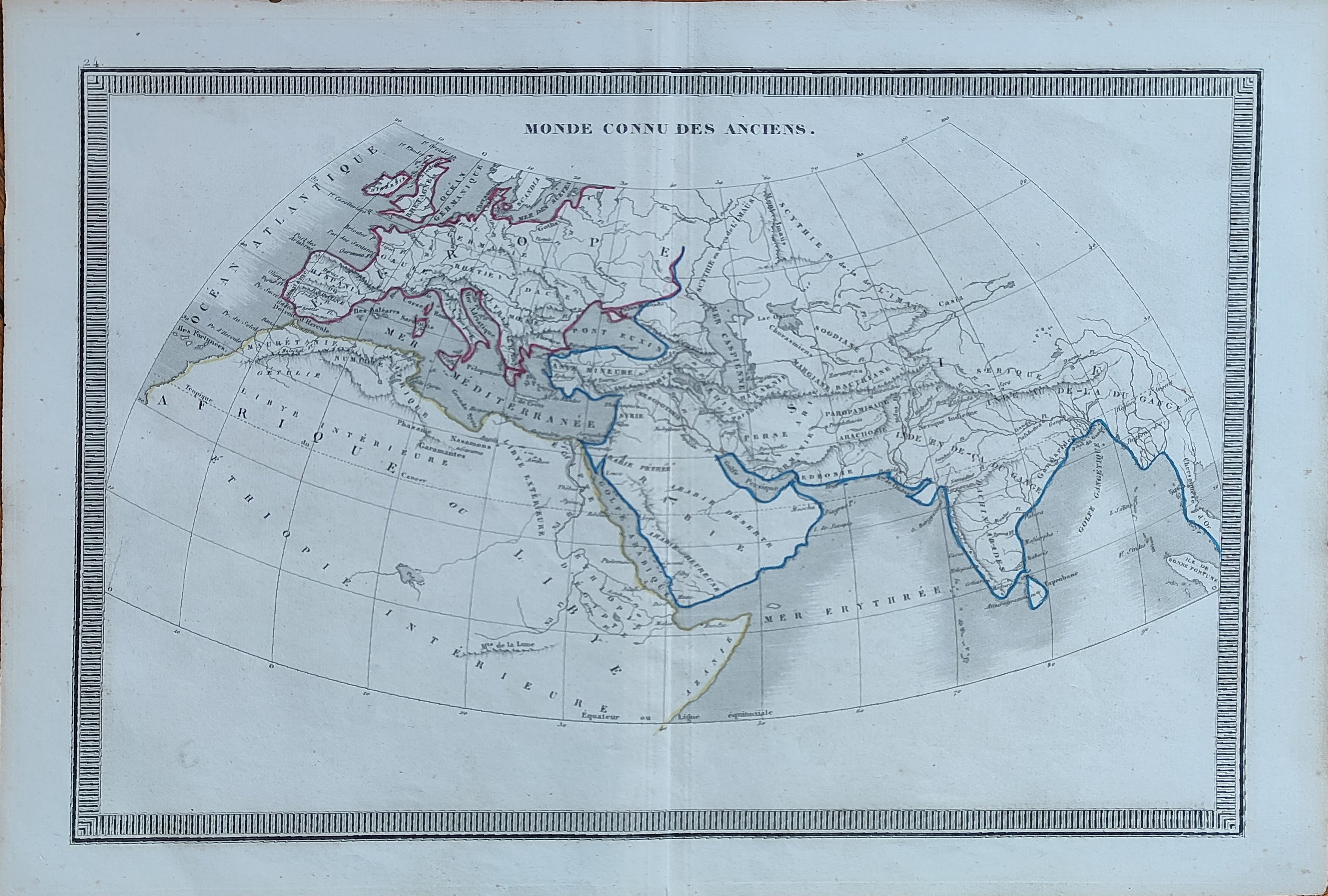
Monde connu des anciens
Author
Monin
Location shown in map
World
Edition date
1840
Edition place
Paris
Editor
Atlas
Atlas Classique de la Geographie
Price
50 Euro
State
[mint/EXCELLENT/very good/good/fair/mediocre/poor]
Color
Old colors
Verso
Blank
Size
Plate: cm (39 x 28) inches (15.35 x 11.02) Paper: cm (45 x 33) inches (17.72 x 12.99)
Technique
Copper engraving
Note
Reference
Wiki
Here for more info
In stock
Available
Info
info@thetreasuremaps.com
Code
#1043
×
![Monde connu des anciens by Monin, World, 1840]()
Map title
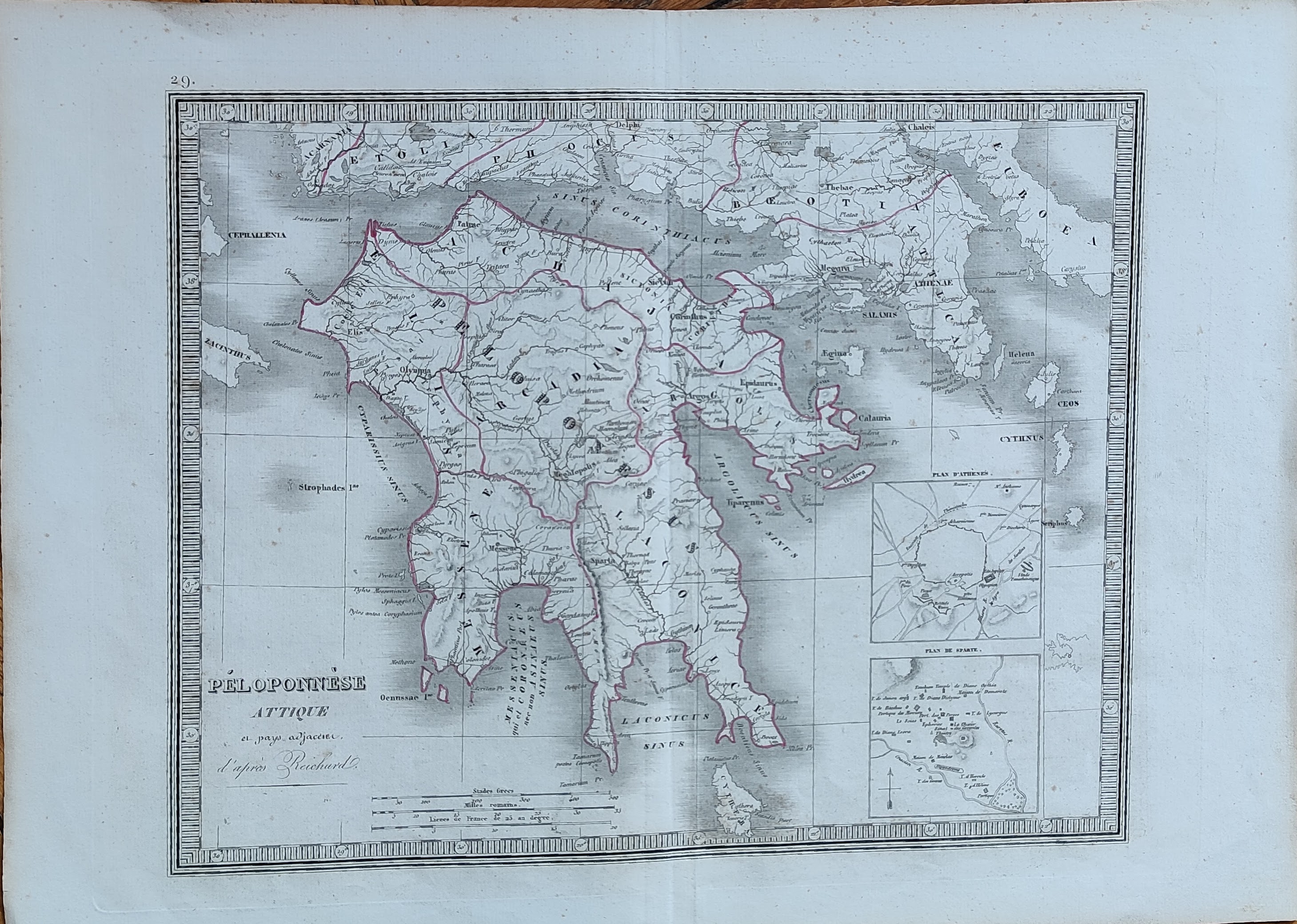
Peloponnese
Author
Monin
Location shown in map
Greece
Edition date
1840
Edition place
Paris
Editor
Atlas
Atlas Classique de la Geographie
Price
50 Euro
State
[mint/EXCELLENT/very good/good/fair/mediocre/poor]
Color
Old colors
Verso
Blank
Size
Plate: cm (39 x 28) inches (15.35 x 11.02) Paper: cm (45 x 33) inches (17.72 x 12.99)
Technique
Copper engraving
Note
Reference
Wiki
Here for more info
In stock
Available
Info
info@thetreasuremaps.com
Code
#1044
×
![Peloponnese by Monin, Greece, 1840]()
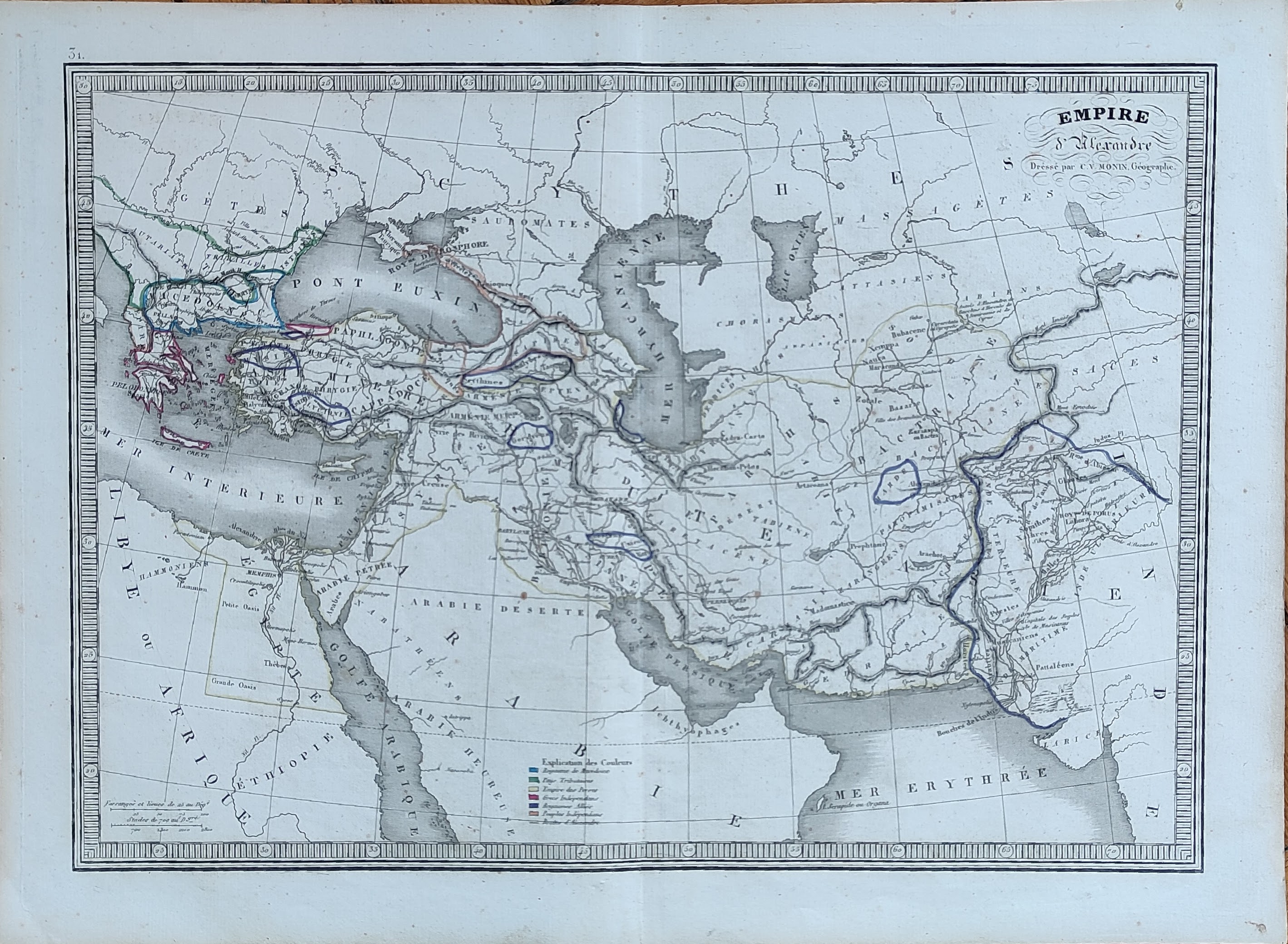
Map title
Empire d'Alexandre
Author
Monin
Location shown in map
Middle East
Edition date
1840
Edition place
Paris
Editor
Atlas
Atlas Classique de la Geographie
Price
50 Euro
State
[mint/EXCELLENT/very good/good/fair/mediocre/poor]
Color
Old colors
Verso
Blank
Size
Plate: cm (39 x 28) inches (15.35 x 11.02) Paper: cm (45 x 33) inches (17.72 x 12.99)
Technique
Copper engraving
Note
Reference
Wiki
Here for more info
In stock
Available
Info
info@thetreasuremaps.com
Code
#1045
×
![Empire d'Alexandre by Monin, Middle East, 1840]()
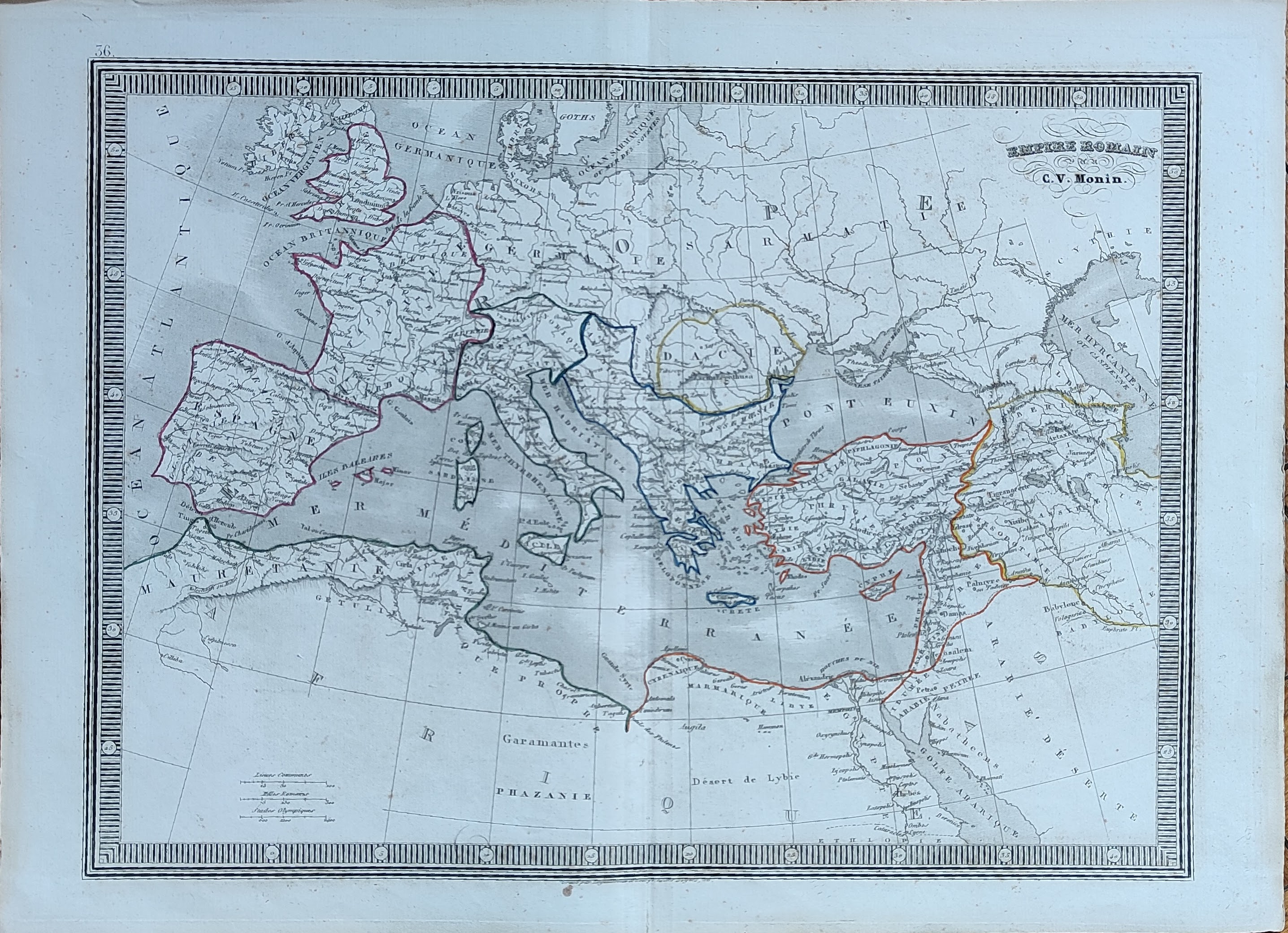
Map title
Empire Romain
Author
Monin
Location shown in map
Europe
Edition date
1840
Edition place
Paris
Editor
Atlas
Atlas Classique de la Geographie
Price
50 Euro
State
[mint/EXCELLENT/very good/good/fair/mediocre/poor]
Color
Old colors
Verso
Blank
Size
Plate: cm (39 x 28) inches (15.35 x 11.02) Paper: cm (45 x 33) inches (17.72 x 12.99)
Technique
Copper engraving
Note
Reference
Wiki
Here for more info
In stock
Available
Info
info@thetreasuremaps.com
Code
#1046
×
![Empire Romain by Monin, Europe, 1840]()

Map title
Palestine
Author
Monin
Location shown in map
Middle East
Edition date
1840
Edition place
Paris
Editor
Atlas
Atlas Classique de la Geographie
Price
50 Euro
State
[mint/EXCELLENT/very good/good/fair/mediocre/poor]
Color
Old colors
Verso
Blank
Size
Plate: cm (39 x 28) inches (15.35 x 11.02) Paper: cm (45 x 33) inches (17.72 x 12.99)
Technique
Copper engraving
Note
Reference
Wiki
Here for more info
In stock
Available
Info
info@thetreasuremaps.com
Code
#1047
×
![Palestine by Monin, Middle East, 1840]()
Map title
Carte de la Germanie Ancienne
Author
Monin
Location shown in map
Germany
Edition date
1840
Edition place
Paris
Editor
Atlas
Atlas Classique de la Geographie
Price
50 Euro
State
[mint/EXCELLENT/very good/good/fair/mediocre/poor]
Color
Old colors
Verso
Blank
Size
Plate: cm (28 x 39) inches (11.02 x 15.35) Paper: cm (33 x 45) inches (12.99 x 17.72)
Technique
Copper engraving
Note
Reference
Wiki
Here for more info
In stock
Available
Info
info@thetreasuremaps.com
Code
#1048
×
![Carte de la Germanie Ancienne by Monin, Germany, 1840]()
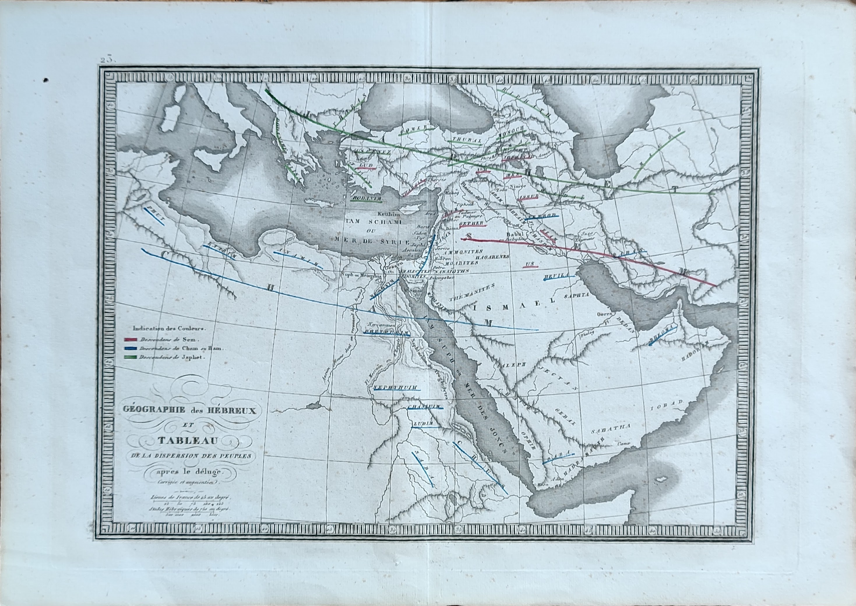
Map title
Geographie des Hebreux
Author
Monin
Location shown in map
Middle East
Edition date
1840
Edition place
Paris
Editor
Atlas
Atlas Classique de la Geographie
Price
50 Euro
State
[mint/EXCELLENT/very good/good/fair/mediocre/poor]
Color
Old colors
Verso
Blank
Size
Plate: cm (39 x 28) inches (15.35 x 11.02) Paper: cm (45 x 33) inches (17.72 x 12.99)
Technique
Copper engraving
Note
Reference
Wiki
Here for more info
In stock
Available
Info
info@thetreasuremaps.com
Code
#1049
×
![Geographie des Hebreux by Monin, Middle East, 1840]()
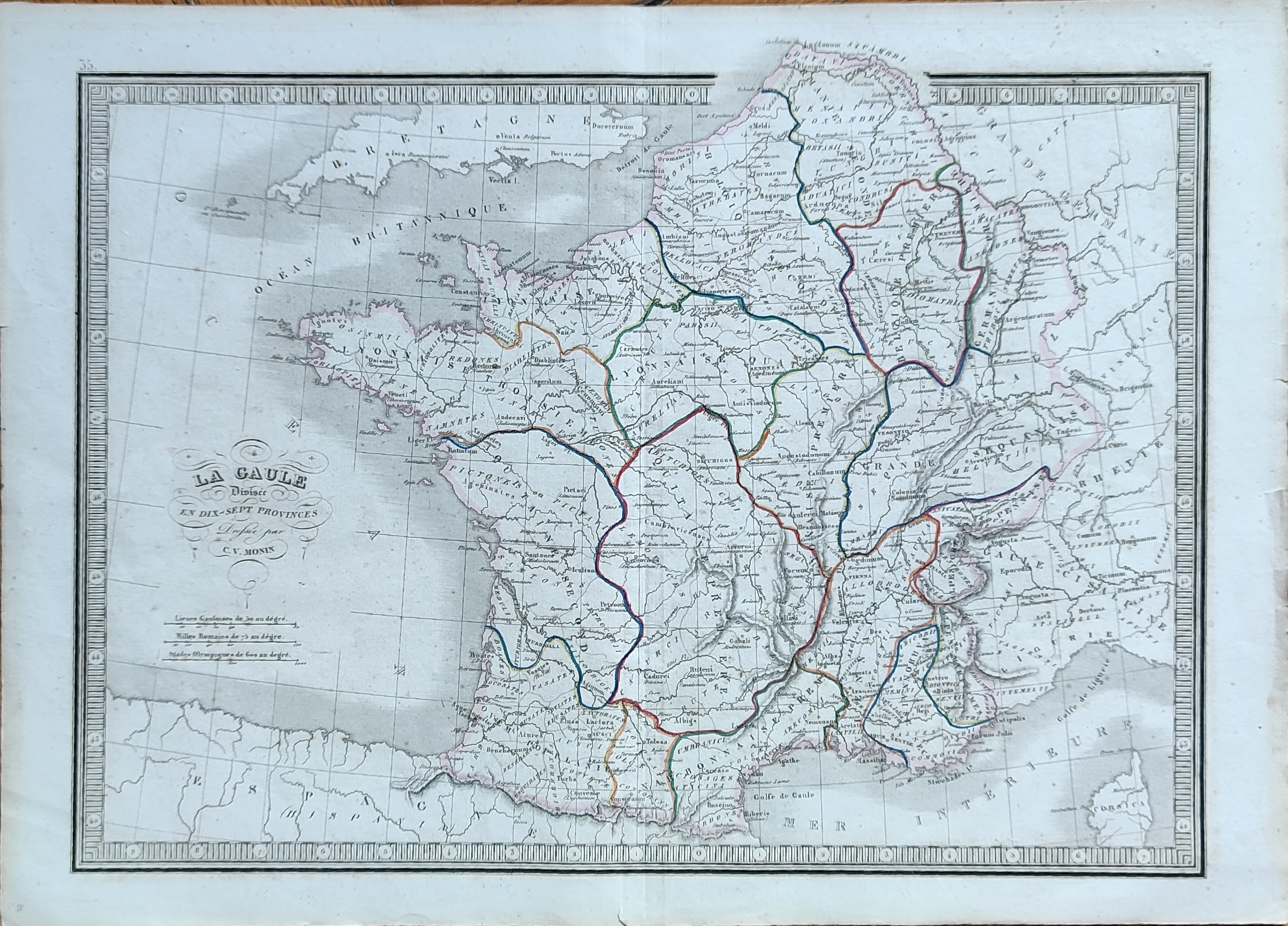
Map title
La Gaule
Author
Monin
Location shown in map
France
Edition date
1840
Edition place
Paris
Editor
Atlas
Atlas Classique de la Geographie
Price
50 Euro
State
[mint/EXCELLENT/very good/good/fair/mediocre/poor]
Color
Old colors
Verso
Blank
Size
Plate: cm (39 x 28) inches (15.35 x 11.02) Paper: cm (45 x 33) inches (17.72 x 12.99)
Technique
Copper engraving
Note
Reference
Wiki
Here for more info
In stock
Available
Info
info@thetreasuremaps.com
Code
#1050
×
![La Gaule by Monin, France, 1840]()
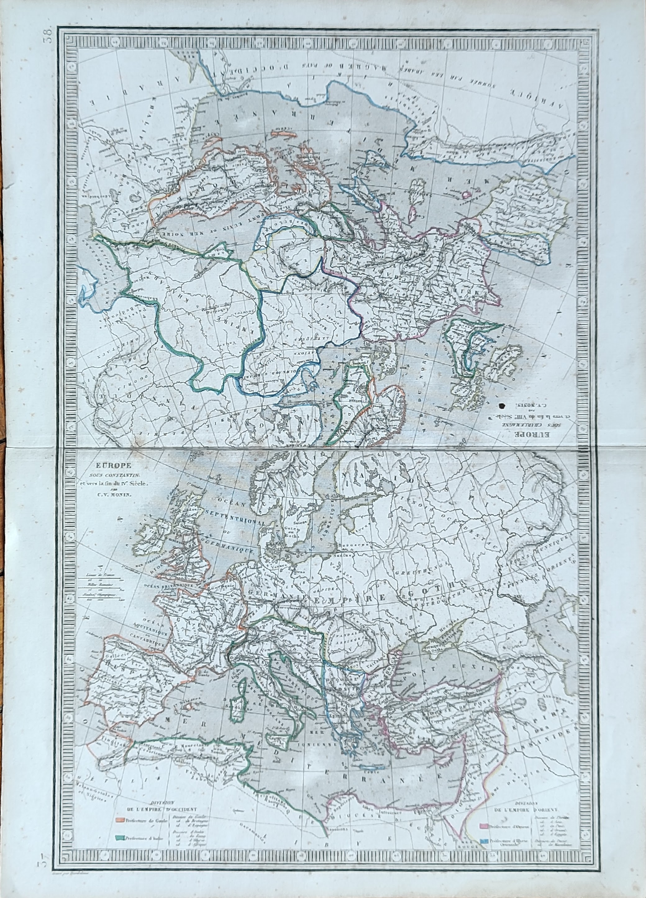
Map title
Europe
Author
Monin
Location shown in map
Europe
Edition date
1840
Edition place
Paris
Editor
Atlas
Atlas Classique de la Geographie
Price
50 Euro
State
[mint/EXCELLENT/very good/good/fair/mediocre/poor]
Color
Old colors
Verso
Blank
Size
Plate: cm (28 x 39) inches (11.02 x 15.35) Paper: cm (33 x 45) inches (12.99 x 17.72)
Technique
Copper engraving
Note
Reference
Wiki
Here for more info
In stock
Available
Info
info@thetreasuremaps.com
Code
#1051
Europe
Author
Monin
Location shown in map
Europe
Edition date
1840
Edition place
Paris
Editor
Atlas
Atlas Classique de la Geographie
Price
50 Euro
State
[mint/EXCELLENT/very good/good/fair/mediocre/poor]
Color
Old colors
Verso
Blank
Size
Plate: cm (28 x 39) inches (11.02 x 15.35) Paper: cm (33 x 45) inches (12.99 x 17.72)
Technique
Copper engraving
Note
Reference
Wiki
Here for more info
In stock
Available
Info
info@thetreasuremaps.com
Code
#1051
×
![Europe by Monin, Europe, 1840]()
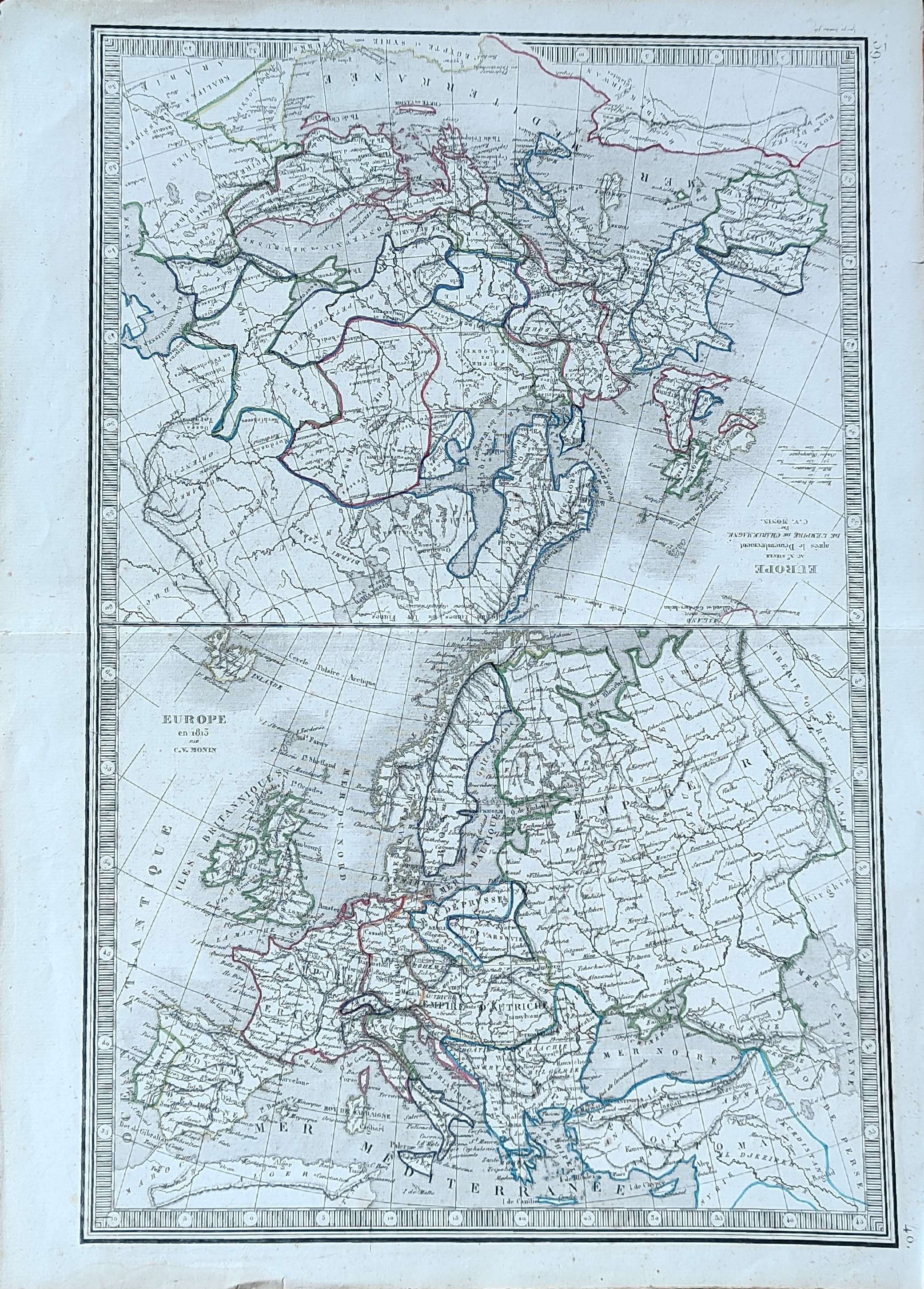
Map title
Europe
Author
Monin
Location shown in map
Europe
Edition date
1840
Edition place
Paris
Editor
Atlas
Atlas Classique de la Geographie
Price
50 Euro
State
[mint/EXCELLENT/very good/good/fair/mediocre/poor]
Color
Old colors
Verso
Blank
Size
Plate: cm (28 x 39) inches (11.02 x 15.35) Paper: cm (33 x 45) inches (12.99 x 17.72)
Technique
Copper engraving
Note
Reference
Wiki
Here for more info
In stock
Available
Info
info@thetreasuremaps.com
Code
#1052
Europe
Author
Monin
Location shown in map
Europe
Edition date
1840
Edition place
Paris
Editor
Atlas
Atlas Classique de la Geographie
Price
50 Euro
State
[mint/EXCELLENT/very good/good/fair/mediocre/poor]
Color
Old colors
Verso
Blank
Size
Plate: cm (28 x 39) inches (11.02 x 15.35) Paper: cm (33 x 45) inches (12.99 x 17.72)
Technique
Copper engraving
Note
Reference
Wiki
Here for more info
In stock
Available
Info
info@thetreasuremaps.com
Code
#1052
×
![Europe by Monin, Europe, 1840]()