News

Map title
Italia XIIII Nova Tabula
Author
Fries
Location shown in map
Italy
Edition date
1522
Edition place
Strasbourg
Editor
Atlas
Claudii Ptolemaei Alexandrini
Price
900 Euro
State
[mint/EXCELLENT/very good/good/fair/mediocre/poor]
Color
Black/white
Verso
Latin text pag.36
Size
Plate: cm (34 x 27) inches (13.39 x 10.63) Paper: cm (50 x 38) inches (19.69 x 14.96)
Technique
Woodcut
Note
No particular notes for this maps
Reference
R.Borri L'Italia nelle antiche carte pag.47
Wiki
Here for more info
In stock
Available
Info
info@thetreasuremaps.com
Code
#0932
×
![Italia XIIII Nova Tabula by Fries, Italy, 1522]()
Map title
--
Author
Munster
Location shown in map
Italy
Edition date
1542
Edition place
Basel
Editor
Henrich Petri
Atlas
Geographia Universalis
Price
700 Euro
State
[mint/EXCELLENT/very good/good/fair/mediocre/poor]
Color
Black/white
Verso
Latin text pag.43
Size
Plate: cm (33 x 25) inches (12.99 x 9.84) Paper: cm (40 x 32) inches (15.75 x 12.6)
Technique
Woodcut
Note
Reference
R.Borri L'Italia nelle antiche carte pag.50
Wiki
Here for more info
In stock
Available
Info
info@thetreasuremaps.com
Code
#0933
×
![-- by Munster, Italy, 1542]()
Map title
Italiae Typus
Author
Ortelius
Location shown in map
Italy
Edition date
1589
Edition place
Antwerp
Editor
--
Atlas
Epitome theatri Orteliani
Price
200 Euro
State
[mint/EXCELLENT/very good/good/fair/mediocre/poor]
Color
Black/white
Verso
Latin text
Size
Plate: cm (11 x 8) inches (4.33 x 3.15) Paper: cm (14 x 11) inches (5.51 x 4.33)
Technique
Copper engraving
Note
Reference
Wiki
Here for more info
In stock
Available
Info
info@thetreasuremaps.com
Code
#0935
×
![Italiae Typus by Ortelius, Italy, 1589]()
Map title
Italien
Author
Kohler
Location shown in map
Italy
Edition date
1842
Edition place
Leipzing
Editor
--
Atlas
Price
150 Euro
State
[mint/EXCELLENT/very good/good/fair/mediocre/poor]
Color
Old colors
Verso
Blank
Size
Plate: cm (41 x 48) inches (16.14 x 18.9) Paper: cm (43 x 50) inches (16.93 x 19.69)
Technique
Copper engraving
Note
Reference
Wiki
Here for more info
In stock
Available
Info
info@thetreasuremaps.com
Code
#0936
×
![Italien by Kohler, Italy, 1842]()
Map title
Italie
Author
Arrowsmith
Location shown in map
Italy
Edition date
Circa 1806
Edition place
Editor
--
Atlas
Price
75 Euro
State
[mint/EXCELLENT/very good/good/fair/mediocre/poor]
Color
Black/white
Verso
Blank
Size
Plate: cm (25 x 21) inches (9.84 x 8.27) Paper: cm (34 x 26) inches (13.39 x 10.24)
Technique
Copper engraving
Note
Reference
Wiki
Here for more info
In stock
Available
Info
info@thetreasuremaps.com
Code
#0937
×
![Italie by Arrowsmith, Italy, Circa 1806]()
Map title
Imperii Sinarum Nova Descriptio
Author
Blaeu
Location shown in map
China
Edition date
1655
Edition place
Amsterdam
Editor
Atlas
Atlas Sinensis
Price
1100 Euro
State
[mint/excellent/very good/good/fair/MEDIOCRE/poor]
Color
Old colors
Verso
Blank
Size
Plate: cm (60 x 46) inches (23.62 x 18.11) Paper: cm (60 x 46) inches (23.62 x 18.11)
Technique
Copper engraving
Note
No particular notes for this maps.
Reference
--
Wiki
Here for more info
In stock
Available
Info
info@thetreasuremaps.com
Code
#0938
×
![Imperii Sinarum Nova Descriptio by Blaeu, China, 1655]()
Map title
Parte del nord dell'America Settentrionale
Author
Raylan
Location shown in map
North America
Edition date
1776
Edition place
Editor
--
Atlas
Storia filosofica e politica degli Stabilimenti, e del Commercio Degli Europeo nelle due Indie
Price
150 Euro
State
[mint/EXCELLENT/very good/good/fair/mediocre/poor]
Color
Black/white
Verso
Blank
Size
Plate: cm (23 x 32) inches (9.06 x 12.6) Paper: cm (24 x 33) inches (9.45 x 12.99)
Technique
Copper engraving
Note
Reference
--
Wiki
Here for more info
In stock
Available
Info
info@thetreasuremaps.com
Code
#0939
×
![Parte del nord dell'America Settentrionale by Raylan, North America, 1776]()
Map title
Italia geografica statistica e postale
Author
Location shown in map
Italy
Edition date
Circa 1890
Edition place
Rome
Editor
Atlas
Price
300 Euro
State
[mint/EXCELLENT/very good/good/fair/mediocre/poor]
Color
Old colors
Verso
Blank
Size
Plate: cm (88 x 69) inches (34.65 x 27.17) Paper: cm (81 x 61) inches (31.89 x 24.02)
Technique
Steel engraving
Note
Reference
Wiki
Here for more info
In stock
Available
Info
info@thetreasuremaps.com
Code
#0926
×
![Italia geografica statistica e postale by , Italy, Circa 1890]()
Map title
Map of Italy
Author
Gall and Inglis
Location shown in map
Italy
Edition date
Circa 1850
Edition place
Edinburgh
Editor
Atlas
Price
200 Euro
State
[mint/EXCELLENT/very good/good/fair/mediocre/poor]
Color
Old colors
Verso
Blank
Size
Plate: cm (64 x 54) inches (25.2 x 21.26) Paper: cm (57 x 47) inches (22.44 x 18.5)
Technique
Steel engraving
Note
Reference
Wiki
Here for more info
In stock
Available
Info
info@thetreasuremaps.com
Code
#0927
×
![Map of Italy by Gall and Inglis, Italy, Circa 1850]()
Map title
Map of Italy
Author
Ggall and Inglis
Location shown in map
Italy
Edition date
Circa 1859
Edition place
Edinburgh
Editor
Atlas
Price
200 Euro
State
[mint/EXCELLENT/very good/good/fair/mediocre/poor]
Color
Old colors
Verso
Blank
Size
Plate: cm (47 x 56) inches (18.5 x 22.05) Paper: cm (53 x 63) inches (20.87 x 24.8)
Technique
Steel engraving
Note
Reference
Wiki
Here for more info
In stock
Available
Info
info@thetreasuremaps.com
Code
#0928
×
![Map of Italy by Ggall and Inglis, Italy, Circa 1859]()
Map title
Italie economique et politique
Author
Bertillon
Location shown in map
Italy
Edition date
Circa 1920
Edition place
Paris
Editor
Atlas
Price
50 Euro
State
[mint/EXCELLENT/very good/good/fair/mediocre/poor]
Color
Old colors
Verso
Blank
Size
Plate: cm (38 x 37) inches (14.96 x 14.57) Paper: cm (42 x 43) inches (16.54 x 16.93)
Technique
Steel engraving
Note
Reference
Wiki
Here for more info
In stock
Available
Info
info@thetreasuremaps.com
Code
#0929
×
![Italie economique et politique by Bertillon, Italy, Circa 1920]()
Map title
A New Map of Italy, Distinguishing all the
Author
Moll
Location shown in map
Italy
Edition date
1714
Edition place
London
Editor
Atlas
New and compleat atlas
Price
Please ask: info@thetreasuremaps.com
State
[mint/excellent/VERY GOOD/good/fair/mediocre/poor]
Color
Old colors
Verso
Blank
Size
Plate: cm (102 x 61) inches (40.16 x 24.02) Paper: cm (100 x 59) inches (39.37 x 23.23)
Technique
Copper engraving
Note
Reference
R.Borri L'Italia nelle antiche carte pag.231
Wiki
Here for more info
In stock
Available
Info
info@thetreasuremaps.com
Code
#0951
×
![A New Map of Italy, Distinguishing all the by Moll, Italy, 1714]()
Map title
L'Italie
Author
Sanson
Location shown in map
Italy
Edition date
1665
Edition place
Paris
Editor
Atlas
Price
600 Euro
State
[mint/excellent/VERY GOOD/good/fair/mediocre/poor]
Color
Old colors
Verso
Blank
Size
Plate: cm (0 x 0) inches (0 x 0) Paper: cm (0 x 0) inches (0 x 0)
Technique
Copper engraving
Note
Reference
R.Borri L'Italia nelle antiche carte pag.144
Wiki
Here for more info
In stock
Available
Info
info@thetreasuremaps.com
Code
#0918
×
![L'Italie by Sanson, Italy, 1665]()
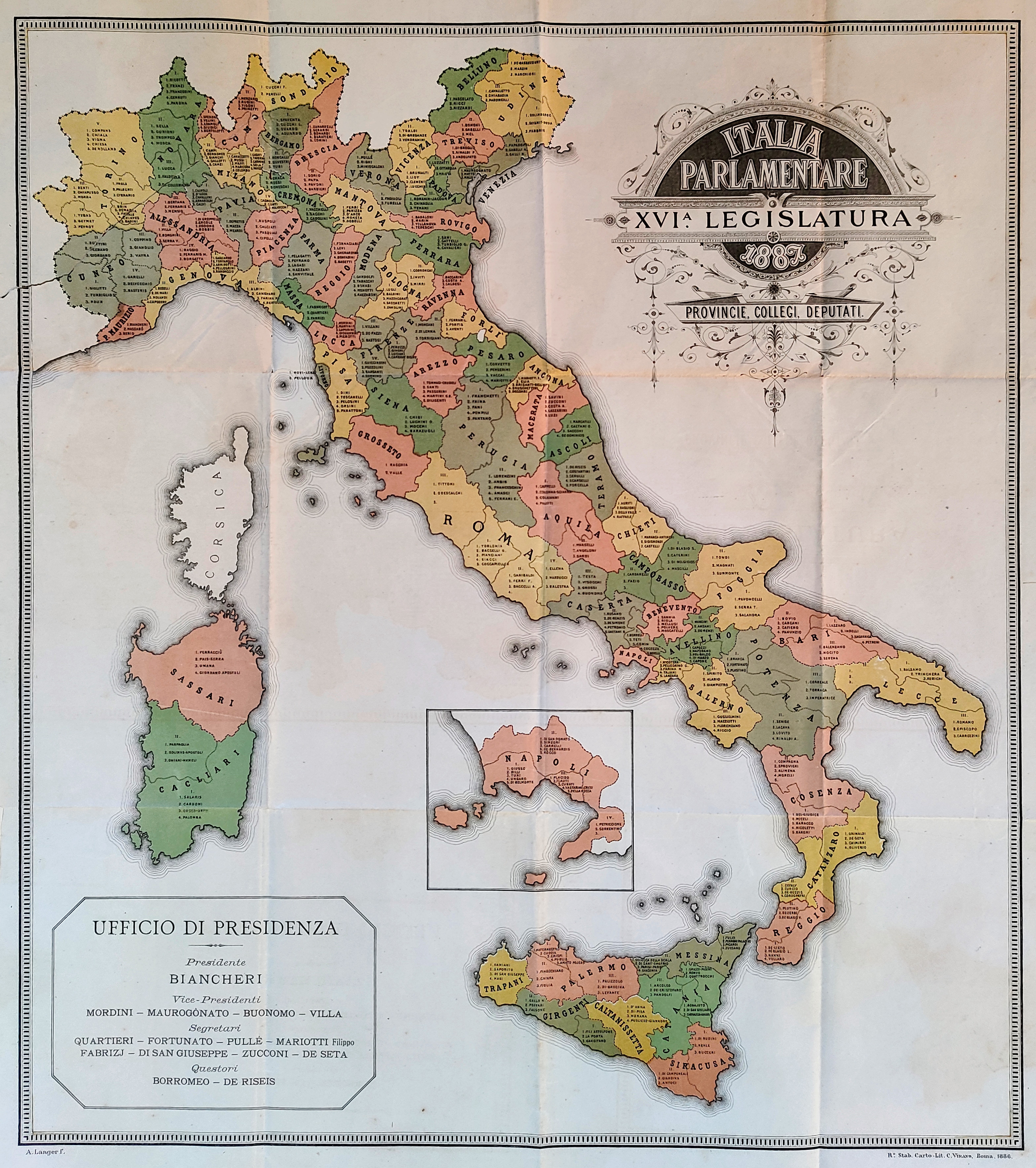
Map title
Italia parlamentare
Author
Location shown in map
Italy
Edition date
1886
Edition place
Rome
Editor
Atlas
Price
300 Euro
State
[mint/EXCELLENT/very good/good/fair/mediocre/poor]
Color
Old colors
Verso
Blank
Size
Plate: cm (68 x 57) inches (26.77 x 22.44) Paper: cm (56 x 50) inches (22.05 x 19.69)
Technique
Steel engraving
Note
Reference
Wiki
Here for more info
In stock
Available
Info
info@thetreasuremaps.com
Code
#0919
×
![Italia parlamentare by , Italy, 1886]()
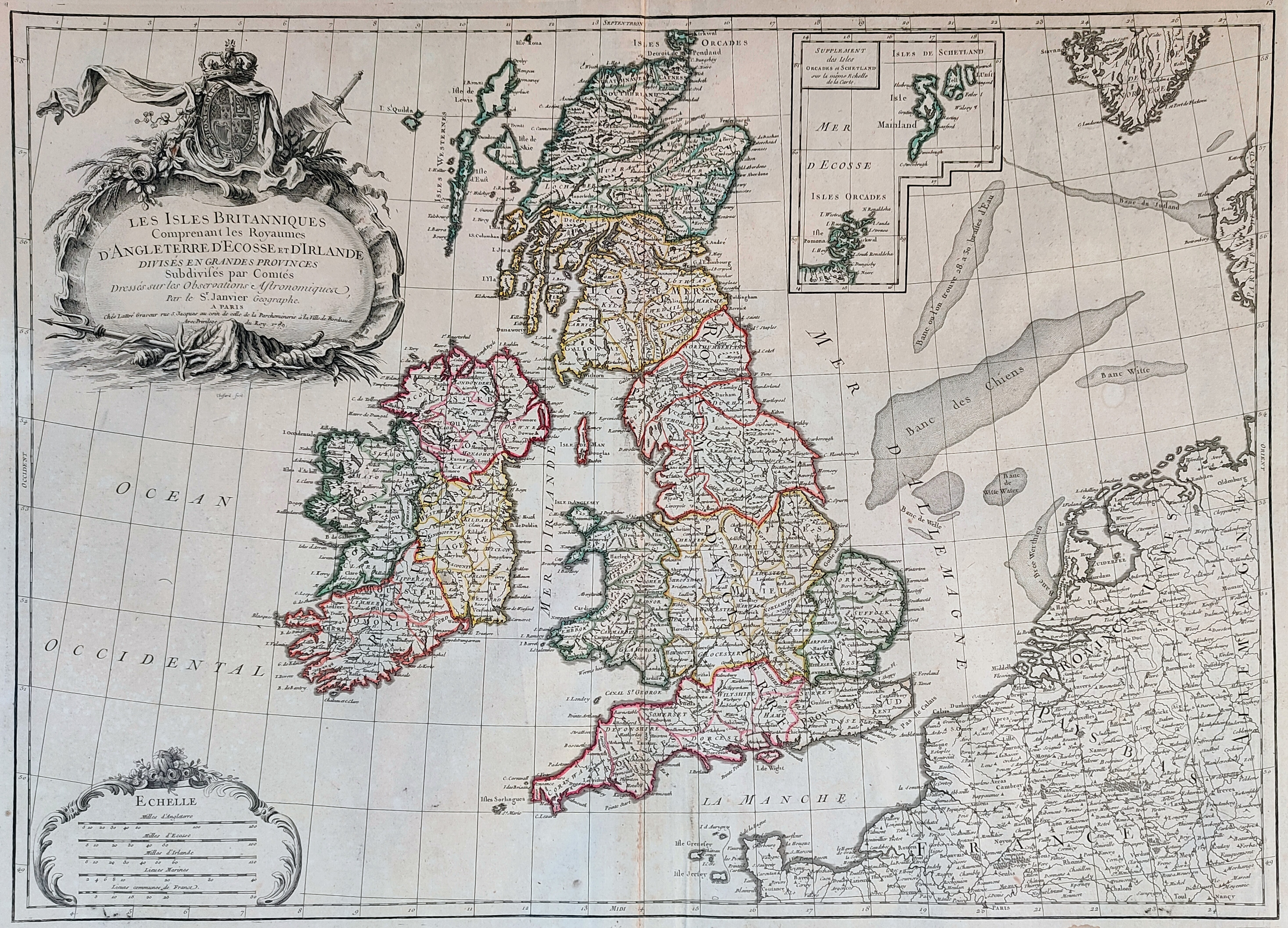
Map title
Les Iles Britanniques comprenant les Royaumes d'Angleterre ...
Author
Janvier
Location shown in map
England
Edition date
1784
Edition place
Venice
Editor
Atlas
Atlas Universel, dresse sur les meilleures cartes modernes
Price
250 Euro
State
[mint/EXCELLENT/very good/good/fair/mediocre/poor]
Color
Old colors
Verso
Blank
Size
Plate: cm (73 x 54) inches (28.74 x 21.26) Paper: cm (65 x 47) inches (25.59 x 18.5)
Technique
Copper engraving
Note
Reference
Wiki
Here for more info
In stock
Available
Info
info@thetreasuremaps.com
Code
#0920
×
![Les Iles Britanniques comprenant les Royaumes d'Angleterre ... by Janvier, England, 1784]()
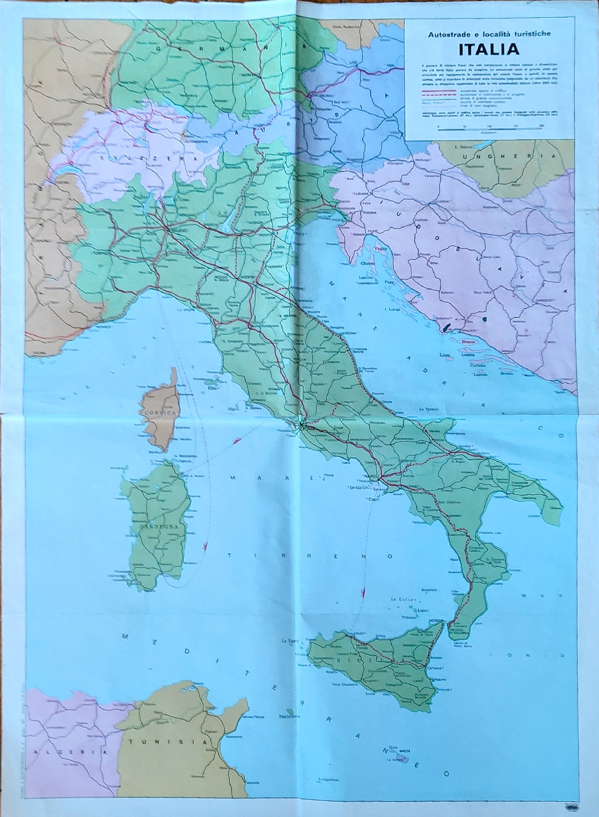
Map title
Autostrade e localita turistiche
Author
Location shown in map
Italy
Edition date
1967
Edition place
Rome
Editor
Atlas
Price
Please ask: info@thetreasuremaps.com
State
[mint/EXCELLENT/very good/good/fair/mediocre/poor]
Color
Old colors
Verso
Blank
Size
Plate: cm (68 x 50) inches (26.77 x 19.69) Paper: cm (45 x 46) inches (17.72 x 18.11)
Technique
Steel engraving
Note
Reference
Wiki
Here for more info
In stock
Available
Info
info@thetreasuremaps.com
Code
#0923
×
![Autostrade e localita turistiche by , Italy, 1967]()
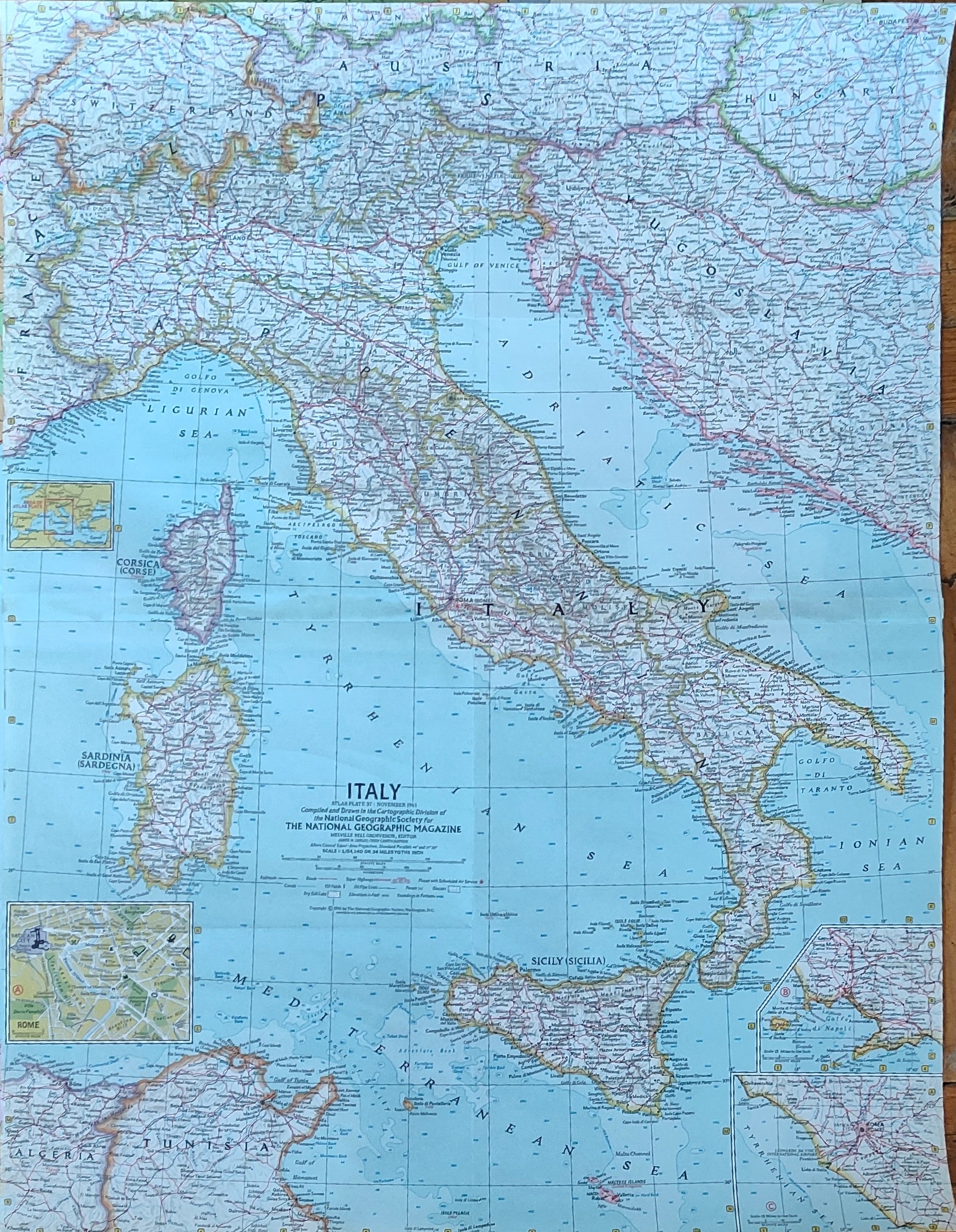
Map title
Italy
Author
Location shown in map
Italy
Edition date
Circa 1960
Edition place
Rome
Editor
Atlas
Price
Please ask: info@thetreasuremaps.com
State
[mint/EXCELLENT/very good/good/fair/mediocre/poor]
Color
Old colors
Verso
Blank
Size
Plate: cm (63 x 48) inches (24.8 x 18.9) Paper: cm (63 x 48) inches (24.8 x 18.9)
Technique
Steel engraving
Note
Reference
Wiki
Here for more info
In stock
Available
Info
info@thetreasuremaps.com
Code
#0924
Italy
Author
Location shown in map
Italy
Edition date
Circa 1960
Edition place
Rome
Editor
Atlas
Price
Please ask: info@thetreasuremaps.com
State
[mint/EXCELLENT/very good/good/fair/mediocre/poor]
Color
Old colors
Verso
Blank
Size
Plate: cm (63 x 48) inches (24.8 x 18.9) Paper: cm (63 x 48) inches (24.8 x 18.9)
Technique
Steel engraving
Note
Reference
Wiki
Here for more info
In stock
Available
Info
info@thetreasuremaps.com
Code
#0924
×
![Italy by , Italy, Circa 1960]()
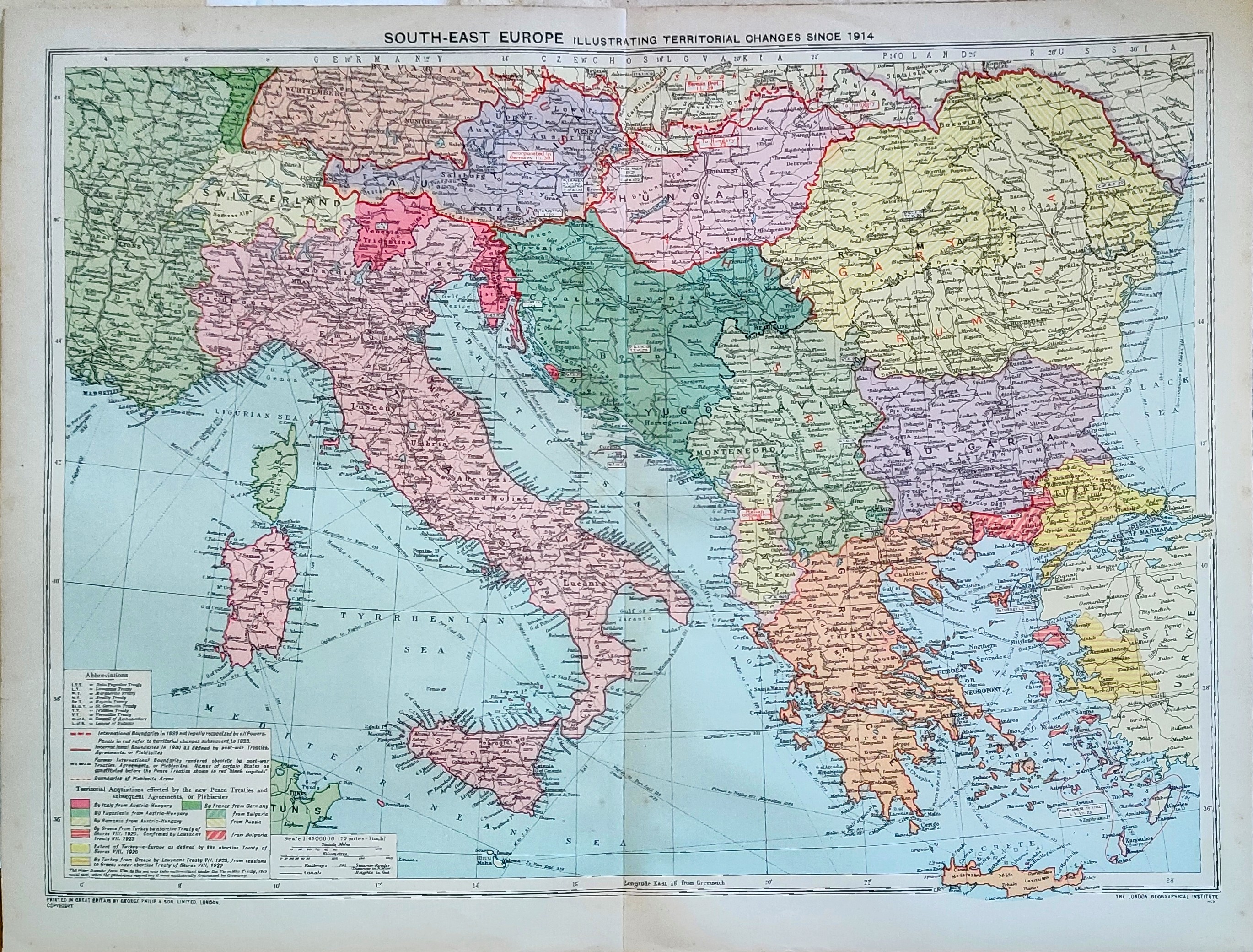
Map title
South Europa
Author
Location shown in map
Italy
Edition date
Circa 1939
Edition place
London
Editor
Atlas
Price
Please ask: info@thetreasuremaps.com
State
[mint/EXCELLENT/very good/good/fair/mediocre/poor]
Color
Old colors
Verso
Blank
Size
Plate: cm (51 x 39) inches (20.08 x 15.35) Paper: cm (48 x 35) inches (18.9 x 13.78)
Technique
Steel engraving
Note
Reference
Wiki
Here for more info
In stock
Available
Info
info@thetreasuremaps.com
Code
#0925
×
![South Europa by , Italy, Circa 1939]()
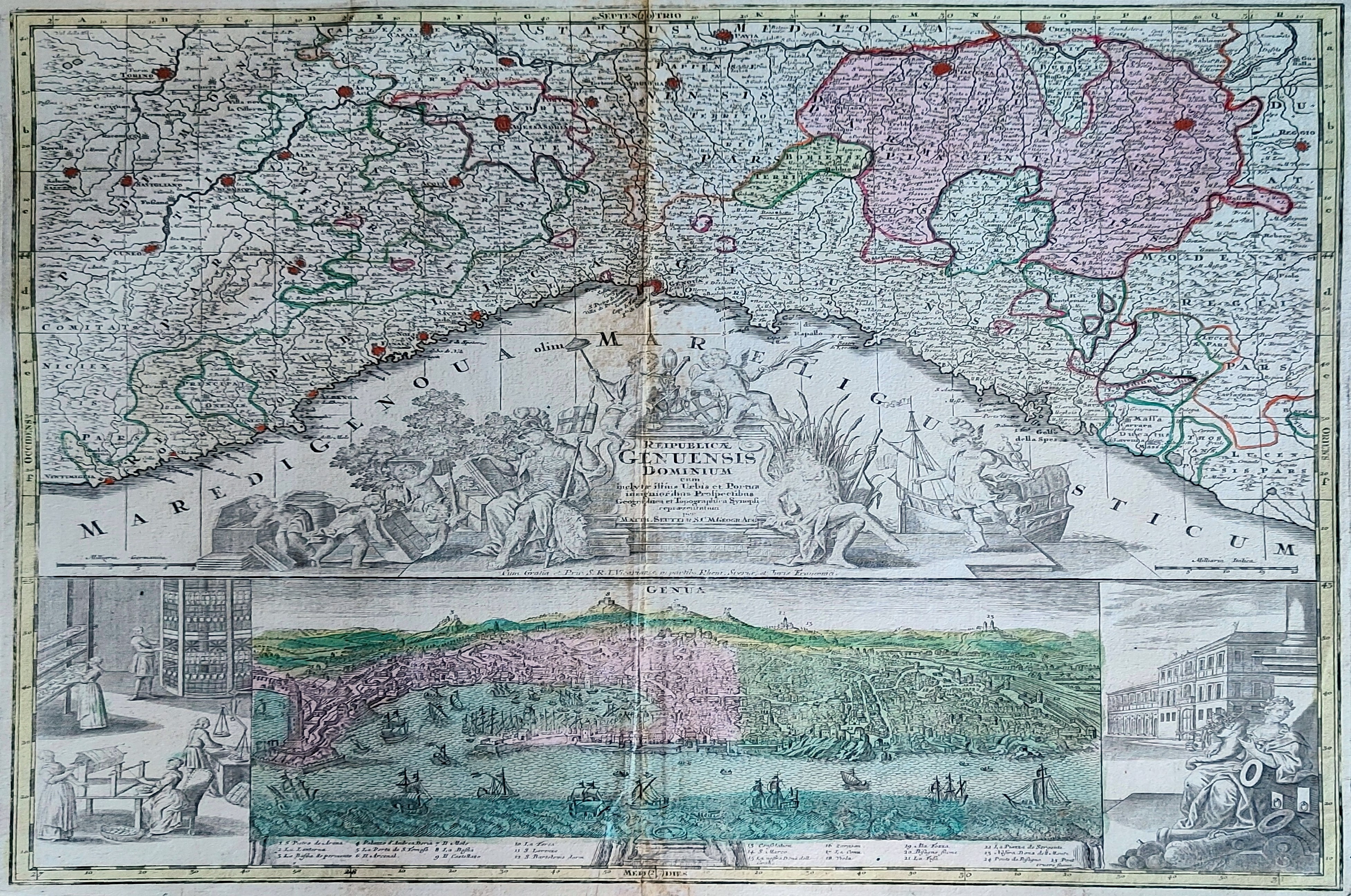
Map title
Republicae Genuensis dominium
Author
Seutter, Matthaus
Location shown in map
Liguria
Edition date
1740
Edition place
Augsburg
Editor
Atlas
Atlas Novus sive Tabulae Geographicae totius orbis faciem, partes, imperia, regna et provincias exhibentes exactissima cura iuxta recontissimas observation
Price
500 Euro
State
[mint/excellent/VERY GOOD/good/fair/mediocre/poor]
Color
Old colors
Verso
Blank
Size
Plate: cm (58 x 48) inches (22.83 x 18.9) Paper: cm (67 x 54) inches (26.38 x 21.26)
Technique
Copper engraving
Note
Reference
Wiki
Here for more info
In stock
Available
Info
info@thetreasuremaps.com
Code
#0911
×
![Republicae Genuensis dominium by Seutter, Matthaus, Liguria, 1740]()
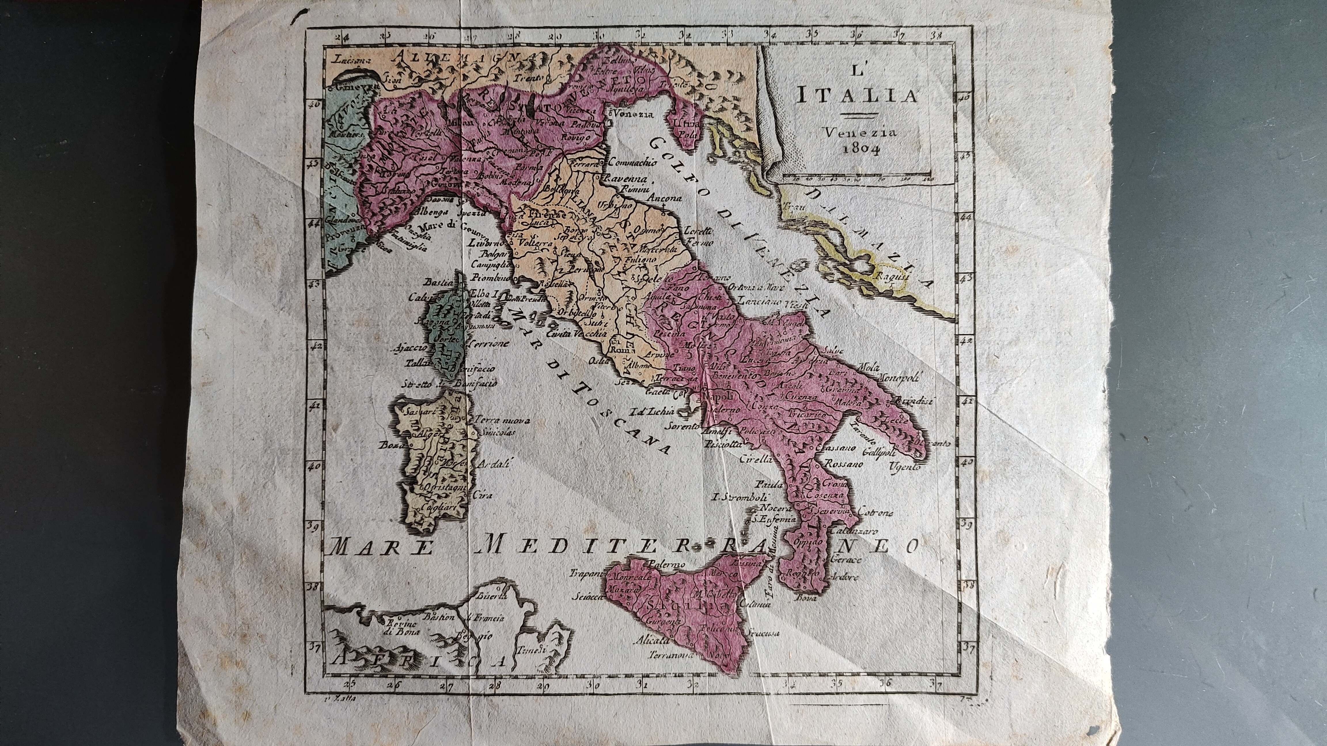
Map title
L'Italia
Author
Zatta
Location shown in map
Italy
Edition date
1804
Edition place
Venice
Editor
Atlas
Nuovo atlante
Price
150 Euro
State
[mint/excellent/VERY GOOD/good/fair/mediocre/poor]
Color
Old colors
Verso
Blank
Size
Plate: cm (16 x 16) inches (6.3 x 6.3) Paper: cm (18 x 28) inches (7.09 x 11.02)
Technique
Copper engraving
Note
Reference
Wiki
Here for more info
In stock
Available
Info
info@thetreasuremaps.com
Code
#0912
×
![L'Italia by Zatta, Italy, 1804]()