News
Map title
Asiae nova descriptio
Author
Hondius
Location shown in map
Asia
Edition date
Circa 1606
Edition place
Amsterdam
Editor
Hondius
Atlas
Price
1000 Euro
State
[mint/EXCELLENT/very good/good/fair/mediocre/poor]
Color
Old colors
Verso
Size
Plate: cm (50 x 37) inches (19.69 x 14.57) Paper: cm (57 x 47) inches (22.44 x 18.5)
Technique
Copper engraving
Note
Reference
Wiki
Here for more info
In stock
Available
Info
info@thetreasuremaps.com
Code
#0913
×
![Asiae nova descriptio by Hondius, Asia, Circa 1606]()
Map title
Tabula Italiae medii evi
Author
Giovanni Giacomo Spinelli
Location shown in map
Italy
Edition date
1785
Edition place
Milan
Editor
Atlas
Geschichte von Italien und allen allda gegrundeten altern und neuern Staaten
Price
350 Euro
State
[mint/EXCELLENT/very good/good/fair/mediocre/poor]
Color
Black/white
Verso
Blank
Size
Plate: cm (46 x 42) inches (18.11 x 16.54) Paper: cm (44 x 32) inches (17.32 x 12.6)
Technique
Copper engraving
Note
Reference
R.Borri L'Italia nelle antiche carte pag.216
Wiki
Here for more info
In stock
Available
Info
info@thetreasuremaps.com
Code
#0914
×
![Tabula Italiae medii evi by Giovanni Giacomo Spinelli, Italy, 1785]()
Map title
Carta d'Italia con le poste
Author
Location shown in map
Italy
Edition date
1810
Edition place
Florence
Editor
Pagni
Atlas
Price
150 Euro
State
[mint/excellent/VERY GOOD/good/fair/mediocre/poor]
Color
Old colors
Verso
Blank
Size
Plate: cm (54 x 52) inches (21.26 x 20.47) Paper: cm (48 x 45) inches (18.9 x 17.72)
Technique
Copper engraving
Note
Reference
Wiki
Here for more info
In stock
Available
Info
info@thetreasuremaps.com
Code
#0915
×
![Carta d'Italia con le poste by , Italy, 1810]()
Map title
Italien
Author
Location shown in map
Italy
Edition date
1808
Edition place
Weimar
Editor
Atlas
Price
150 Euro
State
[mint/EXCELLENT/very good/good/fair/mediocre/poor]
Color
Old colors
Verso
Blank
Size
Plate: cm (33 x 44) inches (12.99 x 17.32) Paper: cm (31 x 42) inches (12.2 x 16.54)
Technique
Copper engraving
Note
Reference
Wiki
Here for more info
In stock
Available
Info
info@thetreasuremaps.com
Code
#0916
×
![Italien by , Italy, 1808]()
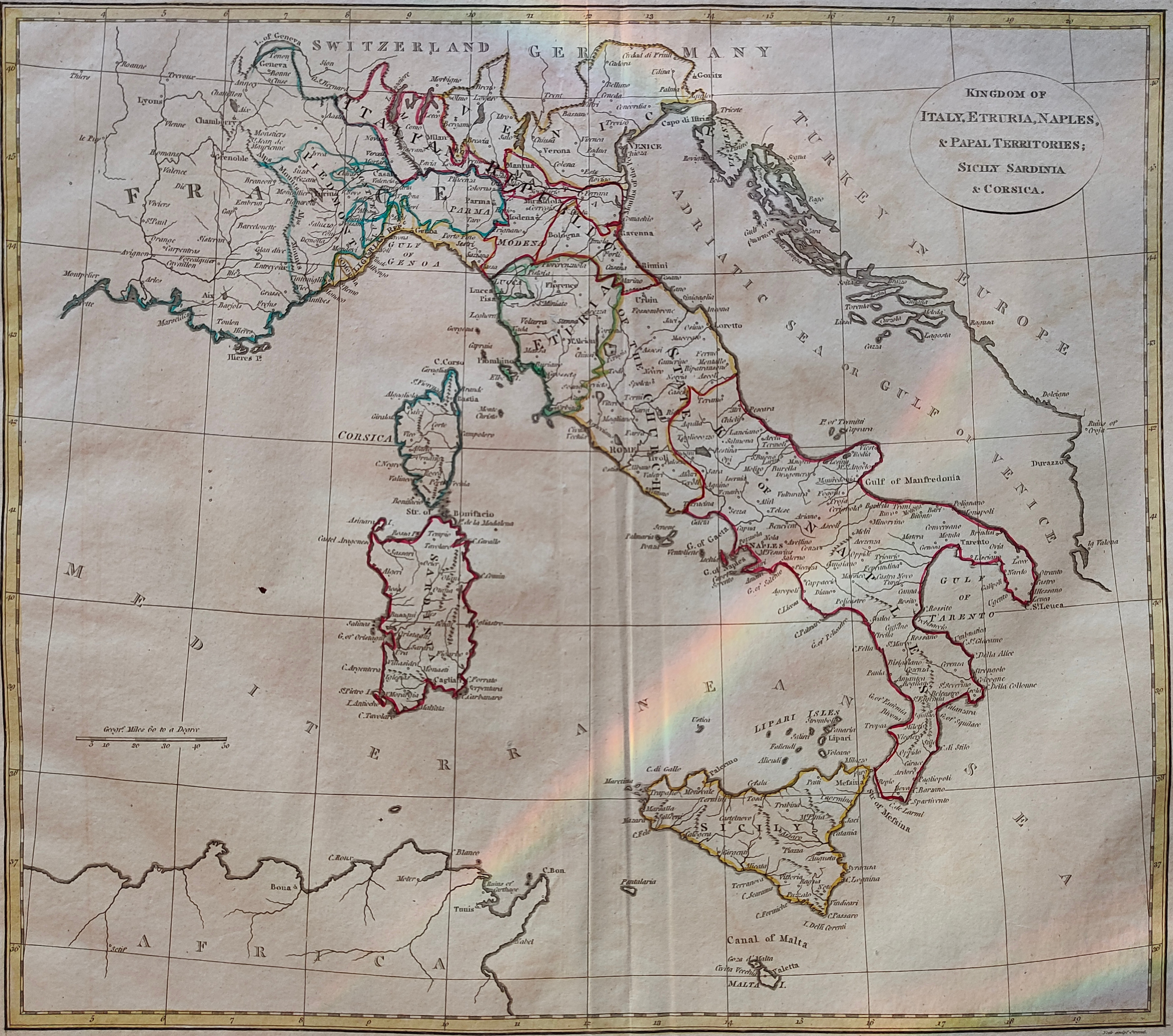
Map title
Kingdom of Italy, Etruria, Naples
Author
Location shown in map
Italy
Edition date
1808
Edition place
London
Editor
Atlas
Price
150 Euro
State
[mint/EXCELLENT/very good/good/fair/mediocre/poor]
Color
Old colors
Verso
Blank
Size
Plate: cm (51 x 43) inches (20.08 x 16.93) Paper: cm (39 x 34) inches (15.35 x 13.39)
Technique
Copper engraving
Note
Reference
Wiki
Here for more info
In stock
Available
Info
info@thetreasuremaps.com
Code
#0917
×
![Kingdom of Italy, Etruria, Naples by , Italy, 1808]()
Map title
Italia
Author
Livio Caiulo
Location shown in map
Italy
Edition date
Circa 1980
Edition place
Milan
Editor
Atlas
Price
175 Euro
State
[mint/EXCELLENT/very good/good/fair/mediocre/poor]
Color
Old colors
Verso
Blank
Size
Plate: cm (99 x 68) inches (38.98 x 26.77) Paper: cm (99 x 68) inches (38.98 x 26.77)
Technique
Steel engraving
Note
Reference
Wiki
Here for more info
In stock
Available
Info
info@thetreasuremaps.com
Code
#0921
×
![Italia by Livio Caiulo, Italy, Circa 1980]()
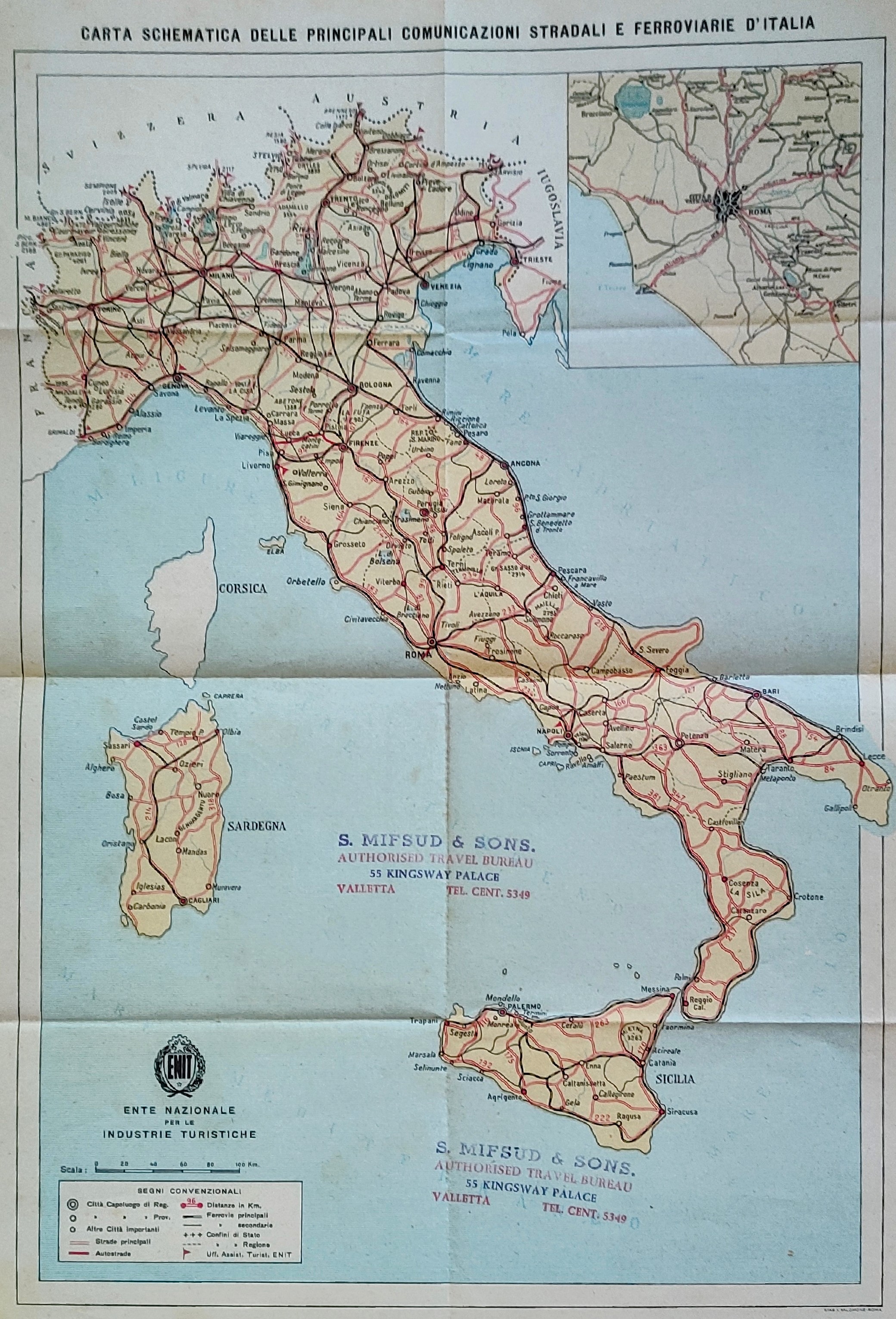
Map title
Carta schematica delle principali comunicazioni stradali e ferroviarie d'italia
Author
Location shown in map
Italy
Edition date
Circa 1950
Edition place
Rome
Editor
Atlas
Price
75 Euro
State
[mint/EXCELLENT/very good/good/fair/mediocre/poor]
Color
Old colors
Verso
Blank
Size
Plate: cm (30 x 42) inches (11.81 x 16.54) Paper: cm (26 x 38) inches (10.24 x 14.96)
Technique
Steel engraving
Note
Reference
Wiki
Here for more info
In stock
Available
Info
info@thetreasuremaps.com
Code
#0922
×
![Carta schematica delle principali comunicazioni stradali e ferroviarie d'italia by , Italy, Circa 1950]()
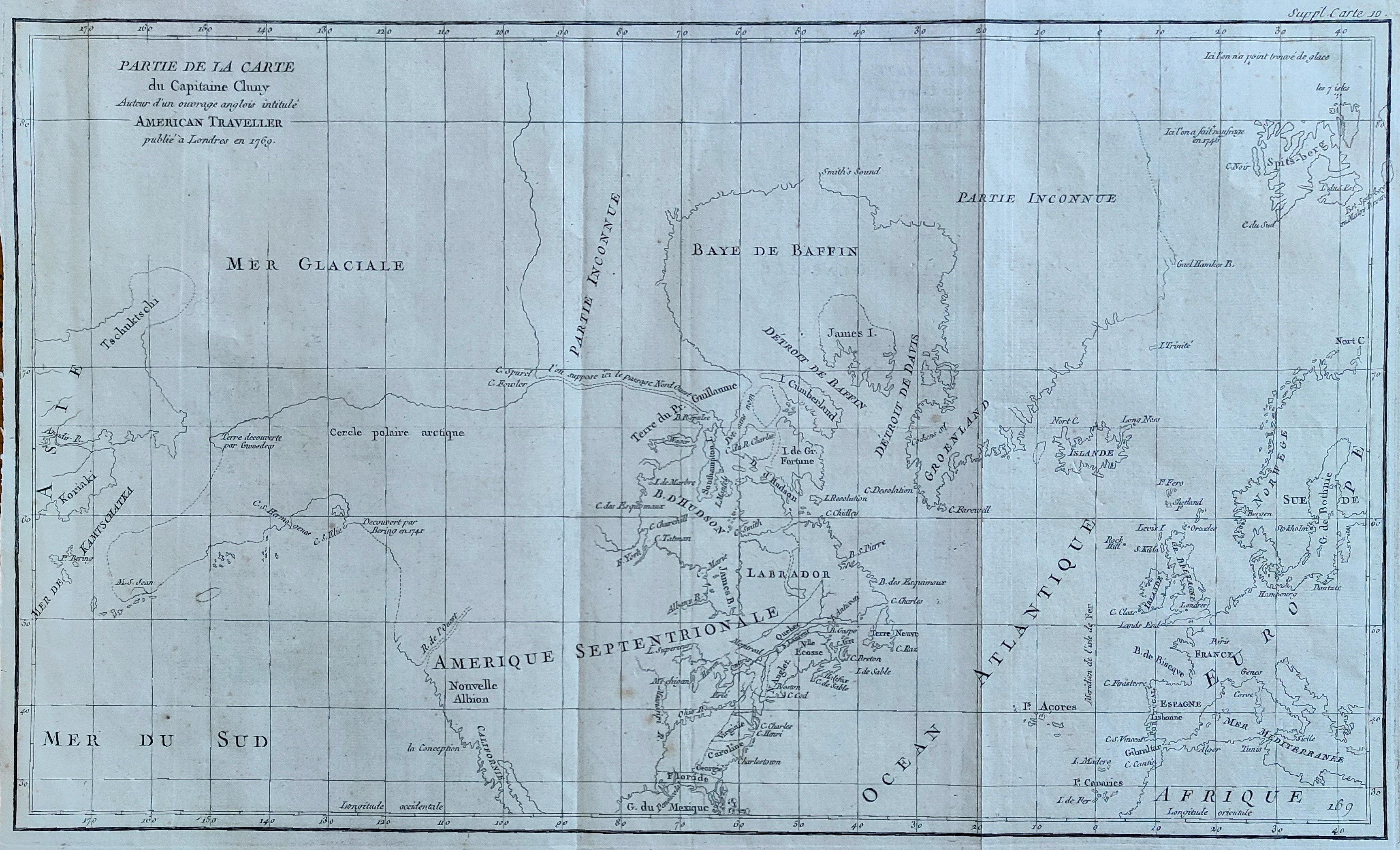
Map title
Partie de la carte du Capitaine Cluny
Author
Diderot
Location shown in map
North America
Edition date
1772
Edition place
Paris
Editor
Diderot
Atlas
Encyclopedie -- De Vaugondy
Price
250 Euro
State
[mint/EXCELLENT/very good/good/fair/mediocre/poor]
Color
Black/white
Verso
Blank
Size
Plate: cm (49.5 x 29.2) inches (19.49 x 11.5) Paper: cm (52 x 38) inches (20.47 x 14.96)
Technique
Copper engraving
Note
No particular notes for this maps
Reference
--
Wiki
Here for more info
In stock
Available
Info
info@thetreasuremaps.com
Code
#0082
×
![Partie de la carte du Capitaine Cluny by Diderot, North America, 1772]()
Map title
Carte des nouvelles decouvertes
Author
Diderot
Location shown in map
North America
Edition date
1772
Edition place
Paris
Editor
--
Atlas
Encyclopedie -- De Vaugondy
Price
125 Euro
State
[mint/EXCELLENT/very good/good/fair/mediocre/poor]
Color
Black/white
Verso
Blank
Size
Plate: cm (40.6 x 31.8) inches (15.98 x 12.52) Paper: cm (50.8 x 40.6) inches (20 x 15.98)
Technique
Copper engraving
Note
No particular notes for this maps
Reference
--
Wiki
Here for more info
In stock
Available
Info
info@thetreasuremaps.com
Code
#0910
×
![Carte des nouvelles decouvertes by Diderot, North America, 1772]()
Map title
Asia ex magna orbis terre descriptione Gerardi Mercatoris Desumpta studio et industria G.M. Iumioris
Author
Mercator
Location shown in map
Asia
Edition date
Circa 1595
Edition place
Amsterdam
Editor
Hondius
Atlas
Price
1500 Euro
State
[mint/excellent/VERY GOOD/good/fair/mediocre/poor]
Color
Black/white
Verso
Size
Plate: cm (49 x 39) inches (19.29 x 15.35) Paper: cm (49 x 39) inches (19.29 x 15.35)
Technique
Copper engraving
Note
Reference
Wiki
Here for more info
In stock
Available
Info
info@thetreasuremaps.com
Code
#0906
×
![Asia ex magna orbis terre descriptione Gerardi Mercatoris Desumpta studio et industria G.M. Iumioris by Mercator, Asia, Circa 1595]()
Map title
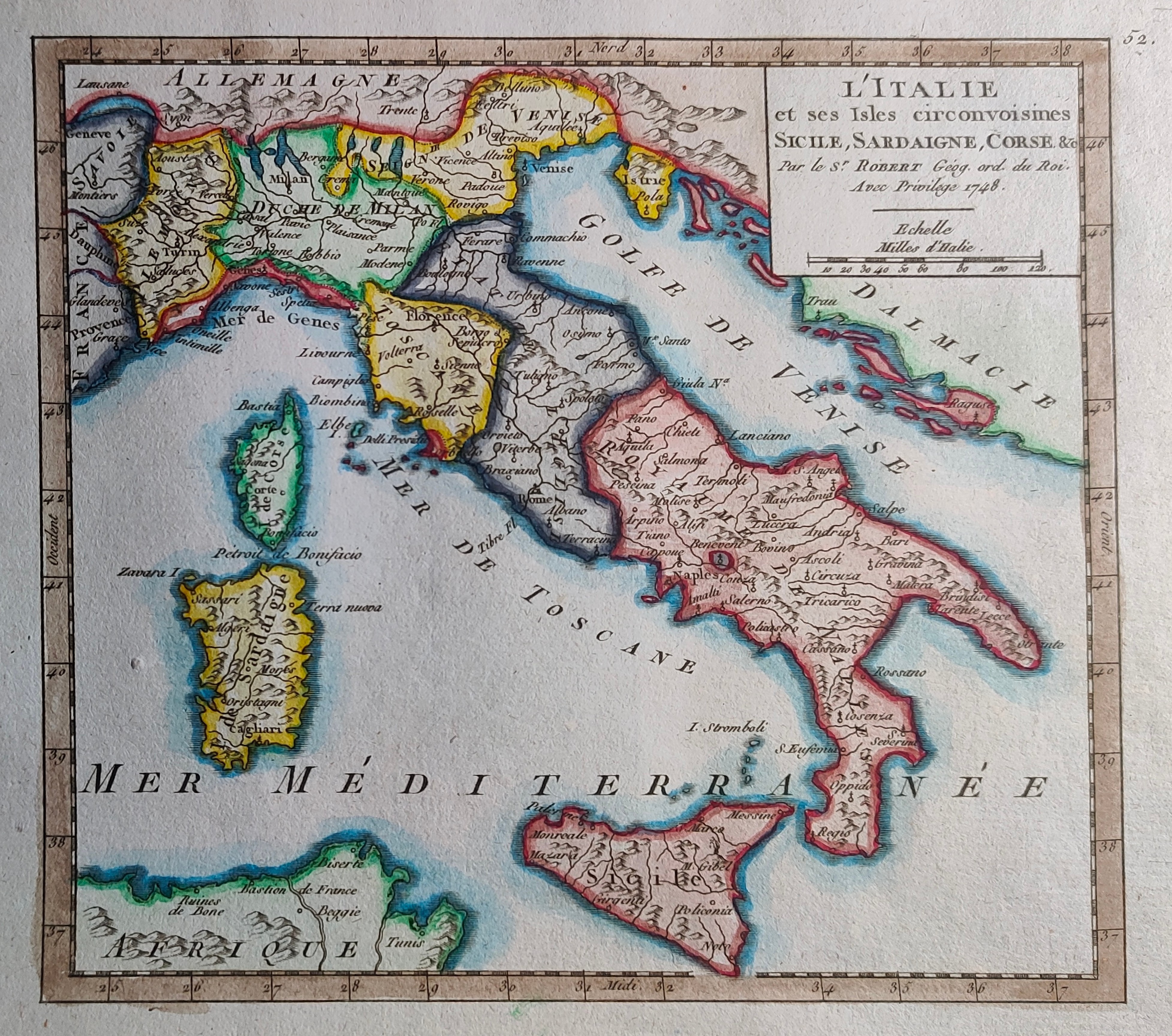
L'Italie et ses isles circonvoisines Siclile, Sargaigne, Corse ...
Author
Sanson
Location shown in map
Italy
Edition date
1778
Edition place
Paris
Editor
Delahaye
Atlas
Price
600 Euro
State
[mint/EXCELLENT/very good/good/fair/mediocre/poor]
Color
Old colors
Verso
Blank
Size
Plate: cm (52 x 68) inches (20.47 x 26.77) Paper: cm (54 x 75) inches (21.26 x 29.53)
Technique
Copper engraving
Note
Reference
R.Borri L'Italia nelle antiche carte pag.241
Wiki
Here for more info
In stock
Available
Info
info@thetreasuremaps.com
Code
#0907
×
![L'Italie et ses isles circonvoisines Siclile, Sargaigne, Corse ... by Sanson, Italy, 1778]()
Map title
Carte Generale du Globe Terrestre
Author
Remondini
Location shown in map
World
Edition date
1761
Edition place
Venice
Editor
Atlas
Dizionario geografico portatile
Price
250 Euro
State
[mint/excellent/VERY GOOD/good/fair/mediocre/poor]
Color
Black/white
Verso
Blank
Size
Plate: cm (33 x 22) inches (12.99 x 8.66) Paper: cm (39 x 29) inches (15.35 x 11.42)
Technique
Copper engraving
Note
Reference
Wiki
Here for more info
In stock
Available
Info
info@thetreasuremaps.com
Code
#0908
×
![Carte Generale du Globe Terrestre by Remondini, World, 1761]()
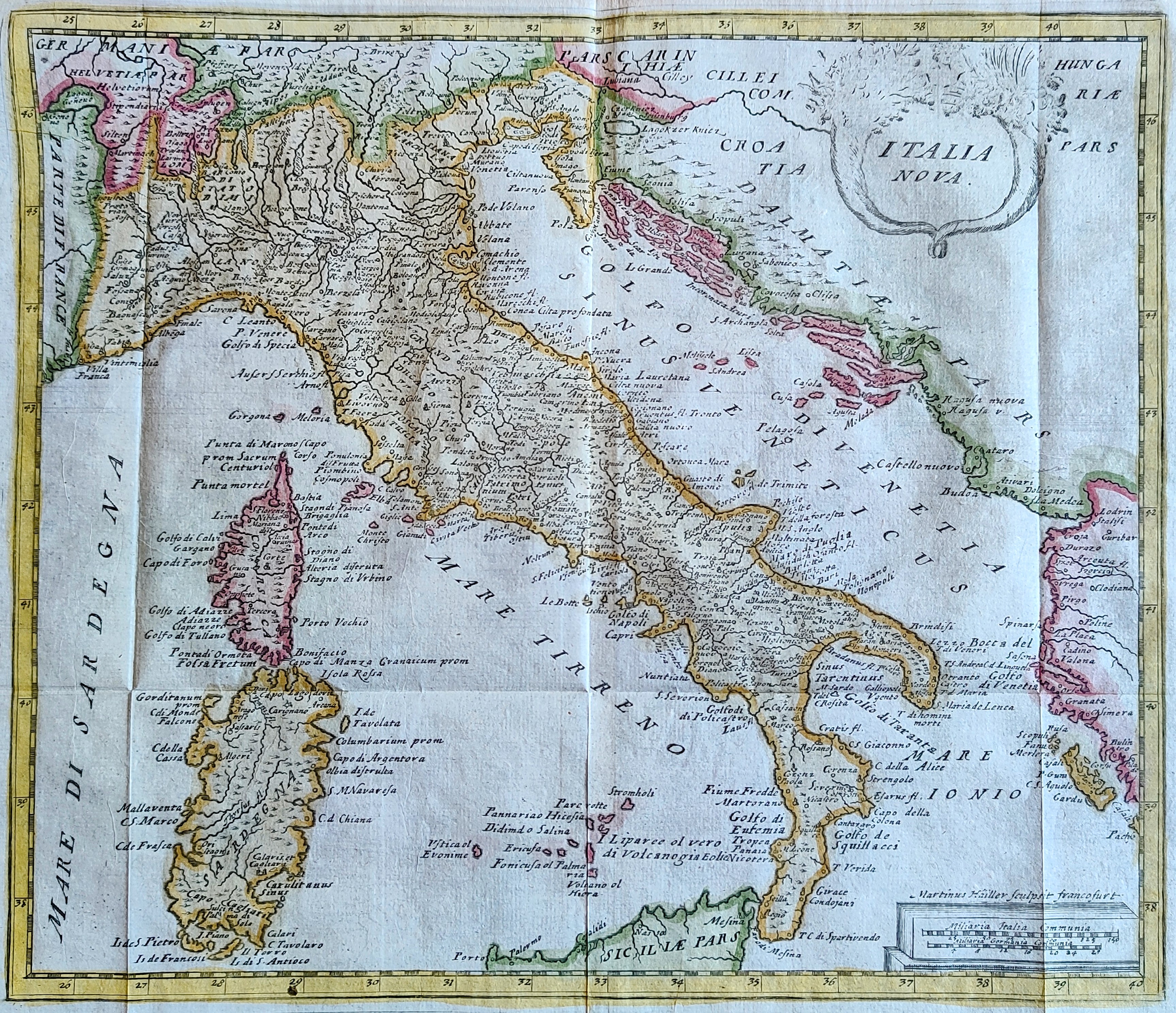
Map title
Carte des nouvelles decouvertes
Author
Hailler
Location shown in map
Italy
Edition date
Circa 1680
Edition place
Frankfurt
Editor
Atlas
Philippi Cluverii introductionis in universa geographiam tam veterem qua nova olim studio & opera Joh. Bunonis.
Price
175 Euro
State
[mint/EXCELLENT/very good/good/fair/mediocre/poor]
Color
Old colors
Verso
Blank
Size
Plate: cm (30 x 26) inches (11.81 x 10.24) Paper: cm (37 x 28) inches (14.57 x 11.02)
Technique
Copper engraving
Note
Reference
R.Borri L'Italia nelle antiche carte pag.150
Wiki
Here for more info
In stock
Available
Info
info@thetreasuremaps.com
Code
#0909
×
![Carte des nouvelles decouvertes by Hailler, Italy, Circa 1680]()
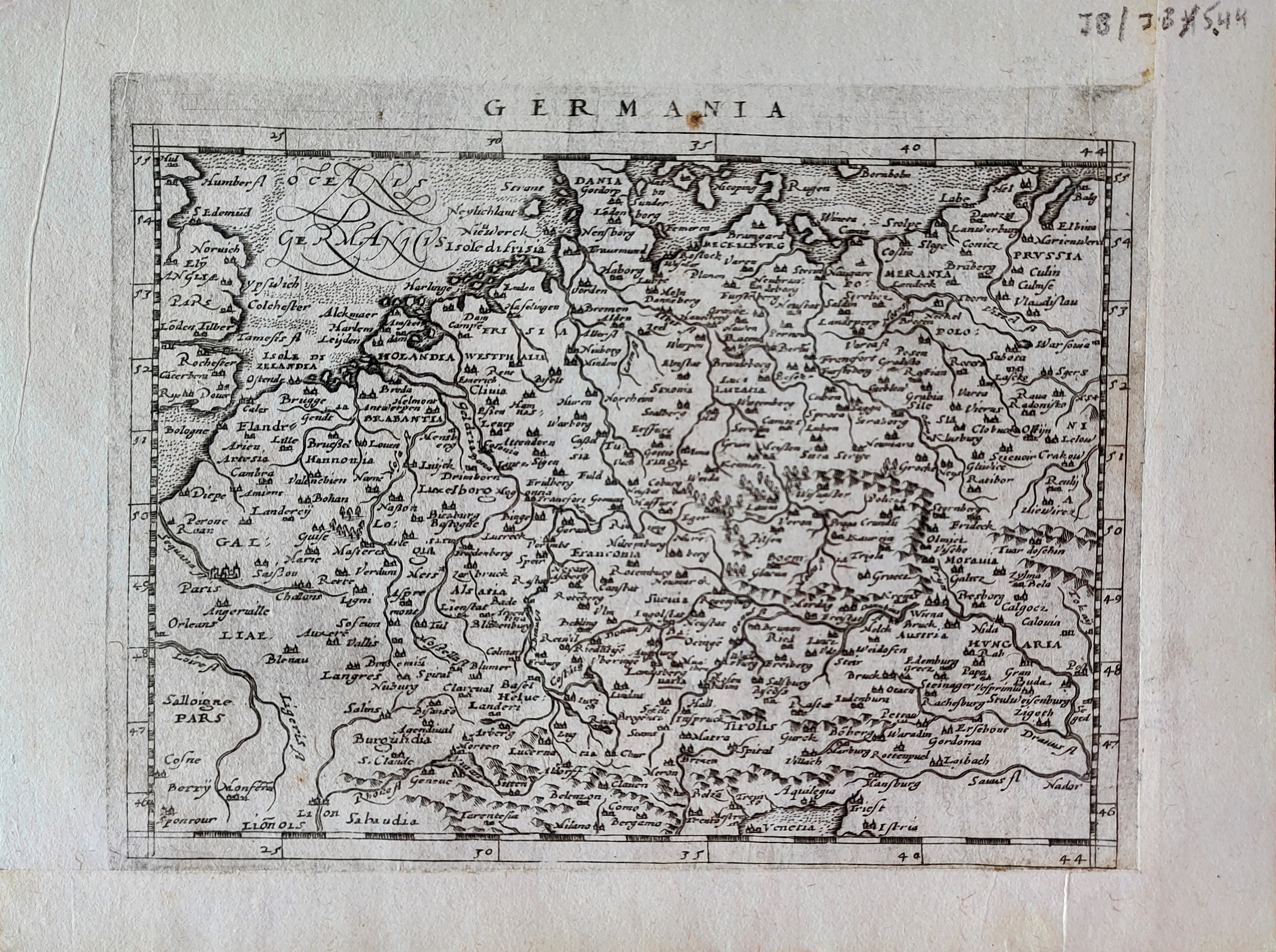
Map title
Germania
Author
Magini
Location shown in map
Germany
Edition date
1597
Edition place
Cologne
Editor
Petrus Keschedt
Atlas
Geografia di Claudio Tolomeo -- Giovanni Antonio Magini
Price
Please ask: info@thetreasuremaps.com
State
[mint/EXCELLENT/very good/good/fair/mediocre/poor]
Color
Black/white
Verso
Latin text pag 75
Size
Plate: cm (18 x 13.5) inches (7.09 x 5.31) Paper: cm (22 x 17) inches (8.66 x 6.69)
Technique
Copper engraving
Note
Maps pirated from those of Girolamo Poro in Magini's edition.
Reference
--
Wiki
Here for more info
In stock
Available
Info
info@thetreasuremaps.com
Code
#0898
×
![Germania by Magini, Germany, 1597]()
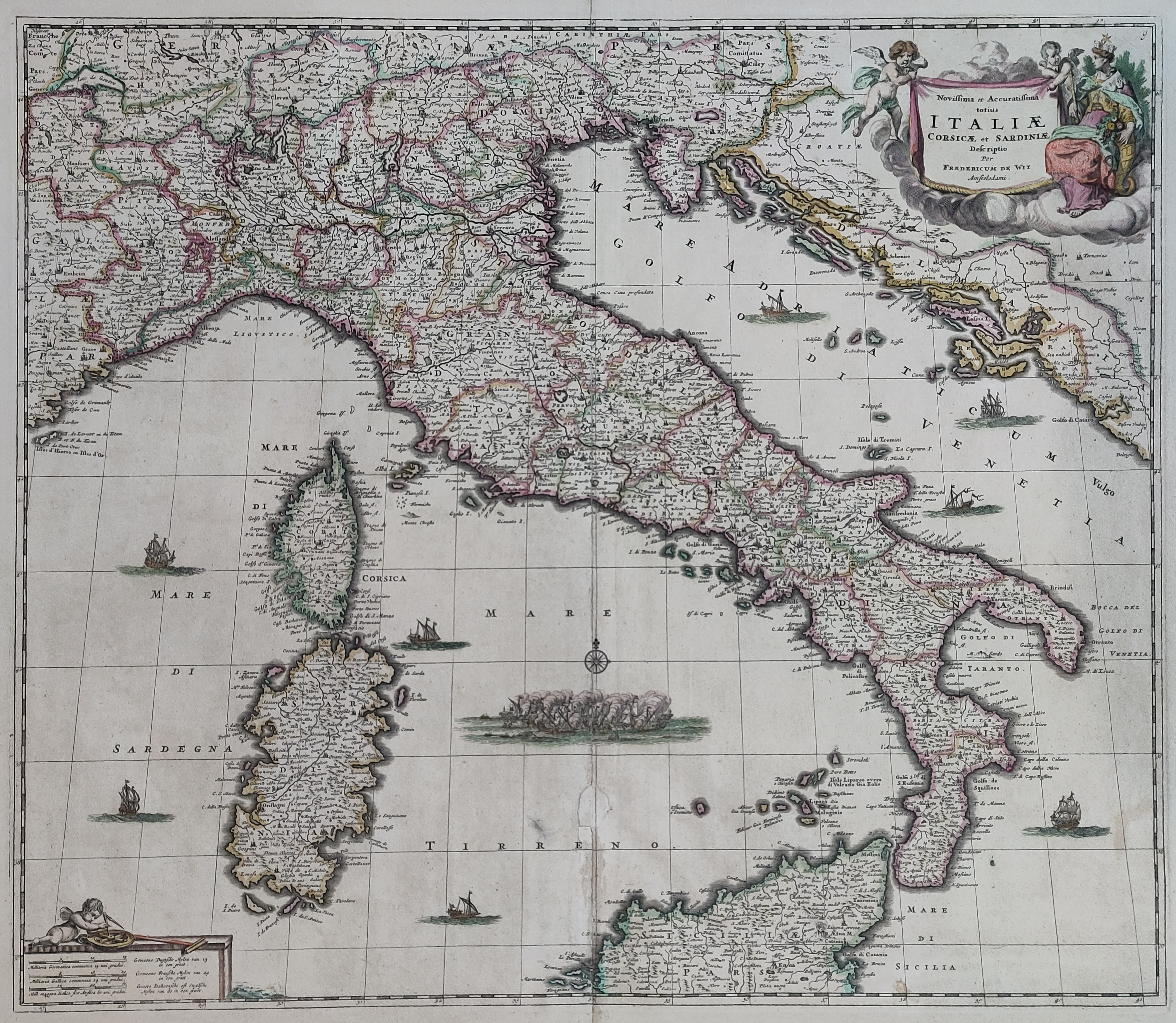
Map title
Novissima et accuratissima totius Italiae
Author
De Wit
Location shown in map
Italy
Edition date
Circa 1671
Edition place
Amsterdam
Editor
Atlas
Atlas Maior
Price
700 Euro
State
[mint/EXCELLENT/very good/good/fair/mediocre/poor]
Color
Old colors
Verso
Blank
Size
Plate: cm (56 x 49) inches (22.05 x 19.29) Paper: cm (63 x 53) inches (24.8 x 20.87)
Technique
Copper engraving
Note
Reference
R.Borri L'Italia nelle antiche carte pag.148
Wiki
Here for more info
In stock
Available
Info
info@thetreasuremaps.com
Code
#0896
×
![Novissima et accuratissima totius Italiae by De Wit, Italy, Circa 1671]()
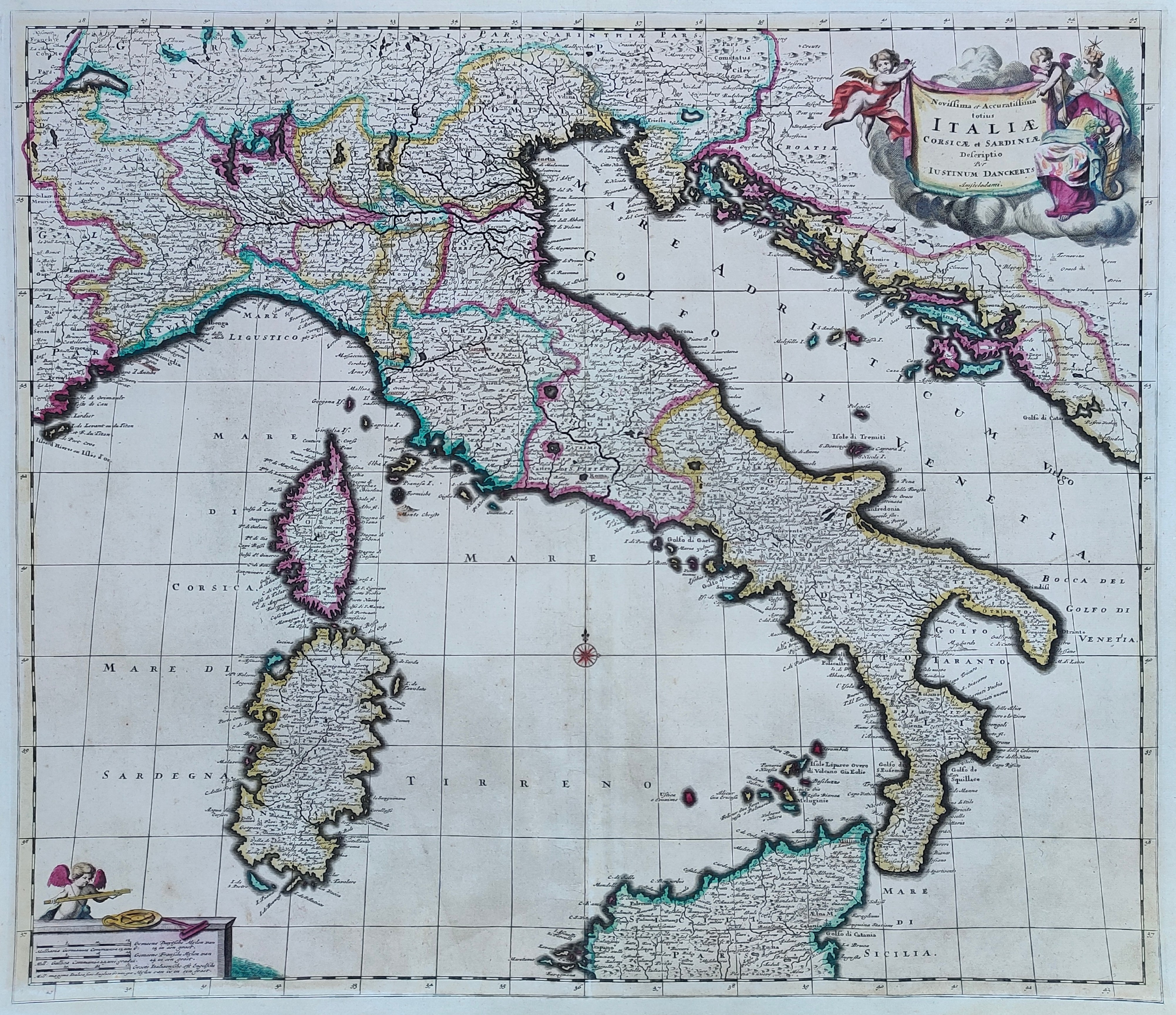
Map title
Novissima et accuratissima totius Italiae
Author
Danckerts
Location shown in map
Italy
Edition date
1685
Edition place
Amsterdam
Editor
Atlas
Price
600 Euro
State
[mint/EXCELLENT/very good/good/fair/mediocre/poor]
Color
Old colors
Verso
Blank
Size
Plate: cm (57 x 49) inches (22.44 x 19.29) Paper: cm (60 x 52) inches (23.62 x 20.47)
Technique
Copper engraving
Note
Professionally repaired
Reference
R.Borri L'Italia nelle antiche carte pag.154
Wiki
Here for more info
In stock
Available
Info
info@thetreasuremaps.com
Code
#0897
×
![Novissima et accuratissima totius Italiae by Danckerts, Italy, 1685]()
Map title
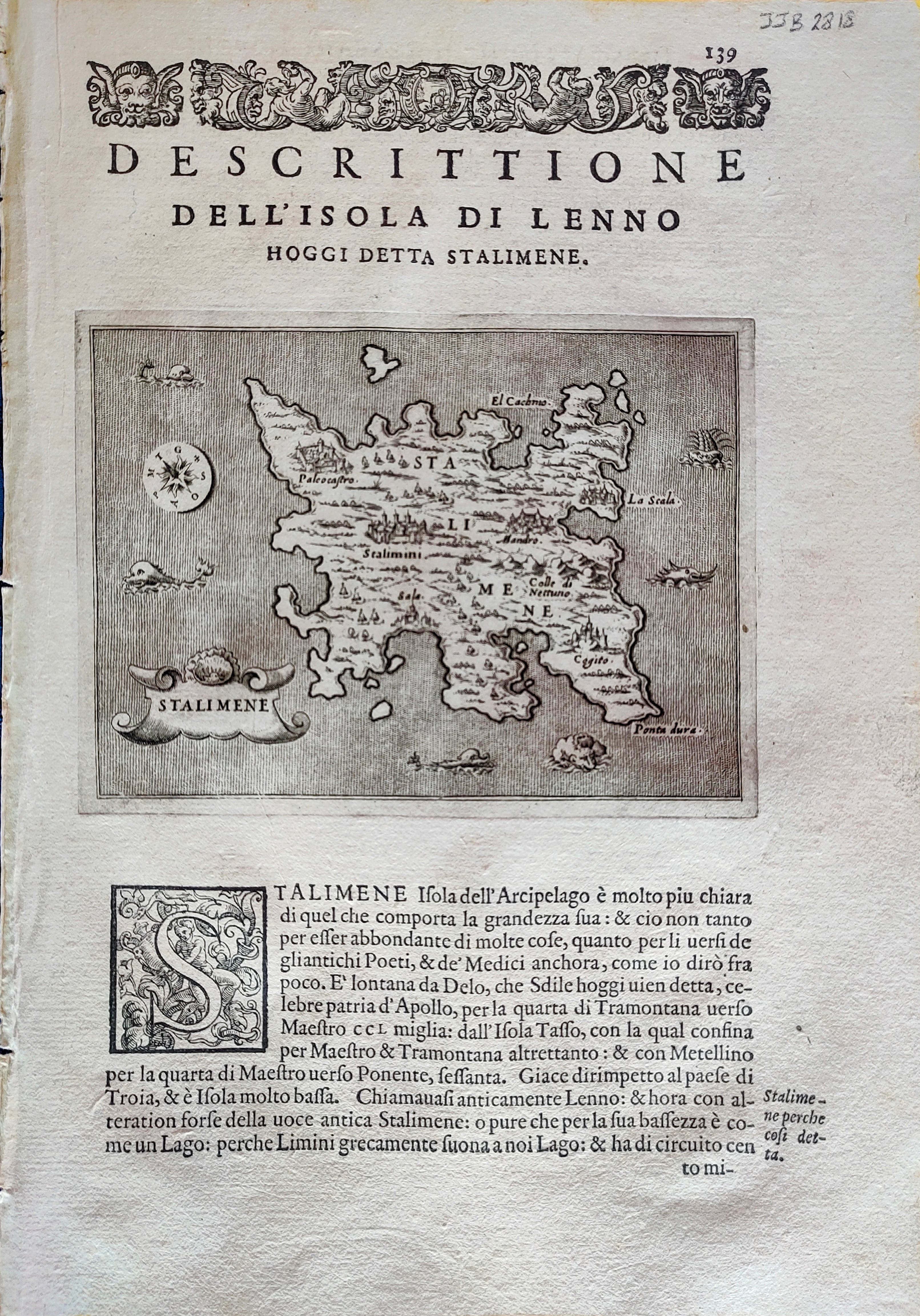
Descrittione dell'isola di Lenno
Author
Porcacchi
Location shown in map
Lemnos
Edition date
1576
Edition place
Venice
Editor
--
Atlas
L'Isole piu famose del mondo -- S. Galignani and G. Porro
Price
Please ask: info@thetreasuremaps.com
State
[mint/EXCELLENT/very good/good/fair/mediocre/poor]
Color
Black/white
Verso
Italian text pag.140
Size
Plate: cm (15.2 x 11.4) inches (5.98 x 4.49) Paper: cm (20.3 x 28) inches (7.99 x 11.02)
Technique
Copper engraving
Note
Reference
--
Wiki
Here for more info
In stock
Available
Info
info@thetreasuremaps.com
Code
#0899
×
![Descrittione dell'isola di Lenno by Porcacchi, Lemnos, 1576]()
Map title
L'Italie et ses isles ...
Author
Robert de Vaugondy
Location shown in map
Italy
Edition date
1748
Edition place
Paris
Editor
--
Atlas
Atlas Portatif Universel et Militaire
Price
100 Euro
State
[mint/EXCELLENT/very good/good/fair/mediocre/poor]
Color
Modern color
Verso
Blank
Size
Plate: cm (16 x 16) inches (6.3 x 6.3) Paper: cm (28 x 22) inches (11.02 x 8.66)
Technique
Copper engraving
Note
Reference
--
Wiki
Here for more info
In stock
Available
Info
info@thetreasuremaps.com
Code
#0901
×
![L'Italie et ses isles ... by Robert de Vaugondy, Italy, 1748]()
Map title
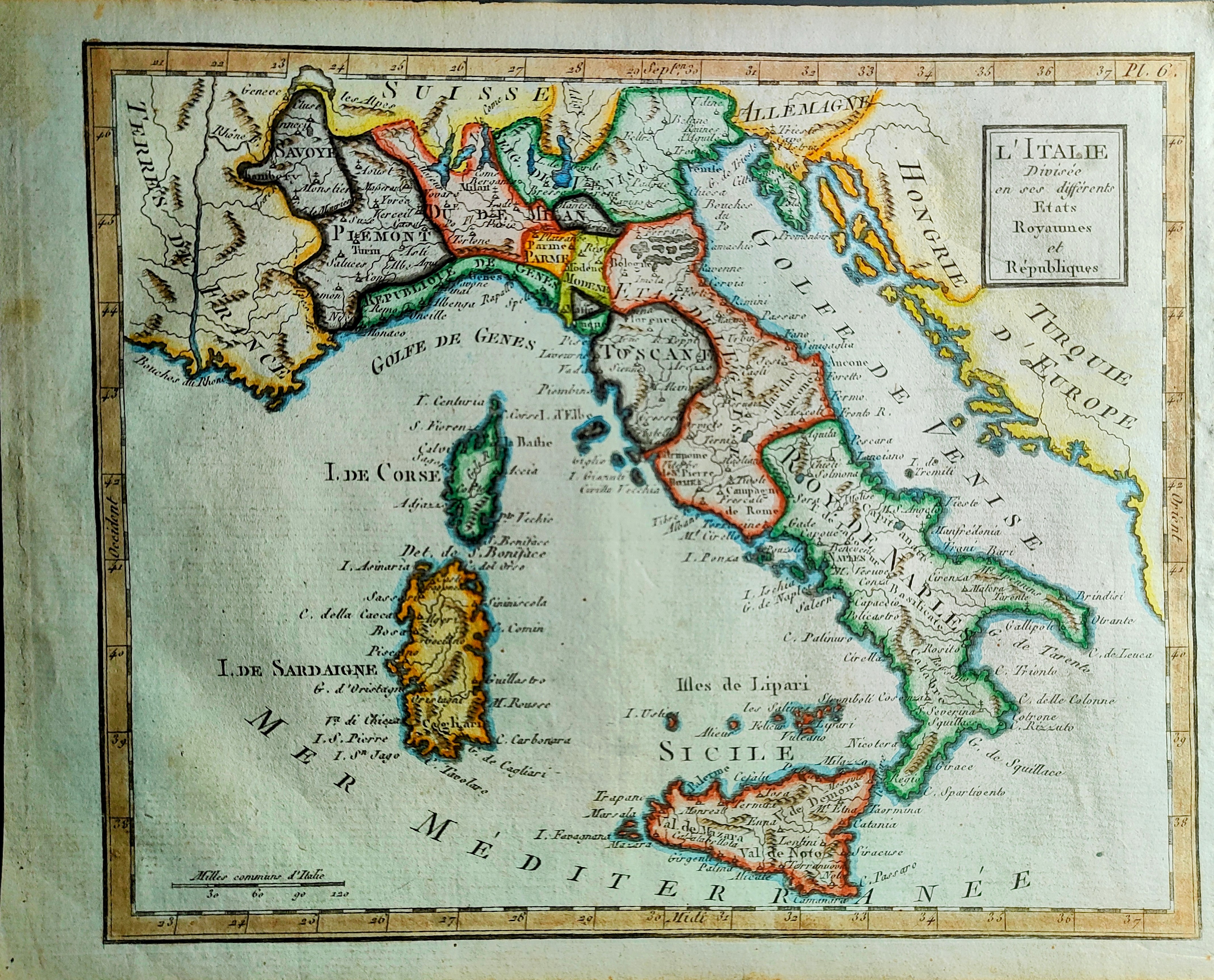
L'Italie Divisee en ses differents Etats Royaumes
Author
Citoyen Berthelon
Location shown in map
Italy
Edition date
Circa 1780
Edition place
Paris
Editor
--
Atlas
Atlas moderne
Price
100 Euro
State
[mint/EXCELLENT/very good/good/fair/mediocre/poor]
Color
Old colors
Verso
Blank
Size
Plate: cm (22 x 18) inches (8.66 x 7.09) Paper: cm (24 x 20) inches (9.45 x 7.87)
Technique
Copper engraving
Note
Reference
--
Wiki
Here for more info
In stock
Available
Info
info@thetreasuremaps.com
Code
#0902
×
![L'Italie Divisee en ses differents Etats Royaumes by Citoyen Berthelon, Italy, Circa 1780]()
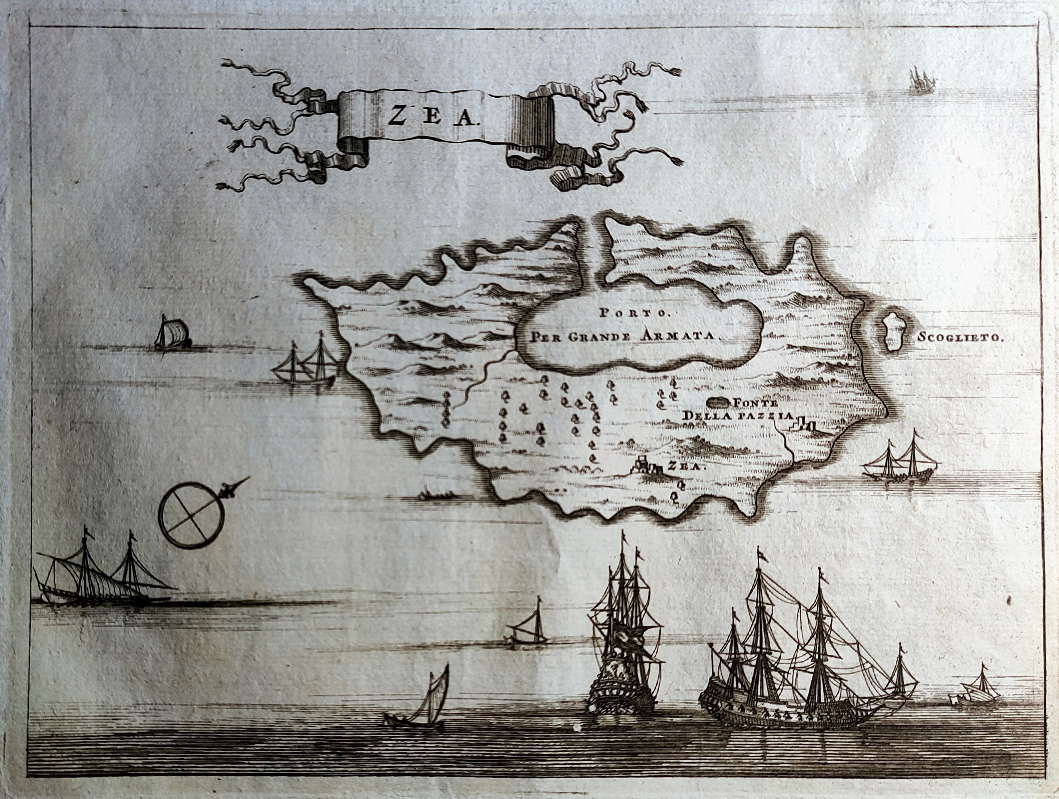
Map title
Zea
Author
Drapper
Location shown in map
Kea
Edition date
1687
Edition place
Amsterdam
Editor
Atlas
Price
125 Euro
State
[mint/EXCELLENT/very good/good/fair/mediocre/poor]
Color
Black/white
Verso
Blank
Size
Plate: cm (17 x 12) inches (6.69 x 4.72) Paper: cm (20 x 14) inches (7.87 x 5.51)
Technique
Copper engraving
Note
Reference
Wiki
Here for more info
In stock
Available
Info
info@thetreasuremaps.com
Code
#0904
×
![Zea by Drapper, Kea, 1687]()