News

Map title
Descrittione dell'isola et citta di Vinetia
Author
Porcacchi
Location shown in map
Venice
Edition date
1576
Edition place
Venice
Editor
--
Atlas
L'Isole piu famose del mondo -- S. Galignani and G. Porro
Price
Please ask: info@thetreasuremaps.com
State
[mint/excellent/VERY GOOD/good/fair/mediocre/poor]
Color
Black/white
Verso
Italian text pag.66
Size
Plate: cm (15.2 x 11.4) inches (5.98 x 4.49) Paper: cm (20.3 x 26) inches (7.99 x 10.24)
Technique
Copper engraving
Note
Reference
--
Wiki
Here for more info
In stock
Available
Info
info@thetreasuremaps.com
Code
#0905
×
![Descrittione dell'isola et citta di Vinetia by Porcacchi, Venice, 1576]()
Map title
Amerique Meridionale
Author
Robert de Vaugondy
Location shown in map
South America
Edition date
1748
Edition place
Paris
Editor
--
Atlas
Atlas Portatif Universel et Militaire
Price
50 Euro
State
[mint/EXCELLENT/very good/good/fair/mediocre/poor]
Color
Old colors
Verso
Blank
Size
Plate: cm (20 x 16) inches (7.87 x 6.3) Paper: cm (23 x 18) inches (9.06 x 7.09)
Technique
Copper engraving
Note
Reference
--
Wiki
Here for more info
In stock
Available
Info
info@thetreasuremaps.com
Code
#1004
×
![Amerique Meridionale by Robert de Vaugondy, South America, 1748]()
Map title
Hibernia
Author
Ortelius
Location shown in map
Ireland
Edition date
1602
Edition place
Antwerp
Editor
Jean-Baptiste Uriens
Atlas
Abrege du Theatre d'Ortelius
Price
175 Euro
State
[mint/EXCELLENT/very good/good/fair/mediocre/poor]
Color
Old colors
Verso
French text
Size
Plate: cm (11 x 8) inches (4.33 x 3.15) Paper: cm (11 x 8) inches (4.33 x 3.15)
Technique
Copper engraving
Note
Plate 2 map
Reference
Wiki
Here for more info
In stock
Available
Info
info@thetreasuremaps.com
Code
#1079
×
![Hibernia by Ortelius, Ireland, 1602]()
Map title
Italie
Author
Dufour
Location shown in map
Italy
Edition date
Circa 1864
Edition place
Paris
Editor
Pilon
Atlas
Price
125 Euro
State
[mint/EXCELLENT/very good/good/fair/mediocre/poor]
Color
Old colors
Verso
Blank
Size
Plate: cm (55 x 75) inches (21.65 x 29.53) Paper: cm (60 x 83) inches (23.62 x 32.68)
Technique
Steel engraving
Note
Reference
Wiki
Here for more info
In stock
Available
Info
info@thetreasuremaps.com
Code
#1147
×
![Italie by Dufour, Italy, Circa 1864]()
Map title
Indiae orientalis
Author
Ortelius
Location shown in map
Southeast Asia
Edition date
1598
Edition place
Brescia
Editor
Pietro Marchetti
Atlas
Theatro del mondo
Price
150 Euro
State
[mint/EXCELLENT/very good/good/fair/mediocre/poor]
Color
Black/white
Verso
Italian text
Size
Plate: cm (11 x 8) inches (4.33 x 3.15) Paper: cm (11 x 8) inches (4.33 x 3.15)
Technique
Copper engraving
Note
Reference
Wiki
Here for more info
In stock
Available
Info
info@thetreasuremaps.com
Code
#0861
×
![Indiae orientalis by Ortelius, Southeast Asia, 1598]()
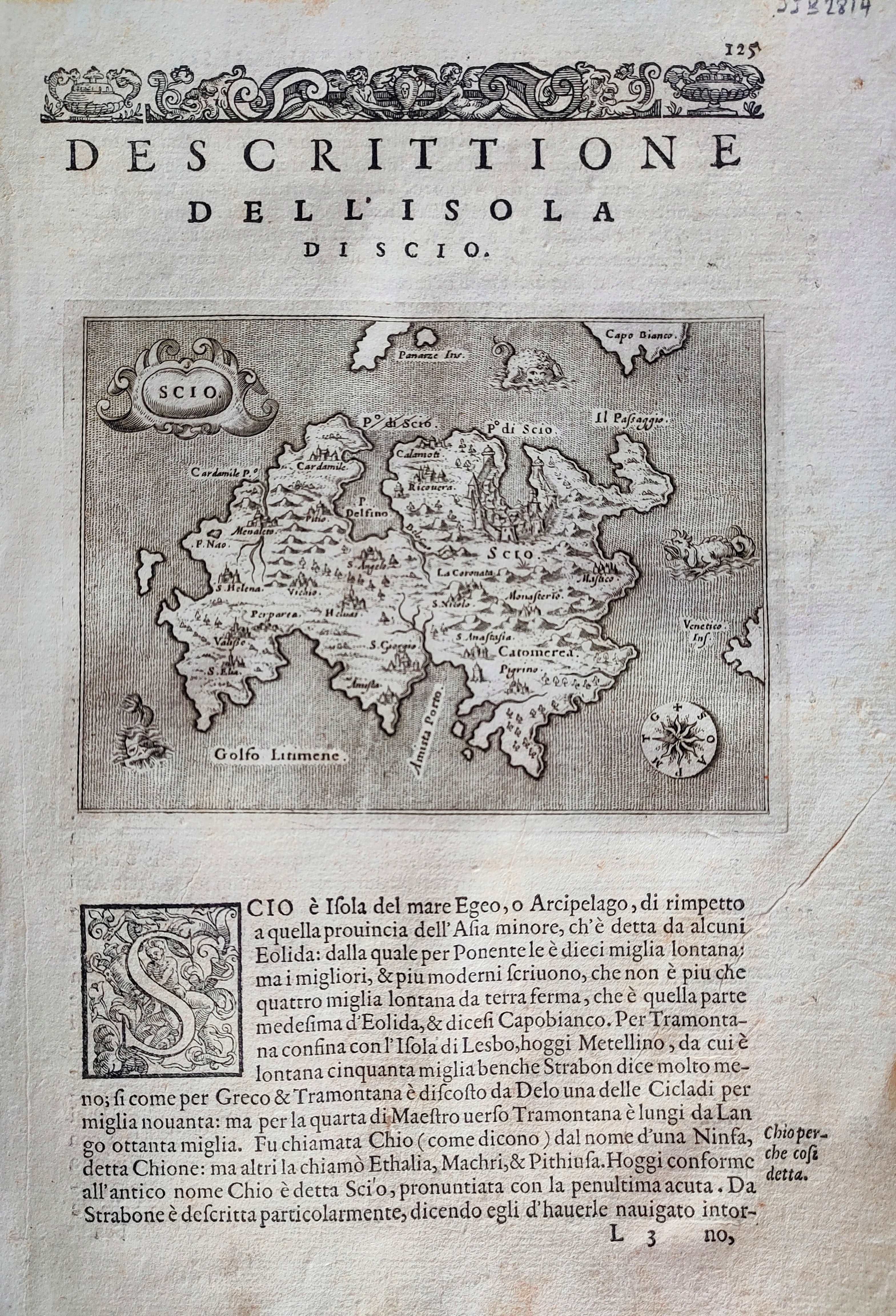
Map title
Descrittione dell'isola di Scio
Author
Porcacchi
Location shown in map
Scio
Edition date
1576
Edition place
Venice
Editor
--
Atlas
L'Isole piu famose del mondo -- S. Galignani and G. Porro
Price
Please ask: info@thetreasuremaps.com
State
[mint/EXCELLENT/very good/good/fair/mediocre/poor]
Color
Black/white
Verso
Italian text pag.126
Size
Plate: cm (15.2 x 11.4) inches (5.98 x 4.49) Paper: cm (20.3 x 29.2) inches (7.99 x 11.5)
Technique
Copper engraving
Note
Reference
--
Wiki
Here for more info
In stock
Available
Info
info@thetreasuremaps.com
Code
#0867
×
![Descrittione dell'isola di Scio by Porcacchi, Scio, 1576]()
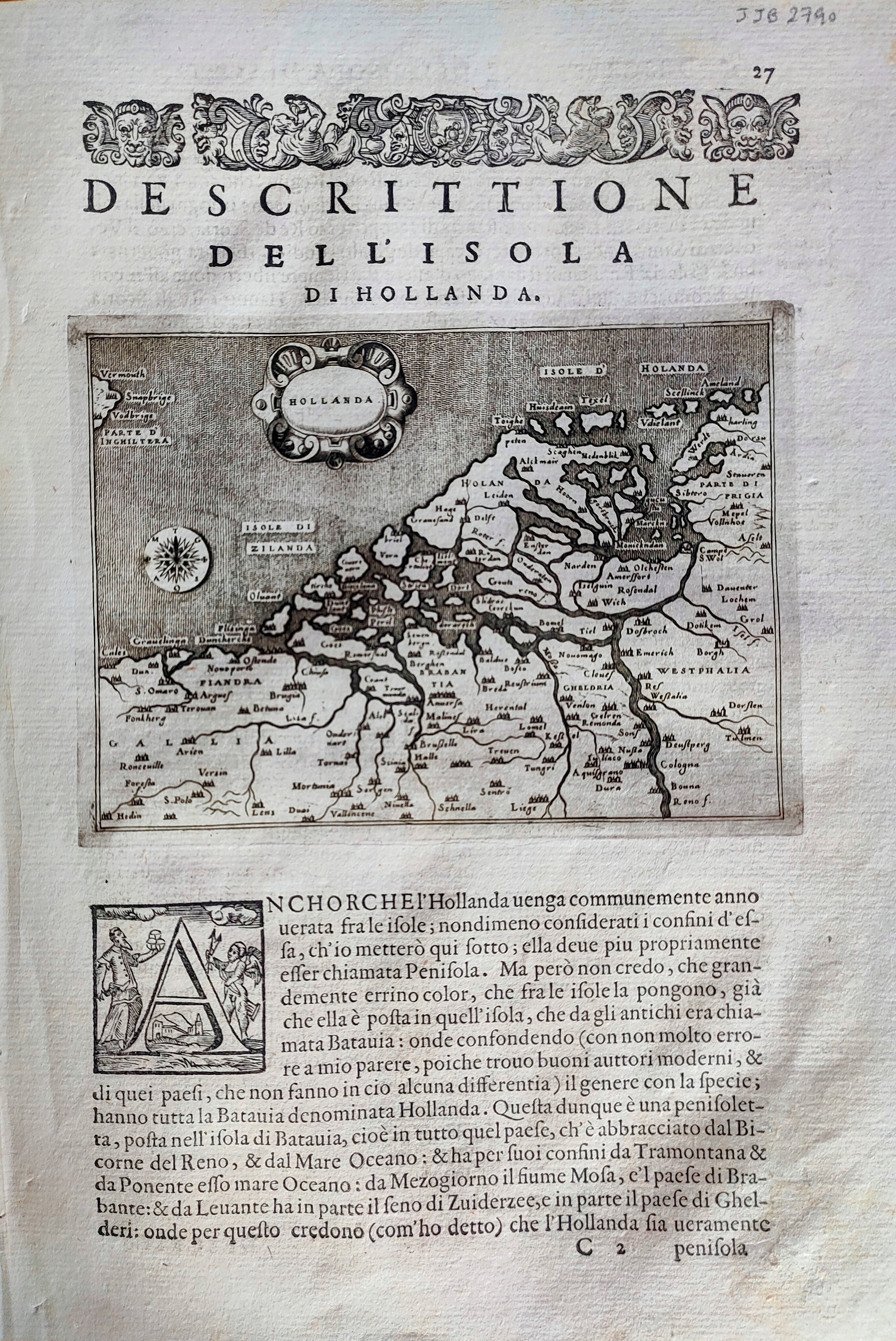
Map title
Descrittione dell'isola di Hollanda
Author
Porcacchi
Location shown in map
Netherlands
Edition date
1576
Edition place
Venice
Editor
--
Atlas
L'Isole piu famose del mondo -- S. Galignani and G. Porro
Price
Please ask: info@thetreasuremaps.com
State
[mint/EXCELLENT/very good/good/fair/mediocre/poor]
Color
Black/white
Verso
Italian text pag.28
Size
Plate: cm (15.2 x 11.4) inches (5.98 x 4.49) Paper: cm (20.3 x 29.2) inches (7.99 x 11.5)
Technique
Copper engraving
Note
Reference
--
Wiki
Here for more info
In stock
Available
Info
info@thetreasuremaps.com
Code
#0868
×
![Descrittione dell'isola di Hollanda by Porcacchi, Netherlands, 1576]()
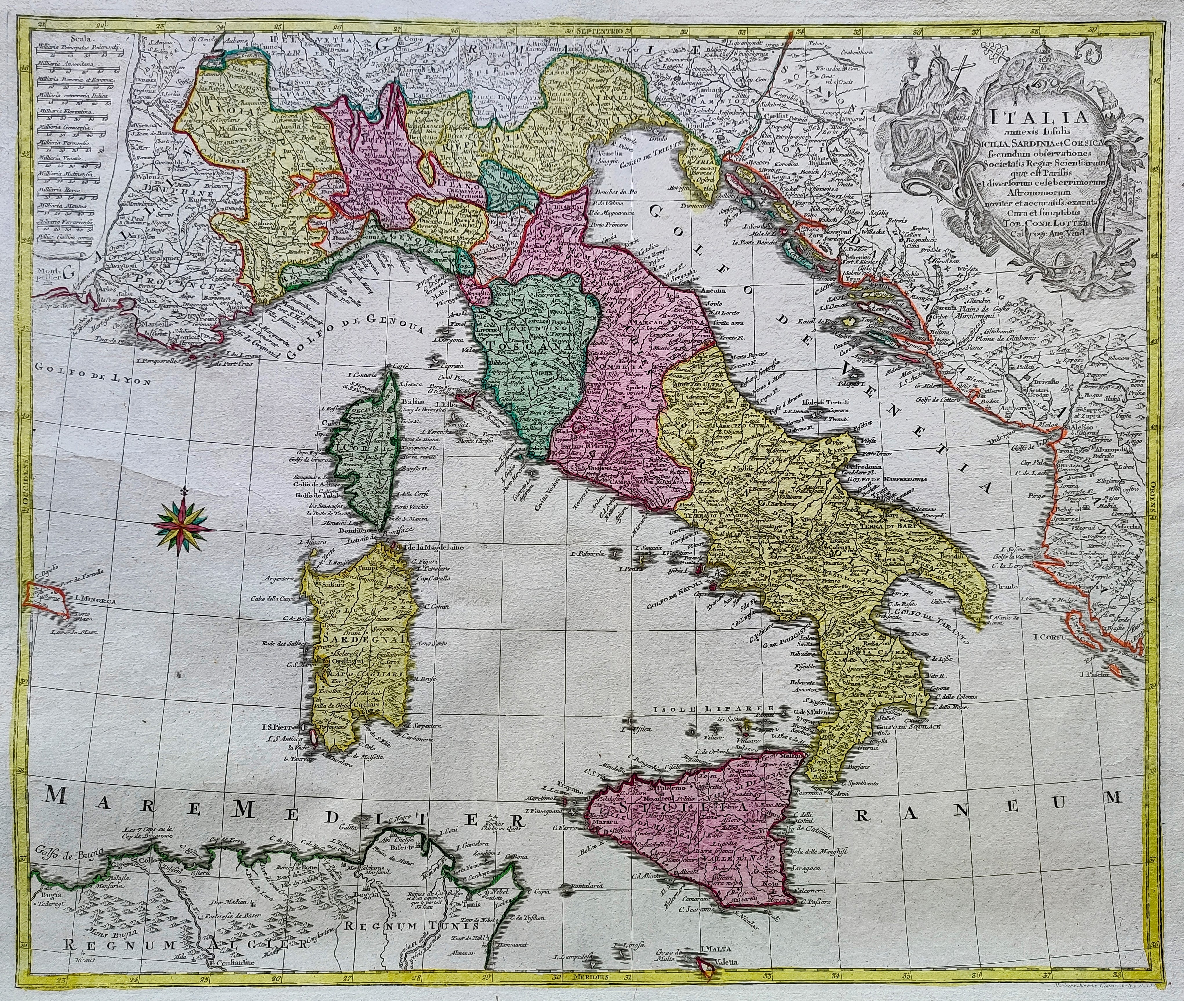
Map title
Italia annexis Insulis Sicilia Sardinia et Corsica ...
Author
Lotter
Location shown in map
Italy
Edition date
1758
Edition place
Ausburg
Editor
Lotter
Atlas
Price
500 Euro
State
[mint/EXCELLENT/very good/good/fair/mediocre/poor]
Color
Old colors
Verso
Blank
Size
Plate: cm (47 x 56) inches (18.5 x 22.05) Paper: cm (58 x 70) inches (22.83 x 27.56)
Technique
Copper engraving
Note
Reference
R.Borri L'Italia nelle antiche carte pag.233
Wiki
Here for more info
In stock
Available
Info
info@thetreasuremaps.com
Code
#0853
×
![Italia annexis Insulis Sicilia Sardinia et Corsica ... by Lotter, Italy, 1758]()
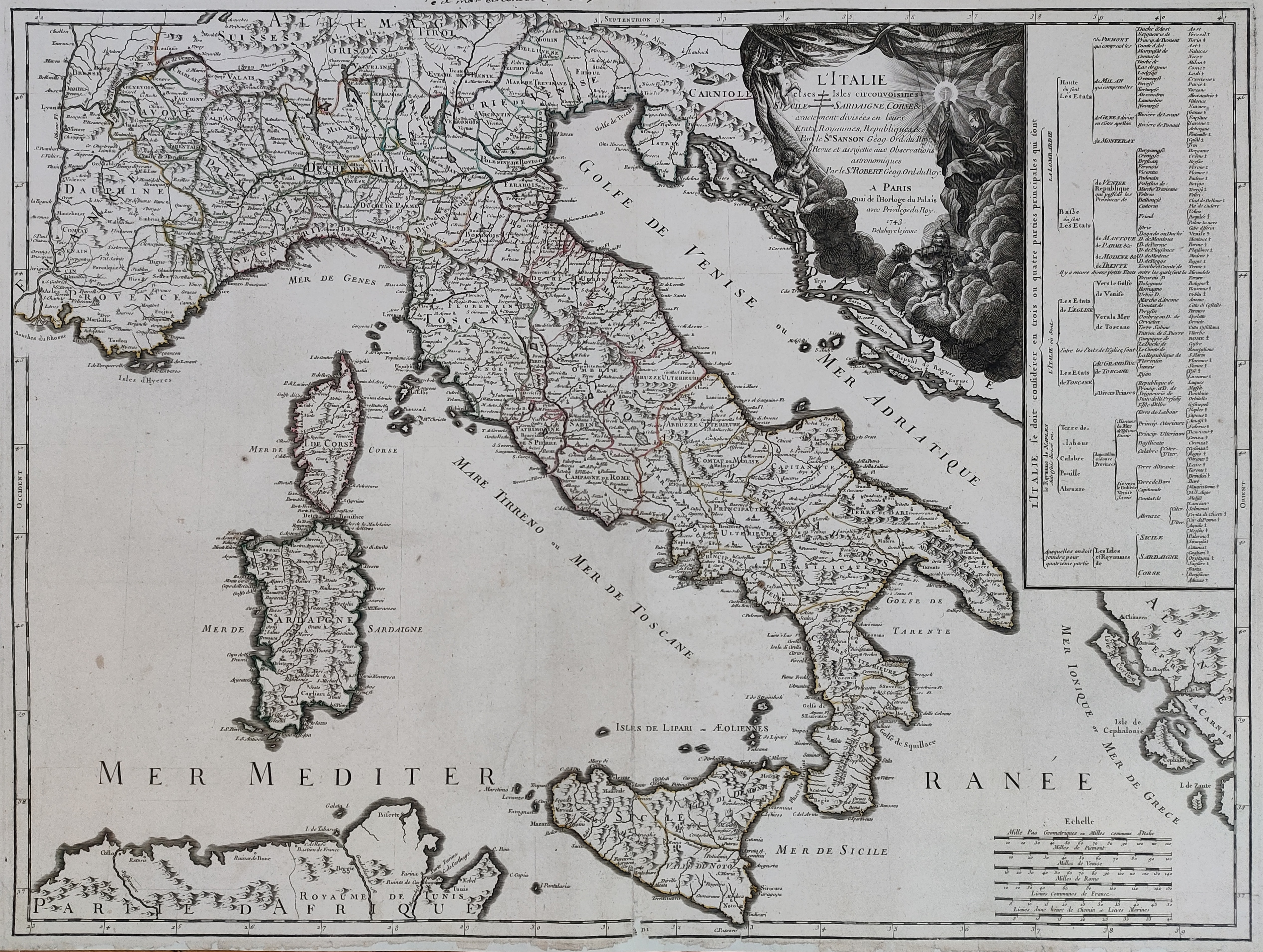
Map title
L'Italie et ses isles circonvoisines Siclile, Sargaigne, Corse ...
Author
Sanson
Location shown in map
Italy
Edition date
1743
Edition place
Paris
Editor
Delahaye
Atlas
Price
500 Euro
State
[mint/excellent/VERY GOOD/good/fair/mediocre/poor]
Color
Old colors
Verso
Blank
Size
Plate: cm (52 x 68) inches (20.47 x 26.77) Paper: cm (54 x 75) inches (21.26 x 29.53)
Technique
Copper engraving
Note
Reference
R.Borri L'Italia nelle antiche carte pag.241
Wiki
Here for more info
In stock
Available
Info
info@thetreasuremaps.com
Code
#0854
×
![L'Italie et ses isles circonvoisines Siclile, Sargaigne, Corse ... by Sanson, Italy, 1743]()
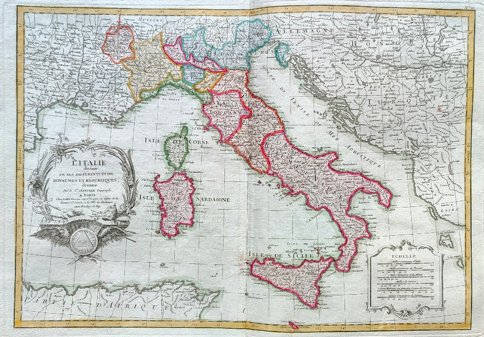
Map title
L'Italie divisee en ses ...
Author
Janvier
Location shown in map
Italy
Edition date
Circa 1762
Edition place
Paris
Editor
Atlas
--
Price
250 Euro
State
[mint/EXCELLENT/very good/good/fair/mediocre/poor]
Color
Old colors
Verso
Blank
Size
Plate: cm (31 x 44) inches (12.2 x 17.32) Paper: cm (39 x 53) inches (15.35 x 20.87)
Technique
Copper engraving
Note
Reference
R.Borri L'Italia nelle antiche carte pag.254
Wiki
Here for more info
In stock
Available
Info
info@thetreasuremaps.com
Code
#0855
×
![L'Italie divisee en ses ... by Janvier, Italy, Circa 1762]()
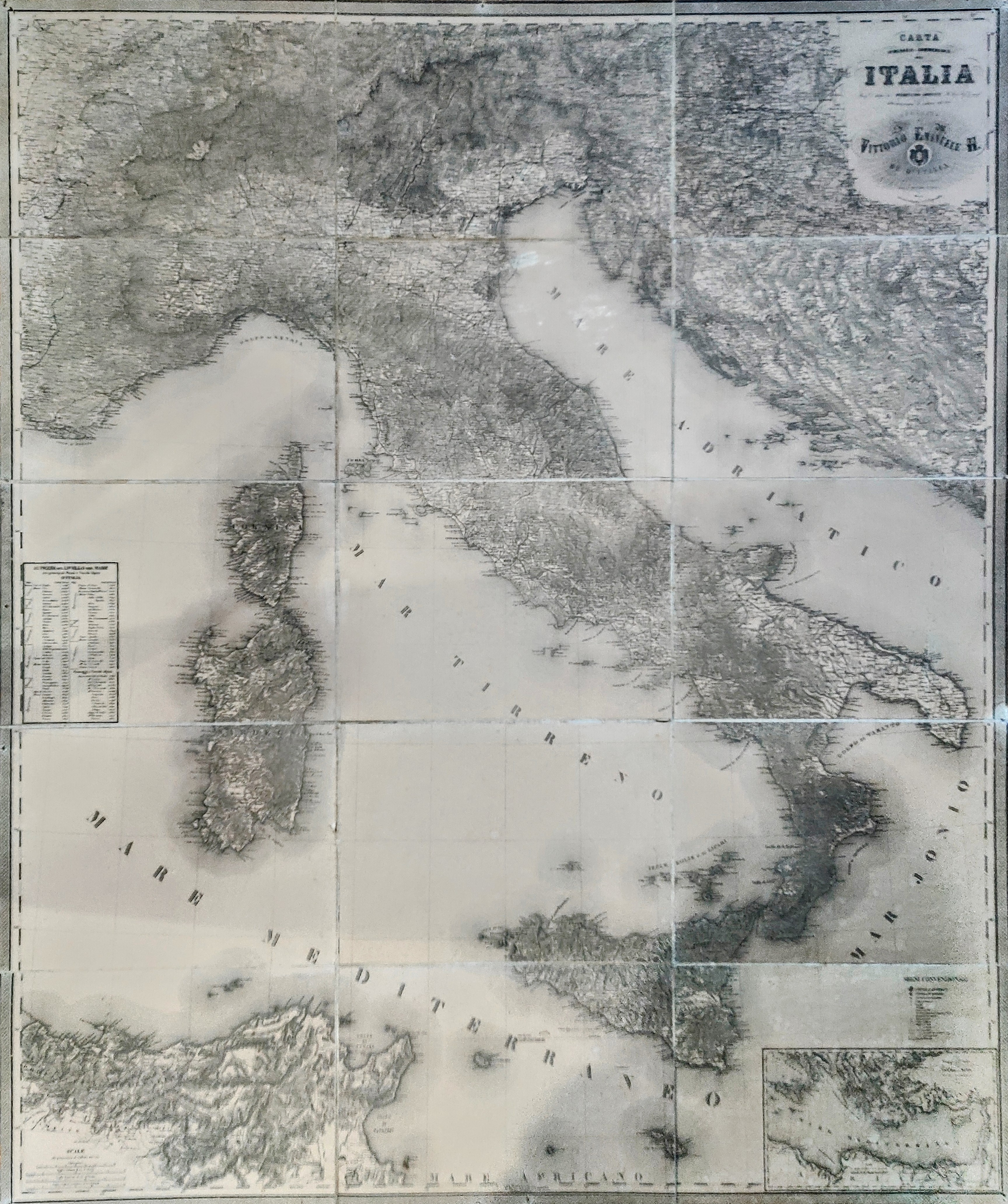
Map title
Carta itineraria-commerciale dell'Italia
Author
Arrigoni
Location shown in map
Italy
Edition date
Circa 1870
Edition place
Milan
Editor
Civelli
Atlas
Price
Please ask: info@thetreasuremaps.com
State
[mint/excellent/VERY GOOD/good/fair/mediocre/poor]
Color
Old colors
Verso
Blank
Size
Plate: cm (113 x 141) inches (44.49 x 55.51) Paper: cm (113 x 141) inches (44.49 x 55.51)
Technique
Steel engraving
Note
Foldable map
Reference
Wiki
Here for more info
In stock
Available
Info
info@thetreasuremaps.com
Code
#0858
×
![Carta itineraria-commerciale dell'Italia by Arrigoni, Italy, Circa 1870]()
Map title
Italie
Author
Dufour
Location shown in map
Italy
Edition date
Circa 1864
Edition place
Paris
Editor
Pilon
Atlas
Price
125 Euro
State
[mint/EXCELLENT/very good/good/fair/mediocre/poor]
Color
Old colors
Verso
Blank
Size
Plate: cm (55 x 75) inches (21.65 x 29.53) Paper: cm (60 x 83) inches (23.62 x 32.68)
Technique
Steel engraving
Note
Reference
Wiki
Here for more info
In stock
Available
Info
info@thetreasuremaps.com
Code
#0859
×
![Italie by Dufour, Italy, Circa 1864]()
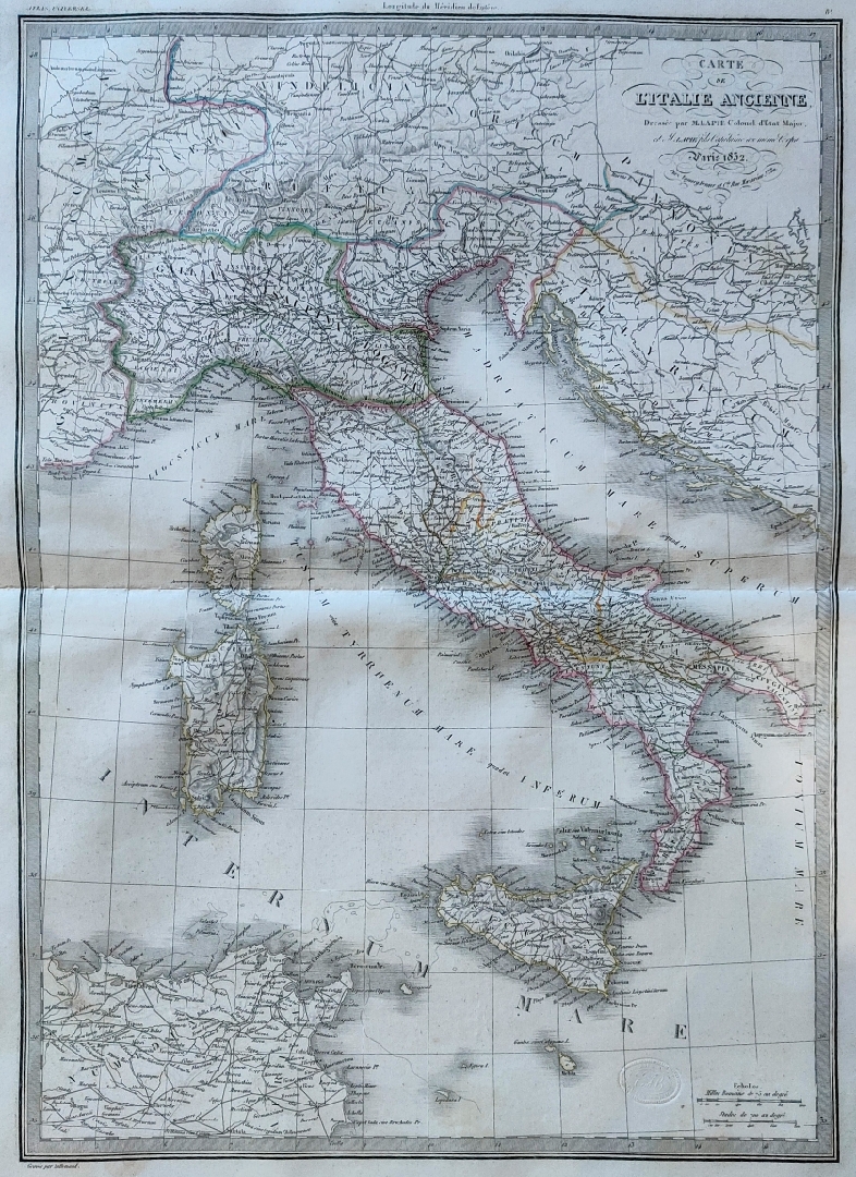
Map title
Carte de l'Italie Ancienne
Author
Lapie
Location shown in map
Italy
Edition date
1832
Edition place
Paris
Editor
Atlas
Price
75 Euro
State
[mint/EXCELLENT/very good/good/fair/mediocre/poor]
Color
Old colors
Verso
Blank
Size
Plate: cm (50 x 66) inches (19.69 x 25.98) Paper: cm (39 x 53) inches (15.35 x 20.87)
Technique
Steel engraving
Note
Reference
Wiki
Here for more info
In stock
Available
Info
info@thetreasuremaps.com
Code
#0860
×
![Carte de l'Italie Ancienne by Lapie, Italy, 1832]()
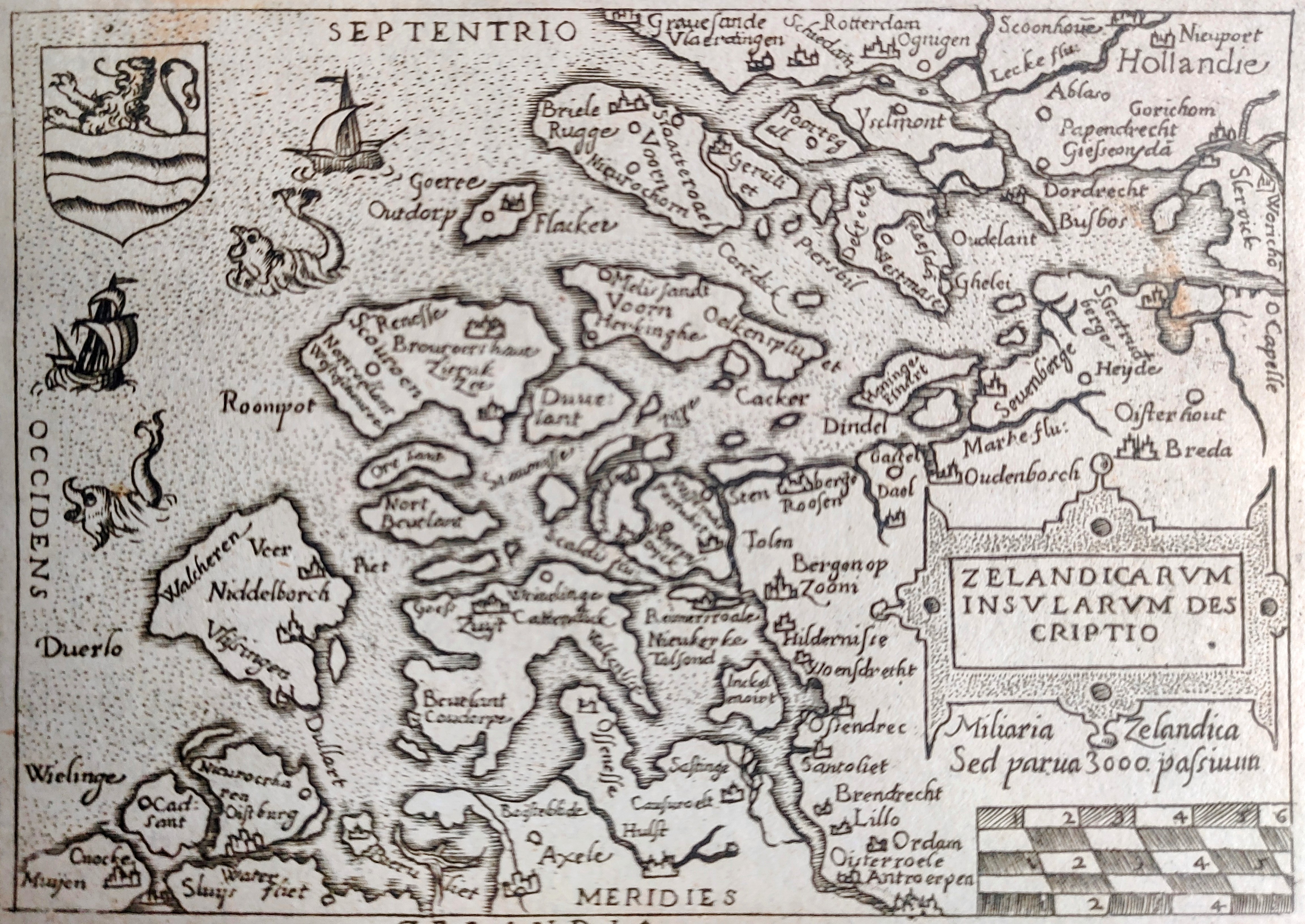
Map title
Zelandia
Author
Ortelius
Location shown in map
Nederland
Edition date
1598
Edition place
Brescia
Editor
Pietro Marchetti
Atlas
Il theatro del mondo
Price
150 Euro
State
[mint/EXCELLENT/very good/good/fair/mediocre/poor]
Color
Black/white
Verso
Italian text
Size
Plate: cm (11 x 8) inches (4.33 x 3.15) Paper: cm (11 x 8) inches (4.33 x 3.15)
Technique
Copper engraving
Note
Reference
Wiki
Here for more info
In stock
Available
Info
info@thetreasuremaps.com
Code
#0862
×
![Zelandia by Ortelius, Nederland, 1598]()
Map title
Pedemontana regio
Author
Mercator
Location shown in map
North-West Italy
Edition date
Circa 1635
Edition place
London
Editor
Michael Spark
Atlas
Historia Mundi or Mercators Atlas
Price
200 Euro
State
[mint/EXCELLENT/very good/good/fair/mediocre/poor]
Color
Black/white
Verso
English text pag 716
Size
Plate: cm (23 x 17) inches (9.06 x 6.69) Paper: cm (28 x 18) inches (11.02 x 7.09)
Technique
Copper engraving
Note
Reference
Wiki
Here for more info
In stock
Available
Info
info@thetreasuremaps.com
Code
#0863
×
![Pedemontana regio by Mercator, North-West Italy, Circa 1635]()
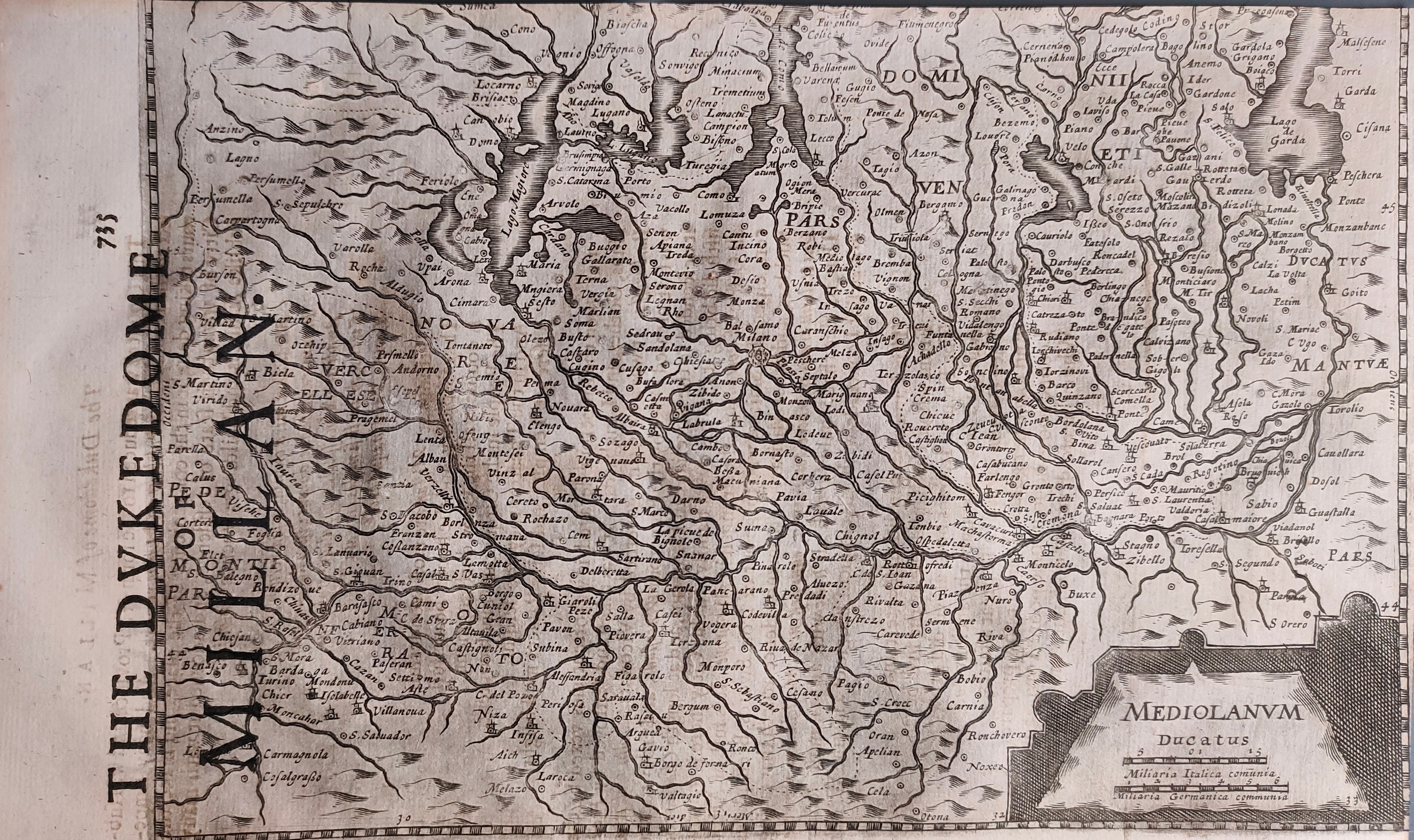
Map title
Mediolanum ducatus
Author
Mercator
Location shown in map
North-West Italy
Edition date
Circa 1635
Edition place
London
Editor
Michael Spark
Atlas
Historia Mundi or Mercators Atlas
Price
175 Euro
State
[mint/EXCELLENT/very good/good/fair/mediocre/poor]
Color
Black/white
Verso
English text pag 736
Size
Plate: cm (23 x 17) inches (9.06 x 6.69) Paper: cm (28 x 18) inches (11.02 x 7.09)
Technique
Copper engraving
Note
Reference
Wiki
Here for more info
In stock
Available
Info
info@thetreasuremaps.com
Code
#0864
×
![Mediolanum ducatus by Mercator, North-West Italy, Circa 1635]()
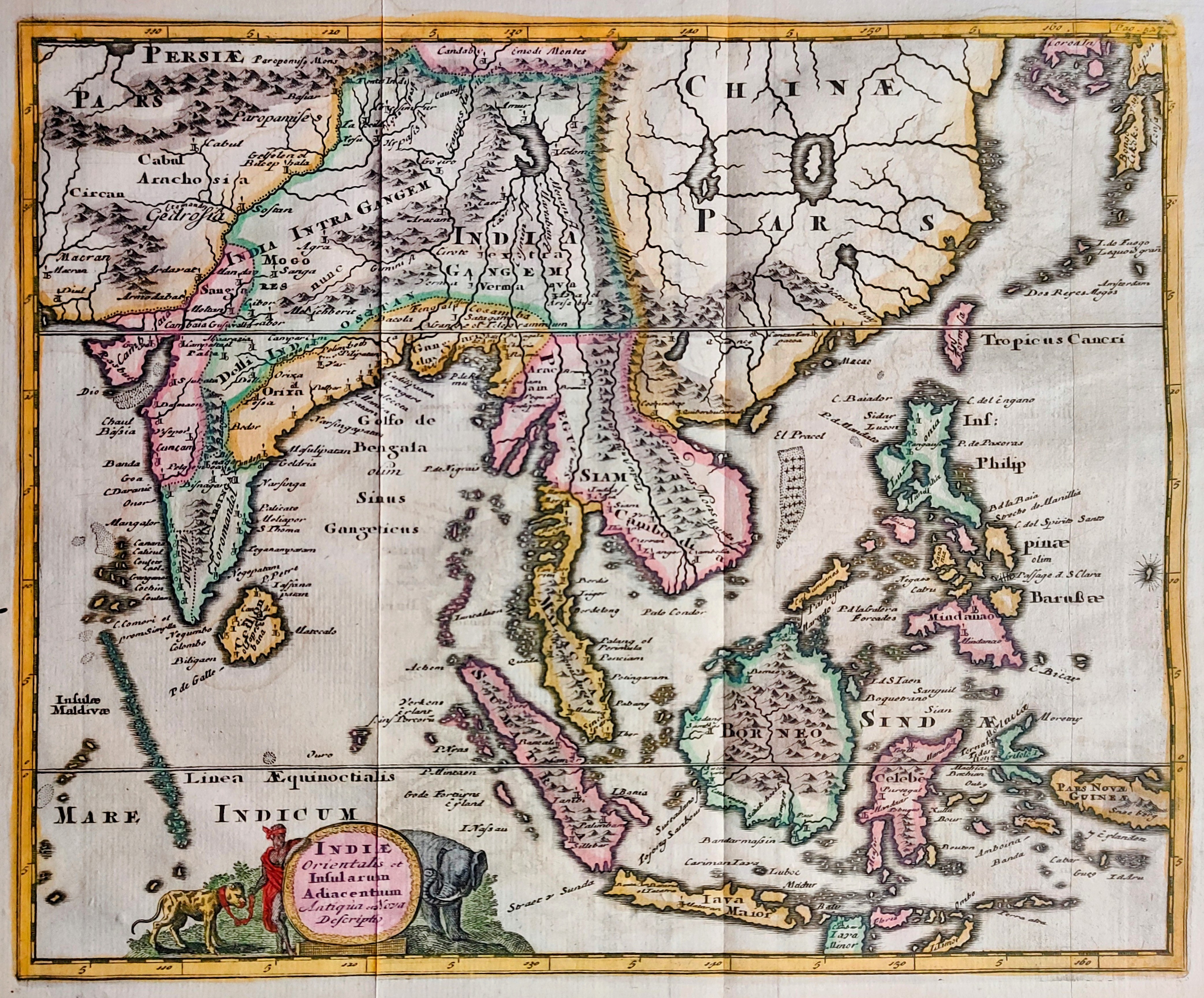
Map title
Indiae orientalis
Author
Cluver
Location shown in map
Southeast Asia
Edition date
1697
Edition place
Leiden
Editor
Atlas
Introductionis in Universam Geographiam ...
Price
200 Euro
State
[mint/EXCELLENT/very good/good/fair/mediocre/poor]
Color
Old colors
Verso
Blank
Size
Plate: cm (33 x 25) inches (12.99 x 9.84) Paper: cm (27 x 22) inches (10.63 x 8.66)
Technique
Copper engraving
Note
Reference
Wiki
Here for more info
In stock
Available
Info
info@thetreasuremaps.com
Code
#0865
×
![Indiae orientalis by Cluver, Southeast Asia, 1697]()
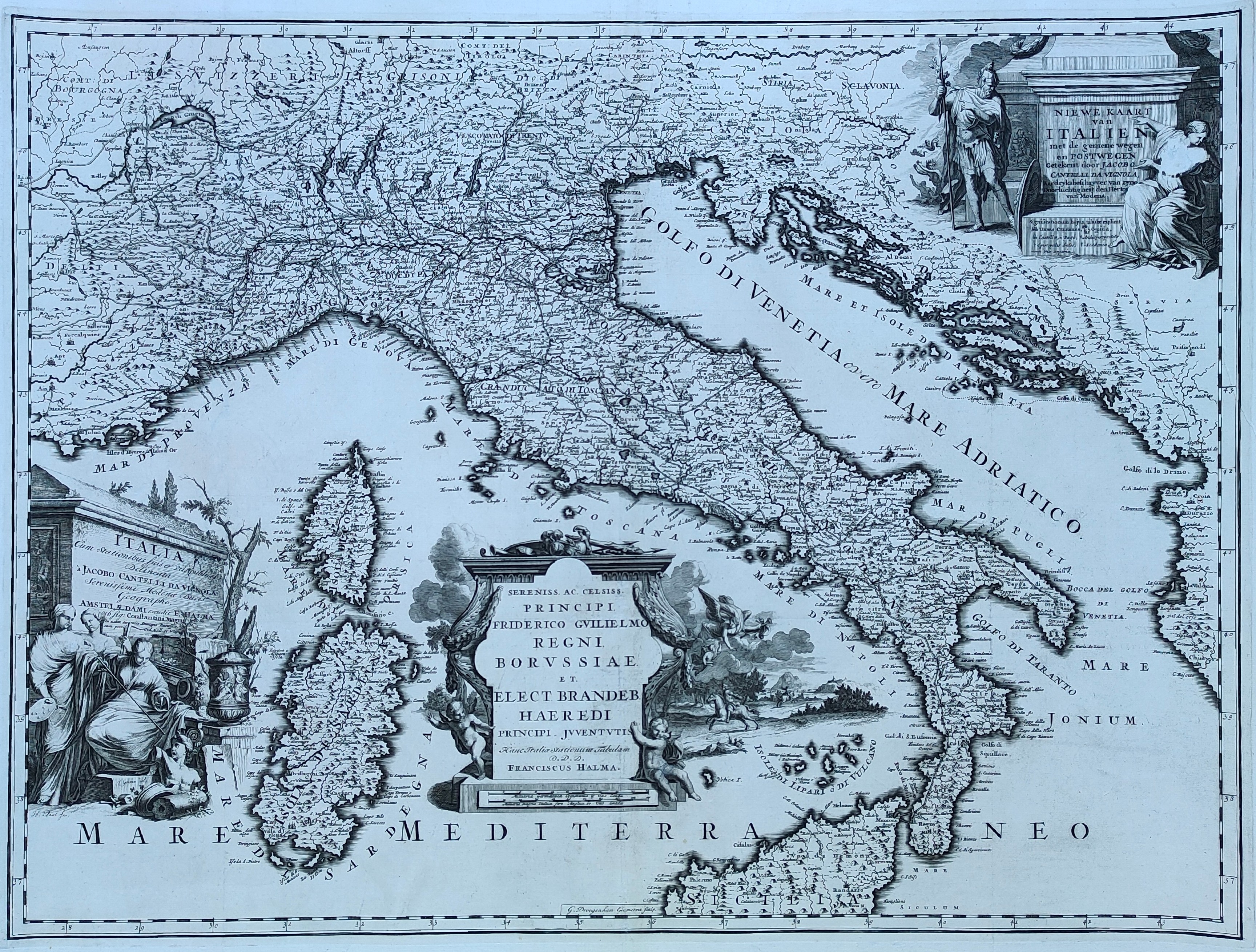
Map title
Niewe kaart van Italien
Author
Cantelli da Vignola
Location shown in map
Italy
Edition date
1704
Edition place
Amsterdam
Editor
Halma
Atlas
Beschryvinge van Oud en Niew Rome
Price
800 Euro
State
[mint/EXCELLENT/very good/good/fair/mediocre/poor]
Color
Black/white
Verso
Blank
Size
Plate: cm (66 x 51) inches (25.98 x 20.08) Paper: cm (70 x 56) inches (27.56 x 22.05)
Technique
Copper engraving
Note
Reference
R.Borri L'Italia nelle antiche carte pag.168
Wiki
Here for more info
In stock
Available
Info
info@thetreasuremaps.com
Code
#0850
×
![Niewe kaart van Italien by Cantelli da Vignola, Italy, 1704]()
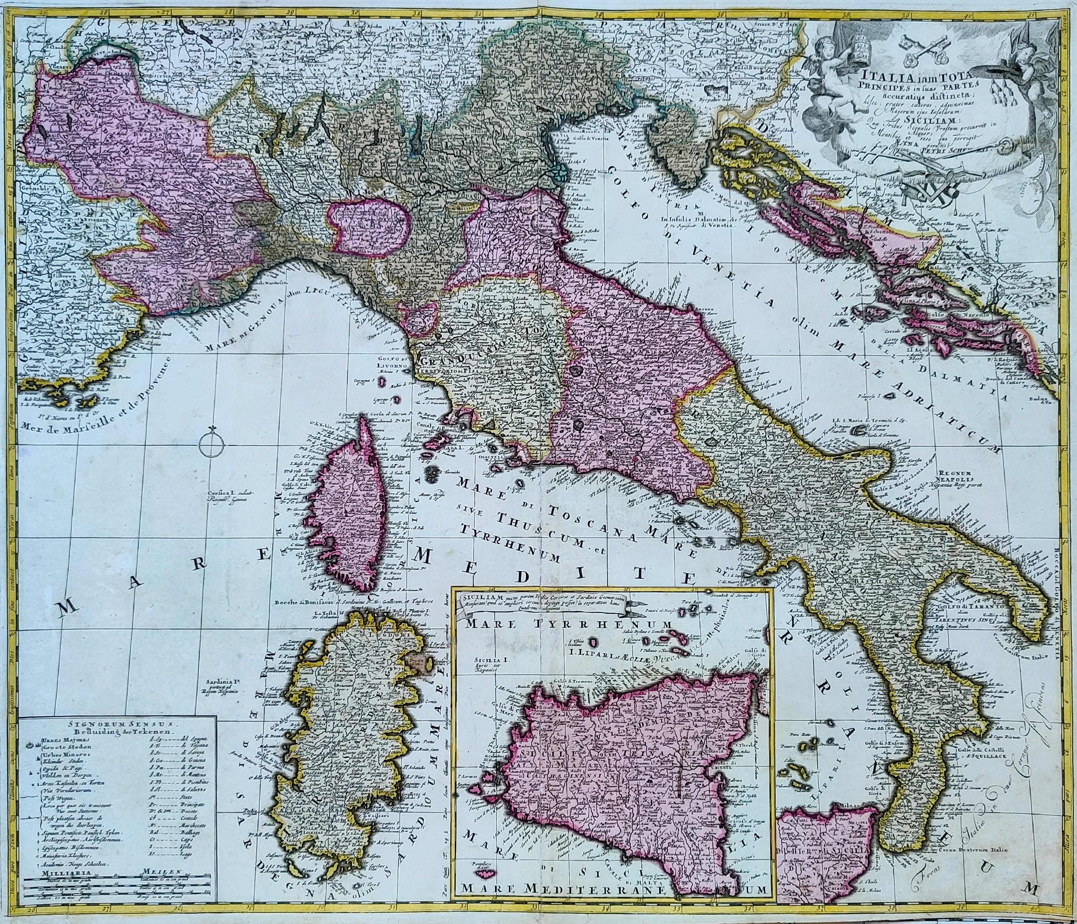
Map title
Italia iam Tota Principes in suas Partes, Accuratius Distincta...
Author
Schenk
Location shown in map
Italy
Edition date
1720
Edition place
Amsterdam
Editor
Schenk
Atlas
Atlas Contractus Sive Mapparum Geographicarum Sansoniarum Auctarum et Correctarum Nova Congeries
Price
600 Euro
State
[mint/EXCELLENT/very good/good/fair/mediocre/poor]
Color
Old colors
Verso
Blank
Size
Plate: cm (55 x 48) inches (21.65 x 18.9) Paper: cm (60 x 52) inches (23.62 x 20.47)
Technique
Copper engraving
Note
Reference
R.Borri L'Italia nelle antiche carte pag.179
Wiki
Here for more info
In stock
Available
Info
info@thetreasuremaps.com
Code
#0851
×
![Italia iam Tota Principes in suas Partes, Accuratius Distincta... by Schenk , Italy, 1720]()
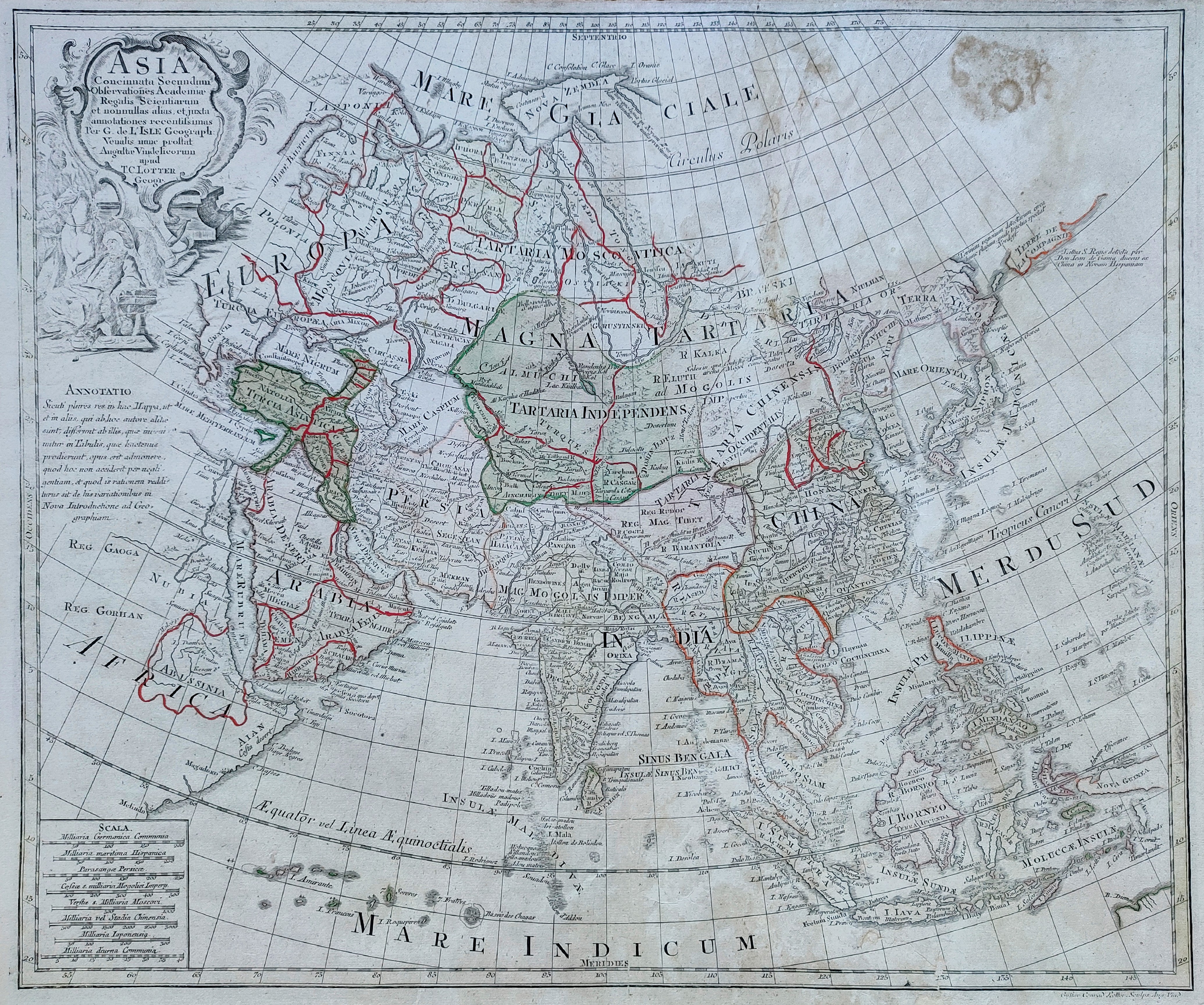
Map title
Asia
Author
Lotter
Location shown in map
Asia
Edition date
1770
Edition place
Ausburg
Editor
Atlas
Atlas novus sive tabulae geographice
Price
300 Euro
State
[mint/excellent/VERY GOOD/good/fair/mediocre/poor]
Color
Old colors
Verso
Blank
Size
Plate: cm (57 x 49) inches (22.44 x 19.29) Paper: cm (64 x 52) inches (25.2 x 20.47)
Technique
Copper engraving
Note
Reference
Wiki
Here for more info
In stock
Available
Info
info@thetreasuremaps.com
Code
#0849
Asia
Author
Lotter
Location shown in map
Asia
Edition date
1770
Edition place
Ausburg
Editor
Atlas
Atlas novus sive tabulae geographice
Price
300 Euro
State
[mint/excellent/VERY GOOD/good/fair/mediocre/poor]
Color
Old colors
Verso
Blank
Size
Plate: cm (57 x 49) inches (22.44 x 19.29) Paper: cm (64 x 52) inches (25.2 x 20.47)
Technique
Copper engraving
Note
Reference
Wiki
Here for more info
In stock
Available
Info
info@thetreasuremaps.com
Code
#0849
×
![Asia by Lotter, Asia, 1770]()