News

Map title
La partie meridionale des estats du duc de Savoye...
Author
Nolin
Location shown in map
Piedmont & Liguria, North west Italy
Edition date
1697
Edition place
Paris
Editor
--
Atlas
Price
400 Euro
State
[mint/EXCELLENT/very good/good/fair/mediocre/poor]
Color
Old colors
Verso
Blank
Size
Plate: cm (62 x 40) inches (24.41 x 15.75) Paper: cm (73 x 53) inches (28.74 x 20.87)
Technique
Copper engraving
Note
Reference
Wiki
Here for more info
In stock
Available
Info
info@thetreasuremaps.com
Code
#0852
×
![La partie meridionale des estats du duc de Savoye... by Nolin, Piedmont & Liguria, North west Italy, 1697]()
Map title
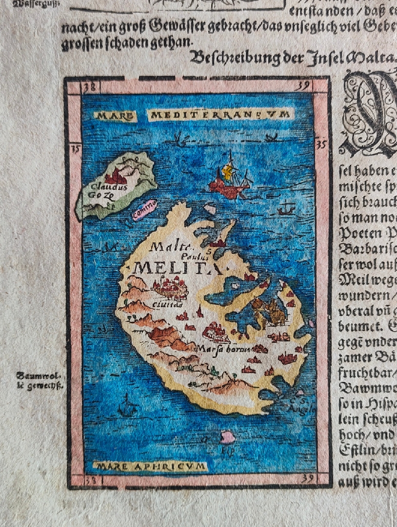
Malta
Author
Munster
Location shown in map
Malta
Edition date
Circa 1550
Edition place
Basel
Editor
Henrich Petri
Atlas
Cosmographia Universalis
Price
200 Euro
State
[mint/EXCELLENT/very good/good/fair/mediocre/poor]
Color
Old colors
Verso
German text pag.613
Size
Plate: cm (24 x 36) inches (9.45 x 14.17) Paper: cm (8 x 12) inches (3.15 x 4.72)
Technique
Woodcut
Note
Reference
Wiki
Here for more info
In stock
Available
Info
info@thetreasuremaps.com
Code
#0843
Malta
Author
Munster
Location shown in map
Malta
Edition date
Circa 1550
Edition place
Basel
Editor
Henrich Petri
Atlas
Cosmographia Universalis
Price
200 Euro
State
[mint/EXCELLENT/very good/good/fair/mediocre/poor]
Color
Old colors
Verso
German text pag.613
Size
Plate: cm (24 x 36) inches (9.45 x 14.17) Paper: cm (8 x 12) inches (3.15 x 4.72)
Technique
Woodcut
Note
Reference
Wiki
Here for more info
In stock
Available
Info
info@thetreasuremaps.com
Code
#0843
×
![Malta by Munster, Malta, Circa 1550]()
Map title
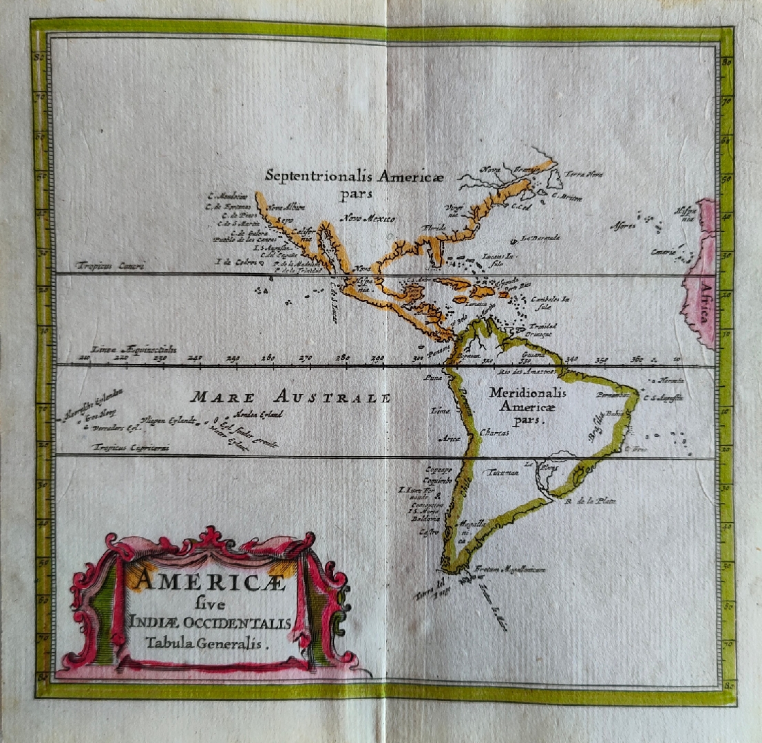
Americae sive Indiae Occidentalis Tabula Generalis
Author
Joannes De Laet
Location shown in map
America
Edition date
1686
Edition place
Amsterdam
Editor
Atlas
Introductio in universam geographiam
Price
Please ask: info@thetreasuremaps.com
State
[mint/EXCELLENT/very good/good/fair/mediocre/poor]
Color
Old colors
Verso
Blank
Size
Plate: cm (14 x 13) inches (5.51 x 5.12) Paper: cm (12 x 12) inches (4.72 x 4.72)
Technique
Copper engraving
Note
Reference
Wiki
Here for more info
In stock
Available
Info
info@thetreasuremaps.com
Code
#0844
×
![Americae sive Indiae Occidentalis Tabula Generalis by Joannes De Laet, America, 1686]()
Map title
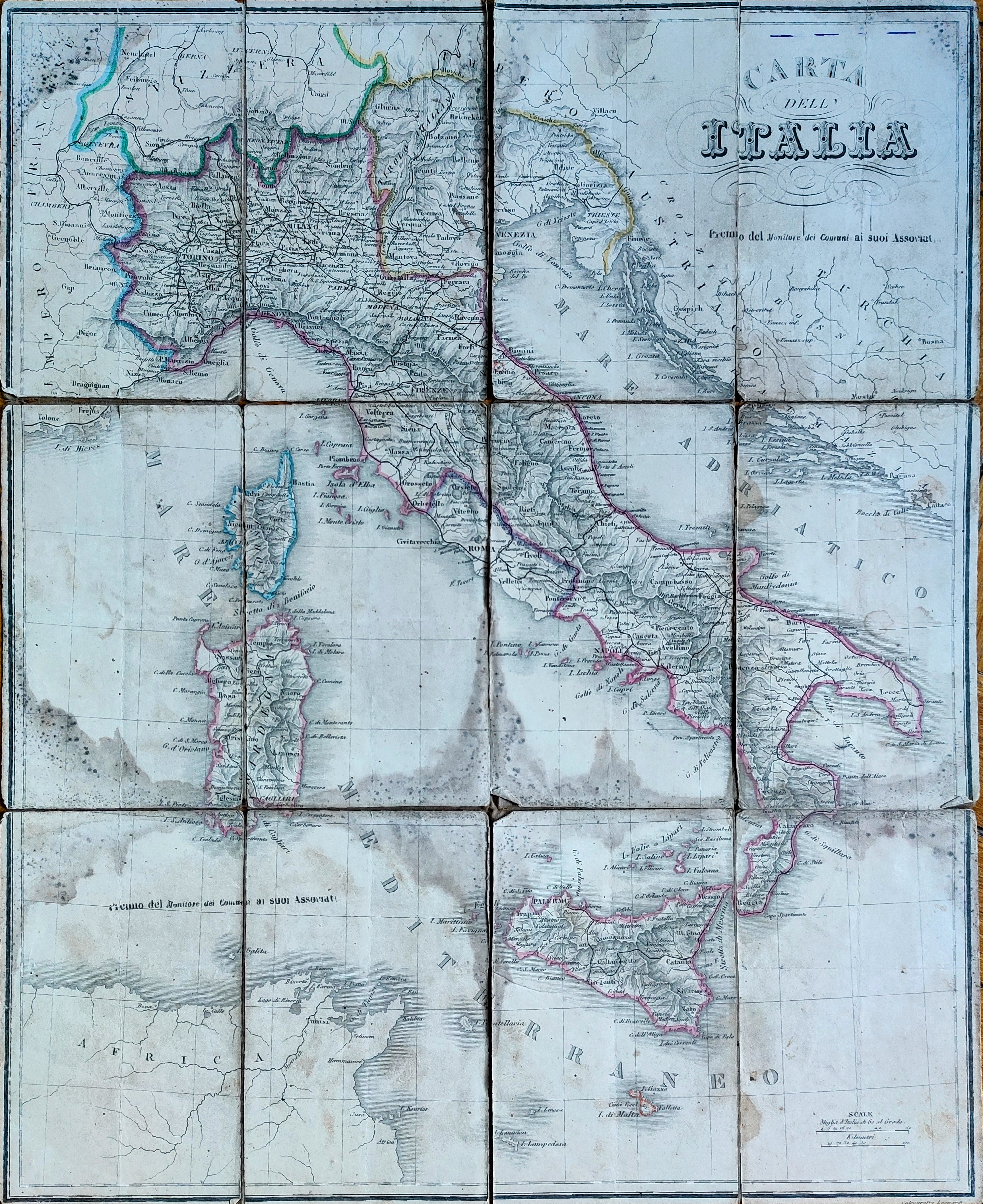
Carta dell Italia
Author
Angeli
Location shown in map
Italy
Edition date
Circa 1866
Edition place
Editor
Atlas
Price
50 Euro
State
[mint/excellent/very good/good/FAIR/mediocre/poor]
Color
Old colors
Verso
Blank
Size
Plate: cm (52 x 43) inches (20.47 x 16.93) Paper: cm (52 x 43) inches (20.47 x 16.93)
Technique
Steel engraving
Note
Foldable map
Reference
Wiki
Here for more info
In stock
Available
Info
info@thetreasuremaps.com
Code
#0857
×
![Carta dell Italia by Angeli, Italy, Circa 1866]()
Map title
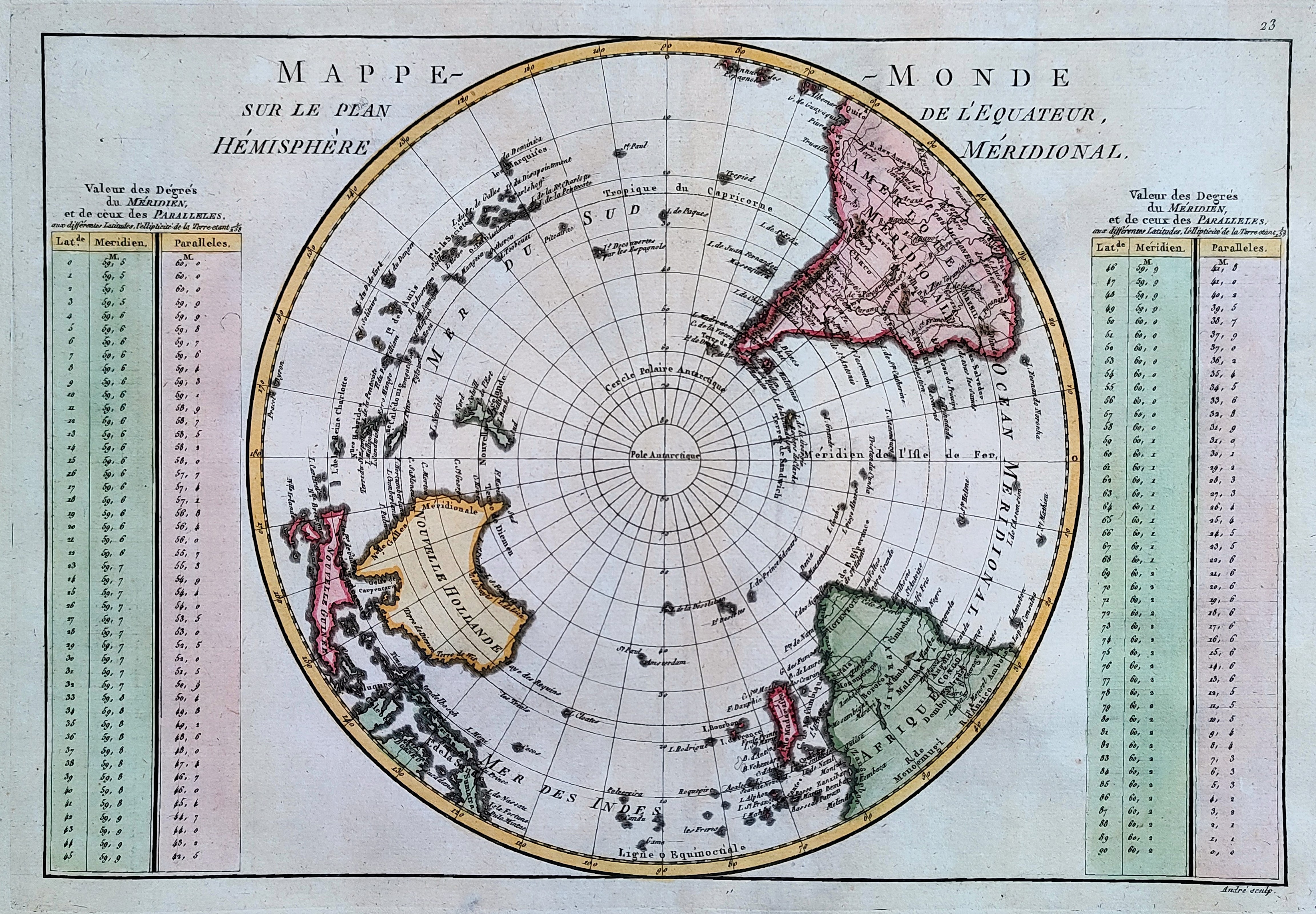
Mappemonde
Author
Bonne
Location shown in map
Polar antarctic regions
Edition date
1787
Edition place
Paris
Editor
Atlas
Atlas Encyclopedique
Price
150 Euro
State
[mint/EXCELLENT/very good/good/fair/mediocre/poor]
Color
Old colors
Verso
Blank
Size
Plate: cm (34 x 23) inches (13.39 x 9.06) Paper: cm (47 x 32) inches (18.5 x 12.6)
Technique
Copper engraving
Note
Reference
Wiki
Here for more info
In stock
Available
Info
info@thetreasuremaps.com
Code
#0848
×
![Mappemonde by Bonne, Polar antarctic regions, 1787]()
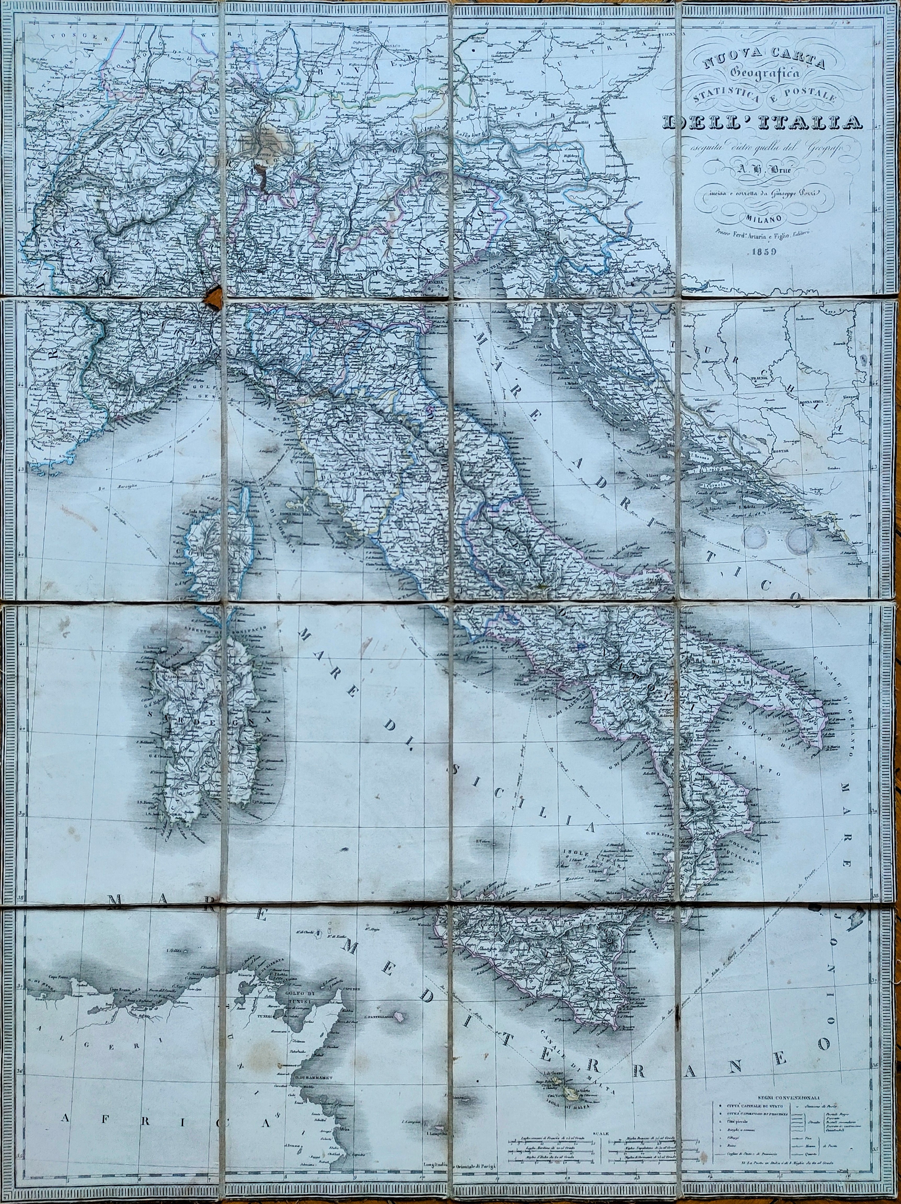
Map title
Nuova carta geografica statistica e postale dell'Italia
Author
Pozzi
Location shown in map
Italy
Edition date
1859
Edition place
Milan
Editor
Artaria
Atlas
Price
125 Euro
State
[mint/excellent/very good/good/FAIR/mediocre/poor]
Color
Old colors
Verso
Blank
Size
Plate: cm (61 x 81) inches (24.02 x 31.89) Paper: cm (61 x 81) inches (24.02 x 31.89)
Technique
Steel engraving
Note
Foldable map
Reference
Wiki
Here for more info
In stock
Available
Info
info@thetreasuremaps.com
Code
#0856
×
![Nuova carta geografica statistica e postale dell'Italia by Pozzi, Italy, 1859]()
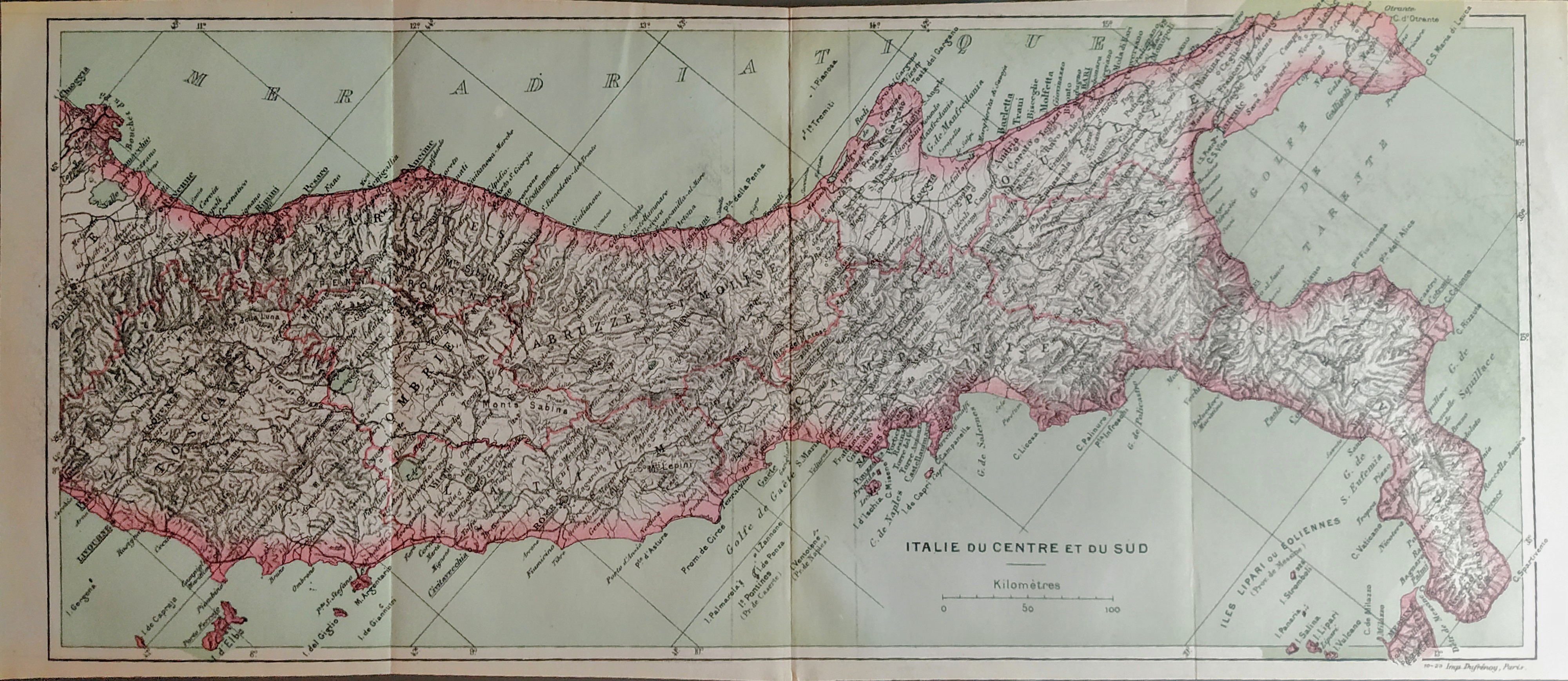
Map title
Italie du centre et du sud
Author
Location shown in map
South Italy
Edition date
Circa 1920
Edition place
Paris
Editor
Atlas
Price
75 Euro
State
[mint/EXCELLENT/very good/good/fair/mediocre/poor]
Color
Old colors
Verso
Black
Size
Plate: cm (34 x 15) inches (13.39 x 5.91) Paper: cm (36 x 16) inches (14.17 x 6.3)
Technique
Steel engraving
Note
Reference
Wiki
Here for more info
In stock
Available
Info
info@thetreasuremaps.com
Code
#0839
×
![Italie du centre et du sud by , South Italy, Circa 1920]()
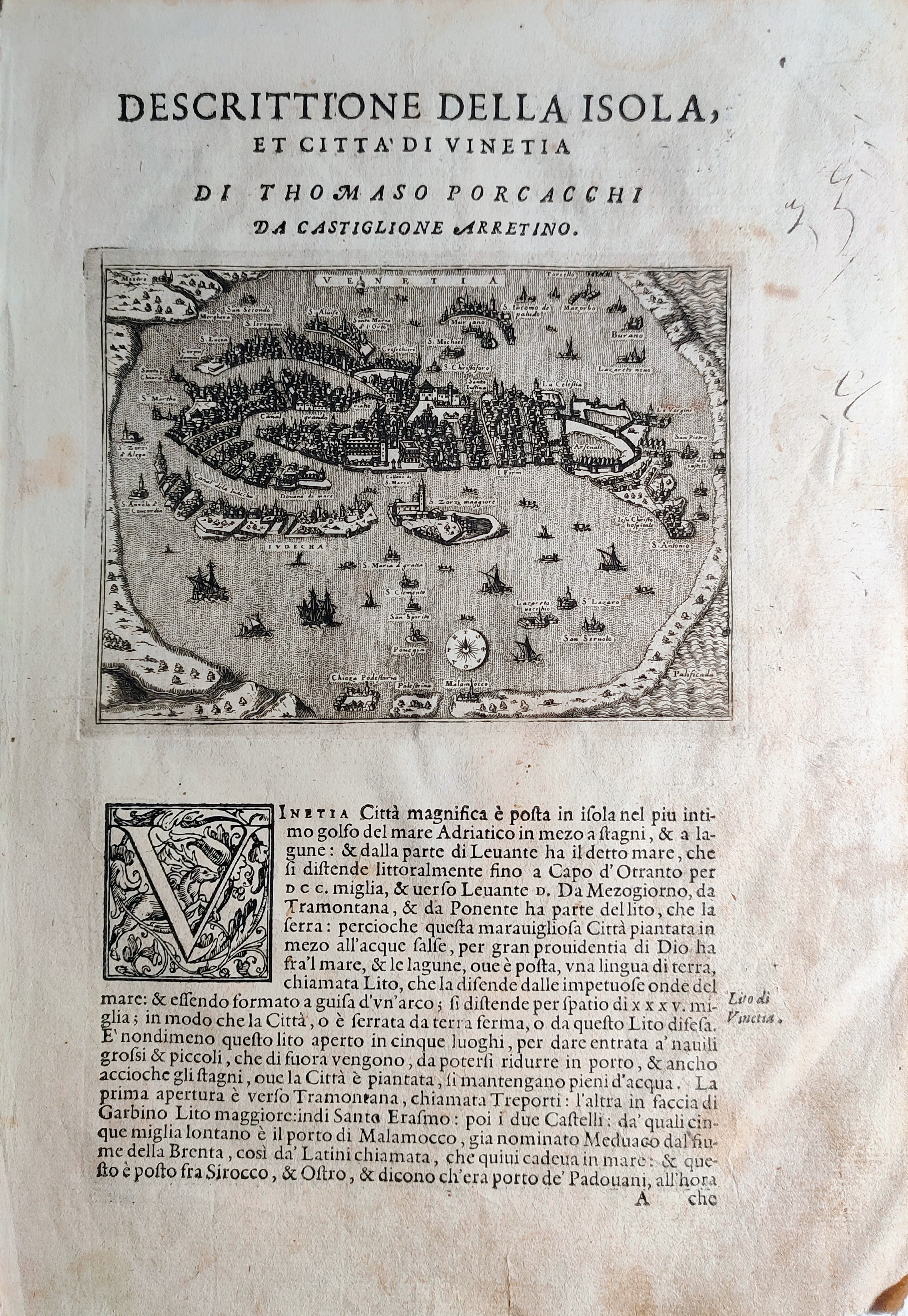
Map title
Descrittione dell'isola et citta di Vinetia
Author
Porcacchi
Location shown in map
Venice
Edition date
1572
Edition place
Venice
Editor
--
Atlas
L'Isole piu famose del mondo -- S. Galignani and G. Porro
Price
250 Euro
State
[mint/EXCELLENT/very good/good/fair/mediocre/poor]
Color
Black/white
Verso
Italian text pag.114
Size
Plate: cm (15.2 x 11.4) inches (5.98 x 4.49) Paper: cm (20.3 x 29.2) inches (7.99 x 11.5)
Technique
Copper engraving
Note
First edition
Reference
--
Wiki
Here for more info
In stock
Available
Info
info@thetreasuremaps.com
Code
#0842
×
![Descrittione dell'isola et citta di Vinetia by Porcacchi, Venice, 1572]()
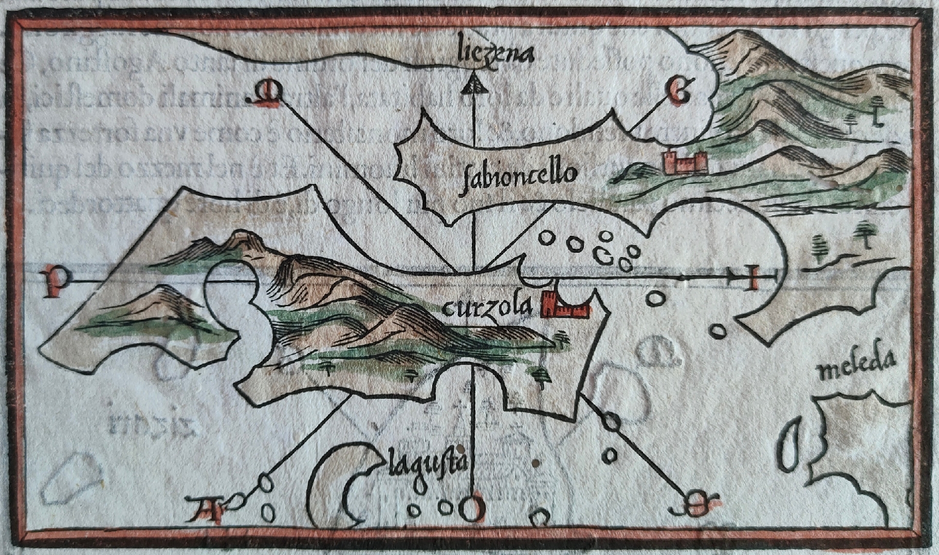
Map title
--
Author
Bordone
Location shown in map
Curzola
Edition date
1540
Edition place
Venice
Editor
Federico Torresano
Atlas
Isolario
Price
350 Euro
State
[mint/EXCELLENT/very good/good/fair/mediocre/poor]
Color
Old colors
Verso
Italian text pag.33
Size
Plate: cm (14 x 8.9) inches (5.51 x 3.5) Paper: cm (19 x 29) inches (7.48 x 11.42)
Technique
Woodcut
Note
--
Reference
--
Wiki
Here for more info
In stock
Available
Info
info@thetreasuremaps.com
Code
#0845
--
Author
Bordone
Location shown in map
Curzola
Edition date
1540
Edition place
Venice
Editor
Federico Torresano
Atlas
Isolario
Price
350 Euro
State
[mint/EXCELLENT/very good/good/fair/mediocre/poor]
Color
Old colors
Verso
Italian text pag.33
Size
Plate: cm (14 x 8.9) inches (5.51 x 3.5) Paper: cm (19 x 29) inches (7.48 x 11.42)
Technique
Woodcut
Note
--
Reference
--
Wiki
Here for more info
In stock
Available
Info
info@thetreasuremaps.com
Code
#0845
×
![-- by Bordone, Curzola, 1540]()
Map title
--
Author
Bordone
Location shown in map
Liezena
Edition date
1540
Edition place
Venice
Editor
Federico Torresano
Atlas
Isolario
Price
350 Euro
State
[mint/EXCELLENT/very good/good/fair/mediocre/poor]
Color
Old colors
Verso
Italian text pag.33
Size
Plate: cm (14 x 8.9) inches (5.51 x 3.5) Paper: cm (19 x 29) inches (7.48 x 11.42)
Technique
Woodcut
Note
--
Reference
--
Wiki
Here for more info
In stock
Available
Info
info@thetreasuremaps.com
Code
#0846
--
Author
Bordone
Location shown in map
Liezena
Edition date
1540
Edition place
Venice
Editor
Federico Torresano
Atlas
Isolario
Price
350 Euro
State
[mint/EXCELLENT/very good/good/fair/mediocre/poor]
Color
Old colors
Verso
Italian text pag.33
Size
Plate: cm (14 x 8.9) inches (5.51 x 3.5) Paper: cm (19 x 29) inches (7.48 x 11.42)
Technique
Woodcut
Note
--
Reference
--
Wiki
Here for more info
In stock
Available
Info
info@thetreasuremaps.com
Code
#0846
×
![-- by Bordone, Liezena, 1540]()
Map title
--
Author
Bordone
Location shown in map
Tremiti
Edition date
1540
Edition place
Venice
Editor
Federico Torresano
Atlas
Isolario
Price
Please ask: info@thetreasuremaps.com
State
[mint/EXCELLENT/very good/good/fair/mediocre/poor]
Color
Old colors
Verso
Italian text pag.33
Size
Plate: cm (14 x 8.9) inches (5.51 x 3.5) Paper: cm (19 x 29) inches (7.48 x 11.42)
Technique
Woodcut
Note
--
Reference
--
Wiki
Here for more info
In stock
Available
Info
info@thetreasuremaps.com
Code
#0847
--
Author
Bordone
Location shown in map
Tremiti
Edition date
1540
Edition place
Venice
Editor
Federico Torresano
Atlas
Isolario
Price
Please ask: info@thetreasuremaps.com
State
[mint/EXCELLENT/very good/good/fair/mediocre/poor]
Color
Old colors
Verso
Italian text pag.33
Size
Plate: cm (14 x 8.9) inches (5.51 x 3.5) Paper: cm (19 x 29) inches (7.48 x 11.42)
Technique
Woodcut
Note
--
Reference
--
Wiki
Here for more info
In stock
Available
Info
info@thetreasuremaps.com
Code
#0847
×
![-- by Bordone, Tremiti, 1540]()
Map title
L'Italia con le sue Poste e strade principali
Author
Cantelli da Vignola
Location shown in map
Italy
Edition date
1695
Edition place
Rome
Editor
Rossi
Atlas
Mercurio Geografico
Price
Please ask: info@thetreasuremaps.com
State
[mint/EXCELLENT/very good/good/fair/mediocre/poor]
Color
Black/white
Verso
Blank
Size
Plate: cm (55 x 44) inches (21.65 x 17.32) Paper: cm (57 x 46) inches (22.44 x 18.11)
Technique
Copper engraving
Note
Reference
R.Borri L'Italia nelle antiche carte pag.161
Wiki
Here for more info
In stock
Available
Info
info@thetreasuremaps.com
Code
#0827
×
![L'Italia con le sue Poste e strade principali by Cantelli da Vignola, Italy, 1695]()
Map title
L'Italia con le sue Poste e strade principali
Author
Cantelli da Vignola
Location shown in map
Italy
Edition date
1740
Edition place
Venice
Editor
Bagozi
Atlas
Price
500 Euro
State
[mint/EXCELLENT/very good/good/fair/mediocre/poor]
Color
Black/white
Verso
Blank
Size
Plate: cm (55 x 44) inches (21.65 x 17.32) Paper: cm (57 x 46) inches (22.44 x 18.11)
Technique
Copper engraving
Note
Reference
R.Borri L'Italia nelle antiche carte pag.161
Wiki
Here for more info
In stock
Available
Info
info@thetreasuremaps.com
Code
#0990
×
![L'Italia con le sue Poste e strade principali by Cantelli da Vignola, Italy, 1740]()
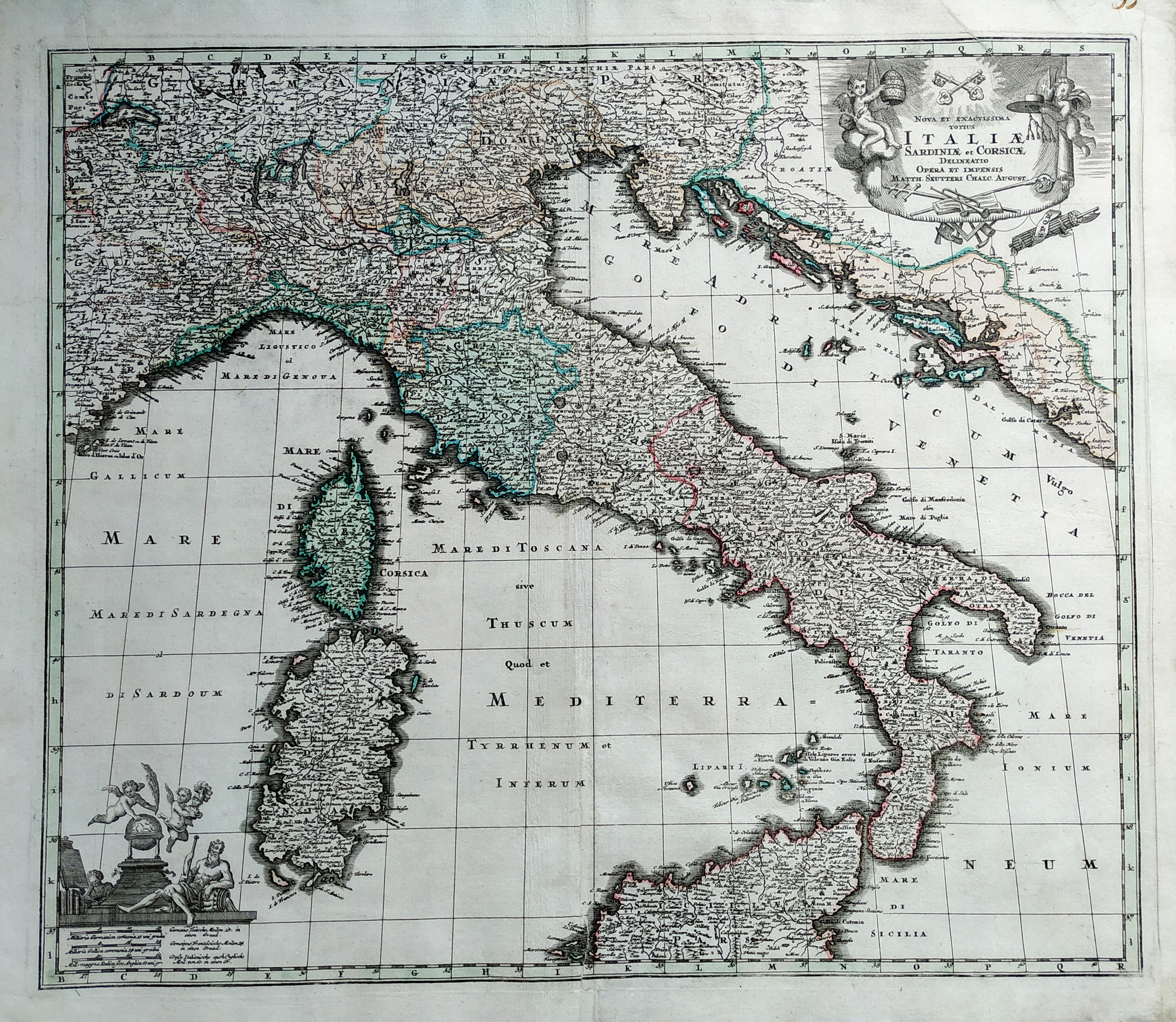
Map title
Nova et Exactissima Totius Italiae Sardiniae et Corsicae Delineatio
Author
Seutter, Matthaus
Location shown in map
Italy
Edition date
Circa 1730
Edition place
Augsburg
Editor
--
Atlas
Atlas Novus sive Tabulae Geographicae totius orbis faciem, partes, imperia, regna et provincias exhibentes exactissima cura iuxta recontissimas observation
Price
Please ask: info@thetreasuremaps.com
State
[mint/EXCELLENT/very good/good/fair/mediocre/poor]
Color
Old color
Verso
Blank
Size
Plate: cm (57 x 49) inches (22.44 x 19.29) Paper: cm (62.2 x 54) inches (24.49 x 21.26)
Technique
Copper engraving
Note
Reference
R.Borri L'Italia nelle antiche carte pag.193
Wiki
Here for more info
In stock
Available
Info
info@thetreasuremaps.com
Code
#0820
×
![Nova et Exactissima Totius Italiae Sardiniae et Corsicae Delineatio by Seutter, Matthaus, Italy, Circa 1730]()
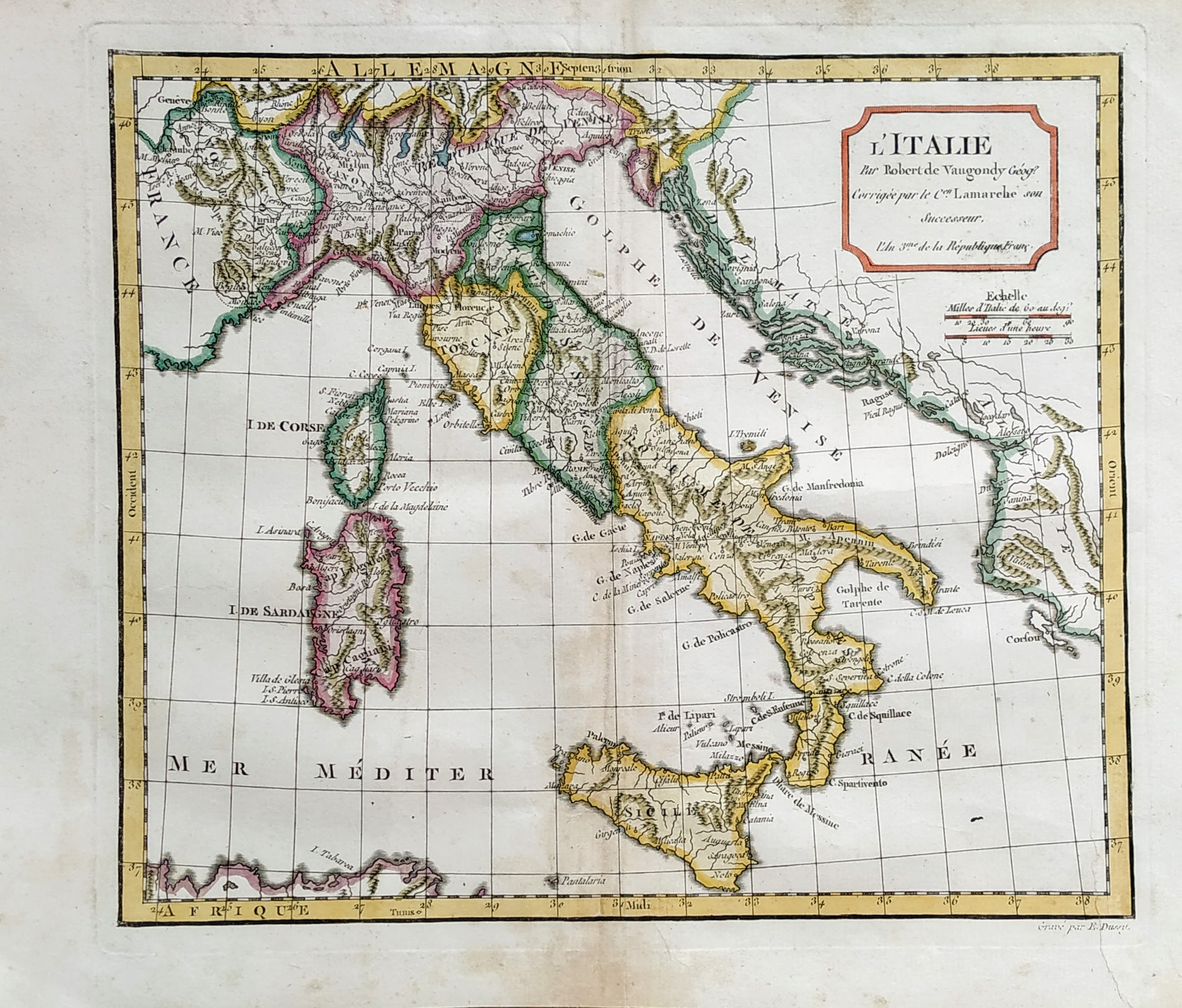
Map title
L'Italie
Author
Robert de Vaugondy
Location shown in map
Italy
Edition date
1795
Edition place
Paris
Editor
Atlas
Atlas portatif universel et militaire
Price
125 Euro
State
[mint/EXCELLENT/very good/good/fair/mediocre/poor]
Color
Old colors
Verso
Blank
Size
Plate: cm (37 x 26) inches (14.57 x 10.24) Paper: cm (44 x 32) inches (17.32 x 12.6)
Technique
Copper engraving
Note
Reference
--
Wiki
Here for more info
In stock
Available
Info
info@thetreasuremaps.com
Code
#0821
×
![L'Italie by Robert de Vaugondy, Italy, 1795]()
Map title
Italy North Part
Author
Adam Black
Location shown in map
North Italy
Edition date
Circa 1851
Edition place
Edimburgh
Editor
Atlas
Black's general atlas
Price
50 Euro
State
[mint/EXCELLENT/very good/good/fair/mediocre/poor]
Color
Old colors
Verso
Blank
Size
Plate: cm (0 x 0) inches (0 x 0) Paper: cm (0 x 0) inches (0 x 0)
Technique
Steel engraving
Note
Reference
Wiki
Here for more info
In stock
Available
Info
info@thetreasuremaps.com
Code
#0822
×
![Italy North Part by Adam Black, North Italy, Circa 1851]()
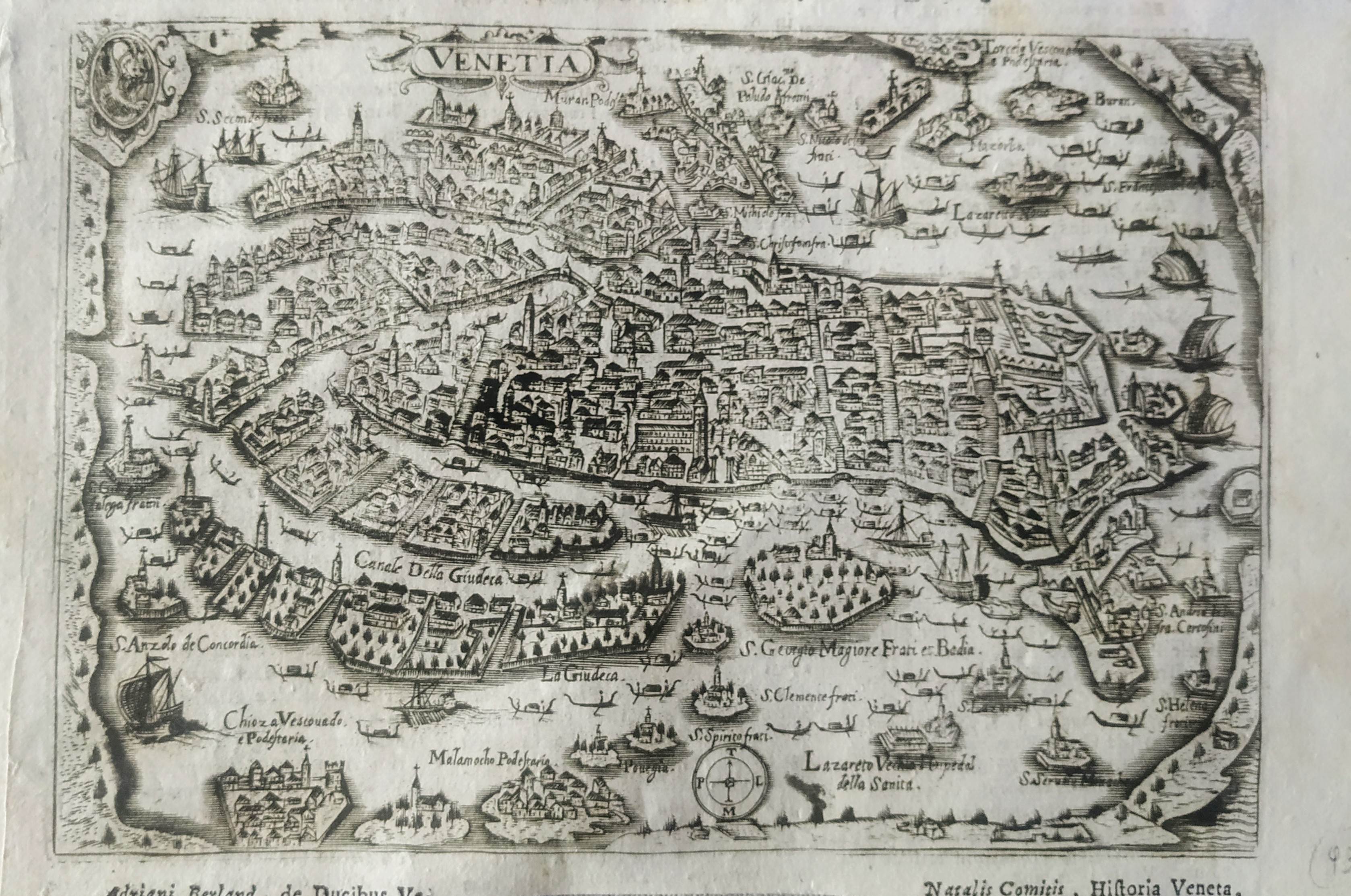
Map title
Venetia
Author
Magini
Location shown in map
Venice
Edition date
1713
Edition place
Padua
Editor
Cadorin
Atlas
Universus terrarum orbis scriptorum calamo delineatus
Price
250 Euro
State
[mint/EXCELLENT/very good/good/fair/mediocre/poor]
Color
Black/white
Verso
Latin text pag.642
Size
Plate: cm (18 x 12) inches (7.09 x 4.72) Paper: cm (22 x 14) inches (8.66 x 5.51)
Technique
Copper engraving
Note
Alphonse Lasor a Varea
Reference
Wiki
Here for more info
In stock
Available
Info
info@thetreasuremaps.com
Code
#0816
×
![Venetia by Magini, Venice, 1713]()
Map title
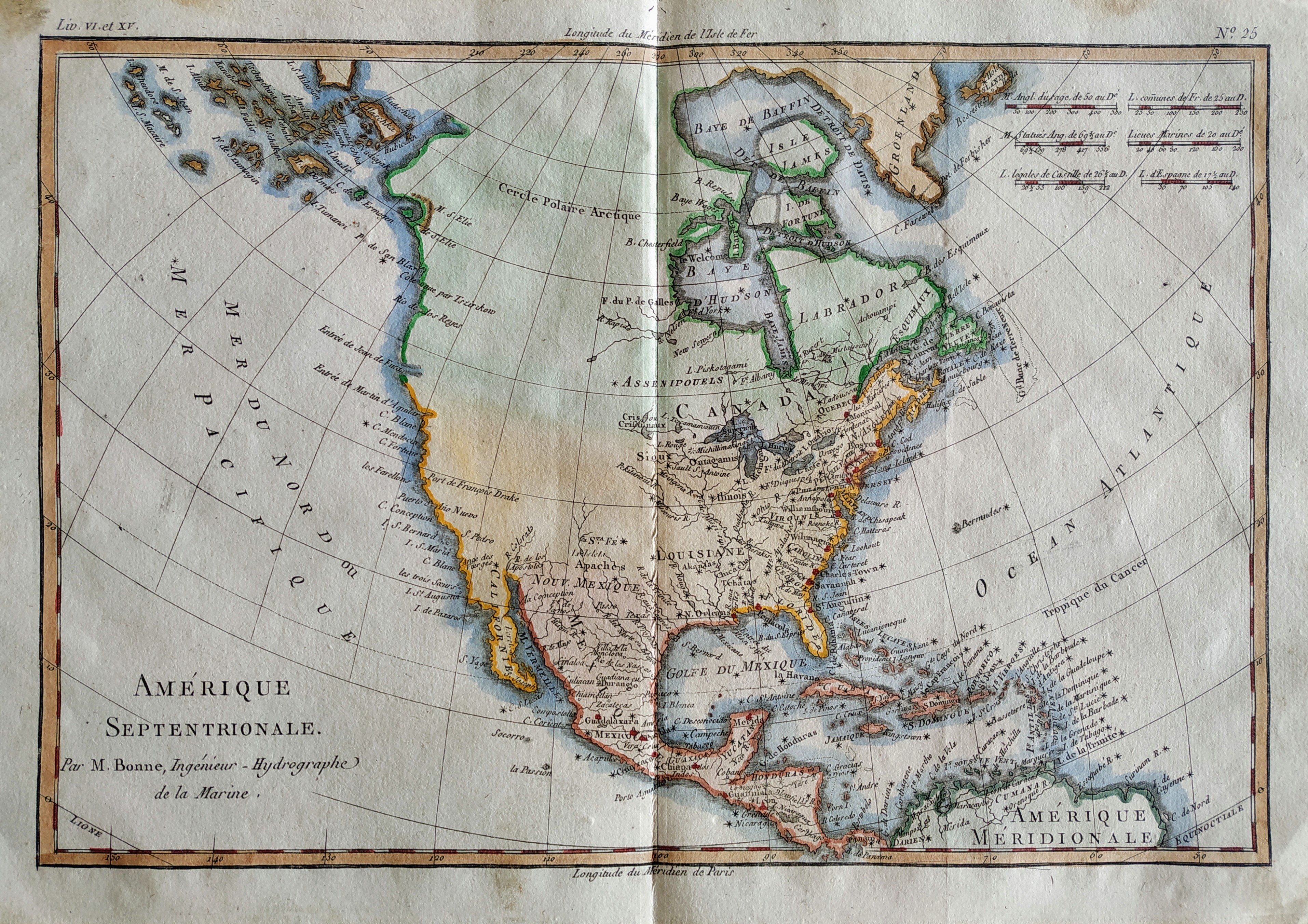
Amerique Septentrionale
Author
Bonne
Location shown in map
North America
Edition date
1789
Edition place
Paris
Editor
Atlas
Atlas Encyclopedique
Price
175 Euro
State
[mint/EXCELLENT/very good/good/fair/mediocre/poor]
Color
Old colors
Verso
Blank
Size
Plate: cm (32 x 22) inches (12.6 x 8.66) Paper: cm (36 x 25) inches (14.17 x 9.84)
Technique
Copper engraving
Note
Reference
Wiki
Here for more info
In stock
Available
Info
info@thetreasuremaps.com
Code
#0815
×
![Amerique Septentrionale by Bonne, North America, 1789]()
Map title
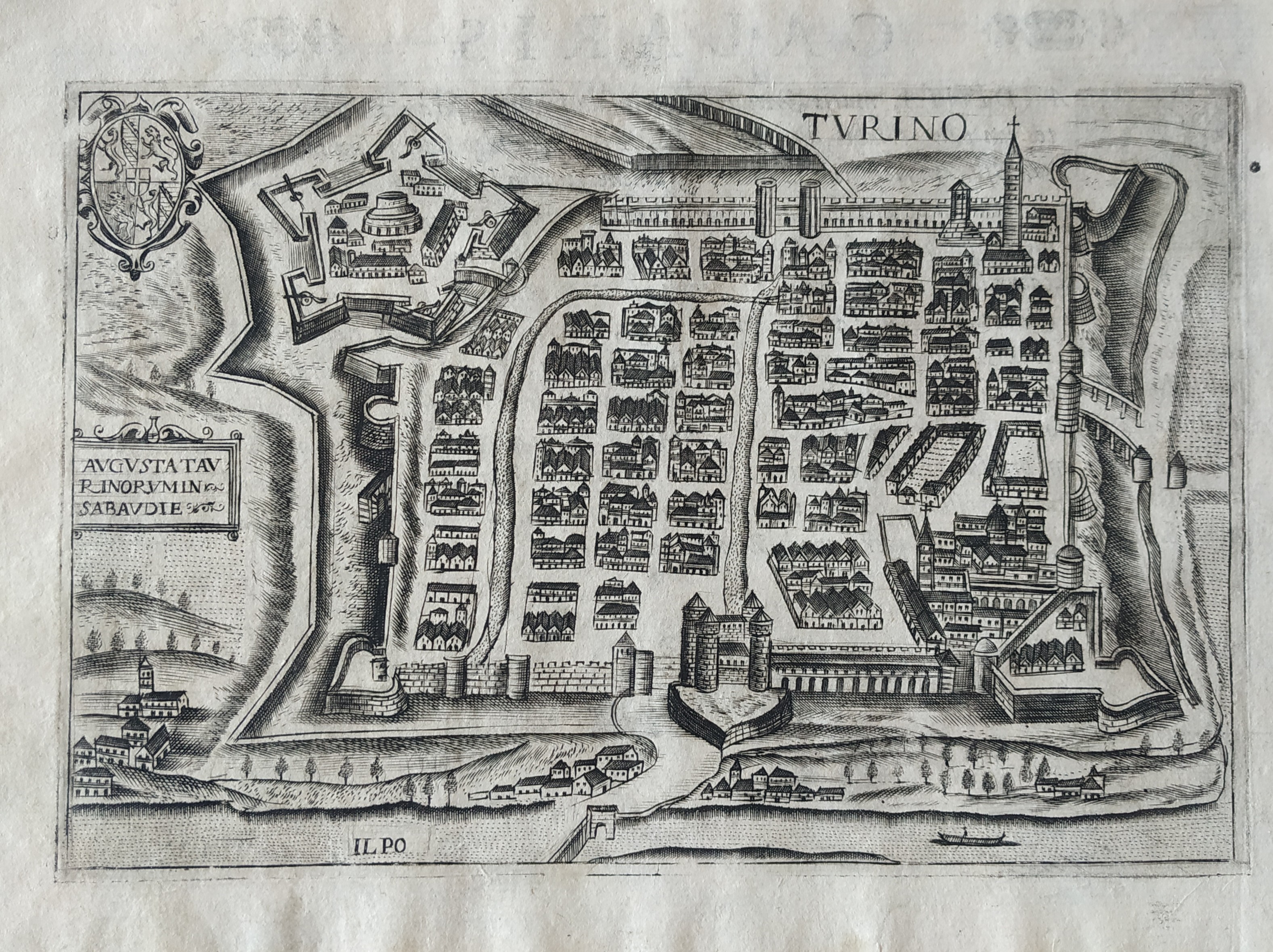
Turino
Author
Bertelli
Location shown in map
Turin
Edition date
1599
Edition place
Venice
Editor
Atlas
Theatrum urbium italicorum
Price
175 Euro
State
[mint/EXCELLENT/very good/good/fair/mediocre/poor]
Color
Black/white
Verso
Latin text
Size
Plate: cm (18 x 13) inches (7.09 x 5.12) Paper: cm (23 x 17) inches (9.06 x 6.69)
Technique
Copper engraving
Note
Reference
Wiki
Here for more info
In stock
Available
Info
info@thetreasuremaps.com
Code
#0817
×
![Turino by Bertelli, Turin, 1599]()
Map title
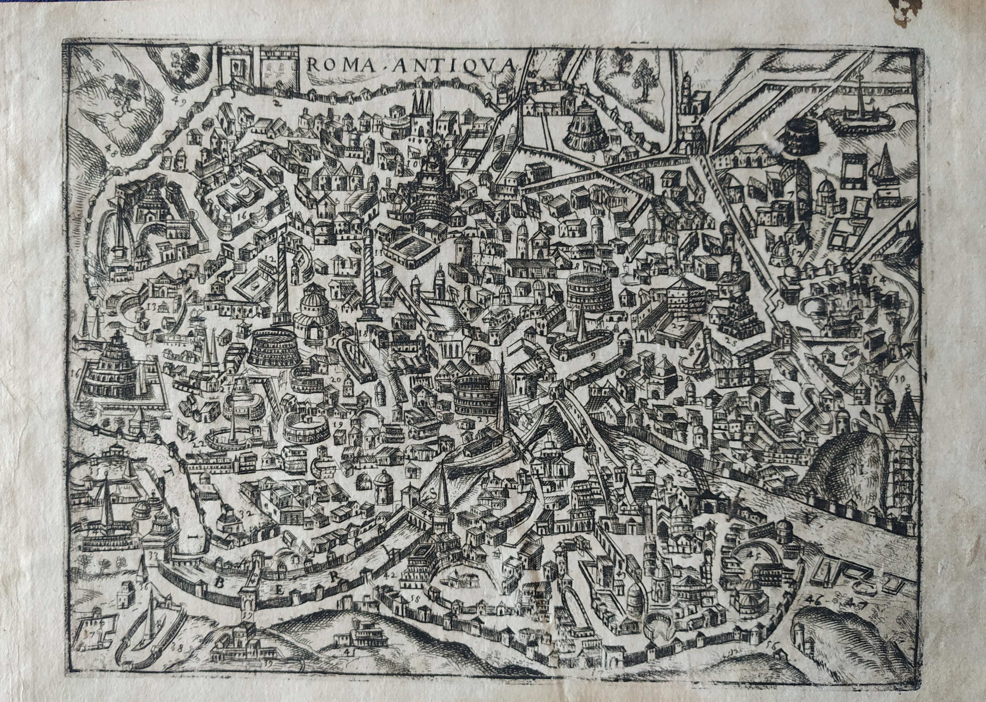
Roma Antiqua
Author
Bertelli
Location shown in map
Rome
Edition date
1599
Edition place
Venice
Editor
Atlas
Theatrum urbium italicorum
Price
Please ask: info@thetreasuremaps.com
State
[mint/EXCELLENT/very good/good/fair/mediocre/poor]
Color
Black/white
Verso
Latin text
Size
Plate: cm (18 x 13) inches (7.09 x 5.12) Paper: cm (23 x 17) inches (9.06 x 6.69)
Technique
Copper engraving
Note
Reference
Wiki
Here for more info
In stock
Available
Info
info@thetreasuremaps.com
Code
#0818
×
![Roma Antiqua by Bertelli, Rome, 1599]()