News
Map title
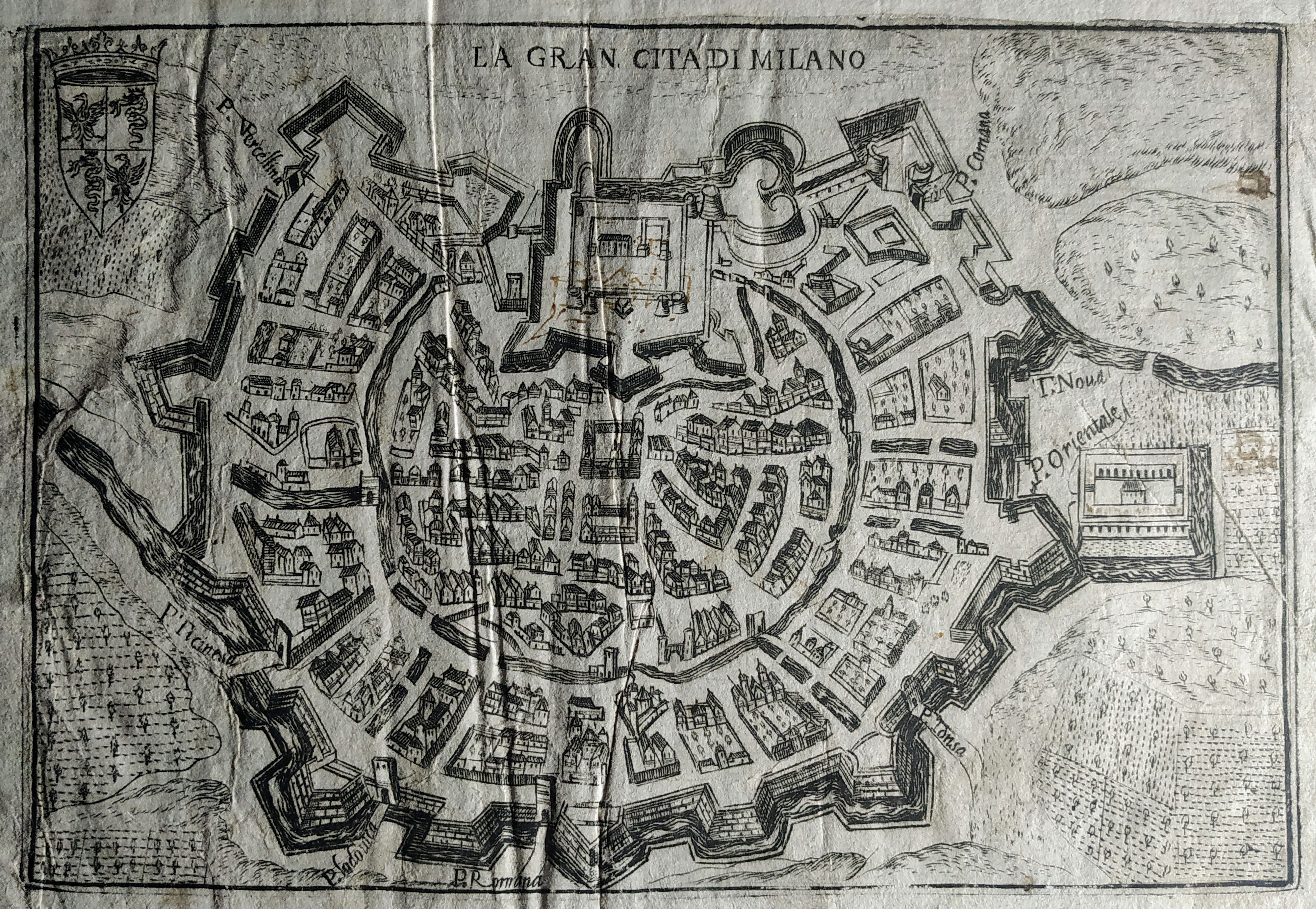
La grande citta di Milano
Author
Bertelli
Location shown in map
Milan
Edition date
1599
Edition place
Venice
Editor
Atlas
Theatrum urbium italicorum
Price
200 Euro
State
[mint/EXCELLENT/very good/good/fair/mediocre/poor]
Color
Black/white
Verso
Latin text
Size
Plate: cm (18 x 13) inches (7.09 x 5.12) Paper: cm (23 x 17) inches (9.06 x 6.69)
Technique
Copper engraving
Note
Reference
Wiki
Here for more info
In stock
Available
Info
info@thetreasuremaps.com
Code
#0819
×
![La grande citta di Milano by Bertelli, Milan, 1599]()

Map title
Fiorenza
Author
Bertelli
Location shown in map
Florence
Edition date
1599
Edition place
Venice
Editor
Atlas
Theatrum urbium italicorum
Price
200 Euro
State
[mint/EXCELLENT/very good/good/fair/mediocre/poor]
Color
Black/white
Verso
Latin text
Size
Plate: cm (18 x 13) inches (7.09 x 5.12) Paper: cm (23 x 17) inches (9.06 x 6.69)
Technique
Copper engraving
Note
Reference
Wiki
Here for more info
In stock
Available
Info
info@thetreasuremaps.com
Code
#1196
×
![Fiorenza by Bertelli, Florence, 1599]()
Map title
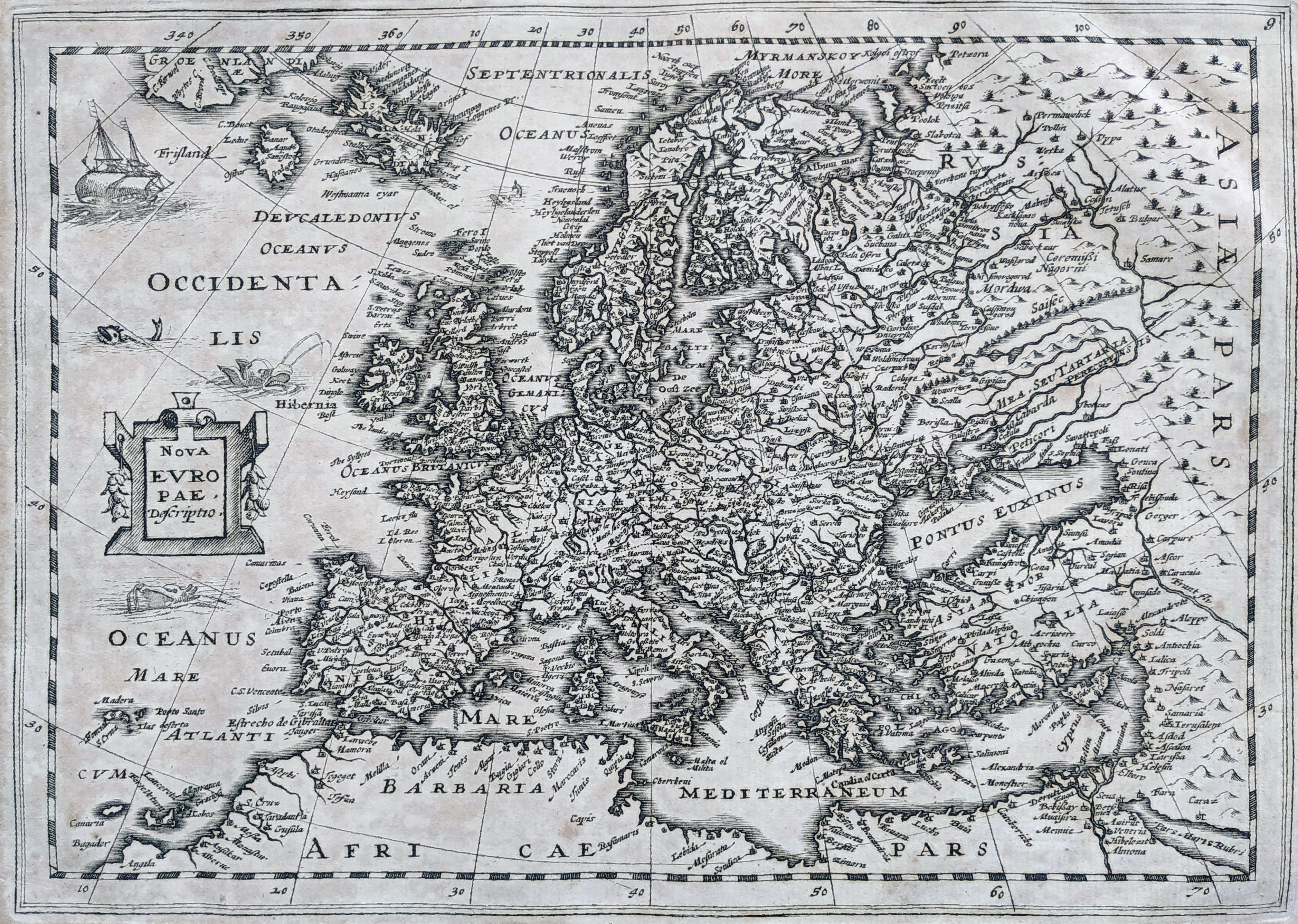
Nova Europae descriptio
Author
Mercator
Location shown in map
Europe
Edition date
1632
Edition place
Amsterdam
Editor
Hondius
Atlas
Atlas sive Cosmographicae Meditationes de Fabrica Mundi et fabricati figura
Price
300 Euro
State
[mint/EXCELLENT/very good/good/fair/mediocre/poor]
Color
Black/white
Verso
Blank
Size
Plate: cm (25 x 19) inches (9.84 x 7.48) Paper: cm (40 x 26) inches (15.75 x 10.24)
Technique
Copper engraving
Note
No particular notes for this maps.
Reference
Wiki
Here for more info
In stock
Available
Info
info@thetreasuremaps.com
Code
#0808
×
![Nova Europae descriptio by Mercator, Europe, 1632]()
Map title
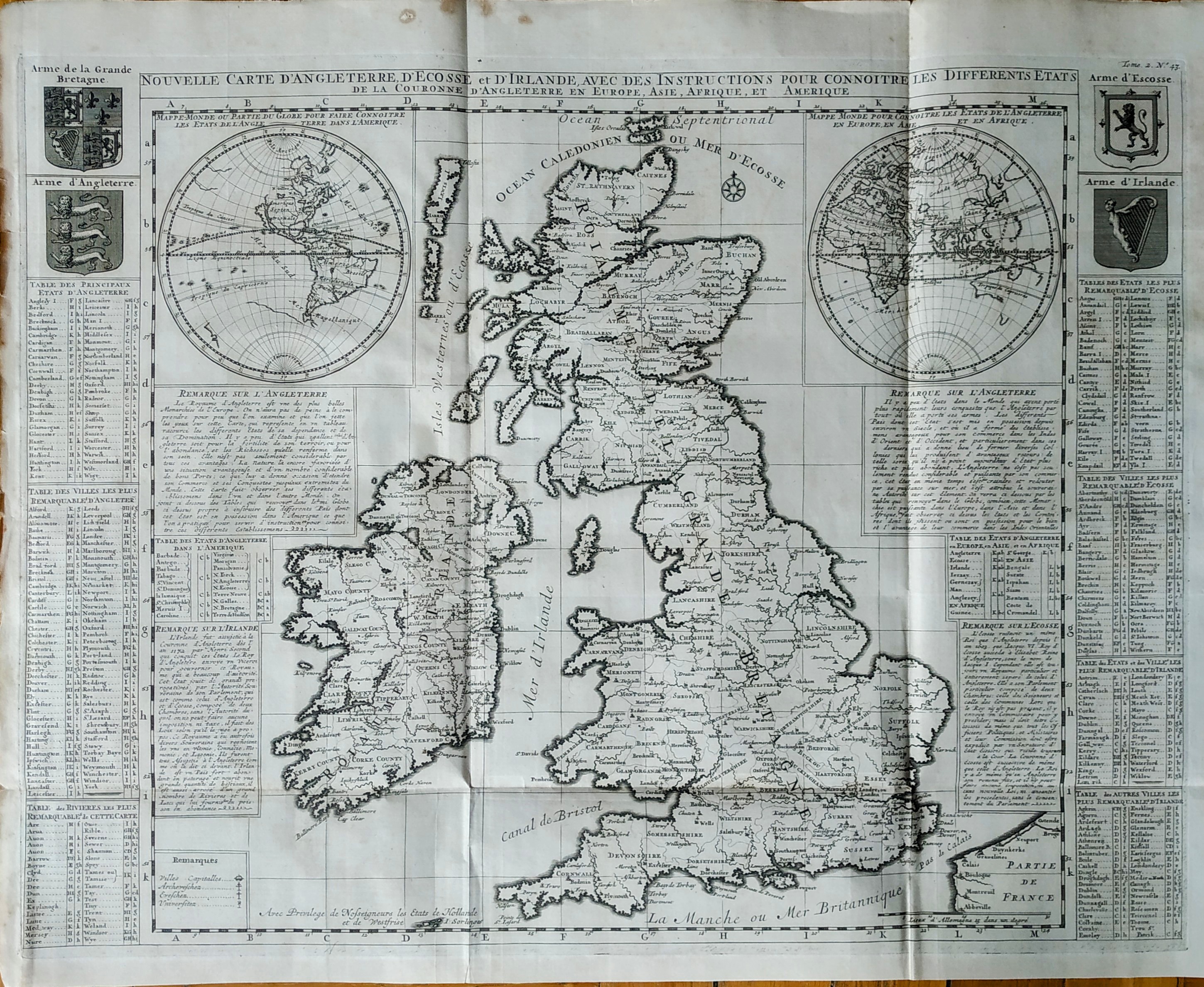
Nouvelle carte d'Angleterre d'Ecosse et d'Irlande
Author
Henri Chatelain
Location shown in map
Great Britain
Edition date
1719
Edition place
Amsterdam
Editor
Atlas
Atlas Historique
Price
350 Euro
State
[mint/EXCELLENT/very good/good/fair/mediocre/poor]
Color
Black/white
Verso
Blank
Size
Plate: cm (62 x 47) inches (24.41 x 18.5) Paper: cm (65 x 53) inches (25.59 x 20.87)
Technique
Copper engraving
Note
Reference
Wiki
Here for more info
In stock
Available
Info
info@thetreasuremaps.com
Code
#0813
×
![Nouvelle carte d'Angleterre d'Ecosse et d'Irlande by Henri Chatelain, Great Britain, 1719]()
Map title
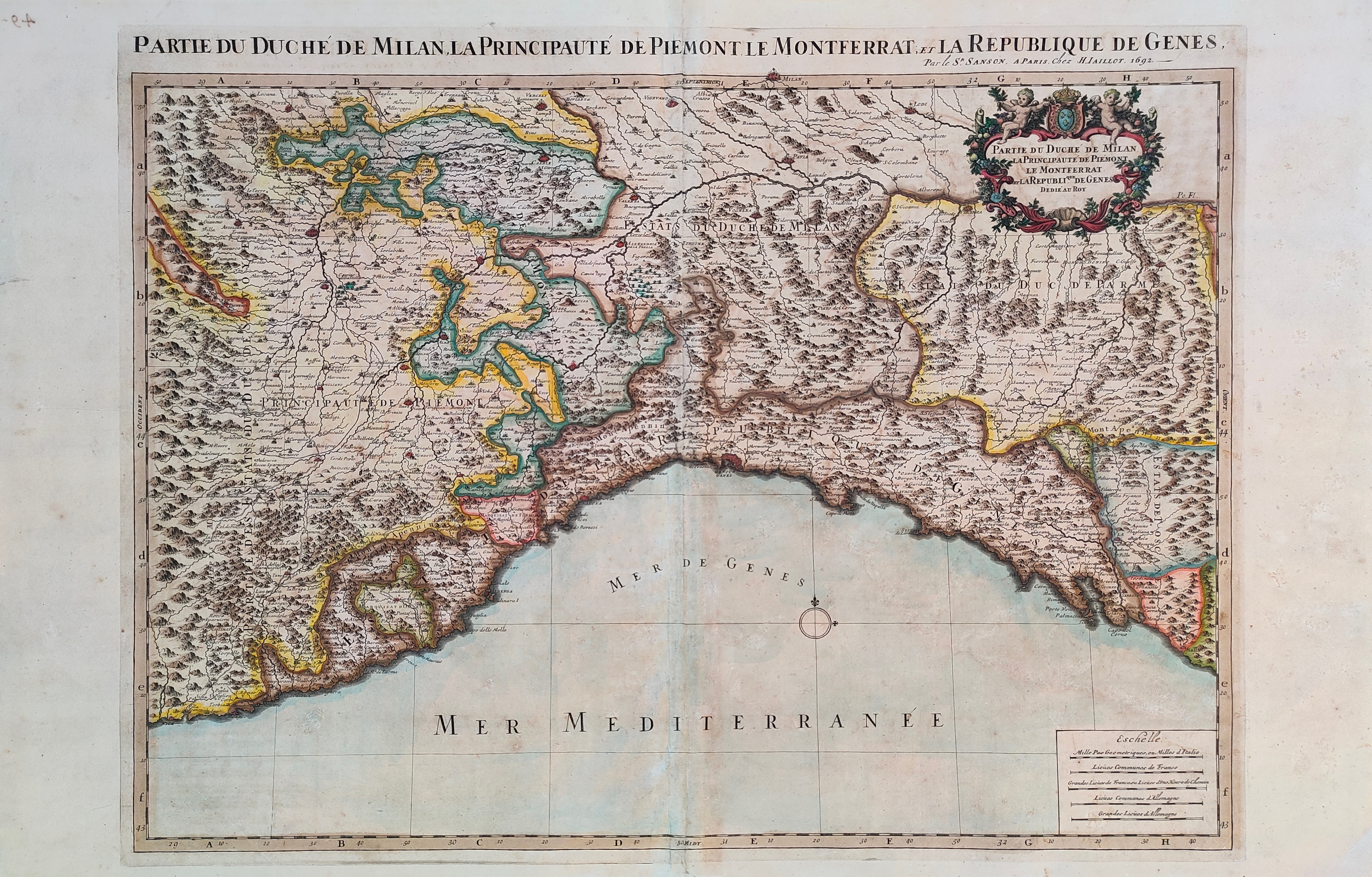
Partie de duche de Milan, la principaute de Piemont le Montferrat et la Republique de Gens
Author
Sanson
Location shown in map
Liguria
Edition date
1692
Edition place
Paris
Editor
Alexis Hubert Jaillot
Atlas
Tables geographiques des divisions du globe terrestre
Price
600 Euro
State
[mint/EXCELLENT/very good/good/fair/mediocre/poor]
Color
Old colors
Verso
Blank
Size
Plate: cm (73 x 54) inches (28.74 x 21.26) Paper: cm (89 x 57) inches (35.04 x 22.44)
Technique
Copper engraving
Note
Reference
Wiki
Here for more info
In stock
Available
Info
info@thetreasuremaps.com
Code
#1234
×
![Partie de duche de Milan, la principaute de Piemont le Montferrat et la Republique de Gens by Sanson, Liguria, 1692]()
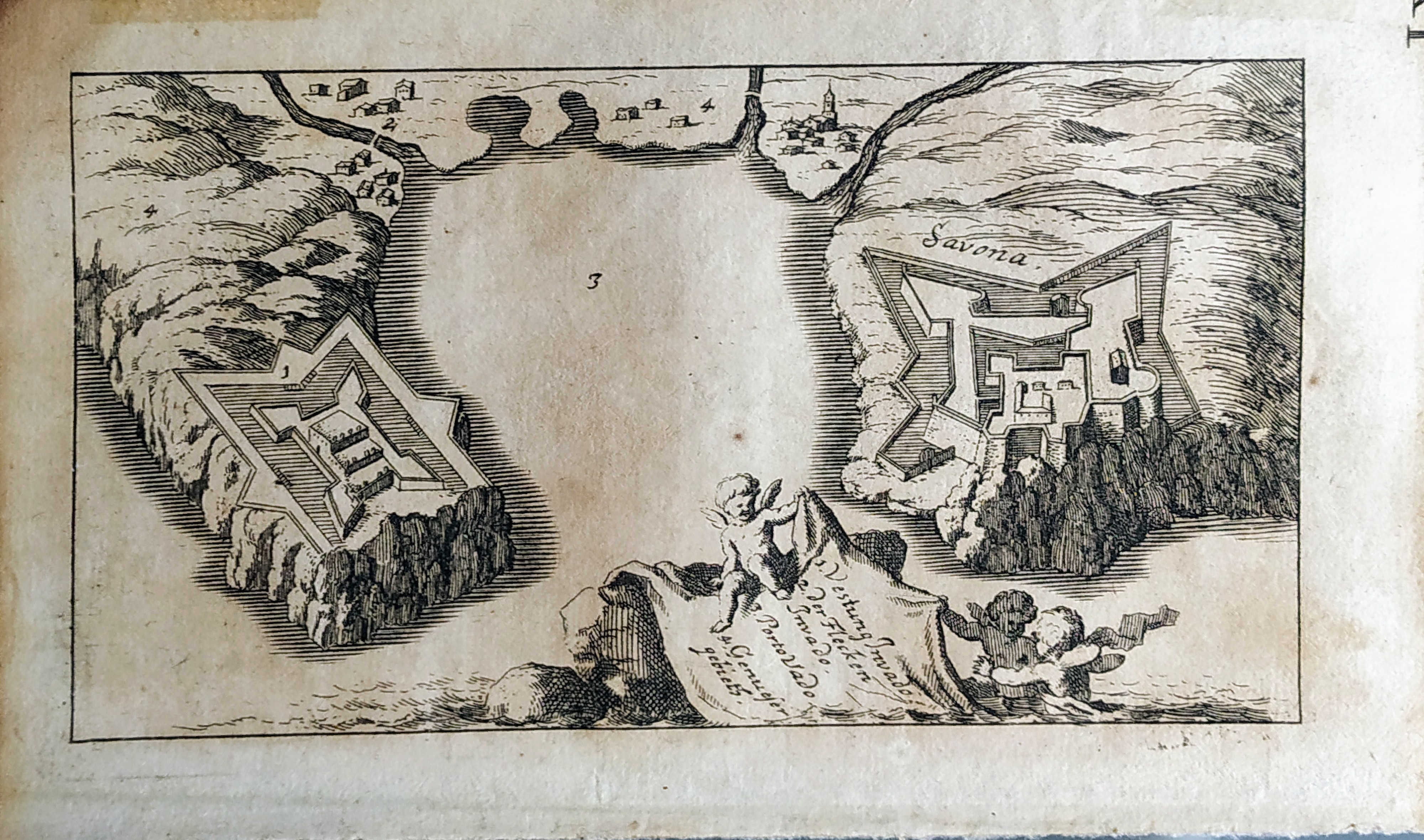
Map title
Savona
Author
Fritschen
Location shown in map
Savona
Edition date
1702
Edition place
Lipsia
Editor
Thomas Fritschen
Atlas
Schauplatz des Krieges In Italien, Oder Accurate Beschreibung der Lombardey
Price
200 Euro
State
[mint/EXCELLENT/very good/good/fair/mediocre/poor]
Color
Black/white
Verso
Blank
Size
Plate: cm (14 x 8) inches (5.51 x 3.15) Paper: cm (17 x 10) inches (6.69 x 3.94)
Technique
Copper engraving
Note
Reference
Wiki
Here for more info
In stock
Available
Info
info@thetreasuremaps.com
Code
#0810
Savona
Author
Fritschen
Location shown in map
Savona
Edition date
1702
Edition place
Lipsia
Editor
Thomas Fritschen
Atlas
Schauplatz des Krieges In Italien, Oder Accurate Beschreibung der Lombardey
Price
200 Euro
State
[mint/EXCELLENT/very good/good/fair/mediocre/poor]
Color
Black/white
Verso
Blank
Size
Plate: cm (14 x 8) inches (5.51 x 3.15) Paper: cm (17 x 10) inches (6.69 x 3.94)
Technique
Copper engraving
Note
Reference
Wiki
Here for more info
In stock
Available
Info
info@thetreasuremaps.com
Code
#0810
×
![Savona by Fritschen, Savona, 1702]()
Map title
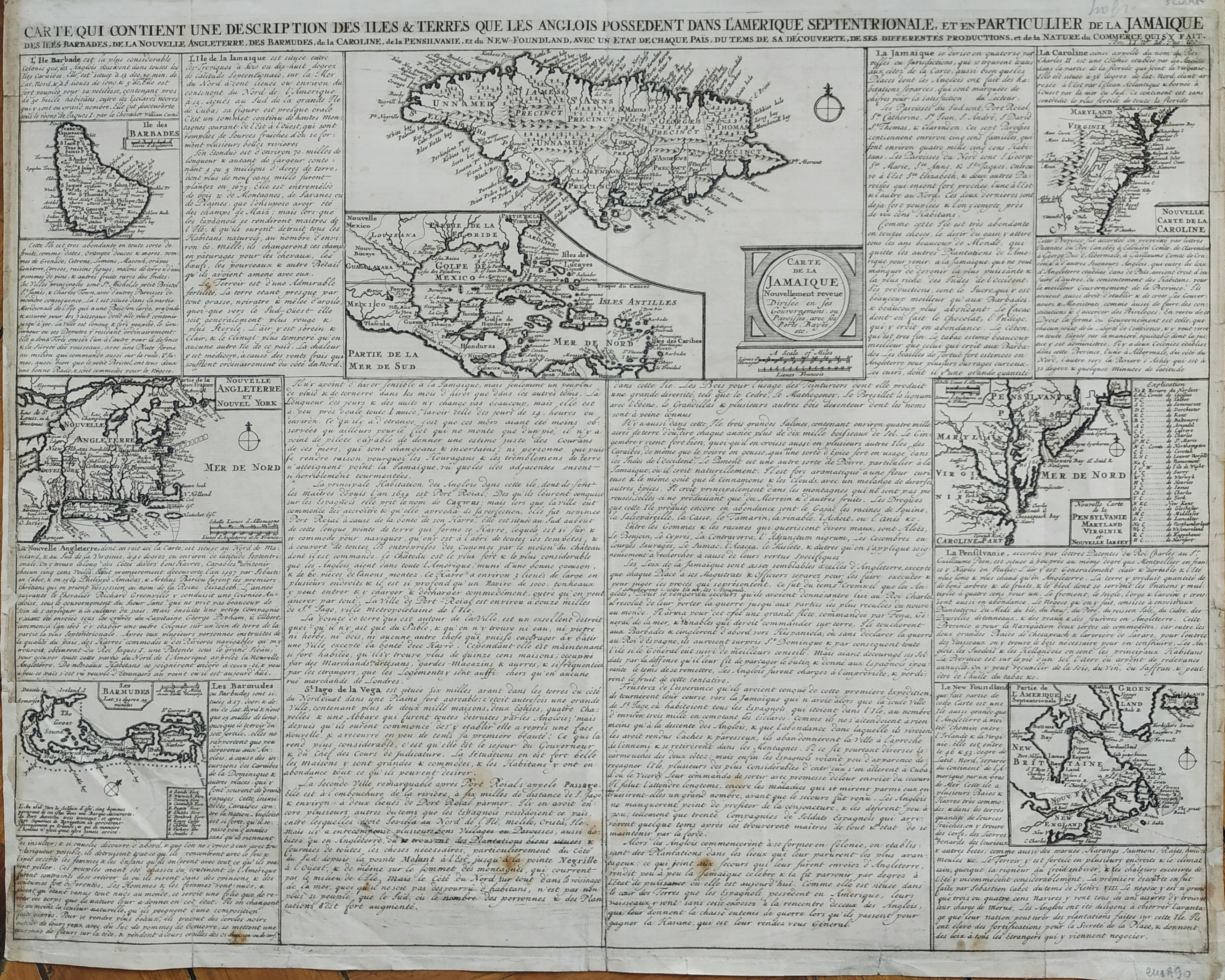
Carte qui contient une description des iles & terres que les Anglois possedent dans l'Amerique septentrionale, et en particulier de la Jamaique, des Iles Barbades, de la Nouvelle Angleterre, Des Barmudes,de la Caroline, de la Pensilvanie, et du New-Foundland, avec un Etat de Chaque Pais
Author
Henri Chatelain
Location shown in map
North America
Edition date
1719
Edition place
Amsterdam
Editor
Atlas
Atlas Historique
Price
200 Euro
State
[mint/excellent/VERY GOOD/good/fair/mediocre/poor]
Color
Black/white
Verso
Blank
Size
Plate: cm (52 x 42) inches (20.47 x 16.54) Paper: cm (53 x 43) inches (20.87 x 16.93)
Technique
Copper engraving
Note
Reference
Wiki
Here for more info
In stock
Available
Info
info@thetreasuremaps.com
Code
#0811
×
![Carte qui contient une description des iles & terres que les Anglois possedent dans l'Amerique septentrionale, et en particulier de la Jamaique, des Iles Barbades, de la Nouvelle Angleterre, Des Barmudes,de la Caroline, de la Pensilvanie, et du New-Foundland, avec un Etat de Chaque Pais by Henri Chatelain, North America, 1719]()
Map title
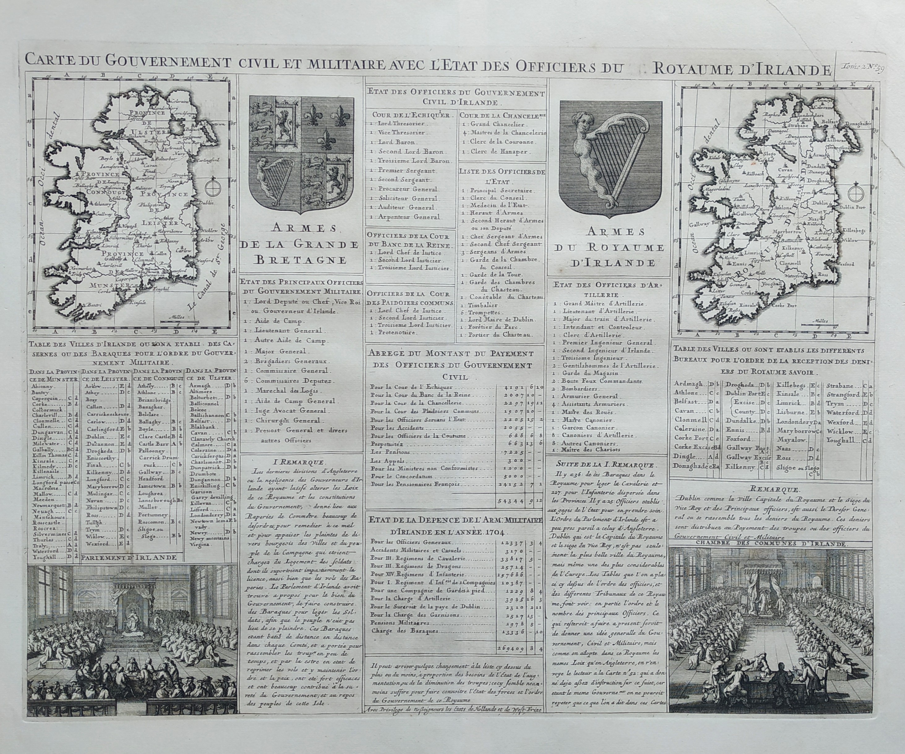
Carte du gouvernment civil et miltaire avec l'etat des officiers du royaume d'Irlande
Author
Henri Chatelain
Location shown in map
Irland
Edition date
1719
Edition place
Amsterdam
Editor
Atlas
Atlas Historique
Price
200 Euro
State
[mint/EXCELLENT/very good/good/fair/mediocre/poor]
Color
Black/white
Verso
Blank
Size
Plate: cm (52 x 42) inches (20.47 x 16.54) Paper: cm (53 x 43) inches (20.87 x 16.93)
Technique
Copper engraving
Note
Reference
Wiki
Here for more info
In stock
Available
Info
info@thetreasuremaps.com
Code
#0825
×
![Carte du gouvernment civil et miltaire avec l'etat des officiers du royaume d'Irlande by Henri Chatelain, Irland, 1719]()
Map title
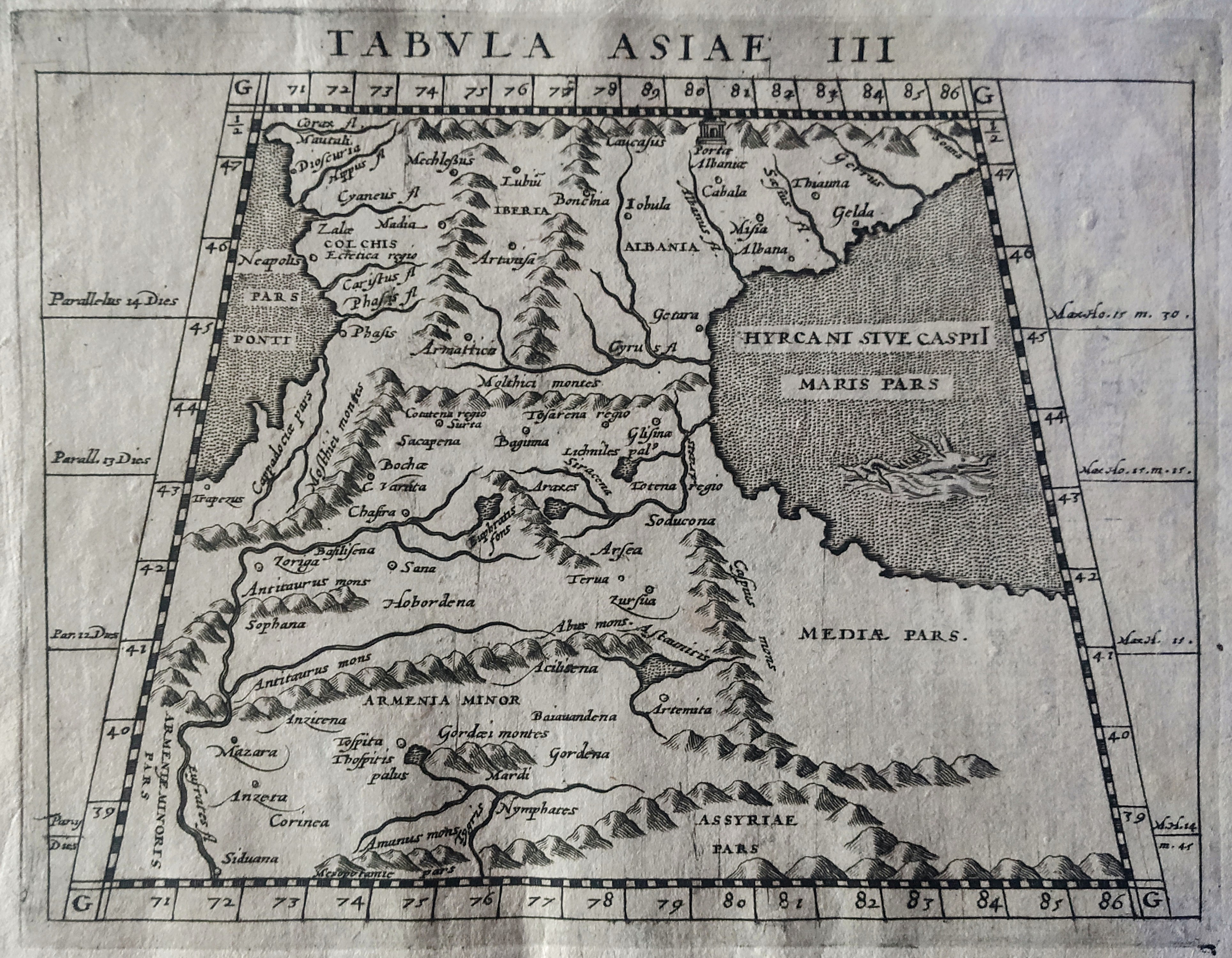
Tabula Asiae III
Author
Magini
Location shown in map
Armenia
Edition date
1597
Edition place
Cologne
Editor
Petrus Keschedt
Atlas
Geografia di Claudio Tolomeo -- Giovanni Antonio Magini
Price
Please ask: info@thetreasuremaps.com
State
[mint/EXCELLENT/very good/good/fair/mediocre/poor]
Color
Black/white
Verso
Latin text pag 18
Size
Plate: cm (18 x 13.5) inches (7.09 x 5.31) Paper: cm (23 x 16) inches (9.06 x 6.3)
Technique
Copper engraving
Note
Maps pirated from those of Girolamo Poro in Magini's edition.
Reference
--
Wiki
Here for more info
In stock
Available
Info
info@thetreasuremaps.com
Code
#0829
×
![Tabula Asiae III by Magini, Armenia, 1597]()
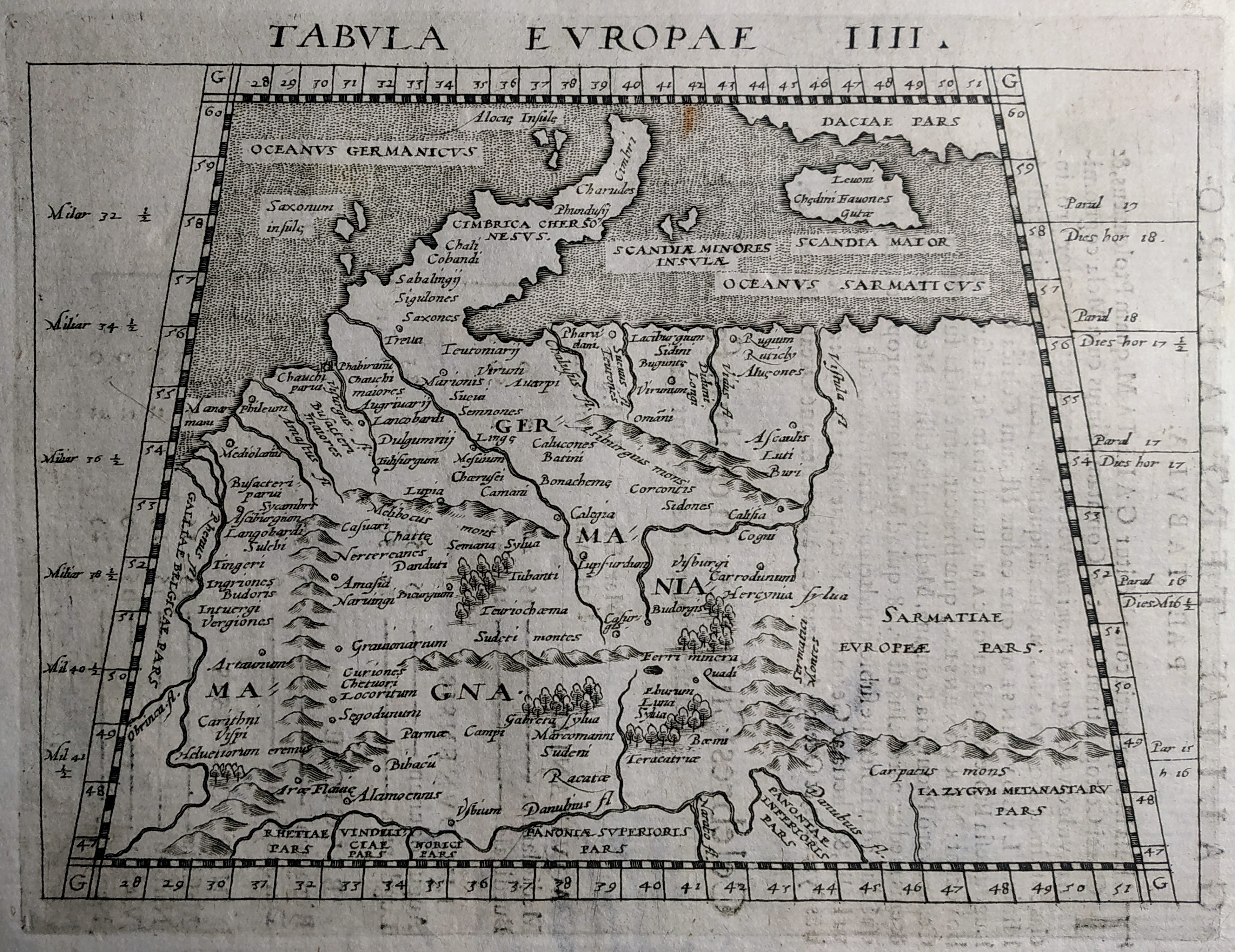
Map title
Tabula Europae IIII
Author
Magini
Location shown in map
Germany
Edition date
1597
Edition place
Cologne
Editor
Petrus Keschedt
Atlas
Geografia di Claudio Tolomeo -- Giovanni Antonio Magini
Price
Please ask: info@thetreasuremaps.com
State
[mint/EXCELLENT/very good/good/fair/mediocre/poor]
Color
Black/white
Verso
Latin text pag 5
Size
Plate: cm (18 x 13.5) inches (7.09 x 5.31) Paper: cm (23 x 16) inches (9.06 x 6.3)
Technique
Copper engraving
Note
Maps pirated from those of Girolamo Poro in Magini's edition.
Reference
--
Wiki
Here for more info
In stock
Available
Info
info@thetreasuremaps.com
Code
#0830
×
![Tabula Europae IIII by Magini, Germany, 1597]()
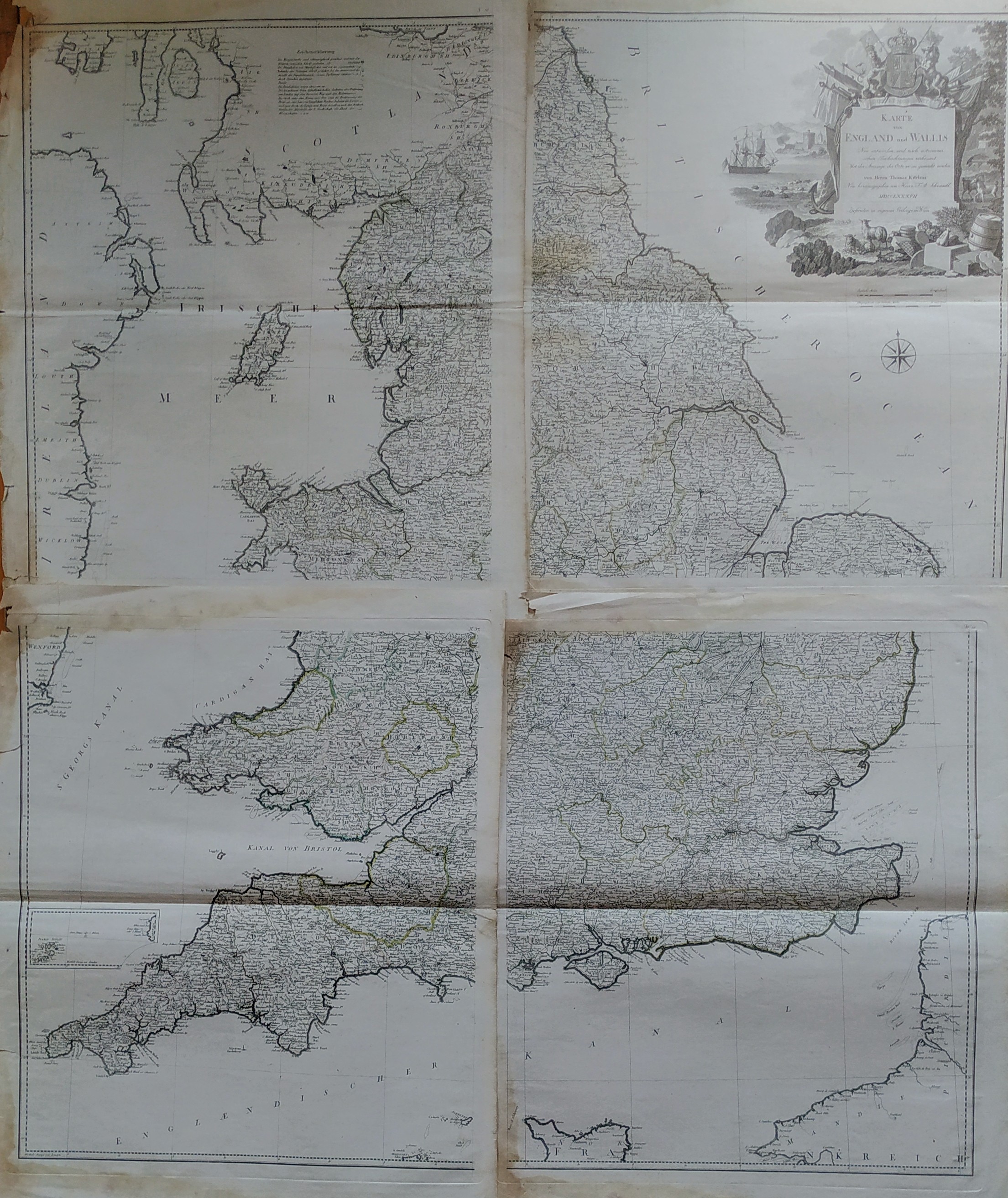
Map title
Karte von England und Wallis
Author
Thomas Kitchin
Location shown in map
England
Edition date
1787
Edition place
Wien
Editor
Atlas
Price
350 Euro
State
[mint/EXCELLENT/very good/good/fair/mediocre/poor]
Color
Black/white
Verso
Blank
Size
Plate: cm (0 x 0) inches (0 x 0) Paper: cm (0 x 0) inches (0 x 0)
Technique
Copper engraving
Note
Reference
Wiki
Here for more info
In stock
Available
Info
info@thetreasuremaps.com
Code
#0826
×
![Karte von England und Wallis by Thomas Kitchin, England, 1787]()
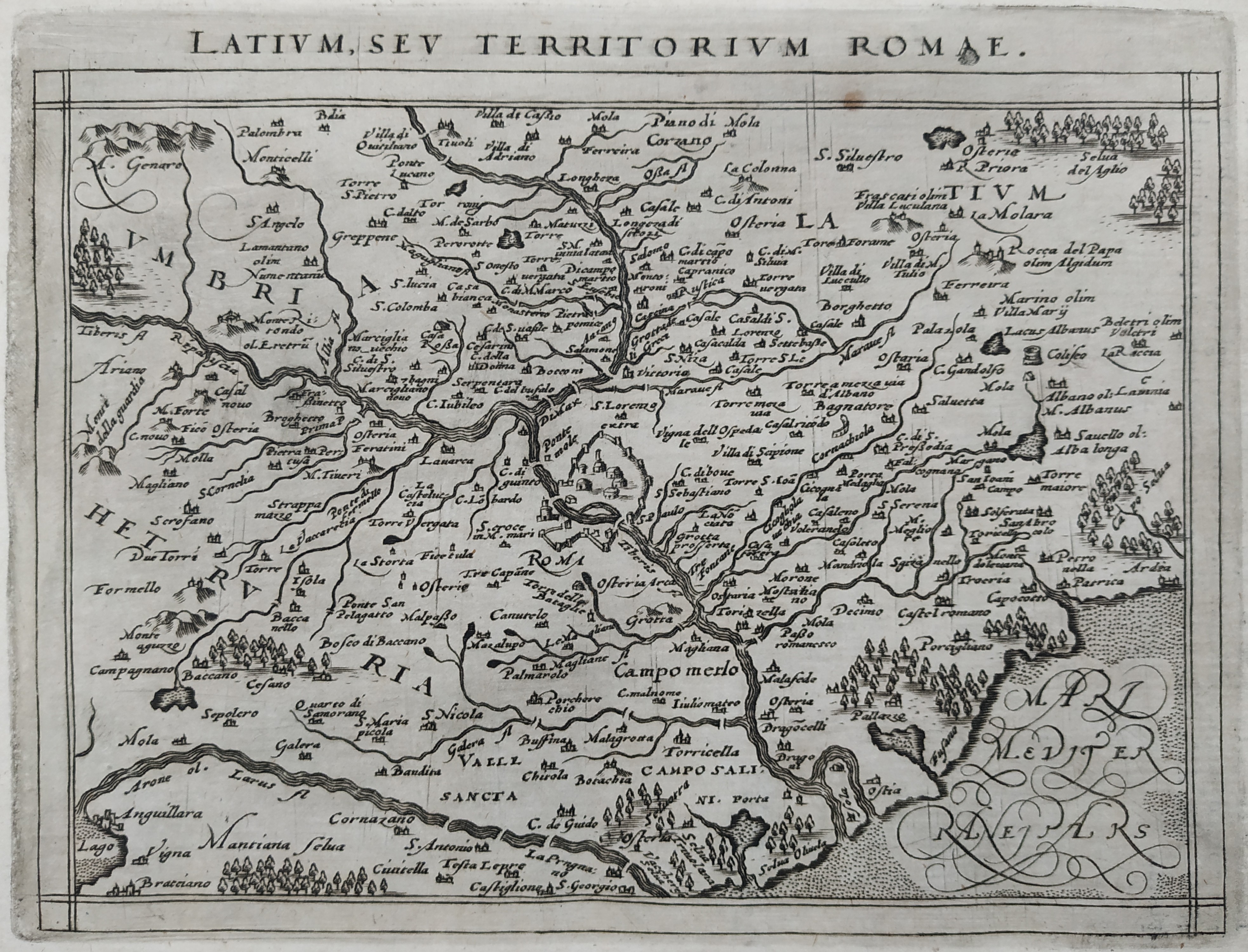
Map title
Latium sev territorium Romae
Author
Magini
Location shown in map
Latium
Edition date
1597
Edition place
Cologne
Editor
Petrus Keschedt
Atlas
Geografia di Claudio Tolomeo -- Giovanni Antonio Magini
Price
Please ask: info@thetreasuremaps.com
State
[mint/EXCELLENT/very good/good/fair/mediocre/poor]
Color
Black/white
Verso
Latin text pag 114
Size
Plate: cm (18 x 13.5) inches (7.09 x 5.31) Paper: cm (23 x 17) inches (9.06 x 6.69)
Technique
Copper engraving
Note
Maps pirated from those of Girolamo Poro in Magini's edition.
Reference
--
Wiki
Here for more info
In stock
Available
Info
info@thetreasuremaps.com
Code
#0831
×
![Latium sev territorium Romae by Magini, Latium, 1597]()
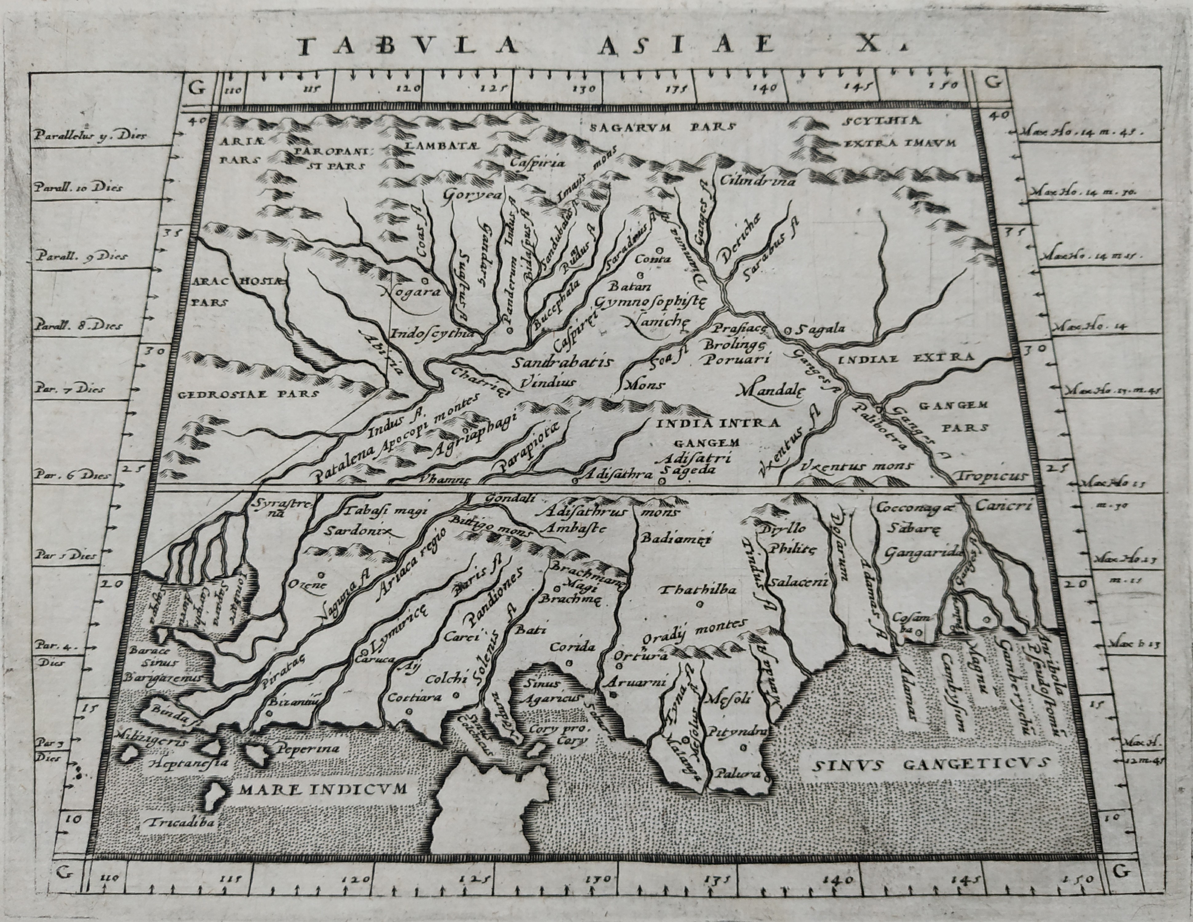
Map title
Tabula Asiae X
Author
Magini
Location shown in map
Indie
Edition date
1597
Edition place
Cologne
Editor
Petrus Keschedt
Atlas
Geografia di Claudio Tolomeo -- Giovanni Antonio Magini
Price
Please ask: info@thetreasuremaps.com
State
[mint/EXCELLENT/very good/good/fair/mediocre/poor]
Color
Black/white
Verso
Latin text pag 25
Size
Plate: cm (18 x 13.5) inches (7.09 x 5.31) Paper: cm (23 x 17) inches (9.06 x 6.69)
Technique
Copper engraving
Note
Maps pirated from those of Girolamo Poro in Magini's edition.
Reference
--
Wiki
Here for more info
In stock
Available
Info
info@thetreasuremaps.com
Code
#0832
×
![Tabula Asiae X by Magini, Indie, 1597]()
Map title
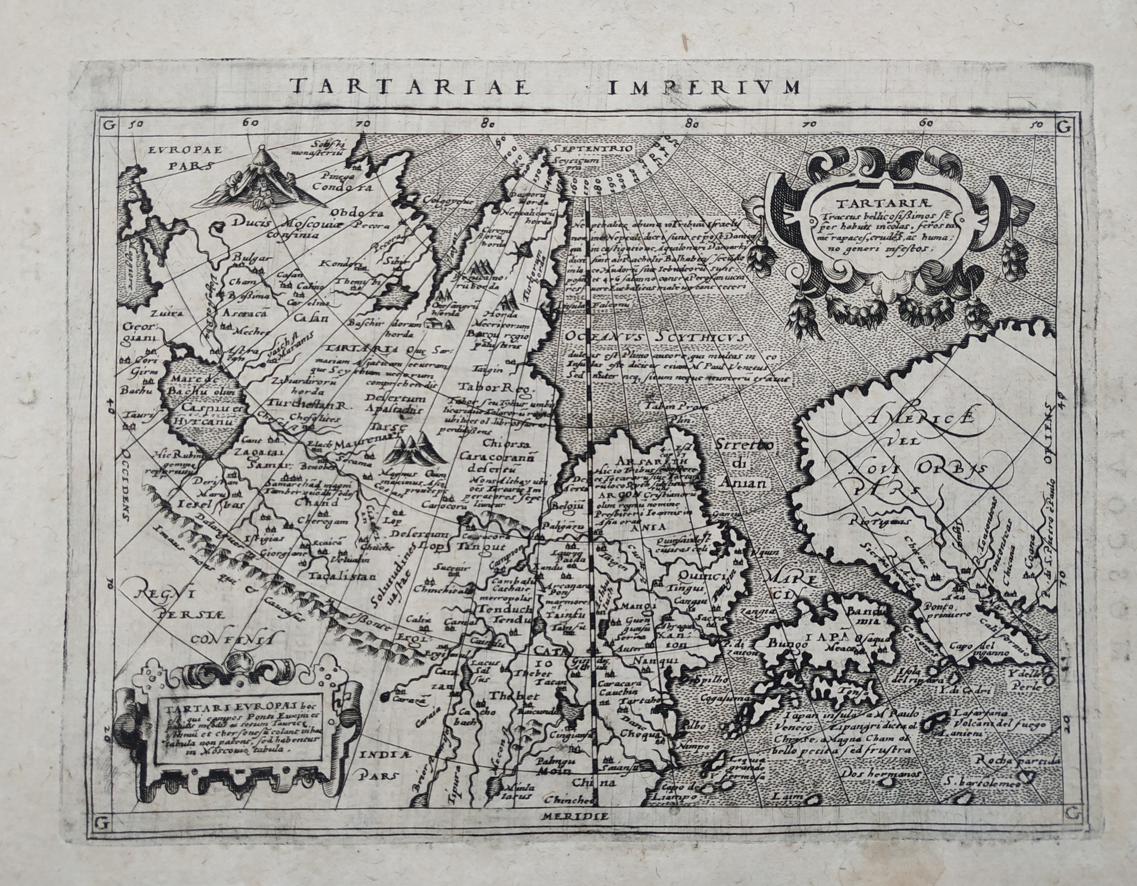
Tartariae Imperium
Author
Magini
Location shown in map
Russia
Edition date
1597
Edition place
Cologne
Editor
Petrus Keschedt
Atlas
Geografia di Claudio Tolomeo -- Giovanni Antonio Magini
Price
Please ask: info@thetreasuremaps.com
State
[mint/EXCELLENT/very good/good/fair/mediocre/poor]
Color
Black/white
Verso
Latin text pag 229
Size
Plate: cm (18 x 13.5) inches (7.09 x 5.31) Paper: cm (23 x 17) inches (9.06 x 6.69)
Technique
Copper engraving
Note
Maps pirated from those of Girolamo Poro in Magini's edition.
Reference
--
Wiki
Here for more info
In stock
Available
Info
info@thetreasuremaps.com
Code
#0833
×
![Tartariae Imperium by Magini, Russia, 1597]()
Map title
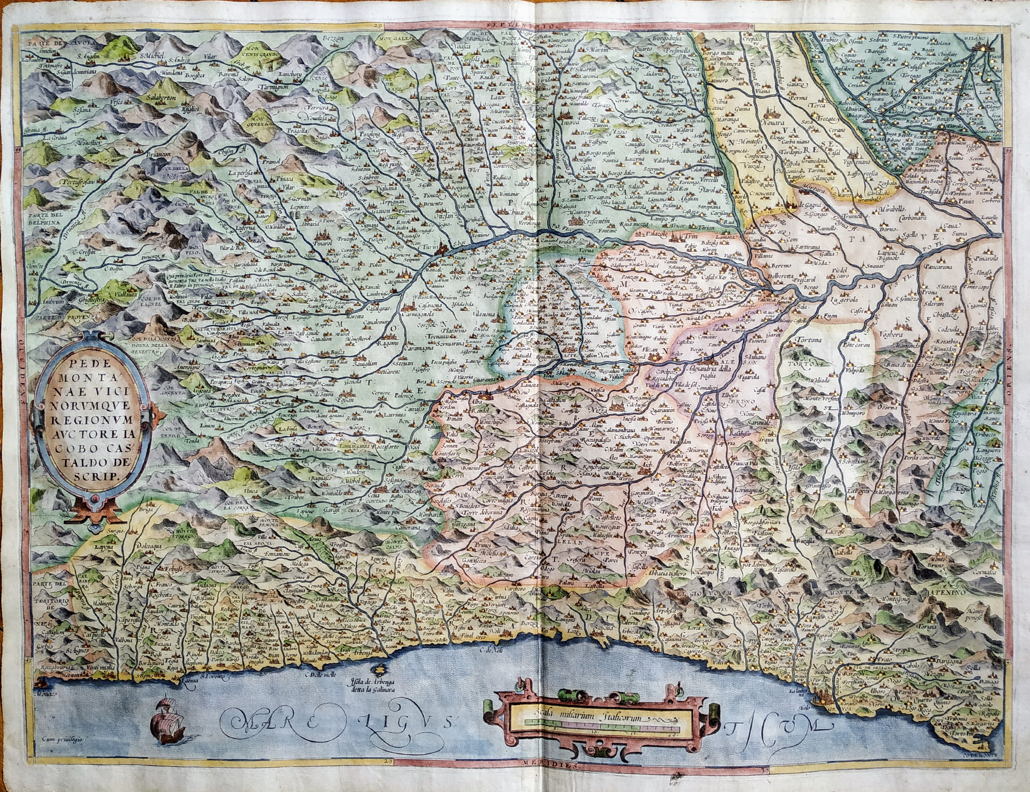
Pedmontanae Vicinorumque Regionum Auctore Iacobo Castaldo Descrip.
Author
Ortelius
Location shown in map
Piedmont & Liguria, North west Italy
Edition date
1572
Edition place
Antwerp
Editor
--
Atlas
Theatrum Orbis Terrarum
Price
600 Euro
State
[mint/EXCELLENT/very good/good/fair/mediocre/poor]
Color
Modern color
Verso
Franch text pag.34
Size
Plate: cm (49 x 36) inches (19.29 x 14.17) Paper: cm (56 x 44) inches (22.05 x 17.32)
Technique
Copper engraving
Note
No particular notes for this maps.
Reference
Van Den Broecke 128
Wiki
Here for more info
In stock
Available
Info
info@thetreasuremaps.com
Code
#0804
×
![Pedmontanae Vicinorumque Regionum Auctore Iacobo Castaldo Descrip. by Ortelius, Piedmont & Liguria, North west Italy, 1572]()
Map title
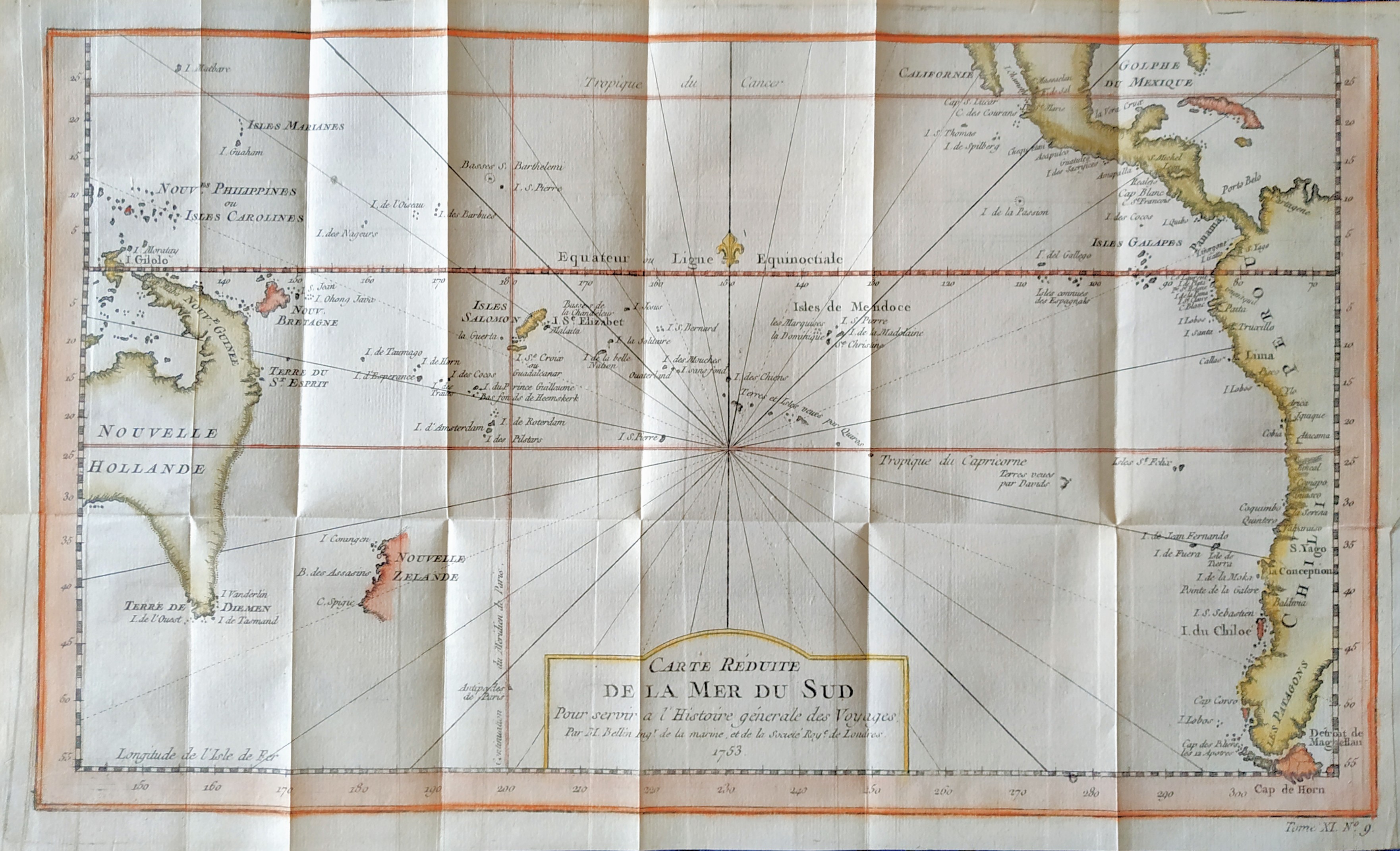
Carte reduite de la mer du Sud
Author
Bellin
Location shown in map
South Pacific
Edition date
1757
Edition place
Paris
Editor
--
Atlas
Historie General des Voyages -- Prevost
Price
300 Euro
State
[mint/EXCELLENT/very good/good/fair/mediocre/poor]
Color
Modern color
Verso
Blank
Size
Plate: cm (35.5 x 21) inches (13.98 x 8.27) Paper: cm (39 x 23) inches (15.35 x 9.06)
Technique
Copper engraving
Note
Showing recent discoveries in the South Pacific: Australia's eastern coastline is virtually featureless, running from New Guinea to Tasmania without a break. Only a small section of New Zealand is marked.
Reference
--
Wiki
Here for more info
In stock
Available
Info
info@thetreasuremaps.com
Code
#0806
×
![Carte reduite de la mer du Sud by Bellin, South Pacific, 1757]()
Map title
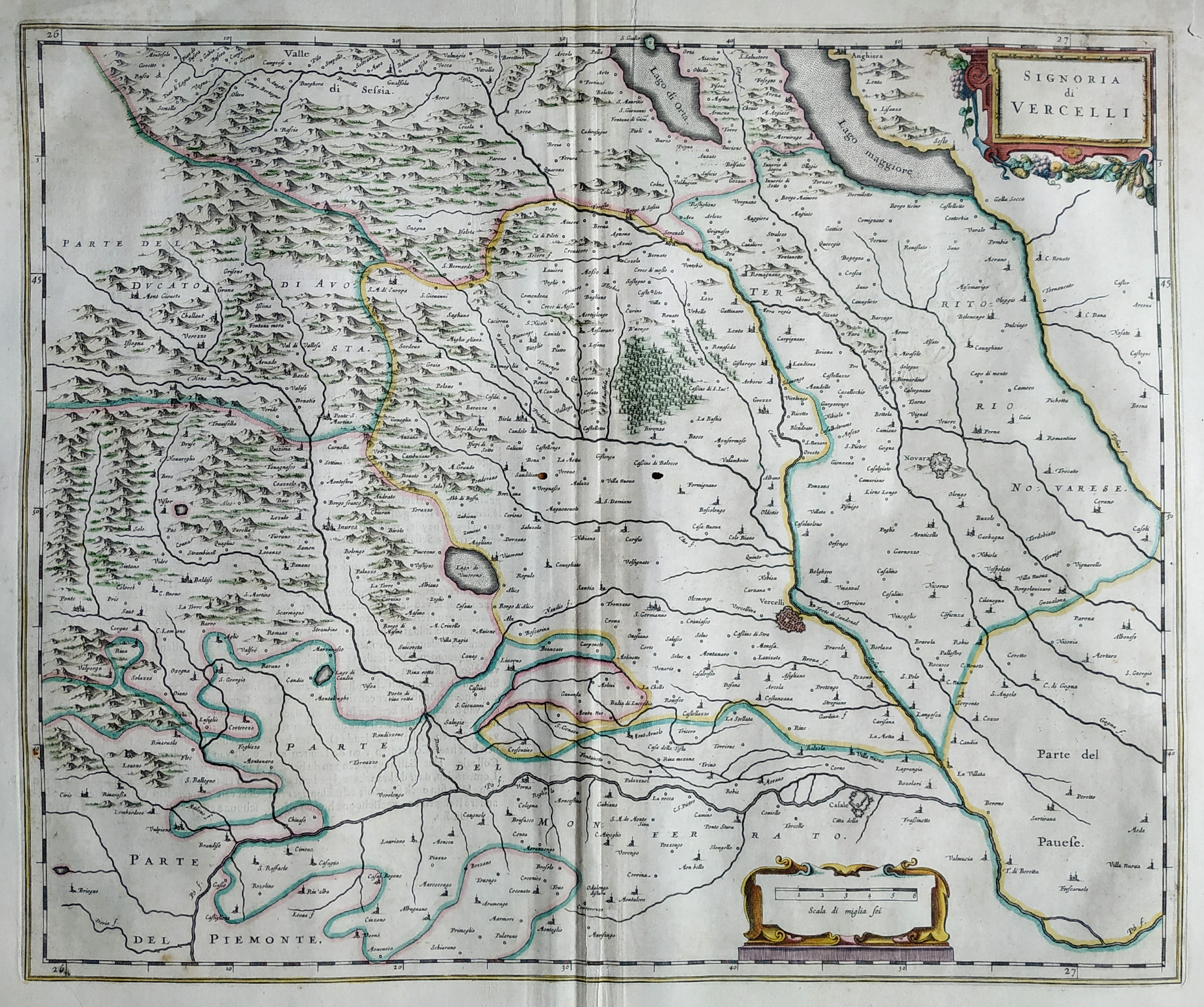
La signoria di Vercelli
Author
Blaeu
Location shown in map
North-West Italy
Edition date
Circa 1650
Edition place
Amsterdam
Editor
Blaeu
Atlas
Atlas Maior
Price
300 Euro
State
[mint/excellent/VERY GOOD/good/fair/mediocre/poor]
Color
Old colors
Verso
Duch text pag.17
Size
Plate: cm (51 x 41) inches (20.08 x 16.14) Paper: cm (55 x 44) inches (21.65 x 17.32)
Technique
Copper engraving
Note
No particular notes for this maps
Reference
Wiki
Here for more info
In stock
Available
Info
info@thetreasuremaps.com
Code
#0805
×
![La signoria di Vercelli by Blaeu, North-West Italy, Circa 1650]()
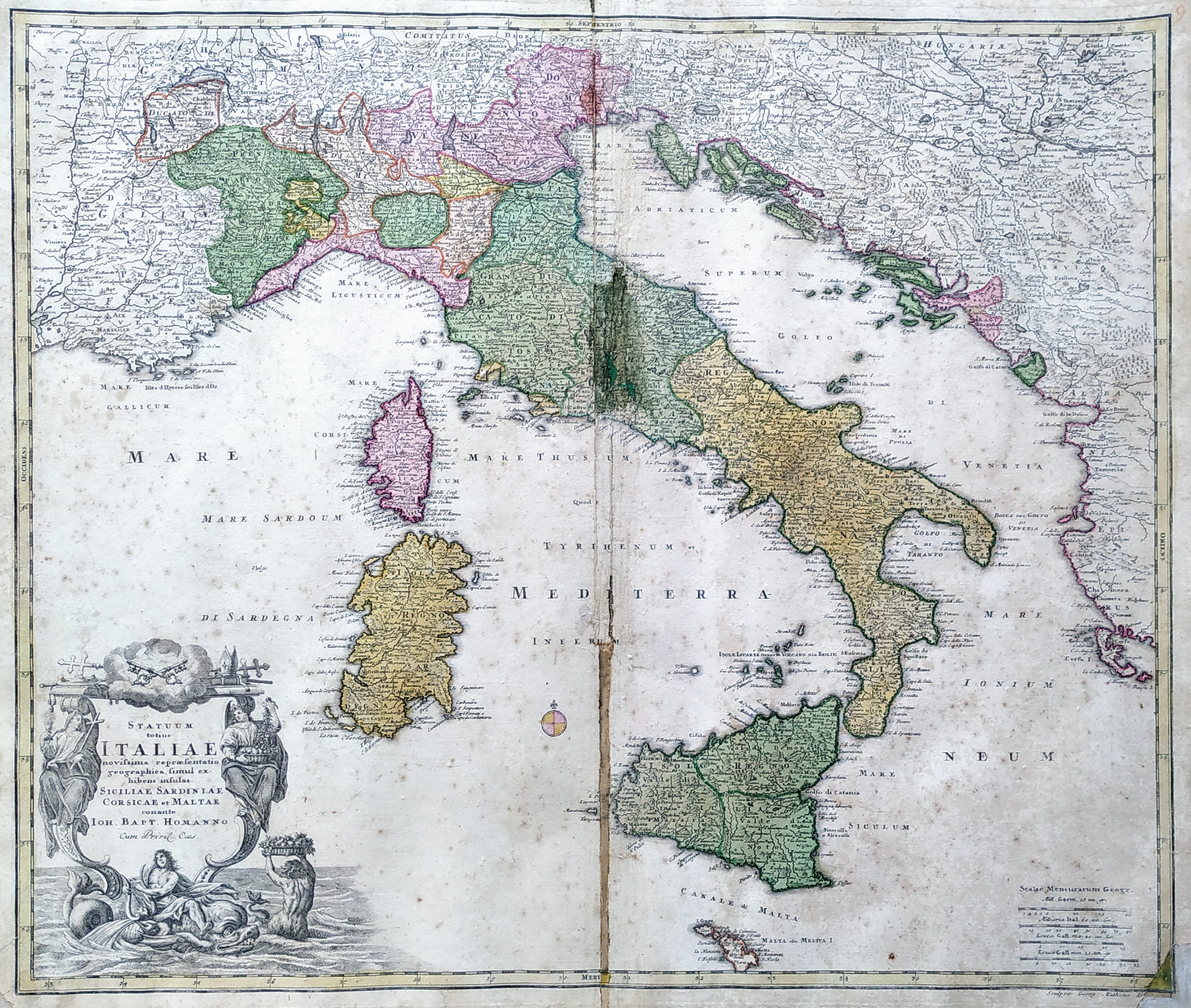
Map title
Statuum Totius Italiae Novissima Repraesentatio Geographica
Author
Homann
Location shown in map
Italy
Edition date
Circa 1712
Edition place
Nuremberg
Editor
Atlas
Price
350 Euro
State
[mint/excellent/very good/good/fair/mediocre/POOR]
Color
Old colors
Verso
Blank
Size
Plate: cm (58 x 50) inches (22.83 x 19.69) Paper: cm (62 x 53) inches (24.41 x 20.87)
Technique
Copper engraving
Note
Reference
R.Borri L'Italia nelle antiche carte pag.185
Wiki
Here for more info
In stock
Available
Info
info@thetreasuremaps.com
Code
#0812
×
![Statuum Totius Italiae Novissima Repraesentatio Geographica by Homann, Italy, Circa 1712]()
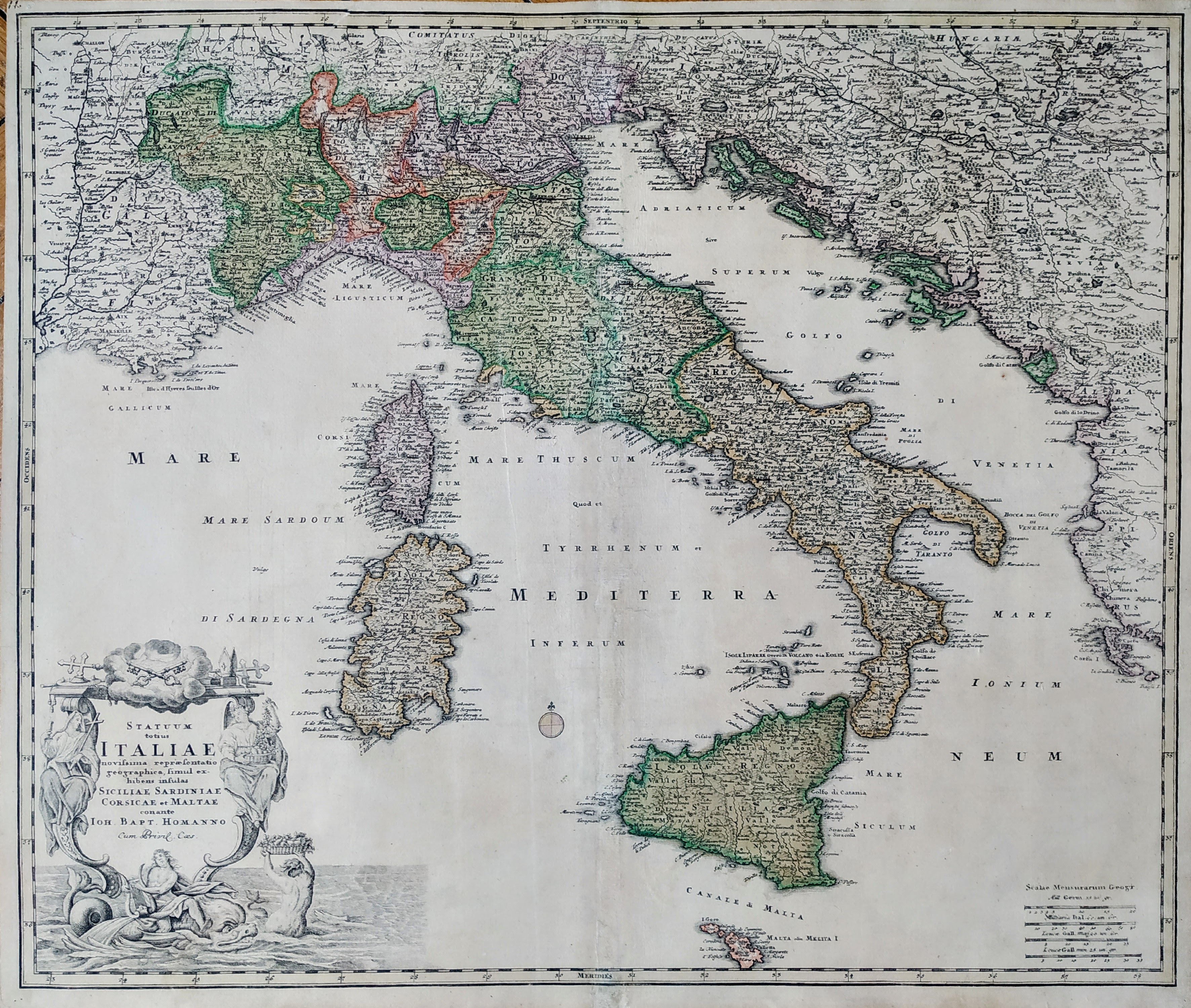
Map title
Statuum Totius Italiae Novissima Repraesentatio Geographica
Author
Homann
Location shown in map
Italy
Edition date
Circa 1712
Edition place
Nuremberg
Editor
Atlas
Price
400 Euro
State
[mint/EXCELLENT/very good/good/fair/mediocre/poor]
Color
Old colors
Verso
Blank
Size
Plate: cm (58 x 50) inches (22.83 x 19.69) Paper: cm (62 x 53) inches (24.41 x 20.87)
Technique
Copper engraving
Note
Reference
R.Borri L'Italia nelle antiche carte pag.185
Wiki
Here for more info
In stock
Available
Info
info@thetreasuremaps.com
Code
#0866
×
![Statuum Totius Italiae Novissima Repraesentatio Geographica by Homann, Italy, Circa 1712]()
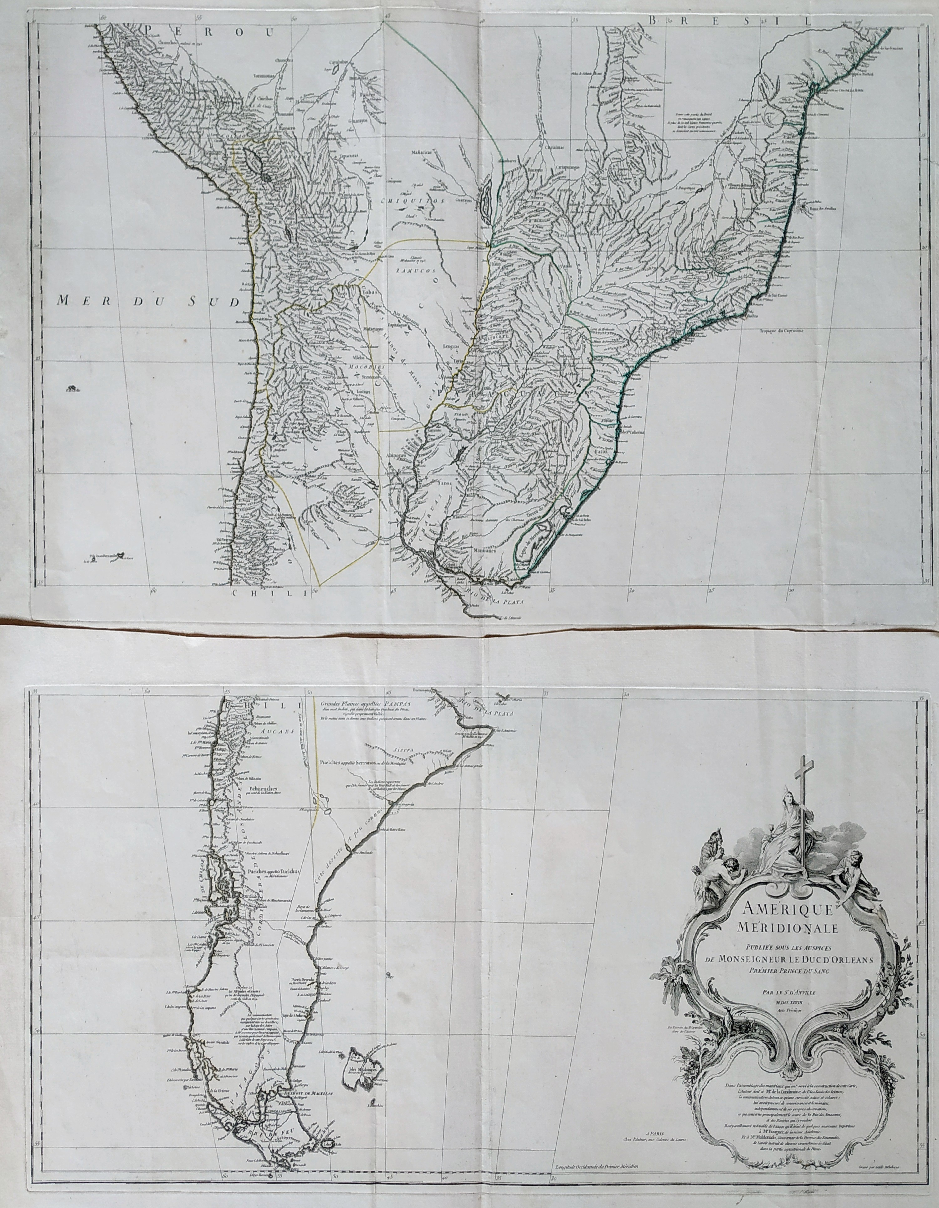
Map title
Amerique Meridionale
Author
Danville
Location shown in map
South America
Edition date
1748
Edition place
Paris
Editor
Atlas
Price
Please ask: info@thetreasuremaps.com
State
[MINT/excellent/very good/good/fair/mediocre/poor]
Color
Black/white
Verso
Blank
Size
Plate: cm (83 x 89) inches (32.68 x 35.04) Paper: cm (0 x 0) inches (0 x 0)
Technique
Copper engraving
Note
Reference
Wiki
Here for more info
In stock
Available
Info
info@thetreasuremaps.com
Code
#0836
×
![Amerique Meridionale by Danville, South America, 1748]()