News
Map title
Italie Novissima Descriptio
Author
Ortelius
Location shown in map
Italy
Edition date
1603
Edition place
Antwerp
Editor
--
Atlas
Theatrum Orbis Terrarum
Price
700 Euro
State
[mint/EXCELLENT/very good/good/fair/mediocre/poor]
Color
Modern color
Verso
Latin text pag.74
Size
Plate: cm (50 x 35) inches (19.69 x 13.78) Paper: cm (56 x 46) inches (22.05 x 18.11)
Technique
Copper engraving
Note
Reference
Van Den Broecke 118
Wiki
Here for more info
In stock
Available
Info
info@thetreasuremaps.com
Code
#0802
×
![Italie Novissima Descriptio by Ortelius, Italy, 1603]()
Map title
America
Author
Magini
Location shown in map
Americas
Edition date
1713
Edition place
Padua
Editor
Cadorin
Atlas
Universus terrarum orbis scriptorum calamo delineatus
Price
400 Euro
State
[MINT/excellent/very good/good/fair/mediocre/poor]
Color
Modern color
Verso
Latin text pag.22
Size
Plate: cm (17.8 x 12.7) inches (7.01 x 5) Paper: cm (23 x 34) inches (9.06 x 13.39)
Technique
Copper engraving
Note
Alphonse Lasor a Varea
Reference
--
Wiki
Here for more info
In stock
Available
Info
info@thetreasuremaps.com
Code
#0835
×
![America by Magini, Americas, 1713]()
Map title
Carte De L'Empire Du Japon
Author
Bellin
Location shown in map
Japan
Edition date
1757
Edition place
Paris
Editor
--
Atlas
Historie General des Voyages -- Prevost
Price
450 Euro
State
[mint/EXCELLENT/very good/good/fair/mediocre/poor]
Color
Black/white
Verso
Blank
Size
Plate: cm (31.1 x 21.6) inches (12.24 x 8.5) Paper: cm (31.1 x 22.9) inches (12.24 x 9.02)
Technique
Copper engraving
Note
No particular notes for this maps
Reference
--
Wiki
Here for more info
In stock
Available
Info
info@thetreasuremaps.com
Code
#0807
×
![Carte De L'Empire Du Japon by Bellin, Japan, 1757]()
Map title
Tabula geographico-hydrographica motus oceani currentes abyssos montes ...
Author
Kircher
Location shown in map
World
Edition date
1678
Edition place
Amsterdam
Editor
Jansson
Atlas
Mundus subterraneus
Price
1100 Euro
State
[mint/EXCELLENT/very good/good/fair/mediocre/poor]
Color
Modern color
Verso
Blank
Size
Plate: cm (54 x 34) inches (21.26 x 13.39) Paper: cm (57 x 39) inches (22.44 x 15.35)
Technique
Copper engraving
Note
Reference
Wiki
Here for more info
In stock
Available
Info
info@thetreasuremaps.com
Code
#0788
×
![Tabula geographico-hydrographica motus oceani currentes abyssos montes ... by Kircher, World, 1678]()
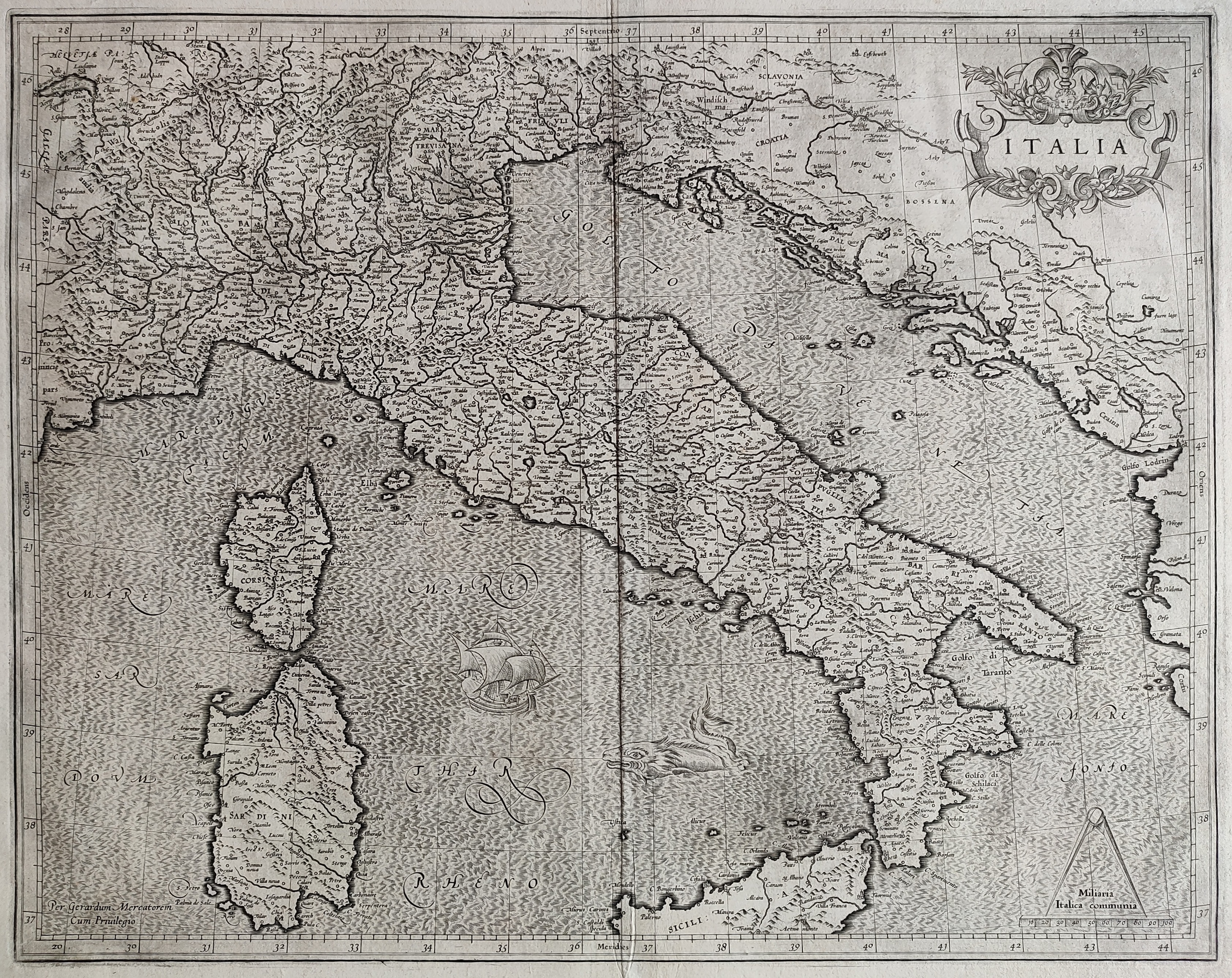
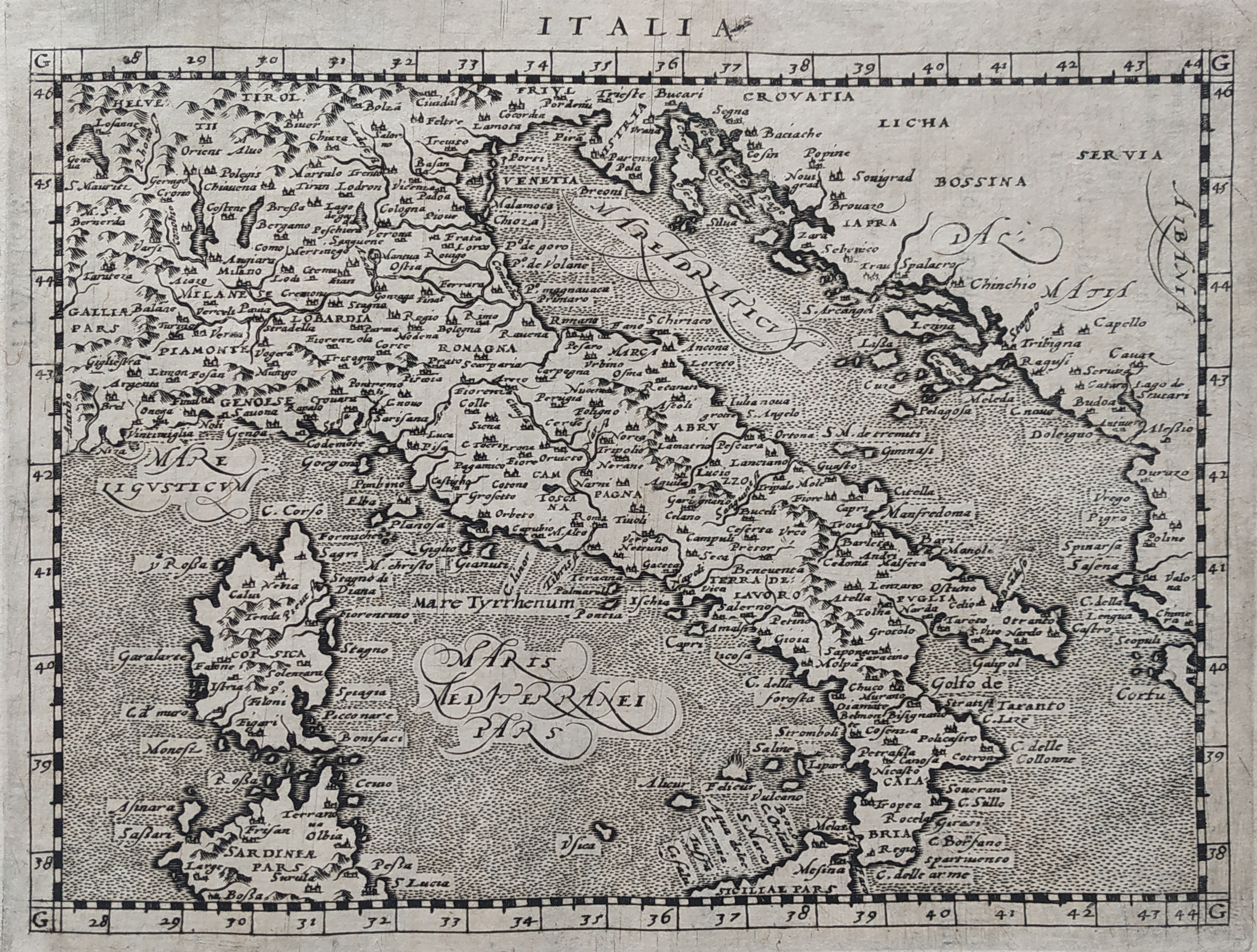
Map title
Italia
Author
Mercator
Location shown in map
Italy
Edition date
1630
Edition place
Amsterdam
Editor
Houndius
Atlas
Mercator-Hondius Atlas.
Price
900 Euro
State
[mint/EXCELLENT/very good/good/fair/mediocre/poor]
Color
Black/white
Verso
Latin text 299
Size
Plate: cm (46 x 36) inches (18.11 x 14.17) Paper: cm (57 x 47) inches (22.44 x 18.5)
Technique
Copper engraving
Note
Reference
R.Borri L'Italia nelle antiche carte pag.92
Wiki
Here for more info
In stock
Available
Info
info@thetreasuremaps.com
Code
#0790
×
![Italia by Mercator, Italy, 1630]()
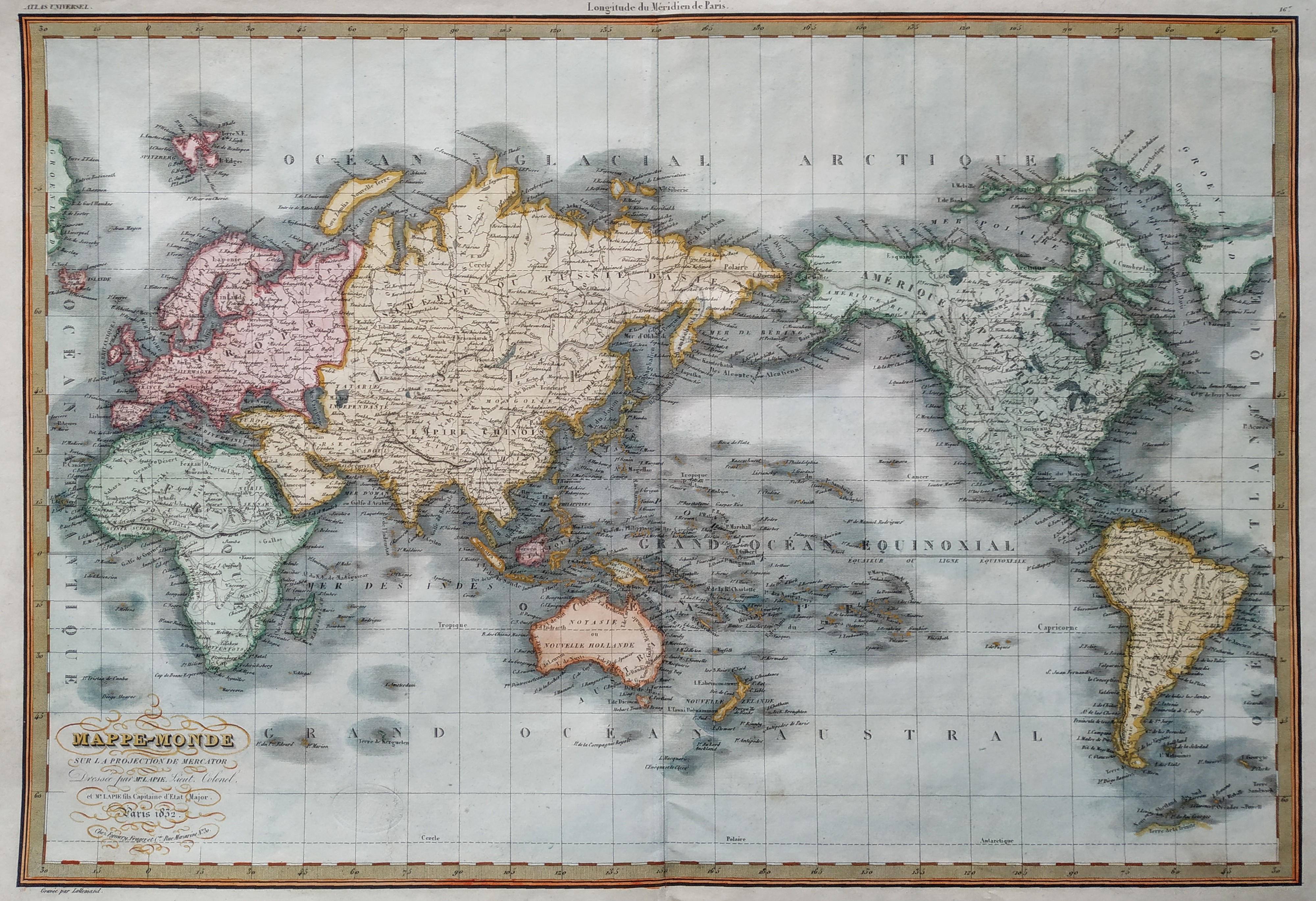
Map title
Mappemonde
Author
Lapie
Location shown in map
World
Edition date
1830
Edition place
Paris
Editor
Atlas
Price
175 Euro
State
[mint/EXCELLENT/very good/good/fair/mediocre/poor]
Color
Old color
Verso
Blank
Size
Plate: cm (53 x 39) inches (20.87 x 15.35) Paper: cm (64 x 46) inches (25.2 x 18.11)
Technique
Copper engraving
Note
Reference
Wiki
Here for more info
In stock
Available
Info
info@thetreasuremaps.com
Code
#0791
×
![Mappemonde by Lapie, World, 1830]()
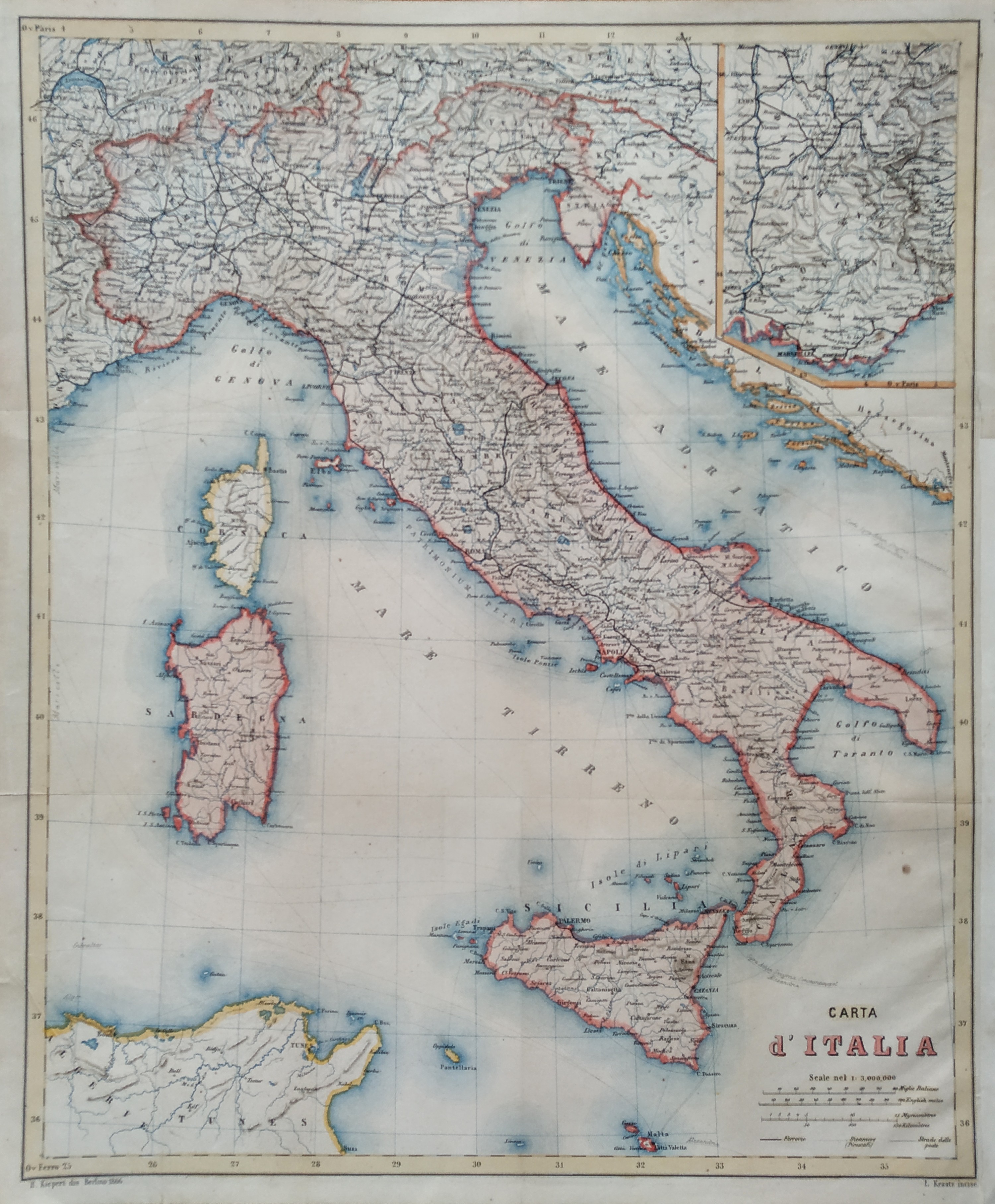
Map title
Carta d'Italia
Author
Kiepert
Location shown in map
Italy
Edition date
1866
Edition place
Berlin
Editor
Atlas
Price
50 Euro
State
[mint/EXCELLENT/very good/good/fair/mediocre/poor]
Color
Old color
Verso
Blank
Size
Plate: cm (34 x 42) inches (13.39 x 16.54) Paper: cm (37 x 44) inches (14.57 x 17.32)
Technique
Steel engraving
Note
Reference
Wiki
Here for more info
In stock
Available
Info
info@thetreasuremaps.com
Code
#0792
×
![Carta d'Italia by Kiepert, Italy, 1866]()
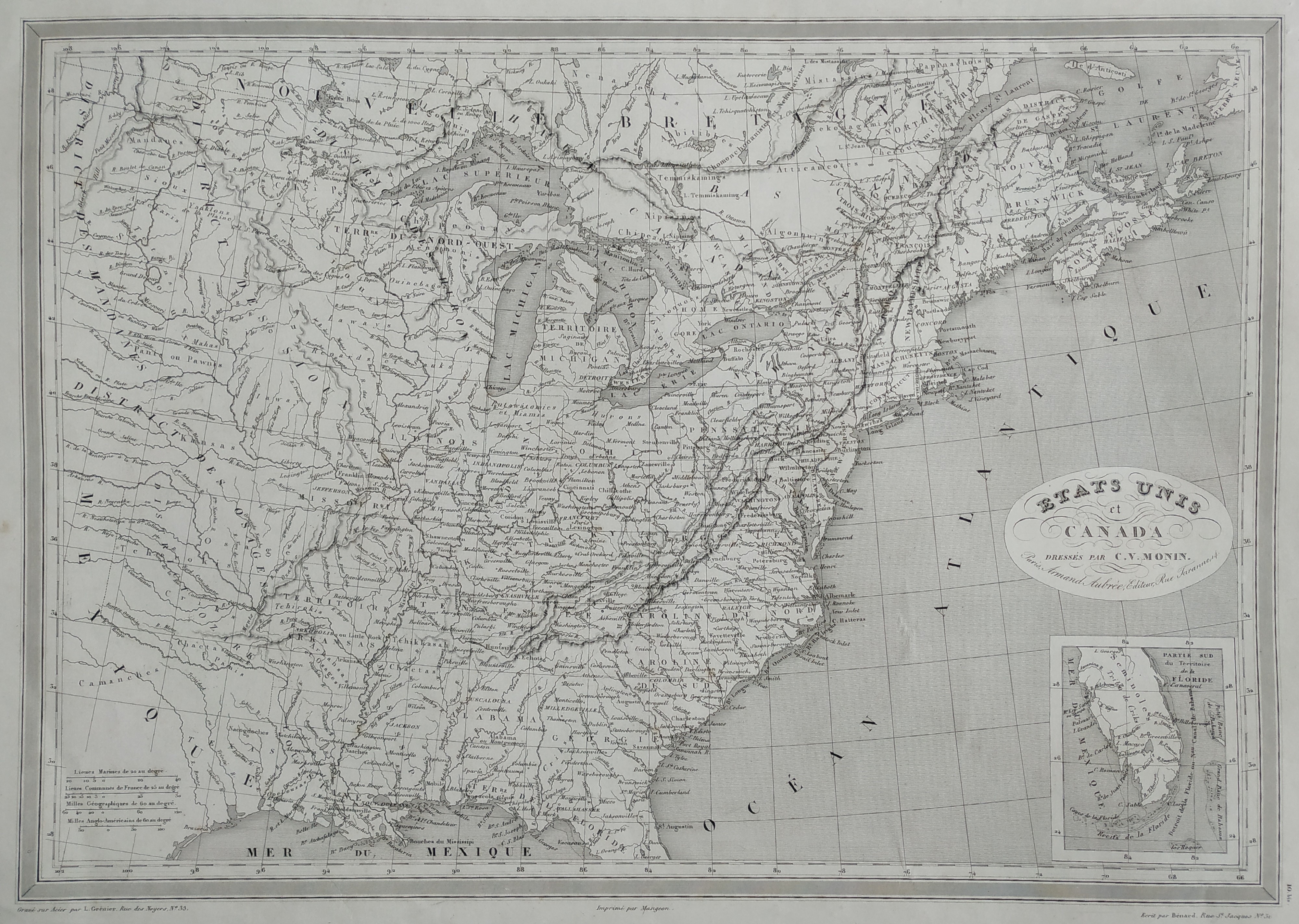
Map title
Etats Unis
Author
Monin
Location shown in map
East coast
Edition date
1837
Edition place
Paris
Editor
Atlas
Price
75 Euro
State
[mint/EXCELLENT/very good/good/fair/mediocre/poor]
Color
Black/white
Verso
Blank
Size
Plate: cm (45 x 32) inches (17.72 x 12.6) Paper: cm (55 x 38) inches (21.65 x 14.96)
Technique
Steel engraving
Note
Reference
Wiki
Here for more info
In stock
Available
Info
info@thetreasuremaps.com
Code
#0793
×
![Etats Unis by Monin, East coast, 1837]()
Map title
Italia
Author
Magini
Location shown in map
Italy
Edition date
1597
Edition place
Cologne
Editor
Petrus Keschedt
Atlas
Geografia di Claudio Tolomeo -- Giovanni Antonio Magini
Price
Please ask: info@thetreasuremaps.com
State
[mint/EXCELLENT/very good/good/fair/mediocre/poor]
Color
Black/white
Verso
Latin text pag 101
Size
Plate: cm (17.8 x 12.7) inches (7.01 x 5) Paper: cm (22.9 x 16.5) inches (9.02 x 6.5)
Technique
Copper engraving
Note
Maps pirated from those of Girolamo Poro in Magini's edition.
Reference
R.Borri L'Italia nelle antiche carte pag.78
Wiki
Here for more info
In stock
Available
Info
info@thetreasuremaps.com
Code
#0789
×
![Italia by Magini, Italy, 1597]()
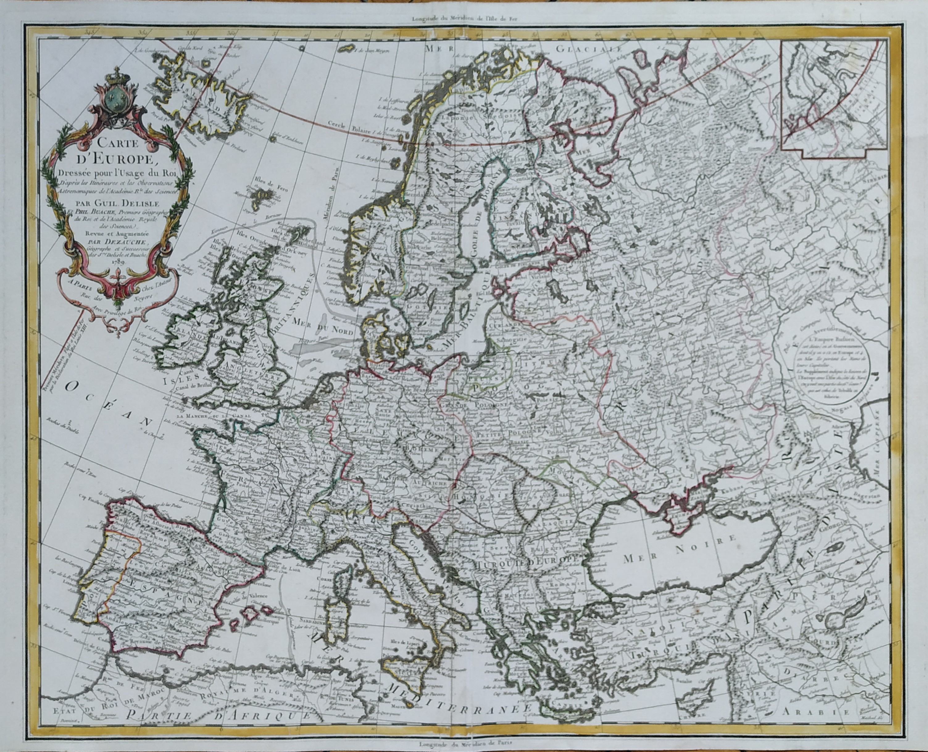
Map title
Carte d'Europe
Author
De L'Isle
Location shown in map
Europe
Edition date
1789
Edition place
Paris
Editor
Dezauche
Atlas
Price
200 Euro
State
[mint/EXCELLENT/very good/good/fair/mediocre/poor]
Color
Old color
Verso
Blank
Size
Plate: cm (61 x 50) inches (24.02 x 19.69) Paper: cm (76 x 53) inches (29.92 x 20.87)
Technique
Copper engraving
Note
Reference
Wiki
Here for more info
In stock
Available
Info
info@thetreasuremaps.com
Code
#0784
×
![Carte d'Europe by De L'Isle, Europe, 1789]()
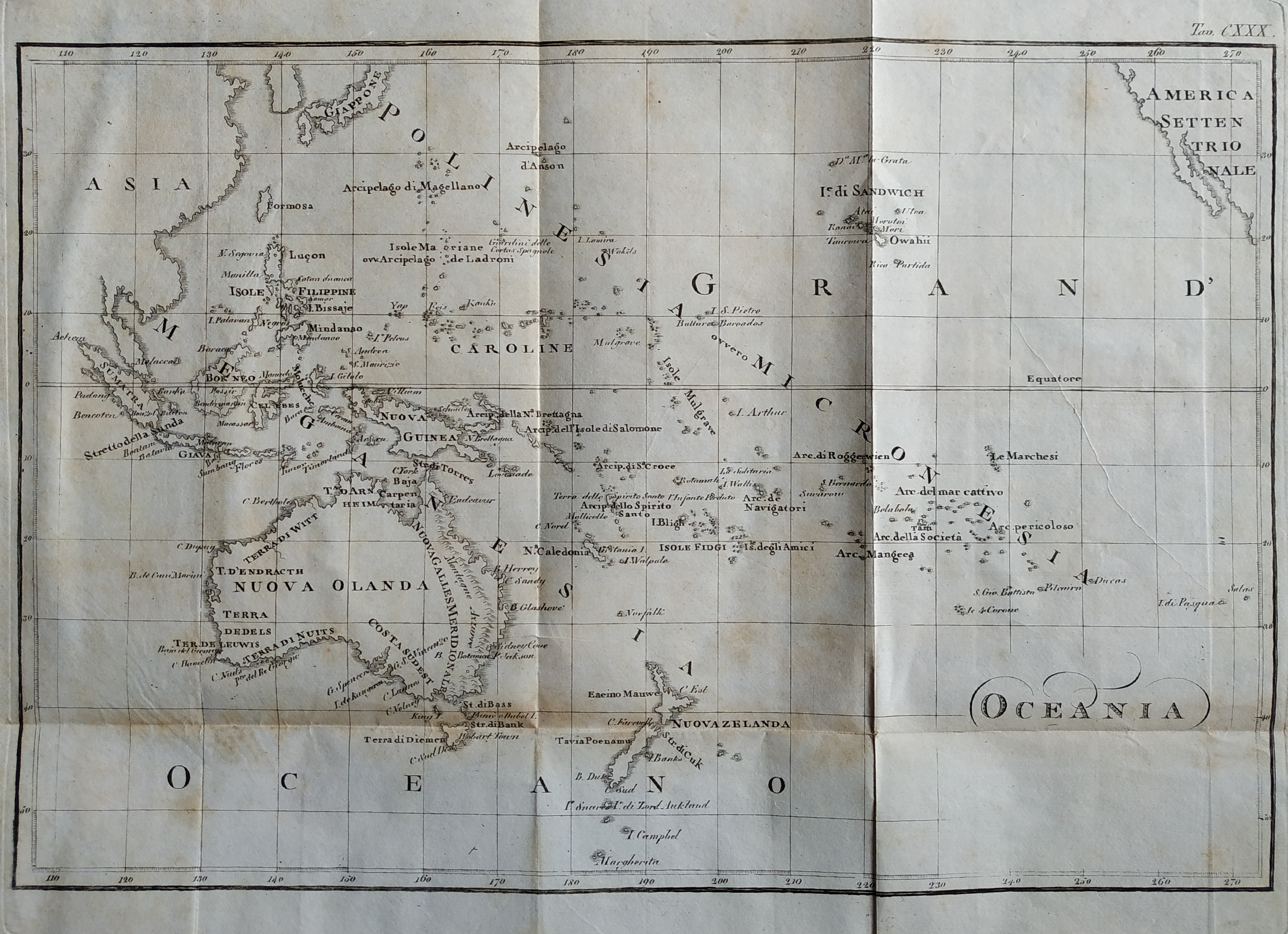
Map title
Oceania
Author
Cacciatore
Location shown in map
Oceania
Edition date
1832
Edition place
Firenze
Editor
Leonardo Cacciatori
Atlas
Nuovo atlante istorico
Price
100 Euro
State
[mint/EXCELLENT/very good/good/fair/mediocre/poor]
Color
Black/white
Verso
Blank
Size
Plate: cm (32 x 22) inches (12.6 x 8.66) Paper: cm (42 x 29) inches (16.54 x 11.42)
Technique
Copper engraving
Note
Reference
Wiki
Here for more info
In stock
Available
Info
info@thetreasuremaps.com
Code
#0776
Oceania
Author
Cacciatore
Location shown in map
Oceania
Edition date
1832
Edition place
Firenze
Editor
Leonardo Cacciatori
Atlas
Nuovo atlante istorico
Price
100 Euro
State
[mint/EXCELLENT/very good/good/fair/mediocre/poor]
Color
Black/white
Verso
Blank
Size
Plate: cm (32 x 22) inches (12.6 x 8.66) Paper: cm (42 x 29) inches (16.54 x 11.42)
Technique
Copper engraving
Note
Reference
Wiki
Here for more info
In stock
Available
Info
info@thetreasuremaps.com
Code
#0776
×
![Oceania by Cacciatore, Oceania, 1832]()
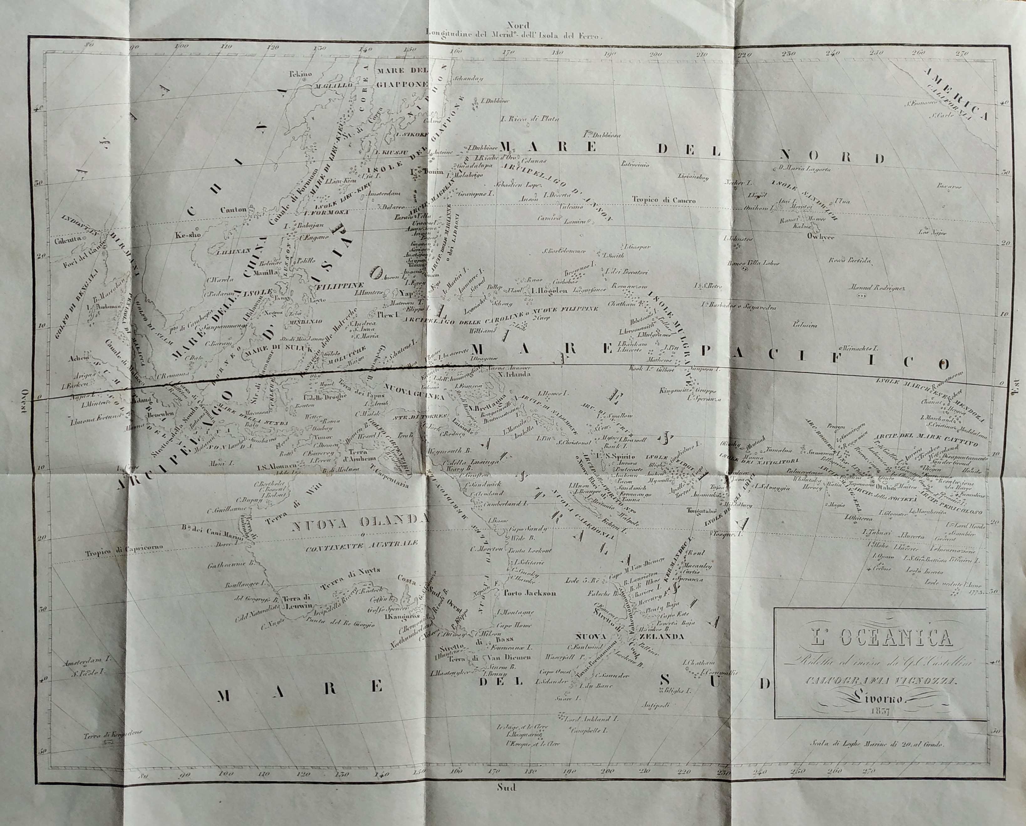
Map title
L'Oceanica
Author
Castellini
Location shown in map
Oceania
Edition date
1837
Edition place
Livorno
Editor
Vignozzi
Atlas
Price
100 Euro
State
[mint/EXCELLENT/very good/good/fair/mediocre/poor]
Color
Black/white
Verso
Blank
Size
Plate: cm (34 x 26) inches (13.39 x 10.24) Paper: cm (40 x 31) inches (15.75 x 12.2)
Technique
Steel engraving
Note
Reference
Wiki
Here for more info
In stock
Available
Info
info@thetreasuremaps.com
Code
#0777
×
![L'Oceanica by Castellini, Oceania, 1837]()
Map title
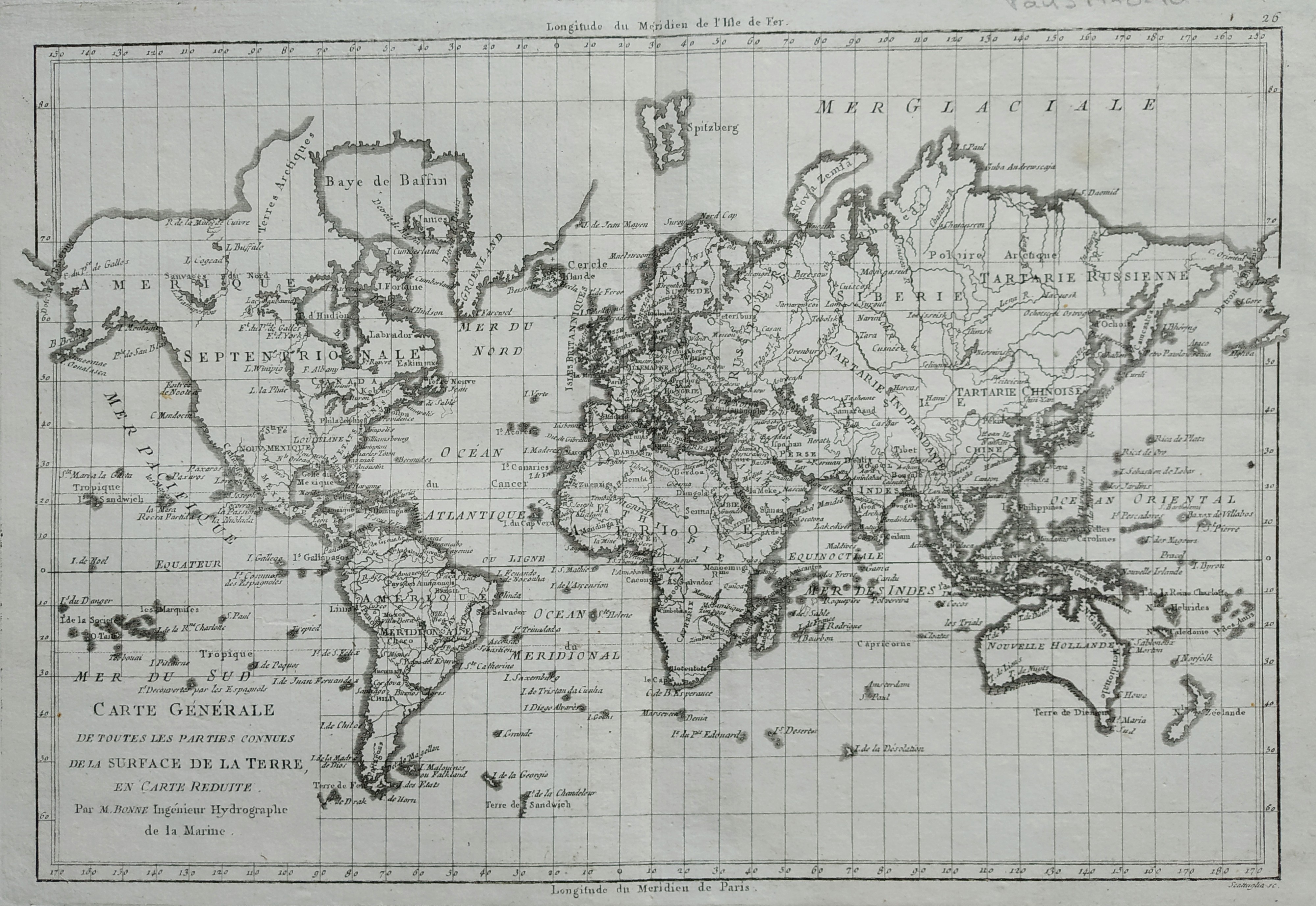
Carte generale des toutes les parties connues
Author
Bonne
Location shown in map
World
Edition date
1789
Edition place
Paris
Editor
Atlas
Atlas Encyclopedique
Price
150 Euro
State
[mint/EXCELLENT/very good/good/fair/mediocre/poor]
Color
Black/white
Verso
Blank
Size
Plate: cm (34 x 23) inches (13.39 x 9.06) Paper: cm (40 x 28) inches (15.75 x 11.02)
Technique
Copper engraving
Note
Reference
Wiki
Here for more info
In stock
Available
Info
info@thetreasuremaps.com
Code
#0779
×
![Carte generale des toutes les parties connues by Bonne, World, 1789]()
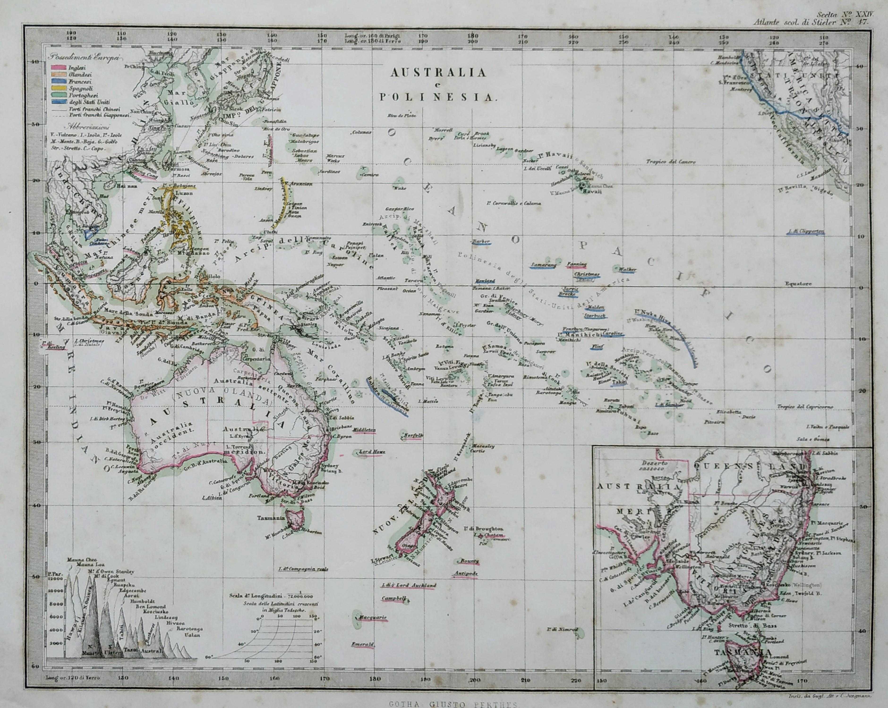
Map title
Australia e Polinesia
Author
Stieler
Location shown in map
Oceania
Edition date
Circa 1870
Edition place
Gotha
Editor
Stieler
Atlas
Atlante scolastico Stieler
Price
50 Euro
State
[mint/excellent/VERY GOOD/good/fair/mediocre/poor]
Color
Old color
Verso
Blank
Size
Plate: cm (25 x 20) inches (9.84 x 7.87) Paper: cm (30 x 24) inches (11.81 x 9.45)
Technique
Steel engraving
Note
Reference
Wiki
Here for more info
In stock
Available
Info
info@thetreasuremaps.com
Code
#0780
×
![Australia e Polinesia by Stieler, Oceania, Circa 1870]()
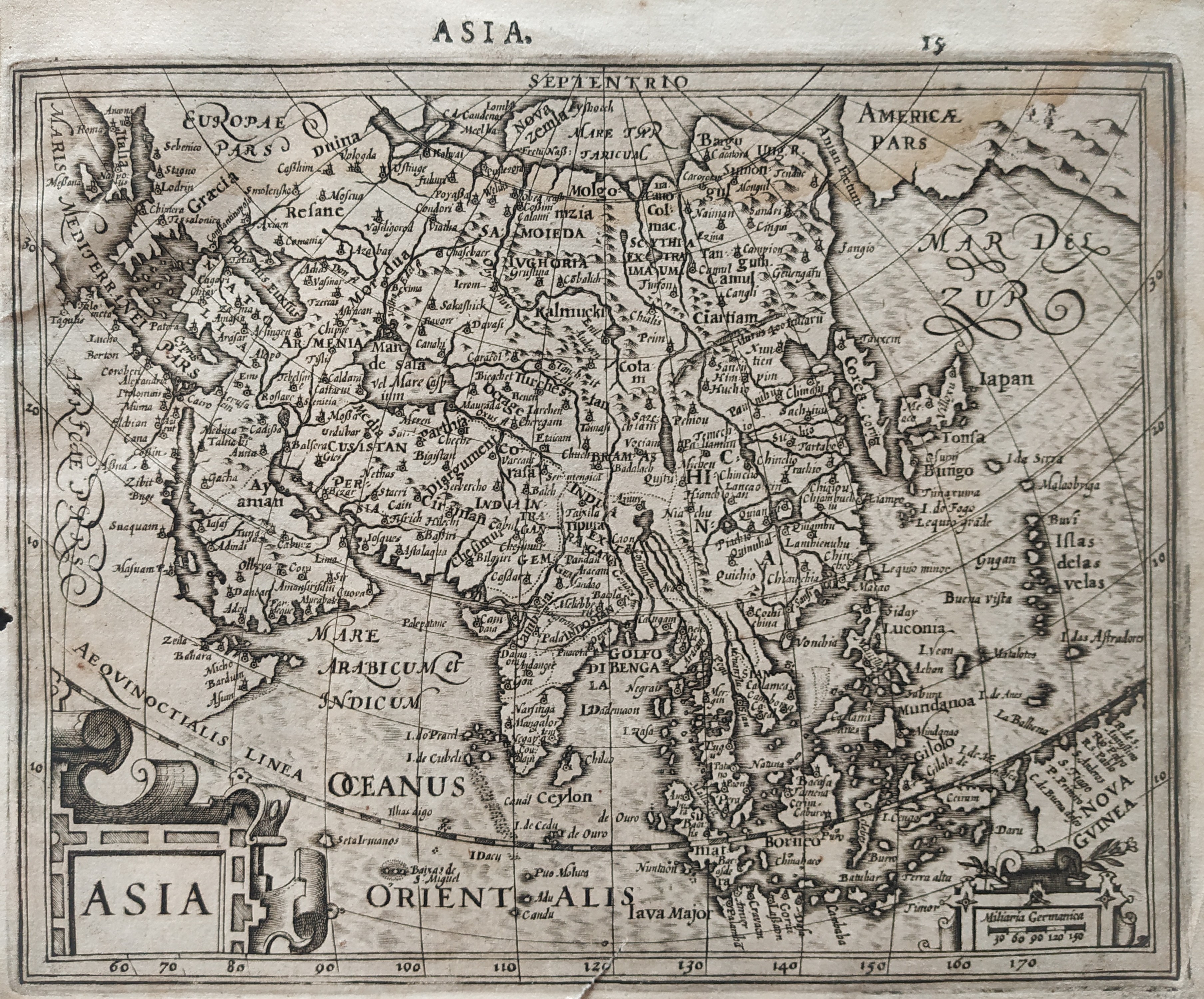
Map title
Asia
Author
Mercator
Location shown in map
Asia
Edition date
1610
Edition place
Amsterdam
Editor
Houndius
Atlas
Altas Minor Gerardi Mercatoris
Price
200 Euro
State
[mint/EXCELLENT/very good/good/fair/mediocre/poor]
Color
Black/white
Verso
Latin text 16
Size
Plate: cm (19 x 15) inches (7.48 x 5.91) Paper: cm (21 x 17.5) inches (8.27 x 6.89)
Technique
Copper engraving
Note
No particular notes for this maps.
Reference
Wiki
Here for more info
In stock
Available
Info
info@thetreasuremaps.com
Code
#0781
Asia
Author
Mercator
Location shown in map
Asia
Edition date
1610
Edition place
Amsterdam
Editor
Houndius
Atlas
Altas Minor Gerardi Mercatoris
Price
200 Euro
State
[mint/EXCELLENT/very good/good/fair/mediocre/poor]
Color
Black/white
Verso
Latin text 16
Size
Plate: cm (19 x 15) inches (7.48 x 5.91) Paper: cm (21 x 17.5) inches (8.27 x 6.89)
Technique
Copper engraving
Note
No particular notes for this maps.
Reference
Wiki
Here for more info
In stock
Available
Info
info@thetreasuremaps.com
Code
#0781
×
![Asia by Mercator, Asia, 1610]()
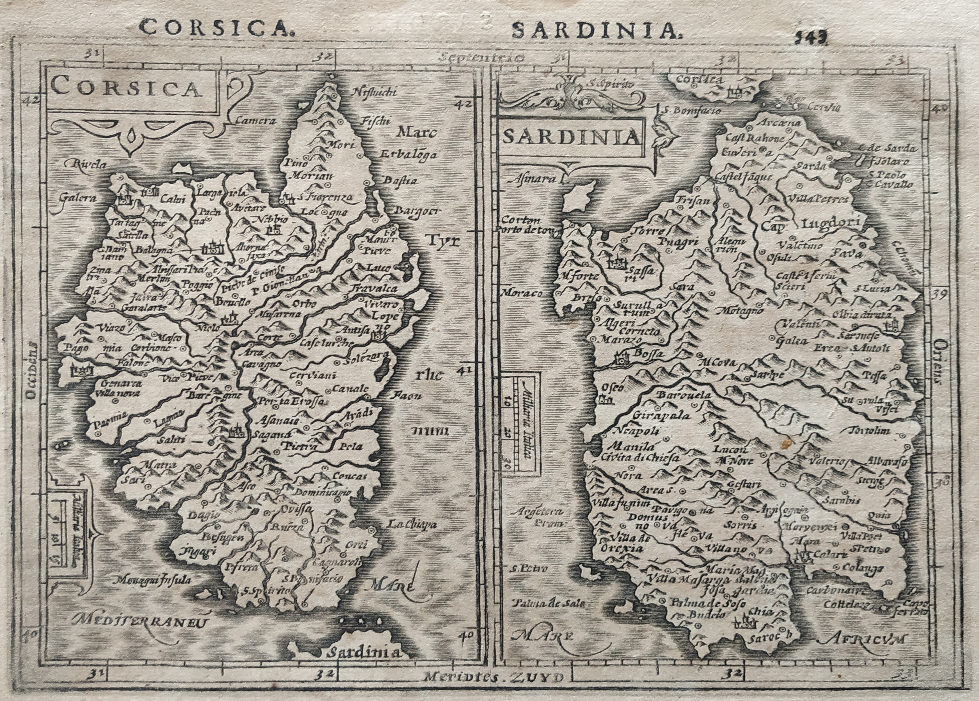
Map title
Corsica Sardinia
Author
Mercator
Location shown in map
Sardinia
Edition date
1610
Edition place
Amsterdam
Editor
Houndius
Atlas
Altas Minor Gerardi Mercatoris
Price
200 Euro
State
[mint/EXCELLENT/very good/good/fair/mediocre/poor]
Color
Black/white
Verso
Latin text 544
Size
Plate: cm (19 x 15) inches (7.48 x 5.91) Paper: cm (21 x 17.5) inches (8.27 x 6.89)
Technique
Copper engraving
Note
No particular notes for this maps.
Reference
Wiki
Here for more info
In stock
Available
Info
info@thetreasuremaps.com
Code
#0782
×
![Corsica Sardinia by Mercator, Sardinia, 1610]()
Map title
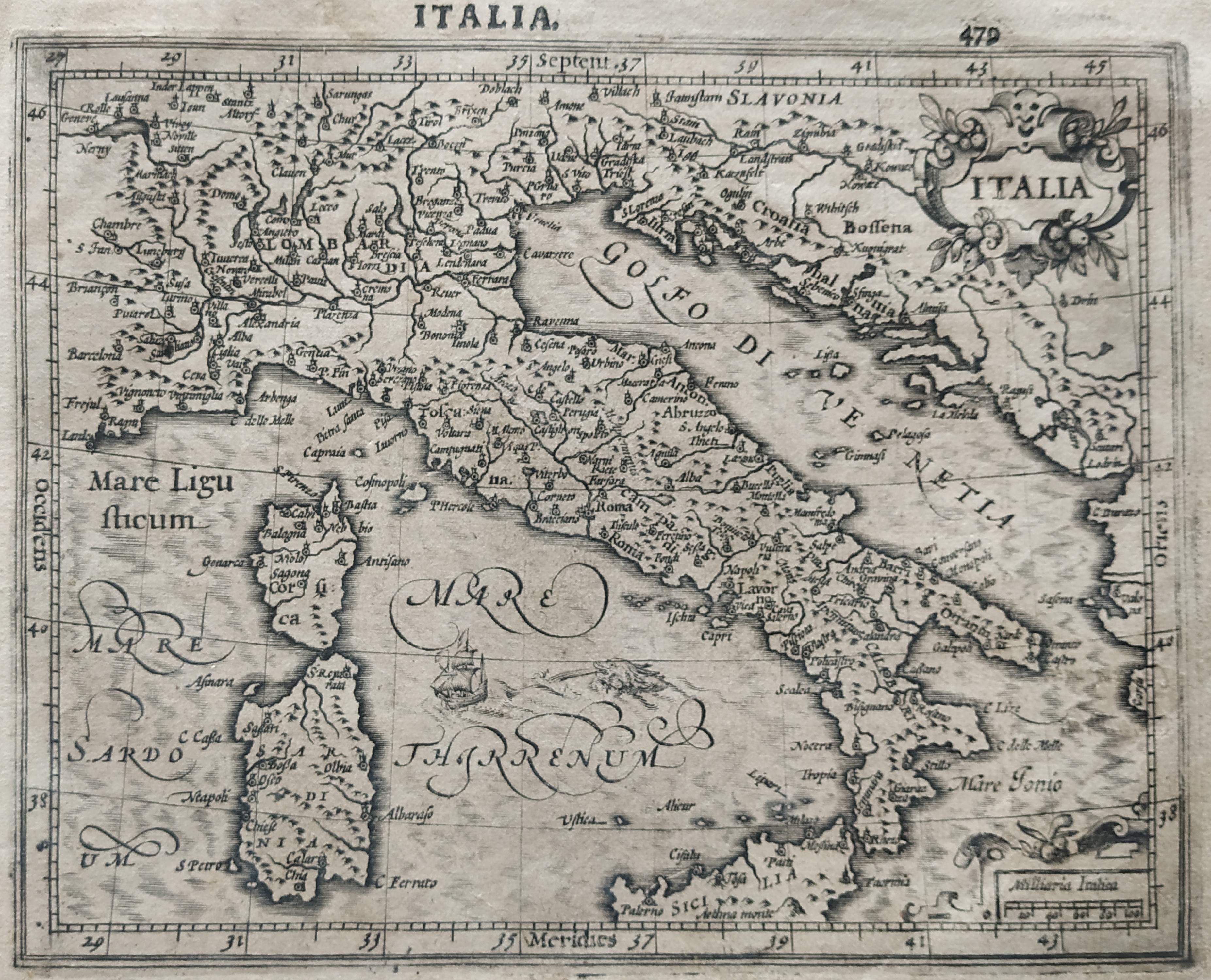
Italia
Author
Mercator
Location shown in map
Italy
Edition date
1610
Edition place
Amsterdam
Editor
Houndius
Atlas
Altas Minor Gerardi Mercatoris
Price
250 Euro
State
[mint/EXCELLENT/very good/good/fair/mediocre/poor]
Color
Black/white
Verso
Latin text 480
Size
Plate: cm (19 x 15) inches (7.48 x 5.91) Paper: cm (21 x 17.5) inches (8.27 x 6.89)
Technique
Copper engraving
Note
Reference
R.Borri L'Italia nelle antiche carte pag.66
Wiki
Here for more info
In stock
Available
Info
info@thetreasuremaps.com
Code
#0783
×
![Italia by Mercator, Italy, 1610]()
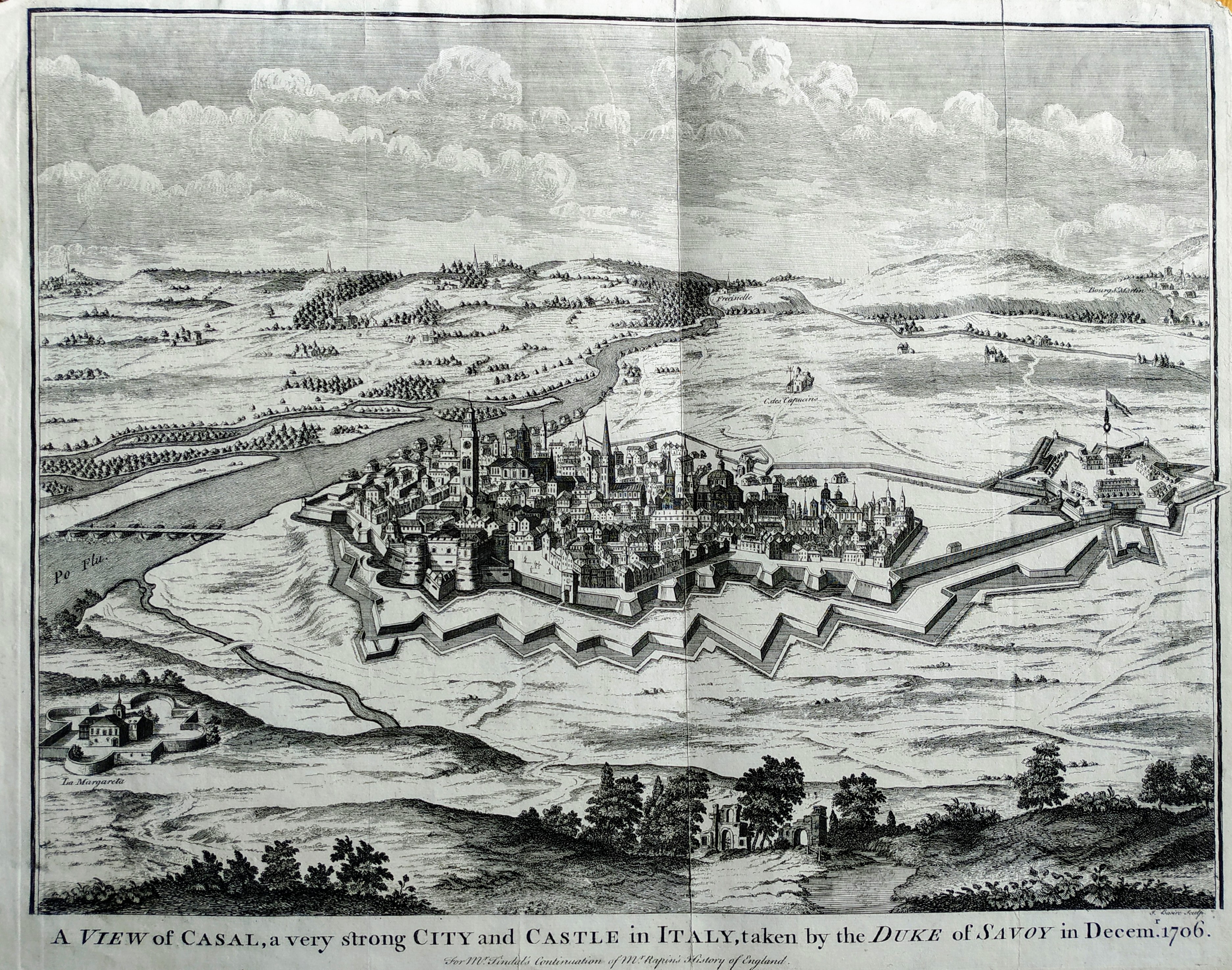
Map title
A view of Casal
Author
Paul de Rapin de Thoyras
Location shown in map
Casal
Edition date
1740
Edition place
London
Editor
Atlas
Price
200 Euro
State
[mint/EXCELLENT/very good/good/fair/mediocre/poor]
Color
Black/white
Verso
Blank
Size
Plate: cm (40 x 37) inches (15.75 x 14.57) Paper: cm (50 x 49) inches (19.69 x 19.29)
Technique
Copper engraving
Note
Reference
Wiki
Here for more info
In stock
Available
Info
info@thetreasuremaps.com
Code
#0785
×
![A view of Casal by Paul de Rapin de Thoyras, Casal, 1740]()
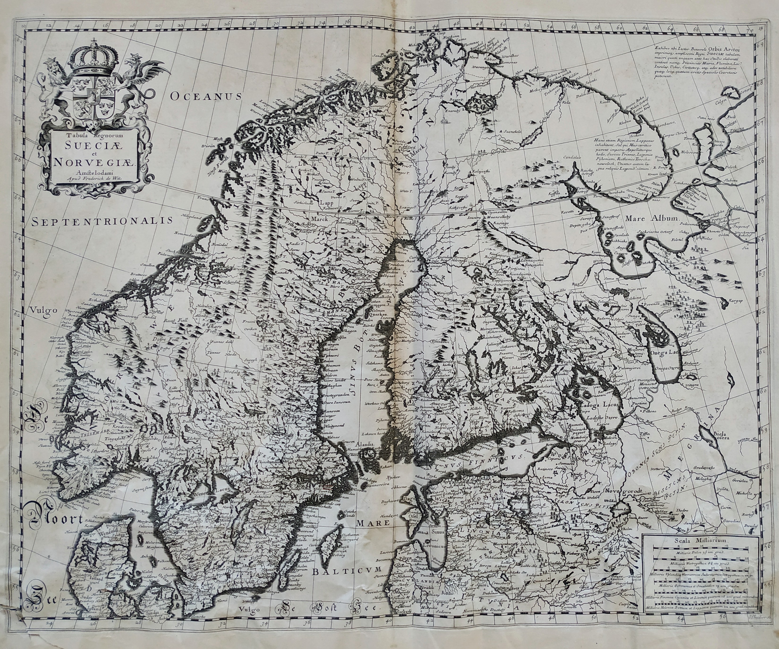
Map title
Tabula Regnorum Sueciae et Norvegiae
Author
Frederick de Wit
Location shown in map
Sweden
Edition date
Circa 1670
Edition place
Amsterdam
Editor
Atlas
Price
600 Euro
State
[mint/EXCELLENT/very good/good/fair/mediocre/poor]
Color
Black/white
Verso
Blank
Size
Plate: cm (55 x 44) inches (21.65 x 17.32) Paper: cm (60 x 52) inches (23.62 x 20.47)
Technique
Copper engraving
Note
Reference
Wiki
Here for more info
In stock
Available
Info
info@thetreasuremaps.com
Code
#0786
×
![Tabula Regnorum Sueciae et Norvegiae by Frederick de Wit, Sweden, Circa 1670]()
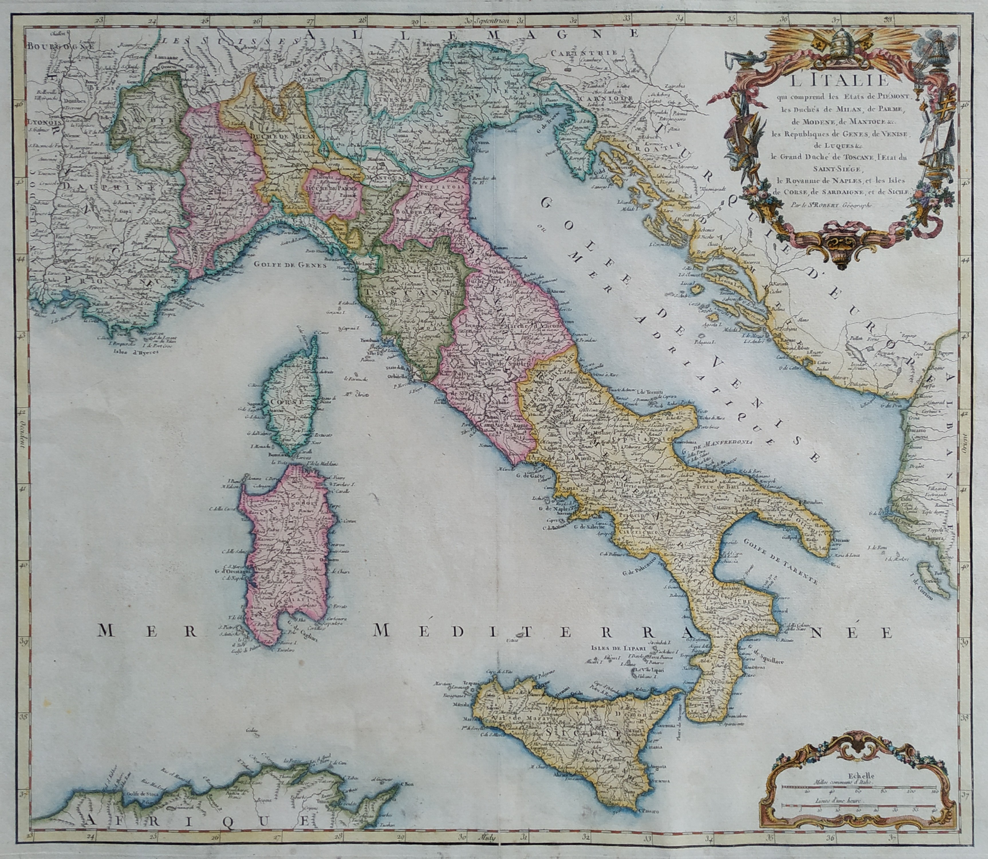
Map title
L'Italie
Author
Robert de Vaugondy
Location shown in map
Italy
Edition date
Circa 1760
Edition place
Paris
Editor
Boudet
Atlas
Atlas Universel
Price
300 Euro
State
[mint/EXCELLENT/very good/good/fair/mediocre/poor]
Color
Old color
Verso
Blank
Size
Plate: cm (55 x 48) inches (21.65 x 18.9) Paper: cm (65 x 54) inches (25.59 x 21.26)
Technique
Copper engraving
Note
Reference
Wiki
Here for more info
In stock
Available
Info
info@thetreasuremaps.com
Code
#0787
×
![L'Italie by Robert de Vaugondy, Italy, Circa 1760]()