News
Map title
L'America Setten.
Author
De L'Isle
Location shown in map
North America
Edition date
Circa 1720
Edition place
Editor
Atlas
Price
Please ask: info@thetreasuremaps.com
State
[mint/EXCELLENT/very good/good/fair/mediocre/poor]
Color
Black/white
Verso
Blank
Size
Plate: cm (17 x 14) inches (6.69 x 5.51) Paper: cm (18 x 16) inches (7.09 x 6.3)
Technique
Copper engraving
Note
Reference
Wiki
Here for more info
In stock
Available
Info
info@thetreasuremaps.com
Code
#0940
×
![L'America Setten. by De L'Isle, North America, Circa 1720]()
Map title
America Settentrionale
Author
Sanson
Location shown in map
North America
Edition date
Circa 1790
Edition place
Editor
--
Atlas
Geographie universelle, italian edition.
Price
125 Euro
State
[mint/EXCELLENT/very good/good/fair/mediocre/poor]
Color
Black/white
Verso
Blank
Size
Plate: cm (22 x 16) inches (8.66 x 6.3) Paper: cm (25 x 20) inches (9.84 x 7.87)
Technique
Copper engraving
Note
Claude Buffier was a Jesuit theologian and geographer working in Paris, who wrote the Geographie Universelle, first issued in about 1715. The Geographie was issued as a pocket-sized volume, illustrated with a set of maps.The volume proved very popular, and numerous editions were published in Paris, Naples and Rome. The book was evidently targeted at the popular market, and for this reason examples of the book tend to be printed on relatively poor quality paper, and this is particularly true of the Italian editions.Evidently there were a large number of different sets of map plates used - so far 17 different plates or states of plates have been identified for the Americas map, some engraved anonymously, and other signed by Hendrick van Loon, Faure, Denise Macquart and Dom. Dell'Acerra Unfortunately, it has been frequent practice to disperse such volumes, so the origin of several of these plates has not yet been identified, and the editor would be grateful to hear from readers about editions of the book, particularly those containing maps engraved by Denise Macquart and Dom. Dell'Acerra.
Reference
--
Wiki
Here for more info
In stock
Available
Info
info@thetreasuremaps.com
Code
#0941
×
![America Settentrionale by Sanson, North America, Circa 1790]()
Map title
America Meridionale
Author
Sanson
Location shown in map
South America
Edition date
Circa 1790
Edition place
Editor
--
Atlas
Geographie universelle, italian edition.
Price
125 Euro
State
[mint/EXCELLENT/very good/good/fair/mediocre/poor]
Color
Black/white
Verso
Blank
Size
Plate: cm (18 x 21) inches (7.09 x 8.27) Paper: cm (20 x 24) inches (7.87 x 9.45)
Technique
Copper engraving
Note
Claude Buffier was a Jesuit theologian and geographer working in Paris, who wrote the Geographie Universelle, first issued in about 1715. The Geographie was issued as a pocket-sized volume, illustrated with a set of maps.The volume proved very popular, and numerous editions were published in Paris, Naples and Rome. The book was evidently targeted at the popular market, and for this reason examples of the book tend to be printed on relatively poor quality paper, and this is particularly true of the Italian editions.Evidently there were a large number of different sets of map plates used - so far 17 different plates or states of plates have been identified for the Americas map, some engraved anonymously, and other signed by Hendrick van Loon, Faure, Denise Macquart and Dom. Dell'Acerra Unfortunately, it has been frequent practice to disperse such volumes, so the origin of several of these plates has not yet been identified, and the editor would be grateful to hear from readers about editions of the book, particularly those containing maps engraved by Denise Macquart and Dom. Dell'Acerra.
Reference
--
Wiki
Here for more info
In stock
Available
Info
info@thetreasuremaps.com
Code
#0942
×
![America Meridionale by Sanson, South America, Circa 1790]()
Map title
Pianta di NuovaYork
Author
Location shown in map
NewYork
Edition date
Circa 1880
Edition place
Editor
--
Atlas
Price
100 Euro
State
[mint/EXCELLENT/very good/good/fair/mediocre/poor]
Color
Black/white
Verso
Blank
Size
Plate: cm (22 x 35) inches (8.66 x 13.78) Paper: cm (25 x 41) inches (9.84 x 16.14)
Technique
Steel engraving
Note
Reference
--
Wiki
Here for more info
In stock
Available
Info
info@thetreasuremaps.com
Code
#0943
×
![Pianta di NuovaYork by , NewYork, Circa 1880]()
Map title
Pianta di Chicago
Author
Location shown in map
Chicago
Edition date
Circa 1880
Edition place
Editor
--
Atlas
Price
Please ask: info@thetreasuremaps.com
State
[mint/EXCELLENT/very good/good/fair/mediocre/poor]
Color
Black/white
Verso
Blank
Size
Plate: cm (34 x 25) inches (13.39 x 9.84) Paper: cm (39 x 30) inches (15.35 x 11.81)
Technique
Steel engraving
Note
Reference
--
Wiki
Here for more info
In stock
Available
Info
info@thetreasuremaps.com
Code
#0944
×
![Pianta di Chicago by , Chicago, Circa 1880]()
Map title
Pianta di Cincinnati
Author
Location shown in map
Cincinnati
Edition date
Circa 1880
Edition place
Editor
--
Atlas
Price
Please ask: info@thetreasuremaps.com
State
[mint/EXCELLENT/very good/good/fair/mediocre/poor]
Color
Black/white
Verso
Blank
Size
Plate: cm (27 x 21) inches (10.63 x 8.27) Paper: cm (32 x 26) inches (12.6 x 10.24)
Technique
Steel engraving
Note
Reference
--
Wiki
Here for more info
In stock
Available
Info
info@thetreasuremaps.com
Code
#0945
×
![Pianta di Cincinnati by , Cincinnati, Circa 1880]()
Map title
Pianta di San Francisco
Author
Location shown in map
San Francisco
Edition date
Circa 1880
Edition place
Editor
--
Atlas
Price
Please ask: info@thetreasuremaps.com
State
[mint/EXCELLENT/very good/good/fair/mediocre/poor]
Color
Black/white
Verso
Blank
Size
Plate: cm (26 x 27) inches (10.24 x 10.63) Paper: cm (30 x 31) inches (11.81 x 12.2)
Technique
Steel engraving
Note
Reference
--
Wiki
Here for more info
In stock
Available
Info
info@thetreasuremaps.com
Code
#0946
×
![Pianta di San Francisco by , San Francisco, Circa 1880]()
Map title
Pianta della Nuova Orleans
Author
Location shown in map
New Orleans
Edition date
Circa 1880
Edition place
Editor
--
Atlas
Price
75 Euro
State
[mint/EXCELLENT/very good/good/fair/mediocre/poor]
Color
Black/white
Verso
Blank
Size
Plate: cm (27 x 22) inches (10.63 x 8.66) Paper: cm (31 x 26) inches (12.2 x 10.24)
Technique
Steel engraving
Note
Reference
--
Wiki
Here for more info
In stock
Available
Info
info@thetreasuremaps.com
Code
#0947
×
![Pianta della Nuova Orleans by , New Orleans, Circa 1880]()
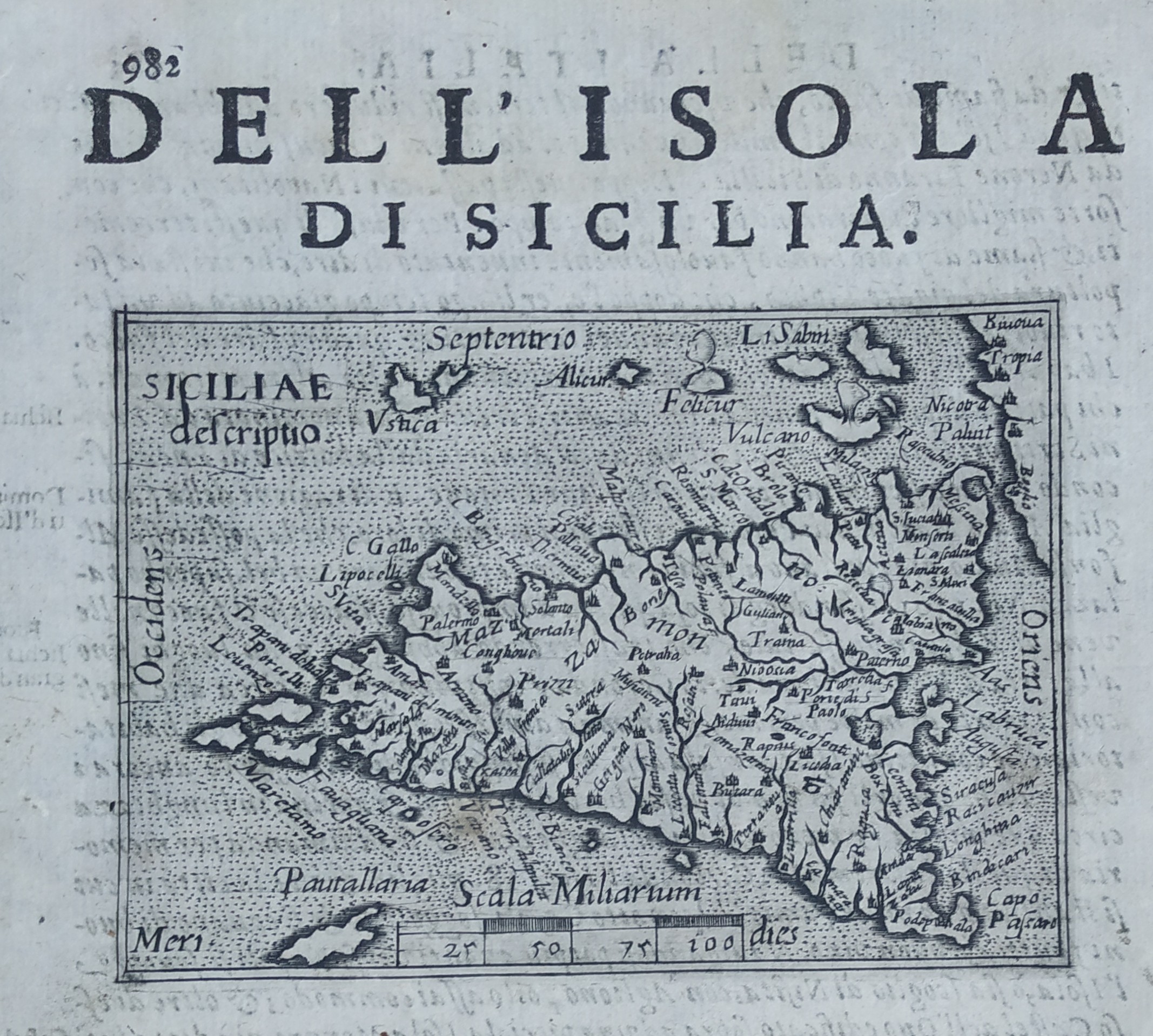
Map title
Dell'isola di Sicilia
Author
Doglioni
Location shown in map
Sicily
Edition date
1623
Edition place
Venice
Editor
Giacomo Sarzina
Atlas
Anfiteatro di Europa
Price
400 Euro
State
[mint/EXCELLENT/very good/good/fair/mediocre/poor]
Color
Black/white
Verso
Italian text pag.981
Size
Plate: cm (11.4 x 8.9) inches (4.49 x 3.5) Paper: cm (15.2 x 22.9) inches (5.98 x 9.02)
Technique
Copper engraving
Note
The maps are copies of the Galle (c.1595) edition of Ortelius.
Reference
--
Wiki
Here for more info
In stock
Available
Info
info@thetreasuremaps.com
Code
#0775
×
![Dell'isola di Sicilia by Doglioni, Sicily, 1623]()

Map title
La France divisee suivant ses Provinces ou Gouvernements Militaire. Par le S.r Robert Vaugondy Geographe
Author
Robert de Vaugondy
Location shown in map
France
Edition date
1771
Edition place
Paris
Editor
Delamarche
Atlas
Atlas moderne. Seconde partie.
Price
250 Euro
State
[mint/excellent/VERY GOOD/good/fair/mediocre/poor]
Color
Old outlined
Verso
Blank
Size
Plate: cm (71 x 50) inches (27.95 x 19.69) Paper: cm (74 x 51) inches (29.13 x 20.08)
Technique
Copper engraving
Note
Reference
Wiki
Here for more info
In stock
Available
Info
info@thetreasuremaps.com
Code
#0772
×
![La France divisee suivant ses Provinces ou Gouvernements Militaire. Par le S.r Robert Vaugondy Geographe by Robert de Vaugondy, France, 1771]()
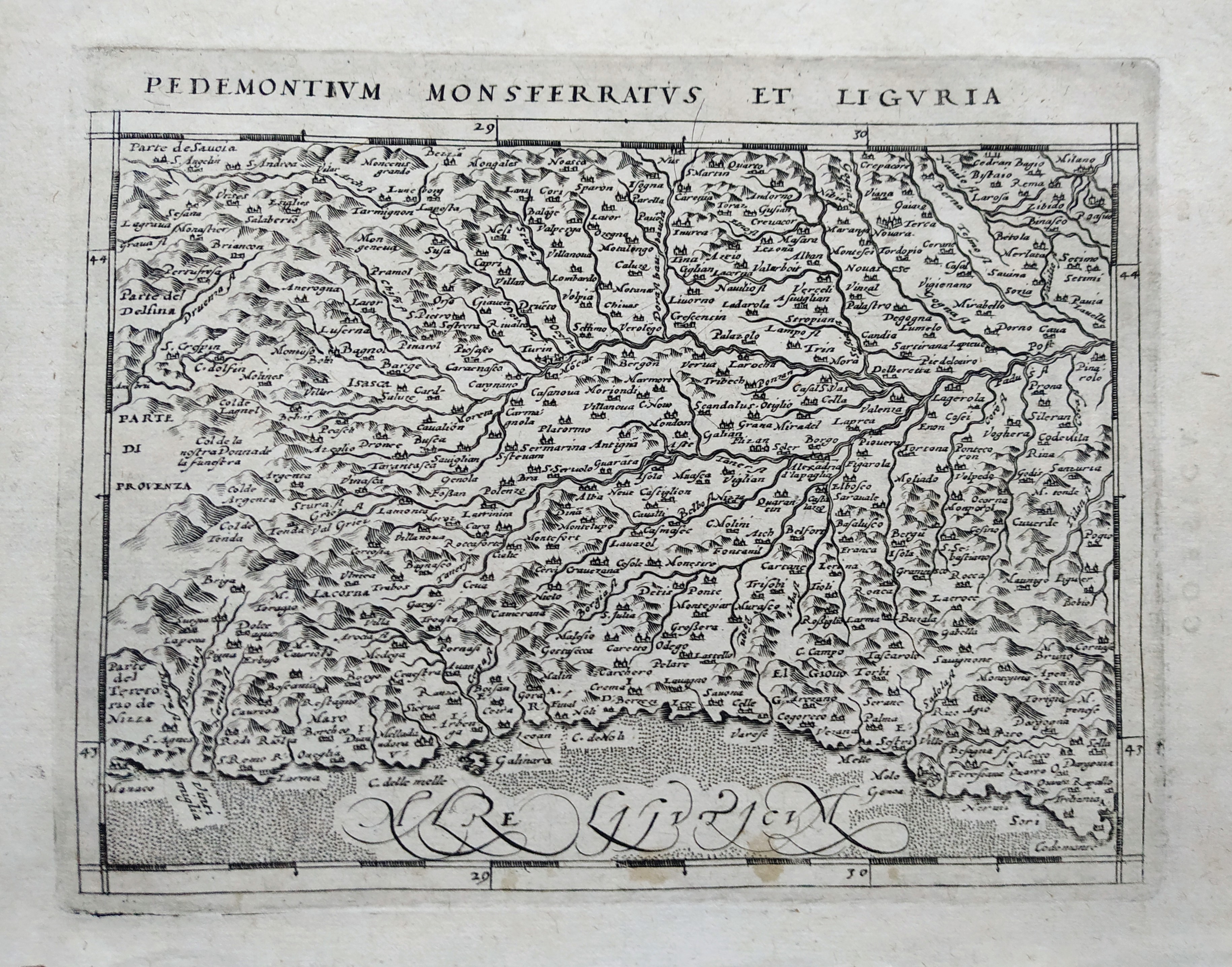
Map title
Pedemontium Monsferratus et Liguria
Author
Magini
Location shown in map
Piedmont & Liguria
Edition date
1617
Edition place
Arnheim
Editor
Ioannes Ianssonius
Atlas
Geografia di Claudio Tolomeo
Price
200 Euro
State
[mint/EXCELLENT/very good/good/fair/mediocre/poor]
Color
Black/white
Verso
Latin text pag 100
Size
Plate: cm (17.8 x 12.7) inches (7.01 x 5) Paper: cm (21.6 x 17.8) inches (8.5 x 7.01)
Technique
Copper engraving
Note
Reference
--
Wiki
Here for more info
In stock
Available
Info
info@thetreasuremaps.com
Code
#0770
×
![Pedemontium Monsferratus et Liguria by Magini, Piedmont & Liguria, 1617]()
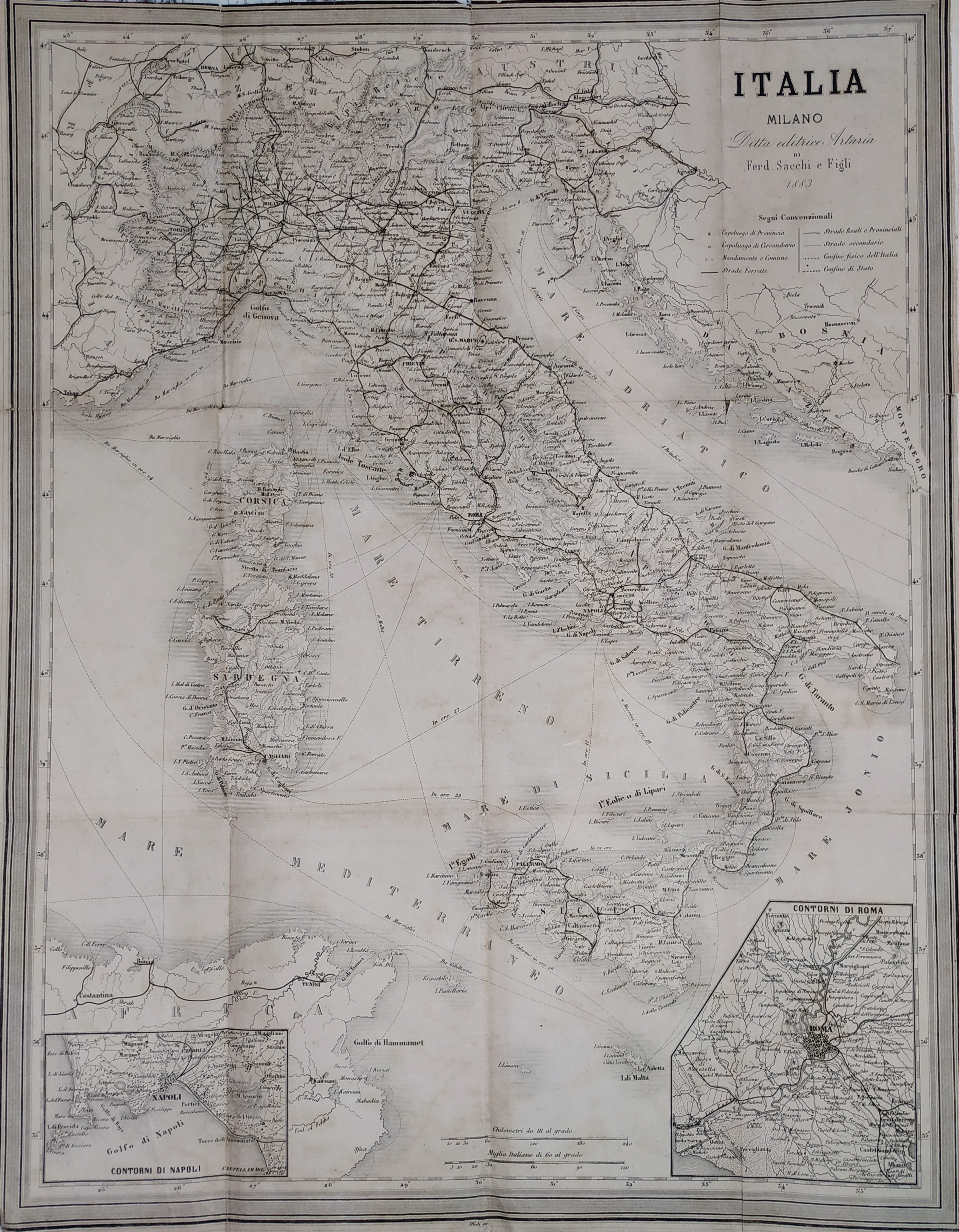
Map title
Italia
Author
Sacchi
Location shown in map
Italy
Edition date
1883
Edition place
Milan
Editor
Sacchi
Atlas
Price
50 Euro
State
[mint/excellent/VERY GOOD/good/fair/mediocre/poor]
Color
Black/white
Verso
Blank
Size
Plate: cm (37 x 48) inches (14.57 x 18.9) Paper: cm (37 x 48) inches (14.57 x 18.9)
Technique
Copper engraving
Note
Reference
Wiki
Here for more info
In stock
Available
Info
info@thetreasuremaps.com
Code
#0773
×
![Italia by Sacchi, Italy, 1883]()
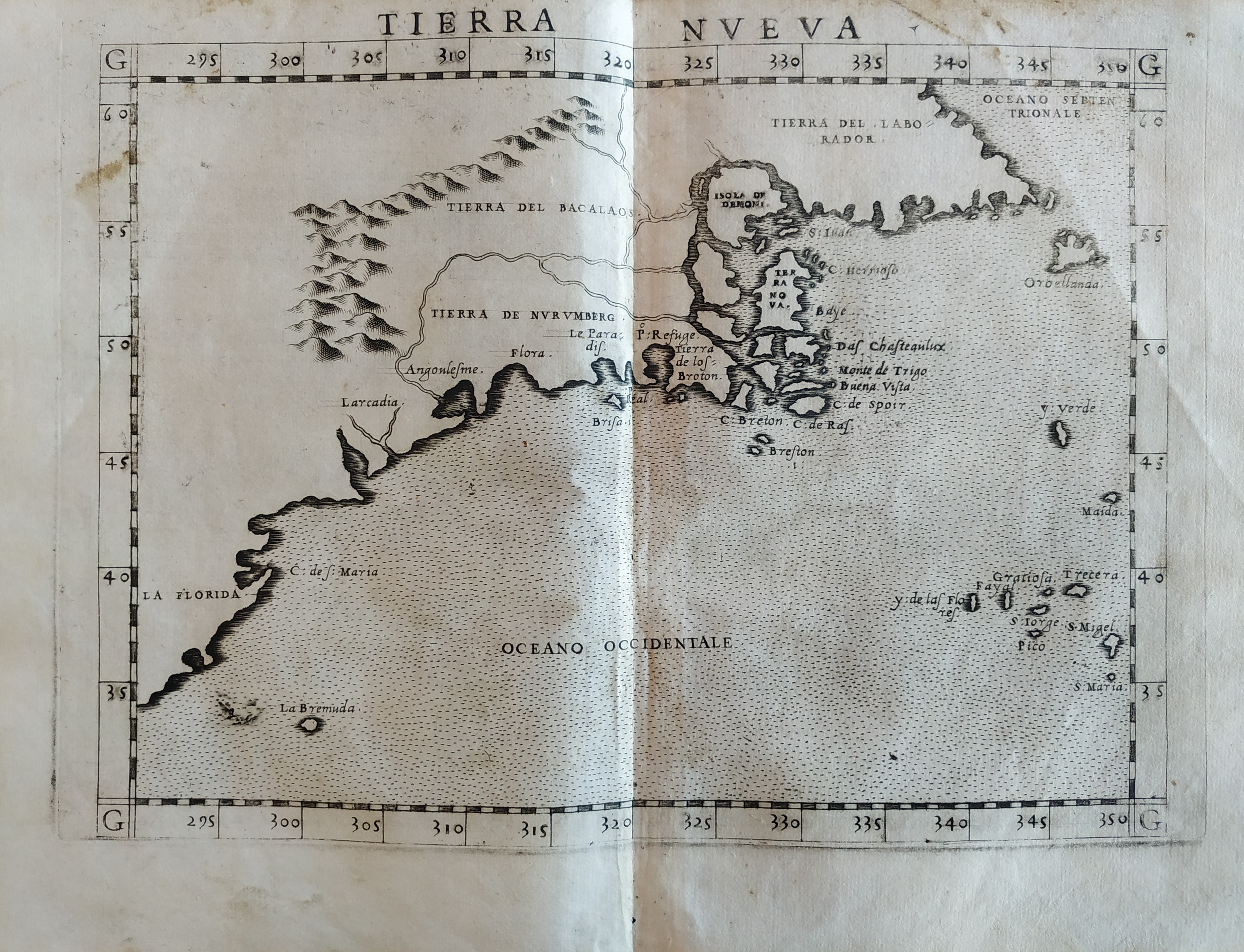
Map title
Tierra Nueva
Author
Ruscelli
Location shown in map
East coast
Edition date
1561
Edition place
Venice
Editor
Vincenzo Valgrisi
Atlas
La Geographia di Claudio Tolomeo
Price
900 Euro
State
[mint/EXCELLENT/very good/good/fair/mediocre/poor]
Color
Black/white
Verso
Italian text pag.32
Size
Plate: cm (26 x 19) inches (10.24 x 7.48) Paper: cm (27.9 x 20.3) inches (10.98 x 7.99)
Technique
Copper engraving
Note
No particular notes for this maps.
Reference
--
Wiki
Here for more info
In stock
Available
Info
info@thetreasuremaps.com
Code
#0767
×
![Tierra Nueva by Ruscelli, East coast, 1561]()
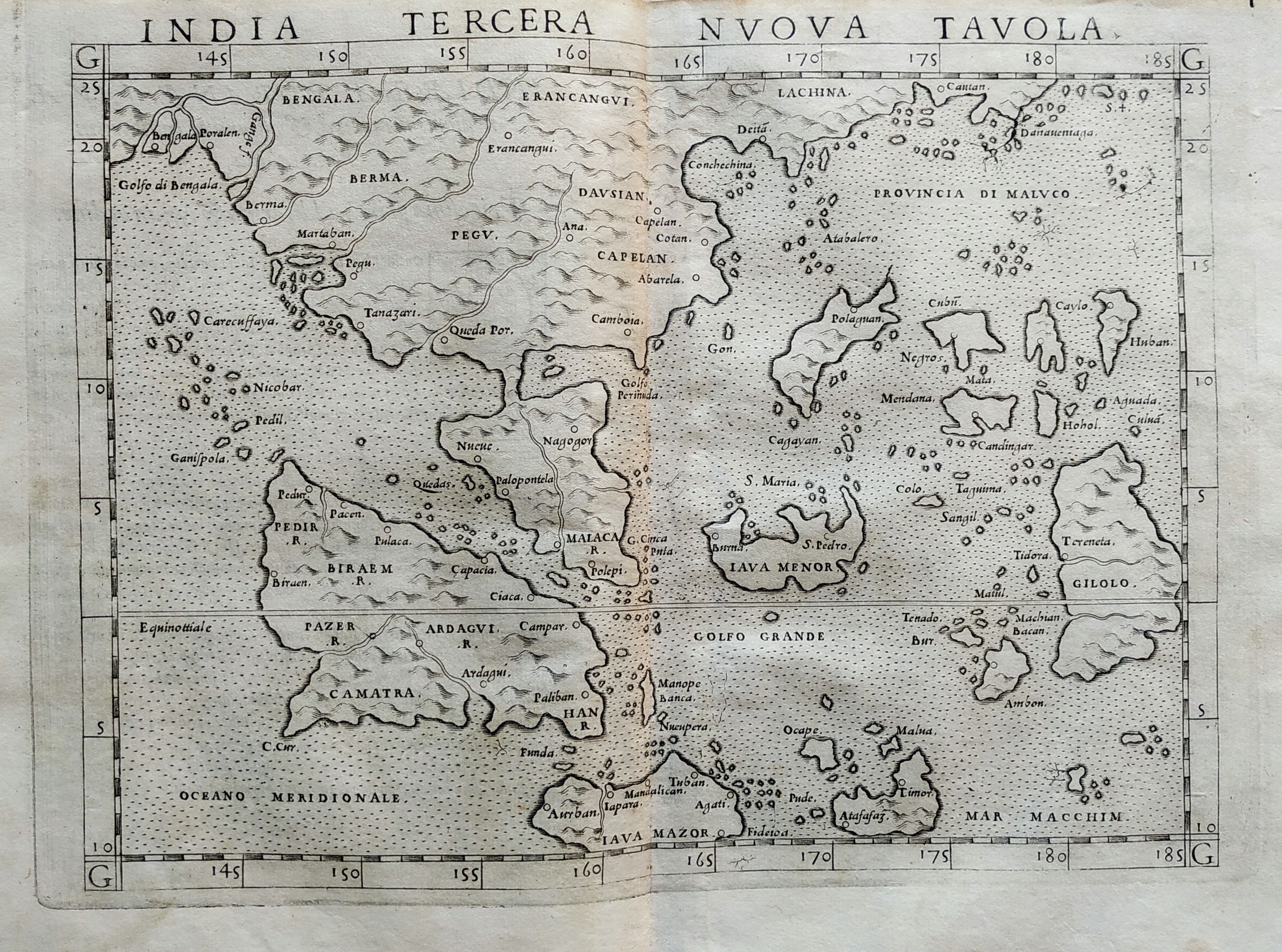
Map title
India tercera nova tabula
Author
Ruscelli
Location shown in map
Southeast Asia
Edition date
1561
Edition place
Venice
Editor
Vincenzo Valgrisi
Atlas
La Geographia di Claudio Tolomeo
Price
500 Euro
State
[mint/EXCELLENT/very good/good/fair/mediocre/poor]
Color
Black/white
Verso
Size
Plate: cm (26 x 19) inches (10.24 x 7.48) Paper: cm (27.9 x 20.3) inches (10.98 x 7.99)
Technique
Copper engraving
Note
No particular notes for this maps.
Reference
--
Wiki
Here for more info
In stock
Available
Info
info@thetreasuremaps.com
Code
#0768
×
![India tercera nova tabula by Ruscelli, Southeast Asia, 1561]()
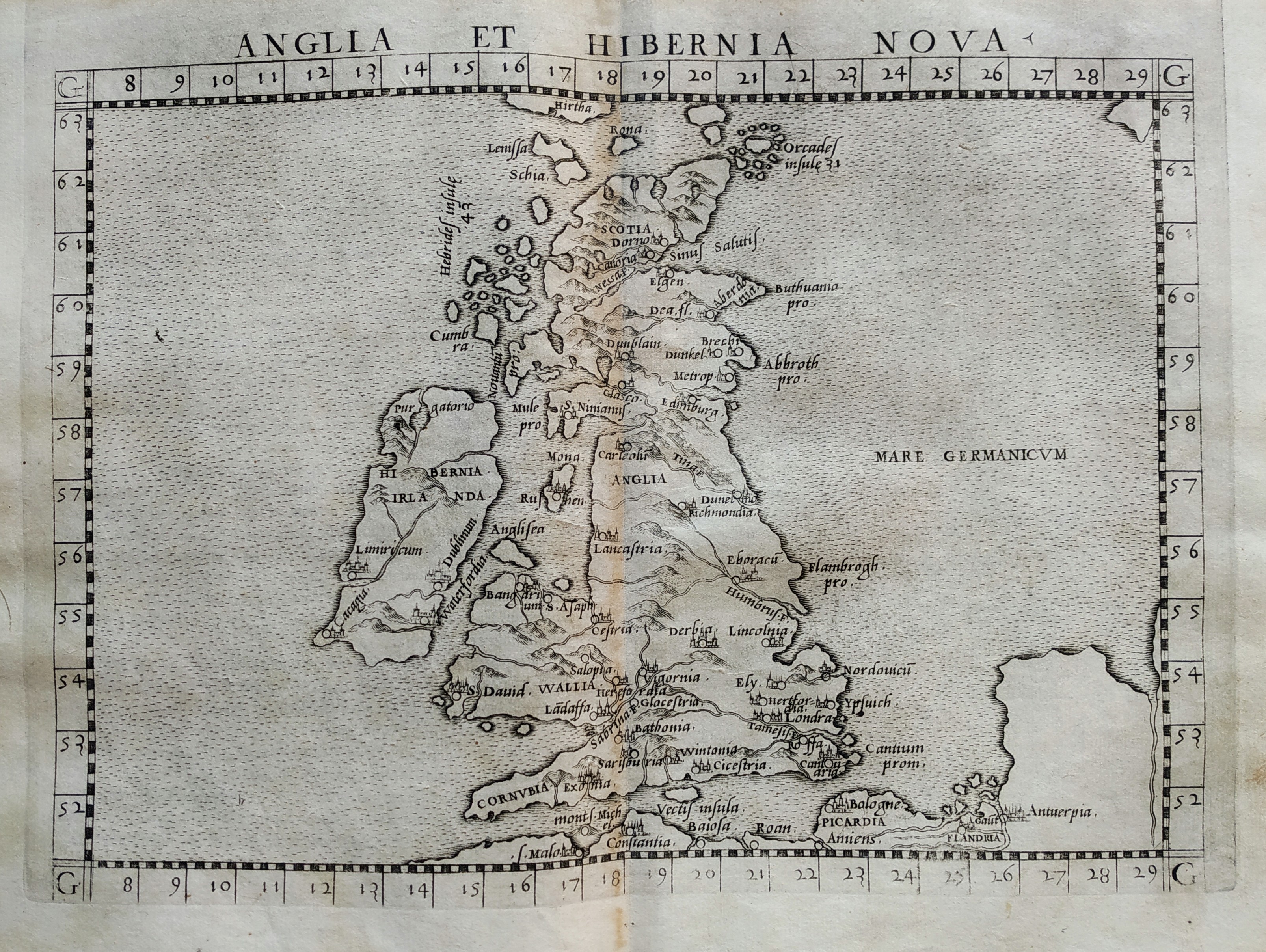
Map title
Anglia et Hibernia nova
Author
Ruscelli
Location shown in map
British Isles
Edition date
1561
Edition place
Venice
Editor
Vincenzo Valgrisi
Atlas
La Geographia di Claudio Tolomeo
Price
300 Euro
State
[mint/EXCELLENT/very good/good/fair/mediocre/poor]
Color
Black/white
Verso
Size
Plate: cm (26 x 19) inches (10.24 x 7.48) Paper: cm (27.9 x 20.3) inches (10.98 x 7.99)
Technique
Copper engraving
Note
No particular notes for this maps.
Reference
--
Wiki
Here for more info
In stock
Available
Info
info@thetreasuremaps.com
Code
#0769
×
![Anglia et Hibernia nova by Ruscelli, British Isles, 1561]()
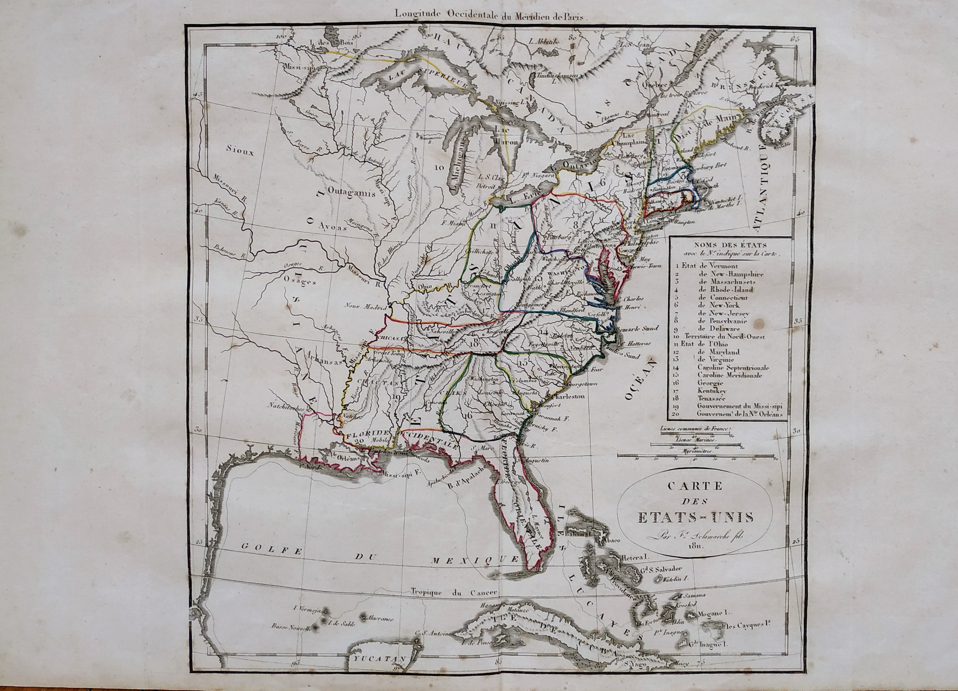
Map title
Carte des Etats-Unis
Author
Delamarche
Location shown in map
USA
Edition date
1811
Edition place
Paris
Editor
--
Atlas
Atlas Portatif de Vaugondy
Price
125 Euro
State
[mint/excellent/VERY GOOD/good/fair/mediocre/poor]
Color
Old outlined
Verso
Blank
Size
Plate: cm (27 x 29) inches (10.63 x 11.42) Paper: cm (48 x 31) inches (18.9 x 12.2)
Technique
Copper engraving
Note
Reference
--
Wiki
Here for more info
In stock
Available
Info
info@thetreasuremaps.com
Code
#0749
×
![Carte des Etats-Unis by Delamarche, USA, 1811]()
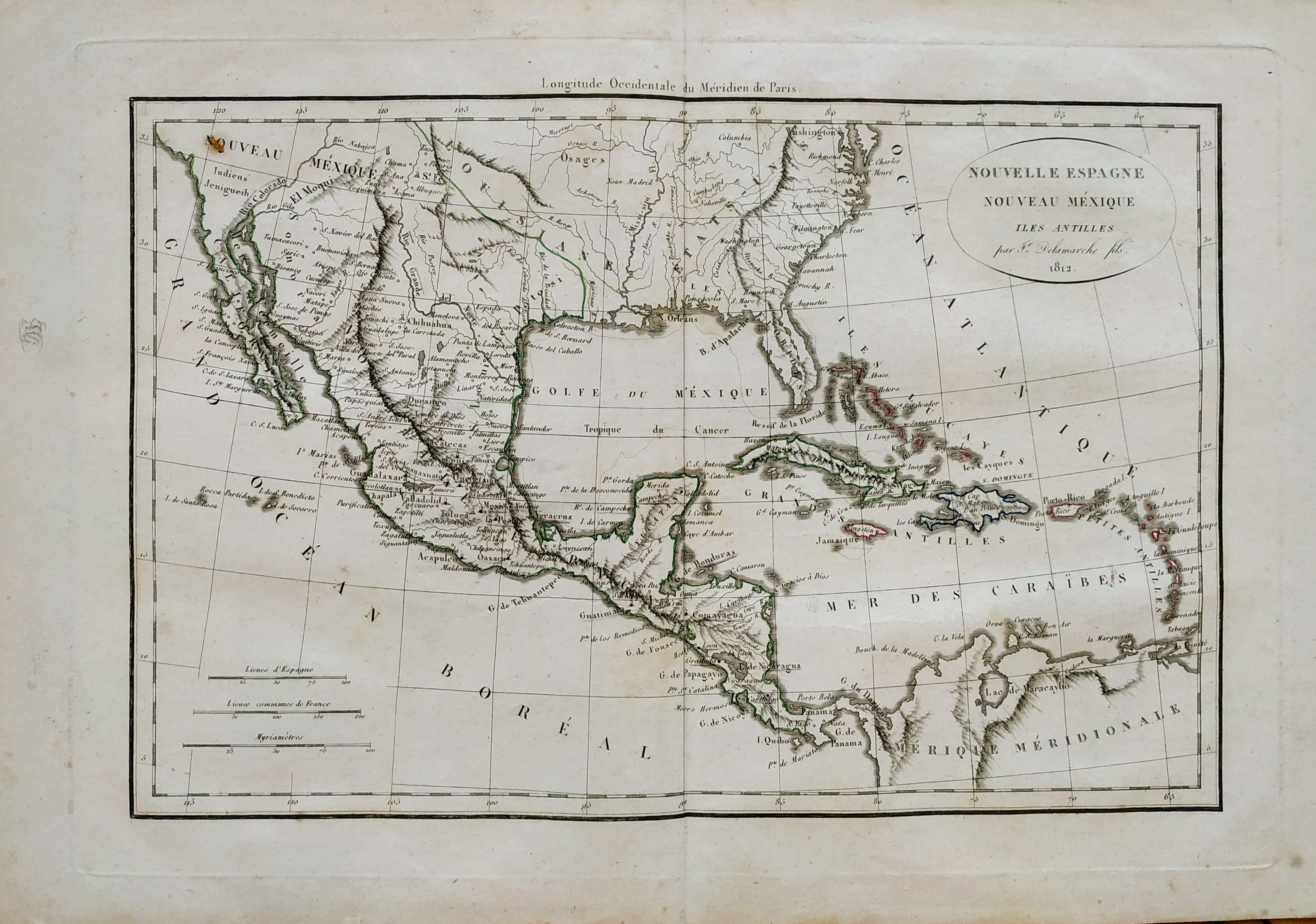
Map title
Nouvelle Espagne
Author
Delamarche
Location shown in map
Mexico
Edition date
1812
Edition place
Paris
Editor
--
Atlas
Atlas Portatif de Vaugondy
Price
125 Euro
State
[mint/excellent/VERY GOOD/good/fair/mediocre/poor]
Color
Old outlined
Verso
Blank
Size
Plate: cm (36 x 24) inches (14.17 x 9.45) Paper: cm (48 x 31) inches (18.9 x 12.2)
Technique
Copper engraving
Note
Reference
--
Wiki
Here for more info
In stock
Available
Info
info@thetreasuremaps.com
Code
#0750
×
![Nouvelle Espagne by Delamarche, Mexico, 1812]()
Map title
Italia
Author
De Bry
Location shown in map
Italy
Edition date
1597
Edition place
Frankfurt
Editor
Boissard, Jean Jacques
Atlas
Romanae Urbis Topographiae & Antiquitatum
Price
1500 Euro
State
[mint/EXCELLENT/very good/good/fair/mediocre/poor]
Color
Black/white
Verso
Blank
Size
Plate: cm (43 x 34) inches (16.93 x 13.39) Paper: cm (41 x 32) inches (16.14 x 12.6)
Technique
Copper engraving
Note
Based on the Mercator projection.
Reference
R.Borri L'Italia nelle antiche carte pag.94
Wiki
Here for more info
In stock
Available
Info
info@thetreasuremaps.com
Code
#0761
×
![Italia by De Bry, Italy, 1597]()
Map title
Cartes des isles Britanniques
Author
Robert de Vaugondy
Location shown in map
British Isles
Edition date
Circa 1780
Edition place
Paris
Editor
Delamarche
Atlas
Atlas d Etude pour l'instruction de la Jeunesse
Price
Please ask: info@thetreasuremaps.com
State
[mint/excellent/VERY GOOD/good/fair/mediocre/poor]
Color
Old color
Verso
Blank
Size
Plate: cm (71 x 53) inches (27.95 x 20.87) Paper: cm (77 x 57) inches (30.31 x 22.44)
Technique
Copper engraving
Note
Professionally rapaired
Reference
--
Wiki
Here for more info
In stock
Available
Info
info@thetreasuremaps.com
Code
#0744
×
![Cartes des isles Britanniques by Robert de Vaugondy, British Isles, Circa 1780]()
Map title
Angliae regni
Author
Ortelius
Location shown in map
England
Edition date
1579
Edition place
Antwerp
Editor
--
Atlas
Theatrum Orbis Terrarum
Price
700 Euro
State
[mint/excelent/very good/good/FAIR/mediocre/poor]
Color
Black/white
Verso
Latin text pag.10
Size
Plate: cm (46 x 37) inches (18.11 x 14.57) Paper: cm (52 x 49) inches (20.47 x 19.29)
Technique
Copper engraving
Note
No particular notes for this maps.
Reference
Van Den Broecke 117
Wiki
Here for more info
In stock
Available
Info
info@thetreasuremaps.com
Code
#0748
×
![Angliae regni by Ortelius, England, 1579]()