News
Map title
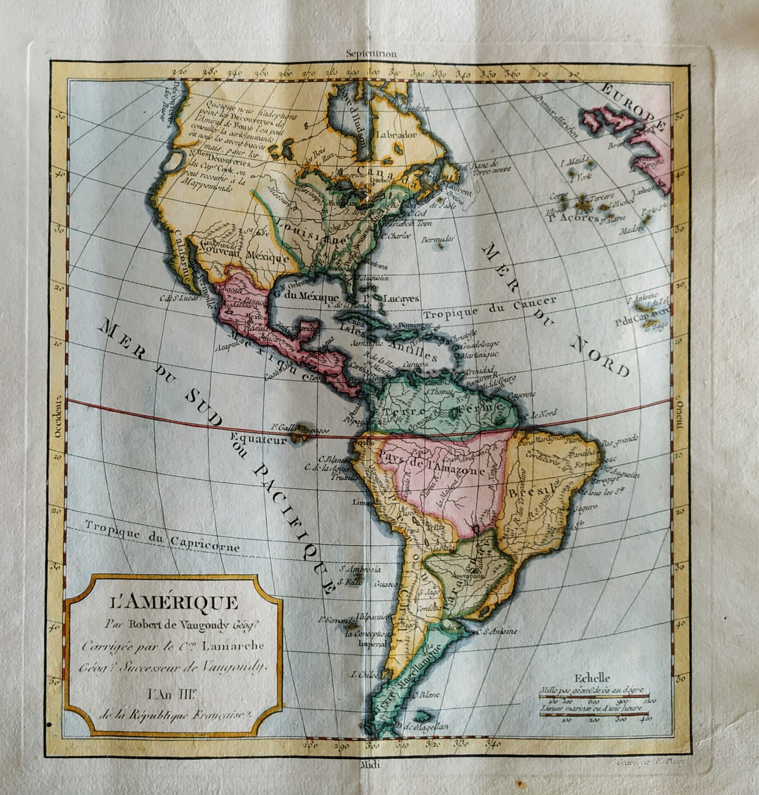
L'Amerique
Author
Robert de Vaugondy
Location shown in map
Americas
Edition date
1795
Edition place
Paris
Editor
Delamarche
Atlas
Atlas Portatif de Vaugondy
Price
100 Euro
State
[MINT/excellent/very good/good/fair/mediocre/poor]
Color
Old color
Verso
Blank
Size
Plate: cm (22 x 24) inches (8.66 x 9.45) Paper: cm (37 x 30) inches (14.57 x 11.81)
Technique
Copper engraving
Note
Reference
--
Wiki
Here for more info
In stock
Available
Info
info@thetreasuremaps.com
Code
#0752
×
![L'Amerique by Robert de Vaugondy, Americas, 1795]()
Map title
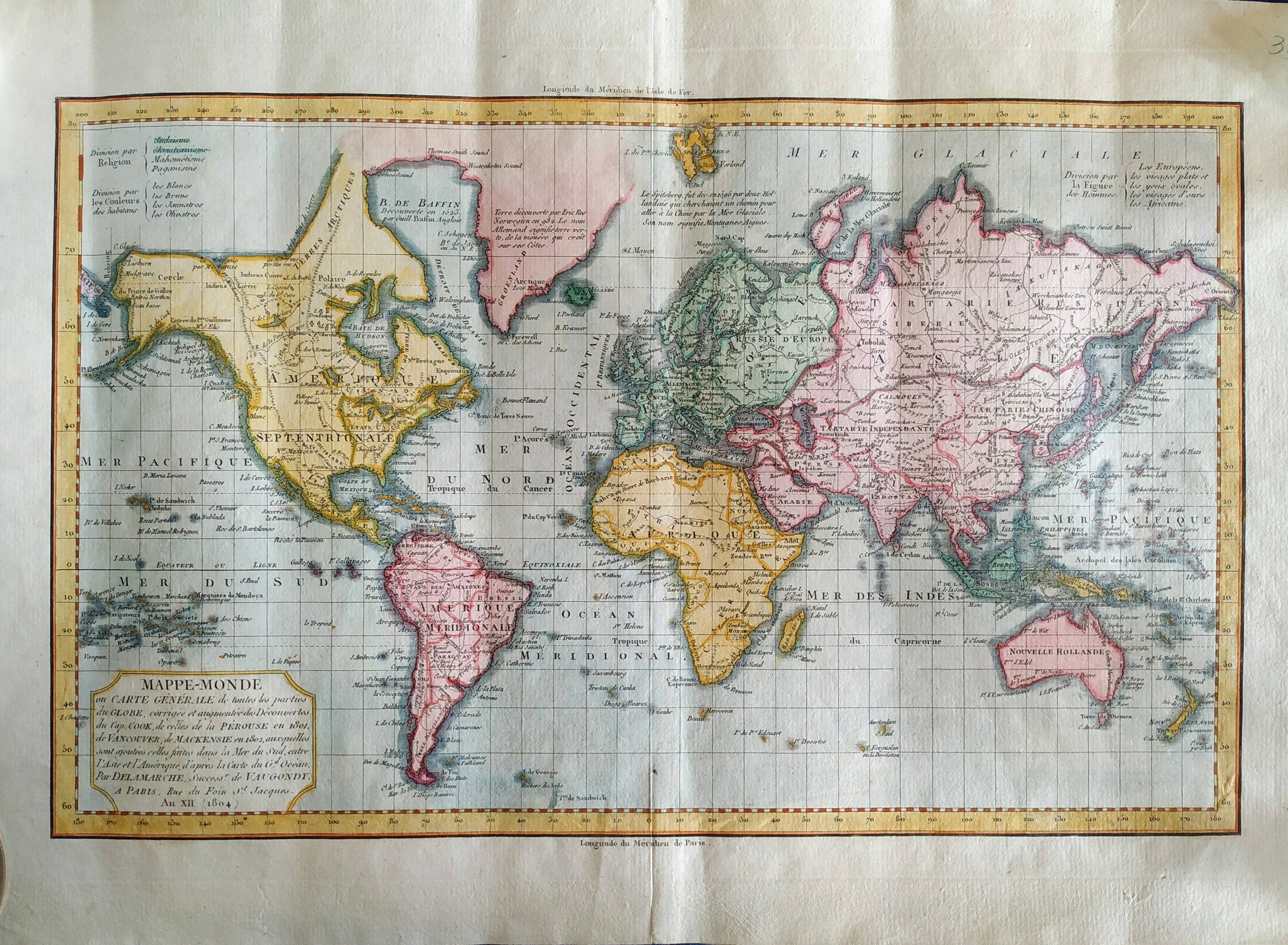
Mappe-Monde
Author
Delamarche
Location shown in map
World
Edition date
1804
Edition place
Paris
Editor
Delamarche
Atlas
Atlas Portatif de Vaugondy
Price
150 Euro
State
[MINT/excellent/very good/good/fair/mediocre/poor]
Color
Old color
Verso
Blank
Size
Plate: cm (38 x 24) inches (14.96 x 9.45) Paper: cm (44 x 30) inches (17.32 x 11.81)
Technique
Copper engraving
Note
Reference
--
Wiki
Here for more info
In stock
Available
Info
info@thetreasuremaps.com
Code
#0753
×
![Mappe-Monde by Delamarche, World, 1804]()
Map title
L'Italie divisee en ses principaux Estats
Author
Alexis Hubert Jaillot
Location shown in map
Italy
Edition date
1718
Edition place
Paris
Editor
Atlas
Price
300 Euro
State
[mint/excellent/VERY GOOD/good/fair/mediocre/poor]
Color
Old color
Verso
Blank
Size
Plate: cm (74 x 53) inches (29.13 x 20.87) Paper: cm (60 x 51) inches (23.62 x 20.08)
Technique
Copper engraving
Note
Reference
R.Borri L'Italia nelle antiche carte pag.187
Wiki
Here for more info
In stock
Available
Info
info@thetreasuremaps.com
Code
#0760
×
![L'Italie divisee en ses principaux Estats by Alexis Hubert Jaillot, Italy, 1718]()
Map title
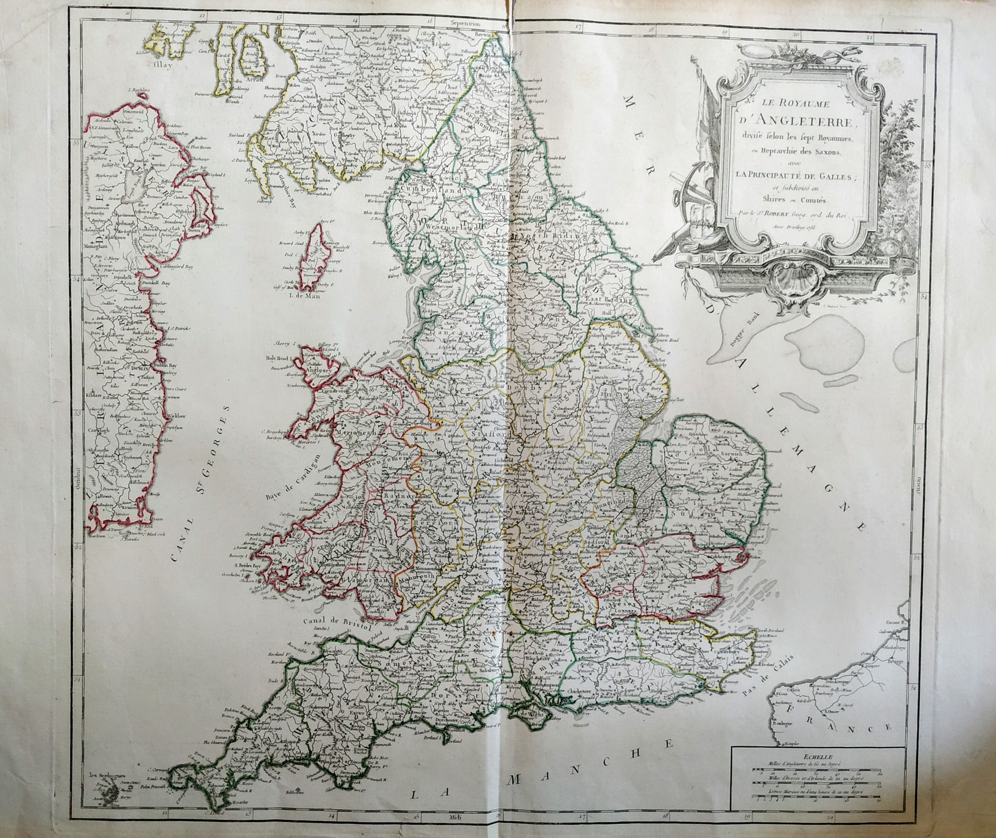
Le royaume d'Angleterre
Author
Robert de Vaugondy
Location shown in map
British Isles
Edition date
1753
Edition place
Paris
Editor
Delamarche
Atlas
Atlas Universel
Price
200 Euro
State
[mint/excellent/VERY GOOD/good/fair/mediocre/poor]
Color
Old color
Verso
Blank
Size
Plate: cm (66 x 51) inches (25.98 x 20.08) Paper: cm (53 x 49) inches (20.87 x 19.29)
Technique
Copper engraving
Note
No particular notes for this maps.
Reference
--
Wiki
Here for more info
In stock
Available
Info
info@thetreasuremaps.com
Code
#0759
×
![Le royaume d'Angleterre by Robert de Vaugondy, British Isles, 1753]()
Map title
Carte de la nouvelle Angleterre
Author
Bellin
Location shown in map
New England
Edition date
1757
Edition place
Paris
Editor
Prevost
Atlas
Historie General des Voyages -- Prevost
Price
300 Euro
State
[mint/EXCELLENT/very good/good/fair/mediocre/poor]
Color
Black/white
Verso
Blank
Size
Plate: cm (29 x 20) inches (11.42 x 7.87) Paper: cm (37 x 25) inches (14.57 x 9.84)
Technique
Copper engraving
Note
The New England colonies are named except Vermont which is still the unnamed disputed territory between New Hampshire and New York. The area covered as a whole extends from Penobscot Bay south to Chesapeake Bay and west to Lake Erie. The map illustrates provinces, towns, forts, rivers, Native American lands and relief.
Reference
--
Wiki
Here for more info
In stock
Available
Info
info@thetreasuremaps.com
Code
#0762
×
![Carte de la nouvelle Angleterre by Bellin, New England, 1757]()
Map title
Descrittione dell impero Persiano
Author
Magini
Location shown in map
Iran
Edition date
1598
Edition place
Venice
Editor
Battista & Giorgio Galignani
Atlas
Geografia di Claudio Tolomeo -- Giovanni Antonio Magini
Price
125 Euro
State
[mint/EXCELLENT/very good/good/fair/mediocre/poor]
Color
Black/white
Verso
Italian test pag.179
Size
Plate: cm (17 x 13) inches (6.69 x 5.12) Paper: cm (21 x 30) inches (8.27 x 11.81)
Technique
Copper engraving
Note
No particular notes for this maps.
Reference
--
Wiki
Here for more info
In stock
Available
Info
info@thetreasuremaps.com
Code
#0763
×
![Descrittione dell impero Persiano by Magini, Iran, 1598]()

Map title
Pedemontana regio cum Genvensium territorio & Montisferrati marchionatu
Author
Mercator
Location shown in map
Liguria
Edition date
Circa 1633
Edition place
Amsterdam
Editor
Houndius
Atlas
Mercator-Hondius Atlas.
Price
400 Euro
State
[mint/EXCELLENT/very good/good/fair/mediocre/poor]
Color
Black/white
Verso
Franch text pag 545
Size
Plate: cm (44 x 35) inches (17.32 x 13.78) Paper: cm (54 x 45) inches (21.26 x 17.72)
Technique
Copper engraving
Note
No particular notes for this maps
Reference
--
Wiki
Here for more info
In stock
Available
Info
info@thetreasuremaps.com
Code
#0020
×
![Pedemontana regio cum Genvensium territorio & Montisferrati marchionatu by Mercator, Liguria, Circa 1633]()
Map title
Italie Novissima Descriptio
Author
Ortelius
Location shown in map
Italy
Edition date
1579
Edition place
Antwerp
Editor
--
Atlas
Theatrum Orbis Terrarum
Price
1200 Euro
State
[mint/EXCELLENT/very good/good/fair/mediocre/poor]
Color
Black/white
Verso
Latin text pag.58
Size
Plate: cm (50 x 35) inches (19.69 x 13.78) Paper: cm (54 x 43.2) inches (21.26 x 17.01)
Technique
Copper engraving
Note
Reference
Van Den Broecke 117
Wiki
Here for more info
In stock
Available
Info
info@thetreasuremaps.com
Code
#0741
×
![Italie Novissima Descriptio by Ortelius, Italy, 1579]()
Map title
Diversi Globi Terr-Aquei
Author
Seutter, Matthaus
Location shown in map
World
Edition date
1744
Edition place
Augsburg
Editor
--
Atlas
Atlas Minor
Price
600 Euro
State
[mint/excellent/VERY GOOD/good/fair/mediocre/poor]
Color
Old color
Verso
Blank
Size
Plate: cm (25.4 x 19) inches (10 x 7.48) Paper: cm (29.2 x 21.6) inches (11.5 x 8.5)
Technique
Copper engraving
Note
Professionally rapaired
Reference
--
Wiki
Here for more info
In stock
Available
Info
info@thetreasuremaps.com
Code
#0742
×
![Diversi Globi Terr-Aquei by Seutter, Matthaus, World, 1744]()
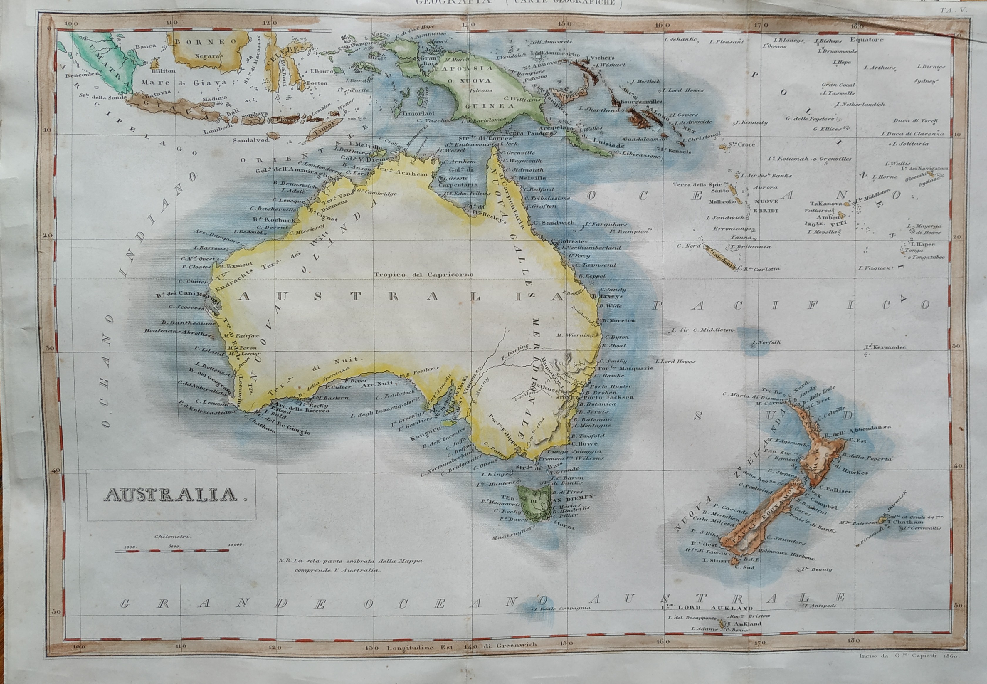
Map title
Australia
Author
Capietti
Location shown in map
Australia
Edition date
1860
Edition place
Turin
Editor
Dalla societa l'unione tipografico
Atlas
Nuova enciclopedia popolare italiana
Price
100 Euro
State
[mint/EXCELLENT/very good/good/fair/mediocre/poor]
Color
Old color
Verso
Blank
Size
Plate: cm (37 x 25) inches (14.57 x 9.84) Paper: cm (42 x 28) inches (16.54 x 11.02)
Technique
Steel engraving
Note
No particular notes for this maps
Reference
--
Wiki
Here for more info
In stock
Available
Info
info@thetreasuremaps.com
Code
#0734
Australia
Author
Capietti
Location shown in map
Australia
Edition date
1860
Edition place
Turin
Editor
Dalla societa l'unione tipografico
Atlas
Nuova enciclopedia popolare italiana
Price
100 Euro
State
[mint/EXCELLENT/very good/good/fair/mediocre/poor]
Color
Old color
Verso
Blank
Size
Plate: cm (37 x 25) inches (14.57 x 9.84) Paper: cm (42 x 28) inches (16.54 x 11.02)
Technique
Steel engraving
Note
No particular notes for this maps
Reference
--
Wiki
Here for more info
In stock
Available
Info
info@thetreasuremaps.com
Code
#0734
×
![Australia by Capietti, Australia, 1860]()
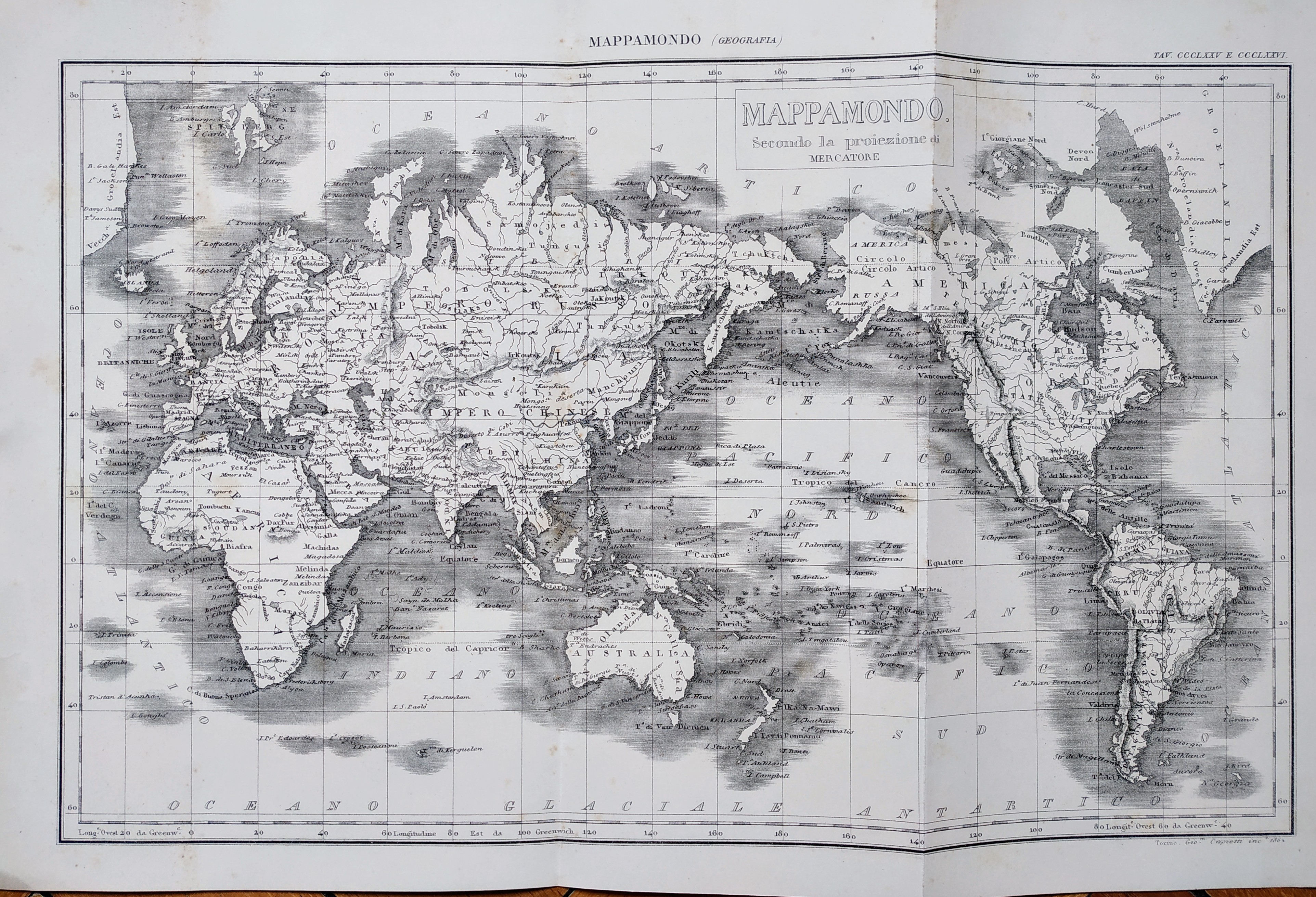
Map title
Mappamondo secondo la proiezione di Mercatore
Author
Capietti
Location shown in map
World
Edition date
1862
Edition place
Turin
Editor
Dalla societa l'unione tipografico
Atlas
Nuova enciclopedia popolare italiana
Price
50 Euro
State
[mint/EXCELLENT/very good/good/fair/mediocre/poor]
Color
Black/white
Verso
Blank
Size
Plate: cm (39 x 25) inches (15.35 x 9.84) Paper: cm (45 x 29) inches (17.72 x 11.42)
Technique
Steel engraving
Note
No particular notes for this maps
Reference
--
Wiki
Here for more info
In stock
Available
Info
info@thetreasuremaps.com
Code
#0725
×
![Mappamondo secondo la proiezione di Mercatore by Capietti, World, 1862]()
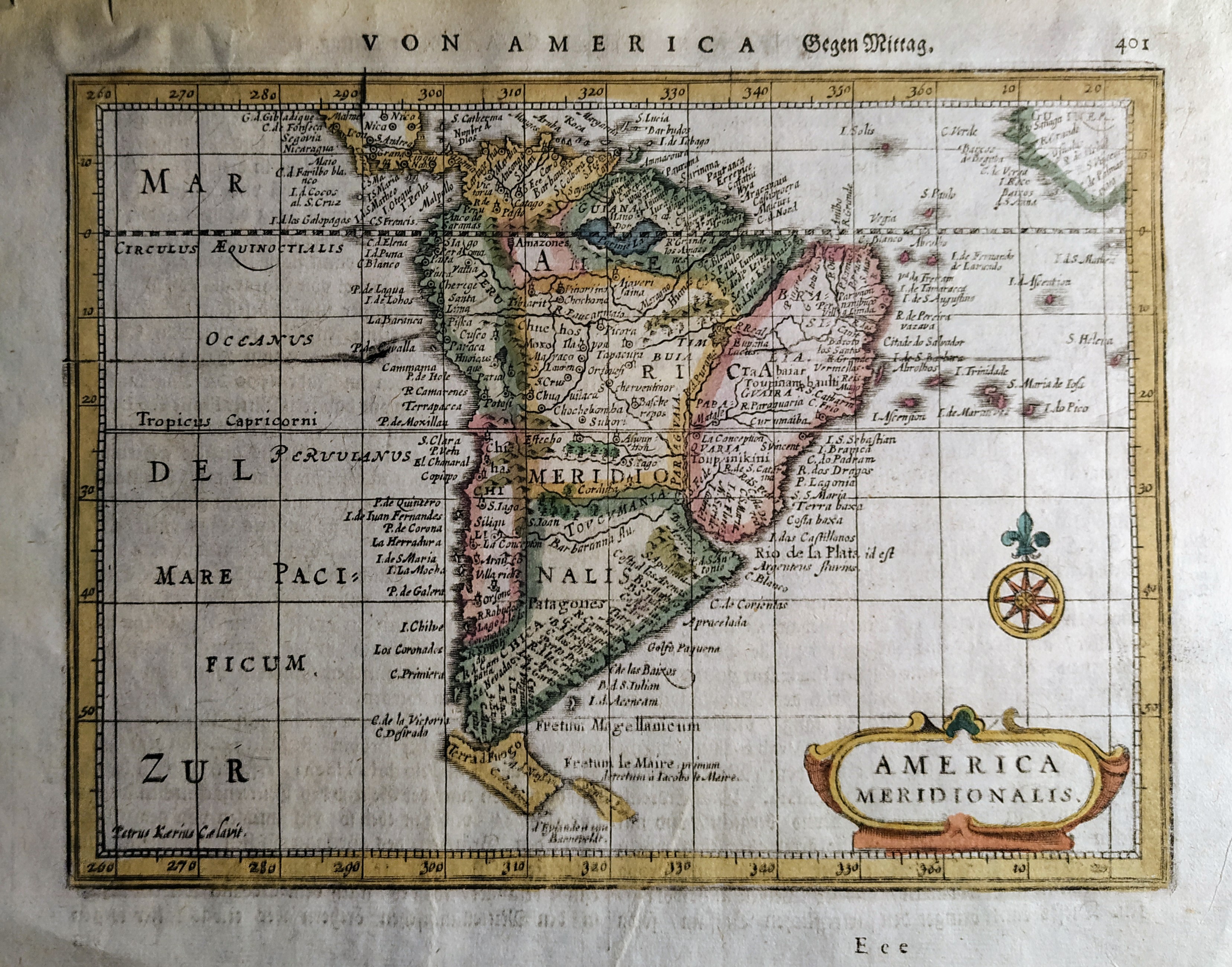
Map title
America Meridionalis
Author
Mercator
Location shown in map
South America
Edition date
Circa 1648
Edition place
Amsterdam
Editor
Janssonius
Atlas
Altas Minor Gerardi Mercatoris
Price
Please ask: info@thetreasuremaps.com
State
[mint/EXCELLENT/very good/good/fair/mediocre/poor]
Color
Old colors
Verso
German text pag 402
Size
Plate: cm (19 x 14) inches (7.48 x 5.51) Paper: cm (23 x 18) inches (9.06 x 7.09)
Technique
Copper engraving
Note
No particular notes for this maps
Reference
Wiki
Here for more info
In stock
Available
Info
info@thetreasuremaps.com
Code
#0726
×
![America Meridionalis by Mercator, South America, Circa 1648]()
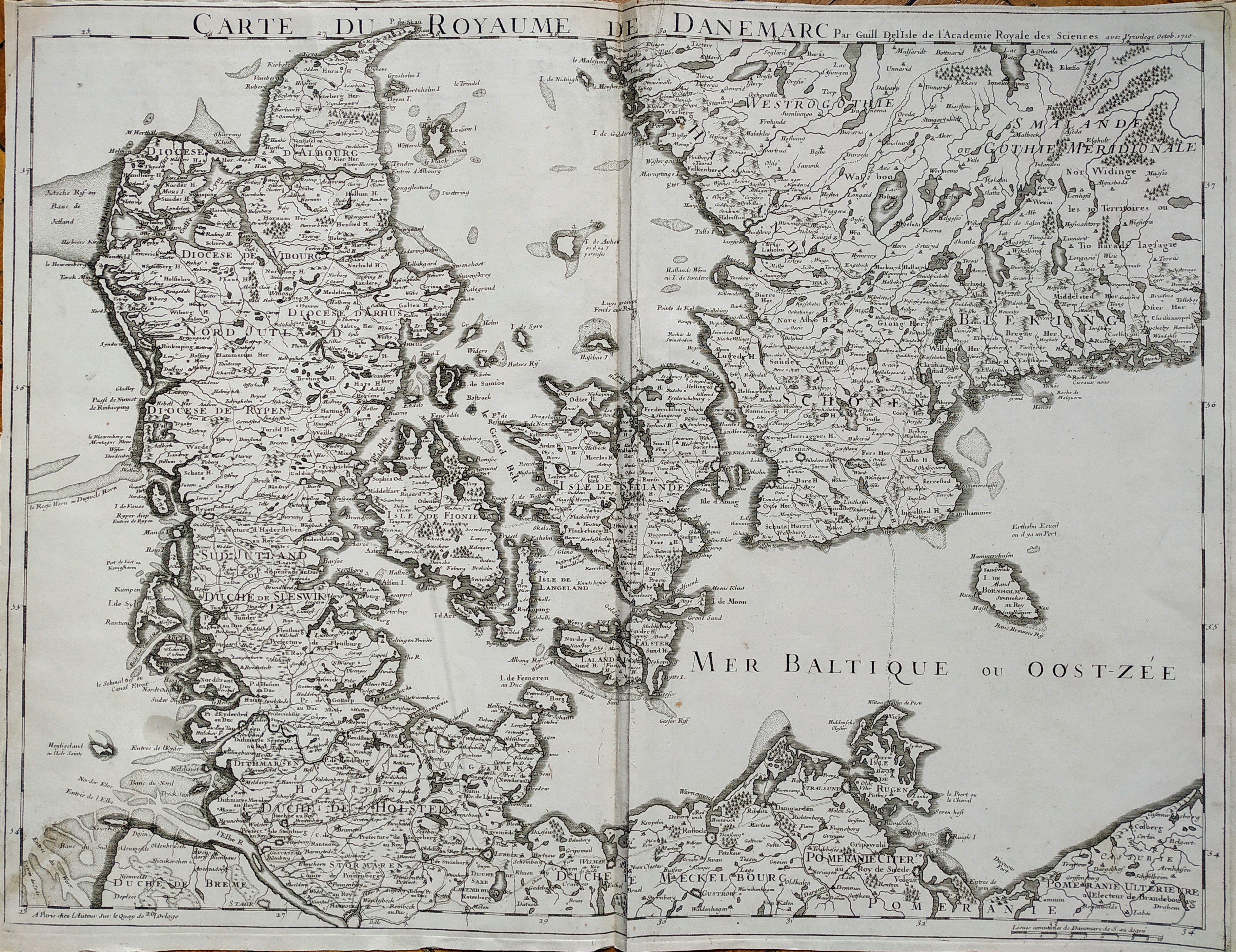
Map title
Carte du roroyaume de Danemarc
Author
De L'Isle
Location shown in map
Denmark
Edition date
1710
Edition place
Paris
Editor
Guillaume Delisle
Atlas
Price
250 Euro
State
[mint/EXCELLENT/very good/good/fair/mediocre/poor]
Color
Black/white
Verso
Blank
Size
Plate: cm (63 x 49) inches (24.8 x 19.29) Paper: cm (65 x 50) inches (25.59 x 19.69)
Technique
Copper engraving
Note
No particular notes for this maps
Reference
Wiki
Here for more info
In stock
Available
Info
info@thetreasuremaps.com
Code
#0727
×
![Carte du roroyaume de Danemarc by De L'Isle, Denmark, 1710]()
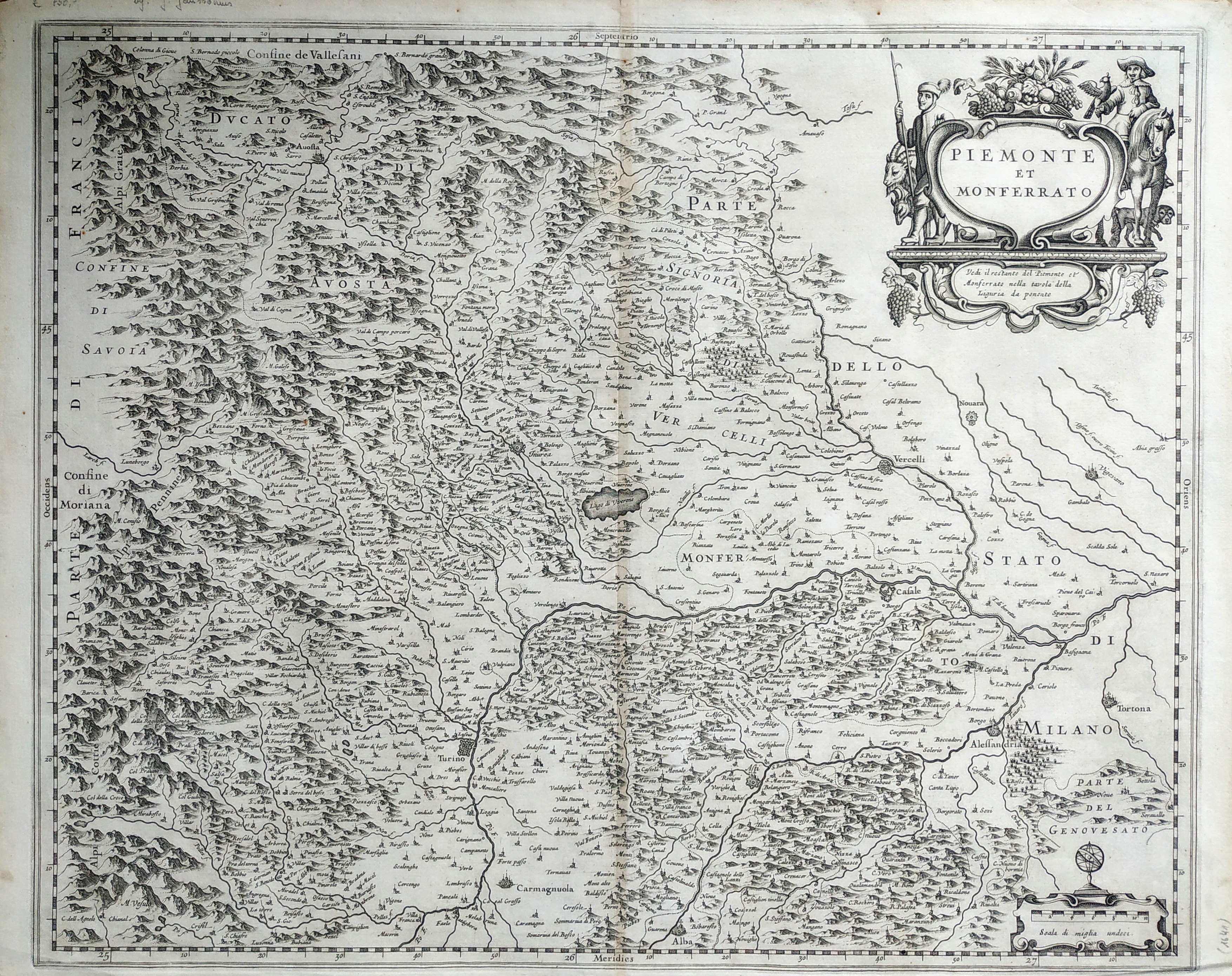
Map title
Piemonte et Monferrato
Author
Blaeu
Location shown in map
North-West Italy
Edition date
Circa 1650
Edition place
Amsterdam
Editor
Blaeu
Atlas
Atlas Maior
Price
300 Euro
State
[mint/EXCELLENT/very good/good/fair/mediocre/poor]
Color
Old colors
Verso
Blank
Size
Plate: cm (51 x 41) inches (20.08 x 16.14) Paper: cm (55 x 44) inches (21.65 x 17.32)
Technique
Copper engraving
Note
No particular notes for this maps
Reference
Wiki
Here for more info
In stock
Available
Info
info@thetreasuremaps.com
Code
#0728
×
![Piemonte et Monferrato by Blaeu, North-West Italy, Circa 1650]()
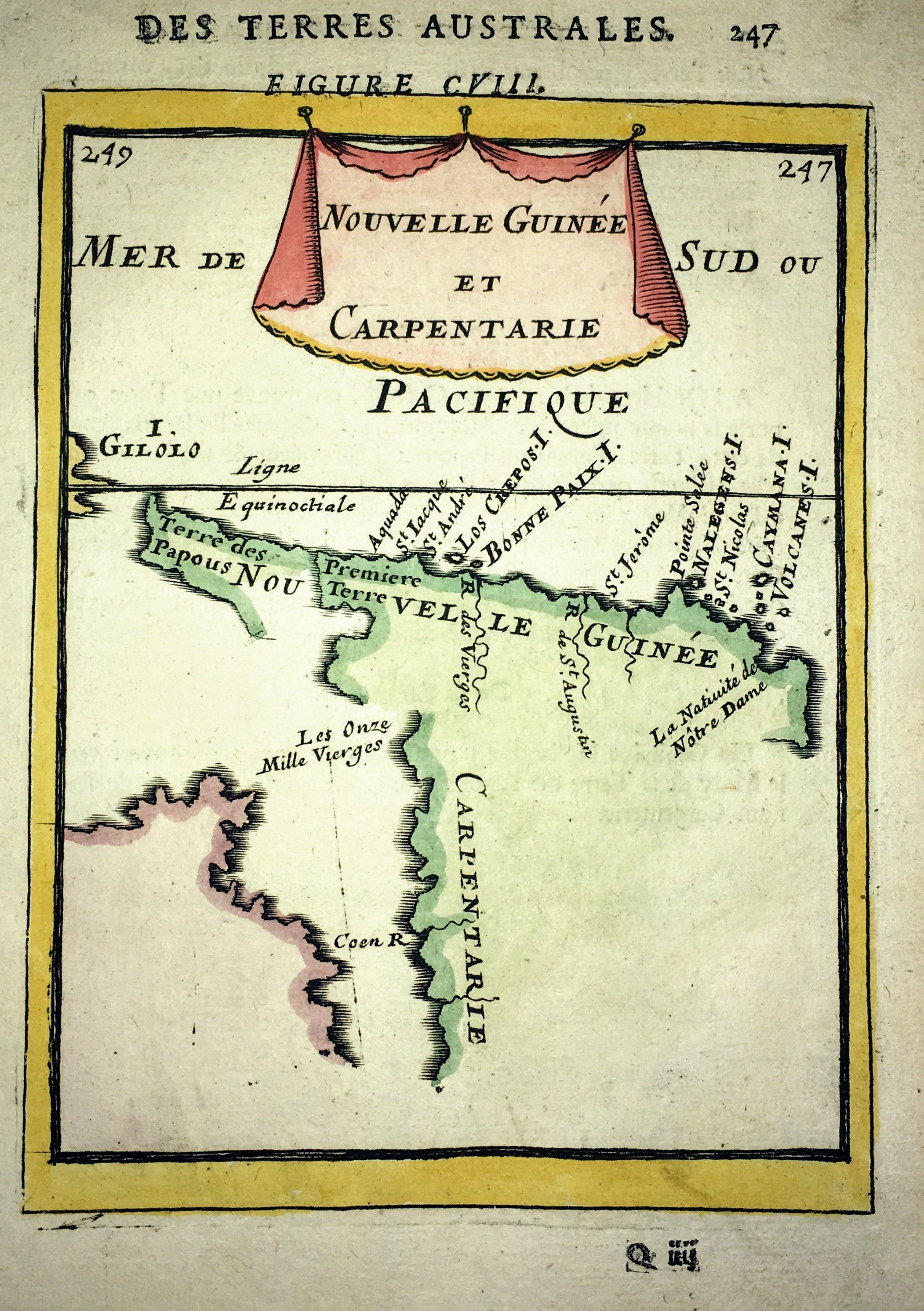
Map title
Nouvelle Guinee et Carpentarie
Author
Mallet
Location shown in map
New Guinea
Edition date
1683
Edition place
Paris
Editor
Atlas
Description de l'Univers
Price
75 Euro
State
[mint/EXCELLENT/very good/good/fair/mediocre/poor]
Color
Old colors
Verso
Blank
Size
Plate: cm (11 x 15) inches (4.33 x 5.91) Paper: cm (14 x 21) inches (5.51 x 8.27)
Technique
Copper engraving
Note
No particular notes for this maps
Reference
Wiki
Here for more info
In stock
Available
Info
info@thetreasuremaps.com
Code
#0666
×
![Nouvelle Guinee et Carpentarie by Mallet, New Guinea, 1683]()
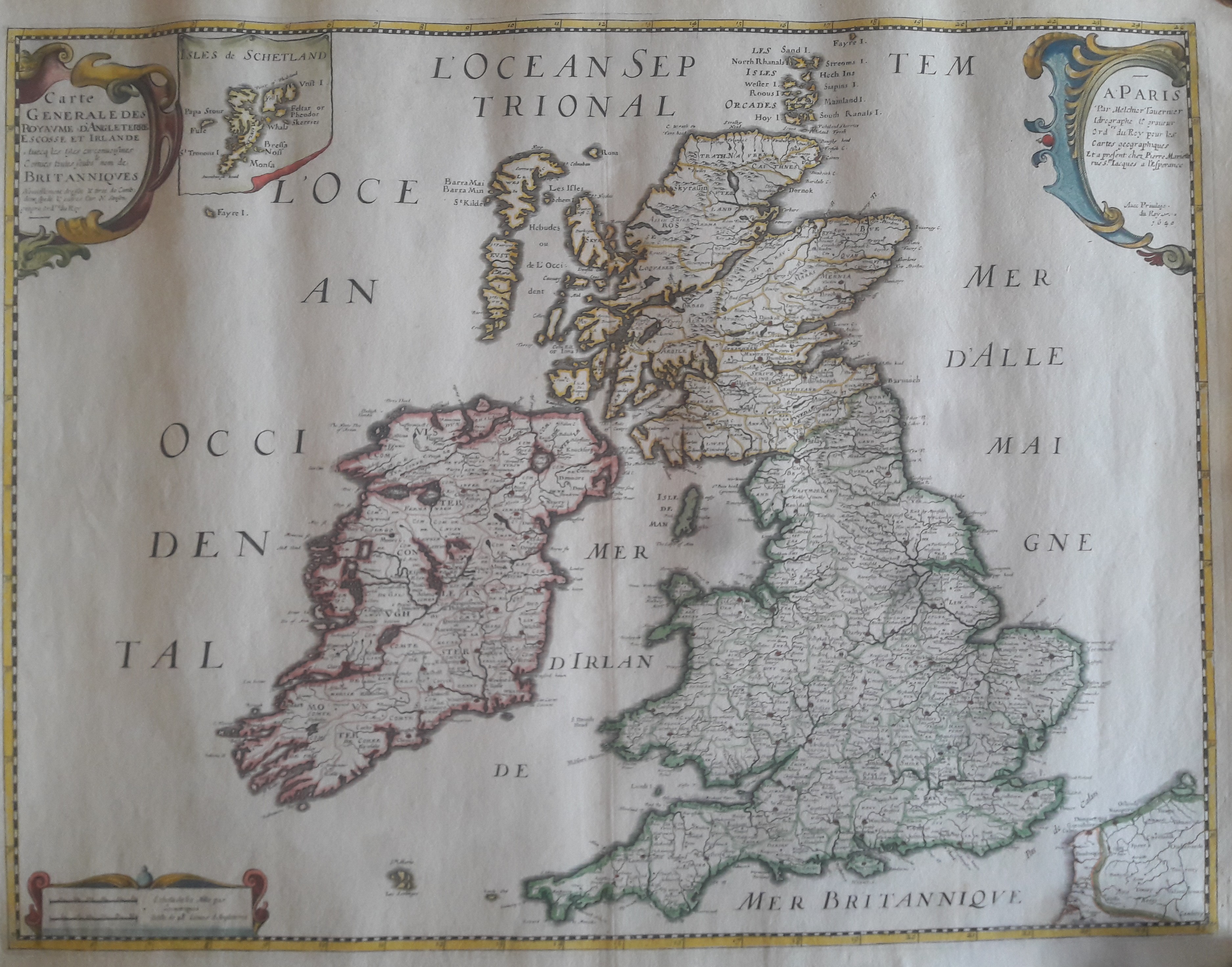
Map title
Carte generale des royaume d'Angleterre
Author
Sanson
Location shown in map
British Isles
Edition date
1640
Edition place
Paris
Editor
Melchior Tavenier
Atlas
Price
Please ask: info@thetreasuremaps.com
State
[mint/EXCELLENT/very good/good/fair/mediocre/poor]
Color
Old colors
Verso
Blank
Size
Plate: cm (52 x 39) inches (20.47 x 15.35) Paper: cm (57 x 44) inches (22.44 x 17.32)
Technique
Copper engraving
Note
No particular notes for this maps
Reference
Wiki
Here for more info
In stock
Available
Info
info@thetreasuremaps.com
Code
#0658
×
![Carte generale des royaume d'Angleterre by Sanson, British Isles, 1640]()
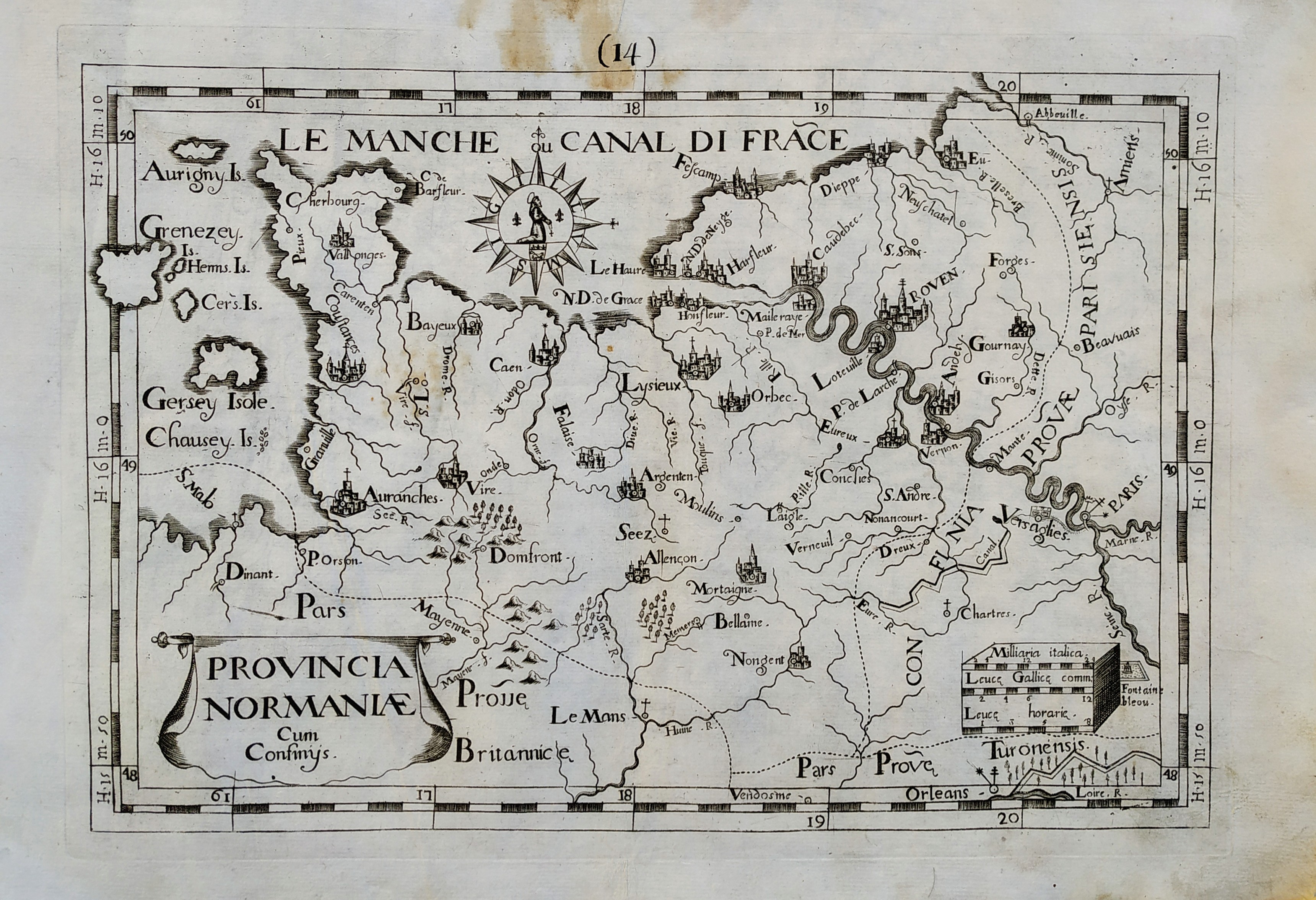
Map title
Provincia Normaniae
Author
Giovanni Battista de Cassine
Location shown in map
Normandie
Edition date
1712
Edition place
Milan
Editor
Ambrosii Ramellati
Atlas
Chorographica descriptio Provinciarum, et Conventuum FF. Min. S. Francisci Capucinorum
Price
Please ask: info@thetreasuremaps.com
State
[mint/EXCELLENT/very good/good/fair/mediocre/poor]
Color
Black/white
Verso
Blank
Size
Plate: cm (32 x 22) inches (12.6 x 8.66) Paper: cm (38 x 27) inches (14.96 x 10.63)
Technique
Copper engraving
Note
No particular notes for this maps.
Reference
--
Wiki
Here for more info
In stock
Available
Info
info@thetreasuremaps.com
Code
#0720
×
![Provincia Normaniae by Giovanni Battista de Cassine, Normandie, 1712]()
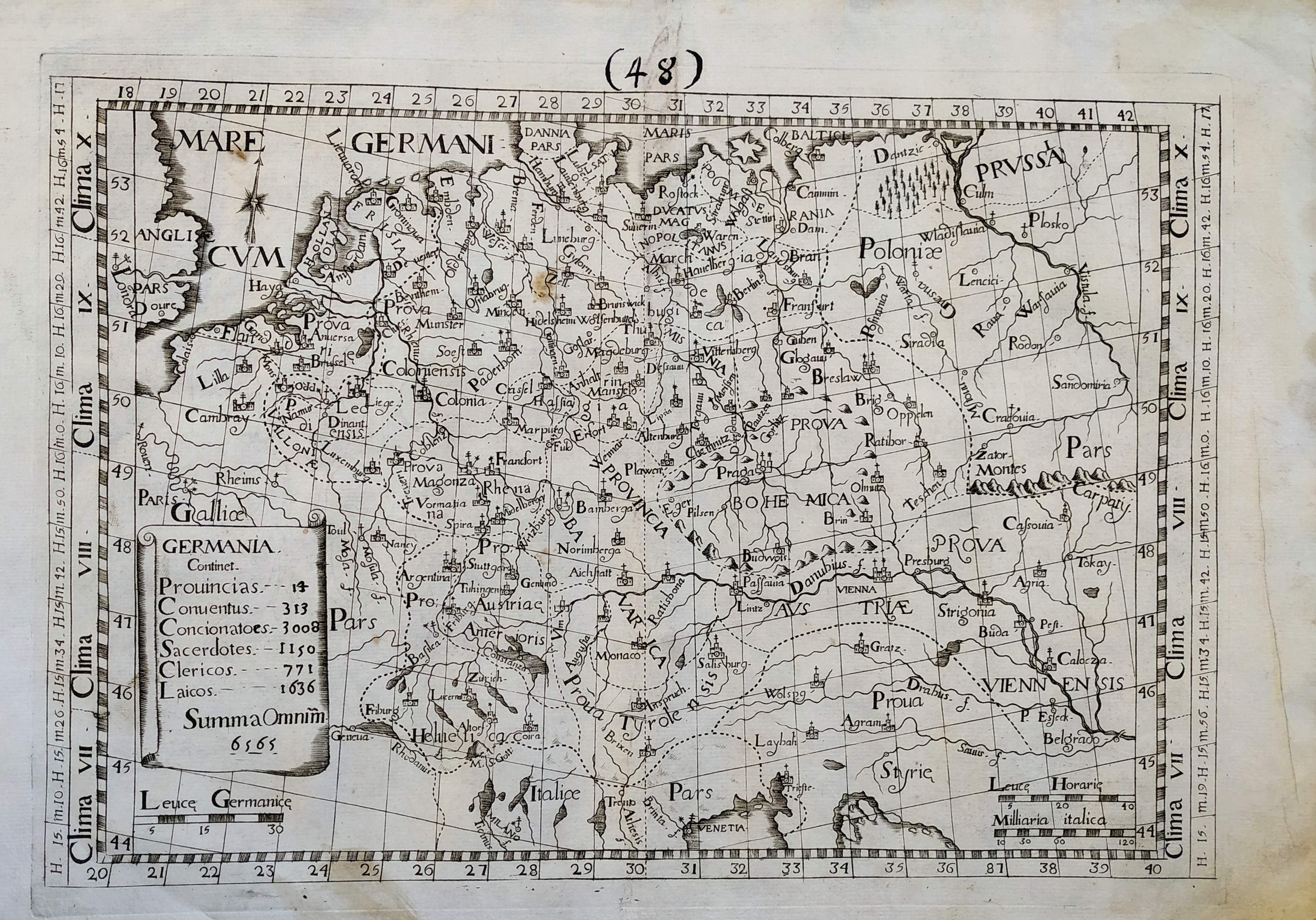
Map title
Germania
Author
Giovanni Battista de Cassine
Location shown in map
Germany
Edition date
1712
Edition place
Milan
Editor
Ambrosii Ramellati
Atlas
Chorographica descriptio Provinciarum, et Conventuum FF. Min. S. Francisci Capucinorum
Price
Please ask: info@thetreasuremaps.com
State
[mint/EXCELLENT/very good/good/fair/mediocre/poor]
Color
Black/white
Verso
Blank
Size
Plate: cm (32 x 22) inches (12.6 x 8.66) Paper: cm (38 x 27) inches (14.96 x 10.63)
Technique
Copper engraving
Note
No particular notes for this maps.
Reference
--
Wiki
Here for more info
In stock
Available
Info
info@thetreasuremaps.com
Code
#0721
×
![Germania by Giovanni Battista de Cassine, Germany, 1712]()
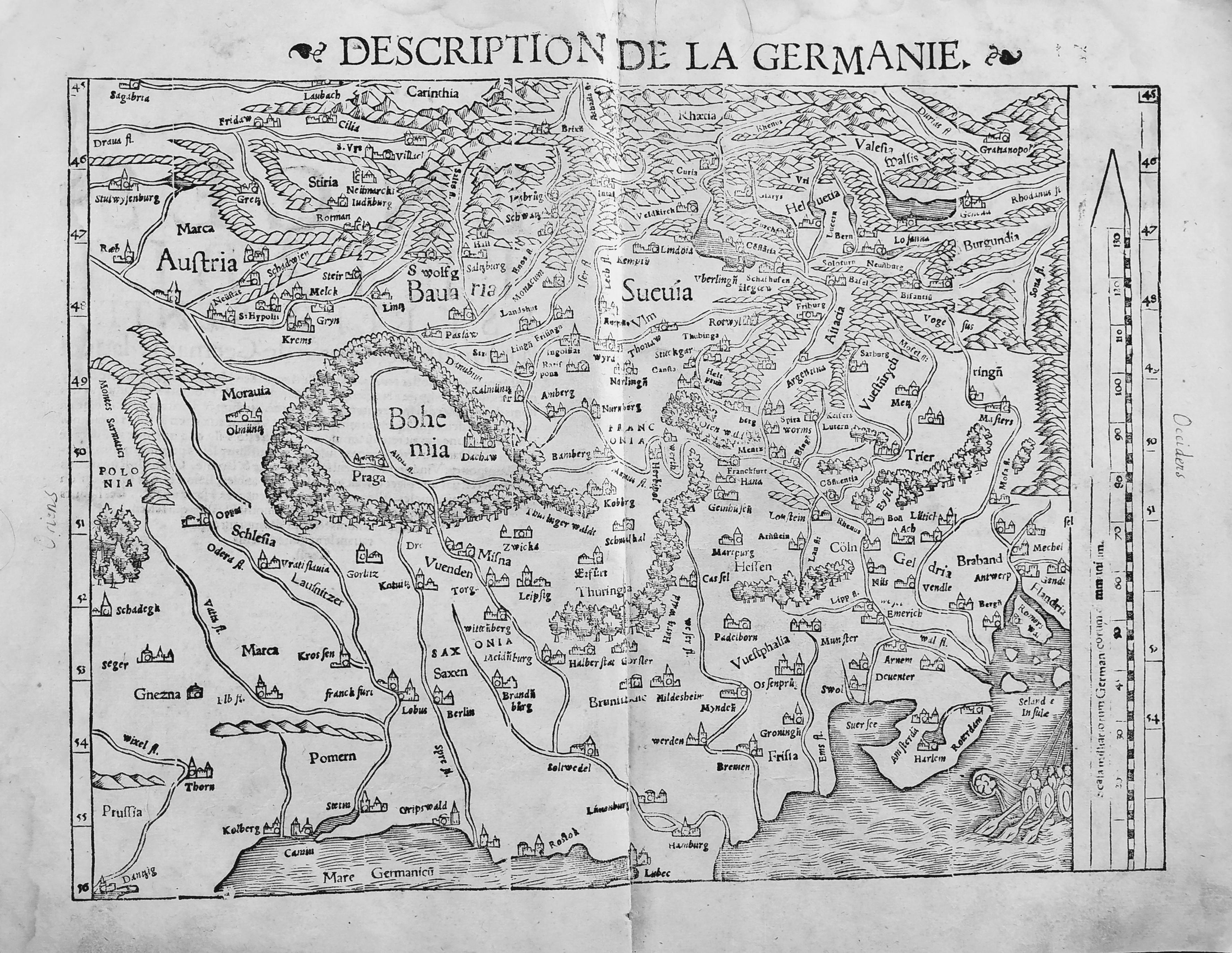
Map title
Description de la Germanie
Author
Munster
Location shown in map
Germany
Edition date
1552
Edition place
Basel
Editor
Henrich Petri
Atlas
Cosmographia Universalis
Price
300 Euro
State
[mint/EXCELLENT/very good/good/fair/mediocre/poor]
Color
Black/white
Verso
Franch text pag.6
Size
Plate: cm (34 x 25) inches (13.39 x 9.84) Paper: cm (39 x 30) inches (15.35 x 11.81)
Technique
Woodcut
Note
No particular notes for this maps.
Reference
--
Wiki
Here for more info
In stock
Available
Info
info@thetreasuremaps.com
Code
#0722
×
![Description de la Germanie by Munster, Germany, 1552]()
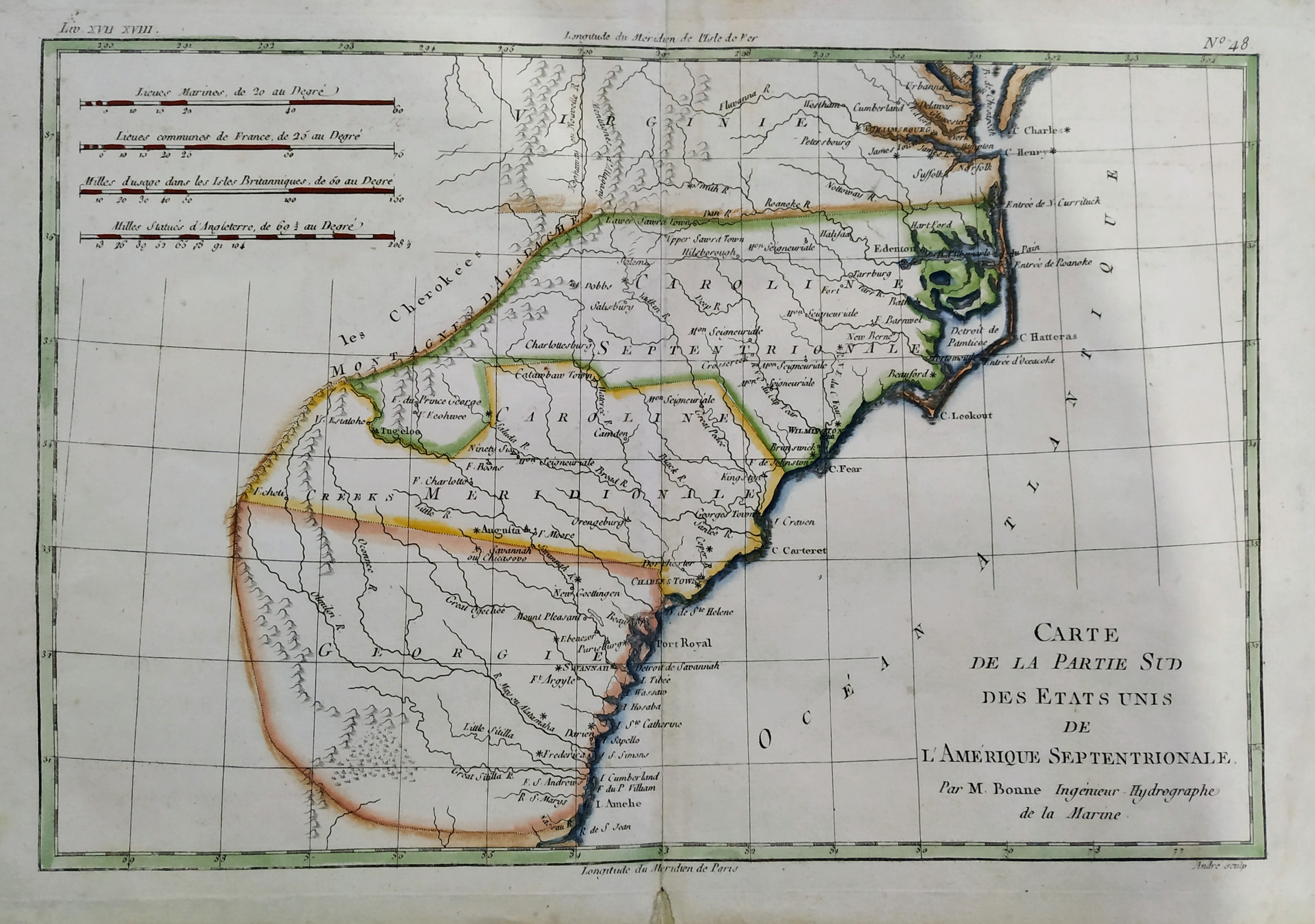
Map title
Carte De La Partie Sud, Des Etats Unis de L' Amerique Septentrionale
Author
Bonne
Location shown in map
East United States
Edition date
1787
Edition place
Paris
Editor
--
Atlas
Atlas Encyclopedique
Price
175 Euro
State
[mint/EXCELLENT/very good/good/fair/mediocre/poor]
Color
Old colors
Verso
Blank
Size
Plate: cm (31 x 21) inches (12.2 x 8.27) Paper: cm (36 x 25) inches (14.17 x 9.84)
Technique
Copper engraving
Note
No particular notes for this maps
Reference
--
Wiki
Here for more info
In stock
Available
Info
info@thetreasuremaps.com
Code
#0724
×
![Carte De La Partie Sud, Des Etats Unis de L' Amerique Septentrionale by Bonne, East United States, 1787]()