News
Map title
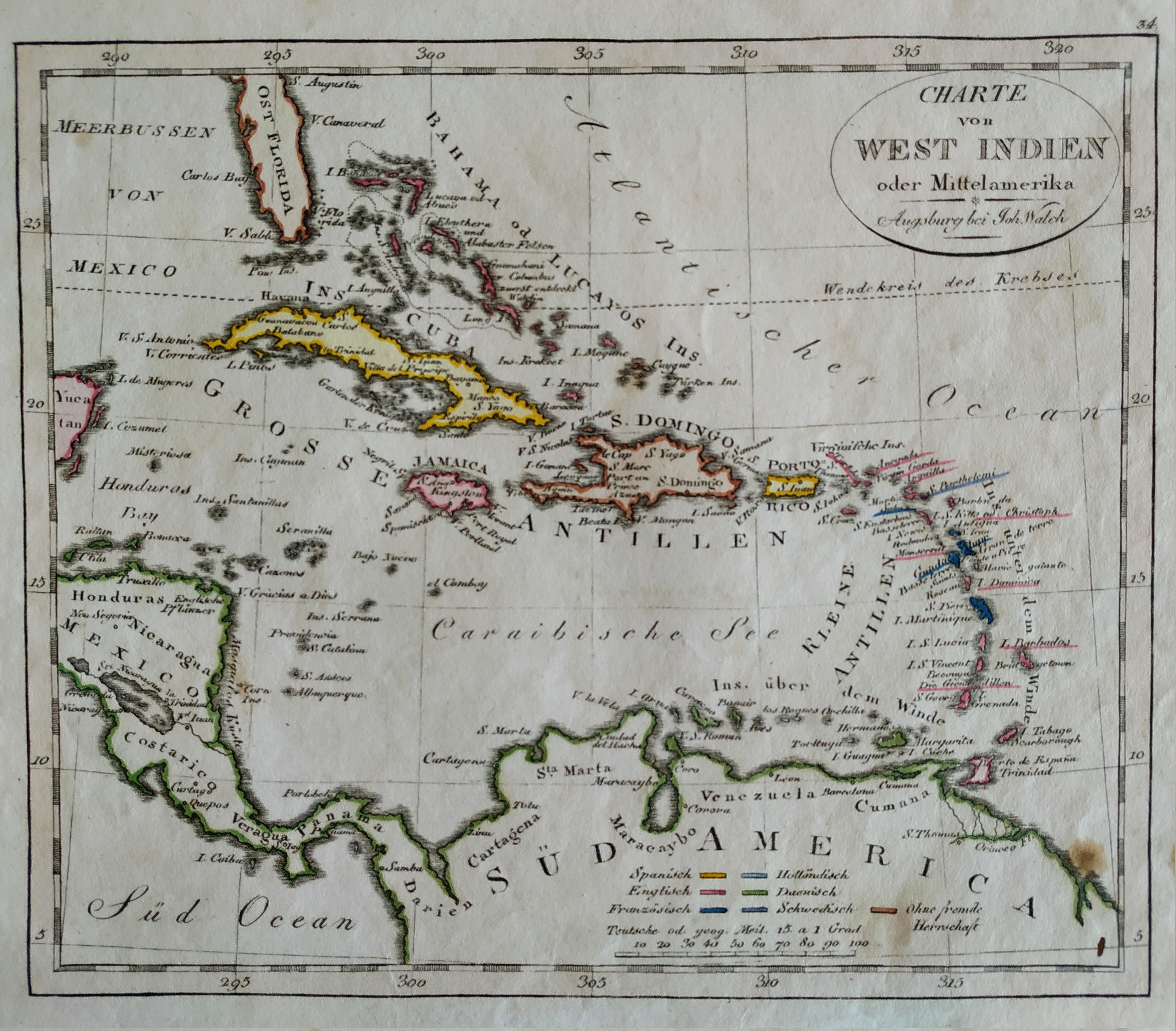
Charte von west Indien
Author
Johann Walch
Location shown in map
West Indies
Edition date
1820
Edition place
Hamburg
Editor
Atlas
Price
Please ask: info@thetreasuremaps.com
State
[mint/EXCELLENT/very good/good/fair/mediocre/poor]
Color
Old colors
Verso
Blank
Size
Plate: cm (21 x 18) inches (8.27 x 7.09) Paper: cm (26 x 22) inches (10.24 x 8.66)
Technique
Steel engraving
Note
No particular notes for this maps
Reference
Wiki
Here for more info
In stock
Available
Info
info@thetreasuremaps.com
Code
#0700
×
![Charte von west Indien by Johann Walch, West Indies, 1820]()
Map title
Nova descrittione dell isole britanniche
Author
Magini
Location shown in map
British Isles
Edition date
1621
Edition place
Padova
Editor
Paolo and Francesco Galignani
Atlas
Geografia di Claudio Tolomeo -- Giovanni Antonio Magini
Price
200 Euro
State
[MINT/excellent/very good/good/fair/mediocre/poor]
Color
Black/white
Verso
Italian text pag 24
Size
Plate: cm (17 x 12) inches (6.69 x 4.72) Paper: cm (20.3 x 30.5) inches (7.99 x 12.01)
Technique
Copper engraving
Note
No particular notes for this maps
Reference
--
Wiki
Here for more info
In stock
Available
Info
info@thetreasuremaps.com
Code
#0730
×
![Nova descrittione dell isole britanniche by Magini, British Isles, 1621]()
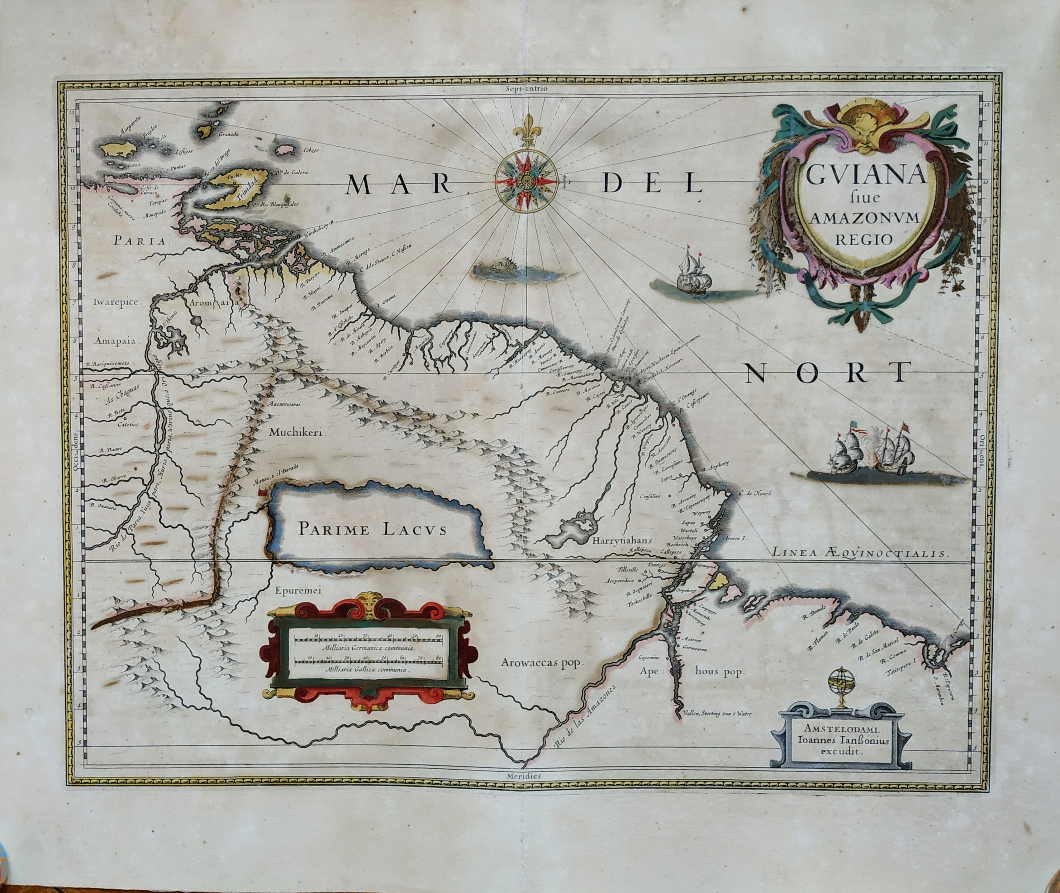
Map title
Guiana Sive Amazonum Regio
Author
Blaeu
Location shown in map
Guiana
Edition date
Circa 1641
Edition place
Amsterdam
Editor
Blaeu
Atlas
Price
400 Euro
State
[mint/EXCELLENT/very good/good/fair/mediocre/poor]
Color
Old colors
Verso
Latin text
Size
Plate: cm (48 x 37) inches (18.9 x 14.57) Paper: cm (59 x 48) inches (23.23 x 18.9)
Technique
Copper engraving
Note
No particular notes for this maps
Reference
Wiki
Here for more info
In stock
Available
Info
info@thetreasuremaps.com
Code
#0731
×
![Guiana Sive Amazonum Regio by Blaeu, Guiana, Circa 1641]()
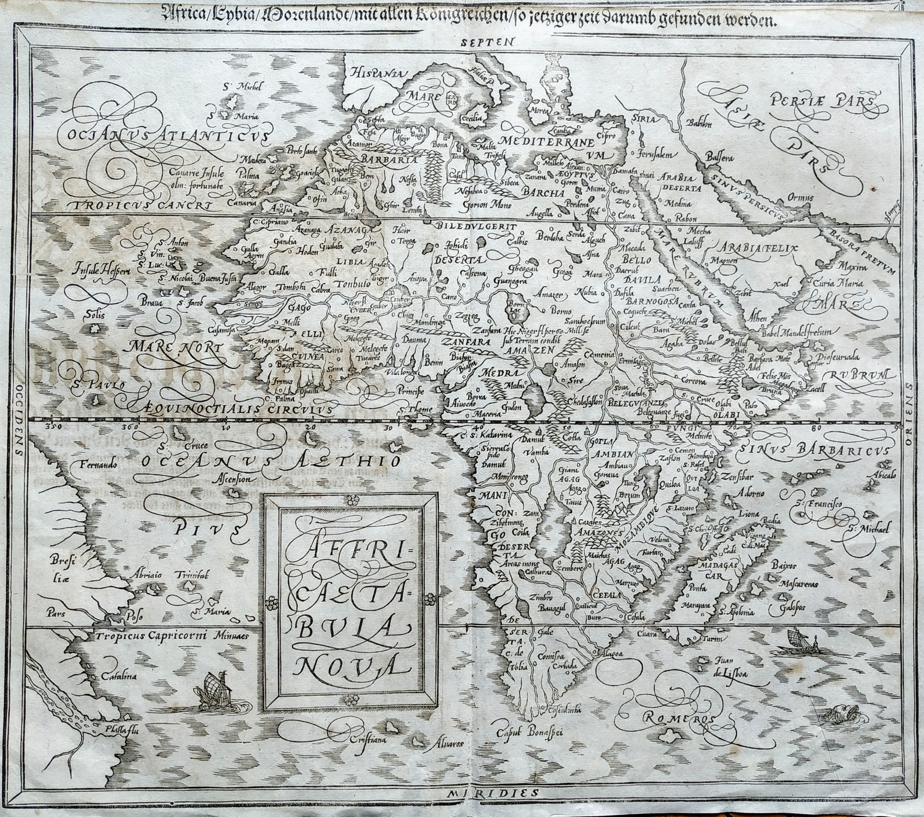
Map title
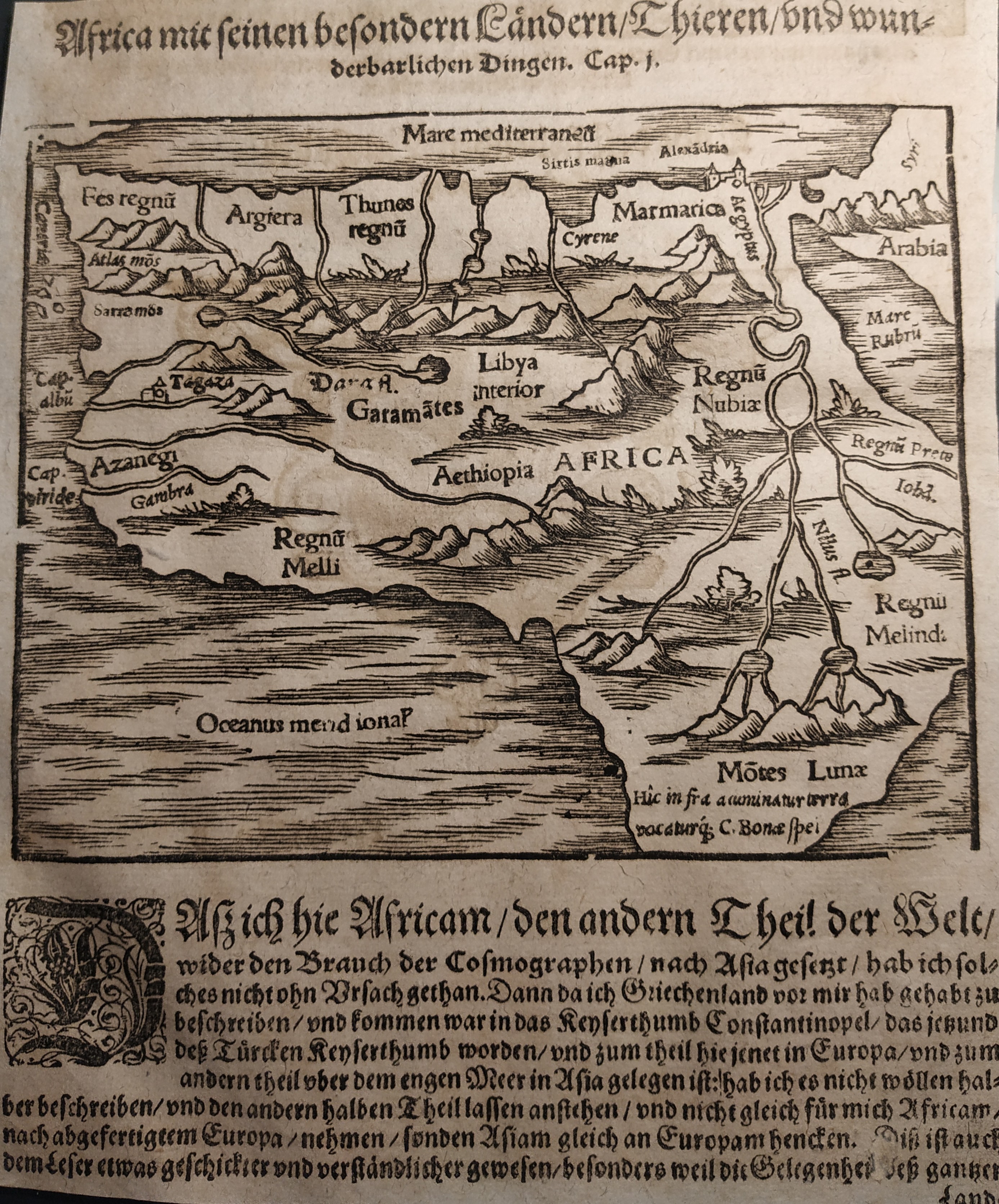
Africa Tabula Nova
Author
Munster
Location shown in map
Africa
Edition date
1598
Edition place
Basel
Editor
Henrich Petri
Atlas
Cosmographia Universalis
Price
400 Euro
State
[mint/excellent/VERY GOOD/good/fair/mediocre/poor]
Color
Black/white
Verso
German text
Size
Plate: cm (36 x 31) inches (14.17 x 12.2) Paper: cm (38 x 33) inches (14.96 x 12.99)
Technique
Woodcut
Note
No particular notes for this maps
Reference
--
Wiki
Here for more info
In stock
Available
Info
info@thetreasuremaps.com
Code
#0732
×
![Africa Tabula Nova by Munster, Africa, 1598]()
Map title
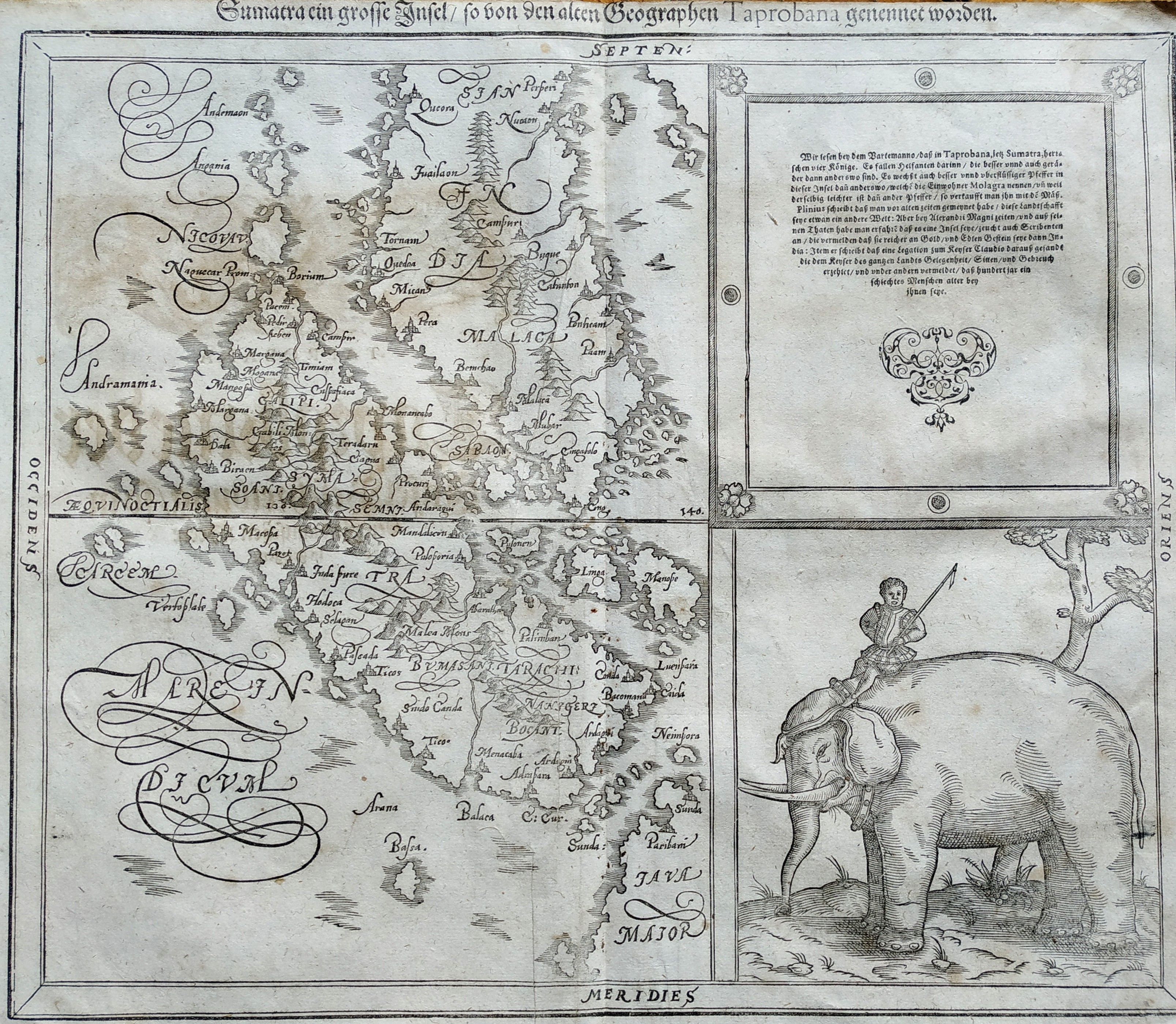
Sumatra
Author
Munster
Location shown in map
Sumatra
Edition date
1598
Edition place
Basel
Editor
Henrich Petri
Atlas
Cosmographia Universalis
Price
400 Euro
State
[mint/excellent/VERY GOOD/good/fair/mediocre/poor]
Color
Black/white
Verso
German text
Size
Plate: cm (57 x 47) inches (22.44 x 18.5) Paper: cm (66 x 55) inches (25.98 x 21.65)
Technique
Woodcut
Note
No particular notes for this maps
Reference
--
Wiki
Here for more info
In stock
Available
Info
info@thetreasuremaps.com
Code
#0733
Sumatra
Author
Munster
Location shown in map
Sumatra
Edition date
1598
Edition place
Basel
Editor
Henrich Petri
Atlas
Cosmographia Universalis
Price
400 Euro
State
[mint/excellent/VERY GOOD/good/fair/mediocre/poor]
Color
Black/white
Verso
German text
Size
Plate: cm (57 x 47) inches (22.44 x 18.5) Paper: cm (66 x 55) inches (25.98 x 21.65)
Technique
Woodcut
Note
No particular notes for this maps
Reference
--
Wiki
Here for more info
In stock
Available
Info
info@thetreasuremaps.com
Code
#0733
×
![Sumatra by Munster, Sumatra, 1598]()
Map title
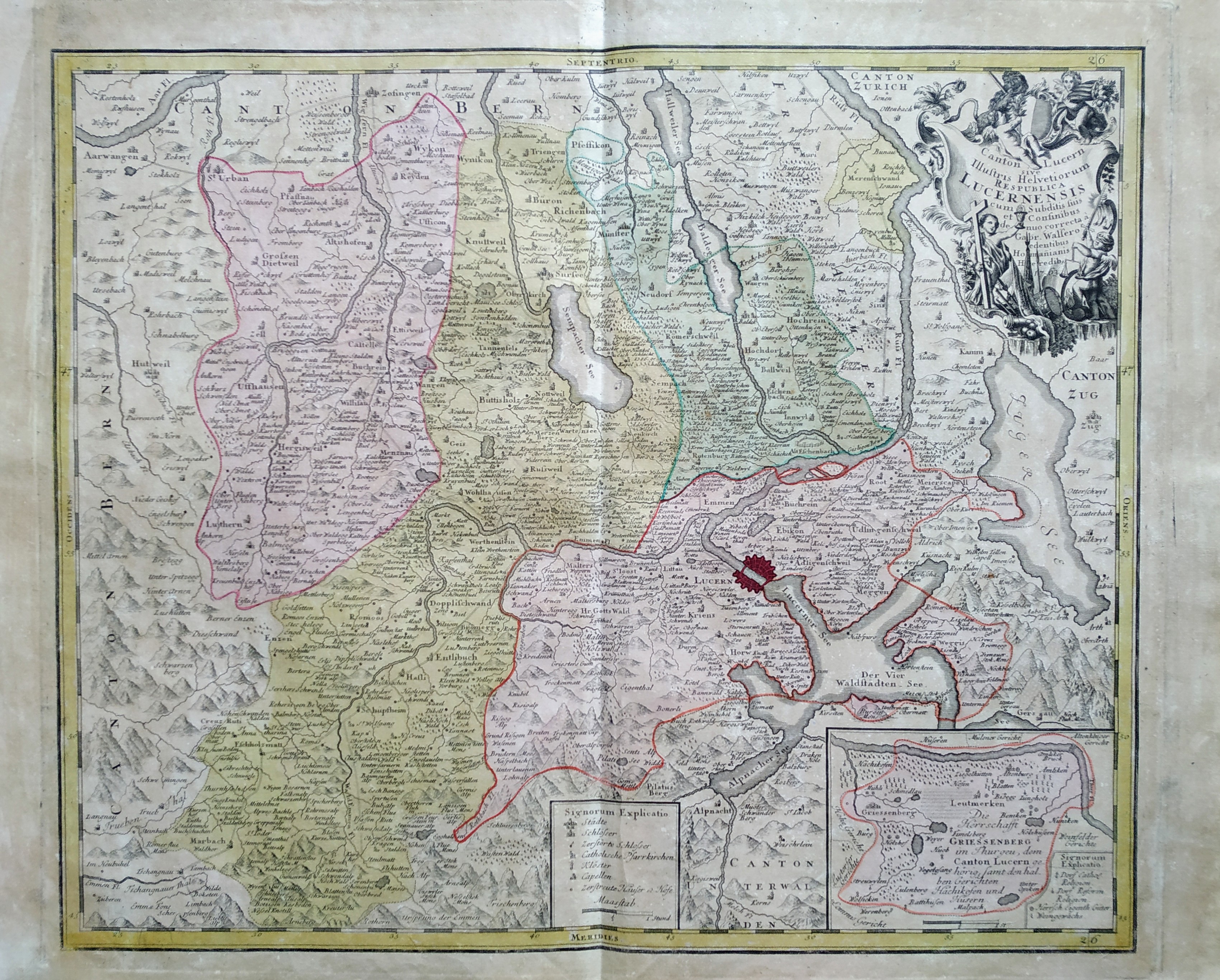
Canton Lucern sive illustris helvetiorum respublica Lucernensis cum subditis suis et confinibus
Author
Homann
Location shown in map
Lucerne
Edition date
1763
Edition place
Nuremberg
Editor
Atlas
Price
200 Euro
State
[mint/EXCELLENT/very good/good/fair/mediocre/poor]
Color
Old colors
Verso
Blank
Size
Plate: cm (51 x 59) inches (20.08 x 23.23) Paper: cm (55 x 64) inches (21.65 x 25.2)
Technique
Copper engraving
Note
Reference
Wiki
Here for more info
In stock
Available
Info
info@thetreasuremaps.com
Code
#0735
×
![Canton Lucern sive illustris helvetiorum respublica Lucernensis cum subditis suis et confinibus by Homann, Lucerne, 1763]()
Map title
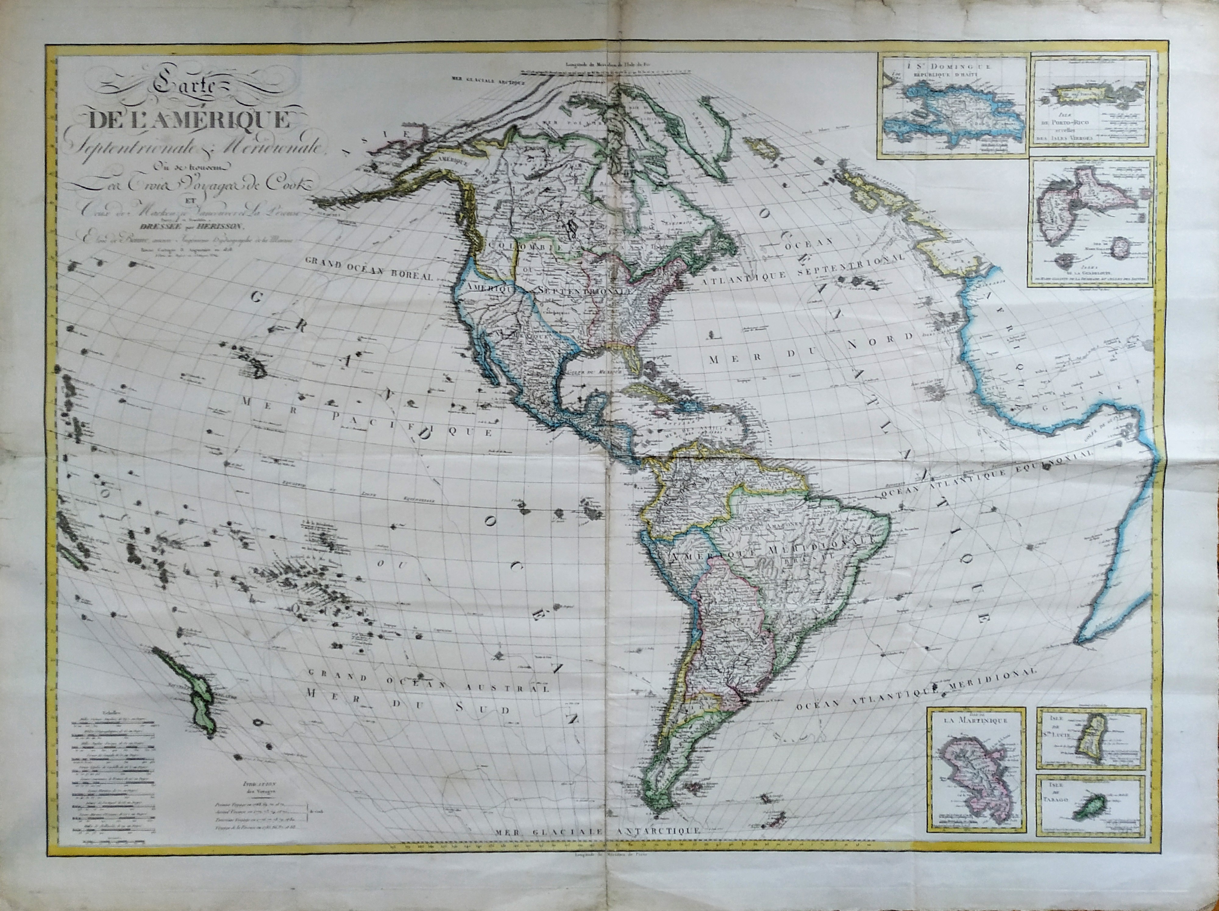
Carte de l'Amerique Septentrionale & Meridionale
Author
Bonne
Location shown in map
Americas
Edition date
1828
Edition place
Paris
Editor
Atlas
Price
Please ask: info@thetreasuremaps.com
State
[mint/excellent/VERY GOOD/good/fair/mediocre/poor]
Color
Old colors
Verso
Blank
Size
Plate: cm (118 x 85) inches (46.46 x 33.46) Paper: cm (130 x 97) inches (51.18 x 38.19)
Technique
Copper engraving
Note
No particular notes for this maps
Reference
Wiki
Here for more info
In stock
Available
Info
info@thetreasuremaps.com
Code
#0736
×
![Carte de l'Amerique Septentrionale & Meridionale by Bonne, Americas, 1828]()
Map title
Africa
Author
Munster
Location shown in map
Africa
Edition date
Circa 1550
Edition place
Basel
Editor
Henrich Petri
Atlas
Cosmographia Universalis
Price
150 Euro
State
[mint/EXCELLENT/very good/good/fair/mediocre/poor]
Color
Black/white
Verso
German text
Size
Plate: cm (16 x 13) inches (6.3 x 5.12) Paper: cm (17 x 21) inches (6.69 x 8.27)
Technique
Woodcut
Note
No particular notes for this maps
Reference
Wiki
Here for more info
In stock
Available
Info
info@thetreasuremaps.com
Code
#0737
Africa
Author
Munster
Location shown in map
Africa
Edition date
Circa 1550
Edition place
Basel
Editor
Henrich Petri
Atlas
Cosmographia Universalis
Price
150 Euro
State
[mint/EXCELLENT/very good/good/fair/mediocre/poor]
Color
Black/white
Verso
German text
Size
Plate: cm (16 x 13) inches (6.3 x 5.12) Paper: cm (17 x 21) inches (6.69 x 8.27)
Technique
Woodcut
Note
No particular notes for this maps
Reference
Wiki
Here for more info
In stock
Available
Info
info@thetreasuremaps.com
Code
#0737
×
![Africa by Munster, Africa, Circa 1550]()
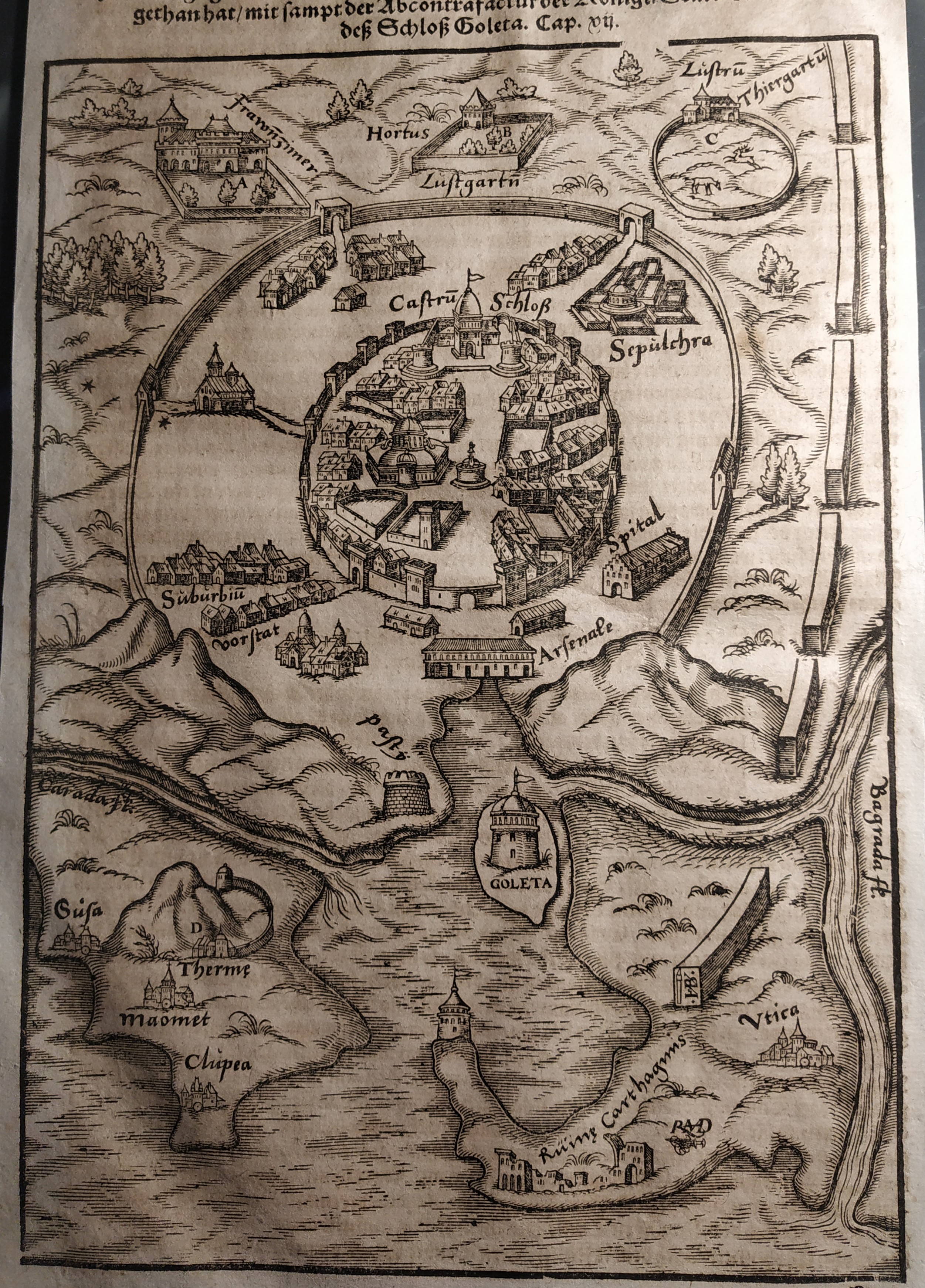
Map title
Goleta
Author
Munster
Location shown in map
Tunis
Edition date
Circa 1550
Edition place
Basel
Editor
Henrich Petri
Atlas
Cosmographia Universalis
Price
Please ask: info@thetreasuremaps.com
State
[mint/EXCELLENT/very good/good/fair/mediocre/poor]
Color
Black/white
Verso
German text
Size
Plate: cm (17 x 24) inches (6.69 x 9.45) Paper: cm (18 x 30) inches (7.09 x 11.81)
Technique
Woodcut
Note
No particular notes for this maps
Reference
Wiki
Here for more info
In stock
Available
Info
info@thetreasuremaps.com
Code
#0738
×
![Goleta by Munster, Tunis, Circa 1550]()
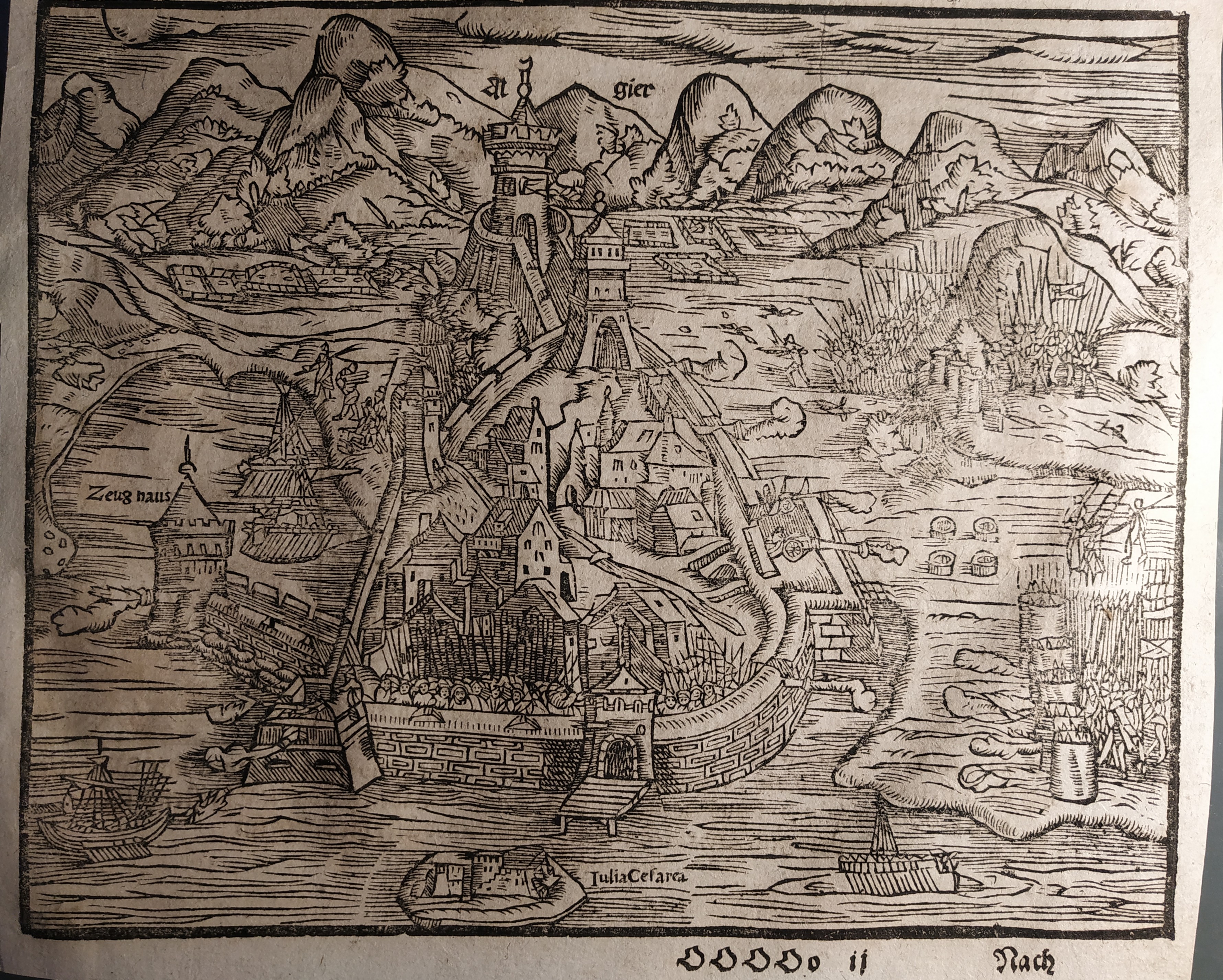
Map title
Algiers
Author
Munster
Location shown in map
Algiers
Edition date
Circa 1550
Edition place
Basel
Editor
Henrich Petri
Atlas
Cosmographia Universalis
Price
Please ask: info@thetreasuremaps.com
State
[mint/EXCELLENT/very good/good/fair/mediocre/poor]
Color
Black/white
Verso
German text
Size
Plate: cm (11 x 15) inches (4.33 x 5.91) Paper: cm (13 x 21) inches (5.12 x 8.27)
Technique
Woodcut
Note
No particular notes for this maps
Reference
Wiki
Here for more info
In stock
Available
Info
info@thetreasuremaps.com
Code
#0739
Algiers
Author
Munster
Location shown in map
Algiers
Edition date
Circa 1550
Edition place
Basel
Editor
Henrich Petri
Atlas
Cosmographia Universalis
Price
Please ask: info@thetreasuremaps.com
State
[mint/EXCELLENT/very good/good/fair/mediocre/poor]
Color
Black/white
Verso
German text
Size
Plate: cm (11 x 15) inches (4.33 x 5.91) Paper: cm (13 x 21) inches (5.12 x 8.27)
Technique
Woodcut
Note
No particular notes for this maps
Reference
Wiki
Here for more info
In stock
Available
Info
info@thetreasuremaps.com
Code
#0739
×
![Algiers by Munster, Algiers, Circa 1550]()
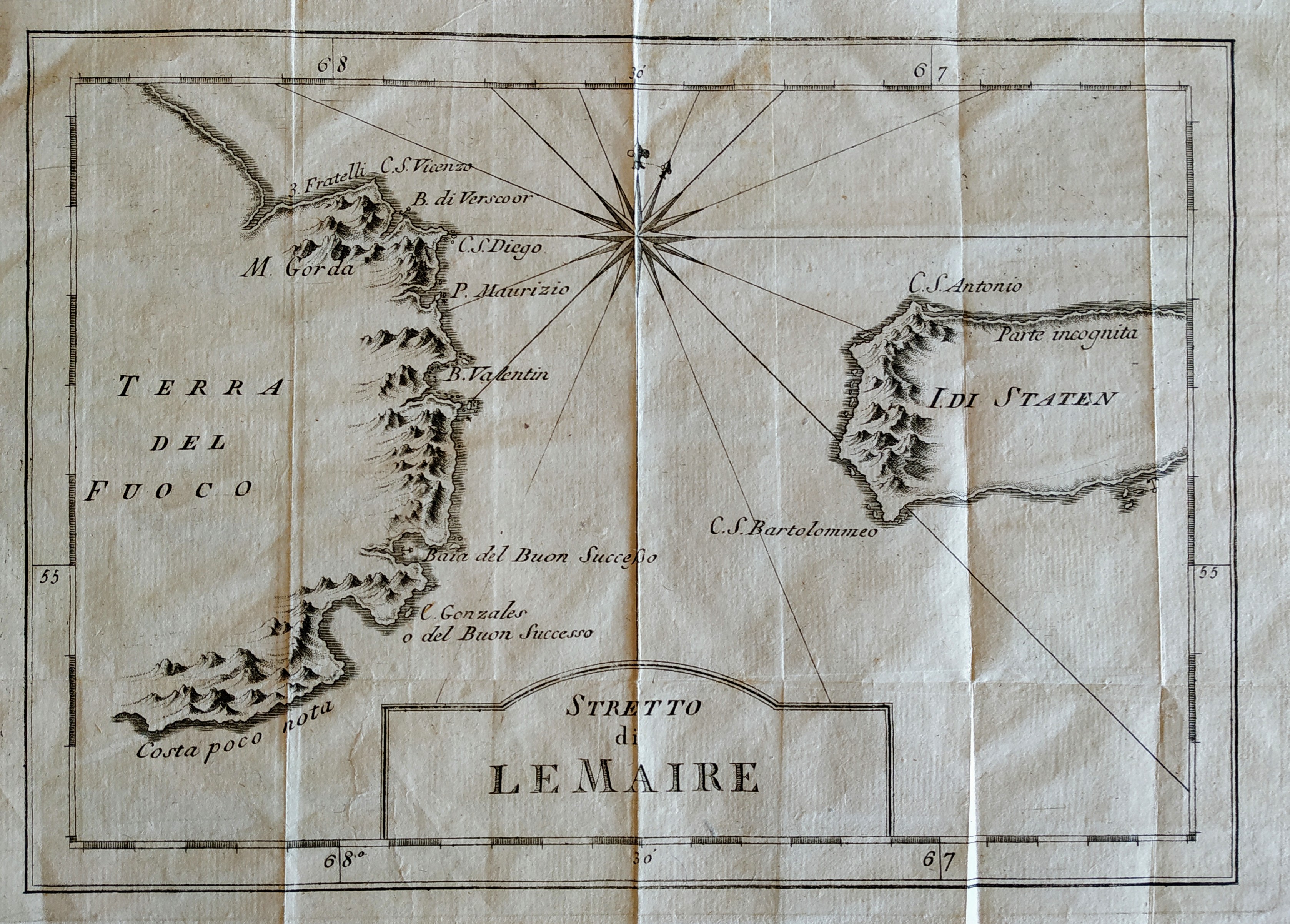
Map title
Stretto di Le Maire
Author
Bellin
Location shown in map
Magellan straits
Edition date
1757
Edition place
Paris
Editor
Prevost
Atlas
Historie General des Voyages -- Prevost
Price
75 Euro
State
[mint/EXCELLENT/very good/good/fair/mediocre/poor]
Color
Black/white
Verso
Blank
Size
Plate: cm (27 x 19) inches (10.63 x 7.48) Paper: cm (32 x 26) inches (12.6 x 10.24)
Technique
Copper engraving
Note
No particular notes for this maps
Reference
--
Wiki
Here for more info
In stock
Available
Info
info@thetreasuremaps.com
Code
#0669
×
![Stretto di Le Maire by Bellin, Magellan straits, 1757]()
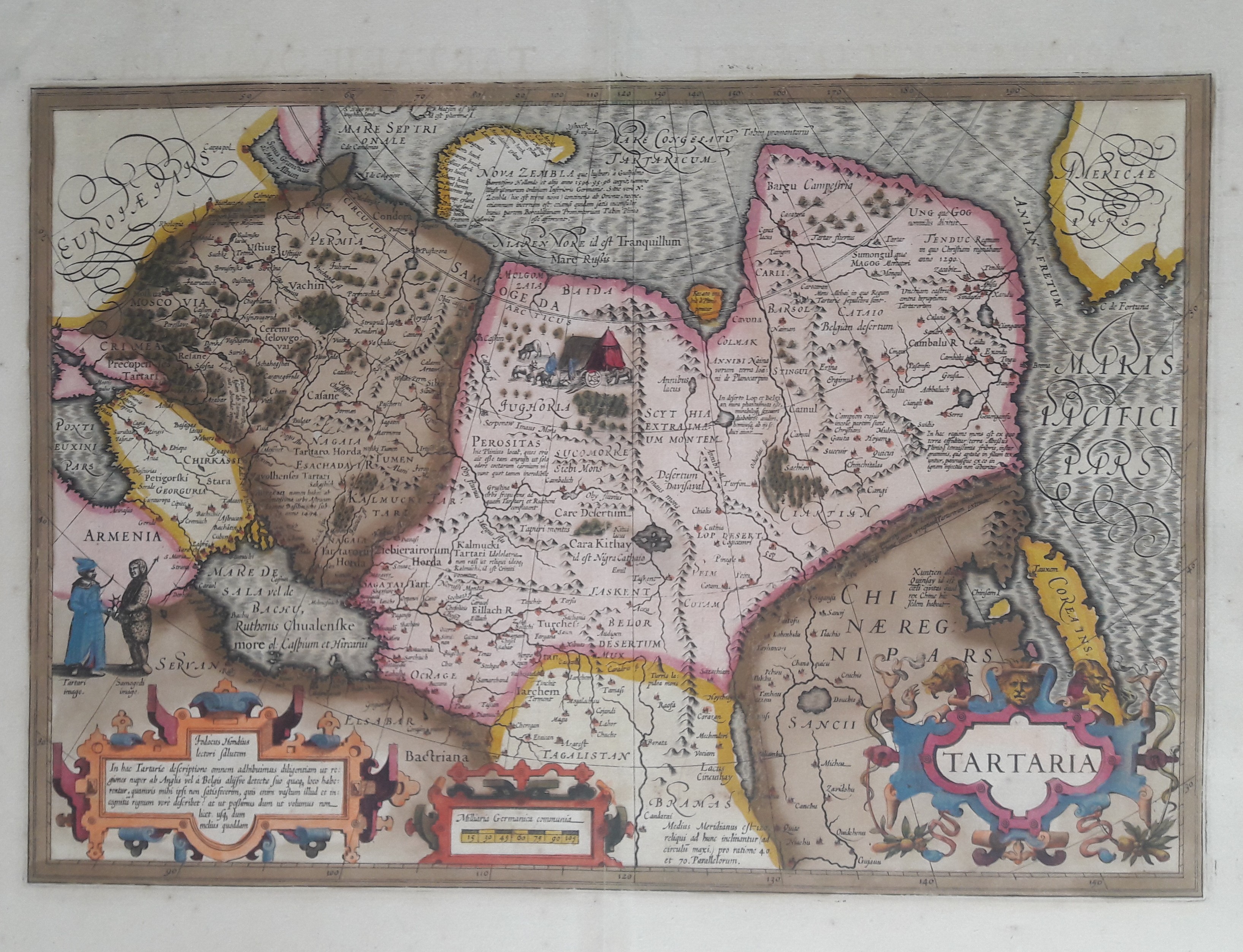
Map title
Tartaria
Author
Hondius
Location shown in map
Russia
Edition date
1606
Edition place
Amsterdam
Editor
Atlas
Atlas Maioris
Price
600 Euro
State
[mint/EXCELLENT/very good/good/fair/mediocre/poor]
Color
Old colors
Verso
Franch text 336
Size
Plate: cm (49 x 33) inches (19.29 x 12.99) Paper: cm (58 x 47) inches (22.83 x 18.5)
Technique
Copper engraving
Note
Professionally repaired
Reference
Wiki
Here for more info
In stock
Available
Info
info@thetreasuremaps.com
Code
#0656
×
![Tartaria by Hondius, Russia, 1606]()
Map title
L'isola d'Islanda
Author
Coronelli
Location shown in map
Iceland
Edition date
Circa 1697
Edition place
Venice
Editor
Coronelli
Atlas
Atlante veneto
Price
400 Euro
State
[mint/EXCELLENT/very good/good/fair/mediocre/poor]
Color
Black/white
Verso
Blank
Size
Plate: cm (31 x 23) inches (12.2 x 9.06) Paper: cm (40 x 30) inches (15.75 x 11.81)
Technique
Copper engraving
Note
No particular notes for this maps.
Reference
--
Wiki
Here for more info
In stock
Available
Info
info@thetreasuremaps.com
Code
#0745
×
![L'isola d'Islanda by Coronelli, Iceland, Circa 1697]()
Map title
Plan de la ville de Buenos-Ayres
Author
Bellin
Location shown in map
Buenos Aires
Edition date
1757
Edition place
Paris
Editor
Prevost
Atlas
Historie General des Voyages -- Prevost
Price
150 Euro
State
[mint/EXCELLENT/very good/good/fair/mediocre/poor]
Color
Black/white
Verso
Blank
Size
Plate: cm (27 x 18) inches (10.63 x 7.09) Paper: cm (36 x 51) inches (14.17 x 20.08)
Technique
Copper engraving
Note
No particular notes for this maps
Reference
--
Wiki
Here for more info
In stock
Available
Info
info@thetreasuremaps.com
Code
#0758
×
![Plan de la ville de Buenos-Ayres by Bellin, Buenos Aires, 1757]()
Map title
Carte generale des royaume d'Angleterre
Author
Sanson
Location shown in map
British Isles
Edition date
1658
Edition place
Paris
Editor
Melchior Tavenier
Atlas
Price
350 Euro
State
[mint/excellent/VERY GOOD/good/fair/mediocre/poor]
Color
Old colors
Verso
Blank
Size
Plate: cm (52 x 39) inches (20.47 x 15.35) Paper: cm (57 x 44) inches (22.44 x 17.32)
Technique
Copper engraving
Note
Reference
Wiki
Here for more info
In stock
Available
Info
info@thetreasuremaps.com
Code
#1173
×
![Carte generale des royaume d'Angleterre by Sanson, British Isles, 1658]()
Map title
Villes de la Province de Kiang-Nan
Author
Henri Scheurleer
Location shown in map
Jangsung
Edition date
1736
Edition place
The Haugue
Editor
Atlas
Description de la Chine
Price
50 Euro
State
[mint/EXCELLENT/very good/good/fair/mediocre/poor]
Color
Old colors
Verso
Blank
Size
Plate: cm (17 x 19) inches (6.69 x 7.48) Paper: cm (20 x 26) inches (7.87 x 10.24)
Technique
Copper engraving
Note
No particular notes for this maps
Reference
Wiki
Here for more info
In stock
Available
Info
info@thetreasuremaps.com
Code
#0704
×
![Villes de la Province de Kiang-Nan by Henri Scheurleer, Jangsung, 1736]()
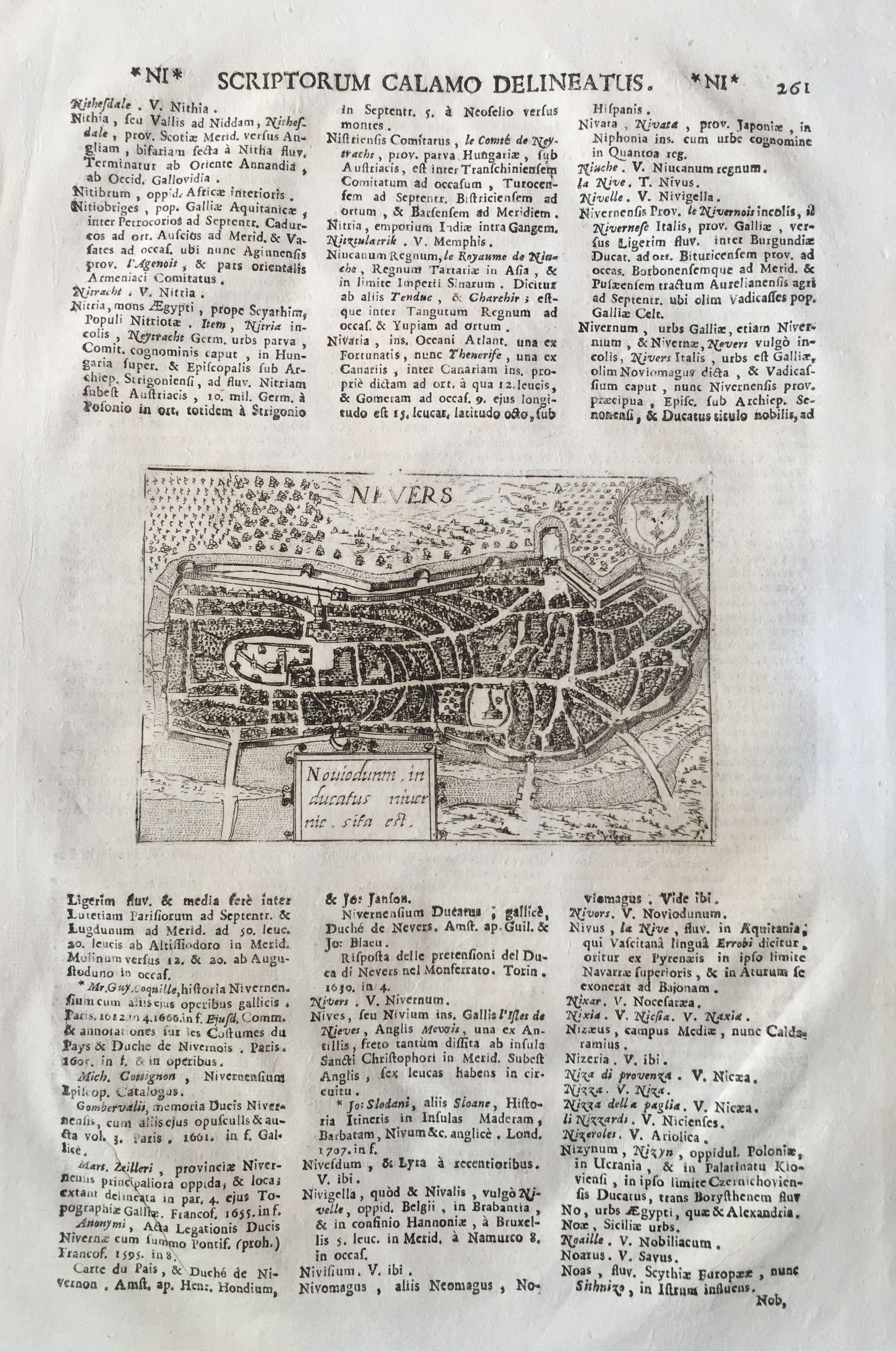
Map title
Nevers
Author
Magini
Location shown in map
Nevers
Edition date
1713
Edition place
Padua
Editor
Cadorin
Atlas
Universus terrarum orbis scriptorum calamo delineatus
Price
100 Euro
State
[mint/EXCELLENT/very good/good/fair/mediocre/poor]
Color
Black/white
Verso
Latin text pag.262
Size
Plate: cm (14 x 9) inches (5.51 x 3.54) Paper: cm (21 x 33) inches (8.27 x 12.99)
Technique
Copper engraving
Note
Alphonse Lasor a Varea
Reference
Wiki
Here for more info
In stock
Available
Info
info@thetreasuremaps.com
Code
#0665
Nevers
Author
Magini
Location shown in map
Nevers
Edition date
1713
Edition place
Padua
Editor
Cadorin
Atlas
Universus terrarum orbis scriptorum calamo delineatus
Price
100 Euro
State
[mint/EXCELLENT/very good/good/fair/mediocre/poor]
Color
Black/white
Verso
Latin text pag.262
Size
Plate: cm (14 x 9) inches (5.51 x 3.54) Paper: cm (21 x 33) inches (8.27 x 12.99)
Technique
Copper engraving
Note
Alphonse Lasor a Varea
Reference
Wiki
Here for more info
In stock
Available
Info
info@thetreasuremaps.com
Code
#0665
×
![Nevers by Magini, Nevers, 1713]()
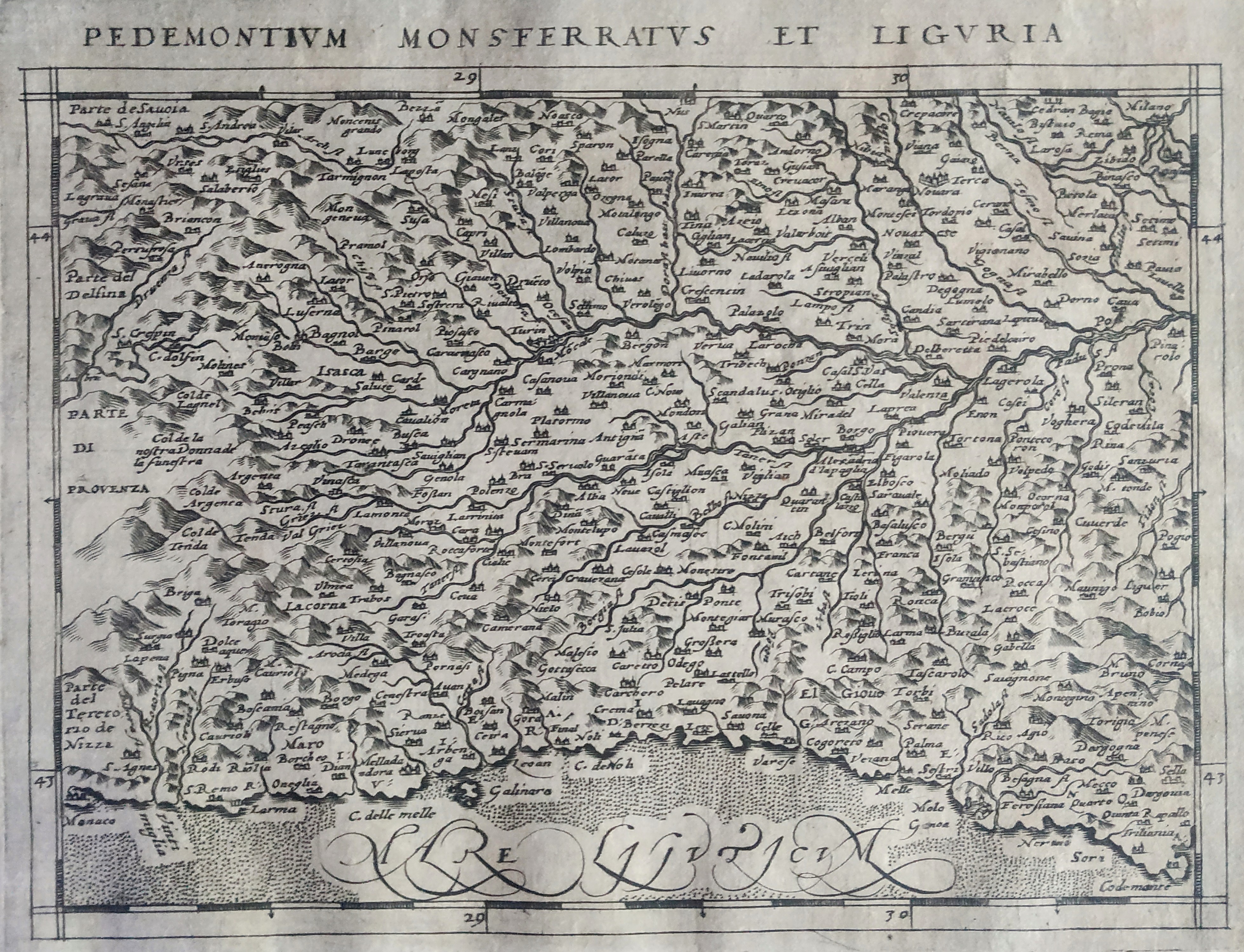
Map title
Pedemontium Monsferratus et Liguria
Author
Magini
Location shown in map
North-West Italy
Edition date
1597
Edition place
Cologne
Editor
Petrus Keschedt
Atlas
Geografia di Claudio Tolomeo -- Giovanni Antonio Magini
Price
Please ask: info@thetreasuremaps.com
State
[mint/EXCELLENT/very good/good/fair/mediocre/poor]
Color
Black/white
Verso
Latin text pag 106
Size
Plate: cm (18 x 13.5) inches (7.09 x 5.31) Paper: cm (23 x 16) inches (9.06 x 6.3)
Technique
Copper engraving
Note
Maps pirated from those of Girolamo Poro in Magini's edition.
Reference
--
Wiki
Here for more info
In stock
Available
Info
info@thetreasuremaps.com
Code
#0828
×
![Pedemontium Monsferratus et Liguria by Magini, North-West Italy, 1597]()
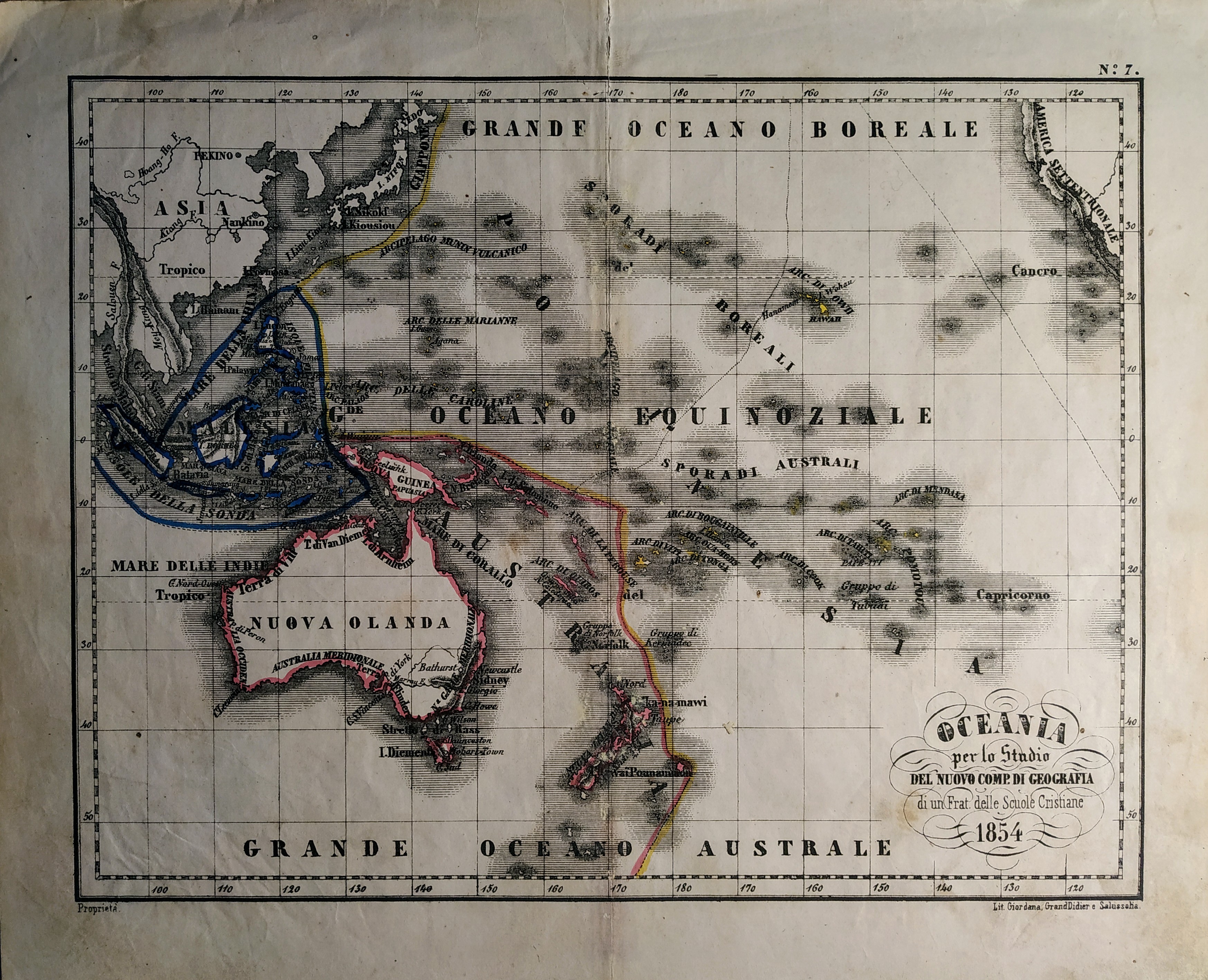
Map title
Oceania
Author
Unknown
Location shown in map
Oceania
Edition date
1854
Edition place
Torino
Editor
Unione tipografico editrice
Atlas
Atlente geografico per lo studio del nuovo compendio di geografia di un Frat. delle scuole cristiane
Price
50 Euro
State
[mint/excellent/VERY GOOD/good/fair/mediocre/poor]
Color
Old colors
Verso
Blank
Size
Plate: cm (27 x 21) inches (10.63 x 8.27) Paper: cm (32 x 25) inches (12.6 x 9.84)
Technique
Steel engraving
Note
No particular notes for this maps.
Reference
Wiki
Here for more info
In stock
Available
Info
info@thetreasuremaps.com
Code
#0710
Oceania
Author
Unknown
Location shown in map
Oceania
Edition date
1854
Edition place
Torino
Editor
Unione tipografico editrice
Atlas
Atlente geografico per lo studio del nuovo compendio di geografia di un Frat. delle scuole cristiane
Price
50 Euro
State
[mint/excellent/VERY GOOD/good/fair/mediocre/poor]
Color
Old colors
Verso
Blank
Size
Plate: cm (27 x 21) inches (10.63 x 8.27) Paper: cm (32 x 25) inches (12.6 x 9.84)
Technique
Steel engraving
Note
No particular notes for this maps.
Reference
Wiki
Here for more info
In stock
Available
Info
info@thetreasuremaps.com
Code
#0710
×
![Oceania by Unknown, Oceania, 1854]()
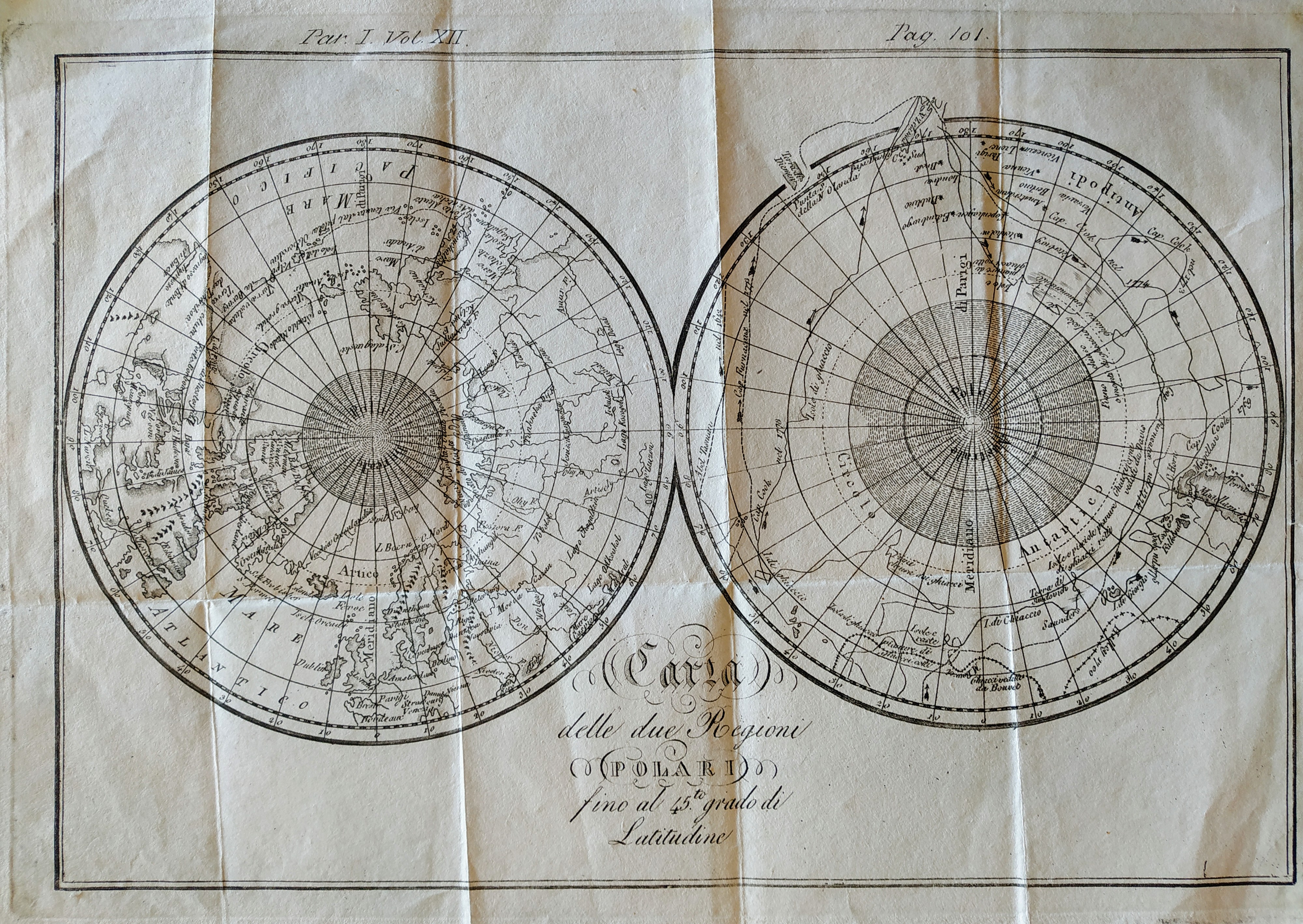
Map title
Carta delle due regioni polari
Author
Unknown
Location shown in map
Polar
Edition date
Circa 1800
Edition place
Editor
Atlas
Price
Please ask: info@thetreasuremaps.com
State
[mint/EXCELLENT/very good/good/fair/mediocre/poor]
Color
Black/white
Verso
Blank
Size
Plate: cm (27 x 19) inches (10.63 x 7.48) Paper: cm (30 x 22) inches (11.81 x 8.66)
Technique
Copper engraving
Note
No particular notes for this maps.
Reference
Wiki
Here for more info
In stock
Available
Info
info@thetreasuremaps.com
Code
#0701
×
![Carta delle due regioni polari by Unknown, Polar, Circa 1800]()