News
Map title
Tabula Asiae IX
Author
Magini
Location shown in map
Pakistan
Edition date
1597
Edition place
Cologne
Editor
Petrus Keschedt
Atlas
Geografia di Claudio Tolomeo -- Giovanni Antonio Magini
Price
Please ask: info@thetreasuremaps.com
State
[mint/EXCELLENT/very good/good/fair/mediocre/poor]
Color
Black/white
Verso
Latin text pag 24
Size
Plate: cm (17.8 x 15) inches (7.01 x 5.91) Paper: cm (22.9 x 16.5) inches (9.02 x 6.5)
Technique
Copper engraving
Note
Maps pirated from those of Girolamo Poro in Magini's edition.
Reference
--
Wiki
Here for more info
In stock
Available
Info
info@thetreasuremaps.com
Code
#0718
×
![Tabula Asiae IX by Magini, Pakistan, 1597]()
Map title
Tabula Asiae VII
Author
Magini
Location shown in map
Iran
Edition date
1597
Edition place
Cologne
Editor
Petrus Keschedt
Atlas
Geografia di Claudio Tolomeo -- Giovanni Antonio Magini
Price
Please ask: info@thetreasuremaps.com
State
[mint/EXCELLENT/very good/good/fair/mediocre/poor]
Color
Black/white
Verso
Latin text pag 22
Size
Plate: cm (17.8 x 12.7) inches (7.01 x 5) Paper: cm (22.9 x 16.5) inches (9.02 x 6.5)
Technique
Copper engraving
Note
Maps pirated from those of Girolamo Poro in Magini's edition.
Reference
--
Wiki
Here for more info
In stock
Available
Info
info@thetreasuremaps.com
Code
#0719
×
![Tabula Asiae VII by Magini, Iran, 1597]()
Map title
Tabula Islandiae Auctore Georgio Carolo Flandro
Author
Jansson
Location shown in map
Iceland
Edition date
Circa 1634
Edition place
Amsterdam
Editor
Jansson
Atlas
Atlantis Maioris Appendix
Price
1100 Euro
State
[mint/EXCELLENT/very good/good/fair/mediocre/poor]
Color
Old colors
Verso
Latin text pag 3
Size
Plate: cm (48 x 37) inches (18.9 x 14.57) Paper: cm (55 x 44) inches (21.65 x 17.32)
Technique
Copper engraving
Note
This map is one of the symbols of the intense rivalry between Jansson and Blaeu. Joris Carl's map was first engraved by Jodocus Hondius II (son of the firm's founder and Jansson's brother-in-law). When Jodocus died in 1629 many of his plates were sold to Willem Blaeu, who added his name to the plates and used them to publish his first atlas in 1630. Angered by the sale, Jansson had the Hondius plates slavishly copied. This plate, which only differs from Blaeu's by the lack of his name under the title, was first issued the same year.
Reference
Wiki
Here for more info
In stock
Available
Info
info@thetreasuremaps.com
Code
#0635
×
![Tabula Islandiae Auctore Georgio Carolo Flandro by Jansson, Iceland, Circa 1634]()
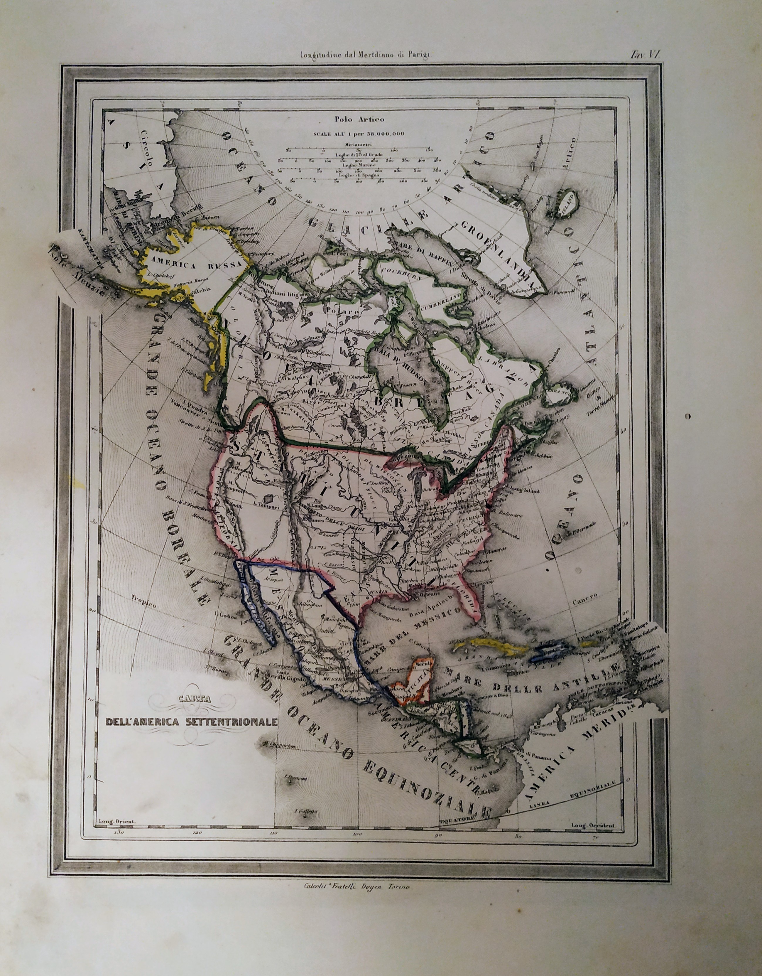
Map title
Carta dell'America settentrionale
Author
Unknown
Location shown in map
North America
Edition date
1854
Edition place
Torino
Editor
Unione tipografico editrice
Atlas
Atlente geografico per lo studio del nuovo compendio di geografia di un Frat. delle scuole cristiane
Price
150 Euro
State
[mint/excellent/VERY GOOD/good/fair/mediocre/poor]
Color
Old colors
Verso
Blank
Size
Plate: cm (21 x 27) inches (8.27 x 10.63) Paper: cm (26 x 32) inches (10.24 x 12.6)
Technique
Steel engraving
Note
Texas as indipendent repubblic
Reference
Wiki
Here for more info
In stock
Available
Info
info@thetreasuremaps.com
Code
#0709
×
![Carta dell'America settentrionale by Unknown, North America, 1854]()
Map title
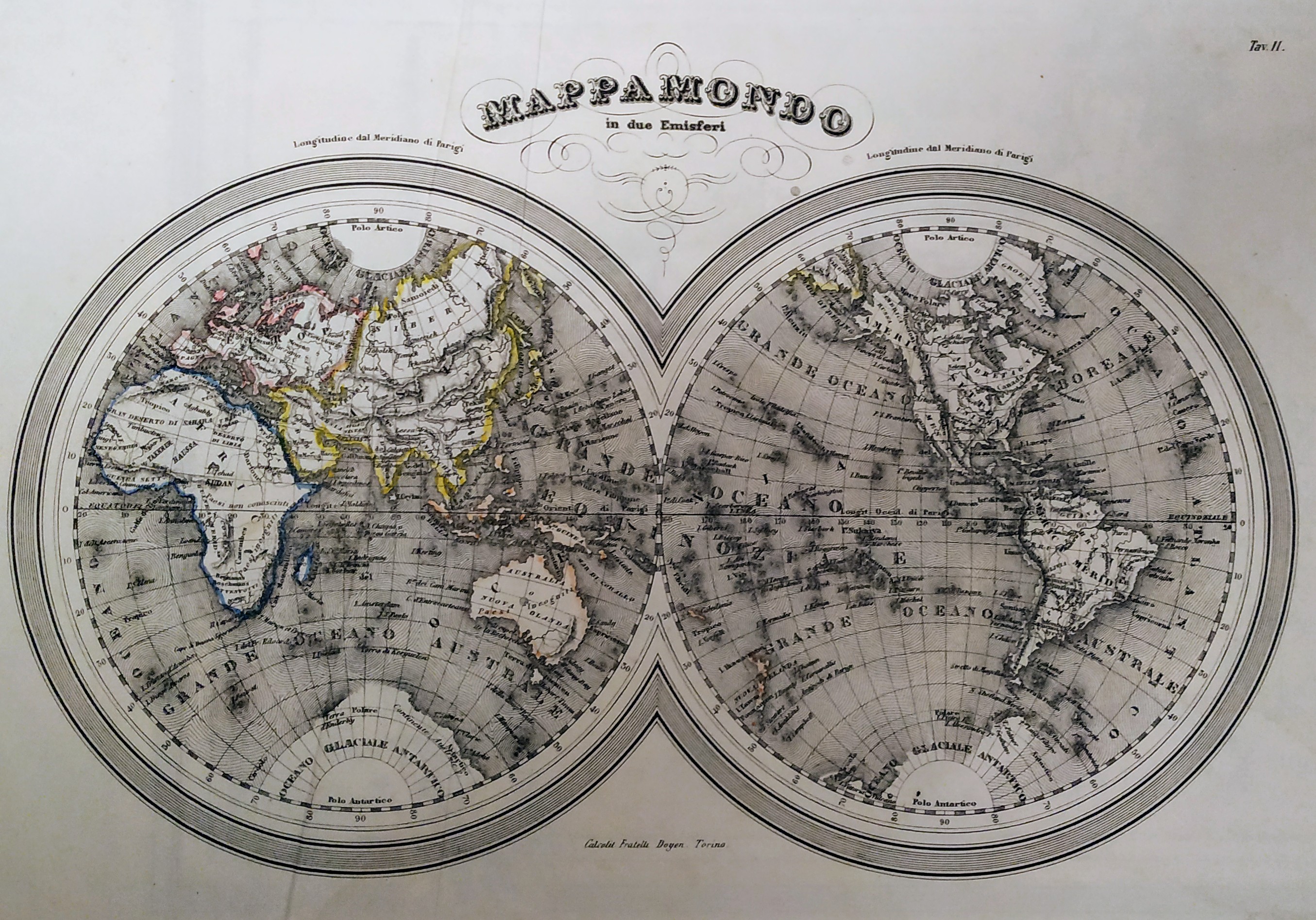
Mappamondo in due emisferi
Author
Unknown
Location shown in map
World
Edition date
Circa 1850
Edition place
Torino
Editor
F.lli Doyen
Atlas
--
Price
Please ask: info@thetreasuremaps.com
State
[mint/excellent/VERY GOOD/good/fair/mediocre/poor]
Color
Old colors
Verso
Blank
Size
Plate: cm (29 x 20) inches (11.42 x 7.87) Paper: cm (35 x 28) inches (13.78 x 11.02)
Technique
Steel engraving
Note
No particular notes for this maps.
Reference
Wiki
Here for more info
In stock
Available
Info
info@thetreasuremaps.com
Code
#0708
×
![Mappamondo in due emisferi by Unknown, World, Circa 1850]()
Map title
Carta dell'Oceania
Author
Unknown
Location shown in map
Oceania
Edition date
Circa 1850
Edition place
Torino
Editor
F.lli Doyen
Atlas
--
Price
75 Euro
State
[mint/excellent/VERY GOOD/good/fair/mediocre/poor]
Color
Old colors
Verso
Blank
Size
Plate: cm (29 x 21) inches (11.42 x 8.27) Paper: cm (37 x 29) inches (14.57 x 11.42)
Technique
Steel engraving
Note
No particular notes for this maps.
Reference
Wiki
Here for more info
In stock
Available
Info
info@thetreasuremaps.com
Code
#0707
×
![Carta dell'Oceania by Unknown, Oceania, Circa 1850]()
Map title
Cara dell'America settentrionale
Author
Unknown
Location shown in map
North America
Edition date
Circa 1850
Edition place
Torino
Editor
F.lli Doyen
Atlas
--
Price
75 Euro
State
[mint/excellent/VERY GOOD/good/fair/mediocre/poor]
Color
Old colors
Verso
Blank
Size
Plate: cm (22 x 19) inches (8.66 x 7.48) Paper: cm (28 x 38) inches (11.02 x 14.96)
Technique
Steel engraving
Note
No particular notes for this maps.
Reference
Wiki
Here for more info
In stock
Available
Info
info@thetreasuremaps.com
Code
#0706
×
![Cara dell'America settentrionale by Unknown, North America, Circa 1850]()
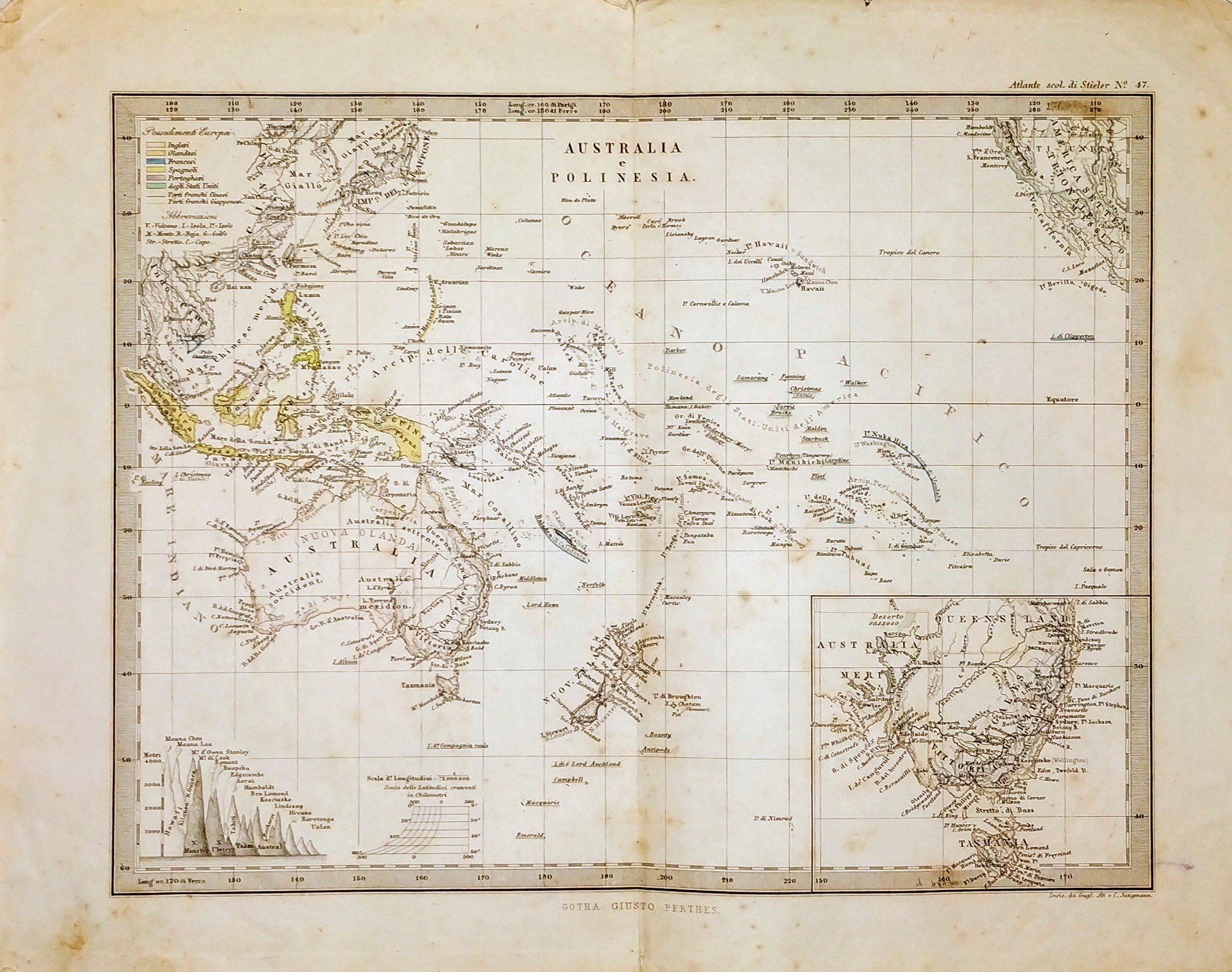
Map title
Australia e polinesia
Author
Stieler
Location shown in map
Oceania
Edition date
1876
Edition place
Editor
Gotha
Atlas
Price
50 Euro
State
[mint/excellent/VERY GOOD/good/fair/mediocre/poor]
Color
Black/white
Verso
Blank
Size
Plate: cm (26 x 20) inches (10.24 x 7.87) Paper: cm (32 x 25) inches (12.6 x 9.84)
Technique
Steel engraving
Note
No particular notes for this maps.
Reference
Wiki
Here for more info
In stock
Available
Info
info@thetreasuremaps.com
Code
#0703
×
![Australia e polinesia by Stieler, Oceania, 1876]()
Map title
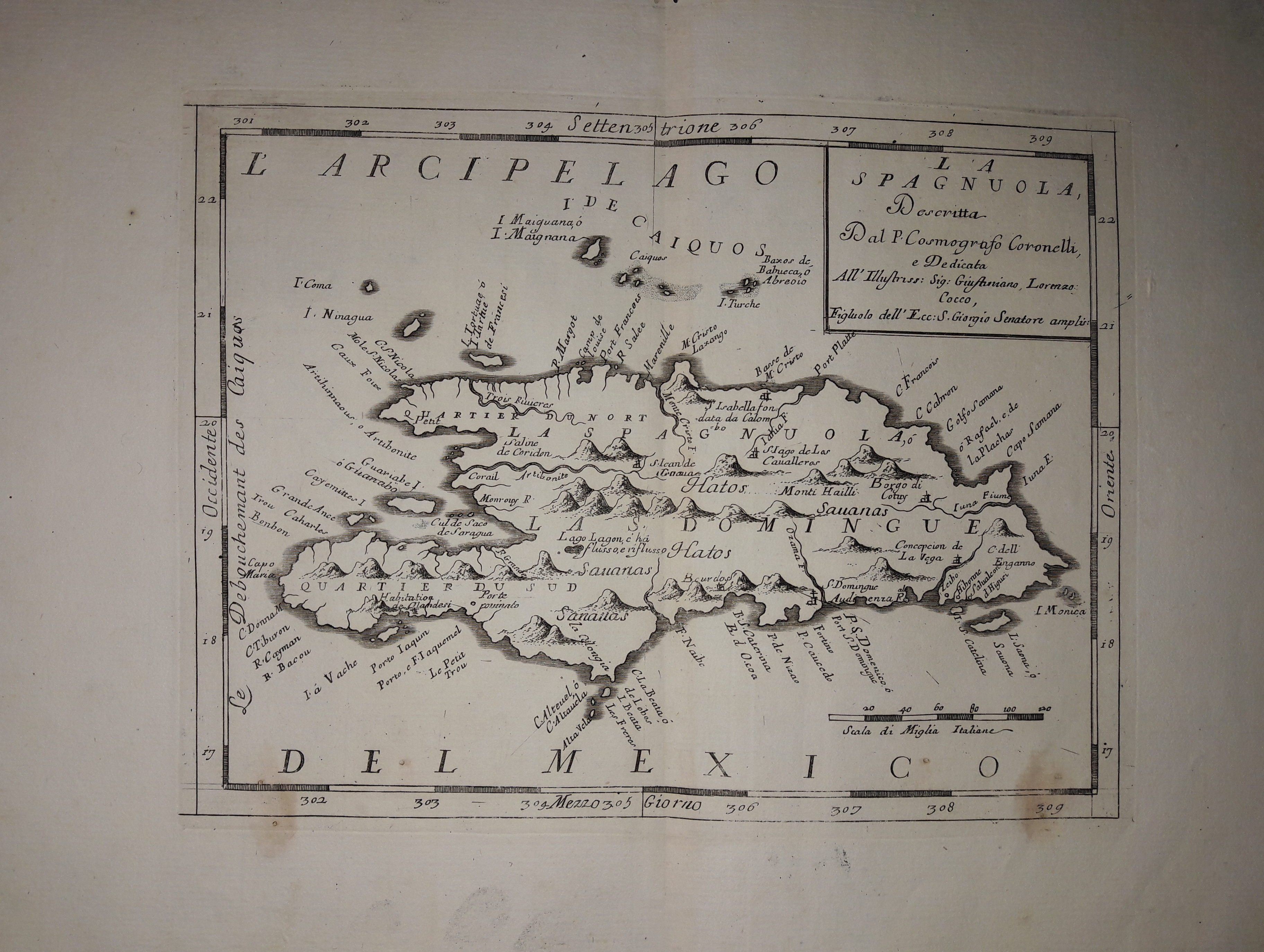
La Spagnuola
Author
Coronelli
Location shown in map
Haiti
Edition date
Circa 1690
Edition place
Venice
Editor
Atlas
Atlante veneto
Price
300 Euro
State
[mint/EXCELLENT/very good/good/fair/mediocre/poor]
Color
Black/white
Verso
Blank
Size
Plate: cm (30 x 22) inches (11.81 x 8.66) Paper: cm (43 x 32) inches (16.93 x 12.6)
Technique
Copper engraving
Note
No particular notes for this maps.
Reference
--
Wiki
Here for more info
In stock
Available
Info
info@thetreasuremaps.com
Code
#0636
×
![La Spagnuola by Coronelli, Haiti, Circa 1690]()
Map title
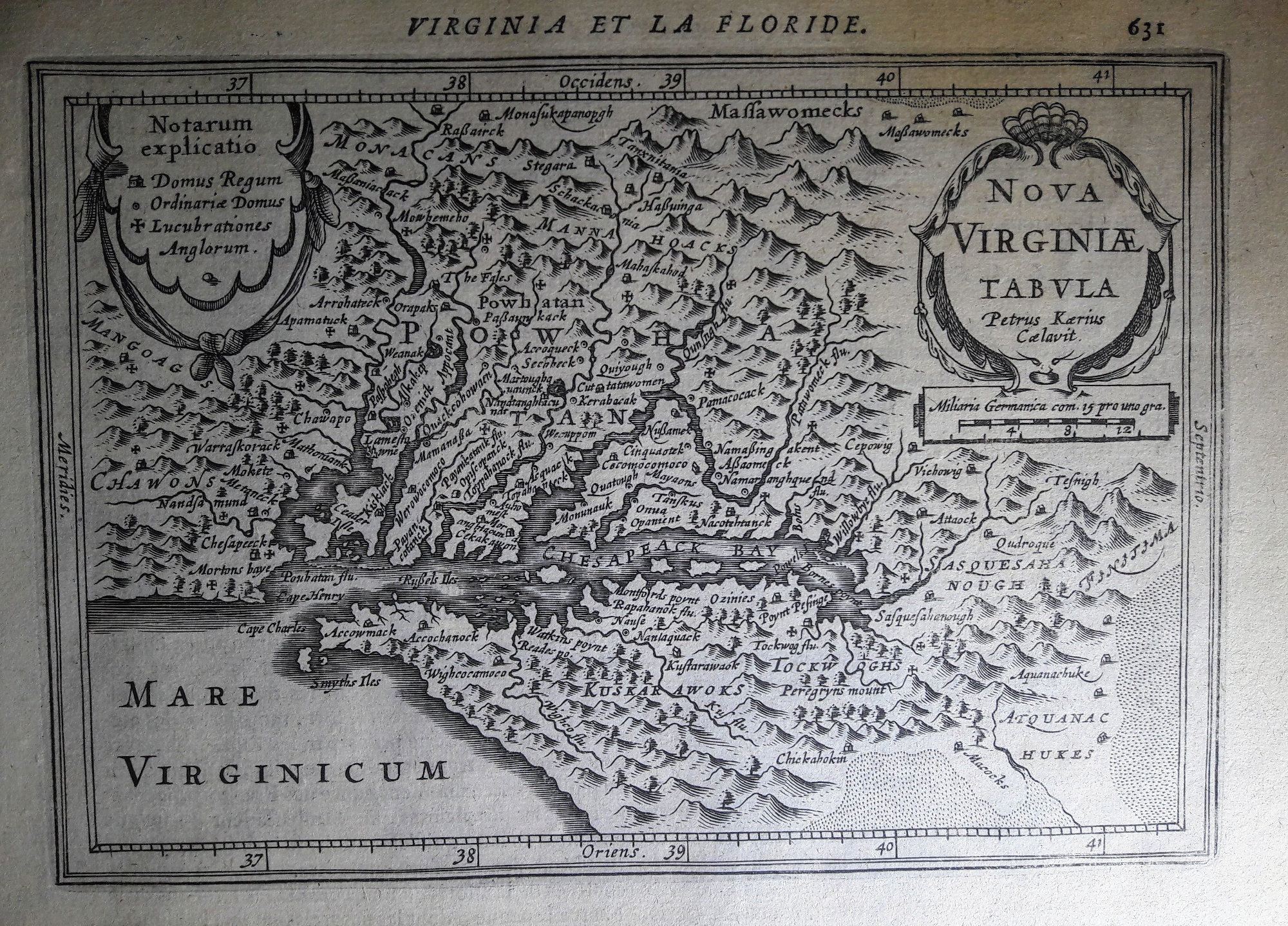
Nova Virginiae tabula
Author
Pieter van den Keere
Location shown in map
Virginiae
Edition date
1628
Edition place
Amsterdam
Editor
Janssonius
Atlas
Altas Minor Gerardi Mercatoris
Price
400 Euro
State
[mint/EXCELLENT/very good/good/fair/mediocre/poor]
Color
Black/white
Verso
French text pag.632
Size
Plate: cm (19 x 13) inches (7.48 x 5.12) Paper: cm (22 x 17) inches (8.66 x 6.69)
Technique
Copper engraving
Note
No particular notes for this maps.
Reference
--
Wiki
Here for more info
In stock
Available
Info
info@thetreasuremaps.com
Code
#0655
×
![Nova Virginiae tabula by Pieter van den Keere, Virginiae, 1628]()
Map title
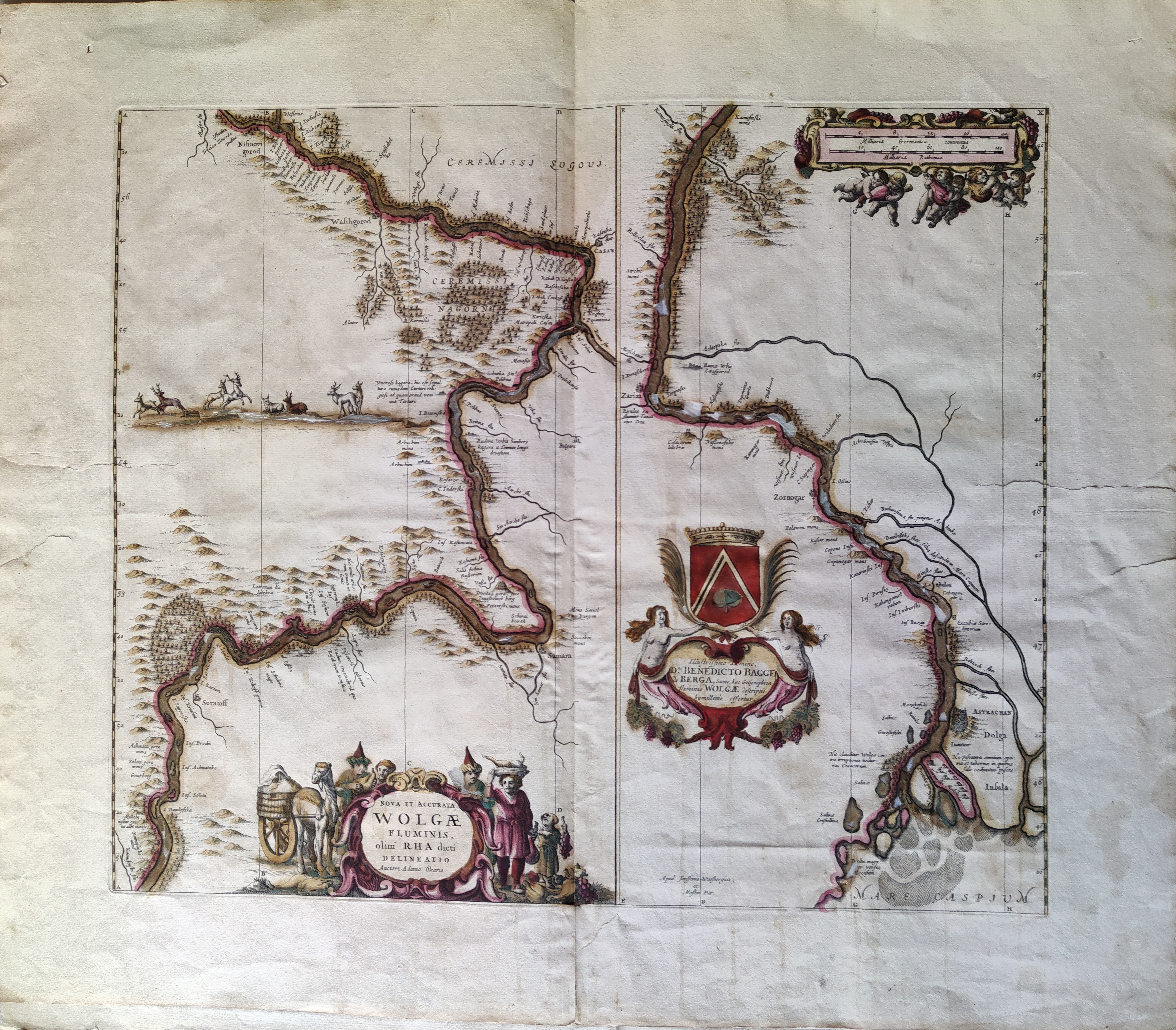
Nova et Accurata Wolgae Fluminis, Olim Rha Dicti Delineatio Auctore Adamo Oleario
Author
Jansson
Location shown in map
Russia
Edition date
Circa 1680
Edition place
Amsterdam
Editor
Jansson
Atlas
Price
400 Euro
State
[mint/excellent/very good/good/fair/MEDIOCRE/poor]
Color
Old colors
Verso
Size
Plate: cm (54 x 47) inches (21.26 x 18.5) Paper: cm (70 x 60) inches (27.56 x 23.62)
Technique
Copper engraving
Note
Reference
Wiki
Here for more info
In stock
Available
Info
info@thetreasuremaps.com
Code
#1076
×
![Nova et Accurata Wolgae Fluminis, Olim Rha Dicti Delineatio Auctore Adamo Oleario by Jansson, Russia, Circa 1680]()
Map title
America Settentrionale
Author
Allodi
Location shown in map
North America
Edition date
1857
Edition place
Milan
Editor
Pagnoni Marghieri
Atlas
Geografia storica moderna universale
Price
50 Euro
State
[mint/EXCELLENT/very good/good/fair/mediocre/poor]
Color
Old colors
Verso
Blank
Size
Plate: cm (15 x 21) inches (5.91 x 8.27) Paper: cm (17 x 25) inches (6.69 x 9.84)
Technique
Steel engraving
Note
No particular notes for this maps
Reference
--
Wiki
Here for more info
In stock
Available
Info
info@thetreasuremaps.com
Code
#0644
×
![America Settentrionale by Allodi, North America, 1857]()
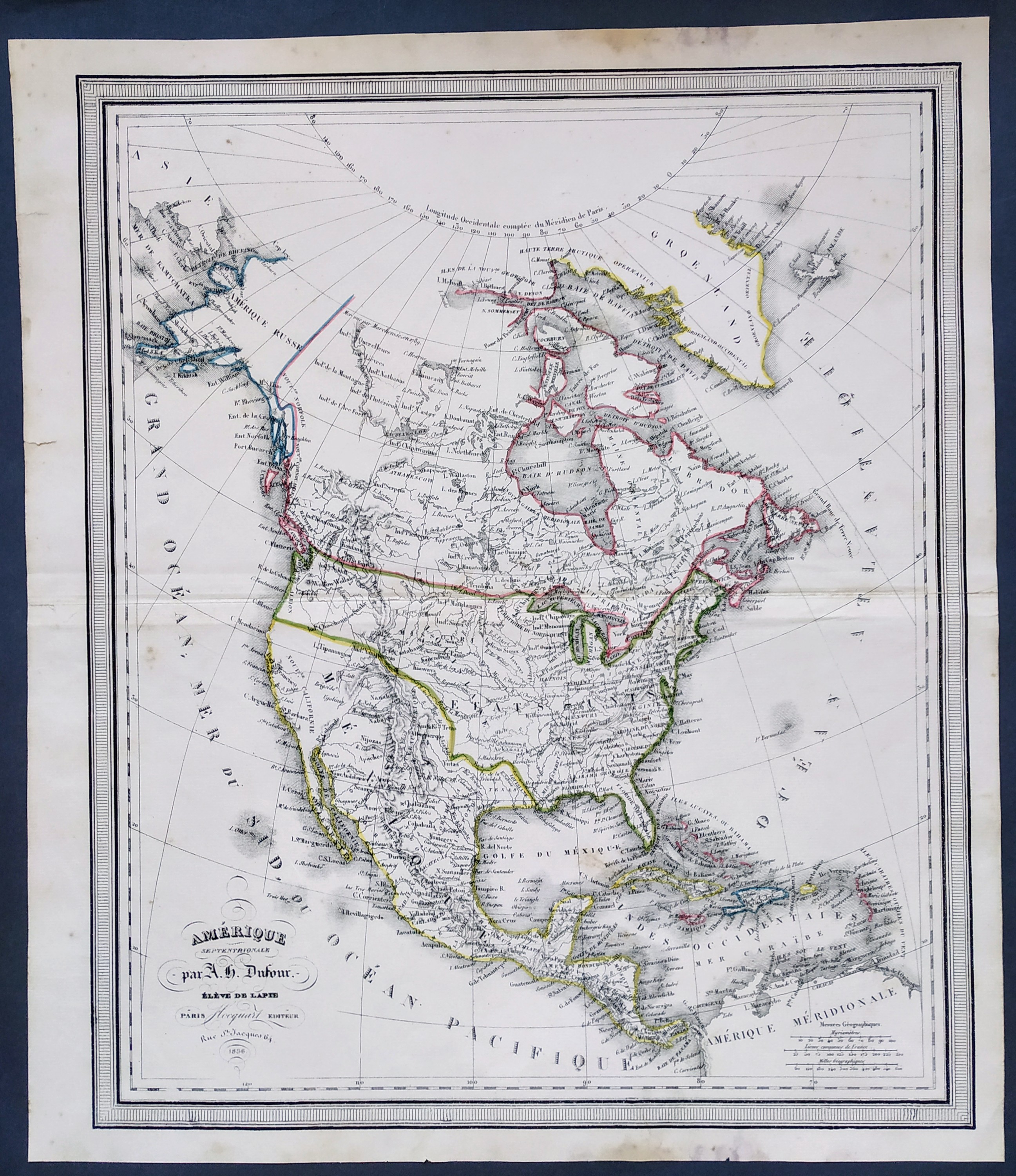
Map title
Amerique Septentrionale
Author
Dufour
Location shown in map
USA
Edition date
1836
Edition place
Paris
Editor
Flocquart
Atlas
--
Price
100 Euro
State
[mint/EXCELLENT/very good/good/fair/mediocre/poor]
Color
Old colors
Verso
Blank
Size
Plate: cm (0 x 0) inches (0 x 0) Paper: cm (0 x 0) inches (0 x 0)
Technique
Steel engraving
Note
No particular notes for this maps.
Reference
--
Wiki
Here for more info
In stock
Available
Info
info@thetreasuremaps.com
Code
#0715
×
![Amerique Septentrionale by Dufour, USA, 1836]()
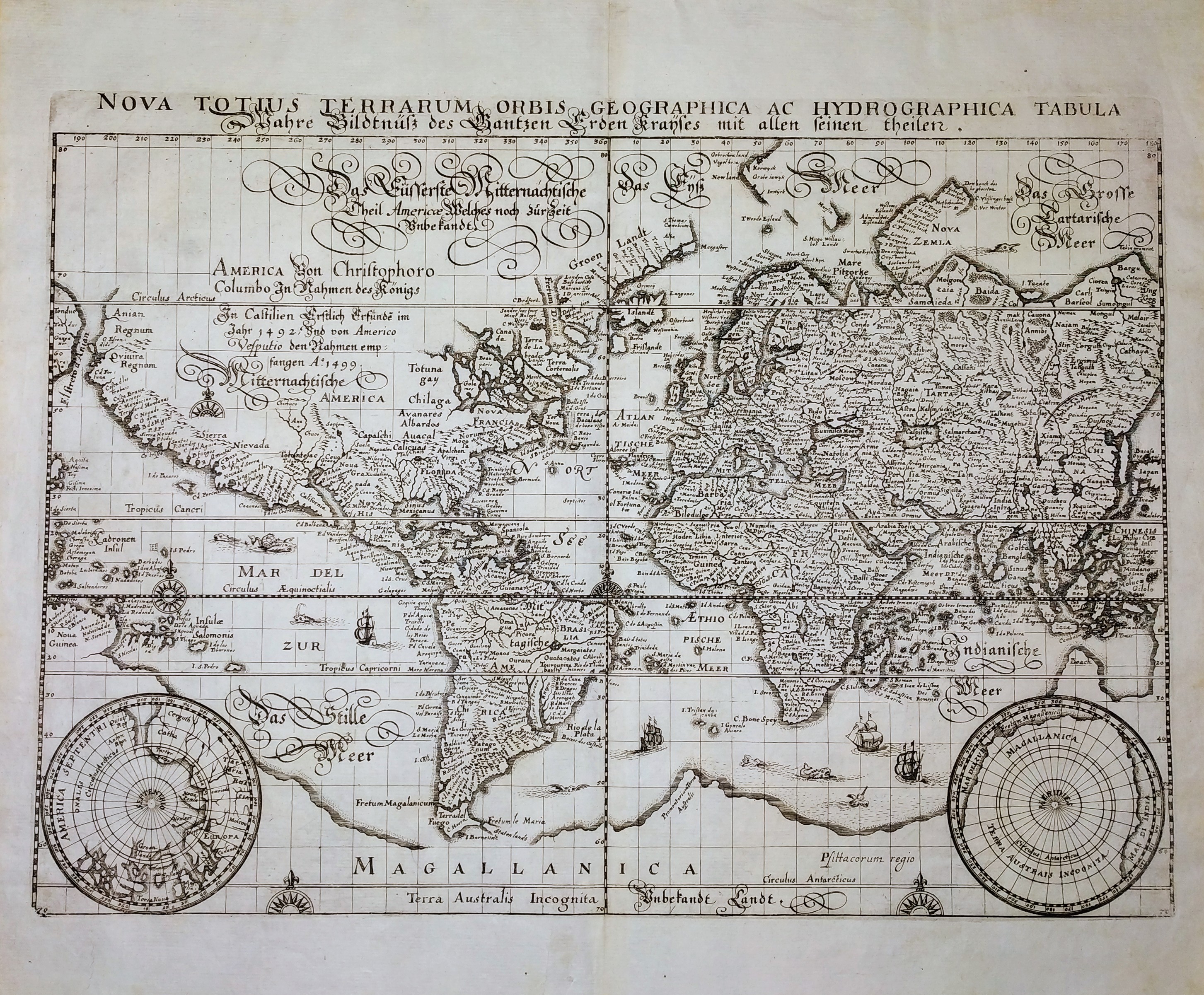
Map title
Nova Totius Terrarum Orbis Geographica ac Hydrographica Tabula
Author
Merian
Location shown in map
World
Edition date
Circa 1646
Edition place
Frankfurt
Editor
--
Atlas
Neuwe Archontologia Cosmica
Price
1000 Euro
State
[MINT/excellent/very good/good/fair/mediocre/poor]
Color
Black/white
Verso
Blank
Size
Plate: cm (35 x 26) inches (13.78 x 10.24) Paper: cm (39 x 33) inches (15.35 x 12.99)
Technique
Copper engraving
Note
No particular notes for this maps.
Reference
--
Wiki
Here for more info
In stock
Available
Info
info@thetreasuremaps.com
Code
#0705
×
![Nova Totius Terrarum Orbis Geographica ac Hydrographica Tabula by Merian, World, Circa 1646]()
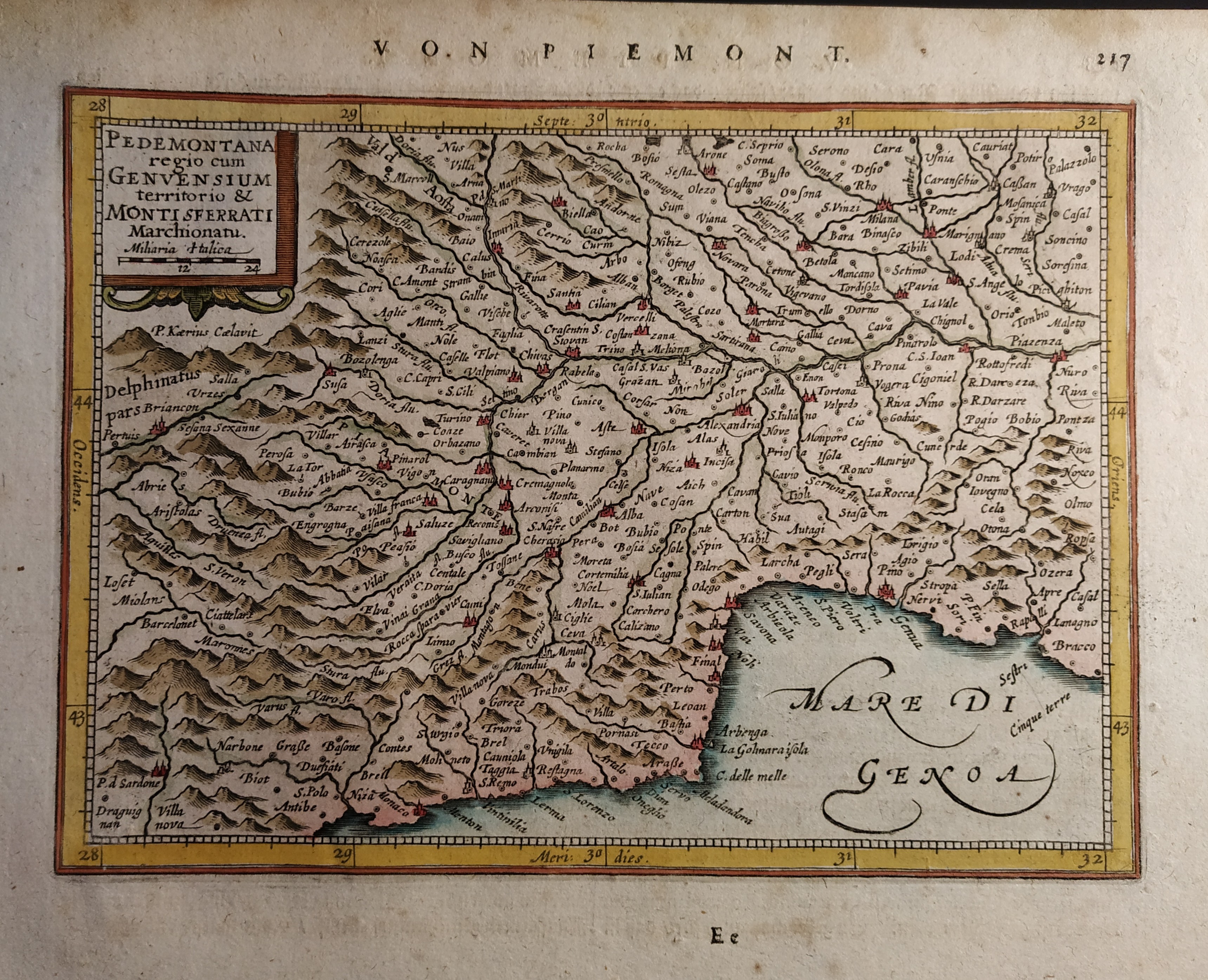
Map title
Pedemontana regio cum Genvensium territorio & Montisferrati marchionatu
Author
Mercator
Location shown in map
North-West Italy
Edition date
Circa 1628
Edition place
Amsterdam
Editor
Janssonius
Atlas
Altas Minor Gerardi Mercatoris
Price
150 Euro
State
[mint/EXCELLENT/very good/good/fair/mediocre/poor]
Color
Old colors
Verso
German text pag 218
Size
Plate: cm (19 x 14) inches (7.48 x 5.51) Paper: cm (23 x 19) inches (9.06 x 7.48)
Technique
Copper engraving
Note
No particular notes for this maps.
Reference
Wiki
Here for more info
In stock
Available
Info
info@thetreasuremaps.com
Code
#0660
×
![Pedemontana regio cum Genvensium territorio & Montisferrati marchionatu by Mercator, North-West Italy, Circa 1628]()
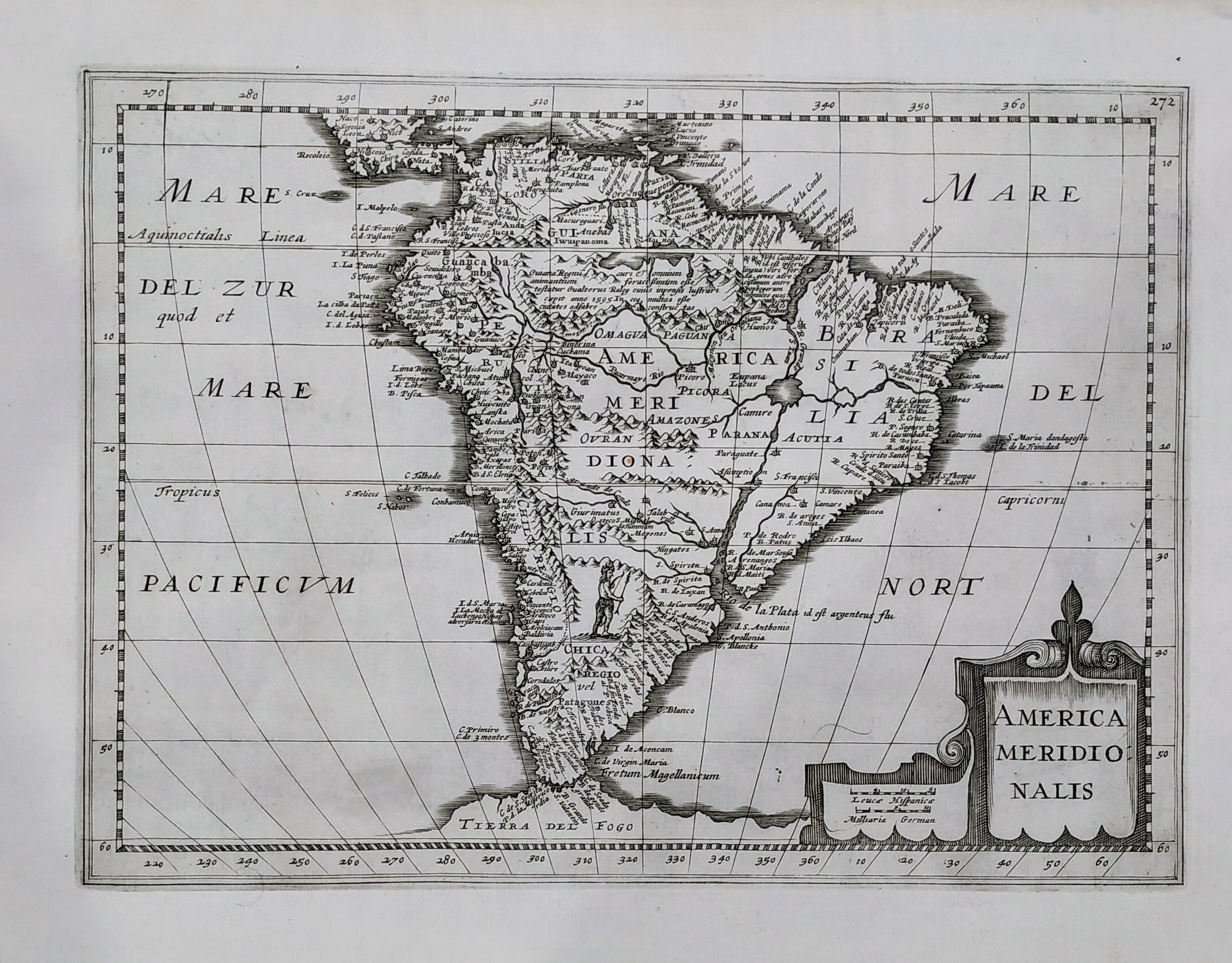
Map title
America Meridionalis
Author
Henri du Sauzet
Location shown in map
South America
Edition date
1734
Edition place
Amsterdam
Editor
Henri du Sauzet
Atlas
Atlas Portatif
Price
300 Euro
State
[MINT/excellent/very good/good/fair/mediocre/poor]
Color
Black/white
Verso
Blank
Size
Plate: cm (25 x 18) inches (9.84 x 7.09) Paper: cm (37 x 25) inches (14.57 x 9.84)
Technique
Copper engraving
Note
No particular notes for this maps.
Reference
--
Wiki
Here for more info
In stock
Available
Info
info@thetreasuremaps.com
Code
#0702
×
![America Meridionalis by Henri du Sauzet, South America, 1734]()
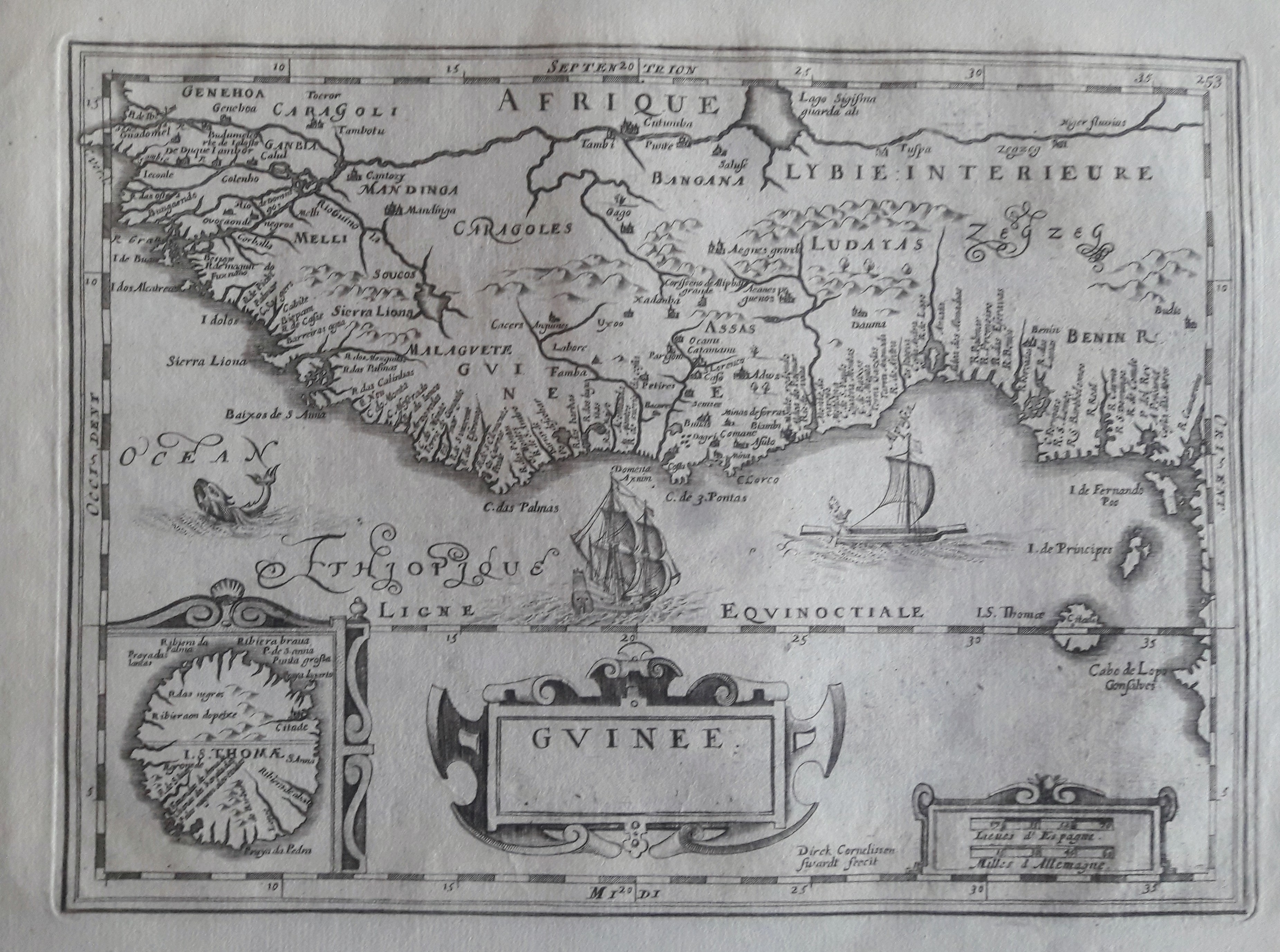
Map title
Guinee
Author
Direk Cornelissen
Location shown in map
West Africa
Edition date
Circa 1690
Edition place
Editor
--
Atlas
--
Price
150 Euro
State
[MINT/excellent/very good/good/fair/mediocre/poor]
Color
Black/white
Verso
Blank
Size
Plate: cm (25 x 28) inches (9.84 x 11.02) Paper: cm (41 x 27) inches (16.14 x 10.63)
Technique
Copper engraving
Note
No particular notes for this maps.
Reference
--
Wiki
Here for more info
In stock
Available
Info
info@thetreasuremaps.com
Code
#0659
×
![Guinee by Direk Cornelissen, West Africa, Circa 1690]()
Map title
Montisferrati Ducatus
Author
Mercator
Location shown in map
North-West Italy
Edition date
Circa 1628
Edition place
Amsterdam
Editor
Janssonius
Atlas
Altas Minor Gerardi Mercatoris
Price
150 Euro
State
[mint/EXCELLENT/very good/good/fair/mediocre/poor]
Color
Old colors
Verso
German text 222
Size
Plate: cm (20 x 15) inches (7.87 x 5.91) Paper: cm (23 x 19) inches (9.06 x 7.48)
Technique
Copper engraving
Note
No particular notes for this maps.
Reference
Wiki
Here for more info
In stock
Available
Info
info@thetreasuremaps.com
Code
#0661
×
![Montisferrati Ducatus by Mercator, North-West Italy, Circa 1628]()
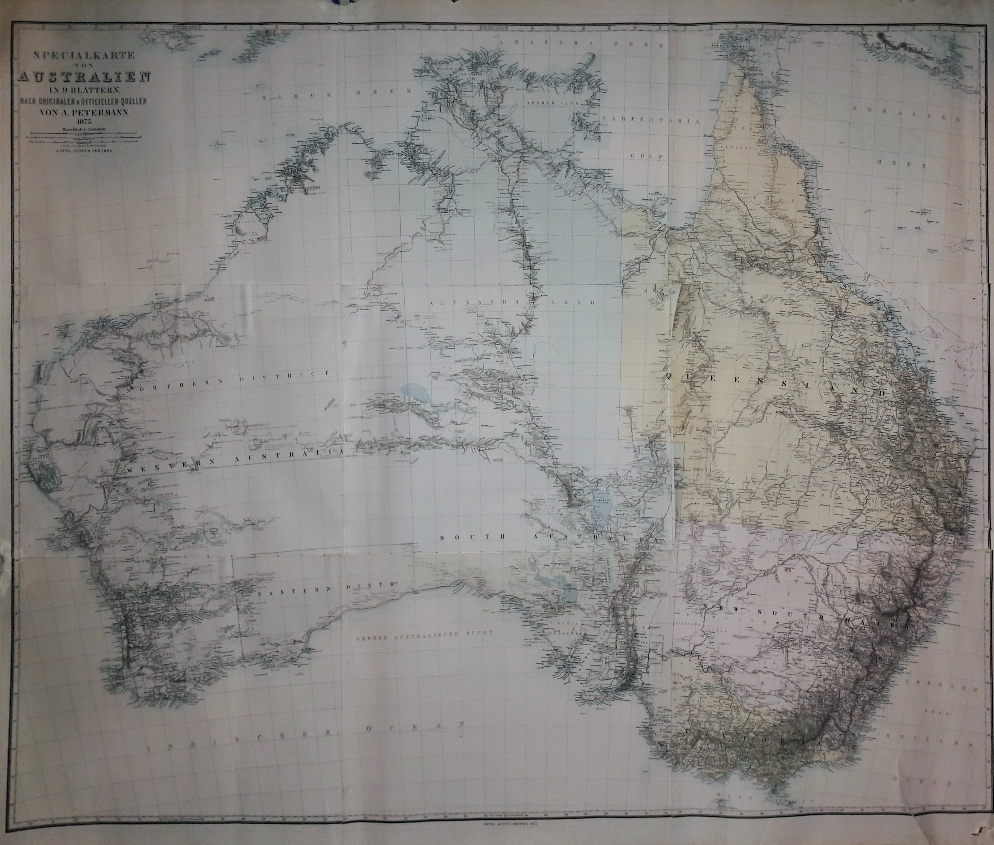
Map title
Spezialkarte von Australien
Author
Petermann, August
Location shown in map
Australia
Edition date
1875
Edition place
Editor
Gotha, Perthes
Atlas
Price
Please ask: info@thetreasuremaps.com
State
[mint/excellent/VERY GOOD/good/fair/mediocre/poor]
Color
Old colors
Verso
Size
Plate: cm (126 x 147) inches (49.61 x 57.87) Paper: cm (126 x 147) inches (49.61 x 57.87)
Technique
Steel engraving
Note
Wall map
Reference
Wiki
Here for more info
In stock
Available
Info
info@thetreasuremaps.com
Code
#0652
×
![Spezialkarte von Australien by Petermann, August, Australia, 1875]()

Map title
North-sea
Author
Keulen, Joannes
Location shown in map
British Isles
Edition date
1690
Edition place
Amsterdam
Editor
Atlas
Price
Please ask: info@thetreasuremaps.com
State
[mint/excellent/VERY GOOD/good/fair/mediocre/poor]
Color
Black/white
Verso
Blank
Size
Plate: cm (55 x 95) inches (21.65 x 37.4) Paper: cm (55 x 95) inches (21.65 x 37.4)
Technique
Copper engraving
Note
Professionally repaired
Reference
Wiki
Here for more info
In stock
Available
Info
info@thetreasuremaps.com
Code
#0740
×
![North-sea by Keulen, Joannes, British Isles, 1690]()