News
Map title
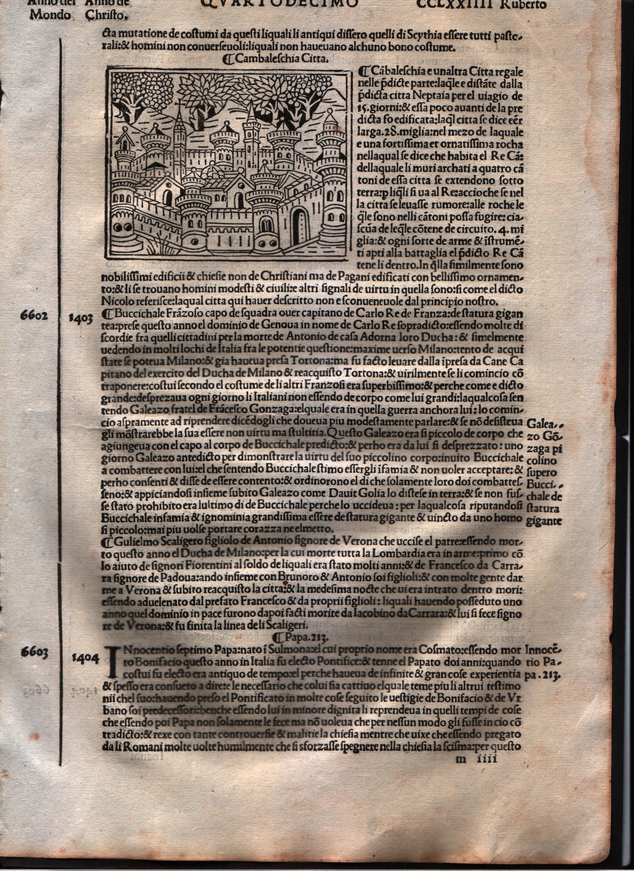
Cambaleschia
Author
Foresti
Location shown in map
City of Beijing
Edition date
1508
Edition place
Venice
Editor
Georgii de Rusconibus
Atlas
Supplementum supplementi cronicarum
Price
Please ask: info@thetreasuremaps.com
State
[MINT/excellent/very good/good/fair/mediocre/poor]
Color
Black/white
Verso
Italian text
Size
Plate: cm (8.9 x 6.4) inches (3.5 x 2.52) Paper: cm (21.6 x 30.5) inches (8.5 x 12.01)
Technique
Woodcut
Note
No particular notes for this maps.
Reference
--
Wiki
Here for more info
In stock
Available
Info
info@thetreasuremaps.com
Code
#0011
×
![Cambaleschia by Foresti, City of Beijing, 1508]()
Map title
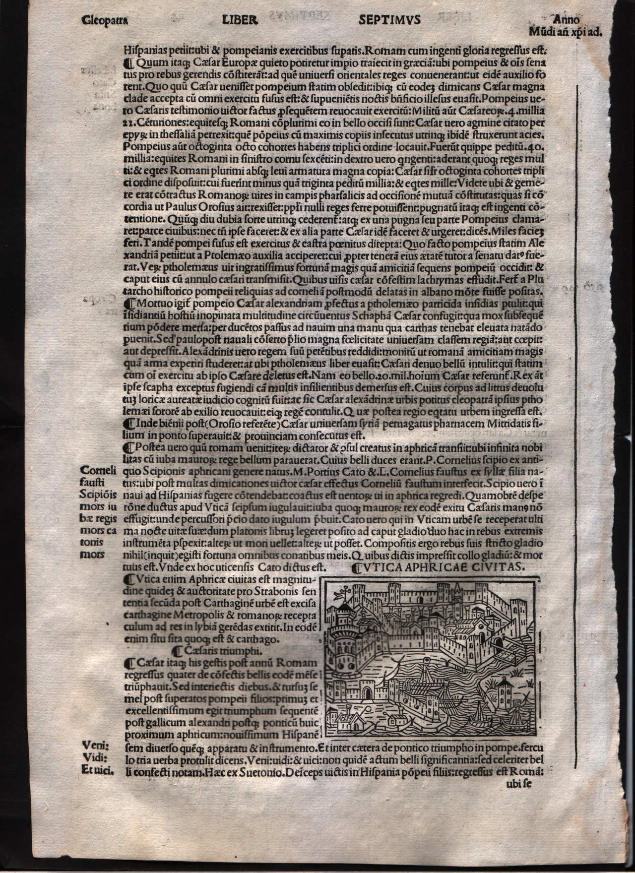
Utica
Author
Foresti
Location shown in map
City of Utica
Edition date
1508
Edition place
Venice
Editor
Georgii de Rusconibus
Atlas
Supplementum supplementi cronicarum
Price
Please ask: info@thetreasuremaps.com
State
[MINT/excellent/very good/good/fair/mediocre/poor]
Color
Black/white
Verso
Latin text
Size
Plate: cm (7.6 x 6.4) inches (2.99 x 2.52) Paper: cm (20.3 x 30.5) inches (7.99 x 12.01)
Technique
Woodcut
Note
No particular notes for this maps.
Reference
--
Wiki
Here for more info
In stock
Available
Info
info@thetreasuremaps.com
Code
#0012
×
![Utica by Foresti, City of Utica, 1508]()
Map title
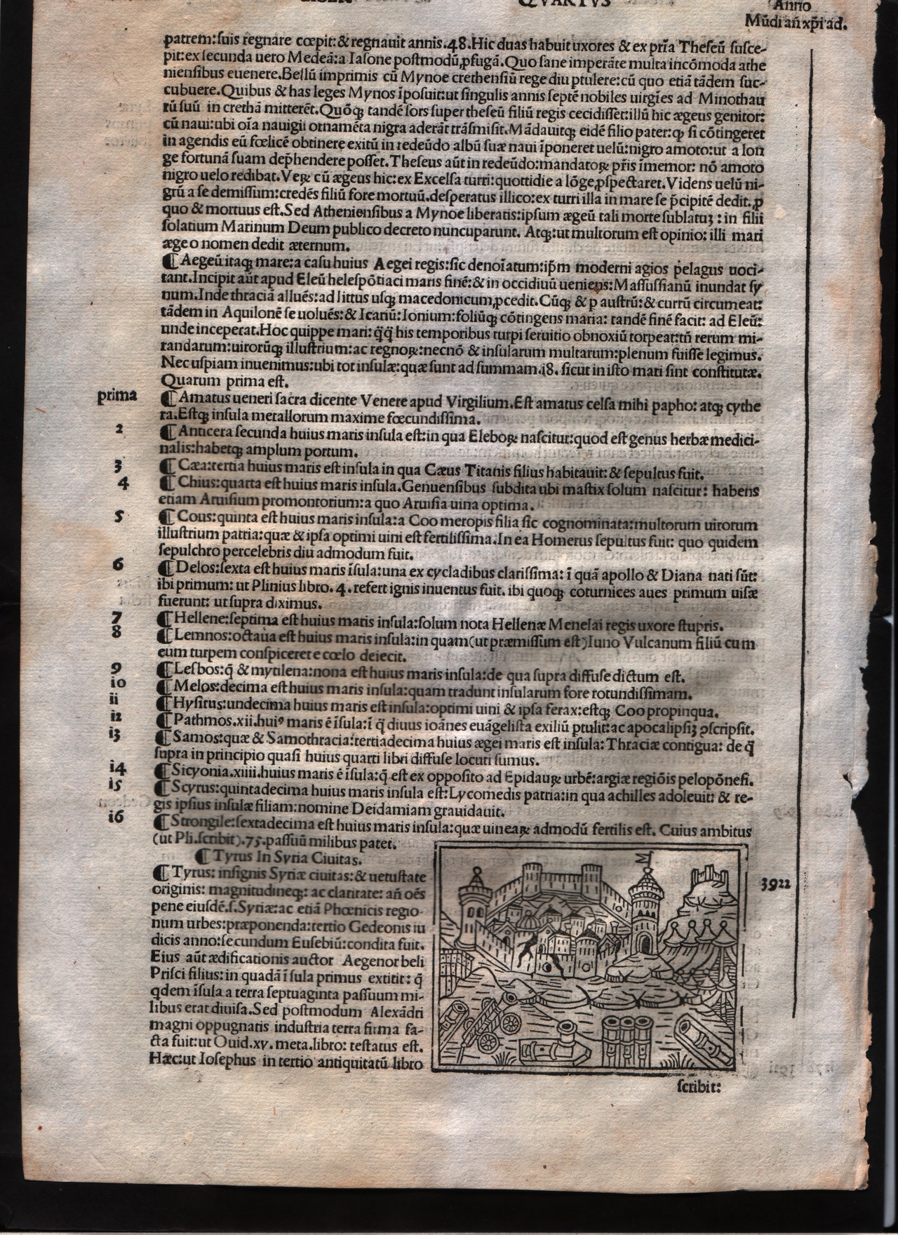
Tyre
Author
Foresti
Location shown in map
City of Tyre - Lebanon
Edition date
1508
Edition place
Venice
Editor
Georgii de Rusconibus
Atlas
Supplementum supplementi cronicarum
Price
Please ask: info@thetreasuremaps.com
State
[MINT/excellent/very good/good/fair/mediocre/poor]
Color
Black/white
Verso
Latin text
Size
Plate: cm (7.6 x 6.4) inches (2.99 x 2.52) Paper: cm (20.3 x 30.5) inches (7.99 x 12.01)
Technique
Woodcut
Note
No particular notes for this maps.
Reference
--
Wiki
Here for more info
In stock
Available
Info
info@thetreasuremaps.com
Code
#0013
×
![Tyre by Foresti, City of Tyre - Lebanon, 1508]()
Map title
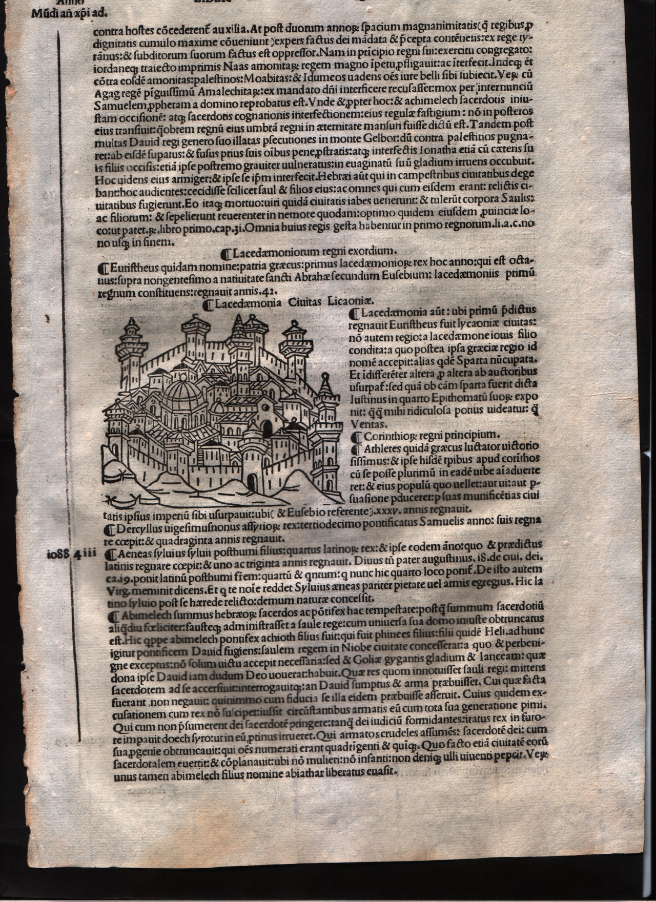
Lacedemonia
Author
Foresti
Location shown in map
City of Sparta
Edition date
1508
Edition place
Venice
Editor
Georgii de Rusconibus
Atlas
Supplementum supplementi cronicarum
Price
Please ask: info@thetreasuremaps.com
State
[MINT/excellent/very good/good/fair/mediocre/poor]
Color
Black/white
Verso
Latin text
Size
Plate: cm (7.6 x 6.4) inches (2.99 x 2.52) Paper: cm (20.3 x 30.5) inches (7.99 x 12.01)
Technique
Woodcut
Note
No particular notes for this maps.
Reference
--
Wiki
Here for more info
In stock
Available
Info
info@thetreasuremaps.com
Code
#0014
×
![Lacedemonia by Foresti, City of Sparta, 1508]()
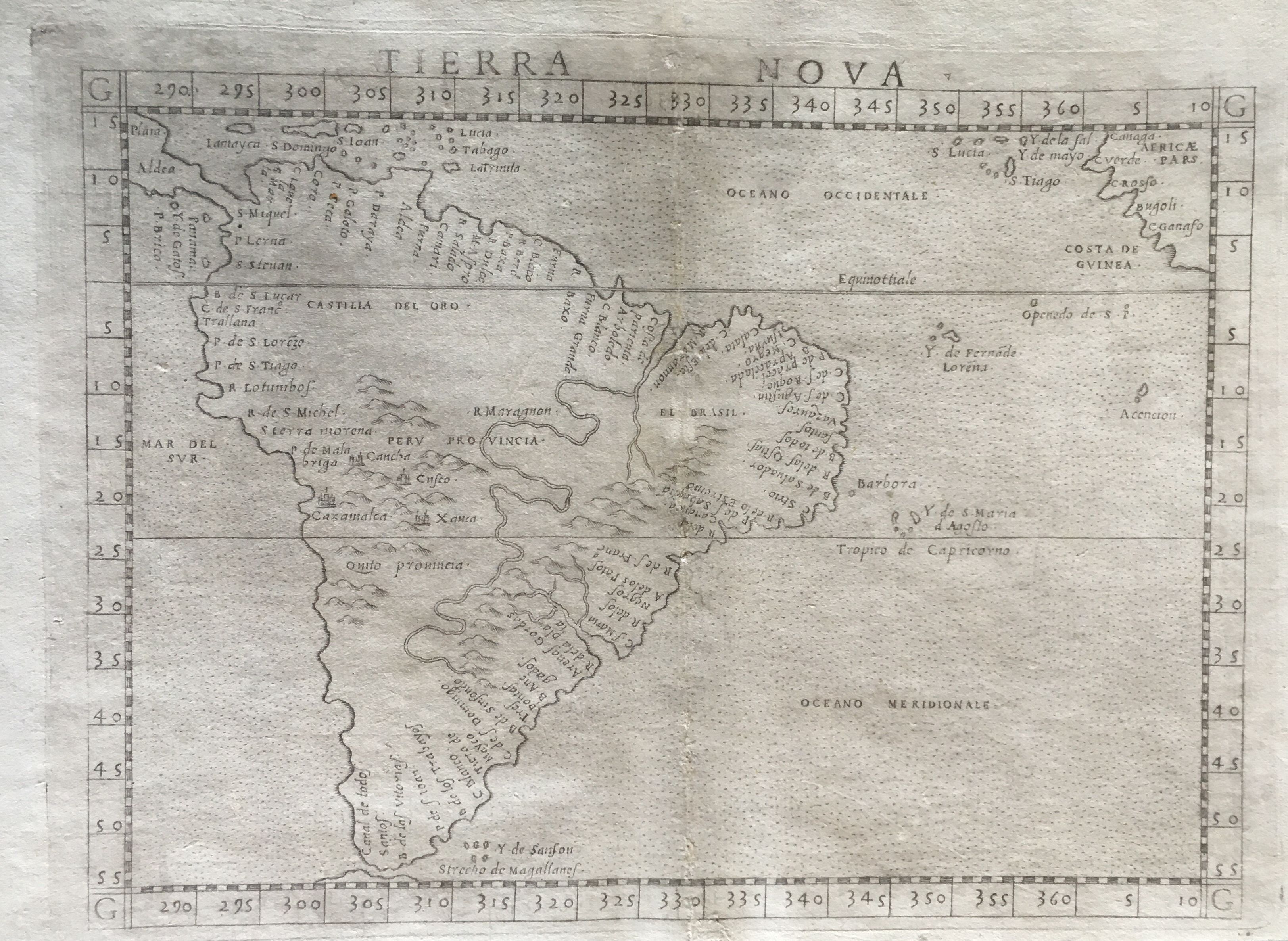
Map title
Tierra Nova
Author
Ruscelli
Location shown in map
South America
Edition date
1574
Edition place
Venice
Editor
Giordano Ziletti
Atlas
La Geographia di Claudio Tolomeo
Price
550 Euro
State
[mint/excellent/very good/GOOD/fair/mediocre/poor] Three small holes in the center.
Color
Black/white
Verso
Italian text pag.33
Size
Plate: cm (24.1 x 19) inches (9.49 x 7.48) Paper: cm (30.5 x 21.6) inches (12.01 x 8.5)
Technique
Copper engraving
Note
A fine early copperplate engraving and one of the first printed maps of the entire continent of South America. Many places named along the coastlines. Little is know of the interior.
Reference
Genoa pubblic library "Civica Berio"
Wiki
Here for more info
In stock
Available
Info
info@thetreasuremaps.com
Code
#0016
×
![Tierra Nova by Ruscelli, South America, 1574]()
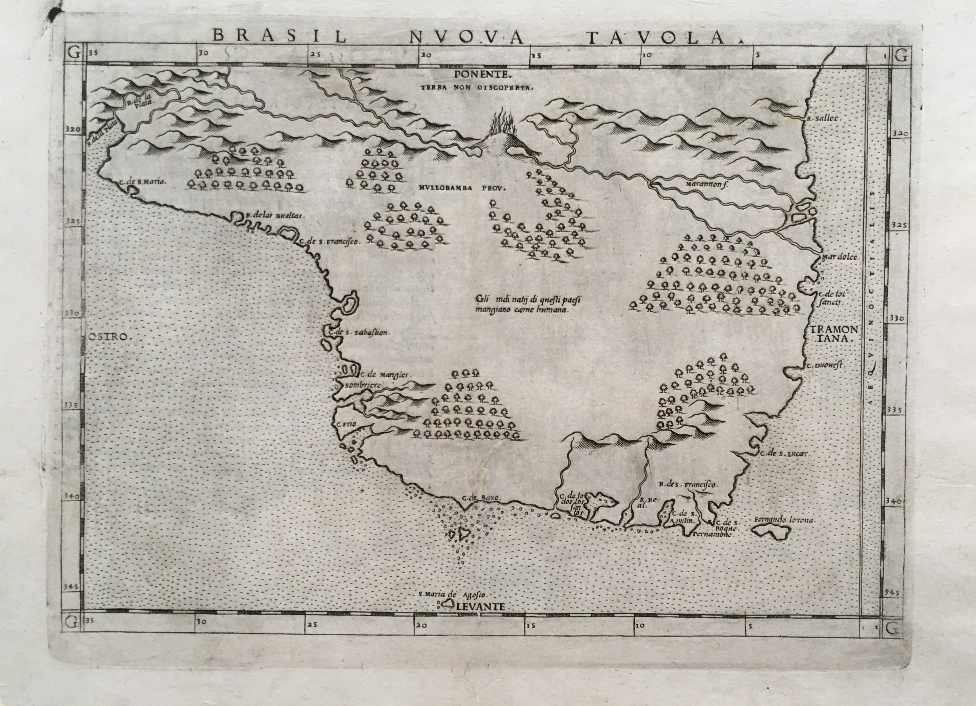
Map title
Brasil Nuova Tavola
Author
Ruscelli
Location shown in map
Bresil
Edition date
1574
Edition place
Venice
Editor
Giordano Ziletti
Atlas
La Geographia di Claudio Tolomeo
Price
400 Euro
State
[mint/excellent/very good/GOOD/fair/mediocre/poor]
Color
Black/white
Verso
Italian text pag.34
Size
Plate: cm (26 x 19) inches (10.24 x 7.48) Paper: cm (30.5 x 22.9) inches (12.01 x 9.02)
Technique
Copper engraving
Note
No particular notes for this maps
Reference
Genoa pubblic library "Civica Berio"
Wiki
Here for more info
In stock
Available
Info
info@thetreasuremaps.com
Code
#0017
×
![Brasil Nuova Tavola by Ruscelli, Bresil, 1574]()
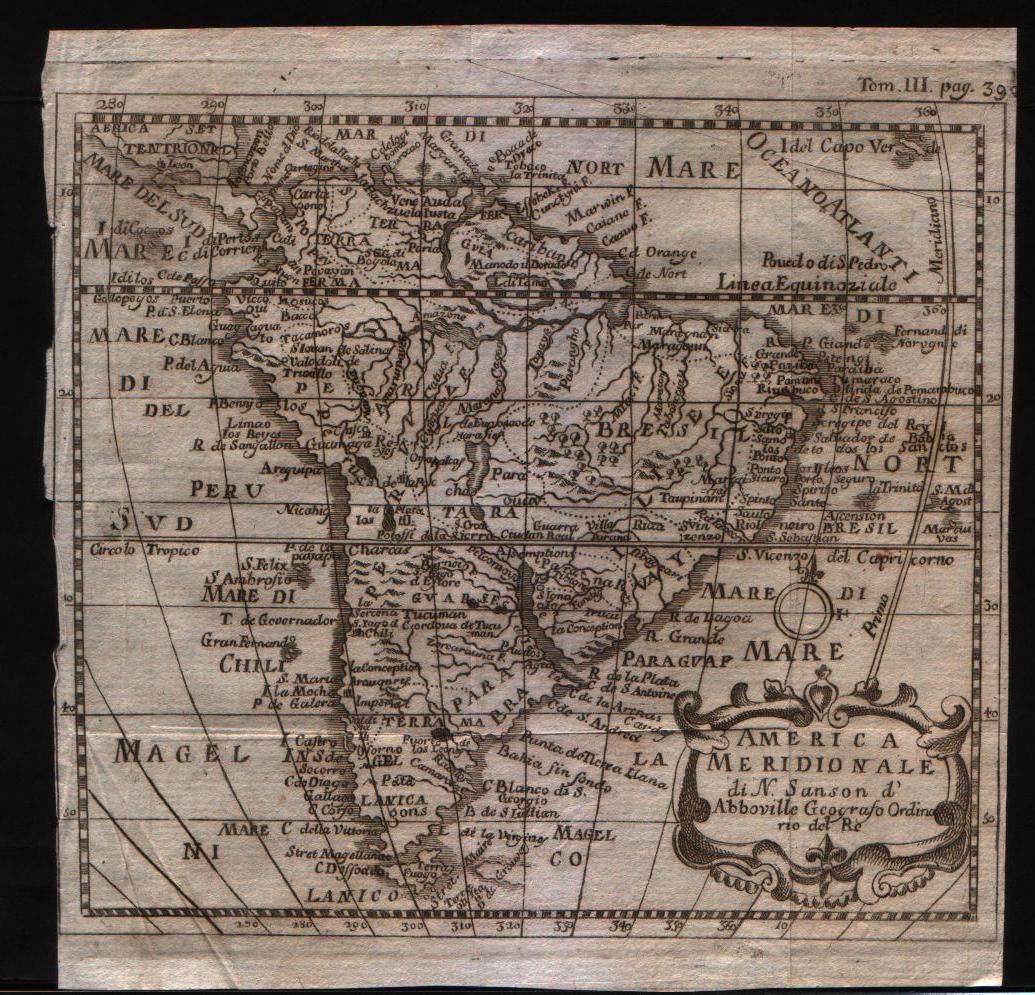
Map title
America Meridionale
Author
Sanson
Location shown in map
South America
Edition date
1720
Edition place
--
Editor
--
Atlas
--
Price
100 Euro
State
[mint/excellent/VERY GOOD/good/fair/mediocre/poor]
Color
Black/white
Verso
Blank
Size
Plate: cm (15.2 x 15.2) inches (5.98 x 5.98) Paper: cm (16.5 x 16.5) inches (6.5 x 6.5)
Technique
Copper engraving
Note
No particular notes for this maps
Reference
--
Wiki
Here for more info
In stock
Available
Info
info@thetreasuremaps.com
Code
#0018
×
![America Meridionale by Sanson, South America, 1720]()
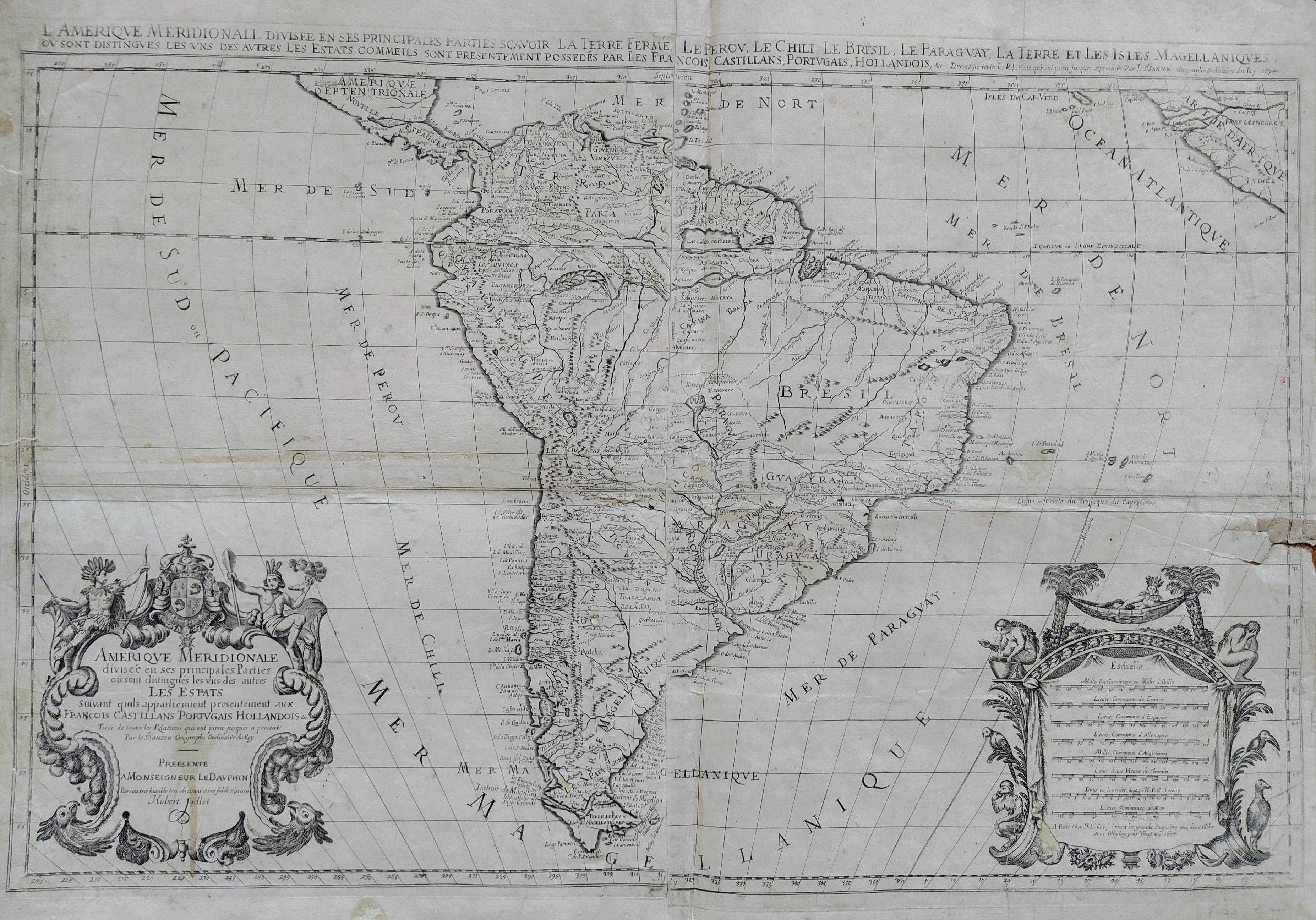
Map title
Amerique Meridionale
Author
Sanson
Location shown in map
South America
Edition date
1694
Edition place
Paris
Editor
Alexis Hubert Jaillot
Atlas
Tables geographiques des divisions du globe terrestre
Price
500 Euro
State
[mint/excellent/very good/GOOD/fair/mediocre/poor] Some repaire tears
Color
Black/white
Verso
Blank
Size
Plate: cm (86.4 x 55.9) inches (34.02 x 22.01) Paper: cm (91.4 x 66) inches (35.98 x 25.98)
Technique
Copper engraving
Note
Wall map
Reference
--
Wiki
Here for more info
In stock
Available
Info
info@thetreasuremaps.com
Code
#0019
×
![Amerique Meridionale by Sanson, South America, 1694]()
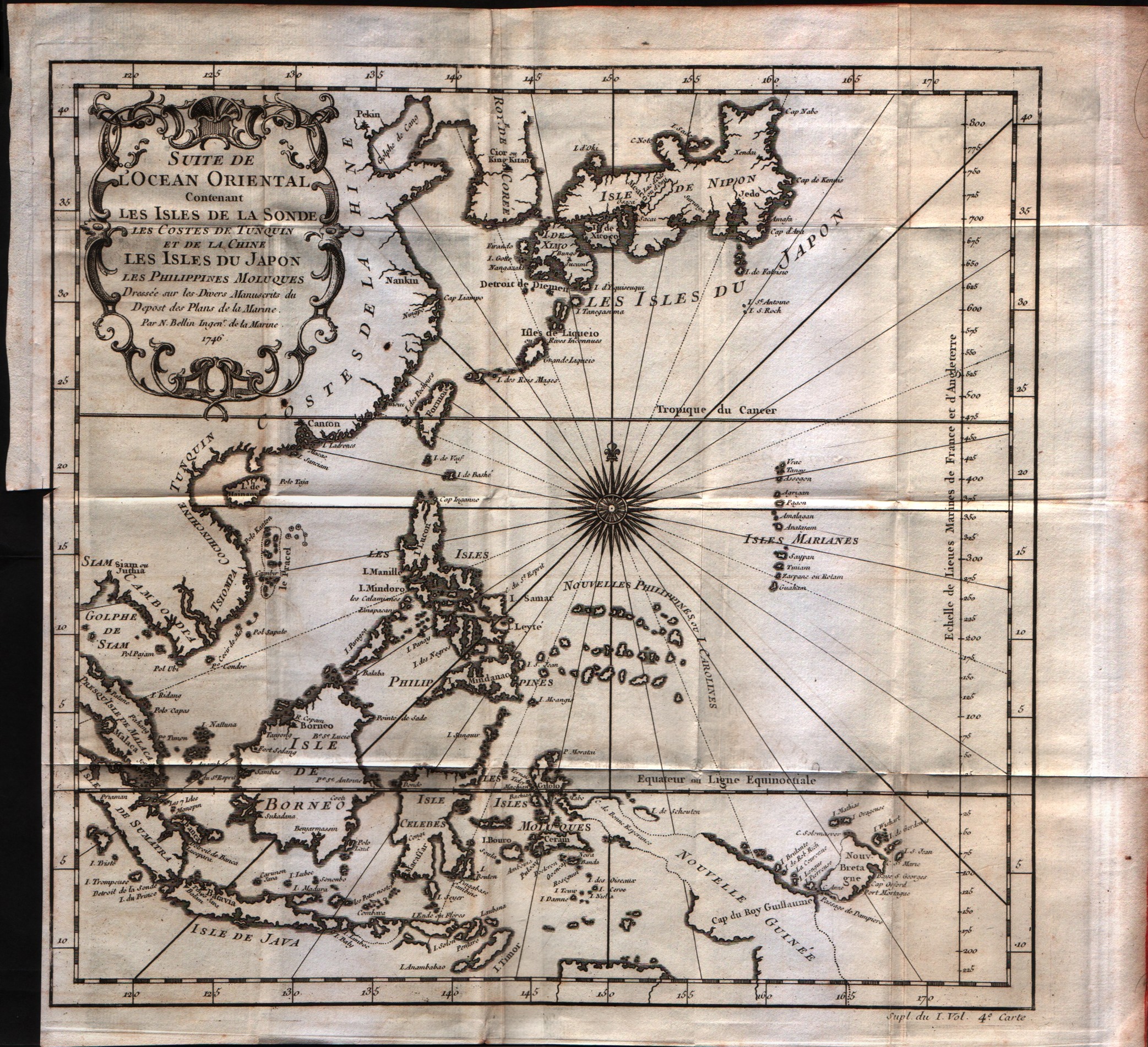
Map title
Suite de l'Ocean Oriental
Author
Bellin
Location shown in map
Inde
Edition date
1757
Edition place
Paris
Editor
--
Atlas
Historie General des Voyages -- Prevost
Price
250 Euro
State
[mint/EXCELLENT/very good/good/fair/mediocre/poor]
Color
Black/white
Verso
Blank
Size
Plate: cm (30.5 x 29.2) inches (12.01 x 11.5) Paper: cm (35.6 x 33) inches (14.02 x 12.99)
Technique
Copper engraving
Note
No particular notes for this maps
Reference
--
Wiki
Here for more info
In stock
Available
Info
info@thetreasuremaps.com
Code
#0548
×
![Suite de l'Ocean Oriental by Bellin, Inde, 1757]()
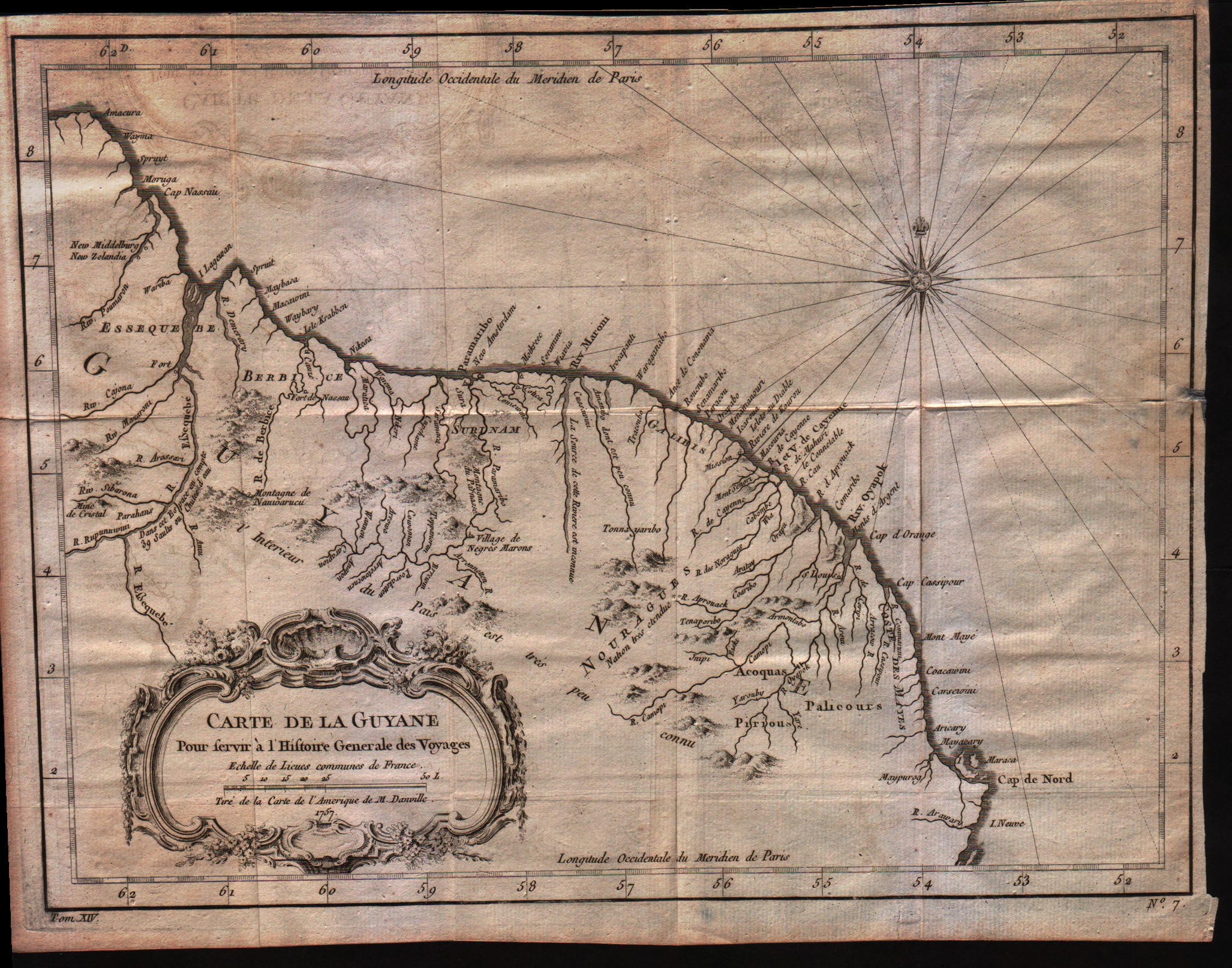
Map title
Carte de la Guyane
Author
Bellin
Location shown in map
Guyane
Edition date
1757
Edition place
Paris
Editor
--
Atlas
Historie General des Voyages -- Prevost
Price
Please ask: info@thetreasuremaps.com
State
[mint/EXCELLENT/very good/good/fair/mediocre/poor]
Color
Black/white
Verso
Blank
Size
Plate: cm (30.5 x 22.9) inches (12.01 x 9.02) Paper: cm (33 x 25.4) inches (12.99 x 10)
Technique
Copper engraving
Note
No particular notes for this maps
Reference
--
Wiki
Here for more info
In stock
Available
Info
info@thetreasuremaps.com
Code
#0021
×
![Carte de la Guyane by Bellin, Guyane, 1757]()
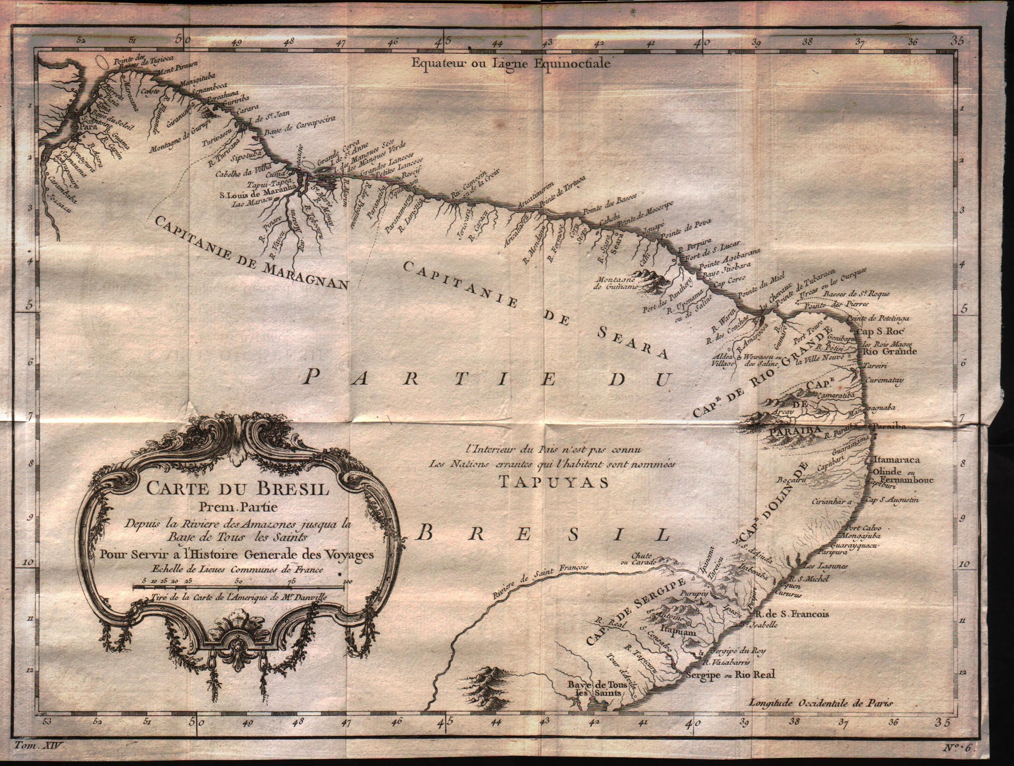
Map title
Carte du Bresil Prem.Partie
Author
Bellin
Location shown in map
Brasil
Edition date
1757
Edition place
Paris
Editor
--
Atlas
Historie General des Voyages -- Prevost
Price
125 Euro
State
[mint/EXCELLENT/very good/good/fair/mediocre/poor]
Color
Black/white
Verso
Blank
Size
Plate: cm (34.3 x 25.4) inches (13.5 x 10) Paper: cm (31.8 x 24.1) inches (12.52 x 9.49)
Technique
Copper engraving
Note
No particular notes for this maps
Reference
--
Wiki
Here for more info
In stock
Available
Info
info@thetreasuremaps.com
Code
#0023
×
![Carte du Bresil Prem.Partie by Bellin, Brasil, 1757]()
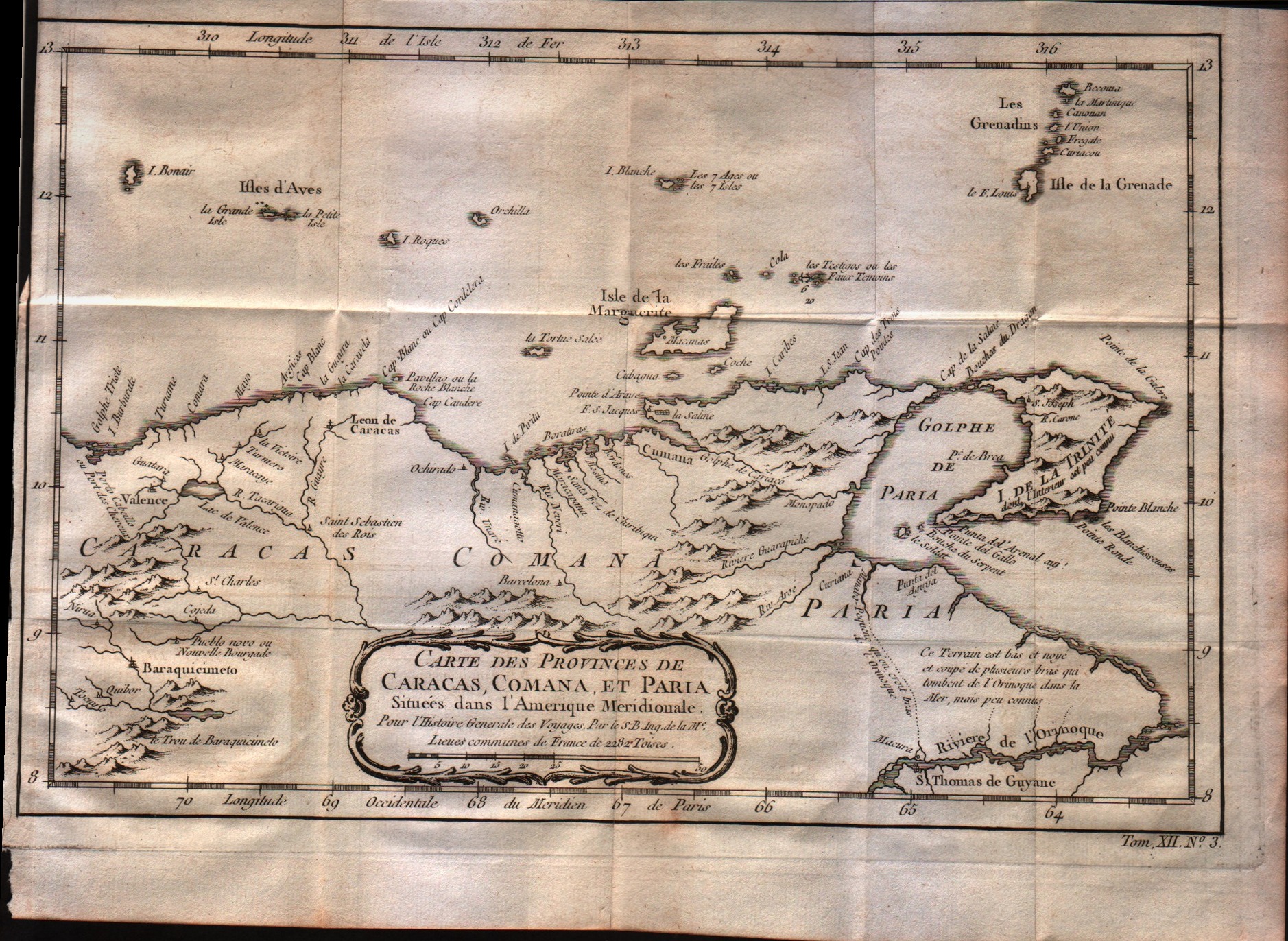
Map title
Carte des provinces de Caracas, Comana et Paria
Author
Bellin
Location shown in map
Caracas
Edition date
1757
Edition place
Paris
Editor
--
Atlas
Historie General des Voyages -- Prevost
Price
Please ask: info@thetreasuremaps.com
State
[mint/EXCELLENT/very good/good/fair/mediocre/poor]
Color
Black/white
Verso
Blank
Size
Plate: cm (31.8 x 22.9) inches (12.52 x 9.02) Paper: cm (29.2 x 22.9) inches (11.5 x 9.02)
Technique
Copper engraving
Note
No particular notes for this maps
Reference
--
Wiki
Here for more info
In stock
Available
Info
info@thetreasuremaps.com
Code
#0024
×
![Carte des provinces de Caracas, Comana et Paria by Bellin, Caracas, 1757]()
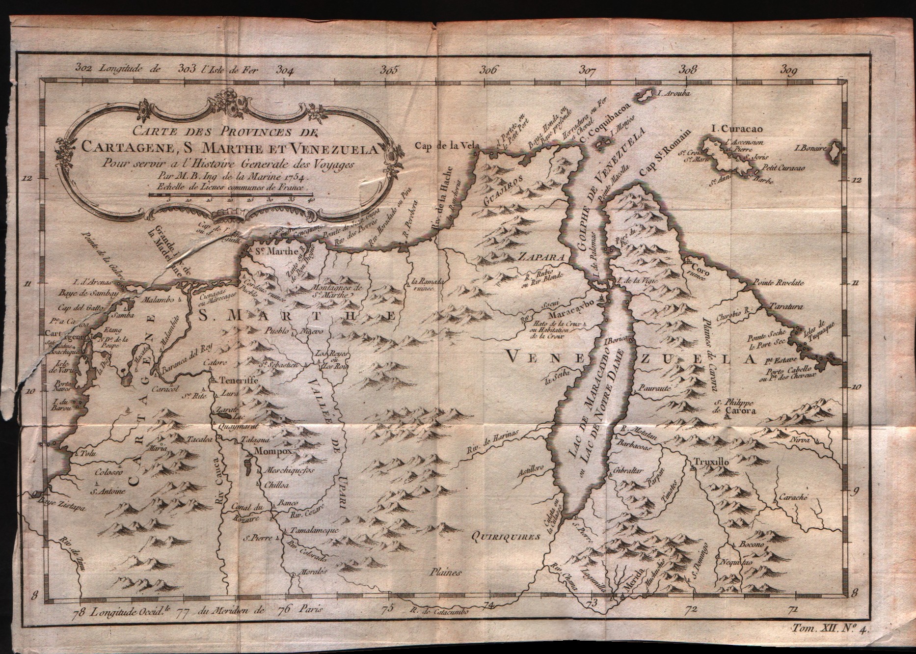
Map title
Carte des provinces de Cartagene,St.Marthe et Venezuela
Author
Bellin
Location shown in map
Venezuela
Edition date
1757
Edition place
Paris
Editor
--
Atlas
Historie General des Voyages -- Prevost
Price
Please ask: info@thetreasuremaps.com
State
[mint/EXCELLENT/very good/good/fair/mediocre/poor]
Color
Black/white
Verso
Blank
Size
Plate: cm (30.5 x 21.6) inches (12.01 x 8.5) Paper: cm (27.9 x 20.3) inches (10.98 x 7.99)
Technique
Copper engraving
Note
No particular notes for this maps
Reference
--
Wiki
Here for more info
In stock
Available
Info
info@thetreasuremaps.com
Code
#0025
×
![Carte des provinces de Cartagene,St.Marthe et Venezuela by Bellin, Venezuela, 1757]()
Map title
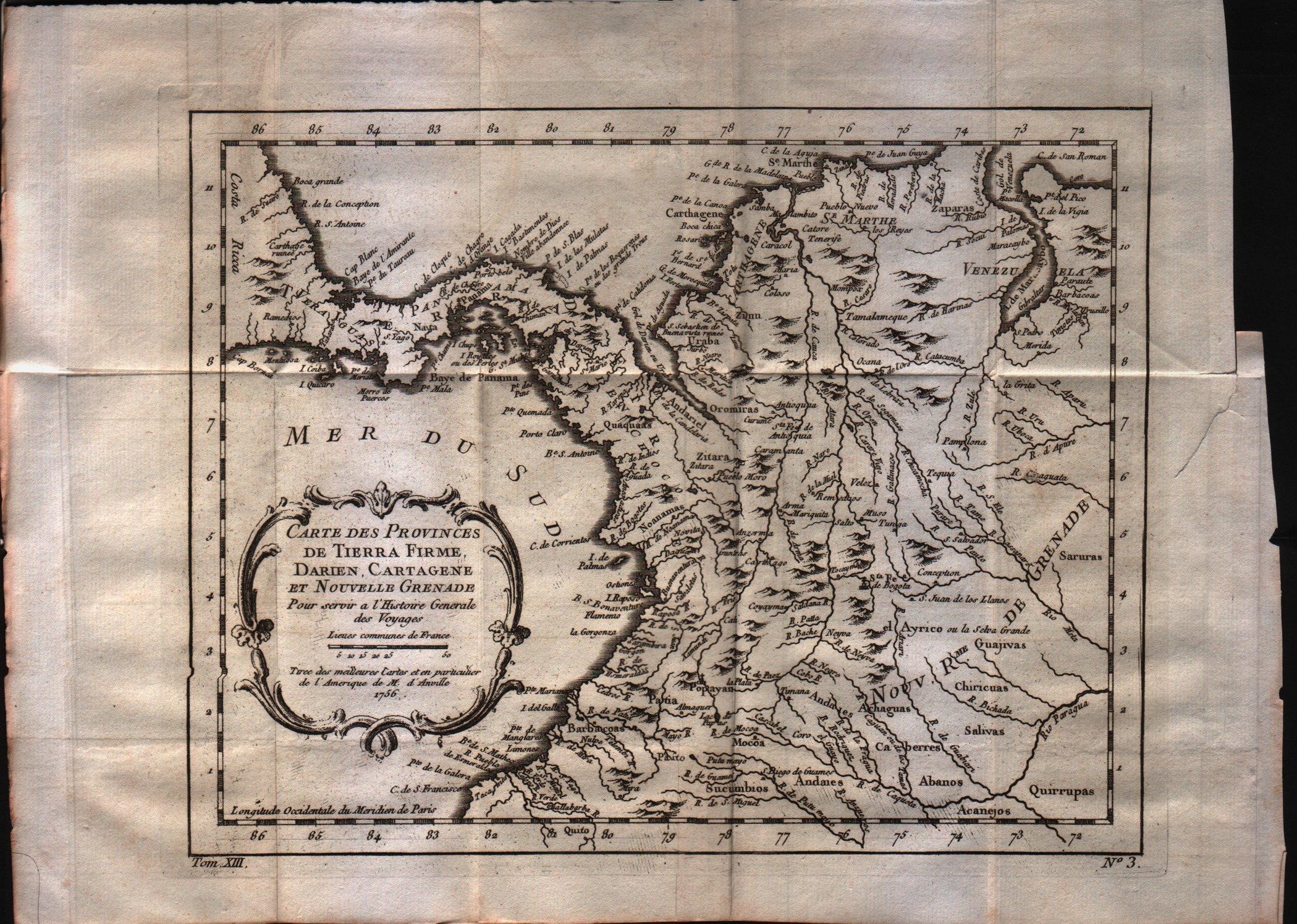
Carte des Provinces de Tierra Firme, Darien, Cartagene et Nouvelle Grenade
Author
Bellin
Location shown in map
--
Edition date
1757
Edition place
Paris
Editor
--
Atlas
Historie General des Voyages -- Prevost
Price
Please ask: info@thetreasuremaps.com
State
[mint/EXCELLENT/very good/good/fair/mediocre/poor]
Color
Black/white
Verso
Blank
Size
Plate: cm (25.4 x 20.3) inches (10 x 7.99) Paper: cm (33 x 25.4) inches (12.99 x 10)
Technique
Copper engraving
Note
No particular notes for this maps
Reference
--
Wiki
Here for more info
In stock
Available
Info
info@thetreasuremaps.com
Code
#0026
×
![Carte des Provinces de Tierra Firme, Darien, Cartagene et Nouvelle Grenade by Bellin, --, 1757]()
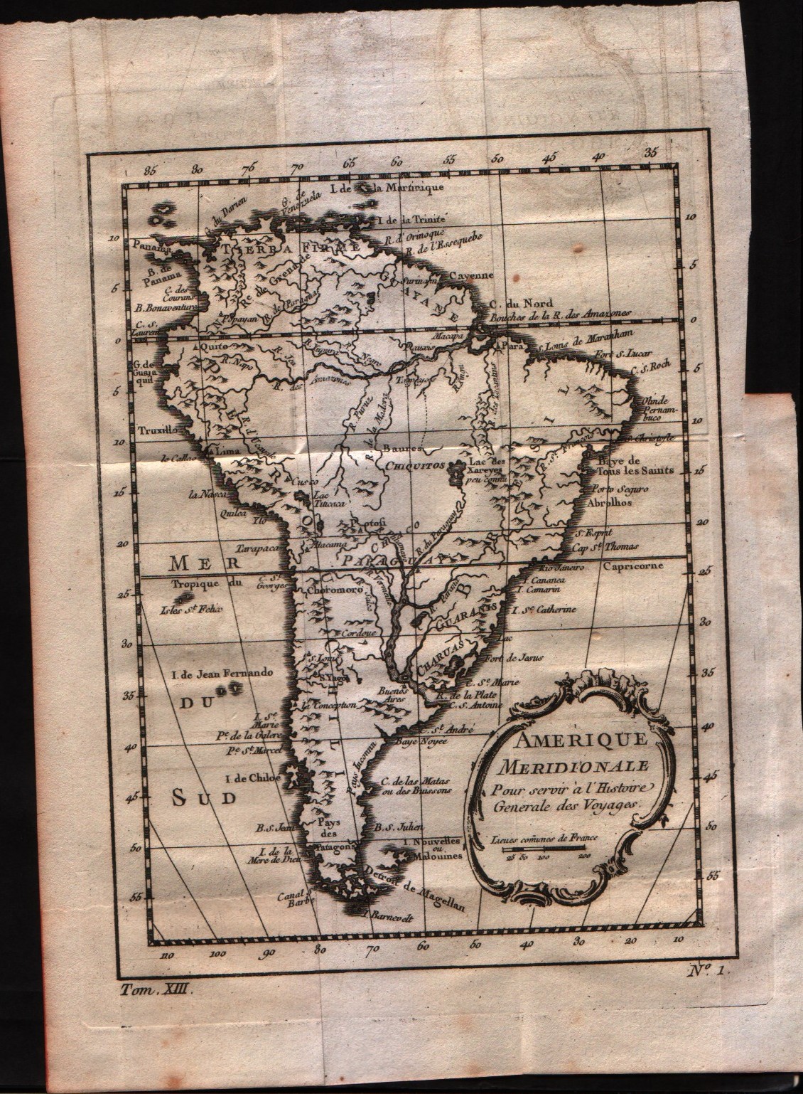
Map title
Amerique Meridionale
Author
Bellin
Location shown in map
South America
Edition date
1757
Edition place
Paris
Editor
--
Atlas
Historie General des Voyages -- Prevost
Price
75 Euro
State
[mint/EXCELLENT/very good/good/fair/mediocre/poor]
Color
Black/white
Verso
Blank
Size
Plate: cm (15.2 x 20.3) inches (5.98 x 7.99) Paper: cm (15.2 x 20.3) inches (5.98 x 7.99)
Technique
Copper engraving
Note
No particular notes for this maps
Reference
--
Wiki
Here for more info
In stock
Available
Info
info@thetreasuremaps.com
Code
#0027
×
![Amerique Meridionale by Bellin, South America, 1757]()
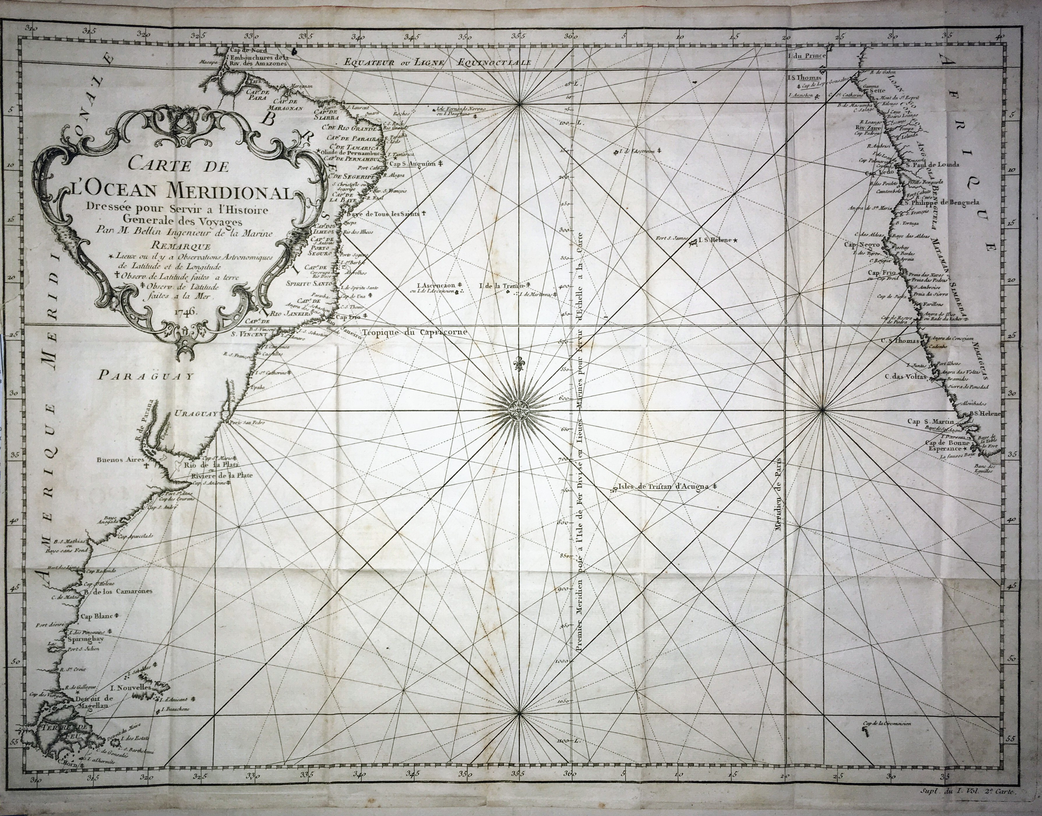
Map title
Carte de l'ocean Meridional
Author
Bellin
Location shown in map
--
Edition date
1757
Edition place
Paris
Editor
--
Atlas
Historie General des Voyages -- Prevost
Price
Please ask: info@thetreasuremaps.com
State
[mint/excellent/VERY GOOD/good/fair/mediocre/poor]
Color
Black/white
Verso
Blank
Size
Plate: cm (45.7 x 34.3) inches (17.99 x 13.5) Paper: cm (50.8 x 36.8) inches (20 x 14.49)
Technique
Copper engraving
Note
No particular notes for this maps
Reference
--
Wiki
Here for more info
In stock
Available
Info
info@thetreasuremaps.com
Code
#0028
×
![Carte de l'ocean Meridional by Bellin, --, 1757]()

Map title
Carte de la province de Quito au Perou
Author
Bellin
Location shown in map
--
Edition date
1757
Edition place
Paris
Editor
--
Atlas
Historie General des Voyages -- Prevost
Price
250 Euro
State
[mint/excellent/VERY GOOD/good/fair/mediocre/poor]
Color
Black/white
Verso
Blank
Size
Plate: cm (34.3 x 58.4) inches (13.5 x 22.99) Paper: cm (34.3 x 58.4) inches (13.5 x 22.99)
Technique
Copper engraving
Note
No particular notes for this maps
Reference
--
Wiki
Here for more info
In stock
Available
Info
info@thetreasuremaps.com
Code
#0029
×
![Carte de la province de Quito au Perou by Bellin, --, 1757]()
Map title
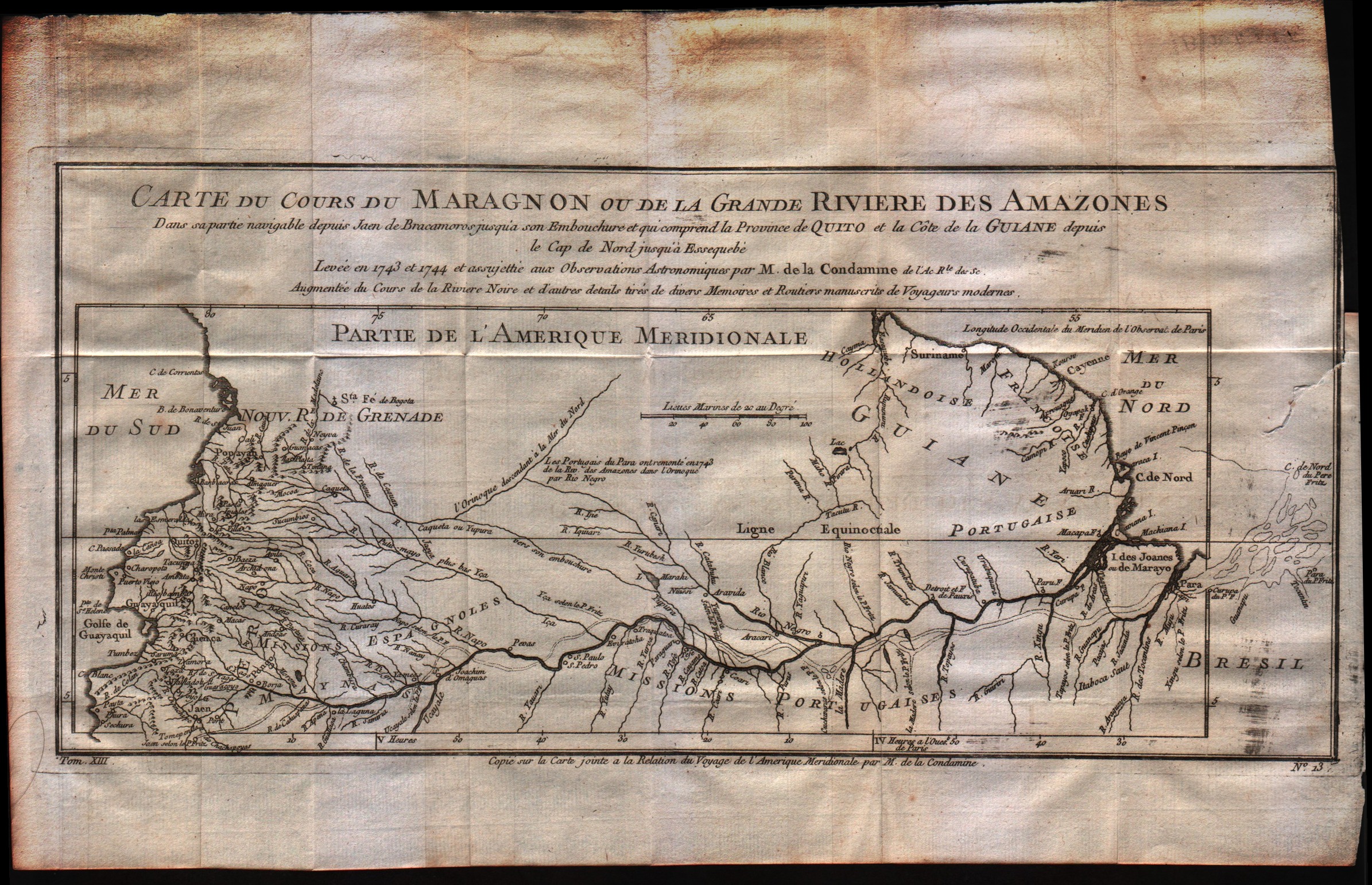
Carte du cours du Maragnon ou de la Grande Riviere des Amazones
Author
Bellin
Location shown in map
--
Edition date
1757
Edition place
Paris
Editor
--
Atlas
Historie General des Voyages -- Prevost
Price
Please ask: info@thetreasuremaps.com
State
[mint/excellent/VERY GOOD/good/fair/mediocre/poor]
Color
Black/white
Verso
Blank
Size
Plate: cm (36.8 x 17.8) inches (14.49 x 7.01) Paper: cm (39.4 x 25.4) inches (15.51 x 10)
Technique
Copper engraving
Note
No particular notes for this maps
Reference
--
Wiki
Here for more info
In stock
Available
Info
info@thetreasuremaps.com
Code
#0030
×
![Carte du cours du Maragnon ou de la Grande Riviere des Amazones by Bellin, --, 1757]()
Map title
Carte du Paraguay et des pays voisins
Author
Bellin
Location shown in map
--
Edition date
1757
Edition place
Paris
Editor
--
Atlas
Historie General des Voyages -- Prevost
Price
Please ask: info@thetreasuremaps.com
State
[mint/EXCELLENT/very good/good/fair/mediocre/poor]
Color
Black/white
Verso
Blank
Size
Plate: cm (30.5 x 20.3) inches (12.01 x 7.99) Paper: cm (35.6 x 25.4) inches (14.02 x 10)
Technique
Copper engraving
Note
No particular notes for this maps
Reference
--
Wiki
Here for more info
In stock
Available
Info
info@thetreasuremaps.com
Code
#0031
×
![Carte du Paraguay et des pays voisins by Bellin, --, 1757]()
Map title
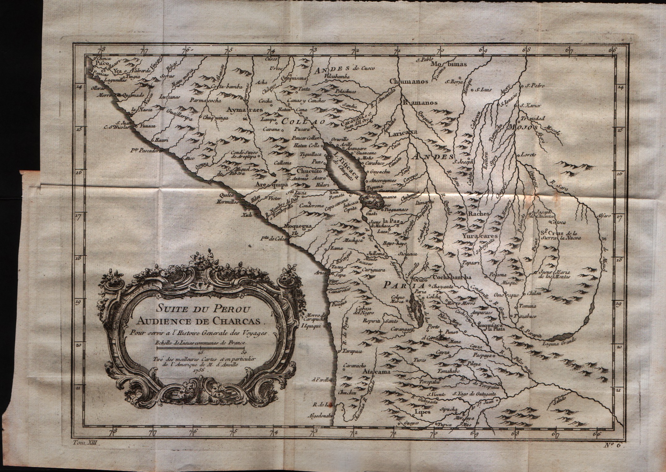
Suit du Perou audience de Charcas
Author
Bellin
Location shown in map
Peru
Edition date
1757
Edition place
Paris
Editor
--
Atlas
Historie General des Voyages -- Prevost
Price
Please ask: info@thetreasuremaps.com
State
[mint/EXCELLENT/very good/good/fair/mediocre/poor]
Color
Black/white
Verso
Blank
Size
Plate: cm (30.5 x 21.6) inches (12.01 x 8.5) Paper: cm (34.3 x 26.7) inches (13.5 x 10.51)
Technique
Copper engraving
Note
No particular notes for this maps
Reference
--
Wiki
Here for more info
In stock
Available
Info
info@thetreasuremaps.com
Code
#0032
×
![Suit du Perou audience de Charcas by Bellin, Peru, 1757]()