News
Map title
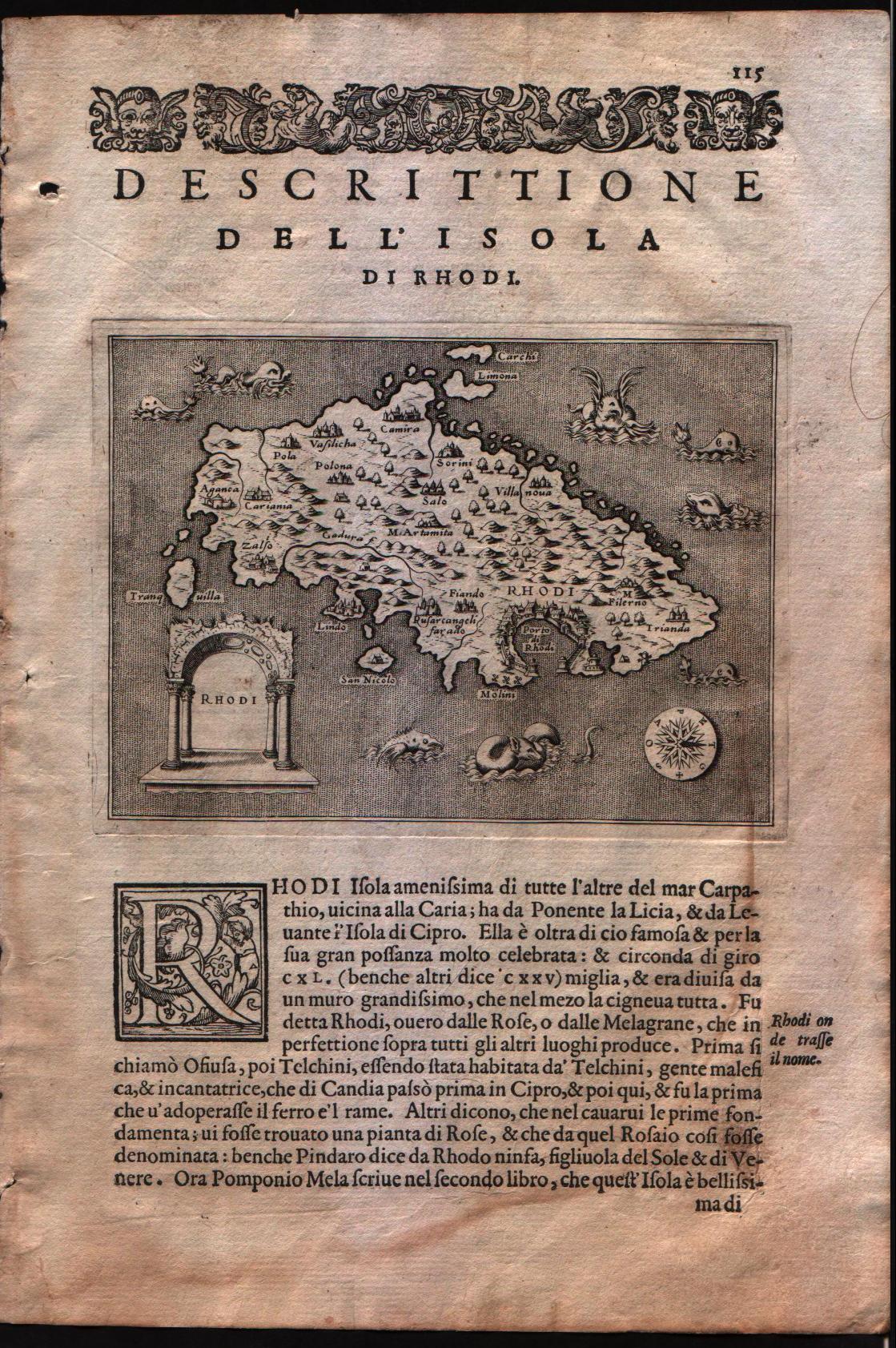
Descrittione dell'isola di Rhodi
Author
Porcacchi
Location shown in map
Rhodi island
Edition date
1576
Edition place
Venice
Editor
--
Atlas
L'Isole piu famose del mondo -- S. Galignani and G. Porro
Price
Please ask: info@thetreasuremaps.com
State
[mint/EXCELLENT/very good/good/fair/mediocre/poor]
Color
Black/white
Verso
Italian text pag.122
Size
Plate: cm (15.2 x 11.4) inches (5.98 x 4.49) Paper: cm (19 x 29.2) inches (7.48 x 11.5)
Technique
Copper engraving
Note
No particular notes for this maps
Reference
Genoa pubblic library "Civica Berio"
Wiki
Here for more info
In stock
Available
Info
info@thetreasuremaps.com
Code
#0109
×
![Descrittione dell'isola di Rhodi by Porcacchi, Rhodi island, 1576]()
Map title
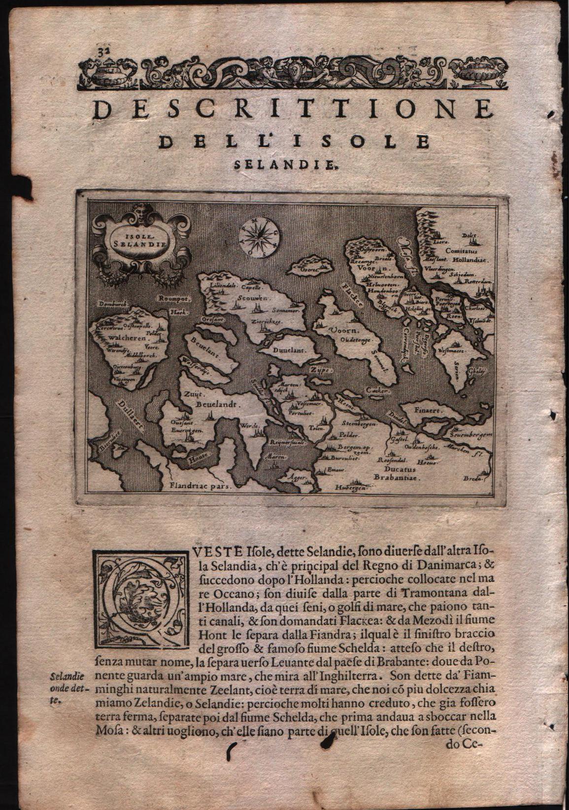
Descrittione dell'isole Selandie
Author
Porcacchi
Location shown in map
Zeeland islands
Edition date
1576
Edition place
Venice
Editor
--
Atlas
L'Isole piu famose del mondo -- S. Galignani and G. Porro
Price
Please ask: info@thetreasuremaps.com
State
[mint/EXCELLENT/Vvery good/good/fair/mediocre/poor]
Color
Black/white
Verso
Italian text pag.31
Size
Plate: cm (15.2 x 11.4) inches (5.98 x 4.49) Paper: cm (19 x 29.2) inches (7.48 x 11.5)
Technique
Copper engraving
Note
No particular notes for this maps
Reference
Genoa pubblic library "Civica Berio"
Wiki
Here for more info
In stock
Available
Info
info@thetreasuremaps.com
Code
#0111
×
![Descrittione dell'isole Selandie by Porcacchi, Zeeland islands, 1576]()
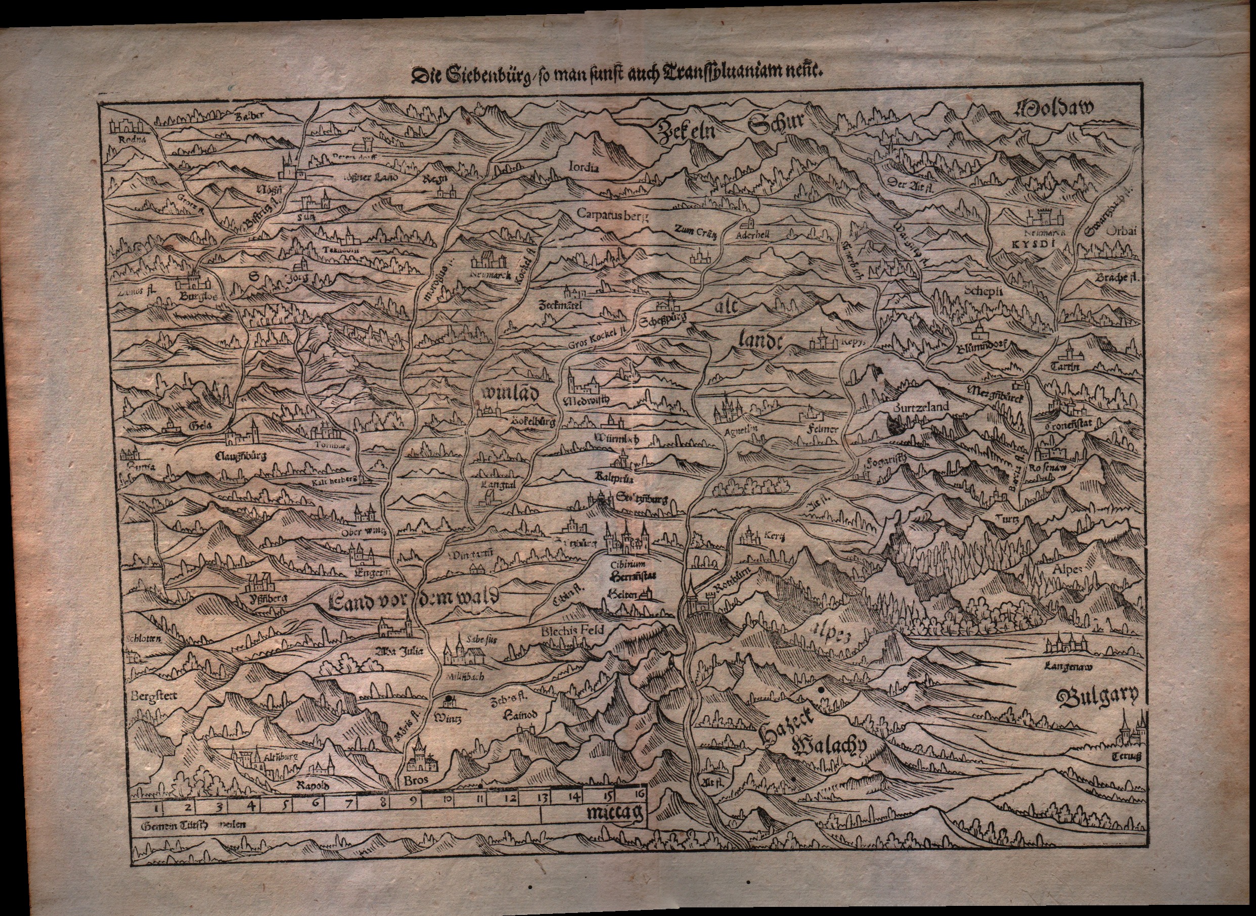
Map title
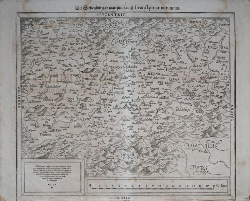
Die Siebenburg...
Author
Munster
Location shown in map
Transylvania and Bosnia
Edition date
1598
Edition place
Basel
Editor
Henrich Petri
Atlas
Cosmographia Universalis
Price
150 Euro
State
[mint/EXCELLENT/very good/good/fair/mediocre/poor]
Color
Black/white
Verso
German text pag.???
Size
Plate: cm (35.6 x 30.5) inches (14.02 x 12.01) Paper: cm (40.6 x 33) inches (15.98 x 12.99)
Technique
Woodcut
Note
Central Romania, Moldova at the top right and Wallachia at the bottom right.
Reference
--
Wiki
Here for more info
In stock
Available
Info
info@thetreasuremaps.com
Code
#0112
×
![Die Siebenburg... by Munster, Transylvania and Bosnia, 1598]()
Map title
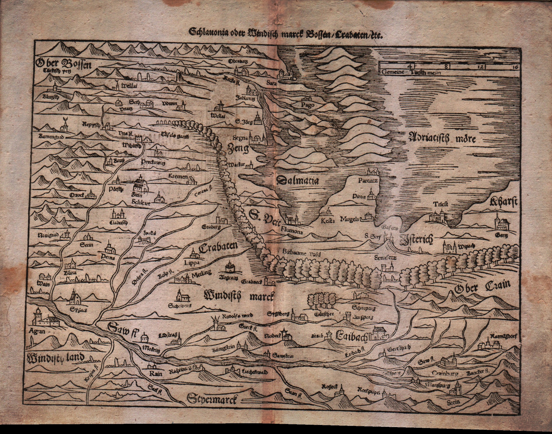
Sclavonia oder Windisch Marck Bossen Crabaten ...
Author
Munster
Location shown in map
Slovenia,Kroatia,Bosnia,Triest
Edition date
Unknown
Edition place
Basel
Editor
Henrich Petri
Atlas
Cosmographia Universalis
Price
200 Euro
State
[mint/EXCELLENT/very good/good/fair/mediocre/poor]
Color
Black/white
Verso
German text pag.???
Size
Plate: cm (34.3 x 25.4) inches (13.5 x 10) Paper: cm (40.6 x 31.8) inches (15.98 x 12.52)
Technique
Woodcut
Note
--
Reference
--
Wiki
Here for more info
In stock
Available
Info
info@thetreasuremaps.com
Code
#0113
×
![Sclavonia oder Windisch Marck Bossen Crabaten ... by Munster, Slovenia,Kroatia,Bosnia,Triest, Unknown]()
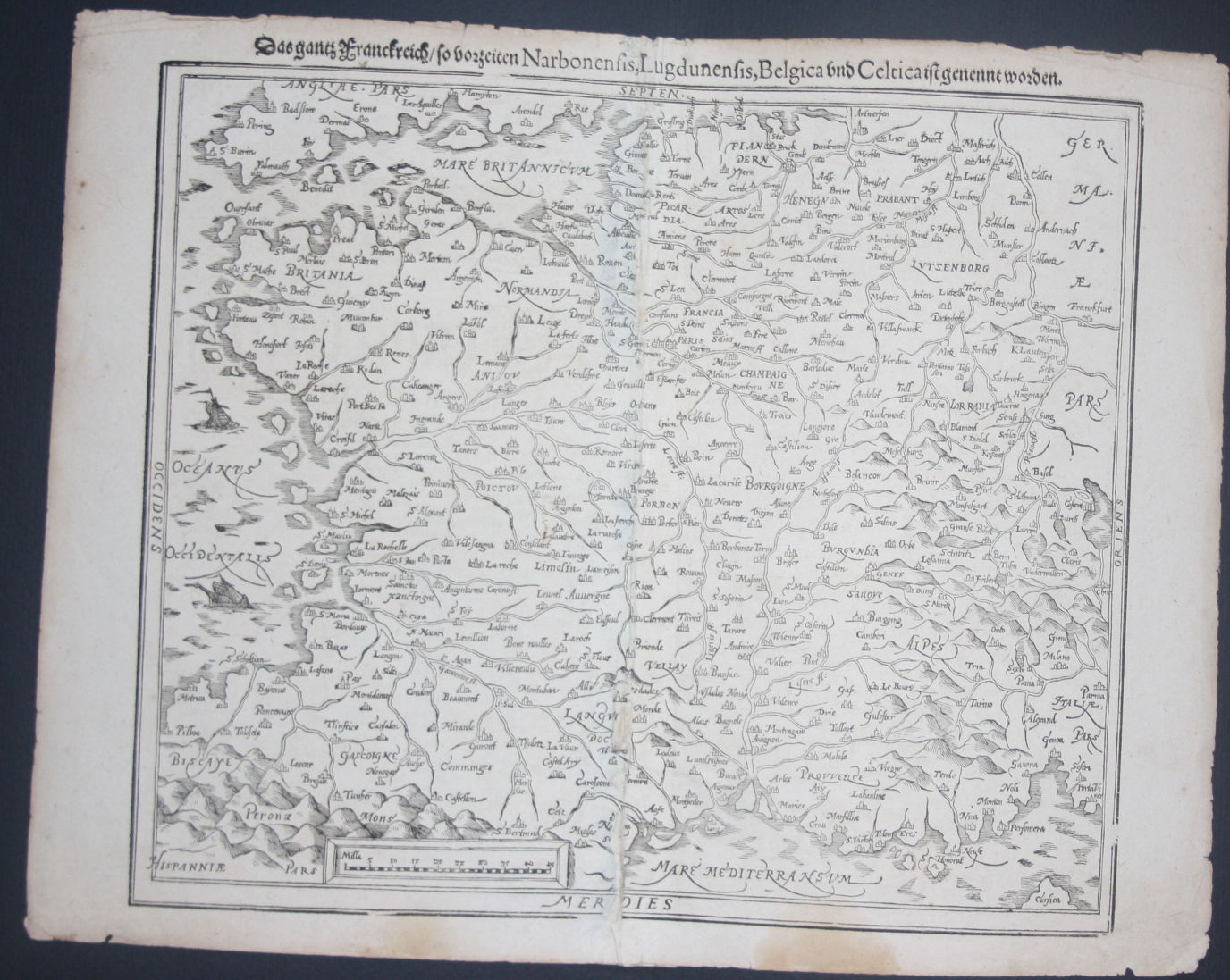
Map title
Narbonensis,Lugdunensis,Belgica and Celtica
Author
Munster
Location shown in map
France
Edition date
1598
Edition place
Basel
Editor
Henrich Petri
Atlas
Cosmographia Universalis
Price
150 Euro
State
[mint/excellent/very good/good/FAIR/mediocre/poor]
Color
Black/white
Verso
German text pag.???
Size
Plate: cm (35.6 x 30.5) inches (14.02 x 12.01) Paper: cm (43.2 x 33) inches (17.01 x 12.99)
Technique
Woodcut
Note
All France
Reference
--
Wiki
Here for more info
In stock
Available
Info
info@thetreasuremaps.com
Code
#0114
×
![Narbonensis,Lugdunensis,Belgica and Celtica by Munster, France, 1598]()
Map title
Die Siebenburg...
Author
Munster
Location shown in map
Transylvania and est Romania
Edition date
1598
Edition place
Basel
Editor
Henrich Petri
Atlas
Cosmographia Universalis
Price
150 Euro
State
[mint/EXCELLENT/very good/good/fair/mediocre/poor]
Color
Black/white
Verso
German text pag.???
Size
Plate: cm (34.3 x 25.4) inches (13.5 x 10) Paper: cm (40.6 x 33) inches (15.98 x 12.99)
Technique
Woodcut
Note
No particular notes for this maps
Reference
--
Wiki
Here for more info
In stock
Available
Info
info@thetreasuremaps.com
Code
#0115
×
![Die Siebenburg... by Munster, Transylvania and est Romania, 1598]()
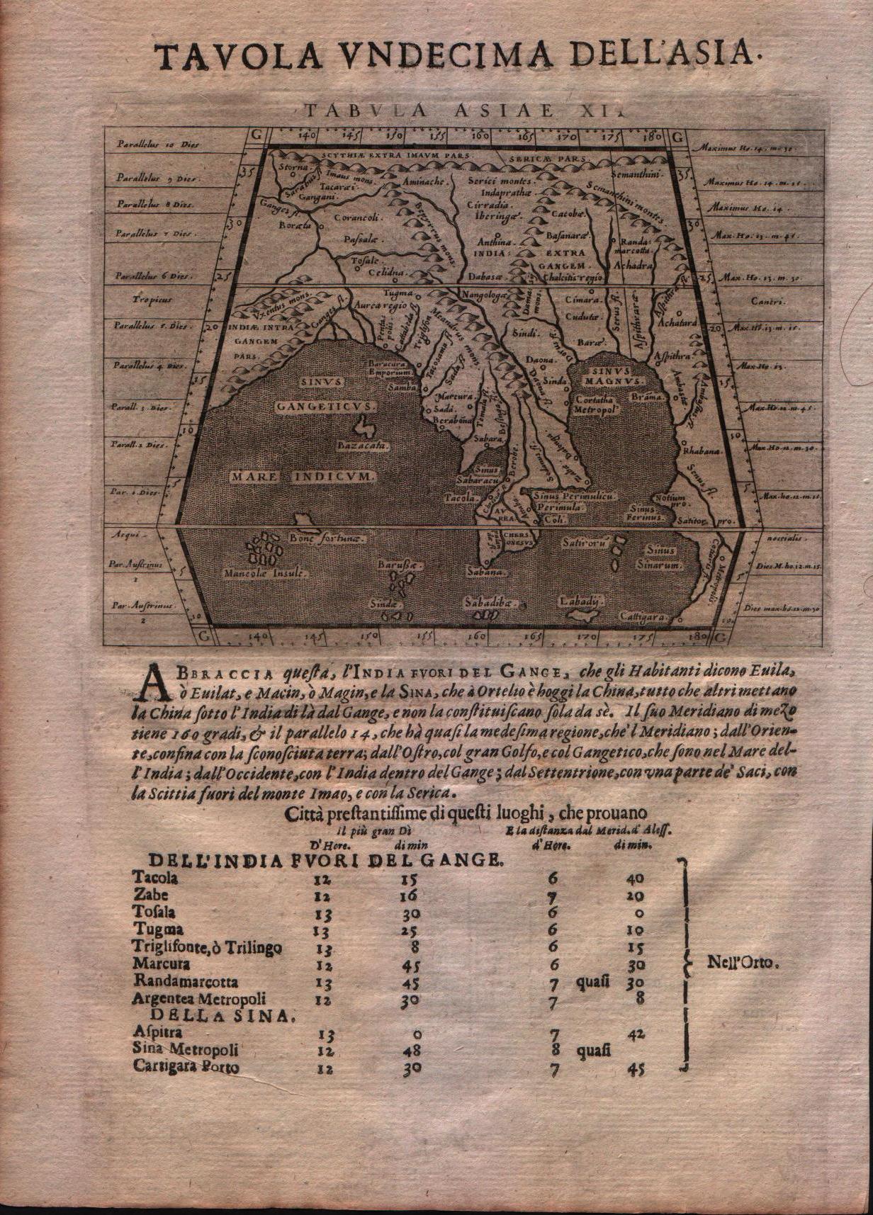
Map title
Tabula Asiae XI
Author
Magini
Location shown in map
India
Edition date
1621
Edition place
Padova
Editor
Paolo and Francesco Galignani
Atlas
Geografia di Claudio Tolomeo -- Giovanni Antonio Magini
Price
Please ask: info@thetreasuremaps.com
State
[MINT/excellent/very good/good/fair/mediocre/poor]
Color
Black/white
Verso
Italian text
Size
Plate: cm (12.7 x 17.8) inches (5 x 7.01) Paper: cm (20.3 x 30.5) inches (7.99 x 12.01)
Technique
Copper engraving
Note
--
Reference
--
Wiki
Here for more info
In stock
Available
Info
info@thetreasuremaps.com
Code
#0562
×
![Tabula Asiae XI by Magini, India, 1621]()
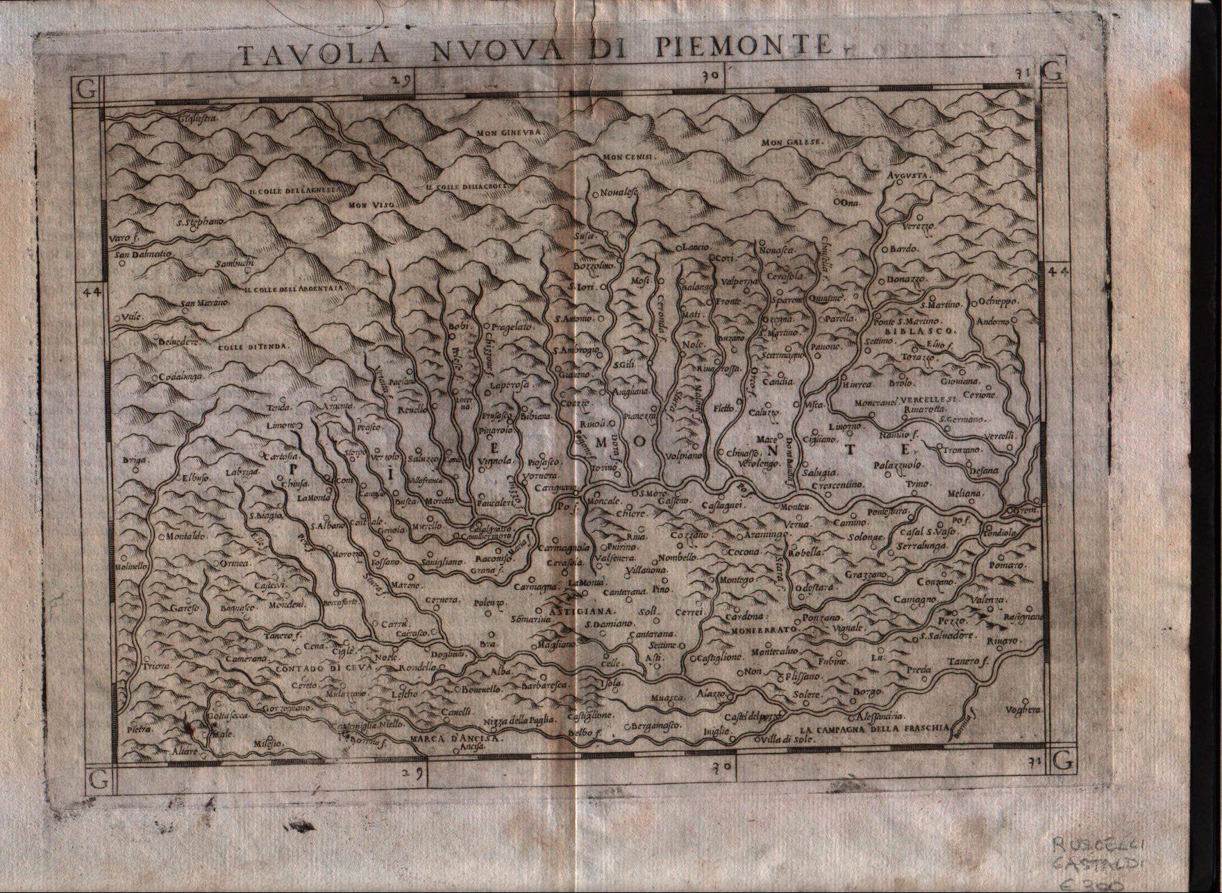
Map title
Tavola nuova di Piemonte
Author
Ruscelli
Location shown in map
Piedmont
Edition date
1574
Edition place
Venice
Editor
Giordano Ziletti
Atlas
La Geographia di Claudio Tolomeo
Price
300 Euro
State
[mint/excellent/VERY GOOD/good/fair/mediocre/poor]
Color
Black/white
Verso
Italian text
Size
Plate: cm (26 x 19) inches (10.24 x 7.48) Paper: cm (30.5 x 22.9) inches (12.01 x 9.02)
Technique
Copper engraving
Note
Based on Gastaldi map.
Reference
Genoa pubblic library "Civica Berio"
Wiki
Here for more info
In stock
Available
Info
info@thetreasuremaps.com
Code
#0117
×
![Tavola nuova di Piemonte by Ruscelli, Piedmont , 1574]()
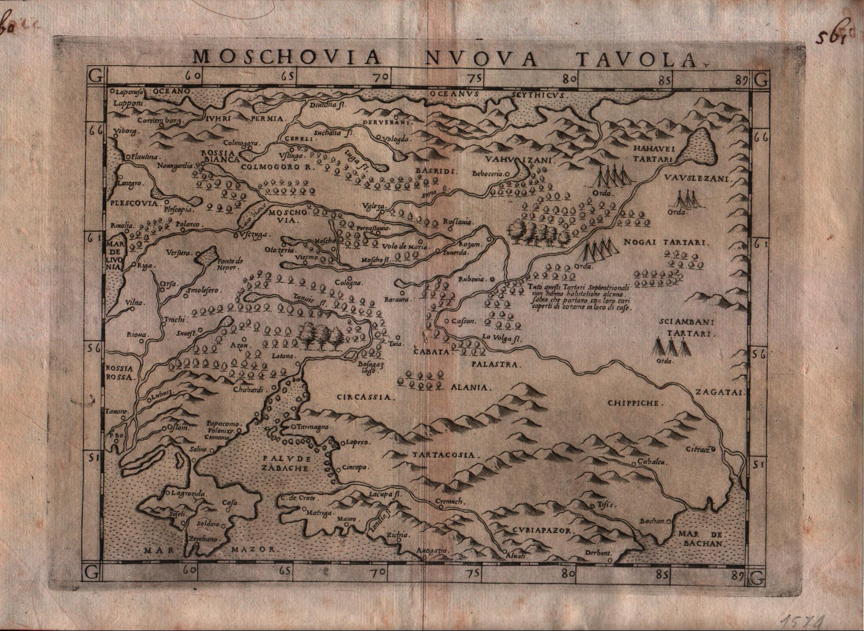
Map title
Moschovia nuova tavola
Author
Ruscelli
Location shown in map
Russia
Edition date
1574
Edition place
Venice
Editor
Giordano Ziletti
Atlas
La Geographia di Claudio Tolomeo
Price
300 Euro
State
[mint/EXCELLENT/very good/good/fair/mediocre/poor]
Color
Black/white
Verso
Italian text pag.25
Size
Plate: cm (26 x 19) inches (10.24 x 7.48) Paper: cm (30.5 x 22.9) inches (12.01 x 9.02)
Technique
Copper engraving
Note
Based on Gastaldi map.
Reference
Genoa pubblic library "Civica Berio"
Wiki
Here for more info
In stock
Available
Info
info@thetreasuremaps.com
Code
#0118
×
![Moschovia nuova tavola by Ruscelli, Russia, 1574]()
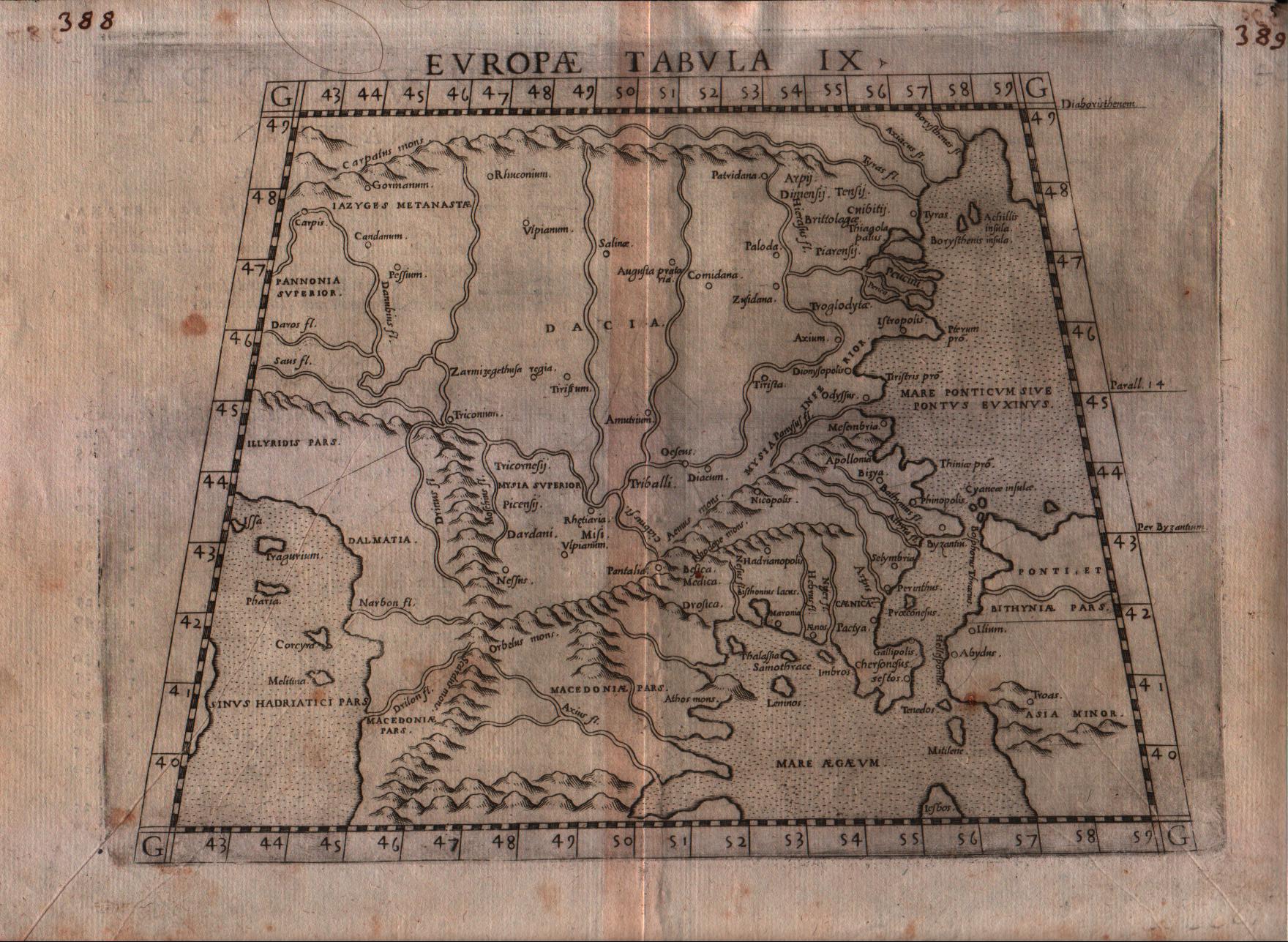
Map title
Europae tabula IX
Author
Ruscelli
Location shown in map
Balkan
Edition date
1574
Edition place
Venice
Editor
Giordano Ziletti
Atlas
La Geographia di Claudio Tolomeo
Price
150 Euro
State
[mint/EXCELLENT/very good/good/fair/mediocre/poor]
Color
Black/white
Verso
Italian text pag.10
Size
Plate: cm (26 x 19) inches (10.24 x 7.48) Paper: cm (30.5 x 22.9) inches (12.01 x 9.02)
Technique
Copper engraving
Note
Based on Gastaldi map.
Reference
Genoa pubblic library "Civica Berio"
Wiki
Here for more info
In stock
Available
Info
info@thetreasuremaps.com
Code
#0119
×
![Europae tabula IX by Ruscelli, Balkan , 1574]()
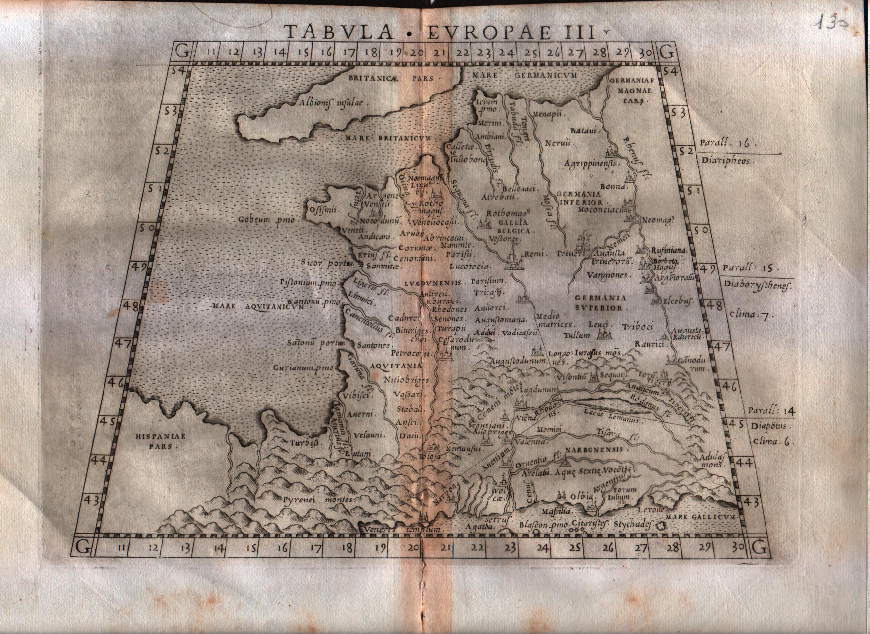
Map title
Tabula Europae III
Author
Ruscelli
Location shown in map
France
Edition date
1564
Edition place
Venice
Editor
Girolamo Ziletti
Atlas
La Geographia di Claudio Tolomeo
Price
150 Euro
State
[mint/excellent/very good/GOOD/fair/mediocre/poor]
Color
Black/white
Verso
Latin text pag.8
Size
Plate: cm (26 x 20.3) inches (10.24 x 7.99) Paper: cm (30.5 x 22.9) inches (12.01 x 9.02)
Technique
Copper engraving
Note
Based on Gastaldi map.
Reference
--
Wiki
Here for more info
In stock
Available
Info
info@thetreasuremaps.com
Code
#0120
×
![Tabula Europae III by Ruscelli, France, 1564]()
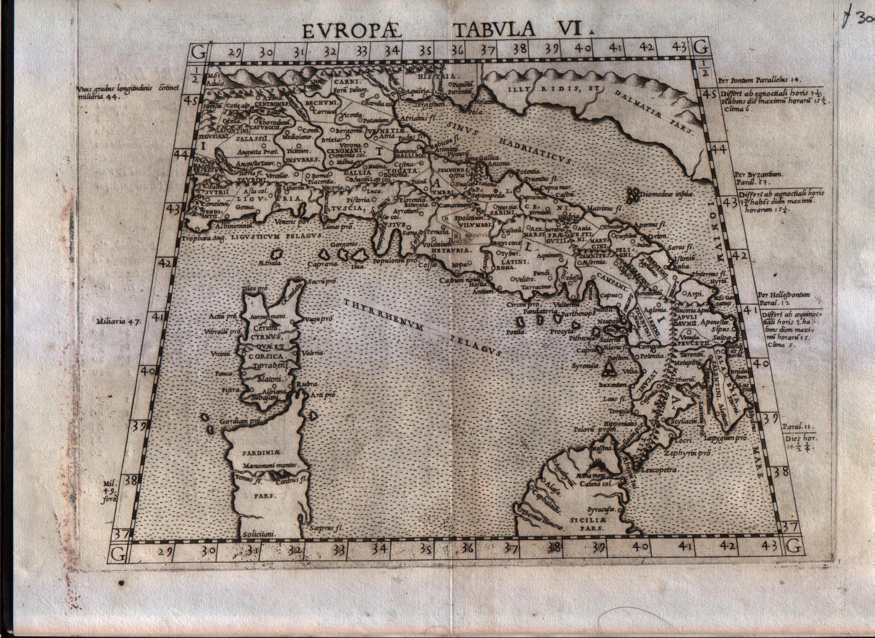
Map title
Europae tabula VI
Author
Ruscelli
Location shown in map
Italy
Edition date
1564
Edition place
Venice
Editor
Giordano Ziletti
Atlas
La Geographia di Claudio Tolomeo
Price
250 Euro
State
[mint/EXCELLENT/very good/good/fair/mediocre/poor]
Color
Black/white
Verso
Latin text pag.15
Size
Plate: cm (26 x 20.3) inches (10.24 x 7.99) Paper: cm (30.5 x 22.9) inches (12.01 x 9.02)
Technique
Copper engraving
Note
Reference
R.Borri L'Italia nelle antiche carte pag.33
Wiki
Here for more info
In stock
Available
Info
info@thetreasuremaps.com
Code
#0121
×
![Europae tabula VI by Ruscelli, Italy, 1564]()
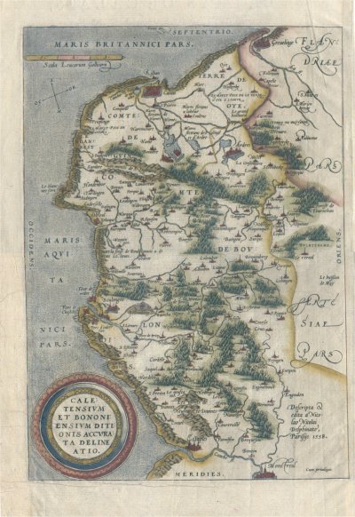
Map title
Caletensium et Bononiensium Ditionis Accurata Delineatio
Author
Ortelius
Location shown in map
--
Edition date
1602
Edition place
Anvers
Editor
--
Atlas
Theatrum Orbis Terrarum
Price
150 Euro
State
[mint/EXCELLENT/very good/good/fair/mediocre/poor]
Color
Modern color
Verso
French text
Size
Plate: cm (33 x 24.1) inches (12.99 x 9.49) Paper: cm (33 x 24.1) inches (12.99 x 9.49)
Technique
Copper engraving
Note
No particular notes for this maps
Reference
Van Den Broecke 44
Wiki
Here for more info
In stock
Available
Info
info@thetreasuremaps.com
Code
#0122
×
![Caletensium et Bononiensium Ditionis Accurata Delineatio by Ortelius, --, 1602]()
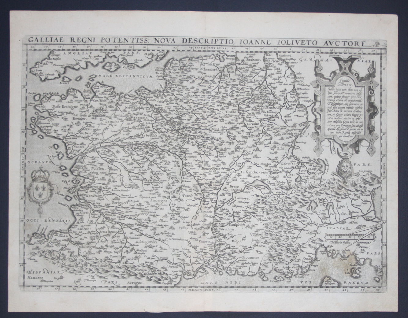
Map title
Galliae regni potentiss: nuova descriptio Ioanne Ioliveto auctore
Author
Ortelius
Location shown in map
France
Edition date
1588
Edition place
Anvers
Editor
--
Atlas
Theatrum Orbis Terrarum
Price
400 Euro
State
[mint/EXCELLENT/very good/good/fair/mediocre/poor]
Color
Black/white
Verso
Spanish text pag.22
Size
Plate: cm (48.3 x 34.3) inches (19.02 x 13.5) Paper: cm (53.3 x 40.6) inches (20.98 x 15.98)
Technique
Copper engraving
Note
No particular notes for this maps
Reference
Van Den Broecke 34
Wiki
Here for more info
In stock
Available
Info
info@thetreasuremaps.com
Code
#0123
×
![Galliae regni potentiss: nuova descriptio Ioanne Ioliveto auctore by Ortelius, France, 1588]()
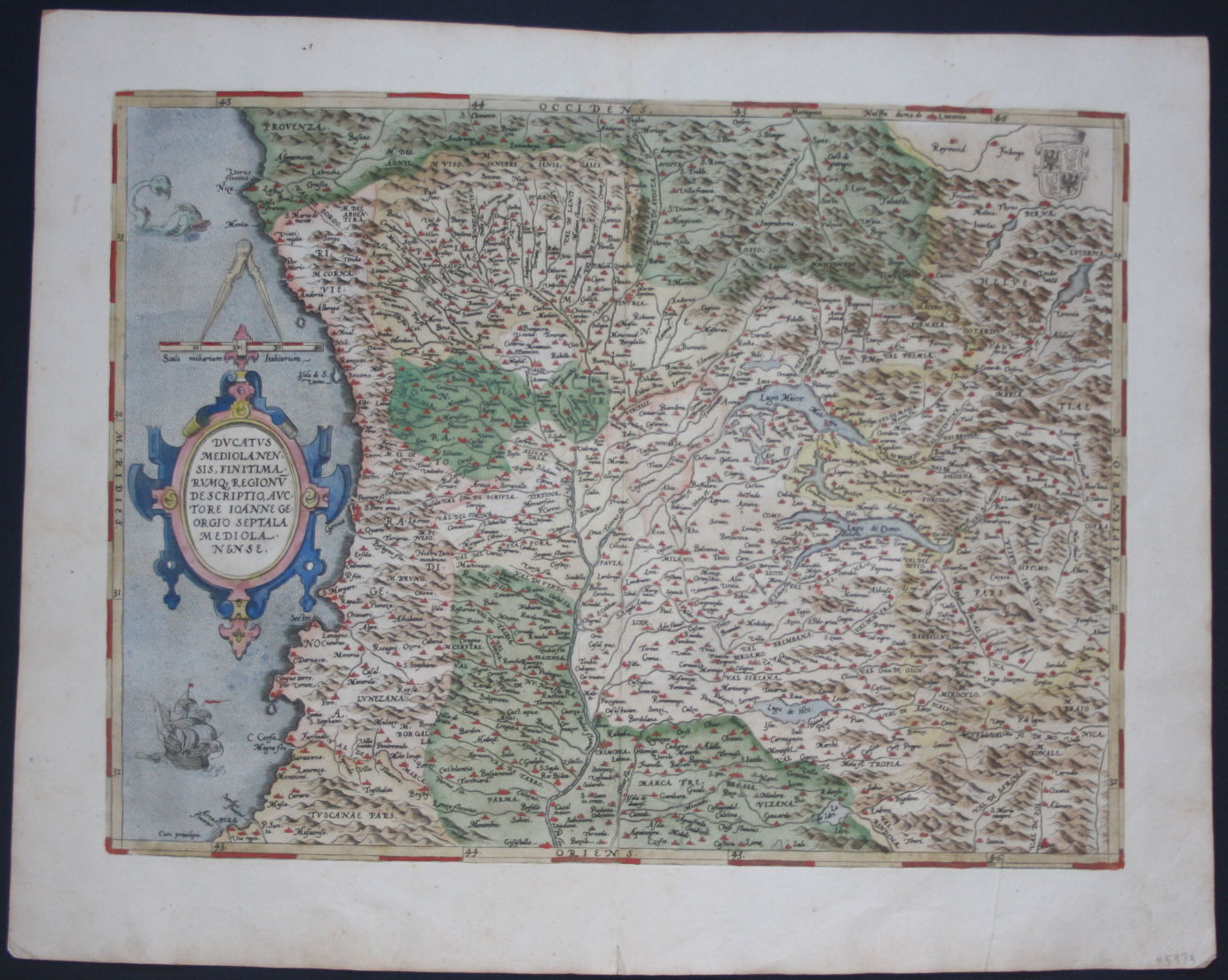
Map title
Ducatus Mediolanensis, Finitimarumq Regionu Descriptio Auctore Iooanne Georgio Septala Mediolanense
Author
Ortelius
Location shown in map
Mediolanum Ducatus, North west Italy
Edition date
1588
Edition place
Antwerp
Editor
--
Atlas
Theatrum Orbis Terrarum
Price
500 Euro
State
[mint/EXCELLENT/very good/good/fair/mediocre/poor]
Color
Black/white
Verso
Spanish text pag.67
Size
Plate: cm (47 x 35.6) inches (18.5 x 14.02) Paper: cm (53.3 x 40.6) inches (20.98 x 15.98)
Technique
Copper engraving
Note
No particular notes for this maps.
Reference
Van Den Broecke 125
Wiki
Here for more info
In stock
Available
Info
info@thetreasuremaps.com
Code
#0124
×
![Ducatus Mediolanensis, Finitimarumq Regionu Descriptio Auctore Iooanne Georgio Septala Mediolanense by Ortelius, Mediolanum Ducatus, North west Italy, 1588]()
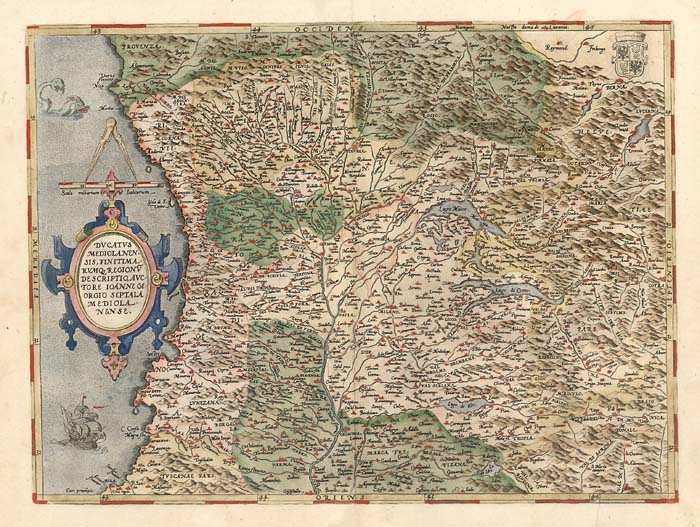
Map title
Ducatus Mediolanensis, Finitimarumq Regionu Descriptio Auctore Iooanne Georgio Septala Mediolanense
Author
Ortelius
Location shown in map
Mediolanum Ducatus, North west Italy
Edition date
1584
Edition place
Antwerp
Editor
--
Atlas
Theatrum Orbis Terrarum
Price
600 Euro
State
[mint/excellent/VERY GOOD/good/fair/mediocre/poor]
Color
Old color
Verso
Latin text pag.67
Size
Plate: cm (47 x 36.8) inches (18.5 x 14.49) Paper: cm (55.9 x 43.2) inches (22.01 x 17.01)
Technique
Copper engraving
Note
No particular notes for this maps.
Reference
Van Den Broecke 125
Wiki
Here for more info
In stock
Available
Info
info@thetreasuremaps.com
Code
#0125
×
![Ducatus Mediolanensis, Finitimarumq Regionu Descriptio Auctore Iooanne Georgio Septala Mediolanense by Ortelius, Mediolanum Ducatus, North west Italy, 1584]()

Map title
Ducatus Mediolanensis, Finitimarumq Regionu Descriptio Auctore Iooanne Georgio Septala Mediolanense
Author
Ortelius
Location shown in map
Mediolanum Ducatus, North west Italy
Edition date
1592
Edition place
Antwerp
Editor
--
Atlas
Theatrum Orbis Terrarum
Price
400 Euro
State
[mint/excellent/very good/GOOD/fair/mediocre/poor]
Color
Old color
Verso
Latin text pag.71
Size
Plate: cm (47 x 35.6) inches (18.5 x 14.02) Paper: cm (53.3 x 44.4) inches (20.98 x 17.48)
Technique
Copper engraving
Note
No particular notes for this maps.
Reference
Van Den Broecke 125
Wiki
Here for more info
In stock
Available
Info
info@thetreasuremaps.com
Code
#0126
×
![Ducatus Mediolanensis, Finitimarumq Regionu Descriptio Auctore Iooanne Georgio Septala Mediolanense by Ortelius, Mediolanum Ducatus, North west Italy, 1592]()
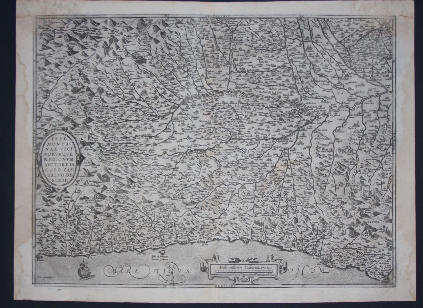
Map title
Pedmontanae Vicinorumque Regionum Auctore Iacobo Castaldo Descrip.
Author
Ortelius
Location shown in map
Piedmont & Liguria, North west Italy
Edition date
1588
Edition place
Antwerp
Editor
--
Atlas
Theatrum Orbis Terrarum
Price
500 Euro
State
[mint/EXCELLENT/very good/good/fair/mediocre/poor]
Color
Black/white
Verso
Spanish text pag.69
Size
Plate: cm (47 x 35.6) inches (18.5 x 14.02) Paper: cm (53.3 x 40.6) inches (20.98 x 15.98)
Technique
Copper engraving
Note
No particular notes for this maps.
Reference
Van Den Broecke 128
Wiki
Here for more info
In stock
Available
Info
info@thetreasuremaps.com
Code
#0127
×
![Pedmontanae Vicinorumque Regionum Auctore Iacobo Castaldo Descrip. by Ortelius, Piedmont & Liguria, North west Italy, 1588]()
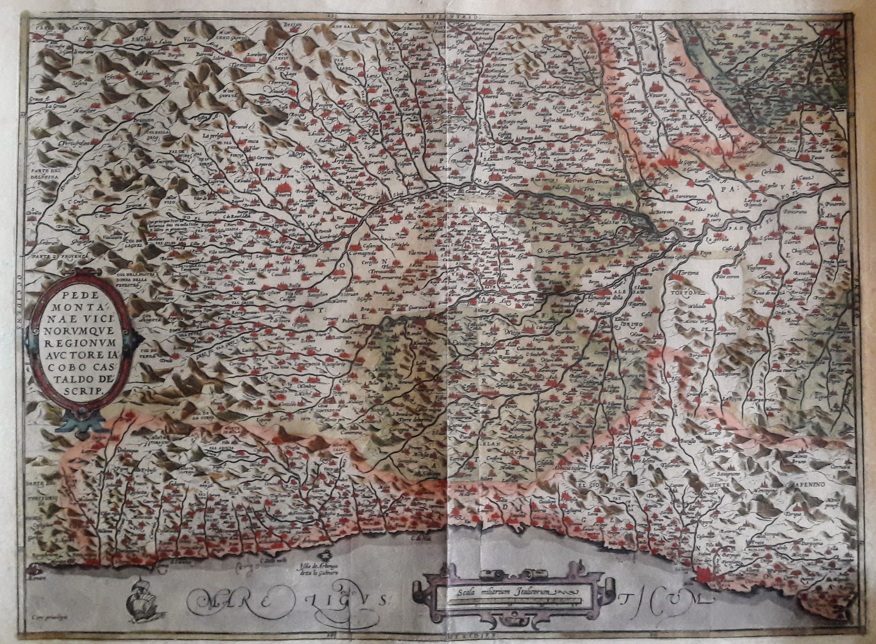
Map title
Pedmontanae Vicinorumque Regionum Auctore Iacobo Castaldo Descrip.
Author
Ortelius
Location shown in map
Piedmont & Liguria, North west Italy
Edition date
1584
Edition place
Antwerp
Editor
--
Atlas
Theatrum Orbis Terrarum
Price
400 Euro
State
[mint/excellent/very good/GOOD/fair/mediocre/poor]
Color
Old color
Verso
Latin text pag.74
Size
Plate: cm (48.3 x 35.6) inches (19.02 x 14.02) Paper: cm (53.3 x 44.4) inches (20.98 x 17.48)
Technique
Copper engraving
Note
Professionally restored
Reference
Van Den Broecke 128
Wiki
Here for more info
In stock
Available
Info
info@thetreasuremaps.com
Code
#0128
×
![Pedmontanae Vicinorumque Regionum Auctore Iacobo Castaldo Descrip. by Ortelius, Piedmont & Liguria, North west Italy, 1584]()
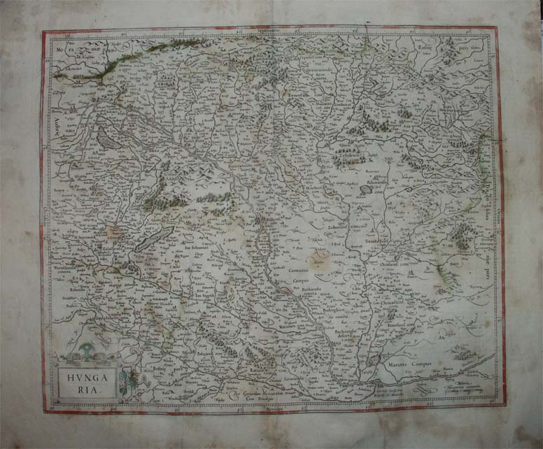
Map title
Hungaria
Author
Mercator
Location shown in map
Hungary
Edition date
1606
Edition place
Amsterdam
Editor
--
Atlas
Mercator-Hondius Atlas.
Price
200 Euro
State
[mint/excellent/very good/GOOD/fair/mediocre/poor]
Color
Black/white
Verso
French text
Size
Plate: cm (41.9 x 36.8) inches (16.5 x 14.49) Paper: cm (55.9 x 45.7) inches (22.01 x 17.99)
Technique
Copper engraving
Note
No particular notes for this maps
Reference
--
Wiki
Here for more info
In stock
Available
Info
info@thetreasuremaps.com
Code
#0130
×
![Hungaria by Mercator, Hungary, 1606]()