News
Map title
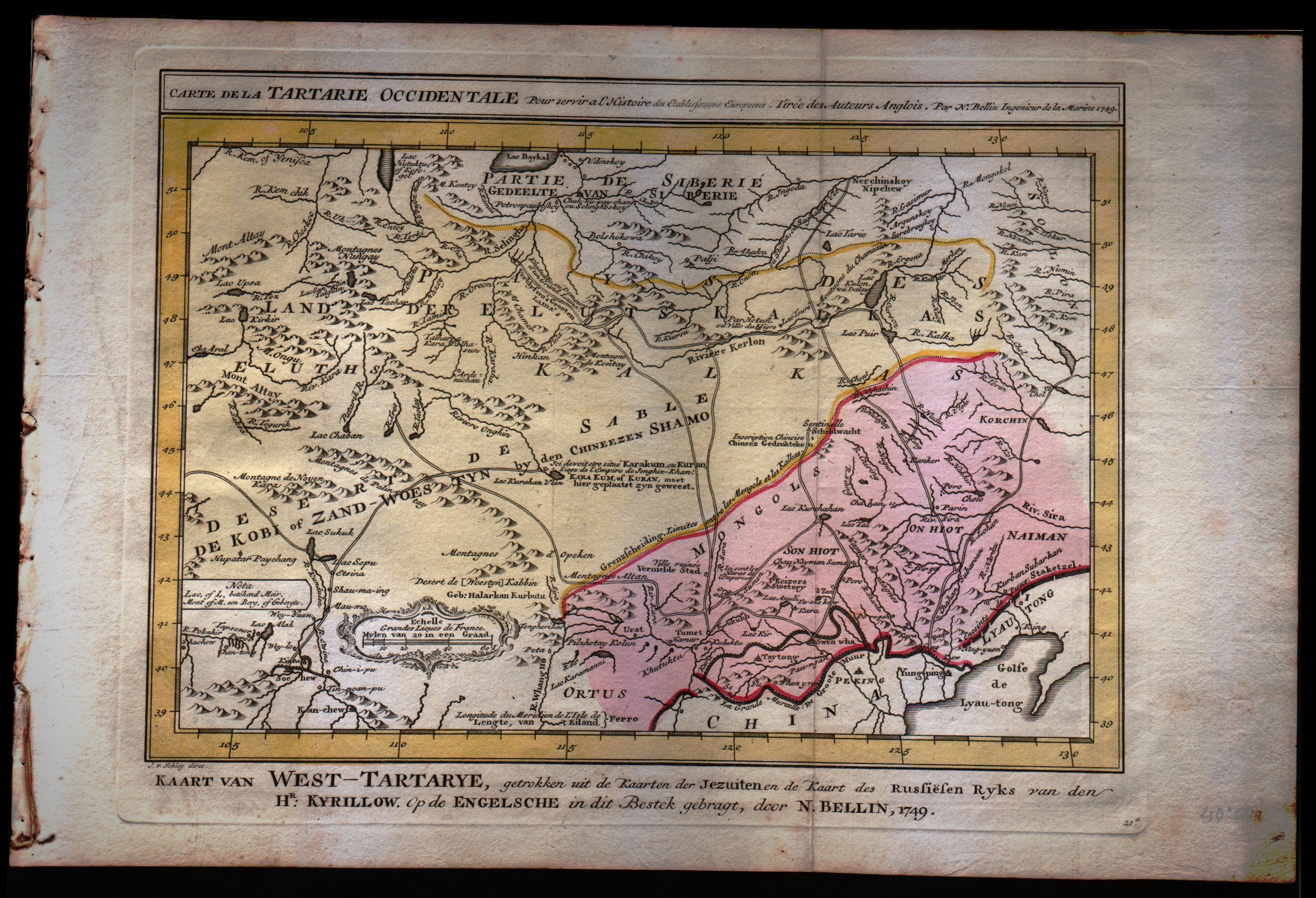
Carte de la Tartarie Occidentale
Author
Bellin
Location shown in map
North-east China
Edition date
1773
Edition place
Amsterdam
Editor
--
Atlas
Atlas Portatif -- E. van Harrevelt
Price
75 Euro
State
[mint/EXCELLENT/very good/good/fair/mediocre/poor]
Color
Old colors
Verso
Blank
Size
Plate: cm (30.5 x 25.4) inches (12.01 x 10) Paper: cm (40.6 x 26.7) inches (15.98 x 10.51)
Technique
Copper engraving
Note
No particular notes for this maps
Reference
--
Wiki
Here for more info
In stock
Available
Info
info@thetreasuremaps.com
Code
#0272
×
![Carte de la Tartarie Occidentale by Bellin, North-east China, 1773]()
Map title
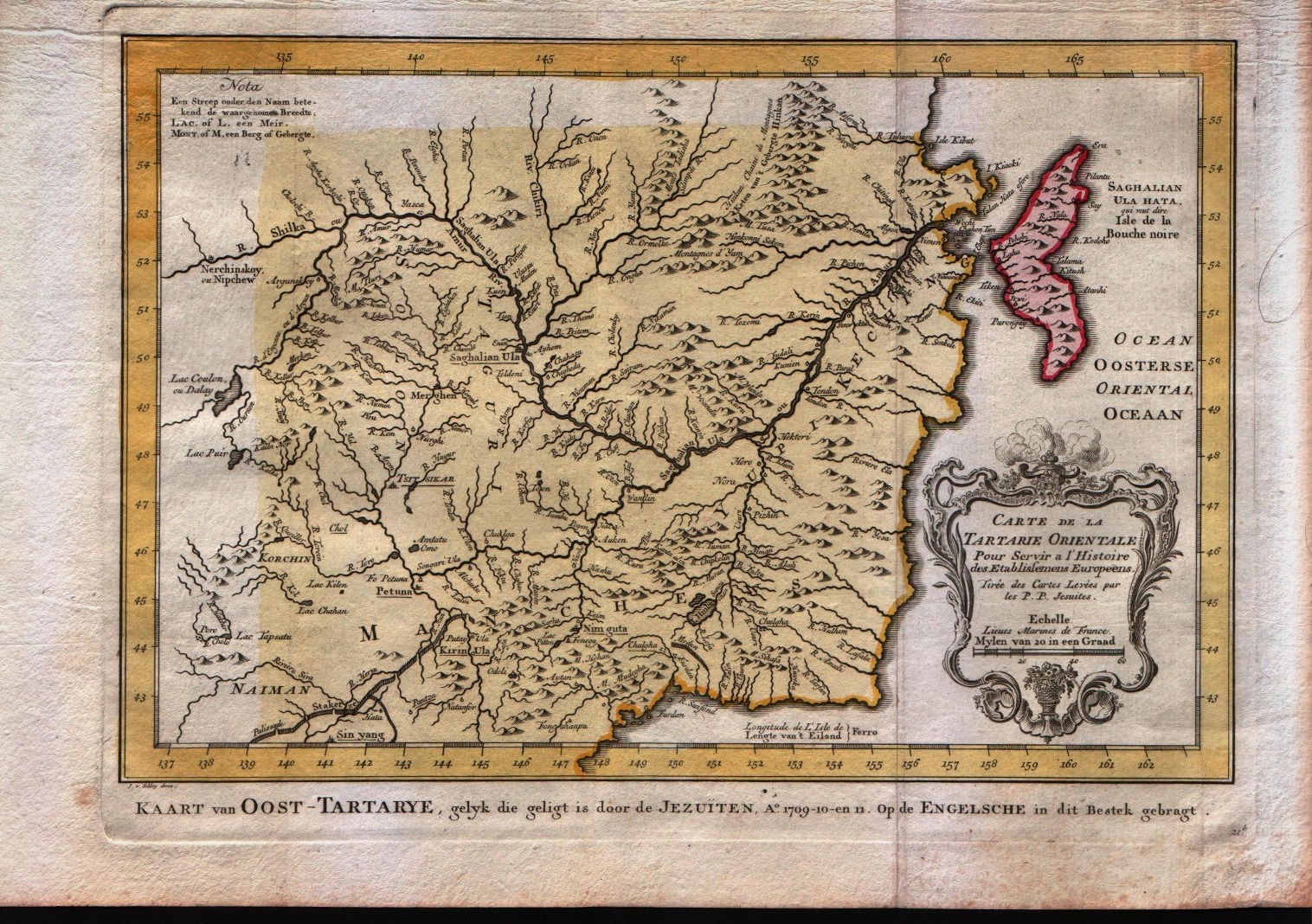
Carte de la Tartarie Orientale
Author
Bellin
Location shown in map
North-east China
Edition date
1773
Edition place
Amsterdam
Editor
--
Atlas
Atlas Portatif -- E. van Harrevelt
Price
75 Euro
State
[mint/EXCELLENT/very good/good/fair/mediocre/poor]
Color
Old colors
Verso
Blank
Size
Plate: cm (30.5 x 25.4) inches (12.01 x 10) Paper: cm (40.6 x 26.7) inches (15.98 x 10.51)
Technique
Copper engraving
Note
No particular notes for this maps
Reference
--
Wiki
Here for more info
In stock
Available
Info
info@thetreasuremaps.com
Code
#0273
×
![Carte de la Tartarie Orientale by Bellin, North-east China, 1773]()
Map title
Nouvelle Representation Des Cotes Nord et Est De L'Asie, pour servir ... Articles du Supplement de l'Encyclopedie qui concerent le Passage aux Indes par le Nord … 1772
Author
Diderot
Location shown in map
Asia
Edition date
1772
Edition place
Paris
Editor
--
Atlas
Encyclopedie -- De Vaugondy
Price
100 Euro
State
[mint/EXCELLENT/very good/good/fair/mediocre/poor]
Color
Black/white
Verso
Blank
Size
Plate: cm (40.6 x 33) inches (15.98 x 12.99) Paper: cm (50.8 x 40.6) inches (20 x 15.98)
Technique
Copper engraving
Note
No particular notes for this maps
Reference
--
Wiki
Here for more info
In stock
Available
Info
info@thetreasuremaps.com
Code
#0274
×
![Nouvelle Representation Des Cotes Nord et Est De L'Asie, pour servir ... Articles du Supplement de l'Encyclopedie qui concerent le Passage aux Indes par le Nord … 1772 by Diderot, Asia, 1772]()
Map title
Isles Moluques
Author
Le Rouge
Location shown in map
--
Edition date
1748
Edition place
Paris
Editor
--
Atlas
Atlas Nouveau Portatif l'usage des militaries et du voyageur
Price
125 Euro
State
[mint/excellent/VERY GOOD/good/fair/mediocre/poor]
Color
Black/white
Verso
Blank
Size
Plate: cm (26.7 x 20.3) inches (10.51 x 7.99) Paper: cm (34.9 x 24.1) inches (13.74 x 9.49)
Technique
Copper engraving
Note
A map depicting European knowledge of Sulawesi, part of Borneo and the Spice Islands at the time of publication.
Reference
--
Wiki
Here for more info
In stock
Available
Info
info@thetreasuremaps.com
Code
#0276
×
![Isles Moluques by Le Rouge, --, 1748]()
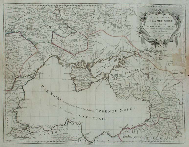
Map title
Carte des environs de la mer Noire o se trouvent l'Ukraine, la petite Tartarie, et les confins de la Russie Europine, et de la Turquie
Author
Unknown
Location shown in map
--
Edition date
1784
Edition place
Venise
Editor
--
Atlas
Atlas Universel dresse sur les meilleures cartes modernes. Printed by Santini & Remondini.
Price
Please ask: info@thetreasuremaps.com
State
[mint/excellent/very good/good/fair/MEDIOCRE/poor] the map is damaged.
Color
Old outlined
Verso
Blank
Size
Plate: cm (48.3 x 63.5) inches (19.02 x 25) Paper: cm (54.6 x 76.2) inches (21.5 x 30)
Technique
Copper engraving
Note
The atlas is effectively an Italian copy of the Robert de Vaugondy Atlas Universel, and contains 123 maps, variously dated 1775 to 1780. The atlas was reprinted in 1784 by Remondini, which gives a relatively short career span for Santini.
Reference
--
Wiki
Here for more info
In stock
Available
Info
info@thetreasuremaps.com
Code
#0277
×
![Carte des environs de la mer Noire o se trouvent l'Ukraine, la petite Tartarie, et les confins de la Russie Europine, et de la Turquie by Unknown, --, 1784]()
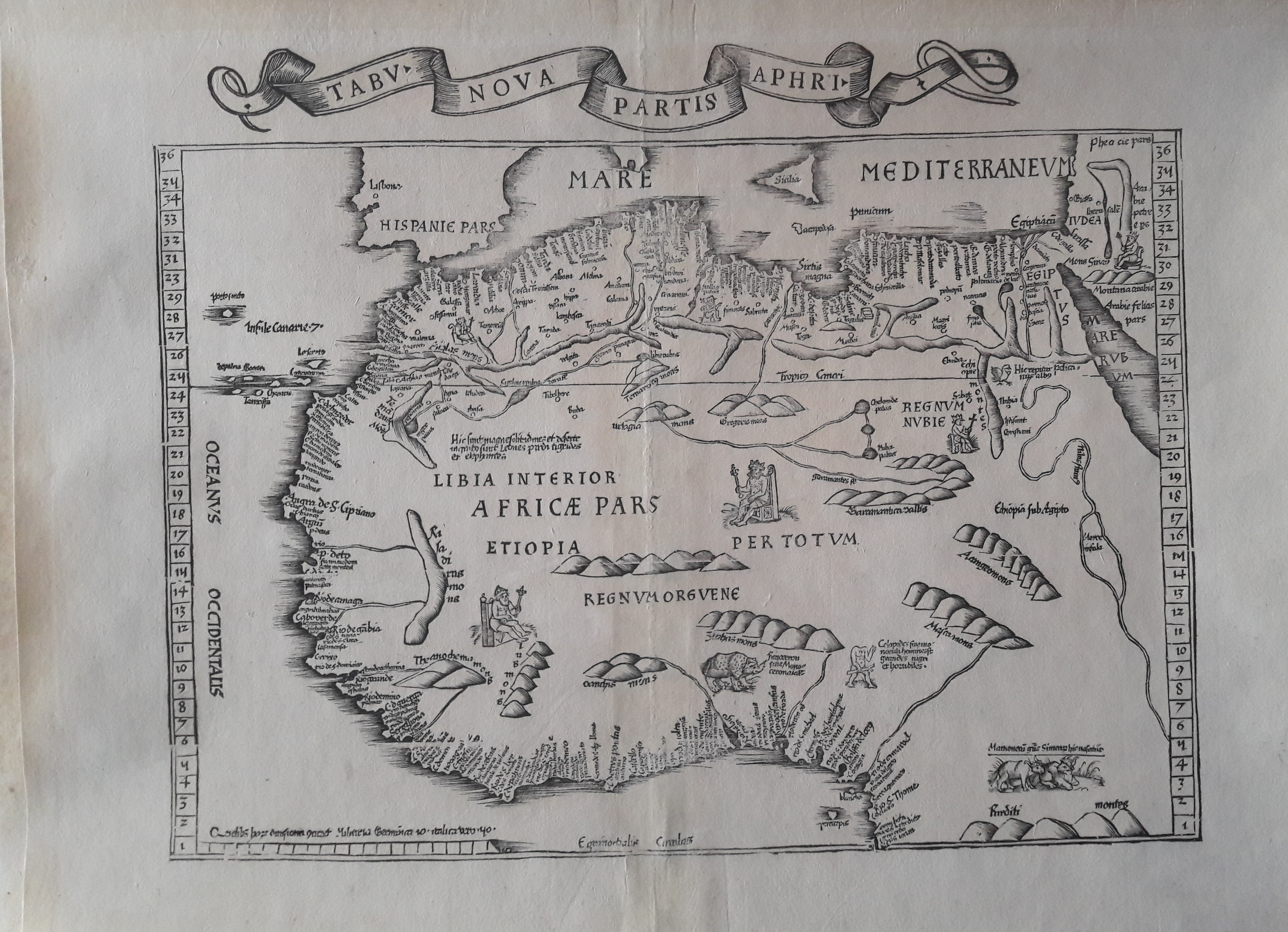
Map title
Tabv Nova Partis Aphri
Author
Fries
Location shown in map
West Africa
Edition date
1535
Edition place
Lyon
Editor
Melchior and Gaspar Trechsel
Atlas
Ptolemy's Geographia
Price
1200 Euro
State
[mint/EXCELLENT/very good/good/fair/mediocre/poor] repaired
Color
Black/white
Verso
Blank
Size
Plate: cm (39.4 x 30.5) inches (15.51 x 12.01) Paper: cm (50.8 x 39.4) inches (20 x 15.51)
Technique
Woodcut
Note
No particular notes for this maps
Reference
--
Wiki
Here for more info
In stock
Available
Info
info@thetreasuremaps.com
Code
#0278
×
![Tabv Nova Partis Aphri by Fries, West Africa, 1535]()
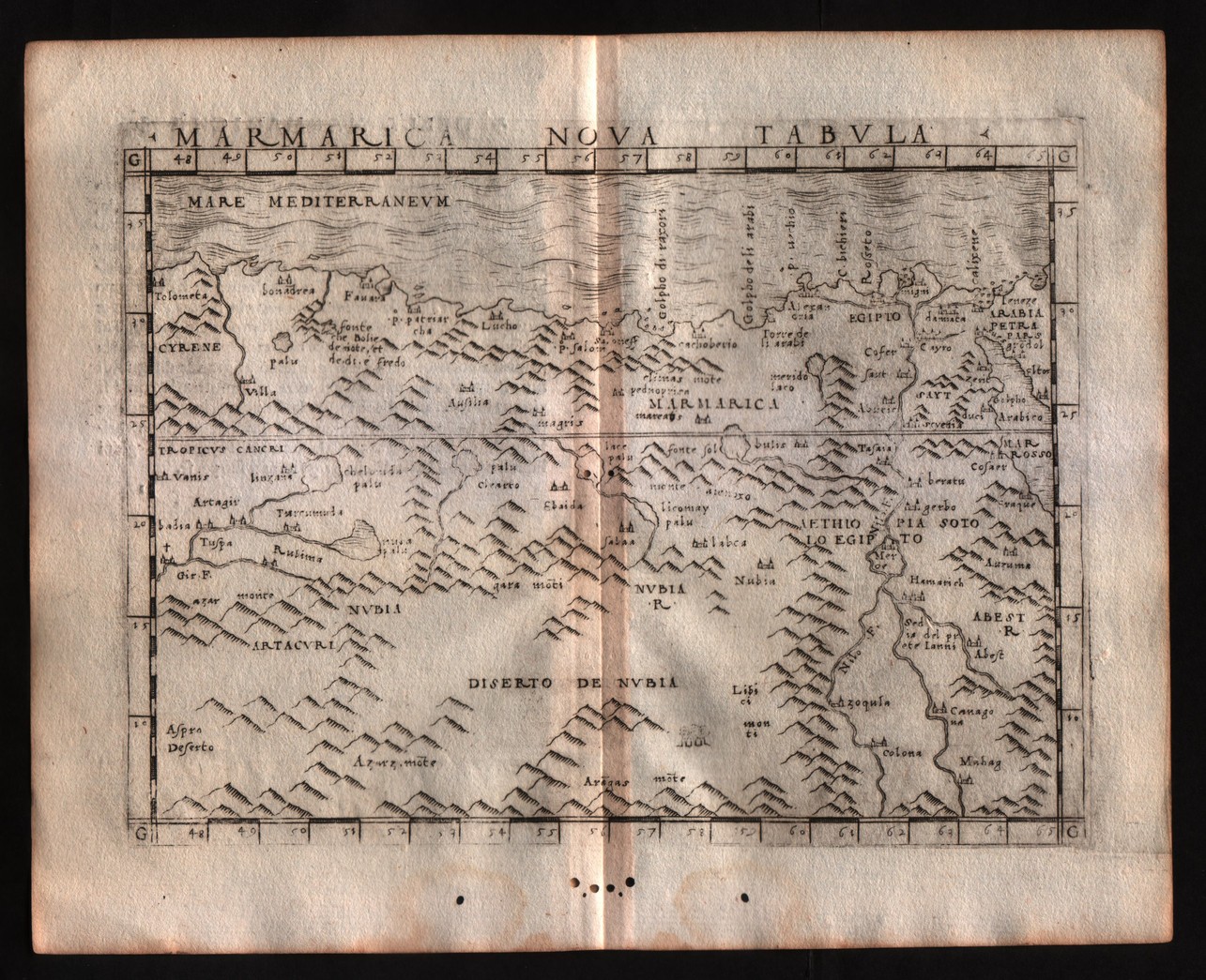
Map title
Marmarica nuova tabula
Author
Gastaldi
Location shown in map
North Africa
Edition date
1548
Edition place
Venice
Editor
Nicolo Bascarini
Atlas
Geographia
Price
200 Euro
State
[mint/excellent/VERY GOOD/good/fair/mediocre/poor] repaired
Color
Black/white
Verso
Italian text pag.31
Size
Plate: cm (17.8 x 12.7) inches (7.01 x 5) Paper: cm (20.3 x 16.5) inches (7.99 x 6.5)
Technique
Copper engraving
Note
No particular notes for this maps
Reference
--
Wiki
Here for more info
In stock
Available
Info
info@thetreasuremaps.com
Code
#0279
×
![Marmarica nuova tabula by Gastaldi, North Africa, 1548]()
Map title
Egitto nuova tavola
Author
Ruscelli
Location shown in map
Egypt
Edition date
1561
Edition place
Venice
Editor
Vincenzo Valgrisi
Atlas
La Geographia di Claudio Tolomeo
Price
150 Euro
State
[mint/excellent/very good/good/FAIR/mediocre/poor] repaired
Color
Black/white
Verso
Italian text
Size
Plate: cm (26 x 20.3) inches (10.24 x 7.99) Paper: cm (30.5 x 22.9) inches (12.01 x 9.02)
Technique
Copper engraving
Note
Based on Gastaldi map.
Reference
Genoa pubblic library "Civica Berio"
Wiki
Here for more info
In stock
Available
Info
info@thetreasuremaps.com
Code
#0280
×
![Egitto nuova tavola by Ruscelli, Egypt, 1561]()
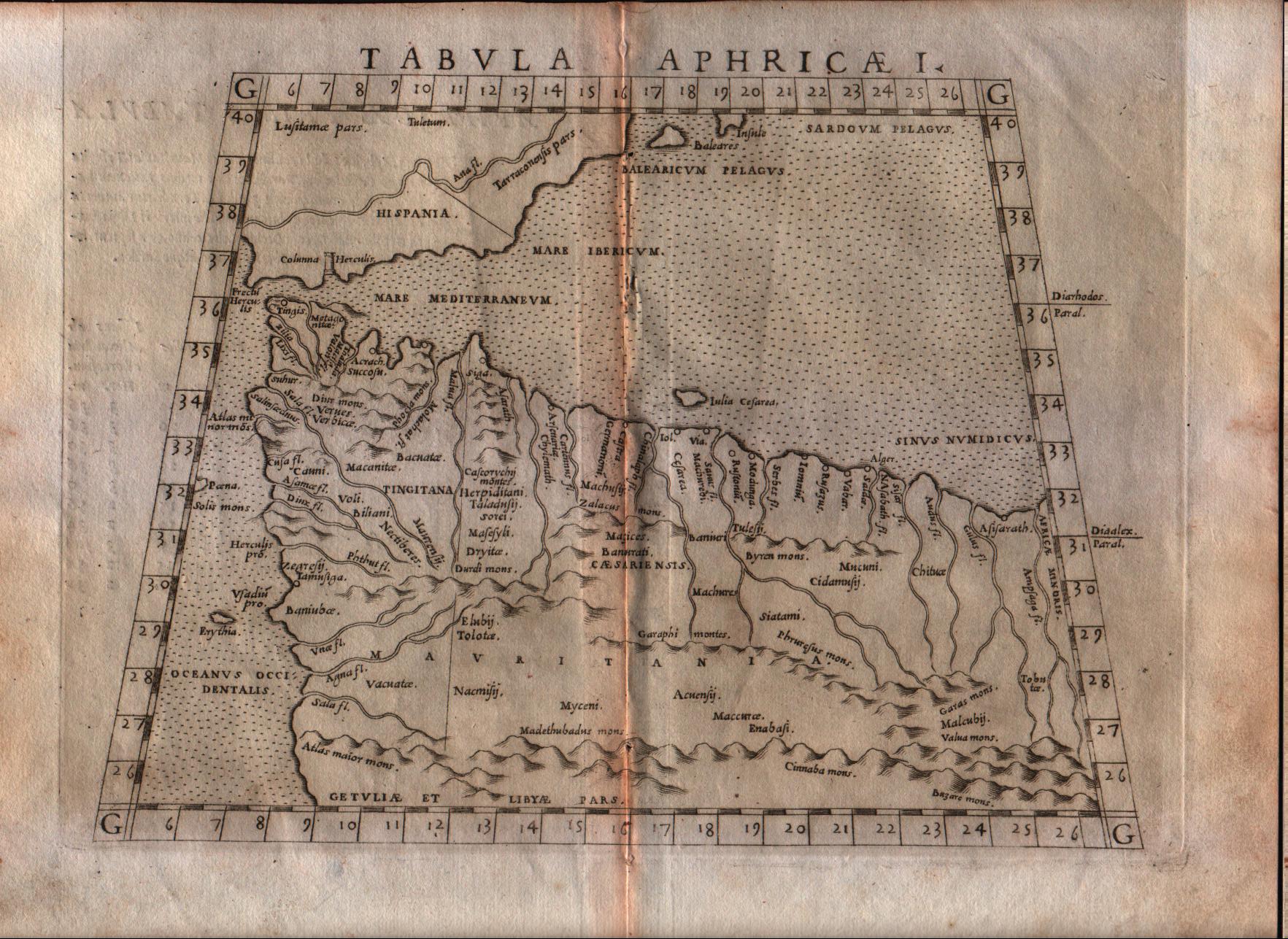
Map title
Tabula Aphricae I
Author
Ruscelli
Location shown in map
North Africa
Edition date
1564
Edition place
Venice
Editor
Girolamo Ziletti
Atlas
La Geographia di Claudio Tolomeo
Price
125 Euro
State
[mint/excellent/very good/GOOD/fair/mediocre/poor]
Color
Black/white
Verso
Latin text pag.31
Size
Plate: cm (25.4 x 20.3) inches (10 x 7.99) Paper: cm (30.5 x 22.9) inches (12.01 x 9.02)
Technique
Copper engraving
Note
No particular notes for this maps
Reference
--
Wiki
Here for more info
In stock
Available
Info
info@thetreasuremaps.com
Code
#0281
×
![Tabula Aphricae I by Ruscelli, North Africa, 1564]()
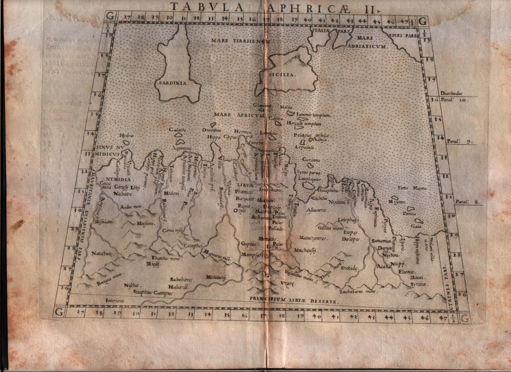
Map title
Tabula Aphricae II
Author
Ruscelli
Location shown in map
North Africa
Edition date
1564
Edition place
Venice
Editor
Girolamo Ziletti
Atlas
La Geographia di Claudio Tolomeo
Price
125 Euro
State
[mint/excellent/very good/GOOD/fair/mediocre/poor]
Color
Black/white
Verso
Latin text pag.33
Size
Plate: cm (25.4 x 20.3) inches (10 x 7.99) Paper: cm (30.5 x 22.9) inches (12.01 x 9.02)
Technique
Copper engraving
Note
No particular notes for this maps
Reference
--
Wiki
Here for more info
In stock
Available
Info
info@thetreasuremaps.com
Code
#0282
×
![Tabula Aphricae II by Ruscelli, North Africa, 1564]()
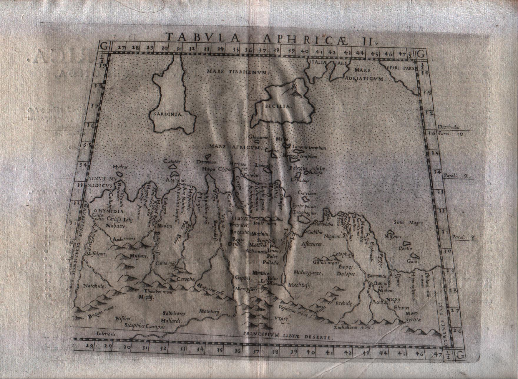
Map title
Tabula Aphricae II
Author
Ruscelli
Location shown in map
North Africa
Edition date
1574
Edition place
Venice
Editor
Giordano Ziletti
Atlas
La Geographia di Claudio Tolomeo
Price
125 Euro
State
[mint/excellent/VERY GOOD/good/fair/mediocre/poor]
Color
Black/white
Verso
Italian text pag.13
Size
Plate: cm (25.4 x 19) inches (10 x 7.48) Paper: cm (33 x 22.9) inches (12.99 x 9.02)
Technique
Copper engraving
Note
No particular notes for this maps
Reference
Genoa pubblic library "Civica Berio"
Wiki
Here for more info
In stock
Available
Info
info@thetreasuremaps.com
Code
#0283
×
![Tabula Aphricae II by Ruscelli, North Africa, 1574]()
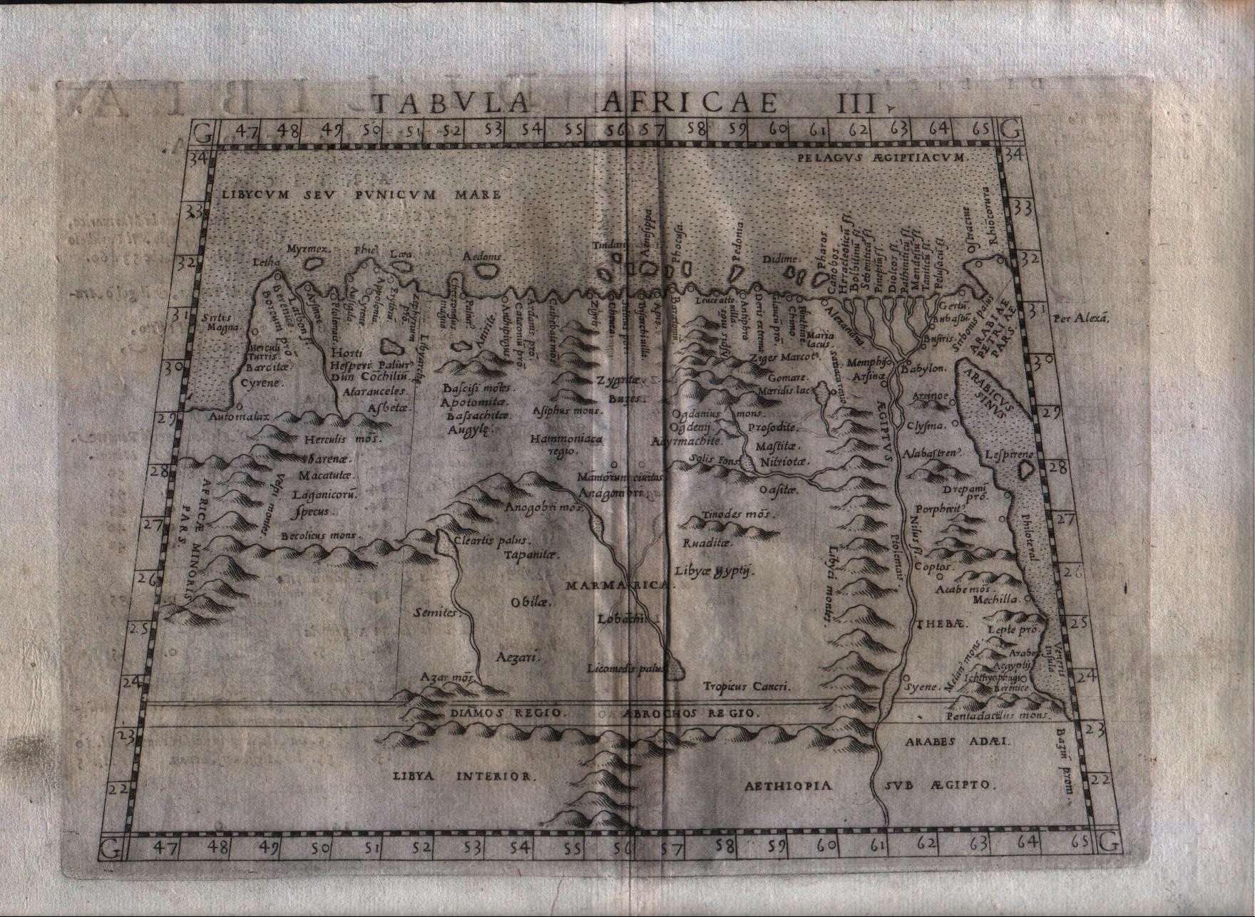
Map title
Tabula Aphricae III
Author
Ruscelli
Location shown in map
Egypt
Edition date
1574
Edition place
Venice
Editor
Giordano Ziletti
Atlas
La Geographia di Claudio Tolomeo
Price
150 Euro
State
[mint/excellent/VERY GOOD/good/fair/mediocre/poor]
Color
Black/white
Verso
Italian text pag.13
Size
Plate: cm (25.4 x 19) inches (10 x 7.48) Paper: cm (33 x 22.9) inches (12.99 x 9.02)
Technique
Copper engraving
Note
No particular notes for this maps
Reference
Genoa pubblic library "Civica Berio"
Wiki
Here for more info
In stock
Available
Info
info@thetreasuremaps.com
Code
#0284
×
![Tabula Aphricae III by Ruscelli, Egypt, 1574]()
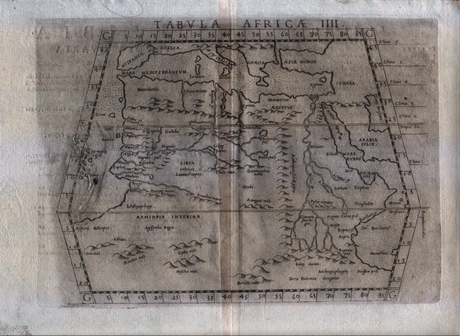
Map title
Tabula Aphricae IIII
Author
Ruscelli
Location shown in map
Africa
Edition date
1574
Edition place
Venice
Editor
Giordano Ziletti
Atlas
La Geographia di Claudio Tolomeo
Price
125 Euro
State
[mint/excellent/VERY GOOD/good/fair/mediocre/poor]
Color
Black/white
Verso
Italian text pag.13
Size
Plate: cm (25.4 x 19) inches (10 x 7.48) Paper: cm (33 x 22.9) inches (12.99 x 9.02)
Technique
Copper engraving
Note
No particular notes for this maps
Reference
Genoa pubblic library "Civica Berio"
Wiki
Here for more info
In stock
Available
Info
info@thetreasuremaps.com
Code
#0285
×
![Tabula Aphricae IIII by Ruscelli, Africa, 1574]()
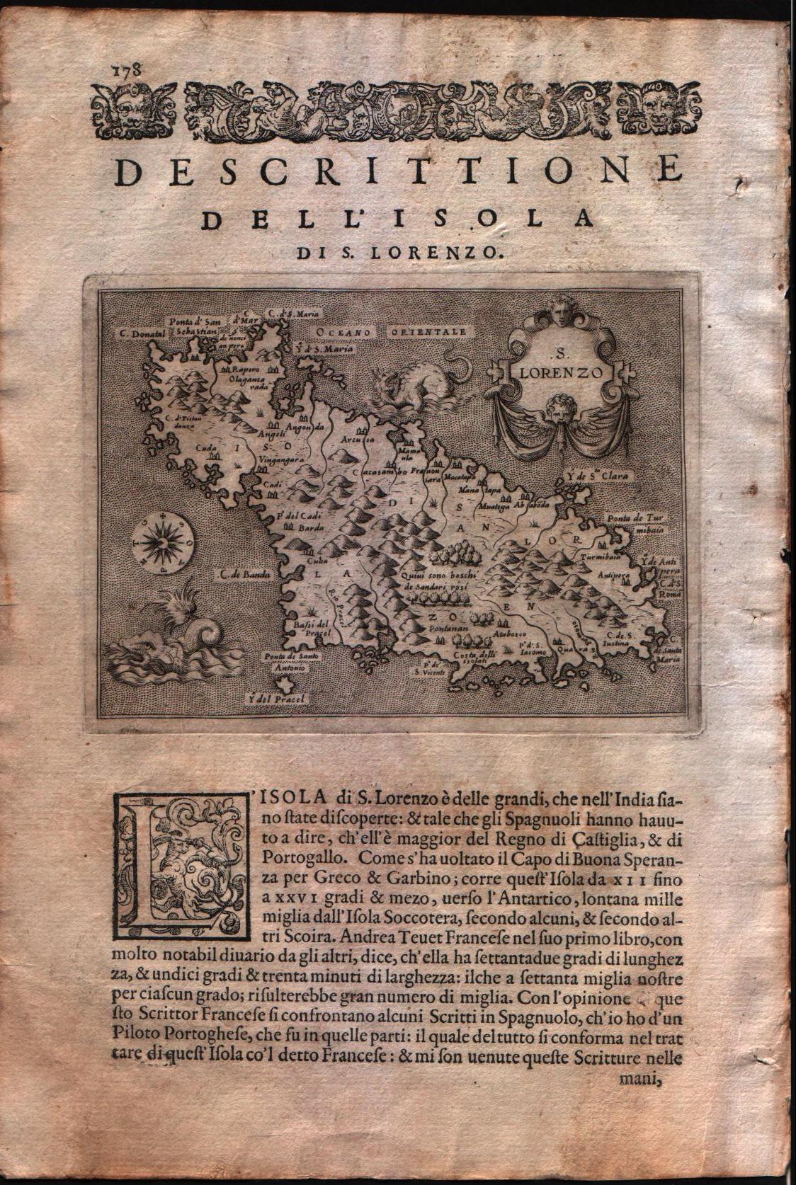
Map title
Descrittione dell'isola di S.Lorenzo
Author
Porcacchi
Location shown in map
Madagascar
Edition date
1576
Edition place
Venice
Editor
--
Atlas
L'Isole piu famose del mondo -- S. Galignani and G. Porro
Price
Please ask: info@thetreasuremaps.com
State
[MINT/excellent/very good/good/fair/mediocre/poor]
Color
Black/white
Verso
Italian text pag.178
Size
Plate: cm (15.2 x 11.4) inches (5.98 x 4.49) Paper: cm (19 x 27.9) inches (7.48 x 10.98)
Technique
Copper engraving
Note
No particular notes for this maps
Reference
Genoa pubblic library "Civica Berio"
Wiki
Here for more info
In stock
Available
Info
info@thetreasuremaps.com
Code
#0286
×
![Descrittione dell'isola di S.Lorenzo by Porcacchi, Madagascar, 1576]()
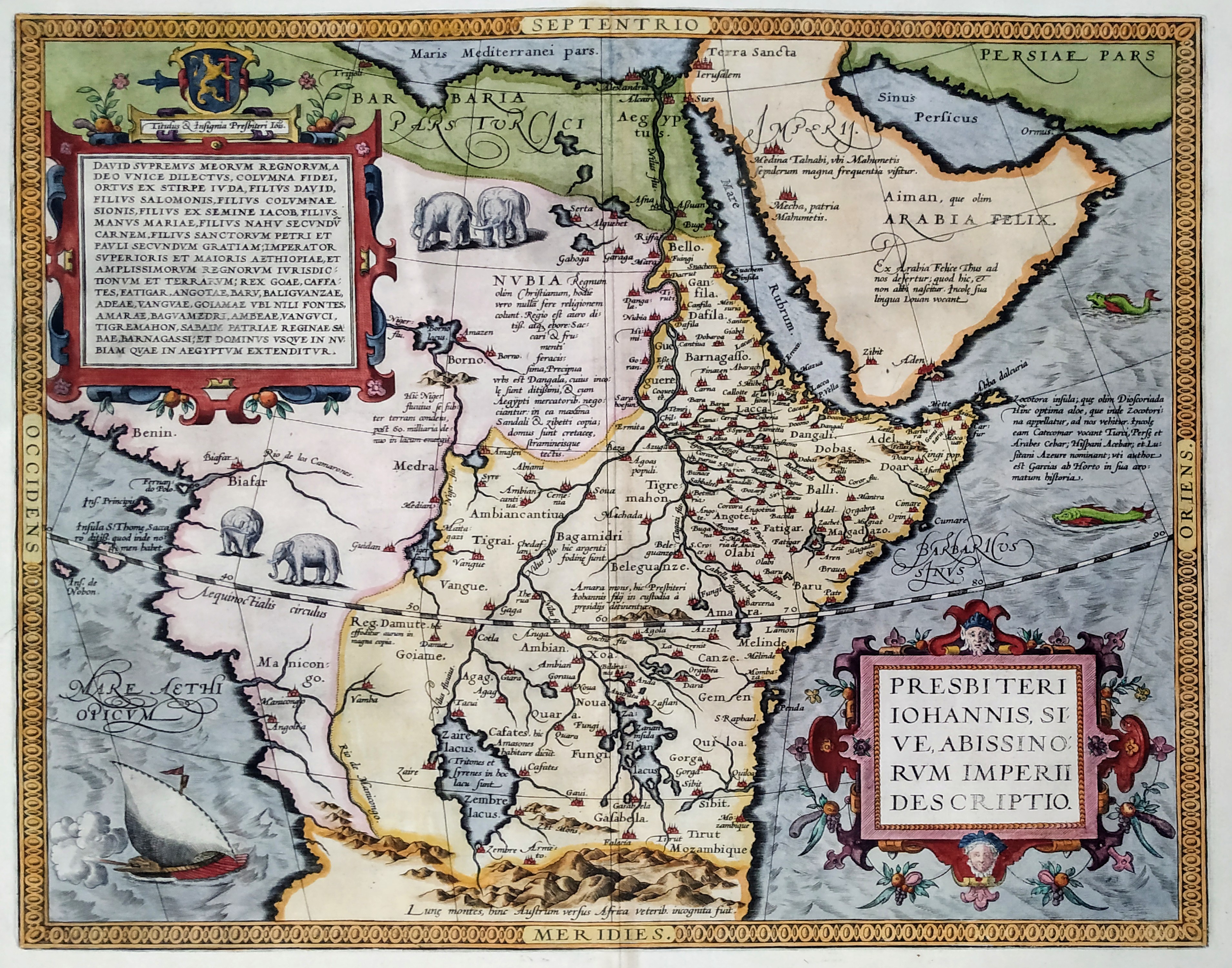
Map title
Presbiteri Johannis, Sive, Abissinorum Imperii Descriptio
Author
Ortelius
Location shown in map
Central Africa
Edition date
1592
Edition place
Anvers
Editor
--
Atlas
Theatrum Orbis Terrarum
Price
1000 Euro
State
[mint/EXCELLENT/very good/good/fair/mediocre/poor]
Color
Modern/Old color
Verso
Latin text
Size
Plate: cm (44 x 37) inches (17.32 x 14.57) Paper: cm (58 x 46) inches (22.83 x 18.11)
Technique
Copper engraving
Note
No particular notes for this maps
Reference
Van den Broecke 175
Wiki
Here for more info
In stock
Available
Info
info@thetreasuremaps.com
Code
#0287
×
![Presbiteri Johannis, Sive, Abissinorum Imperii Descriptio by Ortelius, Central Africa, 1592]()
Map title
Egitto
Author
Ortelius
Location shown in map
Egypt
Edition date
1598
Edition place
Venice
Editor
--
Atlas
Theatrum Orbis Terrarum
Price
100 Euro
State
[mint/EXCELLENT/very good/good/fair/mediocre/poor]
Color
Black/white
Verso
Italian text
Size
Plate: cm (10.2 x 7.6) inches (4.02 x 2.99) Paper: cm (12.7 x 11.4) inches (5 x 4.49)
Technique
Copper engraving
Note
No particular notes for this maps
Reference
--
Wiki
Here for more info
In stock
Available
Info
info@thetreasuremaps.com
Code
#0288
×
![Egitto by Ortelius, Egypt, 1598]()
Map title
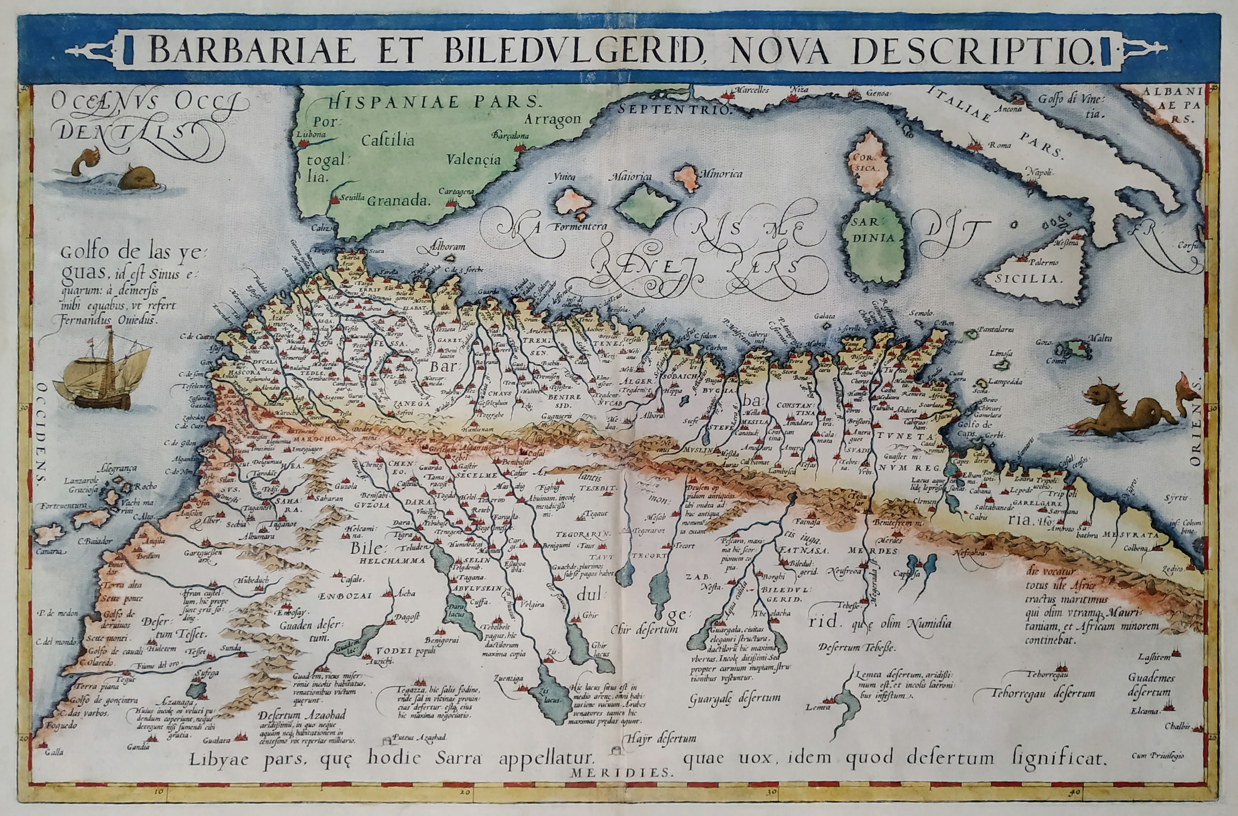
Barbariae et Biledulgerid Nova Descriptio
Author
Ortelius
Location shown in map
North Africa
Edition date
1598
Edition place
Anvers
Editor
--
Atlas
Theatrum Orbis Terrarum
Price
400 Euro
State
[mint/EXCELLENT/very good/good/fair/mediocre/poor]
Color
Modern color
Verso
Latin text
Size
Plate: cm (49.5 x 34.3) inches (19.49 x 13.5) Paper: cm (55.9 x 43.2) inches (22.01 x 17.01)
Technique
Copper engraving
Note
No particular notes for this maps
Reference
Van Den Broecke 176
Wiki
Here for more info
In stock
Available
Info
info@thetreasuremaps.com
Code
#0289
×
![Barbariae et Biledulgerid Nova Descriptio by Ortelius, North Africa, 1598]()
Map title
Africa
Author
Magini
Location shown in map
Africa
Edition date
1598
Edition place
Venice
Editor
Battista & Giorgio Galignani
Atlas
Geografia di Claudio Tolomeo -- Giovanni Antonio Magini
Price
350 Euro
State
[MINT/excellent/very good/good/fair/mediocre/poor]
Color
Black/white
Verso
Italian text pag.130
Size
Plate: cm (12.7 x 17.8) inches (5 x 7.01) Paper: cm (20.3 x 30.5) inches (7.99 x 12.01)
Technique
Copper engraving
Note
No particular notes for this maps
Reference
--
Wiki
Here for more info
In stock
Available
Info
info@thetreasuremaps.com
Code
#0290
Africa
Author
Magini
Location shown in map
Africa
Edition date
1598
Edition place
Venice
Editor
Battista & Giorgio Galignani
Atlas
Geografia di Claudio Tolomeo -- Giovanni Antonio Magini
Price
350 Euro
State
[MINT/excellent/very good/good/fair/mediocre/poor]
Color
Black/white
Verso
Italian text pag.130
Size
Plate: cm (12.7 x 17.8) inches (5 x 7.01) Paper: cm (20.3 x 30.5) inches (7.99 x 12.01)
Technique
Copper engraving
Note
No particular notes for this maps
Reference
--
Wiki
Here for more info
In stock
Available
Info
info@thetreasuremaps.com
Code
#0290
×
![Africa by Magini, Africa, 1598]()
Map title
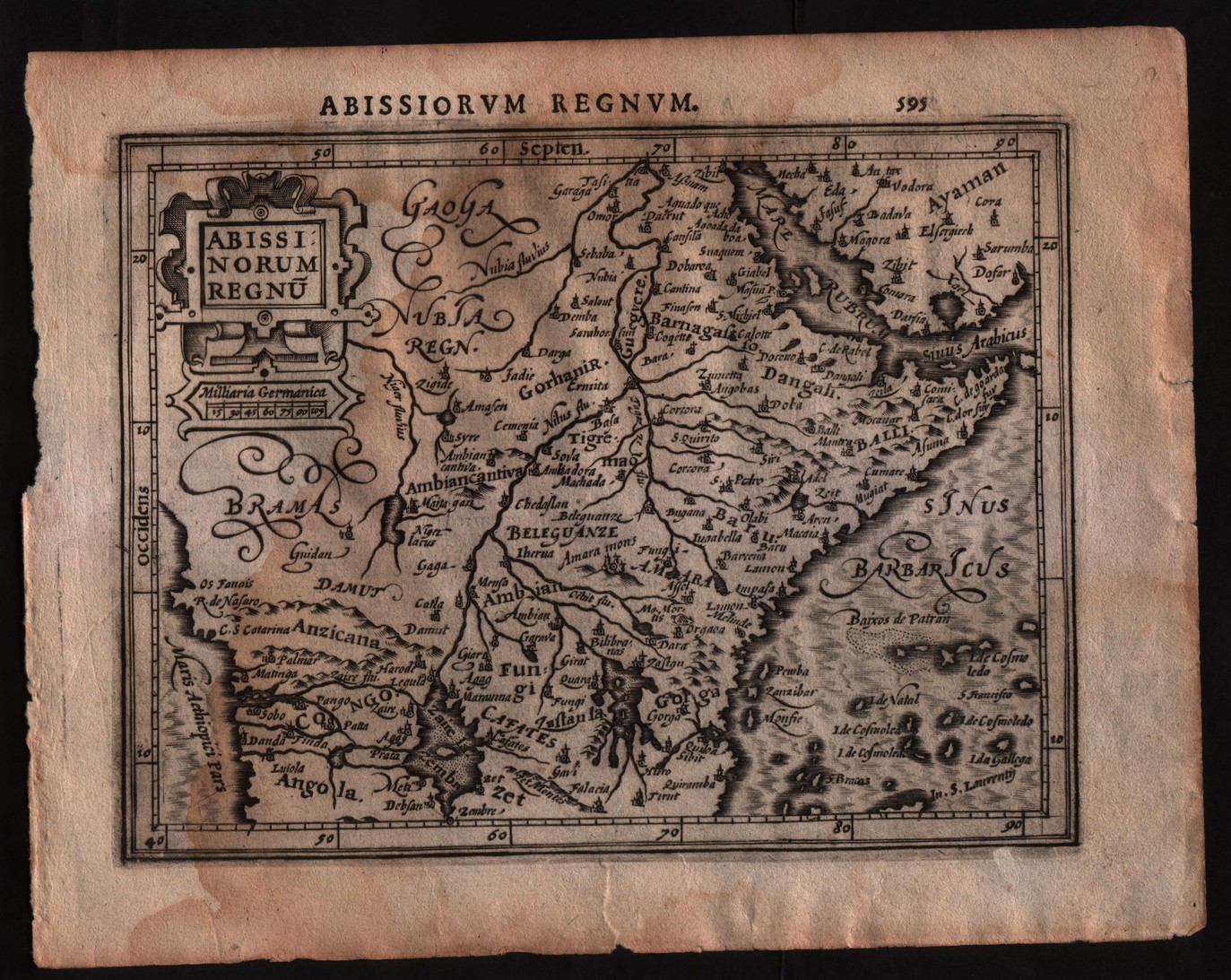
Abissinorum regnum
Author
Mercator
Location shown in map
East Africa
Edition date
1607
Edition place
Amsterdam
Editor
Janssonius
Atlas
Altas Minor Gerardi Mercatoris
Price
150 Euro
State
[mint/EXCELLENT/very good/good/fair/mediocre/poor]
Color
Black/white
Verso
Latin text pag.596
Size
Plate: cm (17.8 x 14) inches (7.01 x 5.51) Paper: cm (22.9 x 17.8) inches (9.02 x 7.01)
Technique
Copper engraving
Note
No particular notes for this maps
Reference
--
Wiki
Here for more info
In stock
Available
Info
info@thetreasuremaps.com
Code
#0291
×
![Abissinorum regnum by Mercator, East Africa, 1607]()
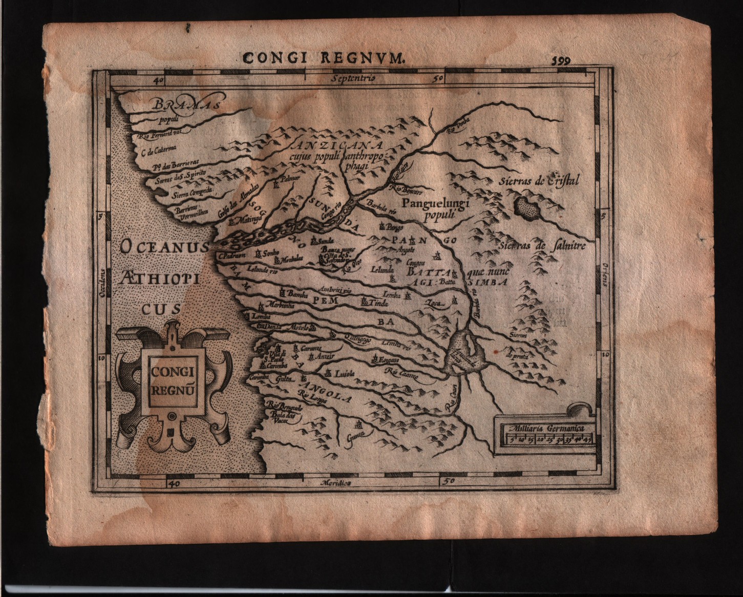
Map title
Congi regnum
Author
Mercator
Location shown in map
Congo
Edition date
1607
Edition place
Amsterdam
Editor
Janssonius
Atlas
Altas Minor Gerardi Mercatoris
Price
150 Euro
State
[mint/EXCELLENT/very good/good/fair/mediocre/poor]
Color
Black/white
Verso
Latin text pag.600
Size
Plate: cm (17.8 x 14) inches (7.01 x 5.51) Paper: cm (22.9 x 17.8) inches (9.02 x 7.01)
Technique
Copper engraving
Note
No particular notes for this maps
Reference
--
Wiki
Here for more info
In stock
Available
Info
info@thetreasuremaps.com
Code
#0292
×
![Congi regnum by Mercator, Congo, 1607]()