News
Map title
Dalmatia maritima occidentale
Author
Cantelli da Vignola
Location shown in map
Dalmatia
Edition date
1689
Edition place
Rome
Editor
De Rossi
Atlas
Mercurio Geografico
Price
700 Euro
State
[mint/EXCELLENT/very good/good/fair/mediocre/poor]
Color
Old colors
Verso
Blank
Size
Plate: cm (41 x 56) inches (16.14 x 22.05) Paper: cm (45 x 60) inches (17.72 x 23.62)
Technique
Copper engraving
Note
Reference
Wiki
Here for more info
In stock
Available
Info
info@thetreasuremaps.com
Code
#1312
×
![Dalmatia maritima occidentale by Cantelli da Vignola, Dalmatia, 1689]()
Map title
A generall mapp of Asia designed by Monsieur Sanson
Author
Blome
Location shown in map
Asia
Edition date
1669
Edition place
London
Editor
Blome
Atlas
Price
700 Euro
State
[mint/excellent/very good/GOOD/fair/mediocre/poor]
Color
Old colors
Verso
Blank
Size
Plate: cm (57 x 37) inches (22.44 x 14.57) Paper: cm (57 x 37) inches (22.44 x 14.57)
Technique
Copper engraving
Note
Reference
Wiki
Here for more info
In stock
Available
Info
info@thetreasuremaps.com
Code
#1310
×
![A generall mapp of Asia designed by Monsieur Sanson by Blome, Asia, 1669]()
Map title
Italia mit Dreyen Furnemesten Inseln
Author
Munster
Location shown in map
Italy
Edition date
Circa 1628
Edition place
Basel
Editor
Henrich Petri
Atlas
Cosmographia Universalis
Price
450 Euro
State
[mint/EXCELLENT/very good/good/fair/mediocre/poor]
Color
Old colors
Verso
German text
Size
Plate: cm (37 x 30) inches (14.57 x 11.81) Paper: cm (41 x 36) inches (16.14 x 14.17)
Technique
Woodcut
Note
Reference
R.Borri L'Italia nelle antiche carte pag.50
Wiki
Here for more info
In stock
Available
Info
info@thetreasuremaps.com
Code
#1301
×
![Italia mit Dreyen Furnemesten Inseln by Munster, Italy, Circa 1628]()
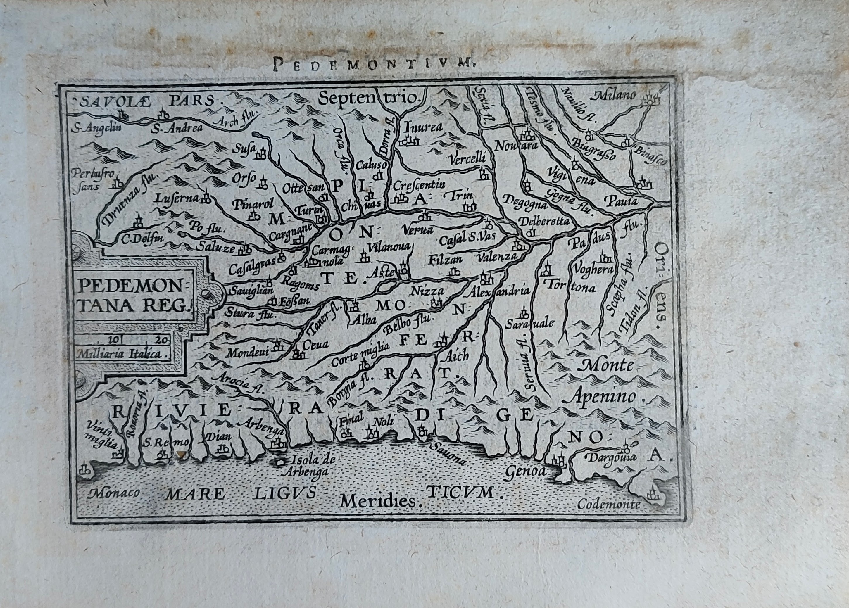
Map title
Pedemontanae vicinorumque
Author
Ortelius
Location shown in map
Liguria
Edition date
Circa 1590
Edition place
Antwerp
Editor
--
Atlas
Epitome Theatri Orteliani
Price
175 Euro
State
[mint/EXCELLENT/very good/good/fair/mediocre/poor]
Color
Old colors
Verso
French text
Size
Plate: cm (11 x 8) inches (4.33 x 3.15) Paper: cm (14 x 10) inches (5.51 x 3.94)
Technique
Copper engraving
Note
Reference
L.Tricerri, Catalog of Maps of Liguria R_013
Wiki
Here for more info
In stock
Available
Info
info@thetreasuremaps.com
Code
#1289
×
![Pedemontanae vicinorumque by Ortelius, Liguria, Circa 1590]()
Map title
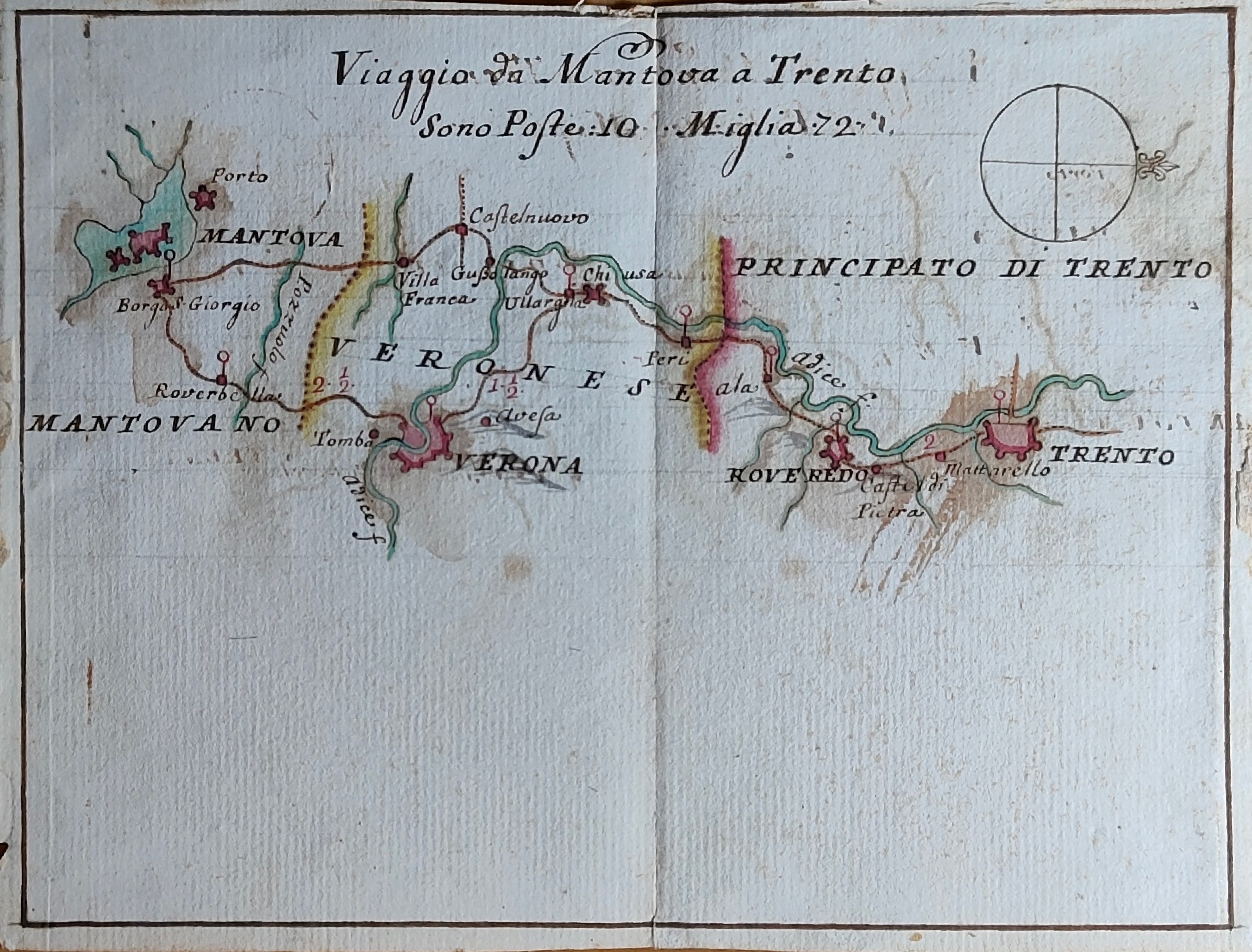
Viaggio da Mantova a Trento
Author
Location shown in map
North Italy
Edition date
Circa 1750
Edition place
Editor
--
Atlas
Price
250 Euro
State
[mint/EXCELLENT/very good/good/fair/mediocre/poor]
Color
Old colors
Verso
Blank
Size
Plate: cm (18 x 14) inches (7.09 x 5.51) Paper: cm (18 x 14) inches (7.09 x 5.51)
Technique
Manuscript
Note
Manuscript map
Reference
Wiki
Here for more info
In stock
Available
Info
info@thetreasuremaps.com
Code
#1290
×
![Viaggio da Mantova a Trento by , North Italy, Circa 1750]()
Map title
Pedemontanae vicinorumque
Author
Ortelius
Location shown in map
Liguria
Edition date
Circa 1601
Edition place
Antwerp
Editor
--
Atlas
Epitome Theatri Orteliani
Price
175 Euro
State
[mint/EXCELLENT/very good/good/fair/mediocre/poor]
Color
Black/white
Verso
French text
Size
Plate: cm (11 x 8) inches (4.33 x 3.15) Paper: cm (15.5 x 11) inches (6.1 x 4.33)
Technique
Copper engraving
Note
Reference
L.Tricerri, Catalog of Maps of Liguria R_020
Wiki
Here for more info
In stock
Available
Info
info@thetreasuremaps.com
Code
#1292
×
![Pedemontanae vicinorumque by Ortelius, Liguria, Circa 1601]()
Map title
Author
Bertarelli
Location shown in map
Milan
Edition date
1906
Edition place
Milan
Editor
Bertarelli
Atlas
Price
100 Euro
State
[mint/EXCELLENT/very good/good/fair/mediocre/poor]
Color
Old colors
Verso
Italian text
Size
Plate: cm (60 x 33) inches (23.62 x 12.99) Paper: cm (62 x 35) inches (24.41 x 13.78)
Technique
Steel engraving
Note
Reference
Wiki
Here for more info
In stock
Available
Info
info@thetreasuremaps.com
Code
#1323
×
![by Bertarelli, Milan, 1906]()
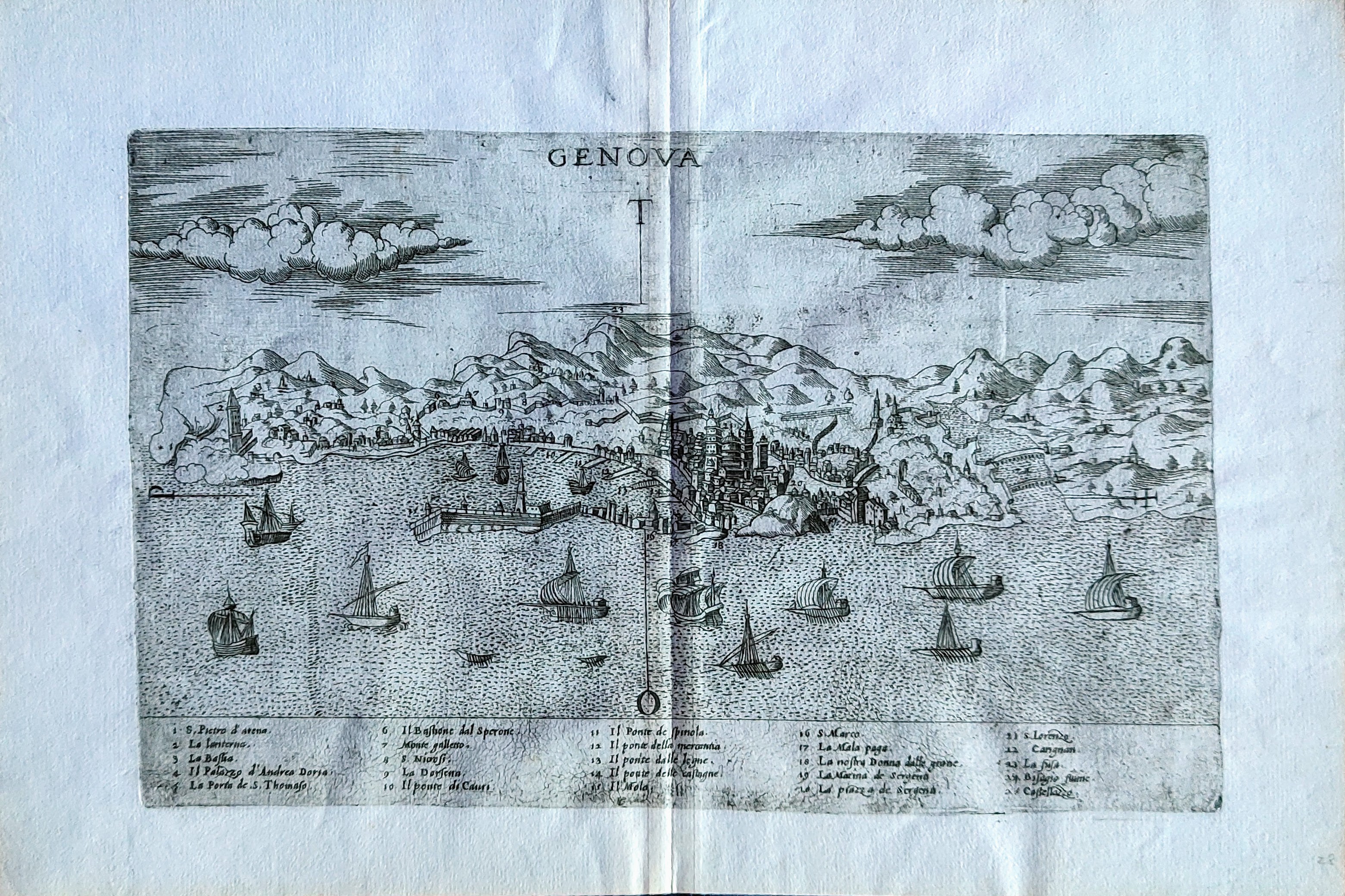
Map title
Genova
Author
Bertelli
Location shown in map
Genoa
Edition date
1568
Edition place
Venice
Editor
Atlas
Civitatum aliquot insigniorum et locorum magis insignium exacta delineatio
Price
1200 Euro
State
[mint/EXCELLENT/very good/good/fair/mediocre/poor]
Color
Black/white
Verso
Blank
Size
Plate: cm (29 x 19) inches (11.42 x 7.48) Paper: cm (37 x 25) inches (14.57 x 9.84)
Technique
Copper engraving
Note
Reference
Wiki
Here for more info
In stock
Available
Info
info@thetreasuremaps.com
Code
#1291
×
![Genova by Bertelli, Genoa, 1568]()
Map title
--
Author
Munster
Location shown in map
Italy
Edition date
1540
Edition place
Basel
Editor
Henrich Petri
Atlas
Geographia Universalis
Price
1200 Euro
State
[mint/EXCELLENT/very good/good/fair/mediocre/poor]
Color
Black/white
Verso
Latin text pag.43
Size
Plate: cm (33 x 25) inches (12.99 x 9.84) Paper: cm (40 x 31) inches (15.75 x 12.2)
Technique
Woodcut
Note
First edition
Reference
R.Borri L'Italia nelle antiche carte pag.50
Wiki
Here for more info
In stock
Available
Info
info@thetreasuremaps.com
Code
#1293
×
![-- by Munster, Italy, 1540]()

Map title
Terra di Bari e Basilicata
Author
Zatta
Location shown in map
Puglia
Edition date
1783
Edition place
Venice
Editor
Atlas
Atlante novissimo
Price
200 Euro
State
[mint/EXCELLENT/very good/good/fair/mediocre/poor]
Color
Old colors
Verso
Blank
Size
Plate: cm (42 x 32) inches (16.54 x 12.6) Paper: cm (47 x 37) inches (18.5 x 14.57)
Technique
Copper engraving
Note
Reference
Wiki
Here for more info
In stock
Available
Info
info@thetreasuremaps.com
Code
#1295
×
![Terra di Bari e Basilicata by Zatta, Puglia, 1783]()
Map title
Charte uber die XIII Vereinigte Staaten von Nord-America
Author
Homann
Location shown in map
USA
Edition date
1784
Edition place
Nuremberg
Editor
Atlas
Price
1300 Euro
State
[mint/EXCELLENT/very good/good/fair/mediocre/poor]
Color
Old colors
Verso
Blank
Size
Plate: cm (58 x 45) inches (22.83 x 17.72) Paper: cm (60 x 49) inches (23.62 x 19.29)
Technique
Copper engraving
Note
United States of America shortly after the revolution
Reference
Wiki
Here for more info
In stock
Available
Info
info@thetreasuremaps.com
Code
#1288
×
![Charte uber die XIII Vereinigte Staaten von Nord-America by Homann, USA, 1784]()
Map title
Carta automobilistica d'Italia
Author
Location shown in map
Italy
Edition date
Circa 1930
Edition place
Novara
Editor
De Agostini
Atlas
Price
175 Euro
State
[mint/EXCELLENT/very good/good/fair/mediocre/poor]
Color
Old colors
Verso
Blank
Size
Plate: cm (98 x 78) inches (38.58 x 30.71) Paper: cm (98 x 78) inches (38.58 x 30.71)
Technique
Steel engraving
Note
Olio Pietro Isnardi Oneglia
Reference
Wiki
Here for more info
In stock
Available
Info
info@thetreasuremaps.com
Code
#1287
×
![Carta automobilistica d'Italia by , Italy, Circa 1930]()
Map title
A map of Italy with its kingdom, states
Author
Seale
Location shown in map
Italy
Edition date
Circa 1745
Edition place
London
Editor
--
Atlas
Mr. Trindal's continuation of Rapin's history of England
Price
350 Euro
State
[mint/EXCELLENT/very good/good/fair/mediocre/poor]
Color
Old colors
Verso
Blank
Size
Plate: cm (46 x 38) inches (18.11 x 14.96) Paper: cm (48 x 39) inches (18.9 x 15.35)
Technique
Copper engraving
Note
Reference
R.Borri L'Italia nelle antiche carte pag.231
Wiki
Here for more info
In stock
Available
Info
info@thetreasuremaps.com
Code
#1286
×
![A map of Italy with its kingdom, states by Seale, Italy, Circa 1745]()
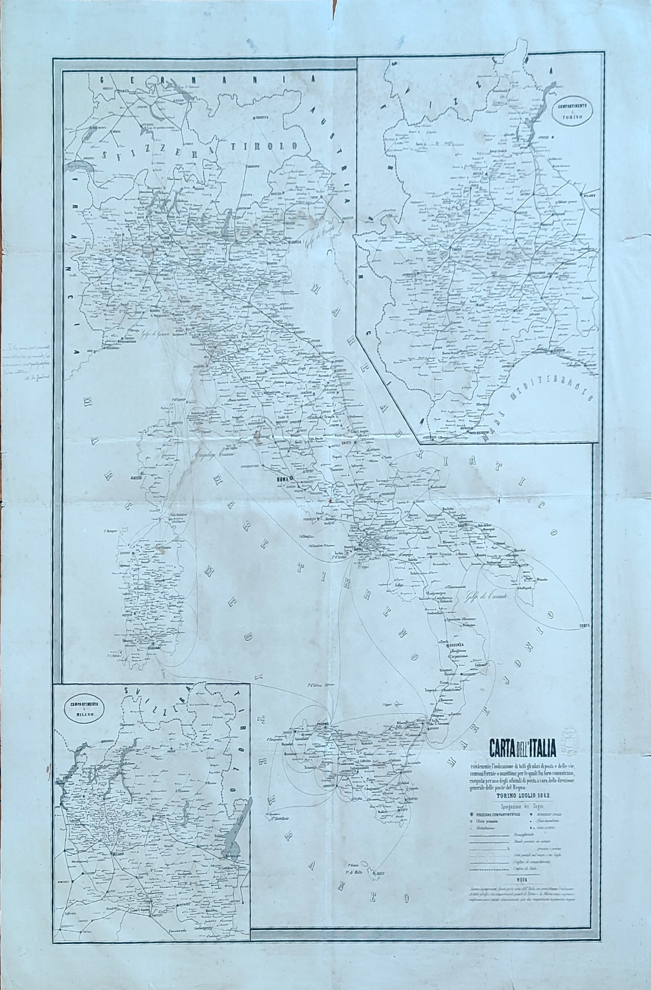
Map title
Carta dell'Italia
Author
Location shown in map
Italy
Edition date
1862
Edition place
Turin
Editor
Direzione Generale delle poste Italiane
Atlas
Price
200 Euro
State
[mint/excellent/VERY GOOD/good/fair/mediocre/poor]
Color
Black/white
Verso
Blank
Size
Plate: cm (59 x 76) inches (23.23 x 29.92) Paper: cm (68 x 86) inches (26.77 x 33.86)
Technique
Steel engraving
Note
Reference
Wiki
Here for more info
In stock
Available
Info
info@thetreasuremaps.com
Code
#1296
×
![Carta dell'Italia by , Italy, 1862]()

Map title
Asia from the latest authorities
Author
Location shown in map
Asia
Edition date
1806
Edition place
London
Editor
Bungay
Atlas
Price
50 Euro
State
[mint/EXCELLENT/very good/good/fair/mediocre/poor]
Color
Black/white
Verso
Blank
Size
Plate: cm (23 x 19) inches (9.06 x 7.48) Paper: cm (25 x 21) inches (9.84 x 8.27)
Technique
Copper engraving
Note
Reference
Wiki
Here for more info
In stock
Available
Info
info@thetreasuremaps.com
Code
#1298
×
![Asia from the latest authorities by , Asia, 1806]()
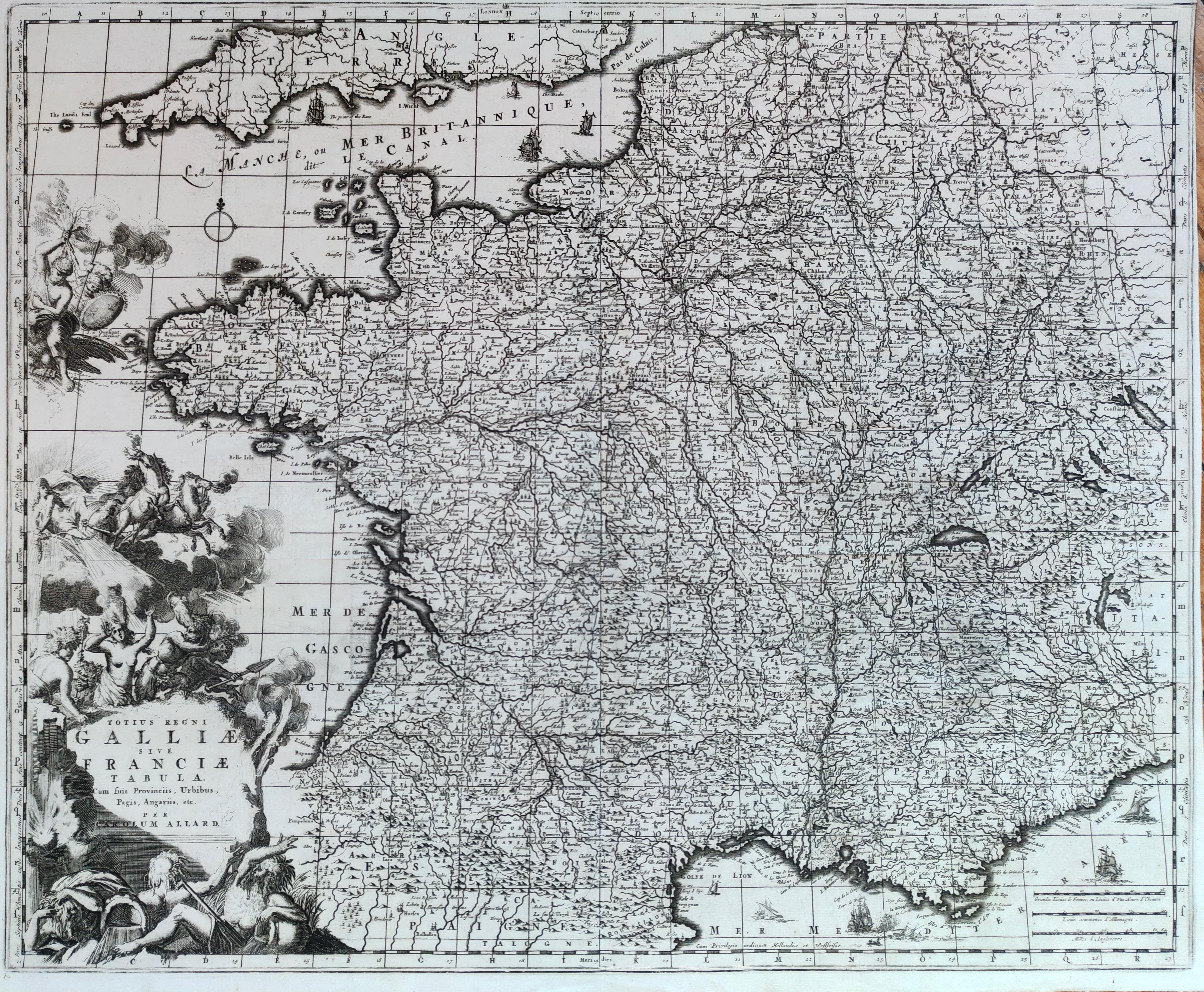
Map title
Totius regni Galliae sive Franciae tabula
Author
Allard
Location shown in map
France
Edition date
Circa 1690
Edition place
Amsterdam
Editor
--
Atlas
Atlas Major
Price
300 Euro
State
[mint/EXCELLENT/very good/good/fair/mediocre/poor]
Color
Black/white
Verso
Blank
Size
Plate: cm (57 x 46) inches (22.44 x 18.11) Paper: cm (56 x 45) inches (22.05 x 17.72)
Technique
Copper engraving
Note
Reference
Wiki
Here for more info
In stock
Available
Info
info@thetreasuremaps.com
Code
#1280
×
![Totius regni Galliae sive Franciae tabula by Allard, France, Circa 1690]()
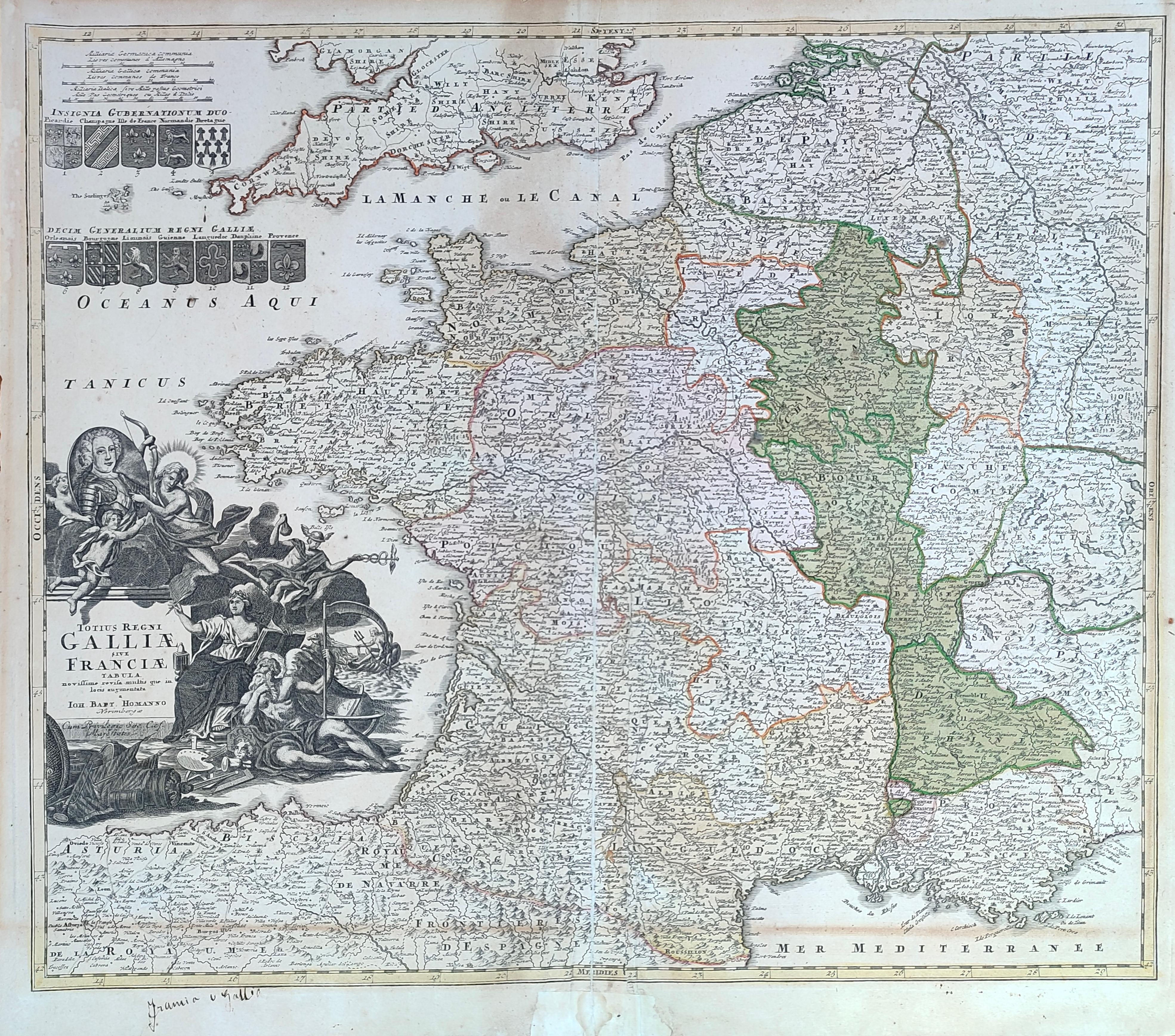
Map title
Totius regni Galliae sive Franciae tabula
Author
Homann
Location shown in map
France
Edition date
Circa 1720
Edition place
Nurimberg
Editor
--
Atlas
Price
200 Euro
State
[mint/excellent/VERY GOOD/good/fair/mediocre/poor]
Color
Old colors
Verso
Blank
Size
Plate: cm (58 x 48) inches (22.83 x 18.9) Paper: cm (59 x 52) inches (23.23 x 20.47)
Technique
Copper engraving
Note
Reference
Wiki
Here for more info
In stock
Available
Info
info@thetreasuremaps.com
Code
#1281
×
![Totius regni Galliae sive Franciae tabula by Homann, France, Circa 1720]()
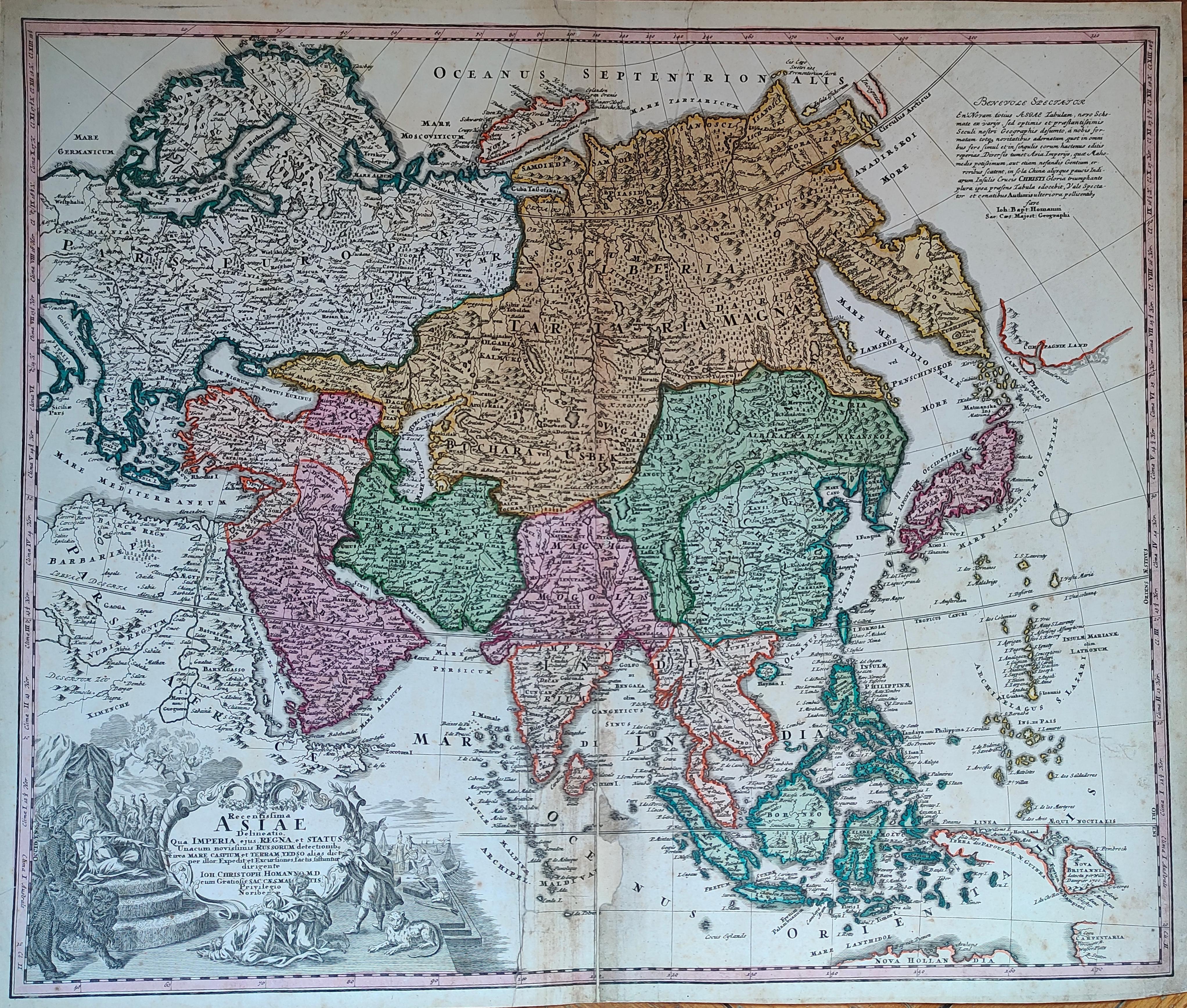
Map title
Asiae Recentissima Delineatio Qua Status et Imperia Totius Orientis unacum Orientalibus Indiis
Author
Homann
Location shown in map
Asia
Edition date
Circa 1720
Edition place
Nurimberg
Editor
--
Atlas
Price
400 Euro
State
[mint/excellent/VERY GOOD/good/fair/mediocre/poor]
Color
Old colors
Verso
Blank
Size
Plate: cm (58 x 48) inches (22.83 x 18.9) Paper: cm (59 x 52) inches (23.23 x 20.47)
Technique
Copper engraving
Note
Reference
Wiki
Here for more info
In stock
Available
Info
info@thetreasuremaps.com
Code
#1282
×
![Asiae Recentissima Delineatio Qua Status et Imperia Totius Orientis unacum Orientalibus Indiis by Homann, Asia, Circa 1720]()
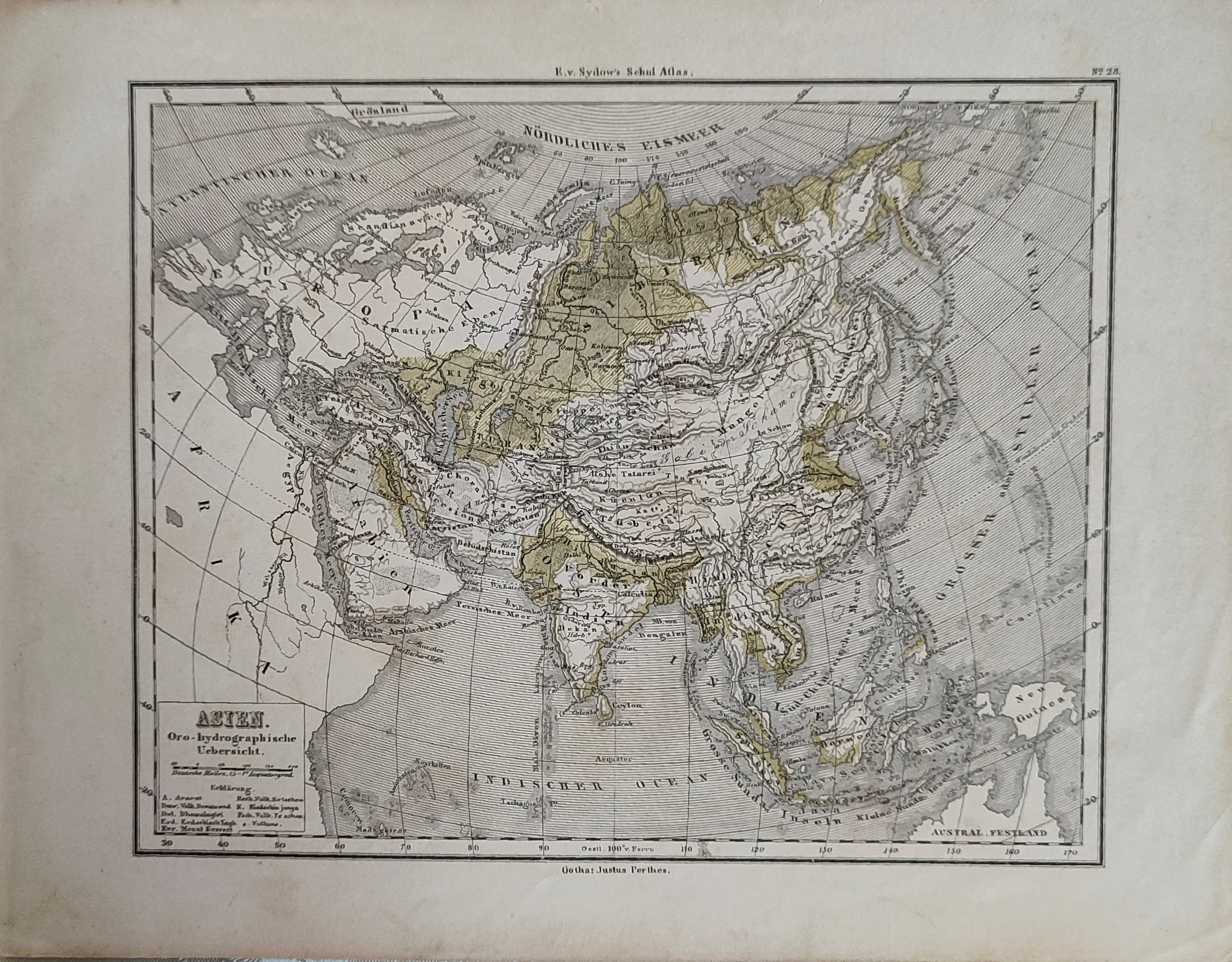
Map title
Asien
Author
Location shown in map
Asia
Edition date
Circa 1870
Edition place
Editor
Gotha
Atlas
VON SYDOWS' SCHUL-ATLAS
Price
50 Euro
State
[mint/EXCELLENT/very good/good/fair/mediocre/poor]
Color
Old colors
Verso
Blank
Size
Plate: cm (24 x 19) inches (9.45 x 7.48) Paper: cm (30 x 23) inches (11.81 x 9.06)
Technique
Steel engraving
Note
Reference
Wiki
Here for more info
In stock
Available
Info
info@thetreasuremaps.com
Code
#1299
×
![Asien by , Asia, Circa 1870]()

Map title
Hindostan
Author
Location shown in map
India
Edition date
Circa 1840
Edition place
Basel
Editor
Hindermann
Atlas
Price
50 Euro
State
[mint/EXCELLENT/very good/good/fair/mediocre/poor] repaired
Color
Black/white
Verso
Blank
Size
Plate: cm (21 x 25) inches (8.27 x 9.84) Paper: cm (24 x 29) inches (9.45 x 11.42)
Technique
Copper engraving
Note
Reference
Wiki
Here for more info
In stock
Available
Info
info@thetreasuremaps.com
Code
#1300
×
![Hindostan by , India, Circa 1840]()