News
Map title
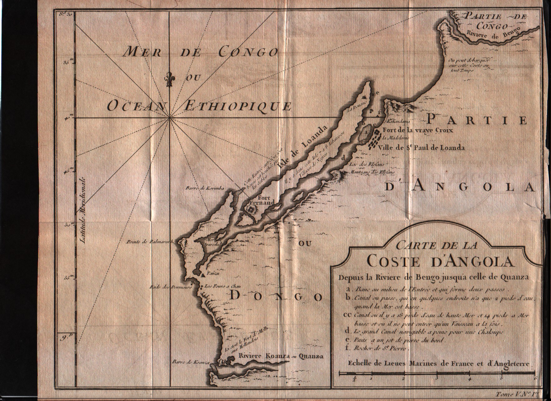
Carte de la Coste d'Angola
Author
Bellin
Location shown in map
Angola
Edition date
1757
Edition place
Paris
Editor
--
Atlas
Historie General des Voyages -- Prevost
Price
Please ask: info@thetreasuremaps.com
State
[mint/excellent/VERY GOOD/good/fair/mediocre/poor]
Color
Black/white
Verso
Blank
Size
Plate: cm (26.7 x 20.3) inches (10.51 x 7.99) Paper: cm (27.9 x 22.9) inches (10.98 x 9.02)
Technique
Copper engraving
Note
No particular notes for this maps
Reference
--
Wiki
Here for more info
In stock
Available
Info
info@thetreasuremaps.com
Code
#0317
×
![Carte de la Coste d'Angola by Bellin, Angola, 1757]()
Map title
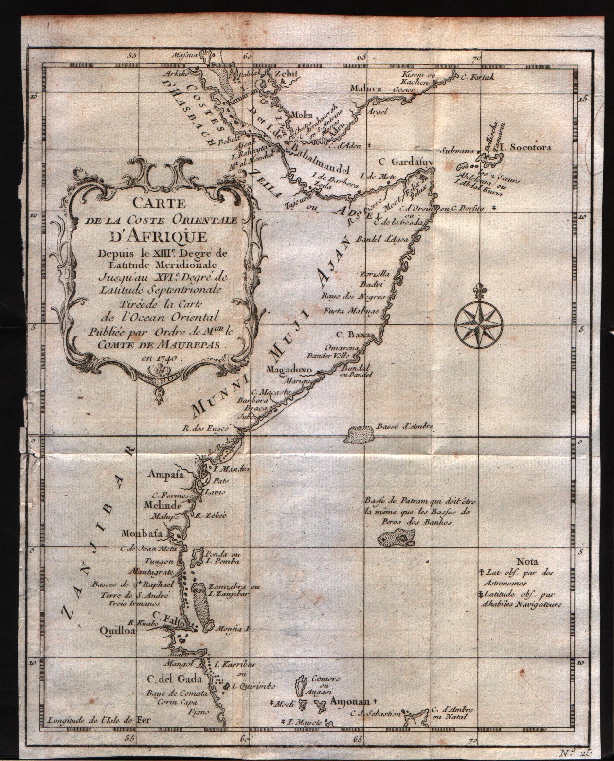
Carte de la Coste Orientale d'Afrique depuis le XIII degre de latitudine
Author
Bellin
Location shown in map
East Africa
Edition date
1757
Edition place
Paris
Editor
--
Atlas
Historie General des Voyages -- Prevost
Price
100 Euro
State
[mint/excellent/VERY GOOD/good/fair/mediocre/poor]
Color
Black/white
Verso
Blank
Size
Plate: cm (20.3 x 24.1) inches (7.99 x 9.49) Paper: cm (20.3 x 25.4) inches (7.99 x 10)
Technique
Copper engraving
Note
No particular notes for this maps
Reference
--
Wiki
Here for more info
In stock
Available
Info
info@thetreasuremaps.com
Code
#0318
×
![Carte de la Coste Orientale d'Afrique depuis le XIII degre de latitudine by Bellin, East Africa, 1757]()
Map title
Carte du Golfe de Guinee et les costes comprises entre le Cap Formosa ...
Author
Bellin
Location shown in map
Gulf of Guinee
Edition date
1757
Edition place
Paris
Editor
--
Atlas
Historie General des Voyages -- Prevost
Price
Please ask: info@thetreasuremaps.com
State
[mint/excellent/VERY GOOD/good/fair/mediocre/poor]
Color
Black/white
Verso
Blank
Size
Plate: cm (27.9 x 25.4) inches (10.98 x 10) Paper: cm (30.5 x 27.9) inches (12.01 x 10.98)
Technique
Copper engraving
Note
No particular notes for this maps
Reference
--
Wiki
Here for more info
In stock
Available
Info
info@thetreasuremaps.com
Code
#0319
×
![Carte du Golfe de Guinee et les costes comprises entre le Cap Formosa ... by Bellin, Gulf of Guinee, 1757]()
Map title
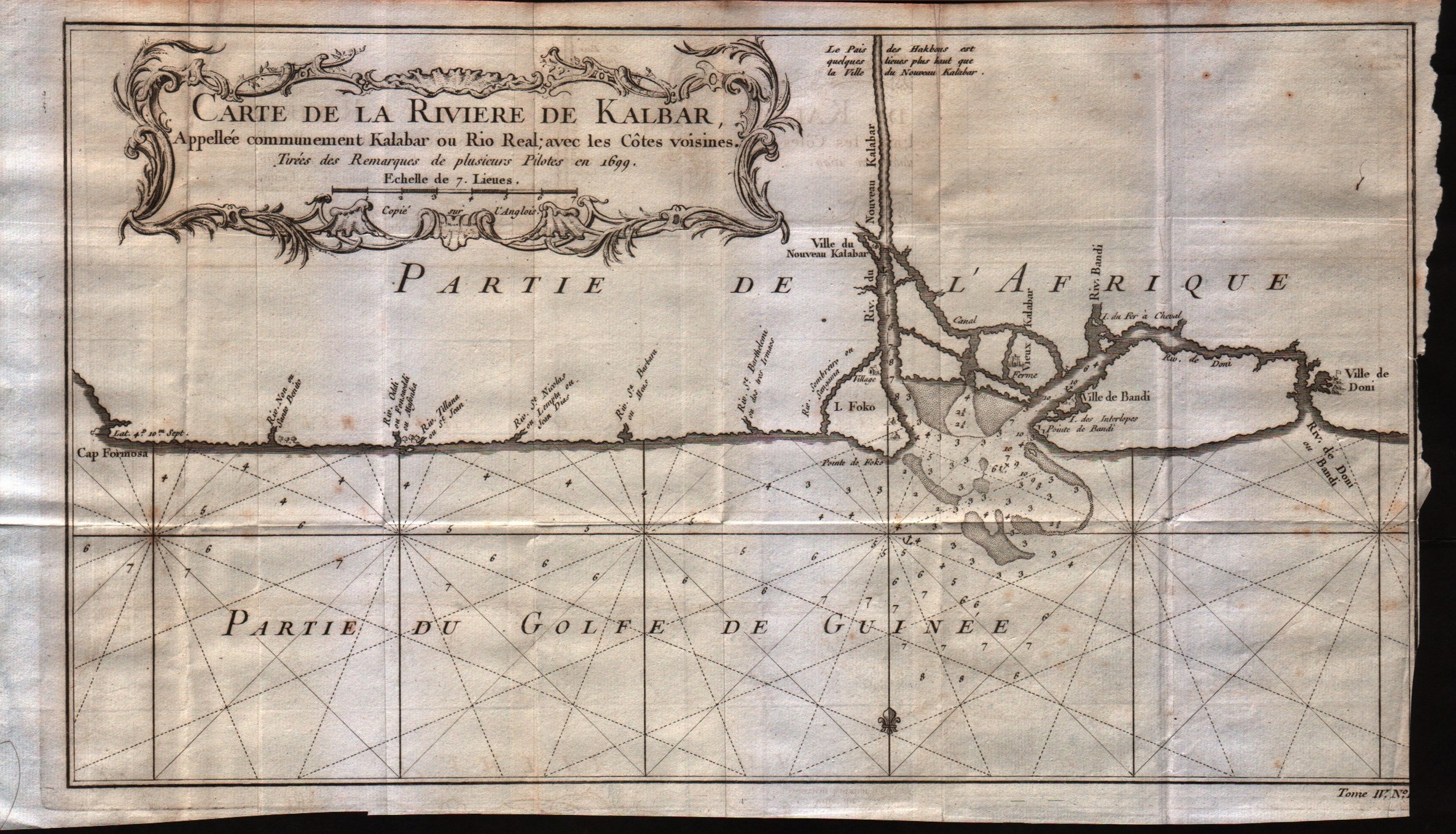
Carte de la riviere de Kalbar
Author
Bellin
Location shown in map
--
Edition date
1757
Edition place
Paris
Editor
--
Atlas
Historie General des Voyages -- Prevost
Price
Please ask: info@thetreasuremaps.com
State
[mint/excellent/VERY GOOD/good/fair/mediocre/poor]
Color
Black/white
Verso
Blank
Size
Plate: cm (35.6 x 20.3) inches (14.02 x 7.99) Paper: cm (38.1 x 22.9) inches (15 x 9.02)
Technique
Copper engraving
Note
No particular notes for this maps
Reference
--
Wiki
Here for more info
In stock
Available
Info
info@thetreasuremaps.com
Code
#0320
×
![Carte de la riviere de Kalbar by Bellin, --, 1757]()
Map title
Carte du cours de la riviere de Gambia ou Gambie depuis ...
Author
Bellin
Location shown in map
Gambia river
Edition date
1757
Edition place
Paris
Editor
--
Atlas
Historie General des Voyages -- Prevost
Price
Please ask: info@thetreasuremaps.com
State
[mint/excellent/VERY GOOD/good/fair/mediocre/poor]
Color
Black/white
Verso
Blank
Size
Plate: cm (31.8 x 20.3) inches (12.52 x 7.99) Paper: cm (35.6 x 22.9) inches (14.02 x 9.02)
Technique
Copper engraving
Note
No particular notes for this maps
Reference
--
Wiki
Here for more info
In stock
Available
Info
info@thetreasuremaps.com
Code
#0321
×
![Carte du cours de la riviere de Gambia ou Gambie depuis ... by Bellin, Gambia river, 1757]()
Map title
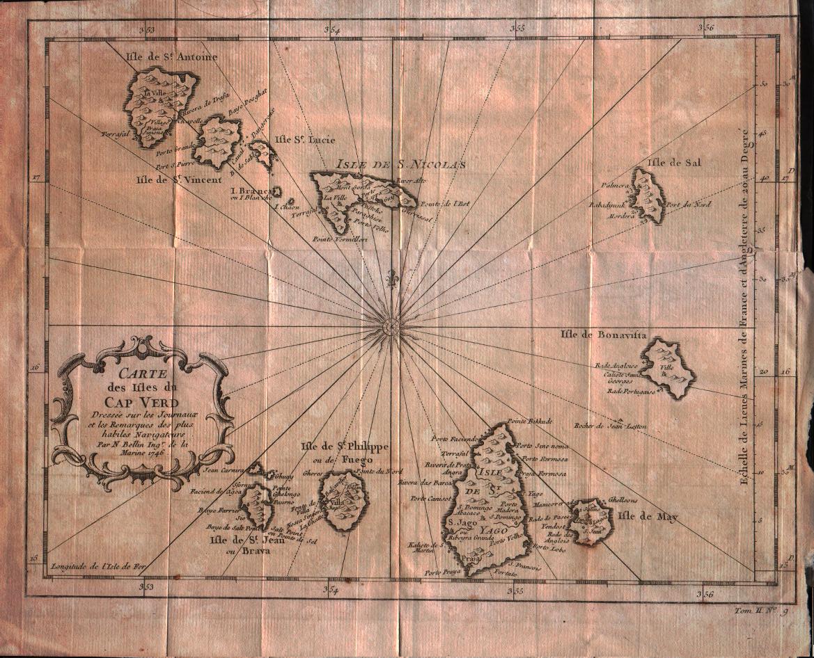
Carte des isles du Cap Verd
Author
Bellin
Location shown in map
Cape Verde island
Edition date
1757
Edition place
Paris
Editor
--
Atlas
Historie General des Voyages -- Prevost
Price
100 Euro
State
[mint/excellent/VERY GOOD/good/fair/mediocre/poor]
Color
Black/white
Verso
Blank
Size
Plate: cm (27.9 x 21.6) inches (10.98 x 8.5) Paper: cm (30.5 x 25.4) inches (12.01 x 10)
Technique
Copper engraving
Note
No particular notes for this maps
Reference
--
Wiki
Here for more info
In stock
Available
Info
info@thetreasuremaps.com
Code
#0322
×
![Carte des isles du Cap Verd by Bellin, Cape Verde island, 1757]()
Map title
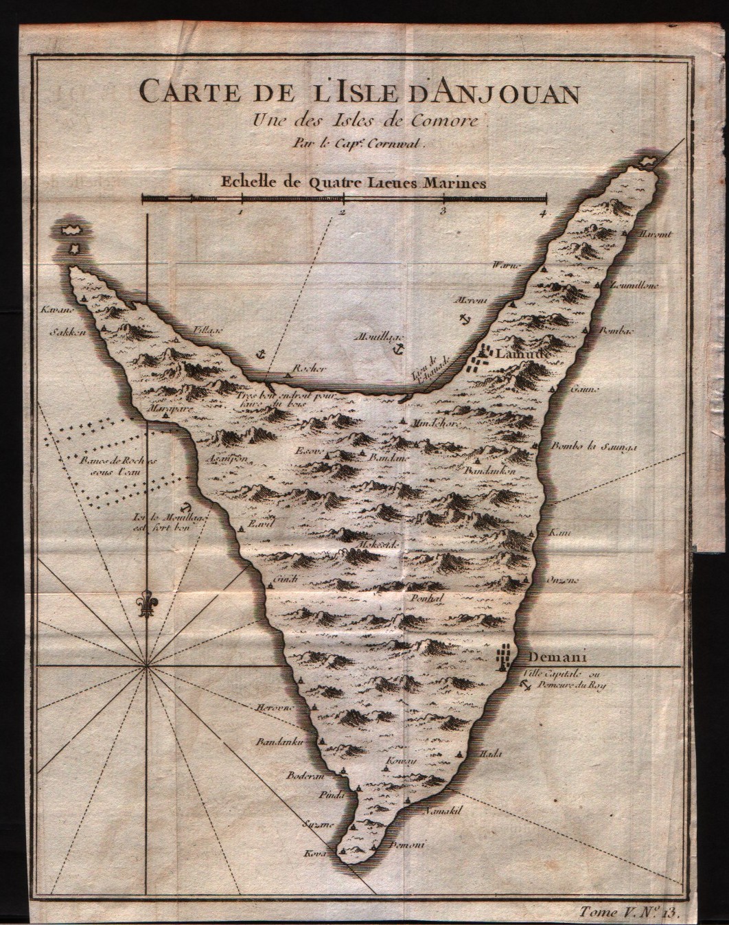
Carte de l'isle d'Anjouan
Author
Bellin
Location shown in map
Comore island
Edition date
1750
Edition place
Paris
Editor
--
Atlas
Historie General des Voyages -- Prevost
Price
75 Euro
State
[mint/EXCELLENT/very good/good/fair/mediocre/poor]
Color
Black/white
Verso
Blank
Size
Plate: cm (16.5 x 21.6) inches (6.5 x 8.5) Paper: cm (17.8 x 22.9) inches (7.01 x 9.02)
Technique
Copper engraving
Note
No particular notes for this maps
Reference
--
Wiki
Here for more info
In stock
Available
Info
info@thetreasuremaps.com
Code
#0323
×
![Carte de l'isle d'Anjouan by Bellin, Comore island, 1750]()
Map title
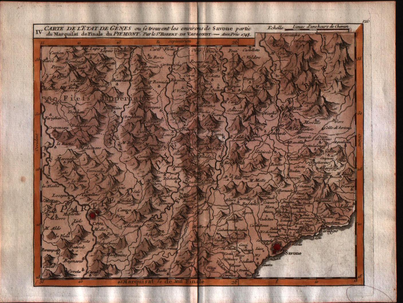
Carte de l'Etat de Genes, ou se trouvent les environs de Savone partie du Marquisat de Finale du Piemont.
Author
Robert de Vaugondy
Location shown in map
Liguria
Edition date
1748
Edition place
Paris
Editor
Durand & Pissot
Atlas
Atlas portatif universel et militaire
Price
150 Euro
State
[MINT/excellent/very good/good/fair/mediocre/poor]
Color
Old colors
Verso
Blank
Size
Plate: cm (20.3 x 15.2) inches (7.99 x 5.98) Paper: cm (24.1 x 19) inches (9.49 x 7.48)
Technique
Copper engraving
Note
No particular notes for this maps.
Reference
--
Wiki
Here for more info
In stock
Available
Info
info@thetreasuremaps.com
Code
#0554
×
![Carte de l'Etat de Genes, ou se trouvent les environs de Savone partie du Marquisat de Finale du Piemont. by Robert de Vaugondy, Liguria, 1748]()
Map title
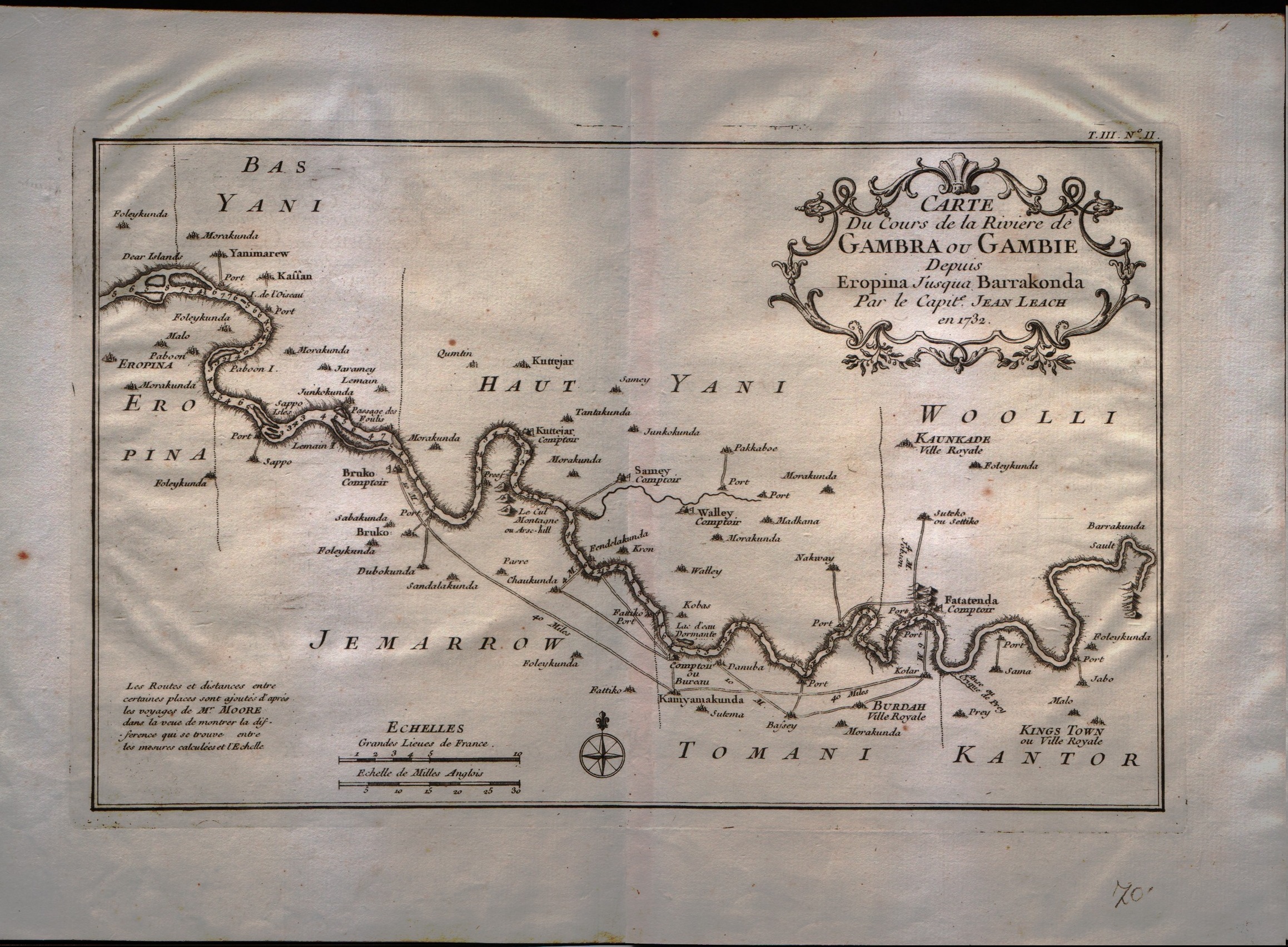
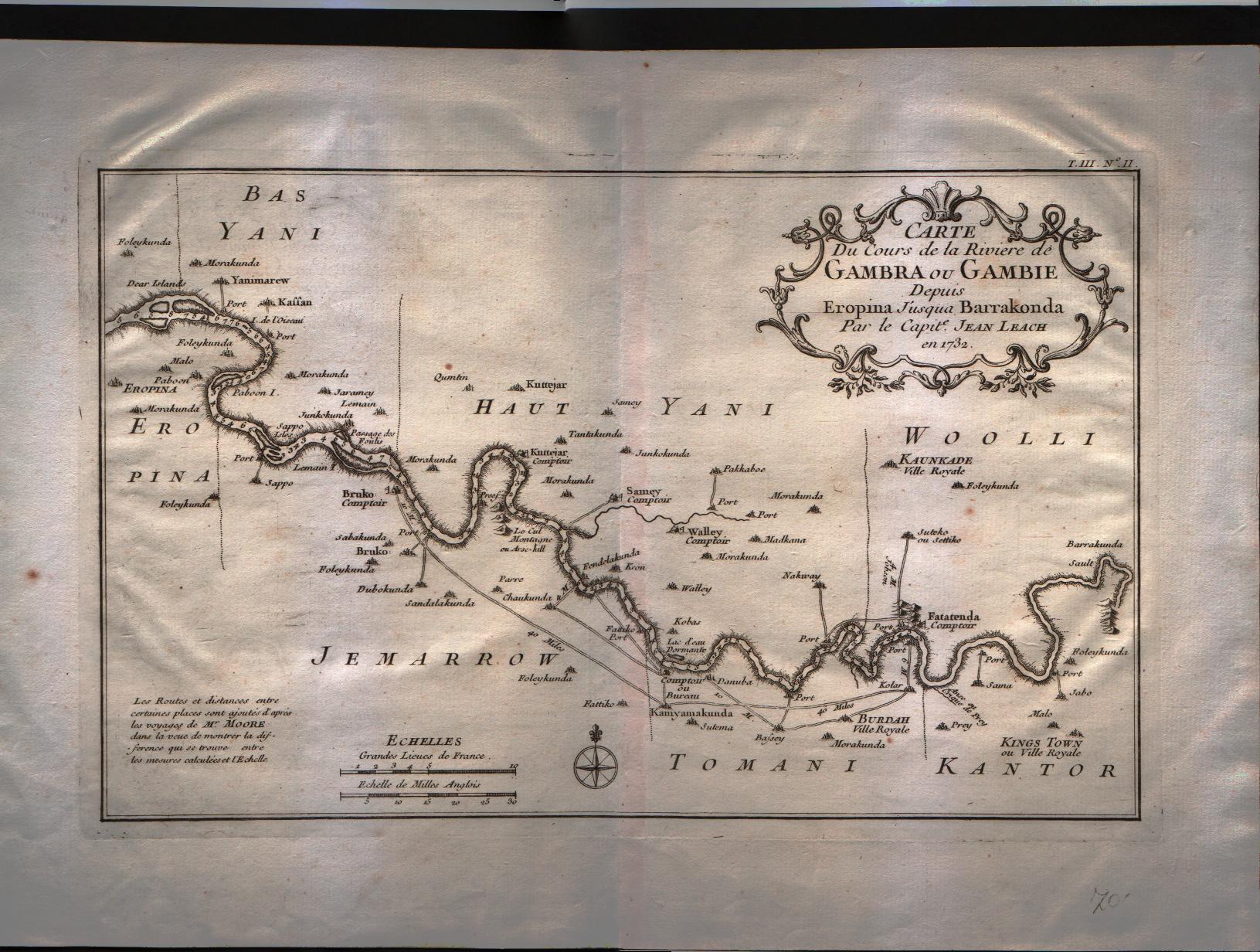
Carte du cours de la riviere de Gambra ou Gambie depuis Eropina u'j'usqua Barrakonda.
Author
Bellin
Location shown in map
Gambie river.
Edition date
1750
Edition place
Paris
Editor
--
Atlas
Historie General des Voyages -- Prevost
Price
Please ask: info@thetreasuremaps.com
State
[mint/EXCELLENT/very good/good/fair/mediocre/poor]
Color
Black/white
Verso
Blank
Size
Plate: cm (33 x 20.3) inches (12.99 x 7.99) Paper: cm (40.6 x 27.9) inches (15.98 x 10.98)
Technique
Copper engraving
Note
No particular notes for this maps
Reference
--
Wiki
Here for more info
In stock
Available
Info
info@thetreasuremaps.com
Code
#0325
×
![Carte du cours de la riviere de Gambra ou Gambie depuis Eropina u'j'usqua Barrakonda. by Bellin, Gambie river., 1750]()
Map title
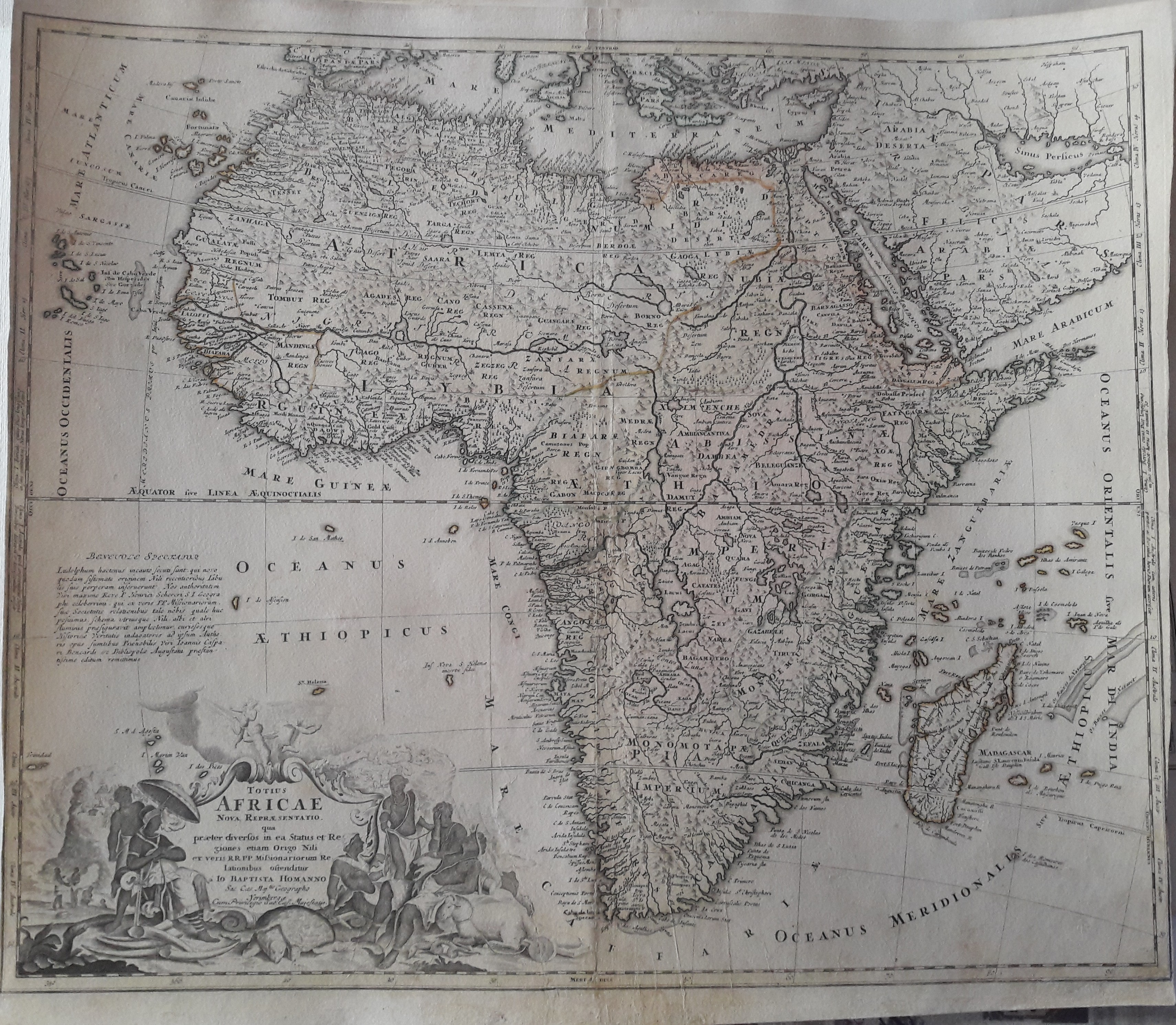
Totius Africae Nova Repraesentatio qua per diversos in ea Status et Regiones, etiam Origo Nili ex veris R.R.P.P. Missionariorum Relationibus ostenditur
Author
Homann
Location shown in map
Africa
Edition date
1720
Edition place
Nuremberg
Editor
--
Atlas
--
Price
300 Euro
State
[mint/excellent/very good/good/FAIR/mediocre/poor]
Color
Old color
Verso
Blank
Size
Plate: cm (55.9 x 48.3) inches (22.01 x 19.02) Paper: cm (57.2 x 50.8) inches (22.52 x 20)
Technique
Copper engraving
Note
Some professional repaired tears. Missing rigth bottom corner 2mm
Reference
--
Wiki
Here for more info
In stock
Available
Info
info@thetreasuremaps.com
Code
#0327
×
![Totius Africae Nova Repraesentatio qua per diversos in ea Status et Regiones, etiam Origo Nili ex veris R.R.P.P. Missionariorum Relationibus ostenditur by Homann, Africa, 1720]()
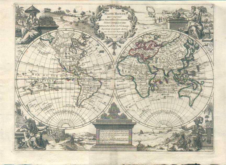
Map title
Mappa mode
Author
Le Rouge
Location shown in map
World
Edition date
1748
Edition place
Paris
Editor
--
Atlas
Atlas Nouveau Portatif l'usage des militaries et du voyageur
Price
Please ask: info@thetreasuremaps.com
State
[MINT/excellent/very good/good/fair/mediocre/poor]
Color
Old outlined
Verso
Blank
Size
Plate: cm (29.7 x 22.2) inches (11.69 x 8.74) Paper: cm (29.7 x 22.2) inches (11.69 x 8.74)
Technique
Copper engraving
Note
No particular notes for this maps
Reference
--
Wiki
Here for more info
In stock
Available
Info
info@thetreasuremaps.com
Code
#0328
×
![Mappa mode by Le Rouge, World, 1748]()
Map title
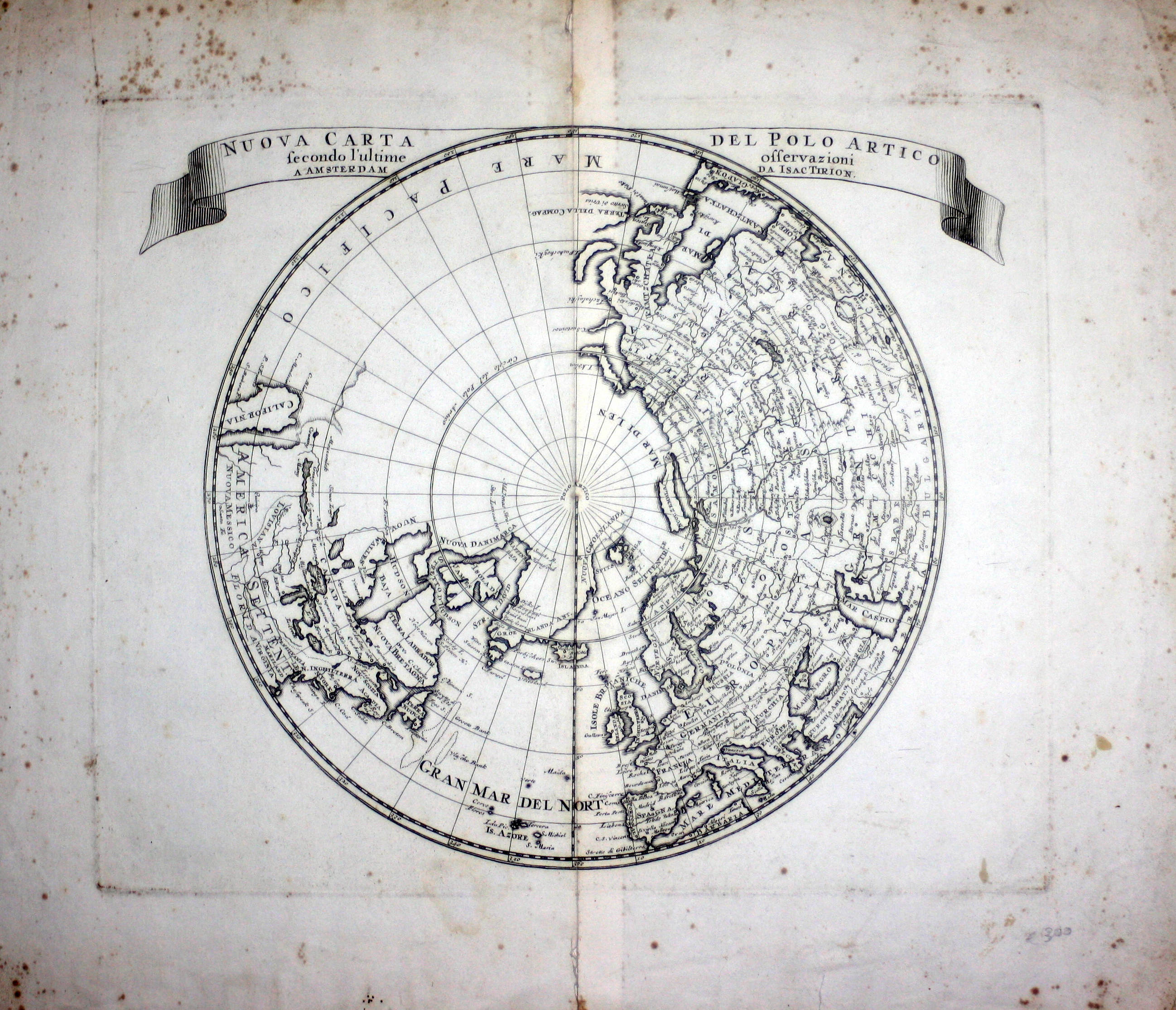
Nuova Carta Del Polo Artico secondo l'ultime osservazioni a Amsterdam da Isac Tirion
Author
Tirion
Location shown in map
Polar Arctic Regions
Edition date
1736
Edition place
Amsterdam
Editor
--
Atlas
--
Price
300 Euro
State
mint/excellent/VERY GOOD/good/fair/mediocre/poor]
Color
Black/white
Verso
Blank
Size
Plate: cm (35.6 x 30.5) inches (14.02 x 12.01) Paper: cm (45.7 x 38.1) inches (17.99 x 15)
Technique
Copper engraving
Note
California as an island
Reference
--
Wiki
Here for more info
In stock
Available
Info
info@thetreasuremaps.com
Code
#0329
×
![Nuova Carta Del Polo Artico secondo l'ultime osservazioni a Amsterdam da Isac Tirion by Tirion, Polar Arctic Regions, 1736]()

Map title
Essay D'Une Catre Reduite Contenant Les Parties Connues Du Globe Terrestre
Author
Bellin
Location shown in map
World
Edition date
1757
Edition place
Paris
Editor
--
Atlas
Historie General DesVoyages
Price
900 Euro
State
[mint/EXCELLENT/very good/good/fair/mediocre/poor]
Color
Black/white
Verso
Blank
Size
Plate: cm ( x ) inches (0 x 0) Paper: cm ( x ) inches (0 x 0)
Technique
Copper engraving
Note
Four sheets
Reference
--
Wiki
Here for more info
In stock
Available
Info
info@thetreasuremaps.com
Code
#0330
×
![Essay D'Une Catre Reduite Contenant Les Parties Connues Du Globe Terrestre by Bellin, World, 1757]()
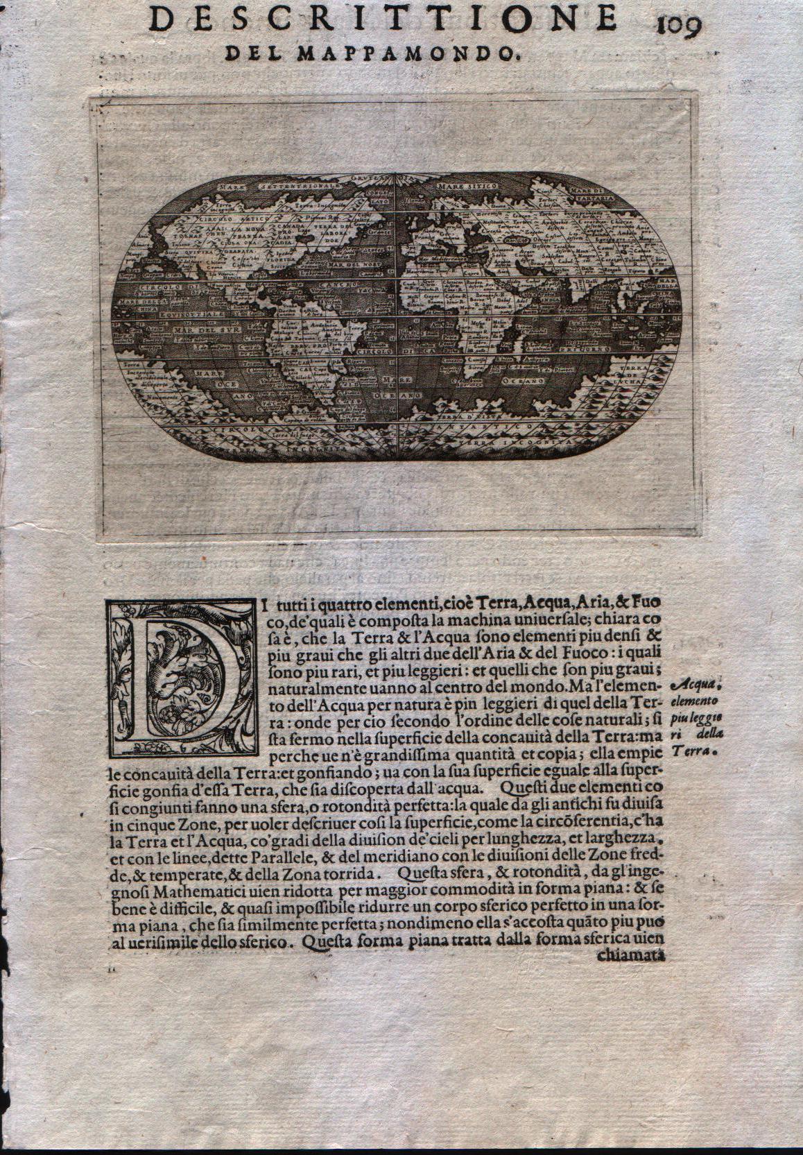
Map title
Descrittione del Mappamondo
Author
Porcacchi
Location shown in map
World
Edition date
1572
Edition place
Venice
Editor
--
Atlas
L'Isole piu famose del mondo -- S. Galignani and G. Porro
Price
600 Euro
State
[mint/EXCELLENT/very good/good/fair/mediocre/poor]
Color
Black/white
Verso
Italian text pag.109
Size
Plate: cm (15.2 x 11.4) inches (5.98 x 4.49) Paper: cm (20.3 x 29.2) inches (7.99 x 11.5)
Technique
Copper engraving
Note
First edition
Reference
--
Wiki
Here for more info
In stock
Available
Info
info@thetreasuremaps.com
Code
#0331
×
![Descrittione del Mappamondo by Porcacchi, World, 1572]()
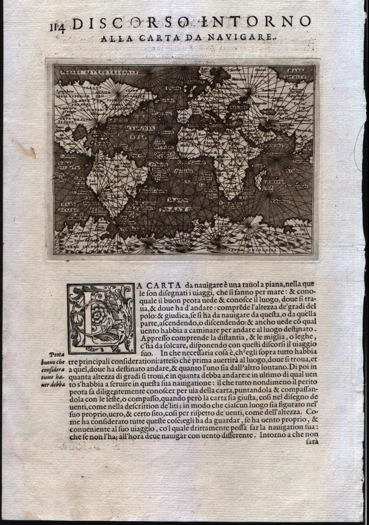
Map title
Discorso intorno alla carta da navigare
Author
Porcacchi
Location shown in map
World
Edition date
1572
Edition place
Venice
Editor
--
Atlas
L'Isole piu famose del mondo -- S. Galignani and G. Porro
Price
600 Euro
State
[mint/EXCELLENT/very good/good/fair/mediocre/poor]
Color
Black/white
Verso
Italian text pag.114
Size
Plate: cm (15.2 x 11.4) inches (5.98 x 4.49) Paper: cm (20.3 x 29.2) inches (7.99 x 11.5)
Technique
Copper engraving
Note
First edition
Reference
--
Wiki
Here for more info
In stock
Available
Info
info@thetreasuremaps.com
Code
#0332
×
![Discorso intorno alla carta da navigare by Porcacchi, World, 1572]()
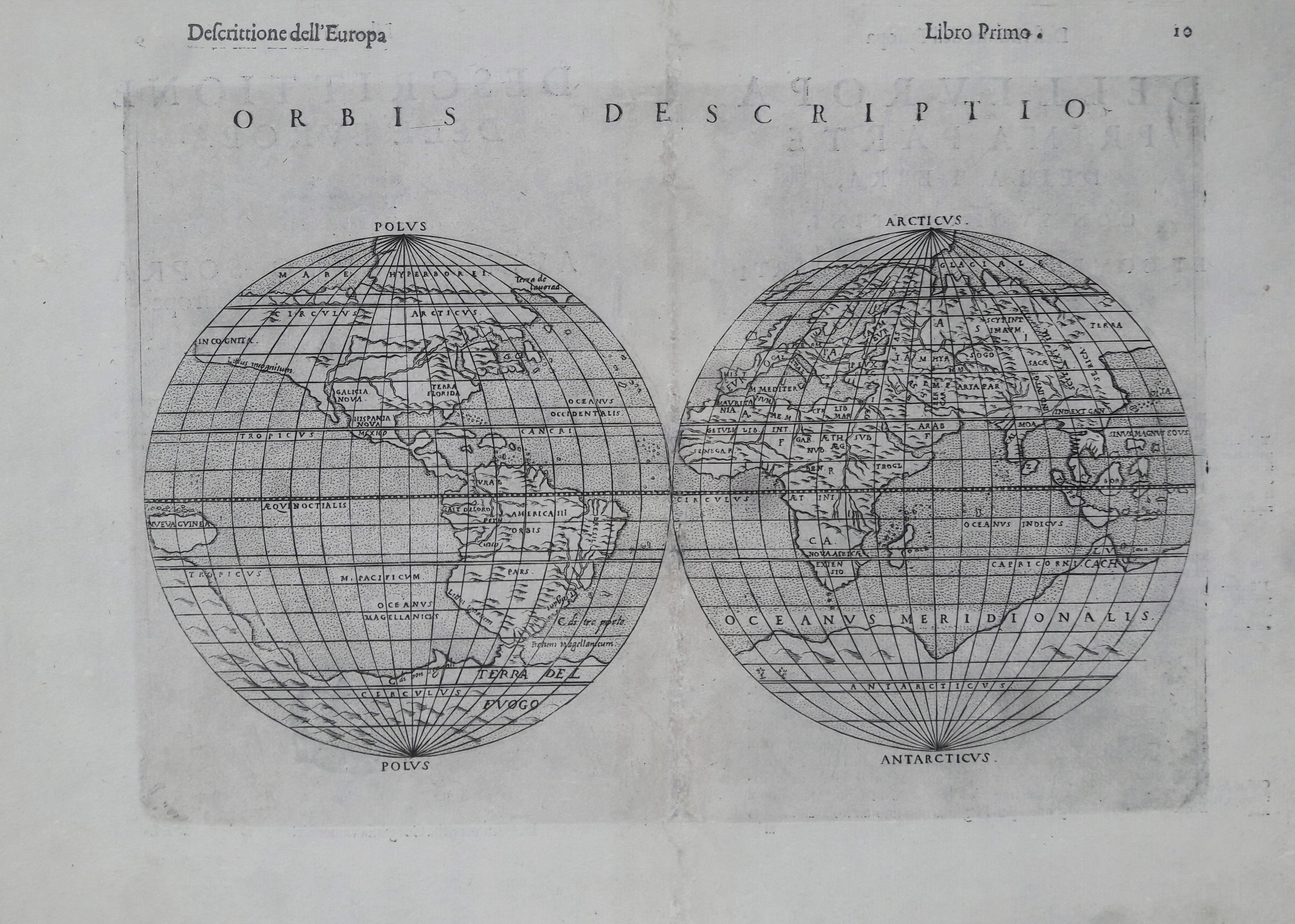
Map title
Orbis descriptio
Author
Ruscelli
Location shown in map
World
Edition date
1599
Edition place
Venice
Editor
Rosaccio
Atlas
La Geographia di Claudio Tolomeo
Price
700 Euro
State
[mint/EXCELLENT/very good/good/fair/mediocre/poor]
Color
Black/white
Verso
Italian text pag.10
Size
Plate: cm (25.4 x 17.8) inches (10 x 7.01) Paper: cm (35.6 x 24.1) inches (14.02 x 9.49)
Technique
Copper engraving
Note
This later edition has been altered to show the Southern Continent.
Reference
--
Wiki
Here for more info
In stock
Available
Info
info@thetreasuremaps.com
Code
#0333
×
![Orbis descriptio by Ruscelli, World, 1599]()
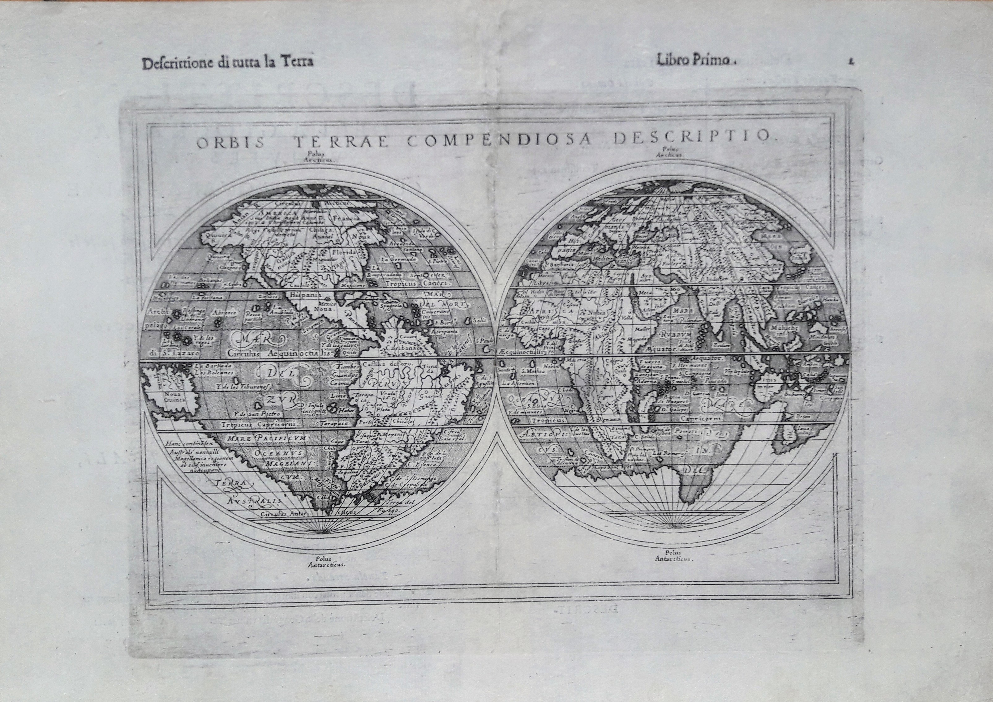
Map title
Orbis terrae compendiosa descriptio
Author
Ruscelli
Location shown in map
World
Edition date
1599
Edition place
Venice
Editor
Rosaccio
Atlas
La Geographia di Claudio Tolomeo
Price
1100 Euro
State
[mint/EXCELLENT/very good/good/fair/mediocre/poor]
Color
Black/white
Verso
Italian text pag.2
Size
Plate: cm (25.4 x 17.8) inches (10 x 7.01) Paper: cm (35.6 x 24.1) inches (14.02 x 9.49)
Technique
Copper engraving
Note
Later edition.
Reference
--
Wiki
Here for more info
In stock
Available
Info
info@thetreasuremaps.com
Code
#0334
×
![Orbis terrae compendiosa descriptio by Ruscelli, World, 1599]()
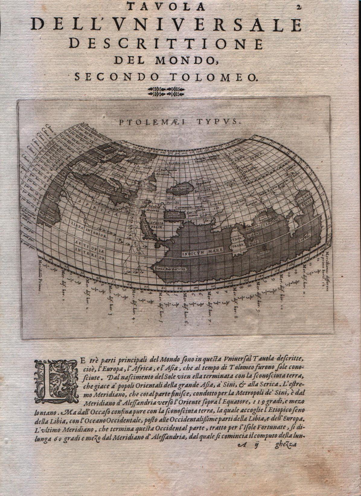
Map title
Ptolemaei Typus
Author
Magini
Location shown in map
World
Edition date
1598
Edition place
Venice
Editor
Battista & Giorgio Galignani
Atlas
Geografia di Claudio Tolomeo -- Giovanni Antonio Magini
Price
300 Euro
State
[MINT/excellent/very good/good/fair/mediocre/poor]
Color
Black/white
Verso
Italian text pag.2
Size
Plate: cm (17.8 x 12.7) inches (7.01 x 5) Paper: cm (20.3 x 30.5) inches (7.99 x 12.01)
Technique
Copper engraving
Note
A map of the Ptolemaic world
Reference
--
Wiki
Here for more info
In stock
Available
Info
info@thetreasuremaps.com
Code
#0335
×
![Ptolemaei Typus by Magini, World, 1598]()
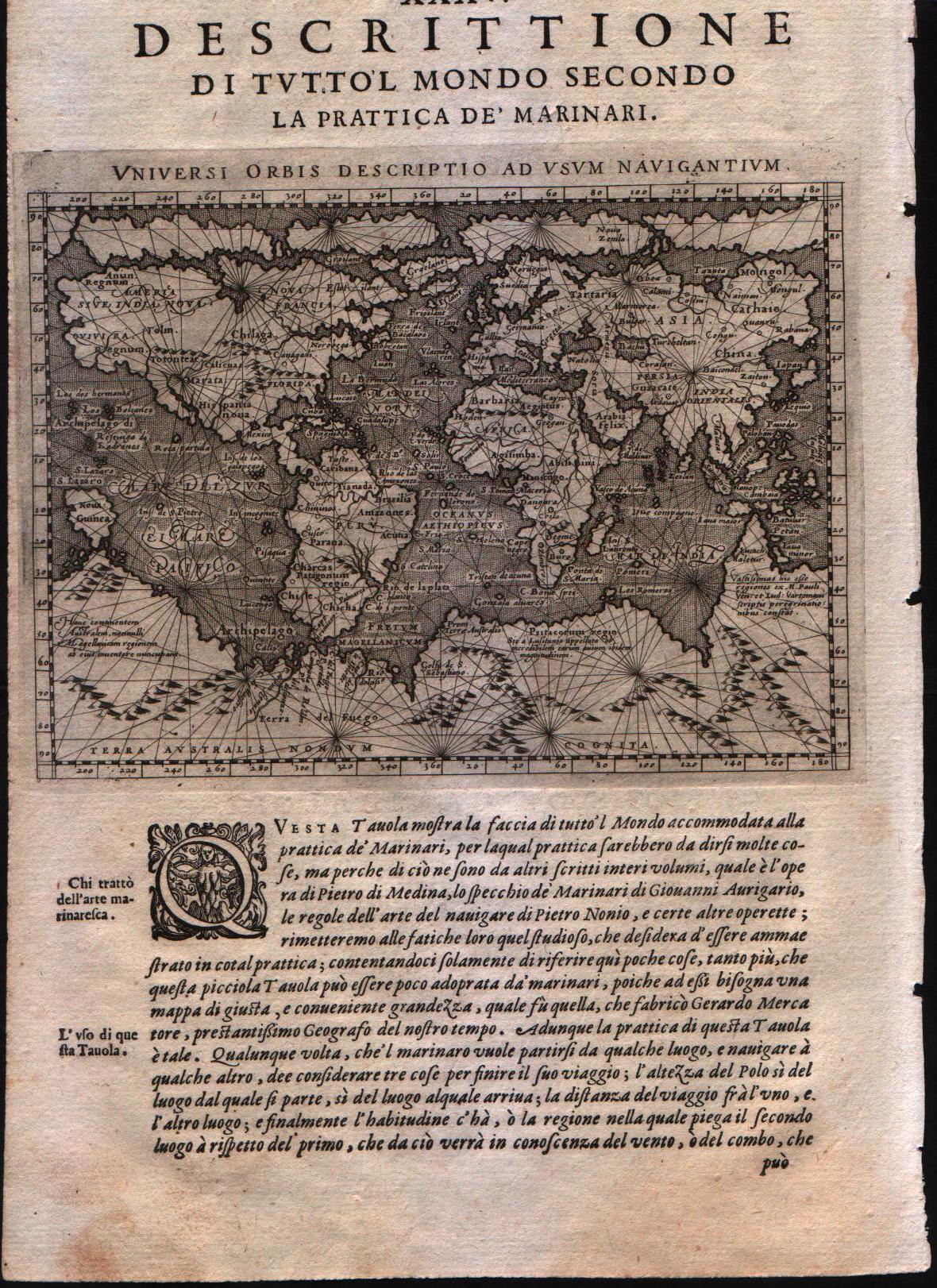
Map title
Universi Orbis Descriptio ad usum navigantium.
Author
Magini
Location shown in map
World
Edition date
1598
Edition place
Venice
Editor
Battista & Giorgio Galignani
Atlas
Geografia di Claudio Tolomeo -- Giovanni Antonio Magini
Price
700 Euro
State
[MINT/excellent/very good/good/fair/mediocre/poor]
Color
Black/white
Verso
Italian text pag.211
Size
Plate: cm (17.8 x 12.7) inches (7.01 x 5) Paper: cm (20.3 x 30.5) inches (7.99 x 12.01)
Technique
Copper engraving
Note
--
Reference
--
Wiki
Here for more info
In stock
Available
Info
info@thetreasuremaps.com
Code
#0336
×
![Universi Orbis Descriptio ad usum navigantium. by Magini, World, 1598]()
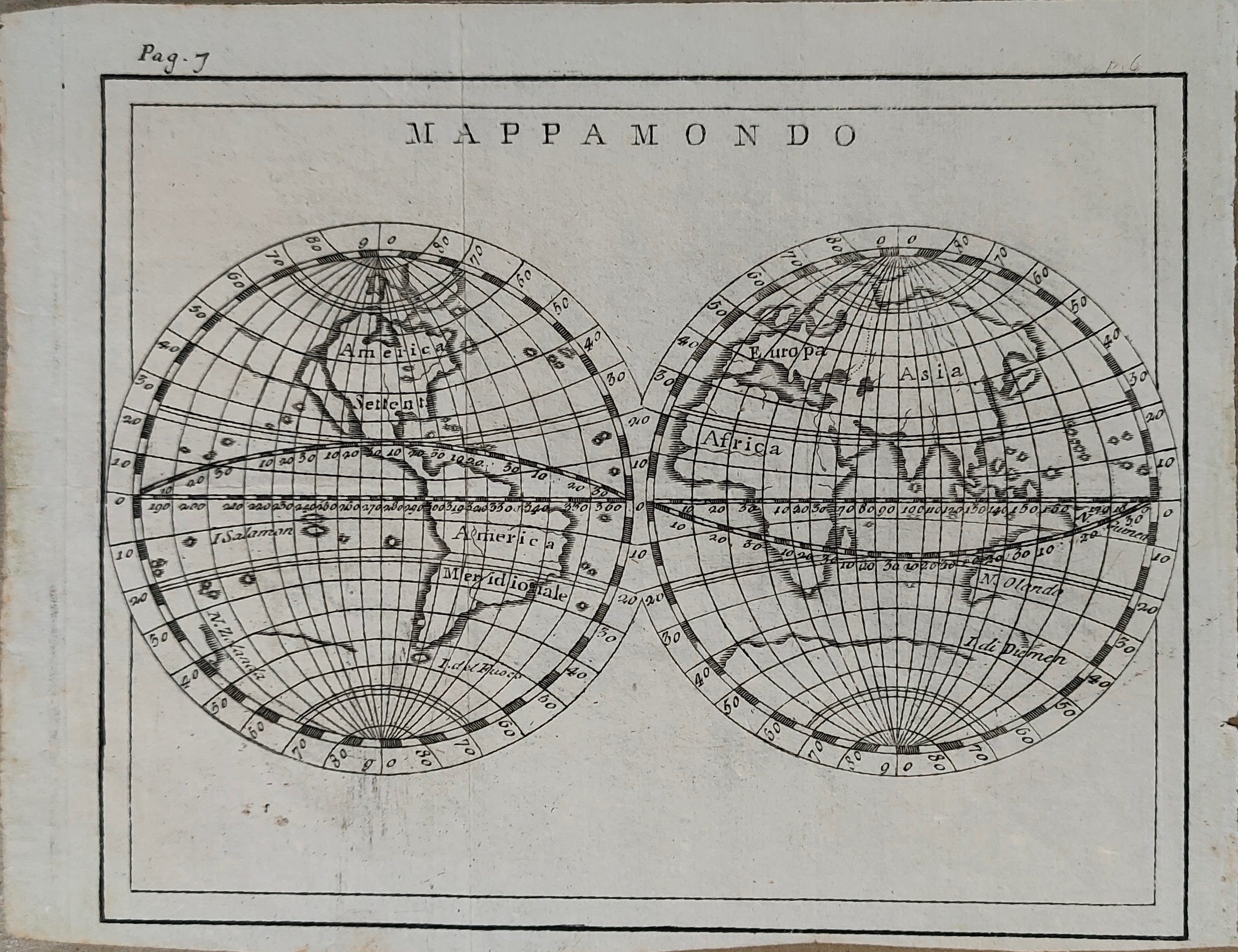
Map title
Mappamondo
Author
Unknown
Location shown in map
World
Edition date
1720
Edition place
--
Editor
--
Atlas
--
Price
100 Euro
State
[mint/EXCELLENT/very good/good/fair/mediocre/poor]
Color
Black/white
Verso
Size
Plate: cm (17.8 x 14) inches (7.01 x 5.51) Paper: cm (20.3 x 15.2) inches (7.99 x 5.98)
Technique
Copper engraving
Note
--
Reference
--
Wiki
Here for more info
In stock
Available
Info
info@thetreasuremaps.com
Code
#0337
×
![Mappamondo by Unknown, World, 1720]()