News
Map title
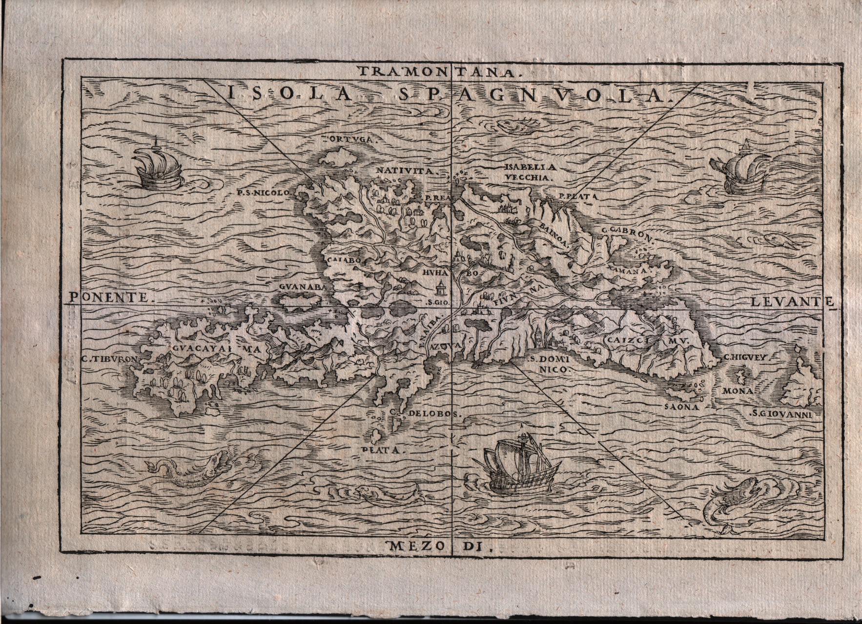
Isola Spaguola
Author
Gastaldi
Location shown in map
Haiti island
Edition date
1613
Edition place
Venice
Editor
Giambattista Ramusio
Atlas
Delle navigazioni e viaggi
Price
500 Euro
State
[mint/EXCELLENT/very good/good/fair/mediocre/poor]
Color
Black/white
Verso
Italian text pag.36
Size
Plate: cm (26.7 x 17.8) inches (10.51 x 7.01) Paper: cm (31.8 x 21.6) inches (12.52 x 8.5)
Technique
Woodcut
Note
Decorated with sea monsters and sailing ships.
Reference
--
Wiki
Here for more info
In stock
Available
Info
info@thetreasuremaps.com
Code
#0338
×
![Isola Spaguola by Gastaldi, Haiti island, 1613]()
Map title
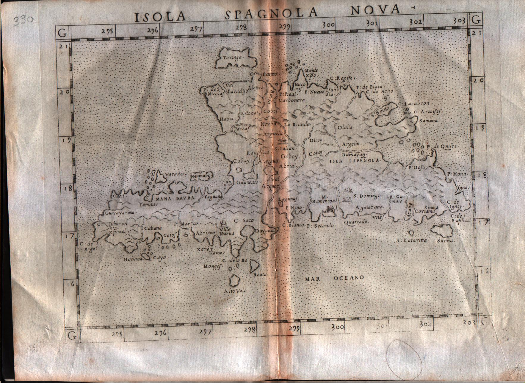
Isola Spagnola Nova
Author
Ruscelli
Location shown in map
Haiti
Edition date
1564
Edition place
Venice
Editor
Girolamo Ziletti
Atlas
La Geographia di Claudio Tolomeo
Price
300 Euro
State
[mint/excellent/VERY GOOD/good/fair/mediocre/poor]
Color
Black/white
Verso
Latin text pag.64
Size
Plate: cm (25.4 x 19) inches (10 x 7.48) Paper: cm (30.5 x 22.9) inches (12.01 x 9.02)
Technique
Copper engraving
Note
--
Reference
--
Wiki
Here for more info
In stock
Available
Info
info@thetreasuremaps.com
Code
#0340
×
![Isola Spagnola Nova by Ruscelli, Haiti, 1564]()
Map title
Descrittione dell'isola Cuba
Author
Porcacchi
Location shown in map
Cuba
Edition date
1576
Edition place
Venice
Editor
--
Atlas
L'Isole piu famose del mondo -- S. Galignani and G. Porro
Price
Please ask: info@thetreasuremaps.com
State
[MINT/excellent/very good/good/fair/mediocre/poor]
Color
Black/white
Verso
Italian text pag.171
Size
Plate: cm (15.2 x 11.4) inches (5.98 x 4.49) Paper: cm (19 x 27.9) inches (7.48 x 10.98)
Technique
Copper engraving
Note
No particular notes for this maps
Reference
Genoa pubblic library "Civica Berio"
Wiki
Here for more info
In stock
Available
Info
info@thetreasuremaps.com
Code
#0341
×
![Descrittione dell'isola Cuba by Porcacchi, Cuba, 1576]()
Map title
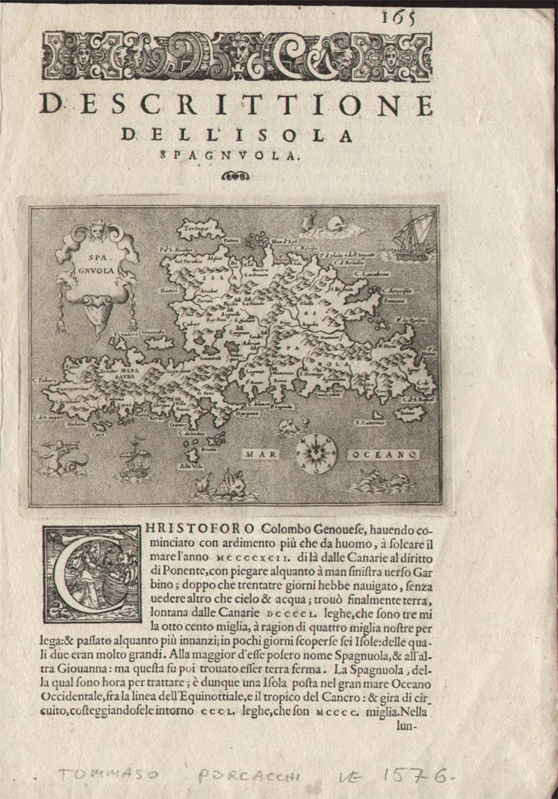
Descrittione dell'isola Spaguola
Author
Porcacchi
Location shown in map
Haiti island
Edition date
1590
Edition place
Venice
Editor
--
Atlas
L'Isole piu famose del mondo -- S. Galignani and G. Porro
Price
200 Euro
State
[MINT/excellent/very good/good/fair/mediocre/poor]
Color
Black/white
Verso
Italian text pag.166
Size
Plate: cm (15.2 x 11.4) inches (5.98 x 4.49) Paper: cm (19 x 29.2) inches (7.48 x 11.5)
Technique
Copper engraving
Note
Decorated with sea monsters and sailing ships.
Reference
--
Wiki
Here for more info
In stock
Available
Info
info@thetreasuremaps.com
Code
#0342
×
![Descrittione dell'isola Spaguola by Porcacchi, Haiti island, 1590]()
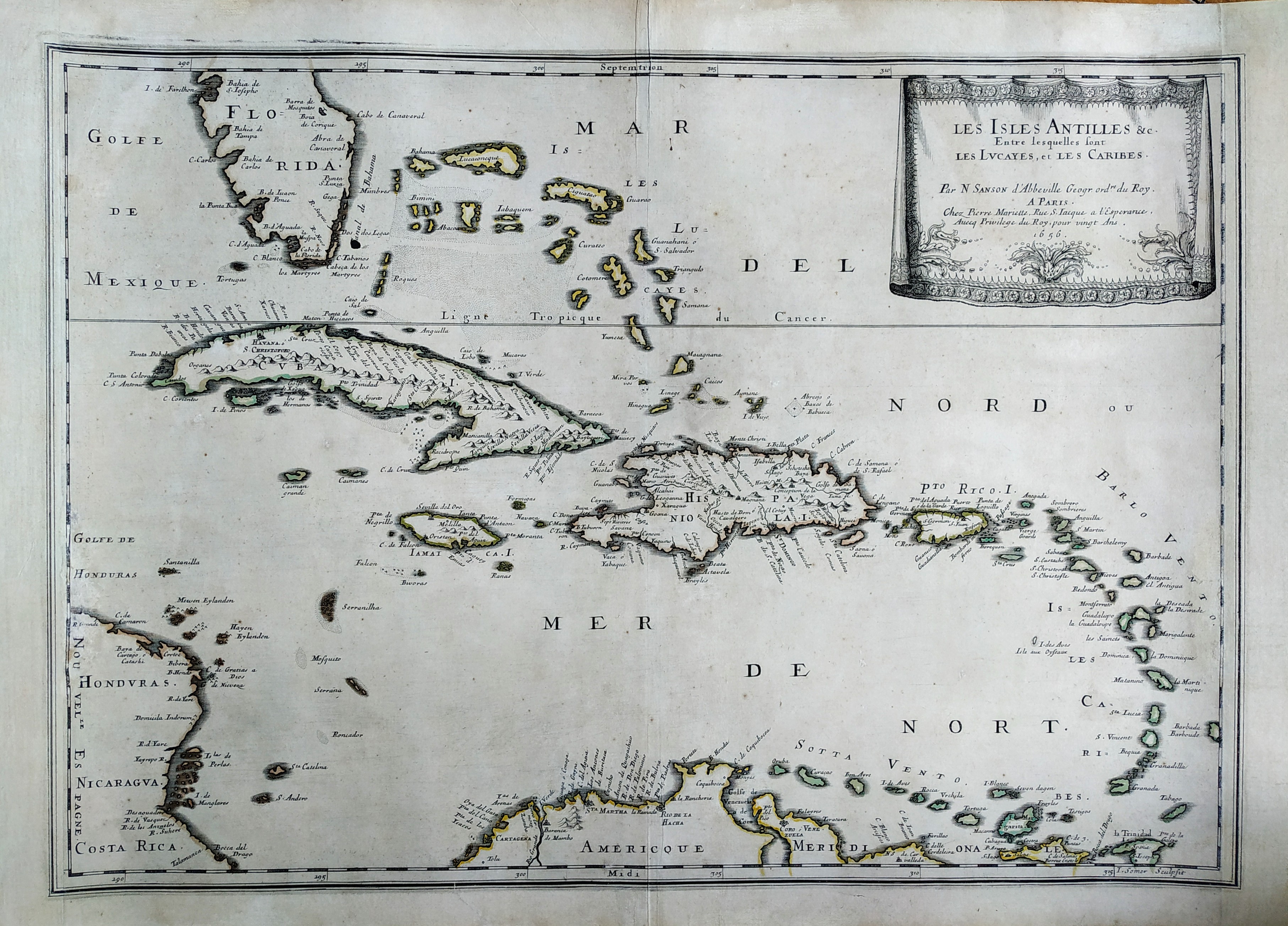
Map title
Les isles Antilles
Author
Sanson
Location shown in map
Antilles islands
Edition date
1656
Edition place
Paris
Editor
--
Atlas
Cartes generales de toutes les parties du monde -- Pierre Mariette
Price
600 Euro
State
[mint/EXCELLENT/very good/good/fair/mediocre/poor]
Color
Black/white
Verso
Blank
Size
Plate: cm (53.3 x 38.1) inches (20.98 x 15) Paper: cm (53.3 x 43.2) inches (20.98 x 17.01)
Technique
Copper engraving
Note
Professionally repaired
Reference
--
Wiki
Here for more info
In stock
Available
Info
info@thetreasuremaps.com
Code
#0343
×
![Les isles Antilles by Sanson, Antilles islands, 1656]()
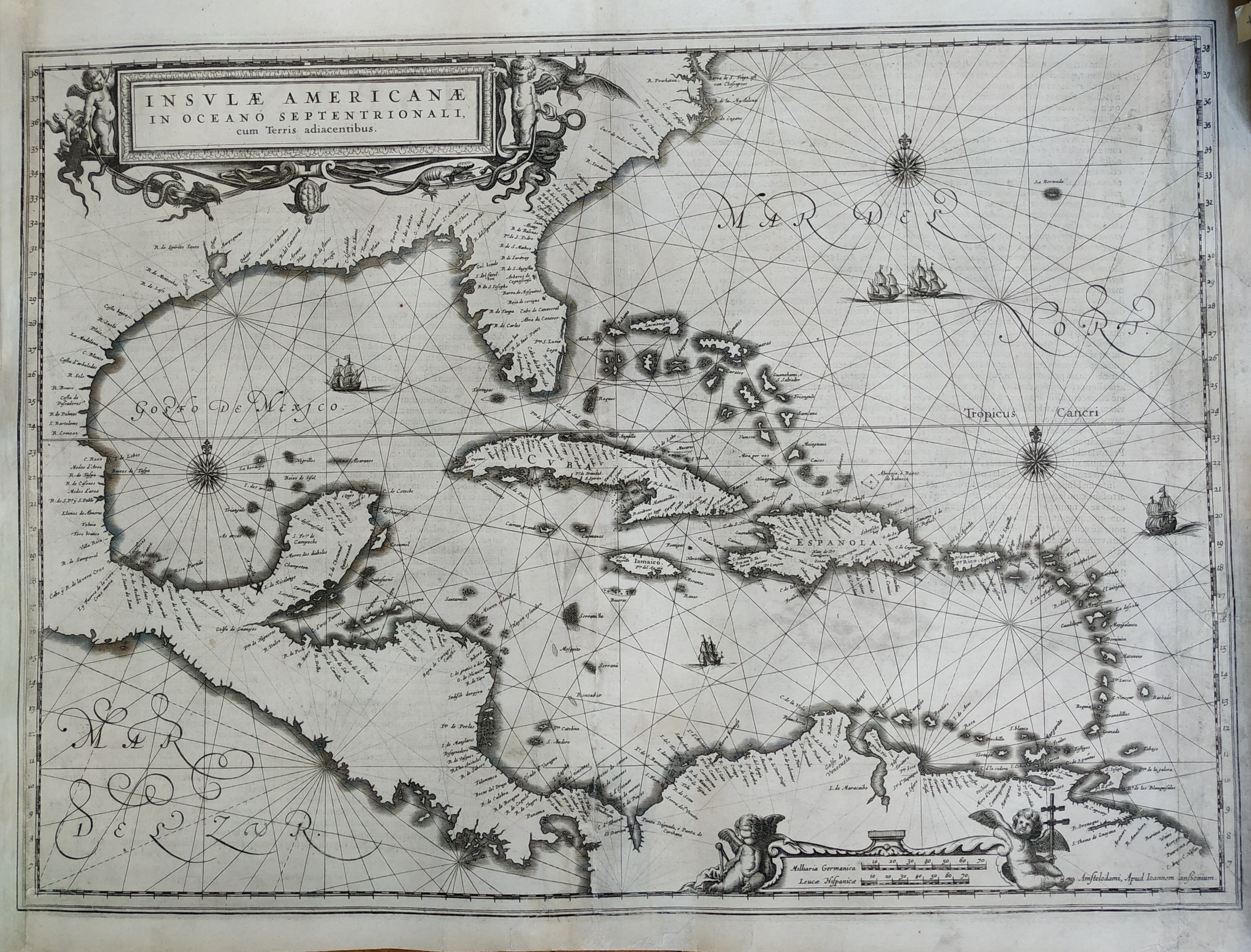
Map title
Insulae Americanae
Author
Jansson
Location shown in map
Florida & Antilles islands
Edition date
1636
Edition place
Amsterdam
Editor
--
Atlas
--
Price
900 Euro
State
[mint/EXCELLENT/verygood/good/fair/mediocre/poor] Professionally restored
Color
Black/white
Verso
Latin text
Size
Plate: cm (50.8 x 38.1) inches (20 x 15) Paper: cm (53.3 x 43.2) inches (20.98 x 17.01)
Technique
Copper engraving
Note
Professionally repaired
Reference
--
Wiki
Here for more info
In stock
Available
Info
info@thetreasuremaps.com
Code
#0344
×
![Insulae Americanae by Jansson, Florida & Antilles islands , 1636]()
Map title
Parte della Nuova Spagna o del Messico
Author
Coronelli
Location shown in map
West Mexic
Edition date
Circa 1696
Edition place
Venice
Editor
--
Atlas
Atlante veneto
Price
600 Euro
State
[mint/EXCELLENT/very good/good/fair/mediocre/poor]
Color
Black/white
Verso
Blank
Size
Plate: cm (61 x 45.7) inches (24.02 x 17.99) Paper: cm (66 x 48.3) inches (25.98 x 19.02)
Technique
Copper engraving
Note
No particular notes for this maps
Reference
--
Wiki
Here for more info
In stock
Available
Info
info@thetreasuremaps.com
Code
#0345
×
![Parte della Nuova Spagna o del Messico by Coronelli, West Mexic, Circa 1696]()
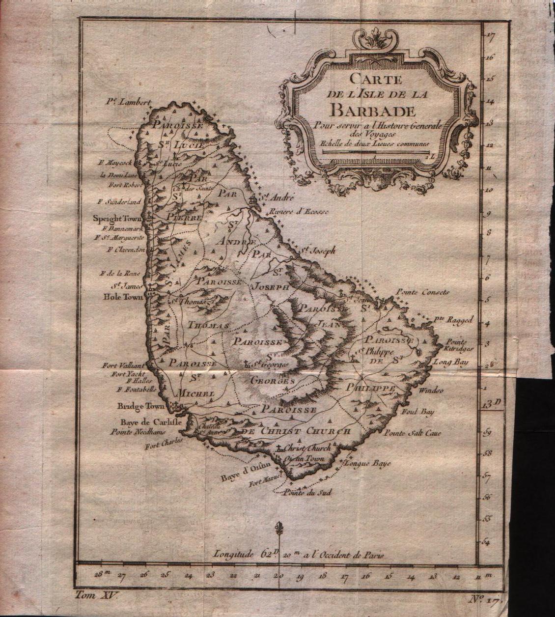
Map title
Carte de l'isle de la Barbade
Author
Bellin
Location shown in map
Barbados
Edition date
1757
Edition place
Paris
Editor
--
Atlas
Historie General des Voyages -- Prevost
Price
150 Euro
State
[mint/EXCELLENT/very good/good/fair/mediocre/poor]
Color
Black/white
Verso
Blank
Size
Plate: cm (15.2 x 20.3) inches (5.98 x 7.99) Paper: cm (17.8 x 22.9) inches (7.01 x 9.02)
Technique
Copper engraving
Note
No particular notes for this maps
Reference
--
Wiki
Here for more info
In stock
Available
Info
info@thetreasuremaps.com
Code
#0347
×
![Carte de l'isle de la Barbade by Bellin, Barbados, 1757]()
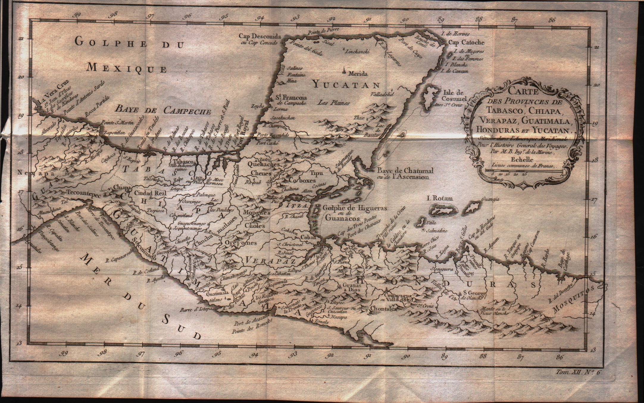
Map title
Carte des Provinces de Tabasco, Chiapa, Verapaz, Guatimala, Honduras et Yucatan
Author
Bellin
Location shown in map
--
Edition date
1757
Edition place
Paris
Editor
--
Atlas
Historie General des Voyages -- Prevost
Price
75 Euro
State
[mint/EXCELLENT/very good/good/fair/mediocre/poor]
Color
Black/white
Verso
Blank
Size
Plate: cm (33 x 20.3) inches (12.99 x 7.99) Paper: cm (35.6 x 22.9) inches (14.02 x 9.02)
Technique
Copper engraving
Note
No particular notes for this maps
Reference
--
Wiki
Here for more info
In stock
Available
Info
info@thetreasuremaps.com
Code
#0348
×
![Carte des Provinces de Tabasco, Chiapa, Verapaz, Guatimala, Honduras et Yucatan by Bellin, --, 1757]()
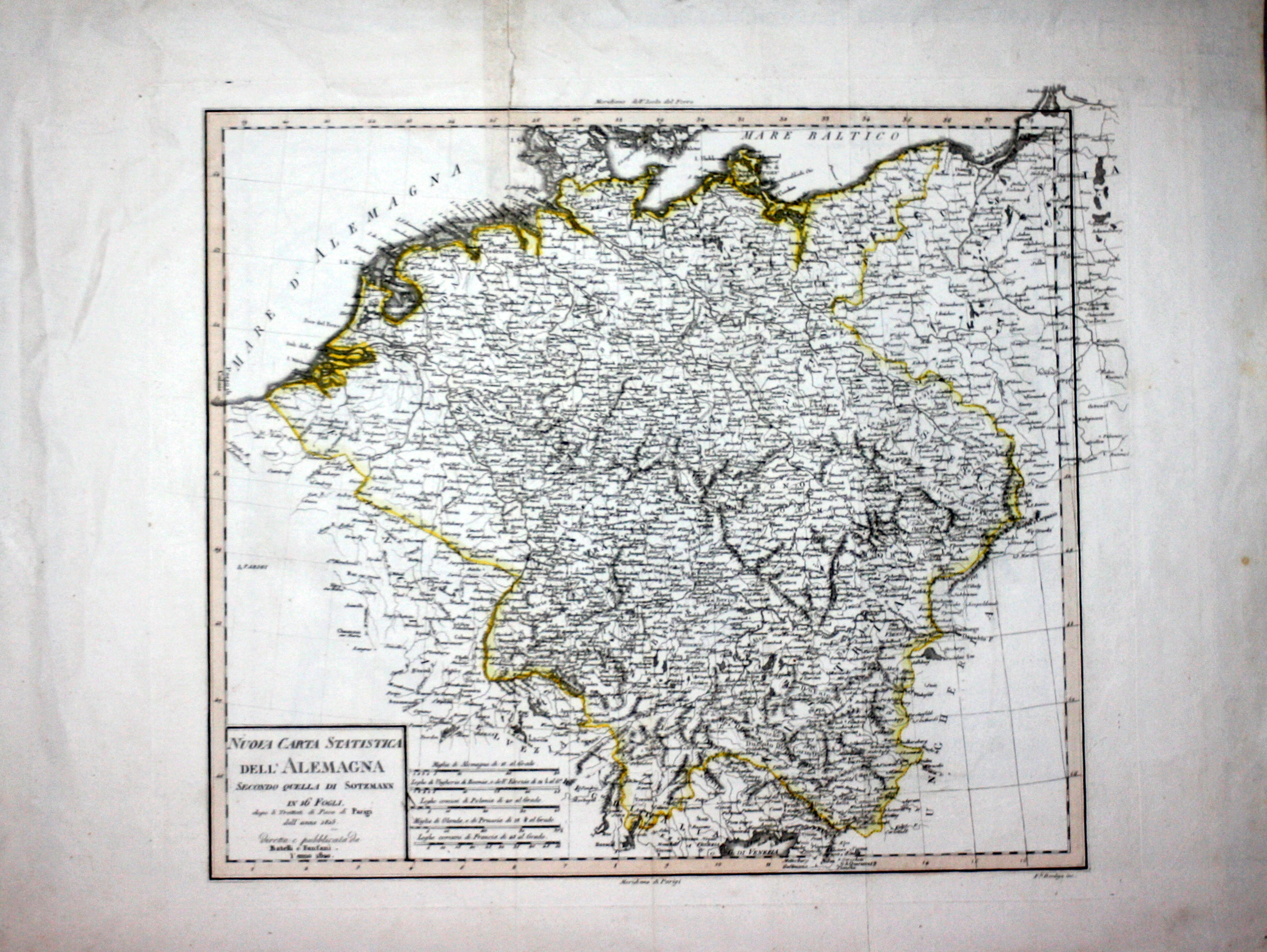
Map title
Nuova carta statistica dell'Alemagna
Author
Bordiga
Location shown in map
Germany
Edition date
1820
Edition place
Milan
Editor
Battelli e Fanfani
Atlas
Nuovo atlante di geografia universale
Price
50 Euro
State
[mint/EXCELLENT/very good/good/fair/mediocre/poor]
Color
Old color
Verso
White
Size
Plate: cm (38.1 x 33) inches (15 x 12.99) Paper: cm (58.4 x 45.7) inches (22.99 x 17.99)
Technique
Steel engraving
Note
No particular notes for this maps.
Reference
--
Wiki
Here for more info
In stock
Available
Info
info@thetreasuremaps.com
Code
#0544
×
![Nuova carta statistica dell'Alemagna by Bordiga, Germany, 1820]()
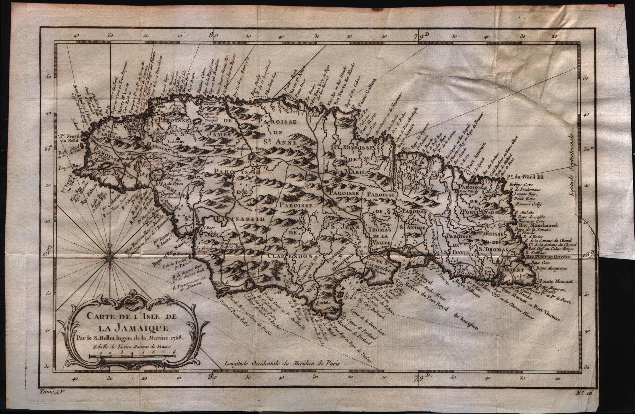
Map title
Carte de lisle de la Jamaique
Author
Bellin
Location shown in map
Jamaica
Edition date
1757
Edition place
Paris
Editor
--
Atlas
Historie General des Voyages -- Prevost
Price
150 Euro
State
[mint/excellent/very good/good/fair/MEDIOCRE/poor]
Color
Black/white
Verso
Blank
Size
Plate: cm (15.2 x 20.3) inches (5.98 x 7.99) Paper: cm (30.5 x 20.3) inches (12.01 x 7.99)
Technique
Copper engraving
Note
No particular notes for this maps
Reference
--
Wiki
Here for more info
In stock
Available
Info
info@thetreasuremaps.com
Code
#0349
×
![Carte de lisle de la Jamaique by Bellin, Jamaica, 1757]()
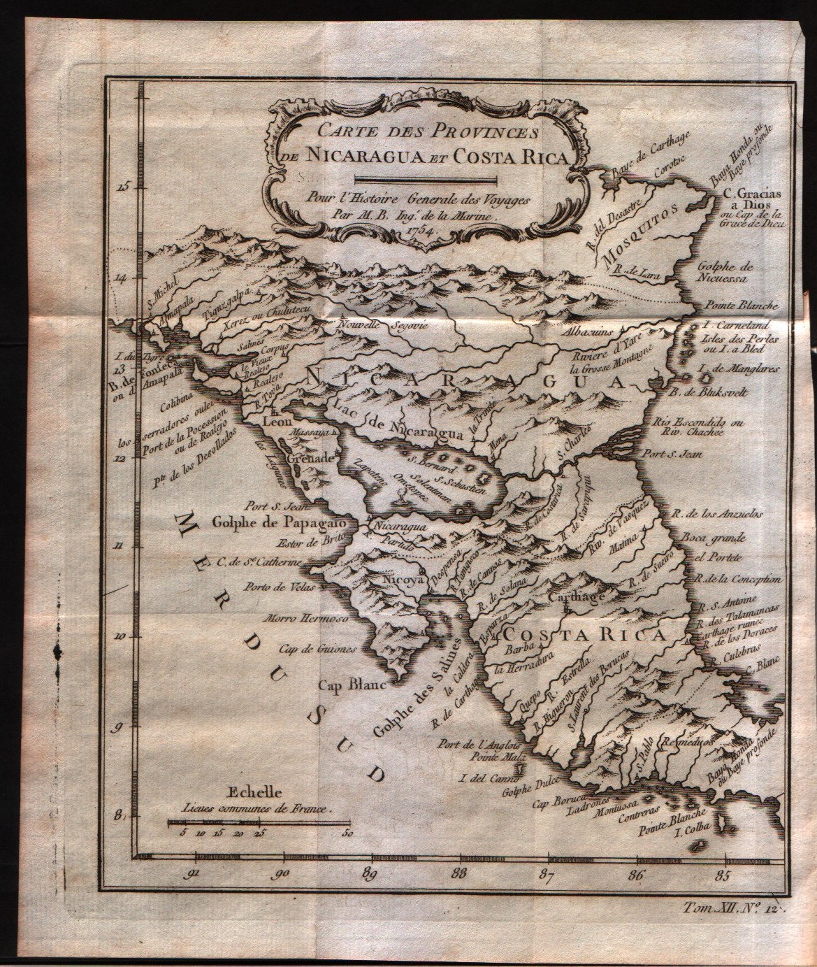
Map title
Carte des provinces de Nicaragua et Costa Rica
Author
Bellin
Location shown in map
Nicaragua and Costa Rica
Edition date
1757
Edition place
Paris
Editor
--
Atlas
Historie General des Voyages -- Prevost
Price
Please ask: info@thetreasuremaps.com
State
[mint/EXCELLENT/very good/good/fair/mediocre/poor]
Color
Black/white
Verso
Blank
Size
Plate: cm (16.5 x 20.3) inches (6.5 x 7.99) Paper: cm (19 x 22.9) inches (7.48 x 9.02)
Technique
Copper engraving
Note
No particular notes for this maps
Reference
--
Wiki
Here for more info
In stock
Available
Info
info@thetreasuremaps.com
Code
#0350
×
![Carte des provinces de Nicaragua et Costa Rica by Bellin, Nicaragua and Costa Rica, 1757]()
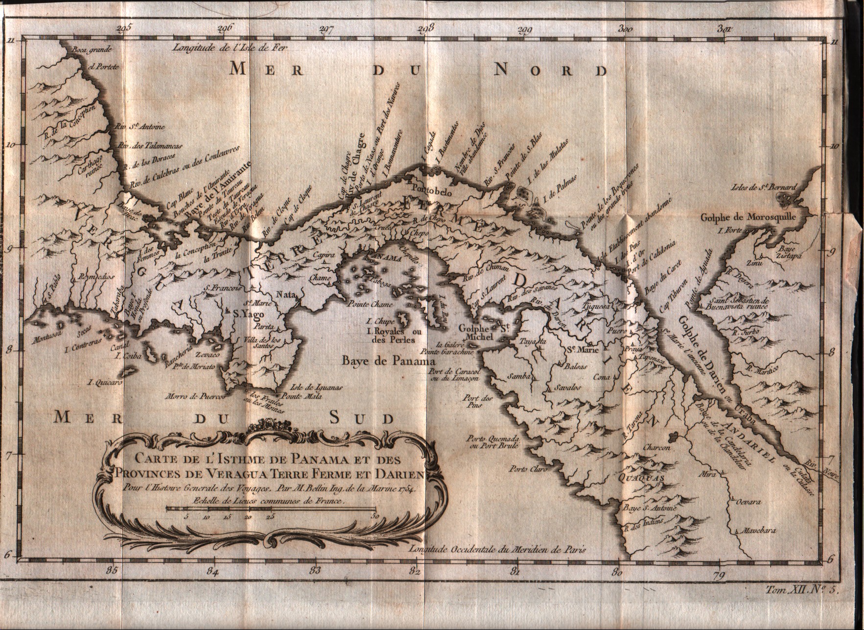
Map title
Carte de l'isthme de Panama et des des provinces de Veragua Terre Ferme et Darien
Author
Bellin
Location shown in map
Panama
Edition date
1757
Edition place
Paris
Editor
--
Atlas
Historie General des Voyages -- Prevost
Price
Please ask: info@thetreasuremaps.com
State
[mint/EXCELLENT/very good/good/fair/mediocre/poor]
Color
Black/white
Verso
Blank
Size
Plate: cm (27.9 x 20.3) inches (10.98 x 7.99) Paper: cm (31.8 x 22.9) inches (12.52 x 9.02)
Technique
Copper engraving
Note
No particular notes for this maps
Reference
--
Wiki
Here for more info
In stock
Available
Info
info@thetreasuremaps.com
Code
#0351
×
![Carte de l'isthme de Panama et des des provinces de Veragua Terre Ferme et Darien by Bellin, Panama, 1757]()
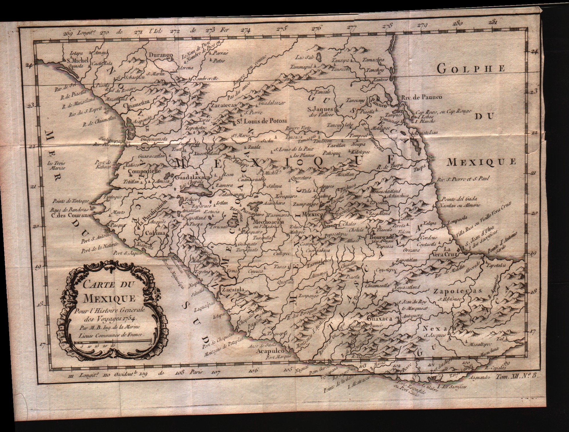
Map title
Carte du Mexique
Author
Bellin
Location shown in map
Mexico
Edition date
1757
Edition place
Paris
Editor
--
Atlas
Historie General des Voyages -- Prevost
Price
Please ask: info@thetreasuremaps.com
State
[mint/EXCELLENT/very good/good/fair/mediocre/poor]
Color
Black/white
Verso
Blank
Size
Plate: cm (29.2 x 20.3) inches (11.5 x 7.99) Paper: cm (31.8 x 22.9) inches (12.52 x 9.02)
Technique
Copper engraving
Note
No particular notes for this maps
Reference
--
Wiki
Here for more info
In stock
Available
Info
info@thetreasuremaps.com
Code
#0352
×
![Carte du Mexique by Bellin, Mexico, 1757]()
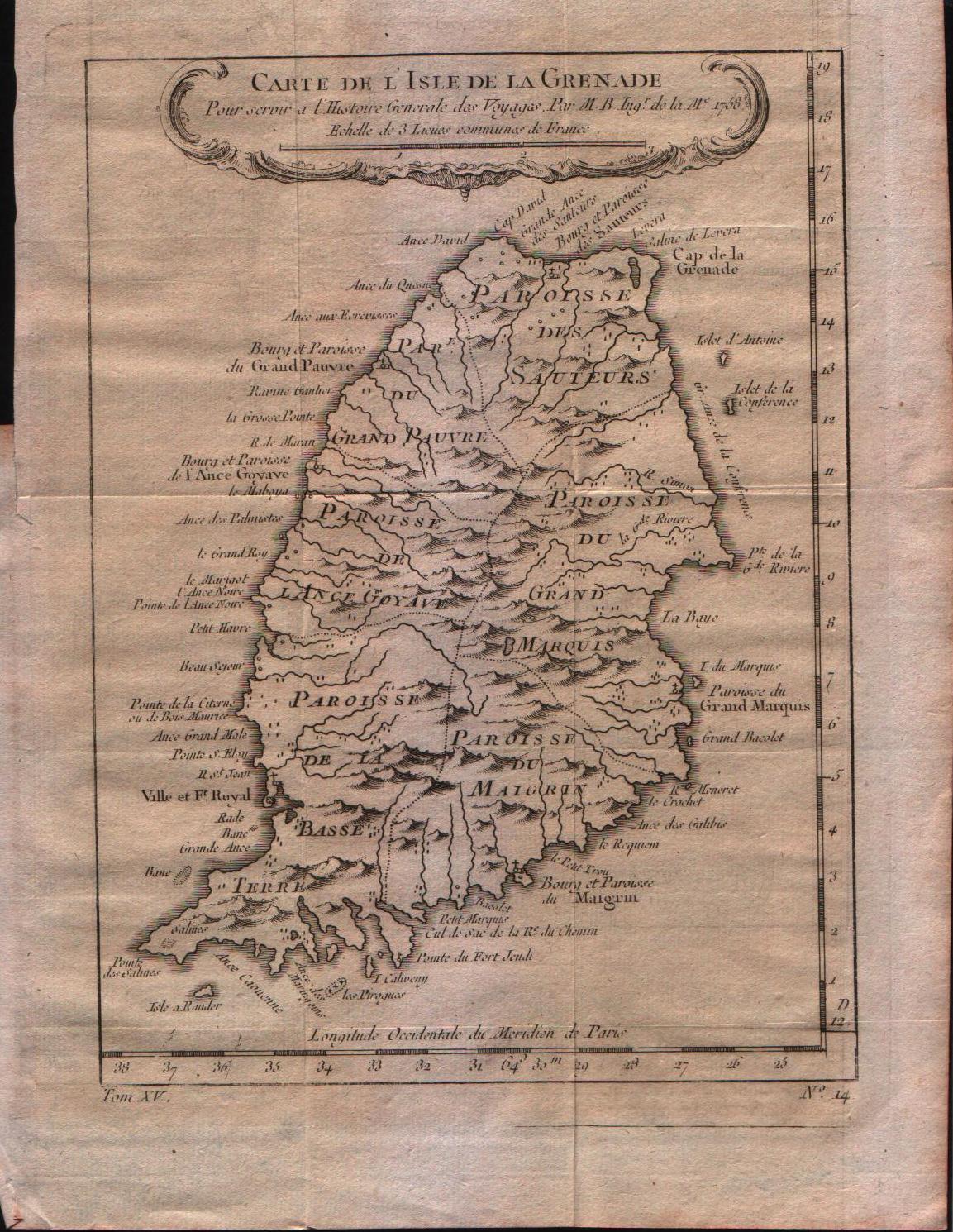
Map title
Carte de l'isle de la Grenade
Author
Bellin
Location shown in map
Grenada
Edition date
1757
Edition place
Paris
Editor
--
Atlas
Historie General des Voyages -- Prevost
Price
150 Euro
State
[mint/EXCELLENT/very good/good/fair/mediocre/poor]
Color
Black/white
Verso
Blank
Size
Plate: cm (15.2 x 21.6) inches (5.98 x 8.5) Paper: cm (20.3 x 25.4) inches (7.99 x 10)
Technique
Copper engraving
Note
No particular notes for this maps
Reference
--
Wiki
Here for more info
In stock
Available
Info
info@thetreasuremaps.com
Code
#0353
×
![Carte de l'isle de la Grenade by Bellin, Grenada, 1757]()
Map title
Carte de l'isle de la Guadeloupe
Author
Bellin
Location shown in map
Guadeloupe
Edition date
1757
Edition place
Paris
Editor
--
Atlas
Historie General des Voyages -- Prevost
Price
150 Euro
State
[mint/EXCELLENT/very good/good/fair/mediocre/poor]
Color
Black/white
Verso
Blank
Size
Plate: cm (30.5 x 21.6) inches (12.01 x 8.5) Paper: cm (34.3 x 25.4) inches (13.5 x 10)
Technique
Copper engraving
Note
No particular notes for this maps
Reference
--
Wiki
Here for more info
In stock
Available
Info
info@thetreasuremaps.com
Code
#0354
×
![Carte de l'isle de la Guadeloupe by Bellin, Guadeloupe, 1757]()
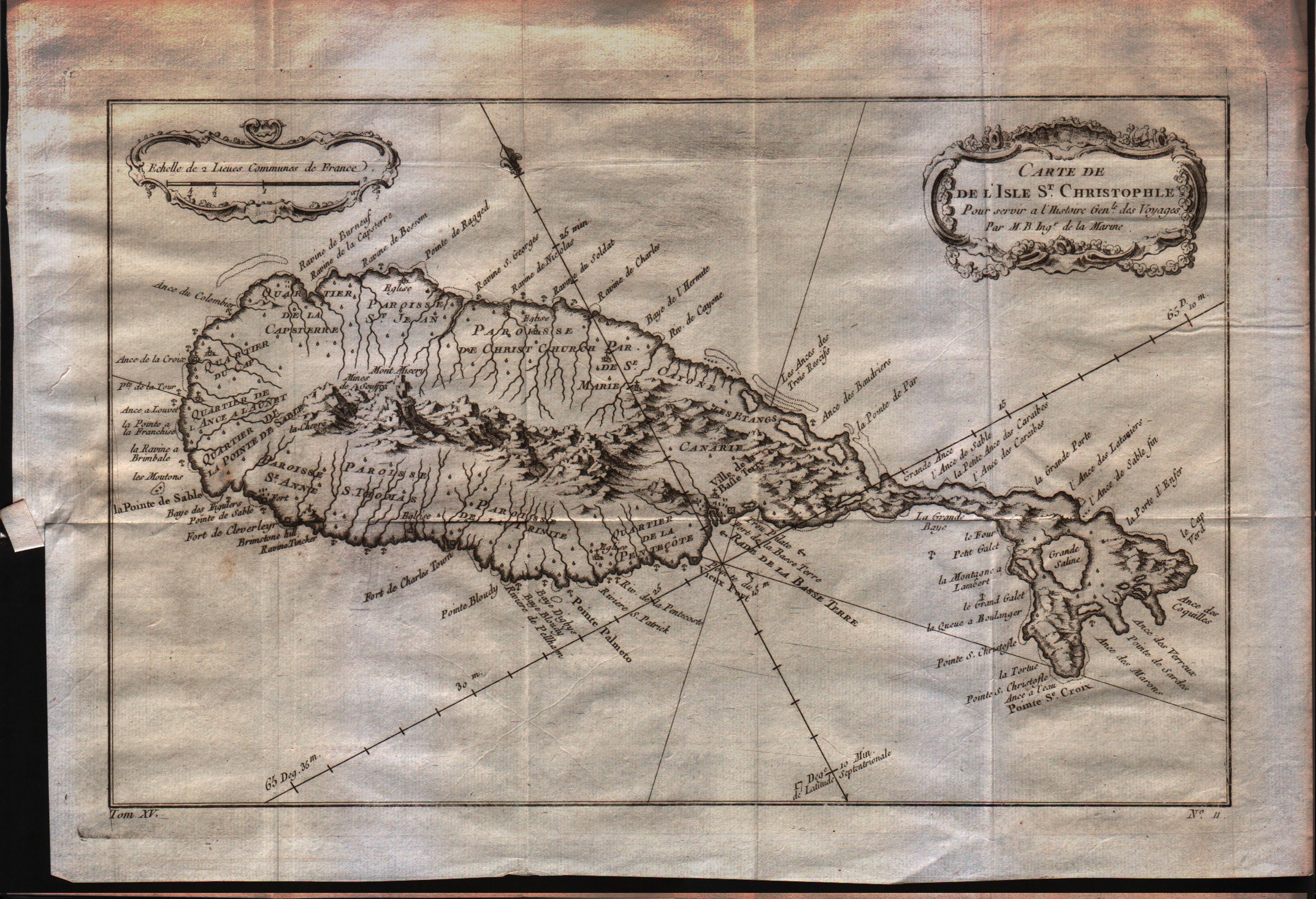
Map title
Carte de l'isle St.Christophle
Author
Bellin
Location shown in map
St.Christopher
Edition date
1757
Edition place
Paris
Editor
--
Atlas
Historie General des Voyages -- Prevost
Price
150 Euro
State
[mint/EXCELLENT/very good/good/fair/mediocre/poor]
Color
Black/white
Verso
Blank
Size
Plate: cm (30.5 x 20.3) inches (12.01 x 7.99) Paper: cm (34.3 x 24.1) inches (13.5 x 9.49)
Technique
Copper engraving
Note
No particular notes for this maps
Reference
--
Wiki
Here for more info
In stock
Available
Info
info@thetreasuremaps.com
Code
#0355
×
![Carte de l'isle St.Christophle by Bellin, St.Christopher, 1757]()
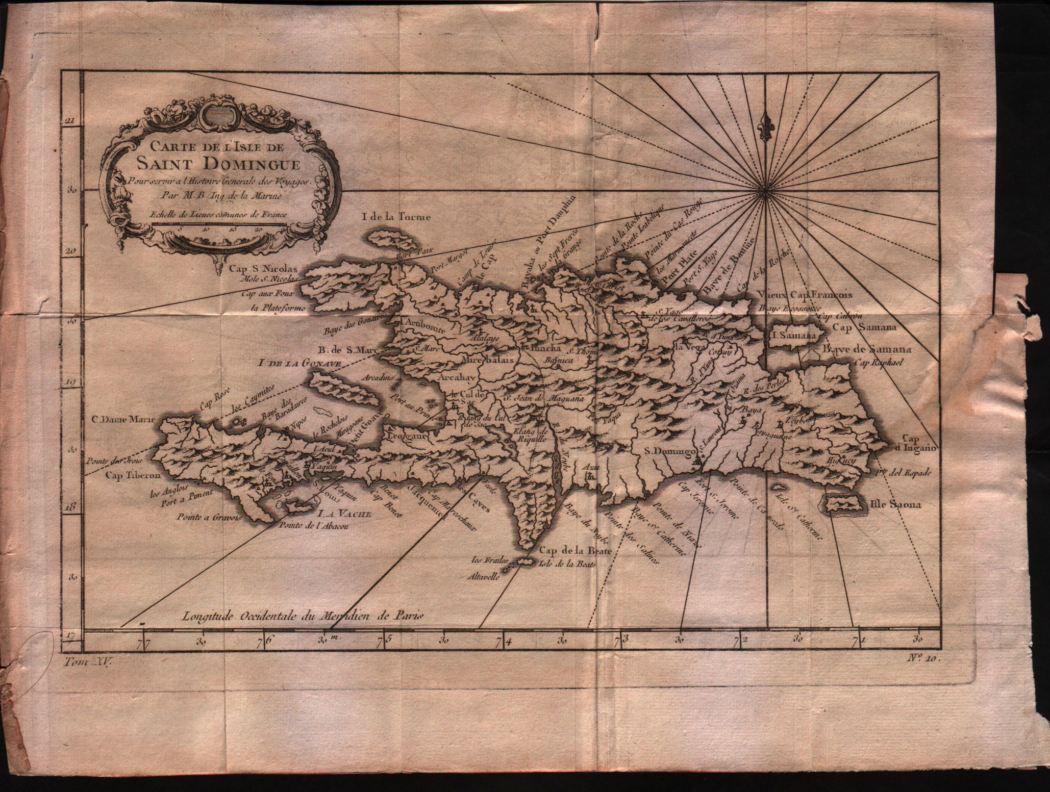
Map title
Carte de l'isle de Saint Domingue
Author
Bellin
Location shown in map
Haiti
Edition date
1757
Edition place
Paris
Editor
--
Atlas
Historie General des Voyages -- Prevost
Price
150 Euro
State
[mint/EXCELLENT/very good/good/fair/mediocre/poor]
Color
Black/white
Verso
Blank
Size
Plate: cm (27.9 x 20.3) inches (10.98 x 7.99) Paper: cm (33 x 25.4) inches (12.99 x 10)
Technique
Copper engraving
Note
No particular notes for this maps
Reference
--
Wiki
Here for more info
In stock
Available
Info
info@thetreasuremaps.com
Code
#0356
×
![Carte de l'isle de Saint Domingue by Bellin, Haiti, 1757]()
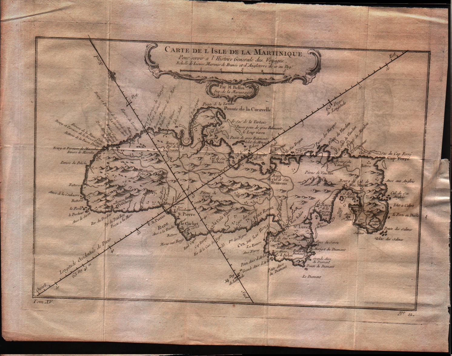
Map title
Carte de l'isle de la Martinique
Author
Bellin
Location shown in map
Martinique
Edition date
1757
Edition place
Paris
Editor
--
Atlas
Historie General des Voyages -- Prevost
Price
150 Euro
State
[mint/EXCELLENT/very good/good/fair/mediocre/poor]
Color
Black/white
Verso
Blank
Size
Plate: cm (29.2 x 20.3) inches (11.5 x 7.99) Paper: cm (34.3 x 25.4) inches (13.5 x 10)
Technique
Copper engraving
Note
No particular notes for this maps
Reference
--
Wiki
Here for more info
In stock
Available
Info
info@thetreasuremaps.com
Code
#0357
×
![Carte de l'isle de la Martinique by Bellin, Martinique, 1757]()
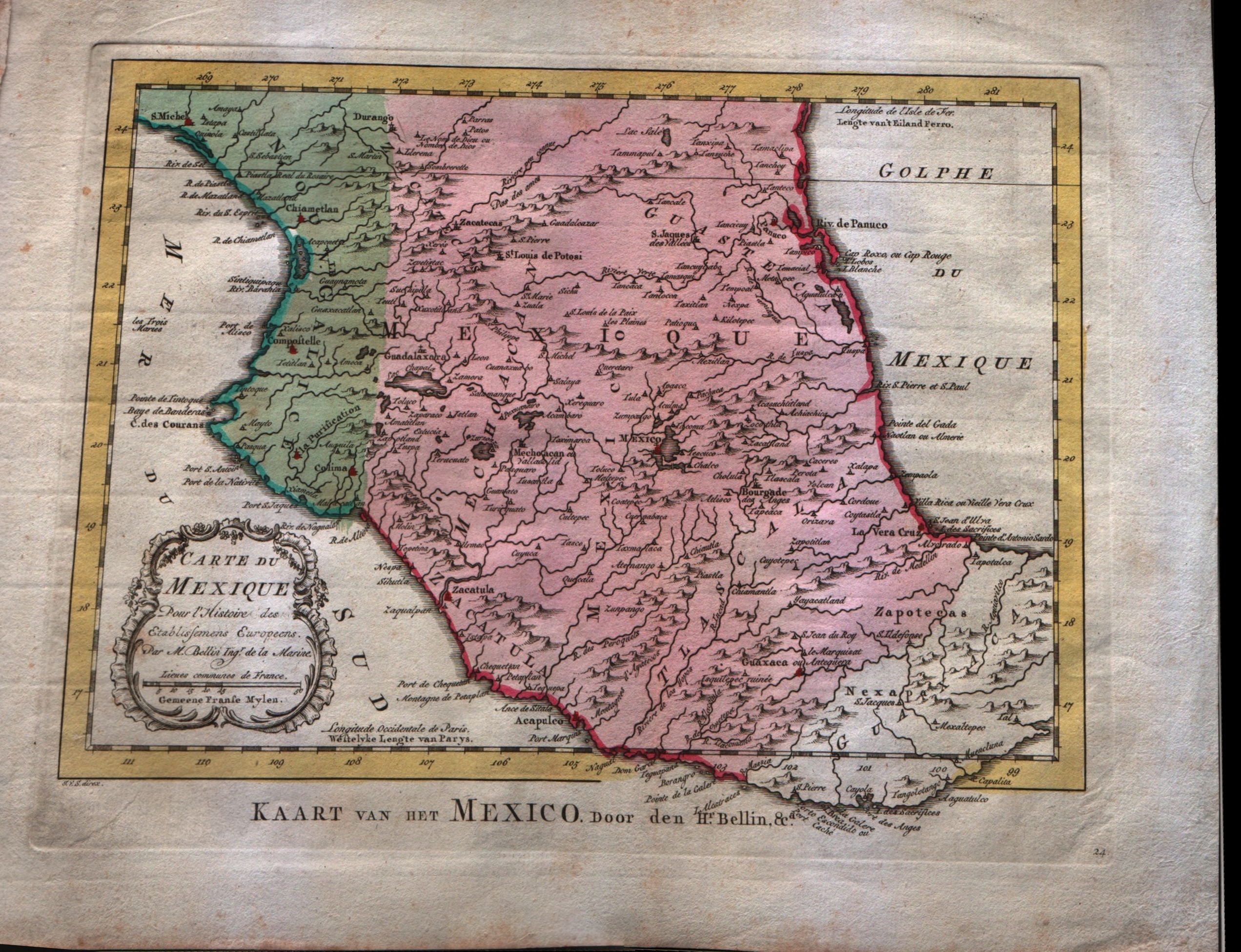
Map title
Carte du Mexique
Author
Bellin
Location shown in map
Mexico
Edition date
1773
Edition place
Amsterdam
Editor
--
Atlas
Atlas Portatif -- E. van Harrevelt
Price
Please ask: info@thetreasuremaps.com
State
[mint/EXCELLENT/very good/good/fair/mediocre/poor]
Color
Old colors
Verso
Blank
Size
Plate: cm (36.8 x 26.7) inches (14.49 x 10.51) Paper: cm (29.2 x 21.6) inches (11.5 x 8.5)
Technique
Copper engraving
Note
No particular notes for this maps
Reference
--
Wiki
Here for more info
In stock
Available
Info
info@thetreasuremaps.com
Code
#0358
×
![Carte du Mexique by Bellin, Mexico, 1773]()