News
Map title
Capitanata olim Mesapiae et Iapigiae pars
Author
Jansson
Location shown in map
Puglia
Edition date
Circa 1640
Edition place
Amsterdam
Editor
Atlas
Atlas Novus
Price
200 Euro
State
[mint/excellent/very good/good/fair/mediocre/POOR]
Color
Old colors
Verso
Latin text
Size
Plate: cm (49 x 37) inches (19.29 x 14.57) Paper: cm (55 x 44) inches (21.65 x 17.32)
Technique
Copper engraving
Note
Reference
Wiki
Here for more info
In stock
Available
Info
info@thetreasuremaps.com
Code
#1294
×
![Capitanata olim Mesapiae et Iapigiae pars by Jansson, Puglia, Circa 1640]()
Map title
Author
Scherer
Location shown in map
Polar
Edition date
1699
Edition place
Munich
Editor
Atlas
Price
350 Euro
State
[mint/EXCELLENT/very good/good/fair/mediocre/poor]
Color
Black/white
Verso
Blank
Size
Plate: cm (18 x 23) inches (7.09 x 9.06) Paper: cm (20 x 25) inches (7.87 x 9.84)
Technique
Copper engraving
Note
framed
Reference
Wiki
Here for more info
In stock
Available
Info
info@thetreasuremaps.com
Code
#1221
×
![by Scherer, Polar, 1699]()
Map title
Nouvelle cartegeographique dela Suisse
Author
Scheuchzer
Location shown in map
Switzerland
Edition date
Circa 1750
Edition place
Amsterdam
Editor
Wetstein
Atlas
Price
100 Euro
State
[mint/EXCELLENT/very good/good/fair/mediocre/poor]
Color
Black/white
Verso
Blank
Size
Plate: cm (28 x 22) inches (11.02 x 8.66) Paper: cm (33 x 26) inches (12.99 x 10.24)
Technique
Copper engraving
Note
Reference
Wiki
Here for more info
In stock
Available
Info
info@thetreasuremaps.com
Code
#1214
×
![Nouvelle cartegeographique dela Suisse by Scheuchzer, Switzerland, Circa 1750]()
Map title
Carta gastronomica del bel paese
Author
Nicouline
Location shown in map
Italy
Edition date
1949
Edition place
Milan
Editor
De Agostini
Atlas
Price
200 Euro
State
[mint/EXCELLENT/very good/good/fair/mediocre/poor]
Color
Old colors
Verso
Blank
Size
Plate: cm (60 x 52) inches (23.62 x 20.47) Paper: cm (51 x 70) inches (20.08 x 27.56)
Technique
Note
Reference
Wiki
Here for more info
In stock
Available
Info
info@thetreasuremaps.com
Code
#1213
×
![Carta gastronomica del bel paese by Nicouline, Italy, 1949]()
Map title
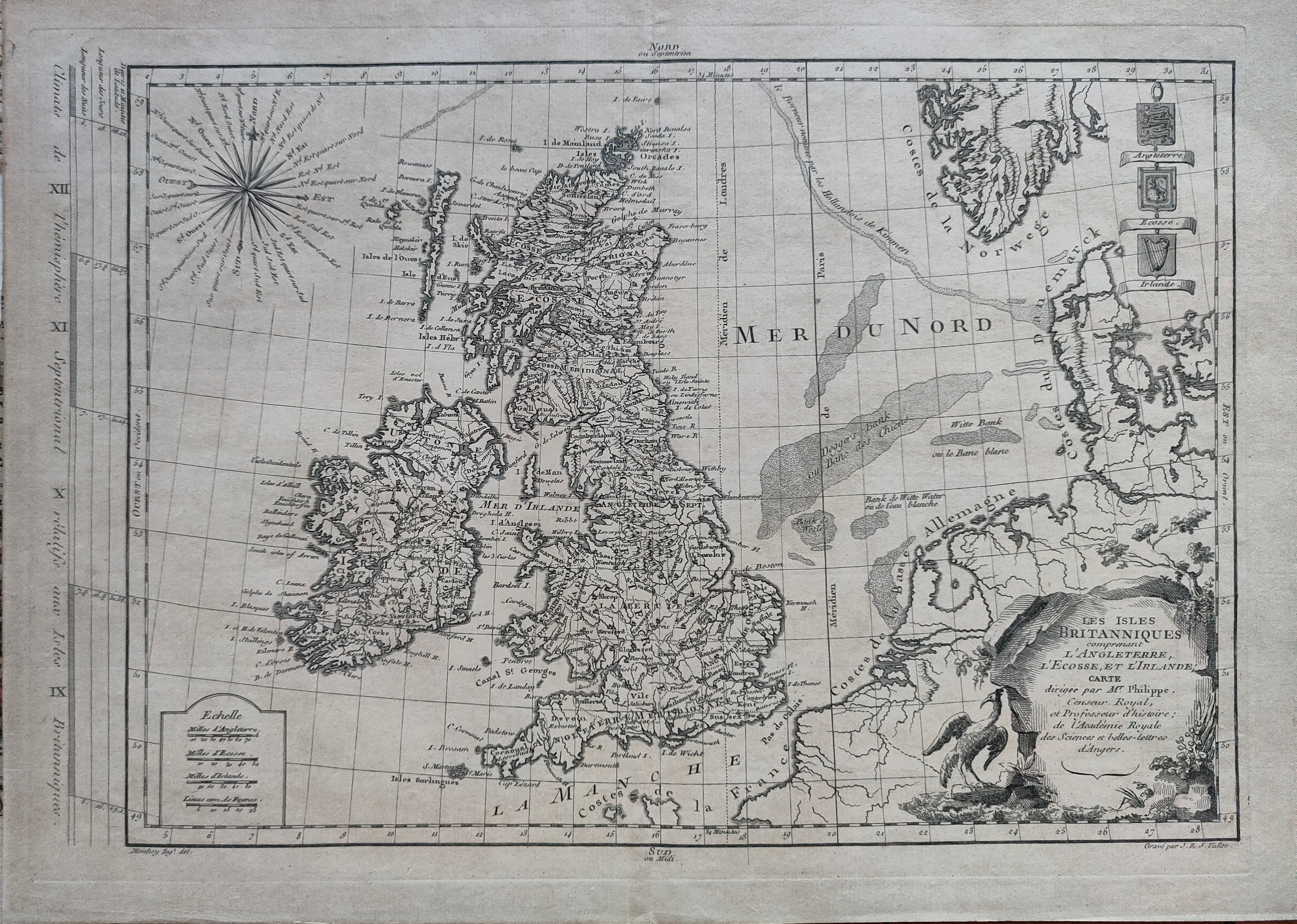
Les isles Britanniques
Author
Philippe
Location shown in map
British Isles
Edition date
1767
Edition place
Paris
Editor
Atlas
Price
125 Euro
State
[mint/EXCELLENT/very good/good/fair/mediocre/poor]
Color
Black/white
Verso
Blank
Size
Plate: cm (40 x 27) inches (15.75 x 10.63) Paper: cm (44 x 31) inches (17.32 x 12.2)
Technique
Copper engraving
Note
Reference
Wiki
Here for more info
In stock
Available
Info
info@thetreasuremaps.com
Code
#1215
×
![Les isles Britanniques by Philippe, British Isles, 1767]()
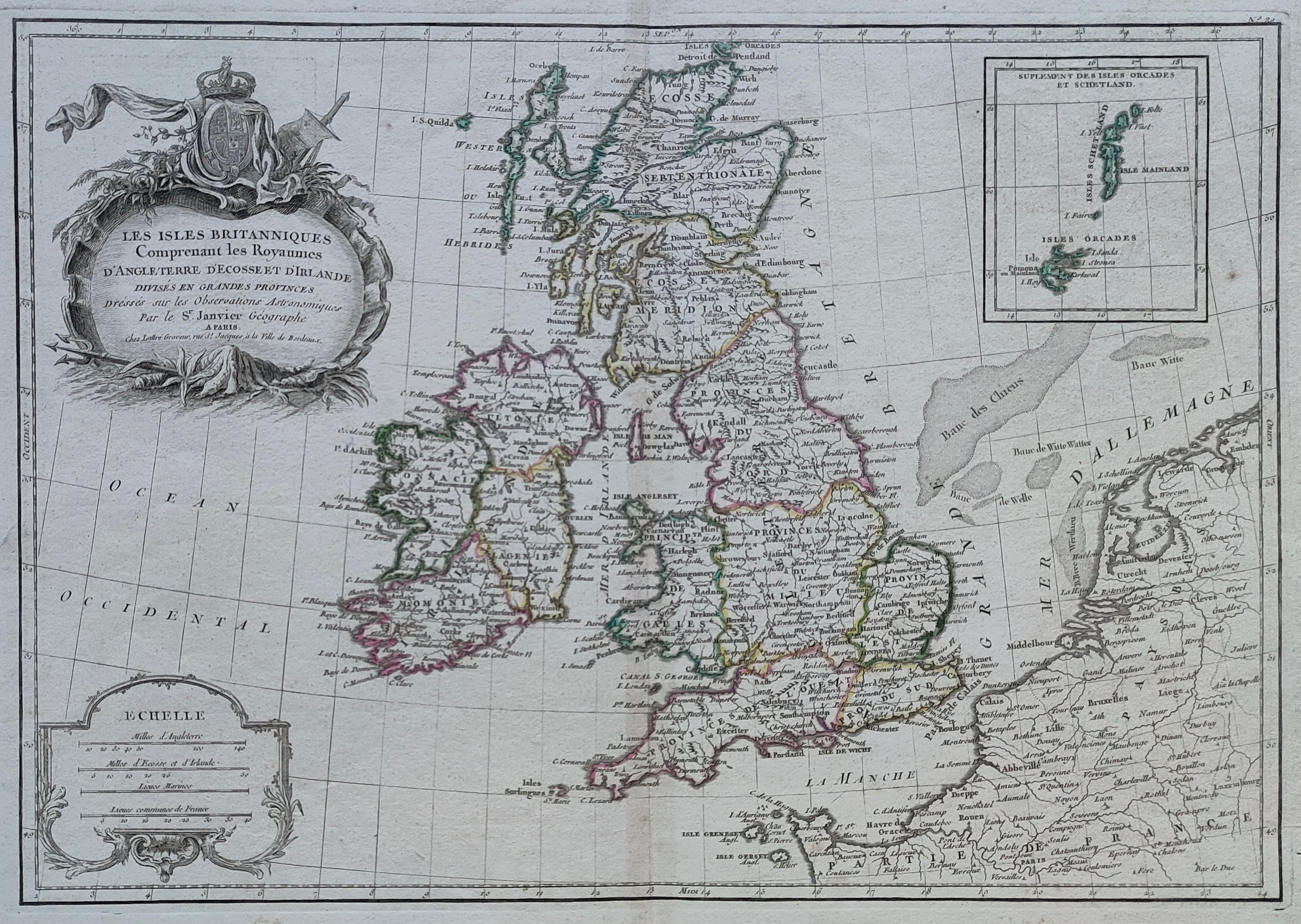
Map title
Les isles Britanniques
Author
Janvier
Location shown in map
British Isles
Edition date
Circa 1782
Edition place
Paris
Editor
Atlas
Price
150 Euro
State
[mint/EXCELLENT/very good/good/fair/mediocre/poor]
Color
Old colors
Verso
Blank
Size
Plate: cm (44 x 31) inches (17.32 x 12.2) Paper: cm (50 x 37) inches (19.69 x 14.57)
Technique
Copper engraving
Note
Reference
Wiki
Here for more info
In stock
Available
Info
info@thetreasuremaps.com
Code
#1216
×
![Les isles Britanniques by Janvier, British Isles, Circa 1782]()
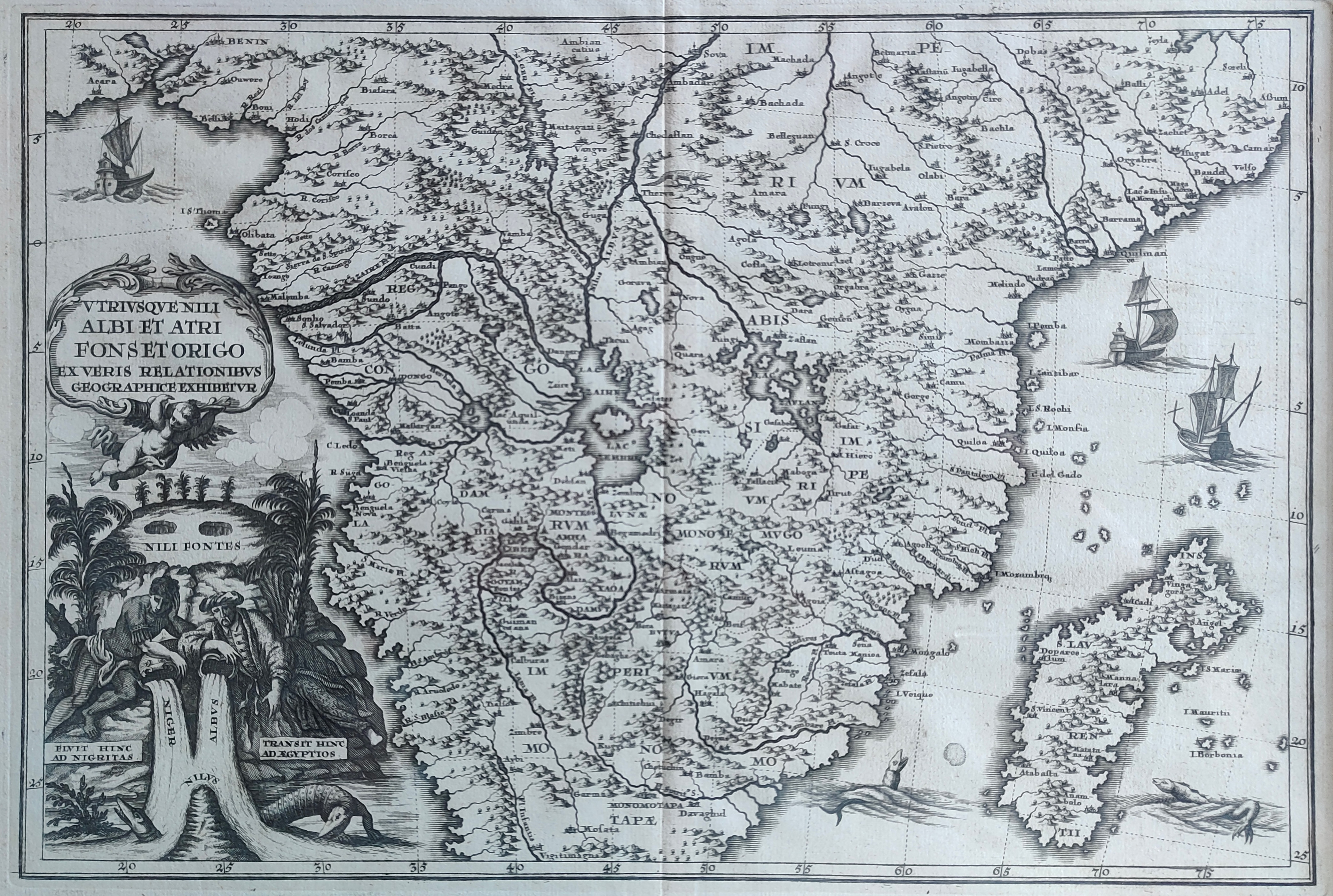
Map title
Utriusque Nili Albi et Atri Fonset Origo
Author
Scherer
Location shown in map
Central Africa
Edition date
1699
Edition place
Munich
Editor
Atlas
Price
250 Euro
State
[mint/EXCELLENT/very good/good/fair/mediocre/poor]
Color
Black/white
Verso
Blank
Size
Plate: cm (34 x 23) inches (13.39 x 9.06) Paper: cm (38 x 28) inches (14.96 x 11.02)
Technique
Copper engraving
Note
framed
Reference
Wiki
Here for more info
In stock
Available
Info
info@thetreasuremaps.com
Code
#1217
×
![Utriusque Nili Albi et Atri Fonset Origo by Scherer, Central Africa, 1699]()
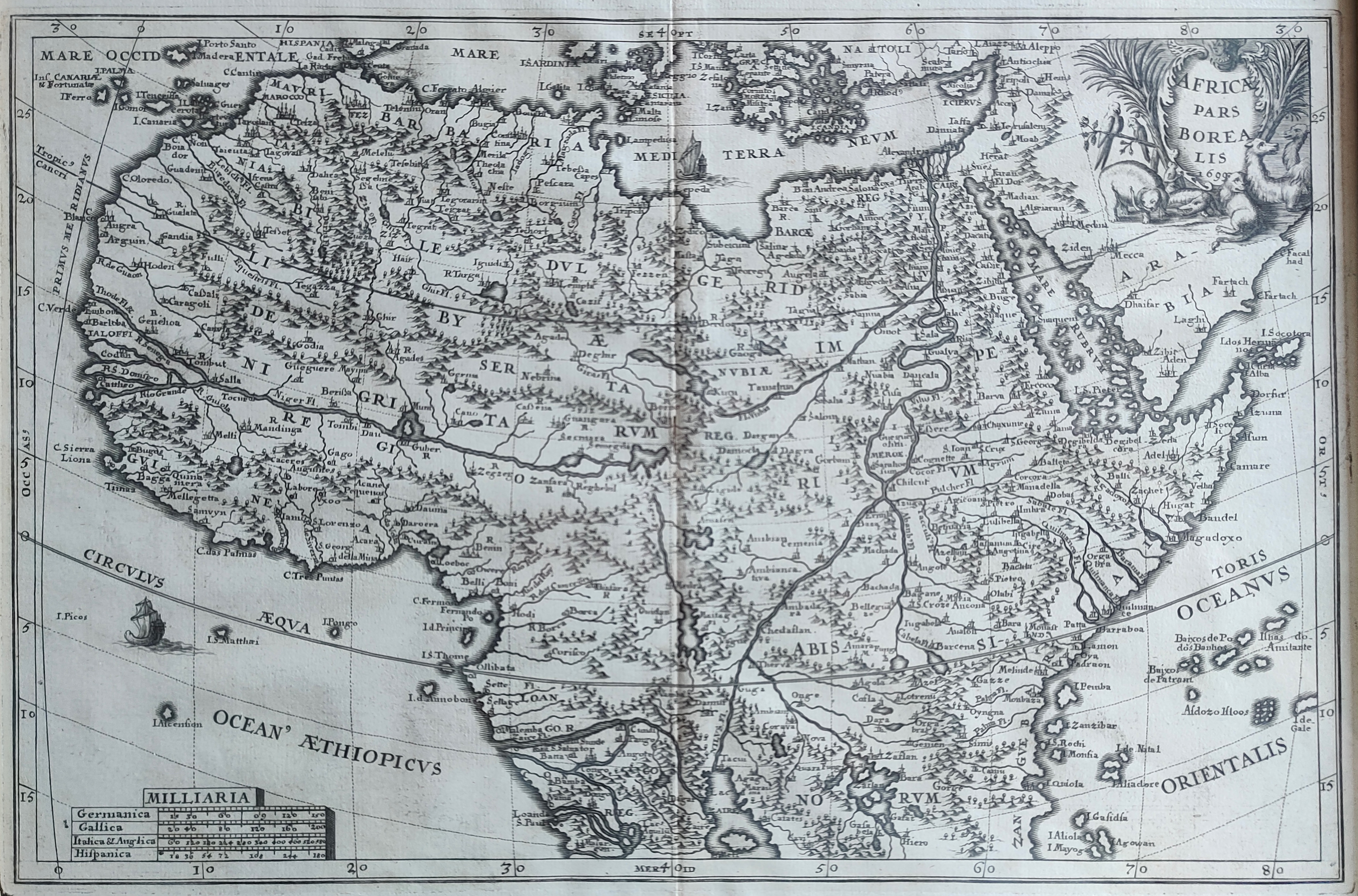
Map title
Africae pars Borealis
Author
Scherer
Location shown in map
North Africa
Edition date
1699
Edition place
Munich
Editor
Atlas
Price
250 Euro
State
[mint/EXCELLENT/very good/good/fair/mediocre/poor]
Color
Black/white
Verso
Blank
Size
Plate: cm (34 x 23) inches (13.39 x 9.06) Paper: cm (38 x 28) inches (14.96 x 11.02)
Technique
Copper engraving
Note
framed
Reference
Wiki
Here for more info
In stock
Available
Info
info@thetreasuremaps.com
Code
#1218
×
![Africae pars Borealis by Scherer, North Africa, 1699]()
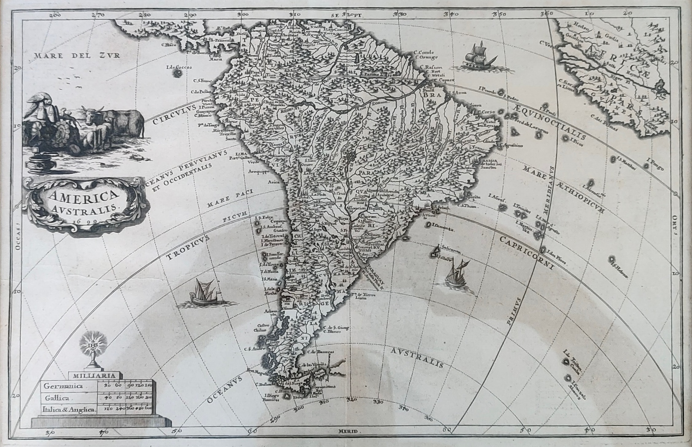
Map title
America Australis
Author
Scherer
Location shown in map
South America
Edition date
1699
Edition place
Munich
Editor
Atlas
Price
250 Euro
State
[mint/EXCELLENT/very good/good/fair/mediocre/poor]
Color
Black/white
Verso
Blank
Size
Plate: cm (34 x 23) inches (13.39 x 9.06) Paper: cm (38 x 28) inches (14.96 x 11.02)
Technique
Copper engraving
Note
framed
Reference
Wiki
Here for more info
In stock
Available
Info
info@thetreasuremaps.com
Code
#1219
×
![America Australis by Scherer, South America, 1699]()
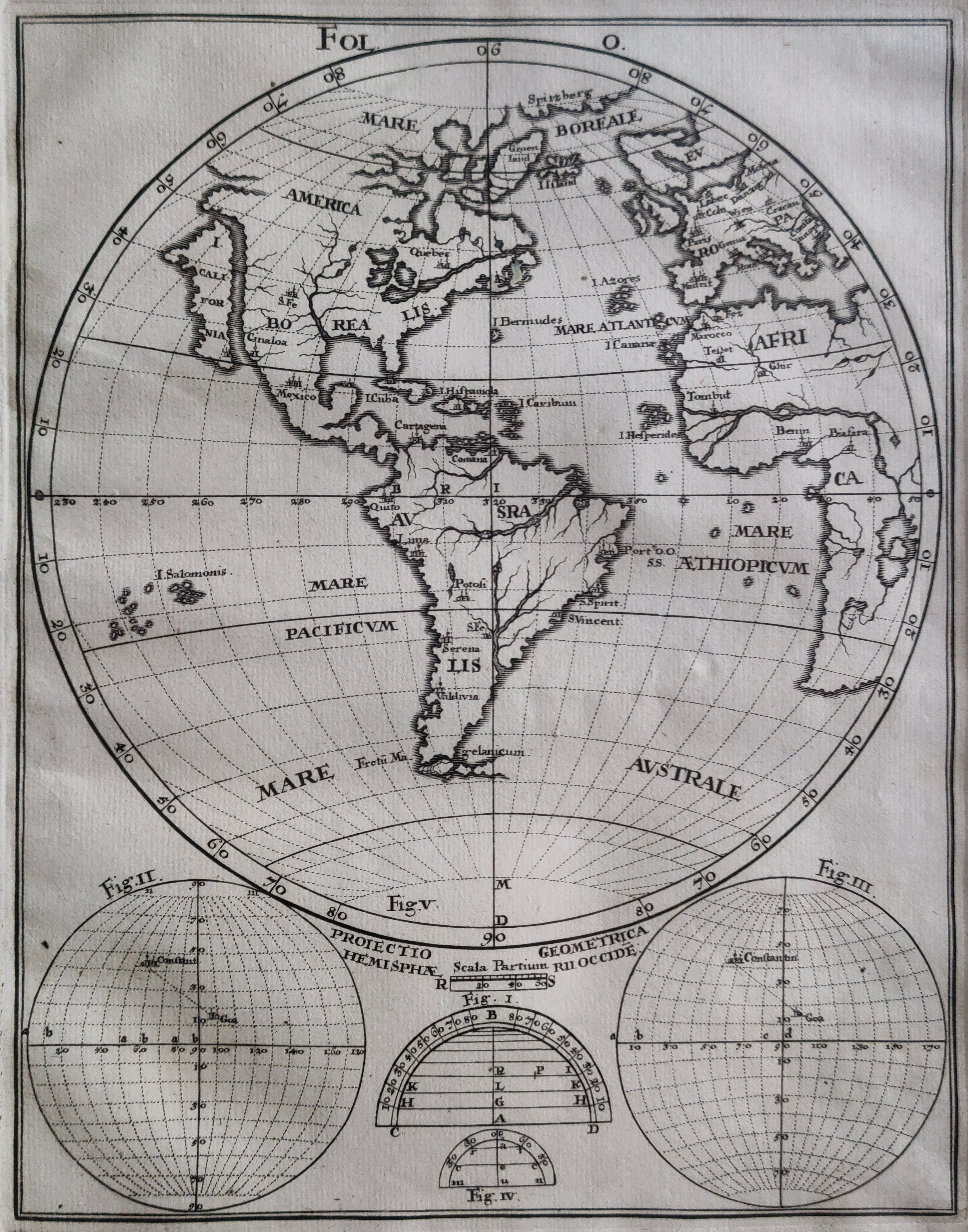
Map title
Author
Scherer
Location shown in map
All America
Edition date
1699
Edition place
Munich
Editor
Atlas
Price
250 Euro
State
[mint/EXCELLENT/very good/good/fair/mediocre/poor]
Color
Black/white
Verso
Blank
Size
Plate: cm (18 x 23) inches (7.09 x 9.06) Paper: cm (20 x 25) inches (7.87 x 9.84)
Technique
Copper engraving
Note
framed
Reference
Wiki
Here for more info
In stock
Available
Info
info@thetreasuremaps.com
Code
#1220
×
![by Scherer, All America, 1699]()
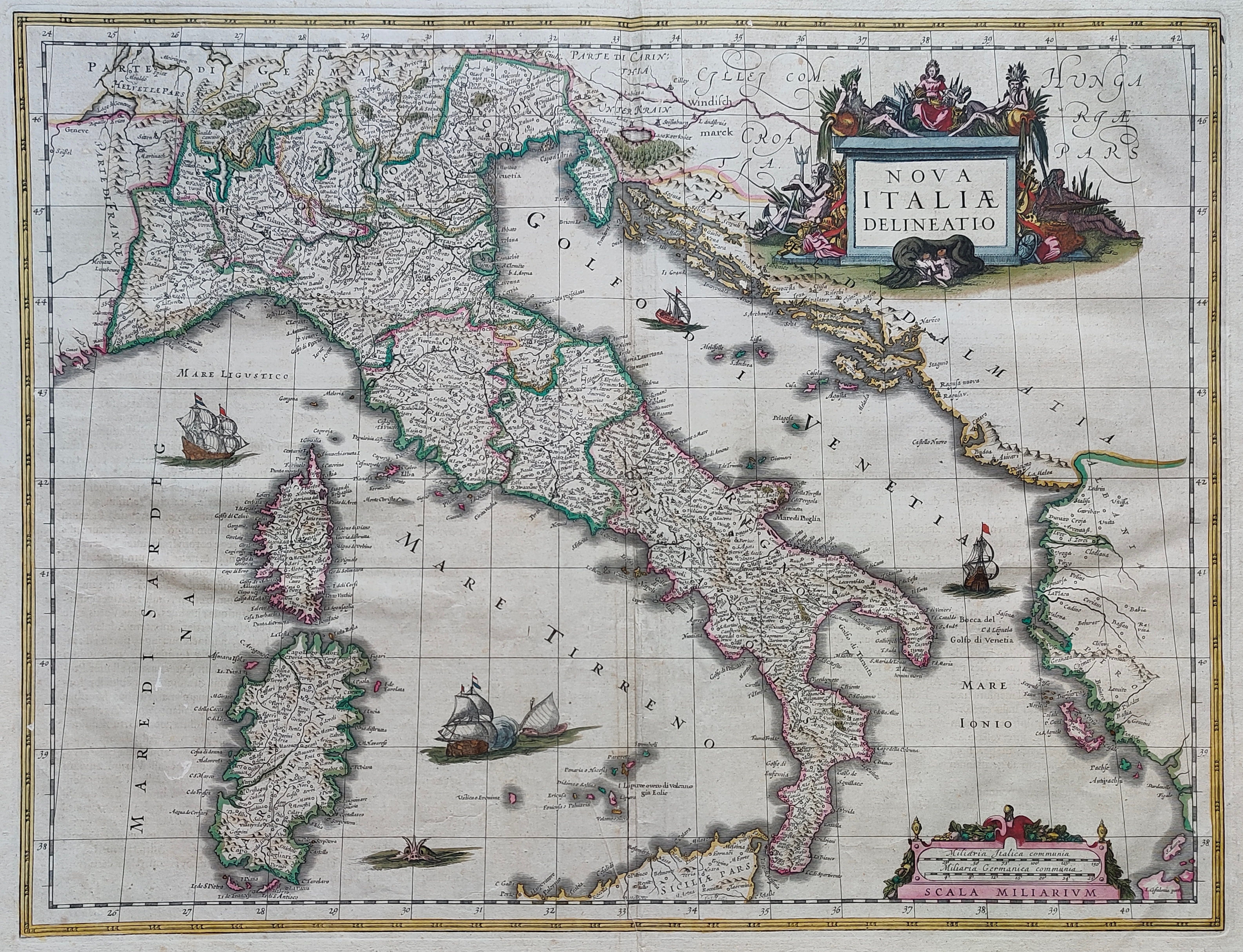
Map title
Nova Italiae delineatio
Author
Hondius
Location shown in map
Italy
Edition date
Circa 1620
Edition place
Amsterdam
Editor
Atlas
Price
800 Euro
State
[mint/excellent/VERY GOOD/good/fair/mediocre/poor]
Color
Old colors
Verso
Blank
Size
Plate: cm (50 x 48) inches (19.69 x 18.9) Paper: cm (53 x 40) inches (20.87 x 15.75)
Technique
Copper engraving
Note
Reference
Wiki
Here for more info
In stock
Available
Info
info@thetreasuremaps.com
Code
#1222
×
![Nova Italiae delineatio by Hondius, Italy, Circa 1620]()
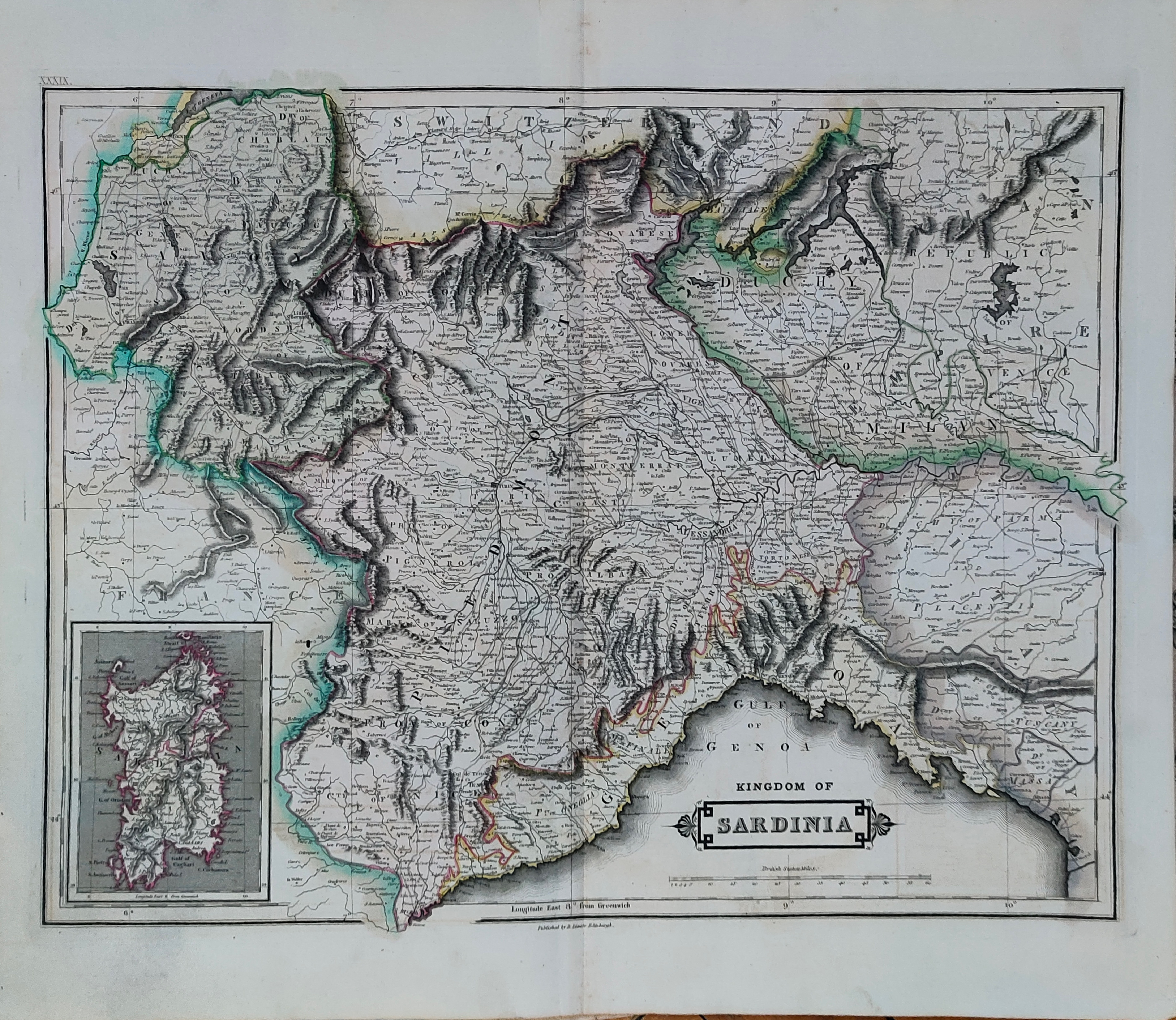
Map title
Kingdom of Sardinia
Author
Hamilton
Location shown in map
Liguria
Edition date
1831
Edition place
Edinburgh
Editor
Daniel Lizars
Atlas
The Edinburgh Geographical and Historical Atlas
Price
150 Euro
State
[mint/EXCELLENT/very good/good/fair/mediocre/poor]
Color
Old colors
Verso
Blank
Size
Plate: cm (49 x 38) inches (19.29 x 14.96) Paper: cm (55 x 47) inches (21.65 x 18.5)
Technique
Copper engraving
Note
Reference
Wiki
Here for more info
In stock
Available
Info
info@thetreasuremaps.com
Code
#1223
×
![Kingdom of Sardinia by Hamilton, Liguria, 1831]()
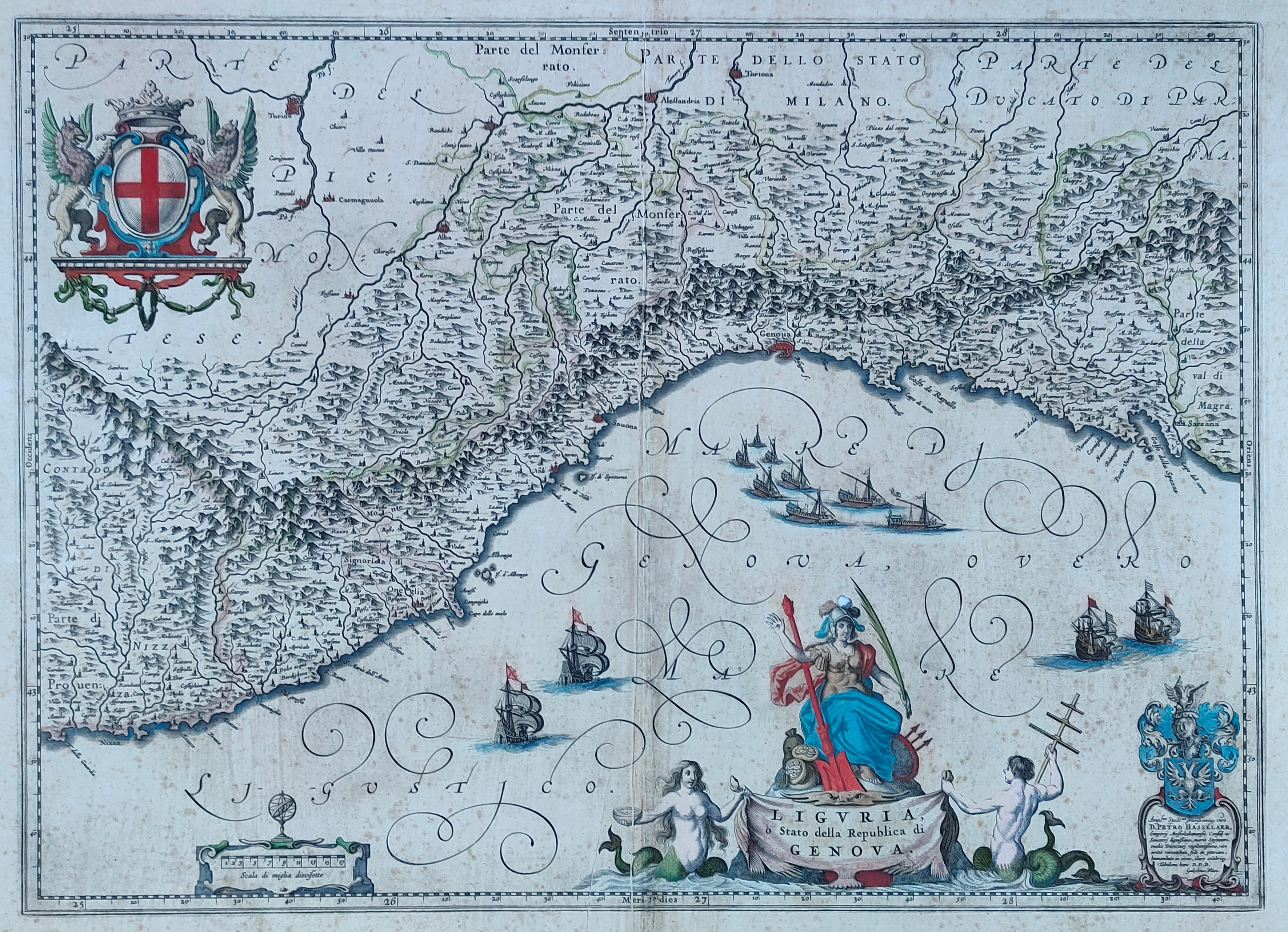
Map title
Liguria
Author
Blaeu
Location shown in map
Liguria
Edition date
Circa 1640
Edition place
Amsterdam
Editor
Atlas
Price
600 Euro
State
[mint/EXCELLENT/very good/good/fair/mediocre/poor]
Color
Old colors
Verso
Size
Plate: cm (51 x 38) inches (20.08 x 14.96) Paper: cm (58 x 50) inches (22.83 x 19.69)
Technique
Copper engraving
Note
Reference
Wiki
Here for more info
In stock
Available
Info
info@thetreasuremaps.com
Code
#1224
Liguria
Author
Blaeu
Location shown in map
Liguria
Edition date
Circa 1640
Edition place
Amsterdam
Editor
Atlas
Price
600 Euro
State
[mint/EXCELLENT/very good/good/fair/mediocre/poor]
Color
Old colors
Verso
Size
Plate: cm (51 x 38) inches (20.08 x 14.96) Paper: cm (58 x 50) inches (22.83 x 19.69)
Technique
Copper engraving
Note
Reference
Wiki
Here for more info
In stock
Available
Info
info@thetreasuremaps.com
Code
#1224
×
![Liguria by Blaeu, Liguria, Circa 1640]()
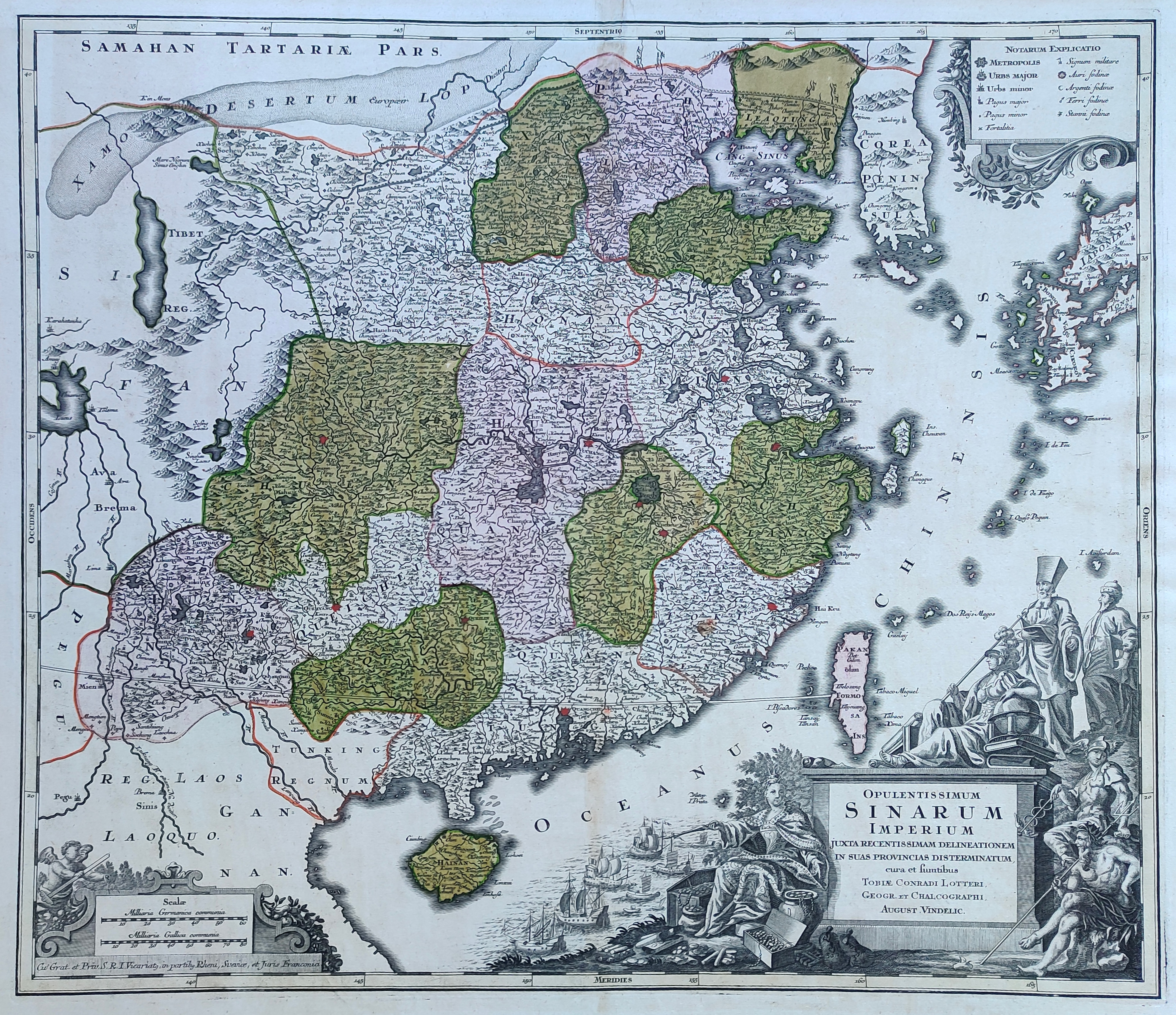
Map title
Opulentissimmun Sinarium Imperium
Author
Lotter
Location shown in map
China
Edition date
Circa 1770
Edition place
Augsburg
Editor
Atlas
Price
600 Euro
State
[mint/EXCELLENT/very good/good/fair/mediocre/poor]
Color
Old colors
Verso
Blank
Size
Plate: cm (57 x 50) inches (22.44 x 19.69) Paper: cm (68 x 55) inches (26.77 x 21.65)
Technique
Copper engraving
Note
Reference
--
Wiki
Here for more info
In stock
Available
Info
info@thetreasuremaps.com
Code
#1212
×
![Opulentissimmun Sinarium Imperium by Lotter, China, Circa 1770]()
Map title
Le colonie degli europei in America
Author
Ricciardo
Location shown in map
America
Edition date
1740
Edition place
Amsterdam
Editor
Francesco Ricciardo
Atlas
Lo spettacolo della natura esposto in varj trattati
Price
75 Euro
State
[mint/EXCELLENT/very good/good/fair/mediocre/poor]
Color
Black/white
Verso
Blank
Size
Plate: cm (7 x 14) inches (2.76 x 5.51) Paper: cm (12 x 18) inches (4.72 x 7.09)
Technique
Copper engraving
Note
Reference
Wiki
Here for more info
In stock
Available
Info
info@thetreasuremaps.com
Code
#1090
×
![Le colonie degli europei in America by Ricciardo, America, 1740]()
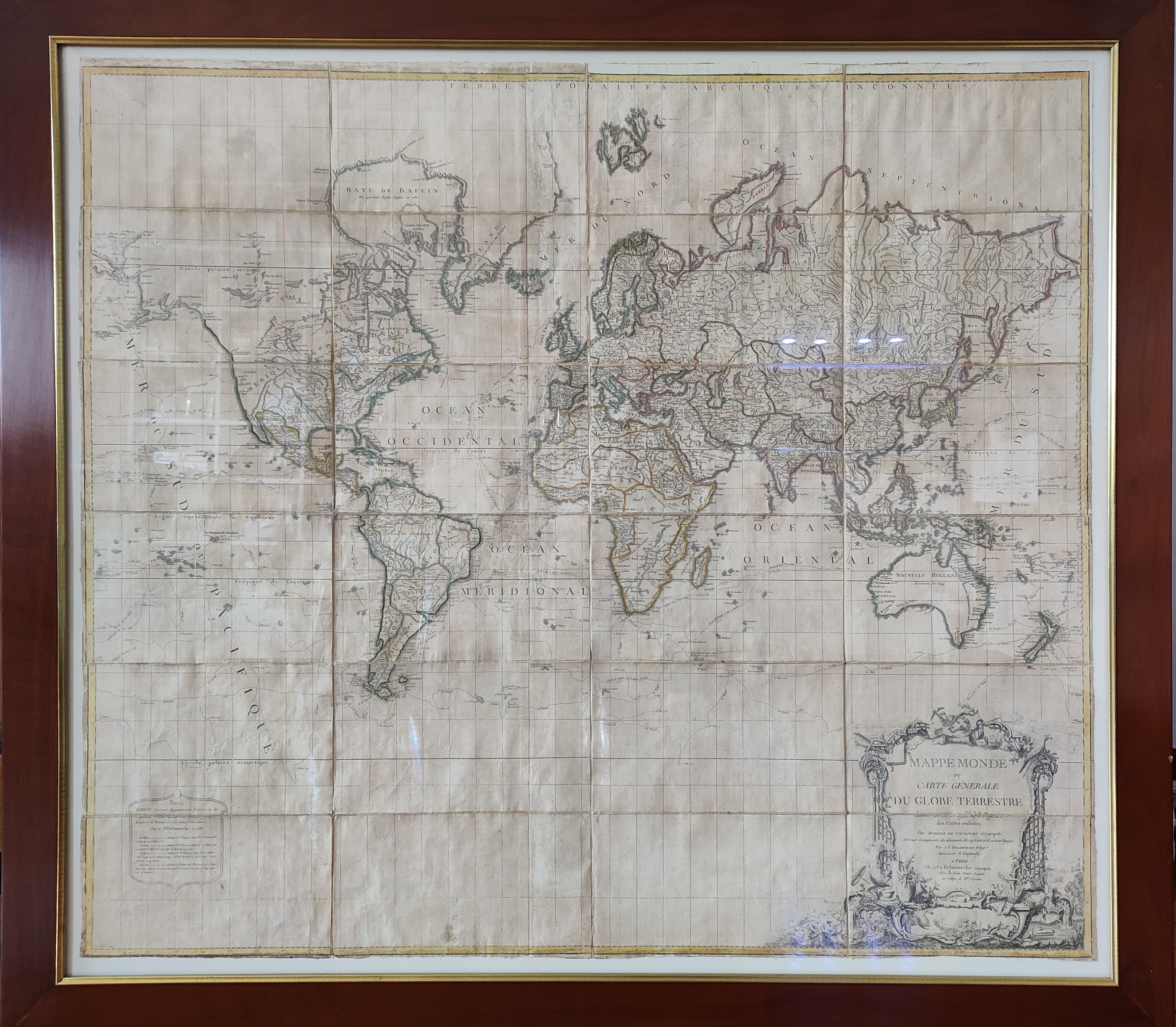
Map title
Mappe Monde ou Carte Generale du Globe Terrestre
Author
Robert de Vaugondy
Location shown in map
World
Edition date
1786
Edition place
Paris
Editor
Delamarche
Atlas
Price
3000 Euro
State
[mint/EXCELLENT/very good/good/fair/mediocre/poor]
Color
Old colors
Verso
Blank
Size
Plate: cm (0 x 0) inches (0 x 0) Paper: cm (119 x 101) inches (46.85 x 39.76)
Technique
Copper engraving
Note
Framed, foldable map
Reference
Wiki
Here for more info
In stock
Available
Info
info@thetreasuremaps.com
Code
#1089
×
![Mappe Monde ou Carte Generale du Globe Terrestre by Robert de Vaugondy, World, 1786]()
Map title
Tabula VI Euro
Author
Fries
Location shown in map
Italy
Edition date
1522
Edition place
Strasbourg
Editor
Atlas
Claudii Ptolemaei Alexandrini
Price
900 Euro
State
[mint/EXCELLENT/very good/good/fair/mediocre/poor]
Color
Black/white
Verso
Latin text
Size
Plate: cm (39 x 24) inches (15.35 x 9.45) Paper: cm (53 x 40) inches (20.87 x 15.75)
Technique
Woodcut
Note
Reference
R.Borri L'Italia nelle antiche carte pag.31
Wiki
Here for more info
In stock
Available
Info
info@thetreasuremaps.com
Code
#1197
×
![Tabula VI Euro by Fries, Italy, 1522]()
Map title
Sinus Gangeticus Vulgo Golfo De Bengala Nova descriptio
Author
Jansson
Location shown in map
India
Edition date
Circa 1670
Edition place
Amsterdam
Editor
Schenk
Atlas
Novus Atlas
Price
450 Euro
State
[mint/EXCELLENT/very good/good/fair/mediocre/poor] repaired
Color
Old colors
Verso
Blank
Size
Plate: cm (54 x 50) inches (21.26 x 19.69) Paper: cm (54 x 49) inches (21.26 x 19.29)
Technique
Copper engraving
Note
Reference
Wiki
Here for more info
In stock
Available
Info
info@thetreasuremaps.com
Code
#1200
×
![Sinus Gangeticus Vulgo Golfo De Bengala Nova descriptio by Jansson, India, Circa 1670]()
Map title
Situs provinciarum imperii sinici
Author
Martini
Location shown in map
China
Edition date
1654
Edition place
Cologne
Editor
Atlas
De bello Tartarico historia
Price
400 Euro
State
[mint/EXCELLENT/very good/good/fair/mediocre/poor]
Color
Black/white
Verso
Blank
Size
Plate: cm (16 x 13) inches (6.3 x 5.12) Paper: cm (19 x 18) inches (7.48 x 7.09)
Technique
Copper engraving
Note
Reference
--
Wiki
Here for more info
In stock
Available
Info
info@thetreasuremaps.com
Code
#1202
×
![Situs provinciarum imperii sinici by Martini, China, 1654]()
Map title
Carte des isles du Japon
Author
Tavernier
Location shown in map
Japan
Edition date
Circa 1679
Edition place
Paris
Editor
Atlas
Price
400 Euro
State
[mint/EXCELLENT/very good/good/fair/mediocre/poor] repaired
Color
Black/white
Verso
Blank
Size
Plate: cm (33 x 21) inches (12.99 x 8.27) Paper: cm (35 x 24) inches (13.78 x 9.45)
Technique
Copper engraving
Note
Reference
Wiki
Here for more info
In stock
Available
Info
info@thetreasuremaps.com
Code
#1201
×
![Carte des isles du Japon by Tavernier, Japan, Circa 1679]()