All Asia
Pages: 1 2
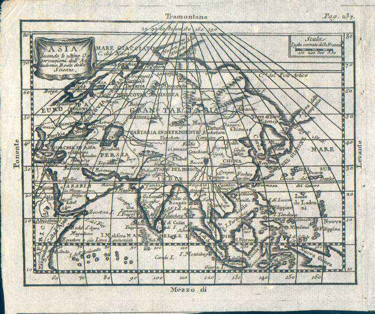
Map title
Asia, secondo le ultime osservazioni dell'accademia reale delle scienze
Author
Buffier
Location shown in map
Asia
Edition date
1790
Edition place
Rome
Editor
--
Atlas
Geographie universelle, italian edition.
Price
75 Euro
State
[mint/EXCELLENT/very good/good/fair/mediocre/poor]
Color
Black/white
Verso
Blank
Size
Plate: cm (17.8 x 13.3) inches (7.01 x 5.24) Paper: cm (19.7 x 16.5) inches (7.76 x 6.5)
Technique
Copper engraving
Note
Claude Buffier was a Jesuit theologian and geographer working in Paris, who wrote the Geographie Universelle, first issued in about 1715. The Geographie was issued as a pocket-sized volume, illustrated with a set of maps.The volume proved very popular, and numerous editions were published in Paris, Naples and Rome. The book was evidently targeted at the popular market, and for this reason examples of the book tend to be printed on relatively poor quality paper, and this is particularly true of the Italian editions.Evidently there were a large number of different sets of map plates used - so far 17 different plates or states of plates have been identified for the Americas map, some engraved anonymously, and other signed by Hendrick van Loon, Faure, Denise Macquart and Dom. Dell'Acerra Unfortunately, it has been frequent practice to disperse such volumes, so the origin of several of these plates has not yet been identified, and the editor would be grateful to hear from readers about editions of the book, particularly those containing maps engraved by Denise Macquart and Dom. Dell'Acerra.[http://www.mapforum.com]
Reference
--
Wiki
Here for more info
In stock
Available
Info
info@thetreasuremaps.com
Code
#0220
×
![Asia, secondo le ultime osservazioni dell'accademia reale delle scienze by Buffier, Asia, 1790]()

Map title
Asia from the latest authorities
Author
Location shown in map
Asia
Edition date
1806
Edition place
London
Editor
Bungay
Atlas
Price
50 Euro
State
[mint/EXCELLENT/very good/good/fair/mediocre/poor]
Color
Black/white
Verso
Blank
Size
Plate: cm (23 x 19) inches (9.06 x 7.48) Paper: cm (25 x 21) inches (9.84 x 8.27)
Technique
Copper engraving
Note
Reference
Wiki
Here for more info
In stock
Available
Info
info@thetreasuremaps.com
Code
#1298
×
![Asia from the latest authorities by , Asia, 1806]()
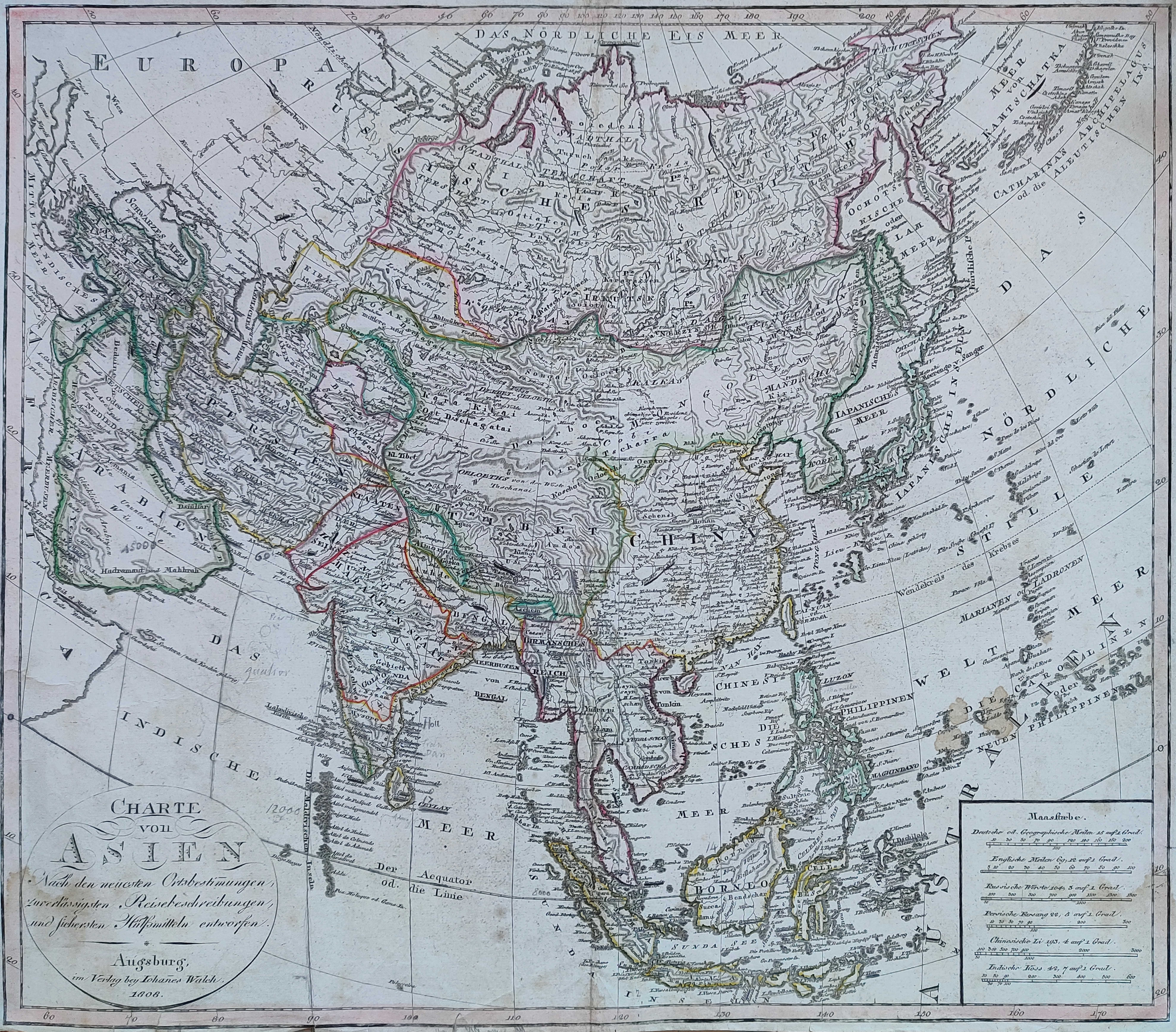
Map title
Charte von Asien
Author
Walch
Location shown in map
Asia
Edition date
1808
Edition place
Augsburg
Editor
Atlas
Price
200 Euro
State
[mint/excellent/VERY GOOD/good/fair/mediocre/poor]
Color
Old colors
Verso
Blank
Size
Plate: cm (43.2 x 59) inches (17.01 x 23.23) Paper: cm (62 x 51) inches (24.41 x 20.08)
Technique
Copper engraving
Note
Reference
--
Wiki
Here for more info
In stock
Available
Info
info@thetreasuremaps.com
Code
#1149
×
![Charte von Asien by Walch, Asia, 1808]()
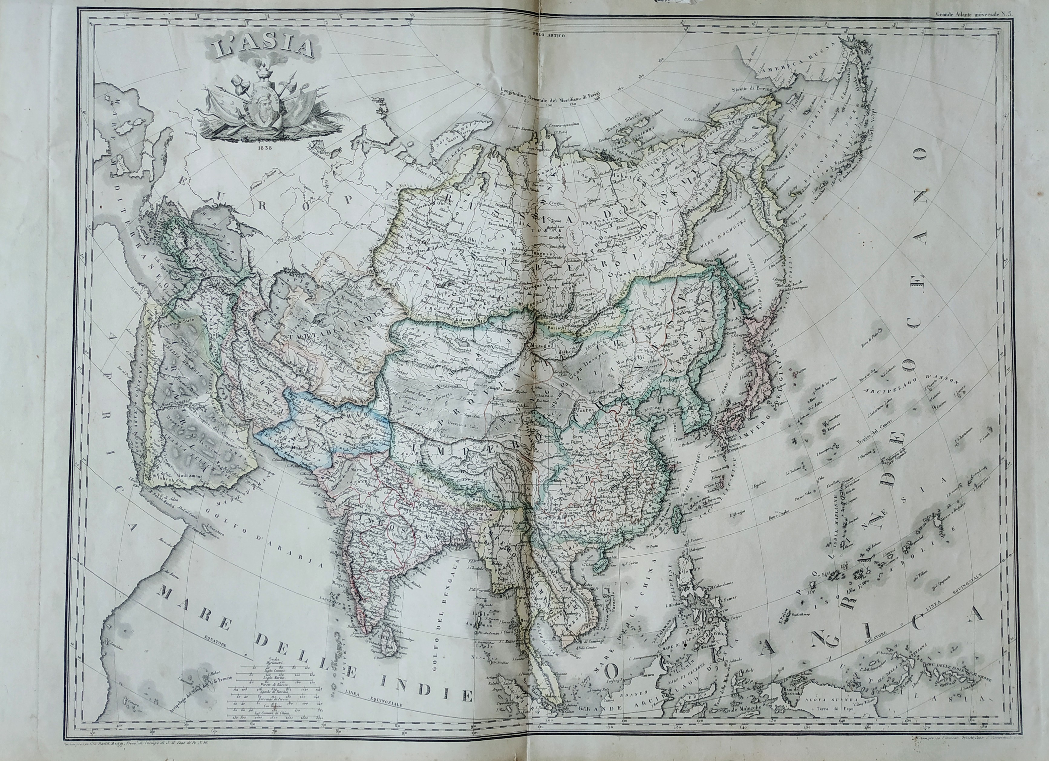
Map title
L'Asia
Author
Stucchi
Location shown in map
Asia
Edition date
1830
Edition place
Torino
Editor
Maggi
Atlas
Grande atlante universale
Price
Please ask: info@thetreasuremaps.com
State
[mint/excellent/VERY GOOD/good/fair/mediocre/poor]
Color
Old colors
Verso
Blank
Size
Plate: cm (70.9 x 53.1) inches (27.91 x 20.91) Paper: cm (81.8 x 59.9) inches (32.2 x 23.58)
Technique
Steel engraving
Note
--
Reference
--
Wiki
Here for more info
In stock
Available
Info
info@thetreasuremaps.com
Code
#0527
×
![L'Asia by Stucchi, Asia, 1830]()
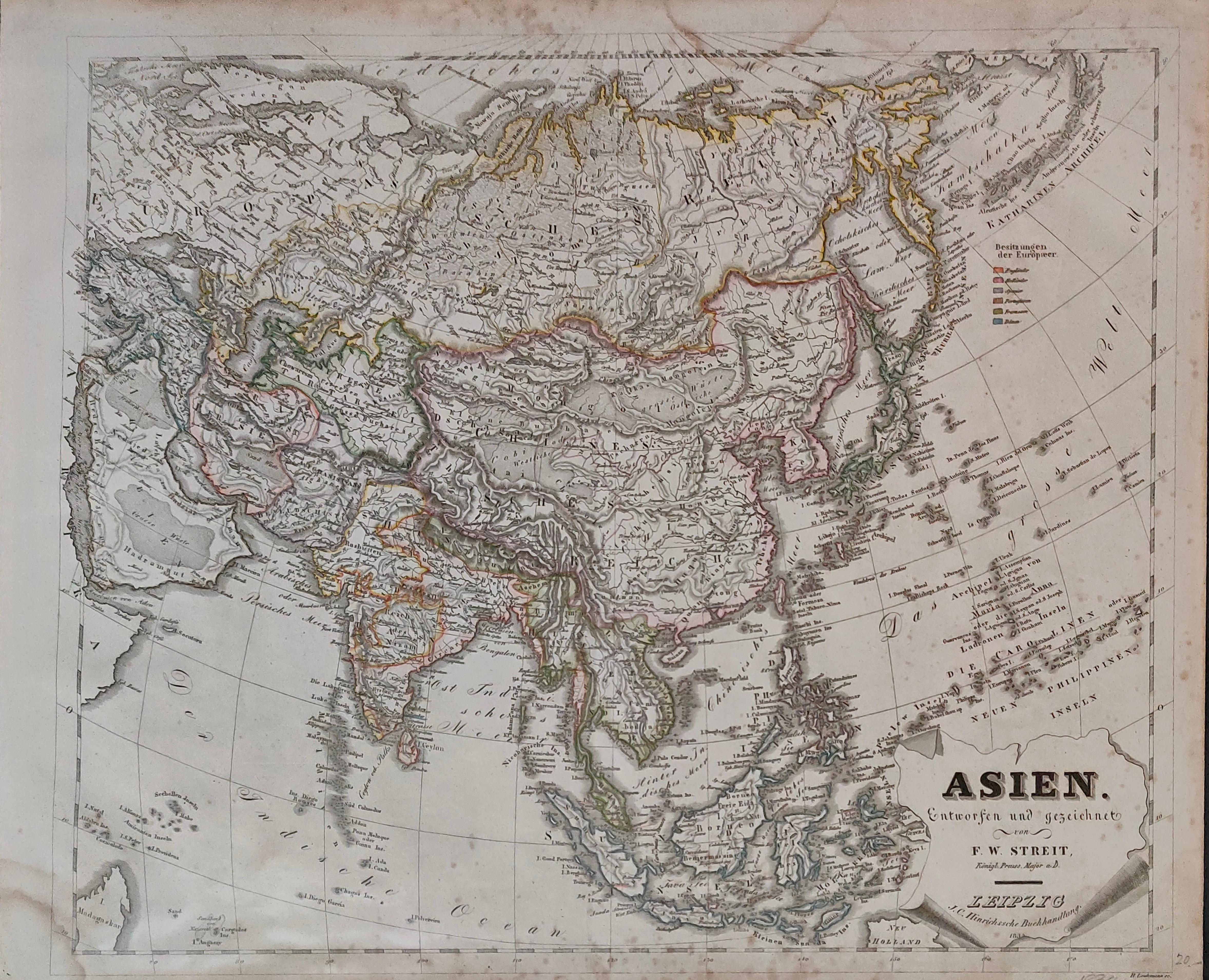
Map title
Asien
Author
Streit
Location shown in map
Asia
Edition date
1834
Edition place
Leipzing
Editor
Atlas
Price
75 Euro
State
[mint/excellent/VERY GOOD/good/fair/mediocre/poor]
Color
Old colors
Verso
Blank
Size
Plate: cm (47 x 40) inches (18.5 x 15.75) Paper: cm (50 x 42) inches (19.69 x 16.54)
Technique
Steel engraving
Note
Reference
Wiki
Here for more info
In stock
Available
Info
info@thetreasuremaps.com
Code
#1256
×
![Asien by Streit, Asia, 1834]()
Map title
Asie
Author
Monin
Location shown in map
Asia
Edition date
1840
Edition place
Paris
Editor
Atlas
Atlas Classique de la Geographie
Price
75 Euro
State
[mint/EXCELLENT/very good/good/fair/mediocre/poor]
Color
Old colors
Verso
Blank
Size
Plate: cm (35 x 28) inches (13.78 x 11.02) Paper: cm (45 x 33) inches (17.72 x 12.99)
Technique
Copper engraving
Note
Reference
Wiki
Here for more info
In stock
Available
Info
info@thetreasuremaps.com
Code
#1009
×
![Asie by Monin, Asia, 1840]()
Map title
Asien
Author
Location shown in map
Asia
Edition date
Circa 1870
Edition place
Editor
Gotha
Atlas
VON SYDOWS' SCHUL-ATLAS
Price
50 Euro
State
[mint/EXCELLENT/very good/good/fair/mediocre/poor]
Color
Old colors
Verso
Blank
Size
Plate: cm (24 x 19) inches (9.45 x 7.48) Paper: cm (30 x 23) inches (11.81 x 9.06)
Technique
Steel engraving
Note
Reference
Wiki
Here for more info
In stock
Available
Info
info@thetreasuremaps.com
Code
#1299
×
![Asien by , Asia, Circa 1870]()
Pages: 1 2