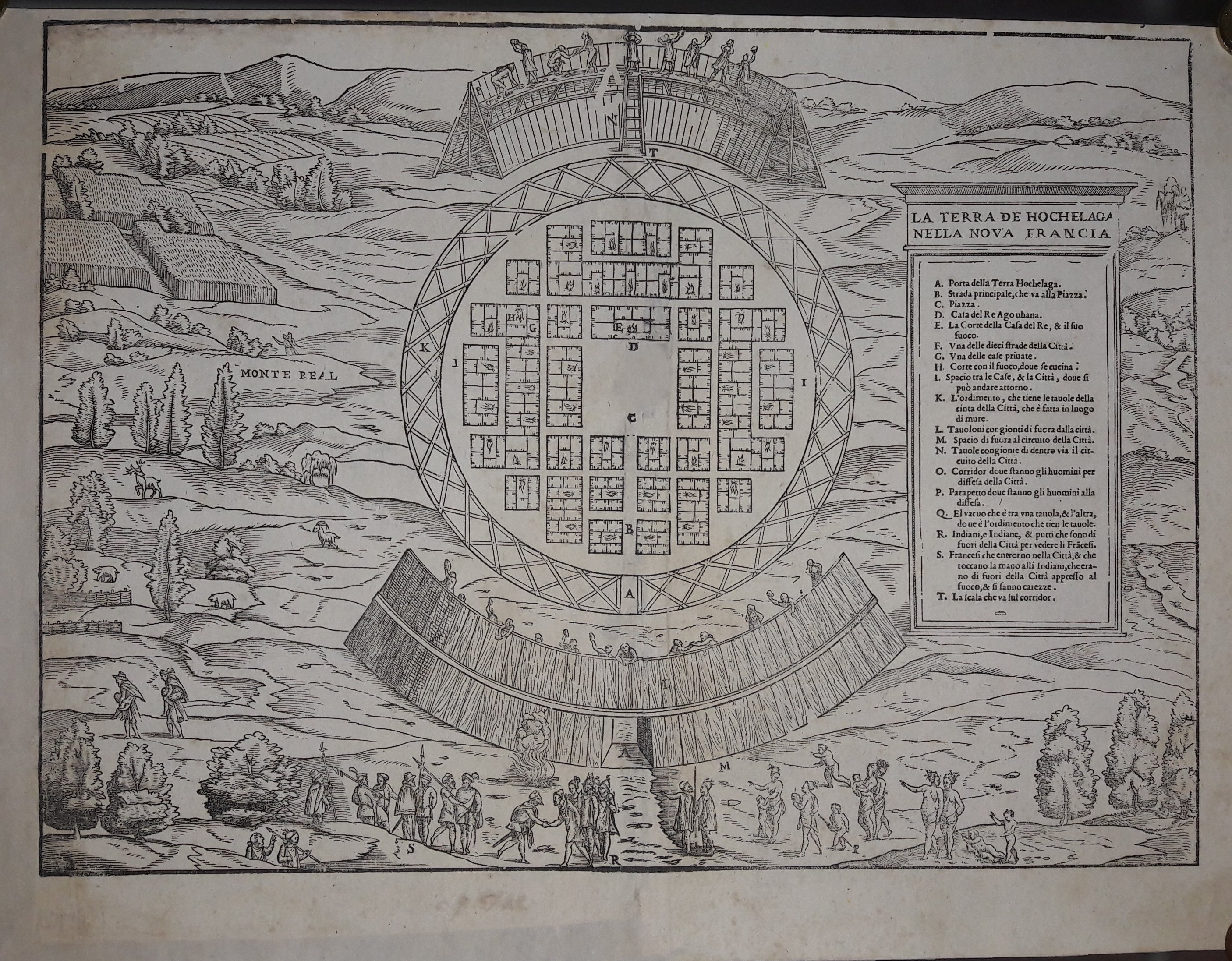
La terra de Hochelaga nella nuova Francia
Gastaldi · Canada · 1613
- Edition place
- Venice
- Editor
- Giambattista Ramusio
- Atlas
- Delle navigazioni e viaggi
- Price
- 1500 Euro
- State
- [mint/EXCELLENT/very good/good/fair/mediocre/poor] professionally restored
- Color
- Black/white
- Verso
- Blank
- Size
- Plate: cm (35.6 × 26.7) in (14.02 × 10.51) · Paper: cm (40.6 × 30.5) in (15.98 × 12.01)
- Technique
- Woodcut
- Note
- --
- Reference
- --
- In stock
- Sold
- Code
- #0546
Tap the map to enlarge · scroll when zoomed · pinch to zoom on phone
- Edition place
- Paris
- Editor
- --
- Atlas
- Historie General des Voyages -- Prevost
- Price
- 175 Euro
- State
- [mint/excellent/VERY GOOD/good/fair/mediocre/poor]
- Color
- Black/white
- Verso
- Blank
- Size
- Plate: cm (29.2 × 21.6) in (11.5 × 8.5) · Paper: cm (30.5 × 24.1) in (12.01 × 9.49)
- Technique
- Copper engraving
- Note
- No particular notes for this maps
- Reference
- --
- In stock
- Available
- Code
- #0061
Tap the map to enlarge · scroll when zoomed · pinch to zoom on phone
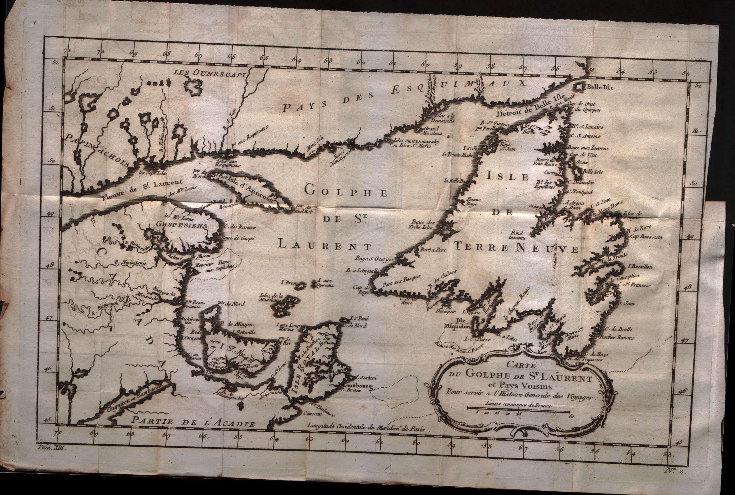
Carte du golphe de S.Laurent et pays voisins
Bellin · -- · 1757
- Edition place
- Paris
- Editor
- --
- Atlas
- Historie General des Voyages -- Prevost
- Price
- 150 Euro
- State
- [mint/excellent/VERY GOOD/good/fair/mediocre/poor]
- Color
- Black/white
- Verso
- Blank
- Size
- Plate: cm (34.3 × 21.6) in (13.5 × 8.5) · Paper: cm (38.1 × 25.4) in (15 × 10)
- Technique
- Copper engraving
- Note
- No particular notes for this maps
- Reference
- --
- In stock
- Available
- Code
- #0062
Tap the map to enlarge · scroll when zoomed · pinch to zoom on phone
- Edition place
- Paris
- Editor
- --
- Atlas
- Historie General des Voyages -- Prevost
- Price
- 125 Euro
- State
- [mint/excellent/VERY GOOD/good/fair/mediocre/poor]
- Color
- Black/white
- Verso
- Blank
- Size
- Plate: cm (27.3 × 22.2) in (10.75 × 8.74) · Paper: cm (31.8 × 26.7) in (12.52 × 10.51)
- Technique
- Copper engraving
- Note
- No particular notes for this maps
- Reference
- --
- In stock
- Available
- Code
- #0063
Tap the map to enlarge · scroll when zoomed · pinch to zoom on phone
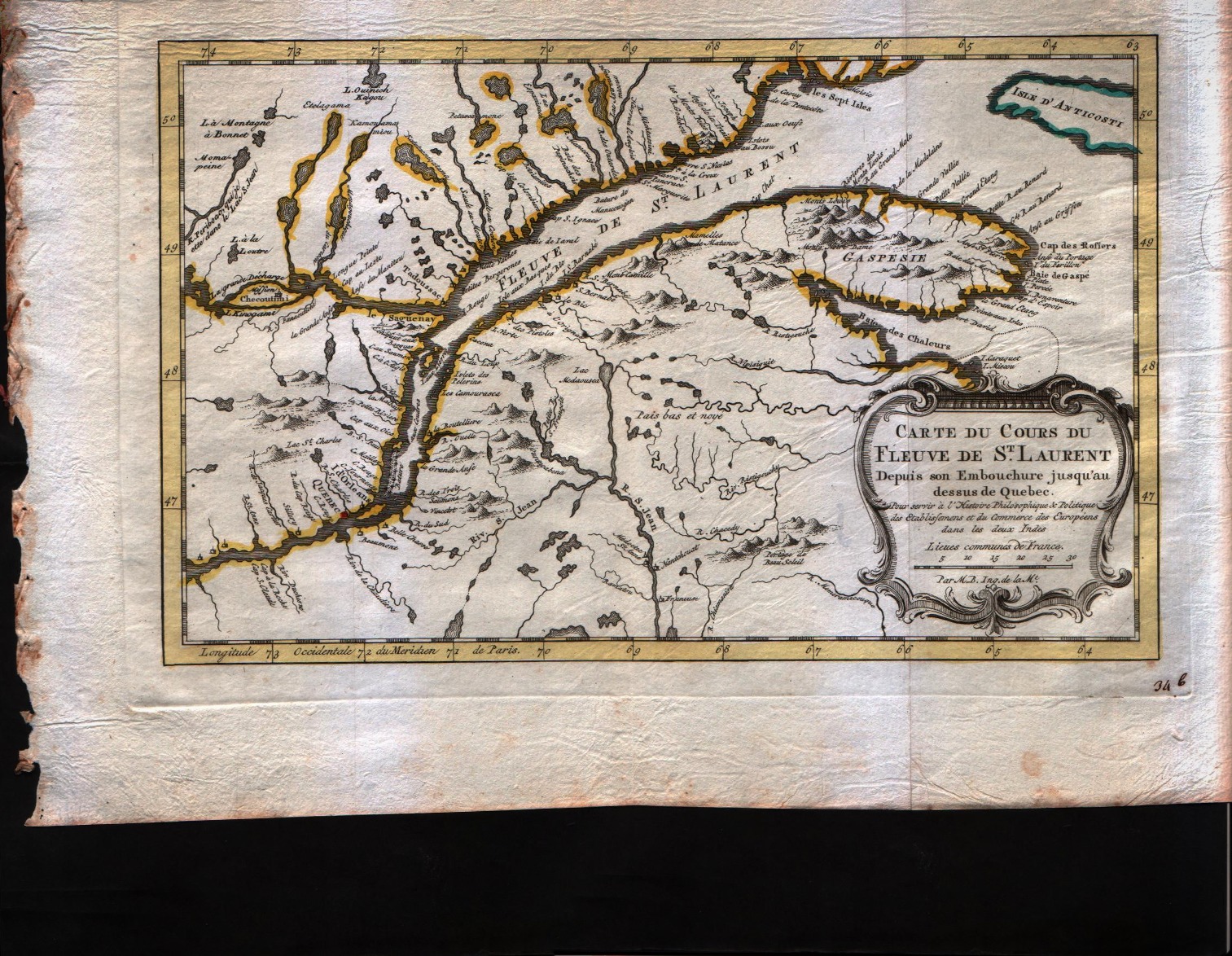
Carte du cours du Fleuve de S.Laurent depuis son embouchure jusqu'au dessus de Quebec
Bellin · -- · 1757
- Edition place
- Paris
- Editor
- --
- Atlas
- Historie General des Voyages -- Prevost
- Price
- 150 Euro
- State
- [mint/excellent/VERY GOOD/good/fair/mediocre/poor]
- Color
- Black/white
- Verso
- Blank
- Size
- Plate: cm (29.2 × 19) in (11.5 × 7.48) · Paper: cm (31.8 × 22.9) in (12.52 × 9.02)
- Technique
- Copper engraving
- Note
- No particular notes for this maps
- Reference
- --
- In stock
- Available
- Code
- #0068
Tap the map to enlarge · scroll when zoomed · pinch to zoom on phone
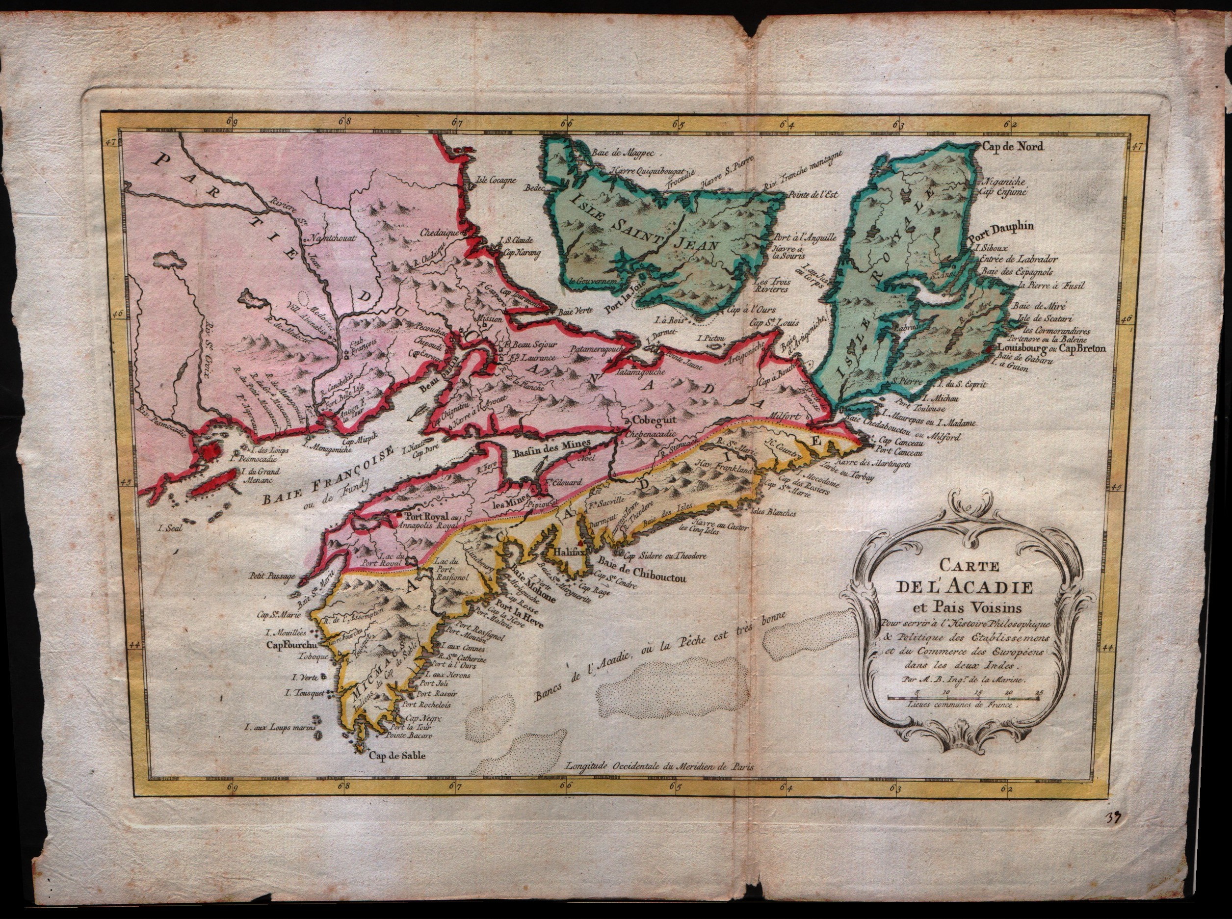
Carte de l'Acadie et pais voisins
Bellin · -- · 1757
- Edition place
- Paris
- Editor
- --
- Atlas
- Historie General des Voyages -- Prevost
- Price
- 200 Euro
- State
- [mint/excellent/VERY GOOD/good/fair/mediocre/poor]
- Color
- Black/white
- Verso
- Blank
- Size
- Plate: cm (31.8 × 20.3) in (12.52 × 7.99) · Paper: cm (34.3 × 24.1) in (13.5 × 9.49)
- Technique
- Copper engraving
- Note
- No particular notes for this maps
- Reference
- --
- In stock
- Available
- Code
- #0069
Tap the map to enlarge · scroll when zoomed · pinch to zoom on phone
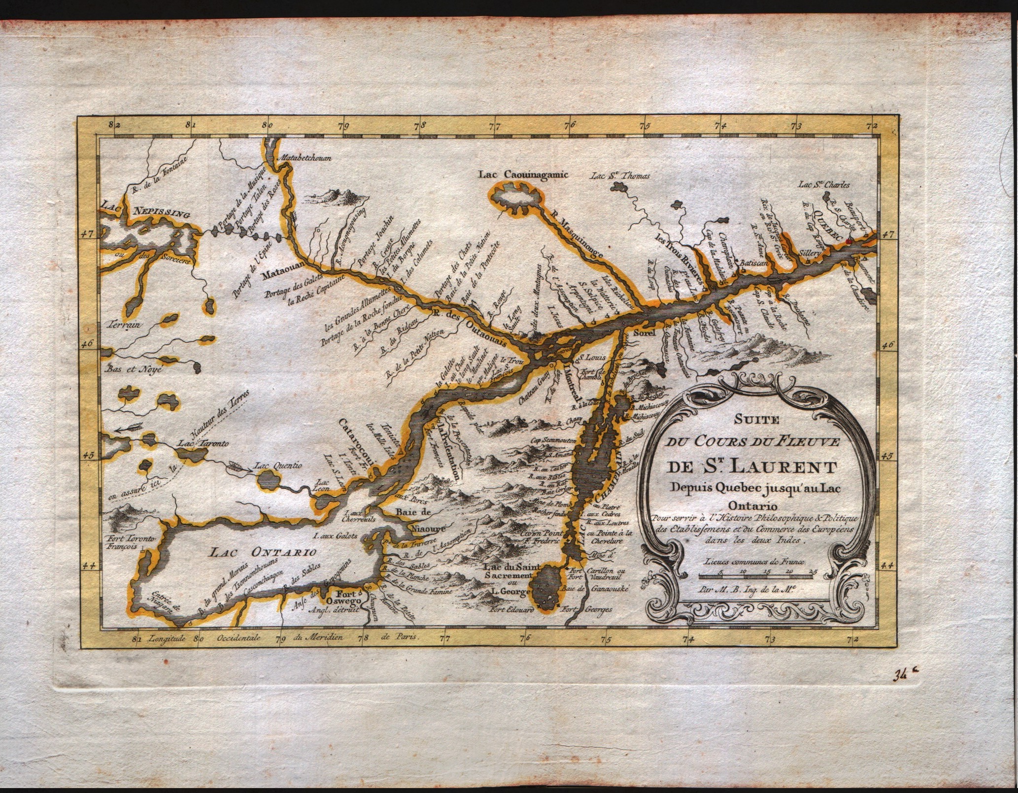
Suite du cours du Fleuve de S.Laurent depuis Quebec jusqu'au Lac Ontario
Bellin · -- · 1757
- Edition place
- Paris
- Editor
- --
- Atlas
- Historie General des Voyages -- Prevost
- State
- [mint/EXCELLENT/very good/good/fair/mediocre/poor]
- Color
- Black/white
- Verso
- Blank
- Size
- Plate: cm (27.9 × 17.8) in (10.98 × 7.01) · Paper: cm (30.5 × 22.9) in (12.01 × 9.02)
- Technique
- Copper engraving
- Note
- No particular notes for this maps
- Reference
- --
- In stock
- Sold
- Code
- #0405
Tap the map to enlarge · scroll when zoomed · pinch to zoom on phone
- Edition place
- Paris
- Editor
- --
- Atlas
- Historie General des Voyages -- Prevost
- State
- [mint/excellent/VERY GOOD/good/fair/mediocre/poor] The map has a small hole in the left size.
- Color
- Black/white
- Verso
- Blank
- Size
- Plate: cm (27.9 × 19) in (10.98 × 7.48) · Paper: cm (30.5 × 22.9) in (12.01 × 9.02)
- Technique
- Copper engraving
- Note
- Bellin's map has the five lakes in an appropriate scale and with the names that we know today.
- Reference
- --
- In stock
- Sold
- Code
- #0060
Tap the map to enlarge · scroll when zoomed · pinch to zoom on phone
- Edition place
- Paris
- Editor
- --
- Atlas
- Historie General des Voyages -- Prevost
- State
- [mint/EXCELLENT/very good/good/fair/mediocre/poor]
- Color
- Black/white
- Verso
- Blank
- Size
- Plate: cm (29.2 × 21.6) in (11.5 × 8.5) · Paper: cm (27.9 × 19.7) in (10.98 × 7.76)
- Technique
- Copper engraving
- Note
- No particular notes for this maps
- Reference
- --
- In stock
- Sold
- Code
- #0374
Tap the map to enlarge · scroll when zoomed · pinch to zoom on phone
Cours du Fleuve S.Laurent depuis Montreal jasqu'a Tadoussac
Tardieu · -- · 1762
- Edition place
- --
- Editor
- --
- Atlas
- --
- State
- [mint/EXCELLENT/very good/good/fair/mediocre/poor]
- Color
- Black/white
- Verso
- Blank
- Size
- Plate: cm (34.3 × 21.6) in (13.5 × 8.5) · Paper: cm (40.6 × 25.4) in (15.98 × 10)
- Technique
- Copper engraving
- Note
- No particular notes for this maps
- Reference
- --
- Wiki
- --
- In stock
- Sold
- Code
- #0388
Tap the map to enlarge · scroll when zoomed · pinch to zoom on phone
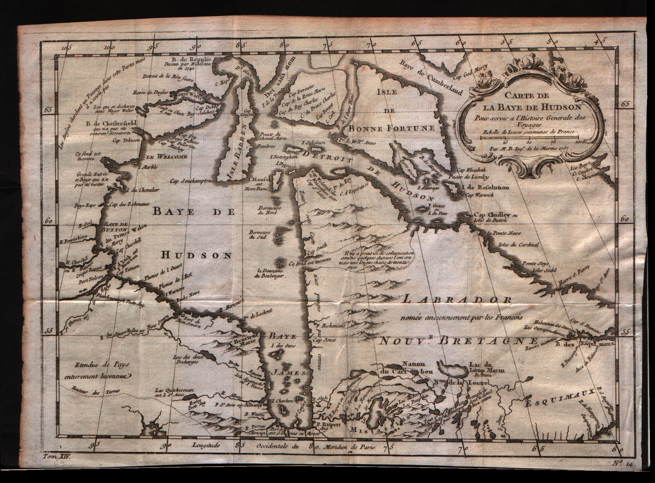
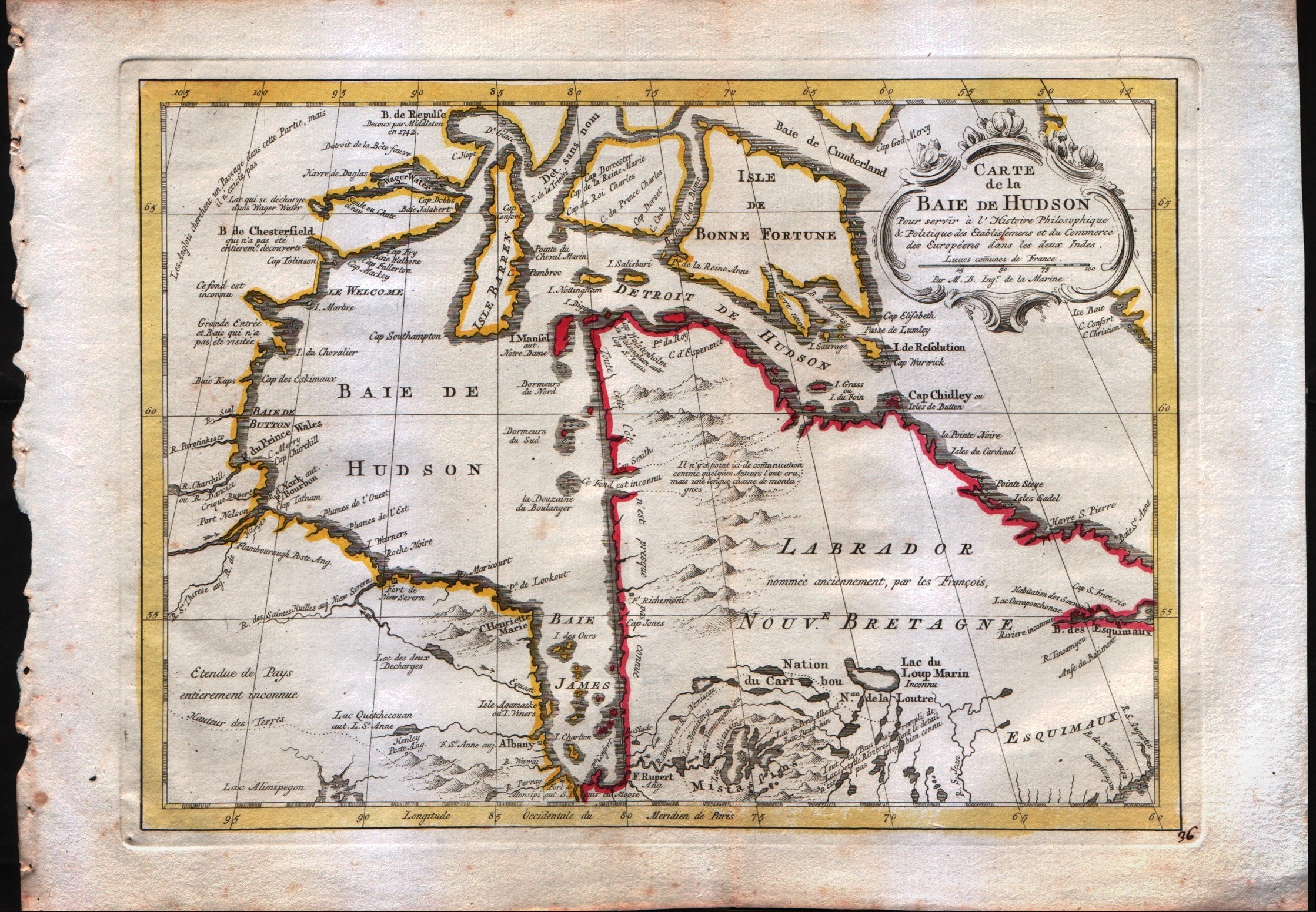
Carte de la baie de Hudson
Bellin · -- · 1773
- Edition place
- Amsterdam
- Editor
- --
- Atlas
- Atlas Portatif -- E. van Harrevelt
- Price
- 175 Euro
- State
- [mint/EXCELLENT/very good/good/fair/mediocre/poor]
- Color
- Old colors
- Verso
- Blank
- Size
- Plate: cm (29.2 × 21.6) in (11.5 × 8.5) · Paper: cm (36.8 × 26.7) in (14.49 × 10.51)
- Technique
- Copper engraving
- Note
- No particular notes for this maps
- Reference
- --
- In stock
- Available
- Code
- #0074
Tap the map to enlarge · scroll when zoomed · pinch to zoom on phone
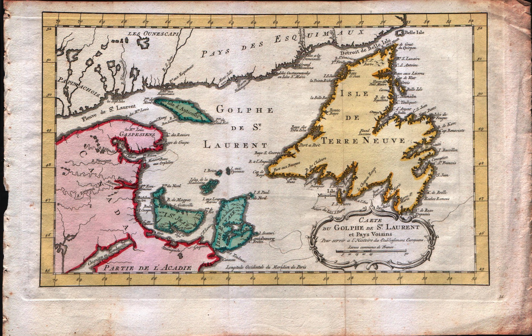
Carte du golphe de S.Laurent et pays voisins
Bellin · -- · 1773
- Edition place
- Amsterdam
- Editor
- --
- Atlas
- Atlas Portatif -- E. van Harrevelt
- Price
- 150 Euro
- State
- [mint/EXCELLENT/very good/good/fair/mediocre/poor]
- Color
- Old colors
- Verso
- Blank
- Size
- Plate: cm (34.3 × 21.6) in (13.5 × 8.5) · Paper: cm (41.9 × 26.7) in (16.5 × 10.51)
- Technique
- Copper engraving
- Note
- No particular notes for this maps
- Reference
- --
- In stock
- Available
- Code
- #0080
Tap the map to enlarge · scroll when zoomed · pinch to zoom on phone
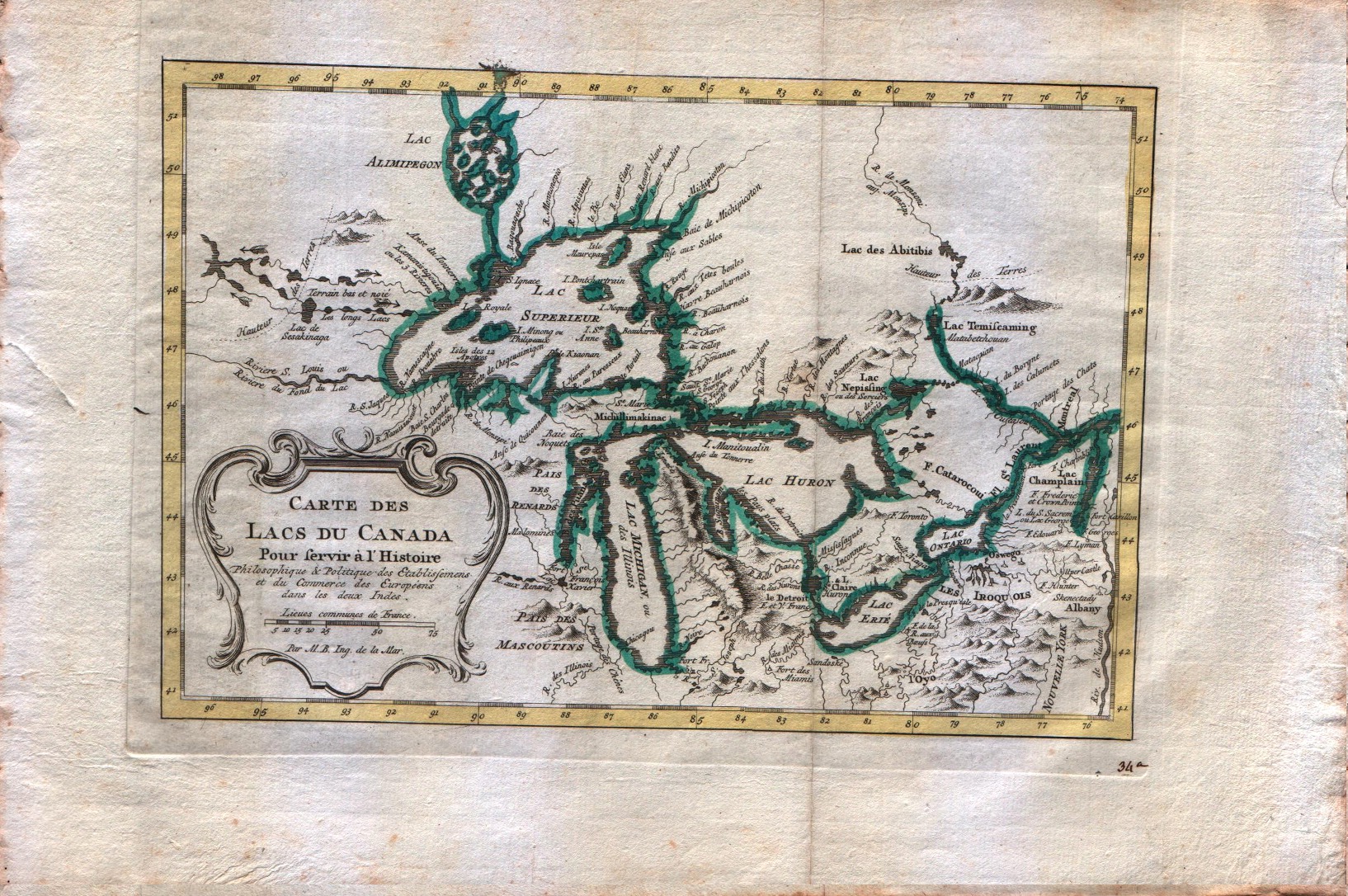
Carte des lacs du Canada
Bellin · -- · 1773
- Edition place
- Amsterdam
- Editor
- --
- Atlas
- Atlas Portatif -- E. van Harrevelt
- Price
- 350 Euro
- State
- [mint/EXCELLENT/very good/good/fair/mediocre/poor]
- Color
- Old colors
- Verso
- Blank
- Size
- Plate: cm (27.9 × 19) in (10.98 × 7.48) · Paper: cm (39.4 × 26.7) in (15.51 × 10.51)
- Technique
- Copper engraving
- Note
- Bellin's map has the five lakes in an appropriate scale and with the names that we know today.
- Reference
- --
- In stock
- Sold
- Code
- #0077
Tap the map to enlarge · scroll when zoomed · pinch to zoom on phone
Suite du cours du Fleuve de S.Laurent depuis Quebec jusqu'au Lac Ontario
Bellin · -- · 1773
- Edition place
- Amsterdam
- Editor
- --
- Atlas
- Atlas Portatif -- E. van Harrevelt
- Price
- 200 Euro
- State
- [mint/EXCELLENT/very good/good/fair/mediocre/poor]
- Color
- Old colors
- Verso
- Blank
- Size
- Plate: cm (27.9 × 17.8) in (10.98 × 7.01) · Paper: cm (35.6 × 26.7) in (14.02 × 10.51)
- Technique
- Copper engraving
- Note
- No particular notes for this maps
- Reference
- --
- In stock
- Available
- Code
- #0073
Tap the map to enlarge · scroll when zoomed · pinch to zoom on phone
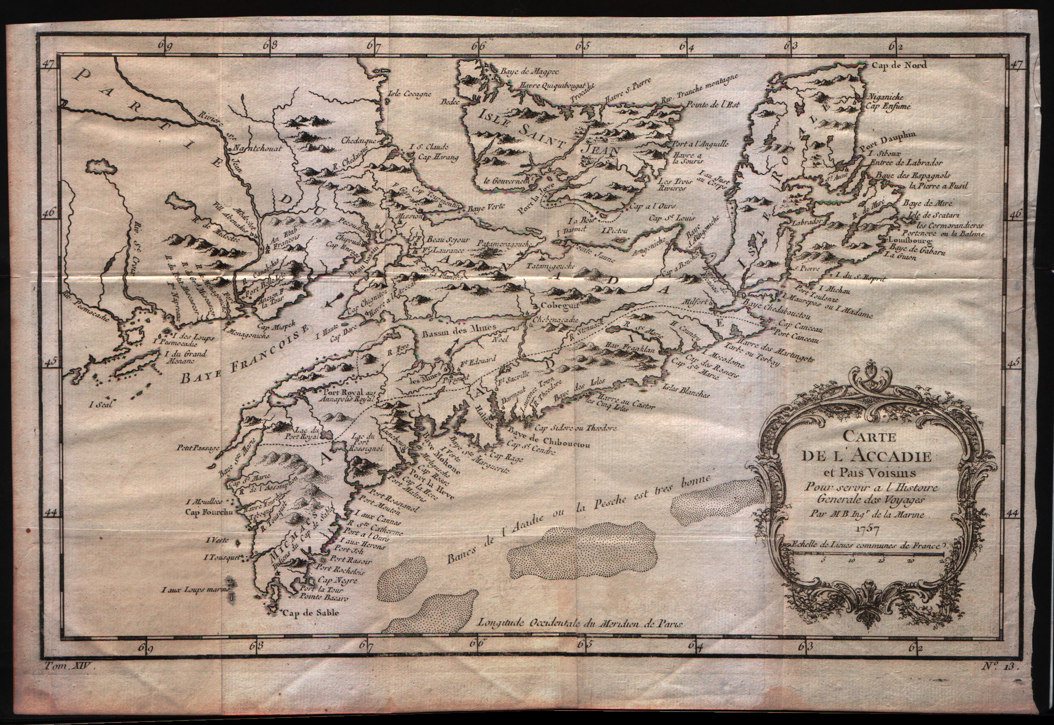
Carte de l'Acadie et pais voisins
Bellin · -- · 1773
- Edition place
- Amsterdam
- Editor
- --
- Atlas
- Atlas Portatif -- E. van Harrevelt
- Price
- 200 Euro
- State
- [mint/excellent/VERY GOOD/good/fair/mediocre/poor]
- Color
- Old colors
- Verso
- Blank
- Size
- Plate: cm (31.8 × 20.3) in (12.52 × 7.99) · Paper: cm (38.1 × 26.7) in (15 × 10.51)
- Technique
- Copper engraving
- Note
- No particular notes for this maps
- Reference
- --
- In stock
- Available
- Code
- #0072
Tap the map to enlarge · scroll when zoomed · pinch to zoom on phone
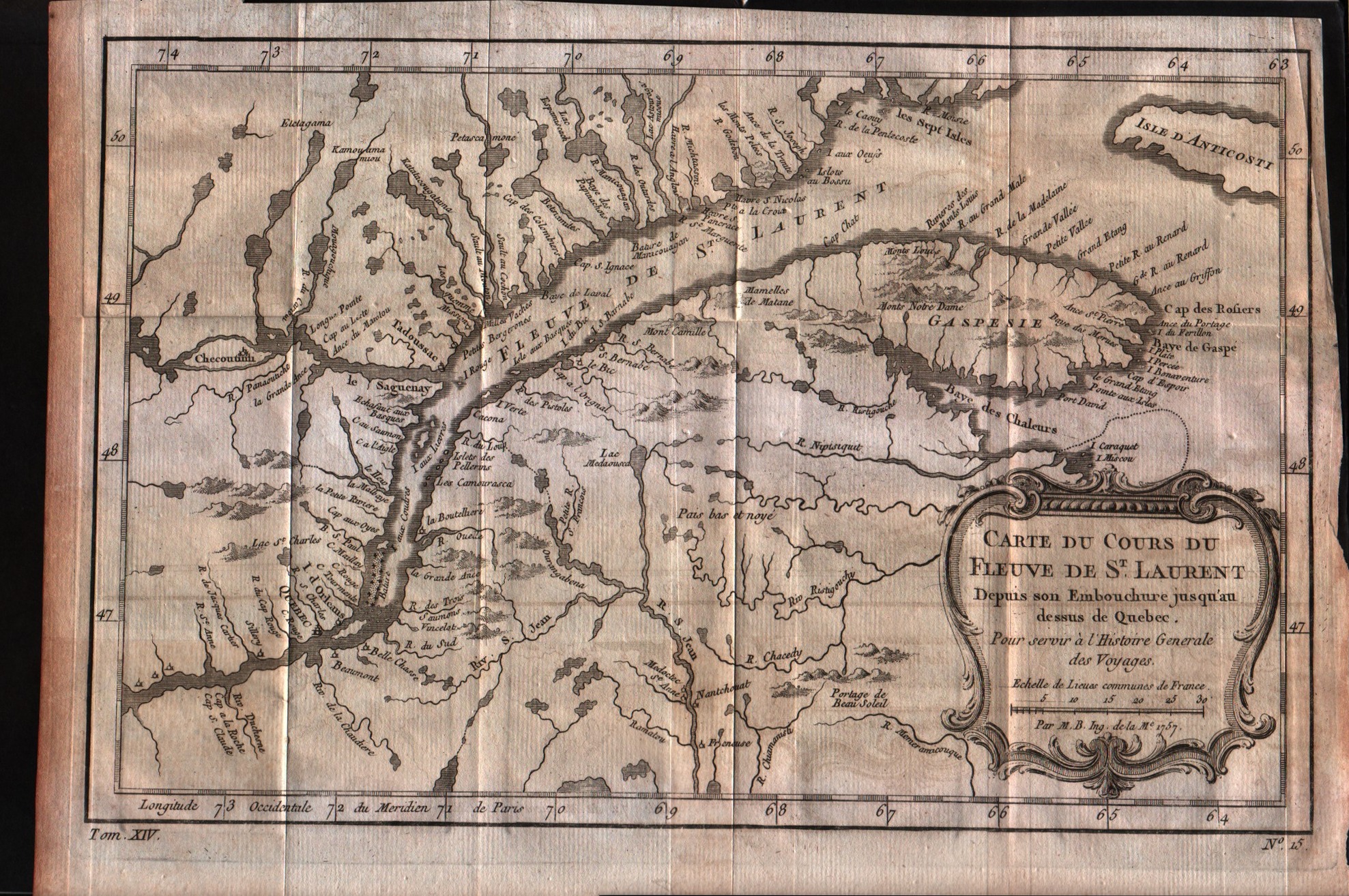
Carte du cours du Fleuve de S.Laurent depuis son embouchure jusqu'au dessus de Quebec
Bellin · -- · 1773
- Edition place
- Amsterdam
- Editor
- --
- Atlas
- Atlas Portatif -- E. van Harrevelt
- Price
- 150 Euro
- State
- [mint/EXCELLENT/very good/good/fair/mediocre/poor]
- Color
- Old colors
- Verso
- Blank
- Size
- Plate: cm (29.2 × 19) in (11.5 × 7.48) · Paper: cm (39.4 × 26.7) in (15.51 × 10.51)
- Technique
- Copper engraving
- Note
- No particular notes for this maps
- Reference
- --
- In stock
- Available
- Code
- #0070
Tap the map to enlarge · scroll when zoomed · pinch to zoom on phone
Isles de la Reine Charlotte
Bonne · Canada · 1776
- Edition place
- Paris
- Editor
- Lattre
- Atlas
- Atlas Moderne
- Price
- 100 Euro
- State
- [mint/EXCELLENT/very good/good/fair/mediocre/poor]
- Color
- Black/white
- Verso
- Blank
- Size
- Plate: cm (35 × 24) in (13.78 × 9.45) · Paper: cm (41 × 28) in (16.14 × 11.02)
- Technique
- Copper engraving
- Note
- Reference
- --
- In stock
- Available
- Code
- #1375
Tap the map to enlarge · scroll when zoomed · pinch to zoom on phone
La baia d'Hudson terra di Labrador
Zatta · Canada · 1776
- Edition place
- Venice
- Editor
- Atlas
- Atlante novissimo, illustrato ed accresciuto sulle osservazioni e scoperte fatte dai più celebri e più recenti geografi
- Price
- 200 Euro
- State
- [mint/EXCELLENT/very good/good/fair/mediocre/poor]
- Color
- Old colors
- Verso
- Blank
- Size
- Plate: cm (40 × 30) in (15.75 × 11.81) · Paper: cm (50 × 38) in (19.69 × 14.96)
- Technique
- Copper engraving
- Note
- Reference
- Wiki
- —
- In stock
- Available
- Code
- #1388
Tap the map to enlarge · scroll when zoomed · pinch to zoom on phone