Celestial
Map title
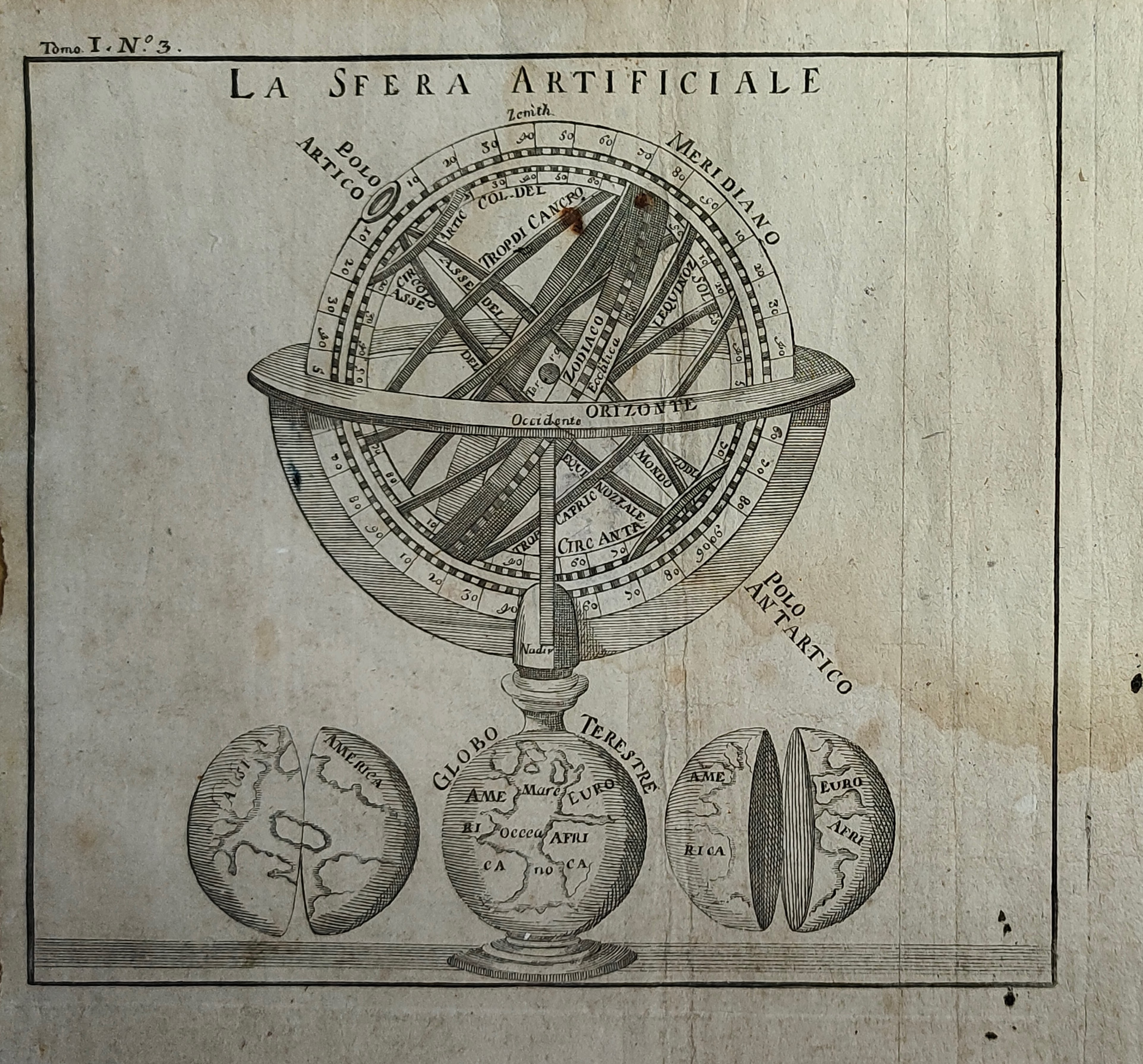
La sfera artificiale
Author
Location shown in map
Celestial
Edition date
Circa 1748
Edition place
Paris
Editor
Atlas
Price
100 Euro
State
[mint/EXCELLENT/very good/good/fair/mediocre/poor]
Color
Black/white
Verso
Blank
Size
Plate: cm (16 x 14) inches (6.3 x 5.51) Paper: cm (20 x 19) inches (7.87 x 7.48)
Technique
Copper engraving
Note
Reference
Wiki
Here for more info
In stock
Available
Info
info@thetreasuremaps.com
Code
#1154
×
![La sfera artificiale by , Celestial, Circa 1748]()
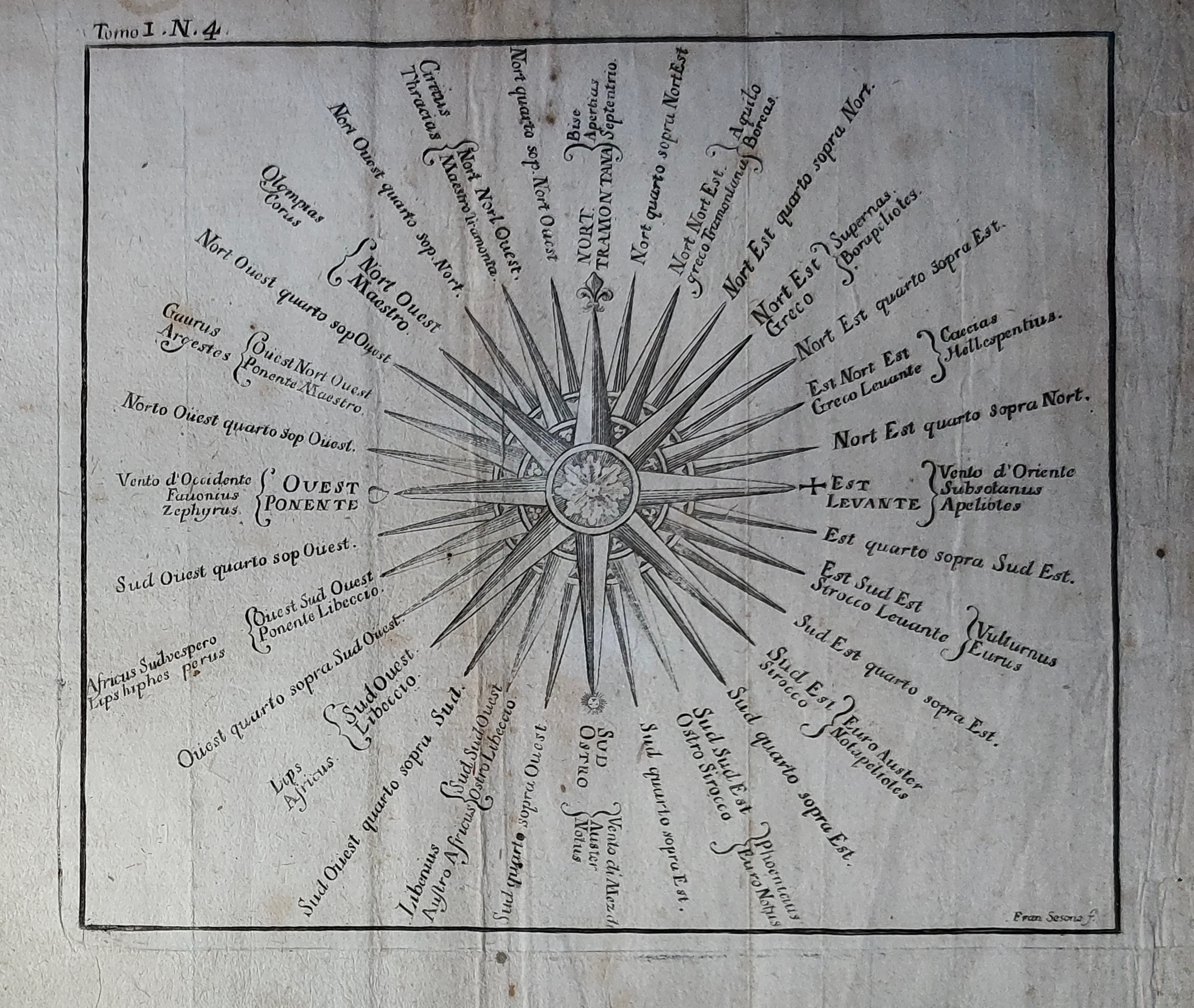
Map title
Author
Location shown in map
Celestial
Edition date
Circa 1748
Edition place
Paris
Editor
Atlas
Price
100 Euro
State
[mint/EXCELLENT/very good/good/fair/mediocre/poor]
Color
Black/white
Verso
Blank
Size
Plate: cm (16 x 14) inches (6.3 x 5.51) Paper: cm (20 x 19) inches (7.87 x 7.48)
Technique
Copper engraving
Note
Reference
Wiki
Here for more info
In stock
Available
Info
info@thetreasuremaps.com
Code
#1155
×
![by , Celestial, Circa 1748]()
Map title
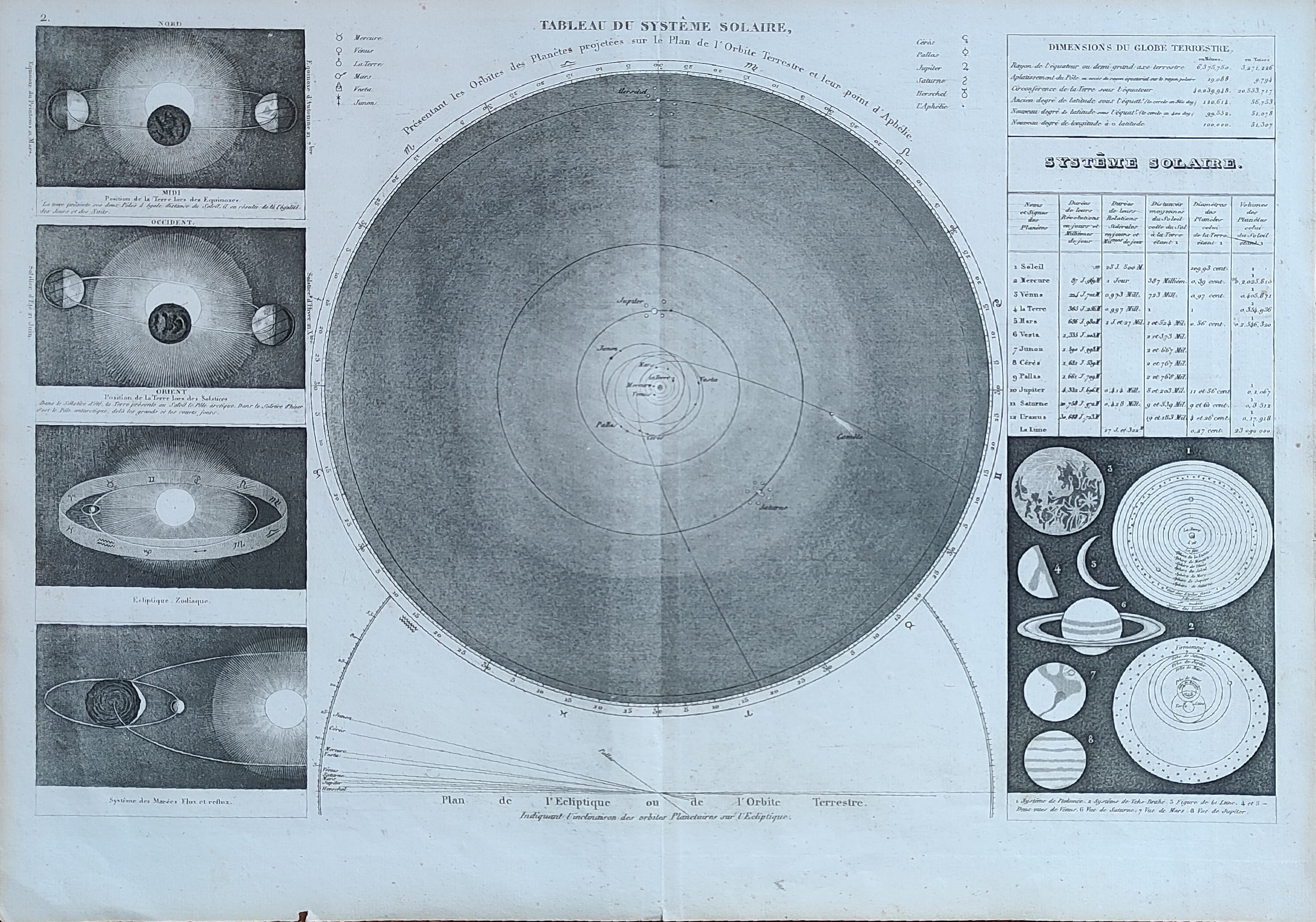
Tableau du system solaire
Author
Monin
Location shown in map
Celestial
Edition date
1840
Edition place
Paris
Editor
Atlas
Atlas Classique de la Geographie
Price
50 Euro
State
[mint/EXCELLENT/very good/good/fair/mediocre/poor]
Color
Old colors
Verso
Blank
Size
Plate: cm (39 x 28) inches (15.35 x 11.02) Paper: cm (45 x 33) inches (17.72 x 12.99)
Technique
Copper engraving
Note
Reference
Wiki
Here for more info
In stock
Available
Info
info@thetreasuremaps.com
Code
#1041
×
![Tableau du system solaire by Monin, Celestial, 1840]()
Map title
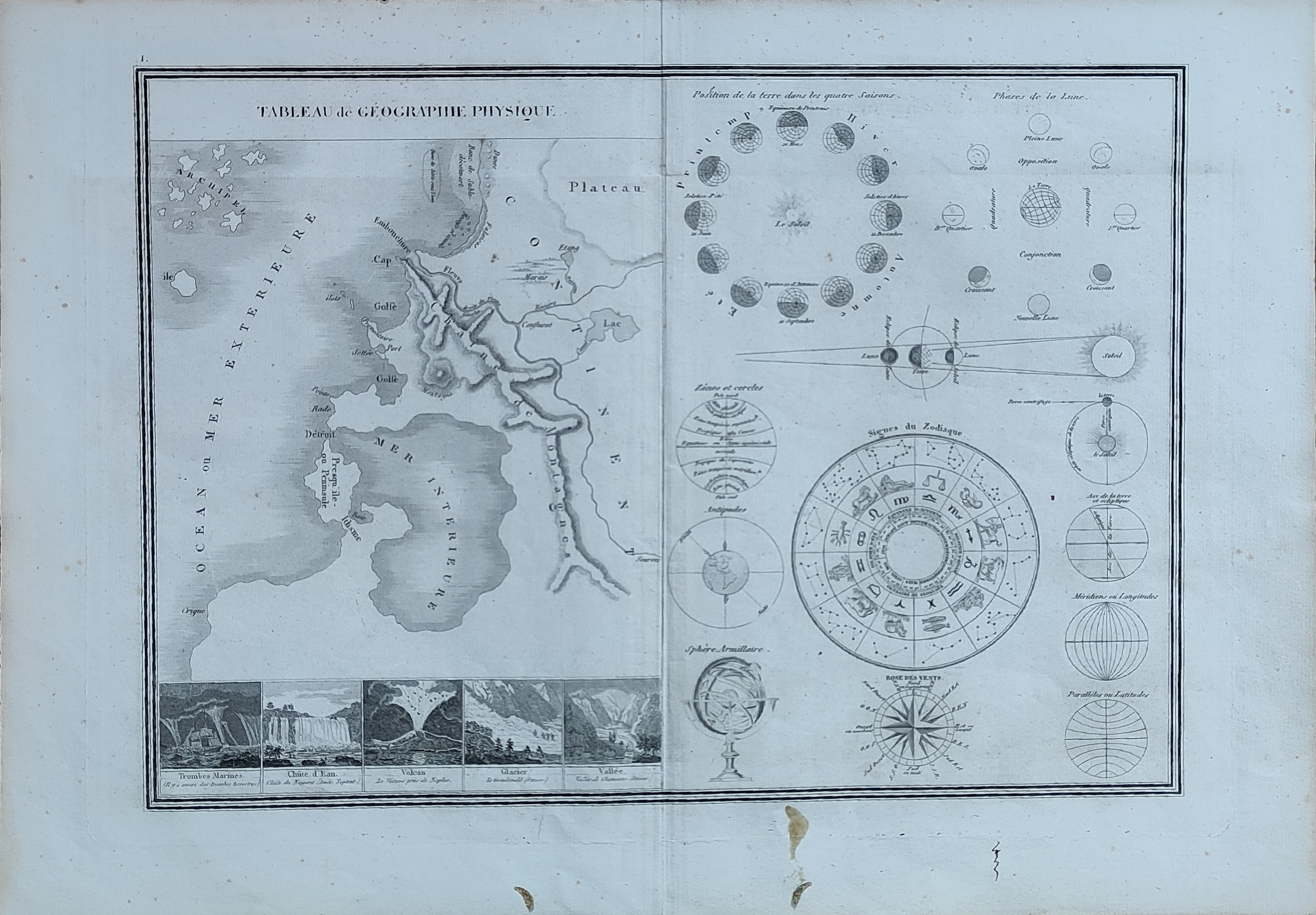
Tableau de geographie physique
Author
Monin
Location shown in map
Celestial
Edition date
1840
Edition place
Paris
Editor
Atlas
Atlas Classique de la Geographie
Price
50 Euro
State
[mint/EXCELLENT/very good/good/fair/mediocre/poor]
Color
Old colors
Verso
Blank
Size
Plate: cm (39 x 28) inches (15.35 x 11.02) Paper: cm (45 x 33) inches (17.72 x 12.99)
Technique
Copper engraving
Note
Reference
Wiki
Here for more info
In stock
Available
Info
info@thetreasuremaps.com
Code
#1042
×
![Tableau de geographie physique by Monin, Celestial, 1840]()
Map title
Mondkarte
Author
Meyers
Location shown in map
Moon
Edition date
Circa 1895
Edition place
Lepzing
Editor
Bibliographic Institute
Atlas
Price
50 Euro
State
[mint/EXCELLENT/very good/good/fair/mediocre/poor]
Color
Old colors
Verso
Blank
Size
Plate: cm (27 x 22) inches (10.63 x 8.66) Paper: cm (31 x 24) inches (12.2 x 9.45)
Technique
Steel engraving
Note
Reference
Wiki
Here for more info
In stock
Available
Info
info@thetreasuremaps.com
Code
#1368
×
![Mondkarte by Meyers, Moon, Circa 1895]()