North Europe
Pages: 1 2
Map title
Septentrionalium partium nova tabula
Author
Ruscelli
Location shown in map
North Atlantic
Edition date
1561
Edition place
Venice
Editor
Vincenzo Valgrisi
Atlas
La Geographia di Claudio Tolomeo
Price
500 Euro
State
[mint/EXCELLENT/very good/good/fair/mediocre/poor]
Color
Black/white
Verso
Italian text pag.35
Size
Plate: cm (25.4 x 19) inches (10 x 7.48) Paper: cm (27.9 x 20.3) inches (10.98 x 7.99)
Technique
Copper engraving
Note
No particular notes for this maps.
Reference
--
Wiki
Here for more info
In stock
Available
Info
info@thetreasuremaps.com
Code
#0530
×
![Septentrionalium partium nova tabula by Ruscelli, North Atlantic, 1561]()
Map title
Schonlandia Nuova
Author
Ruscelli
Location shown in map
Scandinavia
Edition date
1561
Edition place
Venice
Editor
Vincenzo Valgrisi
Atlas
La Geographia di Claudio Tolomeo
Price
600 Euro
State
[mint/excellent/VERY GOOD/good/fair/mediocre/poor]
Color
Black/white
Verso
Italian text pag.6
Size
Plate: cm (26 x 19) inches (10.24 x 7.48) Paper: cm (27.9 x 20.3) inches (10.98 x 7.99)
Technique
Copper engraving
Note
No particular notes for this maps.
Reference
--
Wiki
Here for more info
In stock
Available
Info
info@thetreasuremaps.com
Code
#0533
×
![Schonlandia Nuova by Ruscelli, Scandinavia, 1561]()
Map title
Schonlandia Nuova
Author
Ruscelli
Location shown in map
Scandinavia
Edition date
1562
Edition place
Venice
Editor
Vincenzo Valgrisi
Atlas
La Geographia di Claudio Tolomeo
Price
600 Euro
State
[mint/EXCELLENT/very good/good/fair/mediocre/poor]
Color
Black/white
Verso
Latin text pag.25
Size
Plate: cm (26 x 20) inches (10.24 x 7.87) Paper: cm (31 x 24) inches (12.2 x 9.45)
Technique
Copper engraving
Note
Reference
--
Wiki
Here for more info
In stock
Available
Info
info@thetreasuremaps.com
Code
#1204
×
![Schonlandia Nuova by Ruscelli, Scandinavia, 1562]()

Map title
Descrittione dell'isola di Gotlandia
Author
Porcacchi
Location shown in map
Gotland
Edition date
1576
Edition place
Venice
Editor
--
Atlas
L'Isole piu famose del mondo -- S. Galignani and G. Porro
Price
Please ask: info@thetreasuremaps.com
State
[MINT/excellent/very good/good/fair/mediocre/poor]
Color
Black/white
Verso
Italian text pag.9
Size
Plate: cm (15.2 x 11.4) inches (5.98 x 4.49) Paper: cm (19 x 27.9) inches (7.48 x 10.98)
Technique
Copper engraving
Note
No particular notes for this maps
Reference
Genoa pubblic library "Civica Berio"
Wiki
Here for more info
In stock
Sold
Info
info@thetreasuremaps.com
Code
#0102
×
![Descrittione dell'isola di Gotlandia by Porcacchi, Gotland, 1576]()
Map title
Septentrionalium regionum descriptio
Author
Ortelius
Location shown in map
North Atlantic
Edition date
1588
Edition place
Antwerp
Editor
Atlas
Theatrum Orbis Terrarum
Price
1600 Euro
State
[mint/EXCELLENT/very good/good/fair/mediocre/poor]
Color
Old colors
Verso
Spanish text
Size
Plate: cm (47 x 35) inches (18.5 x 13.78) Paper: cm (53 x 42) inches (20.87 x 16.54)
Technique
Copper engraving
Note
Reference
Van Den Broecke 211
Wiki
Here for more info
In stock
Available
Info
info@thetreasuremaps.com
Code
#1166
×
![Septentrionalium regionum descriptio by Ortelius, North Atlantic, 1588]()
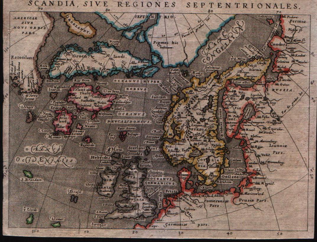
Map title
Scandia sive regiones septentrionales
Author
Magini
Location shown in map
North Europe
Edition date
1598
Edition place
Venice
Editor
Battista & Giorgio Galignani
Atlas
Geografia di Claudio Tolomeo -- Giovanni Antonio Magini
Price
300 Euro
State
[mint/excellent/VERY GOOD/good/fair/mediocre/poor]
Color
Old color
Verso
Italian text
Size
Plate: cm (14 x 17.8) inches (5.51 x 7.01) Paper: cm (14 x 17.8) inches (5.51 x 7.01)
Technique
Copper engraving
Note
--
Reference
--
Wiki
Here for more info
In stock
Available
Info
info@thetreasuremaps.com
Code
#0134
×
![Scandia sive regiones septentrionales by Magini, North Europe, 1598]()
Map title
Septentrionalium regionum descriptio
Author
Botero
Location shown in map
North atlantic
Edition date
Circa 1599
Edition place
Brescia
Editor
--
Atlas
Relationi di Givanno Botero
Price
Please ask: info@thetreasuremaps.com
State
[MINT/excellent/very good/good/fair/mediocre/poor]
Color
Black/white
Verso
Italian text pag.28
Size
Plate: cm (11.4 x 10.2) inches (4.49 x 4.02) Paper: cm (16.5 x 22.9) inches (6.5 x 9.02)
Technique
Copper engraving
Note
No particular notes for this maps.
Reference
--
Wiki
Here for more info
In stock
Available
Info
info@thetreasuremaps.com
Code
#0594
×
![Septentrionalium regionum descriptio by Botero, North atlantic, Circa 1599]()
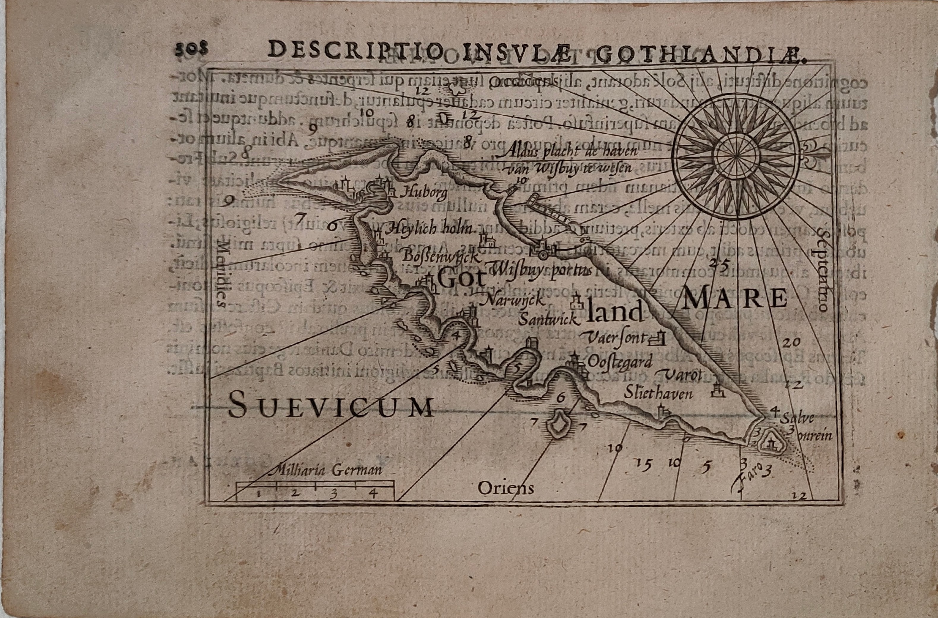
Map title
Descriptio insulae Gothlandiae
Author
Bertius
Location shown in map
Sweden
Edition date
1600
Edition place
Amsterdam
Editor
--
Atlas
Tabularum geographicarum contractarum
Price
200 Euro
State
[mint/EXCELLENT/very good/good/fair/mediocre/poor]
Color
Black/white
Verso
Latin text
Size
Plate: cm (12 x 9) inches (4.72 x 3.54) Paper: cm (18 x 12) inches (7.09 x 4.72)
Technique
Copper engraving
Note
Reference
Wiki
Here for more info
In stock
Available
Info
info@thetreasuremaps.com
Code
#1325
×
![Descriptio insulae Gothlandiae by Bertius, Sweden, 1600]()
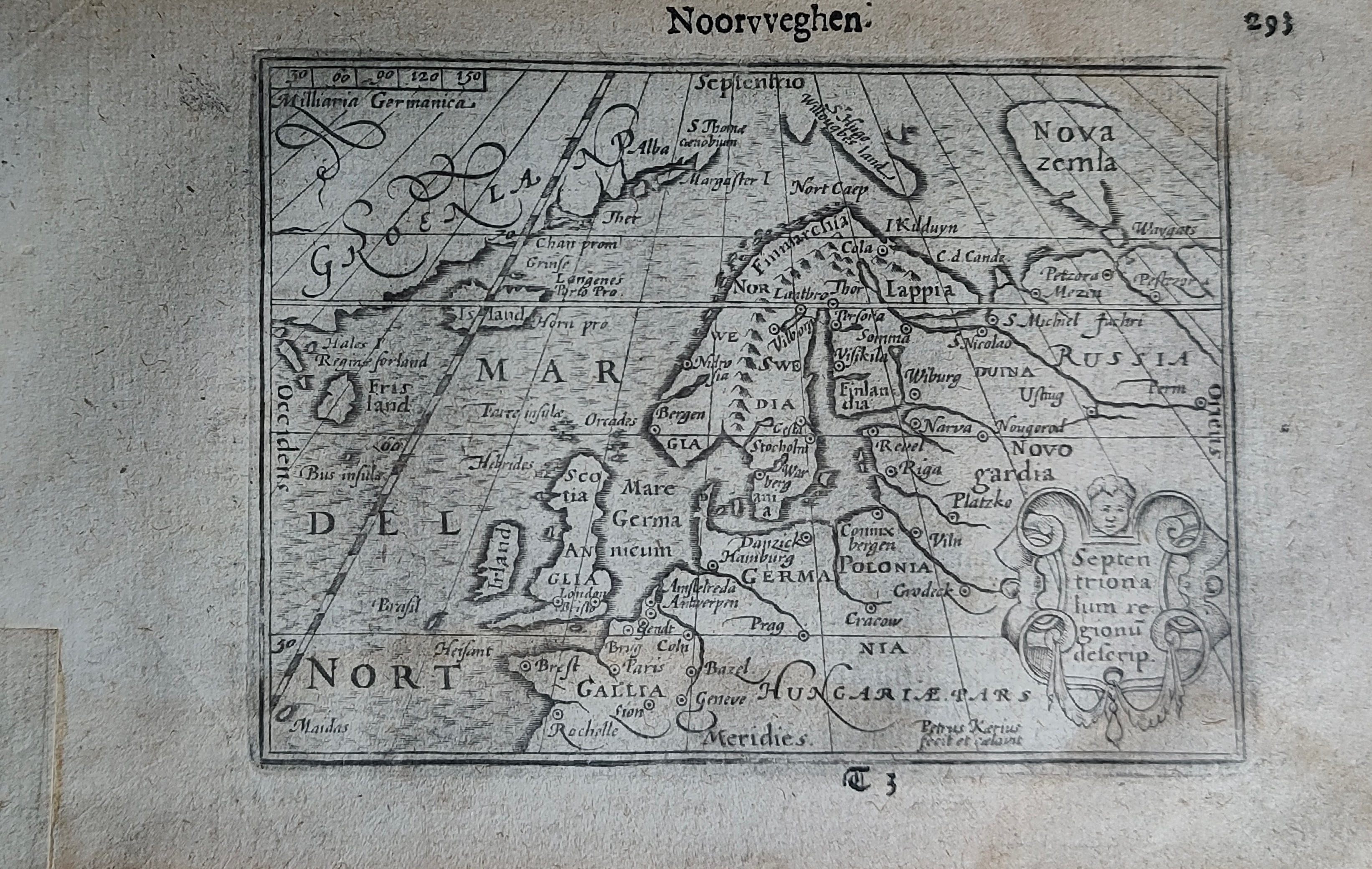
Map title
Noorvveghen
Author
Bertius
Location shown in map
North Europe
Edition date
Circa 1606
Edition place
Amsterdam
Editor
Atlas
Price
300 Euro
State
[mint/EXCELLENT/very good/good/fair/mediocre/poor]
Color
Black/white
Verso
Duch text pag.294
Size
Plate: cm (12 x 9) inches (4.72 x 3.54) Paper: cm (18 x 11) inches (7.09 x 4.33)
Technique
Copper engraving
Note
Reference
Wiki
Here for more info
In stock
Sold
Info
info@thetreasuremaps.com
Code
#1253
×
![Noorvveghen by Bertius, North Europe, Circa 1606]()
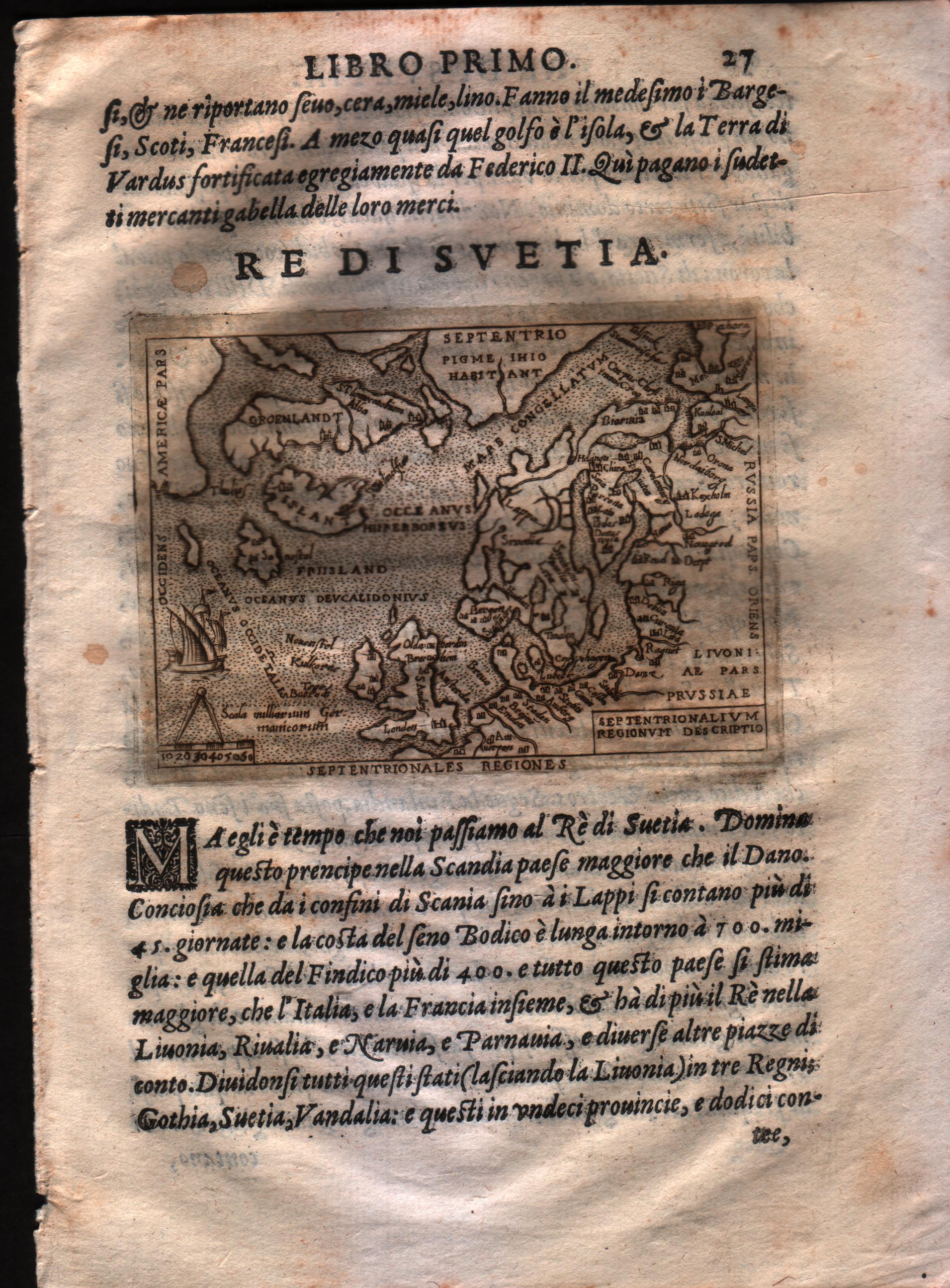
Map title
Septentrionalium regnorum descriptio
Author
Doglioni
Location shown in map
Scandinavia
Edition date
1623
Edition place
Venice
Editor
Giacomo Sarzina
Atlas
Anfiteatro di Europa
Price
700 Euro
State
[mint/EXCELLENT/very good/good/fair/mediocre/poor]
Color
Black/white
Verso
Italian text pag.1368
Size
Plate: cm (11.4 x 8.9) inches (4.49 x 3.5) Paper: cm (15.2 x 22.9) inches (5.98 x 9.02)
Technique
Copper engraving
Note
The maps are copies of the Galle (c.1595) edition of Ortelius.
Reference
--
Wiki
Here for more info
In stock
Available
Info
info@thetreasuremaps.com
Code
#0603
×
![Septentrionalium regnorum descriptio by Doglioni, Scandinavia, 1623]()
Map title
Tabula Islandiae Auctore Georgio Carolo Flandro
Author
Jansson
Location shown in map
Iceland
Edition date
Circa 1634
Edition place
Amsterdam
Editor
Jansson
Atlas
Atlantis Maioris Appendix
Price
1100 Euro
State
[mint/EXCELLENT/very good/good/fair/mediocre/poor]
Color
Old colors
Verso
Latin text pag 3
Size
Plate: cm (48 x 37) inches (18.9 x 14.57) Paper: cm (55 x 44) inches (21.65 x 17.32)
Technique
Copper engraving
Note
This map is one of the symbols of the intense rivalry between Jansson and Blaeu. Joris Carl's map was first engraved by Jodocus Hondius II (son of the firm's founder and Jansson's brother-in-law). When Jodocus died in 1629 many of his plates were sold to Willem Blaeu, who added his name to the plates and used them to publish his first atlas in 1630. Angered by the sale, Jansson had the Hondius plates slavishly copied. This plate, which only differs from Blaeu's by the lack of his name under the title, was first issued the same year.
Reference
Wiki
Here for more info
In stock
Available
Info
info@thetreasuremaps.com
Code
#0635
×
![Tabula Islandiae Auctore Georgio Carolo Flandro by Jansson, Iceland, Circa 1634]()
Map title
Regni Daniae
Author
Jansson
Location shown in map
Denmark
Edition date
Circa 1647
Edition place
Amsterdam
Editor
Atlas
Price
400 Euro
State
[mint/EXCELLENT/very good/good/fair/mediocre/poor]
Color
Old colors
Verso
Latin text
Size
Plate: cm (56 x 45) inches (22.05 x 17.72) Paper: cm (58 x 49) inches (22.83 x 19.29)
Technique
Copper engraving
Note
Reference
Wiki
Here for more info
In stock
Available
Info
info@thetreasuremaps.com
Code
#1311
×
![Regni Daniae by Jansson, Denmark, Circa 1647]()
Map title
Tabula Regnorum Sueciae et Norvegiae
Author
Frederick de Wit
Location shown in map
Sweden
Edition date
Circa 1670
Edition place
Amsterdam
Editor
Atlas
Price
600 Euro
State
[mint/EXCELLENT/very good/good/fair/mediocre/poor]
Color
Black/white
Verso
Blank
Size
Plate: cm (55 x 44) inches (21.65 x 17.32) Paper: cm (60 x 52) inches (23.62 x 20.47)
Technique
Copper engraving
Note
Reference
Wiki
Here for more info
In stock
Available
Info
info@thetreasuremaps.com
Code
#0786
×
![Tabula Regnorum Sueciae et Norvegiae by Frederick de Wit, Sweden, Circa 1670]()
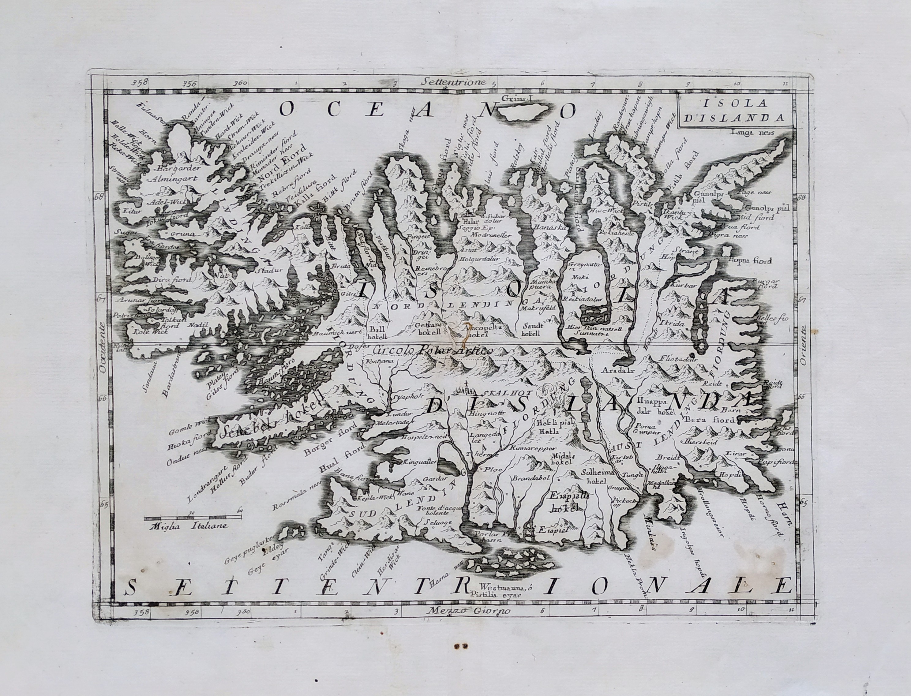
Map title
L'isola d'Islanda
Author
Coronelli
Location shown in map
Iceland
Edition date
Circa 1697
Edition place
Venice
Editor
Coronelli
Atlas
Atlante veneto
Price
400 Euro
State
[mint/EXCELLENT/very good/good/fair/mediocre/poor]
Color
Black/white
Verso
Blank
Size
Plate: cm (31 x 23) inches (12.2 x 9.06) Paper: cm (40 x 30) inches (15.75 x 11.81)
Technique
Copper engraving
Note
No particular notes for this maps.
Reference
--
Wiki
Here for more info
In stock
Available
Info
info@thetreasuremaps.com
Code
#0745
×
![L'isola d'Islanda by Coronelli, Iceland, Circa 1697]()
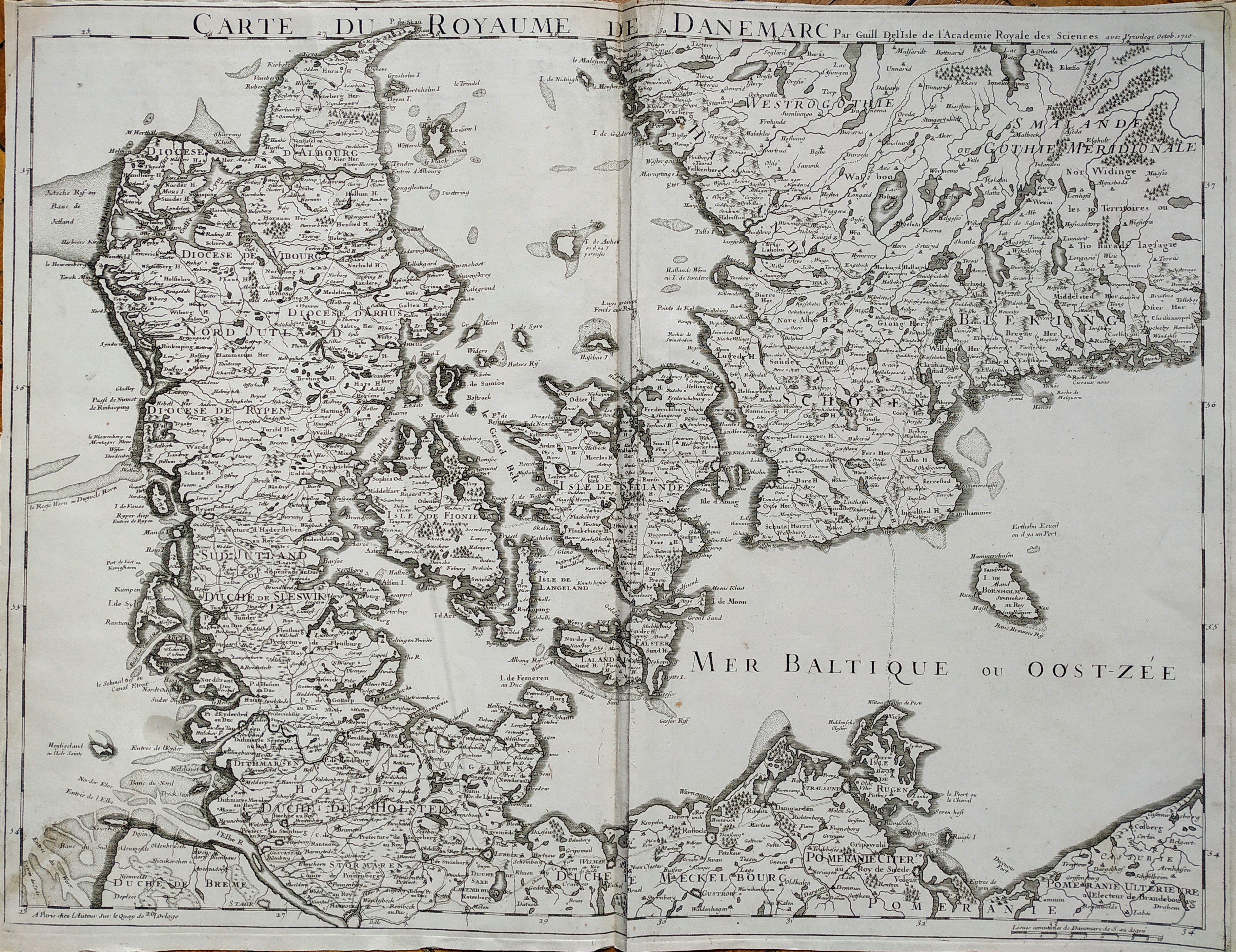
Map title
Carte du roroyaume de Danemarc
Author
De L'Isle
Location shown in map
Denmark
Edition date
1710
Edition place
Paris
Editor
Guillaume Delisle
Atlas
Price
250 Euro
State
[mint/EXCELLENT/very good/good/fair/mediocre/poor]
Color
Black/white
Verso
Blank
Size
Plate: cm (63 x 49) inches (24.8 x 19.29) Paper: cm (65 x 50) inches (25.59 x 19.69)
Technique
Copper engraving
Note
No particular notes for this maps
Reference
Wiki
Here for more info
In stock
Available
Info
info@thetreasuremaps.com
Code
#0727
×
![Carte du roroyaume de Danemarc by De L'Isle, Denmark, 1710]()
Map title
Carte du Spits-Berg
Author
Bellin
Location shown in map
Spitsberg
Edition date
1757
Edition place
Paris
Editor
--
Atlas
Historie General des Voyages -- Prevost
Price
100 Euro
State
[mint/EXCELLENT/very good/good/fair/mediocre/poor]
Color
Black/white
Verso
Blank
Size
Plate: cm (30.5 x 21.6) inches (12.01 x 8.5) Paper: cm (34.3 x 25.4) inches (13.5 x 10)
Technique
Copper engraving
Note
No particular notes for this maps
Reference
--
Wiki
Here for more info
In stock
Available
Info
info@thetreasuremaps.com
Code
#0163
×
![Carte du Spits-Berg by Bellin, Spitsberg, 1757]()
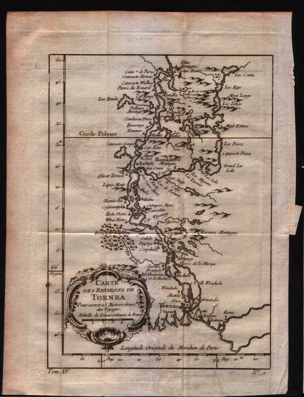
Map title
Carte des environs de Tornea
Author
Bellin
Location shown in map
--
Edition date
1757
Edition place
Paris
Editor
--
Atlas
Historie General des Voyages -- Prevost
Price
Please ask: info@thetreasuremaps.com
State
[mint/EXCELLENT/very good/good/fair/mediocre/poor]
Color
Black/white
Verso
Blank
Size
Plate: cm (17.8 x 21) inches (7.01 x 8.27) Paper: cm (19 x 25.4) inches (7.48 x 10)
Technique
Copper engraving
Note
No particular notes for this maps
Reference
--
Wiki
Here for more info
In stock
Available
Info
info@thetreasuremaps.com
Code
#0162
×
![Carte des environs de Tornea by Bellin, --, 1757]()
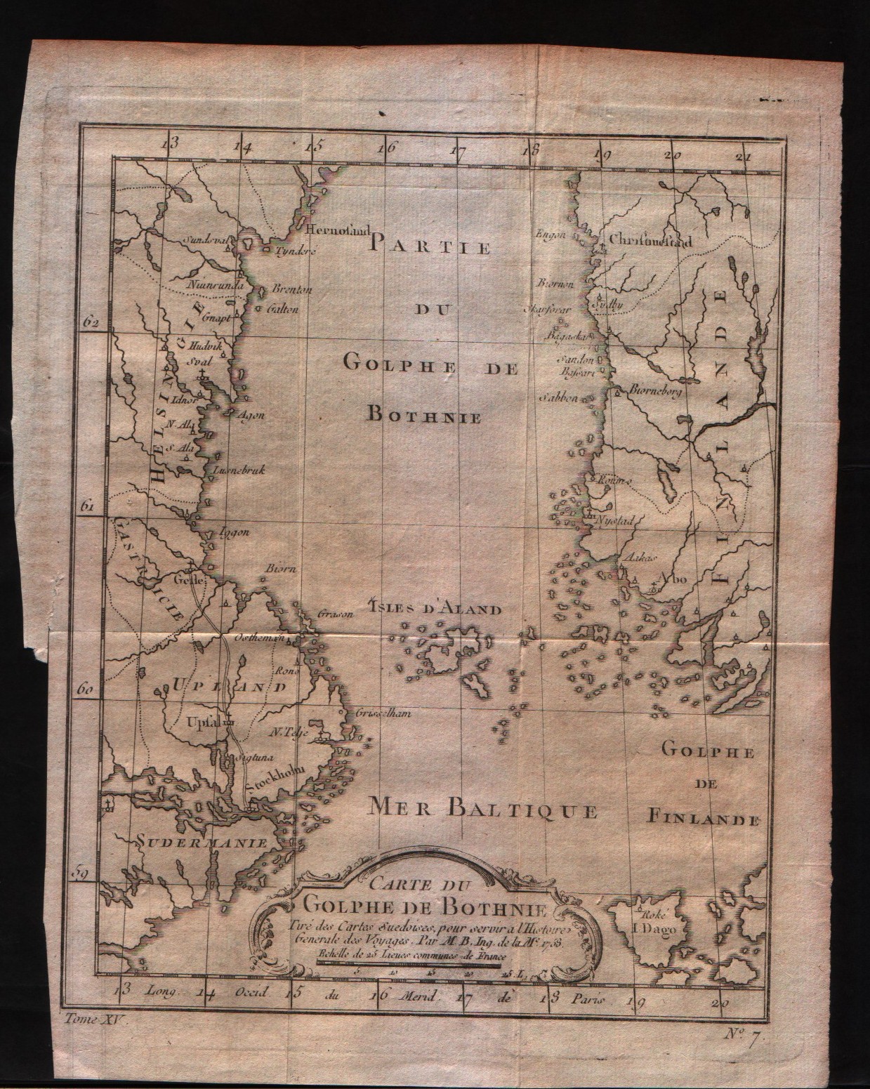
Map title
Carte du golphe de Bothnie
Author
Bellin
Location shown in map
--
Edition date
1757
Edition place
Paris
Editor
--
Atlas
Historie General des Voyages -- Prevost
Price
Please ask: info@thetreasuremaps.com
State
[mint/EXCELLENT/very good/good/fair/mediocre/poor]
Color
Black/white
Verso
Blank
Size
Plate: cm (17.8 x 21) inches (7.01 x 8.27) Paper: cm (20.3 x 25.4) inches (7.99 x 10)
Technique
Copper engraving
Note
No particular notes for this maps
Reference
--
Wiki
Here for more info
In stock
Available
Info
info@thetreasuremaps.com
Code
#0161
×
![Carte du golphe de Bothnie by Bellin, --, 1757]()
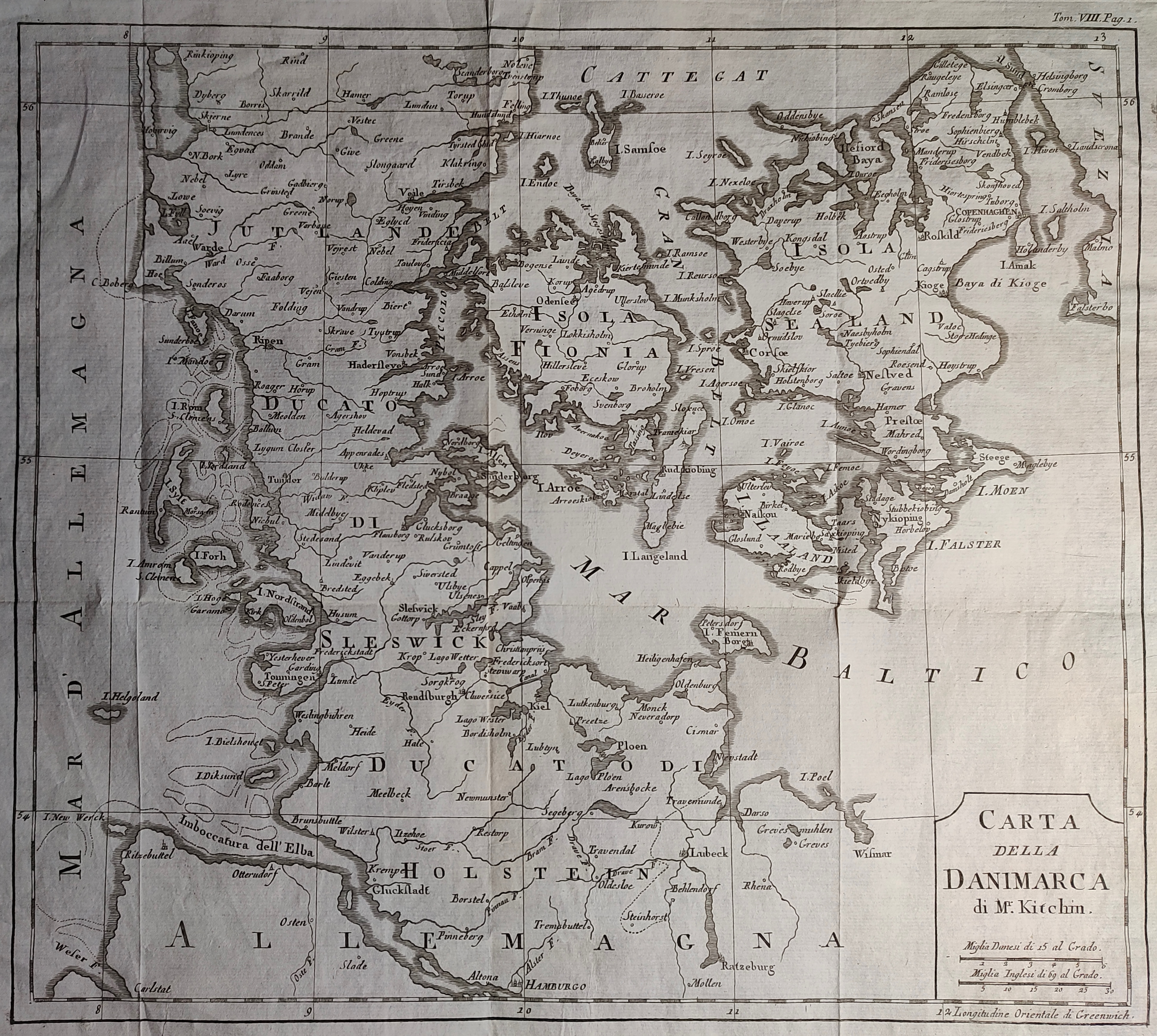
Map title
Carta della Danimarca
Author
Kitchin
Location shown in map
Denmark
Edition date
Circa 1760
Edition place
Paris
Editor
Atlas
Price
75 Euro
State
[mint/EXCELLENT/very good/good/fair/mediocre/poor]
Color
Black/white
Verso
Blank
Size
Plate: cm (34 x 30) inches (13.39 x 11.81) Paper: cm (39 x 33) inches (15.35 x 12.99)
Technique
Copper engraving
Note
Reference
Wiki
Here for more info
In stock
Available
Info
info@thetreasuremaps.com
Code
#1178
×
![Carta della Danimarca by Kitchin, Denmark, Circa 1760]()
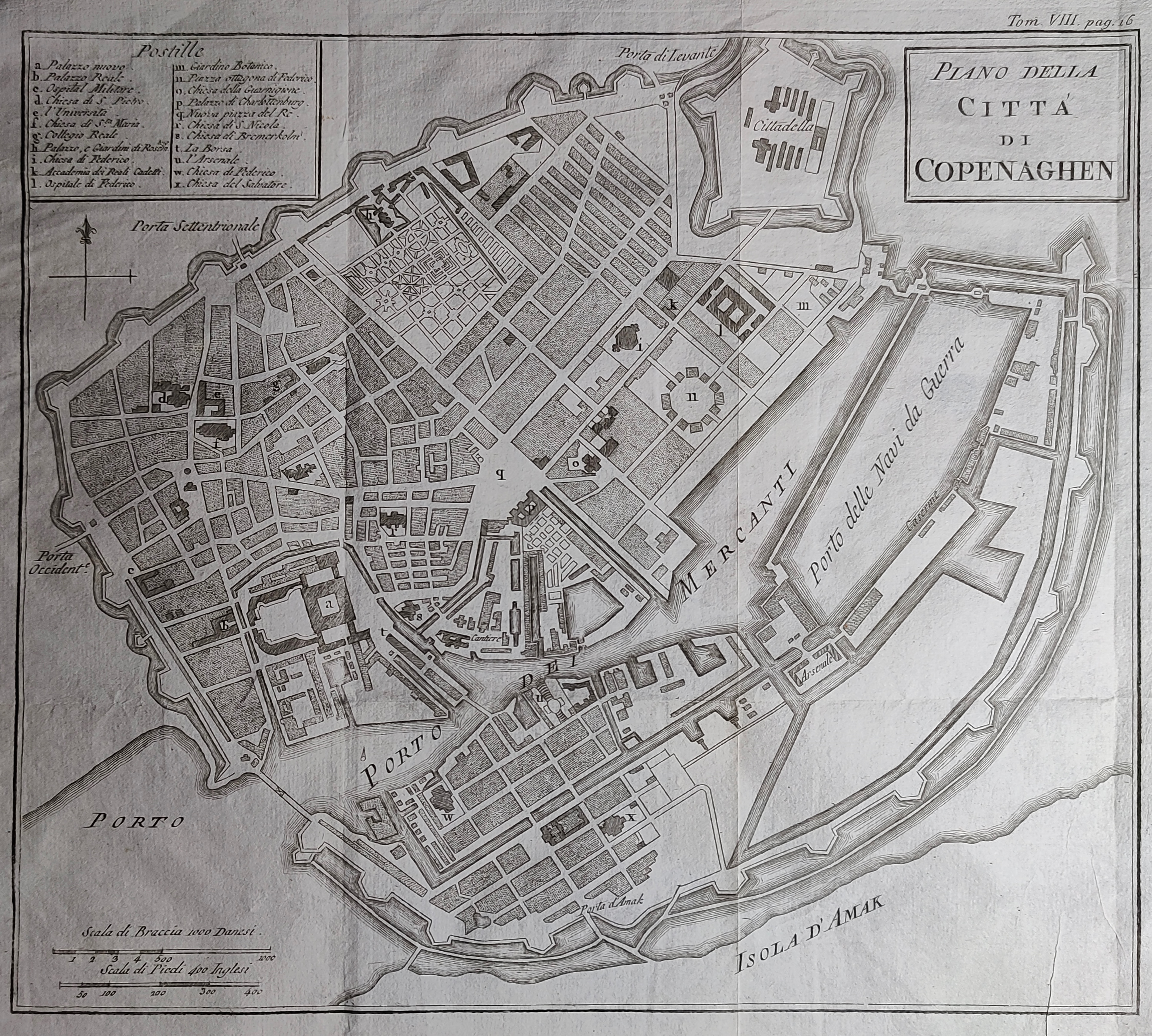
Map title
Piano della citta di Copenaghen
Author
Kitchin
Location shown in map
Copenaghen
Edition date
Circa 1760
Edition place
Paris
Editor
Atlas
Price
75 Euro
State
[mint/EXCELLENT/very good/good/fair/mediocre/poor]
Color
Black/white
Verso
Blank
Size
Plate: cm (30 x 26) inches (11.81 x 10.24) Paper: cm (39 x 30) inches (15.35 x 11.81)
Technique
Copper engraving
Note
Reference
Wiki
Here for more info
In stock
Available
Info
info@thetreasuremaps.com
Code
#1179
×
![Piano della citta di Copenaghen by Kitchin, Copenaghen, Circa 1760]()
Pages: 1 2