- Edition place
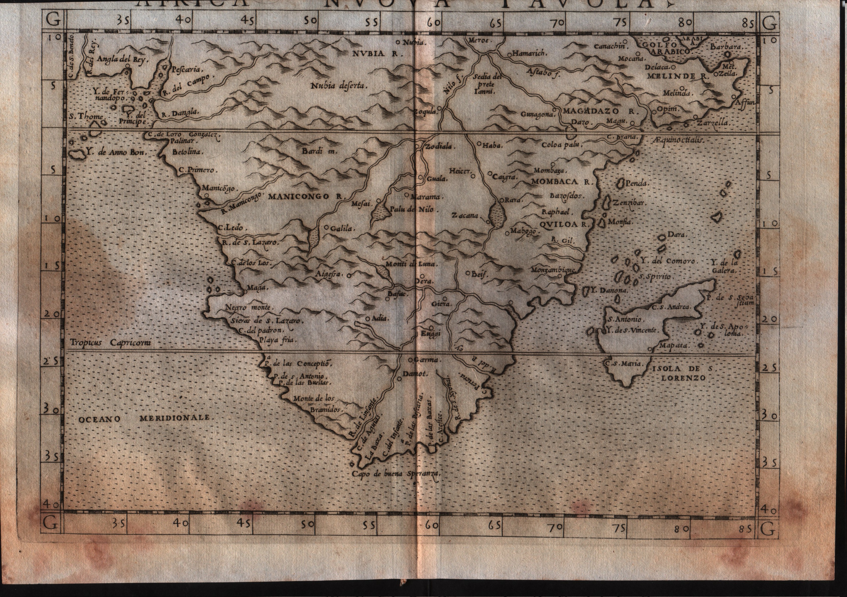
- Venice
- Editor
- Vincenzo Valgrisi
- Atlas
- La Geographia di Claudio Tolomeo
- Price
- 300 Euro
- State
- [mint/excellent/very good/GOOD/fair/mediocre/poor]
- Color
- Black/white
- Verso
- Italian text pag.22
- Size
- Plate: cm (26 × 19) in (10.24 × 7.48) · Paper: cm (27.9 × 20.3) in (10.98 × 7.99)
- Technique
- Copper engraving
- Note
- No particular notes for this maps.
- Reference
- --
- In stock
- Available
- Code
- #0531
Tap the map to enlarge · scroll when zoomed · pinch to zoom on phone
- Edition place
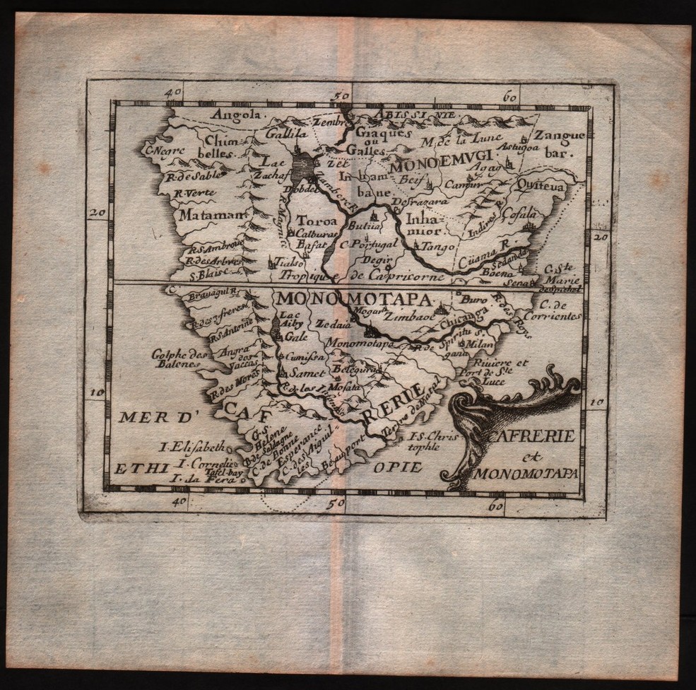
- Paris
- Editor
- --
- Atlas
- La geographie universelle - P. Du Val d'Abbeville
- State
- [mint/EXCELLENT/very good/good/fair/mediocre/poor]
- Color
- Black/white
- Verso
- Blank
- Size
- Plate: cm (12.7 × 10.2) in (5 × 4.02) · Paper: cm (16.5 × 16.5) in (6.5 × 6.5)
- Technique
- Copper engraving
- Note
- No particular notes for this maps
- Reference
- --
- Wiki
- --
- In stock
- Sold
- Code
- #0297
Tap the map to enlarge · scroll when zoomed · pinch to zoom on phone
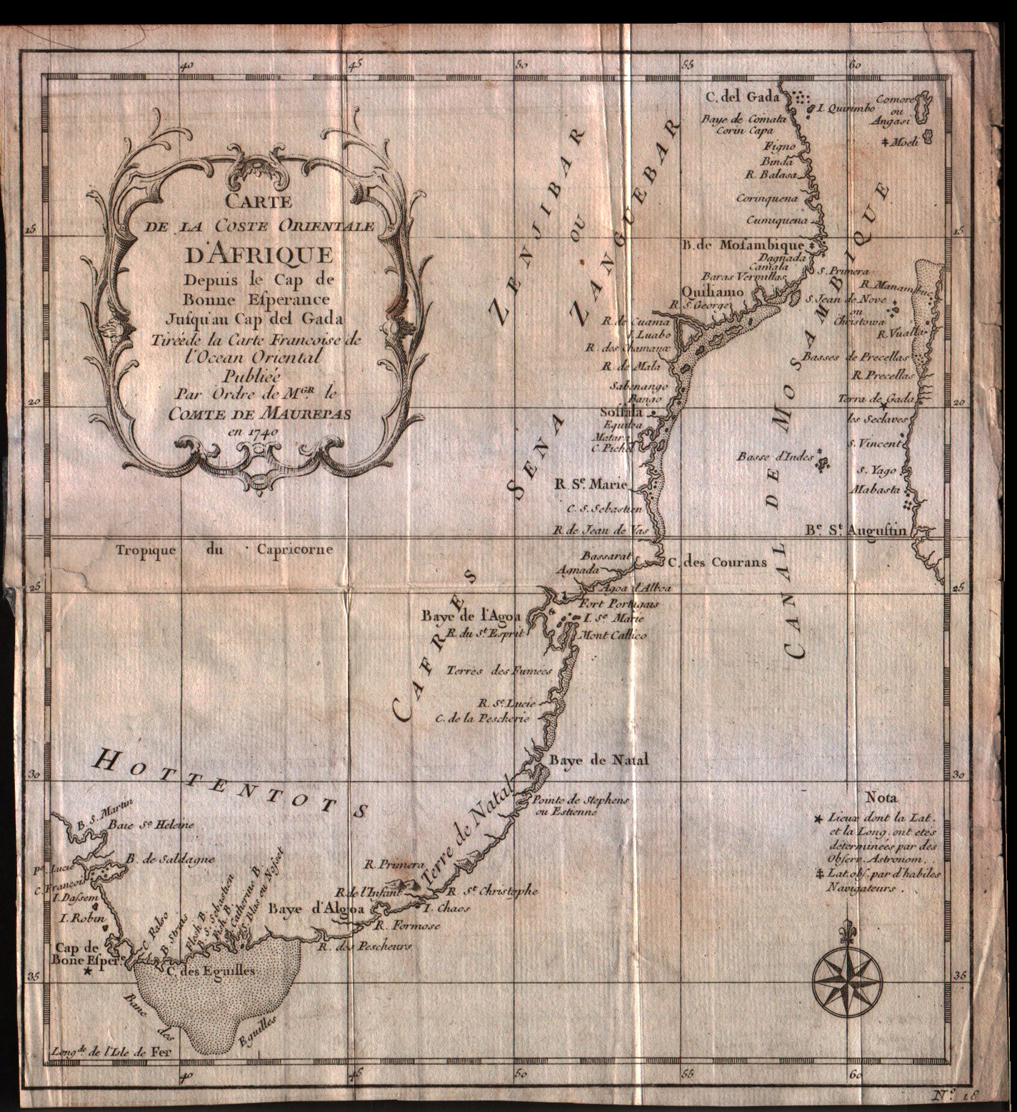
Carte de la coste Orientale d'Afrique depuis le Cap de Bonne Esperance Jusqu'au Cap del Gada
Bellin · -- · 1757
- Edition place
- Paris
- Editor
- --
- Atlas
- Historie General des Voyages -- Prevost
- Price
- 75 Euro
- State
- [mint/excellent/very good/GOOD/fair/mediocre/poor]
- Color
- Black/white
- Verso
- Blank
- Size
- Plate: cm (21.6 × 24.1) in (8.5 × 9.49) · Paper: cm (22.9 × 25.4) in (9.02 × 10)
- Technique
- Copper engraving
- Note
- No particular notes for this maps
- Reference
- --
- In stock
- Available
- Code
- #0306
Tap the map to enlarge · scroll when zoomed · pinch to zoom on phone
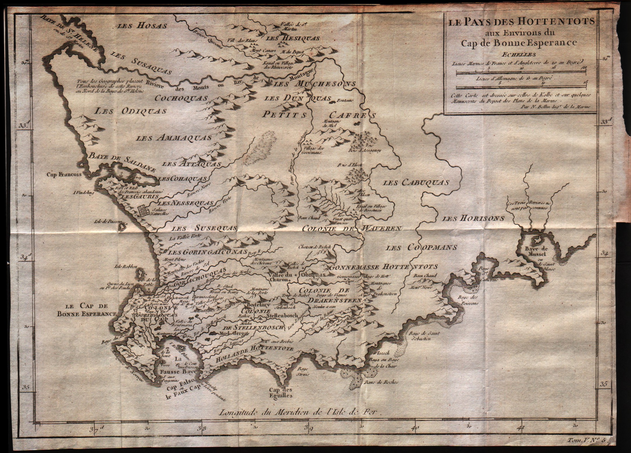
Le pays des Hottentots aux environs du Cap de Bonne Esperance
Bellin · -- · 1757
- Edition place
- Paris
- Editor
- --
- Atlas
- Historie General des Voyages -- Prevost
- State
- [mint/excellent/VERY GOOD/good/fair/mediocre/poor]
- Color
- Black/white
- Verso
- Blank
- Size
- Plate: cm (33 × 26.7) in (12.99 × 10.51) · Paper: cm (35.6 × 26.7) in (14.02 × 10.51)
- Technique
- Copper engraving
- Note
- No particular notes for this maps
- Reference
- --
- In stock
- Available
- Code
- #0307
Tap the map to enlarge · scroll when zoomed · pinch to zoom on phone
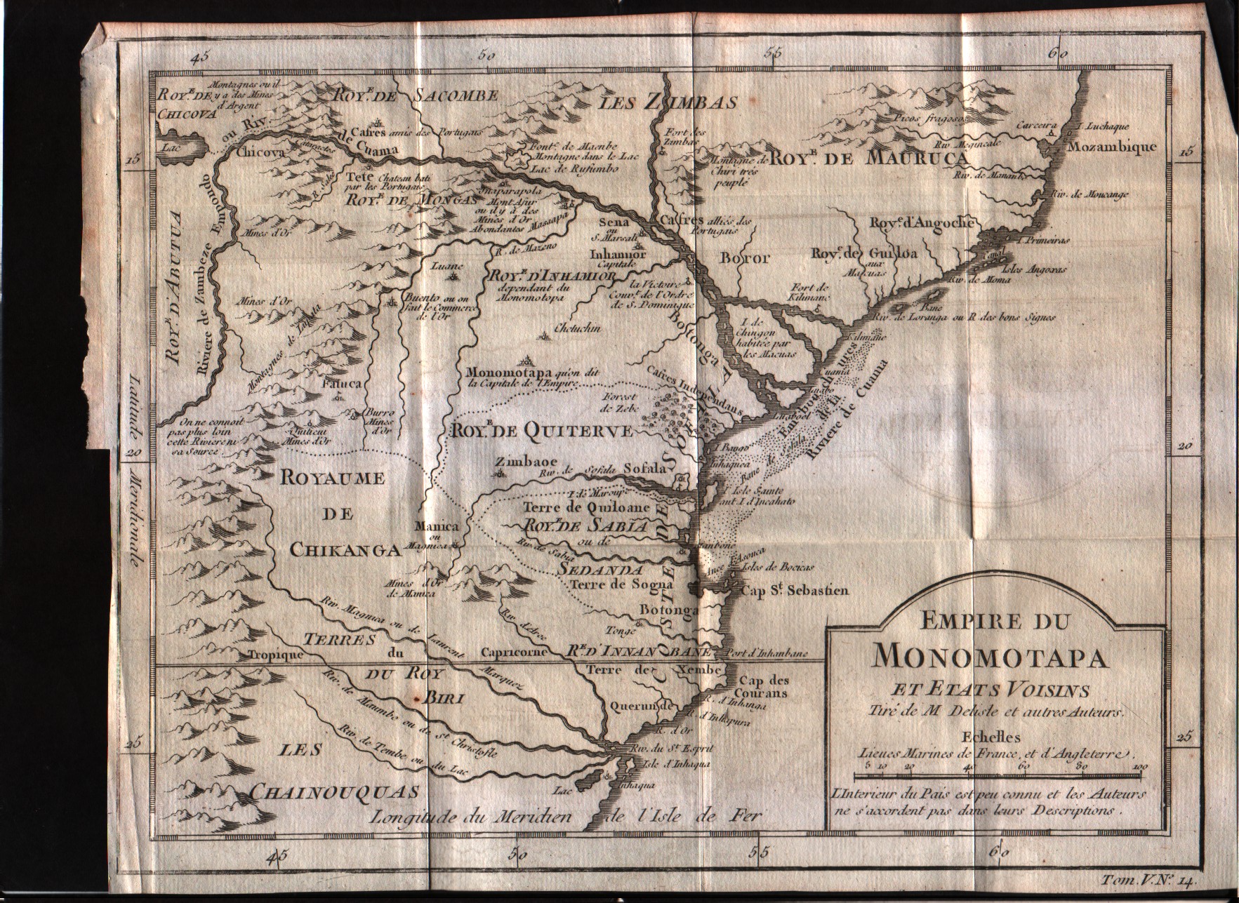
Empire du Monomotapa et etas voisins
Bellin · -- · 1757
- Edition place
- Paris
- Editor
- --
- Atlas
- Historie General des Voyages -- Prevost
- State
- [mint/excellent/VERY GOOD/good/fair/mediocre/poor]
- Color
- Black/white
- Verso
- Blank
- Size
- Plate: cm (25.4 × 20.3) in (10 × 7.99) · Paper: cm (27.9 × 21.6) in (10.98 × 8.5)
- Technique
- Copper engraving
- Note
- No particular notes for this maps
- Reference
- --
- In stock
- Available
- Code
- #0313
Tap the map to enlarge · scroll when zoomed · pinch to zoom on phone
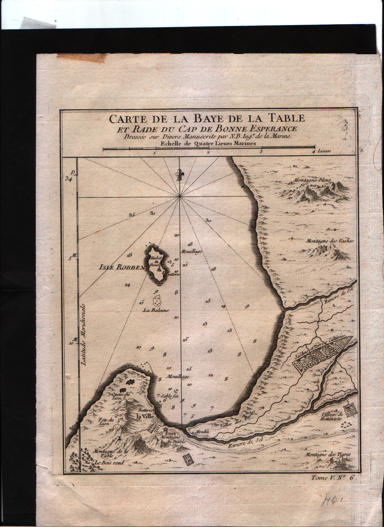
Carte de la baye de la table et rade du Cap de Bonne Esperance
Bellin · -- · 1757
- Edition place
- Paris
- Editor
- --
- Atlas
- Historie General des Voyages -- Prevost
- State
- [mint/excellent/VERY GOOD/good/fair/mediocre/poor]
- Color
- Black/white
- Verso
- Blank
- Size
- Plate: cm (16.5 × 21.6) in (6.5 × 8.5) · Paper: cm (17.8 × 22.9) in (7.01 × 9.02)
- Technique
- Copper engraving
- Note
- No particular notes for this maps
- Reference
- --
- In stock
- Sold
- Code
- #0314
Tap the map to enlarge · scroll when zoomed · pinch to zoom on phone
Plan du Fort et de la Ville du Cap de Bonne Esperance
Bellin · -- · 1757
- Edition place
- Paris
- Editor
- --
- Atlas
- Historie General des Voyages -- Prevost
- State
- [mint/excellent/VERY GOOD/good/fair/mediocre/poor]
- Color
- Black/white
- Verso
- Blank
- Size
- Plate: cm (26.7 × 21.6) in (10.51 × 8.5) · Paper: cm (27.9 × 22.9) in (10.98 × 9.02)
- Technique
- Copper engraving
- Note
- No particular notes for this maps
- Reference
- --
- In stock
- Sold
- Code
- #0315
Tap the map to enlarge · scroll when zoomed · pinch to zoom on phone
Plan du Fort et de la Ville du Cap de Bonne Esperance
Bellin · -- · 1757
- Edition place
- Paris
- Editor
- --
- Atlas
- Historie General des Voyages -- Prevost
- State
- [mint/excellent/VERY GOOD/good/fair/mediocre/poor]
- Color
- Black/white
- Verso
- Blank
- Size
- Plate: cm (26.7 × 21.6) in (10.51 × 8.5) · Paper: cm (27.9 × 22.9) in (10.98 × 9.02)
- Technique
- Copper engraving
- Note
- No particular notes for this maps
- Reference
- --
- In stock
- Sold
- Code
- #0316
Tap the map to enlarge · scroll when zoomed · pinch to zoom on phone
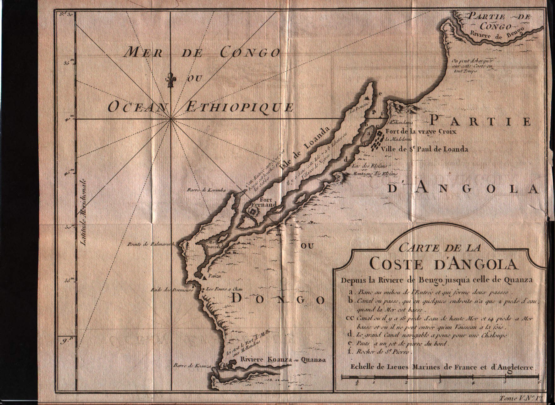
Carte de la Coste d'Angola
Bellin · Angola · 1757
- Edition place
- Paris
- Editor
- --
- Atlas
- Historie General des Voyages -- Prevost
- State
- [mint/excellent/VERY GOOD/good/fair/mediocre/poor]
- Color
- Black/white
- Verso
- Blank
- Size
- Plate: cm (26.7 × 20.3) in (10.51 × 7.99) · Paper: cm (27.9 × 22.9) in (10.98 × 9.02)
- Technique
- Copper engraving
- Note
- No particular notes for this maps
- Reference
- --
- In stock
- Available
- Code
- #0317
Tap the map to enlarge · scroll when zoomed · pinch to zoom on phone
Carte de la baye de la table et rade du Cap de Bonne Esperance
Bellin · -- · 1773
- Edition place
- Amsterdam
- Editor
- --
- Atlas
- Atlas Portatif -- E. van Harrevelt
- State
- [mint/EXCELLENT/very good/good/fair/mediocre/poor]
- Color
- Old colors
- Verso
- Blank
- Size
- Plate: cm (16.5 × 21.6) in (6.5 × 8.5) · Paper: cm (21.6 × 26.7) in (8.5 × 10.51)
- Technique
- Copper engraving
- Note
- No particular notes for this maps
- Reference
- --
- In stock
- Sold
- Code
- #0326
Tap the map to enlarge · scroll when zoomed · pinch to zoom on phone