South East
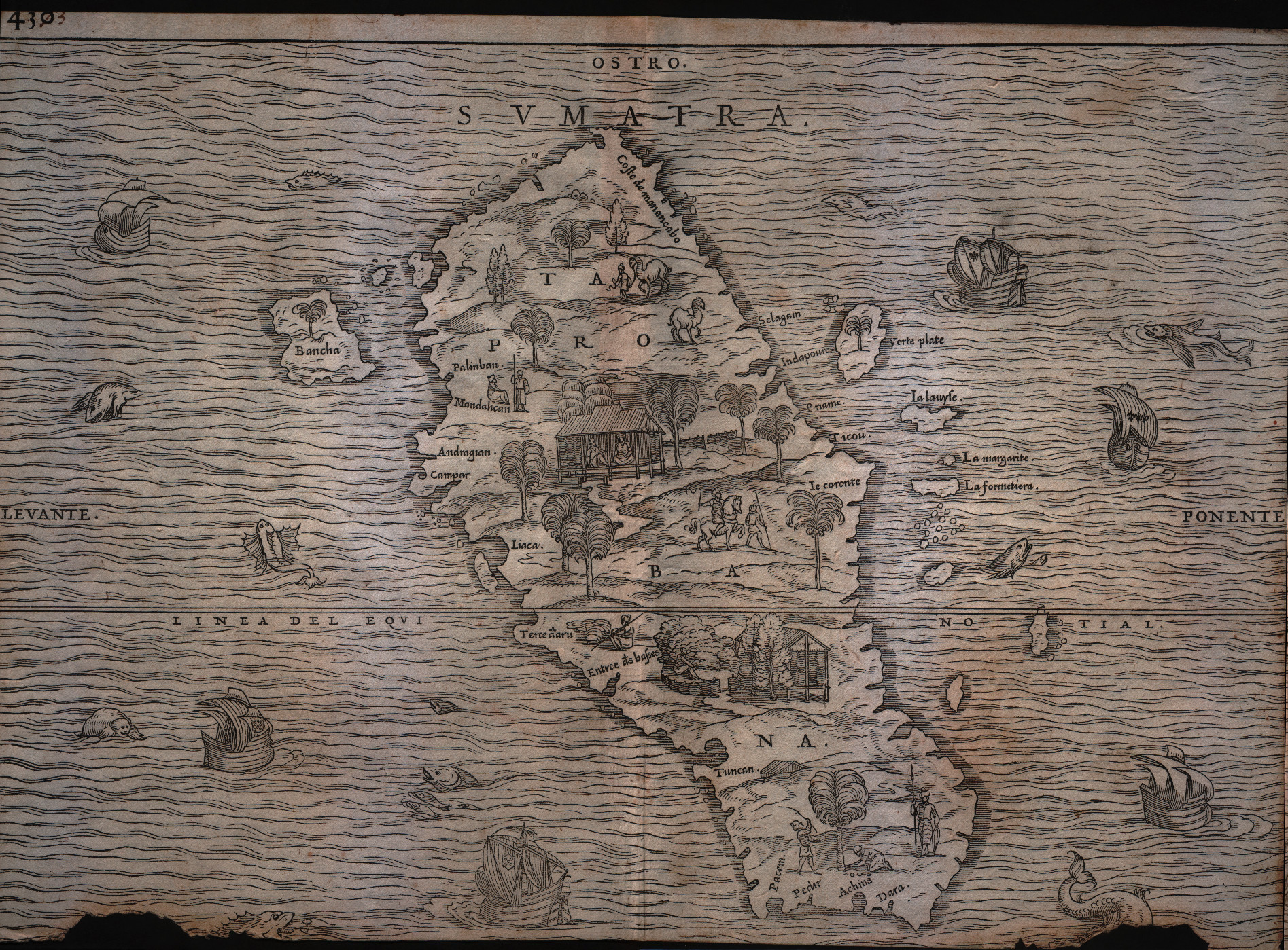
Map title
Sumatra
Author
Gastaldi
Location shown in map
Sumatra
Edition date
1613
Edition place
Venice
Editor
Giambattista Ramusio
Atlas
Delle navigazioni e viaggi
Price
Please ask: info@thetreasuremaps.com
State
[mint/excellent/very good/good/FAIR/mediocre/poor]
Color
Black/white
Verso
pag.430
Size
Plate: cm (36.8 x 26.7) inches (14.49 x 10.51) Paper: cm (36.8 x 26.7) inches (14.49 x 10.51)
Technique
Woodcut
Note
Decorated with sea monsters and sailing ships.
Reference
--
Wiki
Here for more info
In stock
Available
Info
info@thetreasuremaps.com
Code
#0179
Sumatra
Author
Gastaldi
Location shown in map
Sumatra
Edition date
1613
Edition place
Venice
Editor
Giambattista Ramusio
Atlas
Delle navigazioni e viaggi
Price
Please ask: info@thetreasuremaps.com
State
[mint/excellent/very good/good/FAIR/mediocre/poor]
Color
Black/white
Verso
pag.430
Size
Plate: cm (36.8 x 26.7) inches (14.49 x 10.51) Paper: cm (36.8 x 26.7) inches (14.49 x 10.51)
Technique
Woodcut
Note
Decorated with sea monsters and sailing ships.
Reference
--
Wiki
Here for more info
In stock
Available
Info
info@thetreasuremaps.com
Code
#0179
×
![Sumatra by Gastaldi, Sumatra, 1613]()
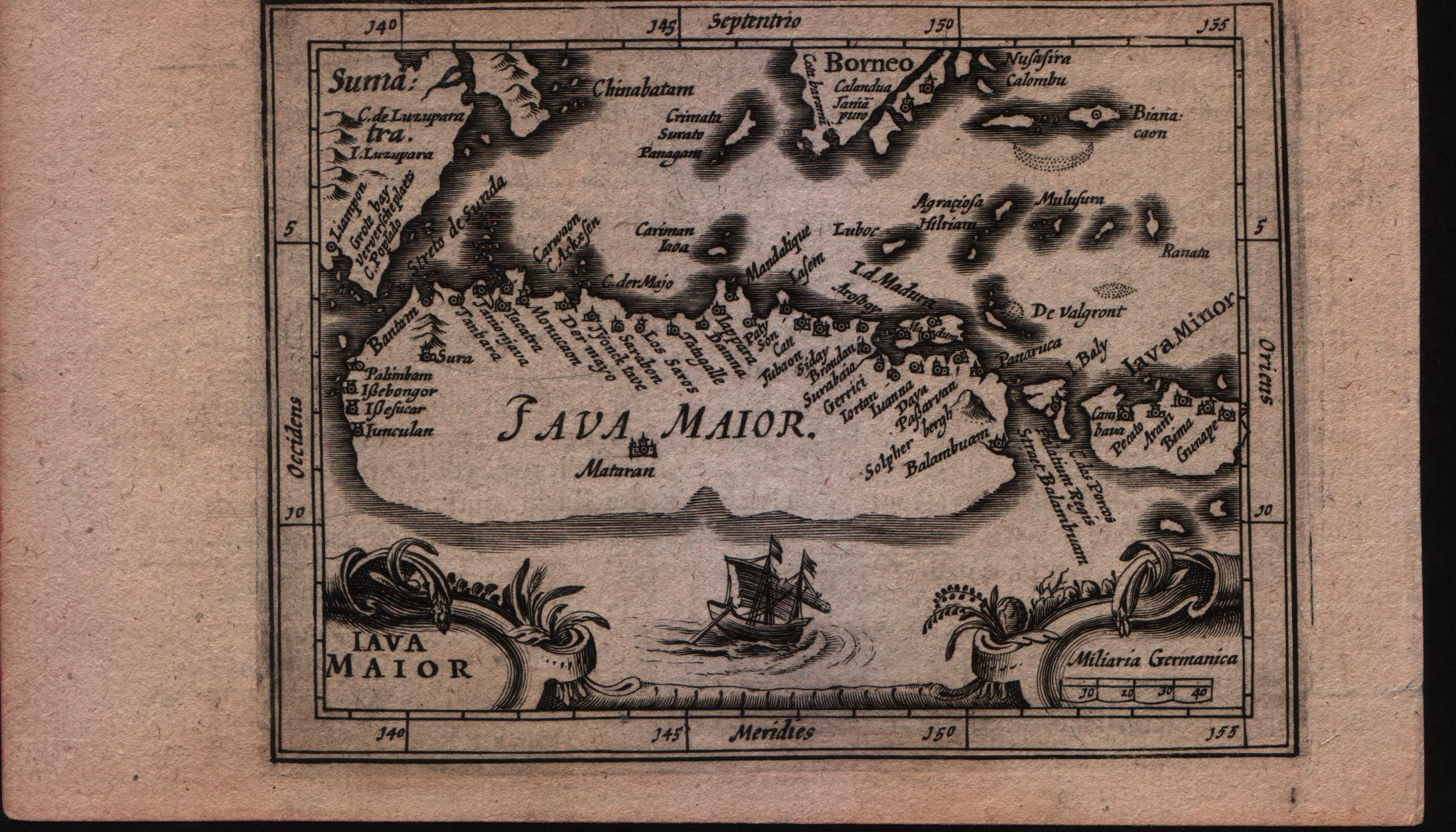
Map title
Description de Java
Author
Bertius
Location shown in map
Java Maior
Edition date
1617
Edition place
Amsterdam
Editor
Jodocus Hondius
Atlas
Tabularum geographicarum contractarum
Price
Please ask: info@thetreasuremaps.com
State
[MINT/excellent/very good/good/fair/mediocre/poor]
Color
Black/white
Verso
French text pag 747
Size
Plate: cm (14 x 10.2) inches (5.51 x 4.02) Paper: cm (17.8 x 11.4) inches (7.01 x 4.49)
Technique
Copper engraving
Note
--
Reference
--
Wiki
Here for more info
In stock
Sold
Info
info@thetreasuremaps.com
Code
#0591
×
![Description de Java by Bertius, Java Maior, 1617]()
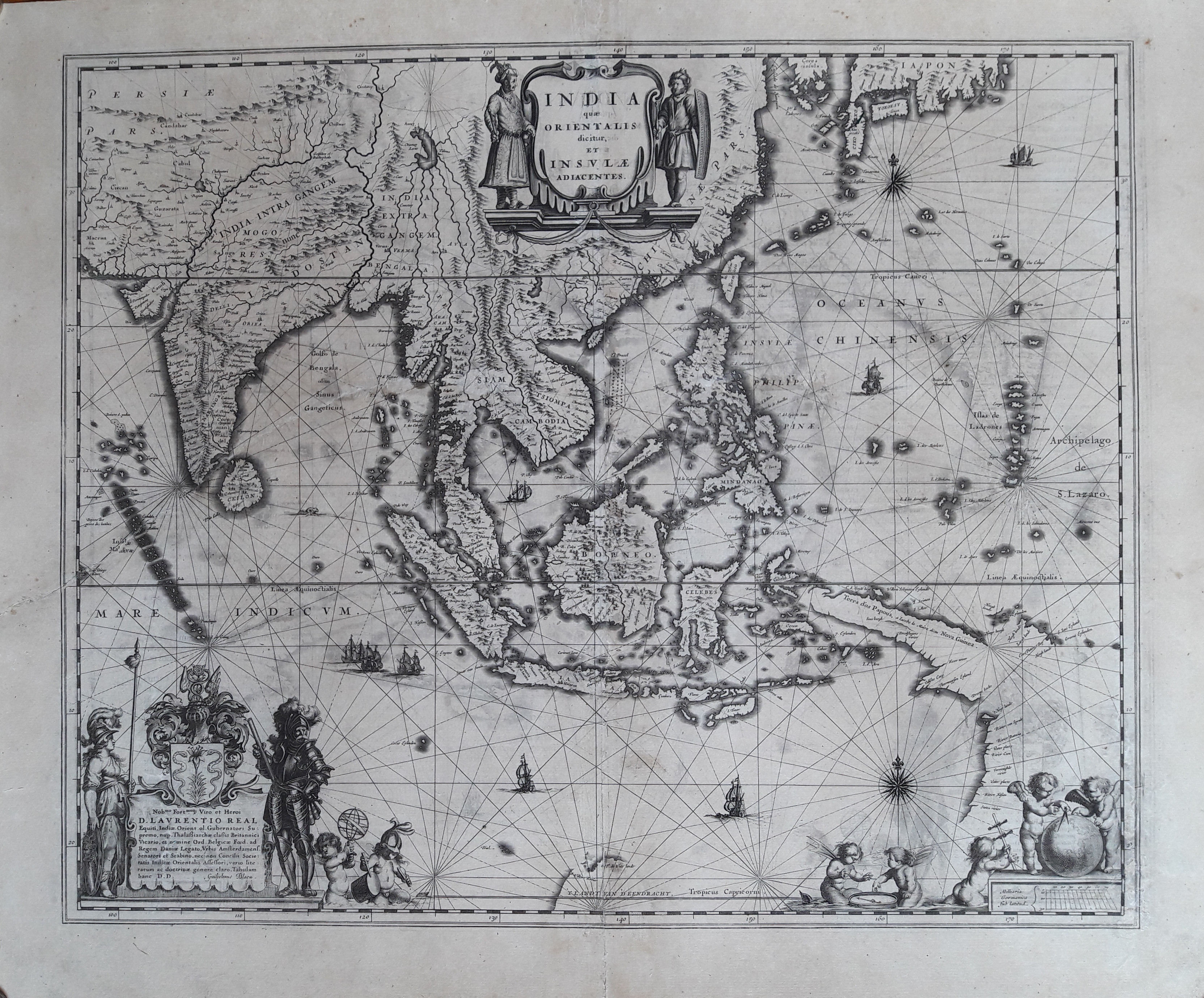
Map title
India que orientalis dicitur et insulae adiacentis
Author
Blaeu
Location shown in map
Southest Asia
Edition date
1635
Edition place
Amsterdam
Editor
--
Atlas
Theatrum Orbis Terrarum, Sive Atlas Novis
Price
1600 Euro
State
[mint/excellent/VERY GOOD/good/fair/mediocre/poor]
Color
Black/white
Verso
Latin text pag.2
Size
Plate: cm (50.8 x 40.6) inches (20 x 15.98) Paper: cm (58.4 x 45.7) inches (22.99 x 17.99)
Technique
Copper engraving
Note
Professionally restored
Reference
--
Wiki
Here for more info
In stock
Available
Info
info@thetreasuremaps.com
Code
#0212
×
![India que orientalis dicitur et insulae adiacentis by Blaeu, Southest Asia, 1635]()
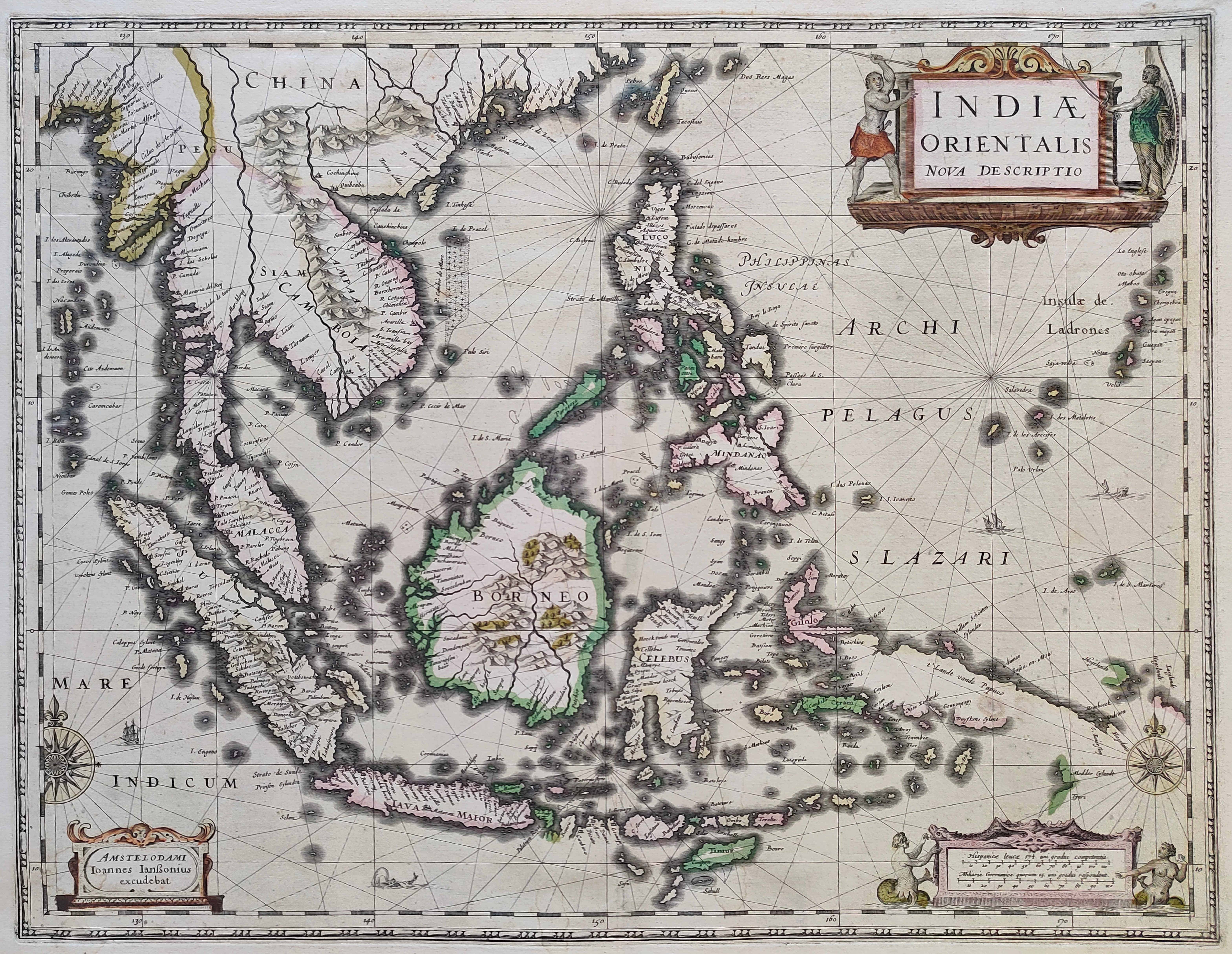
Map title
Indiae Orientalis Nova Descriptio
Author
Jansson
Location shown in map
Southest Asia
Edition date
Circa 1640
Edition place
Amsterdam
Editor
--
Atlas
Novus Atlas
Price
1300 Euro
State
[mint/EXCELLENT/very good/good/fair/mediocre/poor]
Color
Old colors
Verso
Franch text pag. 676
Size
Plate: cm (51 x 39) inches (20.08 x 15.35) Paper: cm (58 x 45) inches (22.83 x 17.72)
Technique
Copper engraving
Note
Reference
--
Wiki
Here for more info
In stock
Sold
Info
info@thetreasuremaps.com
Code
#1211
×
![Indiae Orientalis Nova Descriptio by Jansson, Southest Asia, Circa 1640]()
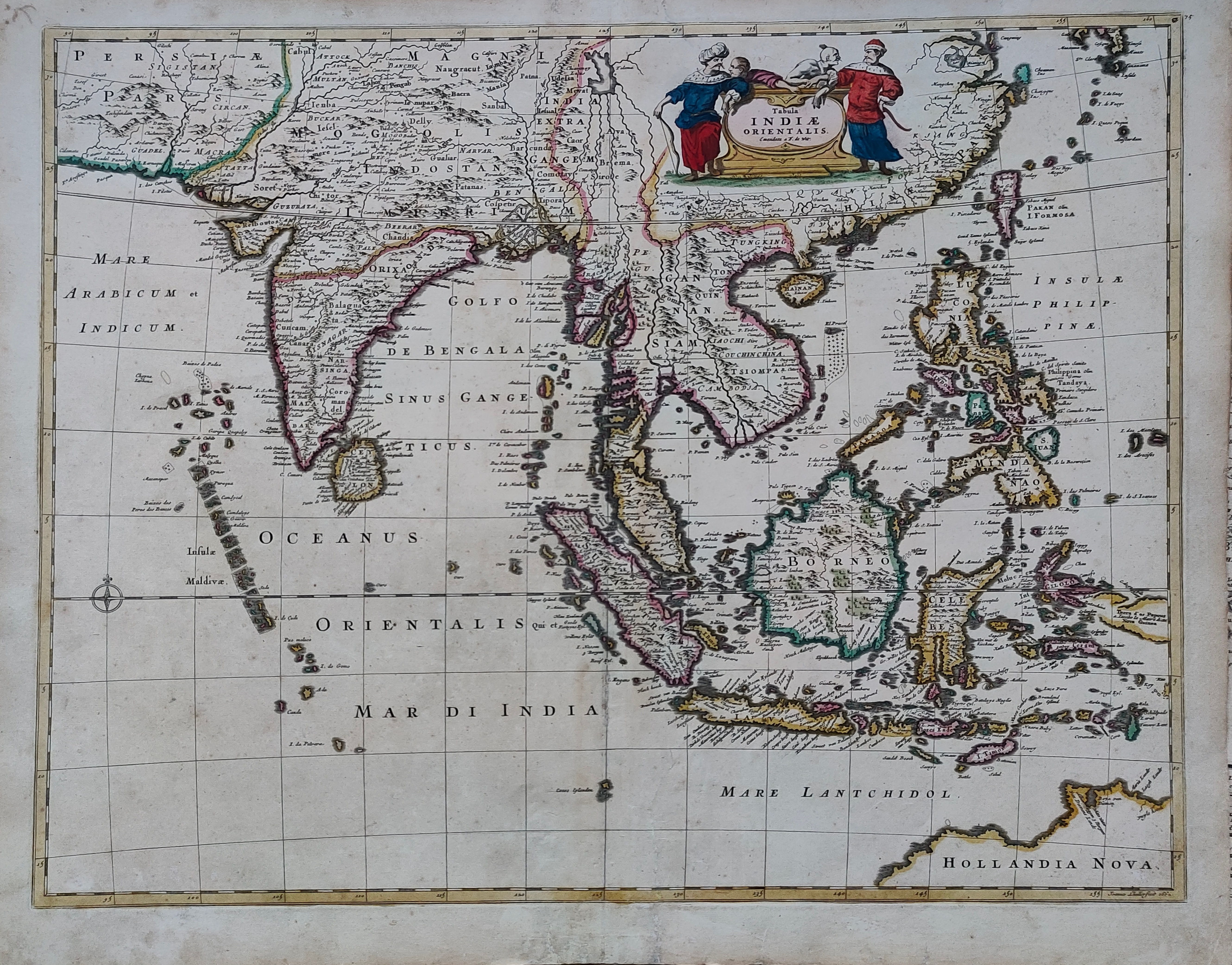
Map title
Tabula Indiae Orientalis
Author
De Witt
Location shown in map
South East
Edition date
Circa 1662
Edition place
Amsterdam
Editor
Atlas
Price
1200 Euro
State
[mint/EXCELLENT/very good/good/fair/mediocre/poor]
Color
Old colors
Verso
Blank
Size
Plate: cm (58 x 46) inches (22.83 x 18.11) Paper: cm (62 x 53) inches (24.41 x 20.87)
Technique
Copper engraving
Note
Reference
Wiki
Here for more info
In stock
Available
Info
info@thetreasuremaps.com
Code
#1261
×
![Tabula Indiae Orientalis by De Witt, South East, Circa 1662]()
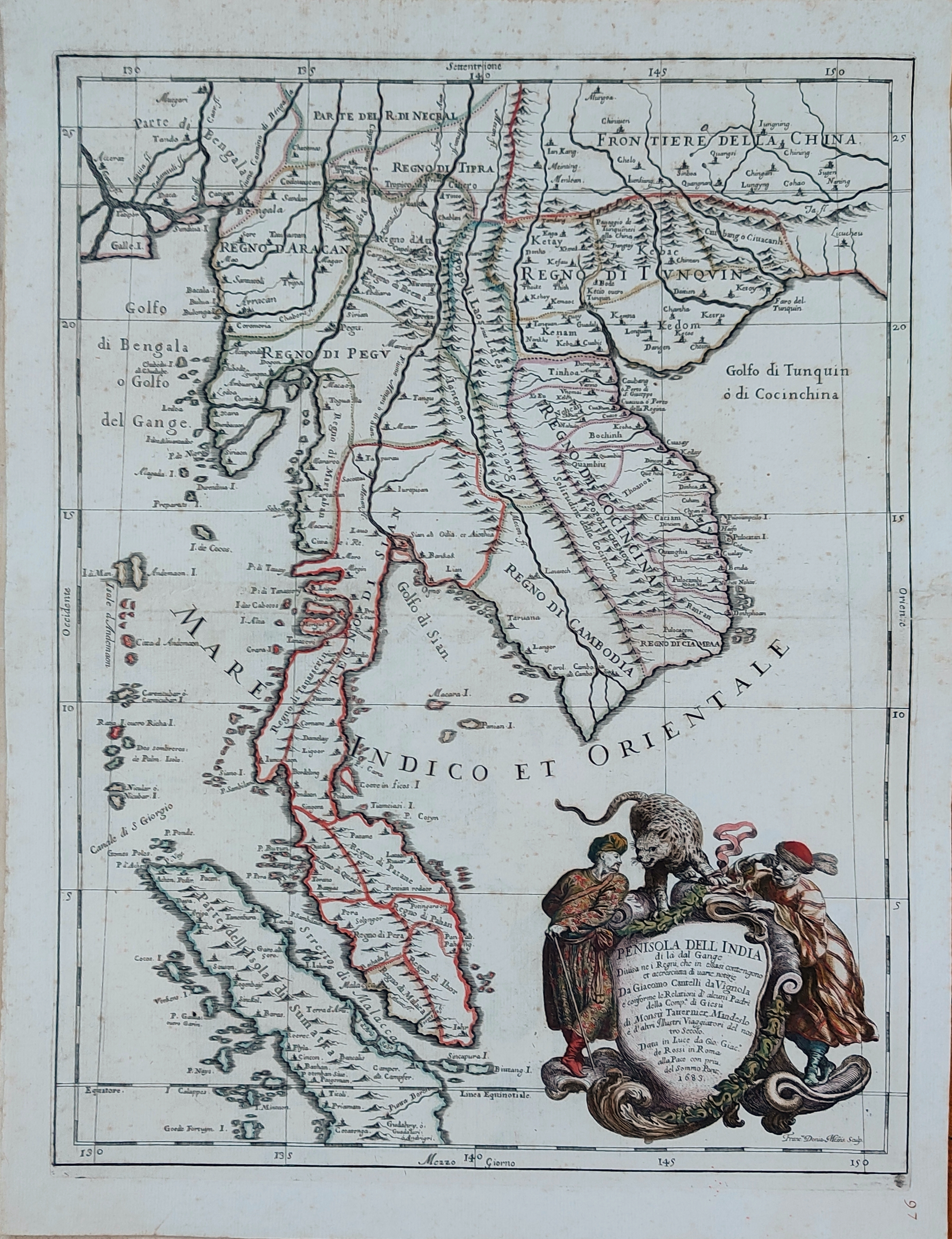
Map title
Penisola dell'India di la dal Gange
Author
Cantelli da Vignola
Location shown in map
Indonesia
Edition date
1689
Edition place
Rome
Editor
De Rossi
Atlas
Mercurio Geografico
Price
1300 Euro
State
[mint/EXCELLENT/very good/good/fair/mediocre/poor]
Color
Old colors
Verso
Blank
Size
Plate: cm (49 x 53) inches (19.29 x 20.87) Paper: cm (53 x 42) inches (20.87 x 16.54)
Technique
Copper engraving
Note
Reference
Wiki
Here for more info
In stock
Sold
Info
info@thetreasuremaps.com
Code
#1328
×
![Penisola dell'India di la dal Gange by Cantelli da Vignola, Indonesia, 1689]()
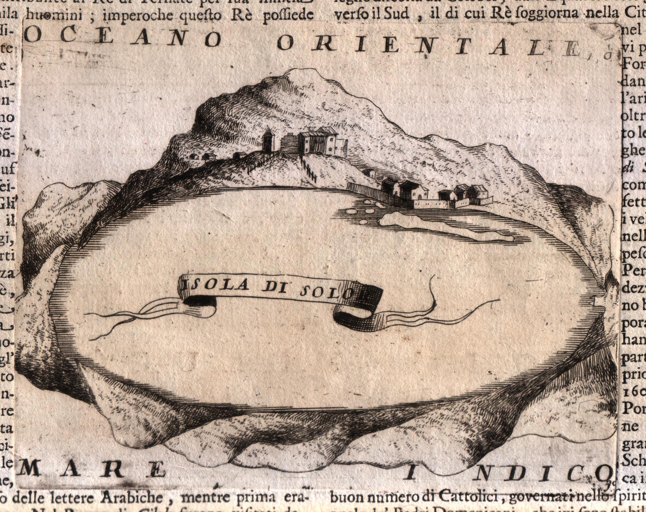
Map title
Isola di Solo
Author
Coronelli
Location shown in map
Sula island
Edition date
Circa 1696
Edition place
Venice
Editor
Coronelli
Atlas
Atlante veneto
Price
Please ask: info@thetreasuremaps.com
State
[MINT/excellent/very good/good/fair/mediocre/poor]
Color
Black/white
Verso
Italian text
Size
Plate: cm (17.8 x 14) inches (7.01 x 5.51) Paper: cm (50.8 x 35.6) inches (20 x 14.02)
Technique
Copper engraving
Note
No particular notes for this maps.
Reference
--
Wiki
Here for more info
In stock
Available
Info
info@thetreasuremaps.com
Code
#0572
×
![Isola di Solo by Coronelli, Sula island, Circa 1696]()
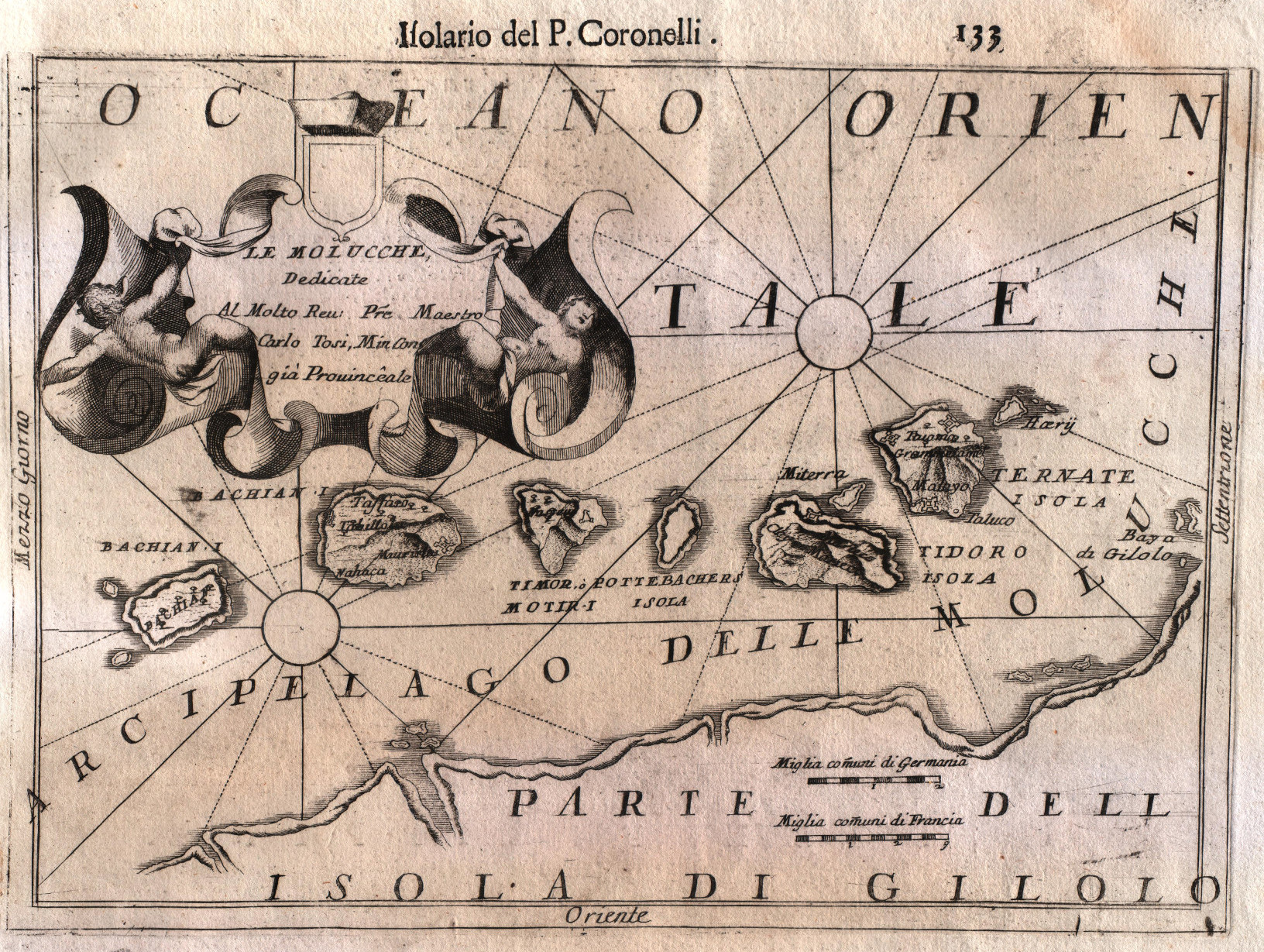
Map title
Arcipelago delle Molucche
Author
Coronelli
Location shown in map
Moluccas
Edition date
Circa 1696
Edition place
Venice
Editor
Coronelli
Atlas
Atlante veneto
Price
250 Euro
State
[MINT/excellent/very good/good/fair/mediocre/poor]
Color
Black/white
Verso
Italian text
Size
Plate: cm (30.5 x 22.9) inches (12.01 x 9.02) Paper: cm (50.8 x 35.6) inches (20 x 14.02)
Technique
Copper engraving
Note
No particular notes for this maps.
Reference
--
Wiki
Here for more info
In stock
Available
Info
info@thetreasuremaps.com
Code
#0573
×
![Arcipelago delle Molucche by Coronelli, Moluccas, Circa 1696]()
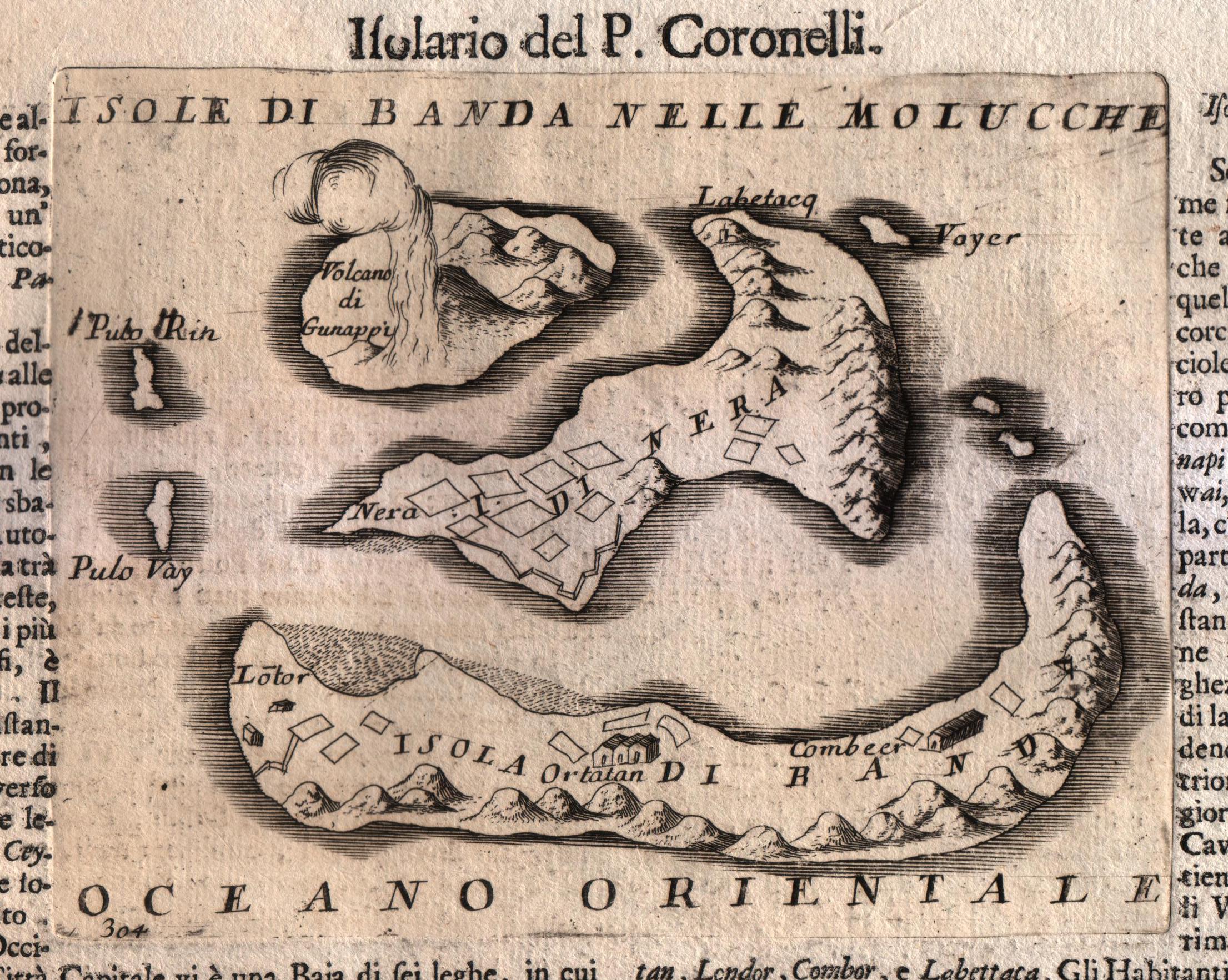
Map title
Isole di Banda nelle Molucche
Author
Coronelli
Location shown in map
Banda island
Edition date
Circa 1696
Edition place
Venice
Editor
Coronelli
Atlas
Atlante veneto
Price
250 Euro
State
[MINT/excellent/very good/good/fair/mediocre/poor]
Color
Black/white
Verso
Italian text
Size
Plate: cm (17.8 x 14) inches (7.01 x 5.51) Paper: cm (50.8 x 35.6) inches (20 x 14.02)
Technique
Copper engraving
Note
No particular notes for this maps.
Reference
--
Wiki
Here for more info
In stock
Available
Info
info@thetreasuremaps.com
Code
#0571
×
![Isole di Banda nelle Molucche by Coronelli, Banda island, Circa 1696]()
Map title
Indiae orientalis
Author
Cluver
Location shown in map
Southeast Asia
Edition date
1697
Edition place
Leiden
Editor
Atlas
Introductionis in Universam Geographiam ...
Price
200 Euro
State
[mint/EXCELLENT/very good/good/fair/mediocre/poor]
Color
Old colors
Verso
Blank
Size
Plate: cm (33 x 25) inches (12.99 x 9.84) Paper: cm (27 x 22) inches (10.63 x 8.66)
Technique
Copper engraving
Note
Reference
Wiki
Here for more info
In stock
Available
Info
info@thetreasuremaps.com
Code
#0865
×
![Indiae orientalis by Cluver, Southeast Asia, 1697]()
Map title
Le Royaume de Siam
Author
Mortier
Location shown in map
South East
Edition date
Circa 1700
Edition place
Amsterdam
Editor
Atlas
Price
2000 Euro
State
[mint/EXCELLENT/very good/good/fair/mediocre/poor]
Color
Old colors
Verso
Blank
Size
Plate: cm (56 x 78) inches (22.05 x 30.71) Paper: cm (57 x 81) inches (22.44 x 31.89)
Technique
Copper engraving
Note
Reference
Wiki
Here for more info
In stock
Available
Info
info@thetreasuremaps.com
Code
#1276
×
![Le Royaume de Siam by Mortier, South East, Circa 1700]()
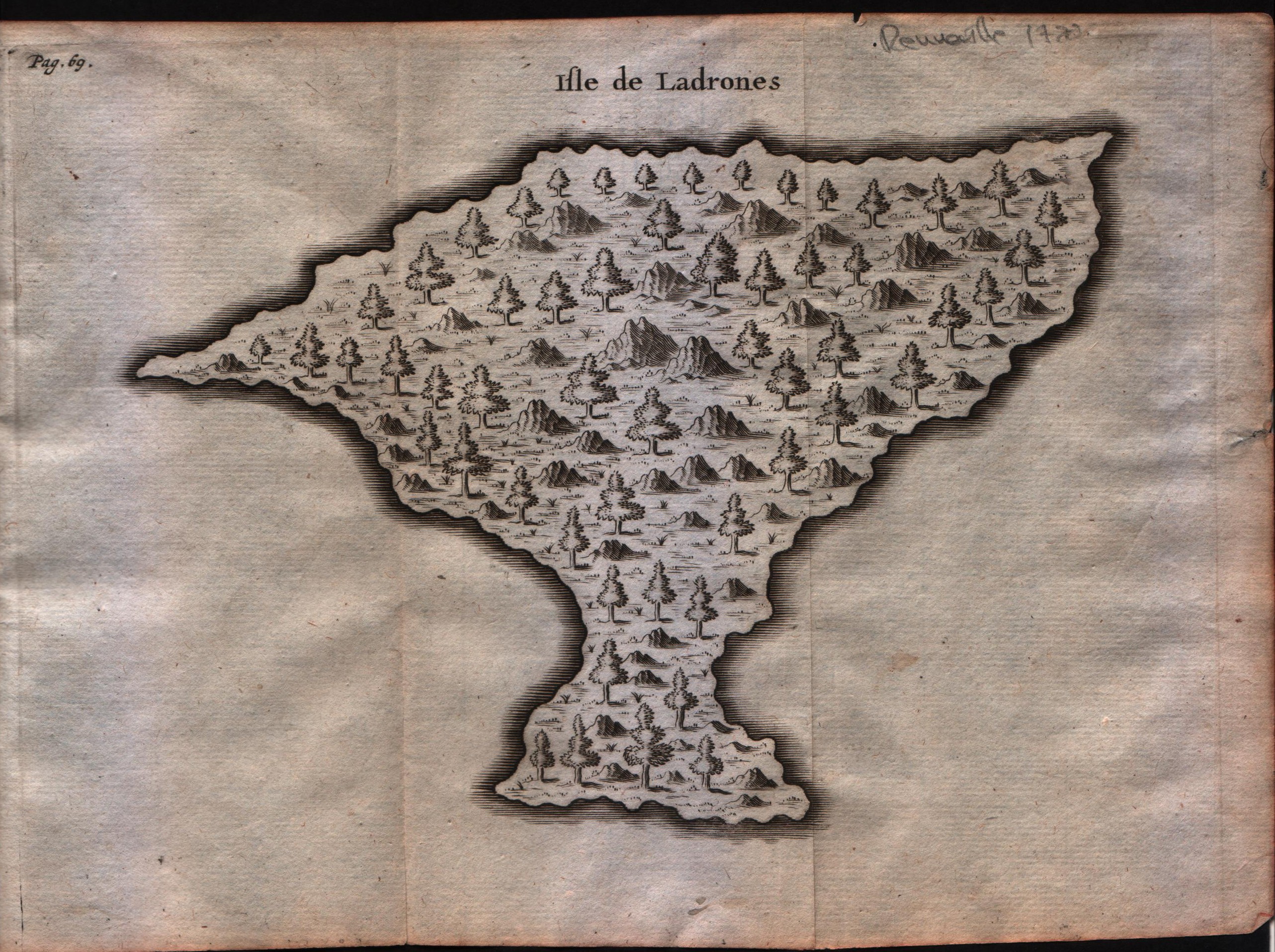
Map title
Isle de Ladrones
Author
Unknown
Location shown in map
Marianne island
Edition date
Circa 1722
Edition place
Amsterdam
Editor
F.Bernard
Atlas
Recueil des voyages qui ont servi a ...
Price
150 Euro
State
[MINT/excellent/very good/good/fair/mediocre/poor]
Color
Black/white
Verso
Blank
Size
Plate: cm (20.3 x 15.2) inches (7.99 x 5.98) Paper: cm (22.9 x 15.2) inches (9.02 x 5.98)
Technique
Copper engraving
Note
--
Reference
--
Wiki
Here for more info
In stock
Available
Info
info@thetreasuremaps.com
Code
#0593
×
![Isle de Ladrones by Unknown, Marianne island, Circa 1722]()
Map title
Isles Moluques
Author
Le Rouge
Location shown in map
--
Edition date
1748
Edition place
Paris
Editor
--
Atlas
Atlas Nouveau Portatif l'usage des militaries et du voyageur
Price
125 Euro
State
[mint/excellent/VERY GOOD/good/fair/mediocre/poor]
Color
Black/white
Verso
Blank
Size
Plate: cm (26.7 x 20.3) inches (10.51 x 7.99) Paper: cm (34.9 x 24.1) inches (13.74 x 9.49)
Technique
Copper engraving
Note
A map depicting European knowledge of Sulawesi, part of Borneo and the Spice Islands at the time of publication.
Reference
--
Wiki
Here for more info
In stock
Available
Info
info@thetreasuremaps.com
Code
#0276
×
![Isles Moluques by Le Rouge, --, 1748]()
Map title
Isles Moluques
Author
Le Rouge
Location shown in map
--
Edition date
1748
Edition place
Paris
Editor
--
Atlas
Atlas Nouveau Portatif l'usage des militaries et du voyageur
Price
125 Euro
State
[mint/EXCELLENT/very good/good/fair/mediocre/poor]
Color
Old colors
Verso
Blank
Size
Plate: cm (26.7 x 20.3) inches (10.51 x 7.99) Paper: cm (34.9 x 24.1) inches (13.74 x 9.49)
Technique
Copper engraving
Note
A map depicting European knowledge of Sulawesi, part of Borneo and the Spice Islands at the time of publication.
Reference
--
Wiki
Here for more info
In stock
Available
Info
info@thetreasuremaps.com
Code
#1152
×
![Isles Moluques by Le Rouge, --, 1748]()
Map title
Suite de l'Ocean Oriental
Author
Bellin
Location shown in map
Inde
Edition date
1757
Edition place
Paris
Editor
--
Atlas
Historie General des Voyages -- Prevost
Price
250 Euro
State
[mint/EXCELLENT/very good/good/fair/mediocre/poor]
Color
Black/white
Verso
Blank
Size
Plate: cm (30.5 x 29.2) inches (12.01 x 11.5) Paper: cm (35.6 x 33) inches (14.02 x 12.99)
Technique
Copper engraving
Note
No particular notes for this maps
Reference
--
Wiki
Here for more info
In stock
Available
Info
info@thetreasuremaps.com
Code
#0548
×
![Suite de l'Ocean Oriental by Bellin, Inde, 1757]()
Map title
Carte particulier des isles Moluques
Author
Bellin
Location shown in map
Moluccas
Edition date
1757
Edition place
Paris
Editor
--
Atlas
Historie General des Voyages -- Prevost
Price
Please ask: info@thetreasuremaps.com
State
[mint/EXCELLENT/very good/good/fair/mediocre/poor]
Color
Black/white
Verso
Blank
Size
Plate: cm (15.2 x 21.6) inches (5.98 x 8.5) Paper: cm (16.5 x 22.9) inches (6.5 x 9.02)
Technique
Copper engraving
Note
No particular notes for this maps
Reference
--
Wiki
Here for more info
In stock
Available
Info
info@thetreasuremaps.com
Code
#0228
×
![Carte particulier des isles Moluques by Bellin, Moluccas, 1757]()
Map title
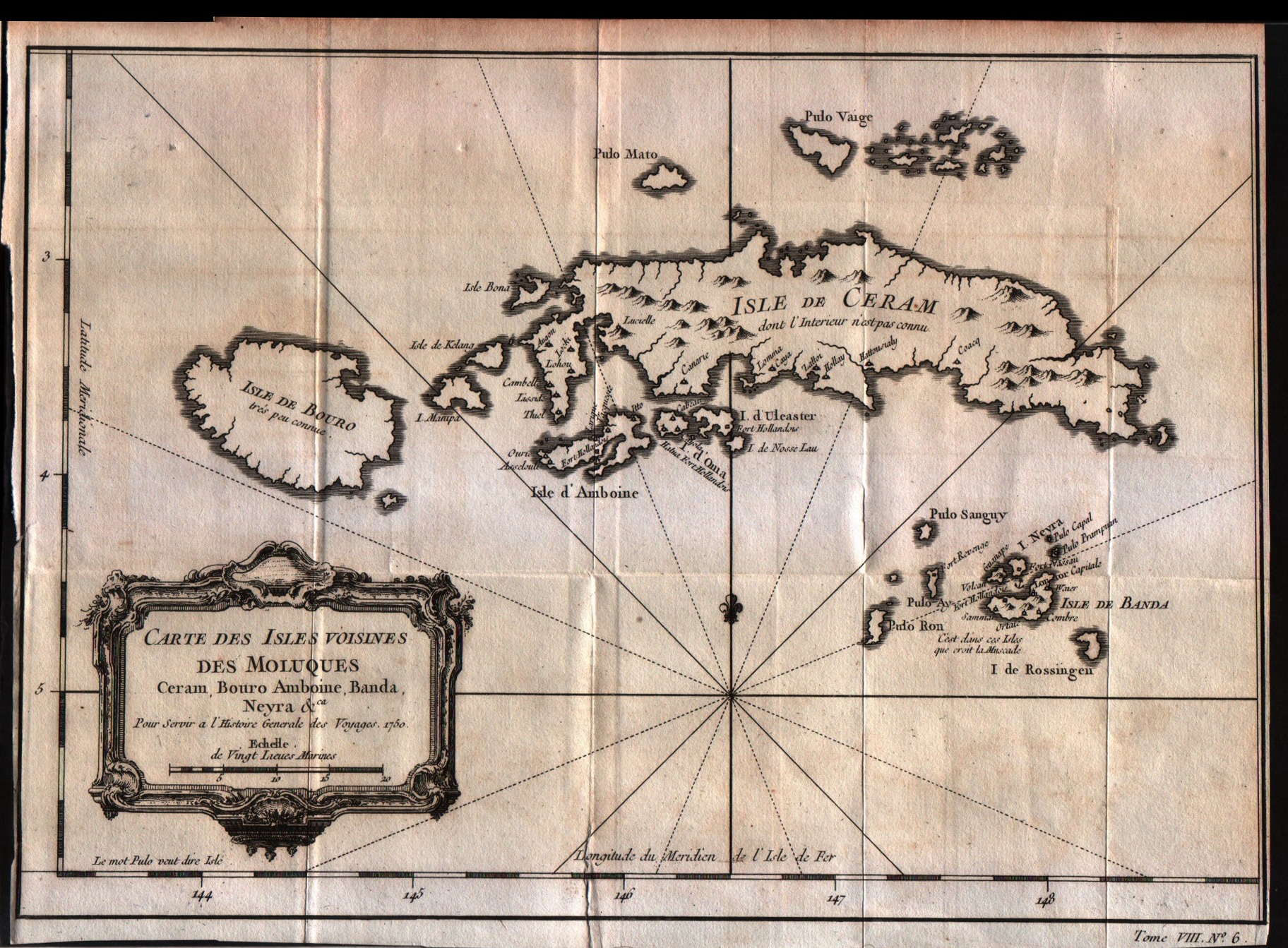
Carte des isles voisines des Moluques Ceram,Bouro,Amboine,Banda Neyra
Author
Bellin
Location shown in map
Ceram
Edition date
1757
Edition place
Paris
Editor
--
Atlas
Historie General des Voyages -- Prevost
Price
125 Euro
State
[mint/EXCELLENT/very good/good/fair/mediocre/poor]
Color
Black/white
Verso
Blank
Size
Plate: cm (29.2 x 20.3) inches (11.5 x 7.99) Paper: cm (30.5 x 21.6) inches (12.01 x 8.5)
Technique
Copper engraving
Note
No particular notes for this maps
Reference
--
Wiki
Here for more info
In stock
Available
Info
info@thetreasuremaps.com
Code
#0230
×
![Carte des isles voisines des Moluques Ceram,Bouro,Amboine,Banda Neyra by Bellin, Ceram, 1757]()
Map title
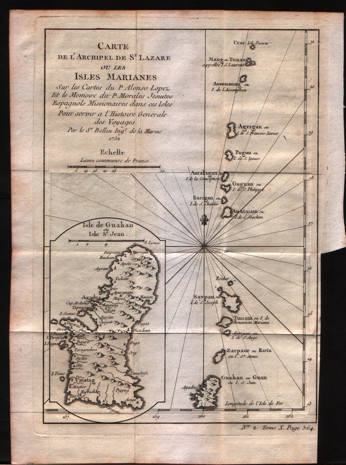
Carte de l'archipel de St.Lazare ou les isles Marianes
Author
Bellin
Location shown in map
Mariana Islands
Edition date
1757
Edition place
Paris
Editor
--
Atlas
Historie General des Voyages -- Prevost
Price
Please ask: info@thetreasuremaps.com
State
[mint/EXCELLENT/very good/good/fair/mediocre/poor]
Color
Black/white
Verso
Blank
Size
Plate: cm (15.2 x 22.9) inches (5.98 x 9.02) Paper: cm (17.8 x 25.4) inches (7.01 x 10)
Technique
Copper engraving
Note
No particular notes for this maps
Reference
--
Wiki
Here for more info
In stock
Available
Info
info@thetreasuremaps.com
Code
#0231
×
![Carte de l'archipel de St.Lazare ou les isles Marianes by Bellin, Mariana Islands, 1757]()
Map title
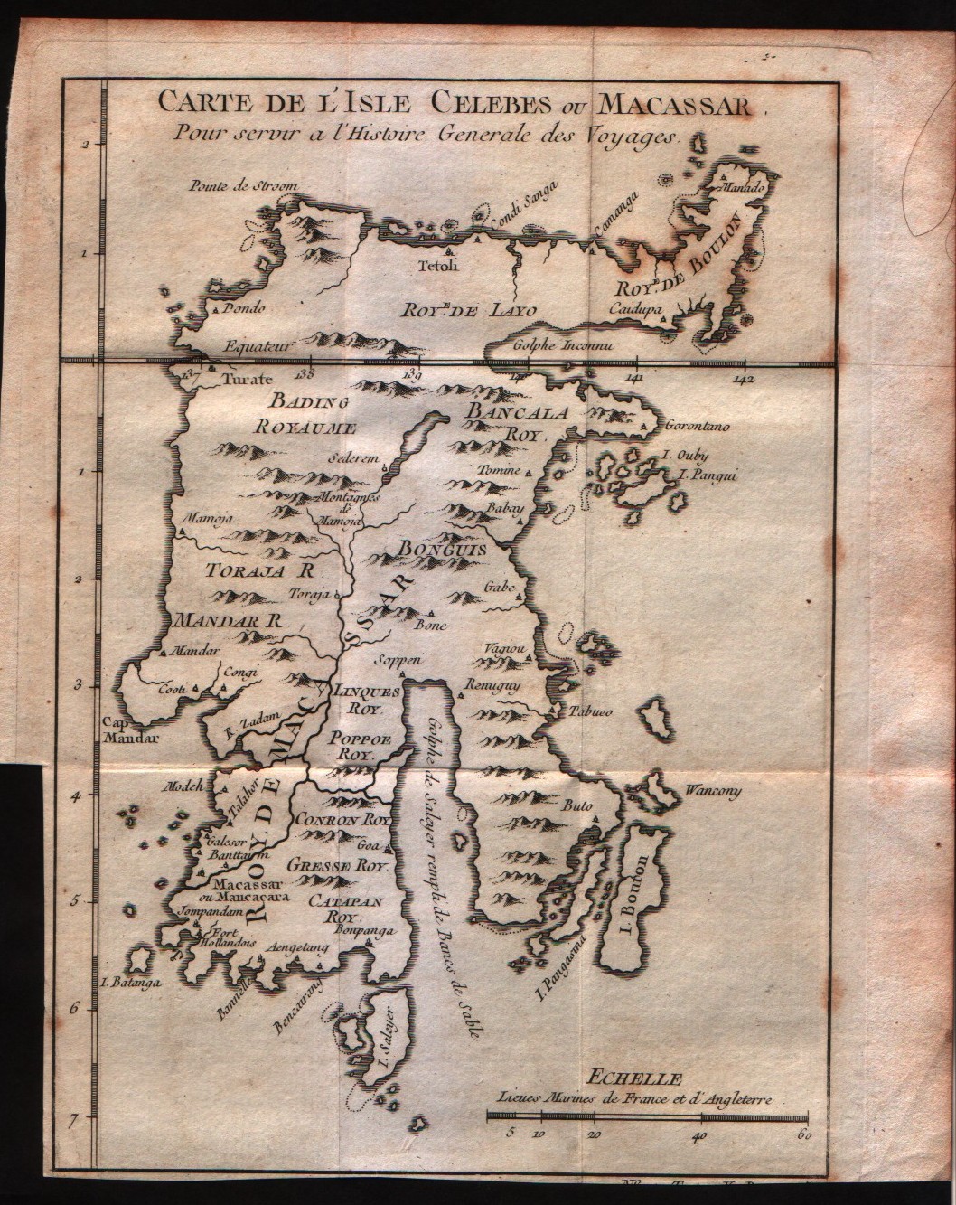
Carte de l'isle Celebes ou Macassar
Author
Bellin
Location shown in map
Celebes
Edition date
1757
Edition place
Paris
Editor
--
Atlas
Historie General des Voyages -- Prevost
Price
75 Euro
State
[mint/EXCELLENT/very good/good/fair/mediocre/poor]
Color
Black/white
Verso
Blank
Size
Plate: cm (15.2 x 19) inches (5.98 x 7.48) Paper: cm (17.8 x 21.6) inches (7.01 x 8.5)
Technique
Copper engraving
Note
No particular notes for this maps
Reference
--
Wiki
Here for more info
In stock
Available
Info
info@thetreasuremaps.com
Code
#0232
×
![Carte de l'isle Celebes ou Macassar by Bellin, Celebes, 1757]()
Map title
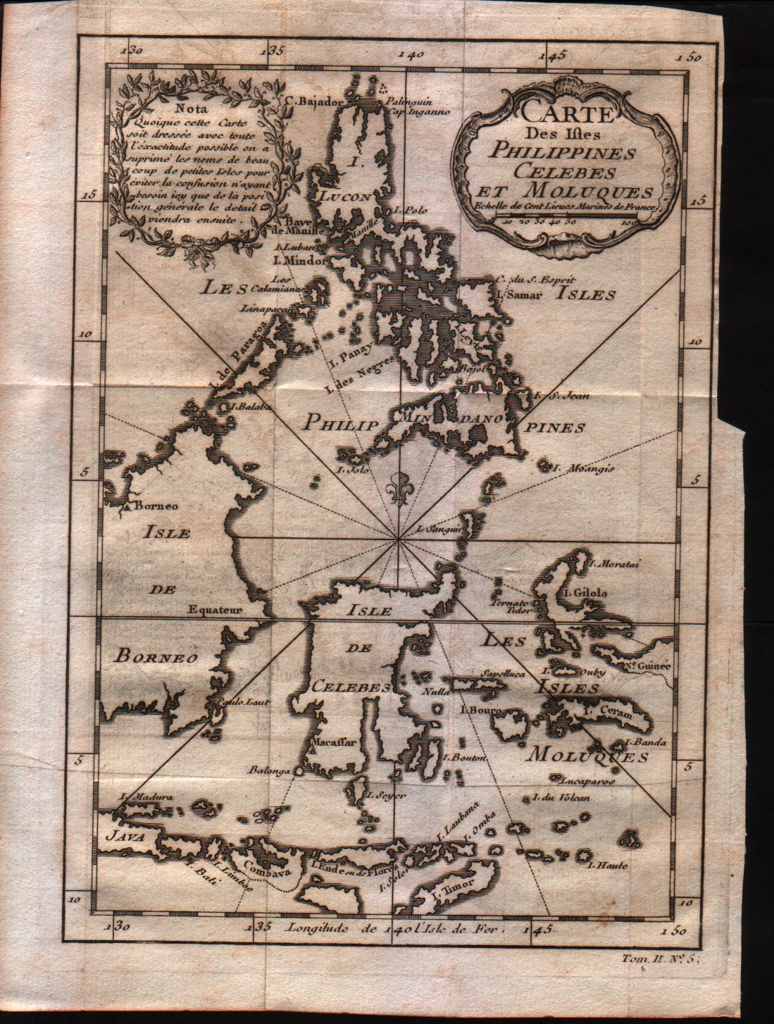
Carte des Isles Philippines Celebes et Moluques
Author
Bellin
Location shown in map
Philippines
Edition date
1757
Edition place
Paris
Editor
--
Atlas
Historie General des Voyages -- Prevost
Price
200 Euro
State
[mint/EXCELLENT/very good/good/fair/mediocre/poor]
Color
Black/white
Verso
Blank
Size
Plate: cm (15.2 x 21.6) inches (5.98 x 8.5) Paper: cm (17.8 x 25.4) inches (7.01 x 10)
Technique
Copper engraving
Note
No particular notes for this maps
Reference
--
Wiki
Here for more info
In stock
Available
Info
info@thetreasuremaps.com
Code
#0233
×
![Carte des Isles Philippines Celebes et Moluques by Bellin, Philippines , 1757]()