Spain-Portugal
Map title
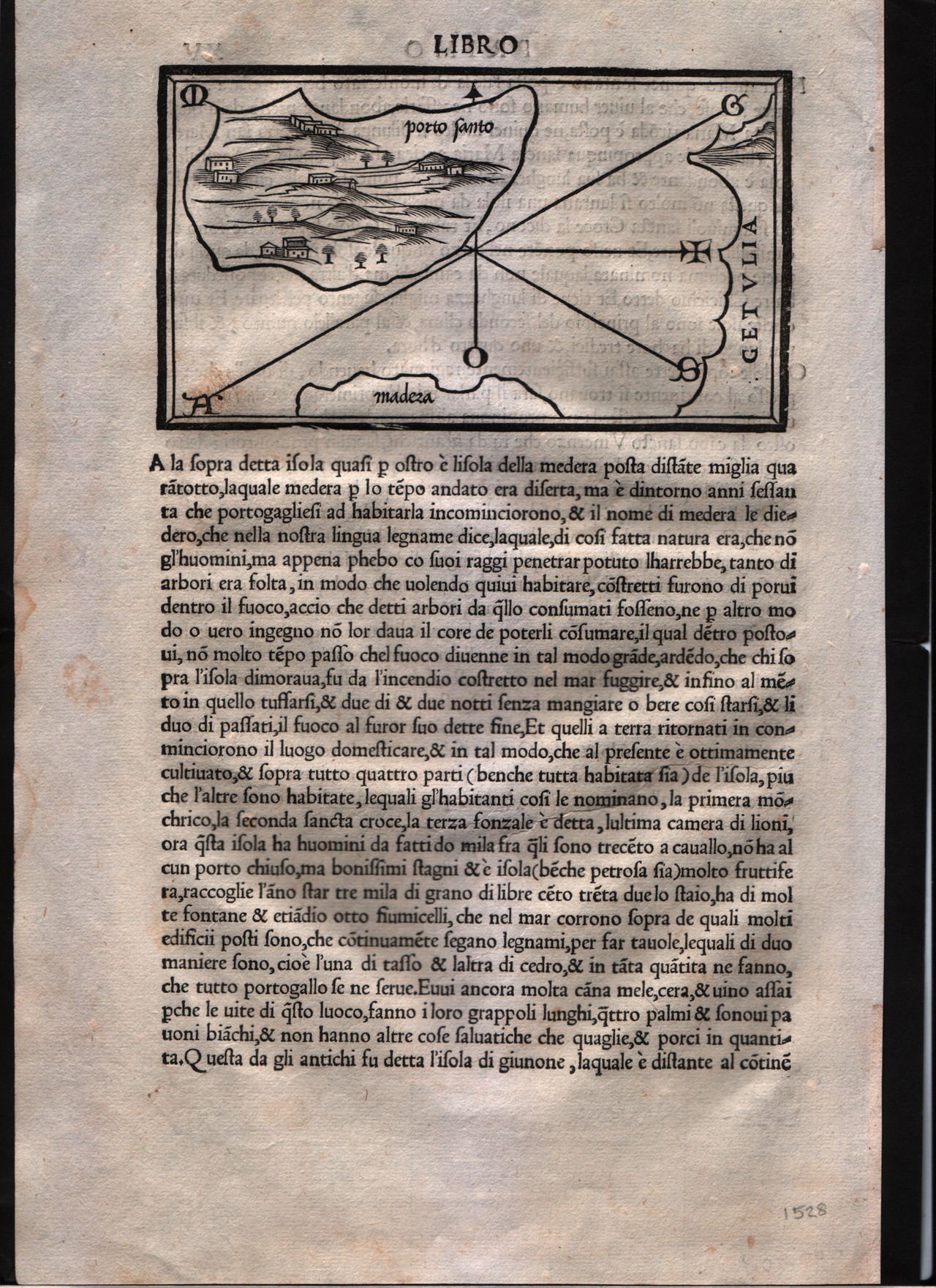
Porto Santo
Author
Bordone
Location shown in map
Madeira island
Edition date
1528
Edition place
Venice
Editor
Nicolò di Aristotile
Atlas
Isolario
Price
400 Euro
State
[mint/EXCELLENT/very good/good/fair/mediocre/poor]
Color
Black/white
Verso
Italian text pag.15
Size
Plate: cm (14 x 8.9) inches (5.51 x 3.5) Paper: cm (20.3 x 30.5) inches (7.99 x 12.01)
Technique
Woodcut
Note
--
Reference
--
Wiki
Here for more info
In stock
Available
Info
info@thetreasuremaps.com
Code
#0171
×
![Porto Santo by Bordone, Madeira island, 1528]()
Map title
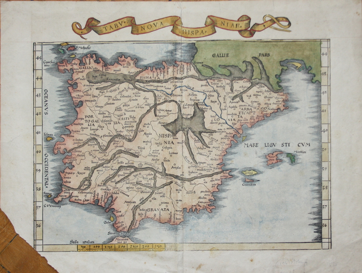
Tabv Nova Hispaniae
Author
Fries
Location shown in map
Spain
Edition date
1535
Edition place
Lyon
Editor
Melchior and Gaspar Trechsel
Atlas
Ptolemy's Geographia
Price
700 Euro
State
[mint/EXCELLENT/very good/good/fair/mediocre/poor] repaired
Color
Recent color
Verso
Blank
Size
Plate: cm (41.9 x 30.5) inches (16.5 x 12.01) Paper: cm (53.3 x 39.4) inches (20.98 x 15.51)
Technique
Woodcut
Note
Missing bottom left corner
Reference
--
Wiki
Here for more info
In stock
Available
Info
info@thetreasuremaps.com
Code
#0091
×
![Tabv Nova Hispaniae by Fries, Spain, 1535]()
Map title
--
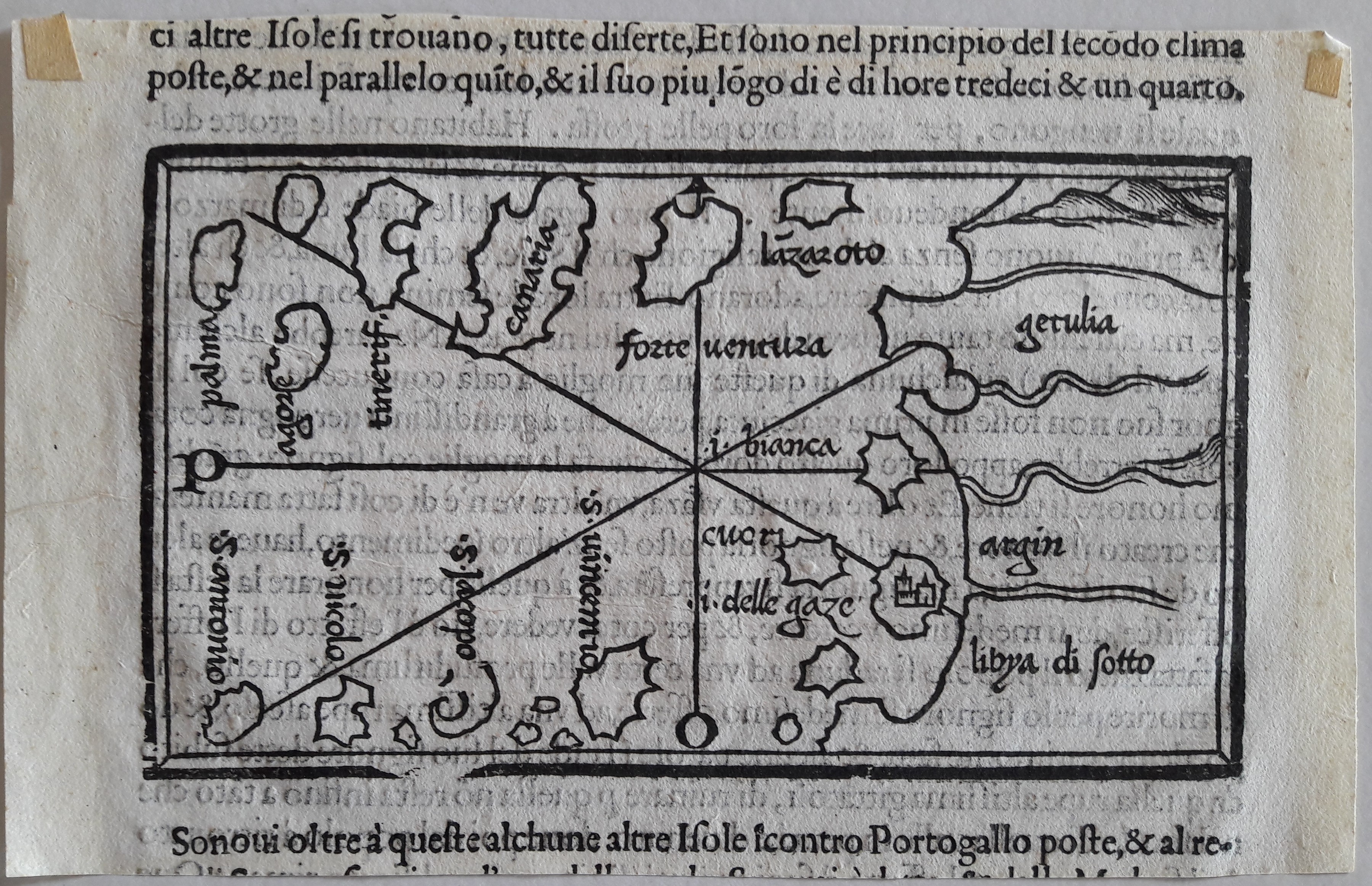
Author
Bordone
Location shown in map
Canary inslands
Edition date
Circa 1537
Edition place
Venice
Editor
Federico Torresano
Atlas
Isolario
Price
400 Euro
State
[mint/EXCELLENT/very good/good/fair/mediocre/poor]
Color
Black/white
Verso
Italian text pag.27
Size
Plate: cm (14 x 8.9) inches (5.51 x 3.5) Paper: cm (19 x 11) inches (7.48 x 4.33)
Technique
Woodcut
Note
--
Reference
--
Wiki
Here for more info
In stock
Available
Info
info@thetreasuremaps.com
Code
#0638
--
Author
Bordone
Location shown in map
Canary inslands
Edition date
Circa 1537
Edition place
Venice
Editor
Federico Torresano
Atlas
Isolario
Price
400 Euro
State
[mint/EXCELLENT/very good/good/fair/mediocre/poor]
Color
Black/white
Verso
Italian text pag.27
Size
Plate: cm (14 x 8.9) inches (5.51 x 3.5) Paper: cm (19 x 11) inches (7.48 x 4.33)
Technique
Woodcut
Note
--
Reference
--
Wiki
Here for more info
In stock
Available
Info
info@thetreasuremaps.com
Code
#0638
×
![-- by Bordone, Canary inslands, Circa 1537]()
Map title
--
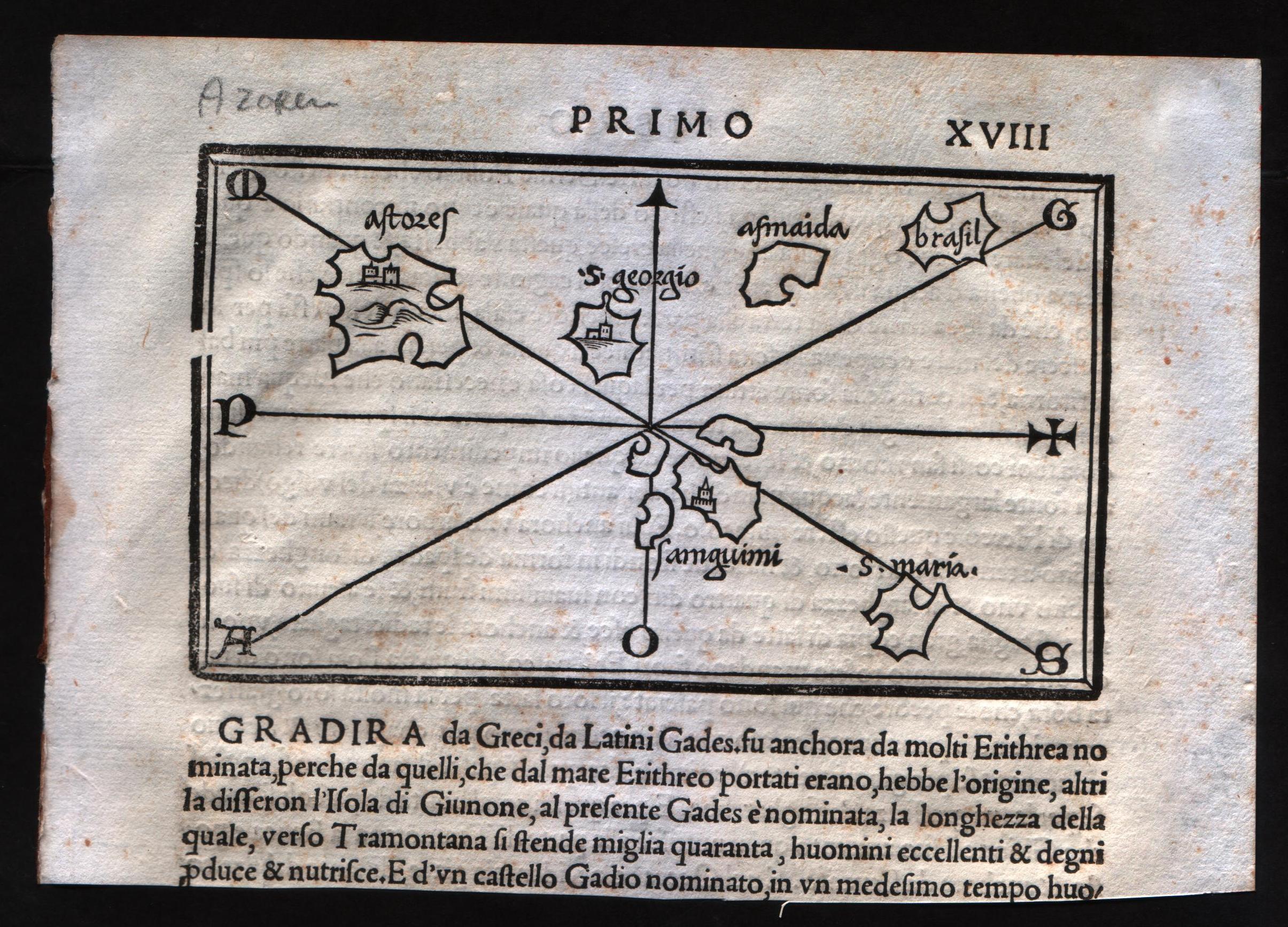
Author
Bordone
Location shown in map
Azores
Edition date
Circa 1537
Edition place
Venice
Editor
Nicolò di Aristotile
Atlas
Isolario
Price
400 Euro
State
[mint/EXCELLENT/very good/good/fair/mediocre/poor]
Color
Black/white
Verso
Italian text pag.18
Size
Plate: cm (14 x 8.9) inches (5.51 x 3.5) Paper: cm (19 x 14) inches (7.48 x 5.51)
Technique
Woodcut
Note
--
Reference
--
Wiki
Here for more info
In stock
Available
Info
info@thetreasuremaps.com
Code
#0579
--
Author
Bordone
Location shown in map
Azores
Edition date
Circa 1537
Edition place
Venice
Editor
Nicolò di Aristotile
Atlas
Isolario
Price
400 Euro
State
[mint/EXCELLENT/very good/good/fair/mediocre/poor]
Color
Black/white
Verso
Italian text pag.18
Size
Plate: cm (14 x 8.9) inches (5.51 x 3.5) Paper: cm (19 x 14) inches (7.48 x 5.51)
Technique
Woodcut
Note
--
Reference
--
Wiki
Here for more info
In stock
Available
Info
info@thetreasuremaps.com
Code
#0579
×
![-- by Bordone, Azores, Circa 1537]()

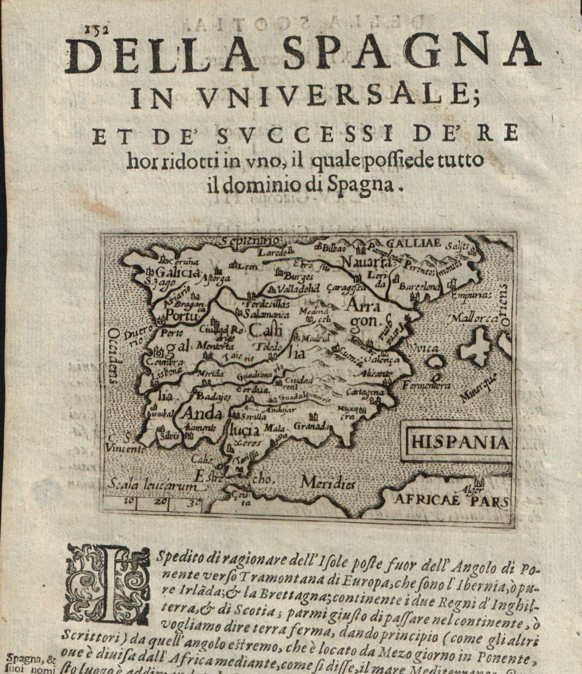
Map title
Hispania Nova Tabula
Author
Munster
Location shown in map
Spain
Edition date
1542
Edition place
Basel
Editor
Henrich Petri
Atlas
Geographia
Price
Please ask: info@thetreasuremaps.com
State
[mint/excellent/VERY GOOD/good/fair/mediocre/poor]
Color
Original colors
Verso
Latin text pag.31
Size
Plate: cm (34.3 x 25.4) inches (13.5 x 10) Paper: cm (38.1 x 30.5) inches (15 x 12.01)
Technique
Woodcut
Note
No particular notes for this maps
Reference
--
Wiki
Here for more info
In stock
Sold
Info
info@thetreasuremaps.com
Code
#0092
×
![Hispania Nova Tabula by Munster, Spain, 1542]()
Map title
Espaigne
Author
Munster
Location shown in map
Spain
Edition date
Circa 1552
Edition place
Basel
Editor
Henrich Petri
Atlas
Cosmographia Universalis
Price
125 Euro
State
[mint/EXCELLENT/very good/good/fair/mediocre/poor]
Color
Black/white
Verso
French text pag.60
Size
Plate: cm (13 x 8) inches (5.12 x 3.15) Paper: cm (20 x 31) inches (7.87 x 12.2)
Technique
Woodcut
Note
Reference
Wiki
Here for more info
In stock
Available
Info
info@thetreasuremaps.com
Code
#0955
×
![Espaigne by Munster, Spain, Circa 1552]()
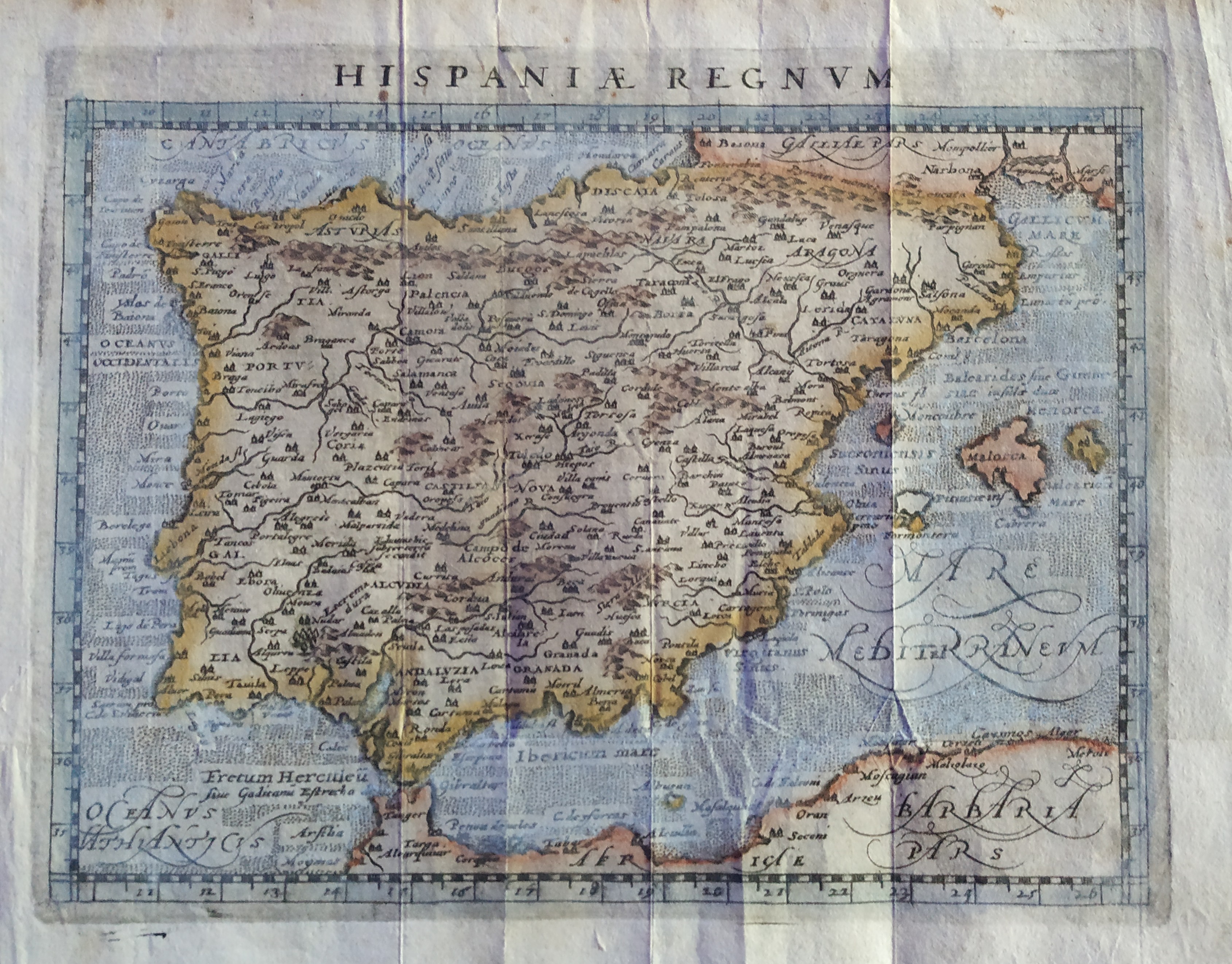
Map title
Hispania Regnum
Author
Magini
Location shown in map
Spain
Edition date
1597
Edition place
Colonia
Editor
Petrus Keschedt
Atlas
Geografia di Claudio Tolomeo -- Giovanni Antonio Magini
Price
Please ask: info@thetreasuremaps.com
State
[mint/excellent/VERY GOOD/good/fair/mediocre/poor]
Color
Old colors
Verso
Blank
Size
Plate: cm (17.8 x 12.7) inches (7.01 x 5) Paper: cm (20 x 16) inches (7.87 x 6.3)
Technique
Copper engraving
Note
Maps pirated from those of Girolamo Poro in Magini's edition.
Reference
--
Wiki
Here for more info
In stock
Available
Info
info@thetreasuremaps.com
Code
#0717
×
![Hispania Regnum by Magini, Spain, 1597]()
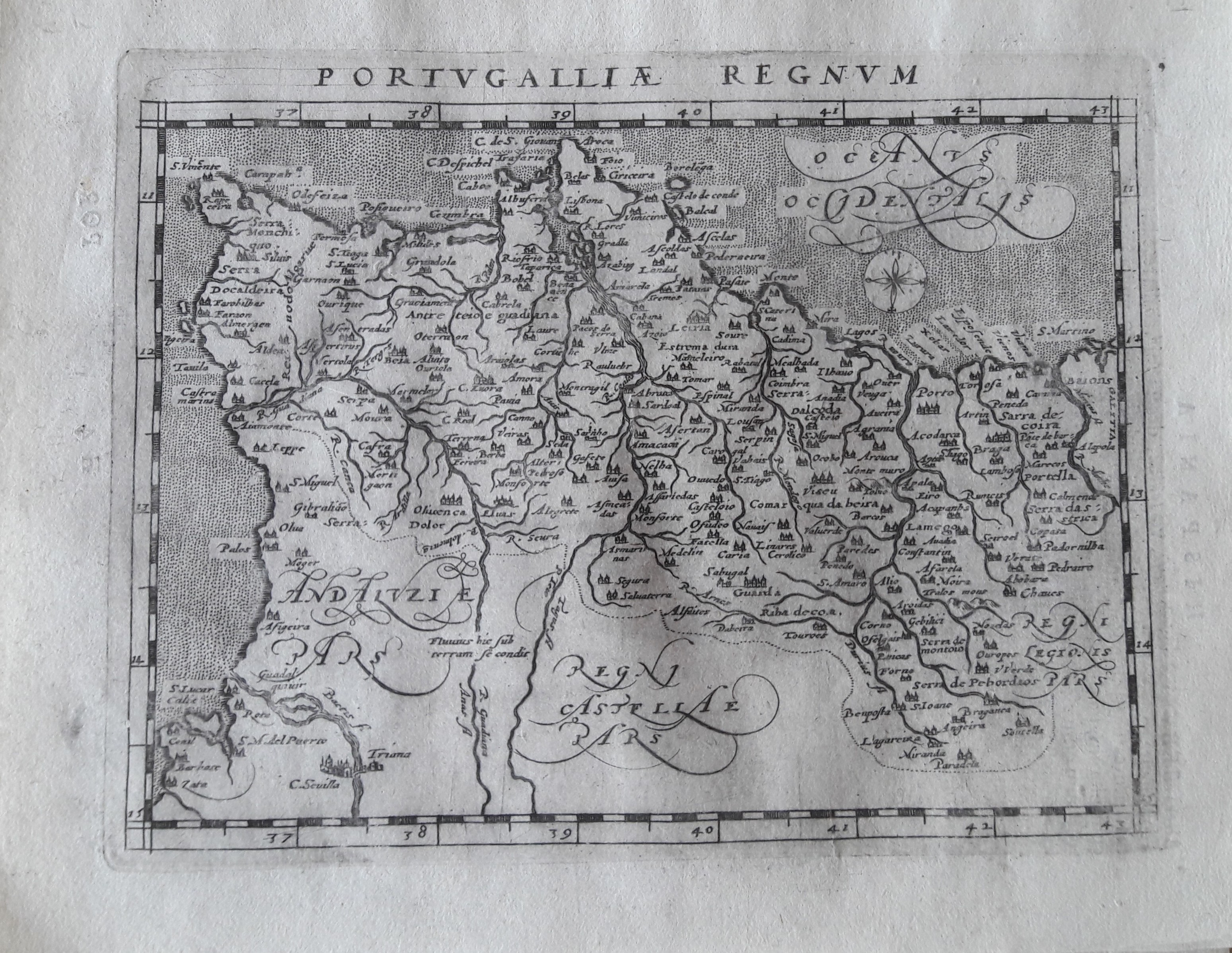
Map title
Portugalliae regnum
Author
Magini
Location shown in map
Portugal
Edition date
1597
Edition place
Colonia
Editor
Petrus Keschedt
Atlas
Geografia di Claudio Tolomeo -- Giovanni Antonio Magini
Price
Please ask: info@thetreasuremaps.com
State
[mint/EXCELLENT/very good/good/fair/mediocre/poor]
Color
Black/white
Verso
Latin text pag 56
Size
Plate: cm (17.8 x 12.7) inches (7.01 x 5) Paper: cm (21.6 x 17.8) inches (8.5 x 7.01)
Technique
Copper engraving
Note
Maps pirated from those of Girolamo Poro in Magini's edition.
Reference
--
Wiki
Here for more info
In stock
Available
Info
info@thetreasuremaps.com
Code
#0648
×
![Portugalliae regnum by Magini, Portugal, 1597]()
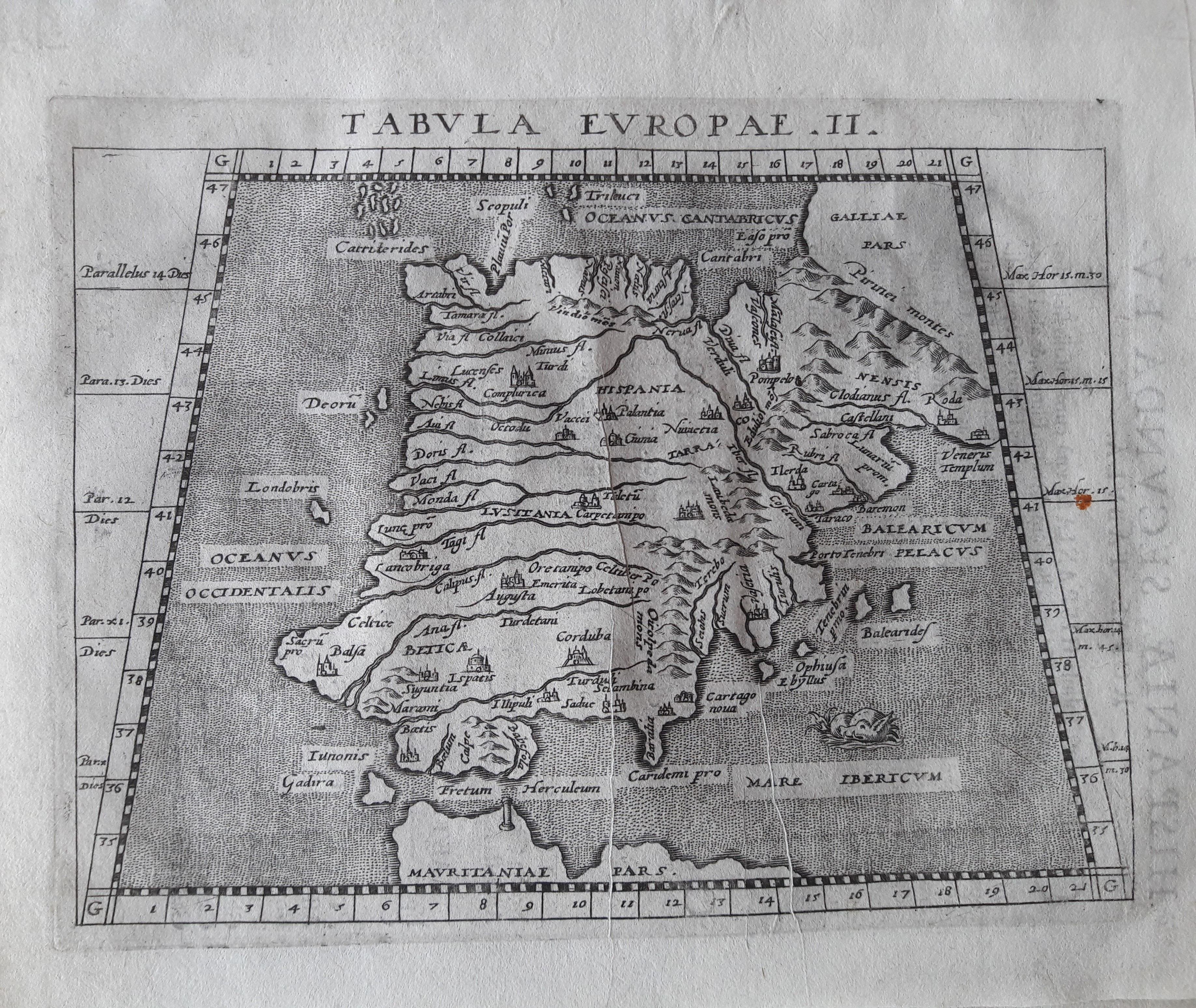
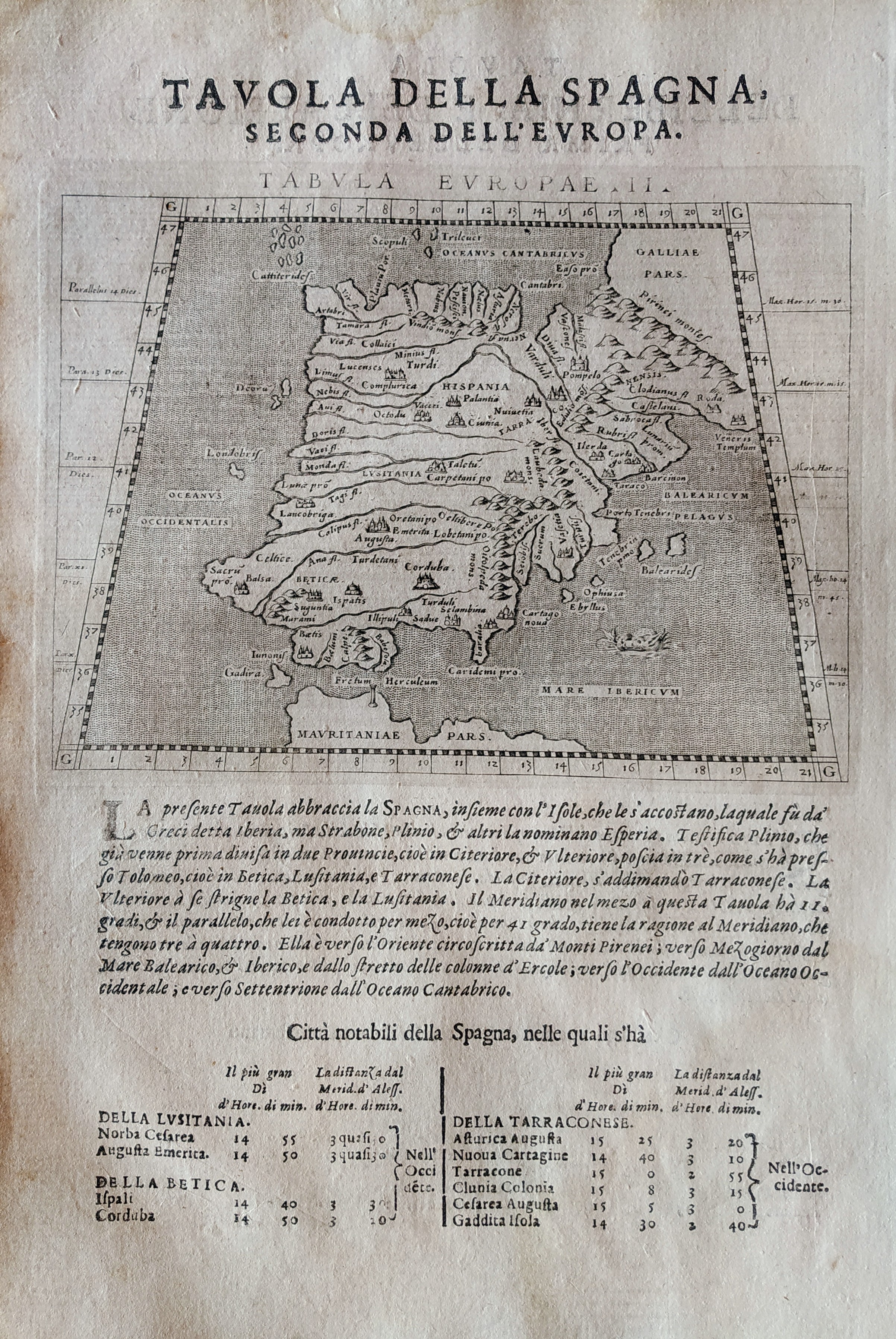
Map title
Tabula Europae II
Author
Magini
Location shown in map
Spain
Edition date
1617
Edition place
Arnheim
Editor
Ioannes Ianssonius
Atlas
Geografia di Claudio Tolomeo -- Giovanni Antonio Magini
Price
Please ask: info@thetreasuremaps.com
State
[mint/EXCELLENT/very good/good/fair/mediocre/poor]
Color
Black/white
Verso
Latin text pag 4
Size
Plate: cm (17.8 x 12.7) inches (7.01 x 5) Paper: cm (21.6 x 17.8) inches (8.5 x 7.01)
Technique
Copper engraving
Note
No particular notes for this maps.
Reference
--
Wiki
Here for more info
In stock
Available
Info
info@thetreasuremaps.com
Code
#0650
×
![Tabula Europae II by Magini, Spain, 1617]()
Map title
Tabula Europae II
Author
Magini
Location shown in map
Spain
Edition date
1621
Edition place
Padova
Editor
Paolo and Francesco Galignani
Atlas
Geografia di Claudio Tolomeo -- Giovanni Antonio Magini
Price
Please ask: info@thetreasuremaps.com
State
[MINT/excellent/very good/good/fair/mediocre/poor]
Color
Black/white
Verso
Italian text pag 3
Size
Plate: cm (12.7 x 17.8) inches (5 x 7.01) Paper: cm (20.3 x 30.5) inches (7.99 x 12.01)
Technique
Copper engraving
Note
No particular notes for this maps.
Reference
--
Wiki
Here for more info
In stock
Available
Info
info@thetreasuremaps.com
Code
#0712
×
![Tabula Europae II by Magini, Spain, 1621]()
Map title
Portugallia
Author
Doglioni
Location shown in map
Portugal
Edition date
1623
Edition place
Venice
Editor
Giacomo Sarzina
Atlas
Anfiteatro di Europa
Price
Please ask: info@thetreasuremaps.com
State
[mint/EXCELLENT/very good/good/fair/mediocre/poor]
Color
Black/white
Verso
Italian text pag.211
Size
Plate: cm (11.4 x 8.9) inches (4.49 x 3.5) Paper: cm (15.2 x 22.9) inches (5.98 x 9.02)
Technique
Copper engraving
Note
The maps are copies of the Galle (c.1595) edition of Ortelius.
Reference
--
Wiki
Here for more info
In stock
Available
Info
info@thetreasuremaps.com
Code
#0608
×
![Portugallia by Doglioni, Portugal, 1623]()
Map title
Hispania
Author
Doglioni
Location shown in map
Spain
Edition date
1623
Edition place
Venice
Editor
Giacomo Sarzina
Atlas
Anfiteatro di Europa
Price
Please ask: info@thetreasuremaps.com
State
[mint/EXCELLENT/very good/good/fair/mediocre/poor]
Color
Black/white
Verso
Italian text pag.151
Size
Plate: cm (11.4 x 8.9) inches (4.49 x 3.5) Paper: cm (15.2 x 22.9) inches (5.98 x 9.02)
Technique
Copper engraving
Note
The maps are copies of the Galle (c.1595) edition of Ortelius.
Reference
--
Wiki
Here for more info
In stock
Available
Info
info@thetreasuremaps.com
Code
#0620
×
![Hispania by Doglioni, Spain, 1623]()
Map title
Portugallia
Author
Doglioni
Location shown in map
Portugal
Edition date
1623
Edition place
Venice
Editor
Giacomo Sarzina
Atlas
Anfiteatro di Europa
Price
Please ask: info@thetreasuremaps.com
State
[mint/EXCELLENT/very good/good/fair/mediocre/poor]
Color
Black/white
Verso
Italian text pag.212
Size
Plate: cm (11.4 x 8.9) inches (4.49 x 3.5) Paper: cm (15.2 x 22.9) inches (5.98 x 9.02)
Technique
Copper engraving
Note
The maps are copies of the Galle (c.1595) edition of Ortelius.
Reference
--
Wiki
Here for more info
In stock
Available
Info
info@thetreasuremaps.com
Code
#0588
×
![Portugallia by Doglioni, Portugal, 1623]()
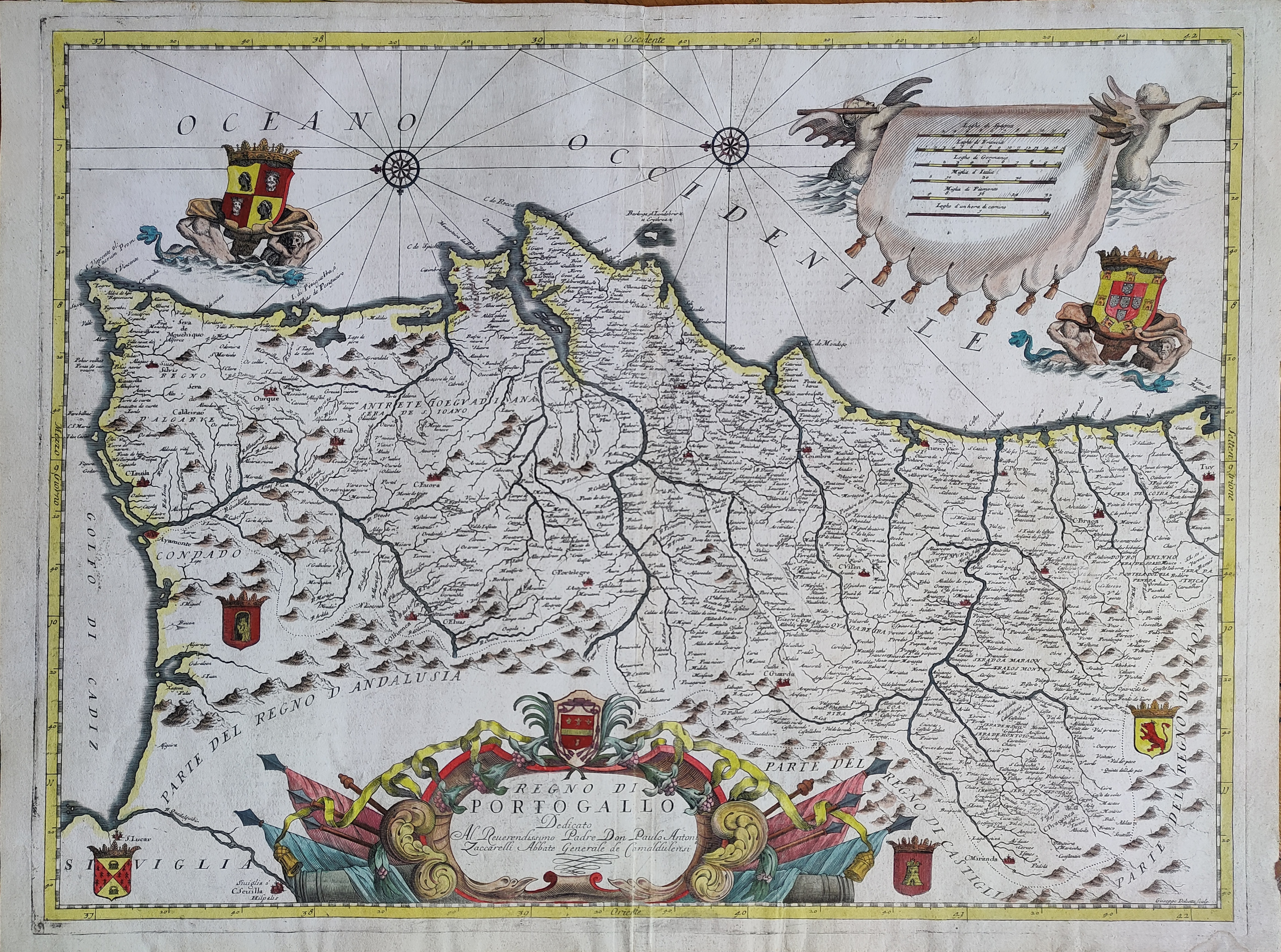
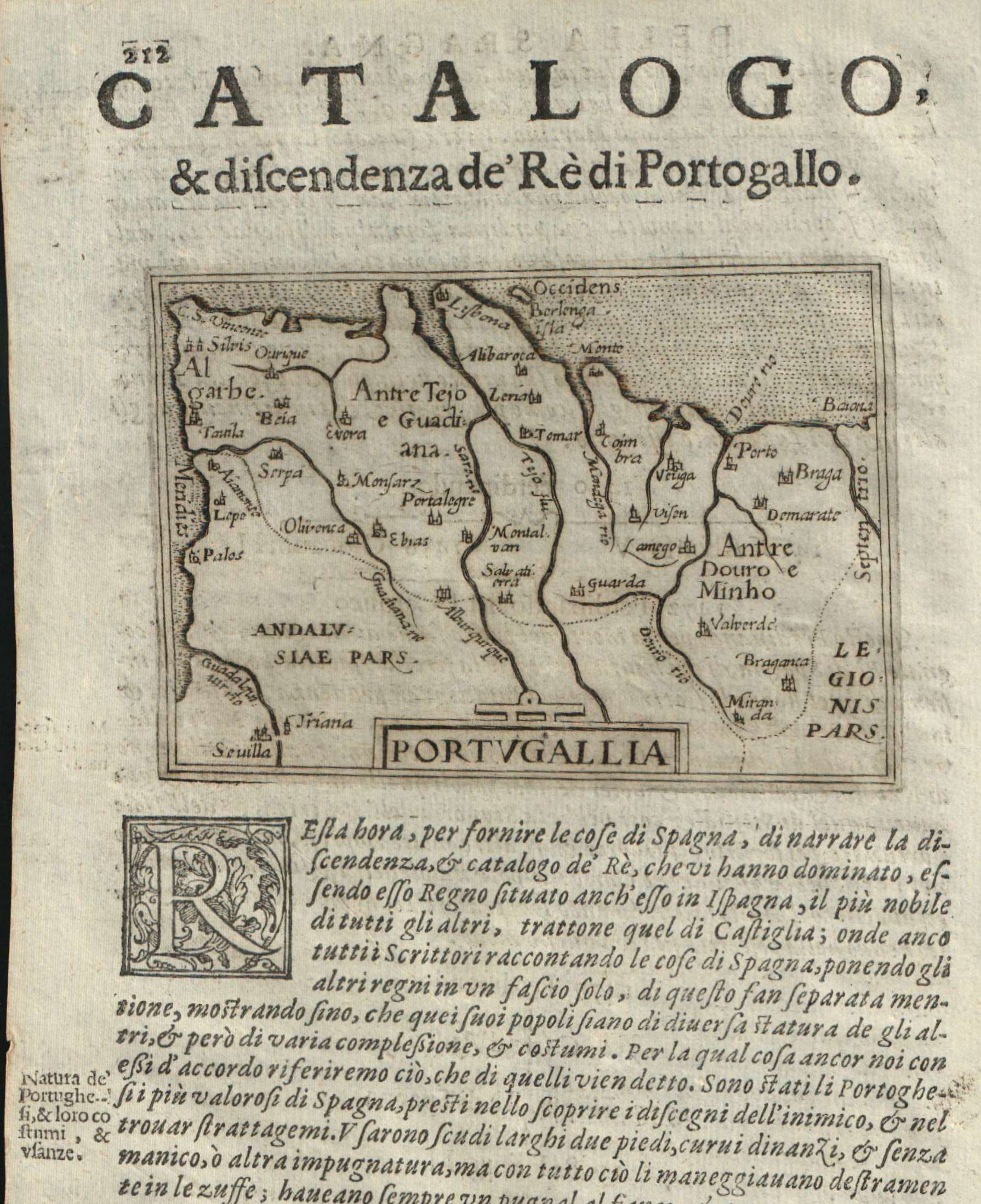
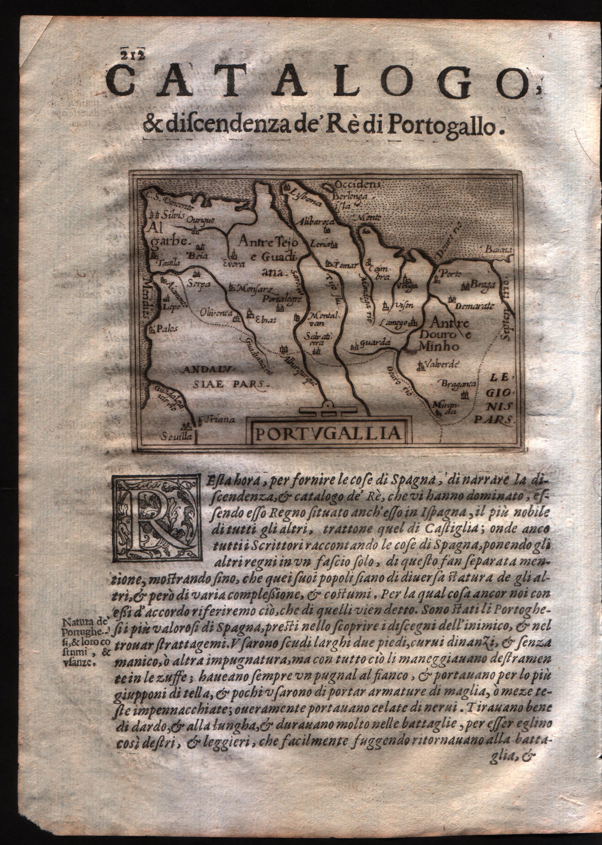
Map title
Regno di Portogallo
Author
Coronelli
Location shown in map
Portugal
Edition date
1696
Edition place
Venice
Editor
--
Atlas
Isolario dell'atlante veneto
Price
400 Euro
State
[mint/EXCELLENT/very good/good/fair/mediocre/poor]
Color
Old colors
Verso
Italian text pag.81
Size
Plate: cm (62 x 46) inches (24.41 x 18.11) Paper: cm (64 x 47) inches (25.2 x 18.5)
Technique
Copper engraving
Note
Reference
--
Wiki
Here for more info
In stock
Available
Info
info@thetreasuremaps.com
Code
#1023
×
![Regno di Portogallo by Coronelli, Portugal, 1696]()

Map title
Hispania
Author
Giovanni Battista de Cassine
Location shown in map
Spain
Edition date
1712
Edition place
Milan
Editor
Ambrosii Ramellati
Atlas
Chorographica descriptio Provinciarum, et Conventuum FF. Min. S. Francisci Capucinorum
Price
Please ask: info@thetreasuremaps.com
State
[mint/EXCELLENT/very good/good/fair/mediocre/poor]
Color
Black/white
Verso
Blank
Size
Plate: cm (32 x 22) inches (12.6 x 8.66) Paper: cm (34 x 24) inches (13.39 x 9.45)
Technique
Copper engraving
Note
No particular notes for this maps.
Reference
--
Wiki
Here for more info
In stock
Sold
Info
info@thetreasuremaps.com
Code
#0657
×
![Hispania by Giovanni Battista de Cassine, Spain, 1712]()
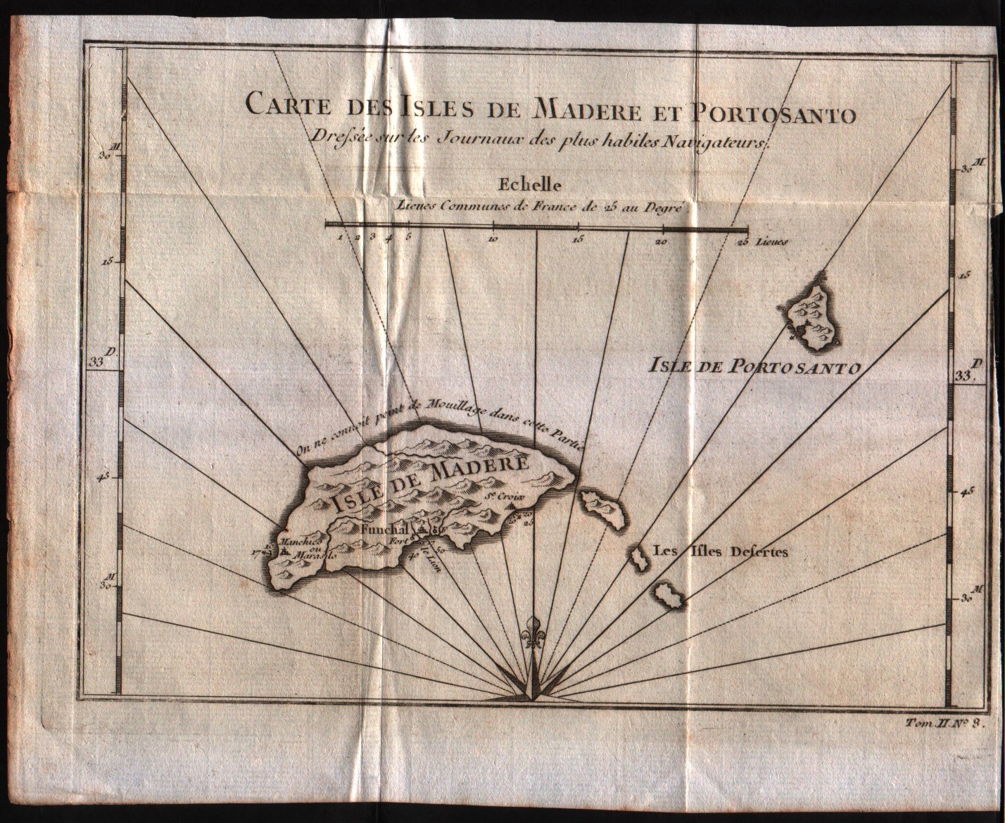
Map title
Carte de l'isles de Madere et Porto Santo
Author
Bellin
Location shown in map
Madeira island
Edition date
1757
Edition place
Paris
Editor
--
Atlas
Historie General des Voyages -- Prevost
Price
100 Euro
State
[mint/EXCELLENT/very good/good/fair/mediocre/poor]
Color
Black/white
Verso
Blank
Size
Plate: cm (21.6 x 15.2) inches (8.5 x 5.98) Paper: cm (24.1 x 19) inches (9.49 x 7.48)
Technique
Copper engraving
Note
No particular notes for this maps
Reference
--
Wiki
Here for more info
In stock
Available
Info
info@thetreasuremaps.com
Code
#0166
×
![Carte de l'isles de Madere et Porto Santo by Bellin, Madeira island, 1757]()
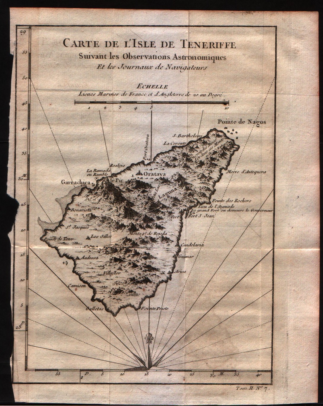
Map title
Carte de l'isles de Tenerife
Author
Bellin
Location shown in map
Tenerife
Edition date
1757
Edition place
Paris
Editor
--
Atlas
Historie General des Voyages -- Prevost
Price
100 Euro
State
[mint/EXCELLENT/very good/good/fair/mediocre/poor]
Color
Black/white
Verso
Blank
Size
Plate: cm (15.2 x 20.3) inches (5.98 x 7.99) Paper: cm (17.8 x 22.9) inches (7.01 x 9.02)
Technique
Copper engraving
Note
No particular notes for this maps
Reference
--
Wiki
Here for more info
In stock
Available
Info
info@thetreasuremaps.com
Code
#0165
×
![Carte de l'isles de Tenerife by Bellin, Tenerife, 1757]()
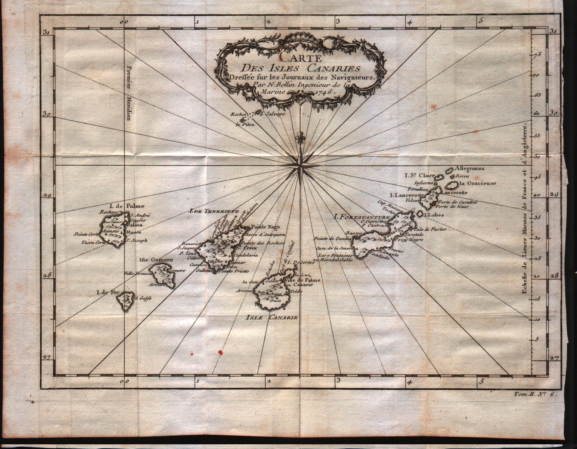
Map title
Carta Des Isles Canaries
Author
Bellin
Location shown in map
Canary inslands
Edition date
1757
Edition place
Paris
Editor
--
Atlas
Historie General des Voyages -- Prevost
Price
100 Euro
State
[mint/EXCELLENT/very good/good/fair/mediocre/poor]
Color
Black/white
Verso
Blank
Size
Plate: cm (27.9 x 20.3) inches (10.98 x 7.99) Paper: cm (27.9 x 20.3) inches (10.98 x 7.99)
Technique
Copper engraving
Note
No particular notes for this maps
Reference
--
Wiki
Here for more info
In stock
Available
Info
info@thetreasuremaps.com
Code
#0159
×
![Carta Des Isles Canaries by Bellin, Canary inslands, 1757]()
Map title
Carte de l'isles de Madere et Porto Santo
Author
Bellin
Location shown in map
Madeira island
Edition date
1773
Edition place
Amsterdam
Editor
--
Atlas
Atlas Portatif -- E. van Harrevelt
Price
100 Euro
State
[mint/EXCELLENT/very good/good/fair/mediocre/poor]
Color
Old colors
Verso
Blank
Size
Plate: cm (21.6 x 15.2) inches (8.5 x 5.98) Paper: cm (26.7 x 21.6) inches (10.51 x 8.5)
Technique
Copper engraving
Note
No particular notes for this maps
Reference
--
Wiki
Here for more info
In stock
Available
Info
info@thetreasuremaps.com
Code
#0164
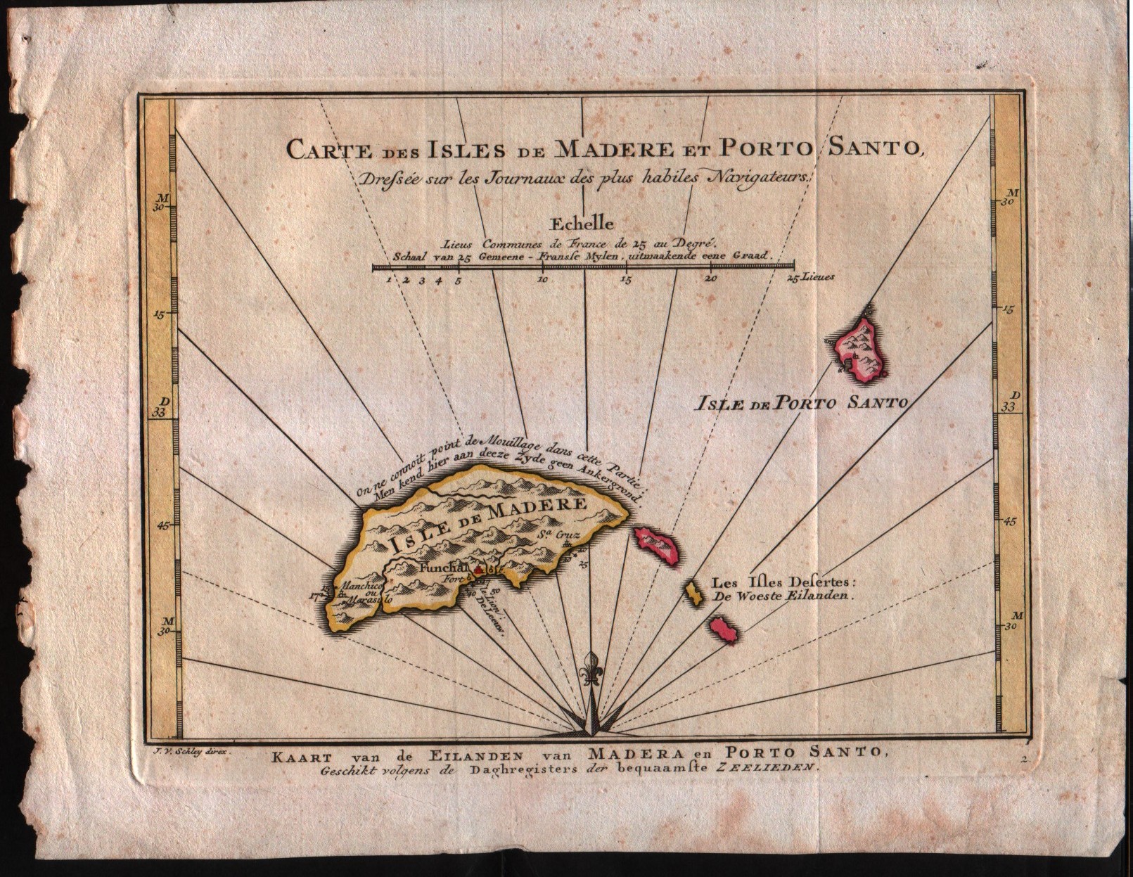
×
![Carte de l'isles de Madere et Porto Santo by Bellin, Madeira island, 1773]()